The geospatial event taking the industry by storm
|
|
|
- Willa White
- 10 years ago
- Views:
Transcription
1 BUSINESS 2015 BUSINESS DESIGN CENTRE LONDON UK MAY Show Preview March The geospatial event taking the industry by storm Designed for everyone involved in the gathering, storing, processing and delivering of geospatial information. GEO Business is the unmissable geospatial event of the year. Since its launch in 2014, the show is continuing to grow from strength to strength! 64% more exhibit space than % increase in advanced visitor registrations than 2014 so far! See inside for the full conference and commercial workshop programmes > International exhibition with over 200 leading geospatial suppliers Cutting edge conference with 50 presentations from industry experts Commercial workshops with over 140 demonstration sessions Social and networking events with welcome drinks and gala dinner GEO Business In collaboration #geobiz

2 Even bigger and better! GEO Business 2015 promises to be even more exciting following a wonderful response to the call for papers, a powerful line up of speakers, a sold-out workshop programme and an expanded exhibition. I m sure it will again be an event that our combined geo-industries can be very proud of. James Kavanagh MRICS, C.Geog, MCInstCES Director, Land, RICS International Exhibition Over 200 exhibitors displaying the latest products and services At the heart of GEO Business is an international exhibition where the geospatial community are coming together to display the latest technology and services all under one roof. With exhibitors travelling from across the globe, GEO Business offers an opportunity for visitors to meet face-to-face with suppliers and see what s new and exciting in this fast moving industry. The exhibition is FREE to attend. Turn to page 4 for the exhibitors highlights. View the exhibitor list online: GeoBusinessShow.com /exhibition Register online for FREE* 97% sold with still 3 months to go! 55% increase in the number of abstracts submitted than 2014 Cutting edge Conference 50 industry experts presenting the latest advances from across the industry Learn about the key commercial and technical issues from industry experts at this innovative conference. Spanning two days in two parallel sessions, delegates can keep one step ahead with presentations from industry experts. Listen to case studies and actual experiences learnt across the entire breadth of the industry. Sessions include: BIM meets geospatial Geospatial data management and big data techniques Is your asset management fit for the 21st Century? Survey operations and systems integration Emerging and developing technologies Shaping the profession/ evolving skills and education Early Bird Rate Register to attend the conference today to take advantage of the Early Bird Rate discount until 10 April EARLY BIRD STANDARD ON-SITE Coastal and hydrographic Recent projects Smart GIS Legal issues Making data deliverable Specifications and standards International issues It s not a drone! Day Delegate: Full Delegate: Discounted rates are also available for students and local authorities. Turn to page 22 for the programme. View the conference programme online: GeoBusinessShow.com /conference

3 3 Commercial Workshops Over 140 workshops demonstrating products and services first-hand GEO Business offers visitors a unique opportunity to see products and services in action via individual workshop and demonstration sessions held in seven parallel sessions over two days. Visitors can explore, discuss and understand more about the latest technology and services. Sessions are held on a first come first served basis, so arrive early to avoid disappointment. The workshops are all FREE to attend. Turn to page 16 for the full commercial workshop programme. View the workshop programme online: GeoBusinessShow.com /workshops 34% more commercial workshop sessions than 2014 Networking opportunities Join an expected 2,500+ international visitors and enjoy social events each night GEO Business provides the perfect platform to network and socialise with international visitors, including complimentary welcome drinks and a highly anticipated gala dinner. Pre-Show Welcome Drinks Tuesday 26 May 2015 The Slug & Lettuce, Islington 6pm 7.30pm FREE to attend The perfect way to start the week and catch up with friends. You don t need tickets for this event, but we do ask that you register for GEO Business 2015 in advance and bring your badge with you. GEO Business Gala Dinner Wednesday 27 May 2015 Pullman London St Pancras 7pm till late Tickets 85 each Taking place at the stylish Pullman hotel at Kings Cross, this event includes live entertainment, excellent cuisine and great company. For tickets [email protected] View details for these events online: GeoBusinessShow.com /social

4 Exhibitor highlights 10D Ireland Providing planning and 3D modelling service using laser scanners to produce initial measured surveys. They aim to provide a single point of contact from initial survey to completed design. 135 Geographic Squadron Royal Engineers UK The Reserve Sub-Unit of 42 Engineer Regiment (Geographic) that provides geographic support to all elements of UK defence and delivers geographic information a nalysis, distribution and geodetic survey capabilities. It supports all defence operations. 2ndQuadrant UK Developers of PostgreSQL RDBMS, a leading open source database, trusted by organisations of all sizes. They deliver support, training and consultancy services including PostGIS. 3D Laser Mapping UK Delivering reliable, high quality measurements. Showcasing Riegl laser scanning technology for terrestrial, mobile and airborne applications. They deliver reliable, high quality measurements to customers around the world. 3DReshaper France Presenting an easy-to-use and affordable software dedicated to point cloud processing for various applications, including cultural heritage, architecture, mine, quarry, digital terrain modelling and civil engineering. A1 Survey UK An authorised GeoMax dealer based in South Wales providing an outstanding level of service for the state of the art products available for hire and sale, backed up with a fully equipped service and calibration centre. it integrates with the VQ480i Riegl scanner and Phase One ixa180 camera and can be installed in a wide variety of helicopters. Aibotix Germany Altus Positioning Systems USA Providing today s GIS engineers with first class GPS/GIS products that are rugged and versatile for any work environment, compatible with most GIS software products and supported by unmatched reliable one-on-one quality customer service. APEM UK A new and innovative company for remote sensing and aerial surveys in Europe, North Africa and the Middle East. Specialising in ultra-high resolution colour, thermal, multispectral and LiDAR surveys, as well as cartography, 3D modelling and hydroacoustic surveys. Association for Geographic Information (AGI) UK A wide-ranging group of public and private sector organisations, suppliers of GI software, hardware, data and services, consultants, academics and interested individuals. Brings together the GI community to share ideas on best practice, experience and innovation, and offers networking opportunities. Atlas Computers Ireland Produce software for the land survey and civil engineering community, it now enjoys in excess of a thousand users worldwide, including major multinationals, government bodies and private surveying firms. Autodesk UK Providing leading BIM software that helps deliver projects faster and more economically, while minimising environmental impact. Autodesk BIM for Infrastructure can help win work, gain faster public and agency approval, accelerate design and provide better insight to all stakeholders across the lifecycle of civil infrastructure projects. Avenza Canada Showcasing GIS, cartographic and imaging solutions based on Adobe creative products, mobile deployment and use of GIS-produced maps on mobiles and tablets with PDF maps. Maps made in GIS can be used in the field digitally. Academy Leasing UK Whether you re looking to fund new or reconditioned survey instruments, for 1,000 or 250,000, Academy Leasing have access to their own funds, so can make decisions fast, supplying the finance you need without making you jump through all the usual hoops. Aerolaser System Spain Presenting AeSystem, a LiDAR system specially designed for corridors, such as power lines, railways and roads. Compact and light weight, Applications in CADD UK Demonstrating its AutoCAD/Stand alone 4Site data capture software with applications in topographic, building and hydrographic surveying. New developments include point clouds using Zeb1, a hand held scanner, in mining and rail surveys with TMD from Abtus. ARGANS UK Presenting their ground-breaking mapping method based on the use of satellite-derived bathymetry, on the eve of World Hydrography Day 2015 Our seas and waterways yet to be fully explored and charted. Arithmetica UK Innovators of 360º imaging solutions and automated laser scanning data processing software. Located in the famous Shepperton Studios in London, Arithmetica is the company behind SphereVision and Pointfuse. Bentley UK Providing solutions to optimise workflows by providing the necessary tools for supporting GIS, mapping, BIM, campus/installation information management and infrastructure engineering, as well as powerful tools for web publishing, printing and plotting.

5 The exhibition is FREE to attend 5 Blackbridge Germany Providing end-to-end solutions across the geospatial value chain, including satellite operations, data centre and geocloud solutions, worldwide distribution and value added services. industry standard sub-centimetre GNSS/GPS to add accurate depth and position of underground services. Carlson UK Providing powerful, easy-to-use features in its software, backed by dedicated customer service that has been the hallmark of the company since its founding in Their software is used by professionals in land surveying, civil engineering, construction, machine control, mining and more throughout the world. BLOM UK Providing airborne data capture and LiDAR mobile mapping solutions for central and local government in defence and security, transport and infrastructure, flood management and renewable energy. They also have an extensive library of aerial oblique and vertical images. Blue Marble Geographics USA Demonstrating Global Mapper, an affordable, powerful, yet easy-to-use GIS application capable of displaying, converting and analysing virtually any type of geospatial data. Offering a free evaluation license on their stand. Bluesky International UK Presenting Air Quality Mapper (AQM) aimed at helping government and specialists understand the air quality within an urban environment and how poor air quality has a significant impact on health, quality of life and the wider environment. Cadcorp UK Demonstrating Web Map Layers an off-theshelf application for internet mapping. It provides advanced capabilities for presenting and interrogating spatial data, accessed through a familiar and responsive interface. It runs on mobile devices, tablets and PCs. Cadline UK Showcasing DynamicMaps, offering a suite of flexible solutions including: WebGIS, Report It, GML translator, INSPIRE data management and open source solutions. As an Autodesk Platinum reseller, Cadline is ideally placed to help integrate CAD and GIS, and advise clients. Campbell Scientific Europe UK Showcasing their dynamic and static spectral analysis method for measuring vibrating wire gauges at high resolution and with low noise errors. Also showing CR6 Datalogger with integrated static VW measurement capability. CATSURVEYS Group UK Presenting their portfolio of services including Mobile GPR and Mobile Asset Management data collection, processing surveys in a fraction of historical time whilst reducing risks and costs. Certainty 3D USA Showcasing TopoDOT a complete solution to LiDAR data processing offering a tool-suite for data management, quality assessment and extraction of features, topographies and 3D models. Can be used across the spectrum of civil infrastructure and land survey applications. CGG UK Presenting NPA Satellite Mapping solutions that respond to global client requirements, reducing risk and enhancing knowledge within exploration, planning and monitoring. Their core expertise is the supply and processing of satellite imagery, offshore exploration, geological mapping and InSAR surveying. British Geological Survey UK Showcasing GeoVisionary, a geoscientific information system for visualisation and interpretation of geoscience datasets in a virtual reality environment, offering the ability to visualise data from a variety of software packages in a single, immersive 3D stereoscopic environment on PCs and laptops. Carbomap UK Showcasing their ground breaking results from airborne multispectral LiDAR for mapping understory vegetation. Recently featured in LiDAR News, this technique is the first of its kind to extract spectral information on vegetation beneath the canopy of a forest. CARIS Netherlands Developers of marine GIS software specialising in high density sensor data that can efficiently process, manage and analyse data and export to a variety of data formats. Chartered Institution of Civil Engineering Surveyors (ICES) UK An international qualifying body dedicated to the regulation, education and training of surveyors working within civil engineering. ICES is now recognised as the leading chartered professional body for civil engineering surveyors. CHC Navigation China Designers and manufacturers of professional GPS/GNSS solutions in more than 50 countries. With headquarters in Shanghai, it has a strong international presence. C.Scope UK Presenting the new MXL2 Locator that enables One pass utility surveys by connecting to

6 Exhibitor highlights Civica UK Showcasing Community Map Pro and for those interested in mobile GIS, representatives will be on hand with mobile devices with the latest Community Map Mobile capabilities. ClearEdge3D USA Presenting EdgeWise BIM Suite and EdgeWise Plant Suite, reducing modelling workflows by up to 70% with full Revit, Plant3D, PDMS and CAD integration. A leader in the field of automated modelling of as-built BIMs and industrial facilities from laser scan point cloud data. Dimenteq Finland Presenting the map-based survey tool Harava, promoting smart decision-making through civic participation with examples of its use ranging from reindeer husbandry to urban planning. Ecometrica UK Presenting Our Ecosystem (OE) an environmental mapping platform. It allows users to deploy apps that access information from satellites and other data sources to build knowledge, manage risks and identify opportunities around the world. Eternix Israel Presenting Blaze Terra and extensions, a comprehensive set of GIS visualisation and editing tools including 3D scenes, with intuitive, dynamic and on-the-fly features. COWI UK Showcasing recent projects including: asset database creation and DTM for simulation, 3D vector-mapping for design and aerial survey feature extraction. COWI is among the largest providers of aerial-survey-based geodata in Europe, Africa and the Middle East. Cranfield University UK Providing information on a range of full and part time Masters Courses, funded PhD opportunities and specialist short courses in aerospace, automotive, energy, environment, management, manufacturing, security and defence. DotProduct USA Showcasing the DPI-8 Handheld 3D Imaging Kit, powered by Phi.3D 2.0 Software. This kit turns an Android tablet into a powerful, real-time 3D-imaging solution. The technology is designed for mobile professionals who need instant high-quality spatial data. EuroMed Mapping Italy A new and innovative company for remote sensing and aerial surveys in Europe, North Africa and the Middle East. They specialise in ultra-high resolution colour, thermal, multispectral and LiDAR surveys, as well as cartography, 3D modelling and hydroacoustic surveys. Cyient UK Showcasing mapping, navigation and location capabilities that exceed customer targets of 99.8% first time acceptance. Cyient captures and manages spatial and non-spatial data with over 4,000 specialists located globally. Datron Technology UK Manufacturers of GNSS+INS systems for measuring continuous position including Survey+ and Inertial+, easily integrated with external sensors and xnav and xoem, their smallest solution for size/weight constrained applications. DIELMO 3D Spain Developers of GIS software tools and processing data, customising LiDAR and GIS software to bring the best expert solutions. Drilline Products UK Exhibiting the new innovative Opera DUO system for utility detection and mapping, with its range of revolutionary features by Italian manufacturer IDS for whom they are the exclusive UK and Ireland distributor. DroneSurv UK A consultancy specialising in the collection of high resolution UAV data sets for the quarry, construction, coastal protection, transportation and landfill industries. EBTM UK Specialists in assisting geospatial, offshore and mining companies to grow and become profitable through focused strategic marketing, marketing planning and marketing implementation. Europa Technologies UK An award-winning map data and services supplier. Their viaeuropa hosted map service enables organisations to consume OS mapping quickly and easily. Excitech UK Helping you achieve the benefits of utilising reality capture and laser scanning technology in project workflows. Significant changes in the construction environment have led to a greater need to articulate these benefits. This requires an understanding of the available technology, how it can add value to an industry, and experience in conveying and delivering that message. EXELIS France Presenting desktop, cloud and mobile software solutions ENVI and IDL to help professionals across industries transform geospatial imagery into actionable information. FARO Technologies UK Showcasing the compact and light FARO Laser Scanner Focus3D X Series and the new, intuitive FARO Scanner Freestyle3D which is the only industrial-grade handheld device able to scan almost any kind of surfaces and environments.

7 The exhibition is FREE to attend 7 Forest it Design UK Demonstrating a wide range of rugged tablet PCs, PDAs, measuring instruments and GPS/GNSS solutions focused on the geospatial market. Forsberg Services UK A navigation systems integrator and OEM component supplier. They have been a successful NovAtel outlet since 1997 with strong engineering experience in navigation; specialising in PCB, software and mechanical design. Based in the UK and Germany. GEO-4D UK Providing software solutions that enable 2, 3 and 4D visualisation and interpretation of all relevant geo-data, using dedicated workstations and a hi-resolution pen tablet. GeoConnexion UK Bringing you the latest news and reports from geotechnology industries in the UK, Europe, the Middle East, Africa, North America and Asia. Coverage of topics such as 3D visualisation, UAS, remote sensing, LiDAR, cloud, mobile mapping and navigation with emphasis on healthcare, public safety, retail, the environment, utilities, surveying, LBS, transport/logistics, telecommunications and more. Geomap UK A chartered survey company, showcasing specialised services such as integrating 3D buried services into existing BIM models, laser scanning, sub-surface utility engineering, reverse engineering of existing infrastructure, drainage and CCTV investigations, as well as more traditional topographic, utility and building surveys. They work across a variety of sectors including rail, MOD, power stations and the public sector to name but a few. Geo-Matching Netherlands The independent product comparison website for hardware and software products for geomatics, hydrography and adjacent fields. GeoMax International UK Showcasing their easy-to-use, productive range of total stations, GNSS, lasers, optical and digital levels alongside the newly introduced Zoom 300 Scanner and innovative X-Pad software. GeoPal Ireland Presenting a cloud service and mobile app that reduces cost and improves productivity of managing field workers using mobile technology; from job scheduling and dispatch, employee location tracking, regulatory compliance to real-time reporting. GeoPlace UK A public sector limited liability partnership between the Local Government Association (LGA) and Ordnance Survey that is one of the UK s foremost managers of complex addressbased national spatial datasets. GeoSolutions Italy Presenting its Open Source products for the management and dissemination of geospatial data and metadata: GeoServer, GeoNetwork and MapStore, as well as the latest developments on open source mobile geospatial platforms for asset management. Geo Survey Instruments UK Getmapping UK Providers of aerial photography, height data, digital mapping and web services to local authorities, central government, as well as clients in property, construction, engineering and environmental sectors. GIM International Netherlands An independent and high-quality information source for the global geomatics industry. Publishers of a magazine, website and a weekly e-newsletter. GPR PRO UK A small team of highly skilled and experienced consultants offering specialised GPR (Ground Penetrating Radar) surveys and training for the civil engineering industry. Other services include GPR data post-processing and interpretation, structural monitoring and laser scanning. GSB Prospection UK Well known for its expertise on Channel 4 s Time Team archaeological TV programme, they provide geophysics for site evaluation and archaeological prospection for planners and developers. GSB is a SUMO Group member. Handheld UK Showcasing the Nautiz X8, a front-runner in the new generation of ultra-rugged IP67 handheld GPS computers, that delivers the largest capacitive touchscreen in its class, along with an unprecedented combination of processing power, connectivity and field durability. Harxon Corporation China Hemisphere GNSS Canada Hexagon UK IBI Group UK Presenting RouteMapper, a powerful combination of high-resolution digital imagery and LiDAR, enabling highway related surveys to be performed from the office environment, reducing costs/disruption and risk to road workers. IDS Italy Institution of Civil Engineers (ICE) UK Presenting ICE Publishing, a leading provider of information for engineering and construction professionals and academics worldwide, producing a wide range of publications which share expert advice and best practice for the entire community. Intelligent Mapping Solutions UK Specialists in the collection and analysis of data through various technologies and software, from specialist UAV flights to spatial analysis and advanced photogrammetry. INTERGEO Germany A trade fair and conference for geodesy, geoinformation and land management, covering a wide variety of fields, ranging from surveying, geoinformation, remote sensing and photogrammetry to complementary solutions and technologies. Don t miss this chance to share knowledge and expertise with other specialists in Stuttgart, September 2015.

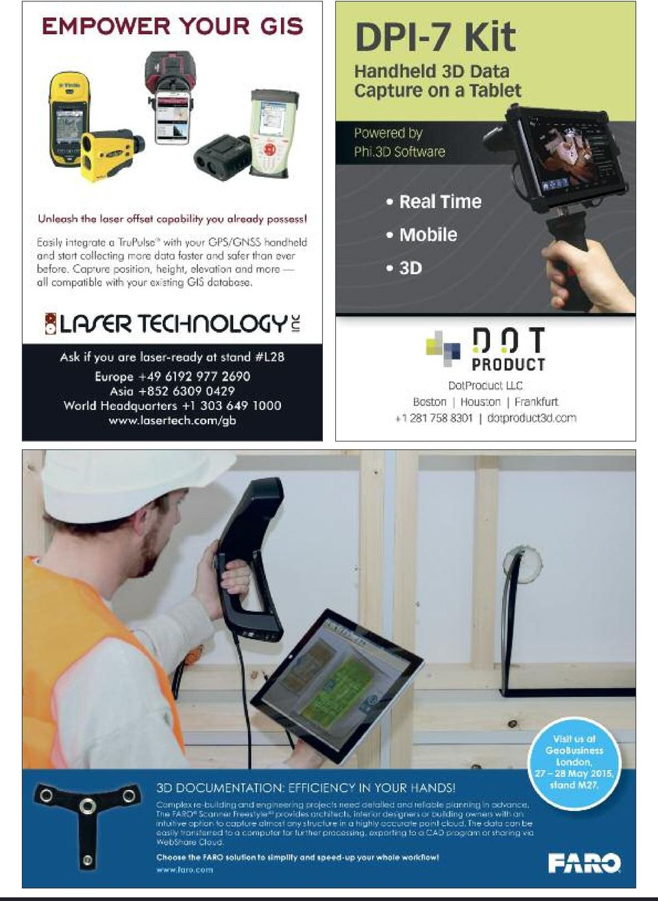
8 Exhibitor highlights Intetics USA Presenting technologies and examples from various industries, learn how one of the biggest GIS companies in Europe can help you achieve your business goals by incorporating GIS solutions and services into your business. Juniper Systems UK Designers and manufacturers of rugged handheld computers. The Archer 2 and Mesa Rugged Notepad are rated for extreme conditions perfect for intensive data collection in geomatics, mapping and highprecision surveying. UK Suppliers of high quality geospatial products to customers across the UK and Ireland, with nearly 200 years of experience in precise measurement. LW Partners UK Bringing together experts in the maritime domain addressing geospatial opportunities and challenges through the provision of maritime spatial business development, planning and commercial solutions. They specialise in innovative technologies, spacebased datasets, crowd-sourcing techniques and the benefits of machine-to-machine communication. MD3D UK Showcasing Surphaser scanners for large volume metrology and high quality (sub-mm accuracy) survey applications. Also available for demonstration will be DotProduct handheld scanners, and istar panoramic cameras for imaging applications and the colouring of point clouds. MGiSS / DigiTerra UK Showcasing the latest products from their suppliers Spectra Precision, Trimble MCS and Digiterra, along with the launch of their cloudbased remote measurement solutions for energy and infrastructure, engineering and environmental services applications. kubit Germany Providing reality capture solutions and workflows for laser scanning, photogrammetry and traditional surveying techniques. Bringing reality to CAD, they have been developing field proven software for capturing existing conditions into the AutoCAD and Revit environment. Macleod Simmonds UK MapAction UK To help save more lives in more humanitarian emergencies, support is needed - as a volunteer, as a donor, as an advocate. Find out what difference you can make for people affected by disasters. Map Careers and pgnosis UK Map Careers offer a portfolio of professional GEO workforce services for the GEO community in the UK and Europe. Providing expert help and advice, careers, intern work experience, vocational education and training, consultancy and project outsourcing for GEO, GIS, geospatial, mapping, remote sensing and software teams and individuals. Mapping Solutions UK Specialists in ground and airborne remote sensing, particularly optical and thermal hyperspectral. They have teamed up with high quality partners to provide clients with the best possible hardware and service solutions. Microsoft/ Vexcel Imaging Austria Presenting their family of award-winning UltraCam sensor systems including the UltraCam Osprey, UltraCam Eagle, UltraCam Falcon and UltraCam Hawk, and end-to-end processing with UltraMap v3 Software. MicroSurvey Software Canada Creating software solutions for land surveyors, forensic specialists and construction professionals. STAR*NET, their least squares adjustment software, is well known around the world. MicroSurvey CAD provides a cost effective way for surveyors to create quality deliverables, in less time - not to mention its world class point cloud features. Laser Technology USA Showcasing the TruPulse laser for a faster, easier and safer field data collection experience, which can be used with existing GPS/GNNS handhelds, data collectors and GIS software. MBS Survey Software UK Understanding the pressures that clients are under to deliver projects on time and within budget. Discover why MBS is a top software company in the UK Geomatics community for floor plans, elevations, river cross-sections and rights of light. MJ Rees & Company UK Suppliers of 3D pipeline mapping information for BIM projects and to the PAS128 specification. Their Reduct system records the 3D profile to a high level of accuracy, regardless of the depth, surrounding ground conditions or pipe material. McCarthy Taylor Systems UK Launching their innovative and cost-effective Point Cloud add-on. Producers of the popular and successful LSS surveying and terrain modelling software for 30 years.

9 The exhibition is FREE to attend 9 Murphy Surveys Ireland & UK Demonstrating a full workflow from field to final product and delivering exceptional quality and value. Newcastle University UK Undertaking world leading teaching and research in geomatics and civil engineering. They work with industry, government and alumni to achieve real world impact of their research, deliver their teaching and support graduate progression to professional placements and careers. NM Group UK Providing topographic and asset mapping services using a range of remote sensing technologies that include aerial and terrestrial LiDAR. They specialise in converting spatial data into asset intelligence; enabling organisations to more effectively increase the safety, reliability and efficiency of their assets. Nutiteq Estonia Introducing Nutiteq Maps Pro a service that enables geosolution providers to enhance their Android or iphone/ipad apps with advanced offline maps display and editing features. Used by Boeing, BAE Systems, BBVA and many others companies worldwide. Oceanwise UK Showcasing their real-time environmental data sharing and publishing system and service, Port- Log; a quick and easy on-line storage and publishing solution for environmental monitoring data; instrument and transmission independent as part of a data management system. Opti-cal Survey Equipment UK Presenting the latest range of FlexLine and Viva total stations as a fully accredited authorised distributor and service partner of Leica. Also on show, the FARO Focus 3D Laser Scanner and the new innovative Handheld FARO Scanner Freestyle. OR3D UK A 3D solutions company that provides 3D scanning hardware and software that can convert laser scan data into CAD models for inspection or redesign. Working with their partner s Mantis Vision, API and Geomagic they will have a solution for you. Ordnance Survey UK Britain s mapping agency will be showcasing products and services including OpenData (including a 30 minute workshop); their latest API Insight technology and Resilience Direct, the new, multi-agency planning and communication tool for emergency response services. Oxford Technical Solutions (oxts) UK Manufacturers of precision GNSS+INS systems for measuring continuous position. Easily integrated with external sensors, their Survey+ and Inertial+ products are invaluable for an array of applications. The xnav and xoem products are their smallest solution for size/weight constrained applications. Phoenix Survey & Safety Equipment UK Showcasing a wide range of products, including the FARO scanner, so you can see for yourself how the smallest and lightest laser scanner on the market could work for you. Providing a full service, from stocking the best equipment through to support and kit maintenance. Pix4D Switzerland Demonstrating the Pix4Dmapper Pro that automatically converts thousands of terrestrial and aerial images taken by lightweight UAV or aircraft into highly accurate, precise, customisable and timely results for a wide range of GIS and CAD applications. Pixalytics UK An Earth observation company with a scientific heart, using cutting edge scientific research to create innovative terrestrial and marine products including land cover, turbidity and water level. Their services include in-house scientific support, Earth observation advice and training. Ogilvie Geomatics UK Ohmex UK Exhibiting the SonarMite portable echo sounder and the remote controlled Hydrone remote controlled hydrographic survey craft. The SonarMite App+ will be released providing a BYOD Hydrographic survey on an Android phone. Optech Canada Showcasing the new airborne, mobile and terrestrial sensors with new technology and software enhancements that maximise data quality and operational efficiency. They are a leader in productivity-focused LiDAR and imaging 3D mapping solutions. Pelydryn UK Providing airborne surveys worldwide they combine simultaneous collection of topographic, bathymetric LiDAR data and imagery. They offer cost effective, highly efficient surveys over land and coastal zone areas utilising the Hawkeye and Chrioptera topo-bathy LiDAR systems. Pointfuse UK Giving professionals an astonishingly fast, precise and flexible way of converting vast point cloud datasets generated by laser scanners or photogrammetry into high fidelity vector models. Designed for engineers, architects and construction professionals, vector models can be manipulated using any industry-standard CAD system. Precision Geomatics UK Showcasing the latest technology recently launched by TopconSOKKIA, they are specialists in land surveying and safety equipment, and 3D laser scanning offering hire, sale, service and repair along with training and technical support.

10 Exhibitor highlights Premier Energy Services UK Presenting their pioneering PALM product where all the utility information is presented on one layered map. In addition, they will demonstrate their interactive website that enables users to get an instant quote for the delivery of a comprehensive report on all the utilities in the scheme s area. mapping and modelling solutions e.g. for the renewable energy, water and agriculture sectors. SCCS - The Survey Equipment Company UK Unveiling new UAV technology with seamless integration into proven DTM packages and new wireless mesh technology from their monitoring division. PV Publications UK Print and digital publishers to the GIS, Geomatics and Surveying sectors. On behalf of the Royal Institution of Chartered Surveyors (RICS), they publish the bi-monthly journal Geomatics World. They also produce the twiceyearly publication, Engineering Surveying Showcase, the AGI sponsored GIS Professional and Maplines, the official newsletter of the British Cartographical Society. They also host the Location-Source web portal for all things Geospatial. Radiodetection SPX UK Demonstrating its range of Precision Marker Locators as well as the new gc.a.t4 Cable Avoidance Tool. The RD Ground Penetrating Radar also on show locates all types of buried infrastructure using wide-band radar in an ergonomic and rugged system. RealSim Ireland Suppliers of 3D city and environment simulation solutions to geospatial professionals and decision makers. 3D survey data, street level photography, and the latest 3D game engine technology, are combined to reveal the world in 3D at your fingers. RIEGL Laser Measurement Systems Austria Presenting the latest developments for terrestrial, mobile, airborne and UAS-based laser scanning in cooperation with 3D Laser Mapping. Stop by to see their RiCOPTER and learn about the latest UAS-based surveying projects. ROTHBUCHER SYSTEMS Germany Exhibiting part of their range of Smart Datum Markers and Targets along with reflective targets, monitoring prisms, angle targets, stake out aids, boundary markers and laser scanner targets; for all surveying and monitoring works. Royal Institution of Chartered Surveyors (RICS) UK Created in 1868 in the UK, it received a royal charter in Today they are a global property professional body that aims to: regulate and promote the profession; maintain the highest educational and professional standards; protect clients and consumers through a strict code of ethics; provide impartial advice, analysis and guidance. RUGGED MOBILE Systems UK Presenting a range of new rugged computing offerings including tablets such as the compact Getac T800 plus the Panasonic FZ-B2 and FZ-X1 Android devices, plus new robust offerings from Handheld, Trimble, RuggON and more. Seafloor Systems USA Showcasing the HyDrone-RCV, a remotely controlled survey platform as well as the wellknown Hydrolite-TM system. Designers and manufacturers of high-precision, portable bathymetric mapping systems for GISprofessionals working in or transitioning to the marine environment. SEEABLE UK Developers of products for health and safety, site inductions and design visualisation, SEEABLE enables engaging, non-technical visualisation of complex 3D environments or simple interactive 2D-plans on multiple platforms. Senceive UK Presenting wireless condition monitoring, which is cost effective, easy to use, robust, reliable and precise. Multi-award winning, NR/LUL approved with 1000 s deployed in rail/construction it has an unprecedented years battery-life powering high precision stable sensors. Renishaw UK Showcasing its latest range of ruggedised laser measurement systems for use in harsh environments. Through innovation Renishaw provides leading edge technology to advance operational performance in the mining and marine industries. Richard Allitt Associates UK Showcasing Remote Aerial Surveys, their UAV aerial survey service. Building on their background in flood mapping, GIS and remote sensing, they specialise in providing bespoke SABRE Advanced 3D Surveying Systems UK Saderet UK The European distributor for the Hemisphere GNSS range of navigation and positioning systems. They are also exclusive representatives for Deepwater Buoyancy, Teledyne RDI, and Odom, along with TSS, QPS, Satel and Edgetech acoustic products. SCALGO Denmark Septentrio Satellite Navigation Belgium Designers of high-precision GNSS receivers for GIS, survey, mapping and various other ground and air demanding applications. They offer solutions for all aspects of navigation, including stabilised VTOL hovering, centimetre accurate geotagging of images, interference mitigation and GNSS-Inertial precision guidance.

11 The exhibition is FREE to attend 11 Severn Partnership UK Chartered geomatics surveyors (land) providing quality data that is measured safely and delivered professionally on time. Experts and innovators in 3D measurement, scan2bim, survey4bim and mobile surveying. Shannon Survey UK Specialists in surveying equipment and laser, for hire, sale, service and repair, along with training and technical support. As an authorised distributor of GeoMax and Carlson products, they will be showcasing the newest Swiss technology recently launched by GeoMax, Carlson software and the new GeoMax Zoom 80 LRBT Robotic Total Station. Silicon Sensing Systems UK Demonstrating the North Finding capability of DMU30, the first of a new range of High Performance MEMS IMUs (HPIMU) designed to offer a realistic, ITAR-free, alternative to more costly FOG/RLG IMUs for survey and mapping applications. Skycap UK Providing unmanned aerial using various aerial platforms and different sensors to create digital elevation models for volume calculations, line-of-sight, profile extraction, slope analysis and view shed analysis. Skyline Software Systems UK Presenting SkylineGlobe suite of applications that allows you to build, view, query and analyse virtual 3D landscapes using aerial and satellite imagery, terrain data and other 2D and 3D datasets. 3D models may be streamed to web, desktop or mobile clients providing interactive 3D visualisation capabilities for any application. SmartPlanes Sweden Presenting an aerial survey system that contains all the hardware and software needed for performing successful missions year after year. Used for survey, forestry, agriculture and much more. South Survey UK Exhibiting Rothbucher Smart Targets for surveying and monitoring, Geodesy wide area WiFi for construction sites, Microsurvey software, total stations and GPS systems from Spectra Precision along with SECO accessories. Spectra Precision France SphereVision UK Leaders in spherical video and 360 imaging services and software, specialising in providing end-to-end solutions across a range of disciplines. Their portable recording systems allow you to record in any environment and applications include: advertising, security, mapping and asset management. Sterling Geo UK Presenting Sterling Power s Lightweight GPR that offers precise identification of subsurface features and anomalies, yet weighs less than a kilogram. This small, easy to use device enables single user operation, either hand-held or attached to a UAV. Storm Geomatics UK Showcasing Storm GeoRiver, the river channel processing engine, for surveys or manipulating river model data. Field surveyors will be on hand to talk about more extreme survey requirements for land, water and rail, as well as their software and app. SUMO Group UK A group of nationwide survey practitioners providing single source multi-discipline surveys. They have specific expertise giving a collective technical knowledge that is applied to plan and design fully integrated surveys, to a consistently high standard, which deliver efficiency and value for money. Also see Team Surveys, GSB Prospection and Stratascan. SUMO Services UK Providing utility detection and mapping, statutory plan collation and PAS 128 compliant surveys. They will present SUMOplus+ the new approach to site investigation, an advanced level survey combining geophysics and topographical surveys for a complete picture above and below ground. SUMO Services is a SUMO Group member. Survey Max UK A key GeoMax partner in the UK, they will present their GNSS and robotic options with low-cost Android controllers. Team Surveys UK Providing land and topographic, measured building surveys and 3D modelling. Using high definition laser scanners, Team produce plans and elevations in Point Clouds and 3D imaging in BIM compatible software. Team Surveys is a SUMO Group member. Technics UK Taking visitors on an interactive journey of exploration and discovery, demonstrating the value they place on team, clients and their partners, its sense of adventure, commitment to the development of people and passion for improving the industry. Terrasolid Finland Presenting advanced mobile LiDAR data colouring that can: remove cars; use best images for colouring and use intensity and artificial colours for thin objects. The British Cartographic Society UK The Hydrographic Society UK UK Promoting the science of hydrography and associated disciplines and encouraging recognised standards of education and training. Membership is drawn from approximately 45 countries and all industry sectors. Sokkia UK Showcasing the latest range of measurement solutions for your geopositioning needs. See the latest GNSS integrated receiver, a completely reimagined approach to receiver design, an ultra-lightweight and ergonomic solution. Stratascan UK Providing near surface geophysics for engineering, environmental, archaeological, forensics and UXO. They have conducted many high profile surveys, most recently, the televised discovery of King Richard III at the Lost Franciscan Friary. Stratascan is a SUMO Group member. The Survey Association (TSA) UK Trade body for commercial survey companies in the UK. Promoting best practice, providing a forum for discussion, debate and continuing professional development for members. To the wider audience it provides guidance on new methods and techniques and a list of suitably qualified and experienced companies.

12
13 The exhibition is FREE to attend 13 The Survey School UK Presenting the TSA Surveying course, created specifically for the development of new entrants into the Geomatics industry, or those with experience but no formal training. TomTom Belgium Delivering maps and detailed disaggregate historic and real-time travel time and incident data in a variety of formats for a range of applications including GIS, asset management, geo-marketing, geo-intelligence, transport planning modelling and internet or mobile applications. Topcon UK Presenting the full range of innovative GeoPositioning solutions and workflows. Supporting you to make your business smarter, faster, more nimble and more profitable. Track Access Services UK Presenting GEO referenced video and laser pointcloud data within a CAD modelling environment featuring OSGB36 or SnakeGrid coordinate system in a rail environment. Data captured from in-service locomotive, post processed and collected in Bentley Microstation with feature extraction and asset modelling. University College London UK Showcasing highlights from their scanning, BIM, GIS and big data computing projects. Their Geomatics group is involved in the science, engineering and modelling of measurements and data ranging from space-based measurements of the Earth down to micron level observations using lasers and optical techniques. University of East London UK Offering undergraduate courses in the science of surveying and mapping. Key areas of interest are the measurement and description of the earth s surface, sea floor, land and property boundaries, engineering and involve a range of modern technologies. University of Leicester UK Veesus UK Specialising in the visualisation, exploitation and animation of huge PointClouds and GIS data. Arena4D is the ideal end product if you collect, edit, analyse, register, reverse-engineer, create videos, present or simply view pointcloud data. Vivax-Metrotech UK Showcasing the vlocpro2 precision Utility Locator with GPS capability, easy to use functions and accuracy of locating, making it a perfect tool for the utility surveyor. Also showing the new vscan next generation Cable Avoidance Tool, for contractors looking to avoid striking underground utilities and the vcam5 pipeline inspection camera. Wroclaw Institute of Spatial Information and Artificial Intelligence Poland Providing semantic-web based solutions for efficient information exploitation in the world of increasingly diverse and fragmented data. Demonstrating how they can help with data structures in organisations that are getting more and more complex. XYZ Maps UK Presenting Xtreme Accuracy postcode boundaries that are the perfect starting point for sales and marketing. Using either MapInfo GIS or Avenza MAPublisher you can map clients, plan campaigns and monitor results, using a cost effective annual or perpetual licence. Z&F UK Laser UK Showcasing field examples to explain and demonstrate the benefits of the new field workflow. A key aspect of a successful project is an efficient workflow for data capturing and post-processing. New developments in hardware and software allow users to significantly reduce field and office time, affecting each stage of the workflow. Trimble USA Showcasing integrated solutions for positioning, imaging, measuring, modelling and analysing that address complete work processes and business challenges of today - and tomorrow - in civil infrastructure, survey, engineering and land administration applications, and many others. UNDET Lithuania Showcasing UNDET ToolBox-V2, the latest software product release that is helping smooth workflow from Point Cloud to Vector Drawing. They provide value for users who want to efficiently derive as-built documentation for multiple laser scanning tasks in AutoCAD. Viametris France Creating 2D and 3D mapping software and hardware systems for outdoor and indoor environments. Based on SLAM technologies their systems are designed to fit professional needs that balance productivity and accuracy. Virtalis UK A virtual reality and advanced visualisation company whose systems allow a deep understanding of complex information. Their technology helps people across many market sectors, including academics, utilities, power, research bodies, engineers, geoscience, geotechnical, retailers, military, security, mining, oil/gas exploration and geologists. Register online for FREE* * The exhibition and workshops are FREE to attend. Registration fee applies for the conference: Early Bird rate expires on 10 April Discounts available for students and local authorities. For information and to register visit: /register

14 w ww w.exelis vis.eu ENVI IDL

15 Commercial Workshops 15 REGISTER ONLINE TODAY: Explore and interact with what s new on the market With an extensive programme of more than 140 workshop sessions running in seven parallel tracks, the commercial workshops are a fantastic opportunity for visitors to see the latest products and services first-hand. Discover what s new and exciting in this fast moving industry when you meet faceto-face with companies providing geospatial solutions. GEO Business will provide a unique chance to see live demonstrations and gain a true understanding of how these latest advances can benefit your business. The workshop sessions are hosted by companies from across the globe. Visitors can meet with suppliers to discuss, explore, challenge and make direct comparisons before they buy. All the workshop sessions are FREE to attend. They are held on a first come, first served basis. Visitors simply need to register to attend GEO Business, which is FREE of charge online at: Workshops are FREE to attend Live Mobile Mapping Vehicle Demonstrations Mobile Mapping Vehicles will be onsite and available for visitors to book demonstrations. 3D Laser Mapping (StreetMapper), Leica Geosystems (Leica Pegasus:Two) and Trimble (Trimble MX8 Mobile Spatial Imaging System) will all be displaying their mobile mapping vehicles. Supporters: C E L E B R A T I N G E A R T H I M A G E R Y

16 Commercial workshops WEDNESDAY 27 MAY 2015 ROOM B ROOM C ROOM E 0930 Septentrio Satellite Navigation Using GNSS receivers and GeoTagz software to geotag pictures with cm-level accuracy without real-time corrections. Trimble Anyone who can benefit from collecting information about their field assets or from a digital forms tool should attend. Dynamic mapping technologies using a combination of laser scanning and imaging to provide a deliverable suitable for GIS apps Sokkia Gyro Surveying - Determine Azimuth Anywhere, Anytime. Directional controls for tunnel construction and internal baseline setup for enclosed spaces RIEGL RIEGL's role in the new UAS market (applications, challenges, obstacles and sensor integrations). Trimble Qualitative, accurate, robust data acquisiton with the Trimble UAS, combined with the easy to use powerful photogrammetry workflows of image processing software. Trimble Anyone who can benefit from collecting information about their field assets or who can benefit from a digital forms tool should attend. 3D laser scanning solutions for all applications using HDS technologies and software including Cyclone 9. Merging laser scanning, robotic instruments, GNSS and imagery to provide an unprecedented range of applications XYZ Maps Creating maps in Illustrator and Photoshop, with some examples using XYZ Postcode Boundaries, OS raster maps, etc. Autodesk Come and meet Infraworks 360 and see how this breakthrough technology allows you to plan, design, manage and visualise your infrastructure in the context of what s real How to minimise risk and project costs - monitoring solutions and the commercial opportunity Topcon & Caintech Workflow and justification of the Sirius Pro UAS, including background and decisions leading to developing this workflow. Trimble Qualitative, accurate, robust data acquisiton with the Trimble UAS, combined with the ease of use and powerful photogrammetry workflows of image processing software. GIS data collection solutions to provide access to authoritative data, supporting enterprise applications that power operational and planning decisions Cyient Field based data collection on a massive scale. Trimble Anyone who can benefit from collecting information about their field assets or who can benefit from a digital forms tool should attend. Accredited training programmes and trusted services to optimise your workflow Terrasolid Advanced Mobile LiDAR Data Colouring - remove vehicles, use best images for colouring, use intensity and artificial colours. Trimble Anyone who can benefit from collecting information about their field assets or who can benefit from a digital forms tool should attend. TomTom How to make maps, mobile mapping and new technologies Topcon Exploring the use of combining Mass Data Collection Technologies, to allow 3D modelling for survey and mapping projects. Storm Geomatics Get your free geospatial iphone App here! PhotoMapp captures information and imagery and auto-presents it professionally. EBTM Marketing your Geospatial Business Topcon Collaboration with Autodesk to create a work flow that ensures design information gets to the "coal face" with minimum down time. Applications in CADD AutoCad/Stand alone 4site data capture software with applications in topographic, building and hydrographic surveying. CGG - NPA Satellite Mapping Review of what's launched recently in satellite imaging. A look at improved terrain mapping and ground deformation monitoring Murphy Surveys Laser-to-BIM: Not just a buzzword but reality. A demonstration of a full workflow from field to final product. Trimble Qualitative, accurate, robust data acquisiton with the Trimble UAS, combined with the ease of use and powerful photogrammetry workflows of image processing software. CHC Navigation Introduction of CHC's development course and demonstration of CHC's latest high-tech GNSS products-i80 receiver, N72 sensor and LT500 handheld series INTERGEO and GeoConnexion The development of the key platform for the industry dialogue around the world. IDS GeoRadar Division - geophysical, civil engineering and security applications. RIS and Opera products - GPR solutions, IBIS family Products - monitoring of structures, building and bridge vibrations.

17 Workshops are FREE to attend WEDNESDAY 27 MAY 2015 ROOM F ROOM H ROOM J ROOM K 0930 Pix4D How to convert terrestrial and aerial imagery acquired by light-weight UAV, into 2D mosaics and 3D models. Ordnance Survey A hands-on session using rich open data stack. Unlocking the value of public open data through the power of location. MGiSS Have your head in the clouds and your feet on the ground - a look at cost-effective mapping tools for any app. 3DReshaper The 3D software designed for surveyors: focus on main and new features available in the 2015 version Eternix Blaze Terra GIS software, showing unique 3D applications and high performance data handling. Severn Partnership Mobile mapping is a new capability allowing rapid engineering grade surveying, bringing asset data capture into the 21st century. DIELMO 3D Exclusive power lines engineering solutions and QA from LiDAR data. LW Partners Taking crowd-sourcing to sea. How can multi-source data be used to improve our knowledge of the marine environment? DotProduct Handheld 3D scanning straight to modelling in minutes. How handheld 3D is changing the industry. Blue Marble Geographics Making the most of your LiDAR data - Exploring Global Mapper and how to maximise your LiDAR investment. Senceive Provide a wireless mesh network platform of sensors that are wire and mains power free with >10 year battery life. NM Group How transforming spatial data into intelligent models can enable managers to run safer, more reliable assets while lowering project costs Bluesky International Block by block: Fusing Bluesky's national GIS datasets with minecraft for education and public engagement. 10D Collaboration of laser scanning and design. Worked examples of using 3D terrain models to assist the planning process. Richard Allitt Associates Remote Aerial Surveys - Fixed Wing or Multi Rotor? Exploring the options when tackling UAV inspections and surveys. RealSim How to assemble 3D mapping, architectural and engineering data in to a game engine for virtual environment simulation Sterling Geo Making the most of UAV, aerial and satellite imagery. Data sources, change detection, feature extraction and classification. FARO Technologies How 3D laser scanning technology is changing the way we work and share data. Drilline Products Look at the current & future GPR technology, in particular the developing utility mapping market. Civica Community Map Pro the latest in Community Map Mobile capabilities GeoPal Using mobile apps for accurate filed data capture, video collaboration and real-time report generation. Opti-cal Survey Equipment Focus 3D Laser Scanners and an introduction to the new Faro Freestyle handheld Scanner. GeoSolutions The basics on GeoServer functionalities for publishing data with well-known OGC protocols. ClearEdge3D Automated modelling technologies for faster as-built BIMs and how you integrate them into your workflow GeoPlace How an enterprise approach to spatial address management enables you to derive greater worth from data holdings Microsoft/Vexcel Imaging Cover all needs for photogrammetry: large image format, high radiometry and a photogrammetric nadir camera with an oblique system. CARIS Processing, validating and analysing high density point clouds. High resolution sonar data for coastal zone management services. EuroMed Mapping Specialist services including 3D mapping, photogrammetry, cartography and environmental applications EXELIS Automated remotely sensed image processing and distribution in the Cloud Laser Technology How to use the laser for laser offset data collection with PocketGlS from Positioning Resources. Phoenix Survey & Safety Equipment Experience Topcon's hybrid surveying solution in a real world outdoor environment. McCarthy Taylor Systems Extraction of elevations, sections and breaklines from pointclouds with the new LSS programme and examples of UAV-derived models from DroneSurv. Certainty 3D New TopoDOT Tablet provides field access to LiDAR project data for acquisition of measurements, assets, images and other metadata. Excitech A practical review of the capabilities, strengths and weaknesses of new technology such as Infraworks 360, ReCap and Oculus Rift. Geo-4D Geocap for ArcGIS, a demonstration of the Esri seismic explorer plug in. University College London Research of highlights of Geospatial Data Processing and Big Data MapAction How GIS volunteers help save lives and alleviate suffering in humanitarian emergencies, such as the Ebola outbreak McCarthy Taylor Systems Extraction of elevations, sections and breaklines from pointclouds with the new LSS programme and examples of UAV-derived models from DroneSurv. SUMO Services Group Revealing the Buried Past - Dr John Gater, Channel 4 Time Team Geofizz Consultant, goes underground without digging. UNDET ToolBox V2 the latest software release that is helping smooth workflow from Point Cloud to vector drawing. 1730

18 Commercial workshops THURSDAY 28 MAY 2015 ROOM B ROOM C ROOM E 0930 Altus Positioning Systems A cross-platform mobile solution for Esri ArcGIS Online using Altus APS-NR2 GNSS receivers, allowing easy map visualisation. TomTom Map-making technology. TomTom deliver reliable and accurate maps in the market: come and discover how. Merging laser scanning, robotic instruments, GNSS and imagery to provide an unprecedented range of applications Technics Utility2BIM:- The Role of Professional Utility Surveying in BIM. Cadline See the DynamicsMaps suite of products from Cadline to help industry achieve BIM data collaboration for CAD and GIS. How to minimise risk and project costs - monitoring solutions and the commercial opportunity Topcon & English Heritage English Heritage discuss using photogrammetric data for archaeological investigation and mapping. Effectiveness of the method. kubit New software for creating BIM models from point clouds in Autodesk Revit. Dynamic mapping technologies using a combination of laser scanning and imaging to provide a deliverable suitable for GIS apps Royal Institution of Chartered Surveyors How to gain chartered status in a globalised industry. The routes to individual chartered status for surveyors, technical membership and the commercial advantages of being regulated by RICS. Campbell Scientific A dynamic spectral analysis measurement method opens up new applications and provides improved measurement quality. Track Access Services Bentley Microstation featuring positional video aligned with 3D CAD model, including extracted assets which can be tagged and database stored. Trimble Qualitative, accurate, robust data acquisiton with the Trimble UAS, combined with the ease of use and powerful photogrammetry workflows of image processing software. 3D laser scanning solutions for all applications using HDS technologies and software including Cyclone 9. GIS data collection solutions to provide access to authoritative data, supporting enterprise applications that power operational and planning decisions Survey Max Harness the power of converging consumer technologies and Hexagon know-how to create a new price to performance standard. Trimble Anyone who can benefit from collecting information about their field assets or who can benefit from a digital forms tool should attend. Accredited training programmes and trusted services to optimise your workflow The Survey Association (TSA) Discover the many and varied benefits of being a Member of TSA. Of interest to members and non-members. SEEABLE Engaging non-technical visualisation of complex 3D environments or simple 2D plans on multiple desktop & mobile platforms. CGG -NPA Satellite Mapping Review of what's launched recently in satellite imaging. A look at improved terrain mapping and ground deformation monitoring Sokkia A completely reimagined approach to receiver design. The latest GNSS integrated receiver designed for lightweight and convenient field operation Trimble Qualitative, accurate, robust data acquisiton with the Trimble UAS, combined with the ease of use and powerful photogrammetry workflows of image processing software. Mapping Solutions Hyperspectral hardware and its capabilities Silicon Sensing Systems The true north-finding capabilities of Silicon Sensing's latest high performance single-axis MEMS Gyroscopes, CRH02 and CRS39. Trimble Qualitative, accurate, robust data acquisiton with the Trimble UAS, combined with the ease of use and powerful photogrammetry workflows of image processing software. Cadcorp Experience of a software development company in designing a responsive location aware web mapping application Topcon Scan to Bim to Field. Work flow from field to office back to field. The process of data collection, design and setting out utilising cloud services Trimble Anyone who can benefit from collecting information about their field assets or who can benefit from a digital forms tool should attend. DigiTerra Mobile GIS data capture in single and multi-user, off & online, Android and Windows. 1730

19 Workshops are FREE to attend THURSDAY 28 MAY 2015 ROOM F ROOM H ROOM J ROOM K 0930 CATSURVEYS Group Mobile ground penetrating radar uses a non-intrusive method for locating underground objects, providing a safe and cost effective solution. Ordnance Survey A hands-on session using rich open data stack. Unlocking the value of public open data through the power of location. XYZ Maps Creating maps in Illustrator and Photoshop, with some examples using XYZ Postcode Boundaries. OS raster maps, etc. Blackbridge RapidEye Satellite Imagery: Using the RapidEye constellation of five identical satellites to demonstrate innovative use cases of satellite imagery Europa Technologies Embracing web map services to consume big geospatial data, including OS MasterMap Topo and OS AddressBase. Optech Learn how you can dramatically increase 'big data' processing efficiency in a single workflow for airborne and mobile surveying. Renishaw Rugged laser measurement systems for use in extreme environments in mining and marine applications. Skycap Aerial platforms and different sensors to create digital elevation models for volume calculations Veesus A demonstration of Arena4D. View, edit, exploit MASSIVE pointclouds, add GIS data, register data and create movies. 3D Laser Mapping SiteMonitor4D automated slope monitoring system that combines laser scanning technology with powerful, simple-to-use software. Oceanwise Maximising the value of marine geospatial data through the provision of intelligent marine mapping data services. MicroSurvey Software Survey desktop products including MicroSurvey CAD and STAR*NET as well as new products coming soon Chartered ICES Find out how individual membership and Approved Development Schemes can help gain that all important edge. MD3D Achieving Sub-MM scan data accuracy for high quality survey, including options for colour overlay. Laser Technology How to unleash the laser offset feature in your GIS field software solution. SmartPlanes Achieve centimetre accuracy at hundreds of hectares within a few hours of work Pixalytics How to add value to remote sensing by applying cutting edge scientific research to create richer imagery and data. Opti-cal Survey Equipment Hands-on look at the Focus 3D Laser Scanners and an introduction to the new Faro Freestyle handheld scanner. Skyline Software Systems Applications for PC, Android and ipad that build, view, query, analyse 3D virtual landscapes and city models. Wroclaw Institute Semantic web based solutions for making geospatial information exploitation efficient in the world of increasingly diverse and unstructured data Avenza Learn how to make any map usable on smartphones and tablets and sell/distribute maps via an ituneslike environment. Ecometrica Cloud based spatial data platform opportunities for content delivery and income generation, demonstrated by Carbomap. Pelydryn Bathymetric and topographic LiDAR, its capabilities and the development of simultaneous cost effective products. SUMO Services Group Revealing the Buried Past - Dr John Gater, Channel 4 Time Team Geofizz Consultant, goes underground without digging Getmapping An insight into Getmapping's Online GIS platform. Z+F UK Laser This partly hands-on workshop will show you the benefits of the Z+F field workflow to save valuable time. Macleod Simmonds Subsurface imaging using HDAGPR (High Density Array Ground Probing Radar) to accurately map buried features and utilities. OR3D Mantis Vision s F5 handheld laser scan systems for fast, dynamic data capture Dimenteq Participatory land use and urban planning with Harava, a map-based survey tool South Survey Wireless laser data transfer, fibre optic link with virtual 'data over laser'. Wireless laser links use light to carry data. Phoenix Survey & Safety Equipment Experience Topcon's hybrid surveying solution in a real world outdoor environment. McCarthy Taylor Systems Extraction of elevations, sections and breaklines from pointclouds with the new LSS programme and examples of UAV-derived models from DroneSurv. Premier Energy Services Showcasing PALM service where all the utility information is transposed onto one map and the online dynamic pricing engine. DIELMO 3D Building online services to centralise, share, access and manage LiDAR and geospatial information in the cloud. Nutiteq How can GIS professionals benefit from mobile GIS software and map editing features. TomTom Visualising and exploiting TomTom real time traffic data within ArcGIS Online GeoMax International A new concept in software for processing data from Total Stations, GPS and Laser Scanners. McCarthy Taylor Systems Extraction of elevations, sections and breaklines from pointclouds with the new LSS programme and examples of UAV-derived models from DroneSurv. Certainty 3D New TopoDOT software offers a comprehensive solution to LiDAR data management and quality assessment. ARGANS With World Hydrography Day on 21 June, ARGANS will highlight recent developments in coastal mapping using satellite-derived bathymetry

20 Web Map Layers from Cadcorp Sharing Local Knowledge Available on desktop, tablet and mobile devices Discover more at cadcorp.com

21 Conference 21 REGISTER ONLINE TODAY: Over 170 abstracts submitted from authors representing 28 countries The GEO Business Technical Conference Committee is excited to reveal the 2015 conference programme, which promises to deliver cutting-edge information through a series of high calibre presentations, covering the breadth of the industry. As the UK s biggest geospatial event, the There will be a keynote address opening conference attracted an exceptionally high the show each day including a presentation standard of papers when it issued a call for on day one from Andrew McNaughton, papers at the end of Technical Director from High Speed 2 (the UK s proposed new high speed rail line). With 50 presentations scheduled over two days, running in two parallel sessions, the Day two will open to a presentation about committee has ensured that there is the BIM Toolkit and Digital Plan of Work something to benefit everyone. Topics will Project by Dr Stephen Hamil, Director of include two new sessions for 2015, Design & Innovation at NBS (National Emerging and Developing Technologies Building Specification, UK, which is part of and Is your Asset Management Fit for the RIBA Enterprises and wholly owned by the 21st Century. Royal Institute of British Architects). With such incredible industry support, we are delighted to present a programme which reflects the vibrancy of technology in the geospatial sector. With so much innovation within the industry, the committee felt the need to introduce two new sessions this year, making a total of 16 sessions with a variety of presentations in each. Graham Mills, Conference Chairman, (Chairman of Technics Group and President of The Survey Association) Conference committee: Graham Mills (TSA) Conference Chairman Chairman, Technics Group Richard Armstrong (ICE) Knowledge Transfer, Advisor of ICE, ICE Dietmar Backes Teaching Fellow, Geomatic System Manager UCL Alan Barrow (ICES) Managing Director, ABA Surveying Lee Braybrooke Europe Segment Marketing Manager Geospatial, Trimble Ian Bush (ICES) Director, BIM, Black & Veatch Paul Cruddace Business Change and Innovation Manager Ordnance Survey Steven Eglinton (AGI) Director, GeoEnable & AGI Representative John Fraser Regional Director - Northern Europe Marc Hobell (ICE) Director of Location, Intelligence & GIS Pitney Bowes Mike Hopkins (TSA) Managing Director, Storm Geomatics Gordon Johnston Senior Consultant CARIS International Colm Jordan Head, Earth & Planetary Observation & Monitoring, British Geological Survey James Kavanagh (RICS) Director Land Group, RICS London Derry Long Business Development Manager MBS Survey Software Matthew McCarter Business Development Manager Laser Scanning, Topcon (Great Britain) Aidan Mercer Senior Industry Marketing Manager, Government, Bentley Systems International Chris Preston (RICS) Senior Survey Engineer Network Rail Cristina Savian Technical Specialist, Infrastructure Solutions Northern Europe, Autodesk Jon Warren President-Elect, National Society of Professional Surveyors (NSPS)
22 BUSINESS 2015 Conference B DAY ONE - WEDNESDAY 27 MAY Welcome from Conference Chairman - AUDITORIUM Graham Mills, Chairman, Technics Group & President of The Survey Association (TSA) OPENING KEYNOTE ADDRESS Andrew McNaughton, Technical Director, High Speed 2, UK TRACK ONE - AUDITORIUM BIM MEETS GEOSPATIAL Session 1 CHAIR: Ian Bush, Director BIM, Black & Veatch and President, Chartered Institution of Civil Engineering Surveyors Joining the dots between BIM and GIS: Arup s role in regenerating Croydon in the UK Paul Hill, Senior Consultant, Arup, UK Different technologies for 3D building documentation Morten Hertz Knudsen, Specialist and Market Manager, COWI, Denmark As-Built BIM - From point clouds to Building Information Models Jörg Braunes, Product Manager, kubit, Germany TRACK TWO ROOM A GEOSPATIAL DATA MANAGEMENT AND BIG DATA TECHNIQUES CHAIR: Lee Braybrooke, Europe Segment Marketing Manager Geospatial, Trimble Future developments in remote sensing more than just a pretty picture Andy Wells, Business Development Director, Sterling Geo, UK Data management & visualisation issues of the Copernicus satellite data Panos Lolonis, Member of the Scientific Council, National Cadastre and Mapping Agency, Greece Open data is more than just putting it out there! John Carpenter, Director of Strategy & Planning, Ordnance Survey, UK TEA AND COFFEE BREAK IS YOUR ASSET MANAGEMENT FIT FOR THE 21ST CENTURY? CHAIR: Steven Eglinton, Director, GeoEnable & AGI Representative Safer streets for London: Asset management to reduce cable pit failure risk Louise Irvine, Principal GIS Consultant, Black and Veatch, UK Maximising value Successful asset maintenance with geospatial solutions Lee Braybrooke, European Marketing Manager Geospatial, Trimble, UK Data driven prediction of asset failure risk due to environmental factors Alan Yates, Independent Consultant & Stephen Hallett, Principal Research Fellow, Cranfield University, UK COASTAL & HYDROGRAPHIC CHAIR: Gordon Johnston, Senior Consultant, CARIS International Ltd Mapping England s changing coast before, during and after the storms of Alastair Duncan, Geomatics Technical Specialist, Environment Agency, UK Satellite Derived Bathymetry (SDB) Jean Laporte, Managing Director, ARGANS, UK Ultra-high resolution imaging for aquatic environmental management David Campbell, Principal Remote Sensing Scientist, APEM, UK LUNCH BREAK RECENT PROJECT EXAMPLES Session 1 CHAIR: Chris Preston, Senior Survey Engineer, Network Rail Locating CERN s next generation particle accelerator: the 100km Future Circular Collider Yung Loo, Tunnel Engineer, Arup, UK Using BIM to improve 100 million annual journeys at London Waterloo Station Darren Cunningham, Scheme Project Manager, Network Rail, UK Alistair O'Reilly, Infrastructure Lead - Work Winning Digital Engineering, Digital Engineering, Laing O'Rourke, UK OS Locate Simplicity is everything Ben Scott-Robinson, Head of Interactive Experience, Ordnance Survey, UK LEGAL ISSUES CHAIR: James Kavanagh, Director Land Group, RICS - London The evolving role of the surveyor in development neighbour dispute resolution Andrew Thompson, Director, Savills, UK Boundary Demarcation in the UK and Europe. Is there a case for a UK cadastre? Martin Penney, Director & Adam Harwood, Property Manager Technics & Julia Stolle, Boundary Consultant, Technics Group, UK Small Unmanned Aircraft (SUA) data capture operations in congested areas Peter McConnell, Events Officer, Skycap, UK TEA AND COFFEE BREAK SMART GIS CHAIR: Steven Eglinton, Director, GeoEnable & AGI Representative Cloud-based spatial data infrastructure for smart cities Albert Godfrind, Spatial Solutions Architect, Oracle, France Geo Media semantics toolkit for linked geospatial data, Adam Iwaniak, President, Wroclaw Institute for Spatial Information and Artificial Intelligence, Poland Modelling of smart cities through smart GIS in India Mohmmed Muslim Sheikh, Associate Professor Geography, College Education Rajasthan, India SURVEY OPERATIONS & SYSTEMS INTEGRATION CHAIR: Paul Cruddace, Business Change and Innovation Manager, Ordnance Survey Strand East - Bridges, boats and lasers Jon Frost, Associate, BIM & Digital Engineering, BWB Consulting, UK Evaluation of data acquisition techniques and workflows for Scan to BIM Maarten Bassier, PhD, KU Leuven, Belgium GNSS avoiding the obstacles to productivity Siôn Rowlands BSc, Geospatial Sales Consultant KOREC, UK Chairman s Closing Remarks Chairman s Closing Remarks
23 Early bird discount ends 10 April 2015 REGISTER ONLINE TODAY: DAY TWO - THURSDAY 28 MAY Welcome from Conference Chairman - AUDITORIUM Graham Mills, Chairman, Technics Group & President of The Survey Association (TSA) OPENING KEYNOTE ADDRESS The BIM Toolkit and Digital Plan of Work Project Dr Stephen Hamil, Director of Design & Innovation at NBS, UK TRACK ONE - AUDITORIUM EMERGING AND DEVELOPING TECHNOLOGIES CHAIR: Derry Long, Business Development Manager, MBS Survey Software The evolution of geospatial technology From data to knowledge Lee Braybrooke, European Segment Marketing Manager Geospatial, Trimble, UK What does the future of maps look like? Gary Gale, Founder, Malstow Geospatial, UK The state of the wearable GIS tools Jaak Laineste, Founder, Nutiteq, Estonia TRACK TWO ROOM A SHAPING THE PROFESSION / EVOLVING SKILLS & EDUCATION CHAIR: Dietmar Backes, Teaching Fellow, Geomatic System Manager, UCL Educating the future geospatial expert: A Newcastle University perspective Nigel Penna, Senior Lecturer, Newcastle University, UK Educating the future geospatial expert: incorporating elearning Abbie Carter, Learning & Development Consultant, Blended Technical Training, UK Putting GI people at the epicentre of enterprise information Kevin Cressy, Senior Consultant, Arup, UK TEA AND COFFEE BREAK MAKING DATA DELIVERABLE CHAIR: Alan Barrow, Managing Director, ABA Surveying Could a LiDAR device comparison unearth material patterns for BIM workflow? Kyle Schertzing, Principal, Materia, USA Complex meshing of point clouds for engineering applications Steven Ramsey, HDS Technical Specialist & Paul Burrows, UK Sales Manager: HDS, UAV, MM, Emerging Technologies,, UK Geo-processing considerations in the big data age coastal survey use case Andrew Hoggarth, Marketing and Sales Manager, CARIS, Canada SPECIFICATIONS AND STANDARDS CHAIR: Marc Hobell, Director of Location Intelligence & GIS, Pitney Bowes Measured surveys specification and guidance standards, James Kavanagh, Director Land Group, RICS London, UK So you like taking risks? Chris Preston, Senior Survey Engineer, Network Rail, UK Metric survey specifications for cultural heritage David Andrews, Geospatial Imaging Officer, English Heritage, UK LUNCH BREAK BIM MEETS GEOSPATIAL Session 2 CHAIR: Matthew McCarter, Business Development Manager Laser Scanning, Positioning Instruments Division, Topcon (Great Britain) New modelling technologies for faster, more efficient as-built BIMs Kevin Williams, Chief Scientist, ClearEdge 3D, USA Construction material classification using multi-spectral laser scanning Hywel Evans, Research student NGI, University of Nottingham, UK Encouraging mass BIM adoption: the role of the Scan-to-BIM workflow Fred Mills, Founding Director, The B1M, UK & Matt Rumbelow, Business Development Manager, Building Point, Australia INTERNATIONAL ISSUES CHAIR: Jon Warren, President-Elect, National Society of Professional Surveyors (NSPS) Taking the web out of web-mapping: a different approach in a disaster Matt Pennells, GI Consultant, MapAction, UK Using airborne remote sensing to search for illicit nuclear explosions James Palmer, Visual Imaging Specialist, AWE, UK & Aled Rowlands, Multispectral Specialist, Comprehensive Nuclear-Test- Ban Treaty Organisation (CTBTO), Austria Addressing the whole world with just three simple words Chris Sheldrick, Chief Executive Officer, What3Words, UK TEA AND COFFEE BREAK IT S NOT A DRONE! RECENT PROJECT EXAMPLES - Session 2 CHAIR: Colm Jordan, Head, Earth and Planetary Observation & Monitoring, British Geological Survey and RSPSoc Chairman Small Unmanned Aircraft Big Data issues Philip Cooper, Director and General Manager, Sterling Geo, UK Unmanned Aerial Vehicles Filling in the gaps James Dunthorne, Technical Manager, Richard Allitt Associates, UK Unmanned Aircraft Systems based laser scanning for demanding survey applications Dr Martin Pfennigbauer, Director Research & Intellectual Property, RIEGL Laser Measurement Systems, Austria CHAIR: David Henderson, Head of Product Management Ordnance Survey and Chair of AGI Ground-based interferometry radar for structural monitoring & maintenance Matthias Twardzik, Regional Sales & Marketing Manager, IDS, Italy Offshore 3D laser scanning and 3D survey for North Sea installation projects Morten Hertz Knudsen, Specialist & Market Manager, COWI, Denmark Precision flood models and spatial analysis of flood risk in Great Britain Justin Butler, Managing Director, Ambiental Technical Solutions, UK Conference Chairman s Closing Remarks - AUDITORIUM Graham Mills, Chairman, Technics Group and President of The Survey Association (TSA)
24 Register online for FREE* VENUE: The Business Design Centre 52 Upper Street, Islington London N1 0QH Sat Nav: N1 0PN OPENING TIMES: Wednesday 27 May 9.00am pm Thursday 28 May 9.00am pm The event the industry is talking about! An interesting, informative and very well organised event that is a very welcome and timely boost to the UK geospatial community - from BIM to SUA's, it had it all. Paul Bryan, Geospatial Imaging Manager, English Heritage, UK I was very impressed with the GEO Business 2014 event and would go so far to say it was one of the best events I have been to for a while and the energy and buzz around the exhibition hall was very impressive. Tracey Stone, Senior Infrastructure Product Sales Specialist Lead EMEA, Autodesk, UK A must-do event for the UK. Excellent meeting point for GIS industry and hardware and software development and consulting. Bernard Weber, Executive Director, Intetics, Germany Top up on your CPD and CCD Points Members of AGI, RICS, ICES and RGS (RGS-IBG CPD Assessed) are agreed that attendances at the conference, the workshops and the exhibition will all count towards delegate s Continued Professional Development (CPD). Members of TSA should note that attending the GEO Business exhibition, workshops or conference goes towards your annual Continued Company Development (CCD) total. Members of other associations not mentioned here, should check with their professional bodies directly to see if CPD/CCD can be applied. Organised by: GEO Business is one of the best organised and well managed geospatial events in the world with excellent attention to detail. Urmi Bhattacharjee, Manager - Business Development, SECON, India It was a great show, I was spoilt for choice, with the exhibition, conference and workshops sessions, it was difficult to fit everything into one day. Jeremy Murfitt, Director, Everything is Somewhere, UK Engelbert Breg, Sales Director EMEA_LatAm, Vexcel Imaging, Austria Exceeded expectations. High quality show, great size, great venue and great location. The Pike House, George Street Nailsworth, Glos GL6 0AG, UK Tel: +44 (0) [email protected] GEO #geobiz * Registration fee applies for the conference: Early Bird rate expires on 10 April Discounts available for students and local authorities. For details please refer online at: Official Charity: When a disaster strikes, the entire landscape can be transformed. The challenge for responders is to know where to start. MapAction is the world s leading mapping charity for sudden onset disasters. They deploy skilled volunteers to the scene within hours of an alert. Their mapped information helps get aid to where it s needed most. Registered charity number:
3D Laser Scanning Technology. Rugged hardware and powerful software combined with streamlined survey workflow
 3D Laser Scanning Technology Rugged hardware and powerful software combined with streamlined survey workflow Maptek specialises in the research, development and application of 3D laser scanning technology.
Offering that little bit extra
 BUSINESS DESIGN CENTRE LONDON UK 28 29 MAY SHOW PREVIEW MARCH www.geobusinessshow.com REGISTER ONLINE FOR FREE* The brand new geospatial event for everyone involved in the gathering, storing, processing
The following was presented at DMT 14 (June 1-4, 2014, Newark, DE).
.") DMT 2014 The following was presented at DMT 14 (June 1-4, 2014, Newark, DE). The contents are provisional and will be superseded by a paper in the DMT 14 Proceedings. See also presentations and Proceedings
DMT 2014 The following was presented at DMT 14 (June 1-4, 2014, Newark, DE). The contents are provisional and will be superseded by a paper in the DMT 14 Proceedings. See also presentations and Proceedings
Construction layout and scanning solutions for the MEP contractor
 Middle East Construction layout and scanning solutions for the MEP contractor Trimble Field Solutions Trimble Robotic Total Stations and 3D scanners allow you to both layout your MEP services as designed,
A new approach to rail asset management.
 A new approach to rail asset management. Geotechnical and structural monitoring via satellite for the rail industry. With mounting pressures on the UK s ageing infrastructure networks from ever increasing
Mobile 360 Degree Imagery: Cost Effective Rail Network Asset Management October 22nd, 2015. Eric McCuaig, Trimble Navigation
 Mobile 360 Degree Imagery: Cost Effective Rail Network Asset Management October 22nd, 2015 Eric McCuaig, Trimble Navigation The debate: Point Clouds vs. Imagery Both are useful pick the right tool for
BSc (Hons) in Geomatics (Surveying & Mapping) DT112
 in Geomatics (Surveying & Mapping) DT112") School of Spatial Planning DEPARTMENT OF SPATIAL INFORMATION SCIENCES BSc (Hons) in Geomatics (Surveying & Mapping) December 2011 HAVE YOU EVER WONDERED? How Sat-Nav systems work? geekanoids.co.uk Imagery
School of Spatial Planning DEPARTMENT OF SPATIAL INFORMATION SCIENCES BSc (Hons) in Geomatics (Surveying & Mapping) December 2011 HAVE YOU EVER WONDERED? How Sat-Nav systems work? geekanoids.co.uk Imagery
IP-S3 HD1. Compact, High-Density 3D Mobile Mapping System
 IP-S3 HD1 Compact, High-Density 3D Mobile Mapping System Integrated, turnkey solution Ultra-compact design Multiple lasers minimize scanning shades Unparalleled ease-of-use No user calibration required
'Developments and benefits of hydrographic surveying using multispectral imagery in the coastal zone
 Abstract With the recent launch of enhanced high-resolution commercial satellites, available imagery has improved from four-bands to eight-band multispectral. Simultaneously developments in remote sensing
BSc (Hons) in Geomatics (Surveying & Mapping) DT112
 in Geomatics (Surveying & Mapping) DT112") School of Spatial Planning DEPARTMENT OF SPATIAL INFORMATION SCIENCES BSc (Hons) in Geomatics (Surveying & Mapping) How Sat-Nav systems work? December 2011 geekanoids.co.uk Imagery by baboom.ie How the
School of Spatial Planning DEPARTMENT OF SPATIAL INFORMATION SCIENCES BSc (Hons) in Geomatics (Surveying & Mapping) How Sat-Nav systems work? December 2011 geekanoids.co.uk Imagery by baboom.ie How the
Hexagon Ventures offers the next generation of smart solutions for business verticals.
 1 2 Hexagon Geosystems offers products and services from leading brands such as Leica Geosystems. solutions are trusted worldwide to capture, analyse, and present spatial information. Hexagon Geospatial
Ocean Engineering, Surveying and Mapping Services
 Ocean Engineering, Surveying and Mapping Services FUGRO PELAGOS, INC. Fugro collects and interprets data related to the earth s surface and the soils and rocks beneath. It provides advice based on the
Keystone Image Management System
 Image management solutions for satellite and airborne sensors Overview The Keystone Image Management System offers solutions that archive, catalogue, process and deliver digital images from a vast number
Land Mobile Mapping & Survey
 Land Mobile Mapping & Survey Trimble Geospatial Solutions Trimble s geospatial solution portfolio has been designed to put information to work. Mobile sensors on the land, in the air or indoors capture
The optimum offshore survey workflow for high-quality GIS results. by integrating CARIS & EIVA software
 The optimum offshore survey workflow for high-quality GIS results by integrating CARIS & EIVA software As a result of a unique and dedicated partnership, CARIS and EIVA offer the optimum solution for offshore
Everything you need for your mobile enterprise
 Everything you need for your mobile enterprise A complete software, hardware and managed service solution for mobile workers Spirit Data Capture Limited is an enterprise mobility company. We have an in-depth
School of Computing and Technology
 School of Computing and Technology We offer employmentfocused education and research in computing, the built environment and engineering, giving our students industry-relevant skills and knowledge. Applied
The Status of Geospatial Information Management in China
 The Status of Geospatial Information Management in China Submitted by the National Administration of Surveying, Mapping and Geoinformation of China 1. Administration System The National Administration
3D Laser Scanner. Extra long range laser scanner combined with a high resolution digital panoramic camera
 3D Laser Scanner Fast, PORTABLE, accurate Extra long range laser scanner combined with a high resolution digital panoramic camera INTRODUCING THE MAPTEK I-SITE 8800 LASER SCANNER > From Pit to Mine Model
How To Make An Orthophoto
 ISSUE 2 SEPTEMBER 2014 TSA Endorsed by: CLIENT GUIDE TO DIGITAL ORTHO- PHOTOGRAPHY The Survey Association s Client Guides are primarily aimed at other professionals such as engineers, architects, planners
Get to know your Autodesk Design and Creation Suites 2014
 Get to know your Design and Creation Suites 2014 Design and Creation Suites 2014 offer more tools and cloud services so you can take advantage of smoother workflows, better access to project information,
Technology Trends In Geoinformation
 Technology Trends In Geoinformation Dato Prof. Sr Dr. Abdul Kadir Bin Taib Department of Survey and Mapping Malaysia (JUPEM) Email: [email protected] www.jupem.gov.my NGIS 2008 3 rd. National GIS Conference
Field Techniques Manual: GIS, GPS and Remote Sensing
 Field Techniques Manual: GIS, GPS and Remote Sensing Section A: Introduction Chapter 1: GIS, GPS, Remote Sensing and Fieldwork 1 GIS, GPS, Remote Sensing and Fieldwork The widespread use of computers
IP-S2 Compact+ 3D Mobile Mapping System
 IP-S2 Compact+ 3D Mobile Mapping System 3D scanning of road and roadside features Delivers high density point clouds and 360 spherical imagery High accuracy IMU options without export control Simple Map,
State of the art in mobile terrestrial laser scanning systems in Romania and at an international level
 UN/Moldova/USA Workshop on the Applications of GNSS Chisinau, 17-21 May 2010 State of the art in mobile terrestrial laser scanning systems in Romania and at an international level V.G. Olteanu, A. Badea,
ENVI THE PREMIER SOFTWARE FOR EXTRACTING INFORMATION FROM GEOSPATIAL IMAGERY.
 ENVI THE PREMIER SOFTWARE FOR EXTRACTING INFORMATION FROM GEOSPATIAL IMAGERY. ENVI Imagery Becomes Knowledge ENVI software uses proven scientific methods and automated processes to help you turn geospatial
VISUALISATION Bring your concepts to life
 The Igloo 360 is a fullyimmersive, highly-engaging visualisation platform. You can step right inside your Computer-aided Design (CAD) and Business Information Modelling (BIM) data. You can get a palpable
TerraGo Geospatial Collaboration Solutions
 TerraGo Geospatial Collaboration Solutions Oil and Gas Deploying Enterprise Geospatial Information Throughout the Petroleum Lifecycle TerraGo Solutions for Oil and Gas Whether in the exploration phase
ArcGIS. Server. A Complete and Integrated Server GIS
 ArcGIS Server A Complete and Integrated Server GIS ArcGIS Server A Complete and Integrated Server GIS ArcGIS Server enables you to distribute maps, models, and tools to others within your organization
www.intergeo.de 15 17 September 2015 Stuttgart, Exhibition Centre MEDIA INFORMATION 2015 Get involved as a media partner!
 www.intergeo.de 15 17 September 2015 Stuttgart, Exhibition Centre MEDIA INFORMATION 2015 Get involved as a media partner! profile 76% Unmissable networking convention, international marketplace and knowledge
Solutions for Central and Federal Governments
 Solutions for Central and Federal Governments Intergraph s Advanced Geospatial Solutions for for Central and Federal Government Operations Central and federal governments are continually asked to do more
Putting your business into motion
 Putting your business into motion Monitoring Systems MONITORING IS ONE OF THE FASTEST GROWING DISCIPLINES IN SURVEYING THE WORLD IN MOTION Demand for monitoring is on the rise. Around the world, new monitoring
HNOLOGY IN POLICING SECURITY & CYBERSPACE SITUATION
 S e c u r i t y & D e f e n c e Bringing The Digital Edge To Your Operations ITY & CYBERSPACE SITUATIONAL AWARENESS CRITICAL COM S CRITICAL COMMUNICATIONS TECHNOLOGY IN POLICING SE ITUATIONAL AWARENESS
The premier software for extracting information from geospatial imagery.
 Imagery Becomes Knowledge ENVI The premier software for extracting information from geospatial imagery. ENVI Imagery Becomes Knowledge Geospatial imagery is used more and more across industries because
Geospatially Enabling the World: The Convergence of Geospatial and Architectural and Engineering Design
 Geospatially Enabling the World: The Convergence of Geospatial and Architectural and Engineering Design Geoff Zeiss Director of Technology Autodesk Map Middle East Dubai 2007 1 Overview Geospatial inflection
Geospatial Software Solutions for the Environment and Natural Resources
 Geospatial Software Solutions for the Environment and Natural Resources Manage and Preserve the Environment and its Natural Resources Our environment and the natural resources it provides play a growing
DELPH v3.0. seabed mapping software suite
 DELPH v3.0 seabed mapping software suite DELPH seabed mapping software suite DELPH SEISMIC, DELPH SONAR and DELPH MAG are complete software packages with dedicated acquisition, processing and interpretation
mototrbo TM application developer programme join our community
 mototrbo TM application developer programme join our community MOTOTRBO APPLICATION DEVELOPER PROGRAMME GROW YOUR BUSINESS WITH MOTOTRBO APPS Harness the full potential of Motorola Solutions MOTOTRBO professional
SOLUTIONS FROM VIANOVA SYSTEMS
 NovapointDCM & QuadriDCM Sydhavna, Oslo - Statens vegvesen/vianova SOLUTIONS FROM VIANOVA SYSTEMS The transport infrastructure industry worldwide is restructuring to meet increasing demands for shorter
MSDI: Workflows, Software and Related Data Standards
 MSDI: Workflows, Software and Related Data Standards By Andy Hoggarth October 2009 Introduction Leveraging SDI principles for hydrographic operational efficiency French INFRAGEOS example (SHOM - Service
IP-S2 HD. High Definition 3D Mobile Mapping System
 IP-S2 HD High Definition 3D Mobile Mapping System Integrated, turnkey solution High Density, Long Range LiDAR sensor for ultimate in visual detail High Accuracy IMU and DMI Odometry for positional accuracy
Leica Geosystems World leader in spatial measurement
 Leica Geosystems World leader in spatial measurement No matter the task, scope or environment, Leica Geosystems supplies the solutions that help professionals get it right. Trust. More than a feeling.
From Whitehall to orbit and back again: using space in government
 From Whitehall to orbit and back again: using space in government 18 th June 2014 Bristol 25 th June 2014 Liverpool 3 rd July 2014 -Newcastle Space for Smarter Government Programme ([email protected])
THE OHIO STATE UNIVERSITY CIVIL, ENVIRONMENTAL & GEODETIC ENGINEERING
 THE OHIO STATE UNIVERSITY CIVIL, ENVIRONMENTAL & GEODETIC ENGINEERING Graduate Tracks GEOINFORMATION & GEODETIC ENGINEERING Geoinformation and Geodetic Engineering emerged from the scientific framework
Asset Management Policy March 2014
 Asset Management Policy March 2014 In February 2011, we published our current Asset Management Policy. This is the first update incorporating further developments in our thinking on capacity planning and
Questions and Answers
 Autodesk Factory Design Suite 2013 Questions and Answers Autodesk Factory Design Suite enhances the power of AutoCAD with the benefits of Digital Prototyping, so you spend less time drafting and more time
APPLANIX POSITION AND ORIENTATION SYSTEMS FOR LAND VEHICLES (POS LV)
") APPLANIX POSITION AND ORIENTATION SYSTEMS FOR LAND VEHICLES (POS LV) POS LV powers any application where vehicle positioning and orientation is required. capture everything. precisely. APPLANIX POSITION
APPLANIX POSITION AND ORIENTATION SYSTEMS FOR LAND VEHICLES (POS LV) POS LV powers any application where vehicle positioning and orientation is required. capture everything. precisely. APPLANIX POSITION
MAGNET Field is a powerful and intuitive field
 MAGNET Field is a powerful and intuitive field application software that enables users to collect survey mapping data and perform construction and road layout using total stations, levels, and GPS. MAGNET
GLOBAL SPECIALTY LINES GLOBAL EXPERTISE, DELIVERED LOCALLY.
 GLOBAL SPECIALTY LINES GLOBAL EXPERTISE, DELIVERED LOCALLY. 02 Global expertise, delivered locally. introducing rsa RSA is one of the world s leading multinational quoted insurance groups. The services
MultiQ Digital Retail Gaming The Digital Store enhancing the In-Store gaming experience
 MultiQ Digital Retail Gaming The Digital Store enhancing the In-Store gaming experience MultiQ leading Digital Signage MultiQ is the largest Digital Signage supplier in the Nordics. We offer complete
Digital Asset Manager, Digital Curator. Cultural Informatics, Cultural/ Art ICT Manager
 Role title Digital Cultural Asset Manager Also known as Relevant professions Summary statement Mission Digital Asset Manager, Digital Curator Cultural Informatics, Cultural/ Art ICT Manager Deals with
Satellite-Based Earth Observation (EO), 7th Edition
, 7th Edition") Satellite-Based Earth Observation (EO), 7th Edition Report Brief www.nsr.com 2013 NSR Report Description NSR s Satellite-Based Earth Observation (EO), 7th Edition is the industry-leading analysis of the
Satellite-Based Earth Observation (EO), 7th Edition Report Brief www.nsr.com 2013 NSR Report Description NSR s Satellite-Based Earth Observation (EO), 7th Edition is the industry-leading analysis of the
About As. In a team with the best. ESRI Bulgaria is the exclusive distributor of Esri Inc. for Bulgaria. Esri Inc.
 About As ESRI Bulgaria is an IT company, leader in the field of Geographic Information Systems (GIS) on the Bulgarian market. Offering the most advanced high-tech products, solutions and services, ESRI
Positioning Aware Solutions for Smart Grid. Enterprise Geospatial & Business Development Manager- GIS DC (Trimble, MEIA Region)
") Positioning Aware Solutions for Smart Grid Presented by: Pankaj Gupta Enterprise Geospatial & Business Development Manager- GIS DC (Trimble, MEIA Region) Overview: Position-aware solutions for Smart Grid
Positioning Aware Solutions for Smart Grid Presented by: Pankaj Gupta Enterprise Geospatial & Business Development Manager- GIS DC (Trimble, MEIA Region) Overview: Position-aware solutions for Smart Grid
GEOScaN Remote Data Acquisition for Hydrographic, Topographic and GIS Surveying
 GEOScaN Remote Data Acquisition for Hydrographic, Topographic and GIS Surveying Laurence WATERHOUSE, United Kingdom Key words: remote sensing, hydrographic, laser scanning, GIS SUMMARY British Waterways
Contents. 1. PROFILE p2. 2. SERVICES 2.1 Offshore Support Services p 4 Offshore support p 6 ROV operations p 8
 OCTOBER 2013 22 Contents 1. PROFILE p2 2. SERVICES 2.1 Offshore Support Services p 4 Offshore support p 6 ROV operations p 8 2.2 Hydrographic & Geophysical services p 10 Bathymetric surveys p 12 High resolution
Certified Instructors & Curriculum
 Our Promise. TPM is dedicated to provide the most extensive and high-quality training programs to help you maximize your investment. Although the investment in time and money may seem substantial, it will
Trimble Realworks Software
 TECHNICAL NOTES Trimble Realworks Software A Powerful 3D Laser Scanning Office Software Suite DESIGNED FOR TODAY S MULTIFACETED SCANNING PROFESSIONAL, TRIMBLE REALWORKS IS A POWERFUL OFFICE SOFTWARE THAT
GfK 2016 Tech Trends 2016
 1 Contents 1 2 3 Evolving behavior today s connected consumers Driving you forward 10 tech trends for 2016 Growth from knowledge turning research into smart business decisions 2 Evolving behavior today
Harmonizing Survey Deliverables Emerging Standards and Smart Data Exchange
 Harmonizing Survey Deliverables Emerging Standards and Smart Data Exchange Andy Hoggarth and Karen Cove, CARIS, Fredericton, Canada Introduction When a survey company plans a project the deliverables are
Cityzenith s 5D Smart City platform empowers users with a simple way to make sense of the torrent of data in our cities, corporate
 5D Smart City Cityzenith s 5D Smart City platform empowers users with a simple way to make sense of the torrent of data in our cities, corporate campuses, and universities, revolutionizing the way we access,
Corporate Overview NEC Australia
 Corporate Overview NEC Australia NEC Australia au.nec.com Company facts Strong history in Australia - Forty six years local expertise combined with global reach as part of NEC Corporation, a global leader
Knowledge Transfer Partnership Associate. University of Gloucestershire Faculty of Media, Arts and Technology
 JOB DESCRIPTION Post Title: Software Developer Knowledge Transfer Partnership Associate Post No: Knowledge Transfer Partnership No: 9645 Reference No: Salary: Department/School: Faculty: Base Location:
DIVISION M PROFESSIONAL, SCIENTIFIC AND TECHNICAL SERVICES
 DIVISION M PROFESSIONAL, SCIENTIFIC AND TECHNICAL SERVICES The Professional, Scientific and Technical Services Division includes units mainly engaged in providing professional, scientific and technical
Shallow Water Swath Bathymetry from Small Platforms. Advances in Seafloor Mapping Sonar, 30 Dec 2009 Systems Engineering & Assessment Ltd.
 Shallow Water Swath Bathymetry from Small Platforms Advances in Seafloor Mapping Sonar, 30 Dec 2009 Systems Engineering & Assessment Ltd. Presentation Requirements, applications and challenges SWATHplus
technical notes trimble realworks software
 technical notes trimble realworks software A POWERFUL 3D LASER SCANNING OFFICE SOFTWARE SUITE Designed for today s multifaceted scanning professional, Trimble RealWorks is a powerful office software that
SOLUTION COMMUNICATIONS
 SOLUTION COMMUNICATIONS Infrastructure Management Your Complete communications Solution Perhaps more than any other high-technology sector, the communications industry is experiencing unprecedented technological
Transforming. Source & Deploy Solutions from Computacenter
 Transforming the IT Supply Chain Source & Deploy Solutions from Computacenter CONTENTS 03 04-05 06-07 08-09 10 Effecting change Standard practice EXPERIENCE CERTAINTY Centres of excellence Reaping the
USING MOBILE LIDAR TO SURVEY A RAILWAY LINE FOR ASSET INVENTORY INTRODUCTION
 USING MOBILE LIDAR TO SURVEY A RAILWAY LINE FOR ASSET INVENTORY a Michael Leslar, Sales and Marketing Support Engineer b Gordon Perry, Senior Project Manager b Keith McNease, Principal a Optech Incorporated
Build Contacts, Manage Relationships, Get Results
 Build Contacts, Manage Relationships, Get Results ACT! is the world s best selling contact management software with over 120,000 UK registered users. By using Sage ACT!, individuals, small businesses and
Developments in Geomatics Education. Spatial Information Sciences
 Developments in Geomatics Education Spatial Information Sciences FSCSI FRICS Education in Spatial Information Sciences in Ireland 1. Third-Level Education in Ireland 2. Third-Level Education in the UK
Director Global IT Service Delivery Information Services
 Director Global IT Service Delivery Information Services Reporting to: Chief Information Officer Salary: Competitive package Job Family and level: 7 Contract Status: Permanent Hours of Work: Full time
SPONSORSHIP 2016. 27th ANNUAL WORLD CONGRESS REGIONAL NETWORKING EVENTS. The world s premier networking event for Cyber Security leaders
 SPONSORSHIP 2016 27th ANNUAL WORLD CONGRESS 22 25 October, Berlin, Germany REGIONAL NETWORKING EVENTS Over 50 meetings worldwide including UK, Germany, Benelux, the Nordics, USA, Canada, the Middle East
-Toolset. Simplifying Complex Information WE LOOK
 -Toolset Simplifying Complex Information WE LOOK DEEPER Data is collected today from an ever increasing number of sources ranging from simple video cameras From mounted wind farm on everything to pipe
Managing Director s Message... 2. Company Overview... 3. Mission Statement... 3 Our Vision... 3 Our Corporate Philosophy... 4. Our Team...
 Company Profile www.foresightsurveyors.com Table of Contents Managing Director s Message... 2 Company Overview... 3 Mission Statement... 3 Our Vision... 3 Our Corporate Philosophy... 4 Our Team... 4 Executive
Command Support System
 Command Support System The world s most advanced interoperable and resilient incident management system for emergency services, emergency management, security and homeland defence organisations. State
STATE OF NEVADA Department of Administration Division of Human Resource Management CLASS SPECIFICATION
 STATE OF NEVADA Department of Administration Division of Human Resource Management CLASS SPECIFICATION TITLE PHOTOGRAMMETRIST/CARTOGRAPHER V 39 6.102 PHOTOGRAMMETRIST/CARTOGRAPHER II 33 6.110 PHOTOGRAMMETRIST/CARTOGRAPHER
The user forum is an excellent community in which to bounce questions off other professional users, like you.
 INTRODUCTION Thank you for your interest in MicroSurvey Point Prep Point Prep is a simple to use desktop based product designed specifically for the construction layout professional. Point Prep is used
CRM for Business Intelligence
 CRM for Business Intelligence Real-time visibility into your business Strategise effectively and make informed business decisions with timely, accurate insight into your organisation. Maximizer CRM 2015
Asset Data: A New Beginning, A New AURIZON. OmniSurveyor3D - The one source of truth
 Asset Data: A New Beginning, A New AURIZON OmniSurveyor3D - The one source of truth Gerard Buckett Program Manager, Asset Management Improvement, Aurizon Network 30 years experience in rail engineering
1 Executive Summary... 3. 2 Document Structure... 5. 3 Business Context... 6
 Contents 1 Executive Summary... 3 2 Document Structure... 5 3 Business Context... 6 4 Strategic Response... 8 4.1 Platform... 8 4.2 Network... 10 4.3 Unified Communications... 11 5 Implementation status...
Pipeline Engineering. Natural Gas Distribution
 R Pipeline Engineering Natural Gas Distribution Gas Distribution Engineering Services Our team of professionals at EN Engineering has been designing, upgrading and maintaining distribution system assets
3D REVERSE ENGINEERING SOFTWARE
 3D REVERSE ENGINEERING SOFTWARE PRODUCT WORKFLOWS GEOMAGIC STUDIO WORKFLOW SCAN AND PROBE Collect 3D point cloud and probe data from physical objects to form the basis of the new 3D model. PROCESS Use
Implementing an Imagery Management System at Mexican Navy
 Implementing an Imagery Management System at Mexican Navy The Mexican Navy safeguards 11,000 kilometers of Mexican coastlines, inland water bodies suitable for navigation, and the territorial sea and maritime
ARCHIVING ARCHAEOLOGY: INTRODUCING THE GUIDES TO GOOD PRACTICE
 ARCHIVING ARCHAEOLOGY: INTRODUCING THE GUIDES TO GOOD PRACTICE Jenny Mitcham Kieron Niven Julian Richards Archaeology Data Service ABSTRACT This paper looks at some of the domain specific preservation
IP Video Surveillance
 IP Video Surveillance Solutions and Services Wireless IP PDA Administration Wireless Access Point Viewer Remote Control IP Video Server IP Network Alarm Management Video Recording Analog Video Server Access
How To Manage An Ip Telephony Service For A Business
 Enabling organisations to focus on core revenue generating activities Your business needs reliable, flexible and secure communication tools to enable better connectivity and collaboration with your employees,
Xerox in Financial Services
 Xerox in Financial Whether it s through document management or a number of outsourcing services, we can help Financial companies meet their unique business challenges in new ways with measurable results.
Business Partner Brochure. Become a Business Partner and share the Maximizer success!
 Business Partner Brochure Become a Business Partner and share the Maximizer success! Through Maximizer CRM, the team is able to target end users at the relevant time, increasing sales revenue and driving
Digital Marketplace - G-Cloud
 Digital Marketplace - G-Cloud CRM Services Core offer 9 services in this area: 1. Dynamics CRM Upgrade Services Utilising this service, Core will undertake an evaluation of your current CRM platform. We
Integration Services
 Integration Services EXPERIENCED TEAM ADVANCED TECHNOLOGY PROVEN SOLUTIONS Integrations for large scale metrology applications Metris metrology to streamline your CAPABILITIES Advanced systems design Engineering