Evaluation of the COSICAM hyperspectral camera with agricultural monitoring experiments
|
|
|
- Pierce Harrell
- 7 years ago
- Views:
Transcription


1 Evaluation of the COSICAM hyperspectral camera with agricultural monitoring experiments S. Livens, S. Delalieux, J. Blommaert, P. Baeck, A. Sima, B Delauré M. Boonen


2 Mol, Belgium Remote Sensing unit: Applications global local agriculture water Technology: missions instruments image quality image processing Spatial Data Services operational processing aerial satellite value added products
3 Hyperspectral RPA S VITO COSICAM Results on Strawberries


4 Hyperspectral RPAS VITO COSICAM Results on Strawberries


5 THE RPAS REVOLUTION RPAS allow local mapping: Precision agriculture Limited payloads RGB cameras wanted extra info:» NIR» red edge» subtle spectral differences» Fit a hyperspectral imager onto UAS? 5


6 THE HYPERSPECTRAL IMAGING REVOLUTION from large high end instruments to miniature instruments novel enabling technologies: thin film interference filters direct deposition on imaging sensor Livens et al: Evaluation of the COSICAM hyperspectral camera with agricultural monitoring experiments Earsel 2016


7 HOW TO CAPTURE 3D HYPERCUBE USING A 2D SENSOR? scanning Spatial Spectral Spatio-spectral Snapshot Hypercube slicing concept Pushbroom Alternating bands 1 image contains: spectrum of 1 image line full res image of 1 band Spatiospectral full res image with spectral stripes Mosaic alternating spectral pixels 7 Tiled tiles with 1 band Resolution high high high low low Remarks not possible to create spatial image for UAS requires band switching full res. spatial image needs pixel precise filters complex optics


8 SPATIO-SPECTRAL IMAGING Tilted hypercube sampling Result in rainbow colored 2D spatial map Scanning needed to create hypercube 8


9 CREATE HYPERCUBE FROM SPATIO SPECTRAL IMAGING: GEOMETRIC CHALLENGE Scanning motion required to obtain full spectral information at all locations Each image is a spatial map of the scene, facilitating pointing, focusing, and data analysis. This is particularly valuable for irregular or irretrievable scanning movements. 9

10 Hyperspectral & UAV VITO COSICAM Results on Strawberries


 Typical")
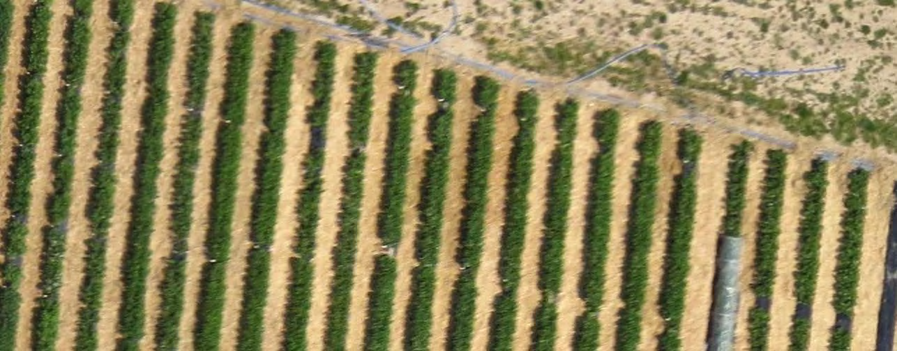
11 COSICAM FLYING PROTOTYPE CMOSIS CMOS sensor CMV2000 direct deposited interference filters 2048 x 1088 pixels 128 bands x 8 image lines 192 band x 5 image lines (in prep.) Typical operational framerate= 30fps 11


12 COSI SYSTEM Complete solution COSI cam: delivers raw images COSI cube: Uses photogrammetry to align image series Creates reflectance hypercubes COSI map : Derives value added products: ranging from vegetation indices to management zone maps 12
 Livens et al: Evaluation of the COSICAM hyperspectral")
13 IMAGE QUALITY Spatio-spectral 5x higher spatial res. 5x higher spectral res Mosaic Snapshot (simulated) Livens et al: Evaluation of the COSICAM hyperspectral camera with agricultural monitoring experiments Earsel


14 GEOMETRIC PERFORMANCE To be presented in July 2016 at ISPRS congress 14

15 Hyperspectral & UAV VITO COSICAM Results on Strawberries


16 DATA ACQUISITION CAMPAIGNS OVER STRAWBERRY TEST FIELD 16
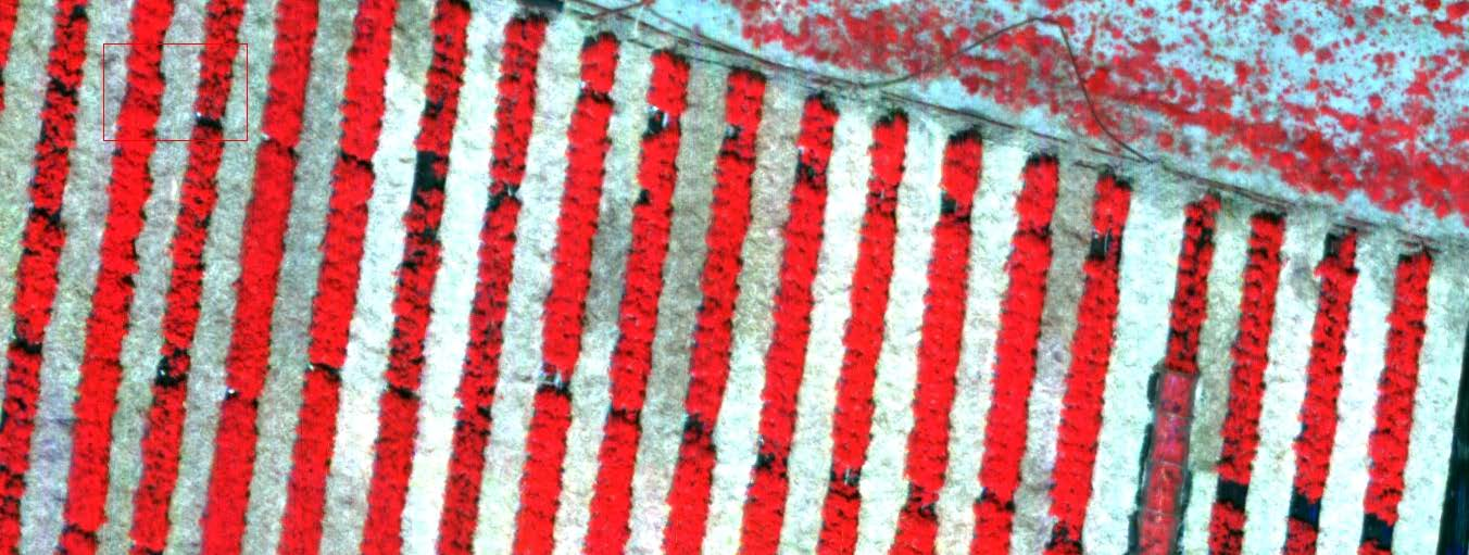


17 STRAWBERRY FIELD - FALSE COLOUR IMAGE( RGB = 801nm, 667nm, 604nm) COSI GSD = 2.0cm 0.5m RGB GSD = 2.6cm 17 17


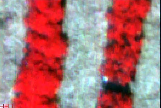
18 IMAGE COMPARISON COSI cam COSI, GSD = 2cm Nex-6, 16mm lens, GSD = 0.8cm 18

19 TEST FIELD TESTUP Plots with different varieties Treatment: nutrients : 0 vs 80kg N Irrigation: 20% vs. 100% 19


20 EXTRACT VEGETATION INDICES Pigment Specific Simple Ratio PSSRb= R800/R % irrigation 80kg N Livens et al: Evaluation of the COSICAM hyperspectral camera with agricultural monitoring experiments Earsel

21 EXAMPLE: PREDICTION WITH VEGETATION INDICES Experiment: Plots with 20% irrigation vs plots with 100% irrigation Index: Pigment Specific Simple Ratio PSSRb= R800/R635 Good correspondence PSSRb from COSI Ground Truth 21
22 Conclusion : Hyperspectral & UAV viable with thin film filters on chip VITO COSICAM complete spatiospectral solution high spatial + high spectral resolution Results on Strawberries good yield prediction


23 COSICAM now industrialized with


24 COSI CAM: delivers the future of high resolution precision farming
MULTIPURPOSE USE OF ORTHOPHOTO MAPS FORMING BASIS TO DIGITAL CADASTRE DATA AND THE VISION OF THE GENERAL DIRECTORATE OF LAND REGISTRY AND CADASTRE
 MULTIPURPOSE USE OF ORTHOPHOTO MAPS FORMING BASIS TO DIGITAL CADASTRE DATA AND THE VISION OF THE GENERAL DIRECTORATE OF LAND REGISTRY AND CADASTRE E.ÖZER, H.TUNA, F.Ç.ACAR, B.ERKEK, S.BAKICI General Directorate
Information Contents of High Resolution Satellite Images
 Information Contents of High Resolution Satellite Images H. Topan, G. Büyüksalih Zonguldak Karelmas University K. Jacobsen University of Hannover, Germany Keywords: satellite images, mapping, resolution,
CBERS Program Update Jacie 2011. Frederico dos Santos Liporace AMS Kepler liporace@amskepler.com
 CBERS Program Update Jacie 2011 Frederico dos Santos Liporace AMS Kepler liporace@amskepler.com Overview CBERS 3 and 4 characteristics Differences from previous CBERS satellites (CBERS 1/2/2B) Geometric
Realization of a UV fisheye hyperspectral camera
 Realization of a UV fisheye hyperspectral camera Valentina Caricato, Andrea Egidi, Marco Pisani and Massimo Zucco, INRIM Outline Purpose of the instrument Required specs Hyperspectral technique Optical
From Pixel to Info-Cloud News at Leica Geosystems JACIE Denver, 31 March 2011 Ruedi Wagner Hexagon Geosystems, Geospatial Solutions Division.
 From Pixel to Info-Cloud News at Leica Geosystems JACIE Denver, 31 March 2011 Ruedi Wagner Hexagon Geosystems, Geospatial Solutions Division What else can I do with my sensor/data? Earth to Image Image
Supervised Classification workflow in ENVI 4.8 using WorldView-2 imagery
 Supervised Classification workflow in ENVI 4.8 using WorldView-2 imagery WorldView-2 is the first commercial high-resolution satellite to provide eight spectral sensors in the visible to near-infrared
INTA AIRBORNE REMOTE SENSING FACILITY from the Hasselblad s cameras to the SensyTech-AHS sensor
 INTA AIRBORNE REMOTE SENSING FACILITY from the Hasselblad s cameras to the SensyTech-AHS sensor José-Antonio Gómez-Sánchez gomezsj@inta.es Remote Sensing Laboratory INSTITUTO NACIONAL DE TÉCNICA AEROESPACIAL
Digital Image Increase
 Exploiting redundancy for reliable aerial computer vision 1 Digital Image Increase 2 Images Worldwide 3 Terrestrial Image Acquisition 4 Aerial Photogrammetry 5 New Sensor Platforms Towards Fully Automatic
10000 pixels wide CMOS frame imager for earth observation from a HALE UAV
 10000 pixels wide CMOS frame imager for earth observation from a HALE UAV B. Delauré a, S. Livens a, J. Everaerts a, R. Kleihorst a, G. Schippers b, Yannick De Wit b, John Compiet b, Bartosz Banachowicz
Landsat Monitoring our Earth s Condition for over 40 years
 Landsat Monitoring our Earth s Condition for over 40 years Thomas Cecere Land Remote Sensing Program USGS ISPRS:Earth Observing Data and Tools for Health Studies Arlington, VA August 28, 2013 U.S. Department
16 th IOCCG Committee annual meeting. Plymouth, UK 15 17 February 2011. mission: Present status and near future
 16 th IOCCG Committee annual meeting Plymouth, UK 15 17 February 2011 The Meteor 3M Mt satellite mission: Present status and near future plans MISSION AIMS Satellites of the series METEOR M M are purposed
SAMPLE MIDTERM QUESTIONS
 Geography 309 Sample MidTerm Questions Page 1 SAMPLE MIDTERM QUESTIONS Textbook Questions Chapter 1 Questions 4, 5, 6, Chapter 2 Questions 4, 7, 10 Chapter 4 Questions 8, 9 Chapter 10 Questions 1, 4, 7
How To Make An Orthophoto
 ISSUE 2 SEPTEMBER 2014 TSA Endorsed by: CLIENT GUIDE TO DIGITAL ORTHO- PHOTOGRAPHY The Survey Association s Client Guides are primarily aimed at other professionals such as engineers, architects, planners
Map World Forum Hyderabad, India Introduction: High and very high resolution space images: GIS Development
 Very high resolution satellite images - competition to aerial images Dr. Karsten Jacobsen Leibniz University Hannover, Germany jacobsen@ipi.uni-hannover.de Introduction: Very high resolution images taken
TerraColor White Paper
 TerraColor White Paper TerraColor is a simulated true color digital earth imagery product developed by Earthstar Geographics LLC. This product was built from imagery captured by the US Landsat 7 (ETM+)
Opportunities for the generation of high resolution digital elevation models based on small format aerial photography
 Opportunities for the generation of high resolution digital elevation models based on small format aerial photography Boudewijn van Leeuwen 1, József Szatmári 1, Zalán Tobak 1, Csaba Németh 1, Gábor Hauberger
Vorstellung eines photogrammetrischen Kamerasystems für UAVs mit hochgenauer GNSS/INS Information für standardisierte Verarbeitungsverfahren
 Vorstellung eines photogrammetrischen Kamerasystems für UAVs mit hochgenauer GNSS/INS Information für standardisierte Verarbeitungsverfahren T. Kraft a, M. Geßner a, H. Meißner a, H. J. Przybilla b, M.
TUTORIAL Extraction of Geospatial Information from High Spatial Resolution Optical Satellite Sensors
 TUTORIAL Extraction of Geospatial Information from High Spatial Resolution Optical Satellite Sensors E. Baltsavias 1,L. Zhang 2, D. Holland 3, P.K. Srivastava 4, B. Gopala Krishna 4, T.P. Srinivasan 4
2.3 Spatial Resolution, Pixel Size, and Scale
 Section 2.3 Spatial Resolution, Pixel Size, and Scale Page 39 2.3 Spatial Resolution, Pixel Size, and Scale For some remote sensing instruments, the distance between the target being imaged and the platform,
Grasshopper3 U3. Point Grey Research Inc. 12051 Riverside Way Richmond, BC Canada V6W 1K7 T (604) 242-9937 www.ptgrey.com
 242-9937 www.ptgrey.com") Grasshopper3 U3 USB 3.0 Camera Imaging Performance Specification Version 12.0 Point Grey Research Inc. 12051 Riverside Way Richmond, BC Canada V6W 1K7 T (604) 242-9937 www.ptgrey.com Copyright 2012-2015
Grasshopper3 U3 USB 3.0 Camera Imaging Performance Specification Version 12.0 Point Grey Research Inc. 12051 Riverside Way Richmond, BC Canada V6W 1K7 T (604) 242-9937 www.ptgrey.com Copyright 2012-2015
Computer Vision: Machine Vision Filters. Computer Vision. Optical Filters. 25 August 2014
 Computer Vision Optical Filters 25 August 2014 Copyright 2001 2014 by NHL Hogeschool, Van de Loosdrecht Machine Vision BV and Klaas Dijkstra All rights reserved j.van.de.loosdrecht@nhl.nl, jaap@vdlmv.nl,
UPDATING OBJECT FOR GIS DATABASE INFORMATION USING HIGH RESOLUTION SATELLITE IMAGES: A CASE STUDY ZONGULDAK
 UPDATING OBJECT FOR GIS DATABASE INFORMATION USING HIGH RESOLUTION SATELLITE IMAGES: A CASE STUDY ZONGULDAK M. Alkan 1, *, D. Arca 1, Ç. Bayik 1, A.M. Marangoz 1 1 Zonguldak Karaelmas University, Engineering
MODIS IMAGES RESTORATION FOR VNIR BANDS ON FIRE SMOKE AFFECTED AREA
 MODIS IMAGES RESTORATION FOR VNIR BANDS ON FIRE SMOKE AFFECTED AREA Li-Yu Chang and Chi-Farn Chen Center for Space and Remote Sensing Research, National Central University, No. 300, Zhongda Rd., Zhongli
Observing Lake Erie Algae Blooms via. Hyper Spectral Imaging on CubeSat
 Observing Lake Erie Algae Blooms via Hyper Spectral Imaging on CubeSat Chris Emr, Department of Physics Advisor: Professor Paul Barnhart, Department of Aerospace Engineering Case Western Reserve University
The X100. Safe and fully automatic. Fast and with survey accuracy. revolutionary mapping. create your own orthophotos and DSMs
 The X100 revolutionary mapping Safe and fully automatic create your own orthophotos and DSMs Fast and with survey accuracy operates even in harsh weather conditions (up to 65 km/h wind & light rain) Image
WATER BODY EXTRACTION FROM MULTI SPECTRAL IMAGE BY SPECTRAL PATTERN ANALYSIS
 WATER BODY EXTRACTION FROM MULTI SPECTRAL IMAGE BY SPECTRAL PATTERN ANALYSIS Nguyen Dinh Duong Department of Environmental Information Study and Analysis, Institute of Geography, 18 Hoang Quoc Viet Rd.,
Spectral Response for DigitalGlobe Earth Imaging Instruments
 Spectral Response for DigitalGlobe Earth Imaging Instruments IKONOS The IKONOS satellite carries a high resolution panchromatic band covering most of the silicon response and four lower resolution spectral
Remote sensing is the collection of data without directly measuring the object it relies on the
 Chapter 8 Remote Sensing Chapter Overview Remote sensing is the collection of data without directly measuring the object it relies on the reflectance of natural or emitted electromagnetic radiation (EMR).
Virtual Reality Techniques for the Visualization of Biomedical Imaging Data
 Virtual Reality Techniques for the Visualization of Biomedical Imaging Data M. A. Shaw, w. B. Spiliman Jr., K. E. Meissnera, Gabbardc athe Optical Sciences and Engineering Research Center, Virginia Polytechnic
Resolutions of Remote Sensing
 Resolutions of Remote Sensing 1. Spatial (what area and how detailed) 2. Spectral (what colors bands) 3. Temporal (time of day/season/year) 4. Radiometric (color depth) Spatial Resolution describes how
PRELIMINARY DESIGN REVIEW
 STUDENTS SPACE ASSOCIATION THE FACULTY OF POWER AND AERONAUTICAL ENGINEERING WARSAW UNIVERSITY OF TECHNOLOGY PRELIMINARY DESIGN REVIEW CAMERAS August 2015 Abstract The following document is a part of the
Digital Agriculture: Leveraging Technology and Information into Profitable Decisions
 Digital Agriculture: Leveraging Technology and Information into Profitable Decisions Dr. Matt Darr, Ag & Biosystems Engineering Advancing Agricultural Performance and Environmental Stewardship Some material
Mapping coastal landscapes in Sri Lanka - Report -
 Mapping coastal landscapes in Sri Lanka - Report - contact : Jil Bournazel jil.bournazel@gmail.com November 2013 (reviewed April 2014) Table of Content List of Figures...ii List of Tables...ii Acronyms...ii
RESOLUTION MERGE OF 1:35.000 SCALE AERIAL PHOTOGRAPHS WITH LANDSAT 7 ETM IMAGERY
 RESOLUTION MERGE OF 1:35.000 SCALE AERIAL PHOTOGRAPHS WITH LANDSAT 7 ETM IMAGERY M. Erdogan, H.H. Maras, A. Yilmaz, Ö.T. Özerbil General Command of Mapping 06100 Dikimevi, Ankara, TURKEY - (mustafa.erdogan;
USE OF VERY HIGH-RESOLUTION AIRBORNE IMAGES TO ANALYSE 3D CANOPY ARCHITECTURE OF A VINEYARD
 USE OF VERY HIGH-RESOLUTION AIRBORNE IMAGES TO ANALYSE 3D CANOPY ARCHITECTURE OF A VINEYARD S. Burgos a, *, M. Mota a, D. Noll a, B. Cannelle b a University for Viticulture and Oenology Changins, 1260
ING LA PALMA TECHNICAL NOTE No. 130. Investigation of Low Fringing Detectors on the ISIS Spectrograph.
 ING LA PALMA TECHNICAL NOTE No. 130 Investigation of Low Fringing Detectors on the ISIS Spectrograph. Simon Tulloch (ING) June 2005 Investigation of Low Fringing Detectors on the ISIS Spectrograph. 1.
Connected Farm Field Services. Dan Rooney InfoAg Conference, July 30, 2014
 Connected Farm Field Services Dan Rooney InfoAg Conference, July 30, 2014 What is Connected Farm? Connected Farm is an integrated operations management solution that combines industry-leading hardware,
Generation of Cloud-free Imagery Using Landsat-8
 Generation of Cloud-free Imagery Using Landsat-8 Byeonghee Kim 1, Youkyung Han 2, Yonghyun Kim 3, Yongil Kim 4 Department of Civil and Environmental Engineering, Seoul National University (SNU), Seoul,
COMPARISON OF AERIAL IMAGES, SATELLITE IMAGES AND LASER SCANNING DSM IN A 3D CITY MODELS PRODUCTION FRAMEWORK
 COMPARISON OF AERIAL IMAGES, SATELLITE IMAGES AND LASER SCANNING DSM IN A 3D CITY MODELS PRODUCTION FRAMEWORK G. Maillet, D. Flamanc Institut Géographique National, Laboratoire MATIS, Saint-Mandé, France
Datasheet Preliminary
 Line Scan Camera Datasheet Preliminary Main Features Sensor: 3 or 4 x 4096 pixels 10 x 10 µm Multi-line with 3 Versions (each of them in Full or Low speed): RGB RGB + Monochrome RGB + Near Infra Red Rows
Data Processing Developments at DFD/DLR. Stefanie Holzwarth Martin Bachmann, Rudolf Richter, Martin Habermeyer, Derek Rogge
 Data Processing Developments at DFD/DLR Stefanie Holzwarth Martin Bachmann, Rudolf Richter, Martin Habermeyer, Derek Rogge EUFAR Joint Expert Working Group Meeting Edinburgh, April 14th 2011 Conclusions
Optical Digitizing by ATOS for Press Parts and Tools
 Optical Digitizing by ATOS for Press Parts and Tools Konstantin Galanulis, Carsten Reich, Jan Thesing, Detlef Winter GOM Gesellschaft für Optische Messtechnik mbh, Mittelweg 7, 38106 Braunschweig, Germany
White paper. CCD and CMOS sensor technology Technical white paper
 White paper CCD and CMOS sensor technology Technical white paper Table of contents 1. Introduction to image sensors 3 2. CCD technology 4 3. CMOS technology 5 4. HDTV and megapixel sensors 6 5. Main differences
Requirements and technology for smart materials in greenhouses
 Requirements and technology for smart materials in greenhouses Greenhouses in The Netherlands Workshop 13 April 2016, Bleiswijk Dr. Silke Hemming, Wageningen UR Greenhouse Horticulture About 10 000 Ha
Soil degradation monitoring by active and passive remote-sensing means: examples with two degradation processes
 Soil degradation monitoring by active and passive remote-sensing means: examples with two degradation processes Naftaly Goldshleger, *Eyal Ben-Dor,* *Ido Livne,* U. Basson***, and R.Ben-Binyamin*Vladimir
Imagery. 1:50,000 Basemap Generation From Satellite. 1 Introduction. 2 Input Data
 1:50,000 Basemap Generation From Satellite Imagery Lisbeth Heuse, Product Engineer, Image Applications Dave Hawkins, Product Manager, Image Applications MacDonald Dettwiler, 3751 Shell Road, Richmond B.C.
www.photonics.com May 2013 Color Sense Trilinear Cameras Bring Speed, Quality
 www.photonics.com May 2013 Color Sense Trilinear Cameras Bring Speed, Quality Tech Feature Trilinear Cameras Offer High-Speed Color Imaging Solutions With high color quality and speed and low cost trilinear
Integrating Airborne Hyperspectral Sensor Data with GIS for Hail Storm Post-Disaster Management.
 Integrating Airborne Hyperspectral Sensor Data with GIS for Hail Storm Post-Disaster Management. *Sunil BHASKARAN, *Bruce FORSTER, **Trevor NEAL *School of Surveying and Spatial Information Systems, Faculty
CROP CLASSIFICATION WITH HYPERSPECTRAL DATA OF THE HYMAP SENSOR USING DIFFERENT FEATURE EXTRACTION TECHNIQUES
 Proceedings of the 2 nd Workshop of the EARSeL SIG on Land Use and Land Cover CROP CLASSIFICATION WITH HYPERSPECTRAL DATA OF THE HYMAP SENSOR USING DIFFERENT FEATURE EXTRACTION TECHNIQUES Sebastian Mader
Motion Activated Camera User Manual
 Brinno MAC200 User Manual Last Modified on 12/23/2015 7:51 pm EST Motion Activated Camera User Manual www.brinno.com Register@online http://www.brinno.com/support/register.html contact us: customerservice@brinno.com
Land Use/Land Cover Map of the Central Facility of ARM in the Southern Great Plains Site Using DOE s Multi-Spectral Thermal Imager Satellite Images
 Land Use/Land Cover Map of the Central Facility of ARM in the Southern Great Plains Site Using DOE s Multi-Spectral Thermal Imager Satellite Images S. E. Báez Cazull Pre-Service Teacher Program University
Manufacturing Process and Cost Estimation through Process Detection by Applying Image Processing Technique
 Manufacturing Process and Cost Estimation through Process Detection by Applying Image Processing Technique Chalakorn Chitsaart, Suchada Rianmora, Noppawat Vongpiyasatit Abstract In order to reduce the
Design of a High Resolution Multispectral Scanner for Developing Vegetation Indexes
 Design of a High Resolution Multispectral Scanner for Developing Vegetation Indexes Rishitosh kumar sinha*, Roushan kumar mishra, Sam jeba kumar, Gunasekar. S Dept. of Instrumentation & Control Engg. S.R.M
MRC High Resolution. MR-compatible digital HD video camera. User manual
 MRC High Resolution MR-compatible digital HD video camera User manual page 1 of 12 Contents 1. Intended use...2 2. System components...3 3. Video camera and lens...4 4. Interface...4 5. Installation...5
pb tec solutions GmbH, Max-Planck-Str. 11, 63755 Alzenau (Germany) Tel.: +49 6023 94771 0 Fax: +49 6023 94771 29 www.pbtecsolutions.
 Tel.: +49 6023 94771 0 Fax: +49 6023 94771 29 www.pbtecsolutions.") pb tec solutions GmbH, Max-Planck-Str. 11, 63755 Alzenau (Germany) Tel.: +49 6023 94771 0 Fax: +49 6023 94771 29 www.pbtecsolutions.de info@pbtecsolutions.de Model Description AOI systems MV-3 MV-6E/EM
pb tec solutions GmbH, Max-Planck-Str. 11, 63755 Alzenau (Germany) Tel.: +49 6023 94771 0 Fax: +49 6023 94771 29 www.pbtecsolutions.de info@pbtecsolutions.de Model Description AOI systems MV-3 MV-6E/EM
Resolution for Color photography
 Resolution for Color photography Paul M. Hubel a and Markus Bautsch b a Foveon, Inc., 282 San Tomas Expressway, Santa Clara, CA, USA 955; b Stiftung Warentest, Luetzowplatz -3, D-785 Berlin-Tiergarten,
ULTRACAMXP, THE NEW DIGITAL AERIAL CAMERA SYSTEM BY VEXCEL IMAGING / MICROSOFT INTRODUCTION
 ULTRACAMXP, THE NEW DIGITAL AERIAL CAMERA SYSTEM BY VEXCEL IMAGING / MICROSOFT Michael Gruber, Alexander Wiechert Vexcel Imaging / Microsoft Photogrammetry Anzengrubergasse 8, A-8010 Graz, Austria {michgrub,
Contributions of the geospatial fields to monitoring sustainability of urban environments John Trinder. School of Civil and Environmental Engineering
 Contributions of the geospatial fields to monitoring sustainability of urban environments John Trinder School of Civil and Environmental Engineering 2 IMPACT OF HUMAN DEVELOPMENT Humans are modifying the
Lake Monitoring in Wisconsin using Satellite Remote Sensing
 Lake Monitoring in Wisconsin using Satellite Remote Sensing D. Gurlin and S. Greb Wisconsin Department of Natural Resources 2015 Wisconsin Lakes Partnership Convention April 23 25, 2105 Holiday Inn Convention
Passive Remote Sensing of Clouds from Airborne Platforms
 Passive Remote Sensing of Clouds from Airborne Platforms Why airborne measurements? My instrument: the Solar Spectral Flux Radiometer (SSFR) Some spectrometry/radiometry basics How can we infer cloud properties
Digital image processing
 746A27 Remote Sensing and GIS Lecture 4 Digital image processing Chandan Roy Guest Lecturer Department of Computer and Information Science Linköping University Digital Image Processing Most of the common
Big Data & Big Opportunities
 Big Data & Big Opportunities Dr. Matt Darr, Iowa State University For a copy of this slide deck please send an email request to darr@iastate.edu Presentation Guiding Principles No intent to be critical
Review for Introduction to Remote Sensing: Science Concepts and Technology
 Review for Introduction to Remote Sensing: Science Concepts and Technology Ann Johnson Associate Director ann@baremt.com Funded by National Science Foundation Advanced Technological Education program [DUE
Fig.1. The DAWN spacecraft
 Introduction Optical calibration of the DAWN framing cameras G. Abraham,G. Kovacs, B. Nagy Department of Mechatronics, Optics and Engineering Informatics Budapest University of Technology and Economics
WHITE PAPER. Are More Pixels Better? www.basler-ipcam.com. Resolution Does it Really Matter?
 WHITE PAPER www.basler-ipcam.com Are More Pixels Better? The most frequently asked question when buying a new digital security camera is, What resolution does the camera provide? The resolution is indeed
China Earth Observation
 China High-resolution Earth Observation China Earth Observation System (CHEOS) and its Lastest Development The Earth Observation System and Data Center, CNSA 2014-2 Outlines 1 Introduction 2 The composition
The Role of SPOT Satellite Images in Mapping Air Pollution Caused by Cement Factories
 The Role of SPOT Satellite Images in Mapping Air Pollution Caused by Cement Factories Dr. Farrag Ali FARRAG Assistant Prof. at Civil Engineering Dept. Faculty of Engineering Assiut University Assiut, Egypt.
Planning Tools related to water in Promotional Complex Forest Western Sudety Mountains
 Planning Tools related to water in Promotional Complex Forest Western Sudety Mountains Radomir Balazy Forest Research Institute R.Balazy@ibles.waw.pl Content 1. Introduction 2. Technologies of data collection
Big Data Challenge: Mining Heterogeneous Data. Prof. Mihai Datcu. German Aerospace Center (DLR) Munich Aerospace Faculty
 Munich Aerospace Faculty") Big Data Challenge: Mining Heterogeneous Data Prof. Mihai Datcu German Aerospace Center (DLR) Munich Aerospace Faculty Sensing & Big Data Big Data: - Computer hardware and the Cloud - Storage Challenges
Big Data Challenge: Mining Heterogeneous Data Prof. Mihai Datcu German Aerospace Center (DLR) Munich Aerospace Faculty Sensing & Big Data Big Data: - Computer hardware and the Cloud - Storage Challenges
Scanners and How to Use Them
 Written by Jonathan Sachs Copyright 1996-1999 Digital Light & Color Introduction A scanner is a device that converts images to a digital file you can use with your computer. There are many different types
T-REDSPEED White paper
 T-REDSPEED White paper Index Index...2 Introduction...3 Specifications...4 Innovation...6 Technology added values...7 Introduction T-REDSPEED is an international patent pending technology for traffic violation
Investigation of Color Aliasing of High Spatial Frequencies and Edges for Bayer-Pattern Sensors and Foveon X3 Direct Image Sensors
 Investigation of Color Aliasing of High Spatial Frequencies and Edges for Bayer-Pattern Sensors and Foveon X3 Direct Image Sensors Rudolph J. Guttosch Foveon, Inc. Santa Clara, CA Abstract The reproduction
Introduction to Imagery and Raster Data in ArcGIS
 Esri International User Conference San Diego, California Technical Workshops July 25, 2012 Introduction to Imagery and Raster Data in ArcGIS Simon Woo slides Cody Benkelman - demos Overview of Presentation
Aperture, Shutter speed and iso
 Aperture, Shutter speed and iso These are the building blocks of good photography and making good choices on the combination of these 3 controls will give superior results than you will get by using the
Proba-V: Earthwatch Mission as part of ESA s Earth Observation Programmes
 Proba-V: Earthwatch Mission as part of ESA s Earth Observation Programmes Antwerp 05.07.2013 Bianca Hoersch Proba-V Mission Manager Third Party Mission & Sentinel-2 Mission Manager Earth Observation Directorate,
Choosing a digital camera for your microscope John C. Russ, Materials Science and Engineering Dept., North Carolina State Univ.
 Choosing a digital camera for your microscope John C. Russ, Materials Science and Engineering Dept., North Carolina State Univ., Raleigh, NC One vital step is to choose a transfer lens matched to your
Jean François Aumont (1), Bastien Mancini (2). (1) Image processing manager, Delair-Tech, (2) Managing director, Delair-Tech. Project : Authors:
, Bastien Mancini (2). (1) Image processing manager, Delair-Tech, (2) Managing director, Delair-Tech. Project : Authors:") Jean François Aumont (1), Bastien Mancini (2). (1) Image processing manager, Delair-Tech, (2) Managing director, Delair-Tech. White paper DT26X DT-3BANDS XL APXL Project : Authors: Date:
Jean François Aumont (1), Bastien Mancini (2). (1) Image processing manager, Delair-Tech, (2) Managing director, Delair-Tech. White paper DT26X DT-3BANDS XL APXL Project : Authors: Date:
Adaptive HSI Data Processing for Near-Real-time Analysis and Spectral Recovery *
 Adaptive HSI Data Processing for Near-Real-time Analysis and Spectral Recovery * Su May Hsu, 1 Hsiao-hua Burke and Michael Griffin MIT Lincoln Laboratory, Lexington, Massachusetts 1. INTRODUCTION Hyperspectral
Design Specifications of an UAV for Environmental Monitoring, Safety, Video Surveillance, and Urban Security
 Design Specifications of an UAV for Environmental Monitoring, Safety, Video Surveillance, and Urban Security A. Alessandri, P. Bagnerini, M. Gaggero, M. Ghio, R. Martinelli University of Genoa - Faculty
High Resolution, High Speed, Hyperspectral Cameras for Laboratory, Industrial and Airborne Applications.
 High Resolution, High Speed, Hyperspectral Cameras for Laboratory, Industrial and Airborne Applications. Norsk Elektro Optikk AS P.O.Box 384, Solheimveien 62A, N-1471 Lørenskog, NORWAY Phone: +47 67 97
MACHINE VISION FOR SMARTPHONES. Essential machine vision camera requirements to fulfill the needs of our society
 MACHINE VISION FOR SMARTPHONES Essential machine vision camera requirements to fulfill the needs of our society INTRODUCTION With changes in our society, there is an increased demand in stateof-the art
ZEISS Axiocam 506 color Your Microscope Camera for Imaging of Large Sample Areas Fast, in True Color, and High Resolution
 Product Information Version 1.0 ZEISS Axiocam 506 color Your Microscope Camera for Imaging of Large Sample Areas Fast, in True Color, and High Resolution ZEISS Axiocam 506 color Sensor Model Sensor Pixel
Topic 13 Predictive Modeling. Topic 13. Predictive Modeling
 Topic 13 Predictive Modeling Topic 13 Predictive Modeling 13.1 Predicting Yield Maps Talk about the future of Precision Ag how about maps of things yet to come? Sounds a bit far fetched but Spatial Data
Nederland België / Belgique
 Cronus Brochure 2 Introduction Cronus: The first spectrometer and colorimeter in one The Cronus is world s first spectrocolorimeter combining a high en VIS spectrometer with a high speed XYZ colorimeter.
ENVI THE PREMIER SOFTWARE FOR EXTRACTING INFORMATION FROM GEOSPATIAL IMAGERY.
 ENVI THE PREMIER SOFTWARE FOR EXTRACTING INFORMATION FROM GEOSPATIAL IMAGERY. ENVI Imagery Becomes Knowledge ENVI software uses proven scientific methods and automated processes to help you turn geospatial
Computer Vision. Image acquisition. 25 August 2014. Copyright 2001 2014 by NHL Hogeschool and Van de Loosdrecht Machine Vision BV All rights reserved
 Computer Vision Image acquisition 25 August 2014 Copyright 2001 2014 by NHL Hogeschool and Van de Loosdrecht Machine Vision BV All rights reserved j.van.de.loosdrecht@nhl.nl, jaap@vdlmv.nl Image acquisition
Improved predictive modeling of white LEDs with accurate luminescence simulation and practical inputs
 Improved predictive modeling of white LEDs with accurate luminescence simulation and practical inputs TracePro Opto-Mechanical Design Software s Fluorescence Property Utility TracePro s Fluorescence Property
APPLICATIONS AND USAGE
 APPLICATIONS AND USAGE http://www.tutorialspoint.com/dip/applications_and_usage.htm Copyright tutorialspoint.com Since digital image processing has very wide applications and almost all of the technical
Remote Sensing of Clouds from Polarization
 Remote Sensing of Clouds from Polarization What polarization can tell us about clouds... and what not? J. Riedi Laboratoire d'optique Atmosphérique University of Science and Technology Lille / CNRS FRANCE
Digital Remote Sensing Data Processing Digital Remote Sensing Data Processing and Analysis: An Introduction and Analysis: An Introduction
 Digital Remote Sensing Data Processing Digital Remote Sensing Data Processing and Analysis: An Introduction and Analysis: An Introduction Content Remote sensing data Spatial, spectral, radiometric and
Photogrammetric Point Clouds
 Photogrammetric Point Clouds Origins of digital point clouds: Basics have been around since the 1980s. Images had to be referenced to one another. The user had to specify either where the camera was in
Speed Detection for Moving Objects from Digital Aerial Camera and QuickBird Sensors
 Speed Detection for Moving Objects from Digital Aerial Camera and QuickBird Sensors September 2007 Fumio Yamazaki 1, Wen Liu 1, T. Thuy Vu 2 1. Graduate School of Engineering, Chiba University, Japan.
Corona process The new ZEISS spectrometer system for the food industry
 Interactive PDF Version 1.0 Start Trust needs reliability quality needs ZEISS The real challenge is to offer a product with consistent quality using raw materials which are themselves subject to ongoing
DETECTION OF URBAN FEATURES AND MAP UPDATING FROM SATELLITE IMAGES USING OBJECT-BASED IMAGE CLASSIFICATION METHODS AND INTEGRATION TO GIS
 Proceedings of the 4th GEOBIA, May 79, 2012 Rio de Janeiro Brazil. p.315 DETECTION OF URBAN FEATURES AND MAP UPDATING FROM SATELLITE IMAGES USING OBJECTBASED IMAGE CLASSIFICATION METHODS AND INTEGRATION
ADAPTATION OF OPTICAL SENSORS TO DETECT URINE AND DUNG PATCHES IN DAIRY PASTURE
 ADAPTATION OF OPTICAL SENSORS TO DETECT URINE AND DUNG PATCHES IN DAIRY PASTURE Jemma Mackenzie 1, R Christianson 2, C Mackenzie 1 and I J Yule 2 1 Agri Optics NZ Ltd, 337 Reynolds Rd, RD 6, Ashburton,
Lab #8: Introduction to ENVI (Environment for Visualizing Images) Image Processing
 Image Processing") Lab #8: Introduction to ENVI (Environment for Visualizing Images) Image Processing ASSIGNMENT: Display each band of a satellite image as a monochrome image and combine three bands into a color image, and
Lab #8: Introduction to ENVI (Environment for Visualizing Images) Image Processing ASSIGNMENT: Display each band of a satellite image as a monochrome image and combine three bands into a color image, and
How an electronic shutter works in a CMOS camera. First, let s review how shutters work in film cameras.
 How an electronic shutter works in a CMOS camera I have been asked many times how an electronic shutter works in a CMOS camera and how it affects the camera s performance. Here s a description of the way
Sensori ottici e laser nelle applicazioni industriali
 Sensori ottici e laser nelle applicazioni industriali Guido GIULIANI Pavia giuliani@julight.it 1 Outline Optical sensors in industry: why? Types of optical sensors optical barriers distance measurement
Step-by-Step guide for IMAGINE UAV workflow
 Step-by-Step guide for IMAGINE UAV workflow Overview This short guide will go through all steps of the UAV workflow that are needed to produce the final results. Those consist out of two raster datasets,
Filters for Digital Photography
 Filters for Digital Photography LICHTFILTER Whether for analog or Digital Photography: The best results are achieved by using correction filters - not by digitally enhancing in a software program as once