Local Spatial Data Infrastructure, a Solid Base for Sustainable
|
|
|
- Daniella Adams
- 8 years ago
- Views:
Transcription
1 Local Spatial Data Infrastructure, a Solid Base for Sustainable Land Management in Germany Ulrike Klein and Hartmut Müller FIG Commission 3 Workshop and Commission 3 Annual Meeting The Empowerment of Local Authorities: Spatial Information and Spatial Planning Tools October 2011, Paris, France Technical Session 8 Best Peer-Review Papers, 27 October

2 Current Challenges Climate Change Rapid Urbanisation Population Change dailygalaxy.com

3 SUSTAINABLE LAND MANAGEMENT

4 Sustainable Land Management Demands on land Source: Rubitzki and Vancutsem, 2009, p20

5 SPATIAL DATA INFRASTRUCTURES

6 Principles of SDI Spatial information network Government Industry Science Public Standardized spatial information services Production Analysis Application Spatial information Spatial base data Spatial thematic data Metadata Abb.: IMAGI 2005

7 Classification of SDI hierarchy levels Source: Rajabifard et al (1999) Global Spatial Data Infrastructure (GSDI) Regional Spatial Data Infrastructure (RSDI) Ex. INSPIRE National Spatial Data Infrastructure (NSDI) Ex. SDI Germany State or Provincial Spatial Data Infrastructure (SSDI) Local Spatial Data Infrastructure (LSDI) Ex. SDI German State of Rheinland-Pfalz Corporate Spatial Data Infrastructure (CSDI)
 Local Spatial Data Infrastructure")
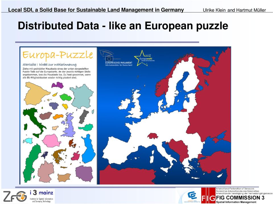
8 Distributed Data - like an European puzzle
9 INSPIRE and Local SDI Annex I: Coordinate reference systems, Geographical grid systems, Geographical names, Administrative units, Addresses, Cadastral parcels, Transport networks, Hydrography, Protected sites Annex II: Elevation, Land cover, Orthoimagery, Geology Annex III: Statistical units, Buildings, Soil, Land use, Human health and safety, Utility and governmental services, Environmental monitoring Facilities, Production and industrial facilities, Agricultural and aquaculture facilities, Population distribution and demography, Area management/ restriction/ regulation zones & reporting units, Natural risk zones, Atmospheric conditions, Meteorological geographical features, Oceanographic geographical features, Sea regions, Bio-geographical regions, Habitats and biotopes, Species distribution, Energy Resources, Mineral Resources.

10 SPATIAL DATA INFRASTRUCTURES AND SUSTAINABLE LAND MANAGEMENT

11 Land use in a prospective planning area Source: Own Image

12 Soil Sealing in the planning area Source: Own Image

13 Useful Data for Land Management from INSPIRE Annex I: Coordinate reference systems, Geographical grid systems, Geographical names, Administrative units, Addresses, Cadastral parcels, Transport networks, Hydrography, Protected sites Annex II: Elevation, Land cover, Orthoimagery, Geology Annex III: Statistical units, Buildings, Soil, Land use, Human health and safety, Utility and governmental services, Environmental monitoring Facilities, Production and industrial facilities, Agricultural and aquaculture facilities, Population distribution and demography, Area management/ restriction/ regulation zones & reporting units, Natural risk zones, Atmospheric conditions, Meteorological geographical features, Oceanographic geographical features, Sea regions, Bio-geographical regions, Habitats and biotopes, Species distribution, Energy Resources, Mineral Resources.

14 Transdiciplinary data flows are needed Source: Own Image Create Actualise Delete Announce changes Read

15 A GERMAN CASE STUDY
16 Case Study, study area in Germany Source:

17 Spatial Data Infrastructures SDI Hierarchy in Germany Source: GDI-DE 2010, p9 SDI- Germany SDI of the federal states Local SDI

18 CHALLENGES IN SDI-DEVELOPMENT AT A SECOND GLANCE

19 Problem: Data quality and access countrywide availiability harmonized symbols harmonized content harmonized uality available metadata costs Abb.: Graeff

20 Problem: Sustainable Datamanagement Abb.: T&P

21 Problem: Lack of Spatial Media Literacy Geographical Literacy = Orientation in spatial media Geographical Media Literacy = Retrieving information from spatial media Geographical Information Literacy = Search and find geographical information Geographical Communication Literacy = Present and communicate geographical information Spatial Media Literacy Abb.: Photcase
22 Local SDI, a Solid Base SDI, a Solid Base for Sustainable Land Management in Germany Land Management in Germany Ulrike Klein Ulrike Klein and Hartmut M artmut Müller ller Problem: Unknown or ignorated laws and directives
23 Problem: Unknown Responibilities Abb.: Photcase
24 Problem: Lack of communication Abb.: Photcase
25 Problem: Not enough Network Government Science Industry Public Abb.: Duttmann
26 Problem: Missing Vision Abb.: Photcase
27 SDI RP
28 Technical implementation - Geoportals and SDI Source: Geoinfo, 2005
29 Local SDI, a Solid Base SDI, a Solid Base for Sustainable Land Management in Germany Land Management in Germany Ulrike Klein Ulrike Klein and Hartmut M artmut Müller ller Technical implementation - Public access to land values within GDI-RP federal state SDI Source:
30 Functional implementation Establishment of workingsgroups at different governmental levels Development of literacy concepts for vertical and horizontal inter- and transdiscplinary cooperation Development of implementation concepts at county level Implementation Support
31 Example: SDI assessment at Rheinland-Pfalz county level List of SDI assessment indicators Source: SDI assessment at the county level, State of Rheinland-Pfalz 1. Degree of availability of digital geospatial basic data 2. Availability of qualified personnel (employee with a high level GIS qualification) 3. Degree of availability of digital geospatial thematic data and of metadata 4. Information retrieval of digital geospatial basic data as a part of daily routine of service personnel 5. Information retrieval of digital geospatial thematic data as a part of daily routine of service personnel 6. Powerful computer hardware available 7. Powerful computer network available 8. Broad use of Desktop GIS in different departments interacting with each other 9. Broad use of external web services in different departments 10. Provision of web services for external users 11. Availability of a WebGIS intranet 12. Availability of WebGIS internet access for general public use 13. Availability of WebGIS internet access for professional use 0 not available 1 implementation scheduled 2 partly implemented 3 fully implemented
32 Result: Local SDI implementation at county level State of Rheinland-Pfalz 2009/2010 Source: SDI assessment at the county level, State of Rheinland-Pfalz Implementation status 90% 80% 70% 60% 50% 40% 30% 20% 10% 0% County No.
33 SDI SH
34 Technical Implementation: Publish- Find-Bind in Schleswig-Holstein Metadata informationsystem SH-MIS Publish e.g. WMSoder WFS-Dienst Find e.g. Geoserver Bind Digital Atlas North
35 Metadata information System SH-MIS Source:
36 Digital Atlas North Source:
37 Local SDI, a Solid Base SDI, a Solid Base for Sustainable Land Management in Germany Land Management in Germany Ulrike Klein Ulrike Klein and Hartmut M artmut Müller ller Technical implementation - Dataflow
38 Functional implementation Establishing the network of sdi-stakeholders from government, science, industrie and public by building up the Centre of Geoinformation at the University of Kiel funded by the European Fond of Regional Development Knowledge- and technologytransfer in e.g. best practice projects, surveys, research, innovation development, consulting and further education
39 CONCLUSIONS
40 Hardcore facts Abb.: Photcase
41 Softskills Abb.: Photcase
42 Thank you for listening
Inspired by new possibilities. Marie Haldorson Director, Statistics Sweden
 Inspired by new possibilities Marie Haldorson Director, Statistics Sweden The INSPIRE Directive The European INSPIRE Directive entered in force in May 2007 and will be fully implemented by 2020. An infrastructure
GIS Data Models for INSPIRE and ELF
 GIS Data Models for INSPIRE and ELF Paul Hardy Roberto Lucchi EuroSDR/ELF Copenhagen Data Modelling and Model Driven Implementation of Data Distribution 28 Jan 2015 ArcGIS for INSPIRE Extends ArcGIS for
Building up a SDI What is needed? Ulla Kronborg Mazzoli Danish ministry for the Environment National Survey and Cadastre
 Building up a SDI What is needed? Ulla Kronborg Mazzoli Danish ministry for the Environment National Survey and Cadastre He who knows all the answers has not yet been asked all the questions. - Author
Establishment of Spatial Data Infrastructure within the Environmental Sector in Slovak Republic
 EnviroInfo 2005 (Brno) Informatics for Environmental Protection - Networking Environmental Information Establishment of Spatial Data Infrastructure within the Environmental Sector in Slovak Republic Martin
INSPIRE and Multi-Disciplinary Interoperability. Max Craglia European Commission Joint Research Centre
 INSPIRE and Multi-Disciplinary Interoperability Max Craglia European Commission Joint Research Centre www.jrc.ec.europa.eu Serving society Stimulating innovation Supporting legislation Earth system science
Cadastre in the context of SDI and INSPIRE
 Cadastre in the context of SDI and INSPIRE Dr. Markus Seifert Bavarian Administration for Surveying and Cadastre Cadastre in the digital age the approach in Germany 3 rd CLGE Conference, Hanover, 11.10.2012
Making Geospatial Data Available and Accessible in Jamaica
 Making Geospatial Data Available and Accessible in Jamaica Presented by Cecille Blake, National GIS Coordinator Office of the Prime Minister, National Spatial Data Management Division 9 th UNRCC New York
THE RENEWAL OF SNIG UNDER INSPIRE UMBRELLA
 THE RENEWAL OF SNIG UNDER INSPIRE UMBRELLA GEIRINHAS, João; FONSECA, Alexandra; JULIÃO, Rui Pedro. joao.geirinhas@igeo.pt; afonseca@igeo.pt; rpj@igeo.pt Instituto Geográfico Português Abstract SNIG, the
The role of the Ina-SDI in supporting the development of the geospatial industry in Indonesia
 GEOGRAFIA Online TM Malaysia Journal of Society and Space 8 issue 1 (69-79) 69 The role of the Ina-SDI in supporting the development of the geospatial industry in Indonesia Asep Karsidi 1 National Coordinating
CONCEPTS, MODELS AND IMPLEMENTATION OF THE MARINE SPATIAL DATA INFRASTRUCTURE IN GERMANY (MDI-DE)
") CONCEPTS, MODELS AND IMPLEMENTATION OF THE MARINE SPATIAL DATA INFRASTRUCTURE IN GERMANY (MDI-DE) C. Rüh, R. Bill Rostock University, Professorship for Geodesy & Geoinformatics, Germany - {christian.rueh
CONCEPTS, MODELS AND IMPLEMENTATION OF THE MARINE SPATIAL DATA INFRASTRUCTURE IN GERMANY (MDI-DE) C. Rüh, R. Bill Rostock University, Professorship for Geodesy & Geoinformatics, Germany - {christian.rueh
Título/Title: Mejoras y avances conseguidos en el Atlas SPINCAM para el año 2014. WP3 Datos y sistemas de información
 Título/Title: Mejoras y avances conseguidos en el Atlas SPINCAM para el año 2014 Actividad en el plan de trabajo WP3 Datos y sistemas de información Autor: Fecha: Reunión: PAIS: Ecuador INSTITUCIÓN: CPPS
Technology Trends In Geoinformation
 Technology Trends In Geoinformation Dato Prof. Sr Dr. Abdul Kadir Bin Taib Department of Survey and Mapping Malaysia (JUPEM) Email: drkadir@jupem.gov.my www.jupem.gov.my NGIS 2008 3 rd. National GIS Conference
Enabling embedded maps
 Enabling embedded maps Case: National geoportal of Finland Antti Rainio National Land Survey of Finland Trends: Web Services, Mapping Mashup, Open Source, Open Data Decentralised data s Service interfaces
Plan on establishment of National Committee on Geographical Names and Spatial Data Infrastructure in Viet Nam *
 UNITED NATIONS E/CONF.104/IP.23 ECONOMIC AND SOCIAL COUNCIL Twentieth United Nations Regional Cartographic Conference for Asia and the Pacific Jeju, 6-9 October 2015 Item 7(b) of the provisional agenda
Description of the table of the in-situ data requirements of GMES services
 Description of the table of the in-situ data requirements of GMES services 1. In-situ data requirement: Contains short description of each in-situ data (including spatial data) requirement defined by GMES
The Status of Geospatial Information Management in China
 The Status of Geospatial Information Management in China Submitted by the National Administration of Surveying, Mapping and Geoinformation of China 1. Administration System The National Administration
Strategy for Improving Cadastral Spatial Quality toward Effective e- Government based NSDI
 Strategy for Improving Cadastral Spatial Quality toward Effective e- Government based NSDI Young-ho LEE, Republic of Korea Key words: e-government, interoperability, NSDI, Spatial quality SUMMARY E-Government
CIESIN Columbia University
 Conference on Climate Change and Official Statistics Oslo, Norway, 14-16 April 2008 The Role of Spatial Data Infrastructure in Integrating Climate Change Information with a Focus on Monitoring Observed
NIPP. Ivica Skender NSDI Working group for technical standards
 Implementing rules for network services Ivica Skender NSDI Working group for technical standards ivica.skender@gisdata.com Content Working group for technical standards INSPIRE implementing rule for Network
e-government Unit Geographic Information: An Analysis of Interoperability and Information Sharing in the United Kingdom
 e-government Unit Geographic Information: An Analysis of Interoperability and Information Sharing in the United Kingdom This report is based on the results of a 2004 survey on interoperability and information
Spatial Data Infrastructure to Facilitate Coastal Zone Management
 Spatial Data Infrastructure to Facilitate Coastal Zone Management Lisa Strain 1, Abbas Rajabifard 2 and Ian Williamson 3 1 M.Sc. Candidate Email: lstrain@sunrise.sli.unimelb.edu.au 2 Deputy Director Email:
Mongolian National Spatial Data Infrastructure
 Mongolian National Spatial Data Infrastructure S.Enkhtuya Chief of Spatial Data Infrastructure Department of Administration of Land Affairs, Geodesy and Cartography Beijing. 2014 ORGANIZATIONAL STRUCTURE
Survey and Mapping Activities in Vietnam *
 UNITED NATIONS E/CONF.100/CRP.1 ECONOMIC AND SOCIAL COUNCIL Eighteenth United Nations Regional Cartographic Conference for Asia and the Pacific Bangkok, 26-29 October 2009 Item 7(a) of the provisional
Stockholm, Rio, Århus, Inspire: Mapping-Out Environmental Information
 Stockholm, Rio, Århus, Inspire: Mapping-Out Environmental Information Thomas Pick Lower-Saxony Ministry for the Environment Thomas Vögele Coordination Center PortalU Themes Climate and Information Nature
BROKERAGES AND NETWORKS: AN APPROACH TO MAKING GEOINFORMATION MORE AVAILABLE IN AFRICA
 BROKERAGES AND NETWORKS: AN APPROACH TO MAKING GEOINFORMATION MORE AVAILABLE IN AFRICA Craig Schwabe Director: GIS Centre Human Sciences Research Council (HSRC) Sives Govender, Gina Weir-Smith and Jacob
INSPIRATION Development of SDI and INSPIRE in the Western Balkan
 I N S P I R A T I O N S p a & a l D a t a I n f r a s t r u c t u r e i n t h e W e s t e r n B a l k a n s INSPIRATION Spa&al Data Infrastructure in the Western Balkans INSPIRATION Development of SDI
A Shared Data Infrastructure (SDI) for integrated coastal management in the Mediterranean and Black Sea Basins
 for integrated coastal management in the Mediterranean and Black Sea Basins") A Shared Data Infrastructure (SDI) for integrated coastal management The ICZM Protocol and the INSPIRE Directive The ICZM Protocol and the INSPIRE Directive Every day we access an enormous and continuous
A Shared Data Infrastructure (SDI) for integrated coastal management The ICZM Protocol and the INSPIRE Directive The ICZM Protocol and the INSPIRE Directive Every day we access an enormous and continuous
GIS Initiative: Developing an atmospheric data model for GIS. Olga Wilhelmi (ESIG), Jennifer Boehnert (RAP/ESIG) and Terri Betancourt (RAP)
, Jennifer Boehnert (RAP/ESIG) and Terri Betancourt (RAP)") GIS Initiative: Developing an atmospheric data model for GIS Olga Wilhelmi (ESIG), Jennifer Boehnert (RAP/ESIG) and Terri Betancourt (RAP) Unidata seminar August 30, 2004 Presentation Outline Overview
GIS Initiative: Developing an atmospheric data model for GIS Olga Wilhelmi (ESIG), Jennifer Boehnert (RAP/ESIG) and Terri Betancourt (RAP) Unidata seminar August 30, 2004 Presentation Outline Overview
Emerging Trends in SDI.
 Emerging Trends in SDI. Jeanne Foust ESRI gsdi 1 Spatial Data Infrastructure TRENDS GIS use continues to rapidly grow. Recognition Of GIS As Critical Infrastructure growing. Alignment of SDI and National
Spatial Data Infrastructure of the Russian Federation: a new paradigm of openness
 Spatial Data Infrastructure of the Russian Federation: a new paradigm of openness Sergey Sapelnikov, Deputy Chairman of Rosreestr The Federal Service For State Registration, Cadaster and Cartography (ROSREESTR)
Spatial Data Infrastructure as Tools in Environment and Geohazard Management. Examples from Norway
 Spatial Data Infrastructure as Tools in Environment and Geohazard Management. Examples from Norway Kari STRANDE, Norway Key words: e-governance, Geoinformation, GSDI, Risk management, Spatial Planing SUMMARY
Knowledge-based policy making
 INSPIRE Conference 2011, Edinburgh, 27.06 01.07.2011 1 Knowledge-based policy making Prof. Dr Leen Hordijk Director, Institute for Environment and Sustainability Joint Research Centre European Commission
Distributed Data Management in Internet Map Services
 Distributed Data Management in Internet Map Services Experiences from Lounaispaikka Thematic Atlas Antti Vasanen Regional Council of Southwest Finland Lounaispaikka Lounaispaikka is a regional non-profit
ArcGIS Framework Plug-In: Extending the ArcGIS Desktop for ANSI Standard Framework Data to Support Government Decision Making
 ArcGIS Framework Plug-In: Extending the ArcGIS Desktop for ANSI Standard Framework Data to Support Government Decision Making Final Project Report October 28, 2008 Agreement Number Organization Project
Development of an Impervious-Surface Database for the Little Blackwater River Watershed, Dorchester County, Maryland
 Development of an Impervious-Surface Database for the Little Blackwater River Watershed, Dorchester County, Maryland By Lesley E. Milheim, John W. Jones, and Roger A. Barlow Open-File Report 2007 1308
Geographic Information System Technician
 Career Service Authority Geographic Information System Technician Page 1 of 5 GENERAL STATEMENT OF CLASS DUTIES Performs standard level paraprofessional work compiling, verifying, maintaining and inputting
Data Sharing Best Practices
 Data Sharing Best Practices Louisiana Remote Sensing and GIS Workshop Session 8: Local Government Wednesday, May 13, 2015 Warren Kron, GISP GIS Manager Department of Information Services Outline ebrgis
CityGML goes to Broadway
 CityGML goes to Broadway Thomas H. Kolbe, Barbara Burger, Berit Cantzler Chair of Geoinformatics thomas.kolbe@tum.de September 11, 2015 Photogrammetric Week 2015, Stuttgart The New York City Open Data
Thematic Map Types. Information Visualization MOOC. Unit 3 Where : Geospatial Data. Overview and Terminology
 Thematic Map Types Classification according to content: Physio geographical maps: geological, geophysical, meteorological, soils, vegetation Socio economic maps: historical, political, population, economy,
COURSE CATALOGUE 2013/2014
 COURSE CATALOGUE 2013/2014 Field: COMPUTER SCIENCE Programme: Master s Degree Programme in Advanced Programming and Databases Length of studies: 2 years (4 semesters) Number of ECTS Credits: 120 +20 for
ITALIAN SPATIAL DATA INFRASTRUCTURE
 Il Sistema Informativo Catastale: una risorsa per le politiche di governo del territorio Roma, 10-11 dicembre 2008 ITALIAN SPATIAL DATA INFRASTRUCTURE Elettra Cappadozzi National Centre for ICT in the
GIS Data Discovery Workshop
 Florida Division of Emergency Management 1 GIS Data Discovery Workshop Richard Butgereit GIS Administrator 850-413-9907 richard.butgereit@em.myflorida.com floridadisaster.org/gis Critical Facilities Inventory
Spatial Data Infrastructure. A Collaborative Network
 Spatial Data Infrastructure A Collaborative Network Solving Challenges Takes Collaboration Social challenges, environmental issues, and economic downturns all take cooperation to solve. Working together
Hydrography and the ACLS. Jean-Claude TÉTREAULT, Canada
 Jean-Claude TÉTREAULT, Canada SUMMARY The Association of Canada Lands Surveyors (ACLS) is the national licensing body for professionals surveying Canada Lands, which consist of the three territories, national
SPATIAL DATA INFRASTRUCTURE Developing Trends and Challenges
 SPATIAL DATA INFRASTRUCTURE Developing Trends and Challenges Jes RYTTERSGAARD, Chair of FIG Commission 3, Denmark Key words: NSDI, Spatial Information Management, Knowledge Management. ABSTRACT Administrators
Implementation in Germany
 Step by step towards INSPIRE Implementation in Germany INSPIRE Conference 2010 National Frameworks Kraków, 23 June 2010 Martin Lenk SDI Office Germany Federal Agency for Cartography and Geodesy Overview
Building & Developing the Environmental
 Building & Developing the Environmental Web Explorer for Riyadh City Authors: Engineer Yousef Bin Othman Al-Fariheedi Manager of Environmental Data Unit Environmental Management and Protection Department
SPATIAL DATA WEB SERVICES PRICING MODEL INRASTRUCTURE
 SPATIAL DATA WEB SERVICES PRICING MODEL INRASTRUCTURE L.Ozmus 1,B.Erkek 2,S.Colak 3, I.Cankurt 4 and S.Bakıcı 5 1 General Directorate of Land Registry and Cadastre, Ankara, Turkey, lozmus@gmail.com 2 General
MSDI: Workflows, Software and Related Data Standards
 MSDI: Workflows, Software and Related Data Standards By Andy Hoggarth October 2009 Introduction Leveraging SDI principles for hydrographic operational efficiency French INFRAGEOS example (SHOM - Service
Earth Data Science in The Era of Big Data and Compute
 Earth Data Science in The Era of Big Data and Compute E. Lynn Usery U.S. Geological Survey usery@usgs.gov http://cegis.usgs.gov U.S. Department of the Interior U.S. Geological Survey Board on Earth Sciences
How To Test For Anspire
 Network for testing GI services Anders Östman GIS Institute, University of Gävle, Nobelvägen 2, SE 80176, Gävle, Sweden Anders.Ostman@hig.se Abstract. The use of standards is essential when building a
Mapping Application for Resource Planning
 Mapping Application for Resource Planning Wyoming Association of Conservation Districts Cathy Rosenthal, WACD Nephi Cole, NRCS SuiteWater Concept Create an Internet application to support WACD Natural
An Esri White Paper June 2011 ArcGIS for INSPIRE
 An Esri White Paper June 2011 ArcGIS for INSPIRE Esri, 380 New York St., Redlands, CA 92373-8100 USA TEL 909-793-2853 FAX 909-793-5953 E-MAIL info@esri.com WEB esri.com Copyright 2011 Esri All rights reserved.
GIS Implementation at the German Regional Public Administration Level
 GIS Implementation at the German Regional Public Administration Level Volker Emmel and Hartmut Mueller University of Applied Sciences, Mainz, Germany i3mainz Institute for Spatial Information and Surveying
ArcGIS Data Models Practical Templates for Implementing GIS Projects
 ArcGIS Data Models Practical Templates for Implementing GIS Projects GIS Database Design According to C.J. Date (1995), database design deals with the logical representation of data in a database. The
WHAT IS GIS - AN INRODUCTION
 WHAT IS GIS - AN INRODUCTION GIS DEFINITION GIS is an acronym for: Geographic Information Systems Geographic This term is used because GIS tend to deal primarily with geographic or spatial features. Information
Building a SDI for small countries the Portuguese example
 Building a SDI for small countries the Portuguese example Rui Pedro Julião Instituto Geográfico Português Deputy Director-General rpj@igeo.pt Abstract Portugal was one of the SDI pioneers in the beginning
A quick overview of geographic information systems (GIS) Uwe Deichmann, DECRG <udeichmann@worldbank.org>
 Uwe Deichmann, DECRG <udeichmann@worldbank.org>") A quick overview of geographic information systems (GIS) Uwe Deichmann, DECRG Why is GIS important? A very large share of all types of information has a spatial component ( 80
A quick overview of geographic information systems (GIS) Uwe Deichmann, DECRG Why is GIS important? A very large share of all types of information has a spatial component ( 80
Better governance by spatial data infrastructures
 Objectives Better governance by spatial data infrastructures Role of spatial data for good governance Conditions for good governance Propositions Joep Crompvoets Brno, 24 September 2012 1 2 1. Role of
Standards for the Preparation of Digital Geospatial Metadata
 National Mapping Program Technical Instructions Standards for the Preparation of Digital Geospatial Metadata U.S. Department of the Interior U.S. Geological Survey National Mapping Division PREFACE On
Executive Director, RECTAS, Ile-Ife, Nigeria e-mail: edrectas@rectas.org
 RECTAS Capacity Building Programme www.rectas.org Isi A. Ikhuoria Executive Director, RECTAS, Ile-Ife, Nigeria e-mail: edrectas@rectas.org +234 803 3712799 Geospatial Capacity building outlets in Africa
Expert System for Solar Thermal Power Stations. Deutsches Zentrum für Luft- und Raumfahrt e.v. Institute of Technical Thermodynamics
 Expert System for Solar Thermal Power Stations Institute of Technical Thermodynamics Stuttgart, July 2001 - Expert System for Solar Thermal Power Stations 2 Solar radiation and land resources for solar
{ { { Meeting Date 08/03/10. City of Largo Agenda Item 24. Leland Dicus, P.E., City Engineer
 City of Largo Agenda Item 24 Form Revision Date: 10/19/09: Meeting Date 08/03/10 Presenter: Leland Dicus, P.E., City Engineer Department: CD Community Development TITLE: GIS PROGRAM UPDATE The implementation
SDI Workshop ESDIN Best Practices. 2011-06-28 INSPIRE conference, Edinburgh. Arnulf Christl, Metaspatial
 SDI Workshop ESDIN Best Practices 2011-06-28 INSPIRE conference, Edinburgh Arnulf Christl, Metaspatial Download this slide set as ODP (1.2MB) or PDF (1.1MB) at http://arnulf.us/publications Arnulf Christl
The Delaware DataMIL A Pilot Project for The National Map. April 18, 2002 Delaware GIS Conference: Connecting Communities
 The Delaware DataMIL A Pilot Project for The National Map April 18, 2002 Delaware GIS Conference: Connecting Communities The DataMIL Team University of Delaware Christina Callahan, Research & Data Management
EUROPEAN COMMISSION. Better Regulation "Toolbox" This Toolbox complements the Better Regulation Guideline presented in in SWD(2015) 111
 111") EUROPEAN COMMISSION Better Regulation "Toolbox" This Toolbox complements the Better Regulation Guideline presented in in SWD(2015) 111 It is presented here in the form of a single document and structured
EUROPEAN COMMISSION Better Regulation "Toolbox" This Toolbox complements the Better Regulation Guideline presented in in SWD(2015) 111 It is presented here in the form of a single document and structured
Sextant. Spatial Data Infrastructure for Marine Environment. C. Satra Le Bris, E. Quimbert, M. Treguer
 Sextant On-Line information system for marine geographical information E. Quimbert, M. Bellouis, F. Lecuy, M. Treguer Centre de Bretagne BP 70, Plouzané 29280 France E-mail: sextant@ifremer.fr Sextant
THE SPATIAL DATA INFRASTRUCTURE OF SPAIN AS AN EXAMPLE OF SUCCESS IN EUROPE
 THE SPATIAL DATA INFRASTRUCTURE OF SPAIN AS AN EXAMPLE OF SUCCESS IN EUROPE Julio Mezcua-Rodríguez (jmezcua@fomento.es) Instituto Geográfico Nacional (National Geographic Institute). General Ibañez Ibero,
Introduction to GIS (Basics, Data, Analysis) & Case Studies. 13 th May 2004. Content. What is GIS?
 & Case Studies. 13 th May 2004. Content. What is GIS?") Introduction to GIS (Basics, Data, Analysis) & Case Studies 13 th May 2004 Content Introduction to GIS Data concepts Data input Analysis Applications selected examples What is GIS? Geographic Information
Introduction to GIS (Basics, Data, Analysis) & Case Studies 13 th May 2004 Content Introduction to GIS Data concepts Data input Analysis Applications selected examples What is GIS? Geographic Information
Interoperability Specifications. A Conceptual Model for Developing. in Spatial Data Infrastructures
 J R C R E F E R E N C E R E P O R T S A Conceptual Model for Developing Interoperability Specifications in Spatial Data Infrastructures Katalin Tóth, Clemens Portele, Andreas Illert, Michael Lutz, Maria
Building Caribbean GeoNode Platform in Support of Climate Risk Management Jacob Opadeyi, PhD
 Building Caribbean GeoNode Platform in Support of Climate Risk Management Jacob Opadeyi, PhD Our Highly Vulnerable Region Housing developments on drainage channels and steep slopes Unapproved development
Francesco Tortorelli
 Francesco Tortorelli Joint CEN/TC 287 and OGC Workshop Bringing GI Standards-making bodies together Frascati (Rome), 30 September 2013 (AgID) AgID (previously CNIPA and DigitPA) is a government agency
Strategic Considerations on Production and Utilization of Global Mapping Information MEXICO
 Strategic Considerations on Production and Utilization of Global Mapping Information MEXICO 21st Meeting of the ISCGM UN Headquarters, New York, USA, August 2014 Rolando Ocampo Alcántar Vicepresidente
Scientific Data Management and Dissemination
 Federal GIS Conference February 9 10, 2015 Washington, DC Scientific Data Management and Dissemination John Fry Solution Engineer, Esri jfry@esri.com Agenda Background of Scientific Data Management through
UTILIZATION OF CLOUD COMPUTING FOR PRESENTATION OF CADASTRE DATA
 UTILIZATION OF CLOUD COMPUTING FOR PRESENTATION OF CADASTRE DATA SEVKET BEDıROGLU, VOLKAN YıLDıRıM, RECEP NıSANCı, EBRU COLAK, TUGBA MEMıSOGLU (TURKEY) THE WORLD CADASTRE SUMMIT CONTENTS 1- Web Based Cadastre
Utah State General Records Retention Schedule SCHEDULE 1 GEOSPATIAL DATA SETS
 Utah State General Records Retention Schedule SCHEDULE 1 BIOTA RECORDS (Item 1-26) These are geospatial records that depict wildlife use areas in the state of Utah as determined by wildlife biologists
Can GIS Help You Manage Water Resources? Erika Boghici Texas Natural Resources Information Systems
 Can GIS Help You Manage Water Resources? Erika Boghici Texas Natural Resources Information Systems Hydrologic Information System Hydrologic Modeling Arc Hydro Geodatabase Arc Hydro Data Model: combination
ISTANBUL DECLARATION ON CADASTRE IN THE WORLD CADASTRE SUMMIT 2015
 ISTANBUL DECLARATION ON CADASTRE IN THE WORLD CADASTRE SUMMIT 2015 Let us Cadastre the World... 1. INTRODUCTION Land had represented wealth and power from the first settlement to the end of 1700s. As a
Sharthi Laldaparsad. Statistics South Africa Executive Manager: Policy Research & Analysis. 1 August 2014, Washington DC, USA. Contents...
 Geographic Databases from population censuses to fundamental framework data for statistics to National Development Planning, Monitoring and Evaluating, South Africa Sharthi Laldaparsad Statistics South
Geospatial Software Solutions for the Environment and Natural Resources
 Geospatial Software Solutions for the Environment and Natural Resources Manage and Preserve the Environment and its Natural Resources Our environment and the natural resources it provides play a growing
Since 2008 integrated GIS and DMS system covers a growing number of departments
 GIS and document management system Work Together Jacek Jania Institute of Spatial and Cadastral Systems (ISPIK S.A) The Municipality of Kielce in 2008 asked ISPIK to develop a pilot system based on GIS
A Spatial Data Infrastructure for a Spatially Enabled Government and Society
 Chapter 1 A Spatial Data Infrastructure for a Spatially Enabled Government and Society Abbas Rajabifard Centre for Spatial Data Infrastructures and Land Administration, Department of Geomatics, University
How To Use Inspire For Eo Data Processing
 INSPIREd computing for EO Based Services Paolo MANUNTA 1, Giulio CERIOLA 1, Jens STUTTE 1 1 Planetek Italia s.r.l Via Massaua 12 I-70132 Bari E-Mail: manunta@planetek.it Workshop Big Data Roma, 26/11/2013
Polish Spatial Data Infrastructure - from the Concept towards its Implementation
 Polish Spatial Data Infrastructure - from the Concept towards its Implementation 8th EC-GI&GIS Workshop ESDI A Work in Progress Dublin, July 3-5 June 2001 r. Adam Linsenbarth, Ewa Wysocka Institute of
GEOGRAPHIC INFORMATION SYSTEMS
 GEOGRAPHIC INFORMATION SYSTEMS WHAT IS A GEOGRAPHIC INFORMATION SYSTEM? A geographic information system (GIS) is a computer-based tool for mapping and analyzing spatial data. GIS technology integrates
Assessment of Workforce Demands to Shape GIS&T Education
 Assessment of Workforce Demands to Shape GIS&T Education Gudrun Wallentin, Barbara Hofer, Christoph Traun gudrun.wallentin@sbg.ac.at University of Salzburg, Dept. of Geoinformatics Z_GIS, Austria www.gi-n2k.eu
COS AND LAND USE PLANNING: OPEN DATA TOWARDS PLANNING
 COS AND LAND USE PLANNING: OPEN DATA TOWARDS PLANNING EFFICIENCY R. Saraiva 1, B. M. Meneses 2, M. J. Vale 3, R. Reis 4 1) General Directorate for Territorial Development, Portugal rsaraiva@dgterritorio.pt
Michigan Tech Research Institute Wetland Mitigation Site Suitability Tool
 Michigan Tech Research Institute Wetland Mitigation Site Suitability Tool Michigan Tech Research Institute s (MTRI) Wetland Mitigation Site Suitability Tool (WMSST) integrates data layers for eight biophysical
EMaRT possibilities for the use of innovative web technologies in monitoring of Natura 2000 territories
 5 th Symposium Conference Volume for Research in Protected Areas pages 813-817 10 to 12 June 2013, Mittersill EMaRT possibilities for the use of innovative web technologies in monitoring of Natura 2000
Digital Cadastral Maps in Land Information Systems
 LIBER QUARTERLY, ISSN 1435-5205 LIBER 1999. All rights reserved K.G. Saur, Munich. Printed in Germany Digital Cadastral Maps in Land Information Systems by PIOTR CICHOCINSKI ABSTRACT This paper presents
The Open Source Approach in Spatial Planning: Applicability Challenges in Bulgaria
 10th Network Conference The Role and Future of Spatial Planning in Central, Eastern and South-Eastern Europe 26-27 September 2013, Dresden The Open Source Approach in Spatial Planning: Applicability Challenges
COUNTRY REPORT GEOSPATIAL INFORMATION MANAGEMENT IN NEPAL
 COUNTRY REPORT ON GEOSPATIAL INFORMATION MANAGEMENT IN NEPAL Government of Nepal Ministry of Land Reform and Management SURVEY DEPARTMENT PO Box 9435 Min Bhavan, Kathmandu Nepal Tel : + 977 1 4622713 +
Managing Bathymetry in the Cloud with GIS
 Esri Maritime Professional Services GEBCO Science Day Tuesday, October 4, 2011 Managing Bathymetry in the Cloud with GIS Timothy Kearns & Beata Van Esch Overview The challenges of bathymetry in GIS - What
State of North Dakota. GIS Program Strategic Plan 2015-2017
 State of North Dakota GIS Program Strategic Plan 2015-2017 Prepared By: Bob Nutsch GIS Coordinator Information Technology Department Approved By: North Dakota GIS Technical Committee Date of Publication:
Enterprise GIS Business Plan July 4, 2008
 Office for Information Resources GIS Services Enterprise GIS Business Plan July 4, 2008 VERSION 1.1 Table of Contents 1 Executive Summary... 3 2 Background... 6 2.1 Tennessee Base Mapping Program... 6
INTERNATIONAL CONFERENCE: SDI & SIM 2013. Spatial Data Infrastructures & Spatial Information Management 2013
 INTERNATIONAL CONFERENCE: Spatial Data Infrastructures & Spatial Information Management 2013 And Commission 3 Annual Meeting The 2013 Annual 'FIG Commission 3' Workshop and Meeting is joined by the 'FIG
Best Practice Network for SDI Nature Conservation TECHNOLOGICAL ASPECTS
 Best Practice Network for SDI Nature Conservation TECHNOLOGICAL ASPECTS Authors: Giorgio Saio, Carmelo Attardo Maria Cabello Giacomo Martirano Andrea Fiduccia, Stefano Turcato, Alina Kmiecik Monica De
Spatial Data Infrastructure: NSDI concepts NSDI components SDI around the world
 Spatial Data Infrastructure: NSDI concepts NSDI components SDI around the world Kate Lance IGIS Americas July 29, 2003 A bit about me U.S. Geological Survey EROS Data Center Global Spatial Data Infrastructure
Remote sensing for habitat mapping and monitoring:
 Remote sensing for habitat mapping and monitoring: experiences from the EU projects SPIN & GEOLAND and other applications Michael Bock Brussels 24 October 2008 Folie 1 > Vortrag > Michael Bock Content
Use of ISO standards by NERC (a snapshot!)
") Use of ISO standards by NERC (a snapshot!) Dr Andrew Woolf andrew.woolf@stfc.ac.uk STFC Rutherford Appleton Laboratory Outline NERC overview The NERC SDI Metadata Data Services Standards activities UK/EU
Use of ISO standards by NERC (a snapshot!) Dr Andrew Woolf andrew.woolf@stfc.ac.uk STFC Rutherford Appleton Laboratory Outline NERC overview The NERC SDI Metadata Data Services Standards activities UK/EU