REAL TIME GNSS-SP NETWORK: A MULTIPURPOSE INFRASTRUCTURE
|
|
|
- Virgil Watkins
- 7 years ago
- Views:
Transcription


1 REAL TIME GNSS-SP NETWORK: A MULTIPURPOSE INFRASTRUCTURE Joao F. Galera Monico 1, Paulo de O. Camargo 1, Daniele B. Marra Alves 1, Luiz F. Sapucci 2, Claudinei R. Aguiar FCT/UNESP Universidade Estadual Paulista, Presidente Prudente - SP 2 CPTEC/INPE - National Institute of Space Research, Center for Weather Forecasting and Climate Research, Cachoeira Paulista SP 3 IFTR Pato Branco, PR. {galera, danibarroca, paulo}@fct.unesp.br; {luiz.sapucci@cptec.inpe.br} <rodrigues.aguiar@gmail.com>

2 GNSS-SP Network São Paulo State GNSS Network (GNSS-SP); Financial support provide by FAPESP, the Foundation for Research at São Paulo State; Besides GNSS receivers, few stations is also equipped with PTU (Meteorological) devices (Vaisala); Data are sampled every 1 second.
 devices (Vaisala); Data are sampled every 1")

3 GNSS-SP Real Time Network


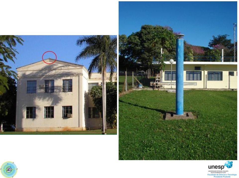
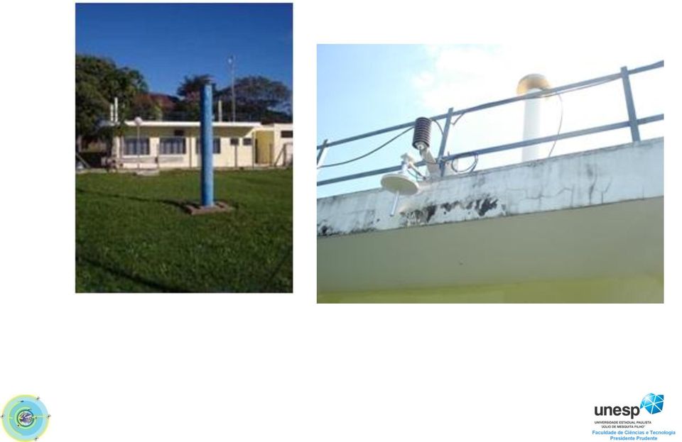
4 GNSS and Meteorological Station

5 GNSS Reference Stations 1 SPAR Araçatuba NetR8 TRIMBLE 2 SPBO Botucatu GRX1200 GNSS 3 CHPI Cachoeira Paulista UZ - 12 ASTECH 4 SPCA Campinas NET R8 TRIMBLE 5 NEIA Cananéia NET R8 TRIMBLE 6 SPFR Franca NET R8 TRIMBLE 7 ILHA Ilha Solteira RGRX1200 GNSS CR TRM59800 GNSS TRIMBLE NO LEICA AX1203 GNSS LEICA YES LEICA 8 SPJA Jaboticabal NET R8 TRIMBLE 9 OURI Ourinhos NET R8 TRIMBLE 10 PPTE Presidente Prudente NET R8 TRIMBLE 11 ROSA Rosana NET R5 TRIMBLE 12 SJRP São José do Rio Preto NET R5 TRIMBLE 14 UBAT1 Ubatuba NET R8 TRIMBLE 15 POLI São Paulo NET R8 TRIMBLE 16 SPLI Lins NET R8 TRIMBLE 17 SPPI Piracicaba NET R8 TRIMBLE DORNE MARGOLIN ASTECH YES CR TRM59800 GNSS TRIMBLE YES LEIAX1203 GNSS LEICA YES GNSS CHOKE RING TRIMBLE YES LEIAX1203 GNSS LEICA YES CR TRM59800 GNSS TRIMBLE YES ZEPHYR GNSS GEO 2 TRIMBLE YES TRM55971 GNSS CHOKE RING TRIMBLE YES ZEPHYR GNSS GEO 2 TRIMBLE YES TRM55971 ZEPHYR GEOO TRM41249 TRIMBLE YES GNSS CHOKE RING TRIMBLE YES GNSS CHOKE YES/NO TRIMBLE RING ACESS GNSS CHOKE RING TRIMBLE NO GNSS CHOKE RING TRIMBLE YES


6 Few examples of GNSS Monuments types

7

8
9
10 Softwares for data management and storage VRS3Net Trimble / RTK Network Spider - Leica: Several scripts for downloads and transfers were developed; NTRIP Caster since 2006; Storage capability of the order of 20?? TB.

11 Data Acess Hourly (1s) and daily (15 s) files in Hatanaka format; Data are mainly used for research, but also made available for practical use (Geodesy and Mapping) Data was provided to the NASA L2CTest net (ROSA, OURI e SJRP) Real time via NTRIP Client (after registering): Several tests being carried out (BKG, Real time PPP, MagicSBAS, IGSRT, JPLRT, LaPlata and FCT/UNESP Ionosphere models)

12 NTRIP NTRIP CLIENT SERVER


13 Data from all Brazilian real time stations are also collect at the Master station of GNSS-SP network. NTRIP

14 Applications and services in development GPS Meteorology; Near real time estimation of zenithal tropospheric delays for all Brazilian GNSS Real time stations (GOA-II); These data are made available to CPTEC/INPE NWM (numerical weather model); Several stations equipped with Met devices IWV is computed Near real time TEC computed also from the all Brazilian GNSS Real time stations It is under development Pos processing VRS, RTK and DGPS network;


15 Applications and services in development RTK Network (VRS Concept - Commercial)


16 Applications and services in development RTK Network (I95 Index among others products)

17 GNSS-SP Net for TEC model and computation

18 GNSS-SP Net for TEC model and computation (Grid of 0.5 x 0.5 degree) (GPS/GLONASS)


19 GNSS-SP Net for TEC model and computation (Grid of 2.5 x 2.5 degree) (GPS/GLONASS)

 Ionosphere Algorithm BNC Ionosphere")

20 Real Time TEC Estimates ALDAR Rinex: Observation (Real Time) Ionosphere Algorithm BNC Ionosphere Model IFB Ionosphere Monitoring Spatial Geodesy Laboratory Coefficients c1,..., cn VTEC, RTEC, IPP

21 Future developments From Research and Development to Operational via IGC; IGC is the Institute of Geography and Cartography of São Paulo State IGC has already a license of VRS3Net software and will probably be responsible by the operational duties of the network after the end of the GNSS-SP project. Integration GNSS-SP & CIGALA/CALIBRA Performance of RTK & PPP under IS.
.")
22 Final Considerations Active GNSS network provides several kind of applications, besides the original aim (Geodesy and Cartography); It is a reality with GNSS network of São Paulo State Provides integration of research all over the word (It is already a reality in South America SIRGAS-CON). GNSS Active network of São Paulo State is one of the densest in the South Hemisphere, providing possibility for several kind of research and applications.

23

24 unesp Acknowledgments
RBMC: The main geodetic infrastructure contributing for land reform and weather researches in Brazil
 RBMC: The main geodetic infrastructure contributing for land reform and weather researches in Brazil Sonia Costa - IBGE Hisao Takahashi and Luiz Sapucci - INPE Workshop on the Applications of Global Navigation
Towards Real-time GNSS Troposphere Delay Monitoring Service for Poland
 Towards Real-time GNSS Troposphere Delay Monitoring Service for Poland Tomasz Hadas, Kaplon Jan, Bosy Jaroslaw Institute of Geodesy and Geoinformatics Wroclaw University of Environmental and Life Sciences
Threats of Ionosphere on GNSS an general overview of CIGALA and CALIBRA Projects
 Threats of Ionosphere on GNSS an general overview of CIGALA and CALIBRA Projects João Francisco Galera Monico Vinícius Stuani Presentation Outline Threats of Ionosphere on GNSS o Ionosphere effects and
Leica SmartNet UK & Ireland Network RTK User Guide
 Leica SmartNet UK & Ireland Network RTK User Guide Contents Background.. Page 3 Single Base RTK.... Page 3 Advantages & Disadvantages of Single Base RTK Page 4 Network RTK... Page 4 Advantages & Disadvantages
Alberding GNSS data management & monitoring tools
 Alberding GNSS data management & monitoring tools 1/24 Alberding GNSS data management & monitoring tools Tamás Horváth Alberding GmbH EUREF 2013 Symposium, 29-31 May 2013, Budapest, Hungary Alberding GNSS
RealtimePPP using EUREF and IGS Networks
 RealtimePPP using EUREF and IGS Networks Georg Weber 1) Leos Mervart 2), Peter Neumaier 1), Andrea Stürze 1) 1) Federal Agency for Cartography and Geodesy, Frankfurt am Main, Germany 2) Technical University
Alberding precision agriculture solutions
 Alberding precision agriculture solutions Alberding GmbH AGRITECHNICA 2015, 8 14 November 2015, Hanover, Germany Presentation by: Tamás Horváth & Katrin Arendholz Alberding GmbH - Precision agriculture
A filtering method developed to improve GNSS receiver data quality in the CALIBRA project
 A filtering method developed to improve GNSS receiver data quality in the CALIBRA project Luca Spogli 1, Vincenzo Romano 1,2, Giorgiana De Franceschi 1, Lucilla Alfonsi 1, Eleftherios Plakidis 1, Claudio
RELEASE NOTES. Trimble VRS 3 Net GNSS Infrastructure Software. Introduction. New features. Enhancements. Supported operating systems and SQL Server
 RELEASE NOTES Trimble VRS 3 Net GNSS Infrastructure Software Introduction New features Enhancements Supported operating systems and SQL Server Minimum system requirements Updating the software Version
A Web-Based Real-Time Monitoring System for GNSS Data Quality and Integrity
 A Web-Based Real-Time Monitoring System for GNSS Data Quality and Integrity Samsung LIM, Yong HEO and Chris RIZOS, Australia Key words: GNSS, NTRIP, RTCM, real time monitoring, data quality control SUMMARY
Streaming Real-Time IGS Data and Products Using NTRIP
 Streaming Real-Time IGS Data and Products Using NTRIP Georg Weber Federal Agency for Cartography and Geodesy (BKG), Frankfurt, Germany 1. Introduction The Real-Time IGS Working Group developed the RTIGS
PPP: Precise Point Positioning Constraints and Opportunities
 PPP: Precise Point Positioning Constraints and Opportunities Katrin HUBER, Florian HEUBERGER, Christoph ABART, Ana KARABATIC, Robert WEBER and Philipp BERGLEZ, Austria Key words PPP, GNSS, positioning,
Congreso Internacional Geomática Andina 2012 4 y 5 de junio, Bogotá, D. C., Colombia
 Claudio Brunini SIRGAS President UNLP - CONICET Argentina Laura Sánchez SIRGAS Vice-President DGFI - Germany William Martínez SIRGAS WGII President IGAC - Colombia María Viriginia Mackern SIRGAS - WGI
Preliminary Study of Modeling the Precipitable Water Vapor Based on Radiosonde Data
 Preliminary Study of Modeling the Precipitable Water Vapor Based on Radiosonde Data Ilke DENIZ and Cetin MEKIK, Turkey Key words: radiosonde, tropospheric zenith delay, precipitable water vapour SUMMARY
Erasmus Mundus External Cooperation Windows. EU-BRAZIL STARTUP Call for applications outcome 08/02/2010
 L15a0900007 L15a0900027 L15a0900041 L15a0900051 L15a0900057 L15a0900080 L15a0900081 L15a0900084 L15a0900088 L15a0900090 L15a0900093 L15a0900095 L15a0900096 L15a0900099 L15a0900106 L15a0900107 L15a0900115
INTRODUCTION TO GNSS NETWORK RTK. BAKU (AZERBAIDJAN) 12 Mai 2009. Ezzedine Djerbi Leica Geo-Systems Switzerland
 12 Mai 2009. Ezzedine Djerbi Leica Geo-Systems Switzerland") INTRODUCTION TO GNSS NETWORK RTK BAKU (AZERBAIDJAN) 12 Mai 2009 Ezzedine Djerbi Leica Geo-Systems Switzerland 1 GPS & GLONASS constellations have never been designed to serve the civilian applications
INTRODUCTION TO GNSS NETWORK RTK BAKU (AZERBAIDJAN) 12 Mai 2009 Ezzedine Djerbi Leica Geo-Systems Switzerland 1 GPS & GLONASS constellations have never been designed to serve the civilian applications
UNESP s Graduate Programs: Fields of International Excellence
 UNESP s Graduate Programs: Fields of International Excellence Universidade Estadual Paulista - UNESP UNESP s Graduate Programs: Fields of International Excellence Graduate Programs: Having as one of its
Leica GR25 Don t think Receiver, think Reference Server
 Leica GR25 Don t think Receiver, think Reference Server Leica GR25 GNSS Reference Server Think Reference Server The GR25 is more than just a reference receiver, it is a GNSS Reference Server. Just like
Online Precise Point Positioning Using the. Natural Resources Canada Canadian Spatial Reference System (CSRS-PPP)
") Online Precise Point Positioning Using the Natural Resources Canada Canadian Spatial Reference System (CSRS-PPP) Thomas Nylen and Seth White UNAVCO October 2007 I. Precise Point Positioning Precise Point
Online Precise Point Positioning Using the Natural Resources Canada Canadian Spatial Reference System (CSRS-PPP) Thomas Nylen and Seth White UNAVCO October 2007 I. Precise Point Positioning Precise Point
EPN Special Project Real-Time Analysis Status Report
 EPN Special Project Real-Time Analysis Status Report Wolfgang Söhne Federal Agency for Cartography and Geodesy (BKG), Germany Highlights Real-time observational data EUREF regional broadcaster Broadcaster
Development of e-learning Modules for the K-12 Programs of Brazilian Public Schools
 Development of e-learning Modules for the K-12 Programs of Brazilian Public Schools Ricardo L. Külzer 1, Luciana Meneghel Cordeiro 2, Leonardo de S. Mendes 3 1 DECOM/FEEC/UNICAMP, ricardol@decom.fee.unicamp.br
NTRIP-based DGPS service in Hungary
 NTRIP-based DGPS service in Hungary Tamás Horváth FÖMI Satellite Geodetic Observatory Penc, Hungary The Satellite Geodetic Observatory Department of the Institute of Geodesy, Cartography and Remote Sensing
AIEA PROVOST PERSPECTIVES
 AIEA PROVOST PERSPECTIVES APRIL 2015 Internationalization as a Driver for Research, Education, and Regional Development Marilza Vieira Cunha Rudge Universidade Estadual Paulista (UNESP) (São Paulo State
Leica SmartNet Commercial RTK Network Solution
 Leica SmartNet Commercial RTK Network Solution One person, one GPS receiver, one precise network solution Work Smart, choose Leica SmartNet Leica SmartNet is Britain and Ireland s first commercial RTK
How To Monitor A Bkg Broadcaster On Epn (Worcester) On A Pc Or Ipad (For Free) On Pc Or Macodeo (For A Free Download) On An Ipad Or Ipa (For Cheap)
 On A Pc Or Ipad (For Free) On Pc Or Macodeo (For A Free Download) On An Ipad Or Ipa (For Cheap)") EPN real-time analysis report Wolfgang Söhne Federal Agency for Cartography and Geodesy Motivation / Background Action Item no. 11 of last TWG (Brussels) was: CB, RP and WS to discuss e procedures to monitor
EPN real-time analysis report Wolfgang Söhne Federal Agency for Cartography and Geodesy Motivation / Background Action Item no. 11 of last TWG (Brussels) was: CB, RP and WS to discuss e procedures to monitor
Real-Time GNSS in Routine EPN Operations Concept
 Real-Time GNSS in Routine EPN Operations Concept EPN Real-time Working Group D. Dettmering, G. Weber, C. Bruyninx, H. v.d.marel W. Gurtner, J. Torres, A. Caporali Status: December 3, 2006 1 CONTENT 1 Introduction
MULTI-GNSS DEMONTRATION CAMPAIGN IN ASIA OCEANIA REGION
 UNITED NATIONS INTERNATIONAL MEETING ON THE APPLICATIONS OF GLOBAL NAVIGATION SATELLITE SYSTEMS PRESENTATION SESSION 2: INTERNATIONAL INITIATIVES/EXPERIENCES MULTI-GNSS DEMONTRATION CAMPAIGN IN ASIA OCEANIA
The Norwegian Tide Gauge Network
 The Norwegian Tide Gauge Network GLOSS Experts 13 th Meeting, October 2013 Tor Tørresen 1 and Svein Ola Thorsen 2 tor.torresen@kartverket.no, svein.ola.thorsen@kartverket.no Introduction The Norwegian
Introduction into Real-Time Network Adjustment with Geo++ GNSMART
 Introduction into Real-Time Network Adjustment with Geo++ GNSMART Andreas Bagge Gerhard Wübbena, Martin Schmitz Geo++ GmbH D-30827 Garbsen, Germany www.geopp.de GeoInformation Workshop 2004, Istanbul Kultur
Distribution of GPS-data via Internet
 LMV-report 2004:01 Reports in Geodesy and Geographical Information Systems Distribution of GPS-data via Internet Martin Peterzon Thesis work Gävle 2004 LANTM Ä TERIET Abstract The progress of easy mobile
GEOGRAPHIC INFORMATION SYSTEMS Lecture 21: The Global Positioning System
 GEOGRAPHIC INFORMATION SYSTEMS Lecture 21: The Global Positioning System The Global Positioning System - recognize that GPS is only one of several Global Navigation Satellite Systems (GNSS) - the Russian
TerraAmazon - The Amazon Deforestation Monitoring System - Karine Reis Ferreira
 TerraAmazon - The Amazon Deforestation Monitoring System - Karine Reis Ferreira GEOSS Users & Architecture Workshop XXIV: Water Security & Governance - Accra Ghana / October 2008 INPE National Institute
SWEPOS and its GNSS-Based Positioning Services
 SWEPOS and its GNSS-Based Positioning Services Dan NORIN, Bo JONSSON and Peter WIKLUND, Sweden Key words: GPS, GLONASS, GNSS, reference stations, network RTK SUMMARY SWEPOS, the Swedish network of permanent
System1200 Using NTRIP via Internet
 Products GPS1200, Smartstation From System1200 Onboard Applications Team Date 23 th August 2005 Supplementary Notes to System1200 Firmware Release Notes (v1.52 or higher) Since the release of System1200
Role and Importance TUSAGA-Active (Cors-tr) In Basis Of The Operations Cadastral Plan
 In Basis Of The Operations Cadastral Plan") Role and Importance TUSAGA-Active (Cors-tr) In Basis Of The Operations Cadastral Plan Tahsin KARA, M. Vahdet GEZER, Ömer SALGIN, Ali İLBEY, Serdar ERGÜNER, Erkan KULAKSIZ, Bilal ERKEK and Sedat BAKICI
Role and Importance TUSAGA-Active (Cors-tr) In Basis Of The Operations Cadastral Plan Tahsin KARA, M. Vahdet GEZER, Ömer SALGIN, Ali İLBEY, Serdar ERGÜNER, Erkan KULAKSIZ, Bilal ERKEK and Sedat BAKICI
GFZ prototype for GPS-based realtime deformation monitoring
 GFZ prototype for GPS-based realtime deformation monitoring Junping Chen, Maorong Ge, Markus Vennebusch, Gerd Gendt, Markus Rothacher Department of Geodesy and Remote Sensing, GeoForschungsZentrum, Postdam
The2002 NKG GNSMART/GPSNet Test Campaign
 The2002 NKG GNSMART/GPSNet Test Campaign Andreas Engfeldt 1, Dan Norin 1, Jan Nielsen 2, LouiseHolm Warming 2, Gro Grinde 3, Daniel Johansson 1, Christina Lilje 1, Andreas Nilsson 1, Peter Wiklund 1, Tina
A Simple Observation Concerning Contraction Mappings
 Revista Colombiana de Matemáticas Volumen 46202)2, páginas 229-233 A Simple Observation Concerning Contraction Mappings Una simple observación acerca de las contracciones German Lozada-Cruz a Universidade
Processing of ground based GNSS data to produce near real time (NRT) tropospheric zenith
 tropospheric zenith") Processing of ground based GNSS data to produce near real time (NRT) tropospheric zenith path delays (ZTD) Jan Douša (jan.dousa@pecny.cz) Geodetic Observatory Pecný, Research Institute of Geodesy, Topography
Processing of ground based GNSS data to produce near real time (NRT) tropospheric zenith path delays (ZTD) Jan Douša (jan.dousa@pecny.cz) Geodetic Observatory Pecný, Research Institute of Geodesy, Topography
Real-time capability of GEONET system and its application to crust monitoring
 27 Real-time capability of GEONET system and its application to crust monitoring Atsushi YAMAGIWA, Yuki HATANAKA, Toru YUTSUDO and Basara MIYAHARA Abstract The GPS Earth Observation Network system (GEONET)
An Innovative Concept to Manage GPS Reference Stations Network and RTK Data Distribution Globally
 An Innovative Concept to Manage GPS Reference Stations Network and RTK Data Distribution Vincent LUI, Hong Kong SAR, China Key words: GPS reference station network, Internet, Spider, data management, integrity
Alberding DGNSS solutions for inland waterways
 Alberding DGNSS solutions for inland waterways December 2012 1/29 Alberding DGNSS solutions for inland waterways Tamás Horváth Alberding GmbH DISC 12 Vukovar 13 December 2012 Alberding DGNSS solutions
Geodetic Monitoring System Equipment List
 Geodetic Monitoring System Equipment List Table of Contents 1. GeoMoS Modules...4 1.1 GeoMoS Demo...4 1.2 GeoMoS Lite...4 1.3 GeoMoS Professional...5 1.3.1 GeoMoS Professional Option 1...5 1.3.2 GeoMoS
AFREF First GNSS Station : Lessons learnt Building up a Continental Reference Frame
 AFREF First GNSS Station : Lessons learnt Building up a Continental Reference Frame Joel van Cranenbroeck, Director of Technology and Project Development Leica Geosystems AG, Geomatic Division CH-9435
Alberding-QC. a multi-purpose GNSS service performance monitoring tool. Tamás Horváth. Alberding GmbH
 a multi-purpose GNSS service performance monitoring tool Alberding GmbH EUREF 2014 Symposium, 4-7 June 2014, Vilnius, Lithuania 1/22 Outline Alberding GmbH Displacement monitoring with low-cost GNSS receivers
LOCAL CORS Network Scene
 SIRGAS Operations and the Regional LOCAL CORS Network Scene Claudio Brunini President Laura Sánchez Vice President Sonia Maria Alves Costa SIRGAS-WGI: Reference System Tomas Marino Herrera SIRGAS-WGII:
Leica Geosystems Networked Reference Stations
 Leica Geosystems Networked Reference Stations GPS Spider IT and Security A guide to communication technology and security for GPS Spider administrators and IT specialists White Paper November 2007 WhitePaper_GPS_Spider_IT_Technology&Security.doc
The IGS: A Multi-GNSS Service
 The IGS: A Multi-GNSS Service Chris Rizos, Urs Hugentobler, Ruth Neilan IUGG IAG Structure International Union of Geodesy and Geophysics (IUGG) 65 Member Countries (Adhering Bodies), 8 Associations International
Guidelines for an excellent arrival and stay
 Foreign Student Guide Guidelines for an excellent arrival and stay W e l c o m e t o U N E S P! We hope that your stay in Brazil goes according to your expectations and that your goals are reached. This
Advances in the knowledge of parasite resistance of ruminant hosts and parasites
 Alessandro Francisco Talamini do Amarante Departamento de Parasitologia, Instituto de Biociências, Universidade Estadual Paulista, Botucatu, SP Main research areas: epidemiology, diagnosis and prophylaxis
Enabling RTK-like positioning offshore using the global VERIPOS GNSS network. Pieter Toor GNSS Technology Manager
 Enabling RTK-like positioning offshore using the global VERIPOS GNSS network Pieter Toor GNSS Technology Manager Introduction PPP/RTK Positioning Techniques PPP-AR Technology Presentation Overview PPP-AR
Preliminary Results of SIRGAS 2000 Campaign IBGE Analysis Center
 1 Preliminary Results of SIRGAS 2000 Campaign IBGE Analysis Center S.M. Alves Costa Department of Geodesy, Brazilian Institute of Geography and Statistics- IBGE Av. Brasil 15671, CEP : 21241-051, Rio de
Impact of ATOVS geopotential heights retrievals on analyses generated by RPSAS
 Impact of ATOVS geopotential heights retrievals on analyses generated by RPSAS Jairo Geraldo Gomes Junior, Dirceu Luis Herdies, Luciano Ponzi Pezzi, Luiz Fernando Sapucci Centro de Previsão de Previsão
Chapter 34 Latest GNSS Results of the CMONOC Network and Its Application in Earthquake Monitoring
 Chapter 34 Latest GNSS Results of the CMONOC Network and Its Application in Earthquake Monitoring Junping Chen, Yize Zhang, Yibing Xie, Weijie Tan, Sainan Yang and Bin Wu Abstract Crustal Movement Observation
Online GPS processing services: an initial study
 GPS Solut (2006) 10: 12 20 DOI 10.1007/s10291-005-0147-5 ORIGINAL ARTICLE Reza Ghoddousi-Fard Peter Dare Online GPS processing services: an initial study Received: 15 September 2004 Accepted: 3 May 2005
PLM PRODUCT INFORMATION
 PLM PRODUCT INFORMATION Agricultural Equipment UK & ROI Precision Farming Reference UK- PLM_03_13 Date: 1st May 2013 Announcing the new RangePoint RTX Correction Service RangePoint RTX is a GPS and GLONASS
Waypoint. Best-in-Class GNSS and GNSS+INS Processing Software
 Waypoint Best-in-Class GNSS and GNSS+INS Processing Software Waypoint Exceptional Post-Processing Software Enhance your GNSS Position, Velocity and Attitude Accuracy For applications requiring highly
REFERÊNCIAS BIBLIOGRÁFICAS
 REFERÊNCIAS BIBLIOGRÁFICAS Allen Osborne Associates (AOA). SNR-8000. [online]. . 19 Oct. 1998. Banks, P. M.; Kockarts, G. Aeronomy: Part B. New York: Academic, 1973.
PAST ACCOMPLISHMENTS AND FUTURE DIRETCTIONS OF JAPAN- BRAZIL ACADEMIC EXCHANGES
 PAST ACCOMPLISHMENTS AND FUTURE DIRETCTIONS OF JAPAN- BRAZIL ACADEMIC EXCHANGES JULIO NAKAGAWA: Rua Magnólia, 335 18.607-670 670 Jd. Bom Pastor, Botucatu, SP. Professor aposentado da FCA/UNESP, Botucatu,
Short Curriculum Vitae. Ricardo Parreira da Silva
 Short Curriculum Vitae Ricardo Parreira da Silva Institution: Universidade Estadual Paulista Address: Department of Mathematics Postal Code: 13506-900 - Rio Claro - SP - Brazil Phone: +55 (19) 3526-9409
Table of Contents 1. Introduction... 3 2. Installing Sxblue Server... 4 3. Principle of Operation... 6 4. Server Configuration... 7 4.
 SXBlue Server Table of Contents 1. Introduction... 3 2. Installing Sxblue Server... 4 3. Principle of Operation... 6 4. Server Configuration... 7 4.1 Server Status... 7 4.1.1 Info Clients... 8 4.1.2 Infos
Precise Point Positioning (PPP) Technique versus Network-RTK GNSS
 Technique versus Network-RTK GNSS") Precise Point Positioning (PPP) Technique versus Network-RTK GNSS Reha Metin ALKAN, İ. Murat OZULU, Veli İLÇİ, Turkey Key words: GNSS, PPP, CSRS-PPP, Network-RTK, CORS, TUSAGA-Aktif SUMMARY The aim of
Precise Point Positioning (PPP) Technique versus Network-RTK GNSS Reha Metin ALKAN, İ. Murat OZULU, Veli İLÇİ, Turkey Key words: GNSS, PPP, CSRS-PPP, Network-RTK, CORS, TUSAGA-Aktif SUMMARY The aim of
ABOUT SENSITIVITY OF CLOUD-TO-GROUND LIGHTNING ACTIVITY TO SURFACE AIR TEMPERATURE CHANGES AT DIFFERENT TIME SCALES IN THE CITY OF SAO PAULO, BRAZIL
 ABOUT SENSITIVITY OF CLOUD-TO-GROUND LIGHTNING ACTIVITY TO SURFACE AIR TEMPERATURE CHANGES AT DIFFERENT TIME SCALES IN THE CITY OF SAO PAULO, BRAZIL O. Pinto Jr. and I.R.C.A. Pinto Brazilian Institute
SKPOS ( EUPOS ) network solution monitoring application
 network solution monitoring application") S ( EUPOS ) network solution monitoring application Karol Smolík Branislav Droščák, PhD. Geodetic and Cartographic Institute BRATISLAVA karol.smolik@skgeodesy.sk branislav.droscak@skgeodesy.sk 18 th conference
S ( EUPOS ) network solution monitoring application Karol Smolík Branislav Droščák, PhD. Geodetic and Cartographic Institute BRATISLAVA karol.smolik@skgeodesy.sk branislav.droscak@skgeodesy.sk 18 th conference
COCONet Regional Data Center Request for Proposals
 COCONet Regional Data Center Request for Proposals L As part of the National Science Foundation- funded COCONet project, UNAVCO will provide startup funding for up to four host institutions to operate
Leica GPS1200+ Series Technical Data
 Leica GPS1200+ Series Technical Data 2 GPS1200+ Technical Data For reference station products please refer to the technical data for GRX1200+ series receivers (746097) Summary Description GX1230+ GNSS
SBD-RESP in active search for leprosy cases SBD-RESP na busca ativa de casos de hanseníase
 CORRESPONDENCE 613 SBD-RESP in active search for leprosy cases SBD-RESP na busca ativa de casos de hanseníase Joel Carlos Lastória 1 Marilda Aparecida Milanez Morgado de Abreu 2 Abstract: BACKGROUND: The
GNSS-PW Progress Session 5: Other GRUAN products
 GNSS-PW Progress Session 5: Other GRUAN products Markus Bradke Helmholtz-Centre Potsdam - GFZ German Research Centre for Geosciences Telegrafenberg, 14473 Potsdam, Germany Department 1: Geodesy and Remote
RELEASE NOTES. Trimble. SPS Series Receivers. Introduction. New features and changes
 RELEASE NOTES Trimble SPS Series Receivers Introduction New features and changes Version 4.41 Revision A April 2011 F Corporate office Trimble Navigation Limited Engineering and Construction group 5475
Using Handheld GPS Receivers for Precise Positioning
 Using Handheld GPS Receivers for Precise Positioning Volker SCHWIEGER, Germany Key words: GPS, handheld GPS receivers, static positioning, kinematic positioning. SUMMARY In general handheld GPS receivers
TESTING REAL-TIME GPS ORBIT AND CLOCK PRODUCT
 TESTING REAL-TIME GPS ORBIT AND CLOCK PRODUCT J. DOUSA1 1. Introduction Within EUREF-IP project, the Federal Agency for Cartography and Geodesy, Frankfurt/Main (BKG) has started to distribute the real-time
Introducing Ambiguity Resolution in Webhosted Global Multi-GNSS Precise Positioning with Trimble RTX-PP
 Introducing Ambiguity Resolution in Webhosted Global Multi-GNSS Precise Positioning with Trimble RTX-PP Ken Doucet, Michael Herwig, Adrian Kipka, Philip Kreikenbohm, Herbert Landau, Rodrigo Leandro, Matthias
Leica AR25 White Paper
 Leica AR25 White Paper February 2009 Lennon Bedford, Neil Brown, Justin Walford Leica Geosystems AG Heerbrugg, Switzerland 2 Biography Lennon Bedford graduated from the University of Otago in 2003 with
ABPPM - BRAZILIAN ASSOCIATION OF JATROPHA GROWE. World Biofuel Markets March 22-24 th, 2011 Rotterdam, Holland
 World Biofuel Markets March 22-24 th, 2011 Rotterdam, Holland Starting point: Biokerosene will become a reality until 2020, but feedstock production is still a major challenge IATA's goals of alternative
Swedish User Guidelines for Network RTK
 Swedish User Guidelines for Network RTK Robert Odolinski GNSS Research Centre, Curtin University of Technology (Previously Geodetic Research Department of Lantmäteriet, Sweden) Perth, WA, Australia robert.odolinski@curtin.edu.au
A study of long-term climatology of ionospheric irregularities by using GPS phase fluctuations at the Brazilian longitudes
 Advances in Space Research xxx (2007) xxx xxx www.elsevier.com/locate/asr A study of long-term climatology of ionospheric irregularities by using GPS phase fluctuations at the Brazilian longitudes F.D.
Pre-LBA Amazonian Region Micrometeorological Experiment (ARME) Data
 Data") Pre-LBA Amazonian Region Micrometeorological Experiment (ARME) Data Summary The Amazonian Region Micrometeorological Experiment (ARME) data contain micrometeorological data (climate, interception of precipitation,
Pre-LBA Amazonian Region Micrometeorological Experiment (ARME) Data Summary The Amazonian Region Micrometeorological Experiment (ARME) data contain micrometeorological data (climate, interception of precipitation,
IGS-MGEX. Preparing the Ground for Multi-Constellation GNSS Science. of global positioning has experienced
 IGS-MGEX Preparing the Ground for Multi-Constellation GNSS Science OLIVER MONTENBRUCK GERMAN AEROSPACE CENTER (DLR), GERMAN SPACE OPERATIONS CENTER (GSOC) PETER STEIGENBERGER INSTITUTE FOR ASTRONOMICAL
BRAZILIAN CONTRIBUTION TO THE LISN PROJECT
 BRAZILIAN CONTRIBUTION TO THE LISN PROJECT (LOW-LATITUDE IONOSPHERIC SENSOR NETWORK) I. J. Kantor, E.R de Paula, L.F.C. de Rezende, M.T.H. Muella and A.C. Neto INPE, Aeronomy Division, São José dos Campos,
Leica GPS1200 Series High performance GNSS System
 Leica GPS1200 Series High performance GNSS System Leica GPS1200 Supports full GNSS signals Best GNSS and RTK technology Fast satellite acquisition, high accuracy measurements, tracking to low elevations,
MONITORING OF STATION VYHL
 LONG-TERM POSITIONAL MONITORING OF STATION VYHL OF THE SNĚŽ ĚŽNÍK NETWORK Josef Weigel, Otakar Švábenský Brno University of Technology Department of Geodesy weigel.j@ fce.vutbr.cz svabensky.o@fce.vutbr.cz
PAULO. Adnei Melges de Andrade Vice-President, International Relations
 UNIVERSIDADE DE SÃO PAULO Adnei Melges de Andrade Vice-President, International Relations UNIVERSIDADE DE SÃO PAULO 7 Campi Universidade de São Paulo Some figures about Brazil Total area Population GDP
AAT Portuguese Project
 Gabriel Moore Forell Bevilacqua gabrielmoore@gmail.com Assistant Professor Information Science Department Universidade Federal Fluminense (Niterói, Rio de Janeiro, Brazil) Juliana Rodrigues Alves julira@yahoo.com
HUMAN AND SOCIAL SCIENCES MULTI-USER EQUIPMENT ADVANCED TECHNOLOGY TO REACH OF RESEARCHERS. Human and Social Sciences SÃO PAULO RESEARCH FOUNDATION
 HUMAN AND SOCIAL SCIENCES MULTI-USER EQUIPMENT ADVANCED TECHNOLOGY TO REACH OF RESEARCHERS Human and Social Sciences SÃO PAULO RESEARCH FOUNDATION 1 Multi-user Equipment Humanities ACQUISITION OF EDITING
and Navigation Systems
 Global Ionospheric Monitoring and Navigation Systems J. Feltens, M. Angling, N. Jakowski, M. Hernández-Pajares, R. Zandbergen 1 Consortium Partners Hewlett-Packard GmbH, Rüsselsheim, Germany QinetiQ Ltd,
Florianópolis, March 21, 2014. Elizabeth Wegner Karas Organizing Committee
 We hereby certify that, Daniella Porto, Universidade Estadual Paulista - São José do Rio Preto, participated in the X Brazilian Workshop on Continuous Optimization. Celebrating Clovis Gonzaga's 70th birthday
The scientific production in health and biological sciences of the top 20 Brazilian universities
 Brazilian Journal of Medical and Biological Research (2006) 39: 1513-1520 The scientific production of the top 20 Brazilian universities ISSN 0100-879X Concepts and Comments 1513 The scientific production
Regional/Operational Centers
 Regional/Operational Centers BKG Regional IGS Data Center Report BKG Regional IGS Data Center Report Heinz Habrich Federal Agency for Cartography and Geodesy D-60598 Frankfurt at Main, Germany 1 Introduction
Universidade de São Paulo
 Universidade de São Paulo 2013 Praça do Relógio - São Paulo Campus photo by Cecília Bastos Universidade de São Paulo is one of the most prestigious higher education and research institutions in Brazil
Post Processing GPS raw observations using data obtained from Continuously Operating Reference Stations (CORS)
") Post Processing GPS raw observations using data obtained from Continuously Operating Reference Stations (CORS) This guide is written using Leica Geo Office version 4, with base and rover data from a Leica
Post Processing GPS raw observations using data obtained from Continuously Operating Reference Stations (CORS) This guide is written using Leica Geo Office version 4, with base and rover data from a Leica
USER S MANUAL. Settop Cell-Xtrem
 USER S MANUAL Settop Cell-Xtrem Rev. March 2014 USER S MANUAL 2 Index USER S MANUAL... 1 Settop Cell-Xtrem... 3 Become familiar with the Settop Cell-Xtrem... 4 Become familiar with the Settop Cell-Xtrem
Distributed Honeypots Project: How It s Being Useful for CERT.br
 Distributed Honeypots Project: How It s Being Useful for CERT.br Cristine Hoepers cristine@cert.br Klaus Steding-Jessen jessen@cert.br Computer Emergency Response Team Brazil - CERT.br http://www.cert.br/
Augmentation of Low Cost GPS Receivers via Web Services and Wireless Mobile Devices
 Journal of Global Positioning Systems (2004) Vol. 3, No. 1-2: 85-94 Augmentation of Low Cost GPS Receivers via Web Services and Wireless Mobile Devices Roger Fraser, Adam Mowlam, Philip Collier Department
Monitoring of Open Pit Mines using Combined GNSS Satellite Receivers and Robotic Total Stations
 Monitoring of Open Pit Mines using Combined GNSS Satellite Receivers and Robotic Total Stations N. Brown Leica Geosystems, Switzerland S. Kaloustian Leica Geosystems, Switzerland M. Roeckle Leica Geosystems,
Carlson SurveyGNSS. UserGuide
 Carlson SurveyGNSS UserGuide V1.041 July 2014 Contents 1 Introduction... 2 2 Registration... 3 3 Carlson SurveyGNSS Workflow... 5 4 Conversion of Receiver Files to RINEX... 7 5 Guidelines for Evaluating
Virtual Machine Instance Scheduling in IaaS Clouds
 Virtual Machine Instance Scheduling in IaaS Clouds Naylor G. Bachiega, Henrique P. Martins, Roberta Spolon, Marcos A. Cavenaghi Departamento de Ciência da Computação UNESP - Univ Estadual Paulista Bauru,
Trimble CenterPoint RTX Post-Processing Services FAQs
 Trimble CenterPoint RTX Post-Processing Services FAQs What is Trimble RTX technology? 30 September 2013 Trimble RTX TM (Real Time extended) is a high-accuracy, global GNSS correction technology that combines
Post Processing Service
 Post Processing Service The delay of propagation of the signal due to the ionosphere is the main source of generation of positioning errors. This problem can be bypassed using a dual-frequency receivers
Leica SmartNet Technical Support Guide
 Leica SmartNet Technical Support Guide Leica SmartNet Technical Support Guide Contents Scenario 1 Page 5 There is no Internet connection on my System 1200. Scenario 2 Page 9 GPRS is not currently available;
Marcos Túlio Oliveira, Ph.D.
 CURRICULUM VITAE Marcos Túlio Oliveira, Ph.D. Contact Information Department of Technology - FCAV São Paulo State University (UNESP) Via de Acesso Prof. Paulo Donato Castellane s/n 14884-900 Jaboticabal,