Military Planning and Operations
|
|
|
- Elinor Lynch
- 9 years ago
- Views:
Transcription
1

2 Esri International User Conference San Diego, California Technical Workshops July 26, 2012 Military Planning and Operations Dave Mitchell Derek Foll

3 Goals of the workshop Briefly review ArcGIS for the Military Land Ops concept Explain how ArcGIS is configured to support - Sharing & collaboration - Connected vs mobile environments - Planning & Analysis - Current Operations Highlight ArcGIS.com resources Recommendations and best practices

4 The Operations Process PLAN BATTLE COMMAND

5

6 ArcGIS for the Military Land Operations Sensors Operations Server COP Mounted Planning Provisioning Dismounted Intelligence

7 Operations Server Mobile Apps Desktop Apps WebApps Services Operations Server Operational Environment Content Staff Products Operations Content Template Users Data Appliance Feeds

8 Solution Patterns Connected Mobile Sharing Planning Operations

9 Connected High speed network Range of devices ArcGIS 10.1 Server and Portal GeoEvent Server Web applications Desktop Runtime Viewer

10 Mobile Connected over tactical radio Small form factor devices ArcGIS Runtime clients Peer to Peer Messaging File based provisioning & update Services if available

11 Sharing Maps Users share information with each other as packages - Packages encapsulate all aspects of a GIS - Symbology - Tools - Data Users share GIS with everyone through services - Shared across the web and mobile devices through web maps and apps - Web maps define the layers/popups for the services - Apps bring the map to life in browsers and devices

12 Planning HQs Product Groups Published Products Tools & Templates Groups Map Templates Tools Functional Product Group Published Options

13 EVENTEMP Development OPS/INTEL ENEMY COA OPERATIONAL ENVIRONMENT MCOO ISR PLANNING NAI Template ISR OPS NAI Options

14 EVENTEMP Decision Support Template

15 Package Workflow Open Map Template (Map Package) - Contains user task layers & tools - Can reference useful services - Can contain default data ORBAT, standard plan features Add data to support decision - Layer packages or services from portal Create own product - Update task layers - Standard procedures for updating other users layers Deliver product as layer pack Share tradecraft, save working environment as map package

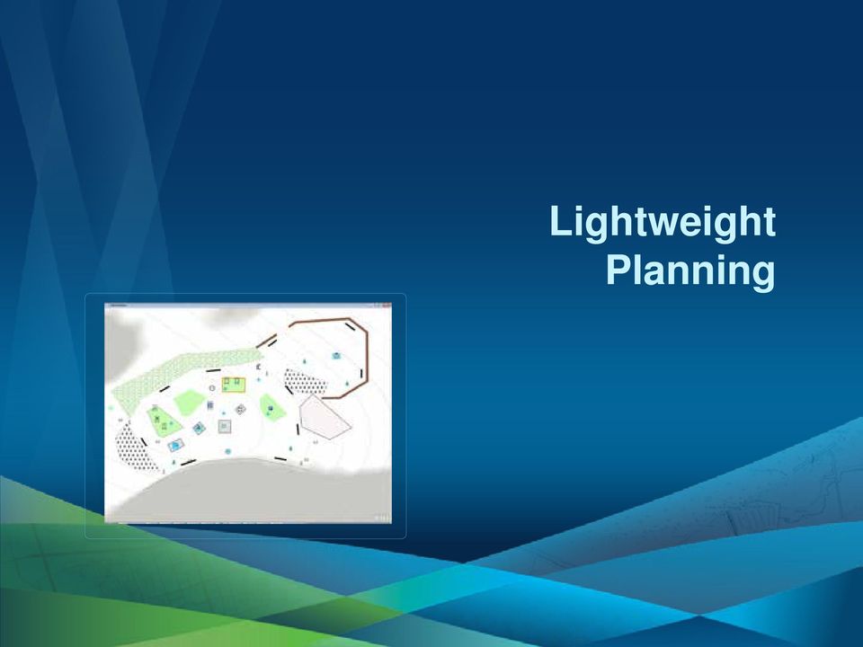
16 Lightweight Planning Observation Post Layout OPERATION Group COP Plans Connected or disconnected Tactical planning, reconnaissance, survey

17 Lightweight Planning
18 Planning Key Points Ad-hoc process, multiple options & versions Support different theaters and mission types Mobile and HQ environments Document style workflow, portal groups & packages Limited structure

19 Operations Operations Server

20 Operations Server Components Squad Leader ArcGIS Viewer Dashboards GeoEvent Server GeoMessage ArcGIS for the Military GeoEvent Server Template ArcGIS Server Vehicle Commander

21 Publish Plans OPERATION Group Service Authoring Map Selected Option (Layer or Map Package) Operations Server Published Options
22 Provisioning & Update Operations Server Basemaps (TPKs) Configuration File Mission Maps (MPKs)
23 Mounted & Dismounted Apps
24 Local Tactical Group 1 NAIs, TAIs Local Tactical Group 2 Operations Server GeoEvent Services Sensor Observations Track Reports Spot Reports Chemlights Commanders Analysts
25 Operations Server Configuration
26 Services Control Measures ISR Plan Ops Locations Ops Reporting Tactical Locations Tactical Reporting
27 ArcGIS GeoEvent Server Analyzing GeoEvent Streams GeoEvent Services are configured to connect Inputs, GeoEvent Models, and resulting output: - GeoEvent Models: perform continuous Processing and Analysis of GeoEvents received from Inputs. ArcGIS GeoEvent Server Input GeoEvent Services Output ArcGIS Server Input 1 Model 1 Output 1 TCP CSV Feature Service Input 2 Model 2 Output 2 UDP JSON Database Input 3 Model 3 Output 3 JMS JSON Model 5 CSV File Input 4 Model 4 Output 4 Database CSV UDP Transports Adapters Tools Adapters Transports
28 Supported Message Formats GeoMessages - Trackrep - Chemlight - Spotrep / SALUTE - SLANT report - SITREP - BEDAVAIL - MEDEVAC - EOD 9 LINE GeoEvent Server - VMF - CoT
29 Track Processing Filter SIDC Mapping Tactical Location (Update) Tactical Location Log (Append)
30 SPOTREP Processing SPOTREP Filter SPOTREP in NAI SPOTREP in TAI Events Events HVT Filter HVT in TAI Alert Events ISR Plan - NAI & TAI AGES Defense Template
31 User Groups and Roles
32 Current Operations Applications
33 Summary Reviewed ArcGIS for the Military Land Ops concept Explained how ArcGIS is configured to support - Sharing & collaboration - Connected vs mobile environments - Planning & Analysis - Current Operations Highlighted ArcGIS.com resources - resources.arcgis.com Suggested best practices
34 Questions
35 Military Planning and Operations Thank you! Please fill out evaluations (we need to feel loved!!) Offering ID # 1744 Coming Up: Using Imagery for Intelligence 3:15 pm
36
Operations Dashboard for ArcGIS
 Federal GIS Conference 2014 February 10 11, 2014 Washington DC Operations Dashboard for ArcGIS Joe Bayles Agenda Esri Strategy toward mobility ios Extend the reach of Web GIS Platform agnostic Native apps/web
ArcGIS 10.1 Web Apps and APIs. John Hasthorpe & Kai Hübner
 ArcGIS 10.1 Web Apps and APIs John Hasthorpe & Kai Hübner Overview Options for leveraging ArcGIS Server using Esri s Web APIs Alternatives to the Web ADF application builder (Gone in 10.1) When and how
ArcGIS Web Mapping. Sam Berg, esri [email protected]
 ArcGIS Web Mapping Sam Berg, esri [email protected] Agenda ArcGIS and WebMaps The APIs ArcGIS for Flex Viewer ArcGIS for Silverlight Builder ArcGIS for Sharepoint ArcGIS Application Templates ArcGIS Runtime
ArcGIS for. Intelligence
 ArcGIS for ArcGIS for solutions.arcgis.com/intelligence Copyright 2015 Esri. All rights reserved. 146660 DUAL3M7/15rk Briefing Book ArcGIS for Briefing Book ArcGIS Web Application ArcGIS for Create and
Portal for ArcGIS. Satish Sankaran Robert Kircher
 Portal for ArcGIS Satish Sankaran Robert Kircher ArcGIS A Complete GIS Data Management Planning & Analysis Field Mobility Operational Awareness Constituent Engagement End to End Integration Collect, Organize,
Esri GIS Mobile Solutions. John Sharrard [email protected]
 Esri GIS Mobile Solutions John Sharrard [email protected] If I had asked people what they wanted, they would have said faster horses. Henry Ford Trend: Increase demand for location services Pew Research
Esri Maps for Business Intelligence (BI)
") 2013 Esri International User Conference July 8 12, 2013 San Diego, California Technical Workshop Esri Maps for Business Intelligence (BI) Pierre Seguin Patrick Brennan Esri UC2013. Technical Workshop.
2013 Esri International User Conference July 8 12, 2013 San Diego, California Technical Workshop Esri Maps for Business Intelligence (BI) Pierre Seguin Patrick Brennan Esri UC2013. Technical Workshop.
Petroleum Web Applications to Support your Business. David Jacob & Vanessa Ramirez Esri Natural Resources Team
 Petroleum Web Applications to Support your Business David Jacob & Vanessa Ramirez Esri Natural Resources Team Agenda Petroleum Web Apps to Support your Business The ArcGIS Location Platform Introduction
Network Analysis with ArcGIS Online
 Federal GIS Conference February 9 10, 2015 Washington, DC Network Analysis with ArcGIS Online Matt Kennedy Topics Online versus on-premise network analysis services How to access online services How to
ArcGIS Viewer for Silverlight An Introduction
 Esri International User Conference San Diego, California Technical Workshops July 26, 2012 ArcGIS Viewer for Silverlight An Introduction Rich Zwaap Agenda Background Product overview Getting started and
OPERATIONS DASHBOARD A PILOT PROJECT FOR SECURITY OPERATIONS SCAUG 2014
 OPERATIONS DASHBOARD A PILOT PROJECT FOR SECURITY OPERATIONS SCAUG 2014 ABOUT ACCESS THE NEED Access Midstream Corporate Security 24/7 Security Operations Center Tasked with ensuring employee, contractor
Esri Maps for Salesforce and Microsoft Dynamics CRM
 Esri Maps for Salesforce and Microsoft Dynamics CRM Daniel Lee, Lucy Guerra Esri UC 2014 Technical Workshop Agenda CRM and Esri Esri Maps for Demos Road Ahead Esri UC 2014 Technical Workshop Esri Maps
ArcGIS GeoEvent Extension for Server: Applying Real-Time Analytics
 ArcGIS GeoEvent Extension for Server: Applying Real-Time Analytics C. Adam Mollenkopf Product Lead ArcGIS GeoEvent Extension for Server [email protected] @amollenkopf Esri UC 2014 Technical Workshop
Connecting Space and Time OSIsoft & Esri
 Connecting Space and Time OSIsoft & Esri Presented by Michelle Kuiee Product Manager 2 3 Which of these describe your need? Operating Engineers & Analysts Evironmental Heath and Safety Maintenance Coordinators
ArcGIS GeoEvent Processor Esri Geotrigger. Joseph Brigham Bowles [email protected]
 ArcGIS GeoEvent Processor Esri Geotrigger Joseph Brigham Bowles [email protected] Geotriggers vs. GeoEvent Processor Geotriggers For smartphone or tablets ios and Android now Saas based service Developer
Operations Dashboard for ArcGIS: Extending the Functionality
 Operations Dashboard for ArcGIS: Extending the Functionality Jay Chen Kylie Donia Tif Pun Esri UC 2014 Technical Workshop Esri UC 2014 Technical Workshop Agenda Operations Dashboard In 45 seconds Esri
A Workflow for Creating and Sharing Maps
 A Workflow for Creating and Sharing Maps By Keith Mann, Esri What You Will Need Item Source ArcGIS Online for Organizations subscription ArcGIS 10.1 for Desktop (Any license level) ArcGIS Spatial Analyst
Portal for ArcGIS: An Introduction
 2013 Esri Mid-Atlantic User Conference December 10-11 Baltimore, MD Portal for ArcGIS: An Introduction Derek Law Esri, Redlands Agenda Web GIS Deployment patterns Portal for ArcGIS overview Security Integration
What is new in ArcGIS 10.2 for Server. Nikki Golding
 Federal GIS Conference 2014 February 10 11, 2014 Washington DC What is new in ArcGIS 10.2 for Server Nikki Golding ArcGIS is now a Web GIS Available in the Cloud...... and On-Premises ArcGIS Powered by
Supporting High-Quality Printing in Web Applications with ArcGIS for Server
 2013 Esri International User Conference July 8 12, 2013 San Diego, California Technical Workshop Supporting High-Quality Printing in Web Applications with ArcGIS for Server Craig Williams Tanu Hoque Esri
Mobile Solutions for Data Collection. Sarah Croft and Laura Pierik
 Mobile Solutions for Data Collection Sarah Croft and Laura Pierik Presentation Overview Project Overview Benefits of using Mobile Technology Mobile Solutions- two different approaches Results and Recommendations
Building Applications with the ArcGIS Runtime SDK for Windows Mobile
 Esri International User Conference San Diego, California Technical Workshops July 25th Building Applications with the ArcGIS Runtime SDK for Windows Mobile Jay Chen Justin Colville What we will cover today
Building and Deploying Web Applications
 Building and Deploying Web Applications Dal Hunter and Jeff Shaner Friday, Nov 6 10:30-12:00 Agenda Product overview Web AppBuilder for ArcGIS tour What s New July 2015 ArcGIS Online update Customization
ArcGISSM. Online. The Mapping Platform for Your Organization
 ArcGISSM Online The Mapping Platform for Your Organization ArcGIS Online is a cloud-based platform for making and sharing maps, apps, and other geographic data and content. Knowledge Workers Policy Makers
Essential Mapping Apps
 Essential Mapping Apps 74% of adults use their smartphone to look at maps or other information based on their current location (of the 58% that own a smart phone) Pew Research Center Maps for Directions
Intro to Web App Builder. Mark Scott, Solutions Engineer, Esri County Government Team [email protected]
 Intro to Web App Builder Mark Scott, Solutions Engineer, Esri County Government Team [email protected] The ArcGIS Platform enables Web GIS Enabling GIS Everywhere Desktop Web Device Simple Integrated Open
ArcGIS for Server in the Cloud
 Esri Developer Summit March 8 11, 2016 Palm Springs, CA ArcGIS for Server in the Cloud Cherry Lin, Nikhil Shampur, and Derek Law March 10, 2016 Quick Survey 1. How many attendees are using the Cloud today?
Quick Start Guide to. ArcGISSM. Online. for Public Accounts
 Quick Start Guide to ArcGISSM Online for Public Accounts Using ArcGIS Online with a Public Account ArcGIS SM Online is a cloud-based mapping platform that allows you to easily and quickly make maps, collaborate,
Introduce Web3D Development and Visualization. Moxie Zhang Esri R&D Center Beijing
 Introduce Web3D Development and Visualization Moxie Zhang Esri R&D Center Beijing Web Scene Desktop Web Device New in ArcGIS Online and Portal Web Scene Mash-up of 3D / 2D layers Web Scene Viewer and
Cool New Tools In Network Analysis. Scott Sandusky
 Cool New Tools In Network Analysis Scott Sandusky Cool New Tools in Network Analysis Learn about the new functionality available in the Network Analyst extension and in the ArcGIS Online Network Analysis
How to Setup and Manage Spatial Assets with ArcGIS Online for a Mobile Workforce
 How to Setup and Manage Spatial Assets with ArcGIS Online for a Mobile Workforce W A U R I S A 2 0 1 4 Presented By Engineer Technician II Pierce County Public Works and Utilities Road Operations Division
Prepare Data ArcMap Open Trees.mpk Chrome ArcGIS Online New Map Chrome Esri Blogs Chrome Local Government Resources Reflector Phone Connected
 Prepare Data ArcMap Open Trees.mpk Chrome ArcGIS Online New Map Chrome Esri Blogs Chrome Local Government Resources Reflector Phone Connected Kate Firefox http://doc.arcgis.com/en/operations dashboard/
Welcome to Esri's Software Export Control Classification Number (ECCN) Matrix
 Matrix") Welcome to Esri's Software Export Control Classification Number (ECCN) Matrix Updated September 30, 2015 This portion of the Esri web site is to provide information regarding the export control classification
Welcome to Esri's Software Export Control Classification Number (ECCN) Matrix Updated September 30, 2015 This portion of the Esri web site is to provide information regarding the export control classification
Scott Moore, Esri April 4, 2016 2016 Intermountain, Great Falls, MT
 Create Great Web Apps No Coding Required Scott Moore, Esri April 4, 2016 2016 Intermountain, Great Falls, MT Agenda Product overview Web AppBuilder for ArcGIS tour What s New November 2015 ArcGIS Online
Using CAD Data in ArcGIS
 Esri International User Conference San Diego, California Technical Workshops July 27, 2012 Using CAD Data in ArcGIS Jeff Reinhart & Phil Sanchez Agenda Overview of ArcGIS CAD Support Using CAD Datasets
STATE OF NEW YORK PRICELIST August 2015 Net Price NY
 CLIN Number Esri Part Number Section Product Description Price 1 ArcGIS for Desktop Concurrent Use Licenses STATE OF NEW YORK PRICELIST August 2015 Net Price NY GIS0001 52382 ArcGIS for Desktop Advanced
Configuring and Extending ArcGIS Solutions Web Applications
 Esri Developer Summit March 8 11, 2016 Palm Springs, CA Configuring and Extending ArcGIS Solutions Web Applications Allison Muise & Mike Tschudi ArcGIS Solutions? ArcGIS as a Platform Simple, Open, and
Use ArcGIS Online to Manage
 Use ArcGIS Online to Manage Your Own Custom Map Gallery By Keith Mann, Esri Start customizing the template by changing the graphics and the web page title. Wouldn t it be great if you could create a dynamic
Getting your app together with Web AppBuilder for ArcGIS
 Getting your app together with Web AppBuilder for ArcGIS Walter Simonazzi Walter Simonazzi Session path What is Web AppBuilder for ArcGIS? Web AppBuilder for ArcGIS tour What s new? July 2015 Demos Community
Agenda. How to configure
 [email protected] Agenda Strongly Recommend: Knowledge of ArcGIS Server and Portal for ArcGIS Security in the context of ArcGIS Server/Portal for ArcGIS Access Authentication Authorization: securing web services
MAY 18, 2015 ARCGIS 10.3.1 FOR SERVER FUNCTIONALITY MATRIX
 MAY 18, 2015 ARCGIS 10.3.1 FOR SERVER FUNCTIONALITY MATRIX Copyright 2015 Esri All rights reserved. Printed in the United States of America. The information contained in this document is the exclusive
ArcGIS Pro. James Tedrick, Esri
 ArcGIS Pro James Tedrick, Esri What you already know Why ArcGIS PRO? Vision The next generation ArcGIS desktop application for the GIS community who need a clean and comprehensive user experience which
Introduction to Web AppBuilder for ArcGIS: JavaScript Apps Made Easy
 Introduction to Web AppBuilder for ArcGIS: JavaScript Apps Made Easy OKSCAUG Pamela Kersh September 22, 2015 The ArcGIS Platform enables Web GIS Enabling GIS Everywhere Desktop Web Device Simple Integrated
Enterprise GIS Architecture Deployment Options. Andrew Sakowicz
 Enterprise GIS Architecture Deployment Options Andrew Sakowicz Audience Audience - Architects - Developers - Administrators - Project Managers Level: - Beginner / Intermediate Introduction Andrew Sakowicz
An Esri White Paper May 2012 ArcGIS for Emergency Management
 An Esri White Paper May 2012 ArcGIS for Emergency Management Esri, 380 New York St., Redlands, CA 92373-8100 USA TEL 909-793-2853 FAX 909-793-5953 E-MAIL [email protected] WEB esri.com Copyright 2012 Esri
Network Analysis with Python. Deelesh Mandloi
 Deelesh Mandloi Slides and code samples from this demo theater http://esriurl.com/uc15nawpy Topics ArcGIS Network Analyst extension and concepts Network analysis using ArcGIS Online Network analysis using
ArcGIS online Introduction... 2. Module 1: How to create a basic map on ArcGIS online... 3. Creating a public account with ArcGIS online...
 Table of Contents ArcGIS online Introduction... 2 Module 1: How to create a basic map on ArcGIS online... 3 Creating a public account with ArcGIS online... 3 Opening a Map, Adding a Basemap and then Saving
ArcGIS Platform. An Integrated System. Portal
 Platform An Integrated System Portal An Integrated Web GIS Platform Knowledge Workers Executive Access Public Engagement Work Anywhere Enterprise Integration Providing Mapping, Analysis, Data Management,
ArcGIS GeoEvent Extension for Server: Working with Community Connectors and Processors
 ArcGIS GeoEvent Extension for Server: Working with Community Connectors and Processors Greg Tieman [email protected] Patrick Hill [email protected] Real-Time GIS Integration and exploitation of streaming
Network Analysis with ArcGIS for Server
 Esri International User Conference San Diego, California Technical Workshops July 24, 2012 Network Analysis with ArcGIS for Server Deelesh Mandloi Dmitry Kudinov Introduction Who are we? - Network Analyst
Creating an Enterprise Reporting Bus with SAP BusinessObjects
 September 10-13, 2012 Orlando, Florida Creating an Enterprise Reporting Bus with SAP BusinessObjects Kevin McManus LaunchWorks Session : 0313 Learning Points By consolidating people, process, data and
SharePoint 2010 End User - Level II
 Course Outline Module 1: Overview A simple introduction module. Understand your course, classroom, classmates, facility and instructor. Module 2: Server Site Definitions In this module we will explore
Customizing ArcPad solutions
 Esri International User Conference San Diego, California Technical Workshops 25 July 2012 Customizing ArcPad solutions Marika Vertzonis, Gareth Walters, Stephen Quan Session Outline What can be customized?
An Esri White Paper June 2010 Tracking Server 10
 An Esri White Paper June 2010 Tracking Server 10 Esri 380 New York St., Redlands, CA 92373-8100 USA TEL 909-793-2853 FAX 909-793-5953 E-MAIL [email protected] WEB www.esri.com Copyright 2010 Esri All rights
Data Fusion Centers. Transforming Public Safety Information into Actionable Knowledge
 Data Fusion Centers Transforming Public Safety Information into Actionable Knowledge Defining Geospatial Data Fusion Homeland security relies on fusion the ability to capture and analyze data from multiple
ArcGIS Workflow Manager: An Overview
 Federal GIS Conference February 9 10, 2015 Washington, DC ArcGIS Workflow Manager: An Overview Heather Murnane & Elizabeth Wilcox Session Topics Overview Key Features Notification & Reporting Overview
Publishing Geoprocessing Services Tutorial
 Publishing Geoprocessing Services Tutorial Copyright 1995-2010 Esri All rights reserved. Table of Contents Tutorial: Publishing a geoprocessing service........................ 3 Copyright 1995-2010 ESRI,
Ease of Use No programming, no system administration. Make maps fast with this productivity tool.
 Online Mapping Tools Esri s ArcGIS Online A mapping tool for interactive digital maps Access to map data basemaps and your own data Ease of Use No programming, no system administration. Make maps fast
Quick Start Guide to. ArcGISSM. Online. for Insurance
 Quick Start Guide to ArcGISSM Online for Insurance Historic tracks from tropical storms and hurricanes are overlaid on a map displaying population growth. Quick Start Guide to ArcGIS Online ArcGIS SM Online
Big Data Spatial Analytics An Introduction
 2013 Esri International User Conference July 8 12, 2013 San Diego, California Technical Workshop Big Data Spatial Analytics An Introduction Marwa Mabrouk Mansour Raad Esri iu UC2013. Technical Workshop
Supporting High-Quality Printing in Web Applications with ArcGIS 10.1 for Server
 Esri International User Conference San Diego, California Technical Workshops July 25, 2012 Supporting High-Quality Printing in Web Applications with ArcGIS 10.1 for Server Craig Williams and Tanu Hoque
ArcGIS ArcMap: Printing, Exporting, and ArcPress
 Esri International User Conference San Diego, California Technical Workshops July 25th, 2012 ArcGIS ArcMap: Printing, Exporting, and ArcPress Michael Grossman Jeremy Wright Workshop Overview Output in
1. Abstract. 2. The Problem / Need for the Program
 Program Information: Montgomery County, Maryland Program Title: A GIS Platform for Emergency Management and Response: Common Operational Pictures (COP) Program Category: # 14, Information Technology 1.
Latest Developments in Oceanographic Applications of GIS including!
 Latest Developments in Oceanographic Applications of GIS including! Near-Real-Time Interactive Map Exemplars & Scientific Empowerment Through Storytelling Dawn Wright Esri Chief Scientist Affiliate Professor,
ArcGIS Server 9.3.1 mashups
 Welcome to ArcGIS Server 9.3.1: Creating Fast Web Mapping Applications With JavaScript Scott Moore ESRI Olympia, WA [email protected] Seminar agenda ArcGIS API for JavaScript: An Overview ArcGIS Server Resource
Using ArcGIS for ios with Data on ArcGIS Online
 Using ArcGIS for ios with Data on ArcGIS Online Article ID : TT100038 Software : ArcGIS for ios, ArcGIS.com Platform : Windows XP, Windows Vista, Windows 7 Date : 1 st July, 2011 Introduction This Smart
AV-18 Introduction of the GIS Integration
 Slide 1 AV-18 Introduction of the GIS Integration Authors Victor Lough Dan Marsillo Geoff Tarcha social.invensys.com @InvensysOpsMgmt / #SoftwareRevolution /InvensysVideos /InvensysOpsMgmt /company/invensys
Quick Start Guide to. ArcGISSM. Online
 Quick Start Guide to ArcGISSM Online ArcGIS Online Quick Start Guide ArcGIS SM Online is a cloud-based mapping platform for organizations. Users get access to dynamic, authoritative content to create,
GIS IN THE CLOUD THE ESRI EXAMPLE DAVID CHAPPELL SEPTEMBER 2010 SPONSORED BY ESRI
 GIS IN THE CLOUD THE ESRI EXAMPLE DAVID CHAPPELL SEPTEMBER 2010 SPONSORED BY ESRI CONTENTS Contents... 2 Cloud Computing Basics... 3 Cloud Applications and Cloud Platforms... 3 An Example Cloud Platform:
Introduction to Imagery and Raster Data in ArcGIS
 Esri International User Conference San Diego, California Technical Workshops July 25, 2012 Introduction to Imagery and Raster Data in ArcGIS Simon Woo slides Cody Benkelman - demos Overview of Presentation
Developing Apps with the ArcGIS Runtime SDK for Android. Ben Ramseth Esri Inc. Instructor Technical Lead
 Developing Apps with the ArcGIS Runtime SDK for Android Ben Ramseth Esri Inc. Instructor Technical Lead Ben Ramseth Instructor Technical Lead Esri Inc USA, Charlotte, NC [email protected] @EsriMapNinja
How To Use Gis
 Welcome Understanding Purpose Creating Relationships You A Global Community of GIS Professionals Changing the World Together Applying Geography Everywhere Your WORK Showcasing Your Web Apps Vision Applying
GIS Services for Iowa DOT
 GIS Services for Iowa DOT Request For Proposal Iowa Department of Transportation Introduction The Iowa Department of Transportation s (Iowa DOT) Office of Location and Environment, on behalf of the Performance
Build Your Knowledge!
 About this Course This 3-day Instructor led course Explore several advanced topics of working with SharePoint 2013 sites. Topics include SharePoint Server site definitions (Business Intelligence, Document
secure intelligence collection and assessment system Your business technologists. Powering progress
 secure intelligence collection and assessment system Your business technologists. Powering progress The decisive advantage for intelligence services The rising mass of data items from multiple sources
Esri Maps for Office, SharePoint & Dynamics CRM. Tony Howser Sentha Sivabalan Scott Ball
 Esri Maps for Office, SharePoint & Dynamics CRM Tony Howser Sentha Sivabalan Scott Ball Agenda Location Analytics Esri Maps for - SharePoint - Office - Dynamics CRM Pricing Road Map Q & A Evolving the
<Insert Picture Here> Oracle BI Standard Edition One The Right BI Foundation for the Emerging Enterprise
 Oracle BI Standard Edition One The Right BI Foundation for the Emerging Enterprise Business Intelligence is the #1 Priority the most important technology in 2007 is business intelligence
Database Production and Map Series Management. Using. The Production Line Tool Set
 Database Production and Map Series Management Using The Production Line Tool Set Dewey Marino - ESRI Redlands Production Line Tool Set ArcGIS Solution for high volume database and map creation Creates
Deploying ArcGIS for Server using Managed Services
 2013 Esri International User Conference July 8 12, 2013 San Diego, California Technical Workshop Deploying ArcGIS for Server using Managed Services Erin Ross Andrew Sakowicz Esri UC2013. Technical cal
Deploying ArcGIS for Server Using Managed Services
 Deploying ArcGIS for Server Using Managed Services Andrew Sakowicz Erin Ross Sridhar Karra Agenda Introduction Program Overview - Overview - Methodology - Tools Customer Deployments - Architecture and
Defining, building, and making use cases work
 Defining, building, and making use cases work Paul Brettle Presales Manager, Americas Pacific Region What is a use case? Compliance FISMA, PCI, SOX, etc Network security firewalls, IDS, routers & switches
Managing Social Media in a Disaster. Jeff Baranyi Public Safety Tech Lead and Esri Disaster Response Team
 Managing Social Media in a Disaster Jeff Baranyi Public Safety Tech Lead and Esri Disaster Response Team Esri Disaster Response Program www.esri.com/disaster Support our users, our partners and Esri personnel
Embedding Maps into Microsoft Office and Microsoft SharePoint
 Embedding Maps into Microsoft Office and Microsoft SharePoint Toronto Esri Canada User Conference Tuesday, October 16, 2012 Presented By: Heather Hainsworth [email protected] Agenda This seminar is designed
SAP Business One and SAP HANA
 SAP Business One and SAP HANA High Performance Analytic Appliance Supernova Forum May, 2014 Hana Adoption Continued innovation Key message HANA innovations adds more value for you the customer Key elements
This Readme includes information pertaining to Novell Service Desk 7.0.
 Novell Service Desk 7.0 November 14, 2012 Novell Novell Service Desk is a complete service management solution that allows you to easily monitor and solve services issues so that there is minimal disruption
Promoting Your Location Platform
 Promoting Your Location Platform A Change Management Kit www.esri.com/changekit Publication Date: November 23, 2015 Esri: Promoting Your Location Platform 1 What is the Change Management Kit? The launch
What is GIS. What is GIS? University of Tsukuba. What do you image of GIS? Copyright(C) ESRI Japan Corporation. All rights reserved.
 ESRI Japan Corporation. All rights reserved.") What is GIS University of Tsukuba Graduate School of Life and Environmental Science April 21 st, 2011 What is GIS? What do you image of GIS? Gas Insulated Switch Groupe Interventional Speciale Geographic
What is GIS University of Tsukuba Graduate School of Life and Environmental Science April 21 st, 2011 What is GIS? What do you image of GIS? Gas Insulated Switch Groupe Interventional Speciale Geographic
How To Install The Arcgis For Inspire Server Extension On A Microsoft Gis For Inspire Server Extension (For Microsoft) On A Pc Or Macbook Or Ipa (For Macbook)
 On A Pc Or Macbook Or Ipa (For Macbook)") ArcGIS 10.2.1 for INSPIRE Server Extension Installation Guide Content 1 Introduction... 1 2 System Requirements... 1 3 Installation... 1 4 Software Authorization... 2 5 Changes to the System... 2 6 Performance
ArcGIS 10.2.1 for INSPIRE Server Extension Installation Guide Content 1 Introduction... 1 2 System Requirements... 1 3 Installation... 1 4 Software Authorization... 2 5 Changes to the System... 2 6 Performance
ESRI Mobile GIS Solutions Overview. Shane Clarke ESRI
 ESRI Mobile GIS Solutions Overview Shane Clarke ESRI Agenda Overview of mobile GIS ESRI mobile GIS Solutions Selecting a mobile GIS solution Q & A 2 Mobile GIS Overview 3 What is mobile GIS? Extension
Geospatial exploitation Products. GXP WebView. Powered by the GXP Platform
 Geospatial exploitation Products GXP WebView Powered by the GXP Platform Exploitation Capabilities GXP WebView Powered by the GXP Platform Detailed annotation (text, points, lines, and polygons) Distance,
A Comparison of Enterprise Reporting Tools
 A Comparison of Enterprise Reporting Tools Crystal Reports and Web Intelligence Adam Getz Practice Manager, Business Intelligence DCS Consulting - Corporate Overview About DCS Consulting: DCS Consulting
SolarWinds Log & Event Manager
 Corona Technical Services SolarWinds Log & Event Manager Training Project/Implementation Outline James Kluza 14 Table of Contents Overview... 3 Example Project Schedule... 3 Pre-engagement Checklist...
Implementing a Mobile GIS. Tom Brenneman Esri
 Implementing a Mobile GIS Tom Brenneman Esri Agenda Mobile GIS Overview ESRI Mobile GIS Solutions - ArcPad - ArcGIS Mobile - ArcGIS for ios Select a Mobile GIS Solution Q&A Mobile GIS Overview ArcGIS 10
Esri Business Analyst Overview and the Road Ahead
 Esri Business Analyst Overview and the Road Ahead Brenda Wolfe, Donna Buhr, Lucy Guerra, Kyle Watson Esri UC 2014 Technical Workshop Overview of Business Analyst Business Analyst Online (BAO) Overview/Demos
NatureServe s Environmental Review Tool
 NatureServe s Environmental Review Tool A Repeatable Online Software Solution for Agencies For More Information, Contact: Lori Scott Rob Solomon [email protected] [email protected] 703-908-1877
Export Server Object Extension and Export Task Install guide. (V1.1) Author: Domenico Ciavarella ( http://www.studioat.it )
 Author: Domenico Ciavarella ( http://www.studioat.it )") Export Server Object Extension and Export Task Install guide. (V1.1) Author: Domenico Ciavarella ( http://www.studioat.it ) The Export shapefile Task brings the relevant functionality into your web applications.
Export Server Object Extension and Export Task Install guide. (V1.1) Author: Domenico Ciavarella ( http://www.studioat.it ) The Export shapefile Task brings the relevant functionality into your web applications.