Buffelgrass Growth within Urban Sub-Habitats Using High Resolution Aerial Photography
|
|
|
- Domenic Dean
- 7 years ago
- Views:
Transcription

1 Buffelgrass Growth within Urban Sub-Habitats Using High Resolution Aerial Photography Spencer Padgett The University of Arizona School of Geography and Development
2 Introduction What is buffelgrass? why is it an enemy of the Sonoran Desert? Why map buffelgrass? previous methods used Introduction to Tucson Airport Authority (TAA) study area Selection of sub-habitats Supervised classifications What are the land cover types Accuracy Assessment Georeferencing classified images Isolating the Buffelgrass land cover type Con statements Image differencing sequential year sets Digitizing buffelgrass colony boundaries Results Conclusion

 Growth Form Graminoid")
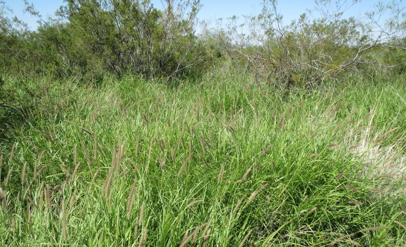
3 Common Names Buffelgrass, African foxtail grass, pasto buffel, zacate buffel Species Pennisetum ciliare Origin Africa, Southern Asia, semi-arid Europe Life Span Perennial (multiyear) Growth Form Graminoid (grass) Biology

4 Buffelgrass in the Sonoran Desert Introduced to Tucson as erosion control and livestock forage in 1940 s U.S. Soil Conservation Service Placed on the Arizona noxious weed list 2005, U.S Department of Agriculture Highly competitive against native vegetation for water and nutrients Low ignition threshold even during growing season Fine fuel Fills in the bare ground space between native vegetation creating a fire linkage Conversion of a succulentrich desert scrub into a buffelgrass dominated savannah

5 Invasive Species that requires monitoring Observation Treatment Follow up Fire Hazard/Fire Linkage Ruining Sonoran Desert native vegetation Current field mapping techniques have drawbacks and need improvement By foot Time Harsh environmental conditions By air Expensive Contracted This project would assess the feasibility of using free, high spatial resolution, orthophotography of a scene to detect and map buffelgrass Need orthophotos with <5 foot spatial resolution to successfully identify buffelgrass from other desert vegetation Why map buffelgrass?
 research grant Property contains vast areas of undisturbed desert and urban/aviation")
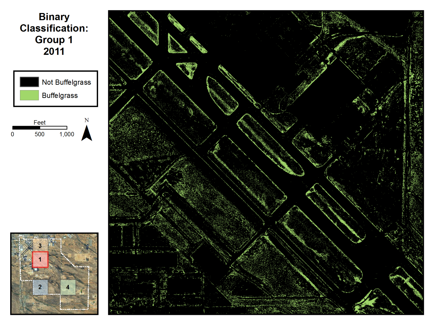
6 8,080 acre parcel located between the I- 10 and I-19 freeways Free high resolution orthophotography available Area included in Southern Arizona Buffelgrass Coordination Center (SABCC) research grant Property contains vast areas of undisturbed desert and urban/aviation infrastructure
 NAD 1983 UTM Zone 12N Collected December, 2012")
7 Data Year Flight Date(s) Resolution Bands 2002 August/September 1 foot 3-band (RGB) 2005 May 1 foot 3-band (RGB) 2008 April 1 foot 3-band (RGB) 2011 April 6 inch 4-band (RGB and NIR) Pima Association of Governments Aerial Orthophotos NAD 1983 Arizona State Plane Central Zone SABCC surveyed buffelgrass vector data (polygon) NAD 1983 UTM Zone 12N Collected December, 2012 February, 2013
8
9
10

11 Sub- Habitat 1 Supervised classification Accuracy assessments Binary reclassification Image difference Buffelgrass colony digitizing Sub- Habitat 2 Supervised classification Accuracy assessments Binary reclassification Image difference Methodology Tucson Airport Authority Sub- Habitat 3 Supervised Classification Accuracy assessments Binary reclassification Image difference Buffelgrass colony digitizing Sub- Habitat 4 Supervised classification Accuracy assessments Binary reclassification Image difference


12 Classifications Supervised Classifications are used to group pixels into distinct land cover groups Requires prior knowledge of scene to correctly identify and label land cover classes User selects Areas of Interest (AOI) with polygon selection tool to declare a land cover type After all user-specified land cover types are identified, a computer algorithm reassigns every pixel in the scene to a particular land cover type.
13
")
14 Isolating Buffelgrass Con( Statement, True Value, False Value) So for the buffelgrass binary reclassification, the following expression was used: Con(Classification_Raster = = 14, 1, 0)
15
16
17
18
19
20
21 190% Increase
22
23
24
25
26
27
28 155% Increase
29
30 Percent Change Results All Group Total Growth 25% 20% 15% Group 1 Group 2 Group 3 10% Group 4 5% 0% Year date sets
31 Percent Change Results All Group Total Loss 25% 20% 15% 10% Group 1 Group 2 Group 3 Group 4 5% 0% Year date sets
32 Conclusion There was a strong connection between buffelgrass growth and colony location when looking alongside roadways, tarmac, and urbanized boundaries There was an average growth rate of 19% per year in the digitized subsections of study groups 1 and 3 Locating and monitoring buffelgrass colony locations was much more difficult in a desert scrub scene Successfully integrated tools and techniques commonly found in remote sensing and GIS to produce an analysis for buffelgrass identification and growth habits within an urban setting.
33 References "ArcGIS Help 10.1: Georeferencing Tools." ArcGIS Help 10.1: Resource Center. ESRI, n.d. Web. 05 Dec < Agius, B Forging changes in an American landscape: invasive plant species at the Saugus Iron Works National Historic Site. Technical Report NPS/NER/NRTR 2005/10. National Park Service.Woodstock, VT. Biging, G. and Congalton, R Advances in forest inventory using advanced digital imagery, in Proceedings of Global Natural Research Monitoring and Assessments': Preparing for the 21st Century. Venice, Italy, September, Vol. 3, "Biology." SABCC (Southern Arizona Buffelgrass Coordination Center). SABCC, n.d. Web. 05 Dec < Olsson, A.D., Betancourt, J., McClaran, M.P., Marsh, S.E., Sonoran Desert Ecosytstem transformation by a C4 grass without the grass/fire cycle. Diversity and Distributions 18(1):10-21 The Nature Conservancy Cenchrus ciliaris L. (syn. Pennisetum ciliare) (Buffelgrass, anjangrass, African foxtail grass). The Nature Conservancy, Wildlands Invasive Species Team, Weed Alert. WRCC, Arizona Climate Summaries. Western Regional Climate Center. Accessed: April 19, 2010 Ziegler, A.D., Warren, S.D., Perry, J.L. and T.W. Giambelluca Reassessment of revegetation strategies for Kaho olawe Island, Hawai i. Journal of Range Management 53: Rutman, Sue. "Buffelgrass: Enemy of the Sonoran Desert." Invasive Plant Species - Organ Pipe Cactus National Monument. United States National Park Service, June Web. 5 Dec < Image credit: SABCC
34 Questions?
Understanding Raster Data
 Introduction The following document is intended to provide a basic understanding of raster data. Raster data layers (commonly referred to as grids) are the essential data layers used in all tools developed
2002 URBAN FOREST CANOPY & LAND USE IN PORTLAND S HOLLYWOOD DISTRICT. Final Report. Michael Lackner, B.A. Geography, 2003
 2002 URBAN FOREST CANOPY & LAND USE IN PORTLAND S HOLLYWOOD DISTRICT Final Report by Michael Lackner, B.A. Geography, 2003 February 2004 - page 1 of 17 - TABLE OF CONTENTS Abstract 3 Introduction 4 Study
Weed Survey and Mapping
 Weed Survey and Mapping The primary objective of weed surveying and mapping is to accurately identify and delineate land with populations of invasive plants or noxious weeds. These surveys allow land managers
TAMARISK MAPPING & MONITORING USING HIGH RESOLUTION SATELLITE IMAGERY. Jason W. San Souci 1. John T. Doyle 2
 TAMARISK MAPPING & MONITORING USING HIGH RESOLUTION SATELLITE IMAGERY Jason W. San Souci 1 John T. Doyle 2 ABSTRACT QuickBird high resolution multispectral satellite imagery (60 cm GSD, 4 spectral bands)
Pima Regional Remote Sensing Program
 Pima Regional Remote Sensing Program Activity Orthophoto GIS Mapping and Analysis Implementing Agency Pima Association of Governments (Tucson, Arizona area Metropolitan Planning Organization) Summary Through
Remote Sensing and Land Use Classification: Supervised vs. Unsupervised Classification Glen Busch
 Remote Sensing and Land Use Classification: Supervised vs. Unsupervised Classification Glen Busch Introduction In this time of large-scale planning and land management on public lands, managers are increasingly
AERIAL PHOTOGRAPHS. For a map of this information, in paper or digital format, contact the Tompkins County Planning Department.
 AERIAL PHOTOGRAPHS What are Aerial Photographs? Aerial photographs are images of the land taken from an airplane and printed on 9 x9 photographic paper. Why are Aerial Photographs Important? Aerial photographs
MAPPING MINNEAPOLIS URBAN TREE CANOPY. Why is Tree Canopy Important? Project Background. Mapping Minneapolis Urban Tree Canopy.
 MAPPING MINNEAPOLIS URBAN TREE CANOPY Why is Tree Canopy Important? Trees are an important component of urban environments. In addition to their aesthetic value, trees have significant economic and environmental
Land Use/Land Cover Map of the Central Facility of ARM in the Southern Great Plains Site Using DOE s Multi-Spectral Thermal Imager Satellite Images
 Land Use/Land Cover Map of the Central Facility of ARM in the Southern Great Plains Site Using DOE s Multi-Spectral Thermal Imager Satellite Images S. E. Báez Cazull Pre-Service Teacher Program University
Land Cover Mapping of the Comoros Islands: Methods and Results. February 2014. ECDD, BCSF & Durrell Lead author: Katie Green
 Land Cover Mapping of the Comoros Islands: Methods and Results February 2014 ECDD, BCSF & Durrell Lead author: Katie Green About the ECDD project The ECDD project was run by Bristol Conservation & Science
Using Remote Sensing Imagery to Evaluate Post-Wildfire Damage in Southern California
 Graham Emde GEOG 3230 Advanced Remote Sensing February 22, 2013 Lab #1 Using Remote Sensing Imagery to Evaluate Post-Wildfire Damage in Southern California Introduction Wildfires are a common disturbance
UPPER COLUMBIA BASIN NETWORK VEGETATION CLASSIFICATION AND MAPPING PROGRAM
 UPPER COLUMBIA BASIN NETWORK VEGETATION CLASSIFICATION AND MAPPING PROGRAM The Upper Columbia Basin Network (UCBN) includes nine parks with significant natural resources in the states of Idaho, Montana,
Bruce Orr and Zooey Diggory S T I L L W A T E R S C I E N C E S. Tom Dudley U C S A N T A B A R B A R A
 A case study from the lower Santa Clara River, CA: Strategic planning for control of Arundo donax and restoration of riparian vegetation in semi-arid landscapes Bruce Orr and Zooey Diggory S T I L L W
The Idiots Guide to GIS and Remote Sensing
 The Idiots Guide to GIS and Remote Sensing 1. Picking the right imagery 1 2. Accessing imagery 1 3. Processing steps 1 a. Geocorrection 2 b. Processing Landsat images layerstacking 4 4. Landcover classification
How To Update A Vegetation And Land Cover Map For Florida
 Florida Vegetation and Land Cover Data Derived from 2003 Landsat ETM+ Imagery Beth Stys, Randy Kautz, David Reed, Melodie Kertis, Robert Kawula, Cherie Keller, and Anastasia Davis Florida Fish and Wildlife
Objectives. Raster Data Discrete Classes. Spatial Information in Natural Resources FANR 3800. Review the raster data model
 Spatial Information in Natural Resources FANR 3800 Raster Analysis Objectives Review the raster data model Understand how raster analysis fundamentally differs from vector analysis Become familiar with
Hawai i Statewide Sustainable Landscape Masterplan
 Ni ihau Kaua i O ahu Molokai Maui Lanai Kaho olawe Hawai i Statewide Sustainable Landscape Masterplan Hawai i Chris Dacus Hawai i Department of Transportation Charlie Scott Jones & Jones Outline Hawaii
Introduction to GIS (Basics, Data, Analysis) & Case Studies. 13 th May 2004. Content. What is GIS?
 & Case Studies. 13 th May 2004. Content. What is GIS?") Introduction to GIS (Basics, Data, Analysis) & Case Studies 13 th May 2004 Content Introduction to GIS Data concepts Data input Analysis Applications selected examples What is GIS? Geographic Information
Introduction to GIS (Basics, Data, Analysis) & Case Studies 13 th May 2004 Content Introduction to GIS Data concepts Data input Analysis Applications selected examples What is GIS? Geographic Information
COASTAL MONITORING & OBSERVATIONS LESSON PLAN Do You Have Change?
 Coastal Change Analysis Lesson Plan COASTAL MONITORING & OBSERVATIONS LESSON PLAN Do You Have Change? NOS Topic Coastal Monitoring and Observations Theme Coastal Change Analysis Links to Overview Essays
TREE CANOPY. August 6 2014
 TREE CANOPY August 6 2014 Tree Canopy Benefits 2 Beautification Reduce the heat island effect Reduces Stormwater Runoff SANDY SPRINGS TREE CANOPY July, 2014 Canopy Studies - 1991, 2001 and 2005 4 UGA Institute
Remote Sensing and GIS Application In Change Detection Study In Urban Zone Using Multi Temporal Satellite
 Remote Sensing and GIS Application In Change Detection Study In Urban Zone Using Multi Temporal Satellite R.Manonmani, G.Mary Divya Suganya Institute of Remote Sensing, Anna University, Chennai 600 025
Increasing water availability through juniper control.
 Tim Deboodt, OSU Crook County Extension Agent 498 SE Lynn Blvd. Prineville, OR 97754 541-447-6228 Tim.deboodt@oregonstate.edu Increasing water availability through juniper control. Throughout the region
JACIE Science Applications of High Resolution Imagery at the USGS EROS Data Center
 JACIE Science Applications of High Resolution Imagery at the USGS EROS Data Center November 8-10, 2004 U.S. Department of the Interior U.S. Geological Survey Michael Coan, SAIC USGS EROS Data Center coan@usgs.gov
Supervised Classification workflow in ENVI 4.8 using WorldView-2 imagery
 Supervised Classification workflow in ENVI 4.8 using WorldView-2 imagery WorldView-2 is the first commercial high-resolution satellite to provide eight spectral sensors in the visible to near-infrared
PRESCRIBED GRAZING NATURAL RESOURCES CONSERVATION SERVICE CONSERVATION PRACTICE STANDARD. (Acre) Code 528
 Code 528") NATURAL RESOURCES CONSERVATION SERVICE CONSERVATION PRACTICE STANDARD PRESCRIBED GRAZING (Acre) Code 528 DEFINITION Managing the harvest of vegetation with grazing and/or browsing animals. PURPOSE Improve
NATURAL RESOURCES CONSERVATION SERVICE CONSERVATION PRACTICE STANDARD PRESCRIBED GRAZING (Acre) Code 528 DEFINITION Managing the harvest of vegetation with grazing and/or browsing animals. PURPOSE Improve
WHAT IS GIS - AN INRODUCTION
 WHAT IS GIS - AN INRODUCTION GIS DEFINITION GIS is an acronym for: Geographic Information Systems Geographic This term is used because GIS tend to deal primarily with geographic or spatial features. Information
ANALYSIS OF FOREST CHANGE IN FIRE DAMAGE AREA USING SATELLITE IMAGES
 ANALYSIS OF FOREST CHANGE IN FIRE DAMAGE AREA USING SATELLITE IMAGES Joon Mook Kang, Professor Joon Kyu Park, Ph.D Min Gyu Kim, Ph.D._Candidate Dept of Civil Engineering, Chungnam National University 220
Restoring Burned Area Fire Regimes at Zion National Park
 Restoring Burned Area Fire Regimes at Zion National Park Kelly Fuhrmann, Zion National Park, State Route 9, Springdale, UT 84767; kelly_ fuhrmann@nps.gov Introduction The Kolob Fire is the largest wildfire
Raster Operations. Local, Neighborhood, and Zonal Approaches. Rebecca McLain Geography 575 Fall 2009. Raster Operations Overview
 Raster Operations Local, Neighborhood, and Zonal Approaches Rebecca McLain Geography 575 Fall 2009 Raster Operations Overview Local: Operations performed on a cell by cell basis Neighborhood: Operations
GULF COASTAL URBAN FOREST HAZARD ASSESSMENT AND REMOTE SENSING EFFORTS AFTER HURRICANES KATRINA AND RITA 1
 GULF COASTAL URBAN FOREST HAZARD ASSESSMENT AND REMOTE SENSING EFFORTS AFTER HURRICANES KATRINA AND RITA 1 Kamran K. Abdollahi, Zhu Hua Ning, Daniel Collins, Fulbert Namwamba and Asebe Negatu SU Agricultural
GIS: Geographic Information Systems A short introduction
 GIS: Geographic Information Systems A short introduction Outline The Center for Digital Scholarship What is GIS? Data types GIS software and analysis Campus GIS resources Center for Digital Scholarship
Adaptation Action Plan For Fire from Learning to Live with the Heat: Adapting to a Changing Climate in the Sky Island Region May 21-22, 2013
 Adaptation Action Plan For Fire from Learning to Live with the Heat: Adapting to a Changing Climate in the Sky Island Region May 21-22, 2013 Report by Louise Misztal July 2013 Adaptation Action Plan for
THE SECRETARY OF THE INTERIOR WASHINGTON
 THE SECRETARY OF THE INTERIOR WASHINGTON ORDER NO. 3336 Subject: Rangeland Fire Prevention, Management and Restoration Sec. 1 Purpose. This Order sets forth enhanced policies and strategies for preventing
Mapping coastal landscapes in Sri Lanka - Report -
 Mapping coastal landscapes in Sri Lanka - Report - contact : Jil Bournazel jil.bournazel@gmail.com November 2013 (reviewed April 2014) Table of Content List of Figures...ii List of Tables...ii Acronyms...ii
Digital Classification and Mapping of Urban Tree Cover: City of Minneapolis
 Digital Classification and Mapping of Urban Tree Cover: City of Minneapolis FINAL REPORT April 12, 2011 Marvin Bauer, Donald Kilberg, Molly Martin and Zecharya Tagar Remote Sensing and Geospatial Analysis
Colorado Natural Heritage Program
 CNHP s mission is to preserve the natural diversity of life by contributing the essential scientific foundation that leads to lasting conservation of Colorado's biological wealth. Colorado Natural Heritage
Geospatial Software Solutions for the Environment and Natural Resources
 Geospatial Software Solutions for the Environment and Natural Resources Manage and Preserve the Environment and its Natural Resources Our environment and the natural resources it provides play a growing
SMEX04 Land Use Classification Data
 Notice to Data Users: The documentation for this data set was provided solely by the Principal Investigator(s) and was not further developed, thoroughly reviewed, or edited by NSIDC. Thus, support for
Texas Prairie Wetlands Project (TPWP) Performance Monitoring
 Performance Monitoring") Texas Prairie Wetlands Project (TPWP) Performance Monitoring Relationship to Gulf Coast Joint Venture (GCJV) Habitat Conservation: Priority Species: Wintering waterfowl species in the Texas portion of
Texas Prairie Wetlands Project (TPWP) Performance Monitoring Relationship to Gulf Coast Joint Venture (GCJV) Habitat Conservation: Priority Species: Wintering waterfowl species in the Texas portion of
SAMPLE MIDTERM QUESTIONS
 Geography 309 Sample MidTerm Questions Page 1 SAMPLE MIDTERM QUESTIONS Textbook Questions Chapter 1 Questions 4, 5, 6, Chapter 2 Questions 4, 7, 10 Chapter 4 Questions 8, 9 Chapter 10 Questions 1, 4, 7
ENVI and ArcGIS Integration Bringing Imagery to GIS
 ITT ENVI and ArcGIS Integration Bringing Imagery to GIS The information contained in this document pertains to software products and services that are subject to the controls of the Export Administration
3D Model of the City Using LiDAR and Visualization of Flood in Three-Dimension
 3D Model of the City Using LiDAR and Visualization of Flood in Three-Dimension R.Queen Suraajini, Department of Civil Engineering, College of Engineering Guindy, Anna University, India, suraa12@gmail.com
WEED MANAGEMENT PLAN FOR. (NAME of PROPERTY or MANAGED AREA) (TOWN or COUNTY, STATE) (TIME PERIOD; e.g. 1996-2000)
 (TOWN or COUNTY, STATE) (TIME PERIOD; e.g. 1996-2000)") (WEED MANAGEMENT PLAN OUTLINE FOR PUBLIC LAND MANAGERS) (Note: This outline is a modification of a weed management plan template produced by The Nature Conservancy) WEED MANAGEMENT PLAN FOR (NAME of PROPERTY
(WEED MANAGEMENT PLAN OUTLINE FOR PUBLIC LAND MANAGERS) (Note: This outline is a modification of a weed management plan template produced by The Nature Conservancy) WEED MANAGEMENT PLAN FOR (NAME of PROPERTY
Angora Fire Restoration Activities June 24, 2007. Presented by: Judy Clot Forest Health Enhancement Program
 Angora Fire Restoration Activities June 24, 2007 Presented by: Judy Clot Forest Health Enhancement Program California Tahoe Conservancy Independent California State Agency within the Resources Agency Governed
TerraColor White Paper
 TerraColor White Paper TerraColor is a simulated true color digital earth imagery product developed by Earthstar Geographics LLC. This product was built from imagery captured by the US Landsat 7 (ETM+)
FORESTED VEGETATION. forests by restoring forests at lower. Prevent invasive plants from establishing after disturbances
 FORESTED VEGETATION Type of strategy Protect General cold adaptation upland and approach subalpine forests by restoring forests at lower Specific adaptation action Thin dry forests to densities low enough
Pima County Range Management Standards and Guidelines
 Pima County Range Management Standards and Guidelines Pima County Natural Resources, Parks and Recreation 3500 West River Road Tucson, AZ 85741 www.pima.gov/nrpr Table of Contents Introduction..............................................................................................
WORKSHOP SUMMARY REPORT 1
 Climate Change Vulnerability Assessment & Adaptation Strategies for Sierra Nevada Resources Sierra Nevada Workshop Series October 14-17, 2014 WORKSHOP SUMMARY REPORT 1 Photo: ESA 1 Authors: Jessi Kershner
CITY OF SUFFOLK, VIRGINIA GIS DATA DISTRIBUTION AND PRICING POLICY
 CITY OF SUFFOLK, VIRGINIA GIS DATA DISTRIBUTION AND PRICING POLICY 1 The City of Suffolk has invested a large amount of effort into the development of a Citywide Geographic Information System (GIS). The
SOKOINE UNIVERSITY OF AGRICULTURE
 SOKOINE UNIVERSITY OF AGRICULTURE FACULTY OF FORESTRY AND NATURE CONSERVATION CURRICULUM FOR MSc. (MNRSA) DEGREE PROGRAMME May 2009 MASTER OF SCIENCE IN MANAGEMENT OF NATURAL RESOURCES AND SUSTAINABLE
INCORPORATING ECOLOGICAL DYNAMICS INTO RANGELAND TREATMENT AND RESTORATION DECISIONS
 INCORPORATING ECOLOGICAL DYNAMICS INTO RANGELAND TREATMENT AND RESTORATION DECISIONS Kimberly Rollins, Environment Canada Visi ng Scholar (2014-15) Professor, University of Nevada Department of Economics
Review for Introduction to Remote Sensing: Science Concepts and Technology
 Review for Introduction to Remote Sensing: Science Concepts and Technology Ann Johnson Associate Director ann@baremt.com Funded by National Science Foundation Advanced Technological Education program [DUE
Environmental Remote Sensing GEOG 2021
 Environmental Remote Sensing GEOG 2021 Lecture 4 Image classification 2 Purpose categorising data data abstraction / simplification data interpretation mapping for land cover mapping use land cover class
RESULTS. that remain following use of the 3x3 and 5x5 homogeneity filters is also reported.
 RESULTS Land Cover and Accuracy for Each Landsat Scene All 14 scenes were successfully classified. The following section displays the results of the land cover classification, the homogenous filtering,
Landforms form an integral part
 Landform classification using GIS by Karsten Drescher, Terralogix Consulting, and Willem de Frey, Ekoinfo Refining existing landform classifications using ESRI s model builder. Landforms form an integral
Natural Resources and Landscape Survey
 Landscape Info Property Name Address Information Contact Person Relationship to Landscape Email address Phone / Fax Website Address Landscape Type (private/muni/resort, etc.) Former Land Use (if known)
PEBBLE PROJECT ENVIRONMENTAL BASELINE DOCUMENT 2004 through 2008 APPENDIX C. DATA MANAGEMENT AND GEOGRAPHIC INFORMATION SYSTEM
 PEBBLE PROJECT ENVIRONMENTAL BASELINE DOCUMENT 2004 through 2008 APPENDIX C. DATA MANAGEMENT AND GEOGRAPHIC INFORMATION SYSTEM PREPARED BY: RESOURCE DATA, INC. TABLE OF CONTENTS TABLE OF CONTENTS... C-i
Forest Biometrics From Space
 Forest Biometrics From Space Timothy B. Hill Lead Remote Sensing / GIS Analyst Geographic Resource Solutions 1125 16th Street, Suite 213 Arcata, CA 95521 ABSTRACT Geographic Resource Solutions (GRS) recently
REPORT TO REGIONAL WATER SUPPLY COMMISSION MEETING OF WEDNESDAY, SEPTEMBER 4, 2013 LEECH WATER SUPPLY AREA RESTORATION UPDATE
 Making a difference... together Agenda Item #9 REPORT #RWSC 2013-17 REPORT TO REGIONAL WATER SUPPLY COMMISSION MEETING OF WEDNESDAY, SEPTEMBER 4, 2013 SUBJECT LEECH WATER SUPPLY AREA RESTORATION UPDATE
From GPS Data Collection to GIS Data Display A Walk-Through Example
 From GPS Data Collection to GIS Data Display A Walk-Through Example The Global Positioning System (GPS) is a satellite based navigation system consisting of 24 satellites, a worldwide network of tracking
Wetland Mapping using High resolution Satellite Images in the Jaffna Peninsula
 Proceedings of Jaffna University International Research Conference (JUICE-2012), pp. 296-300, published: March 2014, Sri Lanka Wetland Mapping using High resolution Satellite Images in the Jaffna Peninsula
Extending Enterprise GIS Into The Field with Mobile GIS Technology
 Extending Enterprise GIS Into The Field with Mobile GIS Technology A White Paper January 10, 2014 1525 Oregon Pike Suite 202 Lancaster, PA 17601-7300 Phone (717) 399-7007 Fax (717) 399-7015 www.geographit.com
Fighting Fire with Fire: Can Fire Positively Impact an Ecosystem?
 Fighting Fire with Fire: Can Fire Positively Impact an Ecosystem? Science Topic: Fire Ecology Grades: 6 th 8 th Essential Questions: What role does fire play in maintaining healthy ecosystems? How does
Active Fire Monitoring: Product Guide
 Active Fire Monitoring: Product Guide Doc.No. Issue : : EUM/TSS/MAN/15/801989 v1c EUMETSAT Eumetsat-Allee 1, D-64295 Darmstadt, Germany Tel: +49 6151 807-7 Fax: +49 6151 807 555 Date : 14 April 2015 http://www.eumetsat.int
U.S. Geological Survey Earth Resources Operation Systems (EROS) Data Center
 Data Center") U.S. Geological Survey Earth Resources Operation Systems (EROS) Data Center World Data Center for Remotely Sensed Land Data USGS EROS DATA CENTER Land Remote Sensing from Space: Acquisition to Applications
U.S. Geological Survey Earth Resources Operation Systems (EROS) Data Center World Data Center for Remotely Sensed Land Data USGS EROS DATA CENTER Land Remote Sensing from Space: Acquisition to Applications
GEOGRAPHIC INFORMATION SYSTEMS Lecture 20: Adding and Creating Data
 Adding Existing Data Into ArcGIS - there are many different ways to get data into ArcGIS GEOGRAPHIC INFORMATION SYSTEMS Lecture 20: Adding and Creating Data Add Data - normally we use the Add Data button
Big Black Mesa Wildlife Water Development Plan
 Big Black Mesa Wildlife Water Development Plan The goal of the plan is establishing reliable sources of permanent water for wildlife on the Prescott National Forest lands on Big Black Mesa. This 100 square-mile
FOR375 EXAM #2 STUDY SESSION SPRING 2016. Lecture 14 Exam #2 Study Session
 FOR375 EXAM #2 STUDY SESSION SPRING 2016 Lecture 14 Exam #2 Study Session INTRODUCTION TO REMOTE SENSING TYPES OF REMOTE SENSING Ground based platforms Airborne based platforms Space based platforms TYPES
Urban Ecosystem Analysis Atlanta Metro Area Calculating the Value of Nature
 August 2001 Urban Ecosystem Analysis Atlanta Metro Area Calculating the Value of Nature Report Contents 2 Project Overview and Major Findings 3 Regional Analysis 4 Local Analysis 6 Using Regional Data
ASSESSMENT OF FOREST RECOVERY AFTER FIRE USING LANDSAT TM IMAGES AND GIS TECHNIQUES: A CASE STUDY OF MAE WONG NATIONAL PARK, THAILAND
 ASSESSMENT OF FOREST RECOVERY AFTER FIRE USING LANDSAT TM IMAGES AND GIS TECHNIQUES: A CASE STUDY OF MAE WONG NATIONAL PARK, THAILAND Sunee Sriboonpong 1 Yousif Ali Hussin 2 Alfred de Gier 2 1 Forest Resource
Effects of Land Cover, Flow, and Restoration on Stream Water Quality in the Portland, OR and Vancouver, WA Metro Area
 Effects of Land Cover, Flow, and Restoration on Stream Water Quality in the Portland, OR and Vancouver, WA Metro Area Heejun Chang 1, Alan Yeakley 2 Noelwah Netusil 3, Paul Thiers 4, Gretchen Rollwagon-Bollens
Ring grave detection in high resolution satellite images of agricultural land
 Ring grave detection in high resolution satellite images of agricultural land Siri Øyen Larsen, Øivind Due Trier, Ragnar Bang Huseby, and Rune Solberg, Norwegian Computing Center Collaborators: The Norwegian
Testimony of Diane Vosick, Director of Policy and Partnerships
 Testimony of Diane Vosick, Director of Policy and Partnerships The Ecological Restoration Institute, Northern Arizona University http://www.eri.nau.edu/ Before the House Federal Lands Subcommittee April
December 19, 2014. Donna Macalle-Holly Lake Hopatcong Foundation 37 Nolan s Point Park Road Lake Hopatcong, NJ 07849. Dear Ms.
 Biology Department Drew University 36 Madison Avenue Madison, New Jersey 07940 Lisa Jordan Assistant Professor, Environmental Studies e. ljordan@drew.edu p. 973.408.3740 drew.edu/ess December 19, 2014
DYNAMICS OF EMERGENT MACROPHYTES OVERGROWTH IN LAKE ENGURES
 Jānis Brižs Latvijas Universitāte, Latvija DYNAMICS OF EMERGENT MACROPHYTES OVERGROWTH IN LAKE ENGURES Abstract Expansion of emergent plants is one of the most important problems of Lake Engures, a Ramsar
GPS Applications in Agriculture. Gary T. Roberson Agricultural Machinery Systems
 GPS Applications in Agriculture Gary T. Roberson Agricultural Machinery Systems What is a Positioning System? A position information system enables the user to determine absolute or relative location of
BSc in Environmental and Conservation Sciences Wildlife and Rangeland Resources Management Major
 Faculty of Agricultural, Life & Environmental Sciences Undergraduate Student Services 2-31 General Services Building www.ales.ualberta.ca Tel: 780.492.4933 Edmonton, Alberta, Canada T6G 2H1 new2ales@ualberta.ca
Appendix C: Geographic Information Systems (GIS) Sources, Technical Notes and Additional Maps
 Sources, Technical Notes and Additional Maps") Appendix C: Geographic Information Systems (GIS) Sources, Technical Notes and Additional Maps Geographic Information Systems (GIS) The maps and three-dimensional representations contained in this report
Appendix C: Geographic Information Systems (GIS) Sources, Technical Notes and Additional Maps Geographic Information Systems (GIS) The maps and three-dimensional representations contained in this report
-1 7.04 Propagules adapted to wind dispersal n. -1 7.05 Propagules water dispersed n
 Australia/New Zealand Weed Risk Assessment adapted for Florida. Data used for analysis published in: Gordon, D.R., D.A. Onderdonk, A.M. Fox, R.K. Stocker, and C. Gantz. 2008. Predicting Invasive Plants
White Paper. Apple Valley Ranchos Water Company Water Conservation Technical Assistance
 White Paper Apple Valley Ranchos Water Company Water Conservation Technical Assistance U.S. Department of the Interior Bureau of Reclamation December 2010 Mission Statements The U.S. Department of the
APPLICATION OF GOOGLE EARTH FOR THE DEVELOPMENT OF BASE MAP IN THE CASE OF GISH ABBAY SEKELA, AMHARA STATE, ETHIOPIA
 APPLICATION OF GOOGLE EARTH FOR THE DEVELOPMENT OF BASE MAP IN THE CASE OF GISH ABBAY SEKELA, AMHARA STATE, ETHIOPIA Abineh Tilahun Department of Geography and environmental studies, Adigrat University,
WATER BODY EXTRACTION FROM MULTI SPECTRAL IMAGE BY SPECTRAL PATTERN ANALYSIS
 WATER BODY EXTRACTION FROM MULTI SPECTRAL IMAGE BY SPECTRAL PATTERN ANALYSIS Nguyen Dinh Duong Department of Environmental Information Study and Analysis, Institute of Geography, 18 Hoang Quoc Viet Rd.,
A HIERARCHICAL APPROACH TO LAND USE AND LAND COVER MAPPING USING MULTIPLE IMAGE TYPES ABSTRACT INTRODUCTION
 A HIERARCHICAL APPROACH TO LAND USE AND LAND COVER MAPPING USING MULTIPLE IMAGE TYPES Daniel L. Civco 1, Associate Professor James D. Hurd 2, Research Assistant III Laboratory for Earth Resources Information
Past and Current Research on Natural Resource Issues in the Blue Mountains
 Past and Current Research on Natural Resource Issues in the Blue Mountains Recreation, Hunting, Access Livestock Production (and Wild Ungulate Ecology) Restoration Timber Harvest, Production Biodiversity,
APPLICATION OF MULTITEMPORAL LANDSAT DATA TO MAP AND MONITOR LAND COVER AND LAND USE CHANGE IN THE CHESAPEAKE BAY WATERSHED
 APPLICATION OF MULTITEMPORAL LANDSAT DATA TO MAP AND MONITOR LAND COVER AND LAND USE CHANGE IN THE CHESAPEAKE BAY WATERSHED S. J. GOETZ Woods Hole Research Center Woods Hole, Massachusetts 054-096 USA
Fayette County Appraisal District
 Fayette County Appraisal District Agricultural Guidelines July 7, 2010 A SUPPLEMENT TO THE STATE OF TEXAS PROPERTY TAX MANUAL FOR THE APPRAISAL OF AGRICULTUAL LAND AND WILDLIFE MANAGEMENT ACTIVITIES AND
understanding Sustainable Landscaping & Tree Preservation Standards
 understanding Sustainable Landscaping & Tree Preservation Standards Purpose To promote landscaping around development that is compatible with the existing environment, and which reduces greenhouse gas
Chapter 3 Communities, Biomes, and Ecosystems
 Communities, Biomes, and Ecosystems Section 1: Community Ecology Section 2: Terrestrial Biomes Section 3: Aquatic Ecosystems Click on a lesson name to select. 3.1 Community Ecology Communities A biological
 JohnEnloe,Principal StantecConsultingServicesInc. KEY STAFF RESUMES 1. OVERVIEW Introduction For the City of Sparks Tree Assessment Phase II Stantec will provide project management, GIS mapping coordination
COMPREHENSIVE PLAN SECTION B, ELEMENT 4 WATER RESOURCES. April 20, 2010 EXHIBIT 1
 COMPREHENSIVE PLAN SECTION B, ELEMENT 4 WATER RESOURCES April 20, 2010 EXHIBIT 1 ELEMENT 4 WATER RESOURCES TABLE OF CONTENTS 4.1 INTRODUCTION 4.2 GOALS AND POLICIES 4.2.A General Goals and Policies 1 4.2.B
Science Rationale. Status of Deforestation Measurement. Main points for carbon. Measurement needs. Some Comments Dave Skole
 Science Rationale Status of Deforestation Measurement Some Comments Dave Skole Tropical deforestation is related to: Carbon cycle and biotic emissions/sequestration Ecosystems and biodiversity Water and
Mapping and assessment of ecosystem services in Lithuania: status, plans & means. Dr. Vytautas Naruševičius Environmental Protection Agency
 Mapping and assessment of ecosystem services in Lithuania: status, plans & means Dr. Vytautas Naruševičius Environmental Protection Agency Project name: Assessment overview Preparation of a national study
CIESIN Columbia University
 Conference on Climate Change and Official Statistics Oslo, Norway, 14-16 April 2008 The Role of Spatial Data Infrastructure in Integrating Climate Change Information with a Focus on Monitoring Observed
ENDANGERED AND THREATENED
 ENDANGERED AND THREATENED Understand how species in the Sonoran Desert Region may become endangered or threatened and what is being done to protect them. ARIZONA SCIENCE STANDARDS SC03-S4C3-03&04, SC08-S1C3-07,
Comparison of Satellite Imagery and Conventional Aerial Photography in Evaluating a Large Forest Fire
 Purdue University Purdue e-pubs LARS Symposia Laboratory for Applications of Remote Sensing --98 Comparison of Satellite Imagery and Conventional Aerial Photography in Evaluating a Large Forest Fire G.
Note on Draft Progress Report Template
 Note on Draft Progress Report Template The Draft Progress Report template is provided as a guide to applicants on possible reporting requirements for the Biodiversity Fund. This actual report will be provided
Technical Study and GIS Model for Migratory Deer Range Habitat. Butte County, California
 Technical Study and GIS Model for Migratory Deer Range Habitat, California Prepared for: Design, Community & Environment And Prepared by: Please Cite this Document as: Gallaway Consulting, Inc. Sevier,
Sullivan s Island Bird Banding and Environmental Education Program. Sarah Harper Díaz, MA and Jennifer Tyrrell, MS
 Sullivan s Island Bird Banding and Environmental Education Program Sarah Harper Díaz, MA and Jennifer Tyrrell, MS I. Introduction The Sullivan s Island Bird Banding and Environmental Education Program
College of Agricultural Sciences and Natural Resources Online Courses
 College of Agricultural Sciences and Natural Resources Online Courses Course # AECN/NRES 883 A B D D E J K L M N P Q Q R T T U V W Y Z AECN/ALEC 899 AGRI/ENTO 826 AGRI/AGRO/HORT 897 AGRO 811 AGRO 812/BIOC
Tall Pots in a Shallow World
 Tall Pots in a Shallow World Scientists have figured out how to restore damaged urban desert landscapes with native plants that use less surface water and prevent erosion. Problem is, the scraggly little