Bring Field to Office by Smart Devices
|
|
|
- Leslie Harmon
- 10 years ago
- Views:
Transcription
1 Supergeo Webinar Bring Field to Office by Smart Devices Sep 18, 2014

2 Presenters Patty Chen Marketing Specialist International Marketing Division Danny Wang Tech Support Engineer GIS Training & Support Center Supergeo Support Team 2

3 Product Roadmap Bring Field to Office by Smart Devices 3

4 Position of SuperSurv A GIS data collection app specially designed for Android and ios platform Integrating with GIS and GPS technologies Easily capturing and handling spatial data in the field 4

5 Overview of SuperSurv Efficiently collect point, line, polygon data Support offline & online editing Display map data with global coordinate system Create and manage waypoints Query and measure on the map Fully compatible with other SuperGIS product lines 5

6 What s New in SuperSurv 3.2 Query Function - Hyperlinks - Query window enlarged GPS Function - Display the Z value of GPS - GPS track length Waypoint Management - Easily managing waypoints Map Display - Defined scale - Label features 6

7 7 Overview of SuperSurv

8 Supported Spec and OS Vector data: SHP, GEO Raster data: SGT, STC GPS track: SHP, KML Waypoint: TXT, CSV, KML OS: Android 4 above ios 6 above 8

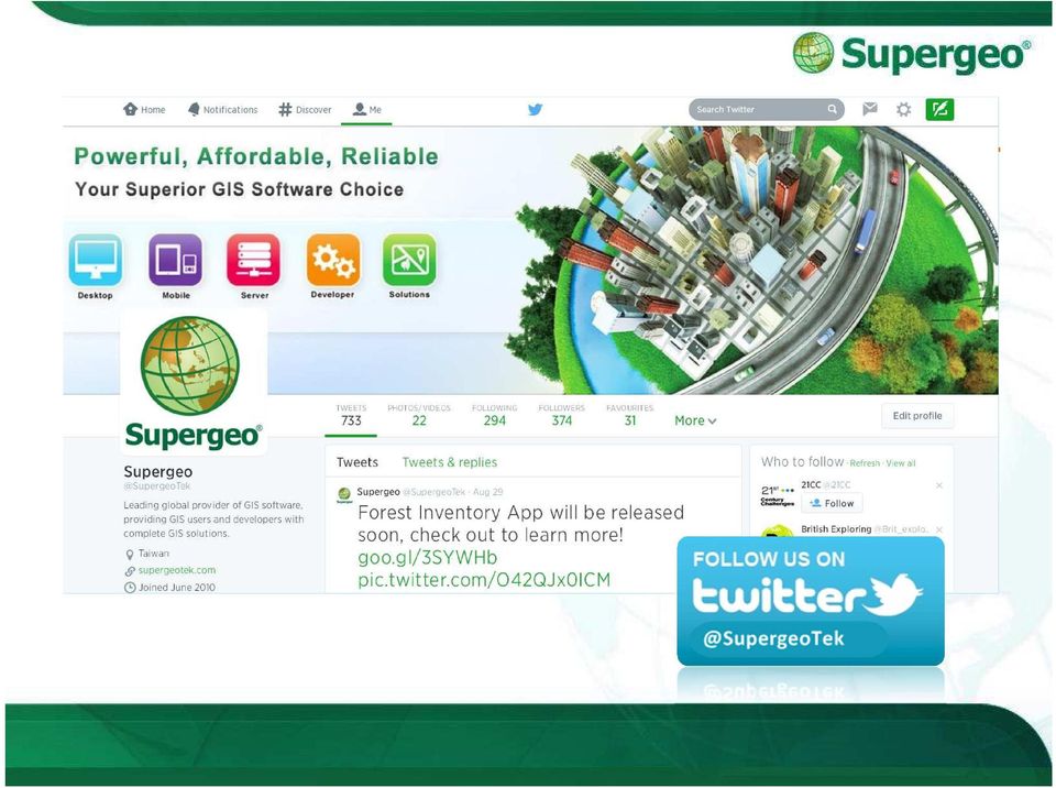
9 Questions & Comments During the presentation, you may share your comments or questions Or, you may drop us an to: Follow us on 9

10
11 Agenda In this webinar, we ll go through: Survey and update cadastral data with smart GIS solutions Capture field data by ready-to-go work flows Fast and easy data editing for efficient facility management Convenient data exportation and arrangement in office Plan for better future - advanced data analysis and report 11

12 Mobile GIS Application A lightweight GIS system on your mobile devices Specifically designed for field works 12

13 Live Demonstration Cadastral data maintenance and survey 13

14 Scenario Cadastral Field Survey The cadastral data of the residential area need to be updated with the latest land use and change. Customers may have some issues with the land border and need to be checked by officers. 14

15 In the Old Ways The cadastral survey means: Loads of geodetics equipment Huge use of manpower Annoying paper works with the results Always fighting with the accuracy Cadastral data on paper 15

16 Latest Cadastral Field Survey A survey project with modern techs Customized coordinate systems Cached Map, online map and layers Quick information and metadata query On-screen measurement Spatial guiding system 16

17 #01 Start With SuperSurv Setting Project Creating a project environment before the survey is very important All data and media will be stored within your project folder To decide the spatial reference system and the purpose of your project, you may create: New Project with localized spatial reference Online Map Tool Project with OpenStreetMap 17

18 #02 Preparation before survey Basemap preparation for survey STC and SGT Map Cache File supported Create your own basemap by SuperGIS Desktop Cache Generator STC or SGT Base Map 18

19 #02 Preparation before survey Base map preparation Drag and drop your basemap in the directory of Project 19

20 #02 Preparation before survey Bring in the GIS data All the layer files should be stored in the Layer folder within the project Both GEO and SHP file format are supported Simply just drag in all the layers you need for the survey to the Layer folder 20

21 #02 Preparation before survey Bring in the GIS data SHP GEO Drag and drop your layers file in the Layer folder within project 21
22 #02 Preparation before survey If you are using ios version Import / Export the data by itunes or Dropbox Photos can also been exported to your photo library 22
23 #02 Preparation before survey Layer Creation and Management SuperSurv allows user to create point, line and polygon layers.geo or.shp format with customized code pages Changeable symbology and layer order Customization of Attribute table Manage and customize the attribute table easily 23
24 #02 Preparation before survey Take photos with camera in field survey Capture the photo of environment at or around spots Record coordinate information to EXIF information of the photo 24
25 #02 Preparation before survey Ways to your destination Waypoint system Manually tapping Add by GPS Import waypoints from files Pan to the specific waypoint Waypoint guidance Augmented Reality (AR) 25

26 #02 Preparation before survey Prepare waypoints as your guide Manually tapping Import waypoints file TXT, CSV or KML 26
27 #02 Preparation before survey Demonstration Build up a project for survey Bring in the basemap and layer files Quick management of the layer data Setup waypoints for spatial guidance 27
28 28 BREAKTIME: QUICK POLL
29 #03 On-field Survey Track recording for your report Track Recording function Record the track of GPS and save as point layer (KML) and line layer (SHP) The file can be found in the Track folder within the project folder 29
30 #03 On-field Survey Data collection with GIS & Survey tools Switchable layers within project for editing and modification Automatic feature collection via GPS, or manually input the vertex one by one. 30
31 Quick data query tools in SuperSurv Attribute Query Identify Query #03 On-field Survey Hyperlink Query New Feature in 3.2!! Query Settings allow user to perform more precise and efficient on-screen query 31
32 #03 On-field Survey Measurement tools in SuperSurv Length Measurement Area Measurement Feature Measurement Switchable metric units and imperial units 32
33 33 BREAKTIME: QUICK POLL
34 #04 Office Operation Export your survey data Export the survey project folder to PC No complicated steps but just drag and drop 34
35 #04 Office Operation Export your survey data All the layers is still within the Layer folder Take out layers and check with GIS Software 35
36 #04 Office Operation Export your survey data The tracklog has been saved as both KML and Shape file format, and you can find them in the Track folder 36
37 #04 Office Operation Export your survey data All the Photos within project are saved in the Photo folder, so you may export them for further usage 37
38 #04 Office Operation Field survey data application All the data collected by mobile device is also good for later use with different platforms Fully compatible with further analysis and statistics 38
39 #04 Office Operation Demonstration Back in the office with survey data Export project folder from device Check the survey data and tracklogs with SuperGIS Desktop 39
40 Reviews Easy-to-prepare survey project and information before field works On-field survey and update cadastral data with smart GIS solutions Convenient data exportation and arrangement back in the office Plan for better future - advanced data usage for analysis and suggestion 40
41 2 editions to fit your needs: Free trial of both SuperSurv and SuperSurv M3 is available on App Store, Google play and Supergeo website. Full-function: 7 days 41

42 42 Get Free Trial
43 Upcoming Events Supergeo Webinars October 29 targeting at SuperGIS Sever November targeting at 3D GIS Exhibitions October 7-9, INTERGEO 2014, Berlin, Germany Booth A3.033 Hall
44 Q&A Time Subscribe to get latest Online Training Resources 44

45 45 Win FREE SuperSurv
46 Thank you for your attention Subscribe to get latest Online Training Resources 46
PDF MAPS FOR SMARTPHONES AND TABLETS
 INTRODUCTION Incident mapping often utilizes PDF documents of maps to be created for printing, archiving, and now for the ability to use these products in the field. With the release of Adobe Acrobat 9
MobileMap and Spatial Content Management: Integrating Field Data Collection, Document Management and Enterprise GIS for Natural Resources
 MobileMap and Spatial Content Management: Integrating Field Data Collection, Document Management and Enterprise GIS for Natural Resources BRIAN GRASS MASON, BRUCE & GIRARD The Mobile Revolution Proliferation
Different types of OS GIS mobile applications: gvsig Mobile & gvsig Mini
 CGS University of Nottingham OSGIS 2011 22ndJune Different types of OS GIS mobile applications: gvsig Mobile & gvsig Mini Amelia del Rey [email protected] Javier Carrasco [email protected] Alberto
Contents. General Overview... 1-2 Common Work Flow... 3 Full Feature List... 4 Additional Information... 5. Website... GIS.Garafa.
 Contents Contents General Overview... 1-2 Common Work Flow... 3 Full Feature List... 4 Additional Information... 5 Website... GIS.Garafa.com 1 Ease of Use Traditional mobile software for data collection
separate the content technology display or delivery technology
 Good Morning. In the mobile development space, discussions are often focused on whose winning the mobile technology wars how Android has the greater share of the mobile market or how Apple is has the greatest
BLM Personnel & REA Collaborator Access. Accessing REA Data, Maps, & Models through SharePoint
 Accessing REA Data, Maps, & Models through SharePoint BLM Personnel & REA Collaborator Access To access REA data and map services through the BLM network, follow the steps provided below. They will take
A Workflow for Creating and Sharing Maps
 A Workflow for Creating and Sharing Maps By Keith Mann, Esri What You Will Need Item Source ArcGIS Online for Organizations subscription ArcGIS 10.1 for Desktop (Any license level) ArcGIS Spatial Analyst
GEM global earthquake model. User guide: Android mobile tool for field data collection. Rosser, J., J.G. Morley, A. Vicini. Data capture tools
 User guide: Android mobile tool for field data collection GEM Technical Report 2014-03 V1.0.0 Rosser, J., J.G. Morley, A. Vicini Data capture tools GEM global earthquake model i User guide: Android mobile
_ LUCIADMOBILE V2015 PRODUCT DATA SHEET _ LUCIADMOBILE PRODUCT DATA SHEET
 _ LUCIADMOBILE PRODUCT DATA SHEET V2015 LuciadMobile enables the rapid development of geospatial situational awareness applications on mobile devices running Android, and is specifically designed for situational
SuperGeo Rugged Personal GIS Solution - Mobile GIS Expert Specification
 SuperGeo Rugged Personal GIS Solution - Mobile GIS Expert Specification Mobile GIS Expert is one of SuperGeo s Rugged Personal GIS Solutions, which includes Getac PS535 Rugged GPS PND and SuperPad 2.1
SuperGIS Software Installation Guide
 SuperGIS Software Installation Guide System Requirements To install SuperGIS software, your computer should be equipped with.net Framework 2.0 Your mobile device (Windows Mobile) should be equipped with.net
SuperGIS Server 3.2 Standard Edition Specification
 SuperGIS Server 3.2 Standard Edition Specification 20140826 Specification 1. All of the services support SOAP (Simple Object Access Protocol). 2. Use map file created by SuperGIS Desktop as map services
Creating Web and Mobile Maps Using ArcGIS Online. SCO Technical Paper
 Creating Web and Mobile Maps Using ArcGIS Online SCO Technical Paper Version History Version Date Notes Author/Contact 1.0 February, 2012 Initial document created. John J Czaplewski Copyright 2012 The
How to use PGS: Basic Services Provision Map App
 How to use PGS: Basic Services Provision Map App The PGS: Basic Services Provision Map App The main features of the PGP Basic Services web application includes: Navigation Tools Map Tools Main Map Links
Installing and viewing your ebooks
 Installing and viewing your ebooks o install and view your ebook, please see the instructions below: VitalSource ebooks For Windows PC and Apple Mac OS X Desktops Download and install the free VitalSource
ArcGIS online Introduction... 2. Module 1: How to create a basic map on ArcGIS online... 3. Creating a public account with ArcGIS online...
 Table of Contents ArcGIS online Introduction... 2 Module 1: How to create a basic map on ArcGIS online... 3 Creating a public account with ArcGIS online... 3 Opening a Map, Adding a Basemap and then Saving
How to use Dropbox. What is Dropbox. Please read the University of Melbourne Guidelines on Dropbox and University Information prior to use.
 How to use Dropbox Please read the University of Melbourne Guidelines on Dropbox and University Information prior to use. What is Dropbox Dropbox lets you easily share and collaborate on documents with
OCAD smart for cartography A niche product towards a professional cartographic. software
 OCAD 10 OCAD smart for cartography A niche product towards a professional cartographic software Positioning of OCAD Geodata Mobile Data Entry (GPS) Internet Desktop Publishing (DTP) OCAD Import and Export
Application of GIS Analyzes with Cloud Computing
 ion of GIS Analyzes with Cloud Computing Sevket BEDIROGLU, Volkan YILDIRIM and Selcuk ERBAS (Turkey) Key words: GIS, Cloud Computing, Spatial Cloud Computing SUMMARY Usage of Cloud Computing (CC) has been
Creating Maps in QGIS: A Quick Guide
 Creating Maps in QGIS: A Quick Guide Overview Quantum GIS, which is often called QGIS, is an open source GIS desktop application. Comparing to ArcGIS, QGIS can be installed on various operating systems,
Introduction to GIS. http://libguides.mit.edu/gis
 Introduction to GIS http://libguides.mit.edu/gis 1 Overview What is GIS? Types of Data and Projections What can I do with GIS? Data Sources and Formats Software Data Management Tips 2 What is GIS? 3 Characteristics
Neat Cloud Service + Mobile App
 Getting Started with Neat Cloud Service + Mobile App Neat transforms paper and electronic documents into organized digital files that are easy to find, use, and share. Neat Cloud Service and Mobile App
What's new in gvsig Desktop 2.0
 What's new in gvsig Desktop 2.0 What are the novelties? 2.0 1.12 Migrating and building... Some examples... Please pardon our appearance during construction Pie and bar chart legends Table in layout 1.12
How to Setup and Manage Spatial Assets with ArcGIS Online for a Mobile Workforce
 How to Setup and Manage Spatial Assets with ArcGIS Online for a Mobile Workforce W A U R I S A 2 0 1 4 Presented By Engineer Technician II Pierce County Public Works and Utilities Road Operations Division
Step by Step Guide for GIS Cloud Applications
 Step by Step Guide for GIS Cloud Applications All in one manual for: Map Editor Map Viewer Asset Data Collection and Management Fleet Management Roadwork Management and Coordination Mobile Data Collection
Resco CRM Guide. Get to know Resco CRM
 Resco CRM Guide Get to know Resco CRM Table of Contents Introducing Resco CRM... 3 1.1. What is Resco CRM...3 1.2. Capabilities of Resco CRM... 4 1.3. Who should use Resco CRM...5 1.4. What are the main
Getting Started. Version 3.1 Last updated 2014/3/10. Orbweb ME: Getting Started
 Information in this document is subject to change without notice. Companies, names, and data used in examples herein are fictitious unless otherwise noted. No part of this document may be reproduced or
Seagate NAS OS 4 Reviewers Guide: NAS / NAS Pro / Business Storage Rackmounts
 Seagate NAS OS 4 Reviewers Guide: NAS / NAS Pro / Business Storage Rackmounts Seagate NAS OS 4 Reviewers Guide 2 Purpose of this guide Experience the most common use cases for the product, learn about
Portal for ArcGIS. Satish Sankaran Robert Kircher
 Portal for ArcGIS Satish Sankaran Robert Kircher ArcGIS A Complete GIS Data Management Planning & Analysis Field Mobility Operational Awareness Constituent Engagement End to End Integration Collect, Organize,
Publishing KML Services Tutorial
 Publishing KML Services Tutorial Copyright 1995-2010 Esri All rights reserved. Table of Contents Tutorial: Publishing a KML service............................ 3 Copyright 1995-2010 ESRI, Inc. All rights
Developing Mapping Applications with ArcGIS Runtime SDK for Windows Mobile. Jay Chen Justin Colville
 Developing Mapping Applications with ArcGIS Runtime SDK for Windows Mobile Jay Chen Justin Colville Agenda What is ArcGIS Runtime for Windows Mobile Software Development Kit Application SDK - Introduction
MaaSter Microsoft Ecosystem Management with MaaS360. Chuck Brown Jimmy Tsang www.maas360.com
 MaaSter Microsoft Ecosystem Management with MaaS360 Chuck Brown Jimmy Tsang www.maas360.com Introductions Chuck Brown Product Management IBM MaaS360 Jimmy Tsang Director of Product Marketing IBM MaaS360
Procedure For Putting A GPS-Enabled GeoPDF Map On An iphone or ipad Carl Beyerhelm GIS, GPS, and Data Management Coconino National Forest 7 Nov 2011
 Procedure For Putting A GPS-Enabled GeoPDF Map On An iphone or ipad Carl Beyerhelm GIS, GPS, and Data Management Coconino National Forest 7 Nov 2011 Background iphones and ipads (referred to here as idevices)
The End is Near. Options for File Management and Storage
 The End is Near Options for File Management and Storage Options Google Drive icloud Drive USB Drives H:Drive icloud icloud IOS 8 icloud Drive icloud With icloud Drive, you can safely store all your presentations,
From GPS Data Collection to GIS Data Display A Walk-Through Example
 From GPS Data Collection to GIS Data Display A Walk-Through Example The Global Positioning System (GPS) is a satellite based navigation system consisting of 24 satellites, a worldwide network of tracking
Digital Field Mapping
 Digital Field Mapping It s very easy to get started in the world of digital mapping. Midland Valley has developed two new applications for field geologists: FieldMove Clino for Apple and Android smartphones,
Cross Platform Mobile Gis System For Data Collection Based On Gps And Emerging Gis Technologies
 International Conference of Advance Research and Innovation (-2014) Cross Platform Mobile Gis System For Data Collection Based On Gps And Emerging Gis Technologies Mohammad Nasim a,*, Prashant Kumar b
Store & Share Quick Start
 Store & Share Quick Start What is Store & Share? Store & Share is a service that allows you to upload all of your content (documents, music, video, executable files) into a centralized cloud storage. You
How to use CamScanner
 CamScanner Tutorial How to use CamScanner Overview Document List Add Document Manage Documents Search Documents View Document Edit Document Settings Additional Features Overview CamScanner is a must-have
Virtual Workplace Personal Device Client Installation Instructions
 Virtual Workplace Personal Device Client Installation Instructions 1 Table of Contents About this Installation Guide... 2 Client Overview... 2 VMware Horizon View Clients... 2 UniPrint Clients... 3 Client
GEOGRAPHIC INFORMATION SOLUTIONS LTD. GPS Data Management & GIS Course
 GEOGRAPHIC INFORMATION SOLUTIONS LTD GPS Data Management & GIS Course 4th Floor-Outbox, Soliz House, Plot 23, Lumumba Avenue, Nakasero, Kampala Uganda. Mobile: +256 778 082 563/+256 712 593 775 Email:
Mobile Print/Scan Guide for Brother iprint&scan
 Mobile Print/Scan Guide for Brother iprint&scan Version G ENG Definitions of notes We use the following icon throughout this user s guide: Notes tell you how you should respond to a situation that may
REQUEST FOR PROPOSALS
 REQUEST FOR PROPOSALS Tourism Mobile Application for Android for Newfoundland and Labrador Tourism Department of Tourism, Culture and Recreation RFP Issued By: Target Marketing & Communications Inc., Date
Backing up your digital image collection provides it with essential protection.
 Backing up your digital image collection provides it with essential protection. In this chapter, you ll learn more about your options for creating a reliable backup of your entire digital image library.
HELCOM Data and Map Service. User Manual
 HELCOM Data and Map Service User Manual Version 2.2 - February 2015 1 Table of contents 1. General Information... 3 1.1 Background... 3 1.2 Technical requirements... 3 1.3 Contact... 3 2. Accessing HELCOM
By Global Delight. Voila Screen Capture For Mac 1
 Voila Screen Capture For Mac By Global Delight Voila Screen Capture For Mac 1 Table Of Contents I. General Information...3 1. Product Overview...3 2. Target Market...3 3. Pricing & Availability...4 4.
Alberding precision agriculture solutions
 Alberding precision agriculture solutions Alberding GmbH AGRITECHNICA 2015, 8 14 November 2015, Hanover, Germany Presentation by: Tamás Horváth & Katrin Arendholz Alberding GmbH - Precision agriculture
Mobile Application Performance
 Mobile Application Performance Tips & Tricks to Significantly Boost App Performance Ray Bennett Director, Microstrategy - Mobile Service Line 11km/s (7mps) Escape Velocity Performance Definition What is
ACS ChemWorx User Guide http://www.acschemworx.org
 ACS ChemWorx User Guide http://www.acschemworx.org Contents OVERVIEW... 5 ACS CHEMWORX DESKTOP APP... 5 HOW TO INSTALL THE DESKTOP... 5 ACS CHEMWORX WEB APP... 5 ACS CHEMWORX MOBILE APP... 5 SETTING UP
This is our best... YOUR best... Online Banking yet!
 INTERNATIONAL FINANCE BANK CUSTOMER USER GUIDE MAKING BANKING A BREEZE! This is our best... YOUR best... Online Banking yet! Member FDIC New & Improved Online Banking Experience > IFB is proud to introduce
Installing Tri-Global Software
 Installing Tri-Global Software To Begin, let us first talk about the different pieces of software available to you and the purpose for each. The individual software pieces are listed below, with a brief
ipecs UCS Unified Communications Solution Easy to access and activate Highlights Single server solution
 ipecs UCS Unified Communications Solution In today s world of remote and dispersed workers, the ipecs UCS application provides tools to enhance productivity and mobility while improving employee collaboration
WFP Liberia Country Office
 1 Oscar Gobbato [email protected] [email protected] WFP Liberia Country Office GIS training - Summary Objectives 1 To introduce to participants the basic concepts and techniques in using Geographic
Downloading an Acted ebook Accessing an ActEd ebook on more than 1 computer/device Printing an ActEd ebook
 ActEd ebooks FAQs Contents EBOOKS DEVICES AND SOFTWARE Checking you have a compatible computer and device Installing the applications Registering with Adobe Downloading a test ebook Accessing an ebook
Publishing geospatial data to the web using the EEA infrastructure
 Publishing geospatial data to the web using the EEA infrastructure *Note: Map Services should be published using the EEA Map Services Tick Sheet for guidance. Contact Sebastien Petit ([email protected])
CommBank Small Business app User Guide
 CommBank Small Business app User Guide CommBank Small Business app user guide 2 Contents Welcome to the CommBank Small Business app 4 CommBank Small Business app in 5 easy steps 4 We re here to help 4
Momentum offers you free training, webinars and much more to: help you understand the power of your current LANDESK products
 LANDESK Momentum Momentum offers you free training, webinars and much more to: help you understand the power of your current LANDESK products improve your ROI Upcoming Webinars: Visit: www.landesk.com/momentum
VantagePoint PC Application Software USER MANUAL
 VantagePoint PC Application Software USER MANUAL 605-0183-004 A Overview Magellan VantagePoint software allows you to view, edit and store color maps on a personal computer, with zoom and pan functions
Save and Share Files in the Cloud with OneDrive for Business
 Work Smart by Microsoft IT Save and Share Files in the Cloud with OneDrive for Business Microsoft OneDrive for Business is your professional file library your OneDrive for your business needs. OneDrive
Lecture 8. Online GIS
 Lecture 8 Online GIS Lecture 8: Outline I. Online GIS 1. Google Earth 2. MSN Live Maps II. Open Source GIS III. ArcGIS Server and the ESRI suite of online software utility options IV. Advanced Data Mining
Oklahoma s Open Source Spatial Data Clearinghouse: OKMaps
 Oklahoma s Open Source Spatial Data Clearinghouse: OKMaps Presented by: Mike Sharp State Geographic Information Coordinator Oklahoma Office of Geographic Information MAGIC 2014 Symposium April 28-May1,
Mobile Data Collection with Avenza PDF Maps
 Mobile Data Collection with Avenza PDF Maps Installing the App The Avenza PDF Maps app v2.0.1 should already be installed on your device. If not, you can search Avenza in the App store to install it. Please
GeoMap.WA. user guide
 GeoMap.WA user guide Version 1.1 March 2011 Preface: The information provided is interpretive. The information is made available in good faith and derived from sources believed to be reliable and accurate
Extending the Survey123 for ArcGIS Mobile App
 Esri Developer Summit March 8 11, 2016 Palm Springs, CA Extending the Survey123 for ArcGIS Mobile App Elvin Slavik, Sathya Prasad THE FOLLOWING TECH PREVIEW HAS BEEN APPROVED FOR ALL RESTRICTED DEVELOPER
Best Free Magento Extensions for Social Network By : M Connect Media
 Best Free Magento Extensions for Social Network By : M Connect Media About Social Shopping Social shopping and reference are one of the most excellent features added in ecommerce from last few years. Magento
Systems Manager Cloud Based Mobile Device Management
 Datasheet Systems Manager Systems Manager Cloud Based Mobile Device Management Overview Meraki Systems Manager provides cloud-based over-the-air centralized management, diagnostics, and monitoring of the
OCAD more than just only a o-mapping software
 OCAD more than just only a o-mapping software IOF ITC Open Meeting, WOC 2014, Lavarone Positioning of OCAD. Import and Export of Geodata Geodata Capture (GPS) Course Setting Desktop Publishing (DTP) Specific
Technologies Enabling the Evolution of a Smart City. Brad Schmidt, Intergraph Canada
 Technologies Enabling the Evolution of a Smart City Brad Schmidt, Intergraph Canada AGENDA The Smart City Key Challenges Facing Cities Technology Challenges Smart Sensor Integration Smart Apps Smart Data
Enterprise Mobility Space
 MBaaS How MBaaS is Shaping up the Enterprise Mobility Space A RapidValue Solutions Whitepaper Contents Executive Summary... What is Mobile Backend as a Service (MBaaS)?... Primary Building Blocks of MBaaS...
Making Your Mobile Workforce More Efficient
 ArcGIS for Mobile Making Your Mobile Workforce More Efficient What Is Mobile GIS? Mobile geographic information system (GIS) technology extends GIS beyond the office and allows organizations to make accurate,
PlanGrid. User Guide. www.plangrid.com [email protected]
 PlanGrid User Guide www.plangrid.com [email protected] Table of Contents Create a New Project Connecting Cloud Storage Partial Downloading ios Web Viewer and Web Markups Viewing Markups on your device
Apple Configurator MDM Site - Review
 Management Options ios New Market ipads - January 2010 Several changes in a short period of time. Apple Lion Server came out June 2011. Apple Configurator came out in June 2012. Why Absolute or Alteris?
ESC Mobile App Guide
 ESC Mobile App Guide General Info and Installation Guide For Android Note: If you re just trying to demo the ESC Mobile app in our sample database, then all that is required is to download it from your
Mobile GIS Guide. About The Author. Getting your mobile GIS project off the ground
 About The Author Matt Sheehan is a mobile GIS pioneer. He and his staff at WebMapSolutions have been providing clients with mobile GIS solutions since the earliest days of smartphones and tablets. We live
Introduction to Stanford Box
 January 15, 2016 Tech Briefing Introduction to Stanford Box box.stanford.edu / stanford.box.com Don Cameron [email protected] (650) 736-0609 INTRODUCTION Agenda Box at Stanford Getting Started Managing
Android Tablet GIS Solution Transforms Well Inspection for Bucks County Health Department
 Android Tablet GIS Solution Transforms Well Inspection for Bucks County Health Department A Case Study Problem Statement The Bureau of Environmental Health (BEH) within the Bucks County Health Department
ipad for Attorneys 366 South Oyster Bay Road Hicksville, NY 11801 Phone: (516) 762-0155 Fax: (516) 977-3174 Email: solutions@glassertech.
 762-0155 Fax: (516) 977-3174 Email: solutions@glassertech.") 1. Using the IPad and Browsing the Web a. Hardware Controls i. On/Off Button To turn the ipad on, just press and hold the on/off button. To turn it off, press the on/off button until the red slide to power
1. Using the IPad and Browsing the Web a. Hardware Controls i. On/Off Button To turn the ipad on, just press and hold the on/off button. To turn it off, press the on/off button until the red slide to power
A GIS helps you answer questions and solve problems by looking at your data in a way that is quickly understood and easily shared.
 A Geographic Information System (GIS) integrates hardware, software, and data for capturing, managing, analyzing, and displaying all forms of geographically referenced information. GIS allows us to view,
What is OneDrive for Business?
 What is OneDrive for Business? This article is based on public presentations at the Microsoft Ignite event and is not an official Microsoft document and may not represent an official Microsoft position
Using CAD Data in ArcGIS
 Esri International User Conference San Diego, California Technical Workshops July 27, 2012 Using CAD Data in ArcGIS Jeff Reinhart & Phil Sanchez Agenda Overview of ArcGIS CAD Support Using CAD Datasets
How to Use This Manual
 Your Guide How to Use This Manual 1. Experience basic operations of Rack2-Filer Smart Let's Try (Page 8) 2. Learn useful functions of Rack2-Filer Smart Let's Learn More (Page 24) For the terms and abbreviations
Google Earth Digitale Wege in eine bekannte Welt Sep. 2006
 Google Earth Digitale Wege in eine bekannte Welt Sep. 2006 Joachim Glaubrecht Google Enterprise [email protected] What is Google Enterprise? 2 1 Focus.de: "Der Papst-Besuch in Google Earth" 3 How to Geo
Apple Client Management with JAMF. Andrew D Huston Client Infrastructure Group Informa8on Services Kent State University
 Apple Client Management with JAMF Andrew D Huston Client Infrastructure Group Informa8on Services Kent State University Intro Intro 2011 Kent State University President s Excellence in Action Award Winner
GIS Solutions for FTTx Design. David Nelson, GISP
 GIS Solutions for FTTx Design David Nelson, GISP Telecom GIS Manager, Black & Veatch Agenda Intro to GIS Telecom GIS Vision GIS Strategy Project Execution Mobile Online Services Dashboards Client Deliverables
Base CRM Guide. Getting started and understanding of the basic features of Base CRM.
 Base CRM Guide Getting started and understanding of the basic features of Base CRM. Table of Contents BASIC NAVIGATION 03 Logging in 04 Desktop Navigation 05 Settings DASHBOARD 06 Your Dashboard LEADS
Contents. The OWRB Floodplain Viewer. Creating Maps... 8. Helpful Tips... 10
 Contents QUICK START GUIDE... 2-5 Add layers...9 Search for Layers...9 COMPREHENSIVE GUIDE... 6 Navigate the map...6 Locate specific places...6 Add layer from file...9 Add layer from web...9 Display pop-up
What is GIS. What is GIS? University of Tsukuba. What do you image of GIS? Copyright(C) ESRI Japan Corporation. All rights reserved.
 ESRI Japan Corporation. All rights reserved.") What is GIS University of Tsukuba Graduate School of Life and Environmental Science April 21 st, 2011 What is GIS? What do you image of GIS? Gas Insulated Switch Groupe Interventional Speciale Geographic
What is GIS University of Tsukuba Graduate School of Life and Environmental Science April 21 st, 2011 What is GIS? What do you image of GIS? Gas Insulated Switch Groupe Interventional Speciale Geographic
Foxit MobilePDF for ios Quick Guide
 for ios 1 Contents Chapter 1 Description... 3 Chapter 2 Main Menu... 5 Chapter 3 File Management... 7 Chapter 4 Viewing PDF Files... 8 Chapter 5 Annotation... 13 Chapter 6 Signatures... 18 Chapter 7 Text
Wireless Presentation Gateway. User Guide
 User Guide Table of Contents 1 Initial Setup Present Anything Without Wires p. 3 2 From A Laptop (Windows or Mac) First, download he client p. 4 Now connect p. 5 Additional Features p. 6 3 From An ios
Overview Help Files Viewing Photos
 User s Guide Overview SpyderGallery is a free mobile App from Datacolor, designed to provide color accurate viewing of images on your mobile device. The Image Viewer can be used with no special preparation;
Seagate Business Storage 8-bay Rackmount NAS Reviewer s Guide
 Seagate Business Storage 8-bay Rackmount NAS Reviewer s Guide Seagate Business Storage 8-bay Rackmount NAS Reviewer s Guide/page 2 Purpose of this guide Experience the most common use cases for the product,