CLOUD-BASED GROUNDWATER SIMULATION AND MAPPING
|
|
|
- Byron Ward
- 8 years ago
- Views:
Transcription
1 CLOUD-BASED GROUNDWATER SIMULATION AND MAPPING Arc Hydro Groundwater Norm Jones Brigham Young University/Aquaveo Gil Strassberg Aquaveo LLC Alan Lemon Aquaveo LLC


2 Data model and tools for managing groundwater data in ArcGIS Background

3 Arc Hydro GW Data Model


4 Arc Hydro GW Tools Groundwater Analyst MODFLOW Analyst Subsurface Analyst

5 Arc Hydro GW Data Model


6 Aquifer features An aquifer is defined by one or a set of polygon features Aquifer features can be grouped by HGUID

7 Wells The Well location is defined as a 2D point in the Well feature class In the Arc Hydro model we only predefine a set of basic attributes Wells in the Edwards Aquifer Point dataset Well HydroID HydroCode LandElev WellDepth AquiferID AqCode HGUID FType


8 Time series views create graph Well HydroID = 2791 FeatureID of the time series = HydroID of the spatial feature (e.g. Well)


9 Raster Series Raster datasets indexed by time Each raster represents a continuous surface describing a variable for a given time over an area of interest

10 Arc Hydro GW Data Model

11 3D Borelines

12 Arc Hydro GW Data Model

13 GeoRasters


14 GeoVolumes


15 GeoSections


16 2D Cross Sections (XS2D)


17 Simulation Feature Data Set Cell2D Cell3D HydroID HydroCode IJ 1 1 HydroID HydroCode IJK CellIndex Boundary HydroID HydroCode Description OriginX OriginY Angle Node2D HydroID HydroCode IJ 1 * I J K IJ IJK 1 1 Node3D HydroID HydroCode IJK 1


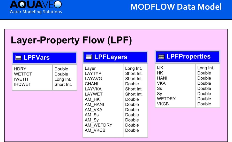
18 MODFLOW Data Model


19 MODFLOW Data Model
20 MODFLOW Analyst Tools Developed as geoprocessing (GP) tools Classes of tools Import Export Visualization/Map Layers Model editing Building package input Working with transient input/solutions


21 Import MODFLOW Model Tool INPUT OUTPUT

22 Make MODFLOW Features Tool + Or Cell2D Node2D INPUT OUTPUT

23 Geoprocessing Tools

24 Geoprocessing Tools - Workflows GP tools enable the development of workflows as models or scripts Extendable You can create your own workflows Leverage low-level tools to create new tools
25 Automated Well Permitting Calibrated regional model is imported to ArcGIS as a baseline model Candidate wells are added to baseline model using well package. Impact of new well is analyzed using MODFLOW and/or SEAWAT
 Area of Impact defined by drawdown = 1 ft Heads for layer")
26 Case Study #1 Virginia DEQ Virginia Coastal Plain Model (VCPM) 10-layer MODFLOW model used to analyze impacts of candidate wells Criteria based on state law Potentiometric surface cannot fall below a critical surface (80% drawdown) Area of Impact defined by drawdown = 1 ft Heads for layer 8

27 Well Permitting Workflow Create new well update well table export well package file run MODFLOW import solution build drawdown map layer
28 GIS Products
29 Utah Division of Water Rights 31 MODFLOW models used for impact analysis Challenges Modeling expertise Software installation and maintenance User error Cost


30 Server-Based Solution Geodatabase Model Files Server GIS Workflow Web Mapping UDWR Staff & Decision Makers
31 Web Interface
32 Static Model Data
33 Map Layers from UDWR Server

34 Table of Well Applications
35 Multiple options for identifying well location Well Locations

36 Submitting a Model Run
37 Model Results
38 Impact on Springs

39 PDF Output
40 Summary Key Points We can build web apps for systematic application of groundwater models Web apps result in Lower cost Greater access Fewer errors Since every model is different, app must be customized for each implementation Library of ArcGIS/AHGW geoprocessing tools provide the foundation for building apps in an economic fashion


41 Utah-Wyoming EPSCoR Track 2 Grant

42 Norm Jones, Jim Nelson, Gus Williams David Tarboton, Jeff Horsburgh, David Rosenberg Steven Corbato, Laura Hunter, Steve Burian, Christine Pomeroy, Courtenay Strong Fred Ogden, Craig Douglas, Kristi Hansen, Scott Miller, Ye Zhang, Gi-Hyeon Park, Ginger Paige, Robert Aylward

43 1. Enhance cyberinfrastructure facilities 2. Enhance access to data- and computationally-intensive modeling 3. Advance high-resolution multi-physics watershed modeling 4. Promote STEM learning and water science engagement

44 Goal is to provide and use these tools to enhance the capacity for water resource planning and management in the Utah-Wyoming region
45 Inputs Sub-region (aquifer, district, county, etc.) Date (or range of dates) Output Water level and/or drawdown maps

46


47 Sample Map Groundwater Surface Elevation Depth to Groundwater 500 ft. 0 ft.

48

49 Gridded Surface/Subsurface Hydrologic Analysis (GSSHA)


50 Library (API) for building web interfaces to scripted modeling workflows and for visualizing archived model solutions


51 Snowmelt Burned regions Urban flooding Levee breach Storm surge
 http://www.aquaveo.com/archydro (Info on tools) http://www.")
52 Thank You Norm Jones (AHGW Wiki page) (Info on tools) (NSF project)
Can GIS Help You Manage Water Resources? Erika Boghici Texas Natural Resources Information Systems
 Can GIS Help You Manage Water Resources? Erika Boghici Texas Natural Resources Information Systems Hydrologic Information System Hydrologic Modeling Arc Hydro Geodatabase Arc Hydro Data Model: combination
Tethys: A Software Framework for Web-Based Modeling and Decision Support Applications
 International Environmental Modelling and Software Society (iemss) 7th Intl. Congress on Env. Modelling and Software, San Diego, CA, USA Daniel P. Ames, Nigel W.T. Quinn and Andrea E. Rizzoli (Eds.) http://www.iemss.org/society/index.php/iemss-2014-proceedings
GIS Initiative: Developing an atmospheric data model for GIS. Olga Wilhelmi (ESIG), Jennifer Boehnert (RAP/ESIG) and Terri Betancourt (RAP)
, Jennifer Boehnert (RAP/ESIG) and Terri Betancourt (RAP)") GIS Initiative: Developing an atmospheric data model for GIS Olga Wilhelmi (ESIG), Jennifer Boehnert (RAP/ESIG) and Terri Betancourt (RAP) Unidata seminar August 30, 2004 Presentation Outline Overview
GIS Initiative: Developing an atmospheric data model for GIS Olga Wilhelmi (ESIG), Jennifer Boehnert (RAP/ESIG) and Terri Betancourt (RAP) Unidata seminar August 30, 2004 Presentation Outline Overview
Converting GIS Datasets into CAD Format
 Ball State University Libraries GIS Research and Map Collection Converting GIS Datasets into CAD Format Author: Angela Gibson, 6/13/2014 Overview: One of the most common requests from students is for GIS
ESRI Technical Certification Overview. Amy Daniels Instructor, Greenville Tech
 ESRI Technical Certification Overview Amy Daniels Instructor, Greenville Tech Why have certification by ESRI? It communicates your proficiency in ESRI software Similar to Microsoft Certification, it can
SCIENCE-BASED GIS SOLUTIONS. www.earthanalytic.com
 SCIENCE-BASED GIS SOLUTIONS www.earthanalytic.com Pipeline Routing, Site Selection, Cost Estimation and Risk Management Tools for Energy SmartFootprint is an extension to ArcGIS designed to assist planning,
The Courses. Covering complete breadth of GIS technology from ESRI including ArcGIS, ArcGIS Server and ArcGIS Engine.
 ESRI India: Corporate profile ESRI India A profile India s Premier GIS Company Strategic alliance between ESRI Inc. and NIIT Technologies Adjudged as India s Best GIS Solutions Company - Map India 2001
Network Analysis with Python. Deelesh Mandloi
 Deelesh Mandloi Slides and code samples from this demo theater http://esriurl.com/uc15nawpy Topics ArcGIS Network Analyst extension and concepts Network analysis using ArcGIS Online Network analysis using
A Method Using ArcMap to Create a Hydrologically conditioned Digital Elevation Model
 A Method Using ArcMap to Create a Hydrologically conditioned Digital Elevation Model High resolution topography derived from LiDAR data is becoming more readily available. This new data source of topography
Remote Sensing, GPS and GIS Technique to Produce a Bathymetric Map
 Remote Sensing, GPS and GIS Technique to Produce a Bathymetric Map Mark Schnur EES 5053 Remote Sensing Fall 2007 University of Texas at San Antonio, Department of Earth and Environmental Science, San Antonio,
Using ArcGIS ModelBuilder to batch process files
 The ArcGIS Model Builder is a tool you can use to help process a large number of files in an automated fashion. To open a new ModelBuilder document, either choose ModelBuilder from the Geoprocessing menu,
Embracing ArcGIS for Local Government. Robert Parsons Delaware County, Ohio Auditor s Office Steve Koenig Bruce Harris & Associates
 Embracing ArcGIS for Local Government Robert Parsons Delaware County, Ohio Auditor s Office Steve Koenig Bruce Harris & Associates Background Project began in April 2013 At that time ArcIMS 9.2 was the
A GIS helps you answer questions and solve problems by looking at your data in a way that is quickly understood and easily shared.
 A Geographic Information System (GIS) integrates hardware, software, and data for capturing, managing, analyzing, and displaying all forms of geographically referenced information. GIS allows us to view,
How To Write An Nccwsc/Csc Data Management Plan
 Guidance and Requirements for NCCWSC/CSC Plans (Required for NCCWSC and CSC Proposals and Funded Projects) Prepared by the CSC/NCCWSC Working Group Emily Fort, Data and IT Manager for the National Climate
INTRODUCTION TO ARCGIS SOFTWARE
 INTRODUCTION TO ARCGIS SOFTWARE I. History of Software Development a. Developer ESRI - Environmental Systems Research Institute, Inc., in 1969 as a privately held consulting firm that specialized in landuse
Note: Hands On workshops are Bring Your Own Laptop (BYOL), unless otherwise noted. Some workshops are Bring Your Own Mobile Device(BYOD).
, unless otherwise noted. Some workshops are Bring Your Own Mobile Device(BYOD).") 2015 MN GIS/LIS Consortium Pre Conference Workshops The Minnesota GIS/LIS Consortium is pleased to offer a diverse list of workshops on Wednesday, October 7th, 2015 at the DECC, Duluth, Minnesota Charting
2015 MN GIS/LIS Consortium Pre Conference Workshops The Minnesota GIS/LIS Consortium is pleased to offer a diverse list of workshops on Wednesday, October 7th, 2015 at the DECC, Duluth, Minnesota Charting
WATER QUALITY DATA MANAGEMENT DATABASE. Rushit Hila. A project submitted to the faculty of. Brigham Young University.
 WATER QUALITY DATA MANAGEMENT DATABASE by Rushit Hila A project submitted to the faculty of Brigham Young University in partial fulfillment of the requirements for the degree of Master of Science Department
James R. Williams, Nebraska Department of Natural Resources Frank Aebly, University of Nebraska at Lincoln
 Getting it Done- Project Management, Documentation, and Delivery James R. Williams, Nebraska Department of Natural Resources Frank Aebly, University of Nebraska at Lincoln Introduction The Nebraska Department
Project Title: Project PI(s) (who is doing the work; contact Project Coordinator (contact information): information):
 (who is doing the work; contact Project Coordinator (contact information): information):") Project Title: Great Northern Landscape Conservation Cooperative Geospatial Data Portal Extension: Implementing a GNLCC Spatial Toolkit and Phenology Server Project PI(s) (who is doing the work; contact
Project Title: Great Northern Landscape Conservation Cooperative Geospatial Data Portal Extension: Implementing a GNLCC Spatial Toolkit and Phenology Server Project PI(s) (who is doing the work; contact
Intro to Web App Builder. Mark Scott, Solutions Engineer, Esri County Government Team mscott@esri.com
 Intro to Web App Builder Mark Scott, Solutions Engineer, Esri County Government Team mscott@esri.com The ArcGIS Platform enables Web GIS Enabling GIS Everywhere Desktop Web Device Simple Integrated Open
Introducing the Open Source CUAHSI Hydrologic Information System Desktop Application (HIS Desktop)
") 18 th World IMACS / MODSIM Congress, Cairns, Australia 13-17 July 2009 http://mssanz.org.au/modsim09 Introducing the Open Source CUAHSI Hydrologic Information System Desktop Application (HIS Desktop) Ames,
18 th World IMACS / MODSIM Congress, Cairns, Australia 13-17 July 2009 http://mssanz.org.au/modsim09 Introducing the Open Source CUAHSI Hydrologic Information System Desktop Application (HIS Desktop) Ames,
Integrated Modeling and Data Management for Complex Stormwater Management Systems
 Integrated Modeling and Data Management for Complex Stormwater Management Systems Peter J. Singhofen Streamline Technologies, Inc. Photo Source: SWFWMD What is Meant by Integrated? Numerical Integration?
Mapping Mashup/Data Integration Development Resources Teaching with Google Earth and Google Ocean Stone Lab August 13, 2010
 Mapping Mashup/Data Integration Development Resources Teaching with Google Earth and Google Ocean Stone Lab August 13, 2010 David Hart GIS Specialist University of Wisconsin Sea Grant Institute Virtual
Data Integration for ArcGIS Users Data Interoperability. Charmel Menzel, ESRI Don Murray, Safe Software
 Data Integration for ArcGIS Users Data Interoperability Charmel Menzel, ESRI Don Murray, Safe Software Product overview Extension to ArcGIS (optional) Jointly developed with Safe Software Based on Feature
NatureServe s Environmental Review Tool
 NatureServe s Environmental Review Tool A Repeatable Online Software Solution for Agencies For More Information, Contact: Lori Scott Rob Solomon lori_scott@natureserve.org rob_solomon@natureserve.org 703-908-1877
GIS Databases With focused on ArcSDE
 Linköpings universitet / IDA / Div. for human-centered systems GIS Databases With focused on ArcSDE Imad Abugessaisa g-imaab@ida.liu.se 20071004 1 GIS and SDBMS Geographical data is spatial data whose
What is GIS. What is GIS? University of Tsukuba. What do you image of GIS? Copyright(C) ESRI Japan Corporation. All rights reserved.
 ESRI Japan Corporation. All rights reserved.") What is GIS University of Tsukuba Graduate School of Life and Environmental Science April 21 st, 2011 What is GIS? What do you image of GIS? Gas Insulated Switch Groupe Interventional Speciale Geographic
What is GIS University of Tsukuba Graduate School of Life and Environmental Science April 21 st, 2011 What is GIS? What do you image of GIS? Gas Insulated Switch Groupe Interventional Speciale Geographic
PART 1. Representations of atmospheric phenomena
 PART 1 Representations of atmospheric phenomena Atmospheric data meet all of the criteria for big data : they are large (high volume), generated or captured frequently (high velocity), and represent a
ArcGIS. Server. A Complete and Integrated Server GIS
 ArcGIS Server A Complete and Integrated Server GIS ArcGIS Server A Complete and Integrated Server GIS ArcGIS Server enables you to distribute maps, models, and tools to others within your organization
ATTACHMENT 8: Quality Assurance Hydrogeologic Characterization of the Eastern Turlock Subbasin
 ATTACHMENT 8: Quality Assurance Hydrogeologic Characterization of the Eastern Turlock Subbasin Quality assurance and quality control (QA/QC) policies and procedures will ensure that the technical services
An Esri White Paper August 2010 Product Library in Esri Aeronautical Solution: Enabling Seamless Product, Data, and Document Management
 An Esri White Paper August 2010 Product Library in Esri Aeronautical Solution: Enabling Seamless Product, Data, and Document Management Esri, 380 New York St., Redlands, CA 92373-8100 USA TEL 909-793-2853
GIS. Digital Humanities Boot Camp Series
 GIS Digital Humanities Boot Camp Series GIS Fundamentals GIS Fundamentals Definition of GIS A geographic information system (GIS) is used to describe and characterize spatial data for the purpose of visualizing
ArcGIS Pro. James Tedrick, Esri
 ArcGIS Pro James Tedrick, Esri What you already know Why ArcGIS PRO? Vision The next generation ArcGIS desktop application for the GIS community who need a clean and comprehensive user experience which
Building and Deploying Web Applications
 Building and Deploying Web Applications Dal Hunter and Jeff Shaner Friday, Nov 6 10:30-12:00 Agenda Product overview Web AppBuilder for ArcGIS tour What s New July 2015 ArcGIS Online update Customization
Create a folder on your network drive called DEM. This is where data for the first part of this lesson will be stored.
 In this lesson you will create a Digital Elevation Model (DEM). A DEM is a gridded array of elevations. In its raw form it is an ASCII, or text, file. First, you will interpolate elevations on a topographic
Risk Analysis, GIS and Arc Schematics: California Delta Levees
 Page 1 of 7 Author: David T. Hansen Risk Analysis, GIS and Arc Schematics: California Delta Levees Presented by David T. Hansen at the ESRI User Conference, 2008, San Diego California, August 6, 2008 Abstract
Leveraging Cloud-Based Mapping Solutions
 Leveraging Cloud-Based Mapping Solutions GeoAlberta October 28, 2014 Laura Kerssens Safe Software Agenda To the Cloud Using Basic Services Cloud Applications Web Services Cloud-Hosted Databases Real-time
HydroDesktop Overview
 HydroDesktop Overview 1. Initial Objectives HydroDesktop (formerly referred to as HIS Desktop) is a new component of the HIS project intended to address the problem of how to obtain, organize and manage
University of Arkansas Libraries ArcGIS Desktop Tutorial. Section 4: Preparing Data for Analysis
 : Preparing Data for Analysis When a user acquires a particular data set of interest, it is rarely in the exact form that is needed during analysis. This tutorial describes how to change the data to make
Quality Assurance Reviews of Hydraulic Models Developed for the Central Valley Floodplain Evaluation and Delineation Program
 Quality Assurance Reviews of Hydraulic Models Developed for the Central Valley Floodplain Evaluation and Delineation Program Techniques Applied and Lessons Learned Seth Ahrens, P.E., CFM Selena Forman,
Mapping Mashup/Data Integration Development Resources
 Mapping Mashup/Data Integration Development Resources David Hart GIS Specialist University of Wisconsin Sea Grant Institute October 6, 2008 Virtual Globes A virtual globe is a 3D software model or representation
Working with Temporal Data
 Esri International User Conference San Diego, California Technical Workshops July 26 2012 Working with Temporal Data Aileen Buckley Mark Smithgall This technical workshop Visualizing temporal data recurring
SUMMER SCHOOL ON ADVANCES IN GIS
 SUMMER SCHOOL ON ADVANCES IN GIS Six Workshops Overview The workshop sequence at the UMD Center for Geospatial Information Science is designed to provide a comprehensive overview of current state-of-the-art
Using CAD Data in ArcGIS
 Esri International User Conference San Diego, California Technical Workshops July 27, 2012 Using CAD Data in ArcGIS Jeff Reinhart & Phil Sanchez Agenda Overview of ArcGIS CAD Support Using CAD Datasets
Cloud Nine: Developing an Entirely Cloud Based GIS, Asset Management and Work Order System
 Cloud Nine: Developing an Entirely Cloud Based GIS, Asset Management and Work Order System Corrie Bondar 1*, Mark Valentino 2 1 Freese and Nichols, Inc., Raleigh, North Carolina 2 Freese and Nichols, Inc.,
Automating the evaluation of flood damages
 (GSP) Management of Public Utilities / (IMFS) Mechanical Institute of Fluids and Solids Ecole Nationale de l Eau et de l Environnement de Strasbourg / Cemagref / CNRS / UdS Automating the evaluation of
INFORMATION SERVICES AZ--SM SMART ART
 AZ-SMART Arizona s Socioeconomic Modeling, Analysis and Reporting Tool Box COG/MPO Mini Conference June 22, 2007 Current Modeling Process Maricopa County Control Totals DES Demographic Model & Regional
Managing Lidar (and other point cloud) Data. Lindsay Weitz Cody Benkelman
 Data. Lindsay Weitz Cody Benkelman") (and other point cloud) Data Lindsay Weitz Cody Benkelman Presentation Context What is lidar, and how does it work? Not this presentation! What can you do with lidar in ArcGIS? What does Esri recommend
(and other point cloud) Data Lindsay Weitz Cody Benkelman Presentation Context What is lidar, and how does it work? Not this presentation! What can you do with lidar in ArcGIS? What does Esri recommend
North Dakota GIS Program Report To Governor Jack Dalrymple. July 1, 2011 June 30, 2012
 North Dakota GIS Program Report To Governor Jack Dalrymple July 1, 2011 June 30, 2012 Executive Order 2001-06: The committee shall issue a report to the Governor's office at the end of each fiscal year,
Building 3D PDFs to Visualize Geological Data
 PDFs to Visualize Geological Data Daniel W. Eungard and David A. Jeschke Digital Mapping Techniques 2015 Part 1: Subsurface geometry using Python and ArcScene David A. Jeschke Part 2: Building professional-quality
About As. In a team with the best. ESRI Bulgaria is the exclusive distributor of Esri Inc. for Bulgaria. Esri Inc.
 About As ESRI Bulgaria is an IT company, leader in the field of Geographic Information Systems (GIS) on the Bulgarian market. Offering the most advanced high-tech products, solutions and services, ESRI
Network Analysis with ArcGIS for Server
 Esri International User Conference San Diego, California Technical Workshops July 24, 2012 Network Analysis with ArcGIS for Server Deelesh Mandloi Dmitry Kudinov Introduction Who are we? - Network Analyst
J9.6 GIS TOOLS FOR VISUALIZATION AND ANALYSIS OF NEXRAD RADAR (WSR-88D) ARCHIVED DATA AT THE NATIONAL CLIMATIC DATA CENTER
 ARCHIVED DATA AT THE NATIONAL CLIMATIC DATA CENTER") J9.6 GIS TOOLS FOR VISUALIZATION AND ANALYSIS OF RADAR (WSR-88D) ARCHIVED DATA AT THE NATIONAL CLIMATIC DATA CENTER Steve Ansari * STG Incorporated, Asheville, North Carolina Stephen Del Greco NOAA National
J9.6 GIS TOOLS FOR VISUALIZATION AND ANALYSIS OF RADAR (WSR-88D) ARCHIVED DATA AT THE NATIONAL CLIMATIC DATA CENTER Steve Ansari * STG Incorporated, Asheville, North Carolina Stephen Del Greco NOAA National
The following was presented at DMT 14 (June 1-4, 2014, Newark, DE).
.") DMT 2014 The following was presented at DMT 14 (June 1-4, 2014, Newark, DE). The contents are provisional and will be superseded by a paper in the DMT 14 Proceedings. See also presentations and Proceedings
DMT 2014 The following was presented at DMT 14 (June 1-4, 2014, Newark, DE). The contents are provisional and will be superseded by a paper in the DMT 14 Proceedings. See also presentations and Proceedings
Geodatabase Programming with SQL
 DevSummit DC February 11, 2015 Washington, DC Geodatabase Programming with SQL Craig Gillgrass Assumptions Basic knowledge of SQL and relational databases Basic knowledge of the Geodatabase We ll hold
How To Use Hadoop For Gis
 2013 Esri International User Conference July 8 12, 2013 San Diego, California Technical Workshop Big Data: Using ArcGIS with Apache Hadoop David Kaiser Erik Hoel Offering 1330 Esri UC2013. Technical Workshop.
Supporting High-Quality Printing in Web Applications with ArcGIS for Server
 2013 Esri International User Conference July 8 12, 2013 San Diego, California Technical Workshop Supporting High-Quality Printing in Web Applications with ArcGIS for Server Craig Williams Tanu Hoque Esri
BPM vs. SharePoint: Which is Right for Your Business
 Gain a high level comparison between Business Process Management (BPM) platforms and SharePoint to better establish the proper software fit for your enterprise. BPM solutions and SharePoint are often viewed
Automating Data Management and Sharing within a Large-Scale, Heterogeneous Sensor Network
 International Environmental Modelling and Software Society (iemss) 7th Intl. Congress on Env. Modelling and Software, San Diego, CA, USA, Daniel P. Ames, Nigel W.T. Quinn and Andrea E. Rizzoli (Eds.) http://www.iemss.org/society/index.php/iemss-2014-proceedings
Bentley ArcGIS. Connector
 Bentley ArcGIS Connector Introduction ESRI, as a GIS software products company, and Bentley Systems, Incorporated, as a developer of solutions for architecture/engineering/construction (AEC) professionals,
NetCDF and HDF Data in ArcGIS
 2013 Esri International User Conference July 8 12, 2013 San Diego, California Technical Workshop NetCDF and HDF Data in ArcGIS Nawajish Noman Kevin Butler Esri UC2013. Technical Workshop. Outline NetCDF
An Esri White Paper October 2010 Esri Production Mapping Product Library: Spatially Enabled Document Management System
 An Esri White Paper October 2010 Esri Production Mapping Product Library: Spatially Enabled Document Management System Esri, 380 New York St., Redlands, CA 92373-8100 USA TEL 909-793-2853 FAX 909-793-5953
WHAT IS GIS - AN INRODUCTION
 WHAT IS GIS - AN INRODUCTION GIS DEFINITION GIS is an acronym for: Geographic Information Systems Geographic This term is used because GIS tend to deal primarily with geographic or spatial features. Information
Managing Bathymetry in the Cloud with GIS
 Esri Maritime Professional Services GEBCO Science Day Tuesday, October 4, 2011 Managing Bathymetry in the Cloud with GIS Timothy Kearns & Beata Van Esch Overview The challenges of bathymetry in GIS - What
Managing sewer flood risk
 Managing sewer flood risk J. Ryu 1 *, D. Butler 2 1 Environmental and Water Resource Engineering, Department of Civil and Environmental Engineering, Imperial College, London, SW7 2AZ, UK 2 Centre for Water
A web system for display and analysis of real-time monitoring observations of small urbanized catchments in Lahti, Finland
 A web system for display and analysis of real-time monitoring observations of small urbanized catchments in Lahti, Finland Jiří Kadlec 1, Juhani Jarveläinen 1 1 Aalto University, Niemenkatu 73, 15140 Lahti,
Enterprise GIS Solutions to GIS Data Dissemination
 Enterprise GIS Solutions to GIS Data Dissemination ESRI International User Conference July 13 17, 2009 Wendy M. Turner Senior GIS Engineer & Program Manager Freedom Consulting Group, LLC Building the Enterprise
Leveraging Geospatial Web Platforms to Advance the Organization
 Leveraging Geospatial Web Platforms to Advance the Organization PSSG-Transforming Information into Insight PRESENTED BY: Kevin Willis, Supervisory Geographer, MBA, GISP, PMP, SSGB ESRI International Users
Scott Moore, Esri April 4, 2016 2016 Intermountain, Great Falls, MT
 Create Great Web Apps No Coding Required Scott Moore, Esri April 4, 2016 2016 Intermountain, Great Falls, MT Agenda Product overview Web AppBuilder for ArcGIS tour What s New November 2015 ArcGIS Online
The Use of Geographic Information Systems in Risk Assessment
 The Use of Geographic Information Systems in Risk Assessment With Specific Focus on the RiVAMP Methodology Presented by Nadine Brown August 27, 2012 Climate Studies Group Mona Climate Change Workshop Presentation
Guidelines for the use of the OGP P6/11 bin grid GIS data model
 Guidelines for the use of the OGP P6/11 bin grid GIS data model Report No. 483-6g July 2013 This document is a companion document to the OGP P6/11 Seismic bin grid data exchange format description (2012)
GIS APPLICATIONS IN URBAN DRAINAGE MASTER PLANNING. Robert J. Muir *
 GIS APPLICATIONS IN URBAN DRAINAGE MASTER PLANNING Robert J. Muir * ABSTRACT: In recent years, GIS applications in water resources management have become widespread and diverse in the Province of Ontario,
Implementing ArcGIS for SharePoint Habitat for Humanity of Omaha April, 2013
 Ingenuity Innovation Integrity Implementing ArcGIS for SharePoint Habitat for Humanity of Omaha April, 2013 1851 Alexander Bell Drive Suite 350 Reston, VA 20191 703.463.2059 800.483.2434 www.vistronix.com
Chapter 1: Introduction to ArcGIS Server
 Chapter 1: Introduction to ArcGIS Server At a high level you can think of ArcGIS Server as software that helps you take your geographic information and make it available to others. This data can be distributed
Environmental Data Management Programs
 Hydrologic Engineering Centre (HEC) Software CD Collection of programs, developed by the U.S. Army Corps of Engineers Environmental Data Management Programs Name: HEC-DSS Package Purpose: Data Storage
13/10/2011. Data Integration and Interoperability. Gordon Sumerling & Maree Wilson
 Data Integration and Interoperability Gordon Sumerling & Maree Wilson 1 Agenda Seamless integration between GIS and CAD CAD Support in ArcGIS Using GIS Data in CAD Editing GIS Data in CAD Introduction
Esri Training Apply what you learn to your job now
 Esri Training Apply what you learn to your job now January 2014 Instructor-Led Courses Esri Course Catalog Dear Colleague: The latest release of ArcGIS transforms how geographic information will be accessed
Image source: www.rivers.gov. Visual Data Analytics, LLC
 AWRA Spring Specialty AWRA Conference Spring Specialty on GIS Conference and Water on Resources GIS and Water VIII Resources May 13, 2014 Using a Temporal Information System for Visualization and Analysis
Lecture 8. Online GIS
 Lecture 8 Online GIS Lecture 8: Outline I. Online GIS 1. Google Earth 2. MSN Live Maps II. Open Source GIS III. ArcGIS Server and the ESRI suite of online software utility options IV. Advanced Data Mining
Guidance for Flood Risk Analysis and Mapping. Changes Since Last FIRM
 Guidance for Flood Risk Analysis and Mapping Changes Since Last FIRM May 2014 This guidance document supports effective and efficient implementation of flood risk analysis and mapping standards codified
Development of 3D Cadastre System to Monitor Land Value and Capacity of Zoning (Case study: Tehran)
") 8 th International Congress on Advances in Civil Engineering, 15-17 September 2008 Eastern Mediterranean University, Famagusta, North Cyprus Development of 3D Cadastre System to Monitor Land Value and
8 th International Congress on Advances in Civil Engineering, 15-17 September 2008 Eastern Mediterranean University, Famagusta, North Cyprus Development of 3D Cadastre System to Monitor Land Value and
Enabling High-Quality Printing in Web Applications with ArcGIS for Server. Craig Williams - @williamscraigm Scott Moore - @ScottMooreInOly
 Enabling High-Quality Printing in Web Applications with ArcGIS for Server Craig Williams - @williamscraigm Scott Moore - @ScottMooreInOly High Quality Printing on the Web Primary Goals: - Create a printable
1. Abstract. 2. The Problem / Need for the Program
 Program Information: Montgomery County, Maryland Program Title: Integration of GIS Web Services with the 311 Call Center Program Category: # 14 Information Technology 1. Abstract Montgomery County s Department
The development of a flood damage assessment tool for urban areas
 The development of a flood damage assessment tool for urban areas Michael Hammond, A. S. Chen, S. Djordjević, D. Butler, D. M. Khan, S. M. M. Rahman, A. K. E. Haque, O. Mark Urban Drainage Modelling Conference,
Introduction to Web AppBuilder for ArcGIS: JavaScript Apps Made Easy
 Introduction to Web AppBuilder for ArcGIS: JavaScript Apps Made Easy OKSCAUG Pamela Kersh September 22, 2015 The ArcGIS Platform enables Web GIS Enabling GIS Everywhere Desktop Web Device Simple Integrated
Geoprocessing Tools for Surface and Basement Flooding Analysis in SWMM
 3 Geoprocessing Tools for Surface and Basement Flooding Analysis in SWMM Eric White, James Knighton, Gary Martens, Matthew Plourde and Rajesh Rajan A geoprocessing routine was used for the development
Introduction to GIS. http://libguides.mit.edu/gis
 Introduction to GIS http://libguides.mit.edu/gis 1 Overview What is GIS? Types of Data and Projections What can I do with GIS? Data Sources and Formats Software Data Management Tips 2 What is GIS? 3 Characteristics
Managing Imagery and Raster Data in ArcGIS
 Technical Workshops Managing Imagery and Raster Data in ArcGIS Hong Xu, Sangeet Mathew, Mark Harris Presentation Overview ArcGIS raster data models Which model to use Mosaic dataset storage and properties
4. Right click grid ( ) and select New MODFLOW, then select Packages, enabling both the optional Well and Recharge option.
 and select New MODFLOW, then select Packages, enabling both the optional Well and Recharge option.") Groundwater Hydrology CE 40460 Example 1 -- Grid Approach Building a grid is the first step in creating a groundwater model using GMS, and it requires the following components: top and bottom elevations,
Groundwater Hydrology CE 40460 Example 1 -- Grid Approach Building a grid is the first step in creating a groundwater model using GMS, and it requires the following components: top and bottom elevations,
Introduction to Imagery and Raster Data in ArcGIS
 Esri International User Conference San Diego, California Technical Workshops July 25, 2012 Introduction to Imagery and Raster Data in ArcGIS Simon Woo slides Cody Benkelman - demos Overview of Presentation
Building & Developing the Environmental
 Building & Developing the Environmental Web Explorer for Riyadh City Authors: Engineer Yousef Bin Othman Al-Fariheedi Manager of Environmental Data Unit Environmental Management and Protection Department
Data access and management
 B Data access and management CONTENTS B.1 Introduction... B-1 B.2 Data requirements and availability... B-1 B.3 Data access... B-2 B.4 Overall procedures... B-2 B.5 Data tools and management... B-4 Appendix
GeoManitoba Spatial Data Infrastructure Update. Presented by: Jim Aberdeen Shawn Cruise
 GeoManitoba Spatial Data Infrastructure Update Presented by: Jim Aberdeen Shawn Cruise Organization Overview Manitoba Innovation Energy and Mines Business Transformation and Technology (BTT) Application
Minnesota State Plan Review Level 2 Hazus-MH 2.1 County Model for Flooding Dakota County Evaluation
 Overview Minnesota State Plan Review Level 2 Hazus-MH 2.1 County Model for Flooding Dakota County Evaluation Minnesota Homeland Security and Emergency Management (HSEM) is responsible for supporting activities
What is GIS? Geographic Information Systems. Introduction to ArcGIS. GIS Maps Contain Layers. What Can You Do With GIS? Layers Can Contain Features
 What is GIS? Geographic Information Systems Introduction to ArcGIS A database system in which the organizing principle is explicitly SPATIAL For CPSC 178 Visualization: Data, Pixels, and Ideas. What Can
How To Hydrologically Condition A Digital Dam
 Program: Funding: Conservation Applications of LiDAR Data http://tsp.umn.edu/lidar Environment and Natural Resources Trust Fund Module: Instructor: Hydrologic Applications Sean Vaughn, DNR GIS Hydrologist
Scientific Data Management and Dissemination
 Federal GIS Conference February 9 10, 2015 Washington, DC Scientific Data Management and Dissemination John Fry Solution Engineer, Esri jfry@esri.com Agenda Background of Scientific Data Management through
Advanced Image Management using the Mosaic Dataset
 Esri International User Conference San Diego, California Technical Workshops July 25, 2012 Advanced Image Management using the Mosaic Dataset Vinay Viswambharan, Mike Muller Agenda ArcGIS Image Management
Esri Training. Prepare to Innovate. Instructor-Led Courses Course Catalog
 Esri Training Prepare to Innovate 2015 Esri Instructor-Led Courses Course Catalog Dear Colleague: The latest release of ArcGIS transforms how geographic information will be accessed and managed by geographic
http://www.esri.com/bia
 ArcGIS for Tribal Transportation Management David Gadsden Federal Account Manager dgadsden@esri.com d d 1 David Gadsden GIS Background UW Geography (1995) Peace Corps Tanzania Environmental Social Science