ESRI Experience in the Use of GIS for Census Mapping Applications
|
|
|
- Brian Melton
- 10 years ago
- Views:
Transcription
 And Peter Kelly (Kelly + Kelly) kenna@kellyandkelly.co.")
1 United Nations Statistical Division Workshop on Census Mapping with GIS ESRI Experience in the Use of GIS for Census Mapping Applications Pieter van Jaarsveld (GIMS) And Peter Kelly (Kelly + Kelly) [email protected] (0977)
 kenna@kellyandkelly.co.")
2 ESRI Founded in 1969 (38 Years) Privately Owned Zero Debt Focused Strictly on Geographic Information Systems (GIS) Modern evolving technology (i.e. ArcGIS) Ranked as one of the Top Software Companies in the World Sustained 20%+ annual growth Clients of ESRI software 130+ countries use ESRI software Over 1 Million Users Globally

3 ESRI Distribution Network 50+ Distributor More than 1200 Sub-Distributors/ Business Partners

4 GIMS (Pty) Ltd ESRI Southern Africa Distributor Company Formed 1989 Authorised Distributor ESRI ERDAS Imagine Trimble (BP) GARMIN Sales Software Hardware (Plotters, GPS, scanners, etc) Training (7 ESRI Accredited Trainers) Instructor Led (11) Virtual Campus Mobile Training Center Application Support Professional Services 25% of Business in Africa

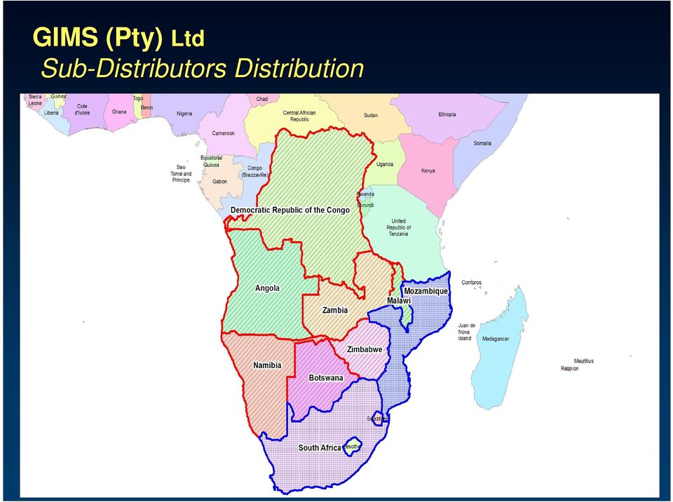
5 GIMS (Pty) Ltd Sub-Distributors Distribution
6 Kelly & Kelly Sub-Distributors Company Formed 2000 Authorised ESRI Sub- Distributors Sales Software Hardware (Plotters, GPS, scanners, etc) Consultancy Training (ESRI Accredited Trainer) Instructor Led Virtual Campus Application Support Professional Services 30% of Business Outside Zambia

7 Outline GIS Technology for Census Mapping Pre-Enumeration Data Design, Collection, and Preparation Enumeration Conducting the Census Post-Enumeration Data Analysis, Dissemination Presented with examples from work around the globe Useful tools for Census Mapping with GIS

8 Benefits of using GIS for Census Activities Benefits in both effectiveness and efficiency for: data creation/collection geodatabase development digital mapping data analysis web mapping GIS web services These include: productivity gain and time savings cost savings/cost avoidance greater credibility and authority of map products better service increased accuracy improved consistency income generation improved analysis improved policy-making improved data sharing improved outreach Source: United Nations, DESA - Statistical Division, Handbook on geographic information systems and digital mapping, 2000

9 Census Mapping GIS is the platform Collect Use Author Serve

10 Pre-Enumeration Data Design, Collection, and Preparation Data Design Census Data Models Development of Census Geographies Defining Enumeration Areas Coding Schemes

11 Census Model from ESRI Support Center


12 Geodatabase Development Scanning, georeferencing,, and vectorization of existing paper maps to develop digital datasets; Conversion of existing digital maps and datasets into the desired data structure; Updating of digital datasets since the last census activity to ensure that new settlements and roads are included and obsolete settlements are omitted from the enumeration activities; and/or Collection of aerial or satellite imagery followed by digital feature extraction and ground-truthing with GPS to ensure proper georeferencing of the images.

13 ArcGIS Desktop Authoring and Using Geographic Knowledge ArcInfo (Geoprocessing/Analysis) ArcEditor (Create/Manage) ArcView (Use) ArcReader (View) Common, Scalable Family of Products
 Common, Scalable Family of")
14 ArcScan for ArcGIS Automate the conversion of scanned paper maps to vector form Reduce the time and expense in creating GIS data Eliminate the tedious need to digitize the data by hand Easily clean up scanned maps

15 Districting for ArcGIS Updated for Version 9.2 of ArcGIS Desktop Create defined groupings of geographic data census tracts, districts, ZIP codes, and precincts by creating a districting plan Functionality Redraw political boundaries Set up sales territories Define voting, school, and fire districts Analyze population densities, housing breakdowns, income and race statistics

16 Local Update of Census Addresses (LUCA) A new extension for ArcGIS Built with CityGate GIS Part of the US Census Bureau s s LUCA program Replicates the task and technical functionality of the census Master Address File/Topologically Integrated Geographic Encoding and Referencing (MAF/TIGER) Partnership Software (MTPS) To be delivered later this year to 40,000 US local governments
 Partnership Software (MTPS) To be delivered later this year to 40,000 US local")
17 Images courtesy of David Rain, Ph.D., GWU Images courtesy of David Rain, Ph.D., GWU The Hashemite Kingdom of Jordan Department of Statistics (DOS)

18 1 Department of Statistics, Royal Hashemite Kingdom of Jordan, with cooperation from USAID Amman, ESRI, and InfoGraph - a Jordanian GIS firm 3 District boundaries of part of Amman city are converted to digital form using center lines on cadastral maps from the Jordan Land & Survey Department 2 Building numbers and land parcels from municipal government Source of street names

19 Hong Kong - Census and Statistical Department (CASD) Government of the Hong Kong Special Administrative Region of the People s s Republic of China Digital Mapping System (DMS) Updating the sampling frame linking the spatial data and textual records of buildings/structures ures to facilitate the updating process and delineating boundary segments, Allocation of assignments Itinerary planning Production of tailor-made and up-to to-date maps of good quality to support fieldwork operation Data compilation from several agencies: Lands Department Planning Department and the Census and Statistics Department

20 Enumeration Conducting the Census Perhaps the biggest new opportunity for census work in 2010 Enumerators enabled with Mobile Computing Devices that include GIS and GPS

21 US Bureau of the Census Using ArcPad mobile GIS platform Field Data Collection Automation (FDCA) project for the 2010 Decennial Census Harris Corporation selected by the U.S. Census Bureau FDCA program supports census field enumerators GPS-enabled mobile devices ESRI s ArcPad software selected performance, productivity, enterprise GIS integration, and customization options
22 ArcPad Perform reliable, accurate, and validated field data collection Integrate GPS, rangefinders, and digital cameras into GIS data collection Share enterprise data with field- workers for updating and decision making Improve the productivity of GIS data collection Improve the accuracy of the GIS database and make it more up to date
23 US - Census Bureau - Preparing for 2010 Census A paperless census?
24 US - Census Bureau - Preparing for 2010 Census Mobile Computing Devices (MCDs( MCDs) ) with GPS and ArcPad
25 Post-Enumeration Data Analysis Analysis of the results with Desktop GIS, such as ArcGIS Desktop products Development of maps for dissemination to the public Source: NOAA Coastal Services Center Community Vulnerability Assessment
26 Post-Enumeration Data Dissemination Web Mapping and GIS Services Web browsers Geovisualization applications Database and Mapping Application on CD Free, embeddable mapping application Free data viewer
27 ArcReader Free and Easy-to to-use Using ArcReader,, anyone can view high-quality maps created using the ArcGIS Publisher extension Key features: GIS Deployment Map Viewing and Navigation Data Query and Exploration Map Printing Configurable and Customizable
28 ArcGIS Server Deploying GIS for Integration Data and Analysis on the Server Visualization Desktop Thin Client Basic Standard Advanced GIS Server Workgroup or Enterprise Editions Geoprocessing Routing Tracking Data Management Mobile Web
29 ArcGIS Server Licensed by Functionality and Capacity More Affordable And Flexible Scaled by Capacity Work Group Enterprise Three Levels of Functionality Geoprocessing & Editing Mapping & Visualization Data Management Advanced Standard Basic
30 ArcGIS Explorer GeoBrowser for Geographic Information Visualization Mapping Integrates Multiple Services Analysis Tasks
31 Costa Rica INEC Map Distribution from Website Internal Migration of Population Percentage of Population with clean water
32 Costa Rica National Office for Census and Statistics (INEC)
33 US - Census Bureau

34 US - Census Bureau Cartographic Boundary Files
35 US - Census Bureau American Fact Finder Thematic Maps (Data) Reference Maps (Boundaries)
36 Japan - Statistics Bureau, Ministry of Internal Affairs and Communications Statistics GIS Plaza


37 Japan - Statistics Bureau, Ministry of Internal Affairs and Communications Area Selection Cadastral Map Graph Settings Graph and Map
38 Zambia Sensus data depicting the population density per area
39 Recommendations for the 2010 Round Consider appropriate GIS technology for each phase of the Census Mobile GIS Integrates with GPS Field data collection Geographic location verification Navigation Desktop GIS Data collection and preparation Automated raster-to to-vector conversion Imagery integration Development of enumeration areas Allocation of assignments Data analysis Strong cartographic tools Data Dissemination with free data viewers Server GIS Data dissemination Web map publishing GIS Services (geocoding( geocoding,, gazetteer, etc.) GeoVisualization tools
40 Recommendations for the 2010 Round Consider the benefits of using GIS and imagery in areas of complex geography Rural areas Informal settlements Adapt best practices to suit specific census requirements Partner with the private sector Builds the geospatial component of your local, knowledge economy Work jointly on coding efforts with telecom, postal service, etc. Value added solutions higher demand for census data
41 Literature related to Census Mapping ESRI Press: Unlocking the Census with GIS Mapping the Census 2000
42 Support GIS Day! GIS Day: November 14, 2007 An Opportunity to Share Your Knowledge
43 Let s s make sure that everyone counts!..and is counted! Source: World Resources Institute Source: Robert Ford, LLU
44 Thank you!
Advances in the Application of Geographic Information Systems (GIS) Carmelle J. Terborgh, Ph.D. ESRI Federal/Global Affairs
 Carmelle J. Terborgh, Ph.D. ESRI Federal/Global Affairs") Advances in the Application of Geographic Information Systems (GIS) Carmelle J. Terborgh, Ph.D. ESRI Federal/Global Affairs Highlights GIS in our World Advancements in GIS Visualization and Analysis Geographic
Advances in the Application of Geographic Information Systems (GIS) Carmelle J. Terborgh, Ph.D. ESRI Federal/Global Affairs Highlights GIS in our World Advancements in GIS Visualization and Analysis Geographic
About As. In a team with the best. ESRI Bulgaria is the exclusive distributor of Esri Inc. for Bulgaria. Esri Inc.
 About As ESRI Bulgaria is an IT company, leader in the field of Geographic Information Systems (GIS) on the Bulgarian market. Offering the most advanced high-tech products, solutions and services, ESRI
http://www.esri.com/bia
 ArcGIS for Tribal Transportation Management David Gadsden Federal Account Manager [email protected] d d 1 David Gadsden GIS Background UW Geography (1995) Peace Corps Tanzania Environmental Social Science
Mapping Mashup/Data Integration Development Resources Teaching with Google Earth and Google Ocean Stone Lab August 13, 2010
 Mapping Mashup/Data Integration Development Resources Teaching with Google Earth and Google Ocean Stone Lab August 13, 2010 David Hart GIS Specialist University of Wisconsin Sea Grant Institute Virtual
ArcGIS. Server. A Complete and Integrated Server GIS
 ArcGIS Server A Complete and Integrated Server GIS ArcGIS Server A Complete and Integrated Server GIS ArcGIS Server enables you to distribute maps, models, and tools to others within your organization
GEOGRAPHIC INFORMATION SYSTEMS
 GEOGRAPHIC INFORMATION SYSTEMS WHAT IS A GEOGRAPHIC INFORMATION SYSTEM? A geographic information system (GIS) is a computer-based tool for mapping and analyzing spatial data. GIS technology integrates
GIS. Digital Humanities Boot Camp Series
 GIS Digital Humanities Boot Camp Series GIS Fundamentals GIS Fundamentals Definition of GIS A geographic information system (GIS) is used to describe and characterize spatial data for the purpose of visualizing
GIS and Mapping Solutions for Developers. ESRI Developer Network (EDN SM)
") GIS and Mapping Solutions for Developers ESRI Developer Network (EDN SM) GIS and Mapping Solutions for Developers If you are a software developer looking for an effective way to bring geographic and mapping
GIS and Mapping Solutions for Developers ESRI Developer Network (EDN SM) GIS and Mapping Solutions for Developers If you are a software developer looking for an effective way to bring geographic and mapping
Mapping Mashup/Data Integration Development Resources
 Mapping Mashup/Data Integration Development Resources David Hart GIS Specialist University of Wisconsin Sea Grant Institute October 6, 2008 Virtual Globes A virtual globe is a 3D software model or representation
Business Analyst Server
 ESRI Business Analyst Server The GIS and Data Solution for Enterprise Business Analysis The Geographic Advantage Challenge To fully understand how Business Analyst Server enables collaboration by helping
A GIS helps you answer questions and solve problems by looking at your data in a way that is quickly understood and easily shared.
 A Geographic Information System (GIS) integrates hardware, software, and data for capturing, managing, analyzing, and displaying all forms of geographically referenced information. GIS allows us to view,
GIS Architecture and Data Management Practices Boone County GIS Created and Maintained by the Boone County Planning Commission GIS Services Division
 GIS Architecture and Data Management Practices Boone County GIS Created and Maintained by the Boone County Planning Commission June 2008 Background Boone County s GIS program has been in existence for
Making Your Mobile Workforce More Efficient
 ArcGIS for Mobile Making Your Mobile Workforce More Efficient What Is Mobile GIS? Mobile geographic information system (GIS) technology extends GIS beyond the office and allows organizations to make accurate,
Data Fusion Centers. Transforming Public Safety Information into Actionable Knowledge
 Data Fusion Centers Transforming Public Safety Information into Actionable Knowledge Defining Geospatial Data Fusion Homeland security relies on fusion the ability to capture and analyze data from multiple
GIS and Census Mapping in St. Lucia
 GIS and Census Mapping in St. Lucia Presented by: Sherma Lawrence Central Statistics Office, St. Lucia Table of Contents Introduction... 1 Background... 2 GIS Software... 3 ED Development... 5 ED Development
Implementing an Imagery Management System at Mexican Navy
 Implementing an Imagery Management System at Mexican Navy The Mexican Navy safeguards 11,000 kilometers of Mexican coastlines, inland water bodies suitable for navigation, and the territorial sea and maritime
ACTIVITY & LOCATION BASED ANALYTICS APPLICATIONS
 ACTIVITY & LOCATION BASED ANALYTICS APPLICATIONS SEAMLESS, REAL TIME MERGING OF GIS AND ERP SYSTEMS ALLOWING THE VISUALIZATION OF RELATIONSHIPS, CONNECTIONS AND PATTERNS IN THE DATA FOR INTELLIGENT, INFORMED
ESRI Business Analyst for Telecommunications
 ESRI Business Analyst for Telecommunications GIS Market Analysis Package Drive Business Results with ESRI Business Analyst ESRI Business Analyst helps you Analyze your competition: Track customer churn.
An Esri White Paper June 2011 ArcGIS for INSPIRE
 An Esri White Paper June 2011 ArcGIS for INSPIRE Esri, 380 New York St., Redlands, CA 92373-8100 USA TEL 909-793-2853 FAX 909-793-5953 E-MAIL [email protected] WEB esri.com Copyright 2011 Esri All rights reserved.
Kingdom Of Bahrain Ministry of Works. Enterprise Asset Management System A Geocentric Approach. Presented By Hisham Y.
 Kingdom Of Bahrain Ministry of Works Enterprise Asset Management System A Geocentric Approach Presented By Hisham Y. Sater April 2012 Ministry Of Works Bahrain MOW The construction arm of the Kingdom of
The Courses. Covering complete breadth of GIS technology from ESRI including ArcGIS, ArcGIS Server and ArcGIS Engine.
 ESRI India: Corporate profile ESRI India A profile India s Premier GIS Company Strategic alliance between ESRI Inc. and NIIT Technologies Adjudged as India s Best GIS Solutions Company - Map India 2001
Making Your Mobile Workforce More Efficient
 ArcGIS for Mobile Making Your Mobile Workforce More Efficient What Is Mobile GIS? Mobile geographic information system (GIS) technology extends GIS beyond the office and allows organizations to make accurate,
Statement of Qualifications
 Statement of Qualifications Prepared By: JAYA Corporation 4900 University Square, Suite 30 Huntsville, AL 35816 TEL: (256) 722-0700 FAX: (256) 722-0711 EMAIL: igis@jaya corp.com Small Disadvantaged Business,
ESRI Mobile GIS Solutions Overview. Shane Clarke ESRI
 ESRI Mobile GIS Solutions Overview Shane Clarke ESRI Agenda Overview of mobile GIS ESRI mobile GIS Solutions Selecting a mobile GIS solution Q & A 2 Mobile GIS Overview 3 What is mobile GIS? Extension
City of Memphis Purchase of Data Migration Services
 Addendum #1 Date: June 15, 2016 TO ALL POTENTIAL BIDDERS: Science Applications International Corporation ( SAIC ) Request for Proposal (RFP) City of Memphis Purchase of Data Migration Services RFP # SAIC
Benefits of Mobile GIS for Public Works
 Benefits of Mobile GIS for Public Works Freese and Nichols, Inc. NCAFPM 2013 Agenda General GIS Concepts Mobile GIS Overview Benefits of Mobile GIS Mobile GIS Project Examples Questions What is GIS? Geographic
Constructing an EA-level Database. for the Census
 Constructing an EA-level Database for the Census Amor Laaribi UN-GGIM Secretariat UN Statistics Division New York 1 Overview Stages in the Geographic Database Development Sources of geographic information
Database Production and Map Series Management. Using. The Production Line Tool Set
 Database Production and Map Series Management Using The Production Line Tool Set Dewey Marino - ESRI Redlands Production Line Tool Set ArcGIS Solution for high volume database and map creation Creates
Mount Laurel Township MUA Hydrant Maintenance Program. Using ArcPad to Track Hydrant Flow Testing and Flushing procedures
 Mount Laurel Township MUA Hydrant Maintenance Program Using ArcPad to Track Hydrant Flow Testing and Flushing procedures What is the Mount Laurel MUA? The Mount Laurel Township, Municipal Utilities Authority
Challenges and Success of Migrating to an Enterprise Database in York County, PA
 Challenges and Success of Migrating to an Enterprise Database in York County, PA PA GIS Conference June 16, 2015 Wade Gobrecht York County Planning Commission Andrew Ross GeographIT Source: Can You Draw
An ESRI White Paper December 2007 Enterprise GIS for Local Government
 An ESRI White Paper December 2007 Enterprise GIS for Local Government ESRI 380 New York St., Redlands, CA 92373-8100 USA TEL 909-793-2853 FAX 909-793-5953 E-MAIL [email protected] WEB www.esri.com Copyright
Branch of Geospatial Support. GEOSPATIAL TRAINING SCHEDULE APRIL 2015 SEPTEMBER 2015 Version: 27 APRIL 2015
 UNITED STATES DEPARTMENT OF THE INTERIOR BUREAU OF INDIAN AFFAIRS Office of Trust Services Division of Land Titles and Records Branch of Geospatial Support 13922 Denver West Parkway, Building 54, Suite
The Use of Geographic Information Systems in Risk Assessment
 The Use of Geographic Information Systems in Risk Assessment With Specific Focus on the RiVAMP Methodology Presented by Nadine Brown August 27, 2012 Climate Studies Group Mona Climate Change Workshop Presentation
Web and Mobile GIS Applications Development
 Web and Mobile GIS Applications Development Presented by : Aamir Ali Manager Section Head (GIS Software Customization) Pakistan Space and Upper Atmosphere Research Commission (SUPARCO) Geographical Information
Qatar National Geospatial Infrastructure
 Qatar National Geospatial Infrastructure Since 1990 up to 2030 and beyond Mohammad Abd El-Wahab Hamouda GIS Consultant & Chairman of GIS Coordinators Group The Center for GIS Ministry of Municipality and
Wildland Fire. GIS Solutions for Wildland Fire Suppression
 Wildland Fire GIS Solutions for Wildland Fire Suppression Applying GIS Technology to Wildland Fire Fire Decision Support Tools When it comes to wildfire protection local, state, and federal agencies must
INDIVIDUAL COURSE DETAILS
 INDIVIDUAL COURSE DETAILS A. Name of Institution NATIONAL INSTITUTE OF TECHNICAL TEACHERS TRAINING AND RESEARCH TARAMANI CHENNAI 600 113 [An Autonomous Institute under Ministry of Human Resource Development,
Advanced Image Management using the Mosaic Dataset
 Esri International User Conference San Diego, California Technical Workshops July 25, 2012 Advanced Image Management using the Mosaic Dataset Vinay Viswambharan, Mike Muller Agenda ArcGIS Image Management
What is GIS. What is GIS? University of Tsukuba. What do you image of GIS? Copyright(C) ESRI Japan Corporation. All rights reserved.
 ESRI Japan Corporation. All rights reserved.") What is GIS University of Tsukuba Graduate School of Life and Environmental Science April 21 st, 2011 What is GIS? What do you image of GIS? Gas Insulated Switch Groupe Interventional Speciale Geographic
What is GIS University of Tsukuba Graduate School of Life and Environmental Science April 21 st, 2011 What is GIS? What do you image of GIS? Gas Insulated Switch Groupe Interventional Speciale Geographic
Conservation Workshop ArcGIS Explorer
 Conservation Workshop ArcGIS Explorer Bern Szukalski [email protected] Topics for this session Introduction Overview of features Using ArcGIS Explorer effectively New features & capabilities Customization
MD imap 2.0 THE NEXT GENERATION OF MARYLAND S ENTERPRISE GIS. Esri MUG Conference Baltimore, MD December 3, 2014 http://imap.maryland.
 THE NEXT GENERATION OF MARYLAND S ENTERPRISE GIS MD imap 2.0 Matt Sokol, GISP Senior GIS Analyst Maryland Department of Information Technology Geographic Information Office Julia Fischer, GISP Senior GIS
Using Census Data in your GIS. Craig Best Supervisory Geographer Kansas City Regional Office
 Using Census Data in your GIS Craig Best Supervisory Geographer Kansas City Regional Office 1 Objectives Understand Census Geographic Identifiers Understand how to obtain geographic files Understand how
GIS Databases With focused on ArcSDE
 Linköpings universitet / IDA / Div. for human-centered systems GIS Databases With focused on ArcSDE Imad Abugessaisa [email protected] 20071004 1 GIS and SDBMS Geographical data is spatial data whose
GIS Initiative: Developing an atmospheric data model for GIS. Olga Wilhelmi (ESIG), Jennifer Boehnert (RAP/ESIG) and Terri Betancourt (RAP)
, Jennifer Boehnert (RAP/ESIG) and Terri Betancourt (RAP)") GIS Initiative: Developing an atmospheric data model for GIS Olga Wilhelmi (ESIG), Jennifer Boehnert (RAP/ESIG) and Terri Betancourt (RAP) Unidata seminar August 30, 2004 Presentation Outline Overview
GIS Initiative: Developing an atmospheric data model for GIS Olga Wilhelmi (ESIG), Jennifer Boehnert (RAP/ESIG) and Terri Betancourt (RAP) Unidata seminar August 30, 2004 Presentation Outline Overview
SUMMER SCHOOL ON ADVANCES IN GIS
 SUMMER SCHOOL ON ADVANCES IN GIS Six Workshops Overview The workshop sequence at the UMD Center for Geospatial Information Science is designed to provide a comprehensive overview of current state-of-the-art
Thematic Map Types. Information Visualization MOOC. Unit 3 Where : Geospatial Data. Overview and Terminology
 Thematic Map Types Classification according to content: Physio geographical maps: geological, geophysical, meteorological, soils, vegetation Socio economic maps: historical, political, population, economy,
Updation of Cadastral Maps Using High Resolution Remotely Sensed Data
 International Journal of Engineering and Advanced Technology (IJEAT) Updation of Cadastral Maps Using High Resolution Remotely Sensed Data V. V.Govind Kumar, K. Venkata Reddy, Deva Pratap Abstract:A cadastral
Introduction to GIS (Basics, Data, Analysis) & Case Studies. 13 th May 2004. Content. What is GIS?
 & Case Studies. 13 th May 2004. Content. What is GIS?") Introduction to GIS (Basics, Data, Analysis) & Case Studies 13 th May 2004 Content Introduction to GIS Data concepts Data input Analysis Applications selected examples What is GIS? Geographic Information
Introduction to GIS (Basics, Data, Analysis) & Case Studies 13 th May 2004 Content Introduction to GIS Data concepts Data input Analysis Applications selected examples What is GIS? Geographic Information
Customizing ArcPad solutions
 Esri International User Conference San Diego, California Technical Workshops 25 July 2012 Customizing ArcPad solutions Marika Vertzonis, Gareth Walters, Stephen Quan Session Outline What can be customized?
SCIENCE-BASED GIS SOLUTIONS. www.earthanalytic.com
 SCIENCE-BASED GIS SOLUTIONS www.earthanalytic.com Pipeline Routing, Site Selection, Cost Estimation and Risk Management Tools for Energy SmartFootprint is an extension to ArcGIS designed to assist planning,
GIS Solutions for Highway and Roadway Management. Average Lane Speed (mph)
") GIS Solutions for Highway and Roadway Management Average Lane Speed (mph) Collect Information from the Field with Mobile GIS Esri s mobile GIS technology allows transportation maintenance and inspection
GIS Solutions for Highway and Roadway Management Average Lane Speed (mph) Collect Information from the Field with Mobile GIS Esri s mobile GIS technology allows transportation maintenance and inspection
What Should a GIS Librarian Do?
 What Should a GIS Librarian Do? Tsering Wangyal Shawa Digital Map and Geospatial Information Center Princeton University Library [email protected] 609-258-6804 American Library Association Map and
Geodatabase Archiving: Introduction to Concepts and Capabilities
 Geodatabase Archiving: Introduction to Concepts and Capabilities Transcript Copyright 2006 ESRI All rights reserved. The information contained in this document is the exclusive property of ESRI. This work
The UCC-21 cognitive skills that are listed above will be met via the following objectives.
 Master Syllabus Department of Geography GEOG 265: Introduction to Geographic Information Systems Course Description Fundamentals of geographic information systems (GIS). How to visualize geographic information
GIS Project Manager. Position #1
 Position #1 GIS Project Manager DataMap Intelligence is seeking a highly qualified GIS Project Manager to join our fast growing GIS team. You must have a strong, well rounded background in GIS and extensive
Gram Panchayat & Ward Boundary Delineation and Assets mapping
 Gram Panchayat & Ward Boundary Delineation and Assets mapping For Rural Development Department & State Election Commission, Govt. of Maharashtra MAHARASHTRA REMOTE SENSING APPLICATIONS CENTRE Autonomous
Application of GIS Analyzes with Cloud Computing
 ion of GIS Analyzes with Cloud Computing Sevket BEDIROGLU, Volkan YILDIRIM and Selcuk ERBAS (Turkey) Key words: GIS, Cloud Computing, Spatial Cloud Computing SUMMARY Usage of Cloud Computing (CC) has been
Geographic Information System Tools for Management of US DOE Sites 14125
 Geographic Information System Tools for Management of US DOE Sites 14125 John Montgomery*, Cliff Carpenter*, Leonard Turton**, Steve Pawel** *US DOE, Office of Legacy Management **S.M. Stoller Corporation
ESRI and Xplore Technologies 2008 Mobile Government Demonstration Project Grant Program Final Report
 ESRI and Xplore Technologies 2008 Mobile Government Demonstration Project Grant Program Final Report Introduction and Project Purpose The ESRI and Xplore Technologies Mobile Government Demonstration Project
Syllabus Introduction to GIS 120
 GIS 120 Ticket 70552 03:55pm to 6:50pm MW first class meeting August 20th last class meets December 5th Syllabus Introduction to GIS 120 Instructor: Warren Roberts Rio Hondo College GIS Los Angeles County
Tourist mature destinations as complex spaces. Notes about the elaboration process of an atlas of Costa del Sol
 Tourist mature destinations as complex spaces. Notes about the elaboration process of an atlas of Costa del Sol Sergio J. Reyes Corredera Universidad de Málaga, ETS Arquitectura, Málaga, España. e-mail:
Managing Bathymetry in the Cloud with GIS
 Esri Maritime Professional Services GEBCO Science Day Tuesday, October 4, 2011 Managing Bathymetry in the Cloud with GIS Timothy Kearns & Beata Van Esch Overview The challenges of bathymetry in GIS - What
How To Improve Gis Data Quality
 An Esri White Paper July 2011 GIS Data Quality Best Practices for Water, Wastewater, and Stormwater Utilities Esri, 380 New York St., Redlands, CA 92373-8100 USA TEL 909-793-2853 FAX 909-793-5953 E-MAIL
What is ArcGIS Comprised Of?
 ArcGIS Server 9.1 What is ArcGIS Comprised Of? ArcGIS Desktop Integrated suite of GIS applications ArcGIS Engine Embeddable developer components Server GIS ArcSDE, ArcIMS, ArcGIS Server Mobile GIS ArcPad
Chapter 1: Introduction to ArcGIS Server
 Chapter 1: Introduction to ArcGIS Server At a high level you can think of ArcGIS Server as software that helps you take your geographic information and make it available to others. This data can be distributed
Geographic Information System Product Distribution Policies. Preface
 Support Services Department Information Technologies Division Geographic Information System Product Distribution Policies Preface 1. Purpose Geographic Information System (GIS) Product Distribution Policies
PDOK Kaart, the Dutch Mapping API
 PDOK Kaart, the Dutch Mapping API Haico van der Vegt*, Leo van der Sluijs* * Cadastre, Land Registry and Mapping Agency of the Netherlands Abstract. PDOK (public services on the map) is a partnership of
How To Build Gis Applications With An Arcgis Engine
 Delivering Custom GIS Applications With ArcGIS Engine An ESRI White Paper February 2004 ESRI 380 New York St., Redlands, CA 92373-8100, USA TEL 909-793-2853 FAX 909-793-5953 E-MAIL [email protected] WEB www.esri.com
Technology Trends In Geoinformation
 Technology Trends In Geoinformation Dato Prof. Sr Dr. Abdul Kadir Bin Taib Department of Survey and Mapping Malaysia (JUPEM) Email: [email protected] www.jupem.gov.my NGIS 2008 3 rd. National GIS Conference
Development and Deployment of GIS Based Spatial Decision Support System. for. Greater NOIDA Industrial Development Authority
 Development and Deployment of GIS Based Spatial Decision Support System for Greater NOIDA Industrial Development Authority About Development Authority in India Development Authorities in India play a very
DISASTER DISASTER MANAGEMENT CRISIS INFORMATICS GIS IN DIFFEERENT STAGES OF DISASTER MANAGEMENT
 APPLICATION OF GIS AND REMOTE SENSING IN DISASTER PRONE AREAS: A CASE STUDY IN COASTAL KERALA DISASTER Disaster is an unpleasant event than occurs with little or no warning which results in economic disruption,
2016 State Data Center Annual Training Conference April 4-8, 2016 U.S. Census Bureau Headquarters
 2016 State Data Center Annual Training Conference April 4-8, 2016 U.S. Census Bureau Headquarters Briefing to the NY SDC Affiliate Meeting on the 2016 National SDC Meeting Data Dissemination Tools New
How To Use Arcgis For Free On A Gdb 2.2.2 (For A Gis Server) For A Small Business
 For A Small Business") Esri Middle East and Africa User Conference December 10 12 Abu Dhabi, UAE Understanding ArcGIS in Virtualization and Cloud Environments Marwa Mabrouk Powerful GIS capabilities Delivered as Web services
Esri Middle East and Africa User Conference December 10 12 Abu Dhabi, UAE Understanding ArcGIS in Virtualization and Cloud Environments Marwa Mabrouk Powerful GIS capabilities Delivered as Web services
An Esri White Paper April 2011 Geospatial Intelligence for Fusion Centers
 An Esri White Paper April 2011 Geospatial Intelligence for Fusion Centers Esri, 380 New York St., Redlands, CA 92373-8100 USA TEL 909-793-2853 FAX 909-793-5953 E-MAIL [email protected] WEB esri.com Copyright
Technologies Enabling the Evolution of a Smart City. Brad Schmidt, Intergraph Canada
 Technologies Enabling the Evolution of a Smart City Brad Schmidt, Intergraph Canada AGENDA The Smart City Key Challenges Facing Cities Technology Challenges Smart Sensor Integration Smart Apps Smart Data
Spatial Data Infrastructure. A Collaborative Network
 Spatial Data Infrastructure A Collaborative Network Solving Challenges Takes Collaboration Social challenges, environmental issues, and economic downturns all take cooperation to solve. Working together
ArcGIS 10.1 Geodatabase Administration. Gordon Sumerling & Christopher Brown
 ArcGIS 10.1 Geodatabase Administration Gordon Sumerling & Christopher Brown Key Improvements at ArcGIS 10.1 1. Easier Administration through Graphic Interfaces 2. Greater Seamless integration with Open
ArcPad 7.1.1 System Requirements
 ArcPad 7.1.1 System Requirements This PDF contains system requirements information, including hardware requirements, best performance configurations, and limitations, for ArcPad 7.1.1. Windows CE 4.2 Windows
ArcGIS Server in Practice Series: Best Practices for Creating an ArcGIS Server Web Mapping Application for Municipal/Local Government
 An Esri White Paper August 2009 ArcGIS Server in Practice Series: Esri, 380 New York St., Redlands, CA 92373-8100 USA TEL 909-793-2853 FAX 909-793-5953 E-MAIL [email protected] WEB www.esri.com Copyright 2009
Esri Maps for Office, SharePoint & Dynamics CRM. Tony Howser Sentha Sivabalan Scott Ball
 Esri Maps for Office, SharePoint & Dynamics CRM Tony Howser Sentha Sivabalan Scott Ball Agenda Location Analytics Esri Maps for - SharePoint - Office - Dynamics CRM Pricing Road Map Q & A Evolving the
An Esri White Paper August 2010 Product Library in Esri Aeronautical Solution: Enabling Seamless Product, Data, and Document Management
 An Esri White Paper August 2010 Product Library in Esri Aeronautical Solution: Enabling Seamless Product, Data, and Document Management Esri, 380 New York St., Redlands, CA 92373-8100 USA TEL 909-793-2853
Cross Platform Mobile Gis System For Data Collection Based On Gps And Emerging Gis Technologies
 International Conference of Advance Research and Innovation (-2014) Cross Platform Mobile Gis System For Data Collection Based On Gps And Emerging Gis Technologies Mohammad Nasim a,*, Prashant Kumar b
ArcGIS Business Analyst - An Introduction. Jason Channin [email protected]
 ArcGIS Business Analyst - An Introduction Jason Channin [email protected] Agenda Introduce Business Analyst Examine the data PowerPoint and demo Discuss product functionality PowerPoint and demo Training,
Data Visualization. Susan Stoddard, PhD InfoUse, VRRTC. InfoUse
 Data Visualization Susan Stoddard, PhD InfoUse, VRRTC InfoUse A picture is worth a thousand words But more than that: Using data visualization tools, we can see patterns and relationships we might miss
SUMA K4205 GIS for Sustainability Management. Instructor Information: Dara Mendeloff GIS Specialist, CIESIN
 SUMA K4205 GIS for Sustainability Management Instructor Information: Dara Mendeloff GIS Specialist, CIESIN Course Description Geographic Information Systems (GIS) are a system of computer software, data
GIS for Real-Time Crime Centers. An Esri White Paper June 2013
 An Esri White Paper June 2013 Copyright 2013 Esri All rights reserved. Printed in the United States of America. The information contained in this document is the exclusive property of Esri. This work is
Managing Government Fleets and Mobile Workforces with GIS
 Managing Government Fleets and Mobile Workforces with GIS The Geographic Advantage Use GIS to Accelerate Logistics Do more with the staff and assets you already have. Governments across the world use geographic
OPEN STANDARD WEB SERVICES FOR VISUALISATION OF TIME SERIES DATA OF FLOOD MODELS
 OPEN STANDARD WEB SERVICES FOR VISUALISATION OF TIME SERIES DATA OF FLOOD MODELS Barend Köbben FRMRC RPA 7 Workshop visualisations and flow simulations as flood risk communication tools