FOSSGIS: What is the future of Geonetwork? What changes are planned?
|
|
|
- Arline Gaines
- 10 years ago
- Views:
Transcription
1

2
3
4 FOSSGIS: What are the most prominent successful cases in using Geonetwork? JEROEN TICHELER: The first was within the United Nations system itself. GeoNetwork is in use in most of the specialized agencies and these agencies exchange spatial data through that network. That was followed by the CGIAR Agriculture Research Institutes Consortium for Spatial Information. Then things moved on quickly in Australia, France, the FAO & ESA GEOPortal for GEOS (the Global Earth Observation System of Systems). Today in Western Europe GeoCat supports 10 national georegistries that provide national geospatial data for the European Spatial Data Infrastructure named INSPIRE. Australia and New Zealand use it as their base catalog. The list goes on and on. I'm not yet aware of the Internation Space Station ISS using it ;-) FOSSGIS: Geonetwork was developed as a catalog of geographic data but can also be used to manage other types of documents and data. Are you aware of different uses of the software? JEROEN TICHELER: I have mostly seen it used for geospatial content. That is also the focus of the project. Slowly we start seeing requests for it to also support other types of information. Open Data as a concept is broader than geospatial data and we think that GeoNetwork offers remendous opportunities for that. Metadata and catalog access protocols are all based on standards in GeoNetwork, making it perfect to serve Open Data using Open Standards. For that we combine GeoNetwork with GeoServer that provides the geospatial Open Data sevices. Obviously the same could be done using other data services applications. FOSSGIS: Who are the major competitors of Geonetwork and the main advantages of it over the others? JEROEN TICHELER: Competitors come and go. There are a few open source projects that serve metadata through the OGC CSW (Catalog Service for the Web) interface. A couple of proprietary metadata catalogs on the market focus on very specific user communities like earth observation. Esri released their Geoportal toolkit as an open source product one year ago, realizing they lost large contracts because of the closed character of their solution. The main advantages of Revista FOSSGIS Brasil Janeiro GeoNetwork over those catalog applications is it huge user community. Users all require the software to comply with the standards that create a Spatial Data Infrastructure. Performance, compliance and metadata management functions have all been tested and used in operational systems for years. The value of that experience is often underestimated by people starting from scratch. In the ten years I've worked on GeoNetwork I have not yet seen a single geospatial metadata catalog come close in offered functionality. That doesn't mean we take our leading position for granted. The list of new functions that is added to GeoNetwork every year is mind boggling to me. The developers working on the project come up with the most amazing new functionality all the time. FOSSGIS: What is the future of Geonetwork? What changes are planned? JEROEN TICHELER: The Graphical User Interface (GUI) has completely been redesigned and implemented from scratch. It will offer functionality in line with that seen in modern web based applications. The old GUI will still be available for some time, but the new one is based on widgets written in ExtJS allowing developers to create new, flexible user front ends that are loosely coupled with underlying GeoNetwork services. Multilingual metadata editing is already part of version 2.6, but the upcoming version 2.8 will see multilingual search and indexing also. Furthermore we are working on metadata versioning, metadata workflow improvements, a metadata profile plugin system and more. FOSSGIS: Obviously data catalog service is an important tool in data discovery. But what else should be done to improve standards and implementation of standards in GIS? JEROEN TICHELER: A big problem in data discovery is still that today's systems don't really know of one another. Connecting catalogs is still a manual process in most cases and search engines like Google and Bing only marginally focus on geospatial data and service discovery. Geographic standards are fairly advanced, while they have not yet stabilized much. The result is a Spatial Data Infrastructure where Web Map Services (OGC-WMS) work fairly well on many GIS platforms and in web applications. But when it comes to any other service things look much worse. Web Feature Services and Sensor Observation Services serving GML formatted data, as well as Catalog Services (with ISO 35
.")
5 metadata) are slowly getting there. Other standards have poor or very fragmented support in the GIS community. Once the main standards stabilize, it is quite likely that the Global Spatial Data Infrastructure will grow at an incredible speed. Applications that use a bit of geospatial data and services are slowly starting to re-use the available geospatial services. It is those applications that will really drive the demand for geospatial content. FOSSGIS: How was the decision to run the Geocat company and what types of services and solutions do you offer? JEROEN TICHELER: After a fantastic nine years working with the United Nations I wanted a new challenge. GeoNetwork was well established in the UN system and was more and more in demand outside of the UN. With the very limited budgets we had to work with at the FAO it was impossible to keep up with the expectations and requirements from the GeoNetwork community. I'd been waiting a long time for other companies to pick up business with GeoNetwork and a few companies did catalog work on the side. That was when I thought the time had come to kick off my own company and give the project development a serious boost. That decision has been a good one for the project I think. GeoCat offers consultancy and development services to governments that need to establish sound geospatial catalog systems. We now even offers support contracts for GeoNetwork opensource to assist clients to reliably run their catalogs and fix problems as they pop up. With OpenGeo we partner to offer similar support on GeoServer, PostGIS and more. We also developed an extension to Esri ArcGIS Desktop named GeoCat Bridge. It does exactly what should be expected from a Bridge: transfer your geospatial data from the desktop to a Spatial Data Infrastructure. It will create the required map services on GeoServer and soon in MapServer also. Data is transfered to the server platform, storing it on disk or loading it into a PostGIS database. Styling is taken from the ArcGIS project, generating the most incredible SLD documents in seconds. Metadata is also maintained at the source and transformed into valid ISO metadata that is published in a GeoNetwork catalog. Links between service and metadata are properly configured and preview images are taken care of. In short that creates an SDI with a click of a button. Eventhough that extension is proprietary, I'm proud of a product that builds a solid bridge between proprietary and open source software solutions using the best of both worlds. FOSSGIS: What kind of organization are its main customers? JEROEN TICHELER: We mostly work for Government agencies, hence our slogan "The Government Geographic Data Publishing Company". About 75% of our revenue comes from international customers we serve worldwide. We're a small company, but we offer experience with both SDI implementations and Open Source Software development that is difficult to find. Most of our work is done through online collaboration, we try to limit travel as much as we can. Although I would obviously love to come over to Brazil one day :-) FOSSGIS: Did you know that Geonetwork software is recommended by the Brazilian National Mapping Comission (CONCAR) for use in public and private agencies for implementing the National Spatial Data Infrastructure? What message would you like to send to brazilian users? JEROEN TICHELER: No, I didn't know that. That's fantastic, what an honour for our team!! I would invite you to make yourself heard on our mailinglists and contribute your experiences and work back to the project. GeoNetwork thrives because of all those individual users that take just that extra step to contribute back. Those contributions can be as small as correcting a spelling error or improve an outdated paragraph in the documentation. Most users don't realize how valuable their work is to the larger community. FOSSGIS: Changing the subject a little. You are the organizer of Bolsena Code Sprint, a one-week event for free software development in a monastery in Italy. How did you come to this idea? Tell us a little about the event and the results so far. JEROEN TICHELER: Nathan, the same friend and old colleague that I started developing InterMap with in the UN now runs a monastry together with his wife Sabrina. I visited them one day in Bolsena, just North of Rome and got the idea to host a week of code sprint there. It is the most incredible place you can imagine to work intensively together. The environment, the small rooms, the garden, the Italian food and the view create an inspiring atmosphere where 25 developers from a range of OSGeo projects meet up and share ideas that they immediately start to implement during the week. We have two presentation sessions during the week where people are free to present their work and their new ideas. Obviously we 36 Revista FOSSGIS Brasil Janeiro

6 laugh, drink and eat a lot! Every year has triggered new initiatives across projects that inspired people to collaborate until months after the event happened. The week also allows people to meet face to face and do the work they never get to back home in their office. The available time and relaxed atmosphere make it a great environment for developers who don't want to be disturbed while their think, discuss and work on complex problems. Hopefully it provides real added value to the OSGeo community. This year will be the fifth time. Time flies when you are having fun! Felipe dos Santos Costa Analista de sistemas, Mestre em engenharia da Computação com ênfase em Geomática pela UERJ e Tecnologista em Saúde Pública no Instituto Leônidas e Maria Deane - Fiocruz Amazônia. [email protected] Revista FOSSGIS Brasil Janeiro

7

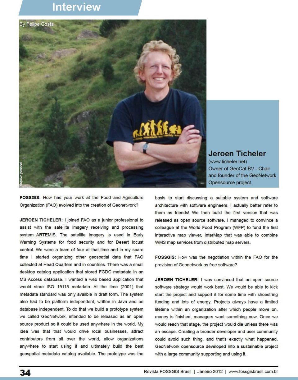
Interview. Jeroen Ticheler (www.ticheler.net) Owner of GeoCat BV - Chair and founder of the GeoNetwork Opensource project.
 Owner of GeoCat BV - Chair and founder of the GeoNetwork Opensource project.") Interview By Felipe Costa Arquivo pessoal Jeroen Ticheler (www.ticheler.net) Owner of GeoCat BV - Chair and founder of the GeoNetwork Opensource project. FOSSGIS: How has your work at the Food and Agriculture
Interview By Felipe Costa Arquivo pessoal Jeroen Ticheler (www.ticheler.net) Owner of GeoCat BV - Chair and founder of the GeoNetwork Opensource project. FOSSGIS: How has your work at the Food and Agriculture
Standardized data sharing through an open-source Spatial Data Infrastructure: the Afromaison project
 Standardized data sharing through an open-source Spatial Data Infrastructure: the Afromaison project Yaniss Guigoz - University of Geneva/GRID-Geneva 1 EcoARM2ERA and AFROMAISON Why Afromaison in this
County of Los Angeles. Chief Information Office Preferred Technologies for Geographic Information Systems (GIS) September 2014
 September 2014") County of Los Angeles Chief Information Office Preferred Technologies for Geographic Information Systems (GIS) September 2014 CIO Preferred Technologies for GIS This document lists the preferred Geographic
County of Los Angeles Chief Information Office Preferred Technologies for Geographic Information Systems (GIS) September 2014 CIO Preferred Technologies for GIS This document lists the preferred Geographic
National Geothermal Data System and Global Geosciences Data Integration
 National Geothermal Data System and Global Geosciences Data Integration Lee Allison, AZGS Stephen Richard, AZGS Arlene Anderson, US DOE David Cuyler, US DOE & Sandia Natl Lab NERC 2008 Outline Rational
GeoNetwork and ESRI GIS Portal Toolkit Comparison
 GeoNetwork and Comparison The following software are being evaluated for the GeoSUR project for the implementation of GIS portal application for the South American region. The information collected for
GeoNetwork, The Open Source Solution for the interoperable management of geospatial metadata
 GeoNetwork, The Open Source Solution for the interoperable management of geospatial metadata Ing. Simone Giannecchini, GeoSolutions Ing. Emanuele Tajariol, GeoSolutions Outline GeoNetwork Introduction
Cloud-based Infrastructures. Serving INSPIRE needs
 Cloud-based Infrastructures Serving INSPIRE needs INSPIRE Conference 2014 Workshop Sessions Benoit BAURENS, AKKA Technologies (F) Claudio LUCCHESE, CNR (I) June 16th, 2014 This content by the InGeoCloudS
GeoNetwork User Manual
 GeoNetwork User Manual Release 2.10.4-0 GeoNetwork July 06, 2015 Contents 1 Preface 3 1.1 About this Project..................................... 3 1.2 License Information....................................
INPE Spatial Data Infrastructure for Big Spatiotemporal Data Sets. Karine Reis Ferreira (INPE-Brazil)
") INPE Spatial Data Infrastructure for Big Spatiotemporal Data Sets Karine Reis Ferreira (INPE-Brazil) INPE (Brazil) and Big Data I work at INPE (Brazilian National Institute for Space Research). Main gate
INPE Spatial Data Infrastructure for Big Spatiotemporal Data Sets Karine Reis Ferreira (INPE-Brazil) INPE (Brazil) and Big Data I work at INPE (Brazilian National Institute for Space Research). Main gate
EXPLORING AND SHARING GEOSPATIAL INFORMATION THROUGH MYGDI EXPLORER
 EXPLORING AND SHARING GEOSPATIAL INFORMATION THROUGH MYGDI EXPLORER Subashini Panchanathan Malaysian Centre For Geospatial Data Infrastructure ( MaCGDI ) Ministry of National Resources and Environment
Spatial Data Infrastructures - trends and impacts on society. Max Craglia Joint Research Centre Digital Earth and Reference Data Unit
 Spatial Data Infrastructures - trends and impacts on society Max Craglia Joint Research Centre Digital Earth and Reference Data Unit Outline Where we were 20 years ago Where we are now Where we are going
smespire - Exercises for the Hands-on Training on INSPIRE Network Services April 2014 Jacxsens Paul SADL KU Leuven
 smespire - Exercises for the Hands-on Training on INSPIRE Network Services April 2014 Jacxsens Paul SADL KU Leuven These exercises aim at people who already have some basic knowledge of INSPIRE Network
Google Lead Generation For Attorneys - Leverage The Power Of Adwords To Grow Your Law Business FAST. The Foundation of Google AdWords
 Google Lead Generation For Attorneys - Leverage The Power Of Adwords To Grow Your Law Business FAST You re about to discover the secrets of fast legal practice success with Google AdWords. Google AdWords
FreeGIS.net, INSPIRE, Open Source Software and OGC standards
 FreeGIS.net, INSPIRE, Open Source Software and OGC standards Workshop: How Open Source / Free Software and Open Standards complement each other in an SDI environment SFScon 13 Free Software Conference
UK Location Programme
 Location Information Interoperability Board Data Publisher How To Guide Understand the background to establishing an INSPIRE View Service using GeoServer DOCUMENT CONTROL Change Summary Version Date Author/Editor
Guide for Local Business Google Pay Per Click Marketing!
 Guide for Local Business Google Pay Per Click Marketing! Guide for Google Pay Per Click Marketing - Leverage The Power Of Adwords To Grow Your Business FAST You re about to discover the secrets of fast
GeoNetwork, The Open Source Solution for the interoperable management of geospatial metadata
 GeoNetwork, The Open Source Solution for the interoperable management of geospatial metadata Ing. Emanuele Tajariol, GeoSolutions Ing. Simone Giannecchini, GeoSolutions GeoSolutions GeoSolutions GeoNetwork
Google Lead Generation for Attorneys
 1 Google Lead Generation For Attorneys Leverage The Power Of AdWords To Grow Your Law Business FAST You re about to discover the secrets of fast legal practice success with Google AdWords. Google AdWords
Analysis of the Free GIS Software Applications in respect to INSPIRE services and OGC standards
 Analysis of the Free GIS Software Applications in respect to INSPIRE services and OGC standards Authors: Francesco D'Alesio Peter Hopfgartner Paolo Viskanic June 2011 Executive Summary This document analyses
An Esri White Paper June 2011 ArcGIS for INSPIRE
 An Esri White Paper June 2011 ArcGIS for INSPIRE Esri, 380 New York St., Redlands, CA 92373-8100 USA TEL 909-793-2853 FAX 909-793-5953 E-MAIL [email protected] WEB esri.com Copyright 2011 Esri All rights reserved.
WP 3. Elaboration database Architecture Features (Software Architecture Document)
") Architecture Features (Software Architecture Document) o Best in class solution, using EC recommendations for IT in this field o Implementation based on free open source o Based on OGC standards, high
Architecture Features (Software Architecture Document) o Best in class solution, using EC recommendations for IT in this field o Implementation based on free open source o Based on OGC standards, high
Enabling embedded maps
 Enabling embedded maps Case: National geoportal of Finland Antti Rainio National Land Survey of Finland Trends: Web Services, Mapping Mashup, Open Source, Open Data Decentralised data s Service interfaces
Institute of Computational Modeling SB RAS
 Institute of Computational Modeling SB RAS ORGANIZATION OF ACCESS TO OBSERVATIONAL DATA USING WEB SERVICES FOR MONITORING SYSTEMS THE STATE OF THE ENVIRONMENT Kadochnikov Aleksey A. Russia, Krasnoyarsk
INSPIRE Dashboard. Technical scenario
 INSPIRE Dashboard Technical scenario Technical scenarios #1 : GeoNetwork catalogue (include CSW harvester) + custom dashboard #2 : SOLR + Banana dashboard + CSW harvester #3 : EU GeoPortal +? #4 :? + EEA
Earn Money Sharing YouTube Videos
 Earn Money Sharing YouTube Videos Get Started FREE! Make money every time you share a video, also make money every time the videos you have shared get watched! Unleash The Viral Power of Social Media To
EEOS 381 - Spatial Databases and GIS Applications
 EEOS 381 - Spatial Databases and GIS Applications Lecture 9 Metadata What is Metadata? Data about data Description of a (GIS) dataset What it represents Who created it? When? How? Format Field definitions
Francesco Tortorelli
 Francesco Tortorelli Joint CEN/TC 287 and OGC Workshop Bringing GI Standards-making bodies together Frascati (Rome), 30 September 2013 (AgID) AgID (previously CNIPA and DigitPA) is a government agency
Transcription. Founder Interview - Panayotis Vryonis Talks About BigStash Cloud Storage. Media Duration: 28:45
 Transcription Founder Interview - Panayotis Vryonis Talks About BigStash Cloud Storage Media Duration: 28:45 Feel free to quote any passage from this interview for your articles. Please reference cloudwards.net
OSGeo Web Mapping Typification: GeoMajas, Mapbender, MapFish and OpenLayers. Christoph Baudson Arnulf Christl FOSS4G 2010 Barcelona
 OSGeo Web Mapping Typification: GeoMajas, Mapbender, MapFish and OpenLayers Christoph Baudson Arnulf Christl FOSS4G 2010 Barcelona Disclaimer All information contained in this presentation has been compiled
An ESRI White Paper October 2009 ESRI Geoportal Technology
 An ESRI White Paper October 2009 ESRI Geoportal Technology ESRI 380 New York St., Redlands, CA 92373-8100 USA TEL 909-793-2853 FAX 909-793-5953 E-MAIL [email protected] WEB www.esri.com Copyright 2009 ESRI
ArcGIS Viewer for Silverlight An Introduction
 Esri International User Conference San Diego, California Technical Workshops July 26, 2012 ArcGIS Viewer for Silverlight An Introduction Rich Zwaap Agenda Background Product overview Getting started and
Managing a Geographic Database From Mobile Devices Through OGC Web Services
 Managing a Geographic Database From Mobile Devices Through OGC Web Services Nieves R. Brisaboa 1, Miguel R. Luaces 1, Jose R. Parama 1, and Jose R. Viqueira 2 1 Database Laboratory, University of A Coruña,
Texas Develops Online Geospatial Data Repository to Support Emergency Management
 Bing Maps for Enterprise Microsoft Customer Solution Case Study Texas Develops Online Geospatial Data Repository to Support Emergency Management Overview Country or Region: United States Industry: Government
Introduction to the Mapbender OWS Security Proxy
 Introduction to the Mapbender OWS Security Proxy Arnulf Christl, WhereGroup GmbH & Co. KG, Bonn, Germany 1/16 Agenda 1 Introduction to the Architecture OWS from Bottom Up with the OSGeo SDI Software Stack
Budget Website Design How to Find It
 Budget Website Design How to Find It I design websites for small business owners who don't have bottomless pockets to have an internet presence. I believe every brick and mortar business needs a website
Oklahoma s Open Source Spatial Data Clearinghouse: OKMaps
 Oklahoma s Open Source Spatial Data Clearinghouse: OKMaps Presented by: Mike Sharp State Geographic Information Coordinator Oklahoma Office of Geographic Information MAGIC 2014 Symposium April 28-May1,
Vision. South Pacific GIS/RS Conference 2015 11/17/2015. Applying Geography Everywhere. Applying Geography Everywhere
 South Pacific GIS/RS Conference 2015 Applying Geography Everywhere Jithen (J) Singh Eagle Technology Group Ltd (Esri New Zealand) Suva, Fiji Vision Applying Geography Everywhere 1 GIS Is Evolving A Whole
Cloud application for water resources modeling. Faculty of Computer Science, University Goce Delcev Shtip, Republic of Macedonia
 Cloud application for water resources modeling Assist. Prof. Dr. Blagoj Delipetrev 1, Assist. Prof. Dr. Marjan Delipetrev 2 1 Faculty of Computer Science, University Goce Delcev Shtip, Republic of Macedonia
Spatial Data Infrastructure. A Collaborative Network
 Spatial Data Infrastructure A Collaborative Network Solving Challenges Takes Collaboration Social challenges, environmental issues, and economic downturns all take cooperation to solve. Working together
The ORIENTGATE data platform
 Seminar on Proposed and Revised set of indicators June 4-5, 2014 - Belgrade (Serbia) The ORIENTGATE data platform WP2, Action 2.4 Alessandra Nuzzo, Sandro Fiore, Giovanni Aloisio Scientific Computing and
CDI/THREDDS Interoperability: the SeaDataNet developments. P. Mazzetti 1,2, S. Nativi 1,2, 1. CNR-IMAA; 2. PIN-UNIFI
 CDI/THREDDS Interoperability: the SeaDataNet developments P. Mazzetti 1,2, S. Nativi 1,2, 1. CNR-IMAA; 2. PIN-UNIFI Outline Interoperability Issues in SeaDataNet A broker solution for CDI/THREDDS interoperability
Introduction to Geospatial Web Services
 Geospatial Web Services Introduction to Geospatial Web Services An introduction and inventory of geospatial web services and their importance to interoperability in the geospatial domain. vers. 20100604
GIS Cloud Computing Solutions
 GIS Cloud Computing Solutions Who We Are IT and GIS professionals with lineage managed services for enterprise-class customers Cloud in 80+ data centers worldwide with access to thousands of servers Operators
http://opendata.comune.fi.it
 The Environmental Observation Web and its Service Applications within the Future Internet OPENDATA IN CITY OF FLORENCE Gianluca Vannuccini Head of the IT Infrastructure Development Office IT Department
Workshop Advanced GeoNetwork
 Workshop Advanced GeoNetwork Jose Garcia Heikki Doeleman OSGIS Nottingham 2012 Table of contents Introduction A horizontally scaled, load-balanced cluster External security system Setup PC Configuration
CentropeSTATISTICS a Tool for Cross-Border Data Presentation Manfred Schrenk, Clemens Beyer, Norbert Ströbinger
 Manfred Schrenk, Clemens Beyer, Norbert Ströbinger (Dipl.-Ing. Manfred Schrenk, Multimediaplan.at, 2320 Schwechat, Austria, [email protected]) (Dipl.-Ing. Clemens Beyer, CORP Competence Center
What people who attend Linton Sellen s Leadership Training have to say:
 What people who attend Linton Sellen s Leadership Training have to say: Excellent course, couldn t have been better. Training content and knowledge and delivery are exceptional. I've been to many management
A Near Secret SEO Strategy Turbo-Charged Using SEO Zen
 1 A Near Secret SEO Strategy Turbo-Charged Using SEO Zen by John Pearce and Chris Cantell Hi everyone, John Pearce here and I m really excited about SEO. The reason is the success we ve been having with
ArcGIS Framework Plug-In: Extending the ArcGIS Desktop for ANSI Standard Framework Data to Support Government Decision Making
 ArcGIS Framework Plug-In: Extending the ArcGIS Desktop for ANSI Standard Framework Data to Support Government Decision Making Final Project Report October 28, 2008 Agreement Number Organization Project
The use of Semantic Web Technologies in Spatial Decision Support Systems
 The use of Semantic Web Technologies in Spatial Decision Support Systems Adam Iwaniak Jaromar Łukowicz Iwona Kaczmarek Marek Strzelecki The INSPIRE Conference 2013, 23-27 June Wroclaw University of Environmental
From Geoportal to Spatial Data Service Platform. Jani Kylmäaho National Land Survey of Finland Development Centre
 From Geoportal to Spatial Data Service Platform Jani Kylmäaho National Land Survey of Finland Development Centre 29.6.2012 Introduction National Land Survey of Finland - 1900 employees Development Centre
Interoperable Solutions in Web-based Mapping
 ISPRS SIPT IGU UCI CIG ACSG Table of contents Table des matières Authors index Index des auteurs Search Recherches Exit Sortir Interoperable Solutions in Web-based Mapping Marta Wojnarowska and Bridget
But have you ever wondered how to create your own website?
 Foreword We live in a time when websites have become part of our everyday lives, replacing newspapers and books, and offering users a whole range of new opportunities. You probably visit at least a few
After you install Spark, you'll get going by logging in and adding contacts. Try out a chat with one of your contacts!
 Spark User Guide Welcome to Spark! This guide will get you acquainted with the basics of chatting using Spark. You'll get logged in, add contacts, chat by text and voice, exchange files, and more. Note:
Iraklis Karampourniotis, Zoi Arvanitidou, Ioannis Paraschakis. Using open source software in gis training and education
 Iraklis Karampourniotis, Zoi Arvanitidou, Ioannis Paraschakis Using open source software in gis training and education Can open source be used? The question troubling us was Can Open Source Software be
Building a SDI for small countries the Portuguese example
 Building a SDI for small countries the Portuguese example Rui Pedro Julião Instituto Geográfico Português Deputy Director-General [email protected] Abstract Portugal was one of the SDI pioneers in the beginning
Louis Gudema: Founder and President of Revenue + Associates
 The Interview Series - Presented by SmartFunnel Interviews of Sales + Marketing Industry Leaders Louis Gudema: Founder and President of Revenue + Associates PETER: Hello folks this is Peter Fillmore speaking.
Leveraging Metadata Standards in ArcGIS for Interoperability
 Esri International User Conference San Diego, California Technical Workshops July 26, 2012 Leveraging Metadata Standards in ArcGIS for Interoperability David Danko Aleta Vienneau Leveraging Metadata Standards
>> My name is Danielle Anguiano and I am a tutor of the Writing Center which is just outside these doors within the Student Learning Center.
 >> My name is Danielle Anguiano and I am a tutor of the Writing Center which is just outside these doors within the Student Learning Center. Have any of you been to the Writing Center before? A couple
gvsig: Open Source GIS client. Spatial Data Infrastructure Client.
 Séminaire gvsig Rennes, 31 Mars 2006 gvsig: Open Source GIS client. Spatial Data Infrastructure Client. Luis W. Sevilla Gabriel Carrión Rico Martín García Hernández Francisco J. Peñarrubia Alvaro A. Anguix
6 HUGE Website Mistakes that could Cost You Thousands
 Websites with Purpose 6 HUGE Website Mistakes that could Cost You Thousands Table of Contents Buying a Website...2 HUGE MISTAKE NUMBER 1...3 Buying on Price Alone...3 Spending Too Much...3 The Real Cost
Chapter 6: Data Acquisition Methods, Procedures, and Issues
 Chapter 6: Data Acquisition Methods, Procedures, and Issues In this Exercise: Data Acquisition Downloading Geographic Data Accessing Data Via Web Map Service Using Data from a Text File or Spreadsheet
Software Outsourcing - Software Development. [email protected]
 Hi I m Tony Radford from West Town Web Services. We area UK based great value, high quality software development and outsourcing solutions business. If you need software built or looked after please get
PRE-TOURNAMENT INTERVIEW TRANSCRIPT: Tuesday, January 27, 2015
 PRE-TOURNAMENT INTERVIEW TRANSCRIPT: Tuesday, January 27, 2015 LYDIA KO MODERATOR: Happy to be joined in the media center by Rolex Rankings No. 2, Lydia Ko. Lydia, you're coming off winning the CME last
Publishing geospatial data to the web using the EEA infrastructure
 Publishing geospatial data to the web using the EEA infrastructure *Note: Map Services should be published using the EEA Map Services Tick Sheet for guidance. Contact Sebastien Petit ([email protected])
Five Steps to Better Performance
 Effective Web maps have a specific focus and are designed so users can interact with them to accomplish meaningful tasks. Five Steps to Better Performance Sample methodology for creating a great Web map
What s new in Carmenta Server 4.2
 What s new in Carmenta Server 4.2 A complete solution for cost-effective visualisation and distribution of GIS data through web services Carmenta Server provides cost-effective technology for building
Digital Marketing Manager, Marketing Manager, Agency Owner. Bachelors in Marketing, Advertising, Communications, or equivalent experience
 Persona name Amanda Industry, geographic or other segments B2B Roles Digital Marketing Manager, Marketing Manager, Agency Owner Reports to VP Marketing or Agency Owner Education Bachelors in Marketing,
GEO 425, Spring 2012 LAB 3: Introduction to Web Map Services
 GEO 425, Spring 2012 LAB 3: Introduction to Web Map Services Objectives: If you have your own web server, it's great to be able to host your own geospatial data. That data can then be accessed through
INSPIRE in practice: Experiences with INSPIRE data and services
 INSPIRE in practice: Experiences with INSPIRE data and services Peter Parslow Principal Geographic Information Architect June 2014: ISO TC211 Standards in Practice workshop What s INSPIRE? European Commission
Introduction to OSGeo and QGIS
 Introduction to OSGeo and QGIS Arnulf Christl OSGeo President Emeritus ESTGIS Pühajärve, Estonia Arnulf Christl Geospatial Systems Architect OSGeo President Emeritus Director of the metaspatial Institute
GetLOD - Linked Open Data and Spatial Data Infrastructures
 GetLOD - Linked Open Data and Spatial Data Infrastructures W3C Linked Open Data LOD2014 Roma, 20-21 February 2014 Stefano Pezzi, Massimo Zotti, Giovanni Ciardi, Massimo Fustini Agenda Context Geoportal
ArcGIS. Server. A Complete and Integrated Server GIS
 ArcGIS Server A Complete and Integrated Server GIS ArcGIS Server A Complete and Integrated Server GIS ArcGIS Server enables you to distribute maps, models, and tools to others within your organization
Open Source Desktop GIS Solutions for the Not-So Casual User
 Open Source Desktop GIS Solutions for the Not-So Casual User Roger C. Lowe III Warnell School of Forestry and Natural Resources The University of Georgia Athens, GA 30605 [email protected] Abstract Ask
Intergraph Roadway Information Management Solution. Title Title. Title Title. A White Paper
 Intergraph Roadway Information Management Solution A White Paper Security, Government & Infrastructure, a division of Intergraph Title Title Title Title Table of Contents 1. Introduction... 1 2. Intergraph
Geospatial exploitation Products. GXP WebView. Powered by the GXP Platform
 Geospatial exploitation Products GXP WebView Powered by the GXP Platform Exploitation Capabilities GXP WebView Powered by the GXP Platform Detailed annotation (text, points, lines, and polygons) Distance,
How To Use Gis
 Welcome Understanding Purpose Creating Relationships You A Global Community of GIS Professionals Changing the World Together Applying Geography Everywhere Your WORK Showcasing Your Web Apps Vision Applying
Reputation Marketing
 Reputation Marketing Reputation Marketing Welcome to our training, We will show you step-by-step how to dominate your market online. We re the nation s leading experts in local online marketing. The proprietary
GeoMedia Product Update. Title of Presentation. Lorilie Barteski October 15, 2008 Edmonton, AB
 Product Update Title of Presentation Lorilie Barteski Edmonton, AB Know the audience poll Existing /Pro users Version 6.1 Version 6.0 Version 5.2 or earlier Existing WebMap users Version 6.1 Version 6.0
DISMAR implementing an OpenGIS compliant Marine Information Management System
 DISMAR implementing an OpenGIS compliant Marine Information Management System Éamonn Ó T uama, Coastal & Marine Resources Centre, ERI, University College Cork. DISMAR DISMAR (Data Integration System for
Data Visualization Using Web GIS Software
 Data Visualization Using Web GIS Software Tuomas Peltonen Radiation and Nuclear Safety Authority (STUK), Finland NKS NordDSS Workshop, Copenhagen, 1.-2.10.2009 RADIATION AND NUCLEAR SAFETY AUTHORITY Preface
Interview With A Teen. Great Family. Outstanding Education. Heroine Addict
 Interview With A Teen. Great Family. Outstanding Education. Heroine Addict I recently had the incredible opportunity to interview a young man, Gregor, who very quickly fell into a dependent situation with
Choosing the right GIS framework for an informed Enterprise Web GIS Solution
 13 ANNUAL INTERNATIONAL CONFERENCE AND EXHIBITION ON GEOSPATIAL INFORMATION TECHNOLOGY AND APPLICATIONS Epicentre; Gurgaon, India; 19-21 January, 2010 Choosing the right GIS framework for an informed Enterprise