Francesco Tortorelli
|
|
|
- Jessie Jackson
- 8 years ago
- Views:
Transcription
1 Francesco Tortorelli Joint CEN/TC 287 and OGC Workshop Bringing GI Standards-making bodies together Frascati (Rome), 30 September 2013
, 30 September")
2 (AgID) AgID (previously CNIPA and DigitPA) is a government agency that works under the guidelines and supervision of the Presidency of the Council of Ministers AgID is responsible for implementing the Italian Digital Agenda and has the mandate to perform many tasks such as: To contribute to the spread of the use of information and communication technologies (ICT) To develop technical requirements and guidelines for promoting interoperability To enable full cooperation between information systems of governmental bodies and between these systems and the European Union 1

3 Interoperability: Overall picture Government needs Political target on ICT: : Increase: Savings, Security & Social inclusion E-GOVERNMENT INNOVATION PLAN Fast response to unespected situations Easy services tayloring to specific needs User centric services ICT organization and governance Legal Framework ICT organisation government Technical multi domain Interoperability Domain interoperability Security Data semantic Application Security Data semantic Application Employment Healthcare 2

4 AgID s role in the GI context Responsible for the development of Repertorio Nazionale dei Dati Territoriali (RNDT) - the Italian Catalogue of metadata for Spatial Data The national point of reference for the metadata related to the spatial data and service (one of the components of the national Spatial Data Infrastructure (SDI), required by the INSPIRE directive Member of the National Committee for technical rules concerning spatial information Coordinates and supports projects of the Southern Regions of Italy (Abruzzo, Campania, Molise, Sardegna, Puglia, Calabria, Sicilia - EU Ob.1 Area), aimed at implementing geographic data base and developing geospatial services. 3

5 Italian public spatial data context A very large number of public sector bodies collect, produce, reproduce and disseminate spatial data in order to fulfill their public tasks However, in Italian data context, in recent past we observed that: There was a significant fragmentation and data overlaps Data were not homogeneous and interoperable Data have had different formats Data were poorly documented Different names were used to identify the same type of data There wasn't a unique public authority for collecting, processing and disseminating spatial data at national level 4

6 Past Italian experience: Intesa GIS Protocol In September 1996, Intesa GIS Protocol (agreement State-Regions and Local authorities for the construction of geographical information systems of general interest) was signed It aimed at activating organic methods of cooperation and coordination in the implementation of Geographic Information Systems It was based on a voluntary initiative It was not supported by standards 5

7 Digital Administration Code (CAD) Requirements Interoperability, usability and sharing of information Harmonization, access and reuse of data managed by government Definition of a clear role of the PA Protection of investments made over the years Support standard and technical rules into a coherent regulatory context This led to the definition of article 59 of CAD that establishes: The creation of the Committee for Technical Rules on Geographic Information for the definition of the technical rules on GI The creation of the National catalogue of spatial data (RNDT), managed by AgID 6
, managed by")
8 Committee for Technical Rules on GI It defined technical rules approved with Decree of November 10, 2011 of Minister of Public Administration and Minister of Environment: Technical rules for the definition of the content of the national catalogue of spatial data RNDT (stands for catalogue of geospatial data) Technical rules for the definition of the specific content of the geographic information database Technical rules for the implementation, documentation and exchange of digital orthophotos at a nominal scale 1:10000 Adoption of the Italian geodetic reference system, certified by EUREF Technical WG It contributed to the definition of the technical and economic rules for the use of cadastral data by other administrations, (Decree of November 13, 2007 of Director of Cadastral Agency) It produced the technical rules for the implementation of the DB related infrastructure for the provision of public utility services AgID was a member of the Committee and the technical secretariat, providing technical and scientific support AgID collaborated with experts of the INSPIRE Drafting Team contributing to the Italy Feasibility Test (Monitoring & Reporting) and providing support for Metadata Implementing Rules (IR) 7

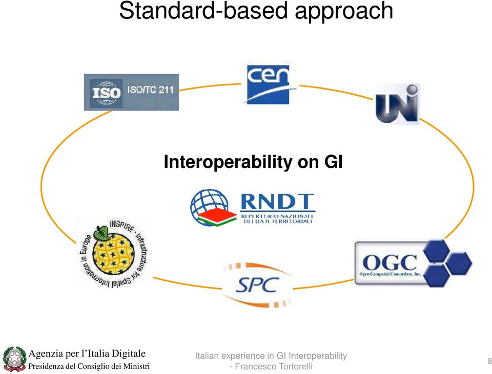
9 Standard-based approach Interoperability on GI 8
10 National catalogue of spatial data - RNDT It is the Italian base register (authentic source) of spatial data of PA, and it is a component of the national infrastructure for spatial information It can be used to promote interoperability in GI sector and the development of services based on the integration of data It facilitates the implementation of policies on sharing, access and re-use It facilitates the evolution of spatial information in terms of quantity and quality (normalization of data, metadata and reliability of real correspondence with the documented record) It promotes effective open data policies It serves as engine for the economic exploitation of GI 9
 It promotes effective open data policies It serves as engine for the economic exploitation")
11 National catalogue of spatial data RNDT/2 Collection of metadata provided by PA EDITOR ON LINE UPLOAD FILE xml RNDT SPC CSWT HARVESTING 10

12 National catalogue of spatial data RNDT /3 Discovery service (for public and private sector) Web CSW service catalogue which is interopeable with INSPIRE geoportal 11

13 National catalogue of spatial data RNDT/4 RNDT includes all the elements of the metadata Implementing Rules (Reg. EC 1205/2008) as well as the mandatory metadata required by interoperability of spatial data sets and services Implementing Rules (Reg. EU 1089/2010 and EU 102/2011) RNDT INSPIRE ISO Core ISO 12

14 OGC Requirements and Specifications [CSW ISO AP] National catalogue of spatial data RNDT/5 The Web Service-based implementation of RNDT ensures both OGC and INSPIRE compliance AgID developed, using open-source software, its own discovery service, according to INSPIRE requirements In order to publish over the web in a standardized and machine-readable way all geographic metadata collected in RNDT Interoperability tests with INSPIRE geoportal were completed successfully Compliance tests to get OGC Certification are in progress RNDT WEB SERVICE OGC Requirements and Specifications [CSW ISO AP] Inspire Extended Capabilities and Metadata IRs based on ISO and ISO

15 Thank you for the attention!

ITALIAN SPATIAL DATA INFRASTRUCTURE
 Il Sistema Informativo Catastale: una risorsa per le politiche di governo del territorio Roma, 10-11 dicembre 2008 ITALIAN SPATIAL DATA INFRASTRUCTURE Elettra Cappadozzi National Centre for ICT in the
GeoNetwork, The Open Source Solution for the interoperable management of geospatial metadata
 GeoNetwork, The Open Source Solution for the interoperable management of geospatial metadata Ing. Emanuele Tajariol, GeoSolutions Ing. Simone Giannecchini, GeoSolutions GeoSolutions GeoSolutions GeoNetwork
Implementation of Recent Metadata Directives and Guidelines in Public Administration: the Experience of Sardinia Region
 Implementation of Recent Metadata Directives and Guidelines in Public Administration: the Experience of Sardinia Region Luisa Manigas, Michele Beneventi, Luca Corvetto, Rita Vinelli and Marco Melis Region
GetLOD - Linked Open Data and Spatial Data Infrastructures
 GetLOD - Linked Open Data and Spatial Data Infrastructures W3C Linked Open Data LOD2014 Roma, 20-21 February 2014 Stefano Pezzi, Massimo Zotti, Giovanni Ciardi, Massimo Fustini Agenda Context Geoportal
An Esri White Paper June 2011 ArcGIS for INSPIRE
 An Esri White Paper June 2011 ArcGIS for INSPIRE Esri, 380 New York St., Redlands, CA 92373-8100 USA TEL 909-793-2853 FAX 909-793-5953 E-MAIL info@esri.com WEB esri.com Copyright 2011 Esri All rights reserved.
GeoNetwork, The Open Source Solution for the interoperable management of geospatial metadata
 GeoNetwork, The Open Source Solution for the interoperable management of geospatial metadata Ing. Simone Giannecchini, GeoSolutions Ing. Emanuele Tajariol, GeoSolutions Outline GeoNetwork Introduction
Open Data Action Plan. Italy
 Open Data Action Plan Italy In June 2013, Italy endorsed the G8 Open Data Charter and, with other G8 Members, committed to implementing a number of open data activities in the G8 Members Collective Action
The Spatial Data Infrastructure of Spain as an example of success in Europe *
 UNITED NATIONS E/CONF.99/IP.16 ECONOMIC AND SOCIAL COUNCIL Ninth United Nations Regional Cartographic Conference for the Americas New York, 10-14 August 2009 Item 7(b) of the provisional agenda Best Practices
How To Test For Anspire
 Network for testing GI services Anders Östman GIS Institute, University of Gävle, Nobelvägen 2, SE 80176, Gävle, Sweden Anders.Ostman@hig.se Abstract. The use of standards is essential when building a
EXPLORING AND SHARING GEOSPATIAL INFORMATION THROUGH MYGDI EXPLORER
 EXPLORING AND SHARING GEOSPATIAL INFORMATION THROUGH MYGDI EXPLORER Subashini Panchanathan Malaysian Centre For Geospatial Data Infrastructure ( MaCGDI ) Ministry of National Resources and Environment
THE RENEWAL OF SNIG UNDER INSPIRE UMBRELLA
 THE RENEWAL OF SNIG UNDER INSPIRE UMBRELLA GEIRINHAS, João; FONSECA, Alexandra; JULIÃO, Rui Pedro. joao.geirinhas@igeo.pt; afonseca@igeo.pt; rpj@igeo.pt Instituto Geográfico Português Abstract SNIG, the
Cadastre in the context of SDI and INSPIRE
 Cadastre in the context of SDI and INSPIRE Dr. Markus Seifert Bavarian Administration for Surveying and Cadastre Cadastre in the digital age the approach in Germany 3 rd CLGE Conference, Hanover, 11.10.2012
Rules for the Public Administration
 Cloud Computing & Healthcare Rules for the Public Administration Daniele Tatti tatti@digitpa.gov.it @DanieleTatti In the next 12 minutes What is DigitPA European scenario Cloud related activities ehealth
INSPIRE Infrastructure for Spatial Information in Europe. INSPIRE Network Services Architecture. Network Services Architecture Creator.
 INSPIRE Infrastructure for Spatial Information in Europe Title Network Creator Network Drafting Team Date 19-07-2008 Subject Status Draft Publisher Network Drafting Team Type Text Description Network describes
INSPIRE Metadata Survey Results
 INSPIRE Metadata Survey Results Joanna Nowak and Massimo Craglia Institute for Environment and Sustainability 2006 EUR 22488 EN The mission of the Institute for Environment and Sustainability is to provide
Catalogue or Register? A Comparison of Standards for Managing Geospatial Metadata
 Catalogue or Register? A Comparison of Standards for Managing Geospatial Metadata Gerhard JOOS and Lydia GIETLER Abstract Publication of information items of any kind for discovery purposes is getting
SPATIAL DATA WEB SERVICES PRICING MODEL INRASTRUCTURE
 SPATIAL DATA WEB SERVICES PRICING MODEL INRASTRUCTURE L.Ozmus 1,B.Erkek 2,S.Colak 3, I.Cankurt 4 and S.Bakıcı 5 1 General Directorate of Land Registry and Cadastre, Ankara, Turkey, lozmus@gmail.com 2 General
NIPP. Ivica Skender NSDI Working group for technical standards
 Implementing rules for network services Ivica Skender NSDI Working group for technical standards ivica.skender@gisdata.com Content Working group for technical standards INSPIRE implementing rule for Network
Enabling embedded maps
 Enabling embedded maps Case: National geoportal of Finland Antti Rainio National Land Survey of Finland Trends: Web Services, Mapping Mashup, Open Source, Open Data Decentralised data s Service interfaces
Cloud-based Infrastructures. Serving INSPIRE needs
 Cloud-based Infrastructures Serving INSPIRE needs INSPIRE Conference 2014 Workshop Sessions Benoit BAURENS, AKKA Technologies (F) Claudio LUCCHESE, CNR (I) June 16th, 2014 This content by the InGeoCloudS
What s new in Carmenta Server 4.2
 What s new in Carmenta Server 4.2 A complete solution for cost-effective visualisation and distribution of GIS data through web services Carmenta Server provides cost-effective technology for building
CDI/THREDDS Interoperability: the SeaDataNet developments. P. Mazzetti 1,2, S. Nativi 1,2, 1. CNR-IMAA; 2. PIN-UNIFI
 CDI/THREDDS Interoperability: the SeaDataNet developments P. Mazzetti 1,2, S. Nativi 1,2, 1. CNR-IMAA; 2. PIN-UNIFI Outline Interoperability Issues in SeaDataNet A broker solution for CDI/THREDDS interoperability
Building up a SDI What is needed? Ulla Kronborg Mazzoli Danish ministry for the Environment National Survey and Cadastre
 Building up a SDI What is needed? Ulla Kronborg Mazzoli Danish ministry for the Environment National Survey and Cadastre He who knows all the answers has not yet been asked all the questions. - Author
INSPIRE Infrastructure for Spatial Information in Europe. INSPIRE Network Services Architecture. Network Services Architecture Creator.
 INSPIRE Infrastructure for Spatial Information in Europe INSPIRE Network Services Architecture Title Network Services Architecture Creator Network Services Drafting Team Date 17-12-2007 Subject INSPIRE
Bringing spatial data and metadata from long term ecosystem research domain to the INSPIRE world
 Bringing spatial data and metadata from long term ecosystem research domain to the INSPIRE world Tomas Kliment Junior Researcher Italian National Research Council Institute of Marine Sciences in Venice
Polish Spatial Data Infrastructure - from the Concept towards its Implementation
 Polish Spatial Data Infrastructure - from the Concept towards its Implementation 8th EC-GI&GIS Workshop ESDI A Work in Progress Dublin, July 3-5 June 2001 r. Adam Linsenbarth, Ewa Wysocka Institute of
Mandate M-403: ehealth Interoperability. Karl Øyri Intervensjonseteret, Rikshospitalet HF
 Mandate M-403: ehealth Interoperability Karl Øyri Intervensjonseteret, Rikshospitalet HF M-403: Mandate to the European Standardisation Organisations CEN, CENELEC and ETSI in the field of Information
UK Location Programme
 Location Information Interoperability Board Data Publisher How To Guide Understand the background to establishing an INSPIRE View Service using GeoServer DOCUMENT CONTROL Change Summary Version Date Author/Editor
13 th EC GI & GIS Workshop WIN: A new OGC compliant SOA. for risk management. GMV, 2007 Property of GMV All rights reserved
 13 th EC GI & GIS Workshop WIN: A new OGC compliant SOA for risk management GMV, 2007 Property of GMV All rights reserved Content 1. Introduction 2. Objectives 3. Architecture and Model 4. Technical aspects
FreeGIS.net, INSPIRE, Open Source Software and OGC standards
 FreeGIS.net, INSPIRE, Open Source Software and OGC standards Workshop: How Open Source / Free Software and Open Standards complement each other in an SDI environment SFScon 13 Free Software Conference
COSTE: a Web-Services Infrastructure Enabling Interoperability and Integration of Spatial and Traffic e-contents for European Regions
 COSTE: a Web-s Infrastructure Enabling Interoperability and Integration of Spatial and Traffic e-contents for European Regions Marco Boero Softeco Sismat SpA Italy Geographic Information: Motivation, problem
THE SPATIAL DATA INFRASTRUCTURE OF SPAIN AS AN EXAMPLE OF SUCCESS IN EUROPE
 THE SPATIAL DATA INFRASTRUCTURE OF SPAIN AS AN EXAMPLE OF SUCCESS IN EUROPE Julio Mezcua-Rodríguez (jmezcua@fomento.es) Instituto Geográfico Nacional (National Geographic Institute). General Ibañez Ibero,
How To Write An Inspire Directive
 INSPIRE Infrastructure for Spatial Information in Europe Detailed definitions on the INSPIRE Network Services Title Detailed definitions on the INSPIRE Network Services Creator Date 2005-07-22 Subject
Earth Science Academic Archive
 Earth Science Academic Archive The Principles of Good Data Management The National Geoscience Data Centre British Geological Survey, Keyworth, Nottingham, NG12 5GG Contents Purpose of this guide 1 What
PDOK Kaart, the Dutch Mapping API
 PDOK Kaart, the Dutch Mapping API Haico van der Vegt*, Leo van der Sluijs* * Cadastre, Land Registry and Mapping Agency of the Netherlands Abstract. PDOK (public services on the map) is a partnership of
Call for experts for INSPIRE maintenance & implementation
 INSPIRE Infrastructure for Spatial Information in Europe Call for experts for INSPIRE maintenance & implementation Title Creator Call for experts for INSPIRE maintenance & implementation EC & EEA INSPIRE
Building a SDI for small countries the Portuguese example
 Building a SDI for small countries the Portuguese example Rui Pedro Julião Instituto Geográfico Português Deputy Director-General rpj@igeo.pt Abstract Portugal was one of the SDI pioneers in the beginning
Task AR-09-01a Progress and Contributions
 Doug Nebert, POC U.S. Geological Survey ddnebert@usgs.gov March 2010 Task AR-09-01a Progress and Contributions Background and scope for AR-09-01a This Task defines the minimum, common technical capabilities
SPC BOARD (COMMISSIONE DI COORDINAMENTO SPC) AN OVERVIEW OF THE ITALIAN GUIDELINES FOR SEMANTIC INTEROPERABILITY THROUGH LINKED OPEN DATA
 AN OVERVIEW OF THE ITALIAN GUIDELINES FOR SEMANTIC INTEROPERABILITY THROUGH LINKED OPEN DATA") SPC BOARD (COMMISSIONE DI COORDINAMENTO SPC) AN OVERVIEW OF THE ITALIAN GUIDELINES FOR SEMANTIC INTEROPERABILITY THROUGH LINKED OPEN DATA INDEX EXECUTIVE SUMMARY... 3 1. PREFACE... 5 1.1. Acronyms... 5
SPC BOARD (COMMISSIONE DI COORDINAMENTO SPC) AN OVERVIEW OF THE ITALIAN GUIDELINES FOR SEMANTIC INTEROPERABILITY THROUGH LINKED OPEN DATA INDEX EXECUTIVE SUMMARY... 3 1. PREFACE... 5 1.1. Acronyms... 5
A project to create an infrastructure for exchanging and integrating regional cadastral information.
 A project to create an infrastructure for exchanging and integrating regional cadastral information. Giovanni Ciardi Regione Emilia-Romagna http://www.sigmater.it/ Alghero, 30th June 2005 Agenda Introduction
The use of Semantic Web Technologies in Spatial Decision Support Systems
 The use of Semantic Web Technologies in Spatial Decision Support Systems Adam Iwaniak Jaromar Łukowicz Iwona Kaczmarek Marek Strzelecki The INSPIRE Conference 2013, 23-27 June Wroclaw University of Environmental
Resource Oriented Architecture and REST
 Resource Oriented Architecture and REST Assessment of impact and advantages on INSPIRE Roberto Lucchi, Michel Millot European Commission Joint Research Centre Institute for Environment and Sustainability
DESIGN SECURITY AND GEO-RIGHTS MANAGEMENT SERVICES IN SPATIAL DATA INFRASTRUCTURE
 DESIGN SECURITY AND GEO-RIGHTS MANAGEMENT SERVICES IN SPATIAL DATA INFRASTRUCTURE Tomasz Kubik 1, Witold Paluszyński 1, Bartosz Kopańczyk 2, Adam Iwaniak 3, Paweł Netzel 4 1 Institute of Computer Engineering,
African European Georesources Observation System
 African European Georesources Observation System Spatial Data Infrastructure (SDI) Dr. Andreas Barth, Bernd Torchala Beak, Germany Outline Project Overview AEGOS SDI data / services hardware / software
Making Geospatial Data Available and Accessible in Jamaica
 Making Geospatial Data Available and Accessible in Jamaica Presented by Cecille Blake, National GIS Coordinator Office of the Prime Minister, National Spatial Data Management Division 9 th UNRCC New York
Ground Level SDI, Building up a Common Municipality Data Transfer Interface
 Ground Level SDI, Building up a Common Municipality Data Transfer Interface Matti Arponen City of Helsinki Matti Holopainen The Association of Finnish Local and Regional Authorities Municipality Spatial
http://opendata.comune.fi.it
 The Environmental Observation Web and its Service Applications within the Future Internet OPENDATA IN CITY OF FLORENCE Gianluca Vannuccini Head of the IT Infrastructure Development Office IT Department
ITAPA 2009 Session Open Source Applications and Best Practices
 ITAPA 2009 Session Open Source Applications and Best Practices The project of National lnteroperability Framework of Spain, main aspects and the approach to standards Bratislava, 4 November 2009 Miguel
Spatial Data Infrastructure as Tools in Environment and Geohazard Management. Examples from Norway
 Spatial Data Infrastructure as Tools in Environment and Geohazard Management. Examples from Norway Kari STRANDE, Norway Key words: e-governance, Geoinformation, GSDI, Risk management, Spatial Planing SUMMARY
Angelos Tzotsos IMIS Athena, Scientific & Technical Manager OSGeo Charter Member Copernicus Big Data Workshop, March 2014
 Angelos Tzotsos IMIS Athena, Scientific & Technical Manager OSGeo Charter Member Copernicus Big Data Workshop, March 2014 Genesis of the project Consortium established on active research, commercial, and
Report meta-information
 Spatial Data Infrastructures in : State of play spring 2011 Report meta-information Title Spatial Data Infrastructures in : State of Play 2011 Creator Danny Vandenbroucke & Dimitrios Biliouris(SADL) Date
Establishment of Spatial Data Infrastructure within the Environmental Sector in Slovak Republic
 EnviroInfo 2005 (Brno) Informatics for Environmental Protection - Networking Environmental Information Establishment of Spatial Data Infrastructure within the Environmental Sector in Slovak Republic Martin
Air Quality Monitoring in Italy
 MACC-III user workshop Rome, 11 May 2015 An overview of the Italian availability of air quality monitoring data Anna Maria Caricchia, Domenico Gaudioso Italian National Institute for Environmental Protection
The Management Centre for Interoperability, Cooperation and Access Infrastructure Services (CG-SICA)
") The Management Centre for Interoperability, Cooperation and Access Infrastructure Services (CG-SICA) part 2 Workshop on ICT Service Oriented Network Architectures University of Rome La Sapienza, May 19
The Management Centre for Interoperability, Cooperation and Access Infrastructure Services (CG-SICA) part 2 Workshop on ICT Service Oriented Network Architectures University of Rome La Sapienza, May 19
European Forest Information and Communication Platform
 1 Metadata Model for the European Forest Information and Communication Platform D. Tilsner 1, C. Figueiredo 1, H. Silva 2, B. Chartier 3, J. San-Miguel 4, A. Camia 4, M. Millot 4 1 EDISOFT, S.A., Lisbon,
Environment Canada Data Management Program. Paul Paciorek Corporate Services Branch May 7, 2014
 Environment Canada Data Management Program Paul Paciorek Corporate Services Branch May 7, 2014 EC Data Management Program (ECDMP) consists of 5 foundational, incremental projects which will implement
Metadata for Data Discovery: The NERC Data Catalogue Service. Steve Donegan
 Metadata for Data Discovery: The NERC Data Catalogue Service Steve Donegan Introduction NERC, Science and Data Centres NERC Discovery Metadata The Data Catalogue Service NERC Data Services Case study:
Spatial Data Infrastructures - trends and impacts on society. Max Craglia Joint Research Centre Digital Earth and Reference Data Unit
 Spatial Data Infrastructures - trends and impacts on society Max Craglia Joint Research Centre Digital Earth and Reference Data Unit Outline Where we were 20 years ago Where we are now Where we are going
Cloud Computing and Government Services August 2013 Serdar Yümlü SAMPAŞ Information & Communication Systems
 eenviper White Paper #4 Cloud Computing and Government Services August 2013 Serdar Yümlü SAMPAŞ Information & Communication Systems 1 Executive Summary Cloud computing could revolutionise public services
The Open Source Approach in Spatial Planning: Applicability Challenges in Bulgaria
 10th Network Conference The Role and Future of Spatial Planning in Central, Eastern and South-Eastern Europe 26-27 September 2013, Dresden The Open Source Approach in Spatial Planning: Applicability Challenges
INSPIRE Evaluation: Summary of findings for EU Member States
 INSPIRE Evaluation: Summary of findings for EU Member States Assessing data and services metadata resources through direct o bservations SPATIAL APPLICATIONS DIVISION K.U.LEUVEN RESEARCH & DEVELOPMENT
FOSSGIS: What is the future of Geonetwork? What changes are planned?
 FOSSGIS: What are the most prominent successful cases in using Geonetwork? JEROEN TICHELER: The first was within the United Nations system itself. GeoNetwork is in use in most of the specialized agencies
CatMDEdit Metadata editor
 Advanced Information Systems Laboratory GeoSpatiumLab S.L. CatMDEdit Metadata editor University of Zaragoza Computer Science and Systems Engineering Department Advanced Information Systems Laboratory (IA3)
An ESRI White Paper October 2009 ESRI Geoportal Technology
 An ESRI White Paper October 2009 ESRI Geoportal Technology ESRI 380 New York St., Redlands, CA 92373-8100 USA TEL 909-793-2853 FAX 909-793-5953 E-MAIL info@esri.com WEB www.esri.com Copyright 2009 ESRI
"Cloud Adoption by the Italian Public Administration: State of Art and Plans" Roberto Masiero, President, THINK! The Innovation Knowledge Foundation
 "Cloud Adoption by the Italian Public Administration: State of Art and Plans" Roberto Masiero, President, THINK! The Innovation Knowledge Foundation SUCRE Workshop: Open Source Clouds in the public sector
Trentino e-government System
 Trentino e-government System Sergio Bettotti, Director, Department for ICT & Innovation Roberto Pizzicannella, I-Gov Unit, Department for ICT & Innovation meeting with the Palestinian Authority Outline
Statistical and Spatial Frameworks. Standards and Data Infrastructure
 Distr. GENERAL 01 May 2013 WP.11 ENGLISH ONLY UNITED NATIONS ECONOMIC COMMISSION FOR EUROPE CONFERENCE OF EUROPEAN STATISTICIANS EUROPEAN COMMISSION STATISTICAL OFFICE OF THE EUROPEAN UNION (EUROSTAT)
Spatial Data Infrastructure. A Collaborative Network
 Spatial Data Infrastructure A Collaborative Network Solving Challenges Takes Collaboration Social challenges, environmental issues, and economic downturns all take cooperation to solve. Working together
EEOS 381 - Spatial Databases and GIS Applications
 EEOS 381 - Spatial Databases and GIS Applications Lecture 9 Metadata What is Metadata? Data about data Description of a (GIS) dataset What it represents Who created it? When? How? Format Field definitions
INSPIRE Dashboard. Technical scenario
 INSPIRE Dashboard Technical scenario Technical scenarios #1 : GeoNetwork catalogue (include CSW harvester) + custom dashboard #2 : SOLR + Banana dashboard + CSW harvester #3 : EU GeoPortal +? #4 :? + EEA
Systèmes de mesures OGC compliant pour le monitoring des infrastructures dans le Projet ISTIMES
 Integrated System for Transport Infrastructures surveillance and Monitoring by Electromagnetic Sensing Systèmes de mesures OGC compliant pour le monitoring des infrastructures dans le Projet ISTIMES 3
Strategy for Improving Cadastral Spatial Quality toward Effective e- Government based NSDI
 Strategy for Improving Cadastral Spatial Quality toward Effective e- Government based NSDI Young-ho LEE, Republic of Korea Key words: e-government, interoperability, NSDI, Spatial quality SUMMARY E-Government
Ingredients of a European business model for certification of EHR systems
 Ingredients of a European business model for certification of EHR systems The demographics Health funding impacted by global financial crisis Population expansion volume impact The aging non-working sector
INTEGRATING RECORDS SYSTEMS WITH DIGITAL ARCHIVES CURRENT STATUS AND WAY FORWARD
 INTEGRATING RECORDS SYSTEMS WITH DIGITAL ARCHIVES CURRENT STATUS AND WAY FORWARD National Archives of Estonia Kuldar As National Archives of Sweden Karin Bredenberg University of Portsmouth Janet Delve
Seminar on Polish & Danish Experiences June 2th 2015
 KMD Master Data KMD Master data management - Master data interoperability Seminar on Polish & Danish Experiences June 2th 2015 Nicolas Horst, Domain executive Lead AGENDA JUNE 2th 1. Trends and overview
D.5.2: Metadata catalogue for drought information
 Project start date: 01 May 2009 Acronym: EuroGEOSS Project title: EuroGEOSS, a European Theme: FP7-ENV-2008-1: Environment (including climate change) Theme title: ENV.2008.4.1.1.1: European Environment
buildingsmart and Infra FINBIM
 buildingsmart and Infra FINBIM Nordic Workshop Helsinki 30th 2011 Harmonization of spatial data in Finland today INSPIRE, EUREF, KRYSP JUHA LIUKAS SITO - Company Profile Consulting - Design - Project Management
WP 3. Elaboration database Architecture Features (Software Architecture Document)
") Architecture Features (Software Architecture Document) o Best in class solution, using EC recommendations for IT in this field o Implementation based on free open source o Based on OGC standards, high
Architecture Features (Software Architecture Document) o Best in class solution, using EC recommendations for IT in this field o Implementation based on free open source o Based on OGC standards, high
an EU perspective Interoperability Solutions for European Public Administrations
 Interoperability Solutions for European Public Administrations an EU perspective Tools for Improving Efficiency and Performance in The Public Sector Seminar Berlin 10 th April 2014 Dr. Raul M. Abril Raul-Mario.Abril-Jimenez@ec.europa.eu
ASSOBIOMEDICA AND BIOMEDICAL START-UPS. Vera Codazzi, Ph.D.
 ASSOBIOMEDICA AND BIOMEDICAL START-UPS Vera Codazzi, Ph.D. Startup Biomed FORUM Torino, 26-27 febbraio 2015 2 Towards innovation in the medical device sector NANO-TECHNOLOGIES CHEMISTRY ELECTRONICS MATERIALS
Implementing a Municipal SDI with Service Oriented Architecture
 Implementing a Municipal SDI with Service Oriented Architecture A. A. Ghaemi a, F. Samadzadegan b, A. Rajabifard c, M. Yadegari b a Tehran Municipality ICT Organazation, Tehran, Iran ghaemi@tehran.ir b
Towards a Cloud of Public Services
 Towards a Cloud of Public Services Public administrations are often organised in silos: monolithic architecture models make it difficult to re-use services for the development of new applications. What
IT Developments Enabling Customer-Oriented Cadastre 1
 1 Bogdan NEY and Andrzej SAMBURA, Poland 1. ROAD FROM PRODUCER-ORIENTED TO CUSTOMER-ORIENTED CADASTRE 1.1 Current Situation The current situation in cadastre is characterized by three main factors. Firstly,
ENVIRONMENTAL PLANNING REGIME: REGIONALITY IN THE FOREGROUND
 ENVIRONMENTAL PLANNING REGIME: REGIONALITY IN THE FOREGROUND Róbert ROMÁN Department of Economics and Law, Institute of Economic Science Eszterházy Károly College, Egészségház u. 4, Eger 3300, Hungary
Tentative Action Plan
 Republic of Serbia Ministry of Science and Environmental Protection Serbia and Montenegro Tentative Action Plan Draft 1 Belgrade, September 2005 Tentative Action Plan - Draft 1 Section 1 and 2 Information
Centre for EcologicalNoosphere Studies NAS RA CENS
 SCOPES 2009-2012 Scientific Co-operation between Eastern Europe and Switzerland Accessing Armenian Environmental data through CENS Spatial Data Infrastructure Centre for EcologicalNoosphere Studies NAS
GeoNetwork User Manual
 GeoNetwork User Manual Release 2.10.4-0 GeoNetwork July 06, 2015 Contents 1 Preface 3 1.1 About this Project..................................... 3 1.2 License Information....................................
Intra-governmental Group on Geographic Information. The Principles of Good Data Management
 Intra-governmental Group on Geographic Information The Principles of Good Data Management The Principles of Good Data Management 2nd Edition July 2005 Office of the Deputy Prime Minister: London The Office
The Nordic way to International standardization ISO/TC 211
 «Think Local - Act Global» Why engagement in international standards development is important A Nordic Perspective The Nordic way to International standardization Olaf Magnus Østensen Chair of Norway SOSI
GEOCOM PROJECT INTEGRATING DATA & TECHONOLOGIES
 GEOCOM PROJECT INTEGRATING DATA & TECHONOLOGIES Lucio Colaiacomo Chief Technology Officer l.colaiacomo@eusc.europa.eu Rationale for the project Providing support through our domain background & tech. expertise
INSPIRE INfrastructure for SPatial InfoRmation in Europe
 INSPIRE INfrastructure for SPatial InfoRmation in Europe Realisation Aspects at BEV in Austria Dr. techn. Markus Jobst Team INSPIRE/BEV Agenda INSPIRE common understanding at BEV/AT Infrastructure Framework
Best Practice Network for SDI Nature Conservation TECHNOLOGICAL ASPECTS
 Best Practice Network for SDI Nature Conservation TECHNOLOGICAL ASPECTS Authors: Giorgio Saio, Carmelo Attardo Maria Cabello Giacomo Martirano Andrea Fiduccia, Stefano Turcato, Alina Kmiecik Monica De
Traineeships Regulation in Italy after the Fornero Labour Market Reform
 Executive Summary Traineeships Regulation in Italy after the Fornero Labour Market Reform www.bollettinoadapt.it Internships in Italy have new rules since the 2012 Fornero labour market reform that changed
Swden-Legal Framework
 Legal framework In 2006, the Swedish Parliament approved legislation that officially appointed Lantmäteriet as the coordinator for the Swedish NSDI and setup the Geodata Advisory Board. The Swedish Geodata
INSPIRE Metadata Implementing Rules: Technical Guidelines based on. on EN ISO 19115 and EN ISO 19119
 INSPIRE Infrastructure for Spatial Information in Europe INSPIRE Metadata Implementing Rules: Technical Guidelines based on EN ISO 19115 and EN ISO 19119 Title INSPIRE Metadata Implementing Rules: Technical
Interview. Jeroen Ticheler (www.ticheler.net) Owner of GeoCat BV - Chair and founder of the GeoNetwork Opensource project.
 Owner of GeoCat BV - Chair and founder of the GeoNetwork Opensource project.") Interview By Felipe Costa Arquivo pessoal Jeroen Ticheler (www.ticheler.net) Owner of GeoCat BV - Chair and founder of the GeoNetwork Opensource project. FOSSGIS: How has your work at the Food and Agriculture
Interview By Felipe Costa Arquivo pessoal Jeroen Ticheler (www.ticheler.net) Owner of GeoCat BV - Chair and founder of the GeoNetwork Opensource project. FOSSGIS: How has your work at the Food and Agriculture
Fraunhofer Institute for Computer Graphics Research IGD. Spatial Information Management
 Fraunhofer Institute for Computer Graphics Research IGD Spatial Information Management Spatial Information Management @ Fraunhofer IGD Spatial information management @ Fraunhofer IGD 2 3D spatial information
ABSTRACT. 1. Introduction
 Core Public Service Vocabulary: The Italian Application Profile Gabriele Ciasullo, Giorgia Lodi, Antonio Rotundo {ciasullo, giorgia.lodi, antonio.rotundo}@agid.gov.it Agency for Digital Italy ABSTRACT
The ECDL-GIS program. The role of skill certification program to support the development of ESDI.
 The ECDL-GIS program. The role of skill certification program to support the development of ESDI. M. Salvemini, G. Mattiozzi, L. Berardi, P. Di Donato AICA www.aicanet.it LABSITA www.labsita.org AGENDA
Sextant. Spatial Data Infrastructure for Marine Environment. C. Satra Le Bris, E. Quimbert, M. Treguer
 Sextant On-Line information system for marine geographical information E. Quimbert, M. Bellouis, F. Lecuy, M. Treguer Centre de Bretagne BP 70, Plouzané 29280 France E-mail: sextant@ifremer.fr Sextant