Achieving Interoperability Using Open Standards and Specifications
|
|
|
- Shannon Hunter
- 8 years ago
- Views:
Transcription


1 Federal GIS Conference February 9 10, 2015 Washington, DC Achieving Interoperability Using Open Standards and Specifications David Danko, Esri Marten Hogeweg, Esri


2 Abstracting geographic knowledge Encapsulating real world knowledge Visualization, Analytics, Decision support... Models Maps Geodata Metadata


3 GIS interoperability exchanging and using geographic knowledge Interoperability: the ability of two or more systems or components to exchange information and to use the information that has been exchanged * Technical interoperability Semantic interoperability * IEE

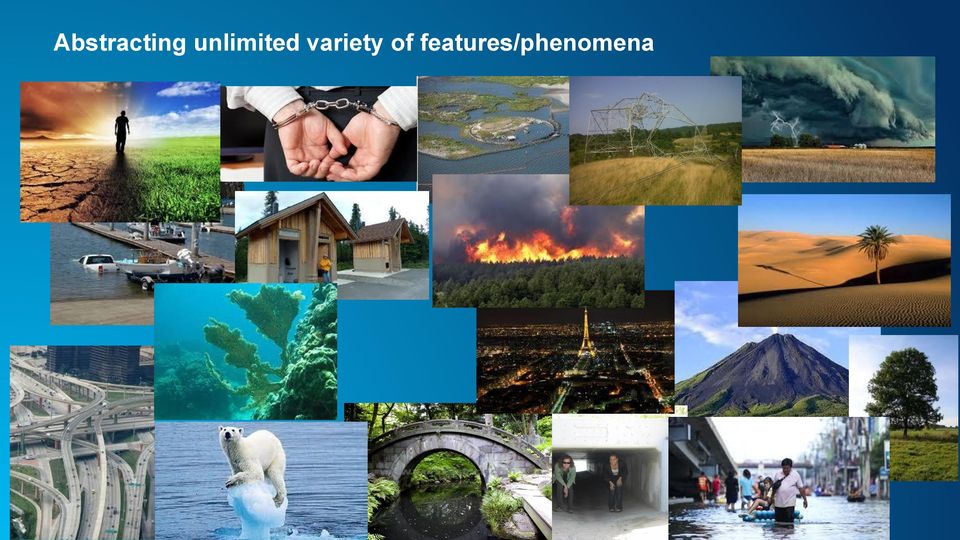
4 Abstracting unlimited variety of features/phenomena


5 GIS - merging diverse information Diverse: information types formats location reference systems perspectives Distributed Integrated by location

6 Laws Interoperability enablers Supportive networks, Interfaces, hardware Well trained Knowledgeable users Understand the need for quality Metadata to understand and use data and services properly Infrastructure Interoperability Standards Practical, widely used Providing technical and semantic interoperability Fit for purpose Geographic structures Data formats Content description Quality Data management Visualization Geoweb services Metadata Intellectual property protection, Authorization to share

7 ESRI learns about and supports standards through active participation: Organizations ISO TC 211 OGC ANSI/INCITS L1 CEN Global Map GSDI DGIWG IHO GWG Projects/Testbeds OGC Web Services testbeds GEOSS INSPIRE NATO Core GIS Implementations IT/industry standards GIS standards Standards Development International Standards Regional Standards National Standards Information Community Standards


8 Standards An agreement between a provider and a consumer a reference document enabling interoperability Standards Development Organizations (SDOs) ISO TC211 Abstract Models, Content, Vocabulary. Software Interfaces: Instantiations based on ISO and W3C standards XML/XSD, HTML, XSLT, URI... Domain Infrastructure

9 Technical interoperability standards ISO Metadata XML Schema WMS GML

10 Organizations in which ESRI participates to establish Technical Interoperability example: ISO 19128, example: WMS, WFS, GML example: XML, URI, HTML5

11 Semantic Interoperability Standards ISO Metadata Title = name by which the resource is known INSPIRE Data specification on Geology FGDC Framework data models GML

12 Organizations in which ESRI participates to establish Semantic Interoperability example: ISO Data quality, Feature Catalogue Methodology example: Point Symbology for Emergency Management, NAP example: INSPIRE Metadata Implementing Rules and Data Specifications example: FGDC Framework Themes, Content Standard for Digital Geospatial Metadata

 - ISO Spatial Schema, Coverages, Coordinate Ref Systems standards 2.")
 - OGC Simple Features 4. Data Formats (technical interoperability) - VPF, OGC GML 5.")
13 GIS Standardization functional areas 1. Basic Geographic Structures (semantic interoperability) - ISO Spatial Schema, Coverages, Coordinate Ref Systems standards 2. Content description (semantic interoperability) - FACC, SDSFIE, Standardized Data Models - Feature Catalogs, Metadata 3. Data Management (semantic and technical) - OGC Simple Features 4. Data Formats (technical interoperability) - VPF, OGC GML 5. Visualization (semantic and technical) - SLD, MIL-STD GeoWeb Services (technical interoperability) - OGC Catalog, Web Services, HTTP
 - OGC Simple Features 4. Data Formats (technical interoperability) - VPF, OGC GML 5.")
14 Putting it all together Using standard s functional areas to provide geographic knowledge Basic Geographic Structure Content Description Data Management Data Format Examples: ISO Spatial Schemas ISO Spatial referencing by coordinates ISO Schema for coverage geometry and functions Examples: ISO Rules for Application Schemas ISO Feature Catalog ISO Metadata ISO Classification Systems Visualization Web services Examples: GML, WMS, WCS WFS, MIL-STD 2525


15 ISO TC 211Participation ESRI provides leadership role in ISO TC 211 Standards Development: Project lead on many ISO Standards Provide technical experts on many Work Item project teams Provide support for ISO TC 211 standards outreach Meeting sponsorship

16 ISO TC 211 Standards examples ISO Spatial schema Conceptual schemata for describing, representing and manipulating the spatial characteristics of geographic features ISO Spatial referencing by coordinates Defines the conceptual schema for spatial reference systems. The data required to define 1, 2, and 3-dimensional systems ISO Metadata Schema for describing geographic information and services


17 ESRI serves many roles within OGC Board of Directors Architecture Board Planning Committee Technical Committee Lead several Standards and Domain Working Groups Joint Advisory Group to ISO TC211 OGC Forums Testbeds & Plugfests Testing & Compliancy Outreach Program Financial Support 160+ Compliant past and present products


18 OGC Web Services examples I-295 Web Map Service Geospatial picture publishing/viewing service Web Map Tile Service static base maps where the bounding box and scales have been constrained to discrete tiles Web Feature Service Geospatial feature publishing/streaming service Global Map Abstract: vector data NOAA Weather htt Abstract: point featur Landsat Abstract: 30m satelli Web Coverage Service Imagery and gridded data publishing/processing service Web Processing Service Interface for publishing geospatial algorithms, calculations or models Catalog Service-Web Metadata publishing/search service

19 ISO TC 211 Standards 6709: Standard representation of latitude, longitude and altitude for geographic point locations 19130:2010 -Sensor and data models for imagery and gridded data 19101: Reference model Part 1: Fundamentals SAR, InSAR, Lidar and Sonar : Reference model - Part 2: Imagery 19131: Data product specifications 19103: Conceptual schema language 19132: Location based services - Reference model 19104: Terminology 19133: Location based services - Tracking and navigation 19105: Conformance and testing 19134: Multimodal location based services for routing and navigation 19106: Profiles 19135: Procedures for registration of geographical information items 19107: Spatial schema XML Schema Implementation 19108: Temporal schema 19136: Geography Markup Language 19109: Rules for applicaiton schema 19137: Core profile of the spatial schema 19110: Methodology for feature cataloguing 19138: Data quality measures 19111: Spatial referencing by coordinates 19139: Metadata - XML schema implementation : Extension for parametric value 19141: Schema for moving features 19112: Spatial referencing by geographic identifiers 19142: Web Feature Service 19113: Quality principles 19143: Filter encoding 19114: Quality evaluation procedures : Classification Systems Part 1: Classification system structure 19115: Metadata Land Cover Meta Language (LCML) : Extension for imagery and gridded data Registry of representations of geographic point location 19116: Positioning services 19146: Cross-domain vocabulary 19117: Portrayal Transfer nodes 19118: Encoding Linear referencing 19119: Services Rights expression language for geographic information 19120: Functional standards Ontology - Part 1: Framework 19121: Imagery and gridded data Ontology - Part 2: Rules for developing OWL 19122: Qualifications and Certification of personnel Linear referencing 19123: Schema for coverage geometry and functions Land Administration Domain Model (LADM) Imagery and gridded data components Geospatial Digital Rights Management Reference Model : Simple feature access - Part 1: Common architecture Ubiquitous public access - Reference model : SQL option Place Identifier (PI) Architecture 19126: Profile - FACC Data Dictionary Observations and measurements 19127: Geodetic codes and parameters Data quality 19128: Web Map server interface Quality assurance of data supply 19129: Imagery, gridded and coverage data framework Calibration and validation of remote sensing imagery sensors and data Addressing

20 OGC Standards 1. Cat: ebrim App Profile: Earth Observation Products 2. Catalogue Service 3. CityGML 4. Coordinate Transformation 5. Filter Encoding 6. GML in JPEG GeoAPI 8. Geopackage 9. GeoSparql 10. Geography Markup Language 11. Geospatial extensible Access Control Markup Language (GeoXACML) 12. IndoorGML 13. KML 14. Location Services (OpenLS) 15. NetCDF 16. Observations and Measurements 17. Open GeoSMS 18. OpenMI 19. OpenSearch Geo 20. Ordering Services Framework for Earth Observation Products 21. OWS Context 22. PUCK 23. SWE Common Data Model 24. SWE Service Model 25. Sensor Model Language 26. Sensor Observation Service 27. Sensor Planning Service 28. Simple Features 29. Simple Features CORBA 30. Simple Features OLE/COM 31. Simple Features SQL 32. Styled Layer Descriptor 33. Symbology Encoding 34. Table Joining Service 35. WaterML 36. Web Coverage Processing Service 37. Web Coverage Service 38. Web Feature Service 39. Web Map Context 40. Web Map Service 41. Web Map Tile Service 42. Web Processing Service 43. Web Service Common

21 W3C Standards Accessibility (All) Accessible Rich Internet Applications (WAI-ARIA) Authoring Tool Accessibility Guidelines (ATAG) Best Practices for Authoring HTML CC/PP CSS Declarative Web Applications Device Description Repository DOM DOM events Efficient XML Interchange egovernment Geospatial Government Linked Data Graphics GRDDL HTML HTTP InkML Internationalization (All) Internationalization of Web Architecture Internationalization of Web Design and Applications Internationalization of XML Javascript APIs Linked Data MathML Media Access Mobile Web Applications Mobile Web Authoring Multimodal Web Applications OWL Web Ontology Language P3P PICS PNG POWDER Provenance Quality Assurance (QA) Framework RDB2RDF RDF RDF Relationship to Other Formats RDF vocabularies RDFa RIF Rule Interchange Format Security for User Agents Security for Web Applications Semantic Annotation for WSDL and XML Schema Service Modeling Language (SML) SKOS SMIL SOAP SPARQL Stylesheets in XML SVG SVG Tiny Timed Text User Agent Accessibility Guidelines (UAAG) Voice Web Architecture Web Content Accessibility Guidelines (WCAG) Web Fonts Web Performance Web Services Addressing Web Services Policy Web Services Resource Access WebCGM Widgets WSDL XForms XHTML For Mobile XHTML Modularization XInclude XKMS XLink XML XML Base XML Canonicalization XML Design Techniques XML Encryption XML Pipeline (XProc) XML Schema XML Signature XML-binary Optimized Packaging xml:id XPath XPointer XQuery XSL-FO XSLT
22 Coordinate Reference systems supported by ArcGIS Geographic coordinate systems - Africa (93) - Antarctica (6) - Asia (97) - Atlantic Ocean (30) - Australia/New Zealand (6) - Caribbean (22) - Europe (92) - Indian Ocean (9) - North America (34) - Pacific Ocean (56) - Solar System (9) - South America (39) - Spheroid-based (47) - World (17) Projected coordinate systems - Arc (equal arc-second) (18) - Continental - Africa (4) - Asia (7) - Europe (9) - North America (24) - South America (3) - Gauss Kruger - Asia (4) - Beijing 1954 (61) - CGCS2000 (62) - Europe (59) - New Beijing (65) - Pulkovo 1942 (~200) - Pulkovo 1995 (~200) - Turkey (7) - National Grids - Africa - Argentina - Asia - Australia - Austria - Canada - Europe - Finland - France - Germany - Indian Subcontinent - Indonesia - Japan - Libya - Malaysia and Singapore - New Zealand - North America - Norway - Oceans - South Africa - South America - South Korea - Sweden - Turkey - Polar - State Plane - State Systems - UTM - World - World (Sphere-based) - Xian 1980 (68)
23 FGDC endorsed External Standards (1) GeoTIFF Revision 1.0 Hierarchical Data Format V 5.0 Codes for Identification of Hydrologic Units in the U.S. and the Caribbean (Outlying) Areas... Codes for the Identification of Counties and Equivalent Areas of the United States... Codes for the Identification of the States and Equivalent Areas within the United States, Puerto Rico, and the Insular Areas Identifying Attributes for Named Physical and Cultural Geographic Features (Except Roads and Highways) of the United States... North American Profile of ISO 19115: Geographic information - Metadata (NAP - Metadata) Codes for the Identification of Metropolitan and Micropolitan Statistical Areas and Related Statistical Areas of the United States and Puerto Rico Codes for the Identification of Congressional Districts and Equivalent Areas of the United States... ISO Spatial schema ISO Temporal schema w/corrigendum 1 ISO Methodology for Feature Cataloguing ISO Spatial referencing by coordinates + extension for parametric values ISO Spatial referencing by geographic identifiers ISO Metadata + Corrigendum 1 ISO Metadata - Part 2: Extensions for imagery and gridded data ISO Encoding ISO Services + Amd 1 ISO Schema for coverage geometry and functions ISO Location Based Services - Reference model ISO Location Based Services - Tracking and navigation ISO Location Based Services - Multimodal routing and navigation ISO Procedures for registration of geographical information items ISO Schema for moving features ISO Rules for application schema ISO Geodetic codes and parameters ISO Data product specifications + Amendment 1 ISO Geographic Markup Language ISO Classification Systems -- Part 1: Classification system structure ISO Codes for the Representation of Names Of Countries and their Subdivisions
24 FGDC endorsed External Standards (2) ISO 6709Standards representation of geographic point locations by coordinates w/corrigendum 1 ISO/IEC : MPEG 2 - video ISO/IEC : MPEG 2 - audio ISO/IEC : JPEG 2000 ISO/IEC IS : JPEG ISO Conceptual schema language ISO Terminology ISO Data quality measures ISO Metadata -- XML schema implementation NetCDF (Network Common Data Form) Web Feature Service Implementation Specification, version with Corrigendum 1 Filter Encoding Implementation Specification, version 1.1 Web Map Context (WMC) Documents Implementation Specification, Version w/corrigendum 1 Web Processing Service, Version: w/ Corrigendum Symbology Encoding Implementation Specification, version Styled Layer Descriptor profile of the Web Map Service Implementation Specification, version Sensor Observation Service Interface Standard, version Location Services: Tracking Service Interface Standard Web Map Service Implementation Specification, Version SensorML Encoding Standard v 1.0 w/schema Corrigendum 1 (1.01) Catalogue Service (CAT) Implementation Specification (2.0.2) + Corrigendum for OpenGIS Implementation Specification : Catalogue Services, Version Catalogue Services Specification ISO Metadata Application Profile Web Map Tile Service Implementation Standard, version Web Coverage Service (WCS) Implementation Standard, version w/corrigendum 2 Location Services (OpenLS): Core Services, version 1.2 OGC KML 2.2 Abstract Test Suite (1.0.0) KML, version Location Services (OpenLS): Part 6-Navigation Service Location Services: Tracking Service Interface Standard Sensor Planning Service Implementation Specification, version Tagged Image File Format (TIFF) Unified Model Language (UML)2.2 GENC Ed.1 Geopolitical Entities, Names, and Codes Standard, Edition 1.0 ISO Observation and Measurements OGC WaterML 2.0 Part 1 Time series Time-Space-Position Information (TSPI), Version 2.0
25 DISR approved GEOINT Standards mandated (1) AIXM 5.1 Aeronautical Information Exchange Model BPCGM01.00 BIIF Profile for Computer Graphics Metafile BPJ2K01.10 BIIF Profile for JPEG 2000, CAT Catalogue Service (CAT) Implementation Specification DGIWG FACC DGIWG Feature and Attribute Coding Catalogue GRIB WMO No. 306 Manual on Codes, International Codes, Ext. BUFR WMO Manual on Codes, International Codes, Volume 1.2 GeoTIFF Revision 1 GeoTIFF Format Specification, GeoXACML GML2 Geospatial extensible Access Control Markup GeoXACML GML3 Geospatial extensible Access Control Markup Language GML Geography Markup Language Encoding Specification IEC :2008 Quantities and units - Part 6: Electromagnetism ISO 19107:2003 Spatial schema ISO 19108:2002 Temporal schema ISO 19109:2005 Rules for application schema ISO 19110:2005 Methodology for feature cataloguing ISO 19111:2007 Spatial referencing by coordinates ISO 19112:2003 Spatial referencing by geographic identifiers ISO :2009 Metadata - Part 2: Extensions for imagery and gridded data ISO 19115:2003 Metadata, 8 May 2003, with Technical Corrigendum 1 ISO 19119:2005 Services ISO 19123:2005 Schema for coverage geometry and functions, ISO 19126:2009 Feature concept dictionaries and registers, ISO 19135:2005 Procedures for item registration, ISO 19136:2007 Geography Markup Language, ISO 19142:2010 Web Feature Service, ISO :2006 Part 1: Country codes, ISO :2007 Part 2: Country subdivision code, ISO 6709:2008 w/cor1:2009 Standard representation of geographic point location by coordinates ISO :2009 Quantities and units - Part 1: General ISO :2006 Quantities and units - Part 3: Space and time ISO :2006 Quantities and units - Part 4: Mechanics ISO :2008 Quantities and units - Part 7: Light
26 DISR approved GEOINT Standards mandated (2) MISB STD Video Moving Target Indicator and Track Metadata MISP v6.4 Motion Imagery Standards Profile NGA.IP.0001_2.0 Implementation Profile for GeoTIFF NGA.IP.0002_1.0 High Resolution Elevation (HRE) Products, NGA.IP.0003_1.0 NITF Implementation Profile for LiDAR Systems NGA.IP.0006_1.0 NITF Implementation Profile for Tactical Hyperspectral Imagery NGA.STND _2.1 NSG Metadata Foundation (NMF) - Part 1: Conceptual Schema NGA.STND _1.0 NSG Metadata Foundation (NMF) - Part 2: Quality Metadata, NGA.STND _1.0.0 NSG Metadata Foundation (NMF) - Part 3: Metadata for Imagery and Gridded Data NGA.STND.0015_3.1 Display Performance Standard, Version 3.1 NGA.STND.0016_2.1 Softcopy Exploitation Facility Standard, Version 2.1 NGA.STND.0017_3.0.1 Community Sensor Model (CSM) Technical Requirements Document NGA.STND.0018_2.1 NSG Metadata Implementation Specification (NMIS) XML Exchange Schema NGA.STND.0020_5.0 NSG Feature Data Dictionary (NFDD), Version 5.0 NGA.STND.0021_5.0 NSG Entity Catalog (NEC), Version 5.0 NGA.STND.0022_5.0 NSG Application Schema (NAS) - Part 1: Platform Independent Model, Version 5.0 NGA.STND _1.0 Sensor Independent Complex Data (SICD) Design & Implementation Description Document NGA.STND _1.0 SICD, File Format Description Document NGA.STND _1.0 SICD Image Projections Description Document NGA.STND _1.0 SIDD Design and Implementation Description Document NGA.STND _1.0 Sensor Independent Derived Data (SIDD) NITF File Format Description Document, Version 1.0 NGA.STND _1.0 Sensor Independent Derived Data (SIDD) GeoTIFF File Format Description Document NGA.STND.0026_5.0 NSG Topographic Data Store (TDS) Content Specification, Version 5.0 NGA.STND.0033_1.0 Geopolitical Entities, Names, and Codes (GENC) Standard, Edition 1.0 NGA.STND.0034_ Joint OPIR Logical Data Model (JODM) Version OCL v2.2 Object Constraint Language (OCL), Version 2.2 OGC GML sfp v2.0 w/cor Geography Markup Language (GML) simple features profile, OGC KML OGC KML, Version OGC SensorML v1.0.0 OpenGIS Sensor Model Language (SensorML) OGC SLD OGC WCS Styled Layer Descriptor Web Coverage Service (WCS) Implementation Standard OpenGIS Filter 1.1 Filter Encoding Implementation Specification, Version OpenGIS SOS 1.0 Sensor Observation Service Implementation Specification, Rec. BT (01/07) Studio encoding parameters of digital television for standard 4:3 and 16:9 aspect ratios, SDSFIE 3.0 Gold Spatial Data Standards for Facilities, Infrastructure, and Environment, SE Symbology Encoding Implementation Specification, Version: SMPTE 336M-2007 Data Encoding Protocol Using Key-Length-Value, SMPTE 377M Material Exchange Format (MXF) - File Format Specification SPS 1.0 Sensor Planning Service Implementation Specification STANAG 3809 Digital Terrain Elevation Data (DTED) Exchange Format STANAG 4559 NATO Standard ISR Library Interface, Edition 3 STANAG 4607 NATO Ground Moving Target Indicator Format (GMTIF), Edition 3 STANAG 7098 Edition 2 Compressed ARC Digitized Raster Graphics (CADRG) STANAG 7099 Edition 2 Controlled Image Base (CIB), 26 November 2004 STANAG 7172 (Ed.2) Use of Geomagnetic Models STANAG 7194 Edition 1 NATO Imagery Interpretability Rating Scale (NIIRS) STDI-0001 v1.3/cn3 National Support Data Extensions (SDE) for the NITF STDI _4.0 Controlled Extensions (CE) for NITF Tagged Record Extensions STDI _1.0 The Compendium of Controlled Extensions (CE) for NITF STDI-0006, 23 July 2008 National Imagery Transmission Format (NITF) T3D v6.4r1 Tasked Target Text Data v6.4r1 TIFF Revision 6.0 TIFF, Revision 6.0, Adobe Systems Inc. U.S. DoD IP 1.1 Motion Imagery for Situational Awareness U.S. DoD USIP 1.1 Line of Sight Transmission of Motion Imagery for Battlespace Awareness U.S. DoD USIP 1.2:2012 Beyond Line-of-Sight Transmission of Sensor Data for Battle Space Awareness UML 2.2 Unified Modeling Language (UML) Superstructure WFS 1.1 Web Feature Service WMC 1.1 Web Map Context WMS 1.3 Web Map Service WMTS v1.0.0 Web Map Tile Service Implementation Standard WPS 1.0 Web Processing Service
27 Standards for Geospatial Information The bad news whew, a lot of standards - Many organizations feel their needs are special - Politically feel the need for an exclusive approach - As a broad based GIS provider Esri is involved a larger number than most The good news - There is overlap! - Some standards are foundations for others - Esri doesn t need to implement all - Some are mainstream IT standards - Esri is very active in getting SDOs to work together - Interoperability is working

28 Full list of Esri implementing, compliant, and reference implementations Sort on ESRI
29 Interoperability across ArcGIS
30 Desktop Web Device Application Layer ArcGIS Online Portal Integration Layer Server Online Content and Services Data Layer Interoperability across

31 Data Layer Exchange, Manage, Analyze Shapefile, Geopackage, SQLite Relational Databases BIG Data Sources Hadoop, SAP HANA, Teradata Multi-dimensional data netcdf, GRIB, HDF Plug-in Data Sources MongoDB Focus: Datasets
32 Integration Layer Enterprise GIS Platform Extract Transform Load (ETL) using Python Data Interoperability Extension GeoEvent Extension Adapters OGC WMS, WMTS, WFS, WFS-T, WCS, WPS Partner Solutions: - OSIsoft (realtime data, internet of things) - SAP (enterprise resource management, geoanalytics) - Focus: Web Services

33 Application Layer ArcGIS Apps for - Android, ios, Windows, ArcGIS CMS Modules - Drupal, WordPress, SharePoint, Kentico, TYPO3, ArcGIS API for Focus: Webmaps User Interface Framework Components Components ArcGIS Online ArcGIS Portal API Web Services ArcGIS JS API

34
Presentation / Interface 1.3
 W3C Recommendations Mobile Web Best Practices 1.0 Canonical XML Version 1.1 Cascading Style Sheets, level 2 (CSS2) SPARQL Query Results XML Format SPARQL Protocol for RDF SPARQL Query Language for RDF
How To Use Gis
 Welcome Understanding Purpose Creating Relationships You A Global Community of GIS Professionals Changing the World Together Applying Geography Everywhere Your WORK Showcasing Your Web Apps Vision Applying
Vision. South Pacific GIS/RS Conference 2015 11/17/2015. Applying Geography Everywhere. Applying Geography Everywhere
 South Pacific GIS/RS Conference 2015 Applying Geography Everywhere Jithen (J) Singh Eagle Technology Group Ltd (Esri New Zealand) Suva, Fiji Vision Applying Geography Everywhere 1 GIS Is Evolving A Whole
INTEROPERABLE IMAGE DATA ACCESS THROUGH ARCGIS SERVER
 INTEROPERABLE IMAGE DATA ACCESS THROUGH ARCGIS SERVER Qian Liu Environmental Systems Research Institute 380 New York Street Redlands, CA92373, U.S.A - qliu@esri.com KEY WORDS: OGC, Standard, Interoperability,
GEOCOM PROJECT INTEGRATING DATA & TECHONOLOGIES
 GEOCOM PROJECT INTEGRATING DATA & TECHONOLOGIES Lucio Colaiacomo Chief Technology Officer l.colaiacomo@eusc.europa.eu Rationale for the project Providing support through our domain background & tech. expertise
ArcGIS Framework Plug-In: Extending the ArcGIS Desktop for ANSI Standard Framework Data to Support Government Decision Making
 ArcGIS Framework Plug-In: Extending the ArcGIS Desktop for ANSI Standard Framework Data to Support Government Decision Making Final Project Report October 28, 2008 Agreement Number Organization Project
UK Location Programme
 Location Information Interoperability Board Data Publisher How To Guide Understand the background to establishing an INSPIRE View Service using GeoServer DOCUMENT CONTROL Change Summary Version Date Author/Editor
Applying Semantic Web Technologies in Service-Oriented Architectures
 Applying Semantic Web Technologies in Service-Oriented Architectures 24 August 2015 Semantic Web for Air Transportation (SWAT) Luis Bermudez - OGC Charles Chen - Skymantics Copyright 2015 Open Geospatial
Sextant. Spatial Data Infrastructure for Marine Environment. C. Satra Le Bris, E. Quimbert, M. Treguer
 Sextant On-Line information system for marine geographical information E. Quimbert, M. Bellouis, F. Lecuy, M. Treguer Centre de Bretagne BP 70, Plouzané 29280 France E-mail: sextant@ifremer.fr Sextant
Chief Architect and Executive Director, Interoperability Program Open Geospatial Consortium
 Overview of OGC Services Architecture Presentation to NOAA EDM, May 2012 George Percivall Chief Architect and Executive Director, Interoperability Program Open Geospatial Consortium Overview of OGC Services
Choosing the right GIS framework for an informed Enterprise Web GIS Solution
 13 ANNUAL INTERNATIONAL CONFERENCE AND EXHIBITION ON GEOSPATIAL INFORMATION TECHNOLOGY AND APPLICATIONS Epicentre; Gurgaon, India; 19-21 January, 2010 Choosing the right GIS framework for an informed Enterprise
Interoperable Solutions in Web-based Mapping
 ISPRS SIPT IGU UCI CIG ACSG Table of contents Table des matières Authors index Index des auteurs Search Recherches Exit Sortir Interoperable Solutions in Web-based Mapping Marta Wojnarowska and Bridget
Introduction to Geospatial Web Services
 Geospatial Web Services Introduction to Geospatial Web Services An introduction and inventory of geospatial web services and their importance to interoperability in the geospatial domain. vers. 20100604
GeoMedia Product Update. Title of Presentation. Lorilie Barteski October 15, 2008 Edmonton, AB
 Product Update Title of Presentation Lorilie Barteski Edmonton, AB Know the audience poll Existing /Pro users Version 6.1 Version 6.0 Version 5.2 or earlier Existing WebMap users Version 6.1 Version 6.0
Semantic Method of Conflation. International Semantic Web Conference Terra Cognita Workshop Oct 26, 2009. Jim Ressler, Veleria Boaten, Eric Freese
 Semantic Method of Conflation International Semantic Web Conference Terra Cognita Workshop Oct 26, 2009 Jim Ressler, Veleria Boaten, Eric Freese Northrop Grumman Information Systems Intelligence Systems
Web technologies - past, present, future
 Web technologies - past, present, future or The Web @ 25 From 25 years of history... into the future or Why am I standing here? or Why are you here? Olle Olsson Swedish W3C Office Swedish Institute of
Standardized data sharing through an open-source Spatial Data Infrastructure: the Afromaison project
 Standardized data sharing through an open-source Spatial Data Infrastructure: the Afromaison project Yaniss Guigoz - University of Geneva/GRID-Geneva 1 EcoARM2ERA and AFROMAISON Why Afromaison in this
VISUAL INSPECTION OF EO DATA AND PRODUCTS - OVERVIEW
 WMS services from the EUMETSAT real-time Image Gallery Uwe Voges (1), Michael Schick (2), Udo Einspanier (1) (1) con terra GmbH Martin-Luther-King-Weg 24, 48155, Münster, Germany EMail: (U.Voges U.Einspanier)@conterra.de
Proposal for a Spatial Data Infrastructure Standards Suite: SDI 1.0
 This article from Research and Theory in Advancing Spatial Data Infrastructure Concepts (ed. Harlan Onsrud; Redlands, CA: ESRI Press, 2007) is made available under a Creative Commons License, Attribution
_ LUCIADLIGHTSPEED PRODUCT DATA SHEET
 _ LUCIADLIGHTSPEED PRODUCT DATA SHEET V2015.1 1 LuciadLightspeed is a software product that enables you to rapidly develop situational awareness applications. It provides a base application and software
The Nordic way to International standardization ISO/TC 211
 «Think Local - Act Global» Why engagement in international standards development is important A Nordic Perspective The Nordic way to International standardization Olaf Magnus Østensen Chair of Norway SOSI
MSDI Open Forum Building a Maritime Spatial Data Infrastructure Are the principles at odds with strategies for delivery?
 MSDI Open Forum Building a Maritime Spatial Data Infrastructure Are the principles at odds with strategies for delivery? Rafael Ponce Global Maritime Business Development Manager, Esri Inc. Tuesday, March
Data Models For Interoperability. Rob Atkinson
 Data Models For Interoperability Rob Atkinson Contents Problem Statement Conceptual Architecture Role of Data Models Role of Registries Integration of GRID and SDI Problem Statement How do we derive useful
Institute of Computational Modeling SB RAS
 Institute of Computational Modeling SB RAS ORGANIZATION OF ACCESS TO OBSERVATIONAL DATA USING WEB SERVICES FOR MONITORING SYSTEMS THE STATE OF THE ENVIRONMENT Kadochnikov Aleksey A. Russia, Krasnoyarsk
Clemens Portele interactive instruments GmbH
 GML - TU Delft - Standards in Action - 17.11.2004 GML Geography Markup Language Clemens Portele interactive instruments GmbH interactive instruments GmbH GML - TU Delft - Standards in Action - 17.11.2004
Visualization Method of Trajectory Data Based on GML, KML
 Visualization Method of Trajectory Data Based on GML, KML Junhuai Li, Jinqin Wang, Lei Yu, Rui Qi, and Jing Zhang School of Computer Science & Engineering, Xi'an University of Technology, Xi'an 710048,
Big Data Volume & velocity data management with ERDAS APOLLO. Alain Kabamba Hexagon Geospatial
 Big Data Volume & velocity data management with ERDAS APOLLO Alain Kabamba Hexagon Geospatial Intergraph is Part of the Hexagon Family Hexagon is dedicated to delivering actionable information through
Metadata Focus Group Charter CHARTER. Metadata Focus Group (MFG) of the Geospatial Intelligence Standards Working Group (GWG)
 of the Geospatial Intelligence Standards Working Group (GWG)") Metadata Focus Group Charter CHARTER Metadata Focus Group (MFG) of the Geospatial Intelligence Standards Working Group (GWG) 31 October 2008 Metadata Focus Group Charter Charter for the Metadata Focus
Metadata Focus Group Charter CHARTER Metadata Focus Group (MFG) of the Geospatial Intelligence Standards Working Group (GWG) 31 October 2008 Metadata Focus Group Charter Charter for the Metadata Focus
Data interchange between Web client based task controllers and management information systems using ISO and OGC standards
 Data interchange between Web client based task controllers and management information systems using ISO and OGC standards Michael Nørremark 1*, Ole Jørgensen 1, Jens Bligaard 2 and Claus G. Sørensen 1
GIS Databases With focused on ArcSDE
 Linköpings universitet / IDA / Div. for human-centered systems GIS Databases With focused on ArcSDE Imad Abugessaisa g-imaab@ida.liu.se 20071004 1 GIS and SDBMS Geographical data is spatial data whose
A Web services solution for Work Management Operations. Venu Kanaparthy Dr. Charles O Hara, Ph. D. Abstract
 A Web services solution for Work Management Operations Venu Kanaparthy Dr. Charles O Hara, Ph. D Abstract The GeoResources Institute at Mississippi State University is leveraging Spatial Technologies and
INSPIRE in practice: Experiences with INSPIRE data and services
 INSPIRE in practice: Experiences with INSPIRE data and services Peter Parslow Principal Geographic Information Architect June 2014: ISO TC211 Standards in Practice workshop What s INSPIRE? European Commission
A RDF Vocabulary for Spatiotemporal Observation Data Sources
 A RDF Vocabulary for Spatiotemporal Observation Data Sources Karine Reis Ferreira 1, Diego Benincasa F. C. Almeida 1, Antônio Miguel Vieira Monteiro 1 1 DPI Instituto Nacional de Pesquisas Espaciais (INPE)
J9.6 GIS TOOLS FOR VISUALIZATION AND ANALYSIS OF NEXRAD RADAR (WSR-88D) ARCHIVED DATA AT THE NATIONAL CLIMATIC DATA CENTER
 ARCHIVED DATA AT THE NATIONAL CLIMATIC DATA CENTER") J9.6 GIS TOOLS FOR VISUALIZATION AND ANALYSIS OF RADAR (WSR-88D) ARCHIVED DATA AT THE NATIONAL CLIMATIC DATA CENTER Steve Ansari * STG Incorporated, Asheville, North Carolina Stephen Del Greco NOAA National
J9.6 GIS TOOLS FOR VISUALIZATION AND ANALYSIS OF RADAR (WSR-88D) ARCHIVED DATA AT THE NATIONAL CLIMATIC DATA CENTER Steve Ansari * STG Incorporated, Asheville, North Carolina Stephen Del Greco NOAA National
The use of Semantic Web Technologies in Spatial Decision Support Systems
 The use of Semantic Web Technologies in Spatial Decision Support Systems Adam Iwaniak Jaromar Łukowicz Iwona Kaczmarek Marek Strzelecki The INSPIRE Conference 2013, 23-27 June Wroclaw University of Environmental
The FGDC Geospatial Metadata Standard and Other Initiatives
 The FGDC Geospatial Metadata Standard and Other Initiatives Norman C. Andersen NGA Metadata Officer, National Center for Geospatial Intelligence Standards Overall Classification of this briefing is UNCLASSIFIED
ArcGIS. Server. A Complete and Integrated Server GIS
 ArcGIS Server A Complete and Integrated Server GIS ArcGIS Server A Complete and Integrated Server GIS ArcGIS Server enables you to distribute maps, models, and tools to others within your organization
Welcome Esri Classified User Symposium
 Welcome Esri Classified User Symposium Understanding Purpose Creating Relationships Special Achievement in GIS (SAG) Award Applying Geography Everywhere Your WORK Cartography Aeronautical Topographic Nautical
Oklahoma s Open Source Spatial Data Clearinghouse: OKMaps
 Oklahoma s Open Source Spatial Data Clearinghouse: OKMaps Presented by: Mike Sharp State Geographic Information Coordinator Oklahoma Office of Geographic Information MAGIC 2014 Symposium April 28-May1,
GetLOD - Linked Open Data and Spatial Data Infrastructures
 GetLOD - Linked Open Data and Spatial Data Infrastructures W3C Linked Open Data LOD2014 Roma, 20-21 February 2014 Stefano Pezzi, Massimo Zotti, Giovanni Ciardi, Massimo Fustini Agenda Context Geoportal
Geospatial exploitation Products. GXP WebView. Powered by the GXP Platform
 Geospatial exploitation Products GXP WebView Powered by the GXP Platform Exploitation Capabilities GXP WebView Powered by the GXP Platform Detailed annotation (text, points, lines, and polygons) Distance,
Study of GML-Based Geographical Data Visualization Strategy
 Study of GML-Based Geographical Data Visualization Strategy ZHANG LIN 1, CHEN SHI-BIN 2 1 College of Information Technology, ZheJiang University of Finance & Economics, HangZhou 310012, China 2 College
Enabling embedded maps
 Enabling embedded maps Case: National geoportal of Finland Antti Rainio National Land Survey of Finland Trends: Web Services, Mapping Mashup, Open Source, Open Data Decentralised data s Service interfaces
Enterprise GIS Solutions to GIS Data Dissemination
 Enterprise GIS Solutions to GIS Data Dissemination ESRI International User Conference July 13 17, 2009 Wendy M. Turner Senior GIS Engineer & Program Manager Freedom Consulting Group, LLC Building the Enterprise
MSDI: Workflows, Software and Related Data Standards
 MSDI: Workflows, Software and Related Data Standards By Andy Hoggarth October 2009 Introduction Leveraging SDI principles for hydrographic operational efficiency French INFRAGEOS example (SHOM - Service
_ LUCIADRIA PRODUCT DATA SHEET
 _ LUCIADRIA PRODUCT DATA SHEET V2015.1 LuciadRIA offers browser-based geospatial situational awareness with the fluidity and speed of a desktop application. The software components of LuciadRIA have been
Web and Mobile GIS Applications Development
 Web and Mobile GIS Applications Development Presented by : Aamir Ali Manager Section Head (GIS Software Customization) Pakistan Space and Upper Atmosphere Research Commission (SUPARCO) Geographical Information
A New Governance Plan for the Spatial Data Standards for Facilities, Infrastructure, and Environment (SDSFIE)
") A New Governance Plan for the Spatial Data Standards for Facilities, Infrastructure, and Environment (SDSFIE) Mr. David LaBranche, PE DISDI Program Manager ODUSD(I&E) July 15, 2014 ESRI IUC 1 Agenda Outline
A New Governance Plan for the Spatial Data Standards for Facilities, Infrastructure, and Environment (SDSFIE) Mr. David LaBranche, PE DISDI Program Manager ODUSD(I&E) July 15, 2014 ESRI IUC 1 Agenda Outline
LSD APC Part I Workshop Geographic Information System. Danny Yeung 14 November 2015
 LSD APC Part I Workshop Geographic Information System Danny Yeung 14 November 2015 Purposes To help LSD probationers to prepare for the LSD APC Part I Written Assessment to be held in December 2015. To
ArcGIS Data Models Practical Templates for Implementing GIS Projects
 ArcGIS Data Models Practical Templates for Implementing GIS Projects GIS Database Design According to C.J. Date (1995), database design deals with the logical representation of data in a database. The
PART 1. Representations of atmospheric phenomena
 PART 1 Representations of atmospheric phenomena Atmospheric data meet all of the criteria for big data : they are large (high volume), generated or captured frequently (high velocity), and represent a
Design Requirements for an AJAX and Web-Service Based Generic Internet GIS Client
 11th AGILE International Conference on Geographic Information Science 2008 Page 1 of 6 Design Requirements for an AJAX and Web-Service Based Generic Internet GIS Client Edward Nash 1, Peter Korduan 1,
ArcGIS Platform. An Integrated System. Portal
 Platform An Integrated System Portal An Integrated Web GIS Platform Knowledge Workers Executive Access Public Engagement Work Anywhere Enterprise Integration Providing Mapping, Analysis, Data Management,
An architecture for open and scalable WebGIS
 An architecture for open and scalable WebGIS Aleksandar Milosavljević, Leonid Stoimenov, Slobodanka Djordjević-Kajan CG&GIS Lab, Department of Computer Science Faculty of Electronic Engineering, University
Web Map Service Architecture for Topographic Data in Finland
 Web Map Service Architecture for Topographic Data in Finland Teemu Sipilä National Land Survey of Finland Abstract. Since 2012 National Land Survey of Finland has been renewing its web map services and
Editing Strategies for Enterprise Geodatabase
 Federal GIS Conference February 9 10, 2015 Washington, DC Editing Strategies for Enterprise Geodatabase Ty Fabling Esri Solution Engineer A Complete Platform Enabling GIS Everywhere Desktop Web Device
Harmonizing Survey Deliverables Emerging Standards and Smart Data Exchange
 Harmonizing Survey Deliverables Emerging Standards and Smart Data Exchange Andy Hoggarth and Karen Cove, CARIS, Fredericton, Canada Introduction When a survey company plans a project the deliverables are
_ LUCIADMOBILE V2015 PRODUCT DATA SHEET _ LUCIADMOBILE PRODUCT DATA SHEET
 _ LUCIADMOBILE PRODUCT DATA SHEET V2015 LuciadMobile enables the rapid development of geospatial situational awareness applications on mobile devices running Android, and is specifically designed for situational
SuperGIS Server 3.2 Standard Edition Specification
 SuperGIS Server 3.2 Standard Edition Specification 20140826 Specification 1. All of the services support SOAP (Simple Object Access Protocol). 2. Use map file created by SuperGIS Desktop as map services
Big Data, Cloud Computing, Spatial Databases Steven Hagan Vice President Server Technologies
 Big Data, Cloud Computing, Spatial Databases Steven Hagan Vice President Server Technologies Big Data: Global Digital Data Growth Growing leaps and bounds by 40+% Year over Year! 2009 =.8 Zetabytes =.08
Web Map Context Service for Adaptive Geospatial Data Visualization
 Web Map Context Service for Adaptive Geospatial Data Visualization Miloš Bogdanović, Danilo Vulović, Leonid Stoimenov INTRODUCTION Faculty of Electronic Engineering, University of Niš, Serbia {milos.bogdanovic,
Correspondence can be sent to: GeoConnections Natural Resources Canada 615 Booth Street Ottawa, Ontario K1A 0E9
 Quick Guide for CGDI Service Compliance Testing and Performance Optimization May 12, 2009 Correspondence can be sent to: GeoConnections Natural Resources Canada 615 Booth Street Ottawa, Ontario K1A 0E9
OGC Smart Cities Spatial Information Framework
 Open Geospatial Consortium Submission Date: 2014-11-26 Approval Date: 2014-12-05 Publication Date: 2015-01-21 External identifier of this OGC document: http://www.opengis.net/doc/wp/smart-cities-sif Internal
GENESIS Employing Web Processing Services and Sensor Web Technology for Environmental Management
 GENESIS Employing Web Processing Services and Sensor Web Technology for Environmental Management Steven Smolders (1), Christian Alegre (2), Simone Gianfranceschi (3), Marc Gilles (4), Bernd Resch (5),
About scope of OpenGIS technology in oceanographic data management and visualization Andrey V. Golik, Vitaly K. Fischenko, Stepan G.
 About scope of OpenGIS technology in oceanographic data management and visualization Andrey V. Golik, Vitaly K. Fischenko, Stepan G. Antushev V.I.Il ichev Pacific Oceanological Institute Far-Eastern Branch
ERDAS APOLLO 2009. How to manage/catalog/share Raster & vector data. ERDAS, Inc. A Hexagon Company. All Rights Reserved 1
 ERDAS APOLLO 2009 How to manage/catalog/share Raster & vector data ERDAS, Inc. A Hexagon Company. All Rights Reserved 1 Here we are; Again Leica Geosystems Geospatial Imaging is now ERDAS, Inc. ERDAS,
ENVI THE PREMIER SOFTWARE FOR EXTRACTING INFORMATION FROM GEOSPATIAL IMAGERY.
 ENVI THE PREMIER SOFTWARE FOR EXTRACTING INFORMATION FROM GEOSPATIAL IMAGERY. ENVI Imagery Becomes Knowledge ENVI software uses proven scientific methods and automated processes to help you turn geospatial
Description and Testing of the Geo Data Portal: A Data Integration Framework and Web Processing Services for Environmental Science Collaboration
 Description and Testing of the Geo Data Portal: A Data Integration Framework and Web Processing Services for Environmental Science Collaboration Open-File Report 2011 1157 U.S. Department of the Interior
Harmonizing Survey Deliverables Emerging Standards and Smart Data Exchange
 Harmonizing Survey Deliverables Emerging Standards and Smart Data Exchange Andy Hoggarth, CARIS 115 Waggoners Lane, Fredericton, New Brunswick, Canada andy.hoggarth@caris.com Karen Cove, CARIS 115 Waggoners
The ORIENTGATE data platform
 Seminar on Proposed and Revised set of indicators June 4-5, 2014 - Belgrade (Serbia) The ORIENTGATE data platform WP2, Action 2.4 Alessandra Nuzzo, Sandro Fiore, Giovanni Aloisio Scientific Computing and
OPEN STANDARD WEB SERVICES FOR VISUALISATION OF TIME SERIES DATA OF FLOOD MODELS
 OPEN STANDARD WEB SERVICES FOR VISUALISATION OF TIME SERIES DATA OF FLOOD MODELS Barend Köbben FRMRC RPA 7 Workshop visualisations and flow simulations as flood risk communication tools
Semantic Interoperability
 Ivan Herman Semantic Interoperability Olle Olsson Swedish W3C Office Swedish Institute of Computer Science (SICS) Stockholm Apr 27 2011 (2) Background Stockholm Apr 27, 2011 (2) Trends: from
Leveraging Metadata Standards in ArcGIS for Interoperability
 Esri International User Conference San Diego, California Technical Workshops July 26, 2012 Leveraging Metadata Standards in ArcGIS for Interoperability David Danko Aleta Vienneau Leveraging Metadata Standards
GIS Initiative: Developing an atmospheric data model for GIS. Olga Wilhelmi (ESIG), Jennifer Boehnert (RAP/ESIG) and Terri Betancourt (RAP)
, Jennifer Boehnert (RAP/ESIG) and Terri Betancourt (RAP)") GIS Initiative: Developing an atmospheric data model for GIS Olga Wilhelmi (ESIG), Jennifer Boehnert (RAP/ESIG) and Terri Betancourt (RAP) Unidata seminar August 30, 2004 Presentation Outline Overview
GIS Initiative: Developing an atmospheric data model for GIS Olga Wilhelmi (ESIG), Jennifer Boehnert (RAP/ESIG) and Terri Betancourt (RAP) Unidata seminar August 30, 2004 Presentation Outline Overview
Standards, Tools and Web 2.0
 Standards, Tools and Web 2.0 Web Programming Uta Priss ZELL, Ostfalia University 2013 Web Programming Standards and Tools Slide 1/31 Outline Guidelines and Tests Logfile analysis W3C Standards Tools Web
Geospatial Platforms For Enabling Workflows
 Geospatial Platforms For Enabling Workflows Steven Hagan Vice President Oracle Database Server Technologies May, 2015 Evolution of Enabling Workflows HENRY FORD 100 YEARS AGO Industrialized the Manufacturing
DISMAR implementing an OpenGIS compliant Marine Information Management System
 DISMAR implementing an OpenGIS compliant Marine Information Management System Éamonn Ó T uama, Coastal & Marine Resources Centre, ERI, University College Cork. DISMAR DISMAR (Data Integration System for
The premier software for extracting information from geospatial imagery.
 Imagery Becomes Knowledge ENVI The premier software for extracting information from geospatial imagery. ENVI Imagery Becomes Knowledge Geospatial imagery is used more and more across industries because
Geospatial Platforms For Enabling Workflows
 Geospatial Platforms For Enabling Workflows Steven Hagan Vice President Oracle Database Server Technologies November, 2015 Evolution of Enabling Workflows HENRY FORD 100 YEARS AGO Industrialized the Manufacturing
XML for Manufacturing Systems Integration
 Information Technology for Engineering & Manufacturing XML for Manufacturing Systems Integration Tom Rhodes Information Technology Laboratory Overview of presentation Introductory material on XML NIST
Developing Business Intelligence and Data Visualization Applications with Web Maps
 Developing Business Intelligence and Data Visualization Applications with Web Maps Introduction Business Intelligence (BI) means different things to different organizations and users. BI often refers to
GeoNetwork, The Open Source Solution for the interoperable management of geospatial metadata
 GeoNetwork, The Open Source Solution for the interoperable management of geospatial metadata Ing. Emanuele Tajariol, GeoSolutions Ing. Simone Giannecchini, GeoSolutions GeoSolutions GeoSolutions GeoNetwork
Scalability of LBS in Mobile GIS Using Web Services
 International Journal of Electronics and Computer Science Engineering 107 Available Online at www.ijecse.org ISSN- 2277-1956 Scalability of LBS in Mobile GIS Using Web Services G. B. V. Padmanadh 1, Dr.
IBM Informix. Reference Documentation on Why Informix Spatial for GIS Projects
 IBM Informix Reference Documentation on Why Informix Spatial for GIS Projects Page 1 of 10 Contents Compliant with OGC... 3 Addressing the SQL standards... 3 Native Spatial, Intuitive Data Types... 3 Powerful
Agents and Web Services
 Agents and Web Services ------SENG609.22 Tutorial 1 Dong Liu Abstract: The basics of web services are reviewed in this tutorial. Agents are compared to web services in many aspects, and the impacts of
GEOGRAPHIC INFORMATION SYSTEMS CERTIFICATION
 GEOGRAPHIC INFORMATION SYSTEMS CERTIFICATION GIS Syllabus - Version 1.2 January 2007 Copyright AICA-CEPIS 2009 1 Version 1 January 2007 GIS Certification Programme 1. Target The GIS certification is aimed
Scientific Data Management and Dissemination
 Federal GIS Conference February 9 10, 2015 Washington, DC Scientific Data Management and Dissemination John Fry Solution Engineer, Esri jfry@esri.com Agenda Background of Scientific Data Management through
XML- New meta language in e-business
 1 XML- New meta language in e-business XML (extensible Markup Language) has established itself as a new meta language in e-business. No matter what, text, pictures, video- or audio files - with the flexibility
PDOK Kaart, the Dutch Mapping API
 PDOK Kaart, the Dutch Mapping API Haico van der Vegt*, Leo van der Sluijs* * Cadastre, Land Registry and Mapping Agency of the Netherlands Abstract. PDOK (public services on the map) is a partnership of
DEVELOPMENT OF THE INTEGRATING AND SHARING PLATFORM OF SPATIAL WEBSERVICES
 DEVELOPMENT OF THE INTEGRATING AND SHARING PLATFORM OF SPATIAL WEBSERVICES Lan Xiaoji 1,2 Lu Guonian 1 Zhang Shuliang 1 Shi Miaomiao 1 Yin Lili 1 1. Jiangsu Provincial Key Lab of GIS Science, Nanjing Normal
About As. In a team with the best. ESRI Bulgaria is the exclusive distributor of Esri Inc. for Bulgaria. Esri Inc.
 About As ESRI Bulgaria is an IT company, leader in the field of Geographic Information Systems (GIS) on the Bulgarian market. Offering the most advanced high-tech products, solutions and services, ESRI
Chapter 6: Data Acquisition Methods, Procedures, and Issues
 Chapter 6: Data Acquisition Methods, Procedures, and Issues In this Exercise: Data Acquisition Downloading Geographic Data Accessing Data Via Web Map Service Using Data from a Text File or Spreadsheet
A New Cloud-based Deployment of Image Analysis Functionality
 243 A New Cloud-based Deployment of Image Analysis Functionality Thomas BAHR 1 and Bill OKUBO 2 1 Exelis Visual Information Solutions GmbH, Gilching/Germany thomas.bahr@exelisvis.com 2 Exelis Visual Information
ArcGIS : Engineered for Interoperability
 ArcGIS : Engineered for Interoperability An ESRI White Paper January 2006 ESRI 380 New York St., Redlands, CA 92373 8100, USA TEL 909 793 2853 FAX 909 793 5953 E MAIL info@esri.com WEB www.esri.com Copyright
Managing a Geographic Database From Mobile Devices Through OGC Web Services
 Managing a Geographic Database From Mobile Devices Through OGC Web Services Nieves R. Brisaboa 1, Miguel R. Luaces 1, Jose R. Parama 1, and Jose R. Viqueira 2 1 Database Laboratory, University of A Coruña,
NetCDF and HDF Data in ArcGIS
 2013 Esri International User Conference July 8 12, 2013 San Diego, California Technical Workshop NetCDF and HDF Data in ArcGIS Nawajish Noman Kevin Butler Esri UC2013. Technical Workshop. Outline NetCDF
Smart Cities require Geospatial Data Providing services to citizens, enterprises, visitors...
 Cloud-based Spatial Data Infrastructures for Smart Cities Geospatial World Forum 2015 Hans Viehmann Product Manager EMEA ORACLE Corporation Smart Cities require Geospatial Data Providing services to citizens,
Sustainable Development with Geospatial Information Leveraging the Data and Technology Revolution
 Sustainable Development with Geospatial Information Leveraging the Data and Technology Revolution Steven Hagan, Vice President, Server Technologies 1 Copyright 2011, Oracle and/or its affiliates. All rights
HydroDesktop Overview
 HydroDesktop Overview 1. Initial Objectives HydroDesktop (formerly referred to as HIS Desktop) is a new component of the HIS project intended to address the problem of how to obtain, organize and manage
digital cultural content: guidelines for geographic information
 digital cultural content: guidelines for geographic information digital cultural content: guidelines for geographic information edited by ATHENA WP7 Working Group Development of plug-ins to be integrated