KLW Canadian Geography
|
|
|
- Tyler Curtis
- 7 years ago
- Views:
Transcription
1 Page1 Fill out the following chart: Source: BLM a Manitoba Education KLW Canadian Geography What I know Physical geography of Canada What I want to learn (state as questions) What I learned Human geography of Canada 1
2 Page1 Source: BLM 9.1.1b MB Education MENTAL MAP OF CANADA About Mental Maps A geographically informed person gathers and selects information about the surrounding environment, and organizes this information in the form of spatial images or mental maps. We use mental maps of our surroundings to orient ourselves, to organize our perceptions, and to describe the world in which we live. A mental map may be a picture of an area as small as one s own home or school, or as large as the entire world. Mental maps include facts as well as rough personal impressions of what the world is like and how it is organized, making every mental map unique. Mental maps are constantly being revised and corrected based on experience and observation. Our pictures of the spatial layout of the world, our country, our region or province, or our immediate surroundings become more complex as we acquire more knowledge. In this exercise, you will be quickly sketching a mental map of Canada and its defining geographic features. Do not try to reproduce a detailed or perfect map. Focus on how you think of the Canadian land or territory in your own mind. Follow the instructions below to create your mental map. Task: Draw a Mental Map of Canada 1. Before starting, take a moment to visualize a very general image of what you would like to sketch: the contours of the Canadian land mass and its major bodies of water. Imagine the main features of the country (e.g., overall shape, the Great Lakes, Hudson Bay, the St. Lawrence Seaway, major islands ), and the relative size and position of the provinces and territories. 2. Next, sketch in a few lines or points to guide your map. For example, you may wish to lightly trace in the approximate line of the 49th parallel (border with the U.S.), and the 60th parallel (the North), as well as the location of Winnipeg or the Red River, which are roughly at the longitudinal centre of Canada. 3. Now, sketch out the rough shapes of the provinces and territories, using rectangles and triangles to start. Use the lines of the graph paper to guide the size or scale. 4. Adjust your lines and shapes to reflect the relative size and shape of the provinces and territories, and add a bit more detail to the contours of the country and the provincial borders. Sketch in main bodies of water or rivers, islands, and mountain ranges. Add in the location of the capitals and other major population centres, and other geographic elements that you consider to be important. 5. Label all important geographic elements included in your map.
3 Page2 Assessing your mental map of Canada 1. Compare your map with a map in an atlas/textbook or online, and think what your map says about your perceptions of Canada. For example, is the Northern region largest in both maps? Have you indicated the cities in approximate locations? Have you included the same geographic elements? Which region has the greatest, or least, amount of detail? 2. Use an atlas of Canada online to check your work. Assess/rate your mental map using this scale: 1 (lowest) to 4 (highest). Map Characteristics The overall contour or shape of the country is accurate. Rating (1 4) What do you need to improve? Add? Correct? All provinces and territories are on the map. Each province or territory is in the right relative location and is correctly labelled. The scale or relative size of the provinces and territories is roughly correct. The shapes of the provinces and territories are roughly correct. The shapes and sizes of the main bodies of water are roughly correct. The distances between points are more or less in scale (proportional). Some distinctive features of human geography (e.g., cities) and physical geography (e.g., mountain ranges) are correctly located and labelled.
4 Page3
5 Page1 MAP OF CANADA Map & Learn Canada s Provinces/Territories along with their Capital Cities & National Capital using the colored map of Canada provided on page 2

6 Page2
7 Page1 Six Physical Regions Use the following information to fill in the chart on the second page. Answer the Questions to follow on Page 3 Atlantic: Physical features - hills, valleys, ocean, and bays. Natural resources - fish (cod), some forestry, farming & mining Great Lakes - St. Lawrence: 3 great Lakes (Huron, Ontario (4( Erie), St. Lawrence River, low lands Natural resources - agriculture, abundant water, mining (iron coal) Cordillera: Physical features - Mountains, valleys, plateaus and bays Natural resources - forestry, mining, fishing (salmon) & fruit (Okanogan Valley) North: Physical features - plateaus, mountains & lowlands, permafrost Natural resources - minerals (iron, gold diamonds), oil & gas The Shield Region: Physical features - forestry, precambrian rock, water Natural resources - mining, hydro electricity The Prairies: Physical features - rolling hills, wide river valleys, prairies Natural resources - agriculture & ranching, oil & gas, coal & potash
8 Page2 Atlantic Physical Features Natural Resources Great Lakes St Lawrence Cordillera North Shield Prairies
9 Page3 QUESTIONS 1. Why is it important to know the physical features and natural resources of a region? 2. How do the physical features and natural resources affect the people living in that region? 3. How does that shape the identity of a region? 4. Using the internet, find 1 picture that portrays each of the physical regions in Canada. Paste all six pictures on the following blank page in a collage.
10 Page4 THE SIX PHYSICAL REGIONS COLLAGE

11 Page1

12 Page2
13 Page3
14 Page4
15 Page5
16 Page6
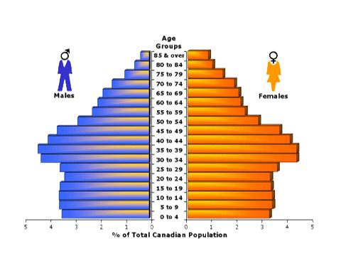
17 Page1 DEMOGRAPHY Use Assignment 5- Notes to complete the following chart Source: BLM c MB Education Etymology or origins of the word demography: (Consult a dictionary or online dictionary) Cite a definition of demography from an online dictionary or the notes below. Cite the reference used. Write a definition of demography in your own words. List examples of elements that are studied in demography. List five examples of characteristics that may be used to describe a population. List one thing you know about Canadian demographics. Make an illustration to show what demography is.
18 Page1 Grade 9 Social Studies - Cluster 1 PRACTICE QUIZ - A Map of Canada Complete the following quiz filling in the blanks with the correct province/territory & city Check your answers when you re done with an atlas. PROVINCE/TERRITORY CAPITAL CITY
Answer Keys to Unit Tests
 Reading Geography Series Answer Keys to Unit Tests Unit 1 The Five Themes of Geography Unit 2 Patterns in Physical Geography Unit 3 Natural Resources 7 Portage & Main Press Unit Test for The Five Themes
Answer Keys to Unit Tests
 Reading Geography Series Answer Keys to Unit Tests Unit 1 Patterns in Human Geography Unit 2 Economic Systems Unit 3 Migration 8 Portage & Main Press Unit Test for Patterns in Human Geography A. Understanding
Cambridge International Examinations Cambridge International General Certificate of Secondary Education
 Cambridge International Examinations Cambridge International General Certificate of Secondary Education *0123456789* GEOGRAPHY 0460/02 Paper 2 Geographical skills For Examination from 2016 SPECIMEN PAPER
2015 Annual Alberta Labour Market Review. Employment. Unemployment. Economic Regions. Migration. Indigenous People. Industries
 2015 Annual Alberta Labour Market Review Employment. Unemployment. Economic Regions Migration. Indigenous People. Industries Occupations. Education. Demographics Employment Despite the economic downturn,
LEARNING THE LANDFORMS Grade Level: Third Presented by: Elizabeth Turcott, Endeavor Charter Academy, Springfield, Michigan Length of Unit: 14 lessons
 LEARNING THE LANDFORMS Grade Level: Third Presented by: Elizabeth Turcott, Endeavor Charter Academy, Springfield, Michigan Length of Unit: 14 lessons I. ABSTRACT This unit develops an understanding of
Rural Settlement Patterns
 Rural Settlement Patterns A summary with pictures. Courtesy of Crescent School There are three types of rural settlement patterns that occurred where large numbers of people settled: the long lots of
Canadian Geography for ESL/ESOL Classrooms
 Canadian Geography for ESL/ESOL Classrooms Submitted by: Patricia A. Kubes, Greer High School (Greer, SC) Date: August 1, 2014 Description: This lesson is intended for students learning English as a second
Grades 3-5. Benchmark A: Use map elements or coordinates to locate physical and human features of North America.
 Grades 3-5 Students use knowledge of geographic locations, patterns and processes to show the interrelationship between the physical environment and human activity, and to explain the interactions that
Educator s Guide to Learning about Mexico Using Google Earth
 Educator s Guide to Learning about Mexico Using Google Earth Overview: Students will research the physical features of Mexico using Google Earth to learn about Mexico s oceans, gulfs, bays, lagoons, rivers,
Send all inquiries to: Glencoe/McGraw-Hill 8787 Orion Place Columbus, Ohio 43240-4027 ISBN 0-07-824996-1. Printed in the United States of America
 Copyright by The McGraw-Hill Companies, Inc. All rights reserved. Permission is granted to reproduce the material contained herein on the condition that such material be reproduced only for classroom use;
The Regions of the United States
 CHAPTER 1 Identify characteristic landforms of the five major regions of the United States. Describe, compare, and contrast regional climates of the United States. Identify regional resources of the United
Internet Connectivity Among Aboriginal Communities in Canada
 Internet Connectivity Among Aboriginal Communities in Canada Since its inception the Internet has been the fastest growing and most convenient means to access timely information on just about everything.
Allows teachers to print reports for individual students or an entire class.
 Map and Globe Skills Developed by teachers and geography specialists, Map and Globe Skills provides the strategies, skills and practice your students need to develop a strong understanding of basic mapping
How To Understand Canada
 Škola: Gymnázium, Brno, Slovanské náměstí 7 Šablona: III/2 Inovace a zkvalitnění výuky prostřednictvím ICT Název projektu: Inovace výuky na GSN prostřednictvím ICT Číslo projektu: CZ.1.07/1.5.00/34.0940
4.0 Health Expenditure in the Provinces and Territories
 4.0 Health Expenditure in the Provinces and Territories Health expenditure per capita varies among provinces/territories because of different age distributions. xii Population density and geography also
 Benchmark Identify physical & human characteristics of places, regions in North America. Grade Level Indicator Describe, compare landforms, climates, population, vegetation, economic characteristics of
Otázka: Canada. Jazyk: Angličtina. Přidal(a): Tomdog3 BASIC FACTS. Capital. o Ottawa. Official languages. o English. o French. Area = 9.970.
: Tomdog3 BASIC FACTS. Capital. o Ottawa. Official languages. o English. o French. Area = 9.970.") Otázka: Canada Jazyk: Angličtina Přidal(a): Tomdog3 BASIC FACTS Capital o Ottawa Official languages o English o French Area = 9.970.610 km 2 Largem cities o Montreal, Calgary o Toronto, Vancouver Metropolitan
Otázka: Canada Jazyk: Angličtina Přidal(a): Tomdog3 BASIC FACTS Capital o Ottawa Official languages o English o French Area = 9.970.610 km 2 Largem cities o Montreal, Calgary o Toronto, Vancouver Metropolitan
Prentice Hall World Geography: Building a Global Perspective 2007
 Prentice Hall World Geography: Building a Global Perspective 2007 Grades 9-12 C O R R E L A T E D T O Louisiana Grade-Level Expectations for World Geography Grades 9-12 Geography The World in Spatial Terms
BASIC LESSON Objective(s)
") [Geology - Landforms] [K-1: Basic] [Grades 2-3: Advanced] BACKGROUND Landforms are natural features of the Earth's surface. They are created by the movement of ice or water, earthquakes, lava flows, volcanoes,
[Geology - Landforms] [K-1: Basic] [Grades 2-3: Advanced] BACKGROUND Landforms are natural features of the Earth's surface. They are created by the movement of ice or water, earthquakes, lava flows, volcanoes,
Missouri Regions Shaped by Land Forms and Geology
 Missouri Regions Shaped by Land Forms and Geology Lesson Abstract Summary: MO GLE: Subject Areas: The students will use various resources to compare and contrast the geology of each Missouri region to
Teacher s Masters California Education and the Environment Initiative. History-Social Science Standards 6.2.6. and 6.2.8. Egypt and Kush: A Tale of
 6 Teacher s Masters California Education and the Environment Initiative History-Social Science Standards 6.2.6. and 6.2.8. Egypt and Kush: A Tale of Two Kingdoms California Education and the Environment
Saskatchewan Small Business Profile 2012
 Saskatchewan Small Business Profile 2012 October 2013 Economic and Competitive Analysis Branch www.economy.gov.sk.ca Table of Contents INTRODUCTION... 1 KEY FACTS... 3 1. SMALL BUSINESS SECTOR... 4 2.
A. Explain the purpose of government. The foundation and extension of this standard can be found in other Prentice Hall textbooks.
 Civics and Government, Economics, Geography, and History (Grade 6) Academic Standards for Civics and Government 5.1. Principles and Documents of Government 5.1.6. GRADE 6 Pennsylvania s public schools
NATURAL REGIONS OF KENTUCKY
 NATURAL WONDERS As you travel around Kentucky taking pictures, you are excited by what you see. Kentucky offers diverse and amazing sights. The Six Regions In the West, you see the Mississippi River, the
1 Branches of Earth Science
 CHAPTER 1 1 Branches of Earth Science SECTION The World of Earth Science BEFORE YOU READ After you read this section, you should be able to answer these questions: What are the four major branches of Earth
Prentice Hall World Studies 2005, 8 Book Series Correlated to: Millard Public School District (Nebraska) Social Studies Standards (Grades 6-7)
 Social Studies Standards (Grades 6-7)") Millard Public School District (Nebraska) Social Studies Standards (Grades 6-7) Note: This is a sample correlation based on four available titles of the new 2005 series in development. Titles include:,
Millard Public School District (Nebraska) Social Studies Standards (Grades 6-7) Note: This is a sample correlation based on four available titles of the new 2005 series in development. Titles include:,
The Number of Businesses in Alberta is Gaining Momentum
 ECONOMIC COMMENTARY The Number of Businesses in Alberta is Gaining Momentum Highlights: The number of businesses in Alberta reached record-levels in 2012, with over 154,000 now having at least one employee.
WHERE DOES THE WATER GO IN THE WATER CYCLE?
 WHERE DOES THE WATER GO IN THE WATER CYCLE? OBJECTIVES Identify the water cycle as a system that is a combination of systems Describe each process in the water cycle, including the changes in state (if
Canada United Kingdom
 Canada United Kingdom Publication No. 214-62-E 9 June 214 Michaël Lambert-Racine Economics, Resources and International Affairs Division Parliamentary Information and Research Service The Library of Parliament
Mapping the Magnetic Field
 I Mapping the Magnetic Field Mapping the Magnetic Field Vector Fields The electric field, E, and the magnetic field, B, are two examples of what are termed vector fields, quantities which have both magnitude
Igneous rocks formed when hot molten material (magma) cools and hardens (crystallizes).
 cools and hardens (crystallizes).") Objectives You will learn about how the land of North Dakota was formed. Introduction North Dakota is a wonderful place to live. Have you ever though about how it was formed? To answer that question, you
Objectives You will learn about how the land of North Dakota was formed. Introduction North Dakota is a wonderful place to live. Have you ever though about how it was formed? To answer that question, you
Chapter 18 Introduction to. A f r i c a
 Chapter 18 Introduction to A f r i c a Ch. 18:1 Landforms & Resources 1. Africa s shape & landforms are the result of its location in the southern part of the ancient supercontinent of. Pangaea Over thousands
Turtle Island Conservation: Grade 4 Miskwaadesi/A`nó:wara Ontario Curriculum Based Expectations Guide. Grade 4
 Ontario Provincial Curriculum-based Expectations Guideline Walking with Miskwaadesi and Walking with A`nó:wara By Subject/Strand Turtle Island Conservation Ontario Teachers Resource Bundle 1 The Arts 1.1
LANDFORMS AND BODIES OF WATER A GEOGRAPHICAL DICTIONARY
 LANDFORMS AND BODIES OF WATER A GEOGRAPHICAL DICTIONARY Candy Aaron Prairie Elementary School 500 S Charles Ave Naperville IL 60540 Promoting Geographic Knowledge Through Literature Workshop July 7-19,
Gold Mining Camps in the Canadian Shield
 Gold Mining Camps in the Canadian Shield James Bay, Québec An emerging Top 10 Mining Camp Gold Mining Camps in the Canadian Shield CANADIAN SHIELD RR GL Hemlo CANADA Detour KL GOLD DEPOSITS JAMES BAY,
HEALTH SYSTEM PERFORMANCE INTERACTIVE INDICATORS WEBSITE PUBLIC ENGAGEMENT SUMMARY REPORT
 HEALTH SYSTEM PERFORMANCE INTERACTIVE INDICATORS WEBSITE PUBLIC ENGAGEMENT SUMMARY REPORT PAGES TABLE OF CONTENTS INTRODUCTION 1 KEY FINDINGS: ONLINE AND IN-PERSON ENGAGEMENT 2 FINDINGS: ONLINE ENGAGEMENT
5.0 Provincial and Territorial Government Health Expenditure by Age and Sex
 5.0 Provincial and Territorial Government Health Expenditure by Age and Sex CIHI has been collecting actual utilization data since 1996 from national and provincial/territorial administrative databases
Improving the Investment Climate in Canada s North: Key Challenges and Opportunities
 Improving the Investment Climate in Canada s North: Key Challenges and Opportunities Nunavut Mining Symposium, April 17, 2012 MAC: The national voice of Canada s mining industry Advocacy - to advance the
Commissioner of the Environment and Sustainable Development to the House of Commons
 2010 Report of the Commissioner of the Environment and Sustainable Development to the House of Commons FALL Chapter 2 Monitoring Water Resources Office of the Auditor General of Canada The Fall 2010 Report
Sample Pages. Free E-mail Newsletter Sign up Today! Learn Through Experience
 Learn Through Experience Sample Pages Sample pages from this product are provided for evaluation purposes. The entire product is available for purchase at www.socialstudies.com or www.teachinteract.com
PURPOSE OF GRAPHS YOU ARE ABOUT TO BUILD. To explore for a relationship between the categories of two discrete variables
 3 Stacked Bar Graph PURPOSE OF GRAPHS YOU ARE ABOUT TO BUILD To explore for a relationship between the categories of two discrete variables 3.1 Introduction to the Stacked Bar Graph «As with the simple
NCSS Standards 1. d. compare ways in which people from different cultures think about and deal with their physical environment and social conditions;
 NCSS Standards 1 National Council for the Social Studies (NCSS) Curriculum Standards for Social Studies Standard I. Culture study of culture and cultural diversity, so that the learner can a. explore and
Water Scarcity Ashley Schopieray
 Water Scarcity Ashley Schopieray INTRODUCTION In this lesson, students will learn about water scarcity and how much of the earth s water is actually available for daily human use. They will learn the importance
CANADA, OUR NEIGHBOR TO THE NORTH
 CANADA, OUR NEIGHBOR TO THE NORTH Grade Level: Third Grade Presented by: Paula Lowthian and Shannon Millican, Platte River Academy, Highlands Ranch, Colorado Length of Unit: Six Lessons I. ABSTRACT This
How Strong Is the Force?
 activity 4 How Strong Is the Force? OBJECTIVES Students investigate the strength of different magnets and then the strength at different places on each magnet. They also investigate the relationship between
USE SOURCE A (THE WHITE MOUNTAIN MAP) TO ANSWER THE FOLLOWING QUESTIONS (1-4).
 TO ANSWER THE FOLLOWING QUESTIONS (1-4).") HOËRSKOOL MONTANA GRADE 8 SOCIAL SCIENCE EXAMINERS: DATE: JUNE 2012 Mr E.P. KLEYNHANS TIME: 1 HOUR Mr. L. TAUTE TOTAL: 100 ANSWER ALL THE QUESTIONS ON THE FOLIOP PAPER. NO WORK ON THE EXAM PAPER WILL BE
HOËRSKOOL MONTANA GRADE 8 SOCIAL SCIENCE EXAMINERS: DATE: JUNE 2012 Mr E.P. KLEYNHANS TIME: 1 HOUR Mr. L. TAUTE TOTAL: 100 ANSWER ALL THE QUESTIONS ON THE FOLIOP PAPER. NO WORK ON THE EXAM PAPER WILL BE
Saskatchewan Small Business Profile 2015
 Saskatchewan Small Business Profile 2015 October 2015 Ministry of the Economy Performance and Strategic Initiatives Division economy.gov.sk.ca Table of Contents INTRODUCTION... 1 KEY FACTS... 3 1. SMALL
2010 National Physician Survey :
 2010 National Physician Survey : Family Physician Usage of Electronic Medical Records Inese Grava-Gubins, Artem Safarov, Jonas Eriksson College of Family Physicians of Canada CAHSPR, Montreal, May 2012
STANDARD 3.1 Greece & Rome. STANDARD 3.2 - Mali
 2008 Curriculum Framework Grade Three Social Studies Standards Condensed format created by SOLpass. www.solpass.org Key: red text highlights NEW (2008 revision) content; crossout indicates content cut
TransGas General Overview
 TransGas General Overview TransGas General Overview TransGas Facilities Many Islands Pipe Lines (Canada) Limited TransGas and Adjacent Systems Primary Business Overview The Saskatchewan Market TransGas
not to be republished NCERT MAJOR LANDFORMS OF THE EARTH
 6 You must have seen some of the landform features as shown in the Figure 6.1 below. You will notice that the surface of the earth is not the same everywhere. The earth has an infinite variety of landforms.
1986-1991 ENUMERATION AREA CORRESPONDENCE FILE
 1986-1991 ENUMERATION AREA CORRESPONDENCE FILE DATA QUALITY STATEMENT AND RECORD LAYOUT April 1992 1986-1991 Enumeration Area Correspondence File Data Quality Statement 1 Table of Contents 1.0 Introduction...2
Canada: A Changing Society
 Reading History Series Sample Pages Canada: A Changing Society Archives of Ontario, F229-308, T. Eaton Co. fonds Unit 3 Jennette MacKenzie, Susan Green, and Mary Quennell Student Name: Table of Contents
Cheshire Public Schools Spelling Program. Practice Strategies
 Cheshire Public Schools Spelling Program Practice Strategies This booklet suggests more than twenty different ideas for practicing spelling words. We suggest that students write, spell, and pronounce the
Climate, Vegetation, and Landforms
 Climate, Vegetation, and Landforms Definitions Climate is the average weather of a place over many years Geographers discuss five broad types of climates Moderate, dry, tropical, continental, polar Vegetation:
Open Government and Information Management. Roy Wiseman Executive Director, MISA/ASIM Canada CIO (Retired), Region of Peel roy.wiseman@outlook.
, Region of Peel roy.wiseman@outlook.") Open Government and Information Management Roy Wiseman Executive Director, MISA/ASIM Canada CIO (Retired), Region of Peel roy.wiseman@outlook.com Open Government Defined Government of Canada defines Open
Open Government and Information Management Roy Wiseman Executive Director, MISA/ASIM Canada CIO (Retired), Region of Peel roy.wiseman@outlook.com Open Government Defined Government of Canada defines Open
The Five W s of Early Trading Networks in Canada
 Lesson Overview In this lesson, students will work in groups to conduct research about early trading networks in Canada using The Canadian Atlas Online. They will discover who, what, when, where, why and
Canada Russia. Alexandre Gauthier* Publication No. 2011-138-E 15 November 2011
 Canada Russia Publication No. 211-138-E 15 November 211 Alexandre Gauthier* International Affairs, Trade and Finance Division Parliamentary Information and Research Service Canada Russia (Trade and Investment
GRADE 4. Social Studies Standards. Evidence. Presentations
 Essential Questions: What influences people s decisions to move to or within the United States? Unit 1 - United States Geography & Landforms How do natural hazards affect people? Unit 2 - Regions of the
and employer contribution rate than either dependent or retiree coverage throughout the state.
 Employer Sponsored Health Insurance: Examining Kentucky John Perry In this article, the availability and general characteristics of employer sponsored health insurance for working Kentuckians are examined.
Written Submission to Federal Review Panel for New Prosperity Gold-Copper Mine Project
 August 20, 2012 Livain Michaud Panel Manager New Prosperity Review Panel Secretariat Canadian Environmental Assessment Agency 160 Elgin Street, 22nd Floor Ottawa ON K1A 0H3 NewProsperityReview@ceaa-acee.gc.ca
ALIKE AND DIFFERENT: GERMANY, THE UNITED STATES, AND OUR REGION. A Second Grade Lesson Plan
 ALIKE AND DIFFERENT: GERMANY, THE UNITED STATES, AND OUR REGION A Second Grade Lesson Plan Wanda Dengel Notre Dame Elementary Portsmouth, Ohio September 26,2008 1 (NOTE: The Second Grade Lesson below can
Careers in Sustainability. Current Job Trends and Future Growth
 Careers in Sustainability Current Job Trends and Future Growth About the Study In Winter 2013, ECO Canada interviewed 658 Canadian organizations: 37% had employees working in environmental, social or economic
RENEWABLE OR NOT? ADVANCE PREPARATION MATERIALS
 AT A GLANCE RENEWABLE OR NOT? Students learn the difference between renewable and non-renewable resources and discover why sustainable use of natural resources is important. OBJECTIVES Students will: Identify
MAPS AND GLOBES: WHERE IN THE WORLD ARE WE?
 MAPS AND GLOBES: WHERE IN THE WORLD ARE WE? Grade Level: Kindergarten Presented by: Karen Davis and Tamara Young, Tate Elementary, Van Buren, AR Length of unit:5 lessons I. ABSTRACT A. This unit focuses
CANADIAN CITIZENSHIP STUDY QUESTIONS & ANSWERS for the City of Richmond, 2010
 CANADIAN CITIZENSHIP STUDY QUESTIONS & ANSWERS for the City of Richmond, 2010 Section 1: Questions about Canada Aboriginal Peoples 1. Who are the Aboriginal peoples in Canada? The Aboriginal peoples were
Prairie Mountain Health Physician Recruitment Strategy
 Prairie Mountain Health Physician Recruitment Strategy 2014 Table of Contents Recruitment Committee Members Introduction Methods Recruitment Committee Members Tanja Borchers Med I Winnipeg, MB. Jordan
Our Earth, Our Resources
 UNIT 4 Essential Question: How can we take the best care of our Earth? Objectives Our Earth, Our Resources Unit Resource Guide Social Studies Resources Identify and describe the physical characteristics
Profile of Canadian Environmental Employment
 Profile of Canadian Environmental Employment LABOUR MARKET RESEARCH STUDY 2010 ECO CANADA ECO Canada develops programs that help individuals build meaningful environmental careers, provides employers with
Exploration. Exploration methods
 Exploration Activities related to establishing a mineral deposit through geological, geophysical and geochemical methods. It is preceded by Prospecting and followed by Planning & Development. Geological
Climate Change: A Local Focus on a Global Issue Newfoundland and Labrador Curriculum Links 2010-2011
 Climate Change: A Local Focus on a Global Issue Newfoundland and Labrador Curriculum Links 2010-2011 HEALTH Kindergarten: Grade 1: Grade 2: Know that litter can spoil the environment. Grade 3: Grade 4:
YEAR 2 TOPIC OVERVIEW 2014 2015. YEAR 1 Term 1 Term 2 Term 3 Term 4 Term 5 Term 6
 YEAR 2 TOPIC OVERVIEW 2014 2015 YEAR 1 Term 1 Term 2 Term 3 Term 4 Term 5 Term 6 TOPIC Here and there What s it made of? Changes SCIENCE ANIMALS INCLUDING HUMANS - HEALTHY EATING HISTORY THE GREAT FIRE
ANCIENT EGYPT FUN AND ENGAGING LESSONS
 ANCIENT EGYPT FUN AND ENGAGING LESSONS NILE RIVER 3D CUBES MODERN DAY TOMB COLLECTIONS ILLUSTRATED MUMMIFICATION WHEEL EGYPTIAN TIME TRAVEL SCRAPBOOK HIEROGLYPHIC CARTOUCHE PENDANTS FUN AND ENGAGING LESSONS
Statistical Profile of Lunenburg County
 Statistical Profile of Lunenburg County Prepared by the Nova Scotia Federation of Agriculture 1 Contents 1.0 Introduction... 2 Agriculture in the Local Economy... 2 2.0 Population and Population Change...
USING MAPS AND GLOBES
 USING MAPS AND GLOBES Grade Level or Special Area: 4 th Grade Written by: Krystal Kroeker, Colorado Springs Charter Academy, Colorado Springs, CO Length of Unit: Five lessons (approximately one week (five
Lesson Plan for Media Literacy
 Constructions Beliefs & Values Audience Intent Form Lesson Plan for Media Literacy Text Production Audience Lesson Focus: What is the focus of the lesson? How will I teach it? The lesson will focus on
1. Incredible India. Shade the map on the next page, to show India s relief. The correct shading is shown on the final page! Incredible India India
 1. Incredible India Shade the map on the next page, to show India s relief. The correct shading is shown on the final page! Incredible India India The DCSF supported Action plan for Geography is delivered
AP HUMAN GEOGRAPHY 2008 SCORING GUIDELINES
 AP HUMAN GEOGRAPHY 2008 SCORING GUIDELINES Question 1 Von Thünen s model of land use and Burgess model of land use are similar in appearance but different in their geographic setting. Analyze and discuss
Grade 5. Ontario Provincial Curriculum-based Expectations Guideline Walking with Miskwaadesi and Walking with A`nó:wara By Subject/Strand
 Ontario Provincial Curriculum-based Expectations Guideline Walking with Miskwaadesi and Walking with A`nó:wara By Subject/Strand Turtle Island Conservation Ontario Teachers Resource Bundle 1 The Arts 1.1
New York Sea Grant Strategic Plan
 New York Sea Grant Strategic Plan Introduction and Process This is the new strategic plan for New York Sea Grant (NYSG) for the years 2010-2013 as requested by the National Sea Grant Office. This plan
Water Security Agency. Plan for 2015-16. saskatchewan.ca
 Water Security Agency Plan for 2015-16 saskatchewan.ca Statement from the Minister I am pleased to present the Water Security Agency s Plan for 2015-16. The Honourable Scott Moe Minister Responsible for
Unhappy on the job by Margot Shields
 33 by Margot Shields Keywords: employment, job satisfaction, occupational health, work, work schedule tolerance The vast majority of Canadian workers were with their jobs in 2002, but approximately 1 in
Privateers in the War of 1812
 Privateers in the War of 1812 Lesson Overview This lesson will focus on the role of Nova Scotia s privateers during the War of 1812. Students will conduct research about privateers and then complete a
All Canadian provinces, territories and
 Guide to Minimum Employment Standards, Pay Deductions and Employment Insurance in Canada All Canadian provinces, territories and the federal government have minimum employment standards. Minimum employment
How To Create A 3D Model Of The Phanerozoic Succession In Southern Manitoba
 3D GEOLOGICAL MAPPING IN MANITOBA MOVING FORWARD Greg Keller (greg.keller@gov.mb.ca), Gaywood Matile, Manitoba Geological Survey (RET), Canada Harvey Thorleifson, Minnesota Geological Survey, United States
Atomic Structure OBJECTIVES SCHEDULE PREPARATION VOCABULARY MATERIALS. For each team of four. The students. For the class.
 activity 4 Atomic Structure OBJECTIVES Students are introduced to the structure of the atom and the nature of subatomic particles. The students are introduced to the properties of protons, neutrons, and
Brass Bell Family Resource Centre Dorion, Ontario
 Early Development Instrumenta population-based measure for communities Results for 2008/2009 Thunder Bay- Superior North Region Brass Bell Family Resource Centre Dorion, Ontario Location of Best Start
God, the Great Creator
 Pre-Session Warm Up God, the Great Creator (Genesis 1: 2:3) Today we re going to start a new series of lessons all about God s attributes. An attribute is a character trait or quality about someone. For
THE COMPOSITION OF BUSINESS ESTABLISHMENTS IN SMALLER AND LARGER COMMUNITIES IN CANADA
 Rural and Small Town Canada Analysis Bulletin Vol. 1, No. 3 (February 1999) Catalogue no. 21-006-XIE THE COMPOSITION OF BUSINESS ESTABLISHMENTS IN SMALLER AND LARGER COMMUNITIES IN CANADA Robert Mendelson
Occupational Therapists in Canada, 2010 National and Jurisdictional Highlights and Profiles
 Occupational Therapists in Canada, 2010 National and Jurisdictional Highlights and Profiles October 2011 Spending and Health Workforce Who We Are Established in 1994, CIHI is an independent, not-for-profit
Hooray for the Hundreds Chart!!
 Hooray for the Hundreds Chart!! The hundreds chart consists of a grid of numbers from 1 to 100, with each row containing a group of 10 numbers. As a result, children using this chart can count across rows
Desertification: Cause and Effect Students learn about the causes and effects of desertification threatening the African Sahel.
 Students learn about the causes and effects of desertification threatening the African Sahel. Author Grade Level Duration Barbara Stout 6-8 and 4-5 class periods National Geography Standards ELEMENT TWO:
Therefore, this is a very important question, which encourages consideration of the current management of the resource.
 Aalisarnermut, Piniarnermut Nunalerinermullu Naalakkersuisoqarfik Department of Fisheries, Hunting and Agriculture Finn's speech to NAFMC Climate change in the North Atlantic has become a reality which
CONTENTS. Executive Summary... 3 BC Labour Market. Credentials. Employment Outcomes
 CONTENTS Executive Summary... 3 BC Labour Market Skills Deficit 2016 to 2020. 5 Labour Market Outlook 2010 to 2020. 6 Employment by Sector..... 7 Job Openings 2010 to 2020..... 8 Regional Job Openings
Earth Science Landforms, Weathering, and Erosion Reading Comprehension. Landforms, Weathering, and Erosion
 Reading Comprehension Name 1 How many people have been to the Rocky Mountains or the Grand Canyon? When people go to visit these natural wonders, they may not realize that it took millions of years for
Aboriginal Consultation and Accommodation
 Government of Canada Gouvernement du Canada Aboriginal Consultation and Accommodation Updated Guidelines for Federal Officials to Fulfill the Duty to Consult March 2011 Information contained in this publication
Early retirement trends
 Patrick Kieran IN THE EARLY 197S, one in five Canadians was 5 or older. By 8, one in three will fall into this age group. This reality has led many researchers to focus on the potential consequences of
A Policy Respecting the Prohibition of Bulk Water Removal from Major River Basins in Nunavut
 Indian and Northern Affairs Canada Affaires indiennes et du Nord Canada A Policy Respecting the Prohibition of Bulk Water Removal from Major River Basins in Nunavut Published under the authority of the
FUR TRADE PHASE 1 The Early Fur Trade 1500-1603 A Glimpse of the Early Fur Trade
 FUR TRADE PHASE 1 The Early Fur Trade 1500-1603 The cod fishery began the early fur trade. First Nations such as the Mi kmaq began to trade with Europeans coming to fish cod off the east coast. The British
The Role of Land Use and Transportation in Building Successful Sustainable Cities City of Vancouver
 The Role of Land Use and Transportation in Building Successful Sustainable Cities City of Vancouver Dr. Ann McAfee Co-Director of Planning, Vancouver Transportation & Land Use 1. Vancouver s Transportation