Andrea Buffam, Natural Resources Canada Canadian Metadata Forum National Library of Canada Ottawa, Ontario September 19 20, 2003
|
|
|
- Lionel Carr
- 7 years ago
- Views:
Transcription
1 Geospatial Metadata Andrea Buffam, Natural Resources Canada Canadian Metadata Forum National Library of Canada Ottawa, Ontario September 19 20, 2003

2 The Presentation - Geospatial Metadata This presentation will outline the 5 W s (who, what, where, when, why) and how, in the following order: What Why Who/Where/When How Wrap-up Recent Achievements Current and Future Challenges 2

3 What is geomatics? Geomatics is the science and technology of gathering, analyzing, interpreting, distributing and using geospatial data. It encompasses a broad range of disciplines that includes: Geographic information systems (GIS); Remote sensing (data acquisition and application); Mapping (photogrammetry, cartography, automated mapping, facilities management and charting); Surveying (geodetic, cadastral, engineering and marine) and, Global positioning systems (GPS) 3
; Mapping (photogrammetry, cartography, automated mapping, facilities management and")
4 What is GeoConnections & CGDI? GeoConnections is a national initiative to make Canada s geospatial information accessible on the Internet. One of the main roles is to facilitate the creation of the Canadian Geospatial Data Infrastructure (CGDI). The CGDI aims to be the main source for geospatial information and services in Canada by working together with governments, private industry and academia to build and ensure fast, consistent and harmonized access to geospatial information and services for all Canadians. 4

5 Why? - Responding to Emergencies Audio courtesy of As It Happens, CBC, Radio 1 5 Patrick Pettit/The Leader Post

6 Why? - Public Safety 6

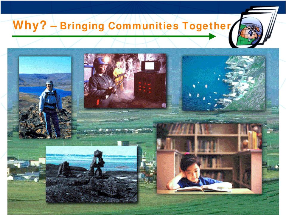
7 Why? Bringing Communities Together 7
8 How? - The Task Natural Resources Data Environmental Data Economic Data Natural Hazards Health Data Soils Inventory Base Map 8

9 Who is an access provider? The GeoConnections Discovery Portal is the primary interface through which users can find and access (or visualize) data, organizations and services within the CGDI using a powerful spatial and keyword search engine. Operations are based in the GeoAccess Division, Canada Centre for Remote Sensing, Natural Resources Canada. The GeoConnections Discovery Portal is at: 9

10 How? The Discovery Portal The GeoConnections Discovery Portal system was built on the Canadian Earth Observation Network (CEONet) technology. Valuable keyword and thesaurus tables were (continue to be) acquired (or developed) providing assistance to metadata providers and easing the search process. Datasets are described using the Federal Geographic Data Committee (FGDC) metadata standard. [Fields are matched with the Directory Interchange Format (DIF) so exchanges to the International Directory Network can be achieved.] Connections to distributed databases use Open GIS Consortium (OGC) standards to provide access to services and resources, such as web mapping services (wms), portals or geomatics software. 10
 so exchanges to the International Directory Network can be achieved.")
11 How? - The Discovery Portal Service Content and connectivity co-ordinators monitor and assist metadata providers with population of quality entries in both official languages (English and French) Staff is involved in developing metadata standards, interoperability and establishing thesauri Reusable geographical tools, including gazetteers; API s (including XML import/export); and, a WMS Viewer are available for designers to use, embed and integrate into their web sites As of September 1, 2003, GeoConnections Discovery Portal had the following published (client visible) entries: 1,920 Organizations 13,008 Data Products 463 Services (no service interface) 265 Searchable Collections (Z39.50) 64 CGDI Web Services (with service interface e.g. WMS) 11
 entries: 1,920 Organizations 13,008 Data Products 463 Services (no service interface) 265 Searchable Collections (Z39.")
12 How? Metadata about Data Federal Geographic Data Committee (FGDC) Content Standard for Digital Geospatial Metadata (CSDGM) and extended profiles: Biological Data profile Shoreline Metadata profile Extensions for Remote Sensing Metadata ISO TC Contributing to a North American effort to produce a standardized implementation specification of the ISO Canada, U.S. and Mexico 12

13 How? Metadata about Services Redesign of the Services component within GeoConnections Discovery Portal: proprietary to standards-based. enhanced discoverability and access. Thesaurus selection process: Investigated various services metadata standards and specifications ISO 19119, OGC-OWS and CEOS IDN. Researched potential keywords thesauri and Universal Standard Products and Services Classifications. Engaged/consulted with other national and international colleagues. 13

14 How? Metadata about Services NAICS The North American Industry Classification System replaced the U.S. Standard Industrial Classification (SIC) system. It was developed jointly by the U.S., Canada, and Mexico to provide new comparability in statistics about business activity across North America. NAPCS The new North American Product Classification System (NAPCS) is presently under development, with initial focus on products of service industries. 14
 is presently under development, with initial")
15 How? Metadata about Services North American Industry Classification System (NAICS) and North American Product Classification System (NAPCS) selected for services categorization scheme. Extracted NAICS and NAPCS categories that met Discovery Portal requirements. Internal working group defined new type and theme keyword categories, to support easy identification of client areas of interest and facilitate searches on the Discovery Portal. Provided same categories (pull-down menus) to the services metadata supplier for excellent service identification. Matched keywords to NAICS/NAPCS categories to ensure use of established standards. Ability to modify as required (upon advise/update from Statistics Canada) 15
 to the services metadata supplier for excellent service identification.")
16 How? Metadata about Services 16

17 How? Partnerships Partnerships with all major federal and some provincial geospatial data providers and users are being implemented. Examples of current data-partners are Indian and Northern Affairs Canada integrating the Northern Information Network into the Discovery Portal. Atlantic Coastal Zone Information Steering Committee integrating information about coastal management GeoNOVA to integrate Nova Scotia provincial and municipal entries Canadian Geoscience Knowledge Network to integrate their data catalogue (data products and WMS) NASA Global Change Master Directory to export the Discovery Portal Canadian metadata and import International information. 17
 NASA Global Change Master Directory to export the Discovery")
18 How? Partnerships Some Data-Use Partnerships include Canadian Information System for the Environment (CISE), Environment Canada Land Information of Ontario (LIO), Ministry of Natural Resources, Government of Ontario National Forestry Information System (NFIS), Pacific Forestry Centre, Natural Resources Canada National Land and Water Information System (NLWIS), Agriculture and Agri-Food Canada 18
, Agriculture")
19 How? Training Training FGDC CSDGM metadata training course held in Ottawa June 10 to12. Hands-on experience gained through use of the Discovery Portal as the metadata input tool. Presentations and Documents: orkshops/pgm_id/25/gcs.cfm. Eco-Instruct Environmental Data Exchange in the Americas is being coordinated by Environment Canada and is scheduled for November in Nova Scotia. Approximately 100 participants are expected. This 3-day workshop is based on the FGDC CSDGM Train the Trainer program using the Biological Data Profile. It is being offered in English, French and Spanish. Participants will learn about what it takes to become a successful environmental technical instructor using the latest environmental information management standards and programming techniques. Details: 19

20 Recent Achievements Provided the English and French versions of the GCMD Theme keyword thesaurus table (on the Discovery Portal) to the National Library of Canada for publication as an authoritative federal list of earth science keywords. Developed and installed new Services metadata interface with keywords formulated by matching terms to the North American Industrial and Product Classification Systems (NAICS/NAPCS) categories (ensuring use of established standards). Updated the Discovery Portal from the 1994 to the 1998 FGDC metadata standard and added ISO TC related fields. Prepared ISO TC North American amendment proposal. Currently under review by U.S. and Mexico teams. 20
 categories (ensuring use of established standards).")
21 Current and Future Challenges Monitoring the evolution of geomatics metadata standards and other industry activities to reflect ongoing development on the Discovery Portal for example, ISO TC Making recommendations for OGC-WMS metadata content and authority files, to promote discovery and access of web maps. Involvement with new partners to continue increasing quick and easy access to geospatial data using the GeoConnections Discovery Portal. Continue to provide an IDN representative to the Global Change Master Directory Science Users' Working Group (GCMD UWG) for the American Coordinating Node. 21
22 Current and Future Challenges Major investment, geographic data and knowledge have amassed over time. These are national assets. 22
23 Contact Information GeoConnections Discovery Portal site: Andrea Buffam Senior Metadata Co-ordinator GeoConnections Discovery Portal Phone:
EXPLORING AND SHARING GEOSPATIAL INFORMATION THROUGH MYGDI EXPLORER
 EXPLORING AND SHARING GEOSPATIAL INFORMATION THROUGH MYGDI EXPLORER Subashini Panchanathan Malaysian Centre For Geospatial Data Infrastructure ( MaCGDI ) Ministry of National Resources and Environment
Interoperable Solutions in Web-based Mapping
 ISPRS SIPT IGU UCI CIG ACSG Table of contents Table des matières Authors index Index des auteurs Search Recherches Exit Sortir Interoperable Solutions in Web-based Mapping Marta Wojnarowska and Bridget
Strategic Activities to Support Sustainability of Canada s Geospatial Data Infrastructure
 Strategic Activities to Support Sustainability of Canada s Geospatial Data Infrastructure Paula McLeod Canada Centre for Mapping and Earth Observation United Nations 10 th Regional Cartographic Conference
CGDI IN ACTION: EXPLORING QUALITY OF SERVICE
 CGDI IN ACTION: EXPLORING QUALITY OF SERVICE S. Gao a, *, D. J. Coleman a, C. MacLachlan b, G. Plunkett c a Department of Geodesy and Geomatics Engineering, University of New Brunswick, 15 Dineen Dr.,
Cadastre in the context of SDI and INSPIRE
 Cadastre in the context of SDI and INSPIRE Dr. Markus Seifert Bavarian Administration for Surveying and Cadastre Cadastre in the digital age the approach in Germany 3 rd CLGE Conference, Hanover, 11.10.2012
Environment Canada Data Management Program. Paul Paciorek Corporate Services Branch May 7, 2014
 Environment Canada Data Management Program Paul Paciorek Corporate Services Branch May 7, 2014 EC Data Management Program (ECDMP) consists of 5 foundational, incremental projects which will implement
Leveraging Metadata Standards in ArcGIS for Interoperability
 Esri International User Conference San Diego, California Technical Workshops July 26, 2012 Leveraging Metadata Standards in ArcGIS for Interoperability David Danko Aleta Vienneau Leveraging Metadata Standards
MSDI: Workflows, Software and Related Data Standards
 MSDI: Workflows, Software and Related Data Standards By Andy Hoggarth October 2009 Introduction Leveraging SDI principles for hydrographic operational efficiency French INFRAGEOS example (SHOM - Service
GEOGRAPHIC INFORMATION GATEWAY New York Department of State (NYDOS) data acceptance & metadata standards
 data acceptance & metadata standards") GEOGRAPHIC INFORMATION GATEWAY New York Department of State (NYDOS) data acceptance & metadata standards 1. DATA ACCEPTANCE STANDARDS The following describes the data acceptance standards for data included
GEOGRAPHIC INFORMATION GATEWAY New York Department of State (NYDOS) data acceptance & metadata standards 1. DATA ACCEPTANCE STANDARDS The following describes the data acceptance standards for data included
Implementing a Municipal SDI with Service Oriented Architecture
 Implementing a Municipal SDI with Service Oriented Architecture A. A. Ghaemi a, F. Samadzadegan b, A. Rajabifard c, M. Yadegari b a Tehran Municipality ICT Organazation, Tehran, Iran ghaemi@tehran.ir b
Scholars GeoPortal: Since 2002, Scholars Portal has hosted shared collections...
 Scholars GeoPortal: A New Platform for Geospatial Data Discovery, Exploration and Access in Ontario Universities by Elizabeth Hill and Leanne Trimble 1 OCUL Abstract The need to support and promote the
CIESIN Columbia University
 Conference on Climate Change and Official Statistics Oslo, Norway, 14-16 April 2008 The Role of Spatial Data Infrastructure in Integrating Climate Change Information with a Focus on Monitoring Observed
The role of the Ina-SDI in supporting the development of the geospatial industry in Indonesia
 GEOGRAFIA Online TM Malaysia Journal of Society and Space 8 issue 1 (69-79) 69 The role of the Ina-SDI in supporting the development of the geospatial industry in Indonesia Asep Karsidi 1 National Coordinating
Task AR-09-01a Progress and Contributions
 Doug Nebert, POC U.S. Geological Survey ddnebert@usgs.gov March 2010 Task AR-09-01a Progress and Contributions Background and scope for AR-09-01a This Task defines the minimum, common technical capabilities
GGOS Portal EXECUTIVE SUMMARY
 GGOS Portal EXECUTIVE SUMMARY Introduction The GGOS Portal will be a unique access point for all GGOS products. The portal will also provide a route to the heterogeneous IAG service/technique specific
A Java Tool for Creating ISO/FGDC Geographic Metadata
 F.J. Zarazaga-Soria, J. Lacasta, J. Nogueras-Iso, M. Pilar Torres, P.R. Muro-Medrano17 A Java Tool for Creating ISO/FGDC Geographic Metadata F. Javier Zarazaga-Soria, Javier Lacasta, Javier Nogueras-Iso,
INSPIRE Metadata Survey Results
 INSPIRE Metadata Survey Results Joanna Nowak and Massimo Craglia Institute for Environment and Sustainability 2006 EUR 22488 EN The mission of the Institute for Environment and Sustainability is to provide
Metadata for Data Discovery: The NERC Data Catalogue Service. Steve Donegan
 Metadata for Data Discovery: The NERC Data Catalogue Service Steve Donegan Introduction NERC, Science and Data Centres NERC Discovery Metadata The Data Catalogue Service NERC Data Services Case study:
Global Earth Observation Integrated Data Environment (GEO-IDE) Presentation to the Data Archiving and Access Requirements Working Group (DAARWG)
 Presentation to the Data Archiving and Access Requirements Working Group (DAARWG)") Global Earth Observation Integrated Data Environment (GEO-IDE) Presentation to the Data Archiving and Access Requirements Working Group (DAARWG) Ken McDonald Data Management Integration Architect National
Global Earth Observation Integrated Data Environment (GEO-IDE) Presentation to the Data Archiving and Access Requirements Working Group (DAARWG) Ken McDonald Data Management Integration Architect National
1. Introduction ABSTRACT
 ISPRS SIPT IGU UCI CIG ACSG Table of contents Table des matières Authors index Index des auteurs Search Recherches Exit Sortir Oceans Management Internet Mapping Application (OMIMA): A GIS Web-Based Tool
Progress in Creating a Global Polar Metadata Interoperability Network
 Progress in Creating a Global Polar Metadata Interoperability Network Julie E. Friddell Canadian Cryospheric Information Network/Polar Data Catalogue Department of Geography, University of Waterloo Canada
How To Use The Alabama Data Portal
 113 The Alabama Metadata Portal: http://portal.gsa.state.al.us By Philip T. Patterson Geological Survey of Alabama 420 Hackberry Lane P.O. Box 869999 Tuscaloosa, AL 35468-6999 Telephone: (205) 247-3611
Spatial Data Infrastructure to Facilitate Coastal Zone Management
 Spatial Data Infrastructure to Facilitate Coastal Zone Management Lisa Strain 1, Abbas Rajabifard 2 and Ian Williamson 3 1 M.Sc. Candidate Email: lstrain@sunrise.sli.unimelb.edu.au 2 Deputy Director Email:
GUIDE BECOMING A PROFESSIONAL SURVEYOR IN CANADA
 GUIDE TO BECOMING A PROFESSIONAL SURVEYOR IN CANADA Requirements, Standards and Processes July 2012 FOREWORD The purpose of this document is to provide complete information on the processes and procedures
Report on the Medi Pilot Project
 Limited Distribution IOC/IODE-XVI/11 Paris, 1 September 2000 Original: English INTERGOVERNMENTAL OCEANOGRAPHIC COMMISSION (of UNESCO) Sixteenth Session of the IOC Committee on International Oceanographic
The Proposal of the CBS Expert Team on Integrated Data Management for a WMO Metadata Standard
 The Proposal of the CBS Expert Team on Integrated Data Management for a WMO Metadata Standard Jürgen Seib Deutscher Wetterdienst Referat TI 13 e-mail: juergen.seib@dwd.de Members of the Expert Team Dr.
ISO 19119 and OGC Service Architecture
 George PERCIVALL, USA Keywords: Geographic Information, Standards, Architecture, Services. ABSTRACT ISO 19119, "Geographic Information - Services," has been developed jointly with the Services Architecture
Sydney Ph: +61 2 8570 5050. Melbourne Ph: +61 3 8680 3250. Adelaide Ph: +61 8 8425 8050. LISAsoft. Bespoke Development
 Sydney Ph: +61 2 8570 5050 Melbourne Ph: +61 3 8680 3250 Adelaide Ph: +61 8 8425 8050 LISAsoft Bespoke Development August 2008 MER Program Data Access Consultancy Monitoring, Evaluation and Reporting
SCOOP Data Management: A Standards-based Distributed System for Coastal Data and Modeling
 SCOOP Data Management: A Standards-based Distributed System for Coastal Data and Modeling Helen Conover, Bruce Beaumont, Marilyn Drewry, Sara Graves, Ken Keiser, Manil Maskey, Matt Smith The University
VGIS HANDBOOK PART 2 - STANDARDS SECTION D METADATA STANDARD
 VGIS HANDBOOK PART 2 - STANDARDS SECTION D Vermont Geographic Information System Standard History November 15, 1989 version 1a - Section A: Digitizing Data adopted by Policy Advisory Board January, 1991
Sextant. Spatial Data Infrastructure for Marine Environment. C. Satra Le Bris, E. Quimbert, M. Treguer
 Sextant On-Line information system for marine geographical information E. Quimbert, M. Bellouis, F. Lecuy, M. Treguer Centre de Bretagne BP 70, Plouzané 29280 France E-mail: sextant@ifremer.fr Sextant
Introduction to Geospatial Web Services
 Geospatial Web Services Introduction to Geospatial Web Services An introduction and inventory of geospatial web services and their importance to interoperability in the geospatial domain. vers. 20100604
ALGONQUIN COLLEGE GEOMATICS TECHNICIAN Ontario College Diploma (1584X)
") ALGONQUIN COLLEGE GEOMATICS TECHNICIAN Ontario College Diploma (1584X) Introduction Algonquin College s 2-Year Geomatics Technician Program is designed to enable graduates to gather and compile spatial
ALGONQUIN COLLEGE GEOMATICS TECHNICIAN Ontario College Diploma (1584X) Introduction Algonquin College s 2-Year Geomatics Technician Program is designed to enable graduates to gather and compile spatial
Building a SDI for small countries the Portuguese example
 Building a SDI for small countries the Portuguese example Rui Pedro Julião Instituto Geográfico Português Deputy Director-General rpj@igeo.pt Abstract Portugal was one of the SDI pioneers in the beginning
EED Task Order. Contract: NNG10HP02C Contractor: Raytheon Task Type:
 EED Task Order Title: Studies CMR Phase 0 No-Cost Extension Task Number: 9 Rev 15 Originator: Marinelli Effective Date: Dec 11, 2013 ESDIS POC: Marinelli Task Estimate Cost and Maximum Available Fee Estimate
Canadian Geospatial Data Infrastructure Vision, Mission and Roadmap - The Way Forward
 CANADIAN GEOSPATIAL DATA INFRASTRUCTURE CANADIAN GEOSPATIAL DATA INFRASTRUCTURE INFORMATION PRODUCT 28e Canadian Geospatial Data Infrastructure Vision, Mission and Roadmap - The Way Forward GeoConnections
CONCEPTS, MODELS AND IMPLEMENTATION OF THE MARINE SPATIAL DATA INFRASTRUCTURE IN GERMANY (MDI-DE)
") CONCEPTS, MODELS AND IMPLEMENTATION OF THE MARINE SPATIAL DATA INFRASTRUCTURE IN GERMANY (MDI-DE) C. Rüh, R. Bill Rostock University, Professorship for Geodesy & Geoinformatics, Germany - {christian.rueh
CONCEPTS, MODELS AND IMPLEMENTATION OF THE MARINE SPATIAL DATA INFRASTRUCTURE IN GERMANY (MDI-DE) C. Rüh, R. Bill Rostock University, Professorship for Geodesy & Geoinformatics, Germany - {christian.rueh
Evolving Infrastructure: Growth and Evolution of Spatial Portals
 Evolving Infrastructure: Growth and Evolution of Spatial Portals Jeanne FOUST, USA, Winnie S.M. TANG, Hong Kong SAR, China and Jan SELWOOD, Japan Key words: GIS, Global, Spatial Infrastructures, Internet/Web,
The Arctic Observing Network and its Data Management Challenges Florence Fetterer (NSIDC/CIRES/CU), James A. Moore (NCAR/EOL), and the CADIS team
, James A. Moore (NCAR/EOL), and the CADIS team") The Arctic Observing Network and its Data Management Challenges Florence Fetterer (NSIDC/CIRES/CU), James A. Moore (NCAR/EOL), and the CADIS team Photo courtesy Andrew Mahoney NSF Vision What is AON? a
The Arctic Observing Network and its Data Management Challenges Florence Fetterer (NSIDC/CIRES/CU), James A. Moore (NCAR/EOL), and the CADIS team Photo courtesy Andrew Mahoney NSF Vision What is AON? a
Metadata Focus Group Charter CHARTER. Metadata Focus Group (MFG) of the Geospatial Intelligence Standards Working Group (GWG)
 of the Geospatial Intelligence Standards Working Group (GWG)") Metadata Focus Group Charter CHARTER Metadata Focus Group (MFG) of the Geospatial Intelligence Standards Working Group (GWG) 31 October 2008 Metadata Focus Group Charter Charter for the Metadata Focus
Metadata Focus Group Charter CHARTER Metadata Focus Group (MFG) of the Geospatial Intelligence Standards Working Group (GWG) 31 October 2008 Metadata Focus Group Charter Charter for the Metadata Focus
Metadata Hierarchy in Integrated Geoscientific Database for Regional Mineral Prospecting
 Metadata Hierarchy in Integrated Geoscientific Database for Regional Mineral Prospecting MA Xiaogang WANG Xinqing WU Chonglong JU Feng ABSTRACT: One of the core developments in geomathematics in now days
Product Navigator User Guide
 Product Navigator User Guide Table of Contents Contents About the Product Navigator... 1 Browser support and settings... 2 Searching in detail... 3 Simple Search... 3 Extended Search... 4 Browse By Theme...
Making Geospatial Data Available and Accessible in Jamaica
 Making Geospatial Data Available and Accessible in Jamaica Presented by Cecille Blake, National GIS Coordinator Office of the Prime Minister, National Spatial Data Management Division 9 th UNRCC New York
GIS Initiative: Developing an atmospheric data model for GIS. Olga Wilhelmi (ESIG), Jennifer Boehnert (RAP/ESIG) and Terri Betancourt (RAP)
, Jennifer Boehnert (RAP/ESIG) and Terri Betancourt (RAP)") GIS Initiative: Developing an atmospheric data model for GIS Olga Wilhelmi (ESIG), Jennifer Boehnert (RAP/ESIG) and Terri Betancourt (RAP) Unidata seminar August 30, 2004 Presentation Outline Overview
GIS Initiative: Developing an atmospheric data model for GIS Olga Wilhelmi (ESIG), Jennifer Boehnert (RAP/ESIG) and Terri Betancourt (RAP) Unidata seminar August 30, 2004 Presentation Outline Overview
GIS Data Quality and Evaluation. Tomislav Sapic GIS Technologist Faculty of Natural Resources Management Lakehead University
 GIS Data Quality and Evaluation Tomislav Sapic GIS Technologist Faculty of Natural Resources Management Lakehead University The quality of GIS data gains in importance when considering some of the main
Internet Connectivity Among Aboriginal Communities in Canada
 Internet Connectivity Among Aboriginal Communities in Canada Since its inception the Internet has been the fastest growing and most convenient means to access timely information on just about everything.
FAO s online searching and browsing catalogue of key Geographic Information Systems (GIS) maps
 maps") Meeting on Cartography and Geographic Information Science UN Headquarters, New York, 28-30/03/00 FAO s online searching and browsing catalogue of key Geographic Information Systems (GIS) maps (Developed
Meeting on Cartography and Geographic Information Science UN Headquarters, New York, 28-30/03/00 FAO s online searching and browsing catalogue of key Geographic Information Systems (GIS) maps (Developed
Geographic data linking in statistics Norwegian practices - With focus on the Norwegian Cadastre 1
 UNITED NATIONS SECRETARIAT SA/STAT/AC.279/P10 Department of Economic and Social Affairs October 2013 Statistics Division English only United Nations Expert Group on the Integration of Statistical and Geospatial
Proposal for a Spatial Data Infrastructure Standards Suite: SDI 1.0
 This article from Research and Theory in Advancing Spatial Data Infrastructure Concepts (ed. Harlan Onsrud; Redlands, CA: ESRI Press, 2007) is made available under a Creative Commons License, Attribution
Data access and management
 B Data access and management CONTENTS B.1 Introduction... B-1 B.2 Data requirements and availability... B-1 B.3 Data access... B-2 B.4 Overall procedures... B-2 B.5 Data tools and management... B-4 Appendix
A Software Tool for Thesauri Management, Browsing and Supporting Advanced Searches
 J. Nogueras-Iso, J.A. Bañares, J. Lacasta, J. Zarazaga-Soria 105 A Software Tool for Thesauri Management, Browsing and Supporting Advanced Searches J. Nogueras-Iso, J.A. Bañares, J. Lacasta, J. Zarazaga-Soria
Nevada NSF EPSCoR Track 1 Data Management Plan
 Nevada NSF EPSCoR Track 1 Data Management Plan August 1, 2011 INTRODUCTION Our data management plan is driven by the overall project goals and aims to ensure that the following are achieved: Assure that
WLIA Standard. Content Standard for Geospatial Metadata
 WLIA Standard Content Standard for Geospatial Metadata Version: September 2000 WLIA Standard 2000-8 Wisconsin Land Information Association Frontispiece The Wisconsin Land Information Association Board
GeoNetwork, The Open Source Solution for the interoperable management of geospatial metadata
 GeoNetwork, The Open Source Solution for the interoperable management of geospatial metadata Ing. Simone Giannecchini, GeoSolutions Ing. Emanuele Tajariol, GeoSolutions Outline GeoNetwork Introduction
Stellwagen Bank/Jeffreys Ledge Restricted Area
 Stellwagen Bank/Jeffreys Ledge Restricted Area Identification CITATION CITATION INFORMATION ORIGINATOR NOAA Fisheries Greater Atlantic Regional Fisheries Office PUBLICATION DATE 2015-06-05 TITLE Stellwagen
Web Services and National Spatial Data Infrastructure (NSDI)
") Web Services and National Spatial Data Infrastructure (NSDI) Çetin CÖMERT KTU, Geodesy and Photogrammetry Department, 6108 Trabzon, Turkey ccomert@ktu.edu.tr Commission IV, WG IV/4 Spatial Data Infrastructures,
Web Services and National Spatial Data Infrastructure (NSDI) Çetin CÖMERT KTU, Geodesy and Photogrammetry Department, 6108 Trabzon, Turkey ccomert@ktu.edu.tr Commission IV, WG IV/4 Spatial Data Infrastructures,
Francesco Tortorelli
 Francesco Tortorelli Joint CEN/TC 287 and OGC Workshop Bringing GI Standards-making bodies together Frascati (Rome), 30 September 2013 (AgID) AgID (previously CNIPA and DigitPA) is a government agency
National Diploma in Surveying (Level 6) with an optional strand in Mine Surveying Level 6
 with an optional strand in Mine Surveying Level 6") NZQF Ref 0453 Version 7 Page 1 of 17 National Diploma in Surveying (Level 6) with an optional strand in Mine Surveying Level 6 Credits 250 This qualification has been reviewed. The last date to meet the
NZQF Ref 0453 Version 7 Page 1 of 17 National Diploma in Surveying (Level 6) with an optional strand in Mine Surveying Level 6 Credits 250 This qualification has been reviewed. The last date to meet the
The Nordic way to International standardization ISO/TC 211
 «Think Local - Act Global» Why engagement in international standards development is important A Nordic Perspective The Nordic way to International standardization Olaf Magnus Østensen Chair of Norway SOSI
GetLOD - Linked Open Data and Spatial Data Infrastructures
 GetLOD - Linked Open Data and Spatial Data Infrastructures W3C Linked Open Data LOD2014 Roma, 20-21 February 2014 Stefano Pezzi, Massimo Zotti, Giovanni Ciardi, Massimo Fustini Agenda Context Geoportal
Introduction to Geographical. Information Systems. Government 1008. Lecture 1: Introduction to Course and Content Sumeeta Srinivasan
 Government 1008 Introduction to Geographical Information Systems Lecture 1: Introduction to Course and Content Sumeeta Srinivasan Reference: Longley, Goodchild, et al. Geographic Information Systems and
Plan on establishment of National Committee on Geographical Names and Spatial Data Infrastructure in Viet Nam *
 UNITED NATIONS E/CONF.104/IP.23 ECONOMIC AND SOCIAL COUNCIL Twentieth United Nations Regional Cartographic Conference for Asia and the Pacific Jeju, 6-9 October 2015 Item 7(b) of the provisional agenda
Best Practices for Developing Geographic Information Models
 Urban and Regional Information Systems Association 1460 Renaissance Dr., Suite 305 Park Ridge, IL 60068 (847) 824-6300 Best Practices for Developing URISA Certified Workshop August 2007 Dr. David K. Arctur,
FGDC, Meet the DDI. Adding Geospatial Metadata to a Numeric Data Catalog. Julie Linden Yale University
 FGDC, Meet the DDI Adding Geospatial Metadata to a Numeric Data Catalog Julie Linden Yale University Outline StatCat: numeric data catalog Why add geospatial metadata? FGDC/DDI crosswalk Implementation
Advancing Sustainability with Geospatial Steven Hagan, Vice President, Server Technologies João Paiva, Ph.D. Spatial Information and Science
 Advancing Sustainability with Geospatial Steven Hagan, Vice President, Server Technologies João Paiva, Ph.D. Spatial Information and Science Engineering 1 Copyright 2011, Oracle and/or its affiliates.
STATISTICAL COMMISSION and Working Paper No. 3 ECONOMIC COMMISSION FOR EUROPE CONFERENCE OF EUROPEAN STATISTICIANS
 STATISTICAL COMMISSION and Working Paper No. 3 ECONOMIC COMMISSION FOR EUROPE English only CONFERENCE OF EUROPEAN STATISTICIANS Work Session on Geographical Information Systems (Ottawa, Canada, 5-7 October
Use of ISO standards by NERC (a snapshot!)
") Use of ISO standards by NERC (a snapshot!) Dr Andrew Woolf andrew.woolf@stfc.ac.uk STFC Rutherford Appleton Laboratory Outline NERC overview The NERC SDI Metadata Data Services Standards activities UK/EU
Use of ISO standards by NERC (a snapshot!) Dr Andrew Woolf andrew.woolf@stfc.ac.uk STFC Rutherford Appleton Laboratory Outline NERC overview The NERC SDI Metadata Data Services Standards activities UK/EU
What is GIS? Why Geography?
 Geographic Information System (GIS), What is GIS? contributed by the Spatial Data Management Division, secretariat of the Land Information Council of Jamaica (LICJ), Ministry of Agriculture. Contact Ms.
THE SPATIAL DATA INFRASTRUCTURE OF SPAIN AS AN EXAMPLE OF SUCCESS IN EUROPE
 THE SPATIAL DATA INFRASTRUCTURE OF SPAIN AS AN EXAMPLE OF SUCCESS IN EUROPE Julio Mezcua-Rodríguez (jmezcua@fomento.es) Instituto Geográfico Nacional (National Geographic Institute). General Ibañez Ibero,
Local Loading. The OCUL, Scholars Portal, and Publisher Relationship
 Local Loading Scholars)Portal)has)successfully)maintained)relationships)with)publishers)for)over)a)decade)and)continues) to)attract)new)publishers)that)recognize)both)the)competitive)advantage)of)perpetual)access)through)
Mongolian National Spatial Data Infrastructure
 Mongolian National Spatial Data Infrastructure S.Enkhtuya Chief of Spatial Data Infrastructure Department of Administration of Land Affairs, Geodesy and Cartography Beijing. 2014 ORGANIZATIONAL STRUCTURE
http://www.esri.com/bia
 ArcGIS for Tribal Transportation Management David Gadsden Federal Account Manager dgadsden@esri.com d d 1 David Gadsden GIS Background UW Geography (1995) Peace Corps Tanzania Environmental Social Science
Use of NASA World Wind Java SDK for Three-Dimensional Accessibility Visualization of Remote Areas in Lao P.D.R.
 Use of NASA World Wind Java SDK for Three-Dimensional Accessibility Visualization of Remote Areas in Lao P.D.R. Adrian Weber 1, Andreas Heinimann 2, Peter Messerli 2 1 Institute of Cartography, ETH Zurich,
Question/Answer Transaction Protocol Overview First Committee Working Draft NISO Committee AZ: September 22, 2003
 Question/Answer Transaction Protocol Overview First Committee Working Draft NISO Committee AZ: September 22, 2003 NISO Committee AZ is developing a Question/Answer Transaction (QAT) Protocol to support
Geography and Cartography
 LIBRARY OF CONGRESS COLLECTIONS POLICY STATEMENTS ±² Collections Policy Statement Index Geography and Cartography Contents I. Scope II. Research Strengths III. Collecting Policy IV. Acquisitions Sources:
Harmonizing Survey Deliverables Emerging Standards and Smart Data Exchange
 Harmonizing Survey Deliverables Emerging Standards and Smart Data Exchange Andy Hoggarth and Karen Cove, CARIS, Fredericton, Canada Introduction When a survey company plans a project the deliverables are
THE DEVELOPMENT OF A PROTOTYPE GEOSPATIAL WEB SERVICE SYSTEM FOR REMOTE SENSING DATA
 THE DEVELOPMENT OF A PROTOTYPE GEOSPATIAL WEB SERVICE SYSTEM FOR REMOTE SENSING DATA Meixia Deng a, *, Peisheng Zhao a, Yang Liu a, Aijun Chen a Liping Di a a George Mason University, Laboratory for Advanced
NSW Government Open Data Policy. September 2013 V1.0. Contact
 NSW Government Open Data Policy September 2013 V1.0 Contact datansw@finance.nsw.gov.au Department of Finance & Services Level 15, McKell Building 2-24 Rawson Place SYDNEY NSW 2000 DOCUMENT CONTROL Document
Activites in Survey Department. Data Development Progress
 Introduction Activites in Survey Department Data Development Progress Conclusion Data Development in Brunei Darussalam Presented by : Hj Mohd Jamil bin Hj Mohd Ali Hj Jali bin Hj Nudin Survey Department
Technology Trends In Geoinformation
 Technology Trends In Geoinformation Dato Prof. Sr Dr. Abdul Kadir Bin Taib Department of Survey and Mapping Malaysia (JUPEM) Email: drkadir@jupem.gov.my www.jupem.gov.my NGIS 2008 3 rd. National GIS Conference
PDOK Kaart, the Dutch Mapping API
 PDOK Kaart, the Dutch Mapping API Haico van der Vegt*, Leo van der Sluijs* * Cadastre, Land Registry and Mapping Agency of the Netherlands Abstract. PDOK (public services on the map) is a partnership of
Australia s National Carbon Accounting System. Dr Gary Richards Director and Principal Scientist
 Australia s National Carbon Accounting System Dr Gary Richards Director and Principal Scientist Government Commitment The Australian Government has committed to a 10 year, 3 phase, ~$35M program for a
Table of Contents. Executive Summary...1. Statement of Purpose and Key Terms...3. Strategic Planning Approach and Methodology...6
 Table of Contents Executive Summary...1 Statement of Purpose and Key Terms...3 Strategic Planning Approach and Methodology...6 Current Snapshot of GIS in the Commonwealth...16 A Shared Vision of GIS in
ADWR GIS Metadata Policy
 ADWR GIS Metadata Policy 1 PURPOSE OF POLICY.. 3 INTRODUCTION.... 4 What is metadata?... 4 Why is it important? 4 When to fill metadata...4 STANDARDS. 5 FGDC content standards for geospatial metadata...5
An Esri White Paper June 2011 ArcGIS for INSPIRE
 An Esri White Paper June 2011 ArcGIS for INSPIRE Esri, 380 New York St., Redlands, CA 92373-8100 USA TEL 909-793-2853 FAX 909-793-5953 E-MAIL info@esri.com WEB esri.com Copyright 2011 Esri All rights reserved.
Earth Science Academic Archive
 Earth Science Academic Archive The Principles of Good Data Management The National Geoscience Data Centre British Geological Survey, Keyworth, Nottingham, NG12 5GG Contents Purpose of this guide 1 What
There are various ways to find data using the Hennepin County GIS Open Data site:
 Finding Data There are various ways to find data using the Hennepin County GIS Open Data site: Type in a subject or keyword in the search bar at the top of the page and press the Enter key or click the
Data Lifecycle Management
 Image credit: http://www.flickr.com/photos/blprnt/3642742876/in/photostream/ Lifecycle Management Hannah Norton and Rolando Garcia-Milian UF Health Science Center Libraries Agenda The data lifecycle and
EEOS 381 - Spatial Databases and GIS Applications
 EEOS 381 - Spatial Databases and GIS Applications Lecture 9 Metadata What is Metadata? Data about data Description of a (GIS) dataset What it represents Who created it? When? How? Format Field definitions
NATIONAL CLIMATE CHANGE & WILDLIFE SCIENCE CENTER & CLIMATE SCIENCE CENTERS DATA MANAGEMENT PLAN GUIDANCE
 NATIONAL CLIMATE CHANGE & WILDLIFE SCIENCE CENTER & CLIMATE SCIENCE CENTERS DATA MANAGEMENT PLAN GUIDANCE Prepared by: NCCWSC/CSC Data Management Working Group US Geological Survey February 26, 2013 Version
Fraunhofer Institute for Computer Graphics Research IGD. Spatial Information Management
 Fraunhofer Institute for Computer Graphics Research IGD Spatial Information Management Spatial Information Management @ Fraunhofer IGD Spatial information management @ Fraunhofer IGD 2 3D spatial information
The Agroclimate Impact Reporter
 The Agroclimate Impact Reporter Allan Howard, P. Cherneski, T. Hadwen, S. Sutherland and D. Chobanyk Natrional Agroclimate Information Service, Science & Technology Branch Agriculture and Agri Food Canada
Business Plan for the. The Geospatial Platform. September 20, 2012 REDACTED
 Business Plan for the Geospatial Platform September 20, 2012 REDACTED The Geospatial Platform Federal Geographic Data Committee Geospatial Platform Business Plan, September 20, 2012 REDACTED 1 The Federal
Creating a More Resilient Future. Friday 30 May, 11:00 to 12:30, Rooms S29-31
 Creating a More Resilient Future Friday 30 May, 11:00 to 12:30, Rooms S29-31 Empowering Resilience With GIS ICLEI Smart Resilient Cities Strategic Use of Spatial Systems Jim Geringer, Esri Former Governor,
Solutions for Central and Federal Governments
 Solutions for Central and Federal Governments Intergraph s Advanced Geospatial Solutions for for Central and Federal Government Operations Central and federal governments are continually asked to do more
THE STATUS OF GEOSPATIAL TRAINING IN TANZANIAN UNIVERSITIES
 1 st Esri Eastern Africa Education UC Opening Session 17 September 2013 THE STATUS OF GEOSPATIAL TRAINING IN TANZANIAN UNIVERSITIES Dr. Job Asheri Chaula & Mr. Zakaria Ngereja School of Geospatial Sciences
East Central and South-East Europe Division (ECSEED)
") United Nations Group of Experts on Geographical Names (UNGEGN) East Central and South-East Europe Division (ECSEED) The Nineteenth Session of the East Central and South-East Europe Division of the UNGEGN
United Nations Group of Experts on Geographical Names (UNGEGN) East Central and South-East Europe Division (ECSEED) The Nineteenth Session of the East Central and South-East Europe Division of the UNGEGN
GIS-Integrated Emissions Inventory Software Solution
 GIS-Integrated Emissions Inventory Software Solution Dr. Jesse L. Thé, Mike Johnson, Steve Koo, Mark Hilverda, Cris Thé Lakes Environmental Software, Inc., 450 Phillip Street, Suite 2 Waterloo, Ontario,
CAPITAL REGION GIS SPATIAL DATA DEMONSTRATION PROJECT
 CAPITAL REGION GIS SPATIAL DATA DEMONSTRATION PROJECT DRAFT January 2013 Prepared by: O2 Planning + Design, Inc. The information contained in this document has been compiled by O2 Planning + Design Inc.
Assessment of Workforce Demands to Shape GIS&T Education
 Assessment of Workforce Demands to Shape GIS&T Education Gudrun Wallentin, Barbara Hofer, Christoph Traun gudrun.wallentin@sbg.ac.at University of Salzburg, Dept. of Geoinformatics Z_GIS, Austria www.gi-n2k.eu