Introduction to R+OSGeo (software installation and first steps)
|
|
|
- Lydia Simon
- 9 years ago
- Views:
Transcription
1 Introduction to R+OSGeo (software installation and first steps) Tomislav Hengl ISRIC World Soil Information, Wageningen University

2 About myself Senior researcher at ISRIC World Soil Information; PhD in pedometric ITC (GIS institute in Enschede) in 2003; 2 years university assistant; 2.5 years JRC Ispra; 2 years University of Amsterdam; My expertise: Geostatistics, Digital Soil Mapping, spatial data analysis, geomorphometry (vice-chair); Global Soil Information Facilities
; Global Soil")
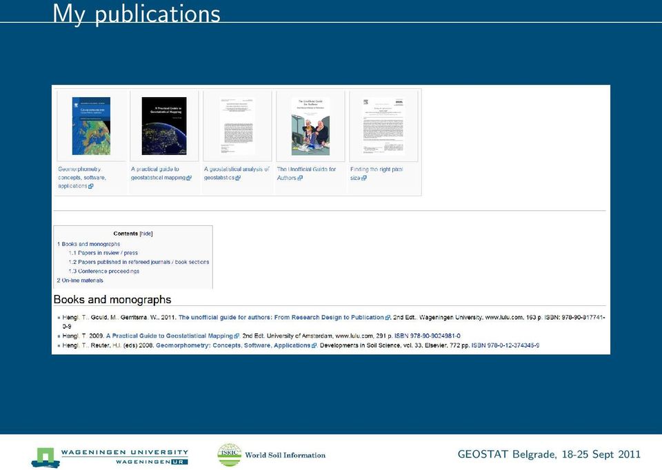
3 My publications
4 GEOSTAT What is GEOSTAT?

5 GEOSTAT GEOSTAT is a non-profit, specialized, block course (summer school) run by FOSS enthusiasts and developers. The main idea of GEOSTAT is to promote various aspects of statistical analysis of spatial and spatio-temporal data using open source / free GIS tools: R, SAGA GIS, GRASS GIS, FWTools, Google Earth and similar.


6 The happy triangle Statistical computing GDAL GRASS GIS GIS analysis ground overlays, time-series Browsing of geo-data KML

7 Previous meetings 2007 Naples (IT) 2008 Amsterdam (NL) 2009 Split (HR) 2010 Plasencia (ES) 2011 Landau (GE) Local GEOSTAT: Zagreb (2004), Ispra (2007), Canberra (2011), Belgrade (2011)
, Ispra (2007), Canberra (2011),")
8 What is a crash course A crash course is a compressed version of a training course for people that already have full agendas. It is really intended for people who pick up new methods/tools quickly and have a high motivation to learn (PhD students?). This means no long questions, no going back, no deep discussion, no complains about the speed/programme of the course... and of course: no promises that you will manage to master these tools in such a short time.
.")
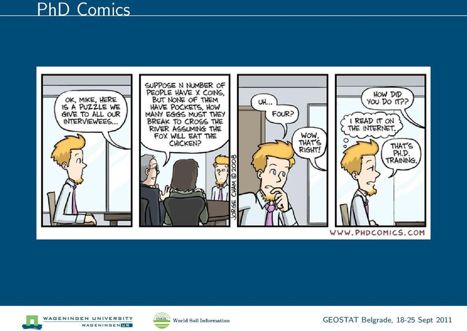
9 PhD Comics
10 Main principles 1. The location is selected by the lecturers. 2. The course programme is largely shaped by the participants. 3. Selection of candidates is based on solidarity, academic output and contributions to open source projects. 4. Participants come with their own laptop computers. 5. GEOSTAT makes no profit.

11 100% pure enthusiasm

12 Belgrade 2008/2009

13 The six pillars of open geo-data production 1 1. open data, in real-time 2. open source geospatial software 3. open, reproducable procedures 4. open, web-based, methods for data and processing models (interoperability) 5. open and explicitly quantified significance and accuracy levels of research findings 6. managed, open user and developer communities 1 Edzer Pebesma, (OpenGeostatistic.org)

14 General structure DAY 1: Introduction and course overview (software installation and first (baby) steps in R). DAY 2: Open Source GIS day. DAY 3: Spatio-temporal data in R (linking R with GIS, MySQL). DAY 4: Sensor Web and SWE hands on with INTAMAP, WPS, and RServe. DAY 5: Open day (the programme will be published on Day 4)

15 Types of internal courses You loose time, we loose time.

16 Types of internal courses You loose time, we loose time. You loose time (we practice teaching).

17 Types of internal courses You loose time, we loose time. You loose time (we practice teaching). We loose time.
.")
18 Types of internal courses You loose time, we loose time. You loose time (we practice teaching). We loose time. You run a similar course in 1 2 years.

19 Literature I Beaudette, D., Open Source Software Tools for Soil Scientists. University of California at Davis. Bivand, R., Pebesma, E., Rubio, V., Applied Spatial Data Analysis with R. Use R Series, Springer, Heidelberg, pp Conrad, O. 2007: SAGA Entwurf, Funktionsumfang und Anwendung eines Systems für Automatisierte Geowissenschaftliche Analysen. electronic doctoral dissertation, University of Göttingen. Hengl, T A Practical Guide for Geostatistical Mapping. University of Amsterdam, (lulu.com). Kabacoff, R.I., Data Analysis and Graphics with R. Manning publications, 375 p.

20 Literature II Neteler, M., Mitasova, H., Open Source GIS: A GRASS GIS Approach, 3rd Edt. Springer, The International Series in Engineering and Computer Science: Volume p. Venables, W.N. et al, Introduction to R. R Core Development team.

21 Some important assumptions Some of you are experienced users (20 30% are beginners).
22 Some important assumptions Some of you are experienced users (20 30% are beginners). Most of you are new to SAGA / GRASS (you need a gentle intro).
23 Some important assumptions Some of you are experienced users (20 30% are beginners). Most of you are new to SAGA / GRASS (you need a gentle intro). R is hot.
24 Some important assumptions Some of you are experienced users (20 30% are beginners). Most of you are new to SAGA / GRASS (you need a gentle intro). R is hot. It has a steep learning curve: R is hell.
25 Some important assumptions Some of you are experienced users (20 30% are beginners). Most of you are new to SAGA / GRASS (you need a gentle intro). R is hot. It has a steep learning curve: R is hell. You all have various backgrounds and see world with different eyes.
26 Disclaimer We can give you an overview of R+OSGeo in 5 days; we can NOT teach you statistics, GIS, RS, computer science... in 40 hours.
27 Disclaimer We can give you an overview of R+OSGeo in 5 days; we can NOT teach you statistics, GIS, RS, computer science... in 40 hours. Lecturers are not responsible for Internet, coffee breaks, lunches, local logistics etc.
28 Disclaimer We can give you an overview of R+OSGeo in 5 days; we can NOT teach you statistics, GIS, RS, computer science... in 40 hours. Lecturers are not responsible for Internet, coffee breaks, lunches, local logistics etc. Local organizers (Branislav) is not responsible for the program (or a complete lack of it).
29 Getting the right motivation (inspiration) Why should you invest time to learn to speak R? What can it do? (and what it can t do?) How does the R-sig-geo community works (what are its shared principles)? How does the OSgeo community works (what are its shared principles)? Is R+SAGA/GRASS the best choice for spatio-temporal data analysis?
30 The open source movement Open Source solutions 2 : Operating systems: Linux Databases: SQL Scientific writing: L A TEX Spatial analysis: GRASS GIS, SAGA GIS Statistical computing: R 2
31 Quote To build a better world we need to replace the patchwork of lucky breaks and arbitrary advantages that today determine success the fortunate birth dates and the happy accidents of history with a society that provides opportunities for all. Malcom Gladwell in Outliers.
32 FOSS and academic work
33 R Why R?
34 What is R? the open source implementation of the S language for statistical computing created by created by Ross Ihaka and Robert Gentleman (now maintained by the R Development Core Team);
35 What is R? the open source implementation of the S language for statistical computing created by created by Ross Ihaka and Robert Gentleman (now maintained by the R Development Core Team); why R?: the name R was selected for two reasons: (1) precedence R is a letter before S, and (2) coincidence both of the creators names start with a letter R ;
36 What is R? the open source implementation of the S language for statistical computing created by created by Ross Ihaka and Robert Gentleman (now maintained by the R Development Core Team); why R?: the name R was selected for two reasons: (1) precedence R is a letter before S, and (2) coincidence both of the creators names start with a letter R ; it is a computer language developed to simplify statistical computing/programming;
37 What is R? the open source implementation of the S language for statistical computing created by created by Ross Ihaka and Robert Gentleman (now maintained by the R Development Core Team); why R?: the name R was selected for two reasons: (1) precedence R is a letter before S, and (2) coincidence both of the creators names start with a letter R ; it is a computer language developed to simplify statistical computing/programming; it offers many contributed packages (>2000), technical documents, demos and examples;
38 What is R? the open source implementation of the S language for statistical computing created by created by Ross Ihaka and Robert Gentleman (now maintained by the R Development Core Team); why R?: the name R was selected for two reasons: (1) precedence R is a letter before S, and (2) coincidence both of the creators names start with a letter R ; it is a computer language developed to simplify statistical computing/programming; it offers many contributed packages (>2000), technical documents, demos and examples; widely recognized as one of the fastest growing and most comprehensive statistical computing tools;
39 What is R? the open source implementation of the S language for statistical computing created by created by Ross Ihaka and Robert Gentleman (now maintained by the R Development Core Team); why R?: the name R was selected for two reasons: (1) precedence R is a letter before S, and (2) coincidence both of the creators names start with a letter R ; it is a computer language developed to simplify statistical computing/programming; it offers many contributed packages (>2000), technical documents, demos and examples; widely recognized as one of the fastest growing and most comprehensive statistical computing tools; it is a movement;
40 R is sexy
41 What it is not it s not a software with GUI and point-and-click control;
42 What it is not it s not a software with GUI and point-and-click control; there are practically no data analysis wizards;
43 What it is not it s not a software with GUI and point-and-click control; there are practically no data analysis wizards; it s not an interactive system!;
44 What it is not it s not a software with GUI and point-and-click control; there are practically no data analysis wizards; it s not an interactive system!; it comes with no warranties (but so does the commercial software too!!);
45 What it is not it s not a software with GUI and point-and-click control; there are practically no data analysis wizards; it s not an interactive system!; it comes with no warranties (but so does the commercial software too!!); there is practically no formal support;
46 Why make scripts? Roger Bivand: Because S (and its implementation R) is a well-developed, simple and effective programming language which includes conditionals, loops, user-defined recursive functions and input and output facilities, existing functions can be modified. This is what is referred to as statistical programming in R we all become programmers (but much faster than with C++ or Java).
47 Why make scripts? Roger Bivand: Because S (and its implementation R) is a well-developed, simple and effective programming language which includes conditionals, loops, user-defined recursive functions and input and output facilities, existing functions can be modified. This is what is referred to as statistical programming in R we all become programmers (but much faster than with C++ or Java). The basic approach to using R is to generate scripts that define the data processing steps (workflows?).
48 Why make scripts? Roger Bivand: Because S (and its implementation R) is a well-developed, simple and effective programming language which includes conditionals, loops, user-defined recursive functions and input and output facilities, existing functions can be modified. This is what is referred to as statistical programming in R we all become programmers (but much faster than with C++ or Java). The basic approach to using R is to generate scripts that define the data processing steps (workflows?). Documenting the analysis process is a good thing, so programming scripts are not just a burden, certainly for users doing original research and repetetive work, arguably for student classes too.
49 Why make scripts? Roger Bivand: Because S (and its implementation R) is a well-developed, simple and effective programming language which includes conditionals, loops, user-defined recursive functions and input and output facilities, existing functions can be modified. This is what is referred to as statistical programming in R we all become programmers (but much faster than with C++ or Java). The basic approach to using R is to generate scripts that define the data processing steps (workflows?). Documenting the analysis process is a good thing, so programming scripts are not just a burden, certainly for users doing original research and repetetive work, arguably for student classes too. Point-and-click operations are for little children!
50 Do you speak R? After some time you basically discovered that most of the things you want to do, you can do in R, the only question is how. Well, first, you have to learn to how to speak n write R.
51 A bit of history R was first time released in 1997; majority of the development is (still) done by prof.brian D. Ripley; at the moment (september :50), there are 3228 contributed packages! according to Google trends, R-project.org has a community of about k active users; in 2003, a group of researchers (International Workshop on Distributed Statistical Computing) decided to add spatial functionality to R;... now is time to use it more broadly (MSc level and PhD level modules, projects, reports and scientific documents);
52 Quote Once methodological problems start being perceived or even defined in terms of what one s favorite software does well, then the software has stopped being a tool, and has become a crutch, and at worse a shackle. Simon Jackman
53 Quote R has really become the second language for people coming out of grad school now, and there s an amazing amount of code being written for it. Max Kuhn
54 Why I use R? It s provides analysis tools of highest quality (top scientistis work with R).
55 Why I use R? It s provides analysis tools of highest quality (top scientistis work with R). It s reliabile (it s open).
56 Why I use R? It s provides analysis tools of highest quality (top scientistis work with R). It s reliabile (it s open). It s developing at faster speed.
57 Why I use R? It s provides analysis tools of highest quality (top scientistis work with R). It s reliabile (it s open). It s developing at faster speed. It expands my creativity.
58 Why I use R? It s provides analysis tools of highest quality (top scientistis work with R). It s reliabile (it s open). It s developing at faster speed. It expands my creativity. It s free.
59 The ASDA(R)-book.org
60 The ASDA(R) team
61 A Practical Guide to Geostatistical Mapping
62 Quote I created Quick-R for one simple reason. I wanted to learn R and I am a teacher at heart. The easiest way for me to learn something is to teach it Robert I.Kabacoff
63 Software Not all software is required to follow the exercises R v2.13 (Windows OS) including a list of packages; Tinn-R v2.3 (code editor); ODBC driver for windows; Optional: FWTools v2.4 a list of utilities to handle spatial data; SAGA GIS v2.0.7 a light GIS excellent for educational purposes.
64 Installing the add-on packages > install.packages("ctv") > library(ctv) > install.views("spatial") This will install all connected packages listed at views/spatial.
65 Check your installation > Sys.getenv(c("OS", "COMPUTERNAME", "R_HOME", "R_LIBS_USER", + "PROCESSOR_IDENTIFIER")) OS "Windows_NT" COMPUTERNAME "L " R_HOME "C:\\PROGRA~1\\R\\R-212~1.2" R_LIBS_USER "M:\\My Documents/R/win-library/2.12" PROCESSOR_IDENTIFIER "Intel64 Family 6 Model 30 Stepping 5, GenuineIntel"
66 Making friends with R 1. Use script editors such as as TINN-R or JGR (syntax highlighting, wrapping, search/replace etc.).
67 Making friends with R 1. Use script editors such as as TINN-R or JGR (syntax highlighting, wrapping, search/replace etc.). 2. The best way to learn R is to look at the existing scripts, then adjust/improve/extend/combine them to fit your needs, e.g.:
68 Making friends with R 1. Use script editors such as as TINN-R or JGR (syntax highlighting, wrapping, search/replace etc.). 2. The best way to learn R is to look at the existing scripts, then adjust/improve/extend/combine them to fit your needs, e.g.: Graphical Manual/Addicted to R if you prefer to explore examples graphically;
69 Making friends with R 1. Use script editors such as as TINN-R or JGR (syntax highlighting, wrapping, search/replace etc.). 2. The best way to learn R is to look at the existing scripts, then adjust/improve/extend/combine them to fit your needs, e.g.: Graphical Manual/Addicted to R if you prefer to explore examples graphically; Teach-your-self books e.g. Statistics with R or An Introduction to R ;
70 Making friends with R 1. Use script editors such as as TINN-R or JGR (syntax highlighting, wrapping, search/replace etc.). 2. The best way to learn R is to look at the existing scripts, then adjust/improve/extend/combine them to fit your needs, e.g.: Graphical Manual/Addicted to R if you prefer to explore examples graphically; Teach-your-self books e.g. Statistics with R or An Introduction to R ; Quick-R;
71 Making friends with R 1. Use script editors such as as TINN-R or JGR (syntax highlighting, wrapping, search/replace etc.). 2. The best way to learn R is to look at the existing scripts, then adjust/improve/extend/combine them to fit your needs, e.g.: Graphical Manual/Addicted to R if you prefer to explore examples graphically; Teach-your-self books e.g. Statistics with R or An Introduction to R ; Quick-R; 3. If your R script does not work, do not break your head, try to get help:
72 Making friends with R 1. Use script editors such as as TINN-R or JGR (syntax highlighting, wrapping, search/replace etc.). 2. The best way to learn R is to look at the existing scripts, then adjust/improve/extend/combine them to fit your needs, e.g.: Graphical Manual/Addicted to R if you prefer to explore examples graphically; Teach-your-self books e.g. Statistics with R or An Introduction to R ; Quick-R; 3. If your R script does not work, do not break your head, try to get help: local installation (> help.search("kriging"));
73 Making friends with R 1. Use script editors such as as TINN-R or JGR (syntax highlighting, wrapping, search/replace etc.). 2. The best way to learn R is to look at the existing scripts, then adjust/improve/extend/combine them to fit your needs, e.g.: Graphical Manual/Addicted to R if you prefer to explore examples graphically; Teach-your-self books e.g. Statistics with R or An Introduction to R ; Quick-R; 3. If your R script does not work, do not break your head, try to get help: local installation (> help.search("kriging")); R-project (> RSiteSearch("krige dimensions do not match"))
74 Making friends with R 1. Use script editors such as as TINN-R or JGR (syntax highlighting, wrapping, search/replace etc.). 2. The best way to learn R is to look at the existing scripts, then adjust/improve/extend/combine them to fit your needs, e.g.: Graphical Manual/Addicted to R if you prefer to explore examples graphically; Teach-your-self books e.g. Statistics with R or An Introduction to R ; Quick-R; 3. If your R script does not work, do not break your head, try to get help: local installation (> help.search("kriging")); R-project (> RSiteSearch("krige dimensions do not match")) www Rseek.org
75 Good practice Put comments in script (after #). Add some meta-information at the beginning of your script. Once you tested your script and saw that it works, tidy-up the code. Place the input data on-line (database) so you can communicate only the script.
76 R mailing lists: Do s and Don ts! Do s: If you have not done so already, read the R posting guide. Use the existing pre-installed datasets (come together with a certain package) to describe your problem; link your problem to some existing problems. Acknowledge the work (time spent) other people do to help you. You can submit not only the problems you discover but also the information that you think is interesting for the community. Don ts: Do not send poorly formulated questions. Do not send too much. Complaining to a mailing list about what frustrates you about R makes no sense. You are requesting that somebody does a work for you that you could do yourself!
77 R GUI
78 JaGuaR
79 RStudio
80 New function > name <- function(arg_1, arg_2,...) expression
81 Example > sum2 <- function(x, y) { + sum2 <- x + y + return(sum2) + } > sum2(5, 6) [1] 11
82 Spatial objects An advantage of R is that you can create your own formats and structures for data. But if there are too many formats you can easily get lots. In addition, we want to have smooth links to external formats (R is open!). To reduce this problem, Bivand et al.(2008) developed new-style classes to represent spatial data.
83 Spatial class The foundation object is the Spatial class, with just two slots (new-style class objects have pre-defined components called slots): a bounding box mostly used for setting up plots; a CRS class object defining the coordinate reference system, and may be set to CRS(as.character(NA)); Operations on Spatial* objects should update or copy these values to the new Spatial* objects being created. The most basic spatial data object is a point, which may have 2 or 3 dimensions.
84 Spatial classes for point features: SpatialPoints; SpatialPointsDataFrame; for line features: SpatialLines, SpatialLinesDataFrame; polygons: SpatialPolygons, SpatialPolygonsDataFrame; rasters: SpatialPixels, SpatialPixelsDataFrame, SpatialGrid, SpatialGridDataFrame;
85 SpatialPoints > library(sp) > data(meuse) > coords <- SpatialPoints(meuse[, c("x", "y")]) > summary(coords) Object of class SpatialPoints Coordinates: min max x y Is projected: NA proj4string : [NA] Number of points: 155
86 SpatialPointsDataFrame We can add the tabular data to make a SpatialPointsDataFrame object: > meuse1 <- SpatialPointsDataFrame(coords, meuse) > str(meuse1, max.level = 2) Formal class 'SpatialPointsDataFrame' [package "sp"] with 5 slots..@ data :'data.frame': 155 obs. of 14 variables:..@ coords.nrs : num(0)..@ coords : num [1:155, 1:2] attr(*, "dimnames")=list of 2..@ bbox : num [1:2, 1:2] attr(*, "dimnames")=list of 2..@ proj4string:formal class 'CRS' [package "sp"] with 1 slots
87 Point features Spatial points classes and their slots SpatialPointsDataFrame SpatialPoints coords.nrs data data.frame Spatial bbox proj4string SpatialPoints coords Spatial Spatial lines and polygons
88 Spatial Line/polygon Polygonsfeatures classes and slots SpatialLines lines Spatial Lines Lines ID Line coords SpatialPolygons polygons plotorder Spatial Spatial bbox proj4string Polygons Polygons plotorder labpt ID area Polygon labpt area hole ringdir coords
89 Grids Spatial grid and pixels classes and their slots SpatialGridDataFrame SpatialGrid data SpatialPixelsDataFrame SpatialPixels data data.frame SpatialGrid grid grid.index SpatialPoints SpatialPixels grid grid.index SpatialPoints GridTopology cellcentre.offset cellsize cells.dim Spatial bbox proj4string SpatialPoints coords Spatial Spatial classes provided by sp
90 Basic methods spplot plotting of spatial objects (maps); spsample sample points from a set of polygons, on a set of lines or from a gridded area; bbox get the bounding box; proj4string get or set the projection (coordinate reference system); coordinates set or retrieve coordinates; sptransform transform coordinates from one CRS to another; overlay combine two different spatial objects;
91 Plotting a SpatialPoints object > plot(as(meuse1, "Spatial"), axes = TRUE) > plot(meuse1, add = TRUE) > plot(meuse1[meuse1$ffreq == 1, ], col = "green", add = TRUE)
92 Combining statistical and GIS operations Because the Spatial*DataFrame family objects behave in most cases like data frames, most of what we are used to doing with standard data frames just works (but no merge, etc., yet). These objects are very similar to typical representations of the same kinds of objects in geographical information systems, so they do not suit spatial data that is not geographical (like medical imaging) as such. Because now sp classes for GIS data exits, this opens the door for fusing GIS and statistical operations (this has not been possible in e.g.2002).
93 Spatial packages R now offers a range of contributed packages in spatial statistics and increasing awareness of the importance of spatial data analysis in the broader community. Current contributed packages with spatial applications: point patterns: spatstat, VR:spatial, splancs; geostatistics: gstat, geor, georglm, fields, spbayes, RandomFields, VR:spatial, sgeostat, vardiag; lattice/area data: spdep, DCluster, spgwr, ade4; links to GIS: rgdal, spgrass, RPy, RSAGA;
94 Let s create spatial objects! We can create spatial objects from scratch! For example a DEM: > dem <- expand.grid(x = seq(100, 600, 100), y = seq(100, + 600, 100)) > dem$z <- as.vector(c(23, 24, 34, 38, 45, 51, 24, 20, + 20, 28, 18, 49, 22, 20, 19, 14, 38, 45, 19, 15, 13, + 21, 23, 25, 14, 11, 18, 11, 18, 19, 10, 16, 23, 16, + 9, 6)) > gridded(dem) <- ~x + y > dem <- as(dem, "SpatialGridDataFrame") > str(dem)
95 A small DEM > dem.plt <- spplot(dem[1], main = "DEM", scales = list(draw = FALSE), + col.regions = topo.colors(25)) > print(dem.plt) > writegdal(dem, "dem6.sdat", "SAGA") DEM
96 Controlling SAGA from R > library(rsaga) > rsaga.env() $workspace [1] "." $cmd [1] "saga_cmd.exe" $path [1] "C:/PROGRA~1/R/R-212~1.2/library/RSAGA/saga_vc" $modules [1] "C:/PROGRA~1/R/R-212~1.2/library/RSAGA/saga_vc/modules" $version [1] "2.0.7"
97 Getting list of modules > rsaga.get.modules("ta_channels") $ta_channels code name interactive 1 0 Channel Network FALSE 2 1 Watershed Basins FALSE 3 2 Watershed Basins (Extended) FALSE 4 3 Vertical Distance to Channel Network FALSE 5 4 Overland Flow Distance to Channel Network FALSE 6 5 D8 Flow Analysis FALSE 7 6 Strahler Order FALSE
98 Run stream extraction > rsaga.geoprocessor(lib = "ta_channels", module = 5, param = list(dem = "dem6.sg + DIRECTION = "channels.sgrd", CONNECTION = "route.sgrd", + NETWORK = "channels.shp")) library path: C:/PROGRA~1/R/R-212~1.2/library/RSAGA/saga_vc/modules library name: ta_channels module name : D8 Flow Analysis author : (c) 2003 by O.Conrad Load grid: dem6.sgrd... ready Load grid: channels.sgrd... ready Load grid: route.sgrd... ready Load shapes: channels.shp... ready
99 Read back to R > dem$route <- readgdal("route.sdat")$band1 route.sdat has GDAL driver SAGA and has 6 rows and 6 columns > channels <- readogr("channels.shp", "channels") OGR data source with driver: ESRI Shapefile Source: "channels.shp", layer: "channels" with 32 features and 2 fields Feature type: wkblinestring with 2 dimensions
100 Plot the final result > dem.plt <- spplot(dem[1], main = "DEM", col.regions = topo.colors(25)) > channels.plt <- spplot(dem[2], col.regions = rev(gray(0:20/20)), + main = "Flow connectivity", sp.layout = list("sp.lines", + channels, col = "red")) > print(dem.plt, split = c(1, 1, 2, 1), more = T) > print(channels.plt, split = c(2, 1, 2, 1), more = F) DEM Flow connectivity
101 FWTools There is still no package to control FWTools from R, but we can simply send command lines. Before we can use FWTools from R, we need to locate it on our PC: > gdalwarp <- gsub("/", "\\\\", dir(path="c:/progra~1/fwtool~1.7", + pattern="gdalwarp.exe", recursive=true, full.names=true)) > gdalwarp [1] "C:\\PROGRA~1\\FWTOOL~1.7\\bin\\gdalwarp.exe" > workd <- paste(gsub("/", "\\\\", getwd()), "\\", sep="")
102 MODIS data Now we can download some GIS data from web: > MOD12Q1 <- + MOLT/MOD12Q1.004/ /" > download.file(paste(mod12q1, + "MOD12Q1.A h18v hdf", sep=""), + destfile=paste(getwd(), + "MOD12Q1.A h18v hdf", sep="/"), + mode='wb') Resolving e4ftl01u.ecs.nasa.gov Connecting to e4ftl01u.ecs.nasa.gov :21... connected. Logging in as anonymous... Logged in! ==> SYST... done. ==> PWD... done. ==> TYPE I... done. ==> CWD /MOLT/MOD12Q1.004/ done. ==> SIZE MOD12Q1.A h18v hdf ==> PASV... done. ==> RETR MOD12Q1.A done. Length: (22M) 0K % 64.9K 5m48s K % 501K 0s 22600K % 503K=65s
103 Reprojecting grids We can reproject/resample the map to our local coordinate system using the gdalwarp functionality (this combines several processing steps in one function): > NL.prj <- "+proj=sterea +lat_0= lon_0= k= x_0= y_0= ellps=bessel +units=m +no_defs + +towgs84= , , , , , ,4.0812" > system(paste(gdalwarp, " HDF4_EOS:EOS_GRID:\"", workd, + "\\MOD12Q1.A h18v hdf\" + :MOD12Q1:Land_Cover_Type_1 -t_srs \"", NL.prj, "\" + IGBP2004NL.tif -r near -te tr ", sep="")) Creating output file that is 560P x 650L. Processing input file HDF4_EOS:EOS_GRID:\\MOD12Q1.A Using internal nodata values (eg. 255) for image HDF4_EOS:EOS_ done.
104 Plot the final result In this case we have produced a MODIS-based land cover map for the whole Netherlands in resolution of 500 m (in local coordinate system).
105 ODBC Open Database Connectivity (ODBC) an DB independent software interface (driver library); RODBC allows you to connect to a remote or local database and send SQL queries from R. Basically, by using RODBC we should be able to connect to any database (R/W).
106 Add DSN
107 Writing spatial data to KML There are two possibilities to export maps to KML: (a) using existing packages, and (b) by writing KML files by-hand. To export point or line features to KML, use the writeogr method that is available in R package rgdal. More flexible way to writing KML files is by using loops.
Classes and Methods for Spatial Data: the sp Package
 Classes and Methods for Spatial Data: the sp Package Edzer Pebesma Roger S. Bivand Feb 2005 Contents 1 Introduction 2 2 Spatial data classes 2 3 Manipulating spatial objects 3 3.1 Standard methods..........................
The sp Package. July 27, 2006
 The sp Package July 27, 2006 Version 0.8-18 Date 2006-07-10 Title classes and methods for spatial data Author Edzer J. Pebesma , Roger Bivand and others Maintainer
Reading & Writing Spatial Data in R John Lewis. Some material used in these slides are taken from presentations by Roger Bivand and David Rossiter
 Reading & Writing Spatial Data in R John Lewis Some material used in these slides are taken from presentations by Roger Bivand and David Rossiter Introduction Having described how spatial data may be represented
APPLICATION OF OPEN SOURCE/FREE SOFTWARE (R + GOOGLE EARTH) IN DESIGNING 2D GEODETIC CONTROL NETWORK
 IN DESIGNING 2D GEODETIC CONTROL NETWORK") INTERNATIONAL SCIENTIFIC CONFERENCE AND XXIV MEETING OF SERBIAN SURVEYORS PROFESSIONAL PRACTICE AND EDUCATION IN GEODESY AND RELATED FIELDS 24-26, June 2011, Kladovo -,,Djerdap upon Danube, Serbia. APPLICATION
INTERNATIONAL SCIENTIFIC CONFERENCE AND XXIV MEETING OF SERBIAN SURVEYORS PROFESSIONAL PRACTICE AND EDUCATION IN GEODESY AND RELATED FIELDS 24-26, June 2011, Kladovo -,,Djerdap upon Danube, Serbia. APPLICATION
Map overlay and spatial aggregation in sp
 Map overlay and spatial aggregation in sp Edzer Pebesma June 5, 2015 Abstract Numerical map overlay combines spatial features from one map layer with the attribute (numerical) properties of another. This
Customising spatial data classes and methods
 Customising spatial data classes and methods Edzer Pebesma Feb 2008 Contents 1 Programming with classes and methods 2 1.1 S3-style classes and methods.................... 3 1.2 S4-style classes and methods....................
Lecture 8. Online GIS
 Lecture 8 Online GIS Lecture 8: Outline I. Online GIS 1. Google Earth 2. MSN Live Maps II. Open Source GIS III. ArcGIS Server and the ESRI suite of online software utility options IV. Advanced Data Mining
Introduction to GIS (Basics, Data, Analysis) & Case Studies. 13 th May 2004. Content. What is GIS?
 & Case Studies. 13 th May 2004. Content. What is GIS?") Introduction to GIS (Basics, Data, Analysis) & Case Studies 13 th May 2004 Content Introduction to GIS Data concepts Data input Analysis Applications selected examples What is GIS? Geographic Information
Introduction to GIS (Basics, Data, Analysis) & Case Studies 13 th May 2004 Content Introduction to GIS Data concepts Data input Analysis Applications selected examples What is GIS? Geographic Information
Institute of Natural Resources Departament of General Geology and Land use planning Work with a MAPS
 Institute of Natural Resources Departament of General Geology and Land use planning Work with a MAPS Lecturers: Berchuk V.Y. Gutareva N.Y. Contents: 1. Qgis; 2. General information; 3. Qgis desktop; 4.
Introduction of geospatial data visualization and geographically weighted reg
 Introduction of geospatial data visualization and geographically weighted regression (GWR) Vanderbilt University August 16, 2012 Study Background Study Background Data Overview Algorithm (1) Information
Introduction to Imagery and Raster Data in ArcGIS
 Esri International User Conference San Diego, California Technical Workshops July 25, 2012 Introduction to Imagery and Raster Data in ArcGIS Simon Woo slides Cody Benkelman - demos Overview of Presentation
Journal of Statistical Software
 JSS Journal of Statistical Software February 2015, Volume 63, Issue 5. http://www.jstatsoft.org/ plotkml: Scientific Visualization of Spatio-Temporal Data Tomislav Hengl ISRIC World Soil Information the
Vector analysis - introduction Spatial data management operations - Assembling datasets for analysis. Data management operations
 Vector analysis - introduction Spatial data management operations - Assembling datasets for analysis Transform (reproject) Merge Append Clip Dissolve The role of topology in GIS analysis Data management
NetCDF and HDF Data in ArcGIS
 2013 Esri International User Conference July 8 12, 2013 San Diego, California Technical Workshop NetCDF and HDF Data in ArcGIS Nawajish Noman Kevin Butler Esri UC2013. Technical Workshop. Outline NetCDF
Blender addons ESRI Shapefile import/export and georeferenced raster import
 Blender addons ESRI Shapefile import/export and georeferenced raster import This blender addon is a collection of 4 tools: ESRI Shapefile importer - Import point, pointz, polyline, polylinez, polygon,
A GIS helps you answer questions and solve problems by looking at your data in a way that is quickly understood and easily shared.
 A Geographic Information System (GIS) integrates hardware, software, and data for capturing, managing, analyzing, and displaying all forms of geographically referenced information. GIS allows us to view,
Geodatabase Programming with SQL
 DevSummit DC February 11, 2015 Washington, DC Geodatabase Programming with SQL Craig Gillgrass Assumptions Basic knowledge of SQL and relational databases Basic knowledge of the Geodatabase We ll hold
SAGA vs GRASS: A Comparative Analysis of the Two Open Source Desktop GIS for the Automated Analysis of Elevation Data
 SAGA vs GRASS: A Comparative Analysis of the Two Open Source Desktop GIS for the Automated Analysis of Elevation Data T. Hengl 1, C. H. Grohmann 2, R. S. Bivand 3, O. Conrad 4, and A. Lobo 5 1 IBED University
INTRODUCTION TO ARCGIS SOFTWARE
 INTRODUCTION TO ARCGIS SOFTWARE I. History of Software Development a. Developer ESRI - Environmental Systems Research Institute, Inc., in 1969 as a privately held consulting firm that specialized in landuse
MrSID Plug-in for 3D Analyst
 LizardTech MrSID Plug-in for 3D Analyst User Manual Copyrights Copyright 2009 2010 LizardTech. All rights reserved. Information in this document is subject to change without notice. The software described
An Introduction to Open Source Geospatial Tools
 An Introduction to Open Source Geospatial Tools by Tyler Mitchell, author of Web Mapping Illustrated GRSS would like to thank Mr. Mitchell for this tutorial. Geospatial technologies come in many forms,
University of Arkansas Libraries ArcGIS Desktop Tutorial. Section 4: Preparing Data for Analysis
 : Preparing Data for Analysis When a user acquires a particular data set of interest, it is rarely in the exact form that is needed during analysis. This tutorial describes how to change the data to make
Geospatial exploitation Products. GXP WebView. Powered by the GXP Platform
 Geospatial exploitation Products GXP WebView Powered by the GXP Platform Exploitation Capabilities GXP WebView Powered by the GXP Platform Detailed annotation (text, points, lines, and polygons) Distance,
SUMMER SCHOOL ON ADVANCES IN GIS
 SUMMER SCHOOL ON ADVANCES IN GIS Six Workshops Overview The workshop sequence at the UMD Center for Geospatial Information Science is designed to provide a comprehensive overview of current state-of-the-art
GIS Databases With focused on ArcSDE
 Linköpings universitet / IDA / Div. for human-centered systems GIS Databases With focused on ArcSDE Imad Abugessaisa [email protected] 20071004 1 GIS and SDBMS Geographical data is spatial data whose
GIS Tools for Land Managers
 Citation: Karl, J. 2010. GIS Tools for Land Managers. Sound Science White Paper Series #05. www.sound-science.org. GIS Tools for Land Managers Most land managers recognize that geographic information systems
ArcGIS Viewer for Silverlight An Introduction
 Esri International User Conference San Diego, California Technical Workshops July 26, 2012 ArcGIS Viewer for Silverlight An Introduction Rich Zwaap Agenda Background Product overview Getting started and
Image Registration. Using Quantum GIS
 Using Quantum GIS Tutorial ID: IGET_GIS_004 This tutorial has been developed by BVIEER as part of the IGET web portal intended to provide easy access to geospatial education. This tutorial is released
Open Source tools for geospatial tasks
 Open Source tools for geospatial tasks Some alternatives to commercial software packages ([email protected]) Graduate Student Department of Biology Dalhousie University Workshop on Inshore Ecosystems
Automate Your BI Administration to Save Millions with Command Manager and System Manager
 Automate Your BI Administration to Save Millions with Command Manager and System Manager Presented by: Dennis Liao Sr. Sales Engineer Date: 27 th January, 2015 Session 2 This Session is Part of MicroStrategy
What s new in Carmenta Server 4.2
 What s new in Carmenta Server 4.2 A complete solution for cost-effective visualisation and distribution of GIS data through web services Carmenta Server provides cost-effective technology for building
Chapter 6: Data Acquisition Methods, Procedures, and Issues
 Chapter 6: Data Acquisition Methods, Procedures, and Issues In this Exercise: Data Acquisition Downloading Geographic Data Accessing Data Via Web Map Service Using Data from a Text File or Spreadsheet
The ORIENTGATE data platform
 Seminar on Proposed and Revised set of indicators June 4-5, 2014 - Belgrade (Serbia) The ORIENTGATE data platform WP2, Action 2.4 Alessandra Nuzzo, Sandro Fiore, Giovanni Aloisio Scientific Computing and
Google Earth Digitale Wege in eine bekannte Welt Sep. 2006
 Google Earth Digitale Wege in eine bekannte Welt Sep. 2006 Joachim Glaubrecht Google Enterprise [email protected] What is Google Enterprise? 2 1 Focus.de: "Der Papst-Besuch in Google Earth" 3 How to Geo
Setting Up ALERE with Client/Server Data
 Setting Up ALERE with Client/Server Data TIW Technology, Inc. November 2014 ALERE is a registered trademark of TIW Technology, Inc. The following are registered trademarks or trademarks: FoxPro, SQL Server,
Data Modeling Basics. John Auel GIS Technician II United Services Group
 Data Modeling Basics John Auel GIS Technician II United Services Group Background Bachelor of Science at University of Wisconsin, Steven s Point Area of Emphasis -- Cartography Been at United Services
Application Note Windows 2008 and IBM Tape Diagnostic Tool (ITDT-GE)
") Application Note Windows 2008 and IBM Tape Diagnostic Tool (ITDT-GE) PREFACE This document describes how to install and use IBM Tape Diagnostic Tool GUI Edition (ITDT-GE) on a Windows 2008 x 64 server
Application Note Windows 2008 and IBM Tape Diagnostic Tool (ITDT-GE) PREFACE This document describes how to install and use IBM Tape Diagnostic Tool GUI Edition (ITDT-GE) on a Windows 2008 x 64 server
An Introduction to the Use of R for Clinical Research
 An Introduction to the Use of R for Clinical Research Dimitris Rizopoulos Department of Biostatistics, Erasmus Medical Center [email protected] PSDM Event: Open Source Software in Clinical Research
Quick and Easy Web Maps with Google Fusion Tables. SCO Technical Paper
 Quick and Easy Web Maps with Google Fusion Tables SCO Technical Paper Version History Version Date Notes Author/Contact 1.0 July, 2011 Initial document created. Howard Veregin 1.1 Dec., 2011 Updated to
CityGML goes to Broadway
 CityGML goes to Broadway Thomas H. Kolbe, Barbara Burger, Berit Cantzler Chair of Geoinformatics [email protected] September 11, 2015 Photogrammetric Week 2015, Stuttgart The New York City Open Data
Documentation of open source GIS/RS software projects
 Contract no. Workpackage Delivery Delivery Date 030776 WP1 D1.6 2007-07-02 CASCADOSS Development of a trans-national cascade training programme on Open Source GIS&RS Software for environmental applications
Introduction to GIS software
 Introduction to GIS software There are a wide variety of GIS software packages available. Some of these software packages are freely available for you to download and could be used in your classroom. ArcGIS
INSTRUCTIONS FOR MAKING 3D,.DWG CONTOUR LINES
 INSTRUCTIONS FOR MAKING 3D,.DWG CONTOUR LINES A TUTORIAL FROM SPATIAL AND NUMERIC DATA SERVICES NICOLE SCHOLTZ AND GEOFF IVERSON Overview... 2 A. Get a Digital Elevation Model (DEM)... 3 B. Open ArcMap,
Use R! Series Editors: Robert Gentleman Kurt Hornik Giovanni Parmigiani
 Use R! Series Editors: Robert Gentleman Kurt Hornik Giovanni Parmigiani Use R! Albert: Bayesian Computation with R Bivand/Pebesma/Gómez-Rubio: Applied Spatial Data Analysis with R Cook/Swayne: Interactive
GEOSTAT13 Spatial Data Analysis Tutorial: Raster Operations in R Tuesday AM
 GEOSTAT13 Spatial Data Analysis Tutorial: Raster Operations in R Tuesday AM In this tutorial we shall experiment with the R package 'raster'. We will learn how to read and plot raster objects, learn how
2015, André Melancia (Andy.PT) 1
 1") 2015, (Andy.PT) 1 "" 1. Requirements For this session you will need a computer with: Windows 7 Professional or higher Office 2007 Professional or higher (Outlook and Access installed) Some of the drivers
2015, (Andy.PT) 1 "" 1. Requirements For this session you will need a computer with: Windows 7 Professional or higher Office 2007 Professional or higher (Outlook and Access installed) Some of the drivers
Open Source Tools for Spatial Analysis and Geoprocessing
 Open Source Tools for Spatial Analysis and Geoprocessing on the Desktop Karsten Vennemann www.terragis.net Seattle, WA, USA [email protected] 206 905 1711 Workshop Outline Introduction to Free and Open
Getting Started with R and RStudio 1
 Getting Started with R and RStudio 1 1 What is R? R is a system for statistical computation and graphics. It is the statistical system that is used in Mathematics 241, Engineering Statistics, for the following
A Web Service based U.S. Cropland Visualization, Dissemination and Querying System
 A Web Service based U.S. Cropland Visualization, Dissemination and Querying System Rick Mueller, Zhengwei Yang, and Dave Johnson USDA/National Agricultural Statistics Service Weiguo Han and Liping Di GMU/Center
Intro to evis: the event visualization tool
 Intro to evis: the event visualization tool Background The of the (CBC) at the (AMNH) developed the Event Visualization Tool (evis), as a conservation monitoring and decision support tool for guiding protected
Practical, Easy-to-Use, Free GIS and Remote Sensing Tools for Resource Management
 Practical, Easy-to-Use, Free GIS and Remote Sensing Tools for Resource Management Andrew Lister Research Forester 11 Campus Blvd, Ste. 200 Newtown Square, PA 19073 [email protected] Abstract: Geographic
Linking Sensor Web Enablement and Web Processing Technology for Health-Environment Studies
 Linking Sensor Web Enablement and Web Processing Technology for Health-Environment Studies Simon Jirka 1, Stefan Wiemann 2, Johannes Brauner 2, and Eike Hinderk Jürrens 1 1 52 North Initiative for Geospatial
Use R! Series Editors: Robert Gentleman Kurt Hornik Giovanni Parmigiani
 Use R! Series Editors: Robert Gentleman Kurt Hornik Giovanni Parmigiani Use R! Albert: Bayesian Computation with R Bivand/Pebesma/Gómez-Rubio: Applied Spatial Data Analysis with R Cook/Swayne: Interactive
Big Data and Analytics: Getting Started with ArcGIS. Mike Park Erik Hoel
 Big Data and Analytics: Getting Started with ArcGIS Mike Park Erik Hoel Agenda Overview of big data Distributed computation User experience Data management Big data What is it? Big Data is a loosely defined
What is GIS. What is GIS? University of Tsukuba. What do you image of GIS? Copyright(C) ESRI Japan Corporation. All rights reserved.
 ESRI Japan Corporation. All rights reserved.") What is GIS University of Tsukuba Graduate School of Life and Environmental Science April 21 st, 2011 What is GIS? What do you image of GIS? Gas Insulated Switch Groupe Interventional Speciale Geographic
What is GIS University of Tsukuba Graduate School of Life and Environmental Science April 21 st, 2011 What is GIS? What do you image of GIS? Gas Insulated Switch Groupe Interventional Speciale Geographic
ArcGIS. Server. A Complete and Integrated Server GIS
 ArcGIS Server A Complete and Integrated Server GIS ArcGIS Server A Complete and Integrated Server GIS ArcGIS Server enables you to distribute maps, models, and tools to others within your organization
Data Integration for ArcGIS Users Data Interoperability. Charmel Menzel, ESRI Don Murray, Safe Software
 Data Integration for ArcGIS Users Data Interoperability Charmel Menzel, ESRI Don Murray, Safe Software Product overview Extension to ArcGIS (optional) Jointly developed with Safe Software Based on Feature
Create and share a map with GIScloud.com
 Create and share a map with GIScloud.com GIS Cloud is a web based Geographic Information System powered by Cloud Computing and with the full power of desktop GIS. It allows users to create and access your
Bentley ArcGIS. Connector
 Bentley ArcGIS Connector Introduction ESRI, as a GIS software products company, and Bentley Systems, Incorporated, as a developer of solutions for architecture/engineering/construction (AEC) professionals,
Whisler 1 A Graphical User Interface and Database Management System for Documenting Glacial Landmarks
 Whisler 1 A Graphical User Interface and Database Management System for Documenting Glacial Landmarks Whisler, Abbey, Paden, John, CReSIS, University of Kansas [email protected] Abstract The Landmarks
Using CAD Data in ArcGIS
 Esri International User Conference San Diego, California Technical Workshops July 27, 2012 Using CAD Data in ArcGIS Jeff Reinhart & Phil Sanchez Agenda Overview of ArcGIS CAD Support Using CAD Datasets
Spatial Database Support
 Page 1 of 11 Spatial Database Support Global Mapper can import vector data from and export vector data to the following spatial databases: Esri ArcSDE Geodatabase Esri File Geodatabase Esri Personal Geodatabases
Data Analysis and Statistical Software Workshop. Ted Kasha, B.S. Kimberly Galt, Pharm.D., Ph.D.(c) May 14, 2009
 May 14, 2009") Data Analysis and Statistical Software Workshop Ted Kasha, B.S. Kimberly Galt, Pharm.D., Ph.D.(c) May 14, 2009 Learning Objectives: Data analysis commonly used today Available data analysis software packages
Data Analysis and Statistical Software Workshop Ted Kasha, B.S. Kimberly Galt, Pharm.D., Ph.D.(c) May 14, 2009 Learning Objectives: Data analysis commonly used today Available data analysis software packages
bitmedia Access 2007 Basics Entry test Database Basics Entry test Basic database terms What is Access 2007? Tables and indexes
 bitmedia Access 2007 Basics Databases such as Access are often considered by some to live in the shadows of the Microsoft Office Package. This is, as we hope to demonstrate in the course of this module,
Summer Project Report. Fingerprint Based Attendance System
 Summer Project Report On Fingerprint Based Attendance System Advisor Prof Amey Karkare Submitted by- Rajat Chaudhary Priyaranjan Deepak Kumar Durgesh Deep (Group 02) Introduction The most common means
What is Where? Getting Started With Geographic Information Systems Chapter 5
 What is Where? Getting Started With Geographic Information Systems Chapter 5 You can use a GIS to answer the question: What is where? WHAT: Characteristics of attributes or features WHERE: In geographic
Run your own Oracle Database Benchmarks with Hammerora
 Run your own Oracle Database Benchmarks with Hammerora Steve Shaw Intel Corporation UK Keywords: Database, Benchmark Performance, TPC-C, TPC-H, Hammerora Introduction The pace of change in database infrastructure
OPEN STANDARD WEB SERVICES FOR VISUALISATION OF TIME SERIES DATA OF FLOOD MODELS
 OPEN STANDARD WEB SERVICES FOR VISUALISATION OF TIME SERIES DATA OF FLOOD MODELS Barend Köbben FRMRC RPA 7 Workshop visualisations and flow simulations as flood risk communication tools
Environmental Remote Sensing GEOG 2021
 Environmental Remote Sensing GEOG 2021 Lecture 4 Image classification 2 Purpose categorising data data abstraction / simplification data interpretation mapping for land cover mapping use land cover class
UNICORN 7.0. Administration and Technical Manual
 UNICORN 7.0 Administration and Technical Manual Page intentionally left blank Table of Contents Table of Contents 1 Introduction... 1.1 Administrator functions overview... 1.2 Network terms and concepts...
 Development tools to create Web-GIS applications DbMAP ASJ the best solution to easily publish GIS data from existing spatial databases and distributed GIS data sources Easily designs, produces, and publishes
Oklahoma s Open Source Spatial Data Clearinghouse: OKMaps
 Oklahoma s Open Source Spatial Data Clearinghouse: OKMaps Presented by: Mike Sharp State Geographic Information Coordinator Oklahoma Office of Geographic Information MAGIC 2014 Symposium April 28-May1,
First Steps. Setup, data import, visualization and basic terrain analysis. Volker Wichmann
 SAGA First Steps Setup, data import, visualization and basic terrain analysis Volker Wichmann SAGA Setup on Windows Download of SAGA 2.0.8 binaries (1) www.saga-gis.org (2) >> Downloads (@ SourceForge)
Object systems available in R. Why use classes? Information hiding. Statistics 771. R Object Systems Managing R Projects Creating R Packages
 Object systems available in R Statistics 771 R Object Systems Managing R Projects Creating R Packages Douglas Bates R has two object systems available, known informally as the S3 and the S4 systems. S3
Calling R Externally : from command line, Python, Java, and C++
 Calling R Externally : from command line, Python, Java, and C++ Leo Pekelis February 2nd, 2013, Bicoastal Datafest, Stanford University 1/11 What is R? Why and why not use it? R is a language and environment
"SQL Database Professional " module PRINTED MANUAL
 "SQL Database Professional " module PRINTED MANUAL "SQL Database Professional " module All rights reserved. No parts of this work may be reproduced in any form or by any means - graphic, electronic, or
DATA SHARING AND SPATIAL QUERY
 Technical Memorandum No. 2 DATA SHARING AND SPATIAL QUERY Raghavan Srinivasan Spatial Sciences Laboratory Texas Agricultural Experiment Station, Texas A&M University Submitted to El Paso Water Utilities
SQL Server An Overview
 SQL Server An Overview SQL Server Microsoft SQL Server is designed to work effectively in a number of environments: As a two-tier or multi-tier client/server database system As a desktop database system
Metadata for Big River Watershed Geologic and Geomorphic Data
 Metadata for Big River Watershed Geologic and Geomorphic Data Metadata are descriptions and information regarding compiled data. This appendix contains the metadata that describes the compiled data used
GetLOD - Linked Open Data and Spatial Data Infrastructures
 GetLOD - Linked Open Data and Spatial Data Infrastructures W3C Linked Open Data LOD2014 Roma, 20-21 February 2014 Stefano Pezzi, Massimo Zotti, Giovanni Ciardi, Massimo Fustini Agenda Context Geoportal
A Web services solution for Work Management Operations. Venu Kanaparthy Dr. Charles O Hara, Ph. D. Abstract
 A Web services solution for Work Management Operations Venu Kanaparthy Dr. Charles O Hara, Ph. D Abstract The GeoResources Institute at Mississippi State University is leveraging Spatial Technologies and
MAS 500 Intelligence Tips and Tricks Booklet Vol. 1
 MAS 500 Intelligence Tips and Tricks Booklet Vol. 1 1 Contents Accessing the Sage MAS Intelligence Reports... 3 Copying, Pasting and Renaming Reports... 4 To create a new report from an existing report...
Generate Android App
 Generate Android App This paper describes how someone with no programming experience can generate an Android application in minutes without writing any code. The application, also called an APK file can
Integrated Municipal Asset Management tool (IMAM)
") Integrated Municipal Asset Management tool (IMAM) Integrated Municipal Asset Management tool that makes it easy for decision makers to use and implement the developed Models. This tool is developed using
Integrated Municipal Asset Management tool (IMAM) Integrated Municipal Asset Management tool that makes it easy for decision makers to use and implement the developed Models. This tool is developed using
Integrated Risk Management System Components in the GEO Architecture Implementation Pilot Phase 2 (AIP-2)
") Meraka Institute ICT for Earth Observation PO Box 395 Pretoria 0001, Gauteng, South Africa Telephone: +27 12 841 3028 Facsimile: +27 12 841 4720 University of KwaZulu- Natal School of Computer Science
Meraka Institute ICT for Earth Observation PO Box 395 Pretoria 0001, Gauteng, South Africa Telephone: +27 12 841 3028 Facsimile: +27 12 841 4720 University of KwaZulu- Natal School of Computer Science
UNICORN 6.4. Administration and Technical Manual
 UNICORN 6.4 Administration and Technical Manual Page intentionally left blank Table of Contents Table of Contents 1 Introduction... 1.1 Administrator functions overview... 1.2 Network terms and concepts...
Organization of VizieR's Catalogs Archival
 Organization of VizieR's Catalogs Archival Organization of VizieR's Catalogs Archival Table of Contents Foreword...2 Environment applied to VizieR archives...3 The archive... 3 The producer...3 The user...3
Publishing geospatial data to the web using the EEA infrastructure
 Publishing geospatial data to the web using the EEA infrastructure *Note: Map Services should be published using the EEA Map Services Tick Sheet for guidance. Contact Sebastien Petit ([email protected])
Introduction to the Data Migration Framework (DMF) in Microsoft Dynamics WHITEPAPER
 in Microsoft Dynamics WHITEPAPER") Introduction to the Data Migration Framework (DMF) in Microsoft Dynamics WHITEPAPER Junction Solutions documentation 2012 All material contained in this documentation is proprietary and confidential to
Introduction to the Data Migration Framework (DMF) in Microsoft Dynamics WHITEPAPER Junction Solutions documentation 2012 All material contained in this documentation is proprietary and confidential to
The Courses. Covering complete breadth of GIS technology from ESRI including ArcGIS, ArcGIS Server and ArcGIS Engine.
 ESRI India: Corporate profile ESRI India A profile India s Premier GIS Company Strategic alliance between ESRI Inc. and NIIT Technologies Adjudged as India s Best GIS Solutions Company - Map India 2001
Raster to Vector Conversion for Overlay Analysis
 Raster to Vector Conversion for Overlay Analysis In some cases, it may be necessary to perform vector-based analyses on a raster data set, or vice versa. The types of analyses that can be performed on
Advanced Image Management using the Mosaic Dataset
 Esri International User Conference San Diego, California Technical Workshops July 25, 2012 Advanced Image Management using the Mosaic Dataset Vinay Viswambharan, Mike Muller Agenda ArcGIS Image Management
GIS Initiative: Developing an atmospheric data model for GIS. Olga Wilhelmi (ESIG), Jennifer Boehnert (RAP/ESIG) and Terri Betancourt (RAP)
, Jennifer Boehnert (RAP/ESIG) and Terri Betancourt (RAP)") GIS Initiative: Developing an atmospheric data model for GIS Olga Wilhelmi (ESIG), Jennifer Boehnert (RAP/ESIG) and Terri Betancourt (RAP) Unidata seminar August 30, 2004 Presentation Outline Overview
GIS Initiative: Developing an atmospheric data model for GIS Olga Wilhelmi (ESIG), Jennifer Boehnert (RAP/ESIG) and Terri Betancourt (RAP) Unidata seminar August 30, 2004 Presentation Outline Overview
A Java Tool for Creating ISO/FGDC Geographic Metadata
 F.J. Zarazaga-Soria, J. Lacasta, J. Nogueras-Iso, M. Pilar Torres, P.R. Muro-Medrano17 A Java Tool for Creating ISO/FGDC Geographic Metadata F. Javier Zarazaga-Soria, Javier Lacasta, Javier Nogueras-Iso,
Pivot Charting in SharePoint with Nevron Chart for SharePoint
 Pivot Charting in SharePoint Page 1 of 10 Pivot Charting in SharePoint with Nevron Chart for SharePoint The need for Pivot Charting in SharePoint... 1 Pivot Data Analysis... 2 Functional Division of Pivot