UPPER FEATHER RIVER WATERSHED, CALIFORNIA
|
|
|
- Phebe Carpenter
- 8 years ago
- Views:
Transcription
1 INTEGRATED REGIONAL WATER MANAGEMENT PLAN UPPER FEATHER RIVER WATERSHED, CALIFORNIA VOLUME 1 Issue Date:

2

3 Ecosystem Sciences Foundation Statement ecosystemsciences.com This Integrated Regional Water Management plan was prepared by Ecosystem Sciences Foundation with matching grants from the foundation and Plumas County, California. Ecosystem Sciences Foundation supports finding balanced and lasting solutions to economic, logistical, and ecological challenges of water management. Ecosystem Sciences Foundation encourages and promotes integrated regional strategies to improve water management. It is the hope of the Board of Directors at the Ecosystem Sciences Foundation that resource managers in the Upper Feather River Watershed utilize the integrated strategies presented in this document to enhance their communities and landscape by protecting their ecologic resources including water quantity and quality.

4

5 Table of Contents Page Executive Summary Chapter 1 Introduction 1-1 Introduction 1-1 Background 1-1 Watershed Issues 1-2 Integrated Regional Planning 1-3 Conflicts and Disadvantage Communities 1-6 Purpose of the Plan 1-6 Entities Creating the Plan 1-7 Supporting Mandatory Documents with Statutory Authority 1-7 Description of Mandatory Documents 1-8 Summary of Mandatory Plan Relation to the IRWM Plan 1-16 Successes and Gaps 1-19 Relation to Local Planning 1-20 Purpose and Uses of this Document 1-20 Chapter 2 Goals and Objectives 2-1 Introduction 2-1 Watershed Condition and Influences 2-1 IRWM Plan Goals 2-4 IRWM Plan Objectives 2-7 Chapter 3 Planning Process 3-1 Planning Process 3-1 Public Involvement 3-1 Coordination Infrastructure 3-1 Chapter 4 Watershed Resources 4-1 Overview 4-1 Geology 4-2

6 Hydrology and Groundwater 4-3 Soils 4-10 Hydrology, Water Resources, Infrastructure 4-12 Subwatershed Descriptions 4-20 Land Use, Water Use, Water Supplies 4-25 Biological Resources 4-28 Social and Cultural Characteristics 4-36 Economic Conditions and Trends 4-36 Chapter 5 Water Demand 5-1 Water Demand Overview 5-1 Agricultural Water Demand 5-2 Urban Water Demand 5-4 Environmental Water Demand 5-6 Chapter 6 Integrated Watershed Actions 6-1 Watershed Management Actions 6-1 Water Supply Actions 6-2 Restoration Actions 6-3 Chapter 7 Implementation Strategy 7-1 Strategy Development 7-1 Implementation Goals, Objectives and Actions Illustrated 7-1 Strategy Evaluation 7-19 APPENDICES Reference and Glossary A-1 References A-1 Glossary A-6 GIS Metadata Information A-9

7 Abbreviations Used: AF- acre foot (of water) AUM- Animal Unit Month AW- American Whitewater BMP- Best Management Practices CCWA- Central Coast Water Authority CD- Critically Dry (water year) CDFG- California Department of Fish and Game CFS- cubic feet (per second) CEQA- California Environmental Quality Act CO- California Outdoors CP- Chico Paddleheads CPA- Citizens Planning Association of Santa Barbara County CSPA- California Sportfishing Protection Alliance CT- California Trout CVRWQCB- Central Valley Regional Water Quality Control Board CWA- Clean Water Act DWR- State of California Department of Water Resources EIR- Environmental Impact Report EIS- Environmental Impact Statement ERC- Ecological Resources Committee ESA- Endangered Species Act FERC- Federal Energy Regulatory Commission FOR- Friends of the River FPA- Federal Power Act FRCRM- Feather River Coordinated Resources Management FS- Forest Service (United States Department of Agriculture) FWS- Fish and Wildlife Service (United States Department of Interior) HCP- Habitat Conservation Plan/Natural Community Conservation Plan IRWM- Integrated Regional Water Management KWBA- Kern Water Bank Authority MCDG- Maidu Culture and Development Group MMC- Mountain Meadows Conservancy MOU- Memorandum of Understanding NEPA- National Environmental Policy Act NFFR- North Fork Feather River NHI- Natural Heritage Institute NPS- National Park Service PC- Plumas County PCL- Planning and Conservation League PCFC- Plumas County Flood Control and Water Conservation District PGE- Pacific Gas and Electric Company PME- Protection, Mitigation & Enhancement PNF- Plumas National Forest PWF- Plumas Watershed Forum QLG- Quincy Library Group SP- Shasta Paddlers SWP- State Water Resources Development System (State Water Project) SWRCB- State Water Resources Control Board SVGMD- Sierra Valley Groundwater Management District TRG- Technical Review Group UNFFR- Upper North Fork Feather River

8

9 Upper Feather River Watershed Regional Setting The Upper Feather River Watershed straddles the Northern Sierra Nevada Range between the Great Basin Desert and the Central Valley of California. The collective streams, rivers, lakes and reservoirs of the watershed drain into Oroville Reservoir and are a major source of freshwater for the State Water Project of California. EXECUTIVE SUMMARY The Upper Feather River Watershed is part of the northern Sierra Nevada mountain range. The tributaries of the Upper Feather River flow southwest to eventually fill Lake Oroville, a major reservoir of the California State Water Project. Water flows from Lake Oroville through canals to irrigate farms of the Central Valley and provide domestic water to Southern Californians, and also to the Lower Feather River and beyond to enrich the aquatic ecosystem of the Sacramento-San Joaquin Delta. The Oroville Reservoir is the principal water storage facility of the State Water Project (SWP), which conserves and delivers water to over two-thirds of California s population. This Integrated Regional Water Management (IRWM) Plan is an implementation plan for the management of water resources throughout the Upper Feather River Watershed. The foundation for the IRWM Plan is the integration of seven existing plans by the statutory planning entities in the watershed. These plans all have statutory authority and are, therefore, mandatory. However, the mandatory plans do not address all water issues in the watershed, nor do they geographically encompass the entire watershed. Thus, there is a compelling need to integrate the mandatory plans into an IRWM Plan that does have the geographic scope and capacity to manage water resources throughout the watershed. The IRWM Plan is divided into two Volumes. Volume One, this document, is the watershed plan. Volume Two is a compilation of the seven mandatory plans with statutory authority that support the IRWM Plan. Volume Two is considered a reference volume. Each of the seven mandatory plans is described in detail in Chapter 1 of this document. The Feather River Watershed Authority is responsible for the creation of the IRWM Plan. The Feather River Watershed Authority incorporates several organizations of which Plumas County is the lead agency; Plumas National Forest, Sierra Valley Groundwater Management District,

10 and Plumas County Flood Control and Water Conservation District are partner agencies. These four entities have statutory authority in the Upper Feather River Watershed. The foundation for the IRWM Plan is based on a long history of collaboration in the Upper Feather River Watershed. Partnerships among numerous watershed resource management entities have included federal and state agencies, conservation groups, and county and municipal departments. The effectiveness of these partnerships provides a strong foundation for the IRWM Plan to achieve success. The IRWM Plan goals and objectives are a logical extension of the interplay, public involvement, agency coordination and negotiation inherent in each of the mandatory plans. Because of the dialogue and ultimate agreement on actions and objectives for these separate water plans, the IRWM is able to build a more comprehensive plan with some certainty of consensus by stakeholders and government organizations. The mandatory plans set many of the goals and objectives for the IRWM Plan. Linking the mandatory plans with the IRWM Plan and extrapolating shared goals and objectives throughout the watershed is accomplished by integrating all of the goals, objectives, and actions into cohesive strategies that can be implemented independently or collectively. The IRWM Plan consists of 7 goals, 12 objectives to achieve the goals, and 24 actions to meet the objectives. For every goal there is a mix of objectives and for every objective there is a mix of actions. These are organized into distinct strategies that structure specific actions to specific objectives and to specific goals. Each strategy is designed to be independent of other strategies, yet be linked through overlapping objectives and actions. This independence and linkage within and between strategies gives decision-makers the flexibility to implement the Plan piecemeal, if necessary (because of limited funding for example), without losing continuity or sacrificing goals or objectives. The seven independent strategies are: Water Quantity Strategy Water Quality Strategy Flood Control Strategy Temperature/Sediment Strategy Groundwater Strategy Land Management Strategy Habitat Strategy such that water quality and water quantity strategies, if implemented first, create a foundation and direction for the other strategies. Implementing these two strategies accounts for 83% of the objectives (10 of 12) in the Plan and 83% of the actions (20 of 24). Thus, other goals can be achieved with little additional cost or effort if the strategies for water quality and quantity goals are implemented first and concurrently. The IRWM Plan, while meeting the criteria described in Proposition 50 guidelines, is intended to surpass the minimum Proposition 50 requirements. Over time, the statutory authorities in the Upper Feather River Watershed expect to grapple with numerous water issues that may not be identifiable today or in the near future. Throughout this process, an organic and dynamic watershed plan is needed to provide guidance to decision makers. Implementation of this IRWM Plan will meet or contribute to California State resource agency priorities including reduction of water conflicts, coordination with and support Regional Water Quality Control Board (RWQCB) plans, support for Delta water quality objectives, support for State Water Quality Control Board (SWQCB) Non-point Source (NPS) Pollution Plans through agriculture waiver components, implementation of floodplain management strategies, assist for state species recovery plans with improved habitats, and in addressing environmental justice concerns. This Plan meets IRWM objectives by protecting local communities from drought, protecting and improving water quality, and improving local water security. The following water management elements (California Water Code 79561) that serve to meet IRWM objectives are included in the actions recommended by this IRWM Plan: watershed management planning and implementation storm water creation and enhancement of wetlands; restoration of open space and watershed lands; programs for water supply reliability, water conservation, and water use efficiency; NPS pollution reduction, management, and monitoring; groundwater recharge and management projects; planning of multipurpose flood control programs that protect property, improve water quality, and protect and improve wildlife habitat; water banking, water exchange, water reclamation, and improvement of water quality. Implementation of the IRWM Plan can be prioritized by strategy, however. There is a hierarchy to the strategies

11 The following water management strategies are included as actions described in this IRWM Plan: ecosystem restoration; conjunctive use management; environmental and habitat protection and improvement; water supply reliability; flood management; land use planning; groundwater management; NPS pollution control; recreation and public access; surface storage; storm water capture and management; watershed planning water conservation; water quality protection and improvement; wetlands creation and enhancement. Proposition 50 funds will be sought for some projects described in the IRWM Plan, but the Plan is predicated on the assumption that other funding sources will be available to underwrite projects over time. Water resource planning and management in the Upper Feather River Watershed have been and will continue to be financed and supported from a number of sources. Proposition 50 funds will be one potential source among others. Because of the availability of funds for the watershed, the IRWM Plan has been designed to guide decision-makers through time, not through just a single funding cycle or opportunity.

12

13

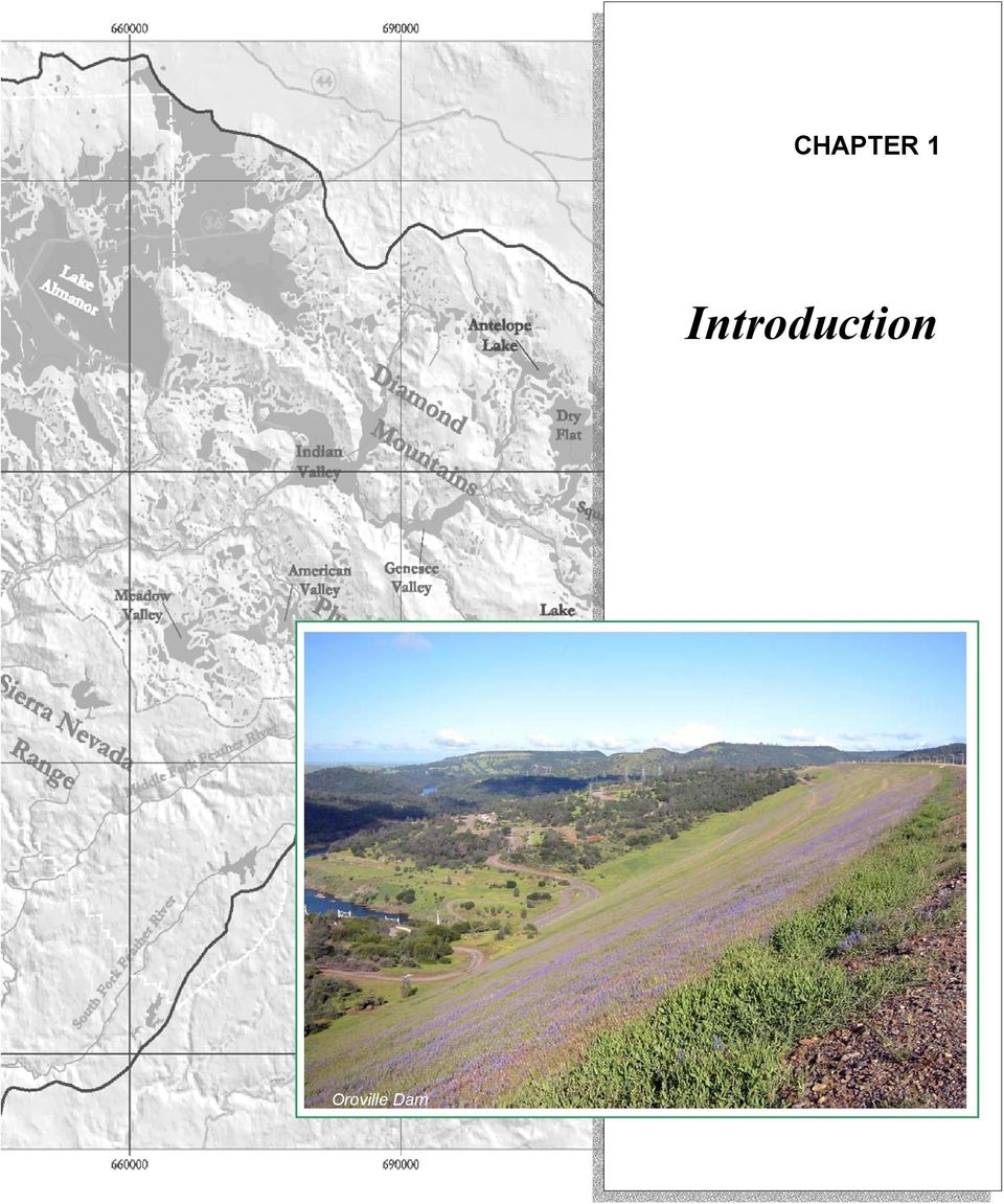
14 CHAPTER 1 Introduction Oroville Dam
15

16 1-1 CHAPTER 1, INTRODUCTION 1.0 INTRODUCTION The Upper Feather River Watershed is part of the northern Sierra Nevada, where that Range intersects with the volcanic Cascade Range to the north and the Diamond Mountains of the Basin and Range Province to the east. The tributaries of the Upper Feather River drain this terrain and flow southwest to eventually fill Lake Oroville, a major reservoir of the California State Water Project. Water flows from Lake Oroville through canals to irrigate farms of the Central Valley and provide domestic water to Southern Californians, and also to the Lower Feather River and beyond to enrich the aquatic ecosystem of the Sacramento-San Joaquin Delta. The Oroville Reservoir is the principal water storage facility of the State Water Project (SWP) which conserves and delivers water to over two-thirds of California s population. 1 Natural and human-influenced conditions in the Upper Feather River Watershed are reflected in the quantity and quality of water flowing into Lake Oroville. Of the natural influences, climate and weather patterns are most determinant, but are outside the scope of management by agencies within the watershed. The human influences, though, are many and varied within the upper watershed, and are a result of actions by public and private entities. To integrate water management is to blend actions and objectives favored by different entities to achieve the best total result. 2 This document works to integrate the planning and actions of water resource management entities, to increase efficiency of management actions, and identify opportunities to benefit the water resource. This Integrated Regional Water Management (IRWM) Plan is an implementation plan for the management of water resources throughout the Upper Feather River Watershed. The foundation for the IRWM Plan is the integration of seven existing plans by the statutory planning entities in the watershed: the Plumas, Lassen, and Tahoe National Forests; Butte, Sierra and Plumas counties; the Sierra Valley Groundwater Management District; and the Plumas County Flood Control and Water Conservation District. These seven mandatory plans are included 1 Oroville Facilities Relicensing website: 2 Grigg 1998 as appendices in Volume II this document. The IRWM Plan is an overarching document that includes all elements of these existing plans and also extrapolates appropriate management actions to the entire watershed. The IRWM Plan presents and describes the current and anticipated water resource issues in the watershed. The mandatory plans are integrated so that (1) problems can be logically prioritized; (2) data and information gaps among plans are identified and addressed; (3) appropriate actions and solutions are adopted; and (4) clear, long-term management strategies are implemented. 1.1 BACKGROUND Integrated regional water management in the Feather River Watershed is the outcome of an effort that began twenty years ago to bring the major resource planning organizations in the watershed together to address watershed concerns. Inter-agency and interorganizational planning, public participation, and intra-regional coordination are some of the results of that process. 3 This IRWM Plan is also a product of that process, serving to document key developments and components, and chart the future direction of the IRWM process. This Plan identifies IRWM goals and objectives and describes how they were determined. It addresses the major water resource objectives and conflicts in the watershed, including water quality, ecosystem restoration, groundwater management, and water supply. This plan describes opportunities for cooperative actions among water resource management entities throughout the region. It also serves as a watershed-wide forum to identify and address water resource concerns, and provides a framework from which local water management policies, projects, and programs can be formulated, evaluated and implemented. As the principle governing authority in the Upper Feather River Watershed, Plumas County is leading this effort to integrate the approach and actions of all watershed-pertinent water resource management entities. In the past, local, state, and federal agencies, as well as private organizations, planned and executed land and water resource management prescriptions without coordinating with one another. 3 London and Kusel 1996

17 1-2 Feather River Watershed, IRWM Plan Figure 1.1. North Fork Feather River below Cresta Dam and Power House Power production and the fixed management of water flow characterize much of the lower portion of the North Fork. Recognizing that water resource concerns in the Upper Feather River Watershed could best be addressed through a cooperative approach, Plumas County promoted the establishment of the Feather River Coordinated Resource Management Committee (FRCRM) in 1985, to implement watershed restoration projects and promote coordinated, strategic resource planning. The statutory watershed planning entities in the Upper Feather River Watershed agreed to cooperatively develop this IRWM Plan. Each of these statutory entities has an associated plan to implement policies and guidelines; these as well as other documents with statutory authority are included in Volume II. This IRWM Plan builds upon these previous efforts and compliments other local water management planning efforts that have been or are being completed by local and state agencies in the region. The mandatory plans include resource management policies for specific and focused areas within the context of the entire watershed and region. WATERSHED ISSUES Activities such as logging, mining, grazing, channel clearing, levee construction, urbanization, roads, forest fires and water diversions have resulted in decreased vegetative cover in the watershed. The lack of riparian and upland vegetation means precipitation is not retained and stored as efficiently in upper watershed water tables and aquifers, resulting in rapid runoff, flooding in high water years, and dry tributaries in the summer. The decrease in water retention underground yields surface water with higher temperatures, impairing water quality. Rapid runoff contributes to increased sediment yields. The primary sources of sediment are streambank erosion and erosion from road cut and fill slopes. Increased sediment yields have affected the water quality in the watershed impacting fish and other biotic habitat; sediments also deposit behind dams in the watershed, decreasing reservoir storage capacity, and impairing flood control capability and power generation storage. Thus, water quality and water quantity are the two central problems throughout the watershed. Streambank and channel degradation is lowering the water table in the valleys causing changes in riparian

18 1-3 CHAPTER 1, INTRODUCTION habitat and in adjacent grazing lands. Decreased cover, channel clearing, and levee construction in streams on the valley floors causes channel bottoms to erode down which leaves channel banks high and vertical. The combination of increased runoff and lowered base flow level in the larger creeks in the valleys causes headcutting in the tributary streams. Poor grazing management that suppresses the growth of riparian and upland vegetation exacerbates headcutting in the tributary streams. Steepened banks begin failing and water tables drop as vegetation is lost. Upper watershed tributaries to the large valley streams are characteristically deeply incised and form gullies that continuously grow upslope. Dams from Oroville to Lake Almanor caused the extirpation of salmon throughout the watershed. Cumulative degradation of streambanks and channels have degraded potential salmon habitat in segments of the Upper Feather River as well as the tributary streams. NOAA s fish passage prescriptions for restoration of salmon runs to the Upper Feather River watershed will depend upon not only successful passage at dams, but restoration of degraded spawning and rearing habitat and reduction of water temperatures. INTEGRATED REGIONAL PLANNING The IRWM Plan is intended to be an implementation plan for the management of water resources throughout the Upper Feather River watershed. The foundation for the IRWM Plan is the integration and extrapolation of seven existing plans that address water resources issues in specific areas of the watershed. These plans all have statutory authority and are, therefore, mandatory. However, the mandatory plans do not address all water issues in the watershed, nor do they geographically encompass the entire watershed. Thus, there is a compelling need to integrate the mandatory plans into an IRWM Plan that does have the geographic scope and capacity to manage water resources throughout the watershed. The seven mandatory plans listed below are described in Section 1.3. Plans Year FERC License # FERC License # Monterey Settlement Agreement 2003 Feather River Watershed Management 2004 Strategy Feather River Coordinated Resources 1987 Management Plan* Quincy Library Group Act and Water Related Sections of the Land and Resource 1998 Management Plans for Lassen, Plumas, and Tahoe National Forests Sierra Valley Groundwater Management 1980 District Legislation Table 1.1 Seven mandatory water resource management plans in the Upper Feather River Watershed included in this IRWM Plan. * FRCRM Plan is the foundation for a great many on-going partnerships, projects and work, but does not have statutory authority. The IRWM Plan, while meeting the criteria described in Proposition 50 Guidelines (DWR and SWRCB 2004), is intended to surpass the minimum Proposition 50 requirements. Over time, the statutory authorities in the Upper Feather River Watershed expect to grapple with numerous water issues which may not be identifiable today or in the near future. Consequently, an organic and dynamic watershed plan is needed to provide guidance to decision makers. Proposition 50 funds will be sought for some projects described in the IRWM Plan, but the Plan is predicated on the assumption that other funding sources will be available on an on-going basis to underwrite projects over time. The active groups and agencies in this watershed have built the prerequisite institutional capacity to manage water resources and implement projects in a holistic and coordinated manner. It is apparent to most decision-makers in the watershed that piecemeal planning constrains the range of potential solutions to the region s most pressing conflicts. By building on the wealth of hands-on watershed restoration experience, project-scale monitoring, and institutional capacity it will become possible to expand water management and planning to larger scales when water management conflicts require larger scale solutions. Completion of the IRWM Plan is the first step in realizing the ability to plan and manage water resources at a watershed and regional scale.

19 1-4 Feather River Watershed, IRWM Plan

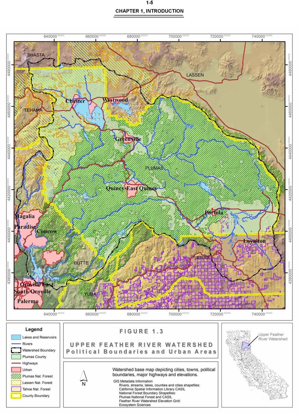
20 1-5 CHAPTER 1, INTRODUCTION
21 1-6 Feather River Watershed, IRWM Plan Management solutions to conflicts over water supply, water quality, and ecosystem protection are often limited by jurisdictional and institutional boundaries. The unresolved issues of water supply, water quality and special status species habitat needs in the watershed require workable solutions that are based on natural water catchment boundaries that extend beyond the jurisdictional and institutional limitations of the existing mandatory plans. Examples of persistent watershed-wide water conflicts include (1) temperature, sediment and nutrient water quality impairments in reservoirs and rivers; (2) fish passage and cold water refugia for salmonids; and (3) increasing water supply to ameliorate conflicts between water diverters, and riparian and in-stream environmental water needs. Current water management planning and actions leave little margin for error in water supply allocations. Water supply and demand assessment errors, cumulative environmental and economic effects, or extreme climatic conditions are watershed scale issues that are rarely addressed in localized plans. Management solutions to watershed scale problems that fail to enhance overall water reliability and flexibility disproportionately shift risks from managers to those that benefit the least - the residents of the watershed. The Area of Origin statutes legally ensure that Plumas County residents have first rights to domestic supplies and may, in the future, legally obtain water supplies by minimally reducing the reliability of water supplies to Lake Oroville. The IRWM Plan is built on the premise that it is in the best interest of both local and downstream water users to enable the statutory watershed planning entities in the Upper Feather River Watershed to achieve the integration of sustainable water management programs at a regional, watershed scale. PURPOSE OF THE WATERSHED PLAN WATER MANAGEMENT CONFLICTS AND DISADVANTAGED COMMUNITIES Current water management plans, including the seven mandatory plans, effectively address water resource objectives within their jurisdictional purview. However, because of the limited jurisdictional boundaries, current planning and implementation processes are not responsible for the overall flexibility and vitality of watershed-scale management of water resources. The cumulative result of incremental planning can be tightened water supplies and increased competition between users for those increasingly unreliable water resources. This inequity is paramount to Plumas County and the Upper Feather River Watershed. All of Plumas County qualifies as a disadvantaged community according to IRWM Guidelines. 4 Water management decision-making often ignores historic, economic, environmental, and social burdens of disadvantaged communities. These communities reside amidst the economically viable water infrastructure, but rarely directly benefit from the economics of water resource supply and demand. 4 DWR and SWRCB 2004 Implement projects prioritized by the IRWM Plan and the supporting mandatory plans that address priority water management conflicts and problems in the larger Feather River Watershed. Implement priority projects concurrently throughout the watershed to achieve maximum benefits. Expand beyond the boundaries of the mandatory plans, using an integrated implementation and assessment strategy. Integrate mandatory plans, priority projects, and regional planning using the implementation and assessment strategy described in this IRWM Plan. Use the integrated implementation and assessment process to inform the public and stakeholders. Use the IRWM implementation and assessment process to inform the development of localized water management options to reduce water conflicts and to improve water supply reliability, flood flow management, water quality and ecosystem benefits. Use the integrated implementation and assessment process to develop future water management priorities and projects, at scales larger than the boundaries of current mandatory plans and projects.
22 1-7 CHAPTER 1, INTRODUCTION Involve disadvantaged communities in the assessment and implementation of priority projects. 1.2 IDENTIFICATION OF ENTITIES CREATING IRWM PLAN Coordination between state and federal agencies and other local entities (e.g. schools, non-profits, cities, service districts, RCDs etc.) in the Upper Feather River Watershed has a long history of success. Two well known successes are the Quincy Library Group and the Feather River CRM. The success of these two multi-member organizations within the Upper Feather River Watershed community has established the principle that coordination between federal, state, and local entities is possible, especially with open communication. 5 Utilizing this coordination process as strategy, several entities within the Upper Feather River Watershed conferred to form the Feather River Watershed Authority and a plan that will conserve, manage and protect the resources of the Upper Feather River Watershed. The Feather River Watershed Authority coordinates federal, state, and local organizations to enact strategies aimed at conserving and enhancing the resources of the Upper Feather River Watershed. The Feather River Watershed Authority is responsible for the creation of the IRWM Plan, with Plumas County as the lead agency. The Feather River Watershed Authority incorporates several organizations as partner agencies; Plumas National Forest, Sierra Valley Groundwater Management District, and Plumas County Flood Control and Water Conservation District (PCFC). The four entities, mentioned above, have statutory authority in the Upper Feather River Watershed. The fact that the partner organizations have statutory authority signifies that a majority of land in the watershed is managed by decision makers with the ability to enact effective change for the resources of the Feather River. The remaining area of the Upper Feather River Watershed is contained, or in some way managed, by entities affiliated with the Feather River Watershed Authority. The affiliated entities of the Feather River 5 London and Kusel 1996 Watershed Authority are Butte County, City of Portola, Indian Valley Community Services District, Quincy Community Services District, Maidu Cultural & Development Group, Feather River CRM, Feather River Land Trust, Sierra Institute, and University of California Cooperative Extension. These affiliated entities endorsed and agreed to support the IRWM effort, even though their participation may be minimal. Several affiliated entities are also members of two other watershed management organizations: Plumas Watershed Forum (PWF) and FRCRM (each is described further in Chapter 3). Members of PWF and FRCRM include numerous organizations ranging from academic institutions to federal agencies and non-profit environmental groups. Overlap between partners and affiliates of the Feather River Watershed Authority with the two other watershed management organizations ensures that all concerned groups within the area are involved in decisions regarding water and resource management. Coordination and integration between and amongst concerned organizations in the Upper Feather River Watershed is paramount to successful resource management decisions. 1.3 SUPPORTING MANDATORY DOCUMENTS WITH STATUTORY AUTHORITY The IRWM Plan is derived from and supported by seven existing regional water resource management plans, all of which were created or adopted by at least two agencies with statutory authority. These seven, mandatory plans address water supply reliability, water quality protection and enhancement, wetland, ecosystem, environmental and habitat restoration and improvement, and recreation and public access. Summaries of each plan and how they relate to this document are included in this section. Volume II contains each plan in full. The existing mandatory water resource management plans and the IRWM Plan differ more in scale than scope. The existing plans are broad and inclusive in their application of water management elements and in their level of inter-agency coordination involved in
23 1-8 Feather River Watershed, IRWM Plan plan development, evaluation, and, implementation. Each plan listed in Table 1 was developed with intensive public and stakeholder involvement. Each is signed and adopted by all or most of the agencies responsible for water regulation and management in the regions covered by the plans. It should be noted, however, that these existing management plans cover only portions of the Feather River watershed. There are geographic as well as topical gaps and overlaps among the plans. Most importantly the existing water management plans pertain to institutional boundaries rather than watershed boundaries. The mandatory plans, therefore, have limited capacity for integrated problem solving at the watershed scale, and need exists to assimilate them in order to best achieve integrated water management benefits. DESCRIPTION OF MANDATORY DOCUMENTS 1. FERC LICENSE # Execution Date: 18 September 2000 Term: 30 Years Parties involved: Pacific Gas and Electric Company (Licensee) United States Department of Agriculture Forest Service (FS) United States Department of the Interior Fish and Wildlife Service (FWS) California Department of Fish and Game (CDFG) California State Water Resources Control Board (SWRCB) Natural Heritage Institute (NHI) American Whitewater (AW) Friends of the River (FOR) Plumas County (PC) California Outdoors (CO) California Trout (CT) Chico Paddleheads (CP) Shasta Paddlers (SP) 6 FERC #1962 can be found in the Volume II Appendix of the IRWMP. Background On September 28, 1979, Licensee filed with the Federal Energy Regulatory Commission (FERC) an application for a new license for the Rock Creek - Cresta Project, FERC Project No located on the North Fork Feather River in Plumas and Butte Counties, California. On October 9, 1991 Licensee and CDFG entered into a Fish and Wildlife Agreement ( 1991 Fish and Wildlife Agreement ) to establish minimum streamflows and other resource management measures for the protection, mitigation, and enhancement of fish and wildlife resources affected by the Project. This Agreement updates and supersedes the 1991 Fish and Wildlife Agreement. On March 15, 1996 FS issued revised preliminary conditions for the Project pursuant to 18 CFR 4.34 b(1) and in furtherance of its mandatory conditioning authority under Section 4(e) ( Preliminary 4(e) Conditions ) of the Federal Power Act ( FPA ). Various Parties and others subsequently submitted comments and appeals to FERC and FS regarding the Preliminary 4(e) Conditions. On November 1, 1996 FERC issued a Draft Environmental Assessment for the Project ( DEA ) pursuant to the National Environmental Policy Act ( NEPA ). Various Parties and others subsequently submitted comments to FERC regarding the DEA. In July 1998, Licensee, FS, FWS, CDFG, SWRCB, AW, FOR, PC, NHI, CT, California Sportfishing Protection Alliance, SP, and CP met and agreed to engage in discussions to resolve issues related to flow in the Rock Creek and Cresta reaches of the NFFR. Since those initial discussions, Licensee has provided several progress updates to the FERC and requested that additional time be allowed to continue the process. Over time the group became known as the Rock Creek - Cresta Relicensing Collaborative ( Collaborative ) and subcommittees were formed to discuss technical issues on fisheries and whitewater recreation. Meetings of the Collaborative were publicly noticed by FERC. This Settlement is an end product of the Collaborative s work. Purpose The purpose of this Settlement is to resolve among the Parties all streamflow issues for ecological purposes and river-based recreational use and other related subjects in support of the Forest Service issuing its final 4(e) conditions and FERC issuing a New Project License. The Parties agreed that this Settlement constitutes an entire agreement that provides an appropriate balancing of hydroelectric power generation with the issues related to water management.
24 1-9 CHAPTER 1, INTRODUCTION Figure 1.3 North Fork Feather River Portion of the Cresta Powerhouse facilities along the North Fork Feather River. Results Subjects resolved by this settlement: (a) Streamflows for the protection, mitigation, and enhancement of fish, wildlife, and other aquatic biota in project-affected stream reaches (b) Streamflows for the protection, mitigation, and enhancement of riparian habitat in Project-affected stream reaches (c) Streamflows for stream channel maintenance in project-affected stream reaches (d) Streamflows for whitewater boating and other river-based recreation on the Rock Creek and Cresta reaches (e) Water quality associated with project operations and facilities, including water temperatures (f) Streamflow fluctuations from project operations, including ramping rates (g) Streamflow gaging for compliance monitoring (h) Stream ecology monitoring (i) Whitewater boating use monitoring (j) Streamflow information for use by the public (k) Access facilities for whitewater boating on the Rock Creek and Cresta reaches (m) Adjustment of the protection, mitigation, and enhancement measures through adaptive management over the term of the license (n) Facility modifications to implement the protection, mitigation, and enhancement measures (o) Administration of Settlement Agreement (p) Term of New Project License (q) River sediment management Specific terms of each resolved subject (a-q) are detailed in Appendix A of the FERC #1962 document. Many of the resolved items pertain to mandatory water elements as required by IRWM Guidelines. 7 Each of these water elements is discussed in further detail in Chapter 7 Implementation Strategies. As well, this settlement produced a number of Project Mitigation and Enhancement (PME) recommendations that were not to be included as a part of the New Project License. These recommendations pertain to water temperature, fishery, macroinvertebrates, natural hydrograph, flow fluctuations, geomorphology, riparian habitat, special status species, hydropower, recreation streamflows, and recreational access. Specific terms of each of these recommendations are detailed in Appendix B of the FERC #1962 document. The Settlement establishes an Ecological Resources Committee to assist Licensee in design of the monitoring plans, review and evaluation of data, and to make specific decisions regarding ecological resources and flow related issues to be addressed by Licensee as provided in the settlement. 2. FERC LICENSE # Execution Date: 22 April 2004 Term: Unresolved Parties involved: Pacific Gas and Electric Company (Licensee) United States Department of Agriculture Forest Service (FS) California Department of Fish and Game (CDFG) American Whitewater (AW) Plumas County (PC) Chico Paddleheads (CP) Shasta Paddlers (SP) Mountain Meadows Conservancy (MMC) California Sportfishing Protection Alliance (CSPA) Background On October 23, 2002, Licensee filed with the Federal Energy Regulatory Commission (FERC) an application for a New Project License for the Upper North Fork Feather River Project, FERC Project No located on the North Fork Feather River (NFFR) in Plumas County, California. Prior to filing its application for a New Project License the Licensee consulted with the Parties and other 7 DWR and SWRCB FERC #2105 can be found in the Volume II Appendix of the IRWMP.
25 1-10 Feather River Watershed, IRWM Plan individuals and organizations in development of the studies, data, and other material presented in the application. In 2002, Licensee and the Parties met and agreed to engage in discussions to resolve issues and agree on PME measures appropriate for the relicensing of the Project. This group, sometimes referred to as the 2105 Licensing Group, engaged in collaborative discussions and is referred to in this Settlement as the Collaborative. This Settlement is an end product of the Collaborative s work. State Water Resources Control Board (SWRCB) staff has participated in the Collaborative in order to provide the Parties with guidance concerning the SWRCB s regulatory requirements and in furtherance of the SWRCB s policy to promote voluntary settlement agreements. However, the SWRCB cannot prejudge the Licensee s request for water quality certification pursuant to Section 401 of the Clean Water Act (33 USC 1341[a][1]) ( 401 Certification ) in connection with this relicensing proceeding and therefore can not execute this Settlement. Figure 1.4 Upper Butt Creek Portion of the water and hydroloelectric facilities in the Upper North Fork Feather River drainage. Purpose The purpose of this Settlement is to resolve among the Parties all lake level and streamflow issues for ecological purposes, river-based recreational uses, and other Resolved Subjects in support of FS issuing its recommended mitigation and FERC issuing a New Project License. For this purpose, the Parties agree that this Settlement constitutes an entire agreement that provides an appropriate balancing of the Resolved Subjects and the Parties will request that the FERC use the provisions of this Settlement as an alternative to be considered in the FERC s NEPA analysis process. Results Subjects resolved by this settlement: a) Streamflows for PME of fish, wildlife, and other aquatic biota in Project-affected stream reaches b) Streamflows for stream channel maintenance in Project-affected stream reaches c) Streamflows for whitewater boating and other river-based recreation on the Belden and Seneca Reaches d) Water quality associated with Project operations and facilities excluding erosion and water temperature e) Streamflow fluctuations from Project operations, including Ramping Rates f) Streamflow gaging for compliance monitoring g) Stream ecology monitoring h) Streamflow information for use by the public i) Facility modifications to implement the PME measures stated in Appendix A j) Administration of Settlement k) River sediment management l) Project reservoir operation and lands management principles m) Recreation facilities development during the term of the New Project License Specific terms of each resolved subject (a-m) are detailed in Appendix A of the FERC #2105 document. Many of the resolved items pertain to mandatory water elements as required by IRWM Guidelines. 9 Each of these water elements is discussed in further detail in Chapter 7 Implementation Strategies. As well, this settlement produced a number PME recommendations that were not to be included as a part of the New Project License. These recommendations are grouped into the two categories of Recreation and Plumas County Lake Almanor Water Quality Monitoring and Protection. Specific terms of each of these recommendations are detailed in Appendix B of the FERC #2105 document. 9 DWR and SWRCB 2004
26 1-11 CHAPTER 1, INTRODUCTION 3. MONTEREY SETTLEMENT AGREEMENT 10 Execution Date: 05 May 2003 Term: in effect for 8 years Parties involved: Planning and Conservation League Citizens Planning Association of Santa Barbara County Plumas County Flood Control and Water Conservation District State of California Department of Water Resources Central Coast Water Authority Kern Water Bank Authority State Water Resources Development System (State Water Project) Contractors Background SWP operates three reservoirs in the Upper Feather River watershed. Water from these reservoirs flows to Oroville Reservoir, where some of it enters canals that are distributed throughout southern California. Lawsuit was filed by PCL (with CPA and PCFC as plaintiffs) against DWR and CCWA seeking to overturn a 1994 agreement that implemented major changes in the operation of the SWP. Accusation was made that the 1994 deal was unfairly reached due to a lack of consideration of environmental impacts and without the participation of environmental groups, therefore not in compliance with CEQA. Purpose The Monterey Settlement Agreement resolves among all groups the abovementioned lawsuit (out of court); specifically, the validity of the EIR associated with the 1994 agreement is in question. The Agreement was presided over by a mediator, retired Judge Daniel Weinstein. Results The Monterey Settlement Agreement directs DWR to re-write the contested EIR, with special consideration to required public participation. It authorizes the establishment of a Watershed Forum to implement watershed management and restoration activities in the Feather River watershed, with particular focus on the drainages of the three SWP Upper Feather River reservoirs, for the mutual benefit of Plumas County and the SWP. The Water Forum s specific goals include: a. Improve retention (storage) of water for augmented base flow in streams; b. Improve water quality (reduced sedimentation), and streambank protection; c. Improve upland vegetation management; and d. Improve groundwater retention/storage in major aquifers. The Settlement Agreement directs DWR to pay $8- million to Plumas County, the majority of which is to be used for watershed improvement programs. Lastly, approximately $5-million was awarded to plaintiffs in the case. Figure 1.5 Reservoir in the High Sierra Water from many reservoirs flows into Oroville reservoir operated by SWP. 10 The Monterey Settlement Agreement can be found in the Volume II Appendix of the IRWMP.
27 1-12 Feather River Watershed, IRWM Plan 4. FEATHER RIVER WATERSHED MANAGEMENT STRATEGY 11 Execution Date: 2004 Term: 10 years Parties involved: Plumas County Flood Control and Water Conservation District Plumas Corp Plumas Watershed Forum Technical Advisory Committee Background The Monterey Settlement Agreement (2003) mandated the distribution of some $8,000,000 toward watershed management and restoration activities in the Upper Feather River Watershed. The same Agreement authorized the creation of the Watershed Forum to receive and manage these monies. Plumas County Flood Control and Water Conservation District, acting as the Plumas Watershed Forum, hired the consultant, Ecosystem Sciences, to research and write the Feather River Watershed Management Strategy document. Purpose The Feather River Watershed Management Strategy was prepared to help decision making by the Plumas Watershed Forum. The document provides an overview of watershed conditions, identifies and prioritizes key problems, and prioritizes watershed management strategies and restoration actions. It directs the Technical Advisory Committee to guide the Plumas Watershed Forum through the process of allotting funds for specific actions. The goals of the Forum, and of the prioritization, are to improve temporal retention of water to increase base flows, reduce sedimentation, protect streambanks, improve upland vegetation, and improve groundwater recharge for the mutual benefit of Plumas County and the SWP. Results The PWF has received numerous project proposals from a variety of individuals and organizations and evaluated them based upon criteria established by the Feather River Watershed Management Strategy document. Based on the prioritization of potential resource actions, PWF has accepted and funded high priority projects. Preliminary research has documented that improved temporal retention of water in upper watershed basins as well as reduced 11 The Feather River Watershed Strategy can be found in the Volume II Appendix of the IRWMP. sedimentation have been achieved in some instances. Project implementation and monitoring continues. 5. FEATHER RIVER COORDINATED RESOURCES MANAGEMENT PLAN 12 Execution Date: 02 June 1987 Term: Perpetual Parties involved: Plumas National Forest, USFS/USDA Natural Resource Conservation Service, USDA North Cal-Neva Resource Conservation and Development Area U.S. Army Corps of Engineers Farm Services Agency, USDA U.S. Fish and Wildlife Service Department of Fish and Game Department of Forestry & Fire Protection Department of Parks and Recreation Department of Transportation Department of Water Resources Regional Water Quality Control Board, Central Valley University of California Cooperative Extension Plumas County Plumas County Community Development Commission Plumas Unified School District Feather River Resource Conservation District Feather River College Pacific Gas & Electric Salmonid Restoration Federation Plumas Corporation Trout Unlimited Background There are currently more than 30 active CRM groups operating at the local (i.e., watershed or subwatershed) level in California. The FRCRM was developed to encourage local initiative and participation in resource management and to coordinate requests for Federal and State technical and financial assistance. The FRCRM is the 3 rd oldest watershed group in California. The FRCRM group is a partnership of 22 public and private sector groups who formed in 1985 to collectively improve watershed health in the Upper Feather River Watershed. The original FRCRM pertained 12 The Feather River Coordinated Resource Management Plan can be found in the Volume II Appendix of the IRWMP.
28 1-13 CHAPTER 1, INTRODUCTION only to the East Branch of the North Fork Feather River, but the geographic scope has since expanded to include the rest of the North Fork, Middle Fork, and South Fork Feather Rivers. In addition to the agencies that have signed the MOU, numerous other county agencies, private consultants, community groups, and students have worked together on FRCRM projects. Purpose The Feather River Coordinated Resources Management Plan is a compilation of agreements that establish the legal and institutional framework of the FRCRM group. Included in the compilation are one section describing the goals and objectives and organizational framework of FRCRM as well as one Memorandum of Agreement and two Memorandums of Understanding that reflect the legal foundations of the FRCRM. Figure 1.6 Last Chance Creek FRCRM is very active in restoration projects throughout the Upper Feather River Watershed, particularly on smaller creek systems in high meadows. solutions are involved at the beginning of the project planning process. Since participation in the CRM is voluntary, participants must recognize that the value of benefits they will receive outweigh the value of their contributions. All decision-making on project prioritization is based on consensus, with ultimate control resting in the hands of the land owners. Once a project is endorsed, a Technical Advisory Committee of resource specialists, landowners, interest groups and anyone with a specific interest in the site is formed to evaluate the site and design the project. Implementation and funding requests are coordinated by Plumas Corporation, the local non-profit economic development corporation. Results More than 50 watershed projects have been completed including studies and assessments, stream restoration, monitoring, resource management plans, strategic planning, community outreach and educational activities. Over 15 miles of stream and 4,000 riparian acres have been treated over the last decade, at a cost of five million dollars contributed largely by FRCRM partners. Overall, restoration activities play an important role in accelerating improvement in watershed function, the local economy, and downstream uses. Public education is also an essential element to the success of FRCRM programs. Plumas County s watershed management initiatives such as the FRCRM provide the foundation for larger scale water management and planning. The FRCRM has, over the past 20 years, piloted and honed strategies for engaging multiple landowners in multiple-objective watershed restoration projects. The FRCRM is composed of three main committees; Executive Committee, Management Committee, and Steering Committee. In addition, four sub-committees with open membership exist as arms of the Management Committee. They are the Projects, Finance, Design, and Monitoring subcommittees. The Executive Committee is responsible for policy guidance and dispute resolution, and support in the political arena. The Management Committee is responsible for administration of projects. The Steering Committee is composed of representatives from each contributing organization who review program status, approve new projects, and interact with landowners. Ideally, all affected parties necessary to implement long-term, comprehensive
Local Steps Toward California s Watershed Program
 Local Steps Toward California s Watershed Program Presented by Robert Meacher Plumas County Board of Supervisors Creating a Watershed Moment in a Watershed Movement Planning and Conservation League Legislative
Final Report. Dixie Creek Restoration Project. Funded by Plumas Watershed Forum
 Final Report Dixie Creek Restoration Project Funded by Plumas Watershed Forum Plumas Corporation January 2009 1 Background FR-CRM staff presented this project to the Dixie Valley Landowners Association
October 11, 2005. Sharon Stohrer State Water Resources Control board P.O. Box 2000 Sacramento, CA 95812-2000
 October 11, 2005 Sharon Stohrer State Water Resources Control board P.O. Box 2000 Sacramento, CA 95812-2000 Re: Maidu Cultural and Development Group CEQA Scoping Comments for the Environmental Impact Report
Post-Flood Assessment
 Page 1 of 7 Post-Flood Assessment CHAPTER 4 AGENCY COORDINATION Agency coordination is an essential element for the operation of the flood management systems in the Central Valley. Due to the nature of
Restoring Anadromous Fish Habitat in Big Canyon Creek Watershed. Summary Report 2002
 Restoring Anadromous Fish Habitat in Big Canyon Creek Watershed Summary Report 2002 DOE/BP-00005268-5 November 2002 This Document should be cited as follows: "Restoring Anadromous Fish Habitat in Big Canyon
Chapter 9. Selected Watershed Initiatives in the Great Basin Region
 Chapter 9 Selected Watershed Initiatives in the Great Basin Region The Great Basin contains vast areas of sparsely populated desert lands. Lacking an ocean drainage, the Great Basin is a hydrologic sink
Presentation Program Outline
 Presentation Program Outline IRWM Program Background San Diego IRWM Planning 2013 IRWM Update Integrated Flood Management Flood Management Planning Study IRWM Program Background What is IRWM? Collaborative
How To Manage Water Resources In The Yakima Basin
 Yakima Basin Integrated Water Resource Management Plan October 23, 2014 Presented by Derek Sandison, Director Office of Columbia River Photo Courtesy of Tom Ring Basin size: 6,155 sq. miles Population:
The North State: Implementing the California Water Action Plan February 24, 2014
 The North State: Implementing the California Water Action Plan February 24, 2014 The North State Water Alliance applauds Governor Brown s California Water Action Plan (Action Plan) and his call for comprehensive
Resolving complex issues with large scale river restoration; a case study: the San Joaquin River in California
 IWA Publishing 2011 Water Practice & Technology Vol 6 No 4 doi:10.2166/wpt.2011.074 Resolving complex issues with large scale river restoration; a case study: the San Joaquin River in California William
3. The submittal shall include a proposed scope of work to confirm the provided project description;
 QIN Shoreline Master Program Project Summary The Shoreline Master Program (SMP) development process for the Quinault Indian Nation (QIN) includes the completion of inventory and analysis report with corresponding
Plumas Watershed Forum. Review of Ongoing Projects. Updated 10/1/008
 Plumas Watershed Forum Review of Ongoing Projects Updated 10/1/008 Hosselkus II Restoration Project Approved Funding: $80,000 (A funds) Expended By 10/1/08: $79,603 This pond-and-plug creek restoration
Appendix A. Lists of Accomplishments and Project Costs. UMRWD 10 Year Plan Update. Appendix A UPPER MINNESOTA RIVER WATERSHED DISTRICT
 UPPER MINNESOTA RIVER WATERSHED DISTRICT Lists of Accomplishments and Project Costs 10 Year Plan Update UMRWD 10 Year Plan Update Page A 1 UMRWD LIST OF ACCOMPLISHMENTS Since its inception in 1967, the
AN INITIATIVE TO IMPROVE
 L OW E R C A R M E L R I V E R A N D L AG O O N F L O O D P L A I N R E S TO R AT I O N A N D E N H A N C E M E N T P R O J E C T AN INITIATIVE TO IMPROVE FLOOD PROTECTION RESTORE AND PROTECT RIPARIAN
Pajaro River Watershed Integrated Regional Water Management Plan Update Project Solicitation Form
 Pajaro River Watershed Integrated Regional Water Management Plan Update PROJECT OVERVIEW General Project Information Project Title: Corralitos Creek Water Supply and Fisheries Enhancement Project Project
NAPA COUNTY WATERSHED SYMPOSIUM
 Planning, Building, and Environmental Services NAPA VALLEY GROWTH NAPA COUNTY WATERSHED SYMPOSIUM Plunging Forward May 15, 2015 1 YOU CAN T CROSS THE SEA MERELY BY STANDING AND STARING AT THE WATER. Rabindranath
GLOSSARY OF TERMS CHAPTER 11 WORD DEFINITION SOURCE. Leopold
 CHAPTER 11 GLOSSARY OF TERMS Active Channel The channel that contains the discharge Leopold where channel maintenance is most effective, sediment are actively transported and deposited, and that are capable
CHAPTER I: INTRODUCTION. Background
 CHAPTER I: INTRODUCTION Background California State Law requires each county to adopt a General Plan for the physical development of the county and any land outside its boundaries which bears relation
COMPREHENSIVE PLAN SECTION B, ELEMENT 4 WATER RESOURCES. April 20, 2010 EXHIBIT 1
 COMPREHENSIVE PLAN SECTION B, ELEMENT 4 WATER RESOURCES April 20, 2010 EXHIBIT 1 ELEMENT 4 WATER RESOURCES TABLE OF CONTENTS 4.1 INTRODUCTION 4.2 GOALS AND POLICIES 4.2.A General Goals and Policies 1 4.2.B
Clean Water Services. Ecosystems Services Case Study: Tualatin River, Washington
 Viewed broadly, the concept of ecosystem services describes the many resources and services provided by nature. Typically, traditional planning and development practices do not adequately represent the
UNITED STATES OF AMERICA 131 FERC 62,175 FEDERAL ENERGY REGULATORY COMMISSION. United Water Conservation District Project No.
 UNITED STATES OF AMERICA 131 FERC 62,175 FEDERAL ENERGY REGULATORY COMMISSION United Water Conservation District Project No. 2153-022 ORDER APPROVING SPOIL MANAGEMENT, EROSION, AND SEDIMENT CONTROL PLAN
Lower Crooked Creek Watershed Conservation Plan EXECUTIVE SUMMARY
 EXECUTIVE SUMMARY Project Background Located in southwestern Pennsylvania, Crooked Creek is a major tributary of the Allegheny River, entering near Ford City in Armstrong County. It is rich in natural
DISTRICT VALUES STATEMENTS, GOALS, ACTION ITEMS, AND ONGOING TASKS FOR 2015 Adopted by the Board of Directors December 10, 2014. Values Statements.
 DISTRICT VALUES STATEMENTS, GOALS, ACTION ITEMS, AND ONGOING TASKS FOR 2015 Adopted by the Board of Directors December 10, 2014 Values Statements. The Board opposes any new transfers of water from the
4. Environmental Impacts Assessment and Remediation Targets
 4. Environmental Impacts Assessment and Remediation Targets 4.1 Environmental Impacts Significant additional development in the Alder Creek watershed is not anticipated at this time; however, there are
COASTAL CONSERVANCY. Staff Recommendation May 26, 2016 LOWER GREEN VALLEY CREEK COHO MIGRATION ENHANCEMENT
 COASTAL CONSERVANCY Staff Recommendation May 26, 2016 LOWER GREEN VALLEY CREEK COHO MIGRATION ENHANCEMENT Project No. 16-014-01 Project Manager: Lisa Ames RECOMMENDED ACTION: Authorization to disburse
The Planning Process. 1 O WOW 1.0 Plan Moving Towards Sustainability
 The Planning Process The development of this One Water One Watershed (OWOW) 2.0 Plan is built upon the planning process of the past to address the challenges of the future. The first phase of OWOW, known
Healthy Forests Resilient Water Supply Vibrant Economy. Ecological Restoration Institute
 Healthy Forests Resilient Water Supply Vibrant Economy Ecological Restoration Institute How Water Gets to Your Home MOST OF THE VALLEY S WATER SUPPLY comes from winter precipitation and runoff from Arizona
BLACK/HARMONY/FAREWELL CREEK WATERSHED EXISTING CONDITIONS REPORT CHAPTER 12 - STORMWATER MANAGEMENT
 Harmony Creek subwatershed Harmony Creek subwatershed BLACK/HARMONY/FAREWELL CREEK WATERSHED EXISTING CONDITIONS REPORT CHAPTER 12 - STORMWATER MANAGEMENT April 2011 TABLE OF CONTENTS 1.0 INTRODUCTION...
Reference: CA Urban Streams Partnership s White Paper on Funding Urban Watershed Projects Recommendations for a 2014 Water Bond
 California Urban Streams Partnership A project of the Earth Island Institute 2150 Allston Way, Suite 460, Berkeley, CA 94704 510 859 9197, CUStreams@gmail.com January 30, 2014 Reference: CA Urban Streams
Summary of the Klamath Basin Settlement Agreements
 Summary Summary of the Klamath Basin Settlement Agreements May 2010 Representatives of 45 organizations, including Federal agencies, California and Oregon, Indian tribes, counties, irrigators and conservation
Restoration Planning and Development of a Restoration Bank
 Restoration Planning and Development of a Restoration Bank Black Creek Pioneer Village, South Theatre 8:30 a.m. to 3:30 p.m. Habitat Restoration and Environmental Monitoring Projects Section Restoration
9.1. Adequacy of Available Data and Monitoring Efforts
 9. DATA MANAGEMENT Data management is a crucial aspect of successful implementation of the ARB IRWMP and its component projects. This section discusses the adequacy of available data and monitoring efforts,
Appendix B REFERENCES
 Appendix B REFERENCES 2007 Field Reconnaissance Report of Bank Erosion Sites and Site Priority Ranking. Sacramento River Flood Control Levees, Tributaries and Distributaries American Red Cross. www.redcross.org
Overview of Proposition 1 TRACIE BILLINGTON, CHIEF FINANCIAL ASSISTANCE BRANCH DIVISION OF INTEGRATED REGIONAL WATER MANAGEMENT
 1 Overview of Proposition 1 TRACIE BILLINGTON, CHIEF FINANCIAL ASSISTANCE BRANCH DIVISION OF INTEGRATED REGIONAL WATER MANAGEMENT Proposition 1 2 Sections 1-7 Reallocates Statewide Bond Costs from prior
Section 4 General Strategies and Tools
 Section 4 General Strategies and Tools Key planning issues for WRIA 35 have been identified in Sections 5 and 6 in the areas of water supply, instream flow, water quality, and aquatic habitat. General
Greater Los Angeles County Region
 Attachment 6 Greater Los Angeles County Region IRWM Implementation Grant Proposal Monitoring, Assessment, and Attachment 6 consists of the following items: Monitoring, Assessment, and. The purpose of this
Flood Risk Management
 Flood Risk Management Value of Flood Risk Management Every year floods sweep through communities across the United States taking lives, destroying property, shutting down businesses, harming the environment
Flood Risk Management
 Flood Risk Management Value of Flood Risk Management Value to Individuals and Communities Every year floods sweep through communities across the United States taking lives, destroying property, shutting
HCP Team Meeting. November 18, 2015. icfi.com
 HCP Team Meeting November 18, 2015 icfi.com 1 Welcome and Introductions Where are we in the HCP process Hydrology modeling update Native fish survey Fish translocation Finalize covered activities Next
4.2 Buena Vista Creek Watershed
 Buena Vista Creek Watershed 4.2 Buena Vista Creek Watershed Watershed Overview The Buena Vista Creek Watershed is the fourth-largest system within the Carlsbad Hydrologic Unit. The watershed extends approximately
 Coldwater Heritage Partnership Implementation Grant Final Report Morrison Run Watershed Restoration Project Western Pennsylvania Conservancy Project Summary The goal of the Morrison Run Watershed Restoration
Chapter 3 Planning Issues, Opportunities, and Constraints
 Chapter 3 Planning Issues, Opportunities, and Constraints Introduction This chapter describes the key factors planning issues, opportunities, and constraints that influenced development of this RMP/EA.
Colorado Natural Heritage Program
 CNHP s mission is to preserve the natural diversity of life by contributing the essential scientific foundation that leads to lasting conservation of Colorado's biological wealth. Colorado Natural Heritage
BIG CREEK Nos. 1 AND 2 (FERC Project No. 2175) VOLUME 1 (BOOK 1 OF 27 BOOKS) INITIAL STATEMENT, EXHIBITS A, B, C, D AND H (PUBLIC INFORMATION)
 VOLUME 1 (BOOK 1 OF 27 BOOKS) INITIAL STATEMENT, EXHIBITS A, B, C, D AND H (PUBLIC INFORMATION)") BIG CREEK Nos. 1 AND 2 (FERC Project No. 2175) VOLUME 1 (BOOK 1 OF 27 BOOKS) INITIAL STATEMENT, EXHIBITS A, B, C, D AND H (PUBLIC INFORMATION) CD NO. 1 OF 19 CDS Initial Statement Exhibit A: Description
BIG CREEK Nos. 1 AND 2 (FERC Project No. 2175) VOLUME 1 (BOOK 1 OF 27 BOOKS) INITIAL STATEMENT, EXHIBITS A, B, C, D AND H (PUBLIC INFORMATION) CD NO. 1 OF 19 CDS Initial Statement Exhibit A: Description
Agua Hedionda Creek Flood Plain Information; Department of Army, Los Angeles District,
 Bibliography Agua Hedionda Creek Flood Plain Information; Department of Army, Los Angeles District, California and Maps. US Army Corps of Engineers July 1973 pg. 24 Aqua Hedionda Lagoon Foundation Framework
The 2015 16 Budget: Effectively Implementing The 2014 Water Bond
 The 2015 16 Budget: Effectively Implementing The 2014 Water Bond MAC TAYLOR LEGISLATIVE ANALYST FEBRUARY 11, 2015 Cover Photo: The cover photo image was provided courtesy of the California Department of
Yakima River Basin Integrated Water Resource Management Plan
 Yakima River Basin Integrated Water Resource Management Plan Technical Memorandum: Preliminary Cost Allocation for the Proposed Integrated Water Resource Management Plan U.S. Bureau of Reclamation Contract
DRAFT Tahoe-Sierra Integrated Regional Water Management Plan SECTION 8: IMPLEMENTATION FRAMEWORK. South Tahoe Public Utility District
 10850 Gold Center Drive, Suite 350 Rancho Cordova, California 95670 916-858-2700 FAX: 916-858-2754 DRAFT Tahoe-Sierra Integrated Regional Water Management Plan SECTION 8: IMPLEMENTATION FRAMEWORK 30 May
FLOOD PROTECTION AND ECOSYSTEM SERVICES IN THE CHEHALIS RIVER BASIN. May 2010. Prepared by. for the. 2010 by Earth Economics
 FLOOD PROTECTION AND ECOSYSTEM SERVICES IN THE CHEHALIS RIVER BASIN May 2010 Prepared by for the Execubve Summary The Chehalis Basin experienced catastrophic flooding in 2007 and 2009. In response, the
Restoring Ecosystems. Ecosystem Restoration Services
 Restoring Ecosystems Ecosystem Restoration Services 2 Ecosystem Restoration Services AECOM s integrated approach sciencebased planning, with innovative design and execution delivers sustainable and cost-effective
CHAD R. GOURLEY SPECIALTY EMPLOYMENT
 CHAD R. GOURLEY P.O. Box 919 Verdi, Nevada 89439 phone 775.345.9960 cell 775.250.8140 chad_gourley at att.net SPECIALTY Restoration of riverine, spring, and wetland ecosystems, specializing in a process
As stewards of the land, farmers must protect the quality of our environment and conserve the natural resources that sustain it by implementing
 N A T U R A L R E S O U R C E C O N S E R V A T I O N As stewards of the land, farmers must protect the quality of our environment and conserve the natural resources that sustain it by implementing conservation
DELAWARE COUNTY STREAM CORRIDOR MANAGEMENT PROGRAM TWO-YEAR ACTION PLAN FOR THE WEST BRANCH DELAWARE RIVER CANNONSVILLE RESERVOIR BASIN
 DELAWARE COUNTY STREAM CORRIDOR MANAGEMENT PROGRAM TWO-YEAR ACTION PLAN FOR THE WEST BRANCH DELAWARE RIVER CANNONSVILLE RESERVOIR BASIN May 2011 - April 2013 1. Introduction 2. Recommendations Table of
STREAMFLOW RESTORATION PRIORITY AREAS
 STREAMFLOW RESTORATION PRIORITY AREAS Synopsis The Water Resources Department and the Department of Fish and Wildlife jointly identified priority areas for streamflow restoration in basins throughout the
QUESTIONS AND ANSWERS WATERS OF THE U.S. PROPOSAL
 QUESTIONS AND ANSWERS WATERS OF THE U.S. PROPOSAL Key Background Congress enacted the modern Clean Water Act in 1972 to address pollution entering the nation s waters to complement statutes such as the
SPA Annual Report for 2002 September, 2003 Montgomery County Department of Environmental Protection Page 125. Evaluation and Recommendations
 Montgomery County Department of Environmental Protection Page 125 Evaluation and Recommendations Monitoring efforts in the Special Protection Areas continue to provide the kind of information needed to
Integrated Restoration Prioritization
 Integrated Restoration Prioritization Habitat Restoration and Environmental Monitoring Projects Section Restoration Services Division Definition Restoration Prioritization is a process of combining various
North Branch Chicago River Watershed-Based Plan
 North Branch Chicago River Watershed-Based Plan EXECUTIVE SUMMARY In Lake County, the Lake County Stormwater Management Commission (SMC) is responsible for managing Lake County s water resources. The North
DWR Drops State Water Project Allocation to Zero, Seeks to Preserve Remaining Supplies
 January 31, 2014 Contacts: Nancy Vogel - (916) 651-7512 Nancy.Vogel@water.ca.gov Ted Thomas- (916) 653-9712 Ted. Thomas@water.ca.gov DWR Drops State Water Project Allocation to Zero, Seeks to Preserve
ALTERNATIVE SOURCES OF FUNDING FOR
 November 2015 ALTERNATIVE SOURCES OF FUNDING FOR Flood-Related General Water Management Water Supply Projects The following inventory contains information about a variety of funding programs offered by
Report for 2003PA14B: Spruce Creek Watershed Keystone Project
 Report for 2003PA14B: Spruce Creek Watershed Keystone Project There are no reported publications resulting from this project. Report Follows Abstract: This proposal seeks support for a graduate assistant
3. Adaptive Management Program
 3. Adaptive Management Program 3.1 Introduction This chapter provides a brief background on the Forest Practices Adaptive Management Program (AMP) and accomplishments to date. In large part, those accomplishments
CLACKAMAS COUNTY ZONING AND DEVELOPMENT ORDINANCE
 1008 STORM DRAINAGE (3/24/05) 1008.01 PURPOSE To minimize the amount of stormwater runoff resulting from development utilizing nonstructural controls where possible, maintain and improve water quality,
ARIZONA DEPARTMENT OF WATER RESOURCES
 ARIZONA DEPARTMENT OF WATER RESOURCES WATER MANAGEMENT REQUIREMENTS FOR SOLAR POWER PLANTS IN ARIZONA ADWR CONTACT: Jeff Tannler, Statewide Active Management Area Director Arizona Department of Water Resources
Walla Walla Bi state Stream Flow Enhancement Study Interim Progress Report. Department of Ecology Grant No. G1400656.
 Walla Walla Bi state Stream Flow Enhancement Study Interim Progress Report Department of Ecology Grant No. G1400656 Submitted by: Walla Walla Watershed Management Partnership Walla Walla, WA Walla Walla
Untreated (left) and treated (right) Sierra Nevada forests in Amador County, CA. Photos: Sierra Nevada Conservancy
 and treated (right) Sierra Nevada forests in Amador County, CA. Photos: Sierra Nevada Conservancy") Case Study Mokelumne Watershed, CA and Santa Fe, NM Avoided Costs: The Economics of Watershed Restoration Forested headwaters are the source of much of the West s drinking water. Protecting and restoring
Case Study Mokelumne Watershed, CA and Santa Fe, NM Avoided Costs: The Economics of Watershed Restoration Forested headwaters are the source of much of the West s drinking water. Protecting and restoring
EFB 496.10/696.03 Online Wetland Restoration Techniques Class Syllabus
 EFB 496.10/696.03 Wetland Restoration Techniques Online Class Syllabus SUNY-ESF College of Environmental Science and Forestry Summer Session II 2015 Wetland Restoration Techniques is a graduate and undergraduate
DEQ Response to Comments regarding the Public Notice for a Coal Mining Project in the Panther Creek watershed In Craig and Nowata Counties.
 DEQ Response to Comments regarding the Public Notice for a Coal Mining Project in the Panther Creek watershed In Craig and Nowata Counties. There were 10 comments received in response to an April 14, 2014
Floodplain Connectivity in Restoration Design
 Floodplain Connectivity in Restoration Design 2015 Symposium on Restoration in a Contaminated Environment: Lessons Learned and Challenges in Moving Forward Part II April 2015 Karin Boyd Applied Geomorphology,
REQUEST FOR PROPOSALS
 REQUEST FOR PROPOSALS LOWER GREAT MIAMI RIVER NUTRIENT MANAGEMENT PROJECT INTRODUCTION On behalf of a partnership of Water Resource Recovery Facilities (WRRFs) WRRFs and other stakeholders with permitted
Arizona s Large Fires Suppression vs. Restoration. WESTCAS Fall 2011 Meeting Bruce Hallin Manager, Water Rights and Contracts October 27, 2011
 Arizona s Large Fires Suppression vs. Restoration WESTCAS Fall 2011 Meeting Bruce Hallin Manager, Water Rights and Contracts October 27, 2011 THE PROBLEM Unhealthy Forests Since 2000, at least 1,501,654
COMMUNITY CERTIFICATIONS
 National Flood Insurance Program Community Rating System COMMUNITY CERTIFICATIONS Public reporting burden for this form is estimated to average 4 hours for annual recertification, per response. The burden
A Cost Analysis of Stream Compensatory Mitigation Projects in the Southern Appalachian Region 1
 A Cost Analysis of Stream Compensatory Mitigation Projects in the Southern Appalachian Region 1 J. Bonham 2 and K. Stephenson Abstract Recently the US Army Corps of Engineers (the Corps) has increased
Sustainability Brief: Water Quality and Watershed Integrity
 Sustainability Brief: and Watershed Integrity New Jersey depends on water resources for the health of our people, the strength of our economy, and the vitality of our ecosystems. The quality of our water
action plan water for life water for life action plan 1
 action plan water for life water for life action plan 1 ISBN 978-0-7785-7672-3 November 2009 2 water for life action plan TABLE OF CONTENTS Introduction 3 Alberta Water Council renewal recommendations
County Watersheds. Total Project Cost - $11.1 M. Project Description. Funding Sources. Project Milestones. Service Impact
 County Watersheds Total Project Cost - $11.1 M Project Description These funds are for watershed capital projects throughout the County. Projects can include stream restoration, best management practices
General Permit for Activities Promoting Waterway - Floodplain Connectivity [working title]
![General Permit for Activities Promoting Waterway - Floodplain Connectivity [working title]](/thumbs/39/18645965.jpg "General Permit for Activities Promoting Waterway - Floodplain Connectivity [working title]") General Permit for Activities Promoting Waterway - Floodplain Connectivity [working title] Purpose These rules set forth the conditions under which a person may, without an individual removal-fill permit
General Permit for Activities Promoting Waterway - Floodplain Connectivity [working title] Purpose These rules set forth the conditions under which a person may, without an individual removal-fill permit
Environmental Case Study Decatur, Georgia, DeKalb County A Suburban Creek Resists Channelization
 Introduction A visual examination of Doolittle Creek in a highly developed suburban county in Georgia yielded telltale signs of a creek whose original streambed had been altered. Examination of official
TESTIMONY OF RONNIE LUPE, TRIBAL CHAIRMAN THE WHITE MOUNTAIN APACHE TRIBE FORT APACHE INDIAN RESERVATION, ARIZONA SENATE COMMITTEE ON INDIAN AFFAIRS
 TESTIMONY OF RONNIE LUPE, TRIBAL CHAIRMAN THE WHITE MOUNTAIN APACHE TRIBE FORT APACHE INDIAN RESERVATION, ARIZONA SENATE COMMITTEE ON INDIAN AFFAIRS Dirksen Senate Office Building, Room 628 White Mountain
Revising the Nantahala and Pisgah Land Management Plan Preliminary Need to Change the Existing Land Management Plan
 Revising the Nantahala and Pisgah Land Management Plan Preliminary Need to Change the Existing Land Management Plan Throughout the Plan 1. There is a fundamental need for the revised plan to address how
Risk Analysis, GIS and Arc Schematics: California Delta Levees
 Page 1 of 7 Author: David T. Hansen Risk Analysis, GIS and Arc Schematics: California Delta Levees Presented by David T. Hansen at the ESRI User Conference, 2008, San Diego California, August 6, 2008 Abstract
WATER QUALITY MODELING TO SUPPORT THE ROUGE RIVER RESTORATION
 WATER QUALITY MODELING TO SUPPORT THE ROUGE RIVER RESTORATION Edward H. Kluitenberg, P.E., Applied Science, Inc. Gary W. Mercer, P.E., Camp, Dresser and McKee Vyto Kaunelis, Wayne County Department of
Earth Science. River Systems and Landforms GEOGRAPHY 1710. The Hydrologic Cycle. Introduction. Running Water. Chapter 14.
 Earth Science GEOGRAPHY 1710 River Systems and Landforms DAVID R. SALLEE Robert W. Christopherson Charlie Thomsen Chapter 14 Introduction Rivers and streams are dynamic systems that continually adjust
Karuk Tribe Integrating Traditional Ecological Knowledge within Natural Resource Management
 Karuk Tribe Integrating Traditional Ecological Knowledge within Natural Resource Management Traditional ecological knowledge (TEK) plays a significant role in the Karuk Tribe s approach to natural resource
Building Resilient Infrastructure for the 21 st Century
 Building Resilient Infrastructure for the 21 st Century 1 Maria Mehranian Cordoba Corporation & Los Angeles Regional Water Quality Control Board October 19, 2014 24 th Annual Lake Arrowhead Symposium:
LR 314 Working Group 5 Final Report
 LR 314 Working Group 5 Final Report I. Nebraska Department of Natural Resources Table 1. NDNR and NATURAL RESOURCES COMMISSION WATER/INTEGRATED MANAGEMENT PLANNING RELATED RESEARCH, STUDIES AND RELATED
THE WATER AGENCY, INC. Water Supply Update
 State Water Resources Control Board Suspends the Sacramento River Temperature Plan We all need to be aware that the SWRCB is causing real turmoil with its recent May 29th letter. The temporary grab of
TABLE 7.7-1. No comment letters related to air quality were received in response to the NOP circulated for the proposed project.
 7.7 AIR QUALITY 7.7 AIR QUALITY 7.7.1 INTRODUCTION 7.7.1.1 Content This section describes the impacts of the Monterey Amendment and the Settlement Agreement on air quality. Only some elements of the proposed
Passive Restoration 101: Framework and Techniques Overview. Amy Chadwick, Great West Engineering August 26, 2015 Butte, America
 Passive Restoration 101: Framework and Techniques Overview Amy Chadwick, Great West Engineering August 26, 2015 Butte, America What Defines Passive Restoration? Process-based, nature-driven Minimal equipment
Determination of NEPA Adequacy (DNA)
") DEPARTMENT OF THE INTERIOR BUREAU OF LAND MANAGEMENT MEDFORD DISTRICT OFFICE GRANTS PASS RESOURCE AREA 2164 NE SPALDING AVENUE GRANTS PASS, OR 97526 Determination of NEPA Adequacy (DNA) Office: Grants
DEPARTMENT OF THE INTERIOR BUREAU OF LAND MANAGEMENT MEDFORD DISTRICT OFFICE GRANTS PASS RESOURCE AREA 2164 NE SPALDING AVENUE GRANTS PASS, OR 97526 Determination of NEPA Adequacy (DNA) Office: Grants
The 25 Year Saskatchewan Water Security Plan. February 2013
 The 25 Year Saskatchewan Water Security Plan February 2013 OUTLINE Challenges The Plan The Agency Implications for Agriculture Water Security Plan Development Consultation in 2011 with 174 individuals
February 12, 2015. Objections to Temporary Urgency Change Order for the Central Valley Project and State Water Project
 February 12, 2015 VIA U.S. MAIL AND E-MAIL State Water Resources Control Board c/o Rich Satkowski P.O. Box 2000 Sacramento, CA 95812-2000 Rich.Satkowski@waterboards.ca.gov RE: Objections to Temporary Urgency
5. Environmental Analysis
 5.11 The potential for adverse impacts on utilities and service systems was evaluated based on information concerning current service levels and the ability of the service providers to accommodate the
LEAGUE NOTES ON APPROVED COMMUNITY WATER SUPPLY PLAN
 1 AUGUST 2011 LEAGUE NOTES ON APPROVED COMMUNITY WATER SUPPLY PLAN KEY ELEMENTS OF THE PLAN: 1. Replace the existing unsafe Ragged Mountain dam with a new dam and raise the reservoir pool level initially
Monitoring at Credit Valley Conservation. Presented by Jackie Thomas and Luke Harvey
 Monitoring at Credit Valley Conservation Presented by Jackie Thomas and Luke Harvey Where are we? WHAT IS MONITORING? Long-term sampling of the same point or reach to track changes over time/space Short
Multiple Species Conservation Program County of San Diego. A Case Study in Environmental Planning & The Economic Value of Open Space
 Multiple Species Conservation Program County of San Diego A Case Study in Environmental Planning & The Economic Value of Open Space Amy M. Fox Land Use Law Case Study Autumn Semester, 1999 Multiple Species
Community Workshop 5. Overarching Goals for Machado Lake Ecosystem and Wilmington Drain Multi-Use Projects
 City of Los Angeles Department of Public Works Bureau of Engineering Machado Lake Ecosystem Rehabilitation Project & Wilmington Drain Multi-Use Project Community Workshop 5 February 24, 2009 In association
MASSACHUSETTS COASTAL NONPOINT PROGRAM NOAA/EPA DECISIONS ON CONDITIONS OF APPROVAL
 MASSACHUSETTS COASTAL NONPOINT PROGRAM NOAA/EPA DECISIONS ON CONDITIONS OF APPROVAL FOREWORD This document contains the basis for NOAA and EPA s decision to fully approve Massachusetts Coastal Nonpoint
Using an All lands Framework for Conservation of Ecosystem Services
 Using an All lands Framework for Conservation of Ecosystem Services Robert Deal USDA Forest Service - PNW Research Station, Portland, OR Nikola Smith USDA Forest Service - Pacific Northwest Region, Portland,
/;L/rl 7!dolO DatE! J
 U.S. DEPARTMENT OF THE INTERIOR BUREAU OF RECLAMATION Mid-Pacific Region Lahontan Basin Area Office, Carson City, Nevada Finding of No Significant Impact FONSI NO: LO-10-05 Recommende. Jane Schmidt Natural