Offshore Construction
|
|
|
- Doreen Melina Sherman
- 8 years ago
- Views:
Transcription
1 Offshore Construction catalogue DEEP INSIGHT. SHARPER SENSES.

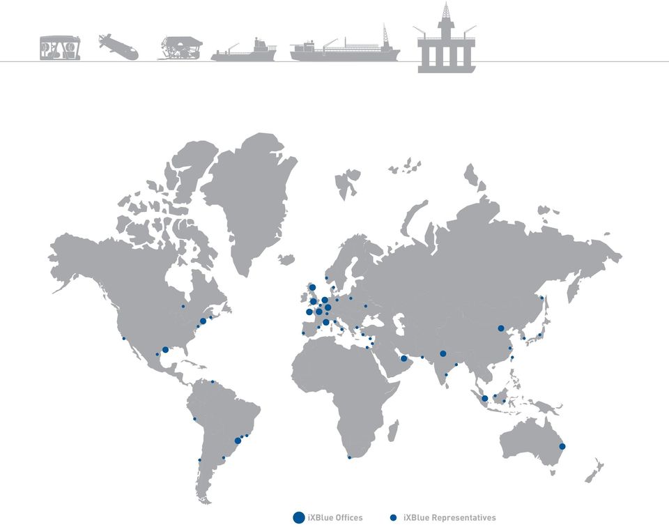
2 ixblue Offices ixblue Representatives
3 About ixblue ixblue is a leading global provider of innovative solutions and services for navigation, positioning, and imaging. Civil and defense customers rely on our systems, operations, and services for the challenges they face at sea, on land, in the air or in space. We are recognized throughout the industry for our pioneering work on the development of ultimate performance fiber-optic gyroscopes (FOG), acoustic and sonar signal processing, and inertial-acoustic sensor data fusion. In all of these areas, we work to ensure that our products provide high accuracy, unrivaled performance and unsurpassed reliability. ixblue serves customers through sales and support offices around the world, offering 24/7 assistance. SOLUTIONS ixblue s offerings encompass inertial navigation systems, photonic components and modules, acoustic positioning and sonar solutions, imaging systems, motion simulators, and stabilized platforms. APPLICATIONS Our solutions are used in challenging applications, including offshore construction and dredging, geophysics and hydrography, ocean science, maritime vessels and yachting, fishing, naval and land defense, land and air survey, optical communications and instrumentation, as well as aerospace. OUR Differentiation and advantage ixblue is an established international technology company with a professional staff of over 500 and operations in more than 30 countries. Our success is based on our ability to deliver excellent products and services to customers who operate in some of the most demanding fields of human endeavor. The foundations of ixblue s technical and commercial success are full-value-chain expertise, vertical integration, easy-to-use, versatile products, professional services, customer care and the ability to establish and maintain successful partnerships. Research and development is central to our activities and our company is recognized as a pioneer in many technical disciplines. This focus on innovation has enabled us to establish and maintain a leading position in our strategic markets over the past three decades.

4

5 ixblue Expertise Offshore applications and ixblue technologies Touchdown Monitoring Pipeline Survey Cut to Length Pipeline Crossings Rig Move Structure Placement Metrology Beach Pulls Trenching Rov dp Operations Vessel DP Sparse Array navigation Offshore products information

6 USBL Acoustic transponder combined acoustic and inertial metrology sparse array LBL transponder

7 portable USBL sparse array LBL ins ins/dvl gyrocompass and motion sensors

8 Fiber-optic gyroscope technology At the heart of an ixblue INS lies a fiber-optic gyroscope (FOG), an extremely high performance rotation sensing device based on the Sagnac effect, which is a relativistic effect discovered at the beginning of the 20 th century. A FOG uses optical waves propagating in a fiberoptic coil to measure a rotational rate accurately. This apparently simple design takes full advantage of the reciprocity principle in the propagation of light, which enables a perfect device to be created from imperfect components. ixblue FOGs are the result of more than 30 years of research and development, and they address the most demanding navigation applications and performance requirements from 0.1 /h to /h. Thanks to in-house mastery of all FOG s key components (optical fiber, coil winding, modulator and source) in combination with advanced modeling of potential environmental sensitivities, ixblue FOGs are insensitive to temperature changes and magnetic perturbations, as well as resistant to extreme shocks and vibrations. As of the end of 2014, ixblue has delivered more than 10,000 high-performance FOGs. As a FOG is a completely passive device with no mechanical dithering, sealed cavity or high-voltage discharge, it has an unrivaled longevity and reliability as well as very low power consumption.

9 UNDERWATER acoustic technology ixblue has developed its own technology, from transducers to power amplifiers, thanks to its expertise in engineering and signal processing. ixblue delivers the full spectrum of underwater acoustic solutions, from the very low to the very high frequency range, in order to meet all the challenges of underwater operations: medium and long-range acoustic positioning systems (GAPS) high-resolution acoustic imagery and mapping (FLS product line) synthetic LBL positioning systems (RAMSES) acoustic transponders (OCEANO) ixblue products offer: subsea positioning acoustic tracking metrology and DP solutions sparse array operations pipeline survey Low frequency acoustic sources
 ixblue products offer: subsea positioning acoustic tracking metrology and DP solutions sparse array operations pipeline survey Low frequency")
10 «The process of checking the location that a pipe or cable first touches on the seabed during construction operations.» TOuChdOwn MOniTOring The Ubiquitous OCTANS OCTANS 3000 Gyroscope and motion sensor has been used for touch down monitoring since its introduction to the market in the late 90 s. OCTANS NANO now offers the same reliability for half the volume and at affordable cost. With the introduction of INS and USBL solutions ixblue now delivers even higher levels of performance. Smooth Accurate Navigation By fitting the ROV with a ROVINS or PHINS, all the benefits of inertial navigation become available: a more accurate and smoother ROV position translates to a more accurate assessment of the final pipeline position. From Shallow to Deep GAPS USBL includes an Inertial Navigation System in its acoustic head which allows it to be pre-calibrated and extremely accurate. 200Hz position update 3X smoother than acoustic positioning post-processed quality in real time The 3-D hydrophone head combined with robust signal processing result in the widest antenna aperture allowing the tracking of targets horizontally even in the shallowest water. The latest generation of GAPS is bringing compatibility with third party beacons (WB1) to facilitate subsea work. It is no longer required to deploy additional transponders in an already existing field of operation. The system can be deployed on any kind or size of vessel, including barges and pipelay vessel, and a separate survey vessel can often be eliminated from the operation. The high power low frequency nature of POSIDONIA means reliable positioning is available even at long laybacks through the extremely difficult acoustic environment of a pipe lay vessel.

11 «The process of surveying a subsea pipeline to check its location and condition.» PiPeline Survey As-Laid and Out of Straightness Pipeline survey operations may be conducted for a number of reasons. ixblue sensors and solutions are key success factors. As-laid surveys are used to confirm the final location of the pipe, checking that: the pipe has been laid to the correct tolerance the pipe has not been damaged during lay there is a need for remedial work a baseline for later inspection surveys is provided Positioning is vital to ensure the pipe has been laid in the correct position, and for future baseline surveys. Good ROV heading and attitude data is necessary for these operations. OCTANS 3000 is the industry standard gyro, and is perfect for these surveys. Save time with INS If real time data is required, ROVINS features the same form factor as the ubiquitous OCTANS 3000 and allows the ROV to be easily upgraded to full inertial capability. The high update rate and smooth position obtained in real time mean there is generally no need to post process the positioning data prior to final chart production. Extreme Accuracy The move to deeper water and higher temperature products combined with tighter pipeline design tolerances has led to a greater need for out-of-straightness surveys. Where the ultimate in accuracy is required, ixblue produces the PHINS 6000 INS, the ideal tool for 3D out of straightness surveys. The data acquired with a ROVINS or PHINS 6000 in real time is suitable for as-laid chart production. DELPH INS is the ixblue software tool for INS data re-processing. It offers: a complete set of dedicated tools available for navigation improvement and QA/QC analysis quick and easy integration in processing workflow an intuitive and user-friendly Man Machine Interface (MMI) cost effective and scalable solutions for all applications.

12 «Cut to length operations are vital to the correct positioning of pipeline lay down points.» Cut to Length If no ROV is available, an USBL beacon may be installed on the pipe, as well, the seabed position of the transponder may be used to calculate the remaining pipe length. High performance in shallow water ixblue offers a number of systems for cut-to-length operations in shallow water, GAPS is the ideal tool for these operations thanks to its pre-calibrated characteristics and simplicity of deployment, together with its excellent horizontal tracking performance. It does not exclude a robust performance in deep water (> 4000m depth). Extreme range in deep water In deeper water, the POSIDONIA is capable of performing cut-to-length operations directly from the pipelay vessel, with no need for a separate survey vessel. Ultimate accuracy For ultimate accuracy, ixblue offers the RAMSES synthetic acoustic positioning system. With a beacon placed on the lay down point and another one attached to the pipe, as soon as the beacon on the pipe reaches the seabed, the ROV is able to perform a metrology operation between the two beacons measuring the remaining length down to a few centimeters. Compatibility The latest generations of RAMSES and GAPS are bringing compatibility with third party beacons (WB1) to facilitate subsea work. It is no longer required to deploy additional transponders in an already existing field of operation.
.")
13 «Pipeline Crossings: Laying a pipe over the top of an existing object, usually over some kind of pre-installed protection.» Pipeline CrossinGS A new approach with RAMSES, for higher productivity When it comes to pipeline crossings, accuracy is vital. In order to minimize risk it is necessary to navigate relative to the pre-laid mattress. RAMSES is the latest building block in the ixblue range of subsea positioning systems, along with features such as sparse array and automatic calibration of beacons (SLAM*), RAMSES introduces relative navigation at LBL accuracies. *Simultaneous Localization and Mapping No lengthy calibration of the subsea beacons is required. The RAMSES in combination with INS SLAM, automatically calibrates the positions of the beacons as the ROV deploys them and moves back to its monitoring position. Within a very short time, the INS switches to navigating with the RAMSES aiding feature, resulting in position accuracy relative to the crossing better than 10 cm. Compatibility The latest generation of RAMSES is bringing compatibility with third party beacons (WB1) to facilitate subsea work. It is no longer required to deploy additional transponders in an already existing field of operation.
, RAMSES introduces")
14 «The process of positioning a mobile rig on a pre-selected location.» rig MOve equipment cannot be used on a rig due to the required calibration which is impractical. Conventional Rig Move For a conventional rig move, reliable lightweight equipment is desirable. QUADRANS is ixblue s latest fiber-optic gyrocompass aimed at IMO grade navigation requirements. Acoustic Rig Moves Often rigs need to be positioned relative to existing seabed structures, the precise position of which are not known. Current techniques rely on installing LBL positioning equipment on the legs of a jackup rig. This dangerous procedure results in very accurate positioning but is slow and often leads to the loss of the equipment installed on the legs. Conventional USBL With its internal INS, GAPS is pre-calibrated and therefore can be installed without the need for a separate UBSL calibration. The GAPS can be installed on a temporary over-the-side pole, or even installed on the drill string. A single transponder is installed on the subsea structure. The GAPS is configured to output the relative position of the transponder. Compatibility The latest generation of GAPS is bringing compatibility with third party beacons (WB1) to facilitate subsea work. It is no longer required to deploy additional transponders in an already existing field of operation.

15 «Placing structures on the seabed.» STruCTure PLacement All kinds of marine construction require the placement of objects on the seabed at defined locations. ixblue solutions can be combined in many ways to achieve the required positioning accuracy. For instance, a simple mattress placement may be achieved through the use of a GAPS USBL beacon on each end of the deployment frame. For ultimate accuracy, an INS on the structure combined with RAMSES will give attitude, orientation and position throughout the deployment. Releasing the structure from its deployment rigging can be achieved without ROV intervention through the use of the ixblue range of heavy duty acoustic releases. ixblue Solutions GAPS: the pre-calibration and the excellent performance in shallow water combined with horizontal tracking capability, makes GAPS the ideal solution for deployment from barges, even in extremely shallow water. The latest generation of GAPS is now compatible with ixblue releasable transponders for limited load handling (up to 5t) and with third party transponders if they are already installed. ROVINS and PHINS: when it comes to high accuracy, INS will improve acoustic positioning and provide full attitude of the structure during the deployment process. POSIDONIA: the solution for deep/ultra deep water positioning. RAMSES: LBL grade accuracy without the usual disadvantage. OCEANO: heavy duty acoustic releases to handle the release of the heaviest loads with no external ROV or diver intervention. OCTANS NANO: heading and attitude data ideal for structure monitoring.

16 «Measuring the angles and distances between two subsea connectors so that a connecting part can be manufactured and fitted.» Rx2 Ry2 β Rx1 Ry1 α MeTrOlOgy Metrology operations are traditionally time consuming and expensive to get right, involving the deployment of many seabed acoustic beacons and a lengthy calibration and data gathering procedure. Traditional Method when you want to perform a traditional metrology operation, ixblue is able to provide OCTANS for measuring connector attitudes and headings. acoustic measurements combined with the best commercially available inertial measurements. metrologies no longer need to be line of sight in order to be completed quickly. the SLAM approach can even conduct multiple metrologies simultaneously, tying a number of structures together in a single ROV dive. redundant processing using multiple techniques leads to the most robust solution. COMMET, Acoustic Aided Inertial Method ixblue s approach of Acoustic Aided Inertial Metrology uses a Simultaneous Localization And Mapping (SLAM) technique. Equipment inventory and time to complete are drastically reduced with no compromise on accuracy. a ROV equipped with PHINS and RAMSES is used in a two-stage process to measure: 1. the distance between two beacons installed in the connectors 2. the heading and attitude of the connectors. using the SLAM technique means thousands of

17 «At the start of a pipe or cable lay, making the link between the lay vessel and the shore.» beach PullS Beach pulls are particularly challenging environments for acoustic positioning systems. The shallow water makes for horizontal tracking and a high degree of multi-path effects. Challenging acoustic environment The unique acoustic performance of the GAPS USBL, with its 200 deg aperture and exceptional shallow water performance, makes it the only choice for tracking the pipe or cable right to the surf zone. The signal processing within GAPS has been specifically designed to minimize multi-path effects. The attitude and heading sensor within the GAPS system is an inertial navigation system (INS) that is integral to the acoustic head. GAPS is de facto the standard for shallow water operations. Best in class performance As well as the best in class performance for shallow water operations, the pre-calibrated nature of the system is vital in these operations. GAPS can be installed on a pipelay barge or cable lay vessel with no further calibration required.... up to 200!

18 «The process of burying a subsea pipe or cable.» TrenChing Two distinct (or combined) problems have to be solved when it comes to plough tracking: in shallow water the tracking system must be capable of operating with a horizontal target (high elevation). in the case of a large plough, the power required to tow the vehicle is immense and produces a high level of noise as well as a great deal of disturbed water. In some cases, acoustic signals between the plough and towing vessel are blocked completely, meaning an additional vessel is required to track the plough. Remote USBL Deployment ixblue has two approaches to solve the problem of tracking a trenching tool: either deploying GAPS below the acoustic disturbance or behind the acoustic disturbance. Because GAPS includes an Inertial Navigation System it does not need to be rigidly attached to a ship. By deploying the GAPS below the towing vessel in quiet 100m water depth undisturbed water, reliable tracking of the plough is achieved. A second approach is to mount the GAPS on a tail buoy and deploy it aft of the towing vessel. This places the GAPS well away from any acoustic noise or disturbed water. For the ultimate in positioning, the plough may be equipped with an INS like the ROVINS. OCTANS NANO is an economical choice providing basic heading and attitude data impervious to magnetic fields whilst being robust enough for the demanding environment. 300m layback

19 «Automatic software control of ROV position, heading and attitude.» rov dp operations Software and sensors detect the ROV position and attitude to control the thrusters, automatically placing the ROV at the desired location. The best in positioning technology For ultimate performance ROV DP needs position and attitude data of high quality at a high data rate. ROVINS is ideal, providing this data at up to 200 times per second. By having the most accurate data at high speed, the DP system can keep the ROV very stable, allowing the pilot to concentrate on the job at hand. The best ROV DP demands the best in positioning technology, ixblue recommends ROVINS interfaced with DVL and a pressure sensor for ROV DP applications. Features: position attitude and heading stabilization auto speed and heading mid-water station keeping riser inspection point and click maneuvering pre-planned mission tracks

20 «A computer-controlled system to automatically maintain a vessel s position and heading by using its own propellers and thrusters.» Vessel DP Vessels operating in deep water need an alternative to GPS for positioning. In shallow water Taught wire, Fanbeam, or Radar systems are often used, but in deep water and away from fixed structures. These systems are not viable. Standard acoustic positioning systems become too noisy for DP operations beyond around 1500m. DP PHINS has been specifically designed as an add-on to an existing acoustic DP system. By smoothing the data from the existing USBL system, applying L/USBL principals. DP operations can be conducted in much deeper water than was previously possible, all without major changes to the DP or acoustic systems on the vessel. POSIDONIA is ixblue deep water acoustic system. When coupled with a ROVINS or a PHINS, the inertially aided L/USBL mode becomes available, bringing the possibility of using acoustics for DP positioning, even in the world s deepest oceans. For shallow water operations Taut wire can be a problem as the range of movement is a function of the water depth: the shallower the water, the less movement is possible. The excellent horizontal performance of GAPS combined with the new L/USBL/INS mode allows world class positioning using only one or two beacons in very shallow water. New releasable ixblue beacons can be used (activated from GAPS itself) or third party already existing beacons. For shallow water pipe or cable lay operations, PHINS DVL is a viable DP reference system. With a station keeping performance of around 0.5m/hour or 0.1% distance traveled, even the longest GPS outages can be dealt with. By adding RAMSES with seabed beacons widely spaced along a route (greater than 1km spacing) better than 40cm positioning accuracy is achievable along the whole route.

21 «Combining inertial and acoustic positioning technologies: the best way for subsea positioning with less beacons and no compromised performance.» Sparse Array Navigation The tight coupling of acoustic systems with inertial navigation systems offers new modes of operation for underwater positioning. Sparse array navigation is one of them. By fusing acoustic ranges to transponders with the intimate knowledge of the vehicle motion provided by the INS, it is possible to reach or exceed conventional LBL performance. Navigation is now possible with only one or two beacons, where previously many were mandatory, including new releasable ixblue beacons or third party already existing ones. PHINS and RAMSES are stand alone devices, but when connected together with a single cable, they make a complete sparse aray navigation system without requiring additional topside equipment. LBL array installation and calibration procedure: Typical subsea field developments can require more than 100 seabed deployed transponders. The time taken to deploy and calibrate such a large array represents a significant cost. With the sparse array techniques made possible by RAMSES, far fewer transponders are required. Rather than requiring at least 4 transponders in range to calculate a position, navigation is possible with only one single beacon in range. ROV robust positioning: RAMSES + PHINS/DVL on the ROV only requires one or two acoustic transponders in range in order to maintain accuracy. A robust position solution is still available even with ROV operating in shadow zones or within acoustically challenging conditions. Acoustic array propagation: With the SLAM (Simultaneous Localization and Mapping) algorithm running in RAMSES it is possible to dynamically extend the acoustic array by adding additional transponders. On the fly, RAMSES will use the additional data to calibrate the position of the new transponders before using them in the sparse array solution.
22 Gaps Fourth-generation usbl acoustic positioning system The ixblue fourth-generation pre-calibrated GAPS combines high performance ultra-short baseline (USBL) and a fiber-optic inertial navigation system (INS) in the same housing to provide accurate position of any subsea object, in diverse and challenging environments. Its performance ranges from extremely shallow water to deep sea. Its compact and all-in-one design allows both portable and permanent installations. One of GAPS key new features is support of dynamic positioning (DP). FEATURES Integrates USBL, high-grade INS, real-time positioning and GPS Position accuracy: 0.06% x slant range Advanced signal processing and 3D acoustic antenna for range and accuracy performance Powerful dynamic positioning (DP) mode (L/USBL/INS) BENEFITS Cost and time saving deployment: flexible, portable, pre-calibrated, rapid, and simple Robust performance in very shallow water (10m depth) to long range (> 4000m depth) Deployment options, from surface buoy, side pole, moon pool or hull mounted Universal utilization Posidonia II Ultra-deep, long-range usbl POSIDONIA II is a USBL acoustic positioning system for high-accuracy / ultra long range tracking of subsea vehicles. It offers enhanced performance with a new electronic cabinet (USBL-Box) including the most recent ixblue acoustic signal processing and full compatibility with RAMSES 6000 synthetic baseline positioning system. FEATURES Extreme long-range up to m and 0.2% of slant distance accuracy Low frequency band, full wideband, robust to noise and multipath Smoothly interfaces with ixblue positioning building blocks (INS, RAMSES, motion sensors) Full Ethernet and ixblue web-based user interface BENEFITS Deep tow operations with no need for second tracking vessel High performance even in extremely adverse conditions Added flexibility and better performance Simple to deploy and operate
23 Ramses Next-generation long baseline medium frequency and low frequency positioning systems RAMSES is an acoustic synthetic baseline positioning system with self-contained computing, for simple real-time sparse array subsea navigation. Tightly coupled with ixblue inertial navigation system (INS), it delivers extreme precision and robustness in challenging acoustic operational environment. Available in MF and LF versions (medium frequency for most applications and low frequency for ultra-long range applications), RAMSES is part of ixblue inertial-acoustic solutions for underwater positioning and navigation. The solution combines RAMSES system with GAPS and POSIDONIA ixblue ultra-short baseline (USBL) positioning systems. FEATURES Sparse array positioning functionality and self-calibration capability All in one self-contained system, including real-time position computation Decimeter range measurement accuracy Open solution environment: operates with ixblue and third party transponders BENEFITS Quick deployment, reduced number of transponders, and calibration-free Requires no top-side computer and no umbilical, enabling immediate and simplified mobilization Highest precision navigation, smooth and drift free positioning Operable within existing deployment fields, reducing operation costs Octans nano Compact subsea gyrocompass and attitude sensor OCTANS NANO is the smallest and most adept state-of-the-art 4 000m depth rated attitude and heading reference system (AHRS). It is built on ixblue s renowned fiber-optic gyroscope (FOG) technology and offshore instrumentation expertise. OCTANS NANO offers an outstanding price/performance solution, with rugged titanium housing, meeting the most challenging requirements of subsea applications. FEATURES BENEFITS Smallest all-in-one subsea gyrocompass and attitude sensor Leading FOG strap-down technology Ethernet and serial interfaces with sensor input rebroadcast capability Free of ITAR components High-performance sensors with real-time computation of true heading, roll, pitch and rates of turn, in a compact six-liter housing High reliability and low maintenance Reduced cabling for advanced architectures and maintaining flexibility for older designs Fast global export and mobilization
24 Octans 3000 High-performance subsea gyrocompass and motion sensor OCTANS 3000 is a subsea survey-grade gyrocompass and complete motion sensor for water depths up to 3 000m. Based on ixblue s FOG technology it outputs heading, roll, pitch, heave, rate of turn and acceleration. OCTANS 3000 can be easily upgraded to full INS mode (i.e. ROVINS). FEATURES Complete gyrocompass and motion sensor Smart Heave TM Fiber-optic gyroscope (FOG), unique strap-down technology Ethernet, web-based man-machine interface (MMI) Titanium made, small, portable plug and play system Optional full featured inertial navigation system BENEFITS High-performance real-time outputs of true heading, roll, pitch,heave, surge, sway, acceleration and rate of turn No spinning element hence maintenance free Lightweight corrosion free housing for water depth up to 3 000m, easy to integrate and interface, saves valuable mobilization time Obtain INS-class system with simple software upgrade Rovins Fog-based high-performance inertial navigation system for subsea vehicles ROVINS is a combined survey-grade full featured inertial navigation system for water depths up to 3 000m. Designed specifically for offshore survey and construction works, ROVINS, thanks to its advanced Kalman filter, improves the efficiency of all operations where accurate position, heading and attitude are key benefits. ROVINS is offered in stand alone, «DVL ready», and ROVINS 154 (for OEM integration) versions. FEATURES BENEFITS All-in-one high-accuracy 3D positioning with heading, roll and pitch, ROT and 3D speeds Unique FOG strap-down technology Multiple interfaces (DVL, USBL, LBL, RAMSES, GPS, depth sensor) DVL ready pre-calibrated option available RAMSES synthetic baseline positioning system (option) OCTANS footprint compatible Post-processing software option Accurate georeferenced position and attitude at high frequency High reliability and low maintenance Flexible and scalable configuration for all deployment scenarios and mission sequences Immediate availability for all vehicles Ultimate sub-metric performance using sparse array Immediately compatible Outstanding image georeferencing
25 Phins 6000 fog-based high-performance subsea inertial navigation system for deep water PHINS 6000 is a subsea inertial navigation system providing position, true heading, attitude, speed, depth and heave. Its high-accuracy inertial measurement unit is coupled with an embedded digital signal processor that runs an advanced Kalman filter. PHINS DVL Ready can be assembled and pre-calibrated with a doppler velocity log version making the system easy to install and ready to use for more precise navigation. FEATURES All-in-one high-accuracy 3D positioning with heading, roll and pitch FOG, unique strap-down technology Multiple aiding available: (DVL, USBL, LBL, RAMSES, GPS, depth sensor) Options: DVL or RAMSES coupling Ethernet, web server (GUI) BENEFITS High grade INS performance High reliability and maintenance free Rugged design for water depths up to 6 000m Ultimate sub-metric performance using sparse array transponders and on-the-fly calibration Ease of use and quick installation Quadrans IMO grade surface gyrocompass and attitude reference system QUADRANS is a fully strap-down fiber-optic gyrocompass and attitude reference system. IMO and IMO-HSC certified, it provides all the necessary data for demanding navigation and control applications at a fast rate and with precise time-stamping. Thanks to its low weight and small size, its low power consumption and its Ethernet/serial connectivity, it can be integrated with ease on any platform. Based on state-of-the-art fiber-optic gyroscope technology, QUADRANS provides a full range of navigation needs, without any compromise on performance and without requiring any maintenance during its service life. FEATURES Small compact and plug and play system Complete gyrocompass Unique strap-down technology fiber-optic gyroscope (FOG) Ethernet, web-based Man-Machine Interface (MMI) IMO certification BENEFITS Plug and play Fast settling time Maintenance free Easy integration High reliability
26 Delph ins Inertial navigation system post-processing software DELPH INS is a post-processing and batch productivity tool for the ixblue INS product range: PHINS, ROVINS, HYDRINS, AIRINS. Powerful data editing and processing functions together with data export capability make this tool ideal for quick and easy navigation enhancement. FEATURES Forward/backward data processing, edit/modify data, add/remove aiding sensors Powerful export tools Intuitive and user-friendly Man Machine Interface (MMI) Several versions tailored to market applications BENEFITS Complete set of dedicated tools available for navigation improvement and QA/QC analysis Quick and easy integration in processing workflow Does not require in-depth INS knowledge Cost effective and scalable solution for all applications Oceano Heavy duty acoustic releases OCEANO Heavy Duty Acoustic Releases allow heavy load handling without hardwire connection, hydraulic hose or ROV. Easy to operate and rugged, they are the perfect tool for offshore construction operations. FEATURES Safety pin, ROV backup, rugged construction, robust coding principle Handle heavy loads (up to 300 tons) Simple to operate Several models from 15 to 300 tons BENEFITS Safe to operate Powerful No need for heavy workclass ROVs, divers or local subsea support Submersible at any depth to 6000m
27
28 EMEA: AMERICAS: APAC: BRO-OFFAPP 2010 BP/Marc Morrison DEEP INSIGHT. SHARPER SENSES.
Automating ROV Operations in aid of the Oil & Gas Offshore Industry
 Automating ROV Operations in aid of the Oil & Gas Offshore Industry Ioseba Tena SeeByte Whitepaper August 2011 Context The Remotely Operated Vehicle has been instrumental in the development of subsea fields.
Survey Sensors Hydrofest 2014. Ross Leitch Project Surveyor
 Survey Sensors Hydrofest 2014 Ross Leitch Project Surveyor Satellite Positioning Only provides position of antenna Acoustic Positioning Only provides position of transponder relative to transceiver How
Apogee Series. > > Motion Compensation and Data Georeferencing. > > Smooth Workflow. Mobile Mapping. > > Precise Trajectory and Direct Georeferencing
 Ultimate accuracy MEMS Apogee Series Inertial Navigation System Motion Sensing and Georeferencing > INS > MRU > AHRS ITAR free 0,005 RMS Apogee Series High quality, high accuracy Hydrography > > Motion
Outline. Application of AUVs for Hydrography. AUVs for hydrographic surveying AUV horizontal mapping accuracy
 Application of AUVs for Hydrography Øyvind Hegrenæs, Ph.D. AUV Department Outline AUVs for hydrographic surveying AUV horizontal mapping accuracy HUGIN 1000 with HISAS 1030 SAS HiPAP 500 USBL or GPS surface
Permanent Reservoir Monitoring (PRM) System Installation: The Installers Perspective
 System Installation: The Installers Perspective") Permanent Reservoir Monitoring (PRM) System Installation: The Installers Perspective Introduction Global Marine Systems Limited (Global Marine) has a vast wealth of knowledge in designing planning and
Permanent Reservoir Monitoring (PRM) System Installation: The Installers Perspective Introduction Global Marine Systems Limited (Global Marine) has a vast wealth of knowledge in designing planning and
AOG 2015 Acoustic System to Monitor Wellhead Fatigue in Real-time. March 12 th 2015. www.pulse-monitoring.com
 AOG 2015 Acoustic System to Monitor Wellhead Fatigue in Real-time March 12 th 2015 Agenda Monitoring method currently used Online monitoring New generation wireless monitoring Benefits of active monitoring
CUBE. Subsea Attitude Monitoring and Logging System
 CUBE Subsea Attitude Monitoring and Logging System Contents Seatronics Introduction Description CUBE Frame Instrumentation Software Installation Support Performance History 3 4 5 6-12 13 14-15 16 17 2
Shallow Water Swath Bathymetry from Small Platforms. Advances in Seafloor Mapping Sonar, 30 Dec 2009 Systems Engineering & Assessment Ltd.
 Shallow Water Swath Bathymetry from Small Platforms Advances in Seafloor Mapping Sonar, 30 Dec 2009 Systems Engineering & Assessment Ltd. Presentation Requirements, applications and challenges SWATHplus
IP-S3 HD1. Compact, High-Density 3D Mobile Mapping System
 IP-S3 HD1 Compact, High-Density 3D Mobile Mapping System Integrated, turnkey solution Ultra-compact design Multiple lasers minimize scanning shades Unparalleled ease-of-use No user calibration required
APPLANIX POSITION AND ORIENTATION SYSTEMS FOR LAND VEHICLES (POS LV)
") APPLANIX POSITION AND ORIENTATION SYSTEMS FOR LAND VEHICLES (POS LV) POS LV powers any application where vehicle positioning and orientation is required. capture everything. precisely. APPLANIX POSITION
APPLANIX POSITION AND ORIENTATION SYSTEMS FOR LAND VEHICLES (POS LV) POS LV powers any application where vehicle positioning and orientation is required. capture everything. precisely. APPLANIX POSITION
HV Submarine Cable Systems Design, Testing and Installation
 HV Submarine Cable Systems Design, Testing and Installation CIGRE Ireland Technical Seminar 6 th October 2010 Robert Donaghy Senior Consultant Engineer, ESB International Presentation Overview Applications
Engineers from Geodetics select KVH for versatile high-performance inertial sensors. White Paper. kvh.com
 White Paper Overcoming GNSS Vulnerability by Applying Inertial Data Integration in Multi-Sensor Systems for High Accuracy Navigation, Pointing, and Timing Solutions Engineers from Geodetics select KVH
DELPH v3.0. seabed mapping software suite
 DELPH v3.0 seabed mapping software suite DELPH seabed mapping software suite DELPH SEISMIC, DELPH SONAR and DELPH MAG are complete software packages with dedicated acquisition, processing and interpretation
IP-S2 Compact+ 3D Mobile Mapping System
 IP-S2 Compact+ 3D Mobile Mapping System 3D scanning of road and roadside features Delivers high density point clouds and 360 spherical imagery High accuracy IMU options without export control Simple Map,
Basic Principles of Inertial Navigation. Seminar on inertial navigation systems Tampere University of Technology
 Basic Principles of Inertial Navigation Seminar on inertial navigation systems Tampere University of Technology 1 The five basic forms of navigation Pilotage, which essentially relies on recognizing landmarks
sonobot autonomous hydrographic survey vehicle product information guide
 sonobot autonomous hydrographic survey vehicle product information guide EvoLogics Sonobot an autonomous unmanned surface vehicle for hydrographic surveys High Precision Differential GPS for high-accuracy
Offshore Structures. Offshore Drilling Equipment
 Offshore Structures Offshore Drilling Equipment The drill string is lowered through a conduit (riser). The drill string consists of a drill bit, drill collar and drill pipe. Drill pipe sections are added
COMPANY PROFILE PELICAN COMPANY LIMITED
 COMPANY PROFILE PELICAN COMPANY LIMITED, Vung Tau 2013 Page 2 1. About Us Based in the city of, and established in 2010 by the professionals in their field of expertise, Pelican Company Limited provides
Error Estimation in Positioning and Orientation Systems
 Error Estimation in Positioning and Orientation Systems Peter Canter Director, Applanix Marine Systems 85 Leek Crescent Richmond Hill, Ontario L4B 3B3 Telephone 905-709-4600 pcanter@applanix.com Co-Author:
Integration of Inertial Measurements with GNSS -NovAtel SPAN Architecture-
 Integration of Inertial Measurements with GNSS -NovAtel SPAN Architecture- Sandy Kennedy, Jason Hamilton NovAtel Inc., Canada Edgar v. Hinueber imar GmbH, Germany Symposium Gyro Technology, Stuttgart 9/25
IP-S2 HD. High Definition 3D Mobile Mapping System
 IP-S2 HD High Definition 3D Mobile Mapping System Integrated, turnkey solution High Density, Long Range LiDAR sensor for ultimate in visual detail High Accuracy IMU and DMI Odometry for positional accuracy
MERMAID FLEET PROFILE SUBSEA SERVICES
 010 Mermaid Maritime Public Company Limited MERMAID ENDURER (Built in 2010) The DSV Mermaid Endurer is a Norwegian purpose-built DP2 dive support and light construction vessel, specially designed for operations
Power & Environmental Monitoring
 Data Centre Monitoring Made Easy Power & Environmental Monitoring Features & Benefits Packet Power provides the easiest, most cost effective way to capture detailed power and temperature information for
Data Data Everywhere, We are now in the Big Data era
 Data Data Everywhere, We are now in the Big Data era Mike Liddell 13 th March 2014 UUVs @ OI 2014 Contents Menu Background Big Data What is Generating our Big Data Physical Management of Big Data Optimisation
Information regarding the Lockheed F-104 Starfighter F-104 LN-3. An article published in the Zipper Magazine #48. December-2001. Theo N.M.M.
 Information regarding the Lockheed F-104 Starfighter F-104 LN-3 An article published in the Zipper Magazine #48 December-2001 Author: Country: Website: Email: Theo N.M.M. Stoelinga The Netherlands http://www.xs4all.nl/~chair
Pipelines and seabed intervention
 Workshop on seabed habitats of environmental concern Jørn Spiten Content Pipeline - route design Seabed Intervention - Trenching - Ploughing - Dredging - Rock installation 2 Pipeline routes 3 Pipeline
Communication Links for Offshore Platforms. A User s Guide to Troposcatter Communications
 Communication Links for Offshore Platforms A User s Guide to Troposcatter Communications 1.0 INTRODUCTION Offshore platforms, whether for coastal defense systems, environmental monitoring, pipe line operations,
Worldwide subsea pipeline cathodic protection surveys
 Worldwide subsea pipeline cathodic protection surveys World leaders in subsea pipeline cathodic protection surveys Corrintec are recognised as a world leader in the field of Subsea Pipeline Cathodic Protection
Contents. 1. PROFILE p2. 2. SERVICES 2.1 Offshore Support Services p 4 Offshore support p 6 ROV operations p 8
 OCTOBER 2013 22 Contents 1. PROFILE p2 2. SERVICES 2.1 Offshore Support Services p 4 Offshore support p 6 ROV operations p 8 2.2 Hydrographic & Geophysical services p 10 Bathymetric surveys p 12 High resolution
MATRIX borehole logging system
 MATRIX borehole logging system Combining their long experience in the slimhole logging industry Mount Sopris and ALT have teamed up to develop M A T R I X, providing a single solution to the multiplication
Woods Hole Group, Inc. Oceanography and Measurement Systems Division INTEGRATED REAL-TIME MONITORING SYSTEM
 Woods Hole Group, Inc. INTEGRATED REAL-TIME MONITORING SYSTEM Woods Hole Group, Inc. (WHG) has developed the Integrated Real-time Monitoring System (IRMS) as a general-purpose data acquisition and telemetry
(0008854) A981653 REV B. 4125 system setup and deployment quick start guide
 A981653 REV B. 4125 system setup and deployment quick start guide") (0008854) A981653 REV B 4125 system setup and deployment quick start guide OPERATION IN AIR Do not operate the system while the tow fish in air for extended periods. The system may be enabled to transmit
(0008854) A981653 REV B 4125 system setup and deployment quick start guide OPERATION IN AIR Do not operate the system while the tow fish in air for extended periods. The system may be enabled to transmit
SPECIALTY FIBER OPTIC CABLE. Downhole Sensing Subsea
 SPECIALTY FIBER OPTIC CABLE Specialty Fiber Optic Cable Customers around the world benefit from using AFL fiber optic cable and components for downhole sensing and subsea umbilicals. With its patented
Creating a Seamless Model of the Littoral and Near Shore Environments
 Creating a Seamless Model of the Littoral and Near Shore Environments Peter Stewart and Peter Canter Applanix Corporation Abstract Ports and harbours have long utilized multibeam sonar to model the surface
Using Industrial Ethernet Switches to Assure Maximum Uptime White Paper
 Six Best Practices for Effective Wind Farm Operation Using Industrial Ethernet Switches to Assure Maximum Uptime White Paper Six Best Practices for Effective Wind Farm Operation Using Industrial Ethernet
Case Study of Emergency Disconnect Sequence in the Gulf of Mexico
 Case Study of Emergency Disconnect Sequence in the Gulf of Mexico Trent Fleece Subsea BOP Operations Team Lead May 8, 2015 Case Study of Emergency Disconnect Sequence in Gulf of Mexico Industry Standards
Cable Laying and Repair - Cable Ship Operations
 http://oceanexplorer.noaa.gov/explorations/03edge/background/sargassum/sargassum.html Cable Laying and Repair - Cable Ship Operations Dr. R.J. Rapp, Director, Industry & Marine Liaison, TE SubCom Submarine
ProductBulletin. Vessel Tracking using HYDROpro. HYDROpro as the Tracking Controller MARINE SURVEYING & CONSTRUCTION
 Vessel Tracking using HYDROpro ProductBulletin January 2001 MARINE SURVEYING & CONSTRUCTION HYDROpro can be used to track vessels in applications like rock dumping, anchor tug control for rig and barge
Rotary vane steering gear for smaller vessels
 Steering gear Rotary vane steering gear for smaller vessels The SR series is designed with integrated frequency controlled pumps. General description Rolls-Royce supplies a complete range of steering gear,
How To Use Leica Dozernav Plus
 Leica DozerNav Plus High precision GPS dozer guidance More than a guidance system Leica DozerNav Plus > helping you drive productivity with ease Leica DozerNav Plus the benefits at a glance Real-time feedback
EMETTEUR RECEPTEUR. Système d accostage
 EMETTEUR RECEPTEUR E-Sea Fix MkII PRODUCT DATASHEET Système d accostage A SYSTEM THAT SUITS ANY APPLICATION SHOCK AND WATERPROOF TRANSPONDERS WIRELESS SOLUTIONS System overview The E-Sea Fix systems have
GEOScaN Remote Data Acquisition for Hydrographic, Topographic and GIS Surveying
 GEOScaN Remote Data Acquisition for Hydrographic, Topographic and GIS Surveying Laurence WATERHOUSE, United Kingdom Key words: remote sensing, hydrographic, laser scanning, GIS SUMMARY British Waterways
By Chris Gorman, PE M.ASCE PROBLEM:
 Improving Bridge Inspection, Scour Monitoring and Infrastructure Management for DOTs using the Echoscope - A true 3D, High-Definition and Real-Time imaging tool. PROBLEM: By Chris Gorman, PE M.ASCE Preserving
NavDP4000 Series Dynamic Positioning Systems
 NavDP4000 Series Dynamic Positioning Systems Introduction NavDP 4000 Series The Professional s Choice Navis Engineering OY, founded in 1992, is one of the few world experts in dynamic positioning. Having
SONOBOT AUTONOMOUS HYDROGRAPHIC SURVEY VEHICLE PRODUCT INFORMATION GUIDE
 SONOBOT AUTONOMOUS HYDROGRAPHIC SURVEY VEHICLE PRODUCT INFORMATION GUIDE EvoLogics SONOBOT: Autonomous Surface Vehicle for Hydrographic Surveys High Precision Differential GPS for high-accuracy cartography
CHAPTER 1 INTRODUCTION
 CHAPTER 1 INTRODUCTION 1.1 Background of the Research Agile and precise maneuverability of helicopters makes them useful for many critical tasks ranging from rescue and law enforcement task to inspection
IMCA Competence Assessment Portfolio May 2012
 S/S30/000/01 Safety (S30 refers to Grade II core competences which are applicable to roles S31, S32, S33, S34 and S35, as described in IMCA C 004) Safe working practices Identify different areas in the
Mobile Case Studies in Success
 Mobile Case Studies in Success Your Application, Our Responsibility. Advanced Fluid Systems solution oriented approach thinks beyond the hydraulic components and assemblies to understand your entire application
Tactical Oil Spill Management TOSM APTOMAR.COM
 Tactical Oil Spill Management TOSM APTOMAR.COM TCMS AIRBORNE OFFSHORE NEAR SHORE ONSHORE Operations Room Oil Rig Oil Rig Standby Vesel SECurus Radar Surveillance Aircraft TACTICAL OIL SPILL MANAGEMENT
TECHNICAL INFORMATION
 Page: 1/6 This checklist recognizes the major accident hazards found by experience of previous HAZID studies. It is not intended to be totally exhaustive and feedback from users should be incorporated
Table of Contents. Fiber Trunking 2. Copper Trunking 5. H-Series Enclosures 6. H-Series Mods/Adapter Panels 7. RSD Enclosures 8
 Data Center Guide 1 Our Philosophy As a leader in the enterprise cable industry since our inception over three decades ago, we can help you implement the solution that will work best for your cabling infrastructure,
A new approach to rail asset management.
 A new approach to rail asset management. Geotechnical and structural monitoring via satellite for the rail industry. With mounting pressures on the UK s ageing infrastructure networks from ever increasing
General GPS Antenna Information APPLICATION NOTE
 General GPS Antenna Information APPLICATION NOTE General GPS Antenna Information Global Positioning System and Precise Time & Frequency The Global Positioning System (GPS) is a worldwide radio-navigation
Horizon Survey and Geotechnical Companies
 Oil & Gas Directory Middle East - 2013 147 Horizon Survey and Geotechnical Companies Corporate P r ofile OUR PEDIGREE Horizon provides comprehensive survey and geotechnical services to the offshore industry
Robot Sensors. Outline. The Robot Structure. Robots and Sensors. Henrik I Christensen
 Robot Sensors Henrik I Christensen Robotics & Intelligent Machines @ GT Georgia Institute of Technology, Atlanta, GA 30332-0760 hic@cc.gatech.edu Henrik I Christensen (RIM@GT) Sensors 1 / 38 Outline 1
Imtech SeaGuide ECDIS
 Imtech SeaGuide ECDIS Imtech SeaGuide ECDIS The Imtech SeaGuide Electronic Chart Display Information System has been designed according to the latest ECDIS regulations and is based on the well known Hagenuk
NetScanner System. Toronto: 416 754 7008, Montreal: 514 695 5147, Toll Free:1888 754 7008, Email: sales@a-tech.ca; www.a-tech.ca
 Networking Solutions NetScanner System 9IFC/90DB/90DC FEATURES Ethernet Interface for NetScanner System Modules Provides Power and Hardware Trigger Interface 10/100 Base-T Auto-Negotiating Universal AC
Putting your business into motion
 Putting your business into motion Monitoring Systems MONITORING IS ONE OF THE FASTEST GROWING DISCIPLINES IN SURVEYING THE WORLD IN MOTION Demand for monitoring is on the rise. Around the world, new monitoring
Distributed Temperature Sensing - DTS
 Intelligent Solutions Distributed Temperature Sensing - DTS Enabling fast, reliable and cost-effective sensing through highly integrated optical measurement systems Fire detection Power cable monitoring
LNG Monitoring. Fiber-Optic Leakage Detection System. Pipeline leakage detection. Regasification and liquefaction monitoring
 LNG Monitoring Fiber-Optic Leakage Detection System Pipeline leakage detection Regasification and liquefaction monitoring Tank annulus and base slab monitoring Spill containment control Intelligent Solutions
Improving Hydrographic Rate of Effort
 Improving Hydrographic Rate of Effort Presented by Scott Elson Australia s Surveying Responsibility Source: http://www.hydro.gov.au/business-publications/hydroscheme-2010-2012.pdf Company Proprietary 2
RIVA Megapixel cameras with integrated 3D Video Analytics - The next generation
 RIVA Megapixel cameras with integrated 3D Video Analytics - The next generation Creating intelligent solutions with Video Analytics (VCA- Video Content Analysis) Intelligent IP video surveillance is one
PRAKlA SEISMDS "V V PRAKLA-SEISMOS AG
 !\ PRAKlA SEISMDS "V V PRAKLA-SEISMOS AG 1 Bridge - all conlrols and video screens are within easy reach Mast lable to lit various antennae 01 radio survey systems in one beamline THE ESSENTIAL INSTRUMENTATION
1-4 kg/m3. Long in-line calibration cycles of the gamma density systems may improve measurement accuracy, but this is often not practical subsea.
 Generating Greater Accuracy and Robustness from Subsea Multiphase Meters By Finn Erik Berge, Emerson Process Management Subsea multiphase meters have faced a growing number of challenges linked to the
TRIMBLE ATS TOTAL STATION ADVANCED TRACKING SYSTEMS FOR HIGH-PRECISION CONSTRUCTION APPLICATIONS
 TRIMBLE ATS TOTAL STATION ADVANCED TRACKING SYSTEMS FOR HIGH-PRECISION CONSTRUCTION APPLICATIONS BY MARTIN WAGENER APPLICATIONS ENGINEER, TRIMBLE EUROPE OVERVIEW Today s construction industry demands more
Introducing TransitVUE Perimeter IDS, the most advanced perimeter intrusion detection system available today! Protecting Perimeters Around the World
 Introducing TransitVUE Perimeter IDS, the most advanced perimeter intrusion detection system available today! Introduction The rising demand for advanced perimeter security detection systems against intrusion
Monitoring and diagnostics
 Monitoring and Diagnostics Monitoring and diagnostics Analyze the past, monitor the present, and predict the future! Asset Services/Monitoring and Diagnostics Switchgear Services Transformer Services Cable
Top Drive Service Loops. Conventional, Enhanced and Superior Solutions for Drilling Applications
 Top Drive Service Loops Conventional, Enhanced and Superior Solutions for Drilling Applications Linking the future As the worldwide leader in the cable industry, Prysmian Group believes in the effective,
Everything you need for protection scheme testing
 Power System Simulator for Testing Protection Relays and Schemes Everything you need for protection scheme testing The is the only instrument with the high power, flexibility and software to perform full
DISASTER RECOVERY AND NETWORK REDUNDANCY WHITE PAPER
 DISASTER RECOVERY AND NETWORK REDUNDANCY WHITE PAPER Disasters or accidents would cause great harm on network infrastructure. It is unavoidable and the operation of network would be hampered for a long
SpaceLoft XL Sub-Orbital Launch Vehicle
 SpaceLoft XL Sub-Orbital Launch Vehicle The SpaceLoft XL is UP Aerospace s workhorse space launch vehicle -- ideal for significant-size payloads and multiple, simultaneous-customer operations. SpaceLoft
New Generation of Deepwater BOP Stacks. Dominique Allegre CAMERON Paris, October 23rd 2013
 New Generation of Deepwater BOP Stacks Dominique Allegre CAMERON Paris, October 23rd 2013 Agenda: Evolution of Standards API Standard 53 RP 17W New Equipment & Technology Developments: Shearing Technology
Application of Subsea Wireless Technology to Environmental Monitoring
 Application of Subsea Wireless Technology to Environmental Monitoring Amanda Collins Marketing, WFS Technologies Edinburgh, UK amanda@wfs-tech.com Abstract This paper will look at how wireless technology
How To Control Gimbal
 Tarot 2-Axis Brushless Gimbal for Gopro User Manual V1.0 1. Introduction Tarot T-2D gimbal is designed for the Gopro Hero3, which is widely used in film, television productions, advertising aerial photography,
A PHOTOGRAMMETRIC APPRAOCH FOR AUTOMATIC TRAFFIC ASSESSMENT USING CONVENTIONAL CCTV CAMERA
 A PHOTOGRAMMETRIC APPRAOCH FOR AUTOMATIC TRAFFIC ASSESSMENT USING CONVENTIONAL CCTV CAMERA N. Zarrinpanjeh a, F. Dadrassjavan b, H. Fattahi c * a Islamic Azad University of Qazvin - nzarrin@qiau.ac.ir
and to mutually agree mitigation measures to reduce identified concerns and risks to acceptable levels.
 PTC ID: 88 Connecting Offshore Platforms to a Subsea Cable System Jerry Brown, Ocean Specialists Inc. Technical Manager Subsea. Introduction Bandwidth hungry applications for process controls and business
Marine Technology Society
 Marine Technology Society Dynamic Positioning Conference 21-22 October, 1997 Session 9 Control Systems Improved DP Performance in Deep Water Operations Through Advanced Reference System Processing and
HELIAX. Exceptional performance guaranteed
 FTTA Turnkey Solutions HELIAX SureFlex premium cable assemblies Exceptional performance guaranteed New HELIAX SureGuard weatherproofing technology Guaranteed for low PIM, VSWR and DTF Protect your network
THE CONTROL OF A ROBOT END-EFFECTOR USING PHOTOGRAMMETRY
 THE CONTROL OF A ROBOT END-EFFECTOR USING PHOTOGRAMMETRY Dr. T. Clarke & Dr. X. Wang Optical Metrology Centre, City University, Northampton Square, London, EC1V 0HB, UK t.a.clarke@city.ac.uk, x.wang@city.ac.uk
Datasheet. High-Performance airmax Bridge. Models: NBE M5-19, NBE-M5-16. Uniform Beamwidth Maximizes Noise Immunity. Innovative Mechanical Design
 High-Performance airmax Bridge Models: NBE M5-19, NBE-M5-16 Uniform Beamwidth Maximizes Noise Immunity Innovative Mechanical Design High-Speed Processor for Superior Performance Overview Application Examples
Servo System Network SSCNETIII
 Servo System Network Here the History of Optical Networks Mitsubishi Electric Corporation Nagoya Works is a factory certified for ISO14001 (standards for environmental management systems) and ISO9001(standards
Navi-Radar 4000 and Navi-Sailor 4000 ECS for workboats and small crafts BIG SOLUTIONS FOR SMALL VESSELS
 Navi-Radar 4000 and Navi-Sailor 4000 ECS for workboats and small crafts BIG SOLUTIONS FOR SMALL VESSELS TRANSAS WORKBOAT SERIES Transas Workboat series offers the same technology, performance and quality
LMS SoundBrush. From sound to source in minutes
 LMS SoundBrush From sound to source in minutes 2 LMS SoundBrush LMS SoundBrush From sound to source in minutes Acoustic troubleshooting is a challenging yet essential process for many types of industries.
Submarine Power Cables. State-of-the-art production facility, more than 100 years of experience and reference installations around the world.
 Submarine Power Cables State-of-the-art production facility, more than 100 years of experience and reference installations around the world. Reliable submarine power cables ABB is one of the world s most
ARIES SAAS HELICOPTER CONTROL AND APPROACH RADAR
 SECURITY AND DEFENSE ARIES SAAS HELICOPTER CONTROL AND APPROACH RADAR Defense and security in five continents indracompany.com ARIES-SAAS ARIES SAAS HELICOPTER CONTROL AND APPROACH RADAR ARIES-SAAS radar
3D Vision An enabling Technology for Advanced Driver Assistance and Autonomous Offroad Driving
 3D Vision An enabling Technology for Advanced Driver Assistance and Autonomous Offroad Driving AIT Austrian Institute of Technology Safety & Security Department Christian Zinner Safe and Autonomous Systems
Automotive Applications of 3D Laser Scanning Introduction
 Automotive Applications of 3D Laser Scanning Kyle Johnston, Ph.D., Metron Systems, Inc. 34935 SE Douglas Street, Suite 110, Snoqualmie, WA 98065 425-396-5577, www.metronsys.com 2002 Metron Systems, Inc
HIGHLY SOPHISTICATED MONITORING
 PERFECTLY PROTECTED HIGHLY SOPHISTICATED MONITORING Yachts are masterpieces of design and technology with thousands of functions providing the highest level of comfort. Besecke s automation and circuitry
Instrumentation for Monitoring around Marine Renewable Energy Devices
 Instrumentation for Monitoring around Marine Renewable Energy Devices 1 Introduction As marine renewable energy has developed, a set of consistent challenges has emerged following attempts to understand
Four Ways High-Speed Data Transfer Can Transform Oil and Gas WHITE PAPER
 Transform Oil and Gas WHITE PAPER TABLE OF CONTENTS Overview Four Ways to Accelerate the Acquisition of Remote Sensing Data Maximize HPC Utilization Simplify and Optimize Data Distribution Improve Business
DESIGNED FOR EFFICIENT EMERGENCY RESPONSE
 DESIGNED FOR EFFICIENT EMERGENCY RESPONSE FOR CUSTOMER CARE QUERIES, PLEASE WRITE TO THE CUSTOMER CARE CENTER: CUSTOMER.CARE@THURAYA.COM DIAL 100 FROM A THURAYA PHONE, OR +88216 100 100 FROM OTHER NETWORKS.
CE801: Intelligent Systems and Robotics Lecture 3: Actuators and Localisation. Prof. Dr. Hani Hagras
 1 CE801: Intelligent Systems and Robotics Lecture 3: Actuators and Localisation Prof. Dr. Hani Hagras Robot Locomotion Robots might want to move in water, in the air, on land, in space.. 2 Most of the
Azimuth thrusters. propulsors
 Azimuth s Rolls-Royce is a global leader in the supply of azimuth s. In an azimuth the propeller rotates 360 around the vertical axis so the unit provides propulsion, steering and positioning thrust for
NEW DIGITAL TERRAIN MODELING (DTM) TOOLS FOR CABLE ROUTE PLANNING by Dr. Jose M. Andres Makai Ocean Engineering Inc.
 TOOLS FOR CABLE ROUTE PLANNING by Dr. Jose M. Andres Makai Ocean Engineering Inc.") NEW DIGITAL TERRAIN MODELING (DTM) TOOLS FOR CABLE ROUTE PLANNING by Dr. Jose M. Andres Makai Ocean Engineering Inc. EXISTING CABLE ROUTE PLANNING TOOLS In recent years, methods used for submarine cable
NEW DIGITAL TERRAIN MODELING (DTM) TOOLS FOR CABLE ROUTE PLANNING by Dr. Jose M. Andres Makai Ocean Engineering Inc. EXISTING CABLE ROUTE PLANNING TOOLS In recent years, methods used for submarine cable
Use Data Budgets to Manage Large Acoustic Datasets
 Use Data Budgets to Manage Large Acoustic Datasets Introduction Efforts to understand the health of the ocean have increased significantly in the recent past. These efforts involve among other things,
Developing Ocean Energy in Ireland. Belmullet Wave Energy Test Site
 Developing Ocean Energy in Ireland Belmullet Wave Energy Test Site Where does our energy come from? Most of the energy we use in Ireland comes from fossil fuels such as oil, coal, peat and gas. We burn
Datasheet. High-Performance airmax Bridge. Models: NBE-M2-13, NBE-M5-16, NBE M5-19. Uniform Beamwidth Maximizes Noise Immunity
 High-Performance airmax Bridge Models: NBE-M2-13, NBE-M5-16, NBE M5-19 Uniform Beamwidth Maximizes Noise Immunity Innovative Mechanical Design High-Speed Processor for Superior Performance Overview Application
Cat Detect. for Surface Mining Applications
 Cat Detect for Surface Mining Applications Enhance Your Site s Safety through Increased Operator Awareness Configurable to suit your operation s needs, Cat MineStar System is the industry s broadest suite
Subsea High Bandwidth Data Transfer Using Fiber Optic Technologies
 Subsea High Bandwidth Data Transfer Using Fiber Optic Technologies Richard T. Jones Research and Development, Fiber Optics Teledyne ODI / Teledyne Oil & Gas Daytona Beach, USA rjones@teledyne.com Jeremy
1.1 The primary function of the ECDIS is to contribute to safe navigation.
 IMO RESOLUTION A.817 (19) PERFORMANCE STANDARDS FOR ELECTRONIC CHART DISPLAY AND INFORMATION SYSTEMS (ECDIS) Note: The IMO Performance Standards for ECDIS are reproduced in this publication for convenience,