LS telcom Summit Unmanned Areal Vehicles UAV, Drones Detection, Tracking, Control
|
|
|
- Madlyn Russell
- 10 years ago
- Views:
Transcription
1 LS telcom Summit 2015 Unmanned Areal Vehicles UAV, Drones Detection, Tracking, Control Prof. Dr.-Ing. Dr. h.c. Dr.-Ing. E.h. mult. Werner Wiesbeck Institut für Hochfrequenztechnik KIT University of the State of Baden-Wuerttemberg and National Research Center of the Helmholtz Association

2 Content of the Presentation Application of UAVs and Drones Security - problems and tasks Approaches for UAV detection and localization Radar detection and tracking transponder localization optical localization audio UAV recognition state of the art systems UAV/Drone control Institut für Hochfrequenztechnik

3 Definition for UAVs and Drones (FAA) A UAV is a powered, aerial vehicle that does not carry a human operator, uses aerodynamic forces to provide vehicle lift, can fly autonomously or be piloted remotely, can be expendable or recoverable, and can carry a lethal or nonlethal payload. When used, UAVs should generally perform missions characterized by the three Ds: dull, dirty, and dangerous Institut für Hochfrequenztechnik

4 Commercial Applications of UAVs, Drones... Utilities Insurance Communications Architecture Construction Transportation Mining Government Oil & Gas Agriculture Institut für Hochfrequenztechnik

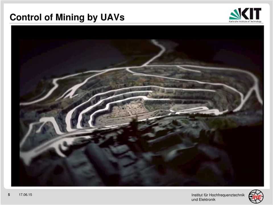
5 Control of Mining by UAVs Institut für Hochfrequenztechnik
6 UAV Traffic Management (UTM) Institut für Hochfrequenztechnik

7 Military Applications of UAVs, Drones... Typical Applications: reconnaissance weapon control weapon carrier Military UAVs are usually equipped with sensors for the detection of surveillance, and often with Electronic CounterMeasure equipment (ECM) Institut für Hochfrequenztechnik
 7")
8 Private Applications of UAVs, Drones... - hobby or recreation - taking photos for personal use - surveillance of private areas - surveillance of public areas - flying at local model aircraft club - use for farming and forest Institut für Hochfrequenztechnik

9 UAV 3D Photography Institut für Hochfrequenztechnik

10 Dangerous Abuse of Drones and UAVs Spionage - private areas - industrial installations - public institutions - governmental institutions - military installations Smuggeling - prisons - borders - industry Terror acts - governmental institutions - critical infrastructure (f.e. atomic) - dense populated areas - people assemblies, events Violation of Privacy Institut für Hochfrequenztechnik

11 Typical News to UAVs and Drones Versand-Drohnen orten Empfänger via Smartphone Wenn Drogen vom Himmel fallen Graffiti-Drohne sprüht über riesiges Calvin Klein-Plakat Japan: Radioaktive Drohne landet auf Regierungsgebäude Spezial-Drohnen saugen Wasser für Umweltanalysen auf Chinesische Drohnenfirma soll zehn Milliarden wert sein Drohne gefährdet Cessna im Landeanflug + cases where drones entered governmental institutions: Washington, Paris and Berlin We realize, in the wrong hands, drones can be dangerous Institut für Hochfrequenztechnik

12 Uncontrolled Photography Private, Public, Military Institut für Hochfrequenztechnik

13 Threat by Ammunition, Chemicals Institut für Hochfrequenztechnik

14 Football Stadium, Threat by Ammunition, Chemicals Allianz Arena Munich Institut für Hochfrequenztechnik

15 Swarm UAVs: Silent Threat Multiplier Institut für Hochfrequenztechnik

16 UAV / Drone Detection, Tracking, Control Institut für Hochfrequenztechnik KIT University of the State of Baden-Wuerttemberg and National Research Center of the Helmholtz Association

17 Detector Systems and Functions Noise of the rotors Audio Detection GPS Detection Radio Frequency Detection Video Detection Thermal Detection Radar Detection Position link Communication link Visibility Increased temperature Scattering and reflection Institut für Hochfrequenztechnik

18 UAV (Drone) Localization Task Detection of UAV presence: is a UAV flying in an endangered area? is a UAV approaching an endangered area? does the UAV carry a dangerous load? How is the UAV controlled: by a radio link? - up-link only? - up-link and down-link? by Laser/optical? autonomous by GPS coding? by mobile phone? Institut für Hochfrequenztechnik

19 Detection of the Drone Communication Link Remote UAV control: Frequency: 2,45 GHz, or arbitrary frequencies? Range: up to several hundred meters Almost spherical radiation Spectrum surveillance Direction Finder Transmitter, receiver location Institut für Hochfrequenztechnik

20 Sensor System for UAV Link Detection Direction Finder 2 Direction Finder 1 Direction Finder 3 Direction finder base station Institut für Hochfrequenztechnik

21 Monitoring Stations for UAV Communication Control Allianz Arena Munich Institut für Hochfrequenztechnik
22 UAV / Drone Detection and Tracking by Radar Institut für Hochfrequenztechnik KIT University of the State of Baden-Wuerttemberg and National Research Center of the Helmholtz Association
23 MIMO Radar Network Concept Each node is a fully functional MIMO radar can estimate 3D+velocity Each node can communicate with each other (OFDM signals) area of observation Self-calibration network positions, synchronization (time & frequency) done via communication/radar To simplify network, all commands come from the Master node Institut für Hochfrequenztechnik
24 True Trajectory of 3 Targets by Radar 3D 2D 24 GHz MIMO Radar Institut für Hochfrequenztechnik
25 UAV / Drone Optical Detection and Tracking Institut für Hochfrequenztechnik KIT University of the State of Baden-Wuerttemberg and National Research Center of the Helmholtz Association
26 UAV / Drone Acoustical Detection and Tracking Institut für Hochfrequenztechnik KIT University of the State of Baden-Wuerttemberg and National Research Center of the Helmholtz Association
27 Commercial Systems for UAV / Drone Detection and Tracking Institut für Hochfrequenztechnik KIT University of the State of Baden-Wuerttemberg and National Research Center of the Helmholtz Association
28 Multi-Sensor Surveillance: Dedrone DroneTracker Multi-Sensor, stand-alone Wireless LAN (-B/-G/-N) Sensor range 100 m Size 420 x420 x 120 mm 3 Data registration Dedrone GmbH Otto-Hahn-Straße 31 D Kassel-Lohfelden T: +49 (0) [email protected] Institut für Hochfrequenztechnik
29 Secure Hemisphere: Dedrone Drone Tracker Institut für Hochfrequenztechnik
30 Secure Hemisphere: Dedrone Drone Tracker Institut für Hochfrequenztechnik
31 Sensor Surveillance: dronehunter No detailed information available - Radar Sensor - range up to 500m - weather independent - alarm - scalable Fink Secure Communication GmbH Simonsgasse 28 D Niederfüllbach [email protected] Institut für Hochfrequenztechnik
32 Comparison of Drone Detector Systems ( ) I Feature Detector Drone Detector Drone Shield (USA) Orelia aka Drone Detector (France) Dedrone (Germany) CellAnt enna (USA) Domestic Drone Countermeasur es (USA) Audio Detection Radio Frequency Detection GPS Detection Video Detection Thermal Detection Radar Detection Institut für Hochfrequenztechnik
33 Comparison of Drone Detector Systems ( ) II Feature Detector Drone Detector Drone Shield (USA) Orelia aka Drone Detector (France) Dedrone (Germany) CellAnt enna (USA) Domestic Drone Countermeasures (USA) Detect Flying Drones Detect Groundbased Drones Detect Waterbased Drones Detection Strength Strong (Multi Layer Weak (Single Layer) Weak (Single Layer) Weak (Double Layer) Medium (Single Layer) Medium (Single Layer) Institut für Hochfrequenztechnik
34 UAV/Drone Risk Reduction Institut für Hochfrequenztechnik KIT University of the State of Baden-Wuerttemberg and National Research Center of the Helmholtz Association
35 Registration of UAVs and Drones The registration of all produced and operated UAVs and Drones in databases is required: manufacturer type specifications owner/user License ID localization Identity All UAVs and Drones have to transmit continuously their identity when flying. All UAV and Drone operators must have a license; they have to certify their qualification to operate a drone. In case of problems for public security all UAVs and Drones must be identifiable via the database Institut für Hochfrequenztechnik
36 Security Measures for UAV/Drone Control Identify the UAV or Drone Determine UAV task: commercial, hobby, terroristic UAV communication link interference GPS interference Take over UAV control Prevent dangerous actions Institut für Hochfrequenztechnik
37 Take over Control Required Information: frequency modulation Code Take over control with excess power Control GPS Spoofing: GPS spoofing takes advantage of the fact that the civilian GPS signals are unencrypted and unauthenticated Take over control with false GPS ( 1000$) Institut für Hochfrequenztechnik
38 Destroy the UAV This is not a good idea, because the threat may become reality. High precision shooting Collision by a controlled UAV Anti-radiation missiles (ARMs) Institut für Hochfrequenztechnik
39 Summary Unmanned Areal Vehicles UAV, Drones Detection, Tracking, Control Institut für Hochfrequenztechnik KIT University of the State of Baden-Wuerttemberg and National Research Center of the Helmholtz Association
40 Scenario Summary UAVs may become a major threat for privat, public and office areas. Prepare a law regulating the Drone registration, use and applications Surveilance and control of endangered areas What to do? Take over UAV/Drone control Track away dangerous UAVs and Drones Institut für Hochfrequenztechnik
Intelligent Surveillance & Security Systems
 Intelligent Surveillance & Security Systems Weapon Station (Optional) - Lethal / Non-lethal weapon - Universal Gun Mount Tracking Module - Low light, High resolution Camera - Illuminator - Laser Range
BMS Digital Microwave Solutions for National Security & Defense
 BMS Digital Microwave Solutions for National Security & Defense Broadcast Microwave Services, Inc. P.O. Box 84630 San Diego, CA 92138 Phone: +1.800.669.9667 Email: [email protected] Web: www.bms-inc.com
Current Challenges in UAS Research Intelligent Navigation and Sense & Avoid
 Current Challenges in UAS Research Intelligent Navigation and Sense & Avoid Joerg Dittrich Institute of Flight Systems Department of Unmanned Aircraft UAS Research at the German Aerospace Center, Braunschweig
The 7 th International Scientific Conference DEFENSE RESOURCES MANAGEMENT IN THE 21st CENTURY Braşov, November 15 th 2012
 The 7 th International Scientific Conference DEFENSE RESOURCES MANAGEMENT IN THE 21st CENTURY Braşov, November 15 th 2012 COMMUNICATION ISSUES OF UAV 1 INTEGRATION INTO NON 1 st. Lt. Gábor Pongrácz, ATM
Drones: All Abuzz with Privacy & Security Issues
 SESSION ID: LAW-R01 Drones: All Abuzz with Privacy & Security Issues Dr. Christopher T. Pierson, J.D. EVP, General Counsel & Chief Security Officer Viewpost James T. Shreve, J.D. Attorney BuckleySandler
29.01.2015. Industry and Business Applications. Industry and Business Applications
 Industry and Business Applications ETH Zürich 30 January 2015 Dr. Jürg Wildi Vice President Technology RUAG Aviation 1 Industry and Business Applications Where is the business for the industry? A Swiss
Nighthawk IV UAS. Versatility. User Friendly Design. Capability. Aerial Surveillance Simplified. [email protected] 800.639.6315 www.ara.
 Aerial Surveillance Simplified The Nighthawk IV small unmanned aerial vehicle brings military hardened technology to civil agencies and commercial user groups. Supremely easy to operate and recently certified
Table of Contents 1. INTRODUCTION 2 2. DEFINITION 4 3. UAS CLASSIFICATION 6 4. REGULATORY PRINCIPLES 16 5. INTERACTION WITH AIR TRAFFIC CONTROL 16
 FOREWORD Table of Contents 1. INTRODUCTION 2 2. DEFINITION 4 3. UAS CLASSIFICATION 6 4. REGULATORY PRINCIPLES 16 5. INTERACTION WITH AIR TRAFFIC CONTROL 16 6. SENSE AND AVOID ( required for applicants
Two Novel Technologies Enabling IoT: Mobile Clouds and Visible Light Communications. Centre for Wireless Communications University of Oulu, Finland
 Two Novel Technologies Enabling IoT: Mobile Clouds and Visible Light Communications Marcos Katz Centre for Wireless Communications University of Oulu, Finland Introduction: Internet of Things (IoT) What
SU MEJOR DECISIÓN. We have also involved in the cooperation with our government in R+D fields like NVG, missiles, UAV and Armoring.
 TELSAT was established in 1.987 as a Colombian company. We have 22 years of experience in the field of high technology, research & development, construction of high security systems, telecommunications,
Opening the European Sky to UAS From military to civilian
 Unmanned Systems Opening the European Sky to UAS From military to civilian applications Pablo González Aerodays 2011 /Madrid/31 de March 2011 INTRODUCTION From military to civilian applications Currently,
Unmanned Aircraft Systems (UAS)
") Unmanned Aircraft Systems (UAS) UAS 101 Presented to: Airports Consultant Council Technical Workshop Presented by: Victoria Wei, Deputy Director Airport Planning and Programming Date: July 16, 2015 FAA
Unmanned Aircraft Systems (UAS) UAS 101 Presented to: Airports Consultant Council Technical Workshop Presented by: Victoria Wei, Deputy Director Airport Planning and Programming Date: July 16, 2015 FAA
How To Discuss Unmanned Aircraft System (Uas)
") Unmanned Aerial Systems (UAS) for American Association of Port Authorities Administration and Legal Issues Seminar New Orleans, LA April 9, 2015 Briefly about Flight Guardian Our Services: Educating public
Unmanned Aerial Systems (UAS) for American Association of Port Authorities Administration and Legal Issues Seminar New Orleans, LA April 9, 2015 Briefly about Flight Guardian Our Services: Educating public
Drones Jammer. A simple drone Jammer designed to hack unwelcomed civilian drones within your backyard range.
 Drones Jammer A simple drone Jammer designed to hack unwelcomed civilian drones within your backyard range. Designed by: Ahmad Jisrawi [email protected] https://twitter.com/ajisrawi What are Jammers? Commonly
www.thalesgroup.com/watchkeeper WATCHKEEPER X UNMANNED AIRCRAFT SYSTEM (UAS)
") www.thalesgroup.com/watchkeeper WATCHKEEPER X UNMANNED AIRCRAFT SYSTEM (UAS) Certified Foundation Watchkeeper X is built to the same standards as a manned aircraft, and conforms to CAA/MAA standards. It
www.thalesgroup.com/watchkeeper WATCHKEEPER X UNMANNED AIRCRAFT SYSTEM (UAS) Certified Foundation Watchkeeper X is built to the same standards as a manned aircraft, and conforms to CAA/MAA standards. It
AeroVironment, Inc. Unmanned Aircraft Systems Overview Background
 AeroVironment, Inc. Unmanned Aircraft Systems Overview Background AeroVironment is a technology solutions provider with a more than 40-year history of practical innovation in the fields of unmanned aircraft
DRONE DETECTION RADAR
 DRONE DETECTION RADAR MEETING TODAY S CHALLENGES Drones are increasingly becoming wide spread. They ve become affordable, easy to obtain and simple to fly. This creates new opportunities, but also poses
Growth through partnerships and licensing technologies
 Growth through partnerships and licensing technologies Standards support Innovation Jens N. Albers, CEO AIM-D board member International Conference on Standardization and Innovation @ CERN, Geneva Overview
GPS Use in U.S. Critical Infrastructure. and Emergency Communications. Presented to the
 GPS Use in U.S. Critical Infrastructure and Emergency Communications Presented to the DOT, DoD, and DHS United States Technical Training Institute (USTTI) Presenter Monty Graham Program Manager GPS Jamming
Position Descriptions. Aerospace
 Position Descriptions Aerospace Aerospace Engineering? Aeromechanics / Flight Control / Flight Qualities Engineer Predict, analyze, and verify air vehicle flight dynamics including aircraft aerodynamics,
CHAPTER 1 INTRODUCTION
 CHAPTER 1 INTRODUCTION 1.1 Background of the Research Agile and precise maneuverability of helicopters makes them useful for many critical tasks ranging from rescue and law enforcement task to inspection
UAV Drone Jammer CPB-4030C with remote control Wireless
 UAV Drone Jammer CPB-4030C with remote control Wireless Kit Version extérieure à panneaux sectoriels Applications Especially for large sensitive locations such as military or governmental compounds. It
Distributed Multi-Layer Spectrum Monitoring Systems. Alistair Massarella, CEO 4 th July 2012. CRFS 2012. All rights reserved www.crfs.
 Distributed Multi-Layer Spectrum Monitoring Systems Alistair Massarella, CEO 4 th July 2012 1 Snapshot Entrepreneurial company, based in Cambridge UK, and California Team with track record in wireless
VOICE OVER WI-FI CAPACITY PLANNING
 VOICE OVER WI-FI CAPACITY PLANNING Version 1.0 Copyright 2003 Table of Contents Introduction...3 Wi-Fi RF Technology Options...3 Spectrum Availability and Non-Overlapping Wi-Fi Channels...4 Limited
Security Threats on National Defense ICT based on IoT
 , pp.94-98 http://dx.doi.org/10.14257/astl.205.97.16 Security Threats on National Defense ICT based on IoT Jin-Seok Yang 1, Ho-Jae Lee 1, Min-Woo Park 1 and Jung-ho Eom 2 1 Department of Computer Engineering,
- Monitoring Array: a seismic or infrasound array, including from 1(4) to 20 Remote Elements (RE) and one Central Recording Facility (CRF).
 to 20 Remote Elements (RE) and one Central Recording Facility (CRF).") Page 1 of 30 Page 2 of 30 1. Basic terminology - Monitoring Array: a seismic or infrasound array, including from 1(4) to 20 Remote Elements (RE) and one Central Recording Facility (CRF). - Remote Element:
Page 1 of 30 Page 2 of 30 1. Basic terminology - Monitoring Array: a seismic or infrasound array, including from 1(4) to 20 Remote Elements (RE) and one Central Recording Facility (CRF). - Remote Element:
RAIM for Ship and Rig Management
 RAIM for Ship and Rig Management Maritime Applications Institute of Space Technology and Space Applications University FAF Munich, Germany PhD Student Diana Fontanella [email protected] PhD Student
UAV Road Surface Monitoring and Traffic Information
 UAV Road Surface Monitoring and Traffic Information Czech Road and Motorway Network New capabilities for Unmanned Aerial Systems Current usage (military operation service) Possible civil usage (possible
IAI/Malat Solutions for the Maritime Arena
 IAI/Malat Solutions for the Maritime Arena Any country with a proximity to the sea has an important operational need to positively and unambiguously identify, in time, threats that originate in the maritime
Possible Applications
 FRAUNHOFER Institute for integrated circuits iis DECT Wireless Voice and Data Communications DECT stands for Digital Enhanced Cordless Telecommunication and is an accepted standard in more than 100 countries.
CORPORATE PRESENTATION December 2015
 CORPORATE PRESENTATION December 2015 FORWARD LOOKING STATEMENT Certain information and statements in this presentation constitute forward-looking statements. Words such as forecast, project, intend, expect,
Design Specifications of an UAV for Environmental Monitoring, Safety, Video Surveillance, and Urban Security
 Design Specifications of an UAV for Environmental Monitoring, Safety, Video Surveillance, and Urban Security A. Alessandri, P. Bagnerini, M. Gaggero, M. Ghio, R. Martinelli University of Genoa - Faculty
RPAS for homeland security applications. Jean CARON Mission Air Systems Lima April 2012
 RPAS for homeland security applications Jean CARON Mission Air Systems Lima April 2012 Agenda RPAS, what is it? Homeland security, what is it? RPAS for Homeland security RPAS Industry capabilities and
About Me" List of Lectures" In This Course" Mobile and Sensor Systems. Lecture 1: Introduction to Wireless Systems" " Dr. Cecilia Mascolo" "
 About Me Reader in Mobile Systems NetOS Research Group Research on Mobile, Social and Sensor Systems More specifically, Human Mobility and Social Network modelling Opportunistic Mobile Networks Mobile
MP2128 3X MicroPilot's. Triple Redundant UAV Autopilot
 MP2128 3X MicroPilot's Triple Redundant UAV Autopilot Triple redundancy (3X) gives autopilot technology the reliability necessary to safely carry out sensitive flight missions and transport valuable payloads.
Keeping a close eye on monitoring stations with R&S ARGUS SIS
 Keeping a close eye on monitoring stations with R&S ARGUS SIS Are all unattended s working properly? This is a source of constant concern for anyone responsible for monitoring networks. The new status
COMMUNICATIONS AND MULTIMEDIA ACT 1998 NOTIFICATION OF ISSUANCE OF CLASS ASSIGNMENTS
 COMMUNICATIONS AND MULTIMEDIA ACT 1998 NOTIFICATION OF ISSUANCE OF CLASS ASSIGNMENTS IN exercise of the powers conferred by section 169 of the Communications and Multimedia Act 1998 [Act 588], the Commission
INTRODUCTION TO COMMUNICATION SYSTEMS AND TRANSMISSION MEDIA
 COMM.ENG INTRODUCTION TO COMMUNICATION SYSTEMS AND TRANSMISSION MEDIA 9/6/2014 LECTURES 1 Objectives To give a background on Communication system components and channels (media) A distinction between analogue
KILN GROUP AVIATION DIVISION UAS INSURANCE PROPOSAL FORM GLOSSARY
 GLOSSARY ATC Air Traffic Control CAA Civil Aviation Authority Comms Abv. Communications GCS Ground Control Station. Including launch system, flight control and mission specific hardware & software, communications
SWISS SECURITAS ASIA PTE LTD
 SWISS SECURITAS ASIA PTE LTD BUSINESS ACTIVITIES SECURITY TECHNOLOGY AND CONSULTANCY September 2013 81 Ubi Avenue 4 #05-08 UB. One Singapore 408830 Tel: (65) 6444 5381 Fax: (65) 6444 1465 Web: www.securitas.sg
Using Tactical Unmanned Aerial Systems to Monitor and Map Wildfires
 Using Tactical Unmanned Aerial Systems to Monitor and Map Wildfires Michael Tranchitella, Stephen Fujikawa, Tzer Leei Ng, David Yoel, Don Tatum IntelliTech Microsystems, Inc. Bowie, Maryland Philippe Roy,
ESNC Kick-off 2015 David Argiles [email protected] 1
 ESNC Kick-off 2015 David Argiles [email protected] 1 as of 2014 ESNC COMPETITION The European Satellite Navigation Competition is an international contest that annually awards the best services,
BUSINESS JET SECURITY SYSTEM
 BUSINESS JET SECURITY SYSTEM WHAT HAPPENS IF...? A business jet can be subject to a variety of risks, usually when it is parked, often at minor airfields where security can be rudimentary. These risks,
COMMUNICATIONS AND MULTIMEDIA ACT 1998 CLASS ASSIGNMENTS NO. 1 OF 2015
 COMMUNICATIONS AND MULTIMEDIA ACT 1998 CLASS ASSIGNMENTS NO. 1 OF 2015 IN exercise of the powers conferred by section 169 of the Communications and Multimedia Act 1998 [Act 588], the Commission issues
HOUSE ENROLLED ACT No. 1009
 Second Regular Session 118th General Assembly (2014) PRINTING CODE. Amendments: Whenever an existing statute (or a section of the Indiana Constitution) is being amended, the text of the existing provision
CHAPTER 2 AIR TRAFFIC CONTROLLER (AC) NAVPERS 18068-2F CH-64
 NAVPERS 18068-2F CH-64") CHAPTER 2 AIR TRAFFIC CONTROLLER (AC) NAVPERS 18068-2F CH-64 Updated: October 2015 TABLE OF CONTENTS AIR TRAFFIC CONTROLLER (AC) SCOPE OF RATING GENERAL INFORMATION AIR TRAFFIC CONTROLLER CONTROL TOWER
CHAPTER 2 AIR TRAFFIC CONTROLLER (AC) NAVPERS 18068-2F CH-64 Updated: October 2015 TABLE OF CONTENTS AIR TRAFFIC CONTROLLER (AC) SCOPE OF RATING GENERAL INFORMATION AIR TRAFFIC CONTROLLER CONTROL TOWER
Security for Railways and Metros
 Security for Railways and Metros Security for Railways and Metros Security Management System Railways and Metros worldwide share a set of characteristics that make them very vulnerable to possible attacks,
Attenuation (amplitude of the wave loses strength thereby the signal power) Refraction Reflection Shadowing Scattering Diffraction
 Refraction Reflection Shadowing Scattering Diffraction") Wireless Physical Layer Q1. Is it possible to transmit a digital signal, e.g., coded as square wave as used inside a computer, using radio transmission without any loss? Why? It is not possible to transmit
Wireless Physical Layer Q1. Is it possible to transmit a digital signal, e.g., coded as square wave as used inside a computer, using radio transmission without any loss? Why? It is not possible to transmit
HUAWEI Enterprise AP Series 802.11ac Brochure
 Enterprise AP Series 802.11ac Brochure 01 Enterprise AP Series 802.11ac Brochure 1 Overview Release of 802.11ac standards has driven wireless technologies to the era of GE Wi-Fi. Enterprise Wi-Fi networks
LAWAREC. Laser Warning Receiver
 METRODAT, s.r.o. Beblavého 8 SK-811 01 Bratislava Slovak Republic tel.: fax: e-mail: web: +421 905 70 70 71 +421 2 544 11 448 [email protected] www.metrodat.eu LAWAREC The LAWAREC (LAser WArning RECeiver)
Emerging Threats and Challenges for Homeland Air Security
 Emerging Threats and Challenges for Homeland Air Security Presentation to National Defense Industrial Association (NDIA) Missile Defense RADM Mike Mathis, Lt. Col., Carey Briefer Director, Joint Air and
Monitoring of Natural Hazards With the ImpactSentinel Alarming System An Intelligent Solution
 Monitoring of Natural Hazards With the ImpactSentinel Alarming System An Intelligent Solution ImpactSentinel Natural Hazard Sensors und Systems hazard signalization in protection fences overstress, shock
Critical Asset Protection Oil and Gas Protection
 Critical Asset Protection Oil and Gas Protection Our Oil & Gas Protection project in the Middle-East features Wisdom Command and Control (C2) system that uses unique correlation algorithms to integrate
Demystifying Wireless for Real-World Measurement Applications
 Proceedings of the IMAC-XXVIII February 1 4, 2010, Jacksonville, Florida USA 2010 Society for Experimental Mechanics Inc. Demystifying Wireless for Real-World Measurement Applications Kurt Veggeberg, Business,
Physical Security Simulation and Analysis Tools A presentation for the Canada & United States Security Simulation Technologies Group
 SAND 2014-3718P Physical Security Simulation and Analysis Tools A presentation for the Canada & United States Security Simulation Technologies Group Unclassified Unlimited Information For Public Dissemination
Use of RPAS/Drones in Norway
 Use of RPAS/Drones in Norway Publisert: 23 mai 2016 13:05 CEST Oppdatert: 08 jun 2016 09:56 CEST Send på epost About Drones Drones Use of drones, or RPAS (Remotely piloted aircraft system) is regulated
UAV Export Controls. Introduction. UAV manufacturers save time and money with a better understanding of export controls.
 UAV Export Controls UAV manufacturers save time and money with a better understanding of export controls Introduction By Howard Loewen If you are involved in Unmanned Aerial Vehicles (UAVs) then it is
GENERAL INFORMATION ON GNSS AUGMENTATION SYSTEMS
 GENERAL INFORMATION ON GNSS AUGMENTATION SYSTEMS 1. INTRODUCTION Navigation technologies with precision approach and landing systems, for civilian and military purposes, enable aircrafts to perform their
Bi-Directional DGPS for Range Safety Applications
 Bi-Directional DGPS for Range Safety Applications Ranjeet Shetty 234-A, Avionics Engineering Center, Russ College of Engineering and Technology, Ohio University Advisor: Dr. Chris Bartone Outline Background
Licensed 700 MHz Spectrum for UAS and Critical Infrastructure. Access Spectrum, LLC Q3 2015
 Licensed 700 MHz Spectrum for UAS and Critical Infrastructure Access Spectrum, LLC Q3 2015 Overview Business opportunities for licensed spectrum Commercial Unmanned Vehicle Systems Command (Land, Sea,
Security Info Day, FP7-SEC-2011-1, 9 September 2010
 MILITARY UNIVERSITY OF TECHNOLOGY WARSAW, POLAND Jerzy Malachowski, Krzysztof Damaziak Military University of Technology, Department of Mechanics and Applied Computer Science 2 Gen. Sylwestra Kaliskiego
RE: Notice of Proposed Rulemaking, Request for Comments: Operation and Certification of Small Unmanned Aircraft Systems [Docket No.
 April 24, 2015 Docket Management Facility (M-30) U. S. Department of Transportation West Building Ground Floor Room W12-140 1200 New Jersey Ave. Washington, DC 20590-0001 RE: Notice of Proposed Rulemaking,
KZO Tactical UAV System Overview
 KZO Tactical UAV System Overview KZO TUAV / FTS / 08.02.2006 / Chart 1 Content System Elements Air Vehicle Ground Control Station Data Link Vehicle Launch Vehicle Refurbishing Vehicle Technical Summary
Surveillance and Security Systems
 Surveillance and Security Systems Surveillance & Security Systems Surveillance Company Overview and Security Systems Company Overview Company Overview Ultra Electronics Surveillance and Security Systems
UAS Insurance - a business necessity. Unmanned Aircraft Systems Typical risks and insurance issues for commercial activities.
 UAS Insurance - a business necessity Unmanned Aircraft Systems Typical risks and insurance issues for commercial activities Adam Piper ACII September 2012 Agenda Introductions Current commercial activities
COJUMA s. Legal Considerations for Defense Support to Civil Authorities. U.S. Southern Command Miami, Florida Draft
 COJUMA s Legal Considerations for Defense Support to Civil Authorities U.S. Southern Command 28 Miami, Florida Miami, Florida Draft Table of Contents Legal Considerations for Defense Support to Civil Authorities.....10
PRT_INCIDENT DETECTION_TRAFFIC
 PRT_INCIDENT DETECTION_TRAFFIC TABLE OF CONTENTS 1. Company Profile... 3 1.1 THE ENTERPRISE... 3 1.2 The perfect solution with the right partner... 4 1.3 OUR PHILOSOPHY... 4 1.4 OUR OBJECTIVE... 4 2. Know
Development of Automatic shooting and telemetry system for UAV photogrammetry INTRODUCTION
 Development of Automatic shooting and telemetry system for UAV photogrammetry Jinwoo PARK 1, Minseok KIM 1, Khin Mar Yee 1, Chuluong CHOI 1 1 Department of Spatial Information Engineering, Pukyong National
Cooperative Techniques in LTE- Advanced Networks. Md Shamsul Alam
 Cooperative Techniques in LTE- Advanced Networks Md Shamsul Alam Person-to-person communications Rich voice Video telephony, video conferencing SMS/MMS Content delivery Mobile TV High quality video streaming
UAV Data Links Present and Future. Broadband Satellite Terminal (BST)
") UAV Data Links Present and Future Broadband Satellite Terminal (BST) Outline of the presentation Speaker: Barry RP Jackson COO Cahon Systems Inc. Outline: First Where we are today. Second Where are we
UAV Data Links Present and Future Broadband Satellite Terminal (BST) Outline of the presentation Speaker: Barry RP Jackson COO Cahon Systems Inc. Outline: First Where we are today. Second Where are we
UAVNet: Prototype of a Highly Adaptive and Mobile Wireless Mesh Network using Unmanned Aerial Vehicles (UAVs) Simon Morgenthaler University of Bern
 Simon Morgenthaler University of Bern") UAVNet: Prototype of a Highly Adaptive and Mobile Wireless Mesh Network using Unmanned Aerial Vehicles (UAVs) Simon Morgenthaler University of Bern Dez 19, 2011 Outline Introduction Related Work Mikrokopter
UAVNet: Prototype of a Highly Adaptive and Mobile Wireless Mesh Network using Unmanned Aerial Vehicles (UAVs) Simon Morgenthaler University of Bern Dez 19, 2011 Outline Introduction Related Work Mikrokopter
Unmanned Aerial Vehicles in the Hungarian Defence Forces
 Unmanned Aerial Vehicles in the Hungarian Defence Forces László Kovács, László Ványa [email protected]; [email protected] Abstract: The history of research and development of unmanned aerial vehicles
Sensor Integration in the Security Domain
 Sensor Integration in the Security Domain Bastian Köhler, Felix Opitz, Kaeye Dästner, Guy Kouemou Defence & Communications Systems Defence Electronics Integrated Systems / Air Dominance & Sensor Data Fusion
Prepared for tomorrow s challenges with your global full service partner
 Prepared for tomorrow s challenges with your global full service partner The changing nature of conflicts RUAG Defence: independent, flexible, solution-oriented RUAG Defence stands for top-level technological
The future of range instrumentation.
 ROCKWELL COLLINS Common Range Integrated Instrumentation System (CRIIS) The future of range instrumentation. A proven solution for accurately testing next-generation weapon systems. The speed and accuracy
SpaceLoft XL Sub-Orbital Launch Vehicle
 SpaceLoft XL Sub-Orbital Launch Vehicle The SpaceLoft XL is UP Aerospace s workhorse space launch vehicle -- ideal for significant-size payloads and multiple, simultaneous-customer operations. SpaceLoft
How To Set Up A Wide Area Surveillance System
 Introduction The purpose of this white paper is to examine the benefits and limitations of shore based marine radar for waterside security applications. This technology has been deployed for over 60 years
Why WireFree: Wireless Gas Detection System Basics and Benefits
 Why WireFree: Wireless Gas Detection System Basics and Benefits Anyone who needs gas detection can benefit from using a wireless system. Whether you re just being introduced to the gas detection market,
Interference in LTE Small Cells:
 Interference in LTE Small Cells: Status, Solutions, Perspectives. Forum on small cells, 2012, December. IEEE Globecom 2012 Presenter: Dr Guillaume de la Roche Mindspeed France 1 Mindspeed: Short history
Integration Services
 Integration Services EXPERIENCED TEAM ADVANCED TECHNOLOGY PROVEN SOLUTIONS Integrations for large scale metrology applications Metris metrology to streamline your CAPABILITIES Advanced systems design Engineering
RECOMMENDATION ITU-R M.1453-1 * Transport information and control systems Dedicated short range communications at 5.8 GHz
 Rec. ITU-R M.1453-1 1 RECOMMENDATION ITU-R M.1453-1 * Transport and control systems Dedicated short range communications at 5.8 GHz (Question ITU-R 205/8) (2000-2002) The ITU Radiocommunication Assembly,
ATCoach Radar Training Simulator
 The ATCoach Radar Simulation product provides a complete turnkey solution for standalone En Route and Terminal simulation applications. The ATCoach Radar Training product is in use today for a variety
Cat Detect. for Surface Mining Applications
 Cat Detect for Surface Mining Applications Enhance Your Site s Safety through Increased Operator Awareness Configurable to suit your operation s needs, Cat MineStar System is the industry s broadest suite
Current and Future Trends in Hybrid Cellular and Sensor Networks
 2010-10-19 Current and Future Trends in Hybrid Cellular and Sensor Networks Yongjun Liu, Bin Zhen, Yong Xu, Hui Yang, Betty Zhao [email protected] www.huawei.com ETSI TC M2M Workshop 19-20 October
COMBATSS-21 Scalable combat management system for the world s navies
 COMBATSS-21 Scalable combat management system for the world s navies The COMBATSS-21 total ship combat management system was designed to deliver capability rapidly and affordably. Built on an open architecture,
www.export.gov.il ISRAEL HomeLand Security Industry
 www.export.gov.il ISRAEL HomeLand Security Industry Homeland Security Protecting Our Way of Life Responding to the domestic, cross-border, and international terror threats that have emerged in the years
ARIES SAAS HELICOPTER CONTROL AND APPROACH RADAR
 SECURITY AND DEFENSE ARIES SAAS HELICOPTER CONTROL AND APPROACH RADAR Defense and security in five continents indracompany.com ARIES-SAAS ARIES SAAS HELICOPTER CONTROL AND APPROACH RADAR ARIES-SAAS radar
Engineers from Geodetics select KVH for versatile high-performance inertial sensors. White Paper. kvh.com
 White Paper Overcoming GNSS Vulnerability by Applying Inertial Data Integration in Multi-Sensor Systems for High Accuracy Navigation, Pointing, and Timing Solutions Engineers from Geodetics select KVH
Coordinated Operation Capability Using Scalable C2
 Coordinated Operation Capability Using Scalable C2 Authors: Hüseyin KUTLUCA, İbrahim AKSU, Arda ÜNAL MilSOFT Yazılım Teknolojileri A.Ş. Teknokent, 06800 ODTU Ankara / TURKEY [email protected] [email protected]
Mathematical Competitive Game 2015-2016. False Alarms in a Sensor Network
 Société de Calcul Mathématique SA Tools for decision help Fédération Française des Jeux Mathématiques Mathematical Competitive Game 2015-2016 False Alarms in a Sensor Network Fédération Française des Jeux
-Toolset. Simplifying Complex Information WE LOOK
 -Toolset Simplifying Complex Information WE LOOK DEEPER Data is collected today from an ever increasing number of sources ranging from simple video cameras From mounted wind farm on everything to pipe