Elevations Certificates: Update 2009 Presented by Wendy Lathrop, PLS, CFM
|
|
|
- Stephany Peters
- 10 years ago
- Views:
Transcription
1 Elevations Certificates: Update 2009 Presented by Wendy Lathrop, PLS, CFM The objectives of the National Flood Insurance Program (NFIP): Reduce the exposure to flood damages through the use of minimum standards for the placement and design of structures located in flood hazard areas. Background: In establishing the NFIP, Congress was concerned about fair allocation of the expenses of the NFIP between those who would be covered by flood insurance and the general public. Those who already lived in the floodplain had to be able to afford premiums, and so these were subsidized. But once the flood risk was identified, insurance had to be linked to floodplain management for new construction that would be charged full actuarial rates. Important Concepts: Existing Construction ( Pre-FIRM ) New Construction ( Post-FIRM ) Substantially Improved Construction ( Post-FIRM ) (FIRM = Flood Insurance Rate Map) NFIP purposes: Identify and map flood hazard areas Provide a framework for floodplain management regulations Make flood insurance available in communities participating in the NFIP NFIP zones 44 CFR 59.1 for definitions, 44 CFR 64.3 for symbols Zone A ( approximate A, unnumbered A ) Zone A1 through A30, Zone AE Zone AO, Zone AH Zone A99, Zone AR Zone B, Shaded Zone X Zone C, Unshaded Zone X Zone V Zone V1 through V30, Zone VE Zone VO Zone D Various Uses of the Elevation Certificate Rating insurance (the I in NFIP) Community compliance with NFIP (land development, permit processes, floodplain management)

2 Community records of Lowest Floor Elevations (44 CFR 60.39b)(5)) in Zone A and Lowest Horizontal Structural Member (44 CFR 60.3(e)(2)) in Zone V Community Rating System requires use of Elevation Certificate for such record keeping Applications for Letters of Map Change (LOMC) Terminology/Acronyms LAG = Lowest adjacent grade HAG = Highest adjacent grade LFE = Lowest floor elevation Addition = increases the square footage of a structure (lateral and/or vertical) Extension = construction not within the footprint of a building FEMA Floodplain Management Bulletin, Elevation Certificates or Section A: Property Information Who owns it? Where is it? What kind of building? Where includes address, general description, latitude and longitude Kind of building includes type of use, reference to Building Diagrams, square feet and flood opening data Changes in Section A Instructions for photographs New and revised building diagrams Instructions for flood openings Copy of Engineered Flood Opening Certifications or Evaluation Report References: Technical Bulletins ( Openings in Foundation Walls (FIA-TB-1) 3-93 Non-Residential Floodproofing -- Requirements and Certification -- (FIA-TB-3) 5-93 Free-of-Obstruction Requirements (FIA-TB-5) 6-93 Below-Grade Parking Requirements -- (FIA-TB-6) 7-93 Wet Floodproofing Requirements (FIA-TB-7) Crawlspace Construction for Buildings Located in Special Flood Hazard Areas (FIA-TB-11) Section A Discussion: No changes in Items A1-A4. Item A4. Note that building use is not certified by the surveyor, and no liability results from misidentification.

3 Item A5. Latitude and longitude may be obtained in a variety of ways. Document it and provide the datum. Note that the form adds a new check box in the Comments (Section D) to identify if this information came from the surveyor as opposed to being from anyone else. Item A6. Photographs are required when use of form is for insurance rating purposes. This can be included in or excluded from the contract to complete the Elevation Certificate. New instructions are to show the foundation and show the entire face of the building if possible. This may require additional photographs. The intent is both to verify Building Diagram and presence of flood openings. Also new: Include a close-up of a representative flood opening in the foundation. Minimum size of photographs is 3 by 3, and digital images are acceptable. Item A7. Building diagrams for three basic structure types: built on slab, below grade, elevated. New diagrams have been added. : Diagram 1(slab on grade) has now been expanded into variations. 1A is the old Diagram 1, ordinary slab on grade 1B is a raised slab on grade or slab on stem wall with fill. The bottom floor is at or above adjacent grade on at least one side. Diagram 2 is a building with the bottom floor below grade on all four sides as a basement. Diagram 3 is a split level building that is slab on grade (a combination of 1A and 1C) Diagram 4 is a split level NOT slab on grade, with the bottom floor of one portion below grade on all four sides (a combination of 1A and 2) Diagram 5 is elevated without obstructions below the elevated floor. Diagram 6 is elevated with either full or partial enclosure below the elevated portion. In A zones the enclosure is with or without openings (meaning, whether compliant or not). In V zones regulations require that for lowest insurance rating, the enclosure is to be less than 300 square feet and used solely for access, parking, or storage. Diagram 7 is elevated on a full story foundation with either partial or full enclosure below the elevated floor. Walkouts fall into this category. Diagram 8 is elevated on a crawl space for which the floor is at grade on at least one side, but not all sides. The distinction between a crawl space and a basement is identified in Technical Bulletin 11-01, Crawlspace Construction for Buildings Located in Special Flood Hazard Areas. A basement is sub grade on all four sides, and a crawl space may also be. However, the crawl space height is limited to four feet and crawl space depth below adjacent grade is limited to two feet. Diagram 9 is elevated on a sub grade crawl space, below grade on all sides. If the area does not qualify as a crawlspace, use Diagram 2. See Technical Bulletin 11-01

4 Items A8 and A9: crawl spaces, enclosures, and attached garages. Enclosure indicates an area with solid perimeter walls. Within a building footprint there may be multiple enclosures, being separate walled areas that water cannot flow between, and by regulation, each should be vented separately with the required two within 12 inches of grade or interior floor per enclosure. A permanent flood opening is newly defined in the instructions as a flood vent or other opening that allows the free passage of water automatically in both directions without human interventions. See Technical Bulletins 1-93 ( Openings in Foundation Walls ), 7-93 ( Wet Floodproofing Requirements ). Flood openings may be within a foot of the exterior grade or within a foot of the interior floor, depending upon the type of construction. The instructions now acknowledge this two-fold option, which has always existed but has not always been clear. If interior grade is used then a note is to be added in Comments in Section D. Also new in the instructions: if provided to the surveyor, then attach a copy of the Engineered Flood Openings Certification or the Evaluation Report issued by the International Code Council Evaluation Service (ICC ES). Section B: Flood Insurance Rate Map Information What NFIP community is the site in? What NFIP map does the property appear on? What flood hazards or related risks are identified by the FIRM? Identify the map used and its effective date, as well as any Letters of Map Change associated with it. Identify the Base Flood Elevation (BFE) and its source. Areas beyond the Special Flood Hazard Area will not have a Base Flood Elevation, as Base Flood refers to the 1% annual chance flood (formerly referred to as the 100-year flood). Possible other sources of BFE data: Typical Sources of Base Flood Elevations: FEMA Flood Insurance Study Report FEMA Flood Insurance Rate Map 1% annual-chance Flood Study from other source FEMA Quick-2 software Stream gauge data (highest level reported at gauge) Extrapolation of detailed study upstream using normal depth (appropriate for open channels) However, not every A- or V-type zone has a BFE shown on the map, and these approximate areas are addressed in Section E of the Elevation Certificate.

5 New in the instructions: If the map in effect at the time of the building s construction was other than the current FIRM, and you have the past map information pertaining to the building, provide the information in the Comments area of Section D. This new line will be pertinent in later discussions of grandfathering. Section C: Building Elevation Information (Survey Required) Are the reported building elevations based upon proposed, partially completed, or existing construction? What elevation reference mark (ERM) was used, what datum is it in, and was any conversion performed to fit elevation measurements into a different datum? Before we begin: Distinctions in Lowest Adjacent Grade locations for foundation and attachments or extensions. New in the instructions For C1: Provide information about conversion software identification and the conversion factor. For GPS survey, indicate the benchmark used for the base station, the CORS sites used for an OPUS solution (also attach the OPUS report) or the name of the Real Time Network used. New on the form and in the instructions for C2: The surveyor is now asked to report on the location of machinery and equipment servicing the building measured in line C2e. Location is meant to be general, such as on the floor inside the garage or on a platform attached to an exterior wall, and this information is to be reported in the Comments in Section D. Elevator shafts must be taken into consideration (see Technical Bulletin 4-93, Elevator Installation ) Elevator Installation (FIA-TB-4) Provides guidance on the NFIP regulations concerning the installation of elevators below the Base Flood Elevation in Special Flood Hazard Areas (both A and V zones). Lines C2f and C2g now ask for the LAG and HAG next to building. The reason for this is related to the multiple purposes of the Elevation Certificate, and confusion arising when the purpose is to apply for a Letter of Map Amendment removing the building from the Special Flood Hazard Area. The instructions now state, Enter the elevation of the ground, sidewalk, or patio slab immediately next to the building. They further add: For Zone AO, use natural grade elevation, if available. The instructions reference the necessity of reporting to the nearest tenth of a foot (or tenth of a meter in Puerto Rico) if the form is being used to support a request for LOMA or LOMR-F. To further distinguish the purpose of the form, a new line C2h has been added to the form: Lowest adjacent grade at lowest elevation of deck or stairs, including structural support. The instructions note For Zone AO, use natural grade elevation, if available. The instructions reference the necessity of reporting to the nearest tenth of a foot (or tenth of a meter in Puerto Rico) if the form is being used to support a request for LOMA or LOMR-F.
 was used, what datum is it in, and was any conversion performed to fit elevation measurements into a different datum?")
6 Section D: Surveyor, Engineer, or Architect Certification Who prepared the technical part of this form? Did the surveyor provide the latitude and longitude reported in Section A? Comments from the certifier added to clarify the information in prior sections, or suggested by the instructions. New check box added if latitude and longitude in Section A are provided by the surveyor means that this is the only information from Section A certified by the Surveyor. The instructions now add the word openings to the list of items that can be addressed in this section. Section E: Building Elevation Information (Survey not required) for Zone AO and Zone A (Without BFE) When a BFE is not provided for certain Special Flood Hazard Areas, a survey is not required, and this section can be completed by anyone. It establishes a comparison between the highest adjacent grade to the structure (rather than the lowest adjacent grade as is the case in areas where BFE is provided) and the various floor levels of the structure as well as machinery and/or equipment. For design purposes, but not for Elevation Certificates, the following methods may be used: Contour method (also called point on boundary ) Comparison with topographic map Contour interpolation, plus 1/2 contour interval Water control structure + freeboard (appropriate for ponds) Historical high water marks + appropriate factor of safety Section F: Property Owner (or Owner s Representative) Certification This section is only completed if the property owner has filled in the information for Sections A, B, and E without a surveyor s assistance. This section is only to be used in Zones A and AO where no BFE is provided. No changes have been made to this section. Section G: Community Information (Optional) Local officials legally authorized to do so who have completed the information in Sections A, B, and C or E must sign this section of the form. Additionally, this section is used for local regulatory compliance with the NFIP.

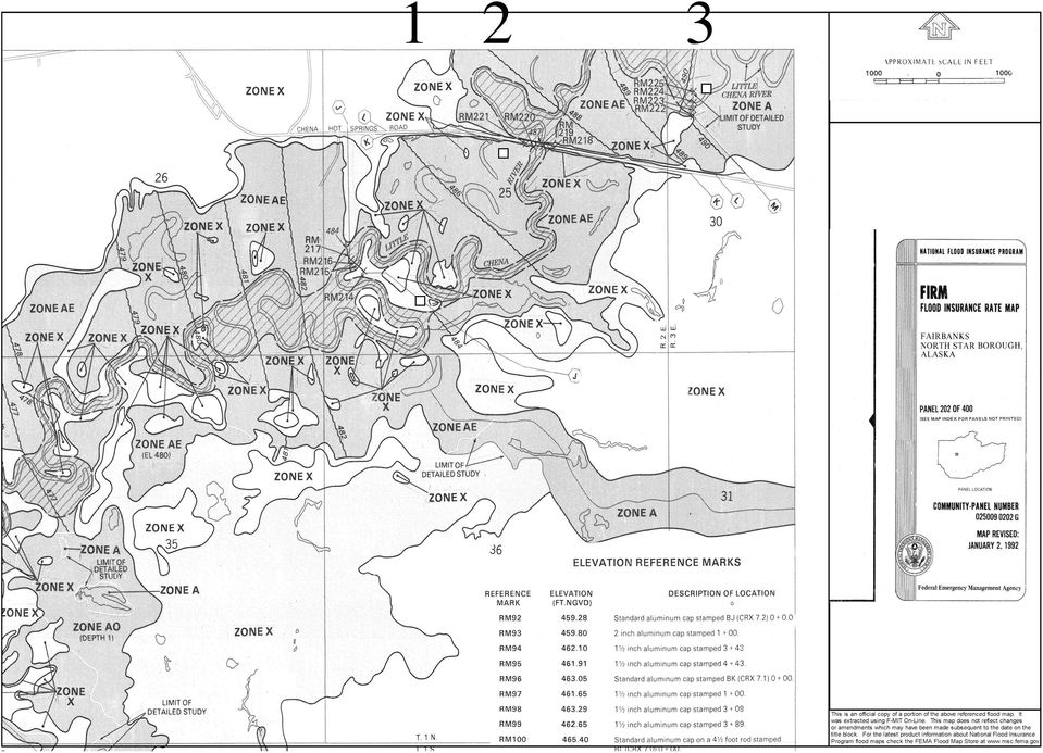
7 A new line has been added to allow communities to identify the design elevation to which they require new construction be elevated. This is not the same as a community provided BFE. Design elevations account for local freeboard (the community-defined safety factor) added on top of the BFE Ensuring that Structures Built on Fill In or Near Special Flood Hazard Areas are Reasonably Safe From Flooding (FIA-TB-10) This technical bulletin discusses building techniques, including the use of fill, that can be used to ensure structures are reasonably safe from flooding. Practice Problem in completing the Elevation Certificate - Block 26. Lot 114, Kinnelon, NJ

8

9 BFE in Approximate A zones Areas that were studied using approximate rather than detailed or limited detail methods do not report a Base Flood Elevation for the areas established as subject to the Special Flood Hazard Area. There are, however, sources for BFE beyond the published maps and accepted means of establishing BFE using other resources Point on the boundary (contour method) Comparison with topographic map Reference: Managing Floodplain Development in Approximate Zone A Areas (FEMA-265) a guide to determining BFE in Approximate Zone A areas. Includes Quick-2 software. Download from the web: Grandfathering Grandfathering : an exemption based on circumstances previously existing. Under the NFIP, buildings located in Emergency Program communities and Pre-FIRM buildings in the Regular Program are eligible for subsidized flood Insurance rates. Post -FIRM buildings in the Regular Program built in compliance with the floodplain management regulations in effect at the start of construction will continue to have favorable rate treatment even though higher base flood elevations or more restrictive, greater risk zone designations result from FIRM revisions. (From definitions section of the insurance agent s manual) Insurance and compliance factors Compare zones and BFEs Owner must provide insurance agent with a copy of FIRM at time of construction OR verification letter from community official Elevation Certificate refers to original map BUT - Use the newer FIRM if it provides a more favorable premium Advisory Base Flood Elevations (ABFE) Major flood events are an opportunity to evaluate the accuracy of the flood risks reported on a map. When the map and /or flood study underestimated the hazard, FEMA may conduct assessments of coastal flood elevations, and issue Advisory Base Flood Elevations to provide State and Local officials with more accurate data and to guide local decisions regarding reconstruction. Issued after a major flood The map and /or flood study underestimated the hazard Reasonably utilize ABFEs to protect reconstruction from the true hazard, not the one shown on the map (don t use ABFE if it shows LESS risk than the current map) Community may add freeboard on top of ABFE Community can protest ABFE Practice Problem in completing the Elevation Certificate - 77 Moores Meadow Road, Vincentown, NJ (Block 2002, Lot 6)
 a guide to determining BFE in Approximate Zone A areas. Includes Quick-2 software. Download from the web: http://www.")
10

11

12

13

14 1 2 3
15

16

17 Other resources: Mad Mod Mgmt. support group What s new in flood hazard mapping New MT EZ and other MT forms Fact sheet on use of digital data

Agenda. Presenter. The Current Form. Adobe Fillable Form. Elevation Certificates FEMA Form 81-31. Elevation Certificates Training 11/14/2013
 NORFMA Floodplain Conference November 14, 2013 Boise, Idaho Agenda Introductions & Housekeeping Overview Basics of FEMA Form 81-31 Building Diagrams Exercise Common Errors Using ECs in Floodplain Development
LOWEST FLOOR GUIDE I. LOWEST FLOOR DETERMINATION. Previous Section Table of Contents
 Previous Section Table of Contents Next Section This section is to be used as a guide for identifying the lowest floor for rating buildings being considered for coverage under the National Flood Insurance
April 2, 2009. Write Your Own (WYO) Company Principal Coordinators and NFIP Servicing Agent
 Company Principal Coordinators and NFIP Servicing Agent") U.S. Department of Homeland Security 500 C Street SW Washington, DC 20472 W-09020 April 2, 2009 MEMORANDUM TO: Write Your Own (WYO) Company Principal Coordinators and NFIP Servicing Agent FROM: SUBJECT:
U.S. Department of Homeland Security 500 C Street SW Washington, DC 20472 W-09020 April 2, 2009 MEMORANDUM TO: Write Your Own (WYO) Company Principal Coordinators and NFIP Servicing Agent FROM: SUBJECT:
LOWEST FLOOR GUIDE I. LOWEST FLOOR DETERMINATION
 Previous Section Main Menu Table of Contents Next Section This section is to be used as a guide for identifying the lowest floor for rating buildings being considered for coverage under the National Flood
FEMA Elevation Certificate
 FEMA Elevation Certificate 2013 MARLS Conference Larry Schock, CFM DNRC Missoula Regional Office (406) 542-5885 [email protected] FEMA Elevation Certificate Presentation Overview National Flood Insurance
National Flood Insurance Program Insurance Agent s Lowest Floor Guide
 National Flood Insurance Program Insurance Agent s Lowest Floor Guide Insurance Agent s Lowest Floor Guide PUTTING IT INTO PERSPECTIVE Sections A and C of the 2009 Elevation Certificate provide fields
LOWEST FLOOR GUIDE I. LOWEST FLOOR DETERMINATION
 LOWEST FLOOR GUIDE This section is to be used as a guide for identifying the lowest floor for rating buildings being considered for coverage under the National Flood Insurance Program (NFIP). I. LOWEST
Elevation Certificate Completion Guide
 Elevation Certificate Completion Guide General Comment: The latest FEMA Elevation Certificate form must be used. The form can be downloaded directly from the FEMA website (FEMA.gov). All information requested
Elevation Certificates. Brad Loar FEMA Region IV
 Elevation Certificates Brad Loar FEMA Region IV What is the purpose of the Elevation Certificate? The Elevation Certificate is an important administrative tool of the National Flood Insurance Program (NFIP).
LOWEST FLOOR GUIDE I. LOWEST FLOOR DETERMINATION
 This section is to be used as a guide for identifying the lowest floor for rating buildings being considered for coverage under the National Flood Insurance Program. I. LOWEST FLOOR DETERMINATION The following
SPECIFIC RATING GUIDELINES
 NATIONAL FLOOD INSURANCE PROGRAM SPECIFIC RATING GUIDELINES April 2015 FEDERAL EMERGENCY MANAGEMENT AGENCY FEDERAL INSURANCE AND MITIGATION ADMINISTRATION RISK INSURANCE DIVISION UNDERWRITING BRANCH This
CITY OF PITTSBURGH Department of City Planning 200 Ross Street, Pittsburgh, PA 15219 412-255-2241 412-255-2561(fax)
") CITY OF PITTSBURGH Department of City Planning 200 Ross Street, Pittsburgh, PA 15219 412-255-2241 412-255-2561(fax) APPLICATION Construction and Development In the Flood Plain Overlay District This is
CITY OF PITTSBURGH Department of City Planning 200 Ross Street, Pittsburgh, PA 15219 412-255-2241 412-255-2561(fax) APPLICATION Construction and Development In the Flood Plain Overlay District This is
PIMA COUNTY REGIONAL FLOOD CONTROL DISTRICT TECHNICAL PROCEDURE
 PIMA COUNTY REGIONAL FLOOD CONTROL DISTRICT TECHNICAL PROCEDURE TECHNICAL PROCEDURE TECH-113 EFFECTIVE DATE: 5/23/2007 REVISED DATE(S): 1/16/2008, 11/30/2009, 2/2/2012, 7/17/2014 PROCEDURE TITLE: Elevation
NFIP LOWEST FLOOR GUIDE ABRIDGED
 NFIP LOWEST FLOOR GUIDE ABRIDGED National Flood Insurance Program SCROLL DOWN 1 NFIP LOWEST FLOOR GUIDE QUICK REFERENCE This is an abridged version of the 2013 Flood Insurance Manual Lowest Floor Guide.
Flood Insurance Rating: Facts and Factors. Jana Green, CFM 2013 NJAFM Annual Conference October 17, 2013 Concurrent Session #3
 Flood Insurance Rating: Facts and Factors Jana Green, CFM 2013 NJAFM Annual Conference October 17, 2013 Concurrent Session #3 Purpose of Presentation THIS PRESENTATION IS INTENDED TO PROVIDE: A clear and
3/23/2015 FEMA NFIP. Session Overview
 FEMA NFIP A g e n t Tr a i n i n g P r o g r a m 1 Session Overview 2 1 Introduction to the Session Session 2 Module 5: Loss Settlement Module 6: Building an NFIP Policy Module 7: Base Flood Elevation
EXISTING STRUCTURES 1) FAIR MARKET VALUE OF STRUCTURE(s) BEFORE IMPROVEMENT: 2) COST OF IMPROVEMENTS:
 FAIR MARKET VALUE OF STRUCTURE(s) BEFORE IMPROVEMENT: 2) COST OF IMPROVEMENTS:") Date Received: Received By: Project/Permit Number: Fee: (To be Completed by MOA) FLOOD HAZARD PERMIT APPLICATION (Please fill out application completely; Indicate NA if necessary. Property information
Date Received: Received By: Project/Permit Number: Fee: (To be Completed by MOA) FLOOD HAZARD PERMIT APPLICATION (Please fill out application completely; Indicate NA if necessary. Property information
MAP TYPES FLOOD HAZARD BOUNDARY MAP MAP READING & FLOOD INSURANCE STUDIES. FHBM Flood Hazard Boundary Map. FIRM Flood Insurance Rate Map
 FLOODPLAIN MANAGEMENT 101 MAP READING & FLOOD INSURANCE STUDIES MAP TYPES FHBM Flood Hazard Boundary Map FIRM Flood Insurance Rate Map FBFM Flood Boundary and Floodway Map DFIRM Digital Flood Insurance
Permit Application No. Development Address. Legal Description. A. Flood Plain and Floodway Information and Sources: (To be completed with Staff)
") FLOOD PLAIN DEVELOPMENT PERMIT APPLICATION of Olathe, Department of Public Works 1385 S. Robinson Drive P.O. Box 768 Olathe, Kansas 66051-0768 (913) 971-9045 FAX (913) 971-9099 Olathe, Kansas, Community
FLOOD PLAIN DEVELOPMENT PERMIT APPLICATION of Olathe, Department of Public Works 1385 S. Robinson Drive P.O. Box 768 Olathe, Kansas 66051-0768 (913) 971-9045 FAX (913) 971-9099 Olathe, Kansas, Community
Openings in Foundation Walls for Buildings Located in Special Flood Hazard Areas
 Openings in Foundation Walls for Buildings Located in Special Flood Hazard Areas in accordance with the National Flood Insurance Program FEDERAL EMERGENCY MANAGEMENT AGENCY FEDERAL INSURANCE ADMINISTRATION
Table of Contents. Comments on the Technical Bulletins should be directed to:
 Openings in Foundation Walls and Walls of Enclosures Below Elevated Buildings in Special Flood Hazard Areas in accordance with the National Flood Insurance Program Technical Bulletin 1 / August 2008 Table
How To Build A Floodproofed Basement
 General Basement Exception Guidelines National Flood Insurance Program (NFIP) floodplain management criteria at 44 CFR 60.6 (c) provide for the granting of exceptions to permit construction of floodproofed
Madison Preliminary Flood Map Open House Community Meeting
 Madison Preliminary Flood Map Open House Community Meeting December 9, 2010 INTRODUCTION Welcome to the Madison County, AL Preliminary Flood Map Open House Meeting The Office of Water Resources (OWR),
CONDOMINIUMS I. METHODS OF INSURING CONDOMINIUMS. Important Notice to Agents/Producers:
 Important Notice to Agents/Producers: CONDOMINIUMS Boards of directors of condominium associations typically are responsible under their by-laws for maintaining all forms of property insurance necessary
CONDOMINIUMS I. METHODS OF INSURING CONDOMINIUMS. Previous Section Table of Contents. Important Notice to Agents/Producers:
 Previous Section Table of Contents Next Section Important Notice to Agents/Producers: CONDOMINIUMS Boards of directors of condominium associations typically are responsible under their by-laws for maintaining
FLOODPLAIN MANAGEMENT IN ILLINOIS
 FLOODPLAIN MANAGEMENT IN ILLINOIS 2001 Illinois Department of Natural Resources Office of Water Resources 524 South Second Street Springfield, IL 62702 (217) 782-3863 http://dnr.state.il.us/waterresources
Summary of Coastal Construction Requirements and Recommendations
 Summary of Coastal Construction Requirements and Recommendations HOME BUILDER S GUIDE TO COASTAL CONSTRUCTION FEMA 499/August 2005 Technical Fact Sheet No. 2 Purpose: To summarize National Flood Insurance
FEMA Updates Flood Plain Information For 2006
 Flood Insurance Rate Map Changes Informational Meeting For Property Owners Entering the Floodplain Durant Center February 23, 2011 Introductions City of Alexandria Transportation and Environmental Services
CHAPTER 3 page 69 LOCAL FLOODPLAIN REGULATIONS AND NFIP STANDARDS
 CHAPTER 3 page 69 LOCAL FLOODPLAIN REGULATIONS AND NFIP STANDARDS LOCAL FLOODPLAIN REGULATIONS AND NFIP STANDARDS, page 69 THE PARTICIPATION OF A COMMUNITY IN THE NFIP IS MADE POSSIBLE BY ITS ADOPTION
DEPARTMENT OF PLANNING AND DEVELOPMENT
 DEPARTMENT OF PLANNING AND DEVELOPMENT FLOODPLAIN DEVELOPMENT PERMIT APPLICATION FOR NON-RESIDENTIAL DEVELOPMENT Property Owner Telephone Street/P.O. Box City State ZIP Agent (if any) Relationship to Property
Introduction to the National Flood Insurance Program: A Guide for Coastal Property Owners
 Introduction to the National Flood Insurance Program: A Guide for Coastal Property Owners Maine Beaches Conference 2015 Sue Baker, CFM State NFIP Coordinator [email protected] 207-287-8063 NFIP Goal:
Teller County, Colorado Floodplain Development Permit Application
 Teller County, Colorado Floodplain Development Permit Application This is an application packet for a Floodplain Development Permit (FDP). Certain sections are to be completed by the Applicant, and certain
OKANOGAN COUNTY OFFICE OF PLANNING AND DEVELOPMENT FLOODPLAIN DEVELOPMENT PERMIT APPLICATION
 OKANOGAN COUNTY OFFICE OF PLANNING AND DEVELOPMENT FLOODPLAIN DEVELOPMENT PERMIT APPLICATION Okanogan County Code, OCC 15.08, Floodplain Management The State of Washington has authorized county governments
PRELIMINARY DIGITAL FLOOD INSURANCE RATE MAPS (DFIRM)
") INTRODUCTION This Mississippi Guidance document has been prepared to explain to community officials how the Preliminary Digital Flood Insurance Rate Maps (DFIRMs) and Preliminary Flood Insurance Study
INTRODUCTION This Mississippi Guidance document has been prepared to explain to community officials how the Preliminary Digital Flood Insurance Rate Maps (DFIRMs) and Preliminary Flood Insurance Study
Producer Name. Producer Street Address. Producer City/State/Zipcode. Producer Phone Number. Producer Number. Insured s Name: Mailing Address:
 Excess Flood Insurance Policy Application Policy Form House Condominium Cooperative Other permanent structure Policy Type New Endorsement Underlying Flood Policy #: Requested Policy Effective Date: 12:01
Changing Flood Maps: A Guide for Homeowners and Consumers
 Changing Flood Maps: A Guide for Homeowners and Consumers The flood maps in your community are being changed. What does this mean to you? Flood maps, also known as Flood Insurance Rate Maps or FIRMs, are
FEMA s FLOOD INSURANCE RATE MAPS
 My Lender is requiring me to purchase Flood Insurance Options for San Diego County Residents in Unincorporated Areas This document is intended to help San Diego County residents who have been contacted
ARTICLE 12 FLOOD DAMAGE PREVENTION
 ARTICLE 12 FLOOD DAMAGE PREVENTION SECTION 12.1 AUTHORIZATION 12.1.1 General The Legislature of the State of North Carolina has in Part 6, Article 21 of Chapter 143; Parts 3 and 4 of Article 18 of Chapter
Floodproof Construction Requirements
 Floodproof Construction Requirements CITY OF FARGO BUILDING INSPECTION DIVISION Updated April 2015 The State of North Dakota requires that you call 1-800-795-0555 at least two business days before you
Elevator Installation for Buildings Located in Special Flood Hazard Areas in accordance with the National Flood Insurance Program
 Elevator Installation for Buildings Located in Special Flood Hazard Areas in accordance with the National Flood Insurance Program FEDERAL EMERGENCY MANAGEMENT AGENCY FEDERAL INSURANCE ADMINISTRATION FIA-TB-4
SECTION 15 FLOODPLAIN MANAGEMENT
 SECTION 15 15.1 Purpose Certain areas of the City of Gardiner, Maine, are subject to periodic flooding, causing serious damages to properties within these areas. Relief is available in the form of flood
FLOOD DAMAGE PREVENTION ORDINANCE
 FLOOD DAMAGE PREVENTION ORDINANCE SECTION 1.0 STATUTORY AUTHORIZATION, FINDINGS FO FACT, PURPOSE, AND OBJECTIVES 1.1 STATUTORY AUTHORIZATION The Legislature of the State of Washington has in RCW delegated
Flood Insurance for Risk Managers
 Flood Insurance for Risk Managers Basics of the National Flood Insurance Program August 20, 2012 Susan W. Wilson DHS/FEMA Region IV NFIP Created by National Flood Insurance Act of 1968 THIS Adopt a local
Understanding the National Flood Insurance Program (NFIP)in Georgia Jeff Brady September 10, 2015 2:45 PM 4:15 PM
in Georgia Jeff Brady September 10, 2015 2:45 PM 4:15 PM") Education Session H Understanding the National Flood Insurance Program (NFIP)in Georgia Jeff Brady September 10, 2015 2:45 PM 4:15 PM GREC Course Code # 66076 / 66077 / 66078 You must attend two 1½-hour
Education Session H Understanding the National Flood Insurance Program (NFIP)in Georgia Jeff Brady September 10, 2015 2:45 PM 4:15 PM GREC Course Code # 66076 / 66077 / 66078 You must attend two 1½-hour
Local Administrator s Handbook for Floodplain Management
 APPENDIX E Excerpts from unpublished Local Administrator s Handbook for Floodplain Management North Carolina Division of Emergency Management Introduction...2 Agreement between Communities and the NFIP...3
How to Read a Flood Insurance Rate Map Tutorial. Developed September 2000 Updated June 2003
 How to Read a Flood Insurance Rate Map Tutorial Developed September 2000 Updated June 2003 Learning Objectives: The Objectives of the tutorial are: 1. To show the various types of flood maps, 2. To describe
Control filling, grading, dredging, and other development which may increase erosion or flood damage; and
 ARTICLE 16. FLOOD DAMAGE PREVENTION Section 16-1: Findings of Fact The flood hazard areas of the Town of Lillington are subject to periodic inundation which results in loss of life and property, health
Answers to Questions. For Property Owners Remapped Into Higher-Risk Flood Areas
 Answers to Questions For Property Owners Remapped Into Higher-Risk Flood Areas You have just been informed that the structure on your property may have been mapped into a higher risk flood zone, known
1. GENERAL ADVISORY BASE FLOOD ELEVATION (ABFE) QUESTIONS
 QUESTIONS") INTRODUCTION As communities begin to recover from the devastating effects of Hurricane Sandy, it is important to recognize lessons learned and to employ mitigation actions that ensure structures are rebuilt
INTRODUCTION As communities begin to recover from the devastating effects of Hurricane Sandy, it is important to recognize lessons learned and to employ mitigation actions that ensure structures are rebuilt
Elevating Your House. Introduction CHAPTER 5
 CHAPTER 5 Elevating Your House Introduction One of the most common retrofitting methods is elevating a house to a required or desired Flood Protection Elevation (FPE). When a house is properly elevated,
SECTION 19 RESIDENTIAL CONSTRUCTION IN FLOODZONES
 SECTION 19 RESIDENTIAL CONSTRUCTION IN FLOODZONES The purpose of the following information and documents are to clarify procedures used by the Sonoma County Permit & Resource Management Department to enforce
Flood Insurance Premium Increases And Increased Cost of Compliance Eligibility
 Flood Insurance Premium Increases And Increased Cost of Compliance Eligibility January 11, 2015 (This document is updated frequently, so please consult the most recent edition) Margaret Becker Director
REBUILDING BELMAR ABFE FLOOD MAPS &THE REBUILDING PROCESS
 REBUILDING BELMAR ABFE FLOOD MAPS &THE REBUILDING PROCESS REBUILDING BELMAR ABFE Maps Preliminary FIRM Maps Flood Insurance Increased Cost of Compliance (ICC) Elevation of Structures Building Permits Acronyms
July 20, 2015. Subject: 7 th Avenue Creek Project Update & Elevation Certificates
 July 20, 2015 Subject: 7 th Avenue Creek Project Update & Elevation Certificates Below are a few updates regarding the 7 th Avenue Creek Project. As you may recall there are two concurrent and independent
Chapter 1350 FLOOD DAMAGE REDUCTION ORDINANCE
 Chapter 1350 FLOOD DAMAGE REDUCTION ORDINANCE Section 1350.1.0 Flood Damage Reduction Ordinance 1 Section 1350.1.1 Statutory Authorization 1 Section 1350.1.2 Purpose.1 Section 1350.1.3 Applicability...1
Updated Federal Emergency Management Agency Flood Insurance Rate Maps and Zoning Ordinance Update. July 16, 2015 Policy Committee
 Updated Federal Emergency Management Agency Flood Insurance Rate Maps and Zoning Ordinance Update July 16, 2015 Policy Committee FEMA Map Update Costal Analysis and mapping study by FEMA in 2009 Changes
Lincoln County Floodplain Development Permit Application
 Lincoln County Floodplain Development Permit Application Application # FP Use Permit Variance Appeal Date SECTION I: GENERAL PROVISIONS (APPLICANT to read and sign) 1. No work of any kind may start until
North Carolina Floodplain Management
 North Carolina Floodplain Management 2008 Quick Guide Floodplain Management Branch www.nccrimecontrol.org/nfip North Carolina Department of Crime Control and Public Safety Table of Contents 1... About
http://library1.municode.com/default/docview/10251/1/101/103
 Page 1 of 8 ARTICLE II. FLOOD DAMAGE PREVENTION* *Cross references: Buildings and building regulations, ch. 67; floor elevation standards, 67-32; flood damage prevention for utility systems, 67-34; drainage
Ignoring Flood Insurance Equals an E & O Exposure
 Ignoring Flood Insurance Equals an E & O Exposure Picture Courtesy of FEMA Photo Library Quick Reference - National Flood Insurance Program This is intended for overview purposes only. For complete underwriting
ORDINANCE NO. 2013 -
 ORDINANCE NO. 2013 - AN ORDINANCE OF BREVARD COUNTY, FLORIDA AMENDING CHAPTER 62, LAND DEVELOPMENT REGULATIONS SECTION 62-2891, LOT DRAINAGE, AND CHAPTER 22 BUILDINGS AND BUILDING REGULATIONS, SECTION
Town of Chatham Department of Community Development
 Town of Chatham Department of Community Development TOWN ANNEX 261 GEORGE RYDER ROAD 02633 CHATHAM, MA TELEPHONE (508) 945-5168 FAX (508) 945-5163 FEMA FLOOD MAP UPDATE & PROPOSED ZONING BYLAW AMENDMENT
rescue and relief efforts in the aftermath of flooding, (iii) repair of flood damaged public facilities and utilities, and
 repair of flood damaged public facilities and utilities, and") 1. Purpose (1) It is the purpose of this Ordinance to protect human life, health, and property from flood conditions, to preserve the ability of floodplains to carry and discharge a base flood, and to
1. Purpose (1) It is the purpose of this Ordinance to protect human life, health, and property from flood conditions, to preserve the ability of floodplains to carry and discharge a base flood, and to
CFM REVIEW COURSE UNIT 8: SUBSTANTIAL IMPROVEMENT AND SUBSTANTIAL DAMAGE
 CFM REVIEW COURSE UNIT 8: SUBSTANTIAL IMPROVEMENT AND SUBSTANTIAL DAMAGE SUBSTANTIAL IMPROVEMENT & SUBSTANTIAL DAMAGE SUBSTANTIAL IMPROVEMENTS/DAMAGE Substantial Improvement means any reconstruction, rehabilitation,
Quick RefeRence Guide comparison of Select nfip and Building code Requirements for Special flood Hazard Areas
 Quick RefeRence Guide comparison of Select nfip and Building code Requirements for Special flood Hazard Areas This guide illustrates the similarities and highlights the differences between the National
1. Why is Lee County getting new flood hazard maps? 3. What are the benefits of the new flood hazard maps?
 1. Why is Lee County getting new flood hazard maps? Flood hazard maps, also known as Flood Insurance Rate Maps (FIRMs), are important tools in the effort to protect lives and property. They indicate the
Flood Damage Mitigation And Insurance Costs
 Flood Damage Mitigation And Insurance Costs Friday, September 25, 2015 at 7:00 PM Saturday, September 26, 2015 at 10:00 AM This presentation was prepared by the Town of South Bethany using Federal Funds
Permits for Development within Floodplains
 For More Information OKLAHOMA Oklahoma Water Resources Board 3800 N. Classen Boulevard Oklahoma City, OK 73118 (405) 530-8800 www.owrb.ok.gov Bulletin No. 2 FLOODPLAIN MANAGEMENT INFORMATION SERIES Lawton
Administrative Procedures Regarding the Application of Flood Damage Prevention
 Administrative Procedures Regarding the Application of Flood Damage Prevention A floodplain development permit, conforming to the provisions of the Flood Damage Prevention Ordinance ( the Ordinance, shall
Kanawha County Floodplain Regulations Quick Guide & Overview
 Kanawha County Floodplain Regulations Quick Guide & Overview CHUCK GRISHABER, CFM KANAWHA COUNTY FLOOD PLAIN MANAGER Office: 304.357.0570 Mobile: 304-356.0979 Fax: 304.357.0572 [email protected]
Frequently Asked Questions (FAQs) 1. Why is the City of Tucson getting new flood hazard maps? 2. Who is responsible for modernizing the maps?
 1. Why is the City of Tucson getting new flood hazard maps? 2. Who is responsible for modernizing the maps?") Frequently Asked Questions (FAQs) 1. Why is the City of Tucson getting new flood hazard maps? 2. Who is responsible for modernizing the maps? 3. What is a Flood Hazard Map? 4. What are the benefits of
Frequently Asked Questions (FAQs) 1. Why is the City of Tucson getting new flood hazard maps? 2. Who is responsible for modernizing the maps? 3. What is a Flood Hazard Map? 4. What are the benefits of
Site Development Information Worksheet for single family residential development
 Site Development Information Worksheet for single family residential development Project description: Address: Owner Name: Phone No. Date Signature & phone number of Individual who Completed this Worksheet