Web-based GIS Application of the WEPP Model
|
|
|
- Ezra Beasley
- 10 years ago
- Views:
Transcription
1 Web-based GIS Application of the WEPP Model Dennis C. Flanagan Research Agricultural Engineer USDA - Agricultural Research Service National Soil Erosion Research Laboratory West Lafayette, Indiana, USA

2 Outline of Presentation Background Advantages/Disadvantages of Existing WEPP Interfaces WEPP Web-Based GIS Software Example Application Status of new Great Lakes WEPP interface for forested watersheds Summary 2

3 Background WEPP Model (1985-present) Water Erosion Prediction Project Public release of validated hillslope and watershed model (1995) Model Interface Development DOS interface Windows interface GeoWEPP ArcView/ArcGIS extensions Web-browser interfaces 2001-present 3

4 Windows Interface Hillslope Profiles Profile depicted graphically in 2-D or 3-D. Graphic image hot and allows viewing & editing of underlying parameters. Can copy, cut, paste, & delete soil or mgmt. regions. Erosion & deposition rates shown in shades of red & green in center profile layer. 4

5 Windows Interface - Watershed Background image can be used, such as a scanned photo. Project can be scaled to known landmarks on image. Graphic is hot and allows viewing/editing of underlying input parameters. Top view of erosion & deposition in shades of red & green can show trouble areas needing treatment. 5

6 Windows Interfaces Advantages Easy to use, especially for simple field situations. Can access full functionality of WEPP model for hillslope and watershed simulations. Best tool for building unique input sets and populating databases. Disadvantages Takes time to learn and understand all options and procedures. User must fully describe or select the slope, soil, management and climate being used for the unique site. For complex watershed simulations with many elements, can be difficult to represent. 6

7 GeoWEPP Interface Requires ESRI Arcview or ArcGIS and Spatial Analyst software Can access commonly available U.S. databases of USGS 30-m or 10-m resolution DEM data, DRG data, land use data, etc. User can also import and use their own more detailed data. Utilizes TOPAZ Topographic Analysis software (Garbrecht and Martz, 1997), ArcView 3.x or ArcGIS 9.x, Spatial Analyst, custom software for I/O to WEPP simulations, CLIGEN model, and WEPP model. 7

8 GeoWEPP ArcView Flowpath Output 8

9 GeoWEPP Interface Advantages Easy to use for someone already familiar with ArcView / ArcGIS or other GIS software Allows use of either commonly available or user s own elevation data Best tool for an experienced GIS user to apply WEPP to watersheds Disadvantages For novice GIS users, takes time to learn and understand options and procedures User must manage and find data, and use correct projections and data preparations Requires a substantial investment in software (ArcGIS & Spatial Analyst - $4000). 9

10 Web-browser Interfaces Advantages Very easy to access and use, just need a basic computer with an internet connection and Web-browser. No installation or set-up time. All inputs selected from existing databases through picklists, or from simple screen entries. Best tool for running WEPP simulations from existing databases. Makes model and database maintenance and management much simpler single distribution point. Disadvantages Limited in ability to fully describe inputs for a particular site. Cannot (yet) modify existing databases. Can make the model too easy to use (if user just selects default inputs, and does not carefully choose best available option) 10
 modify existing databases.")
11 Existing Web-browser Interfaces for WEPP ARS Basic Hillslope Profile Hillslope Profile with Filter Strip at Bottom Strip Cropping Worksheet Watershed GIS Interface (this presentation) Forest Service Cross Drain WEPP: Road Disturbed WEPP WEPP FuME (Fuel Management) ERMiT (Erosion Risk Management Tool) Others Iowa Daily Erosion Project 11
 ERMiT (Erosion Risk Management Tool) Others Iowa Daily Erosion")
12 ARS WEPP Web Browser Interfaces 12

13 WEPP Web Watershed GIS Interface Client Web Browser (Internet Explorer, Firefox, Chrome, etc.) Server MapServer - Web GIS (Univ. of Minnesota) TOPAZ topographic analysis tool (Garbrecht and Martz, 1997) TopazPrep custom software to prepare DEM inputs for TOPAZ processing, handle output from TOPAZ, and prepare and send maps to MapServer. WeppPrep custom software to take data from TOPAZ runs and create slope inputs for WEPP. Also to prepare all other input files for WEPP. Run WEPP, process output files, and prepare and send soil loss maps to MapServer. CLIGEN generator to create climate inputs for WEPP. WEPP erosion model for flowpath and watershed simulations. 13

14 Client PC User s (Client) Web Browser (Internet Explorer, Firefox, Chrome, etc.) Server Hardware Web Server (Apache 2.0) Mapserver (Web GIS) (1) [HTML, Javascript, Map config. files] TOPAZ Maps TopazPrep (2) extract DEM data, reformat [PHP, C++] TOPAZ (3) channel delineation [FORTRAN] NED, Land use, soils, roads, rivers, layers TOPAZ (3) watershed delineation [FORTRAN] TOPAZ generated data Erosion Maps WeppPrep (4) extract land use, soils, climate, generate WEPP inputs, run model, produce maps [PHP, C++] WEPP (6) [FORTRAN] TerraServer Web Services (Orthophotos, DRGs) remote data CLIGEN (5) [FORTRAN] WEPP generated data 14
![files] TOPAZ Maps TopazPrep (2) extract DEM data, reformat [PHP, C++] TOPAZ (3) channel delineation [FORTRAN] NED, Land use, soils, roads, rivers, layers](/docs-images/54/9633894/images/page_14.jpg "TOPAZ (3) watershed delineation [FORTRAN] TOPAZ generated data Erosion Maps WeppPrep (4) extract land use, soils, climate, generate WEPP inputs, run model,")
15 Representative Hillslopes from a DEM z l WEPP topography determined by averaging flowpaths within a subcatchment to a single representative hillslope. Executes WEPP watershed, includes channel routing Single soil loss, sediment yield, runoff values represent each subcatchment Best suited for predicting off-site water quality 15

16 Flowpaths from a DEM Determined using TOPAZ model Interactions and weighting No Channel Routing Numerous WEPP Runs (One for each flowpath). Soil loss displayed by grid cell Best suited for targeting hillslope erosion mitigation practices 16

17 DATABASE REQUIREMENTS & STATUS Soils 1995 SOILS-5, can associate WEPP soil files to SSURGO IDs or custom soil map ids. US Soils-5 included with WEPP install. Climate CLIGEN stations, included with WEPP install. Can import NOAA 15 minute and daily data using WEPP Windows. Can also use now use PRISM data as part of WEPP GIS climate input. Management base tillage operations from RUSLE1. Forest related datasets. Can associate USGS National Landcover Data or custom land use grid IDs to WEPP managements. Plant Major crops in US. Basic rangeland and forest. Topography WEPP GIS automatically develops slope inputs to WEPP model based on DEM. Other Orthophotos, Digital Raster graphs, other GIS layers used as optional information to locate area of interest. 17

18 WEPP Web-GIS Main Screen 18

19 State Map 19

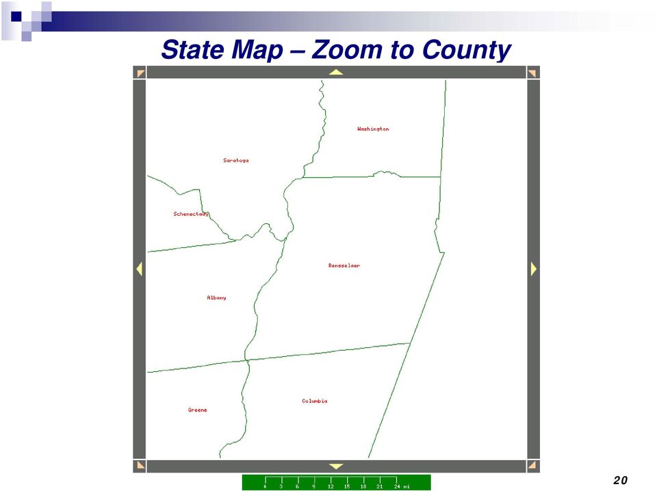
20 State Map Zoom to County 20
21 Zoom into Area of Interest 21
22 Delineate Channel Network 22
23 Delineate Watershed Boundary and Subcatchments 23
24 Setup WEPP Model Simulation & Run 24
25 Spatial Soil Loss Results from Flowpath Method Corn-Soybean Rotation, Fall Moldboard Plow system, T = 4 tonnes/ha 25
26 Subcatchment Sediment Loss Results from Hillslope Method Corn-Soybean Rotation, Fall Moldboard Plow system, T = 4 tonnes/ha 26
27 Results from Flowpath Method with Revised Management Corn-Soybean Rotation, No-till system, T = 4 tonnes/ha 27
28 Results from Hillslope Method with Revised Management Corn-Soybean Rotation, No-till system, T = 4 tonnes/ha 28
29 Text Output Summarizing Simulation Results For Representative Hillslope Profiles (Subcatchments) For Channels in Hillslope Procedure Flowpath Results by Mapped Subcatchments 29
30 Current grant project on Web-based GIS WEPP system for Great Lakes forested watersheds Funding from U.S. Army Corps of Engineers to USDA- Forest Service, RMRS (Bill Elliot, David Hall). Sub-contract to Washington State University (Joan Wu, Shuhui Dun) Sub-contract to USDA-ARS NSERL (Dennis Flanagan, Jim Frankenberger) Project was initiated in late summer 2009 Title of proposal: Developing an Online GIS-Based Tool to Predict Soil Erosion from Forested Watersheds 30
31 Project Objectives 1) to replicate the ARS online site on a public server, to incorporate templates for Great Lakes forest soils, vegetation, and climate 2) to identify an appropriate data set and conduct a model performance assessment in or near the Great Lakes Basin 3) to present the tool at appropriate workshops within the basin in the second year of the proposed project. 31
32 Project Status Server purchased and running at WSU in fall System software installed. Existing ARS modeling software installed. Addition of Great Lakes basin databases is nearly complete (complete by 7/1/2010) FS developing & testing new forest mgmt files FS evaluating WEPP v2010, and determining how to best parameterize the new winter routines for forests where the litter layer and snow cover often limit soil freezing. 32
33 Main View of new Interface 33
34 Land Use Data Layer incorporated 34
35 Work plans By October 2010, have the new forest files incorporated into the interface, then work on testing and debugging. Evaluate other options than MapServer, such as use of Google Earth technology. By June 2011, demonstrate new interface, and begin training May be able to leverage the grant funding to enhance the interface. One of the Forest Service Regions (Montana and N. Idaho) is interested in expanding the coverage of the interface to include their forests. 35
36 Summary WEPP Model is available for prediction of runoff, soil loss, and sediment yield from small watersheds. Existing ARS Web-based WEPP GIS system is available for use (mainly as a prototype), and allows rapid assessment of erosion potential at any location within the United States. Development of slope inputs from DEMs is impartial and may be a more consistent procedure than in-field estimates. Spatial results from flow-path procedure can easily identify areas that may need to be targeted for erosion control treatment or remediation. New Web GIS WEPP interface is targeted towards forested watersheds in the Great Lakes region, and should be available by late
37 Acknowledgements Jim Frankenberger Computer Specialist, USDA-ARS NSERL (all ARS interface design & programming) Tom Cochrane Assistant Professor, University of Canterbury, Christchurch, New Zealand (simulation pre/post processing logic) Bill Elliot Research Engineer, USDA-Forest Service, Rocky Mountain Research Station, Moscow, ID (FS WEPP applications & interfaces) David Hall Computer Programmer, USDA-Forest Service (FS web-based interface programmer) Joan Wu Professor, Biosystems Engineering, Washington State University Shuhui Dun Post-doctoral Research Associate, WSU (main programmer, new Great Lakes WEPP interface) U.S. Army Corps of Engineers Chicago Office (grant funding) 37
38 Questions? 38
DEVELOPMENT OF WEB-BASED GIS INTERFACES FOR APPLICATION OF THE WEPP MODEL
 DEVELOPMENT OF WEB-BASED GIS INTERFACES FOR APPLICATION OF THE WEPP MODEL D.C. Flanagan A, J.R. Frankenberger A, C.S. Renschler B and B.A. Engel C A National Soil Erosion Research Laboratory, USDA-ARS,
WEPP MODEL APPLICATIONS FOR EVALUATIONS OF BEST MANAGEMENT PRACTICES
 WEPP MODEL APPLICATIONS FOR EVALUATIONS OF BEST MANAGEMENT PRACTICES D.C. FLANAGAN 1, W.J. ELLIOT 2, J.R. FRANKENBERGER 3, C. HUANG 4 1 USDA-Agricultural Research Service, National Soil Erosion Research
GEOSPATIAL APPLICATION OF THE WATER EROSION PREDICTION PROJECT (WEPP) MODEL
 MODEL") GEOSPATIAL APPLICATION OF THE WATER EROSION PREDICTION PROJECT (WEPP) MODEL D. C. Flanagan, J. R. Frankenberger, T. A. Cochrane, C. S. Renschler, W. J. Elliot ABSTRACT. At the hillslope profile and/or
GEOSPATIAL APPLICATION OF THE WATER EROSION PREDICTION PROJECT (WEPP) MODEL D. C. Flanagan, J. R. Frankenberger, T. A. Cochrane, C. S. Renschler, W. J. Elliot ABSTRACT. At the hillslope profile and/or
WEPP GIS Support Programs
 WEPP GIS Support Programs This describes how to use the various WEPP GIS programs along with TOPAZ programs to create WEPP input files. Other GIS alternatives to GeoWEPP could be developed using these
WATER EROSION PREDICTION PROJECT (WEPP): DEVELOPMENT HISTORY, MODEL CAPABILITIES,
: DEVELOPMENT HISTORY, MODEL CAPABILITIES,") WATER EROSION PREDICTION PROJECT (WEPP): DEVELOPMENT HISTORY, MODEL CAPABILITIES, AND FUTURE ENHANCEMENTS D. C. Flanagan, J. E. Gilley, T. G. Franti ABSTRACT. The Water Erosion Prediction Project (WEPP)
WATER EROSION PREDICTION PROJECT (WEPP): DEVELOPMENT HISTORY, MODEL CAPABILITIES, AND FUTURE ENHANCEMENTS D. C. Flanagan, J. E. Gilley, T. G. Franti ABSTRACT. The Water Erosion Prediction Project (WEPP)
Create a folder on your network drive called DEM. This is where data for the first part of this lesson will be stored.
 In this lesson you will create a Digital Elevation Model (DEM). A DEM is a gridded array of elevations. In its raw form it is an ASCII, or text, file. First, you will interpolate elevations on a topographic
Impact of water harvesting dam on the Wadi s morphology using digital elevation model Study case: Wadi Al-kanger, Sudan
 Impact of water harvesting dam on the Wadi s morphology using digital elevation model Study case: Wadi Al-kanger, Sudan H. S. M. Hilmi 1, M.Y. Mohamed 2, E. S. Ganawa 3 1 Faculty of agriculture, Alzaiem
REGIONAL SEDIMENT MANAGEMENT: A GIS APPROACH TO SPATIAL DATA ANALYSIS. Lynn Copeland Hardegree, Jennifer M. Wozencraft 1, Rose Dopsovic 2 INTRODUCTION
 REGIONAL SEDIMENT MANAGEMENT: A GIS APPROACH TO SPATIAL DATA ANALYSIS Lynn Copeland Hardegree, Jennifer M. Wozencraft 1, Rose Dopsovic 2 ABSTRACT: Regional sediment management (RSM) requires the capability
Extending Enterprise GIS Into The Field with Mobile GIS Technology
 Extending Enterprise GIS Into The Field with Mobile GIS Technology A White Paper January 10, 2014 1525 Oregon Pike Suite 202 Lancaster, PA 17601-7300 Phone (717) 399-7007 Fax (717) 399-7015 www.geographit.com
Natural Resource-Based Planning*
 Natural Resource-Based Planning* Planning, when done well, is among the most powerful tools available to communities. A solid plan, based on good natural resource information, guides rational land-use
A Method Using ArcMap to Create a Hydrologically conditioned Digital Elevation Model
 A Method Using ArcMap to Create a Hydrologically conditioned Digital Elevation Model High resolution topography derived from LiDAR data is becoming more readily available. This new data source of topography
Tennessee Watershed Modeling Tools. Southern Region Watershed Meeting, July 2005. Forbes Walker University of Tennessee Extension
 Tennessee Watershed Modeling Tools Southern Region Watershed Meeting, July 2005 Forbes Walker University of Tennessee Extension Outline Land Use and Water Quality in Tennessee Watershed models Watershed
Remote Sensing, GPS and GIS Technique to Produce a Bathymetric Map
 Remote Sensing, GPS and GIS Technique to Produce a Bathymetric Map Mark Schnur EES 5053 Remote Sensing Fall 2007 University of Texas at San Antonio, Department of Earth and Environmental Science, San Antonio,
Development of an Impervious-Surface Database for the Little Blackwater River Watershed, Dorchester County, Maryland
 Development of an Impervious-Surface Database for the Little Blackwater River Watershed, Dorchester County, Maryland By Lesley E. Milheim, John W. Jones, and Roger A. Barlow Open-File Report 2007 1308
Introduction to GIS (Basics, Data, Analysis) & Case Studies. 13 th May 2004. Content. What is GIS?
 & Case Studies. 13 th May 2004. Content. What is GIS?") Introduction to GIS (Basics, Data, Analysis) & Case Studies 13 th May 2004 Content Introduction to GIS Data concepts Data input Analysis Applications selected examples What is GIS? Geographic Information
Introduction to GIS (Basics, Data, Analysis) & Case Studies 13 th May 2004 Content Introduction to GIS Data concepts Data input Analysis Applications selected examples What is GIS? Geographic Information
Michigan Tech Research Institute Wetland Mitigation Site Suitability Tool
 Michigan Tech Research Institute Wetland Mitigation Site Suitability Tool Michigan Tech Research Institute s (MTRI) Wetland Mitigation Site Suitability Tool (WMSST) integrates data layers for eight biophysical
Mapping Mashup/Data Integration Development Resources Teaching with Google Earth and Google Ocean Stone Lab August 13, 2010
 Mapping Mashup/Data Integration Development Resources Teaching with Google Earth and Google Ocean Stone Lab August 13, 2010 David Hart GIS Specialist University of Wisconsin Sea Grant Institute Virtual
Understanding Raster Data
 Introduction The following document is intended to provide a basic understanding of raster data. Raster data layers (commonly referred to as grids) are the essential data layers used in all tools developed
GEOENGINE MSc in Geomatics Engineering (Master Thesis) Anamelechi, Falasy Ebere
 Anamelechi, Falasy Ebere") Master s Thesis: ANAMELECHI, FALASY EBERE Analysis of a Raster DEM Creation for a Farm Management Information System based on GNSS and Total Station Coordinates Duration of the Thesis: 6 Months Completion
Master s Thesis: ANAMELECHI, FALASY EBERE Analysis of a Raster DEM Creation for a Farm Management Information System based on GNSS and Total Station Coordinates Duration of the Thesis: 6 Months Completion
Cloud application for water resources modeling. Faculty of Computer Science, University Goce Delcev Shtip, Republic of Macedonia
 Cloud application for water resources modeling Assist. Prof. Dr. Blagoj Delipetrev 1, Assist. Prof. Dr. Marjan Delipetrev 2 1 Faculty of Computer Science, University Goce Delcev Shtip, Republic of Macedonia
Appendix C - Risk Assessment: Technical Details. Appendix C - Risk Assessment: Technical Details
 Appendix C - Risk Assessment: Technical Details Page C1 C1 Surface Water Modelling 1. Introduction 1.1 BACKGROUND URS Scott Wilson has constructed 13 TUFLOW hydraulic models across the London Boroughs
Fort Dodge Stormwater Master Planning. Prepared By: Ralph C. Stark, Jr., P.E., C.F.M. Joel N. Krause, P.E., C.F.M.
 Fort Dodge Stormwater Master Planning Prepared By: Ralph C. Stark, Jr., P.E., C.F.M. Joel N. Krause, P.E., C.F.M. Project Location Project Background Flooding History Localized flooding and storm sewer
Beasley Lake Watershed National Sedimentation Laboratory Water Quality & Ecology Research Unit USDA ARS Oxford, Mississippi
 Beasley Lake Watershed National Sedimentation Laboratory Water Quality & Ecology Research Unit USDA ARS Oxford, Mississippi M. A. Locke, S. S. Knight, C. M. Cooper, S. Smith, Jr., M. T. Moore, F. D. Shields,
 Using the Spatial Database Engine to develop a FEMA friendly Database and Asset Management Tool José Maria Guzmán, PE February 2009 GAFM 4th Annual Technical Conference Columbus, GA Outline Typical Datasets
Figure 1.1 The Sandveld area and the Verlorenvlei Catchment - 2 -
 Figure 1.1 The Sandveld area and the Verlorenvlei Catchment - 2 - Figure 1.2 Homogenous farming areas in the Verlorenvlei catchment - 3 - - 18 - CHAPTER 3: METHODS 3.1. STUDY AREA The study area, namely
INTRODUCTION TO ARCGIS SOFTWARE
 INTRODUCTION TO ARCGIS SOFTWARE I. History of Software Development a. Developer ESRI - Environmental Systems Research Institute, Inc., in 1969 as a privately held consulting firm that specialized in landuse
SCIENCE-BASED GIS SOLUTIONS. www.earthanalytic.com
 SCIENCE-BASED GIS SOLUTIONS www.earthanalytic.com Pipeline Routing, Site Selection, Cost Estimation and Risk Management Tools for Energy SmartFootprint is an extension to ArcGIS designed to assist planning,
ROSE CREEK WATERSHED HYDROLOGIC, HYDRAULIC, SEDIMENT TRANSPORT, AND GEOMORPHIC ANALYSES TASK 1 EXISTING DATA AND INFORMATION SUMMARY REPORT BACKGROUND
 ROSE CREEK WATERSHED HYDROLOGIC, HYDRAULIC, SEDIMENT TRANSPORT, AND GEOMORPHIC ANALYSES TASK 1 EXISTING DATA AND INFORMATION SUMMARY REPORT BACKGROUND The Rose Creek Watershed (RCW) consists of three planning
Introduction to Imagery and Raster Data in ArcGIS
 Esri International User Conference San Diego, California Technical Workshops July 25, 2012 Introduction to Imagery and Raster Data in ArcGIS Simon Woo slides Cody Benkelman - demos Overview of Presentation
Final Report - HydrometDB Belize s Climatic Database Management System. Executive Summary
 Executive Summary Belize s HydrometDB is a Climatic Database Management System (CDMS) that allows easy integration of multiple sources of automatic and manual stations, data quality control procedures,
GIS: Geographic Information Systems A short introduction
 GIS: Geographic Information Systems A short introduction Outline The Center for Digital Scholarship What is GIS? Data types GIS software and analysis Campus GIS resources Center for Digital Scholarship
GEOGRAPHIC INFORMATION SYSTEMS
 GEOGRAPHIC INFORMATION SYSTEMS WHAT IS A GEOGRAPHIC INFORMATION SYSTEM? A geographic information system (GIS) is a computer-based tool for mapping and analyzing spatial data. GIS technology integrates
Abaya-Chamo Lakes Physical and Water Resources Characteristics, including Scenarios and Impacts
 LARS 2007 Catchment and Lake Research Abaya-Chamo Lakes Physical and Water Resources Characteristics, including Scenarios and Impacts Seleshi Bekele Awulachew International Water Management Institute Introduction
Modeling Fire Hazard By Monica Pratt, ArcUser Editor
 By Monica Pratt, ArcUser Editor Spatial modeling technology is growing like wildfire within the emergency management community. In areas of the United States where the population has expanded to abut natural
A HYDROLOGIC NETWORK SUPPORTING SPATIALLY REFERENCED REGRESSION MODELING IN THE CHESAPEAKE BAY WATERSHED
 A HYDROLOGIC NETWORK SUPPORTING SPATIALLY REFERENCED REGRESSION MODELING IN THE CHESAPEAKE BAY WATERSHED JOHN W. BRAKEBILL 1* AND STEPHEN D. PRESTON 2 1 U.S. Geological Survey, Baltimore, MD, USA; 2 U.S.
FREE GIS SOFTWARE AND THEİR USAGE İN THE RİVER BASİN MANAGEMENT
 FREE GIS SOFTWARE AND THEİR USAGE İN THE RİVER BASİN MANAGEMENT Prof.Dr. Kamil ŞENGÖNÜL University of Istanbul,Faculty of Forestry,Department of Watershed Management, 34473, Bahçeköy,İSTANBUL, e-mail:
Guidance for Flood Risk Analysis and Mapping. Changes Since Last FIRM
 Guidance for Flood Risk Analysis and Mapping Changes Since Last FIRM May 2014 This guidance document supports effective and efficient implementation of flood risk analysis and mapping standards codified
Cross Platform Mobile Gis System For Data Collection Based On Gps And Emerging Gis Technologies
 International Conference of Advance Research and Innovation (-2014) Cross Platform Mobile Gis System For Data Collection Based On Gps And Emerging Gis Technologies Mohammad Nasim a,*, Prashant Kumar b
ANALYSIS OF POSTFIRE SALVAGE LOGGING, WATERSHED CHARACTERISTICS, AND SEDIMENTATION IN THE STANISLAUS NATIONAL FOREST
 Yue Hong Chou. Department of Earth Sciences University of California Riverside, CA 92521 Tel: (909)787-5513 Fax: (909)787-5513 Susan G. Conard Peter M. Wohlgemuth Forest Fire Laboratory USDA Forest Service
ArcGIS Data Models Practical Templates for Implementing GIS Projects
 ArcGIS Data Models Practical Templates for Implementing GIS Projects GIS Database Design According to C.J. Date (1995), database design deals with the logical representation of data in a database. The
GIS MAPPING FOR IRRIGATION DISTRICT RAPID APPRAISALS Daniel J. Howes 1, Charles M. Burt 2, Stuart W. Styles 3 ABSTRACT
 GIS MAPPING FOR IRRIGATION DISTRICT RAPID APPRAISALS Daniel J. Howes 1, Charles M. Burt 2, Stuart W. Styles 3 ABSTRACT Geographic information system (GIS) mapping is slowly becoming commonplace in irrigation
GERSVIEW: A New Database for Web Mapping
 GERSVIEW: A New Database for Web Mapping William J. Hernández, M.S. Graduate Student Department of Marine Sciences-UPRM Fernando Gilbes, Ph.D. Associate Professor Department of Geology-UPRM Overview Objectives
Online Site-Specific Degree-Day Predictions Using GIS and Climate Map Technologies
 This newsletter is provided as a printable pdf file at http://oregonipm.ippc.orst.edu Online Site-Specific Degree-Day Predictions Using GIS and Climate Map Technologies Leonard Coop and Paul Jepson Integrated
How To Assess An Area For Erosion
 SKY BASIN (UPPER CA 1 WATERSHED) EROSION ASSESSMENT Prepared by Kevin Drake, CPESC Integrated Environmental Restoration Services, Inc. August 2014 COMMON GROUND UNCOMMON SOLUTIONS P.O. BOX 7559 2780 LAKE
HAZARD RISK ASSESSMENT, MONITORING, MAINTENANCE AND MANAGEMENT SYSTEM (HAMMS) FOR LANDSLIDE AND FLOOD. Mohd. Nor Desa, Rohayu and Lariyah, UNITEN
 FOR LANDSLIDE AND FLOOD. Mohd. Nor Desa, Rohayu and Lariyah, UNITEN") HAZARD RISK ASSESSMENT, MONITORING, MAINTENANCE AND MANAGEMENT SYSTEM (HAMMS) FOR LANDSLIDE AND FLOOD Mohd. Nor Desa, Rohayu and Lariyah, UNITEN WHAT WE HAVE IN MIND AND FROM OUR PREVIOUS PROJECT CONTRIBUTION
HAZARD RISK ASSESSMENT, MONITORING, MAINTENANCE AND MANAGEMENT SYSTEM (HAMMS) FOR LANDSLIDE AND FLOOD Mohd. Nor Desa, Rohayu and Lariyah, UNITEN WHAT WE HAVE IN MIND AND FROM OUR PREVIOUS PROJECT CONTRIBUTION
Mapping Mashup/Data Integration Development Resources
 Mapping Mashup/Data Integration Development Resources David Hart GIS Specialist University of Wisconsin Sea Grant Institute October 6, 2008 Virtual Globes A virtual globe is a 3D software model or representation
CRS 610 Ventura County Flood Warning System Website
 CRS 610 Ventura County Flood Warning System Website Purpose This document gives instructions and a description of the information available via the Ventura County Watershed Protection District s (VCWPD)
Hydrologic Modeling using HEC-HMS
 Hydrologic Modeling using HEC-HMS Prepared by Venkatesh Merwade School of Civil Engineering, Purdue University [email protected] April 2012 Introduction The intent of this exercise is to introduce you
Finding GIS Data and Preparing it for Use
 Finding_Data_Tutorial.Doc Page 1 of 19 Getting Ready for the Tutorial Sign Up for the GIS-L Listserv Finding GIS Data and Preparing it for Use The Yale University GIS-L Listserv is an internal University
Whitebox Geospatial Analysis Tools Tutorial Series. Tutorial 3: Streams and Watershed Extraction
 1 Whitebox Geospatial Analysis Tools Tutorial Series Tutorial 3: Streams and Watershed Extraction 2 Tutorial version 1.0, March, 2010 Written by John Lindsay, Whitebox Geospatial Analysis Tools Project
delorme.com/earthmate Earthmate A Guide to the Complete GPS Navigation Solution for Smartphones and Tablets.
 delorme.com/earthmate Earthmate A Guide to the Complete GPS Navigation Solution for Smartphones and Tablets. EARTHMATE I N C L U D E D A guide to Earthmate Hunt Edition is included in this document. Earthmate
5. GIS, Cartography and Visualization of Glacier Terrain
 5. GIS, Cartography and Visualization of Glacier Terrain 5.1. Garhwal Himalayan Glaciers 5.1.1. Introduction GIS is the computer system for capturing, storing, analyzing and visualization of spatial and
What is GIS. What is GIS? University of Tsukuba. What do you image of GIS? Copyright(C) ESRI Japan Corporation. All rights reserved.
 ESRI Japan Corporation. All rights reserved.") What is GIS University of Tsukuba Graduate School of Life and Environmental Science April 21 st, 2011 What is GIS? What do you image of GIS? Gas Insulated Switch Groupe Interventional Speciale Geographic
What is GIS University of Tsukuba Graduate School of Life and Environmental Science April 21 st, 2011 What is GIS? What do you image of GIS? Gas Insulated Switch Groupe Interventional Speciale Geographic
DEVELOPMENT OF A WEB-BASED GIS MANAGEMENT SYSTEM FOR AGRICULTURAL AUTHORITIES IN IRAQ
 DEVELOPMENT OF A WEB-BASED GIS MANAGEMENT SYSTEM FOR AGRICULTURAL AUTHORITIES IN IRAQ Gabriele Bonaiti, Ph.D. 1 Dave Flahive 2 Guy Fipps, Ph.D., P.E. 3 ABSTRACT A Geographic Information System (GIS) is
North Dakota GIS Program Report To Governor Jack Dalrymple. July 1, 2011 June 30, 2012
 North Dakota GIS Program Report To Governor Jack Dalrymple July 1, 2011 June 30, 2012 Executive Order 2001-06: The committee shall issue a report to the Governor's office at the end of each fiscal year,
3D Model of the City Using LiDAR and Visualization of Flood in Three-Dimension
 3D Model of the City Using LiDAR and Visualization of Flood in Three-Dimension R.Queen Suraajini, Department of Civil Engineering, College of Engineering Guindy, Anna University, India, [email protected]
Web and Mobile GIS Applications Development
 Web and Mobile GIS Applications Development Presented by : Aamir Ali Manager Section Head (GIS Software Customization) Pakistan Space and Upper Atmosphere Research Commission (SUPARCO) Geographical Information
Geotechnical Data Sharing and Electronic Data Exchange at Minnesota DOT. Derrick D. Dasenbrock 1, M. ASCE, P.E.
 Geotechnical Data Sharing and Electronic Data Exchange at Minnesota DOT Derrick D. Dasenbrock 1, M. ASCE, P.E. 1 Minnesota Department of Transportation, 1400 Gervais Ave, Maplewood, MN, 55109 USA PH (651)
CLOUD BASED N-DIMENSIONAL WEATHER FORECAST VISUALIZATION TOOL WITH IMAGE ANALYSIS CAPABILITIES
 CLOUD BASED N-DIMENSIONAL WEATHER FORECAST VISUALIZATION TOOL WITH IMAGE ANALYSIS CAPABILITIES M. Laka-Iñurrategi a, I. Alberdi a, K. Alonso b, M. Quartulli a a Vicomteh-IK4, Mikeletegi pasealekua 57,
A Workflow for Creating and Sharing Maps
 A Workflow for Creating and Sharing Maps By Keith Mann, Esri What You Will Need Item Source ArcGIS Online for Organizations subscription ArcGIS 10.1 for Desktop (Any license level) ArcGIS Spatial Analyst
Figure 2: System Flow Diagram for Workflow Management
 5. WORKFLOW MANAGEMENT The developed system EASKB uses the open source content management system called Drupal ([2]). A Content Management System - CMS is a tool that enables many user friendly features
Risk Analysis, GIS and Arc Schematics: California Delta Levees
 Page 1 of 7 Author: David T. Hansen Risk Analysis, GIS and Arc Schematics: California Delta Levees Presented by David T. Hansen at the ESRI User Conference, 2008, San Diego California, August 6, 2008 Abstract
LOW INTEREST LOANS FOR AGRICULTURAL CONSERVATION
 LOW INTEREST LOANS FOR AGRICULTURAL CONSERVATION LILAC MANUAL LOW INTEREST LOANS FOR AGRICULTURAL CONSERVATION TABLE OF CONTENTS Introduction... 3 General Eligibility... 4 Specific Eligibility Criteria
Land Disturbance, Erosion Control and Stormwater Management Checklist. Walworth County Land Conservation Department
 Land Disturbance, Erosion Control and Stormwater Management Checklist Walworth County Land Conservation Department The following checklist is designed to assist the applicant in complying with the Walworth
Appendix J Online Questionnaire
 Appendix J Online Questionnaire In accordance with the Paperwork Reduction Act, this questionnaire was approved by the Office of Management and Budget (OMB). The OMB control number and expiration date
Range Management Databases on the Web: Two Examples
 Range Management Databases on the Web: Two Examples George Ruyle, Chair, Rangeland & Forest Research Program, School of Renewable Natural Resources, Biological Sciences East 302, University of Arizona,
1.7.0 Floodplain Modification Criteria
 1.7.0 Floodplain Modification Criteria 1.7.1 Introduction These guidelines set out standards for evaluating and processing proposed modifications of the 100- year floodplain with the following objectives:
Statement of Qualifications
 Statement of Qualifications Prepared By: JAYA Corporation 4900 University Square, Suite 30 Huntsville, AL 35816 TEL: (256) 722-0700 FAX: (256) 722-0711 EMAIL: igis@jaya corp.com Small Disadvantaged Business,
SUMMER SCHOOL ON ADVANCES IN GIS
 SUMMER SCHOOL ON ADVANCES IN GIS Six Workshops Overview The workshop sequence at the UMD Center for Geospatial Information Science is designed to provide a comprehensive overview of current state-of-the-art
Toma Danila Dragos. National Institute for Earth Physics Romania
 Toma Danila Dragos National Institute for Earth Physics Romania Before: evaluate the hazard and risk, be prepared for worst case scenario Natural or antropic disaster After: quickly evaluate the situation
GIS Initiative: Developing an atmospheric data model for GIS. Olga Wilhelmi (ESIG), Jennifer Boehnert (RAP/ESIG) and Terri Betancourt (RAP)
, Jennifer Boehnert (RAP/ESIG) and Terri Betancourt (RAP)") GIS Initiative: Developing an atmospheric data model for GIS Olga Wilhelmi (ESIG), Jennifer Boehnert (RAP/ESIG) and Terri Betancourt (RAP) Unidata seminar August 30, 2004 Presentation Outline Overview
GIS Initiative: Developing an atmospheric data model for GIS Olga Wilhelmi (ESIG), Jennifer Boehnert (RAP/ESIG) and Terri Betancourt (RAP) Unidata seminar August 30, 2004 Presentation Outline Overview
Compiled from ESRI s Web site: http://www.esri.com. 1. What Is a GIS?
 Compiled from ESRI s Web site: http://www.esri.com 1. What Is a GIS? A geographic information system (GIS) is a computer-based tool for mapping and analysing things that exist and events that happen on
Facilitating Adaptive Management in the Chesapeake Bay Watershed through the Use of Online Decision Support Tools
 Facilitating Adaptive Management in the Chesapeake Bay Watershed through the Use of Online Decision Support Tools Cassandra Mullinix, Scott Phillips, Kelly Shenk, Paul Hearn, Olivia Devereux Abstract The
Geospatial Software Solutions for the Environment and Natural Resources
 Geospatial Software Solutions for the Environment and Natural Resources Manage and Preserve the Environment and its Natural Resources Our environment and the natural resources it provides play a growing
OBJECT BASED IMAGE CLASSIFICATION AND WEB-MAPPING TECHNIQUES FOR FLOOD DAMAGE ASSESSMENT
 OBJECT BASED IMAGE CLASSIFICATION AND WEB-MAPPING TECHNIQUES FOR FLOOD DAMAGE ASSESSMENT Ejaz Hussain, KyoHyouk Kim, Jie Shan {ehussain, kim458, jshan}@ecn.purdue.edu Geomatics Engineering, School of Civil
Cloud-based Geospatial Data services and analysis
 Cloud-based Geospatial Data services and analysis Xuezhi Wang Scientific Data Center Computer Network Information Center Chinese Academy of Sciences 2014-08-25 Outlines 1 Introduction of Geospatial Data
NEWS RELEASE. For more information, contact: Jenna Rose, [email protected], (573) 808-0815. July 23, 2015
 808-0815. July 23, 2015") NEWS RELEASE For more information, contact: Jenna Rose, [email protected], (573) 808-0815 July 23, 2015 Healthy Soil, Thriving Farmers: Soil Health Field Days Promote Agricultural Evolution Soil Health
NEWS RELEASE For more information, contact: Jenna Rose, [email protected], (573) 808-0815 July 23, 2015 Healthy Soil, Thriving Farmers: Soil Health Field Days Promote Agricultural Evolution Soil Health
It s hard to avoid the word green these days.
 Going green : Environmental jobs for scientists and engineers Alice Ramey Alice Ramey is an economist in the Office of Occupational Statistics and Employment Projections, BLS. She is available at (202)
Storm Water Runoff from Natural Gas Well Sites in North Texas: Sampling, Modeling, and Management Options
 Storm Water Runoff from Natural Gas Well Sites in North Texas: Sampling, Modeling, and Management Options Kenneth E. Banks David J. Wachal City of Denton, Texas David Wachal is now with ESRI Professional
Inlets Online: A Tutorial for Evaluating Inlet/Beach Processes Using Aerial Photography
 Inlets Online: A Tutorial for Evaluating Inlet/Beach Processes Using Aerial Photography by Mark R. Byrnes, Feng Li, and Julie D. Rosati PURPOSE: This Coastal and Hydraulics Engineering Technical Note (CHETN)
Activity: Using ArcGIS Explorer
 Activity: Using ArcGIS Explorer Requirements You must have ArcGIS Explorer for this activity. Preparation: Download ArcGIS Explorer. The link below will bring you to the ESRI ArcGIS Explorer download page.
Multi-purpose Drainage Management (MDM) Plans
 Plans") Multi-purpose Drainage Management (MDM) Plans August 13, 2015 Chuck Brandel, PE Civil Engineer, ISG Joe Mutschler, PE Faribault County SWCD AGENDA 1. Multi-purpose Drainage Management (MDM) Plans 2. Examples
Multi-purpose Drainage Management (MDM) Plans August 13, 2015 Chuck Brandel, PE Civil Engineer, ISG Joe Mutschler, PE Faribault County SWCD AGENDA 1. Multi-purpose Drainage Management (MDM) Plans 2. Examples
Aneeqa Syed [Hatfield Consultants] Vancouver GIS Users Group Meeting December 8, 2010
![Aneeqa Syed [Hatfield Consultants] Vancouver GIS Users Group Meeting December 8, 2010](/thumbs/27/11179985.jpg "Aneeqa Syed [Hatfield Consultants] Vancouver GIS Users Group Meeting December 8, 2010") NEAR-REAL-TIME FLOOD MAPPING AND MONITORING SERVICE Aneeqa Syed [Hatfield Consultants] Vancouver GIS Users Group Meeting December 8, 2010 SLIDE 1 MRC Flood Service Project Partners and Client Hatfield
NEAR-REAL-TIME FLOOD MAPPING AND MONITORING SERVICE Aneeqa Syed [Hatfield Consultants] Vancouver GIS Users Group Meeting December 8, 2010 SLIDE 1 MRC Flood Service Project Partners and Client Hatfield
Expert Review and Questionnaire (PART I)
") NASA ARC Project 1-9-2001 Web-based Geospatial Information Services and Analytic Tools for Habitat Conservation and Management Expert Review and Questionnaire (PART I) Thank you for participating in this
NASA ARC Project 1-9-2001 Web-based Geospatial Information Services and Analytic Tools for Habitat Conservation and Management Expert Review and Questionnaire (PART I) Thank you for participating in this
Integrated Information Management System, Development of Web Interface, a.k.a. Online Data Portal (ODP)
") Integrated Information Management System, Development of Web Interface, a.k.a. Online Data Portal (ODP) USBR Science and Technology Project ID 3625 Eric Peterson, May 2014. Duration: Fiscal Year 2010 through
Integrated Information Management System, Development of Web Interface, a.k.a. Online Data Portal (ODP) USBR Science and Technology Project ID 3625 Eric Peterson, May 2014. Duration: Fiscal Year 2010 through
Universal Soil Erosion Equation
 Author: Laura Swantek Time: 50 minute class period Grade Level: 9-12 Background: Soil is created by the weathering of rock and the decomposition of organic materials. Soils are classified according to
Using Hydraflow Storm Sewers Extension with AutoCAD Civil 3D 2008: A Recommended Workflow
 AutoCAD Civil 3D 2008 Using Hydraflow Storm Sewers Extension with AutoCAD Civil 3D 2008: A Recommended Workflow The ability to perform storm water hydrology and hydraulic (H&H) tasks is crucial to civil
SESSION 8: GEOGRAPHIC INFORMATION SYSTEMS AND MAP PROJECTIONS
 SESSION 8: GEOGRAPHIC INFORMATION SYSTEMS AND MAP PROJECTIONS KEY CONCEPTS: In this session we will look at: Geographic information systems and Map projections. Content that needs to be covered for examination