Tropical Storm Allison 2001
|
|
|
- Abner Wright
- 10 years ago
- Views:
Transcription
1 Texas State Senate Subcommittee on Flooding and Evacuations Testimony of Robert Eckels 18 October 2010 The challenges of Hurricanes and Flooding can best be illustrated in the Tale of Two Storms. Tropical Storm Allison 2001 Rain Event Tropical Storm Allison formed 80 miles off the coast of Galveston on Tuesday, June 5, Five days later it had become the worst urban flood in the History of the United States. When the storm finally moved on, 22 Harris County residents had lost their lives and 95,000 cars and trucks and 73,000 homes were damaged. Shelters housed 30,000 stranded residents and there was over $5 billion in property damage. Allison s slow erratic progress moving inland to the north, then back to the Gulf of Mexico combined to flood 1,000 residences on June 5 7 then returning June 8 9 to deliver it s real wrath with over 28 inches of rain in one 12 hour period just north of downtown Houston. While the storm was unique, so was the response. Local relief agencies were joined by federal and state agencies and thousands of volunteers who put the needs of neighbors and strangers ahead of their own. In the aftermath of the storm, FEMA, the State of Texas and Harris County fundamentally adjusted their recovery efforts to put people first and place the worst hit flood victims on a fast track to get the help they needed. This led to the Tropical Storm Allison Recovery Project to make Harris County a more disaster resistant community.

2 Tropical Storm Allison Recovery Project (tsarp.org) There is no precise way to count the loss, hurt and plain frustration Harris County residents have experienced as a result of Tropical Storm Allison. There is no accurate way to measure the 22 lives the storm claimed, the priceless possessions and precious mementos it ruined, and the subsequent worry and hardship it has randomly cast upon so many families and business owners. Furthermore, there is no scientific method to calculate the sense of community lost with the dozens of neighborhoods Allison destroyed. Yet, to start placing the damage Allison caused in Harris County into perspective, consider the following facts: Total damages directly associated with Tropical Storm Allison are estimated to be over $5 billion in Harris County alone. Of the 73,000 flooded residences, some homes were completely destroyed, while over 2,800 residences sustained what is termed as "substantial damage" (damage that is 50 percent or greater than a structure's pre flood value, not including land). Flooding in downtown Houston was responsible for tens of millions of dollars worth of damages to buildings, the tunnel system and related infrastructure, and parking garages not to mention the displacement of many workers from their places of business and lost productivity. Four hospitals in the Texas Medical Center (TMC) were closed temporarily because of flooding and damage to electric service equipment. Although this flooding did not cause loss of life at the TMC, it certainly made situations difficult for affected patients and healthcare providers, alike. Also, of the county's two level one trauma centers, one was closed while the other was at times unreachable due to the flooding. Approximately 95,000 vehicles sustained $450 million in damages in Harris County. The damages resulted from the flooding of vehicles at residences, in underground parking garages and along flooded roads and highways. State and local highway facilities sustained approximately $5.5 million in damages. Impassable highways and major roads paralyzed many parts of the city throughout Allison. About 200 Houston area schools and three major Houston college campuses sustained significant damage. Rice University and Texas Southern University experienced significant flood damage, while the University of Houston main campus was especially hard hit. Of the University of Houston's 105 buildings, 90 sustained water damage with 55 critically affected. The total damages to area schools are estimated at over $250 million. Damages to Harris County's facilities have reached approximately $40.5 million, with the Criminal Justice Center facing repairs and flood proofing costs of $19.6 million. Eleven other county buildings were also damaged. The City of Houston has spent over $53 million to repair city owned facilities and expects the total damage figure to approach $80 million.

3 TOOLS LIDAR: A Vital New Use of Laser Technology LIDAR stands for Light Detection and Ranging. As part of the Tropical Storm Allison Recovery Project (TSARP), highly detailed ground elevation data for all of Harris County will be acquired through this cutting edge technology that utilizes the projection of millions of laser signals to the ground from a specially equipped aircraft. Using powerful software, the data from these LIDAR reflections is collected by measuring the time it takes for the aircraft to receive each of the millions of laser reflections. The resulting data is then combined and converted into an image that looks exactly like the terrain below, including buildings, trees, roadways, creeks and bayous. So, what will we do with this new data? In order to identify areas of higher flood risk, engineers need a detailed and accurate representation of the shape of the ground. It is just not economical to obtain such detailed information for an area as large as Harris County using conventional survey methods. But LIDAR makes it possible. The LIDAR data will be combined with surveyed creek and bayou cross sections in order to develop detailed computer simulations to determine an estimate of areas that have a higher risk of flooding. LIDAR will help provide a better understanding of flooding and will benefit every citizen in Harris County. Image of White Oak Bayou near I-10, produced from LIDAR data.

4 Flood Insurance Rate Maps (FIRMs): What they are. What they are not. Many of our citizens know that there are FEMA Flood Insurance Rate Maps for our area. And many, including those who use them on a regular basis, have a fundamental misunderstanding of these maps. Here's some information about what these maps really are, and what they are not. A new twp page has also been created to help you understand and read a FEMA Flood Insurance Rate Map. The FIRMs are published by FEMA to establish flood insurance rates and to assist local communities in regulating development activities. They are not depictions of which specific areas are and are not subject to flooding. In fact, the official name is "Flood Insurance Rate Map," not floodplain map. Does this mean that the maps are inaccurate? No, it does not. The maps define the regulatory "floodplain," and other information, based on the "estimated" flooding from an assumed amount of rainfall. It could always rain more, and history tells us that it sometimes does. Furthermore, the maps only define flooding that occurs when a creek or bayou becomes overwhelmed. They do not define flooding when an area receives extraordinarily intense rainfall and is not able to drain quickly enough through street or roadside drainage systems. This was the case for many areas across the county during Tropical Storm Allison. As mentioned, the regulatory floodplains are estimates of the potential for flooding. Analysis after past flood events has indicated that the estimates are, for the most part, relatively accurate. However, these estimates are only as good as the technical data on which they are based. So, there is some generally accepted range of uncertainty in these estimates. In other words, the floodplain maps are accurate, but only to a point. They provide a reasonable depiction of higher risk flood areas along the primary bayous and creeks Over time, our knowledge of where the floodplain is has improved. And occasionally, FEMA FIRMs are changed. This is typically the result of large scale flood damage reduction projects or a new study that uses more current and modern data and technologies to estimate flooding and define the regulatory floodplain. New studies can result in smaller or larger 1% chance regulatory floodplains in a given area because the floodplains are more clearly defined by using the new data and technology. So, the maps change, but do the floodplains really change? Most often, the answer is that the floodplain did not change. It is our understanding of the floodplain that has actually changed.

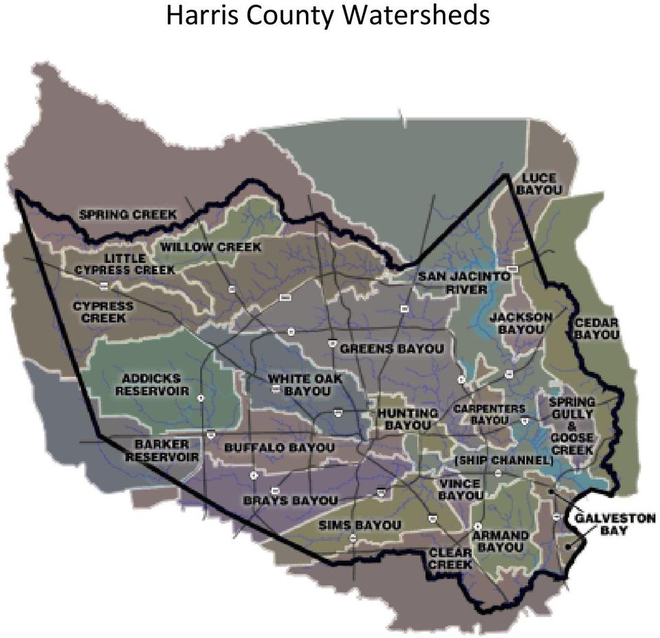
5 Harris County Watersheds
6 White Oak Bayou Watershed Flood Elevation pre and post TSARP FEMA Preliminary Flood Insurance rate Maps Current FEMA Flood Insurance Rate Maps 1% (100-Yr) 0.2% (500-Yr) 1% (100-Yr) 0.2% (500-Yr) 20.5 sq. mi sq. mi sq. mi sq. mi. TSARP Studied Stream Miles = 69.9 miles Current Studied Stream Miles = 71.9 miles Drainage area sq. mi. TSARP 1% Rainfall 24hr duration Total channel miles Allison: Total flooded area 13.2 in 149 mi 50.5 sq. mi. Allison: Flooded homes 11,000 Population 416,067 TSARP is the source for most of the information on TS Allison See for further information.

7 Hurricane Ike 2008 Wind/Storm Surge Event The 2008 hurricane season set new disaster records in Texas. Three hurricanes and a major tropical storm struck the Texas coast. Hurricane Dolly was the worst storm to hit the Rio Grande Valley since 1967 and the last storm of the season, Hurricane Ike, was the hardest blow of the season as it came ashore on Galveston Island. With winds extending 120 miles from the eye, recorded high water marks of 19 feet and damages exceeding $50 billion, Hurricane Ike was likely the largest and costliest hurricane to hit Texas. It may be the second costliest hurricane in US history after only Hurricane Katrina. Hurricane Ike was classified as a Category IV hurricane as it churned through the Gulf of Mexico. As it approached landfall, the winds subsided to a Category II force. Many coastal residents breathed a sigh of relief and, feeling a false sense of security, failed to heed evacuation orders. The Category IV storm surge however, was already being pushed towards Texas. In the pre dawn hours before Ike came ashore, Texas first responders rescued more than 600 residents from the most threatened areas. Over 3,500 Texans would be rescued before the storm was over. Over 305 shelters took in more than 51,000 evacuees. Housing is always the first concern after a storm. FEMA reported 109,045 eligible applicants who had completed the registration process for assistance as of December 1, While UTMB was the most visible institution hit by the storm with damage in the hundreds of millions of dollars, educational institutions and local schools, hospitals, fire stations and water and wastewater systems that support local communities were devastated. Small businesses were hit hardest and many found the process of getting assistance cumbersome and confusing. After the storm, most folks were surprised at the level of devastation. After all, it was only a Category II storm. One of the first challenges of a surge event is to predict the level of the surge. The Governor s Commission on Disaster Recover and Renewal (Commission) recommended changes to the hurricane rating scale to better warn residents of the threat posed by a hurricane storm surge. Hurricane Ike was predicted to strike Corpus Christi only hours before landfall. Hurricane track prediction is an inexact science. Resources staged to support Corpus had to be redeployed to Galveston. Evacuation routes and busses, special needs shelters and support services and supplies were in a constant state of flux. Coordinating a major coastal evacuation and shelter operation is a complex operation. The speed at which this was accomplished and the lives that were saved are a credit to the Governor s Emergency Management Coordinator at the time, Jack Colley. Jack recently passed away, but the team at the Department of Public Safety Division of Emergency Management remains and Texas is ready for today s storm threats. From the Great Storm of 1900 to Hurricane Ike, we can see how damaging and unpredictable a storm surge can be. The only certainty is that Texas will be hit by a large storm surge again. If a surge is a force of nature that we cannot stop, our challenge then is to reduce damage from the surge.

8 Rational regulation of coastal development and common sense approaches to surge protection can protect lives, property and the environment. First and easiest is to require building codes that meet our new understanding of wind and surge threats from hurricanes and tropical storms. Florida passed strong building codes and has seen dramatic reduction in hurricane wind damage and more readily available insurance coverage. Texas should adopt strong wind codes for areas within 100 to 125 miles of the coast. In areas subject to a storm surge, Texas should require homes to be built to a higher and stronger standard than many homes on the coast today. Many newly constructed homes on Galveston Island that have been built to more modern standards came through the storm with little damage. Codes are only as effective as the information used for permits. In Jefferson County, one community was built to new standards for flood elevations yet homeowners found themselves under four feet of water. It turned out that the land survey elevations were wrong by four feet. The state should assist local communities to establish accurate flood maps as those completed by Harris County in its LIDAR survey as part of the TSARP project outlined above. After the 1900 Storm, Galveston undertook a bold plan to build a seawall to protect the city. The seawall worked and it is working today. While the surge worked its way around the seawall to the city center, there is no doubt that much of Galveston would be in the bay if the wall were not between the city and the sea. The Texas City Dike protected much of the industry serving our nation. Yet the waters came to witin inches of the top of the that dike. Six counites on the upper Texas coast have joined together to study the storm surge and look for answers to how to best protect our communities from anoter Ike event. The Gulf Coast Community Protection and Recovery District will look at community recommendations ranging from those of Bill Merril at Texas A&M Galveston for the construcion of an extension of the seawall to the entire island and to Bolivar and Brazoria County with active flood gates to Galvseston Bay to more modest proposals to protect individual facilities to no build alternatives that remove threatended structures from surge prone areas. That study can only happen with help from the state. Confusion reigns for homeowners and insurance companies when both wind and water strike a coastal community. Windstorm coverage and standard homeowner s policies do not cover flood losses. Storm surges wash away the evidence and everyone suffers. Coverage should be coordinated between the federal flood insurance program and the Texas windstorm pool.

9 Restoring communities after a storm requires power. The electrical grid often goes down for thousands of residents in a strong thunderstorm. After Ike, it took weeks to restore power to much of the affected area. Texas should build a more disaster resistant and resilient power distribution system. An effective recovery requires reliable information. The Harris County Housing and Community Development Agency demonstrated a damage assessment tool which provided Harris County with damage assessments on hundreds of thousands of individual homes, apartments, commercial buildings and public infrastructure improvements within days of the storm. The state should adopt such as system for the entire state of Texas. Any assessment should include business and employment data that can help communities restore jobs and an economy so people will have work when they come back home. The Governor s DEM Texas Rebounds report is an excellent source of information in the damage of the storms of 2008 as is the FEMA Hurricane Ike Impact Report December 2008 and the Governor s Commission on Disaster Recovery and Renewal. The State of Mississippi also did an excellent job after Katrina and its Governor s Commission on Recovery, Rebuilding and Renewal Report from December 2005 offers many lessons learned there that can be applied to Texas. I recommend each of them to you as you continue to address the issues arising from the storms and disasters. Texas is ready for the next storm. But there is much we can do to make Hurricane Ike the last storm to devastate our coastal communities. Thank you for the work you are doing to protect Texans. Flood in downtown Houston after Tropical Storm Allison (June 9, 2001) as modeled by the Flood Modeling Science Gateway team, UT Center for Space Research

TROPICAL STORM ALLISON. Prepared by: John P. Ivey, PE, CFM Halff Associates, Inc. ASCE
 TROPICAL STORM ALLISON June 5-9, 5 2001 Prepared by: John P. Ivey, PE, CFM Halff Associates, Inc. ASCE Spring 2002 Meeting Arlington, Texas March 27-30, 2002 Tropical Storm Allison (TSA) The most extensive
A Coastal Barrier Protecting the Houston/Galveston Region from Hurricane Storm Surge
 A Coastal Barrier Protecting the Houston/Galveston Region from Hurricane Storm Surge 1/20/2011 The Houston/Galveston Region Is home to about 2 Million people and may double by 2050 Galveston Bay provides
Texas Universities Recover from Hurricane Ike University of Texas Medical Branch Galveston and Texas A&M University Galveston
 Texas Universities Recover from Hurricane Ike University of Texas Medical Branch Galveston and Texas A&M University Galveston Business Continuity and Disaster Recovery State of Texas Executive Summary
APPENDIX B: PUBLIC PARTICIPATION SURVEY RESULTS
 APPENDIX B: PUBLIC PARTICIPATION SURVEY RESULTS APPENDIX B: PUBLIC PARTICIPATION SURVEY RESULTS This section of the Plan includes a general summary of the results and findings of the Public Participation
Hurricanes and Storm Surge www.hcfcd.org/tropicalweather
 Hurricanes and Storm Surge www.hcfcd.org High-level winds fl ow outward Strong surface winds spiral inward EYE Calm, sometimes cloudfree, sinking air Air sinks in calm area at the storm s eye THUNDERSTORMS
Tropical Storm Allison and its impact on Harris County
 UNIVERSITY OF TEXAS AT AUSTIN CE 394K GIS in Water Resources Binbin Chen December 9, 2006 Tropical Storm Allison and its impact on Harris County Background Tropical Strom Allison Recovery Project Project
Impacts of Global Warming on Hurricane-related Flooding in Corpus Christi,Texas
 Impacts of Global Warming on Hurricane-related Flooding in Corpus Christi,Texas Sea-level Rise and Flood Elevation A one-foot rise in flood elevation due to both sea-level rise and hurricane intensification
Hurricane Sandy Recovery Efforts
 Hurricane Sandy: Recovery Efforts One Year Later There's nothing more important than us getting this right. And we're going to spend as much time, effort and energy as necessary to make sure that all the
Testimony of. President David L. Callender, MD, MBA, FACS The University of Texas Medical Branch. before the
 Testimony of President David L. Callender, MD, MBA, FACS The University of Texas Medical Branch before the Joint Hearing of the House of Representatives Select Committee on Hurricane Ike Devastation and
New Orleans Hurricane Storm Damage Risk Reduction System Tour March 23 24, 2012
 New Orleans Hurricane Storm Damage Risk Reduction System Tour March 23 24, 2012 Host: Falcolm E. Hull, Vice President/Technical Expert, ARCADIS, U.S. Inc. Attending: Cherie Coffman, Coastal Projection
Storm tide is the water level rise during a storm due to the combination of storm surge and the astronomical tide.
 INTRODUCTION TO STORM SURGE Introduction to Storm Surge BOLIVAR PENINSULA IN TEXAS AFTER HURRICANE IKE (2008) What is Storm Surge? Inland Extent Storm surge can penetrate well inland from the coastline.
U.S. Army Corps of Engineers
 Walla Walla District U.S. Army Corps of Engineers Hurricane Katrina Response Briefer: Joseph Saxon Today s Briefing U.S. Army Corps of Engineers Mission Events leading up to New Orleans flooding Corp s
Storm tide is the water level rise during a storm due to the combination of storm surge and the astronomical tide.
 INTRODUCTION TO STORM SURGE Introduction to Storm Surge National Hurricane Center Storm Surge Unit BOLIVAR PENINSULA IN TEXAS AFTER HURRICANE IKE (2008) What is Storm Surge? Inland Extent Storm surge can
Flood After Fire Fact Sheet
 FACT SHEET Flood After Fire Fact Sheet Risks and Protection Floods are the most common and costly natural hazard in the nation. Whether caused by heavy rain, thunderstorms, or the tropical storms, the
Post-Disaster Recovery Seminar: Lessons Learned from Hurricane Isaac
 Post-Disaster Recovery Seminar: Lessons Learned from Hurricane Isaac May 5 and 7, 2014 Everett, Washington and Tacoma, Washington Overview Several cities, counties and the state of Washington are currently
Emergency Management is responsible for coordinating the City of Houston s preparation for and response to emergency situations.
 CITY OF HOUSTON Office of Emergency Management October 2004 Emergency Management is responsible for coordinating the City of Houston s preparation for and response to emergency situations. Houston is exposed
Emergency Management THERE WHEN YOU NEED US
 Emergency Management THERE WHEN YOU NEED US Disasters can change our lives in an instant. Although emergency preparedness, response and recovery are primarily the responsibilities of states and local communities,
HURRICANE SANDY One Year Later A LOOK BACK AT ATLANTIC CITY ELECTRIC S STORM RESTORATION EFFORTS
 HURRICANE SANDY One Year Later A LOOK BACK AT ATLANTIC CITY ELECTRIC S STORM RESTORATION EFFORTS OCTOBER 2013 SANDY STRIKES Hurricane Sandy made landfall bringing maximum sustained winds of 80 mph and
Flood Protection Tips
 Flood Protection Tips Information About Floodplains and Flood Prevention What is a floodplain? Floodplains serve many useful purposes, and those that are preserved in their natural or nearly natural state
www.tsarp.org At the time of printing, all information in this report was current and known to be accurate.
 T R O P I C A L S T O R M A L L I S O N P U B L I C R E P O R T This report is a product of the Tropical Storm Allison Recovery Project, a partnership between the Federal Emergency Management Agency and
Flood Insurance Repetitive Loss Property
 Flood Insurance Repetitive Loss Property When our system of canals, ditches and culverts was built over 20 years ago, it could handle all but the largest tropical storms and hurricanes; since then, urban
With a combination of soaking rain, flying debris, high winds, and tidal surges, Hurricanes and tropical storms can pack a powerful punch.
 With a combination of soaking rain, flying debris, high winds, and tidal surges, Hurricanes and tropical storms can pack a powerful punch. Besides causing extensive damage in coastal areas, hurricanes
CITY OF BELLEAIR BEACH, FLORIDA
 CITY OF BELLEAIR BEACH, FLORIDA FLOOD INSURANCE INFORMATION Important Information for City of Belleair Beach Residents and Property Owners Regarding Flood, Risk, Insurance, Preparation, Evacuation, Safety
Status of Building Codes in New Jersey and New York: The Future of Resilience in a Post-Sandy Environment
 Status of Building Codes in New Jersey and New York: The Future of Resilience in a Post-Sandy Environment Sandy devastated properties in several states, but primarily in New York and New Jersey. Now, as
Mississippi Development Authority Public Housing Program CDBG Disaster Recovery Action Plan Amendment 1
 Mississippi Development Authority Public Housing Program CDBG Disaster Recovery Action Plan Amendment 1 Mississippi Public Housing Program Overview Hurricane Katrina made landfall in Mississippi on August
How To Get A Home Insurance Policy On The Gulf Coast
 INSURANCE IN MISSISSIPPI 10 YEARS AFTER KATRINA Mike Chaney, Commissioner A publication of the Mississippi Insurance Department August 2015 Message from Commissioner of Insurance Mike Chaney One of the
Impact of Hurricane Ike
 Island Transit History, Design and Impact of Hurricane Ike By Gary A. Gordon, P.E. Assistant Federal Security Director-Surface Surface, South Central Region and Michael Worthy Director of Transportation,
ESCAMBIA COUNTY FLOOD RECOVERY: 1- YEAR ANNIVERSARY REPORT
 Joy D. Blackmon, P.E. Director, County Engineer Public Works Department ESCAMBIA COUNTY FLOOD RECOVERY: 1- YEAR ANNIVERSARY REPORT EXECUTIVE SUMMARY One year after the devastating April 2014 floods hit
Flooding Fast Facts. flooding), seismic events (tsunami) or large landslides (sometime also called tsunami).
, seismic events (tsunami) or large landslides (sometime also called tsunami).") Flooding Fast Facts What is a flood? Flooding is the unusual presence of water on land to a depth which affects normal activities. Flooding can arise from: Overflowing rivers (river flooding), Heavy rainfall
Flooding Fast Facts What is a flood? Flooding is the unusual presence of water on land to a depth which affects normal activities. Flooding can arise from: Overflowing rivers (river flooding), Heavy rainfall
1. GENERAL ADVISORY BASE FLOOD ELEVATION (ABFE) QUESTIONS
 QUESTIONS") INTRODUCTION As communities begin to recover from the devastating effects of Hurricane Sandy, it is important to recognize lessons learned and to employ mitigation actions that ensure structures are rebuilt
INTRODUCTION As communities begin to recover from the devastating effects of Hurricane Sandy, it is important to recognize lessons learned and to employ mitigation actions that ensure structures are rebuilt
Develop hazard mitigation policies and programs designed to reduce the impact of natural and human-caused hazards on people and property.
 6.0 Mitigation Strategy Introduction A mitigation strategy provides participating counties and municipalities in the H-GAC planning area with the basis for action. Based on the findings of the Risk Assessment
Hurricane Preparedness in Pinellas County
 Emergency Management Contact: Gary Vickers, Director (727) 464-5550 Hurricane Preparedness in Pinellas County Hurricane Katrina s devastation in the Louisiana- Mississippi area has refocused attention
Flood Emergency Response Planning: How to Protect Your Business from a Natural Disaster RIC005
 Flood Emergency Response Planning: How to Protect Your Business from a Natural Disaster RIC005 Speakers: Tom Chan, CEO, Global Risk Miyamoto Greg Bates, Principal, Global Risk Consultants Learning Objectives
Houston-Galveston Area Council. Disaster Recovery Housing Needs Assessment. Round 2 Phase 2 Funding
 Houston-Galveston Area Council Disaster Recovery Housing Needs Assessment Round 2 Phase 2 Funding Disaster Recovery Community Development Block Grant Funding DR-1791 Hurricanes Ike & Dolly Prepared by
In the Caribbean, August and September are peak months during the hurricane season that lasts from June 1 through November 30.
 Hurricane Fact sheet What is a hurricane? A hurricane is a tropical storm with winds that have reached a constant speed of 74 miles per hour more. Hurricane winds blow in a large spiral around a relative
MISSISSIPPI DEVELOPMENT AUTHORITY HOMEOWNER ASSISTANCE PROGRAM G U I D E L I N E S
 MISSISSIPPI DEVELOPMENT AUTHORITY HOMEOWNER ASSISTANCE PROGRAM G U I D E L I N E S MISSISSIPPI DEVELOPMENT AUTHORITY (MDA) HOMEOWNER ASSISTANCE PROGRAM G U I D E L I N E S The HOMEOWNER ASSISTANCE PROGRAM
Frequently Asked Questions (FAQs) 1. Why is the City of Tucson getting new flood hazard maps? 2. Who is responsible for modernizing the maps?
 1. Why is the City of Tucson getting new flood hazard maps? 2. Who is responsible for modernizing the maps?") Frequently Asked Questions (FAQs) 1. Why is the City of Tucson getting new flood hazard maps? 2. Who is responsible for modernizing the maps? 3. What is a Flood Hazard Map? 4. What are the benefits of
Frequently Asked Questions (FAQs) 1. Why is the City of Tucson getting new flood hazard maps? 2. Who is responsible for modernizing the maps? 3. What is a Flood Hazard Map? 4. What are the benefits of
Response and Recovery
 LESSON PLAN 3 Response and Recovery Hurricanes When young people see what individuals and communities can do before, during and after a hurricane, they will begin to understand the importance of people
Most Vulnerable US Cities to Storm Surge Flooding. August 2015 2 COPLEY PLACE BOSTON, MA 02116 T: 617.423.2800 F: 617.423.2808
 Most Vulnerable US Cities to Storm Surge Flooding August 2015 2 COPLEY PLACE BOSTON, MA 02116 T: 617.423.2800 F: 617.423.2808 Introduction Hurricane Katrina was a stark reminder that strong winds are only
RISD Hurricane Preparedness
 RISD Hurricane Preparedness Hurricane It is the policy of RISD to view each hurricane threat as an extremely hazardous condition. As such, our goal is to minimize the risk to personnel consistent with
that we name it, giving these events a metaphysical element. Carla hit 150 miles down the Texas coast in fear them, like ancient angry spirits.
 by Jim Blackburn BLOW- BY A N E N V I R O N M E N TA L AT TO R N E Y D E TA I L S A M A J O R H U R R I C A N E S P OT E N T I A L I M PACT O N H O U STO N 22 BL OW - FOR MOST OF US, IT IS DIFFICULT TO
Homeowners Insurance in the States
 Testimony to the Senate Business and Commerce Committee Senator John J. Carona, Chair Texas Legislature Tuesday, July 10, 2012 Heather Morton National Conference of State Legislatures Denver, Colorado
Hurricanes: Nature's Wildest Storms by Erin Ryan
 Name: : Nature's Wildest Storms by Erin Ryan You may already know that hurricanes are major tropical storms that can cause devastating waves, wind, and rain. They happen during Hurricane Season, which
1. Why is Lee County getting new flood hazard maps? 3. What are the benefits of the new flood hazard maps?
 1. Why is Lee County getting new flood hazard maps? Flood hazard maps, also known as Flood Insurance Rate Maps (FIRMs), are important tools in the effort to protect lives and property. They indicate the
Challenges. Estimated Damages from 100-Year Flood
 Suffield Suffield is a rural community located along the Massachusetts border. It encompasses about 42.2 square miles and has a population of about 15,735. Suffield s terrain rises from an elevation of
SSPEED Center Phase III: Developing a Houston- Galveston Area Protection System (H-GAPS)
") Center Phase III: Developing a Houston- Galveston Area Protection System (H-GAPS) The Center 6100 Main St., MS317 Houston, Texas 77005 June 2, 2014 DPCAC meeting Center Phase I & II Recap (2009-2014) Phase
Center Phase III: Developing a Houston- Galveston Area Protection System (H-GAPS) The Center 6100 Main St., MS317 Houston, Texas 77005 June 2, 2014 DPCAC meeting Center Phase I & II Recap (2009-2014) Phase
Tropical Storm Debby. Post-Debby Beach/Dune Damage Assessment Report Sarasota Florida. By Weiqi Lin P.E., Ph.D. Coastal Resources/Community Services
 Tropical Storm Debby Post-Debby Beach/Dune Damage Assessment Report Sarasota Florida By Weiqi Lin P.E., Ph.D. Coastal Resources/Community Services June 29, 2012 BACKGROUND AND SUMMARY Tropical storm Debby
Bringing Help, Bringing Hope. The American Red Cross Response to Hurricanes Katrina, Rita and Wilma
 Bringing Help, Bringing Hope The American Red Cross Response to Hurricanes Katrina, Rita and Wilma Unprecedented Disaster When nearly 4.5 million people needed help in the aftermath of Hurricanes Katrina,
Hurricane Sandy: The Challenges and Opportunities to Link Disaster Management and Climate Change Adaptation*
 Hurricane Sandy: The Challenges and Opportunities to Link Disaster Management and Climate Change Adaptation* Gavin Smith, Ph.D. Associate Research Professor Department of City and Regional Planning University
Travelers Coastal Wind Zone Plan THE TRAVELERS INSTITUTE
 THE TRAVELERS INSTITUTE Travelers Coastal Wind Zone Plan A Comprehensive Plan to Improve Availability and Affordability of Named Storm Wind Insurance for Coastal Homeowners Number of Hurricanes per Year,
CITY OF HUMBLE OFFICE OF EMERGENCY MANAGEMENT. 110 W. Main St. Humble, Tx. 77338 ph. 281 446 4928 Email; [email protected]
 CITY OF HUMBLE OFFICE OF EMERGENCY MANAGEMENT 110 W. Main St. Humble, Tx. 77338 ph. 281 446 4928 Email; [email protected] Emergency Management Director: Mayor Donnie McMannes Emergency Management
35 YEARS FLOOD INSURANCE CLAIMS
 40 RESOURCES NO. 191 WINTER 2016 A Look at 35 YEARS FLOOD INSURANCE CLAIMS of An analysis of more than one million flood claims under the National Flood Insurance Program reveals insights to help homeowners
Climate Change Long Term Trends and their Implications for Emergency Management August 2011
 Climate Change Long Term Trends and their Implications for Emergency Management August 2011 Overview A significant amount of existing research indicates that the world s climate is changing. Emergency
Weather Briefing for Southeast Texas October 24 th, 2015
 Weather Briefing for Southeast Texas October 24 th, 2015 Dangerous Flash Flood Event Saturday through Sunday 8:16 AM Overview Ongoing: record deep moisture in place, elevated seas, rip currents, high surf,
CHAPTER 20: DISASTER RECOVERY (CDBG-DR)
") CHAPTER 20: DISASTER RECOVERY (CDBG-DR) CHAPTER PURPOSE & CONTENTS This chapter provides a general overview of the CDBG Disaster Recovery program, including a brief synopsis of the history of the program,
CHAPTER 20: DISASTER RECOVERY (CDBG-DR) CHAPTER PURPOSE & CONTENTS This chapter provides a general overview of the CDBG Disaster Recovery program, including a brief synopsis of the history of the program,
Jefferson Parish Department of Water Emergency Plan
 1. Overview Jefferson Parish Department of Water Emergency Plan 1.1. Purpose The purpose of this document is to establish procedures for the Department of Water during natural disasters or terrorist acts.
Sandy s Effects on Housing in New York City
 MARCH 2013 FACT BRIEF Effects on Housing in New York City Four months after Superstorm Sandy, New Yorkers continue to pick up the pieces and rebuild. Sandy devastated many parts of the city, including
Written Testimony of Frederick Tombar Senior Advisor for Disaster Recovery to Secretary of U.S. Department of Housing and Urban Development (HUD)
") U.S. DEPARTMENT OF HOUSING AND URBAN DEVELOPMENT WASHINGTON, DC 20410 Written Testimony of Frederick Tombar Senior Advisor for Disaster Recovery to Secretary of U.S. Department of Housing and Urban Development
U.S. DEPARTMENT OF HOUSING AND URBAN DEVELOPMENT WASHINGTON, DC 20410 Written Testimony of Frederick Tombar Senior Advisor for Disaster Recovery to Secretary of U.S. Department of Housing and Urban Development
CRS Report for Congress
 Order Code RS22285 Updated March 22, 2006 CRS Report for Congress Received through the CRS Web Hurricane-Damaged Drinking Water and Wastewater Facilities: Impacts, Needs, and Response Summary Claudia Copeland
Preparing for A Flood
 Preparing for A Flood 1. Know if you are in a flood prone area. 2. Each year, update flood procedures to be followed by your company, employees and tenants: Including Emergency Contacts Evacuation Plans
Selected Distance Education Disaster Planning Lessons Learned From Hurricane Katrina
 Selected Distance Education Disaster Planning Lessons Learned From Hurricane Katrina Kay L. McLennan, Ph.D. Professor of Practice & e-learning Coordinator for the Business Studies Program School of Continuing
HURRICANE ISAAC. National Disaster Recovery Framework (NDRF) Long Term Recovery Group (LTRG) Citizens Advisory Committee (CAC)
 Long Term Recovery Group (LTRG) Citizens Advisory Committee (CAC)") HURRICANE ISAAC National Disaster Recovery Framework (NDRF) Long Term Recovery Group (LTRG) Citizens Advisory Committee (CAC) 1 ABOUT ST. JOHN THE BAPTIST PARISH Population: 45,924 Cities: LaPlace, Reserve,
HURRICANE ISAAC National Disaster Recovery Framework (NDRF) Long Term Recovery Group (LTRG) Citizens Advisory Committee (CAC) 1 ABOUT ST. JOHN THE BAPTIST PARISH Population: 45,924 Cities: LaPlace, Reserve,
Migration Patterns and Mover Characteristics from the 2005 ACS Gulf Coast Area Special Products
 Migration Patterns and Mover Characteristics from the 2005 ACS Gulf Coast Area Special Products Kin Koerber Housing and Economic Household Statistics Division U.S. Census Bureau Presented at the Southern
A Publication of Encharter Insurance. The Insurance Guide To: DISASTERS A GUIDE TO CONVERTING PROSPECTS INOT USTOMERS
 A Publication of Encharter Insurance The Insurance Guide To: DISASTERS A GUIDE TO CONVERTING PROSPECTS INOT USTOMERS TABLE OF CONTENTS Melting Snow & Ice.3 Wind & Hurricanes..5 Earthquakes.....6 Brush
Multi-Jurisdictional Hazard Mitigation Plan
 Flooding General Flooding is the leading cause of death among all types of natural disasters throughout the United States, with its ability to roll boulders the size of cars, tear out trees, and destroy
Lesson 5. After a Disaster: Recovery and Hazard Mitigation Programs. Disaster Assistance
 Introduction The previous four lessons focused on pre-disaster mitigation: developing a program, and writing and implementing a hazard mitigation plan. The Disaster Mitigation Act of 2000 (DMA 2000) encourages
Understanding the Electric Power Industry s Response and Restoration Process
 Understanding the Electric Power Industry s Response and Restoration Process Electricity is a crucial product many of us take for granted. We scarcely think about it, unless we don t have it. Because electricity
NEXRAD Flood Warning System and Floodplain Library For Houston, TX
 NEXRAD Flood Warning System and Floodplain Library For Houston, TX Z. Fang 1 and P. B. Bedient 2 1 Graduate Student, Department of Civil and Environmental Engineering, Rice University, 6100 Main Street,
Standard Operating Procedures for Flood Preparation and Response
 Standard Operating Procedures for Flood Preparation and Response General Discussion Hurricanes, tropical storms and intense thunderstorms support a conclusion that more severe flooding conditions than
Critical Need to Rebuild Atlantic City and Protect Vulnerable Environmental Justice Populations Affected by Hurricane Sandy
 Critical Need to Rebuild Atlantic City and Protect Vulnerable Environmental Justice Populations Affected by Hurricane Sandy Presented by: Roy L. Jones, Executive Director, National Institute for Healthy
1. Why is the City of Dickinson getting new flood hazard maps?
 FREQUENTLY ASKED QUESTIONS 1. Why is the City of Dickinson getting new flood hazard maps? Flood hazard maps, also known as Flood Insurance Rate Maps (FIRMs), are important tools in the effort to protect