THE ROYAL JORDANIAN GEOGRAPHIC CENTER
|
|
|
- Paul Franklin
- 8 years ago
- Views:
Transcription
1 THE ROYAL JORDANIAN GEOGRAPHIC CENTER
2 Outlines: 1- Establishment & Duties 2- Organizational Structure 3- Most Important Achievements 4- Ambitions & Future Vision 2

 was established in 1975 as a national agency responsible")

3 Establishment & Duties Map Production Boundaries Demarcation Training Courses The Royal Jordanian Geographic Centre (RJGC) was established in 1975 as a national agency responsible for all the survey work (aerial, spatial and land surveying), and to produce different maps at various scales to meet the needs of Jordan and other Arab countries. Aerial Photography Geodetic Network

4 RJGC Organizational Structure Upper Committee Spatial Reconnaissance Section Technical Advisor Director General Control & Inspection Unit Navigation & Aerial Photography Unit Deputy Director Planning Dept Advance Application Dept Production Production Dept Dept Admin & Finance Dept Technical Services Dept Remote Sensing GIS Digital Cartography Digital Photogrammetry Field Survey

5 Most Important Achievements Hosting the Regional Centre for Space Sciences and Education for Western Asia affiliated to the United Nations in cooperation with Jordan Meteorological Department, Al al-bayt University and Jordan University of Science & Technology. Establishing the Geomatics Faculty in cooperation with the University of Jordan. The faculty will grant a B.Sc. degree in RS, GIS and survey sciences. The previous RJGC College for Survey Sciences has been established since 15 years. It offered two-year courses in geodesy, photogrammetry, RS and GIS. It granted Diploma degree for students from Jordan and the Arab countries. Establishing the Spatial Reconnaissance Section This section provides orthophoto maps and operational maps at different scales upon request. It provides thematic maps for the UN Peace Keeping Missions. Also produces special maps for civil aviation and certain government departments.

6 Future Ambitions & Vision Establishing Radio Astrological Observatory in cooperation with the Institute of Astronomy and Space Sciences in Al al-bayt University, Arab Union for Astronomy and Space Sciences and the British Godrell Bank. Using Pictometry Technology (the aerial oblique photography) in cadastral purposes and security applications. Installing a satellite receiving station (MODIS) at the RJGC The project is funded by World Bank and GEF to improve water resources and agricultural management based on quantitative and spatial-based decision making tools. The implementing agency is the MWI in collaboration with RJGC. The station will provide information on land and ocean for drought & flood management & impacts of climate change. Installing Virtual Reference Stations (VRS) This vital project will provide high accurate coordinates which will serve the public and private sectors. The 6 permanent stations will cover most of Jordan. These stations will reduce the cost and manpower.

7 Future Ambitions & Vision Hosting the National Geographic Information System (NGIS) in coordination with the concerned authorities. Establishing the King Abdullah II City for Space Sciences & Astronomy which will include a planetarium, an optical telescope observatory for astronomical researches and crescent observation.

8 Main National Institutions Active in Space Science: 1. The Royal Jordanian Geographic Centre (RJGC) 2. Al al-bayt University (AABU) 3. Jordan Meteorological Department (JMD) 4. Higher Council for Science and Technology (HCST) 5. Jordan University of Science and Technology (JUST) 6. University of Jordan (UJ) 7. Al-Balqa Applied University (BAU)
 5.")
9 AABU JUST BAU RJGC UJ JMD

10 RJGC - Available Facilities Personnel: - RJGC, Al al-bayt University, University of Jordan, Al-Balqa University and Meteorological Dept. have experts in the fields of remote sensing, GIS, photogrammetry, surveying, space science and Astronomy. - RJGC can provide the required technical staff to supervise RS & GIS laboratories in the Centre. Facilities: - Allocation of classrooms, working areas as well as offices and equipment rooms that might be required for the Centre. - Access to all the facilities in RJGC such as rooms for photo scanning and the Centre s scientific library. - Storage facilities for equipment, documents, aerial photos, satellite imagery and other materials.

11 Labs: - Remote Sensing Labs - GIS Labs - Lecture Rooms - Auditorium - Library Training Center Facilities Equipment: - Office furnishings - 15 Workstations for image processing - 10 Workstations for GIS - Data Show - Intranet and internet facilities - Remote sensed data and aerial photos Software: - ERDAS - ArcGIS v10 - PCI v10

12 Short and Long Term Courses in RS Code Description RS 1 Definition and overview of remote sensing and remote sensing system. RS 2 History and evolution of remote sensing. RS 3 Electromagnetic radiation, terms and definitions, laws of radiation. RS 4 Interaction between electromagnetic radiation and matter, reflection absorption and transmission. RS 5 Interactions between electromagnetic radiation and atmosphere. RS 6 Remote sensing systems: active and passive systems, imaging and non-imaging systems, resolution spatial, spectral and temporal. RS 7 Orbits and platforms for Earth observation. RS 8 Earth observation satellites (Landsat, SPOT, IRS). RS 9 Sensors used in Earth observation satellites and their geometric characteristics. RS 10 Data reception, processing and generation of data products. RS 11 Geometric and radiometric corrections and sources of errors in satellite data. RS 12 Ground truth data collection use of radiometers and spectrophotometers etc. RS 13 Spectral reflectance and spectral signature for water, land and vegetation.
. RS 9 Sensors used in Earth observation satellites and their geometric characteristics.")
13 Short and Long Term Courses in GIS 3 Months Courses Introduction to GIS Hardware and software requirement of GIS Database structures and formats Vector data structures Raster data structures Data inputting, editing and topology in GIS 6 Months Courses Integration of spatial and non-spatial data Map Projections and data transformation in GIS Spatial data analysis (vector-based) Spatial data analysis (raster-based)
 Spatial data analysis")
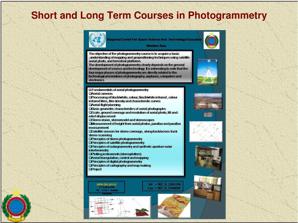
14 Short and Long Term Courses in Photogrammetry
15 The Institute of Astronomy & Space Science (IASS) at Al al-bayt University (AABU) Historical background: IASS-AABU was established in September Its Goals: Building national capacities in A&SS Doing research in A&SS Organizing conferences, seminars & specialized lectures in A&SS.

16 Astronomy at Universities Graduate Level Some Jordanian universities offer astronomy/ astrophysics courses as electives (e.g. University of Jordan, Yarmouk University, Hashemite University, AABU, Islamic Science University ) Al al-bayt University is the only one that offers a degreeleading program in A&SS. IASS-AABU offers the M.Sc. Degree in two disciplines: - Astronomy/ Astrophysics - Space Science

17 Maragha Observatory at AABU
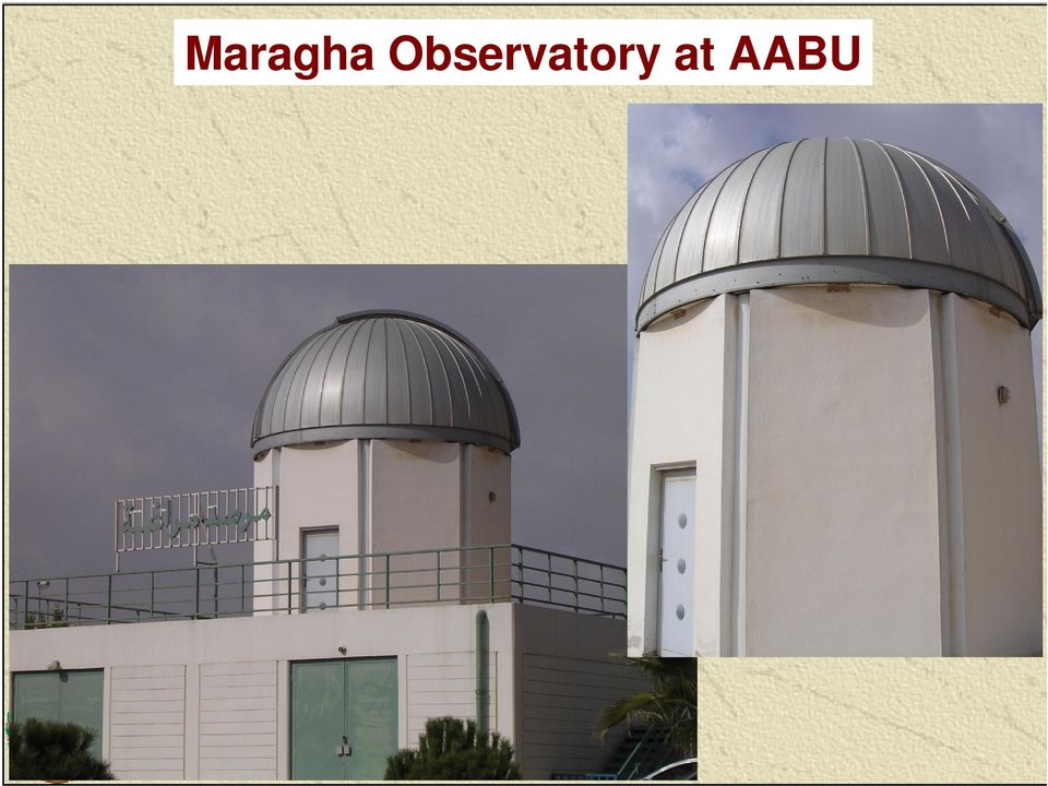
18 Maragha Observatory at AABU Schmidt-Cassegrain Reflector 16-inch Meade LX200 CCD Pictor 1616 The Jordan Astronomical Society Has three Observatory Telescopes of 14, 10 and 8

19 Future Perspectives Installing an Atmospheric Weather Electromagnetic System for Observation and Education (AWESOME) receiver in collaboration with Stanford University.
 receiver in collaboration with")
20 Jordan Meteorological Department (JMD) Meteorological Training Center (MTC) In 1951, the JMD was established as part of the Civil Aviation Authority. The department operates 36 stations: 17 Synoptic, 9 climatological, 9 Agro-meteorological Stations and 1 Radiosond Station. MTC was established as an agency of the JMD in The center provides training courses and graduates weather forecasters, observers and technicians. All teachers and trainers in the MTC are staff of JMD and graduates of MTC. They are sufficiently qualified academics, well experienced and already participated in many training courses.

21 Activities held at the MTC 1 Weather Observation Course: Duration: six months, including four months in the form of theoretical and practical lectures, and two months as practical training in a monitoring weather station. 2 Weather Forecasting Course: Duration: nine months, including six months in the form of theoretical and practical lectures, and three months as practical training in the National Forecasting Center. 3 - Workshops MTC held training workshops in the fields of meteorology, as well as intensive weather observation and forecasting courses on demand.
22 Workshops MTC holds intensive forecasting and observation training courses on demand, as well as specialized workshops in the fields of applied meteorology (Satellite, Applied Climatology, Rain Enhancement, Numerical Weather Prediction, etc). MTC also holds training courses in supported fields such as computer science and statistics upon request. Facilities Available at the Center A classroom of sixteen student capacity
23 Al- Balqa' Applied University (BAU) About BAU: Al-Balqa' Applied University (BAU) was founded in 1997, a distinctive state university in the field of Bachelor and Associate degree Applied Education, at the capacity of 47,500 student distributed into 32,000 at the Bachelor degree program and 15,500 at the Associate degree program. Faculty of Engineering: Surveying and Geomatics Engineering A BSc. program in surveying, RS and GIS.
24 Jordan University of Science and Technology (JUST) Jordan University of Science and Technology was founded as an independent university on September, 1st, 1986 in Irbid. The University currently hosts ten faculties in addition to Faculty of Graduate Studies and Deanship of Research. JUST is one among many other national universities and research centers that have great human and technical resources welling to convene to keep up with scientific developments in space science and astronomy technology.
25 On-going Projects Previous mentioned organizations and institutions along with The Arab Union for Astronomy and Space Science (AUASS) are working to construct the following projects: 1. Planetarium at the site of Ahel Al-Kahef ( The Seven Sleepers Cave), which consider as a holy shrine. 2. Radio Telescope. 3. Optical Telescope of 2m diameter.
26 Thank You for Your Attention
27 Building and transferring the communication satellite dish to a radio telescope and connecting it to the Global European Network (VLBI) The project aims to connect Jordan to the Global Very Long Base Line Interferometer Network (VLBI). The global network incorporates a set of radio telescopes distributed all over the world, except the Arab- Muslim world, where they lack the radio telescope. So it was necessary to plan for selecting a site in the Arab world in order to connect it to the global network. Currently there is a project in Jordan to transform the satellite communication dish in the Baqa area near Amman city to a large telescope (Millimetric Radio Observatory). This telescope will be used for radio astronomy meteorology, radio communications, studying the continental drift, earthquakes and natural disasters prediction as well as the importance of including Jordan and the Arab countries within the developed countries in astronomical field by linking it to VLBI network to complement the global network. back
28 Advanced Applications Department Main Duties Carrying out projects, researches and studies related to urban planning, geological and environmental issues using remote-sensed data and GIS. Providing the government and private sectors with the needed orthorectified satellite imagery. Updating base maps using high resolution satellite imagery. Establishing a National Geographic Database. Building a Digital Topographic Geo-database. back
29 Production Department Main Duties Planning and carrying out aerial photography for both public and private sectors. Producing orthophoto maps using aerial photos of high resolution. Maintaining the networks of: National Geodetic, GPS, Gravity and precise leveling. Field completion for map production and other projects. Carrying out field survey using high tech instruments (Ashtech Total Station and GPS receivers). Producing topographic, tourist maps and atlases in digital format.
30 Maintaining the National Geodetic Network
31 Maintaining the National Gravity Network 2000 Points Relative Absolute
32 Maintaining the GPS Network 44 Points Absolute Relative
33 Digital Photogrammetry Network SUN ULTRA Tape EXB DSW Network SUN ULTRA Tape EXB Stereo DPWs Mono DPWm HP Plotter DLT/ GB CD writer NT back
34 Courses Held at RJGC Basic Remote Sensing Advanced Remote Sensing Basic Geographic Information System (GIS) Advanced Geographic Information System (GIS) ArcScan Spatial Analyst 3d Analyst Watershed and Hydrology Aerial Photo Interpretation & Map Reading Basic Survey Advanced Survey Total Station Global Positioning System (GPS) Qibla Determination Cadastral Surveying Photogrammetry Cartography Geographical Names back
REGIONAL CENTRE FOR TRAINING IN AEROSPACE SURVEYS (RECTAS) MASTER IN GEOINFORMATION PRODUCTION AND MANAGEMENT
 MASTER IN GEOINFORMATION PRODUCTION AND MANAGEMENT") REGIONAL CENTRE FOR TRAINING IN AEROSPACE SURVEYS (RECTAS) MASTER IN GEOINFORMATION PRODUCTION AND MANAGEMENT PROGRAMME DESCRIPTION October 2014 1. The programme The academic programme shall be referred
REGIONAL CENTRE FOR TRAINING IN AEROSPACE SURVEYS (RECTAS) MASTER IN GEOINFORMATION PRODUCTION AND MANAGEMENT PROGRAMME DESCRIPTION October 2014 1. The programme The academic programme shall be referred
INDIVIDUAL COURSE DETAILS
 INDIVIDUAL COURSE DETAILS A. Name of Institution NATIONAL INSTITUTE OF TECHNICAL TEACHERS TRAINING AND RESEARCH TARAMANI CHENNAI 600 113 [An Autonomous Institute under Ministry of Human Resource Development,
Chapter Contents Page No
 Chapter Contents Page No Preface Acknowledgement 1 Basics of Remote Sensing 1 1.1. Introduction 1 1.2. Definition of Remote Sensing 1 1.3. Principles of Remote Sensing 1 1.4. Various Stages in Remote Sensing
Technology Trends In Geoinformation
 Technology Trends In Geoinformation Dato Prof. Sr Dr. Abdul Kadir Bin Taib Department of Survey and Mapping Malaysia (JUPEM) Email: drkadir@jupem.gov.my www.jupem.gov.my NGIS 2008 3 rd. National GIS Conference
Survey and Mapping Activities in Vietnam *
 UNITED NATIONS E/CONF.100/CRP.1 ECONOMIC AND SOCIAL COUNCIL Eighteenth United Nations Regional Cartographic Conference for Asia and the Pacific Bangkok, 26-29 October 2009 Item 7(a) of the provisional
LEOworks - a freeware to teach Remote Sensing in Schools
 LEOworks - a freeware to teach Remote Sensing in Schools Wolfgang Sulzer Institute for Geography and Regional Science University of Graz Heinrichstrasse 36, A-8010 Graz/Austria wolfgang.sulzer@uni-graz.at
THE STATUS OF GEOSPATIAL TRAINING IN TANZANIAN UNIVERSITIES
 1 st Esri Eastern Africa Education UC Opening Session 17 September 2013 THE STATUS OF GEOSPATIAL TRAINING IN TANZANIAN UNIVERSITIES Dr. Job Asheri Chaula & Mr. Zakaria Ngereja School of Geospatial Sciences
KEY WORDS: Geoinformatics, Geoinformation technique, Remote Sensing, Information technique, Curriculum, Surveyor.
 CURRICULUM OF GEOINFORMATICS INTEGRATION OF REMOTE SENSING AND GEOGRAPHICAL INFORMATION TECHNOLOGY Kirsi VIRRANTAUS*, Henrik HAGGRÉN** Helsinki University of Technology, Finland Department of Surveying
The Status of Geospatial Information Management in China
 The Status of Geospatial Information Management in China Submitted by the National Administration of Surveying, Mapping and Geoinformation of China 1. Administration System The National Administration
Review for Introduction to Remote Sensing: Science Concepts and Technology
 Review for Introduction to Remote Sensing: Science Concepts and Technology Ann Johnson Associate Director ann@baremt.com Funded by National Science Foundation Advanced Technological Education program [DUE
INSTITUTE OF HUMAN RESOURSE ADVANCEMENT (IHRA) UNIVERSITY OF COLOMBO. M. Sc. in Geoinformatics 2014/2015
 UNIVERSITY OF COLOMBO. M. Sc. in Geoinformatics 2014/2015") INSTITUTE OF HUMAN RESOURSE ADVANCEMENT (IHRA) UNIVERSITY OF COLOMBO Introduction M. Sc. in Geoinformatics 2014/2015 Course Conducted by the -IHRA, University of Colombo The Master of Science in Geoinformatics
INSTITUTE OF HUMAN RESOURSE ADVANCEMENT (IHRA) UNIVERSITY OF COLOMBO Introduction M. Sc. in Geoinformatics 2014/2015 Course Conducted by the -IHRA, University of Colombo The Master of Science in Geoinformatics
Adaptation of High Resolution Ikonos Images to Googleearth for Zonguldak Test Field
 Adaptation of High Resolution Ikonos Images to Googleearth for Zonguldak Test Field Umut G. SEFERCIK, Murat ORUC and Mehmet ALKAN, Turkey Key words: Image Processing, Information Content, Image Understanding,
Appendix: Curriculum for Double Degree Agreement between Wuhan University (WHU) and the Technische Universität München (TUM)
 and the Technische Universität München (TUM)") Appendix: Curriculum for Double Degree Agreement between (WHU) and the Technische Universität München (TUM) Master s program: - Schools of Resources and Environmental Science - School of Urban Design -
Appendix: Curriculum for Double Degree Agreement between (WHU) and the Technische Universität München (TUM) Master s program: - Schools of Resources and Environmental Science - School of Urban Design -
DIABLO VALLEY COLLEGE CATALOG 2015-2016
 GEOGRAPHY GEOG Tish Young, Dean Physical Sciences and Engineering Division Physical Sciences Building, Room 263 Possible career opportunities Geography is an interdisciplinary study focusing on the spatial
Geospatial Software Solutions for the Environment and Natural Resources
 Geospatial Software Solutions for the Environment and Natural Resources Manage and Preserve the Environment and its Natural Resources Our environment and the natural resources it provides play a growing
Mapping Earth from Space Remote sensing and satellite images. Remote sensing developments from war
 Mapping Earth from Space Remote sensing and satellite images Geomatics includes all the following spatial technologies: a. Cartography "The art, science and technology of making maps" b. Geographic Information
GEOSPATIAL SCIENCE. Program Guide
 MASTER OF SCIENCE GEOSPATIAL SCIENCE Program Guide 2012-2013 Department of Geography University of North Alabama Page 1 MASTER OF SCIENCE IN GEOSPATIAL SCIENCE Department of Geography University of North
Training Courses 2008 2016
 Caribbean Institute for Meteorology and Hydrology The Caribbean Institute for Meteorology and Hydrology The Caribbean Institute for Meteorology and Hydrology is the regional Institution mandated to conduct
GIS Initiative: Developing an atmospheric data model for GIS. Olga Wilhelmi (ESIG), Jennifer Boehnert (RAP/ESIG) and Terri Betancourt (RAP)
, Jennifer Boehnert (RAP/ESIG) and Terri Betancourt (RAP)") GIS Initiative: Developing an atmospheric data model for GIS Olga Wilhelmi (ESIG), Jennifer Boehnert (RAP/ESIG) and Terri Betancourt (RAP) Unidata seminar August 30, 2004 Presentation Outline Overview
GIS Initiative: Developing an atmospheric data model for GIS Olga Wilhelmi (ESIG), Jennifer Boehnert (RAP/ESIG) and Terri Betancourt (RAP) Unidata seminar August 30, 2004 Presentation Outline Overview
Department of Geographic Information Science
 REGIONAL CENTRE FOR TRAINING IN AEROSPACE SURVEYS (RECTAS) Department of Geographic Information Science Curriculum for Master of Science in Geographic Information Science (M.Sc. GIS) October 2014 The programme
Bachelor of Geospatial Science Inaugural intake 2015
 Bachelor of Geospatial Science Inaugural intake 2015 Aleen Prasad and Dr Nick Rollings Geospatial Science Unit School of Geography, Earth Science and Environment The University of the South Pacific Geospatial
OVERVIEW AND BACKGROUND GEOGRAPHICAL INFORMATIONS SYSTEMS at the Missouri University of Science & Technology
 OVERVIEW AND BACKGROUND GEOGRAPHICAL INFORMATIONS SYSTEMS at the Missouri University of Science & Technology U.S. Geological Survey Mid-Continent Mapping Center and National Imaging and Mapping Agency-St
Assessment Tasks Pass theory exams at > 70%. Meet, or exceed, outcome criteria for projects and assignments.
 CENTRAL OREGON COMMUNITY COLLEGE: GEOGRAPHIC INFORMATION SYSTEM PROGRAM 1 CENTRAL OREGON COMMUNITY COLLEGE Associate Degree Geographic Information Systems Program Outcome Guide (POG) Program Outcome Guide
ENVIRONMENTAL MONITORING Vol. I - Remote Sensing (Satellite) System Technologies - Michael A. Okoye and Greg T. Koeln
 System Technologies - Michael A. Okoye and Greg T. Koeln") REMOTE SENSING (SATELLITE) SYSTEM TECHNOLOGIES Michael A. Okoye and Greg T. Earth Satellite Corporation, Rockville Maryland, USA Keywords: active microwave, advantages of satellite remote sensing, atmospheric
REMOTE SENSING (SATELLITE) SYSTEM TECHNOLOGIES Michael A. Okoye and Greg T. Earth Satellite Corporation, Rockville Maryland, USA Keywords: active microwave, advantages of satellite remote sensing, atmospheric
Education and Training in GNSS
 Education and Training in GNSS Mourad BOUZIANI Department of Geodesy and Surveying ESGIT, IAV Hassan II, Morocco Cordinator of GNSS Master Curriculum CRASTE-LF, Affiliated to the United Nations OUTLINE
Bachelor of Geospatial Science
 Bachelor of Geospatial Science The University of the South Pacific Nick Rollings & John Lowry Geospatial Science Unit School of Geography, Earth Science and Environment Faculty of Science, Technology and
Master of Science Degree in Applied Spatial Information Science. An Inter-Disciplinary Degree at Michigan Technological University
 Master of Science Degree in Applied Spatial Information Science An Inter-Disciplinary Degree at Michigan Technological University General Program Description and Characteristics This proposal is to create
Evolving a new Geodetic Positioning Framework: An Australian Perspective
 Evolving a new Geodetic Positioning Framework: An Australian Perspective G. Johnston, J. Dawson Outline Introduction Precise Positioning National Geospatial Reference Systems Asia Pacific Reference Frame
Geographical Information Technology (GIT) courses @ Stellenbosch University. Prof Adriaan van Niekerk
 courses @ Stellenbosch University. Prof Adriaan van Niekerk") Geographical Information Technology (GIT) courses @ Stellenbosch University Prof Adriaan van Niekerk Stellenbosch Outline Overview of GIT training @ SU Programmes Short courses Land cover? Stellenbosch
Geographical Information Technology (GIT) courses @ Stellenbosch University Prof Adriaan van Niekerk Stellenbosch Outline Overview of GIT training @ SU Programmes Short courses Land cover? Stellenbosch
ge (PhD) Education CURRICULUM VITAE Office Address: Department of CPRSG Kahawathaa Rathanapura Sri Lanka. gmail.com enhanced the study
 Education CURRICULUM VITAE Office Address: Department of CPRSG Kahawathaa Rathanapura Sri Lanka. gmail.com enhanced the study") CURRICULUM VITAE Thilanthaa Lakmal Dammalag ge (PhD) Office Address: Department of CPRSG Faculty of Geomatics Sabaragamuwa University of Sri Lanka Belihuloya Sri Lanka. Permanent Address: No:29, Main Street
CURRICULUM VITAE Thilanthaa Lakmal Dammalag ge (PhD) Office Address: Department of CPRSG Faculty of Geomatics Sabaragamuwa University of Sri Lanka Belihuloya Sri Lanka. Permanent Address: No:29, Main Street
Digital Remote Sensing Data Processing Digital Remote Sensing Data Processing and Analysis: An Introduction and Analysis: An Introduction
 Digital Remote Sensing Data Processing Digital Remote Sensing Data Processing and Analysis: An Introduction and Analysis: An Introduction Content Remote sensing data Spatial, spectral, radiometric and
COUNTRY REPORT GEOSPATIAL INFORMATION MANAGEMENT IN NEPAL
 COUNTRY REPORT ON GEOSPATIAL INFORMATION MANAGEMENT IN NEPAL Government of Nepal Ministry of Land Reform and Management SURVEY DEPARTMENT PO Box 9435 Min Bhavan, Kathmandu Nepal Tel : + 977 1 4622713 +
Remote Sensing in Natural Resources Mapping
 Remote Sensing in Natural Resources Mapping NRS 516, Spring 2016 Overview of Remote Sensing in Natural Resources Mapping What is remote sensing? Why remote sensing? Examples of remote sensing in natural
Executive Director, RECTAS, Ile-Ife, Nigeria e-mail: edrectas@rectas.org
 RECTAS Capacity Building Programme www.rectas.org Isi A. Ikhuoria Executive Director, RECTAS, Ile-Ife, Nigeria e-mail: edrectas@rectas.org +234 803 3712799 Geospatial Capacity building outlets in Africa
A CONCEPT OUTLINE ESTABLISHING THE
 Updated 13 November 2009 A CONCEPT OUTLINE ESTABLISHING THE Philippine GIS Data Clearinghouse (PhilGIS) www.philgis.org Prepared by Al Tongco, Ph.D. Stillwater, Oklahoma, U.S.A. al_tongco@yahoo.com Introduction
ROLE OF REMOTE SENSING AND ITS APPLICATIONS IN DISASTER MANAGEMENT LIKE EARTHQUAKE, FLOOD AND TSUNAMIS. Rajeev 1, Tanuja 2,
 ROLE OF REMOTE SENSING AND ITS APPLICATIONS IN DISASTER MANAGEMENT LIKE EARTHQUAKE, FLOOD AND TSUNAMIS. Rajeev 1, Tanuja 2, Abstract: This study highlights the use of remote sensing technologies in disaster
DIPLOMA/MASTER OF GEOGRAPHICAL INFORMATION SYSTEMS AND REMOTE SENSING (MGR)
") UNIVERSITY OF KHARTOUM FACULTY OF GEOGRAPHICAL AND ENVIRONMENTAL SCIENCES DEPARTMENT OF GIS AND CARTOGRAPHY Proposed Program for DIPLOMA/MASTER OF GEOGRAPHICAL INFORMATION SYSTEMS AND REMOTE SENSING (MGR)
UNIVERSITY OF KHARTOUM FACULTY OF GEOGRAPHICAL AND ENVIRONMENTAL SCIENCES DEPARTMENT OF GIS AND CARTOGRAPHY Proposed Program for DIPLOMA/MASTER OF GEOGRAPHICAL INFORMATION SYSTEMS AND REMOTE SENSING (MGR)
Impact of water harvesting dam on the Wadi s morphology using digital elevation model Study case: Wadi Al-kanger, Sudan
 Impact of water harvesting dam on the Wadi s morphology using digital elevation model Study case: Wadi Al-kanger, Sudan H. S. M. Hilmi 1, M.Y. Mohamed 2, E. S. Ganawa 3 1 Faculty of agriculture, Alzaiem
Remote Sensing Department Iranian Space Agency Jeiran Amiraslani 6th June 2014
 Role of E Learning in Knowledge Promotion and Capacity Building for Monitoring and Assessment of Natural Disasters: A case study for Drought Monitoring Remote Sensing Department Iranian Space Agency Jeiran
Istanbul Technical University-Center for Satellite Communications and Remote Sensing (ITU-CSCRS)
") Istanbul Technical University-Center for Satellite Communications and Remote Sensing (ITU-CSCRS) Istanbul Technical University, Center for Satellite Communications and Remote Sensing (ITU-CSCRS) was originally
Istanbul Technical University-Center for Satellite Communications and Remote Sensing (ITU-CSCRS) Istanbul Technical University, Center for Satellite Communications and Remote Sensing (ITU-CSCRS) was originally
Proposal for the Regional Centre for Space Science & Technology Education in East Asia and the Pacific Under the UN Programme on Space Applications
 Proposal for the Regional Centre for Space Science & Technology Education in East Asia and the Pacific Under the UN Programme on Space Applications Dr. Weng Jingnong Director, Space Applications Education
Homepage: http://www.opetus.physics.helsinki.fi/oppiaineet/meteorologia.html
 METEOROLOGY Homepage: http://www.opetus.physics.helsinki.fi/oppiaineet/meteorologia.html DEGREE REQUIREMENTS Students who have begun their studies 1.8.2014 or later study according to these degree requirements.
Curriculum Vitae KEY QUALIFICATIONS AND EXPERIENCES: Name: Nadeem Hashem, PhD, MSc, BEng.
 Name: Nadeem Hashem, PhD, MSc, BEng. Address: P.O Box 2713 Geography/Urban Planning Programme Department Of Humanities, College of Arts & Sciences Qatar University State of Qatar Tel: Home: +974-4507462
UPDATING OBJECT FOR GIS DATABASE INFORMATION USING HIGH RESOLUTION SATELLITE IMAGES: A CASE STUDY ZONGULDAK
 UPDATING OBJECT FOR GIS DATABASE INFORMATION USING HIGH RESOLUTION SATELLITE IMAGES: A CASE STUDY ZONGULDAK M. Alkan 1, *, D. Arca 1, Ç. Bayik 1, A.M. Marangoz 1 1 Zonguldak Karaelmas University, Engineering
GEO-SPATIAL-TECHNOLOGIES", a trans-university new integrative master degree
 GEO-SPATIAL-TECHNOLOGIES", a trans-university new integrative master degree Wolfgang Sulzer Institute for Geography and Regional Science University of Graz, Austria Heinrichstrasse 36 A-8010 Graz, Austria
Double Degrees at TUM
 Double Degrees at TUM. International Week organised by TUM International Office. International Week organised by TUM International Office 8.11.-.1.011 Double, Joint or Dual Degree Double Degree: Prolongation
MASTERS OF PHILOSOPHY (M. PHIL.) GEOGRAPHY DETAILED SYLLABUS SESSION 2013-14
 GEOGRAPHY DETAILED SYLLABUS SESSION 2013-14") MASTERS OF PHILOSOPHY (M. PHIL.) GEOGRAPHY DETAILED SYLLABUS SESSION 2013-14 UNIT - I PAPER I RESEARCH METHODOLOGY THEORY AND TECHNIQUES Research: Definition, Importance and Meaning of research, Characteristics
MASTERS OF PHILOSOPHY (M. PHIL.) GEOGRAPHY DETAILED SYLLABUS SESSION 2013-14 UNIT - I PAPER I RESEARCH METHODOLOGY THEORY AND TECHNIQUES Research: Definition, Importance and Meaning of research, Characteristics
PHOTOGRAMMETRIC RESEARCH PROJECTS AT MICHIGAN TECH INTEGRATED GEOSPATIAL TECHNOLOGY PROGRAM. elevin@mtu.edu. tellidis@mtu.edu. kvtakala@mtu.
 PHOTOGRAMMETRIC RESEARCH PROJECTS AT MICHIGAN TECH INTEGRATED GEOSPATIAL TECHNOLOGY PROGRAM Eugene Levin a, Ioakeim Tellidis b, Kevin Takala c a Michigan Technological University,1400 Townsend drive, Houghton
Study Programme for a Degree of Bachelor of Science in Geomatics, 180 ECTS credits
 UNIVERSITY OF GÄVLE STUDY PLAN BASIC LEVEL STUDY PROGRAMME FOR A DEGREE OF BACHELOR OF SCIENCE IN GEOMATICS Programme code: TGGEB Confirmed by NT board 2007-03-13 Revised by the NT-board 2008-10-28 Study
DEPARTMENT OF GEOGRAPHY
 KENYATTA UNIVERSITY SCHOOL OF HUMANITIES AND SOCIAL SCIENCES DEPARTMENT OF GEOGRAPHY BACHELOR OF EDUCATION PROGRAMME For a student to be registered for the Degree of Bachelor of Education in Geography,
The Use of Geographic Information Systems in Risk Assessment
 The Use of Geographic Information Systems in Risk Assessment With Specific Focus on the RiVAMP Methodology Presented by Nadine Brown August 27, 2012 Climate Studies Group Mona Climate Change Workshop Presentation
ESRI Experience in the Use of GIS for Census Mapping Applications
 United Nations Statistical Division Workshop on Census Mapping with GIS ESRI Experience in the Use of GIS for Census Mapping Applications Pieter van Jaarsveld (GIMS) And Peter Kelly (Kelly + Kelly) kenna@kellyandkelly.co.zm
Course Outline MS Global Environmental Change candidates are required to complete the core module, as well as three compulsory modules:
 ISA Master s Degrees in Sustainability Degree Title Master of Science in Global Environmental Change University King s College University Overview King's College London, ranked among the top 25 universities
Qatar National Geospatial Infrastructure
 Qatar National Geospatial Infrastructure Since 1990 up to 2030 and beyond Mohammad Abd El-Wahab Hamouda GIS Consultant & Chairman of GIS Coordinators Group The Center for GIS Ministry of Municipality and
GIS and Remote Sensing in Diachronic Study of Agriculture in Greece
 GIS and Remote Sensing in Diachronic Study of Agriculture in Greece Maria Androulidaki a, Michail Salampasis b, Vagis Samathrakis c, Christos Batzios d a Alexander Technology Educational Institute of Thessaloniki,
FELIX N. MUTUA シャンテ 西 が 丘 C 号 棟 203
 FELIX N. MUTUA シャンテ 西 が 丘 C 号 棟 203 東 京 都 板 橋 区 板 橋 本 町 11 番 -16 号 TEL : + 8 1 8 0 3 5 5 3 0 3 3 9 E - m a i l : f e l i x. m u t u a @ g m a i l. c o m OBJECTIVE A position where my skills in training,
ENVI THE PREMIER SOFTWARE FOR EXTRACTING INFORMATION FROM GEOSPATIAL IMAGERY.
 ENVI THE PREMIER SOFTWARE FOR EXTRACTING INFORMATION FROM GEOSPATIAL IMAGERY. ENVI Imagery Becomes Knowledge ENVI software uses proven scientific methods and automated processes to help you turn geospatial
Office of the Provost
 Office of the Provost Academic Change to an Existing Degree Program Form Proposed Academic Change to an Existing Degree: Academic Components Title of Degree: MA in Remote & Geospatial Sciences 1. Please
MULTIPURPOSE USE OF ORTHOPHOTO MAPS FORMING BASIS TO DIGITAL CADASTRE DATA AND THE VISION OF THE GENERAL DIRECTORATE OF LAND REGISTRY AND CADASTRE
 MULTIPURPOSE USE OF ORTHOPHOTO MAPS FORMING BASIS TO DIGITAL CADASTRE DATA AND THE VISION OF THE GENERAL DIRECTORATE OF LAND REGISTRY AND CADASTRE E.ÖZER, H.TUNA, F.Ç.ACAR, B.ERKEK, S.BAKICI General Directorate
SNOWTOOLS RESEARCH AND DEVELOPMENT OF REMOTE SENSING METHODS FOR SNOW HYDROLOGY
 SNOWTOOLS RESEARCH AND DEVELOPMENT OF REMOTE SENSING METHODS FOR SNOW HYDROLOGY Tore Guneriussen 1, Rune Solberg 2, Sjur Kolberg 3, Martti Hallikainen 4, Jarkko Koskinen 4, Daniel Hiltbrunner 5, Christian
THE INTERNATIONAL COURSE ON REMOTE SENSING AND GEOGRAPHIC INFORMATION SYSTEMS AN EXPERIENCE OF SIXTEEN YEARS.
 THE INTERNATIONAL COURSE ON REMOTE SENSING AND GEOGRAPHIC INFORMATION SYSTEMS AN EXPERIENCE OF SIXTEEN YEARS. J. Ávila a, T.M. Sausen a a ISPRS - International Society for Photogrammetry and Remote Sensing
REGIONAL CENTRE FOR MAPPING OF RESOURCES FOR DEVELOPMENT (RCMRD): GEO-INFORMATION CAPACITY BUILDING ACTIVITIES IN AFRICA
: GEO-INFORMATION CAPACITY BUILDING ACTIVITIES IN AFRICA") REGIONAL CENTRE FOR MAPPING OF RESOURCES FOR DEVELOPMENT (RCMRD): GEO-INFORMATION CAPACITY BUILDING ACTIVITIES IN AFRICA Dr. Wilber K. Ottichilo Regional Centre for Mapping of Resources for Development
REGIONAL CENTRE FOR MAPPING OF RESOURCES FOR DEVELOPMENT (RCMRD): GEO-INFORMATION CAPACITY BUILDING ACTIVITIES IN AFRICA Dr. Wilber K. Ottichilo Regional Centre for Mapping of Resources for Development
Implementing an Imagery Management System at Mexican Navy
 Implementing an Imagery Management System at Mexican Navy The Mexican Navy safeguards 11,000 kilometers of Mexican coastlines, inland water bodies suitable for navigation, and the territorial sea and maritime
STATE OF NEVADA Department of Administration Division of Human Resource Management CLASS SPECIFICATION
 STATE OF NEVADA Department of Administration Division of Human Resource Management CLASS SPECIFICATION TITLE PHOTOGRAMMETRIST/CARTOGRAPHER V 39 6.102 PHOTOGRAMMETRIST/CARTOGRAPHER II 33 6.110 PHOTOGRAMMETRIST/CARTOGRAPHER
WHAT IS GIS - AN INRODUCTION
 WHAT IS GIS - AN INRODUCTION GIS DEFINITION GIS is an acronym for: Geographic Information Systems Geographic This term is used because GIS tend to deal primarily with geographic or spatial features. Information
en or 20 years ago, planning your life s career meant just that. People tended to learn a relatively narrow set of skills and settle in to a
 en or 20 years ago, planning your life s career meant just that. People tended to learn a relatively narrow set of skills and settle in to a professional life with a simple career path and one or two employers.
Massoud Abd El-aty Massoud Aly
 (CURRICULUM VITAE) Massoud Abd El-aty Massoud Aly BIRTH DATE: 1/10/1960 MARTIAL STATUS: Married + 4 Work: (Tel. & Fax: 009663-5816611, Tel. Central: 5816600 Ext. 2165) Home: (009663-5806832, 00203-5737434)
GEOGRAPHY. Geography Degree. Geographic Information Systems (GIS) Degree
 Degree") GEOGRAPHY Area: Science and Engineering Dean: Dr. Rina Roy Assistant Dean: Dr. Derrick Booth Phone: (916) 484-8107 Counseling: (916) 484-8572 Geography Degree The A.S. degree provides students with a solid
GEOGRAPHY Area: Science and Engineering Dean: Dr. Rina Roy Assistant Dean: Dr. Derrick Booth Phone: (916) 484-8107 Counseling: (916) 484-8572 Geography Degree The A.S. degree provides students with a solid
Bachelor Degree In Geography
 In the College of Arts and Letters OFFICE: Storm Hall 323 TELEPHONE: 619-594-5437 / FAX: 619-594-4938 Faculty Emeritus: Blick, Eidemiller, Fredrich, Getis, Greenwood, Griffin, Johnson, Keen, Kiewiet de
Statement of Qualifications
 Statement of Qualifications Prepared By: JAYA Corporation 4900 University Square, Suite 30 Huntsville, AL 35816 TEL: (256) 722-0700 FAX: (256) 722-0711 EMAIL: igis@jaya corp.com Small Disadvantaged Business,
Program Learning Objectives
 Geographic Information Science, M.S. Majors in Computational Geosciences. 2012-201. Awase Khirni Syed 1 *, Bisheng Yang 2, Eliseo Climentini * 1 s.awasekhirni@tu.edu.sa, Assitant Professor, Taif University,
Remote sensing is the collection of data without directly measuring the object it relies on the
 Chapter 8 Remote Sensing Chapter Overview Remote sensing is the collection of data without directly measuring the object it relies on the reflectance of natural or emitted electromagnetic radiation (EMR).
A GIS helps you answer questions and solve problems by looking at your data in a way that is quickly understood and easily shared.
 A Geographic Information System (GIS) integrates hardware, software, and data for capturing, managing, analyzing, and displaying all forms of geographically referenced information. GIS allows us to view,
About As. In a team with the best. ESRI Bulgaria is the exclusive distributor of Esri Inc. for Bulgaria. Esri Inc.
 About As ESRI Bulgaria is an IT company, leader in the field of Geographic Information Systems (GIS) on the Bulgarian market. Offering the most advanced high-tech products, solutions and services, ESRI
Activites in Survey Department. Data Development Progress
 Introduction Activites in Survey Department Data Development Progress Conclusion Data Development in Brunei Darussalam Presented by : Hj Mohd Jamil bin Hj Mohd Ali Hj Jali bin Hj Nudin Survey Department
A remote sensing instrument collects information about an object or phenomenon within the
 Satellite Remote Sensing GE 4150- Natural Hazards Some slides taken from Ann Maclean: Introduction to Digital Image Processing Remote Sensing the art, science, and technology of obtaining reliable information
DIABLO VALLEY COLLEGE CATALOG 2016-2017
 Geography GEOGRAPHY GEOG Tish Young, Dean Physical Sciences and Engineering Division Physical Sciences Building, Room 263 Possible career opportunities Geography is an interdisciplinary study focusing
SESSION 8: GEOGRAPHIC INFORMATION SYSTEMS AND MAP PROJECTIONS
 SESSION 8: GEOGRAPHIC INFORMATION SYSTEMS AND MAP PROJECTIONS KEY CONCEPTS: In this session we will look at: Geographic information systems and Map projections. Content that needs to be covered for examination
Understanding Raster Data
 Introduction The following document is intended to provide a basic understanding of raster data. Raster data layers (commonly referred to as grids) are the essential data layers used in all tools developed
OCCUPATIONAL GROUP: Information Technology. CLASS FAMILY: Geographic Information Systems CLASS FAMILY DESCRIPTION:
 OCCUPATIONAL GROUP: Information Technology CLASS FAMILY: Geographic Information Systems CLASS FAMILY DESCRIPTION: This family of positions is a blend which includes those at a Computer Technology level
Cover Sheet. Geography B.A. via UF Online for Fall 2015. Info Program Modify Platform Ugrad/Pro
 Cover Sheet Geography B.A. via UF Online for Fall 2015 Info Process Status Submitter Created Updated Description Program Modify Platform Ugrad/Pro Pending Collis,Lynne N lcollis@ufl.edu 10/8/2014 3:41:08
ForeCAST : Use of VHR satellite data for forest cartography
 ForeCAST : Use of VHR satellite data for forest cartography I-MAGE CONSULT UCL- Dpt Sciences du Milieu et de l Aménagement du Territoire Description of the partnership I-MAGE Consult Private partner Team
145,000+ Royalty-Free Maps for the K-12, Academic, and Library Markets. Digital media by:
 145,000+ Royalty-Free Maps for the K-12, Academic, and Library Markets Digital media by: AtoZ Maps Online AtoZ Maps Online remains without peer as the most comprehensive map resource database available
DISASTER RISK DETECTION AND MANAGEMENT COURSES SETUP SCENARIO AT MAKERERE UNIVERSITY. Makerere University
 DISASTER RISK DETECTION AND MANAGEMENT COURSES SETUP SCENARIO AT MAKERERE UNIVERSITY CASE OF THE DEPARTMENT OF GEOGRAPHY Derek Muhwezi 2 MISSION OF THE DEPARTMENT To provide and promote quality education,
Preliminary Study of Modeling the Precipitable Water Vapor Based on Radiosonde Data
 Preliminary Study of Modeling the Precipitable Water Vapor Based on Radiosonde Data Ilke DENIZ and Cetin MEKIK, Turkey Key words: radiosonde, tropospheric zenith delay, precipitable water vapour SUMMARY
MASTA 2016. Master Program on Space Technology Applications. Remote Sensing and Geo-Information System (RS&GIS)
") MASTA 2016 Master Program on Space Technology Applications Remote Sensing and Geo-Information System (RS&GIS) Introduction Space technology and its applications have been made a great advance in recent
MASTA 2016 Master Program on Space Technology Applications Remote Sensing and Geo-Information System (RS&GIS) Introduction Space technology and its applications have been made a great advance in recent
Field Techniques Manual: GIS, GPS and Remote Sensing
 Field Techniques Manual: GIS, GPS and Remote Sensing Section A: Introduction Chapter 1: GIS, GPS, Remote Sensing and Fieldwork 1 GIS, GPS, Remote Sensing and Fieldwork The widespread use of computers
REGULATIONS FOR THE DEGREE OF MASTER OF GEOGRAPHIC INFORMATION SYSTEMS (MGIS)
") 150 REGULATIONS FOR THE DEGREE OF MASTER OF GEOGRAPHIC INFORMATION SYSTEMS (MGIS) (See also General Regulations) Any publication based on work approved for a higher degree should contain a reference to
150 REGULATIONS FOR THE DEGREE OF MASTER OF GEOGRAPHIC INFORMATION SYSTEMS (MGIS) (See also General Regulations) Any publication based on work approved for a higher degree should contain a reference to
DISASTER DISASTER MANAGEMENT CRISIS INFORMATICS GIS IN DIFFEERENT STAGES OF DISASTER MANAGEMENT
 APPLICATION OF GIS AND REMOTE SENSING IN DISASTER PRONE AREAS: A CASE STUDY IN COASTAL KERALA DISASTER Disaster is an unpleasant event than occurs with little or no warning which results in economic disruption,
GNSS permanent stations as the part of integrated geodetic system in Estonia
 GNSS permanent stations as the part of integrated geodetic system in Estonia Karin Kollo (MSc) Department of Geodesy Estonian Land Board United Nations/Croatia Workshop on the applications of Global Navigation
Image Analysis CHAPTER 16 16.1 ANALYSIS PROCEDURES
 CHAPTER 16 Image Analysis 16.1 ANALYSIS PROCEDURES Studies for various disciplines require different technical approaches, but there is a generalized pattern for geology, soils, range, wetlands, archeology,
5. GIS, Cartography and Visualization of Glacier Terrain
 5. GIS, Cartography and Visualization of Glacier Terrain 5.1. Garhwal Himalayan Glaciers 5.1.1. Introduction GIS is the computer system for capturing, storing, analyzing and visualization of spatial and
Mapping Mashup/Data Integration Development Resources Teaching with Google Earth and Google Ocean Stone Lab August 13, 2010
 Mapping Mashup/Data Integration Development Resources Teaching with Google Earth and Google Ocean Stone Lab August 13, 2010 David Hart GIS Specialist University of Wisconsin Sea Grant Institute Virtual
China Earth Observation
 China High-resolution Earth Observation China Earth Observation System (CHEOS) and its Lastest Development The Earth Observation System and Data Center, CNSA 2014-2 Outlines 1 Introduction 2 The composition
Application of Google Earth for flood disaster monitoring in 3D-GIS
 Disaster Management and Human Health Risk II 271 Application of Google Earth for flood disaster monitoring in 3D-GIS M. Mori & Y. L. Chan Department of Information and Computer Science, Kinki University,
DRAFT (VERSION 1.1 05/05/09) CATALOG NARRATIVE ENVIRONMENTAL STUDIES PROGRAM
 CATALOG NARRATIVE ENVIRONMENTAL STUDIES PROGRAM") DRAFT (VERSION 1.1 05/05/09) CATALOG NARRATIVE ENVIRONMENTAL STUDIES PROGRAM Ellensburg Dean Hall, Room 301 (509) 963-1188 FAX: 509-963-1047 www.cwu.edu/~enst Director Greg Brown, PhD Program Information
DRAFT (VERSION 1.1 05/05/09) CATALOG NARRATIVE ENVIRONMENTAL STUDIES PROGRAM Ellensburg Dean Hall, Room 301 (509) 963-1188 FAX: 509-963-1047 www.cwu.edu/~enst Director Greg Brown, PhD Program Information
The premier software for extracting information from geospatial imagery.
 Imagery Becomes Knowledge ENVI The premier software for extracting information from geospatial imagery. ENVI Imagery Becomes Knowledge Geospatial imagery is used more and more across industries because
Approval to establish a Masters of Science in Geography
 March 5-6, 2009 ITEM 142-1009-R0309 Approval to establish a Masters of Science in Geography THAT: In accordance with Montana University System Policy, the Board of Regents of Higher Education authorizes
Applying GIS in seismic hazard assessment and data integration for disaster management
 Applying GIS in seismic hazard assessment and data integration for disaster management Rumiana Vatseva, Dimcho Solakov, Emilia Tcherkezova, Stela Simeonova, Petya Trifonova National Institute of Geophysics,
Cartographic and Geospatial Materials
 LIBRARY OF CONGRESS COLLECTIONS POLICY STATEMENTS ±² Collections Policy Statement Index Cartographic and Geospatial Materials This document consolidates and replaces the former Maps, Atlases, and Remote