Systèmes de mesures OGC compliant pour le monitoring des infrastructures dans le Projet ISTIMES
|
|
|
- Lucas York
- 8 years ago
- Views:
Transcription


1 Integrated System for Transport Infrastructures surveillance and Monitoring by Electromagnetic Sensing Systèmes de mesures OGC compliant pour le monitoring des infrastructures dans le Projet ISTIMES 3 ème séminaire du GERI STICITS Jean Dumoulin et al. IFSTTAR Paris le 20 Novembre 2012 Ma terials Sci ence & Technolog y Tel Aviv University

2 Outlines ISTIMES Objectives and Context Approach Project Overview Standards Architecture Overview User consideration Design and security view User Interface Illustrations : tasking Fiber Optic, Infrared Thermography Conclusion


3 ISTIMES main goals Development of new and advanced electromagnetic sensors for non-destructive monitoring of the critical transport infrastructures. Design, assessment and promotion of an ICT-based system, exploiting distributed and local sensors. Design and implementation of a monitoring system that allows a high situation awareness in order to provide updated, quasi-real time and detailed information and images of the infrastructure status. Sensor Technologies Researchers Citize ns Decision-makers Discovery service Processing service Notification service Data access service Data publishing service Sensor tasking service ICT based system


4 Scales of EM Sensing techniques Global Vision: to monitor wide areas including ground deformation, the overall infrastructure (its status included) and the surrounding environment Local scale: to provide insight on the status of the infrastructure itself by giving a detailed local information on more sensitive and damaged part of the infrastructure. Data integration and correlation: to couple technologies of both visions in order to assess and monitor the infrastructures during normal operations and after the crisis event.

5 Context [courtesy Greg Withee, NOAA]

6 Identified approach Change the traditional data-centric approach Advanced service-based approach Focus on multidisciplinary interoperability Shift from system to infrastructure or system of systems Spatial Data Infrastructure (SDI)

7 From Systems to Infrastructures Sensors & Models SDI Society

8 Geospatial data standardization process Open Geospatial Consortium (OGC) ISO/TC 211 Geographic Information/Geomatics CEN/TC 287 Geographic Information Defence Geospatial Information Working Group (DGI WG) IEEE Committee on Earth Observation (ICEO) and others
 IEEE Committee on Earth Observation")


9 Interoperability Architecture

10 From sensors to Web portal sensors Web portal ISTIMES system architecture not all sensing techniques are included in the figure

11 Approach ISTIMES exploits an open networked architecture that can accommodate a wide range of sensors, static and mobile, and can easily scale up to allow the integration of additional sensors and interfacing with other networks. ISTIMES relies on heterogeneous state-of-the-art electromagnetic terrestrial sensors, supported by specific satellite measurements. ISTIMES integrates electromagnetic technologies with new information and telecommunications systems enabling remotely controlled monitoring and surveillance and real time data imaging of the critical transport infrastructures. ISTIMES use the SWE that offers methods for sensor system discovery and control based on the Web and OGC s framework for geo-processing

12 Project Overview OGC SWE vision: Sensors will be Web accessible Sensors and sensor data will be discoverable Sensors will be self-describing to humans and software (using a standard encoding) Most sensor observations will be easily accessible in a timely fashion over the Web Sensor Observation Service - Defines a standard Web interface for accessing observation data from sensor systems Sensor Planning Service - Defines a standard Web interface for preparing collection feasibility plans and a service to process collection requests for a sensor or sensor constellation

13 Standards SWE Common Data Model 2.0 (08-094) Observations & Measurements O&M 2.0 Sensor Model Language SensorML 2.0 SWE Service Model (SWES, ) Sensor Observation Service SOS 2.0 (10-037) Sensor Planning Service SPS 2.0 (09-000)
 Sensor Observation")
14 O&M _ SOS _ SPS O&M: Provides a conceptual model and XML encoding for sensor observations and measurements SOS: Provides a standard Web interface by which clients can access sensor measurement outputs from sensor systems SPS: Defines a standard Web interface by which clients can prepare collection feasibility plans and a service to process collection requests for a sensor or sensor constellation

15 SensorML Provides an information model and encodings for discovering, querying, and controlling of Web sensors Establishes a standard schema for metadata describing sensors, sensor platforms, and sensor tasking interfaces Enables specifying location and orientation of platforms and sensors (either directly within a CRS or relative to a local CS) Provides a functional model of a sensor system
 Provides a functional model of a sensor")
16 Architecture Overview High Level System Components 16

17 User list review Decision maker user in charge of decision making for what concerns the security and maintenance of the infrastructure under monitoring; Scientific user user with scientific expertise in the sensor measurements and/or in the physical parameters of the infrastructure under monitoring; Generic user any web user browsing to the public section of the system web application; Sensor operator user operating a sensor and performing the actual data acquisition, stored and processed by the system to monitor the infrastructure; System administrator user in charge of system administration from an ICT point of view, e.g. web master, sysop, sys-admin.


18 Schematic view of users

19 Information view The data models and formats relevant to the ISTIMES system are: SensorML for sensor description; Observations and Measurements (O&M) for acquisition description and encoding (through appropriate application schemas); GeoTIFF for map as well as coverage data (e.g. satellite datasets).
; GeoTIFF for map as well as coverage data (e.g. satellite datasets).")
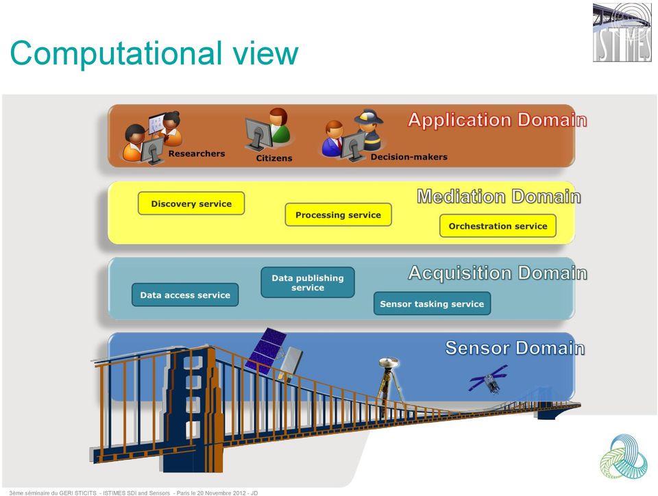
20 Computational view
21 Engineering view
22 Technology view Contributions from partners Data Catalog Sensor controller Security, DSS, portal High-res cartography Third-party solutions 52 North SWE suite

23 Security View Security Shibboleth is an open source middleware SW based over Security Assertion Markup Language Shibboleth provides a Single Sign On (SSO) over the web within a domain or different domain. WAYF= Where are you from SP= Service Provider (ACS) IdP= Identity Provider HS= Handle Service AA= Attribute Authority AR= Attribute Resource
24 Security view
25 User Interface Liferay Portal: is a free and open source enterprise portal written in Java allows users to set up features common to websites is fundamentally constructed of functional units called portalets is sometimes described as a content management framework
26 User Interface Test Beds Sensors List GIS sensors Map Fiber Optic SPS Interface Acquisition List to retrieve using SOS
27 User Interface
28 Fiber Optic SOS server: provides a standard way to access observations and measurements acquired by sensors and sensor system. SPS server: provides method for planning, scheduling and tasking sensor in standard way. OGC client for Fiber sensor: In order to receive and manage planning messages (from SPS service) and to send observation messages (to SOS service), a daemon has to be up and running on Fiber sensor hardware.
29 Infrared thermography Elements of interaction considered for ISTIMES SDI Sensor Observation Service (SOS) Sensor request + User request Application server (Tomcat) Sensor Planning Service (SPS) User request Web Notification Service (WNS) Sensor request IRT System Interaction with SWE (SPS + SOS) IR Camera Weather station GPS InsertObservation Tasking RegisterSensor IRT Measurement Plateform DoNotification SOS IRT PLUGIN SPS WNS 29
30 Illustration: Get Observation <env:envelope xmlns:env=" xmlns:sos=" xmlns:ows=" <env:body> <sos:getobservation xmlns:ows=" xmlns:gml=" xmlns:ogc=" xmlns:om=" xmlns:xsi=" xsi:schemalocation=" service="sos" version="1.0.0" srsname=""> <sos:offering>lwira320</sos:offering> <sos:eventtime> <ogc:tm_during> <ogc:propertyname>om:samplingtime</ogc:propertyname> <gml:timeperiod> <gml:beginposition> t17:44:15+00:00</gml:beginposition> <gml:endposition> t17:44:15+00:00</gml:endposition> </gml:timeperiod> </ogc:tm_during> </sos:eventtime> <sos:procedure>urn:ogc:object:feature:sensor:exent:sbir-istimes</sos:procedure> <sos:observedproperty>urn:ogc:def:phenomenon:ogc:1.0.30:irdataa320matrix</sos:observedproperty> <sos:responseformat>text/xml;subtype="om/1.0.0"</sos:responseformat> <sos:resultmodel>om:observation</sos:resultmodel> <sos:responsemode>inline</sos:responsemode> </sos:getobservation> </env:body> </env:envelope>

31 Illustration Using Google earth and alternative web portal

32 illustration Weather data and IR Image
33 Conclusion Design of an SDI User Interface developed with security layer SDI take into consideration online and offline sensors Online tasking available and tested for Fiber Optic and IRT
34 Thank you for your attention Special thanks to all partners for their contribution Ifsttar MACS (Monitoring, Assessment and Computational Science) Department Route de Bouaye CS Bouguenais Tél. +33 (0) Fax. +33 (0) jean.dumoulin@ifsttar.fr
Deliverable 5.9. System Integration Report
 Deliverable 5.9 System Integration Report Grant Agreement: 225663 Project Title: Integrated System for Transport Infrastructures surveillance and Monitoring by Electromagnetic Sensing Project Acronym:
Use of OGC Sensor Web Enablement Standards in the Meteorology Domain. in partnership with
 Use of OGC Sensor Web Enablement Standards in the Meteorology Domain in partnership with Outline Introduction to OGC Sensor Web Enablement Standards Web services Metadata encodings SWE as front end of
EXPLORING AND SHARING GEOSPATIAL INFORMATION THROUGH MYGDI EXPLORER
 EXPLORING AND SHARING GEOSPATIAL INFORMATION THROUGH MYGDI EXPLORER Subashini Panchanathan Malaysian Centre For Geospatial Data Infrastructure ( MaCGDI ) Ministry of National Resources and Environment
Sextant. Spatial Data Infrastructure for Marine Environment. C. Satra Le Bris, E. Quimbert, M. Treguer
 Sextant On-Line information system for marine geographical information E. Quimbert, M. Bellouis, F. Lecuy, M. Treguer Centre de Bretagne BP 70, Plouzané 29280 France E-mail: sextant@ifremer.fr Sextant
Development of Sensor Web Applications with Open Source Software
 Development of Sensor Web Applications with Open Source Software Arne Bröring1, Eike Hinderk Jürrens1, Simon Jirka1, Christoph Stasch2 1 52 North Initiative for Geospatial Open Source Software GmbH {broering,
Knowledge-based service architecture for multi-risk environmental decision support applications Stuart E. Middleton and Zoheir A.
 Knowledge-based service architecture for multi-risk environmental decision support applications Stuart E. Middleton and Zoheir A. Sabeur IT Innovation Centre, University of Southampton, Gamma House, Enterprise
Data interchange between Web client based task controllers and management information systems using ISO and OGC standards
 Data interchange between Web client based task controllers and management information systems using ISO and OGC standards Michael Nørremark 1*, Ole Jørgensen 1, Jens Bligaard 2 and Claus G. Sørensen 1
Interoperable Solutions in Web-based Mapping
 ISPRS SIPT IGU UCI CIG ACSG Table of contents Table des matières Authors index Index des auteurs Search Recherches Exit Sortir Interoperable Solutions in Web-based Mapping Marta Wojnarowska and Bridget
Remote Sensitive Image Stations and Grid Services
 International Journal of Grid and Distributed Computing 23 Remote Sensing Images Data Integration Based on the Agent Service Binge Cui, Chuanmin Wang, Qiang Wang College of Information Science and Engineering,
Applying OGC Sensor Web Enablement to Risk Monitoring and Disaster Management
 Applying OGC Sensor Web Enablement to Risk Monitoring and Disaster Management Simon Jirka 1, Arne Bröring 2, Christoph Stasch 3 1 52 North Initiative for Geospatial Open Source Software GmbH, jirka@52north.org
INSPIRE Compliant Provision of Metrological Sensor Data at the IMIDA Murcia, Spain
 INSPIRE Compliant Provision of Metrological Sensor Data at the IMIDA Murcia, Spain Authors: Manuel Erena Arrabal, Grupo de Sig y Teledeteccion, IMIDA Juan Antonio Lopez Morales, Grupo de Sig y Teledeteccion,
Enabling embedded maps
 Enabling embedded maps Case: National geoportal of Finland Antti Rainio National Land Survey of Finland Trends: Web Services, Mapping Mashup, Open Source, Open Data Decentralised data s Service interfaces
Geospatial Portal Reference Architecture
 Geospatial Portal Reference Architecture DRAFT OGC 04-039 Open Geospatial Consortium Inc. Date: 2004-07-02 Reference number of this OpenGIS document: OGC 04-039 Version: 0.2 Category: OpenGIS Discussion
The ORIENTGATE data platform
 Seminar on Proposed and Revised set of indicators June 4-5, 2014 - Belgrade (Serbia) The ORIENTGATE data platform WP2, Action 2.4 Alessandra Nuzzo, Sandro Fiore, Giovanni Aloisio Scientific Computing and
How Single-Sign-On Improves The Usability Of Protected Services For Geospatial Data
 2014 Fifth International Conference on Computing for Geospatial Research and Application How Single-Sign-On Improves The Usability Of Protected Services For Geospatial Data Andreas Matheus University of
Introduction to Geospatial Web Services
 Geospatial Web Services Introduction to Geospatial Web Services An introduction and inventory of geospatial web services and their importance to interoperability in the geospatial domain. vers. 20100604
Linking Sensor Web Enablement and Web Processing Technology for Health-Environment Studies
 Linking Sensor Web Enablement and Web Processing Technology for Health-Environment Studies Simon Jirka 1, Stefan Wiemann 2, Johannes Brauner 2, and Eike Hinderk Jürrens 1 1 52 North Initiative for Geospatial
Metadata for Data Discovery: The NERC Data Catalogue Service. Steve Donegan
 Metadata for Data Discovery: The NERC Data Catalogue Service Steve Donegan Introduction NERC, Science and Data Centres NERC Discovery Metadata The Data Catalogue Service NERC Data Services Case study:
Solutions for Central and Federal Governments
 Solutions for Central and Federal Governments Intergraph s Advanced Geospatial Solutions for for Central and Federal Government Operations Central and federal governments are continually asked to do more
A Web services solution for Work Management Operations. Venu Kanaparthy Dr. Charles O Hara, Ph. D. Abstract
 A Web services solution for Work Management Operations Venu Kanaparthy Dr. Charles O Hara, Ph. D Abstract The GeoResources Institute at Mississippi State University is leveraging Spatial Technologies and
Emerging Trends in SDI.
 Emerging Trends in SDI. Jeanne Foust ESRI gsdi 1 Spatial Data Infrastructure TRENDS GIS use continues to rapidly grow. Recognition Of GIS As Critical Infrastructure growing. Alignment of SDI and National
A Hybrid Architecture for Mobile Geographical Data Acquisition and Validation Systems
 A Hybrid Architecture for Mobile Geographical Data Acquisition and Validation Systems Claudio Henrique Bogossian 1, Karine Reis Ferreira 1, Antônio Miguel Vieira Monteiro 1, Lúbia Vinhas 1 1 DPI Instituto
A RDF Vocabulary for Spatiotemporal Observation Data Sources
 A RDF Vocabulary for Spatiotemporal Observation Data Sources Karine Reis Ferreira 1, Diego Benincasa F. C. Almeida 1, Antônio Miguel Vieira Monteiro 1 1 DPI Instituto Nacional de Pesquisas Espaciais (INPE)
The four (five) Sensors
 Sensors") The four (five) Sensors SWE based sensor integration in the German Indonesian Tsunami Early Warning and Mitigation System project (GITEWS) Rainer Häner, GeoForschungsZentrum Potsdam Content GITEWS: A short
The four (five) Sensors SWE based sensor integration in the German Indonesian Tsunami Early Warning and Mitigation System project (GITEWS) Rainer Häner, GeoForschungsZentrum Potsdam Content GITEWS: A short
GeoNetwork, The Open Source Solution for the interoperable management of geospatial metadata
 GeoNetwork, The Open Source Solution for the interoperable management of geospatial metadata Ing. Emanuele Tajariol, GeoSolutions Ing. Simone Giannecchini, GeoSolutions GeoSolutions GeoSolutions GeoNetwork
Design Requirements for an AJAX and Web-Service Based Generic Internet GIS Client
 11th AGILE International Conference on Geographic Information Science 2008 Page 1 of 6 Design Requirements for an AJAX and Web-Service Based Generic Internet GIS Client Edward Nash 1, Peter Korduan 1,
EarthServer @ RDA. RDA: Co-chairing - Big Data IG - Geospatial IG. OGC co-chairing: - editor, Big Geo Data stds - BigData.DWG
 RDA: Co-chairing - Big Data IG - Geospatial IG OGC co-chairing: - editor, Big Geo Data stds - BigData.DWG EarthServer @ RDA RDA-DE/DINI Workshop, Karlsruhe, 2015-may-29 Peter Baumann Jacobs University
Nine partners from Italy, France, Switzerland, Norway, Israel, Sweden, Romany, with the coordination of TERN Consortium (Italy)
") ISTIMES Integrated System for Transport Infrastructures surveillance and Monitoring by Electromagnetic Sensing Vincenzo Cuomo, Francesco Soldovieri Consiglio Nazionale delle Ricerche Joint Call FP7-ICT-SEC-2007-1
ISTIMES Integrated System for Transport Infrastructures surveillance and Monitoring by Electromagnetic Sensing Vincenzo Cuomo, Francesco Soldovieri Consiglio Nazionale delle Ricerche Joint Call FP7-ICT-SEC-2007-1
The Nordic way to International standardization ISO/TC 211
 «Think Local - Act Global» Why engagement in international standards development is important A Nordic Perspective The Nordic way to International standardization Olaf Magnus Østensen Chair of Norway SOSI
ADDING SOS CORE & TRANSACTIONAL PROFILES SUPPORT TO A WEB THIN CLIENT. Irene Garcia Martí
 ADDING SOS CORE & TRANSACTIONAL PROFILES SUPPORT TO A WEB THIN CLIENT Irene Garcia Martí ii ADDING SOS CORE & TRANSACTIONAL PROFILES SUPPORT TO A WEB THIN CLIENT Dissertation supervised by: PhD Joaquín
Open Sensor Web Architecture: Core Services
 Open Web Architecture: Core s Xingchen Chu 1, Tom Kobialka 2, Bohdan Durnota 1, and Rajkumar Buyya 1 GRIDS Lab 1 and NICTA Victoria Lab 2 Department of Computer Science and Software Engineering The University
Intergraph Roadway Information Management Solution. Title Title. Title Title. A White Paper
 Intergraph Roadway Information Management Solution A White Paper Security, Government & Infrastructure, a division of Intergraph Title Title Title Title Table of Contents 1. Introduction... 1 2. Intergraph
CDI/THREDDS Interoperability: the SeaDataNet developments. P. Mazzetti 1,2, S. Nativi 1,2, 1. CNR-IMAA; 2. PIN-UNIFI
 CDI/THREDDS Interoperability: the SeaDataNet developments P. Mazzetti 1,2, S. Nativi 1,2, 1. CNR-IMAA; 2. PIN-UNIFI Outline Interoperability Issues in SeaDataNet A broker solution for CDI/THREDDS interoperability
Managing a Geographic Database From Mobile Devices Through OGC Web Services
 Managing a Geographic Database From Mobile Devices Through OGC Web Services Nieves R. Brisaboa 1, Miguel R. Luaces 1, Jose R. Parama 1, and Jose R. Viqueira 2 1 Database Laboratory, University of A Coruña,
UK Location Programme
 Location Information Interoperability Board Data Publisher How To Guide Understand the background to establishing an INSPIRE View Service using GeoServer DOCUMENT CONTROL Change Summary Version Date Author/Editor
DISMAR: Data Integration System for Marine Pollution and Water Quality
 DISMAR: Data Integration System for Marine Pollution and Water Quality T. Hamre a,, S. Sandven a, É. Ó Tuama b a Nansen Environmental and Remote Sensing Center, Thormøhlensgate 47, N-5006 Bergen, Norway
Centre for EcologicalNoosphere Studies NAS RA CENS
 SCOPES 2009-2012 Scientific Co-operation between Eastern Europe and Switzerland Accessing Armenian Environmental data through CENS Spatial Data Infrastructure Centre for EcologicalNoosphere Studies NAS
ISO 19119 and OGC Service Architecture
 George PERCIVALL, USA Keywords: Geographic Information, Standards, Architecture, Services. ABSTRACT ISO 19119, "Geographic Information - Services," has been developed jointly with the Services Architecture
Francesco Tortorelli
 Francesco Tortorelli Joint CEN/TC 287 and OGC Workshop Bringing GI Standards-making bodies together Frascati (Rome), 30 September 2013 (AgID) AgID (previously CNIPA and DigitPA) is a government agency
Integration of location based services for Field support in CRM systems
 Invited Contribution to GeoInformatics. Deadline September 15, 2001. Integration of location based services for Field support in CRM systems By P. Álvarez, J.A. Bañares, P.R. Muro-Medrano and F.J. Zarazaga
Geospatially Enabling the World: The Convergence of Geospatial and Architectural and Engineering Design
 Geospatially Enabling the World: The Convergence of Geospatial and Architectural and Engineering Design Geoff Zeiss Director of Technology Autodesk Map Middle East Dubai 2007 1 Overview Geospatial inflection
Information Services for Smart Grids
 Smart Grid and Renewable Energy, 2009, 8 12 Published Online September 2009 (http://www.scirp.org/journal/sgre/). ABSTRACT Interconnected and integrated electrical power systems, by their very dynamic
MSDI: Workflows, Software and Related Data Standards
 MSDI: Workflows, Software and Related Data Standards By Andy Hoggarth October 2009 Introduction Leveraging SDI principles for hydrographic operational efficiency French INFRAGEOS example (SHOM - Service
Keystone Image Management System
 Image management solutions for satellite and airborne sensors Overview The Keystone Image Management System offers solutions that archive, catalogue, process and deliver digital images from a vast number
GENESIS Employing Web Processing Services and Sensor Web Technology for Environmental Management
 GENESIS Employing Web Processing Services and Sensor Web Technology for Environmental Management Steven Smolders (1), Christian Alegre (2), Simone Gianfranceschi (3), Marc Gilles (4), Bernd Resch (5),
An ESRI White Paper October 2009 ESRI Geoportal Technology
 An ESRI White Paper October 2009 ESRI Geoportal Technology ESRI 380 New York St., Redlands, CA 92373-8100 USA TEL 909-793-2853 FAX 909-793-5953 E-MAIL info@esri.com WEB www.esri.com Copyright 2009 ESRI
The Arctic Observing Network and its Data Management Challenges Florence Fetterer (NSIDC/CIRES/CU), James A. Moore (NCAR/EOL), and the CADIS team
, James A. Moore (NCAR/EOL), and the CADIS team") The Arctic Observing Network and its Data Management Challenges Florence Fetterer (NSIDC/CIRES/CU), James A. Moore (NCAR/EOL), and the CADIS team Photo courtesy Andrew Mahoney NSF Vision What is AON? a
The Arctic Observing Network and its Data Management Challenges Florence Fetterer (NSIDC/CIRES/CU), James A. Moore (NCAR/EOL), and the CADIS team Photo courtesy Andrew Mahoney NSF Vision What is AON? a
Introduction to Service Oriented Architectures (SOA)
") Introduction to Service Oriented Architectures (SOA) Responsible Institutions: ETHZ (Concept) ETHZ (Overall) ETHZ (Revision) http://www.eu-orchestra.org - Version from: 26.10.2007 1 Content 1. Introduction
Introduction to Service Oriented Architectures (SOA) Responsible Institutions: ETHZ (Concept) ETHZ (Overall) ETHZ (Revision) http://www.eu-orchestra.org - Version from: 26.10.2007 1 Content 1. Introduction
GeoNetwork, The Open Source Solution for the interoperable management of geospatial metadata
 GeoNetwork, The Open Source Solution for the interoperable management of geospatial metadata Ing. Simone Giannecchini, GeoSolutions Ing. Emanuele Tajariol, GeoSolutions Outline GeoNetwork Introduction
GEOSPATIAL DIGITAL ASSET MANAGEMENT A SOLUTION INTEGRATING IMAGERY AND GIS WHERE WILL ALL THE PIXELS GO?(AND HOW WILL WE EVER FIND THEM?
 GEOSPATIAL DIGITAL ASSET MANAGEMENT A SOLUTION INTEGRATING IMAGERY AND GIS WHERE WILL ALL THE PIXELS GO?(AND HOW WILL WE EVER FIND THEM?) Dr. Joan Lurie, GCC, Inc. 30 West 61 st Street, Apt 9A New York,
Technology applied to the most innovative and demanding sectors of the market.
 STE is an Italian medium sized private Systems Integration Company leader in Information and Communication Technology applied to the most innovative and demanding sectors of the market. Established on
How To Use The Alabama Data Portal
 113 The Alabama Metadata Portal: http://portal.gsa.state.al.us By Philip T. Patterson Geological Survey of Alabama 420 Hackberry Lane P.O. Box 869999 Tuscaloosa, AL 35468-6999 Telephone: (205) 247-3611
Web and Mobile GIS Applications Development
 Web and Mobile GIS Applications Development Presented by : Aamir Ali Manager Section Head (GIS Software Customization) Pakistan Space and Upper Atmosphere Research Commission (SUPARCO) Geographical Information
Sense and Sens ability: Semantic Data Modelling for Sensor Networks
 Sense and Sens ability: Semantic Data Modelling for Sensor Networks Payam Barnaghi, Stefan Meissner, Mirko Presser, and Klaus Moessner Centre for Communication Systems Research (CCSR) University of Surrey,
M2M Communications and Internet of Things for Smart Cities. Soumya Kanti Datta Mobile Communications Dept. Email: Soumya-Kanti.Datta@eurecom.
 M2M Communications and Internet of Things for Smart Cities Soumya Kanti Datta Mobile Communications Dept. Email: Soumya-Kanti.Datta@eurecom.fr WHAT IS EURECOM A graduate school & research centre in communication
PART 1. Representations of atmospheric phenomena
 PART 1 Representations of atmospheric phenomena Atmospheric data meet all of the criteria for big data : they are large (high volume), generated or captured frequently (high velocity), and represent a
Standardized data sharing through an open-source Spatial Data Infrastructure: the Afromaison project
 Standardized data sharing through an open-source Spatial Data Infrastructure: the Afromaison project Yaniss Guigoz - University of Geneva/GRID-Geneva 1 EcoARM2ERA and AFROMAISON Why Afromaison in this
Institute of Computational Modeling SB RAS
 Institute of Computational Modeling SB RAS ORGANIZATION OF ACCESS TO OBSERVATIONAL DATA USING WEB SERVICES FOR MONITORING SYSTEMS THE STATE OF THE ENVIRONMENT Kadochnikov Aleksey A. Russia, Krasnoyarsk
Environment Canada Data Management Program. Paul Paciorek Corporate Services Branch May 7, 2014
 Environment Canada Data Management Program Paul Paciorek Corporate Services Branch May 7, 2014 EC Data Management Program (ECDMP) consists of 5 foundational, incremental projects which will implement
Chapter 7. Using Hadoop Cluster and MapReduce
 Chapter 7 Using Hadoop Cluster and MapReduce Modeling and Prototyping of RMS for QoS Oriented Grid Page 152 7. Using Hadoop Cluster and MapReduce for Big Data Problems The size of the databases used in
ArcGIS : Engineered for Interoperability
 ArcGIS : Engineered for Interoperability An ESRI White Paper January 2006 ESRI 380 New York St., Redlands, CA 92373 8100, USA TEL 909 793 2853 FAX 909 793 5953 E MAIL info@esri.com WEB www.esri.com Copyright
INTEROPERABLE IMAGE DATA ACCESS THROUGH ARCGIS SERVER
 INTEROPERABLE IMAGE DATA ACCESS THROUGH ARCGIS SERVER Qian Liu Environmental Systems Research Institute 380 New York Street Redlands, CA92373, U.S.A - qliu@esri.com KEY WORDS: OGC, Standard, Interoperability,
A Web Service based U.S. Cropland Visualization, Dissemination and Querying System
 A Web Service based U.S. Cropland Visualization, Dissemination and Querying System Rick Mueller, Zhengwei Yang, and Dave Johnson USDA/National Agricultural Statistics Service Weiguo Han and Liping Di GMU/Center
SDI National to Global: perspectives from the UK academic sector
 SDI National to Global: perspectives from the UK academic sector Conor G. Smyth, PhD, FRGS, CGeog. (GIS) conor.smyth@ed.ac.uk EDINA, The University of Edinburgh, Scotland Keywords: academic SDI; geospatial
Using Wireless Sensor Networks in the Sensor Web for Flood Monitoring in Brazil
 Using Wireless Sensor Networks in the Sensor Web for Flood Monitoring in Brazil Lívia C. Degrossi, degrossi@icmc.usp.br Guilherme G. do Amaral ggentil@grad.icmc.usp.br Eduardo S. M. de Vasconcelos esmv@grad.icmc.usp.br
Oklahoma s Open Source Spatial Data Clearinghouse: OKMaps
 Oklahoma s Open Source Spatial Data Clearinghouse: OKMaps Presented by: Mike Sharp State Geographic Information Coordinator Oklahoma Office of Geographic Information MAGIC 2014 Symposium April 28-May1,
ShibboLEAP Project. Final Report: School of Oriental and African Studies (SOAS) Colin Rennie
 Colin Rennie") ShibboLEAP Project Final Report: School of Oriental and African Studies (SOAS) Colin Rennie May 2006 Shibboleth Implementation at SOAS Table of Contents Introduction What this document contains Who writes
ShibboLEAP Project Final Report: School of Oriental and African Studies (SOAS) Colin Rennie May 2006 Shibboleth Implementation at SOAS Table of Contents Introduction What this document contains Who writes
AN INTEGRATED SOLUTION FOR MANAGING EXPLORATION DATA
 www.wipro.com AN INTEGRATED SOLUTION FOR MANAGING EXPLORATION DATA Sandipan Chakraborti, Senior Architect ENU Table of Contents 03... Introduction 04... Lack of Holistic View 06... Figure 1: Conceptual
GIS AS A DECISION SUPPORT FOR SUPPLY CHAIN MANAGEMENT
 Paper Reference No.: PN-253 GIS AS A DECISION SUPPORT FOR SUPPLY CHAIN MANAGEMENT Sanjay Kumar 1 and Suneeta Agrawal 2 1. M. Tech. (GIS & Remote Sensing); GIS Cell; MNNIT, Allahabad, India (E-mail: saj.mnnit@gmail.com)
Intergiciels et systèmes distribués
 Intergiciels et systèmes distribués Christophe Gransart IFSTTAR - LEOST 20 Novembre 2012 Christophe Gransart (IFSTTAR) GERI STICITS 20 Novembre 2012 1 / 38 Plan 1 Introduction 2 Service Oriented Architecture
Resource Oriented Architecture and REST
 Resource Oriented Architecture and REST Assessment of impact and advantages on INSPIRE Roberto Lucchi, Michel Millot European Commission Joint Research Centre Institute for Environment and Sustainability
What s new in Carmenta Server 4.2
 What s new in Carmenta Server 4.2 A complete solution for cost-effective visualisation and distribution of GIS data through web services Carmenta Server provides cost-effective technology for building
Cloud application for water resources modeling. Faculty of Computer Science, University Goce Delcev Shtip, Republic of Macedonia
 Cloud application for water resources modeling Assist. Prof. Dr. Blagoj Delipetrev 1, Assist. Prof. Dr. Marjan Delipetrev 2 1 Faculty of Computer Science, University Goce Delcev Shtip, Republic of Macedonia
Cloud-based Infrastructures. Serving INSPIRE needs
 Cloud-based Infrastructures Serving INSPIRE needs INSPIRE Conference 2014 Workshop Sessions Benoit BAURENS, AKKA Technologies (F) Claudio LUCCHESE, CNR (I) June 16th, 2014 This content by the InGeoCloudS
Task AR-09-01a Progress and Contributions
 Doug Nebert, POC U.S. Geological Survey ddnebert@usgs.gov March 2010 Task AR-09-01a Progress and Contributions Background and scope for AR-09-01a This Task defines the minimum, common technical capabilities
Big Data Volume & velocity data management with ERDAS APOLLO. Alain Kabamba Hexagon Geospatial
 Big Data Volume & velocity data management with ERDAS APOLLO Alain Kabamba Hexagon Geospatial Intergraph is Part of the Hexagon Family Hexagon is dedicated to delivering actionable information through
Portal for ArcGIS. Satish Sankaran Robert Kircher
 Portal for ArcGIS Satish Sankaran Robert Kircher ArcGIS A Complete GIS Data Management Planning & Analysis Field Mobility Operational Awareness Constituent Engagement End to End Integration Collect, Organize,
A DISTRIBUTED CATALOG AND DATA SERVICES SYSTEM FOR REMOTE SENSING DATA
 A DISTRIBUTED CATALOG AND DATA SERVICES SYSTEM FOR REMOTE SENSING DATA Ramachandran Suresh *, Liping Di *, Kenneth McDonald ** * NASA/RITSS 4500 Forbes Blvd, Lanham, MD 20706, USA suresh@rattler.gsfc.nasa.gov
Thomas Usländer Fraunhofer IITB
 ORCHESTRA Day Stresa, 12 December 2007 ORCHESTRA Architecture - Behind the Scenes Thomas Usländer Fraunhofer IITB ORCHESTRA Consortium ORCHESTRA Ambition Analysis Maps Info Centre Archive Control centre
ESB-Based Sensor Web Integration for the Prediction of Electric Power Supply System Vulnerability
 Sensors 2013, 13, 10623-10658; doi:10.3390/s130810623 Article OPEN ACCESS sensors ISSN 1424-8220 www.mdpi.com/journal/sensors ESB-Based Sensor Web Integration for the Prediction of Electric Power Supply
An ESRI White Paper July 2009 Creating and Maintaining a Geoportal Management Considerations
 An ESRI White Paper July 2009 Creating and Maintaining a Geoportal Management Considerations ESRI 380 New York St., Redlands, CA 92373-8100 USA TEL 909-793-2853 FAX 909-793-5953 E-MAIL info@esri.com WEB
GEOG 482/582 : GIS Data Management. Lesson 10: Enterprise GIS Data Management Strategies GEOG 482/582 / My Course / University of Washington
 GEOG 482/582 : GIS Data Management Lesson 10: Enterprise GIS Data Management Strategies Overview Learning Objective Questions: 1. What are challenges for multi-user database environments? 2. What is Enterprise
Technology Trends In Geoinformation
 Technology Trends In Geoinformation Dato Prof. Sr Dr. Abdul Kadir Bin Taib Department of Survey and Mapping Malaysia (JUPEM) Email: drkadir@jupem.gov.my www.jupem.gov.my NGIS 2008 3 rd. National GIS Conference
ArcGIS Framework Plug-In: Extending the ArcGIS Desktop for ANSI Standard Framework Data to Support Government Decision Making
 ArcGIS Framework Plug-In: Extending the ArcGIS Desktop for ANSI Standard Framework Data to Support Government Decision Making Final Project Report October 28, 2008 Agreement Number Organization Project
Use of ISO standards by NERC (a snapshot!)
") Use of ISO standards by NERC (a snapshot!) Dr Andrew Woolf andrew.woolf@stfc.ac.uk STFC Rutherford Appleton Laboratory Outline NERC overview The NERC SDI Metadata Data Services Standards activities UK/EU
Use of ISO standards by NERC (a snapshot!) Dr Andrew Woolf andrew.woolf@stfc.ac.uk STFC Rutherford Appleton Laboratory Outline NERC overview The NERC SDI Metadata Data Services Standards activities UK/EU
COPYRIGHTED MATERIAL. Chapter 1: Introduction
 Chapter 1: Introduction 1 Chapter 1: Introduction A major industry trend is evident in the deployment of Web services technology to enhance existing services and to create new and innovative services.
Implementing a Municipal SDI with Service Oriented Architecture
 Implementing a Municipal SDI with Service Oriented Architecture A. A. Ghaemi a, F. Samadzadegan b, A. Rajabifard c, M. Yadegari b a Tehran Municipality ICT Organazation, Tehran, Iran ghaemi@tehran.ir b
Jiří Kadlec and Daniel P. Ames*
 AWRA 2012 SPRING SPECIALTY CONFERENCE New Orleans, Louisiana March 26 28, 2012 Copyright 2012 AWRA DEVELOPMENT OF A LIGHTWEIGHT HYDROSERVER AND HYDROLOGIC DATA HOSTING WEBSITE Jiří Kadlec and Daniel P.
GIS Databases With focused on ArcSDE
 Linköpings universitet / IDA / Div. for human-centered systems GIS Databases With focused on ArcSDE Imad Abugessaisa g-imaab@ida.liu.se 20071004 1 GIS and SDBMS Geographical data is spatial data whose
Access to ESPON Database by third- party applications An expertise on the potentialities of web services for accessing the ESPON metadata and data
 Access to ESPON Database by third- party applications An expertise on the potentialities of web services for accessing the ESPON metadata and data UNEP/GRID- Geneva 27/06/2013 ABOUT THIS DOCUMENT A technical
Using the Grid for the interactive workflow management in biomedicine. Andrea Schenone BIOLAB DIST University of Genova
 Using the Grid for the interactive workflow management in biomedicine Andrea Schenone BIOLAB DIST University of Genova overview background requirements solution case study results background A multilevel
SaaS & DaaS To Manage geospatial knowledge
 SaaS & DaaS To Manage geospatial knowledge Piattaforma Italiana Internet del Futuro Roma 14 April 2011 Dimitri Dello Buono E-Mail : dimitri@dellobuono.eu Italian National Council of Research Was born from
Pan-European infrastructure for management of marine and ocean geological and geophysical data
 Pan-European infrastructure for management of marine and ocean geological and geophysical data By Dick M.A. Schaap Geo-Seas Technical Coordinator March 2010 Supported by the European Commission FP7 - Research
GetLOD - Linked Open Data and Spatial Data Infrastructures
 GetLOD - Linked Open Data and Spatial Data Infrastructures W3C Linked Open Data LOD2014 Roma, 20-21 February 2014 Stefano Pezzi, Massimo Zotti, Giovanni Ciardi, Massimo Fustini Agenda Context Geoportal
Enterprise GIS Solutions to GIS Data Dissemination
 Enterprise GIS Solutions to GIS Data Dissemination ESRI International User Conference July 13 17, 2009 Wendy M. Turner Senior GIS Engineer & Program Manager Freedom Consulting Group, LLC Building the Enterprise
the Cloud Dean McCormick Regional Sales Manager Geospatial MEA Region
 Powering Big Data: From Creation to the Cloud Dean McCormick Regional Sales Manager Geospatial MEA Region The only constant is change, continuing change, inevitable change, that is the dominant factor
13 th EC GI & GIS Workshop WIN: A new OGC compliant SOA. for risk management. GMV, 2007 Property of GMV All rights reserved
 13 th EC GI & GIS Workshop WIN: A new OGC compliant SOA for risk management GMV, 2007 Property of GMV All rights reserved Content 1. Introduction 2. Objectives 3. Architecture and Model 4. Technical aspects
Title: A Client Middleware for Token-Based Unified Single Sign On to edugain
 Title: A Client Middleware for Token-Based Unified Single Sign On to edugain Sascha Neinert Computing Centre University of Stuttgart, Allmandring 30a, 70550 Stuttgart, Germany e-mail: sascha.neinert@rus.uni-stuttgart.de
gvsig: A GIS desktop solution for an open SDI.
 gvsig: A GIS desktop solution for an open SDI. ALVARO ANGUIX1, LAURA DÍAZ1, MARIO CARRERA2 1 IVER Tecnologías de la Información. Valencia, Spain. Tel. +34 96 316 34 00; Fax. +34 96 316 34 00 Email: alvaro.anguix@iver.es
1. Introduction ABSTRACT
 ISPRS SIPT IGU UCI CIG ACSG Table of contents Table des matières Authors index Index des auteurs Search Recherches Exit Sortir Oceans Management Internet Mapping Application (OMIMA): A GIS Web-Based Tool