gebruiken voor aardse toepassingen
|
|
|
- Gabriel Hill
- 8 years ago
- Views:
Transcription
1 26/03/2014 Satellietgegevens gebruiken voor aardse toepassingen Dirk Van Speybroeck

2 VITO, VIsion on TechnOlogy» een op Europees vlak toonaangevend, onafhankelijk onderzoeks- en adviescentrum;» op het gebied van cleantech en duurzame ontwikkeling;» werkt aan oplossingen voor de grote maatschappelijke uitdagingen van vandaag. 26/03/ , VITO NV

3 Thema s Duurzame Chemie Duurzame Energie Duurzaam Materiaalbeheer Duurzame Gezondheid Duurzaam Landgebruik 26/03/ , VITO NV

4 VITO Remote Sensing: a total solution provider platforms satellites airplanes UAS instruments cameras sensors lab raw data pixel values, spectra digital imagery information time series analysis land use change Percentage of crop area affected by drought in the first growing season of 2011 decisions end user client 26/03/ , VITO NV

5 Science meets Industry: innovatieproces toegepast Dissiminatie Implementatie Valorisatie INDUSTRIE Onderzoek VITO Technologie ontwikkeling basis Kennis opbouw UNIVERSITEIT Exploratie Overheid Private sector 26/03/ , VITO NV

6 The remote sensing value chain business model decisions information end user instruments cameras raw data pixel values, spectra digital imagery time series analysis land use change client platforms satellites sensors lab airplanes UAS Industry R&D Space Agency R&D Industry 26/03/ , VITO NV

7 Belgium Space = international collaboration SPOT VEGETATION 1 SPOT VEGETATION 2 Proba-V 1992: Rio Earth Sumit 26/03/ , VITO NV

8 2 VEGETATION instruments in operation Spec Vegetation on SPOT5 Vegetation Instrument on ProbaV Size 1000x1000x700mm 3 800x600x200mm 3 Mass 150kg Max 34kg Power Max. 160W Average +-21W; Max. 41W FOV/Swath 101 /2250km />2250km Spectral bands B0(Blue) B2(Red) B3(NIR)-B4(SWIR) B0(Blue) B2(Red) B3(NIR) B4(SWIR) IQ(MTF) >0.3 >0.3 GSD 1000m VNIR: 100m Nadir - 360m edge SWIR: 200m Nadir 685m edge 26/03/ , VITO NV
 B2(Red) B3(NIR)-B4(SWIR) B0(Blue) B2(Red) B3(NIR) B4(SWIR) IQ(MTF) >0.")
9 SPOT VEGETATION & PROBA-V Daily global vegetation monitoring (1 km, 1/3 km) daily synthesis P-product (segment) 10-daily synthesis global world archive since /03/ , VITO NV

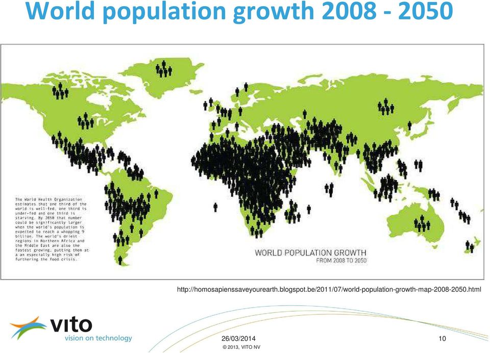
10 World populationgrowth /03/ , VITO NV
11 26/03/ , VITO NV

12 Land useand land cover changes Aral sea 26/03/ , VITO NV

13 Needforlong time series Now at 1/3 km 26/03/ , VITO NV

14 User needin vegetationmonitoring» Daily global coverage» High quality products (S1 and S10)» 1 km, 1/3 km and 100 m products» Link with Long Term archive (> 15 years)» Guaranteed access (> 2020 )» Easy access via web portal» Free and open data policy (Copernicus)» Value added products 26/03/ , VITO NV
» Value added products 26/03/2014 14 2012, VITO")
15 Product Distribution Facility» Web based portal: multi-mission» Integration within ESA GMES Space Component Data Access» Discovery & Ordering, link to multiple processing facilities & Long-term Archive 26/03/ , VITO NV

16 User friendlyon-linecatalogue PROBA V 26/03/ , VITO NV

17 Zoom, select, preview, download PROBA V 26/03/ , VITO NV

18 An active global user community Free Commercial 26/03/ , VITO NV

19 Processing Servers / CPUs Database Servers File servers / TBs Storage 26/03/ , VITO NV

20 GMES Initial Operations (GIO) Global component: Timely production of 14 Global (Bio-geophysical) parameters (Vegetation, Radiation, Water) Based mainly on FP7 GEOLAND-2 processing chains Operations: VITO, IPMA, ZAMG with support science teams Evolution: HYGEOS, UCL, U-Leicester, U-Lisbon, TU Wien, INRA, EOLAB, IPMA, METEO-France, VITO Funding: GIO budget (DG ENTR), contract management by JRC Satellitedata Processing and Product Input Archiving Dissemination 26/03/ , VITO NV
, contract management by JRC Satellitedata Processing and Product Input Archiving Dissemination 26/03/2014")
21 COPERNICUS Global Land Portfolio Product Versions Spatial Spatial Resolution coverage Continental Vegetation Temporal Resolution Temporal Coverage LAI, FAPAR, FCOVER v0 / v1 / v2 1 km Global 10-days 1999-NRT NDVI, VCI, VPI v1 1km Global 10-days (1999)-NRT DMP v1 1km Global 10-days (1999)-NRT Sensor (backup)* VGT (AVHRR) VGT * (AVHRR) VGT (AVHRR) Burnt areas + seasonality v1 1 km Global Daily 1999-NRT VGT Active Fires 1km Global Daily NRT MODIS Energy Budget Land Surface Temperature v1 ~5 km Global Hourly/ 10-days 2009-NRT Top of Canopy Reflectances v1 1km Global 10-days NRT Surface Albedo v0 / v1 1 km Global 10-days 1999-NRT Water cycle Water bodies + seasonality v1 / v2 1km/500m Global 10-days 1999-NRT +/* ΣGEO - VGT + (AVHRR) VGT - (AVHRR) - VGT, MODIS Soil Moisture + Freeze/Thaw v2 25 km Global Daily 2007-NRT ASCAT Time series of soil moisture products v2 25 km Global Daily 1992-present ERS-1&2 Scatt - 26/03/ , VITO NV
22 Vegetation parameters 26/03/ , VITO NV


23 Sample EO based Indicators 26/03/ , VITO NV 23 23
24 Global food security applications 26/03/ , VITO NV
25 FP7 SIGMA project» Start 1 November March 2017 (42 Months)» GEO and GEOGLAM» Agriculture AND Environment» 22 partners, 17 countries» VITO, CIRAD, JRC, IIASA, Alterra, RADI, NMSC, DEIMOS, GeoSAS, RCMRD, Aghrymet, RCMRD, Sarvision, Sarmap, INTA, Geoville, UCL, EFTAS, FAO, ITC, GISAT, IKI, SRI» 9 M EUR» 26/03/ , VITO NV
26 26/03/ , VITO NV
27 The Challenge: dailyglobalat 100 m SPOT VEGETATION 1 1 km SPOT VEGETATION 2 1 km Proba-V 1 km 1/3 km 100 m daily 100 m? Sentinel 3A 300 m Sentinel 3B 300 m METOP A 1 km METOP B 1 km METOP C 1 km 26/03/ , VITO NV
28 Thank you Dirk Van Speybroeck Strategy and Business Development Manager /03/ , VITO NV
IMAGINES_VALIDATIONSITESNETWORK ISSUE 1.00. EC Proposal Reference N FP7-311766. Name of lead partner for this deliverable: EOLAB
 Date Issued: 26.03.2014 Issue: I1.00 IMPLEMENTING MULTI-SCALE AGRICULTURAL INDICATORS EXPLOITING SENTINELS RECOMMENDATIONS FOR SETTING-UP A NETWORK OF SITES FOR THE VALIDATION OF COPERNICUS GLOBAL LAND
VITO Centre of Image Processing
 07/11/2013 VITO Centre of Image Processing Towards an Improved Scientific Exploitation of EO Data Sources in Support of Vegetation Monitoring Erwin Goor, VITO nv Outline» Introduction» The role & and objectives
Proba-V: Earthwatch Mission as part of ESA s Earth Observation Programmes
 Proba-V: Earthwatch Mission as part of ESA s Earth Observation Programmes Antwerp 05.07.2013 Bianca Hoersch Proba-V Mission Manager Third Party Mission & Sentinel-2 Mission Manager Earth Observation Directorate,
Data Warehouse Phase 2 set-up and data offer. Bianca Hoersch, Veronique Amans, Jolyon Martin, Lena Stern, Silke Bode, Luc Govaert
 Data Warehouse Phase 2 set-up and data offer Bianca Hoersch, Veronique Amans, Jolyon Martin, Lena Stern, Silke Bode, Luc Govaert Content 1. Background & Introduction to Copernicus Data Access 2. DWH Phase
Geert BORSTLAP AMESD / BDMS DevCoCast Workshop Antwerp
 Geert BORSTLAP AMESD / BDMS DevCoCast Workshop Antwerp AMESD - DevCoCast 1. AMESD 2. SADC THEMA Agenda 3. AMESD & DevCoCast Cooperation 4. Concluding Remarks 1) AMESD A continental wide, pan-african project
Emergency Management Service. early warning FLOOD AND FIRE ALERTS. Space
 Emergency Management Service early warning FLOOD AND FIRE ALERTS Space 1 Copernicus at a Glance Copernicus is the European Union s Earth Observation programme: a user-driven space programme under civil
Sen-2 Agri System : Champion Users and Site Managers feedback
 Sen-2 Agri System : Champion Users and Site Managers feedback 2 nd Sen2-Agri UsersWorkshop 18-19 Nov. 2015 Brussels, Belgium Sen-2Agri data flow Sen-2Agri system interface Skills requirement to run the
Global environmental information Examples of EIS Data sets and applications
 METIER Graduate Training Course n 2 Montpellier - february 2007 Information Management in Environmental Sciences Global environmental information Examples of EIS Data sets and applications Global datasets
Copernicus Space Component Data Access Architecture. Meeting with Austria 27 May 2014, Vienna
 Copernicus Space Component Data Access Architecture Meeting with Austria 27, Vienna Copernicus Data Policy Users shall have free, full and open access to Copernicus dedicated Sentinel data and Copernicus
Review of Project Objectives
 Review of Project Objectives Folkert Boersma KNMI (Co-ordinator) Jan-Peter Muller UCL (Co-ordinator, Land) Page 1 j.muller@ucl.ac.uk Version: 03.03.2014 5. WP4 Harmonised ECV retrievals & records QA4ECV
SatelliteRemoteSensing for Precision Agriculture
 SatelliteRemoteSensing for Precision Agriculture Managing Director WasatSp. z o.o. Copernicus the road to economic development Warsaw, 26-27 February 2015 Activitiesof WasatSp. z o.o. The company provides
INVESTIGA I+D+i 2013/2014
 INVESTIGA I+D+i 2013/2014 SPECIFIC GUIDELINES ON AEROSPACE OBSERVATION OF EARTH Text by D. Eduardo de Miguel October, 2013 Introducction Earth observation is the use of remote sensing techniques to better
Food security services - GMFS GMES services element. Using ENVISAT MERIS and ASAR for monitoring Agriculture in Africa. http://www.gmfs.
 Food security services - GMFS GMES services element Using ENVISAT MERIS and ASAR for monitoring Agriculture in Africa This presentation - Food (in)security? - Policies, global and european actions - Information
Moderate- and high-resolution Earth Observation data based forest and agriculture monitoring in Russia using VEGA Web-Service
 Moderate- and high-resolution Earth Observation data based forest and agriculture monitoring in Russia using VEGA Web-Service Sergey BARTALEV and Evgeny LOUPIAN Space Research Institute, Russian Academy
Developments toward a European Land Monitoring Framework. Geoff Smith. Seminar 2 nd December, 2015 Department of Geography, University of Cambridge
 Developments toward a European Land Monitoring Framework Geoff Smith Specto Natura Limited Enable clients to deliver useful, accurate and reliable environmental information from EO. Positioned at the interface
Database-driven web mapping using jquery, PHP, PostgreSQL & SDE
 Database-driven web mapping using jquery, PHP, PostgreSQL & SDE By, Jon Nordling, Michael Humber Inbal Becker-Reshef, Brian Barker, Katie McGaughey, Chris Justice University of Maryland College Park http://geoglam-crop-monitor.org/
JECAM Site Ukraine. 21 23 July 2014. Team Leader: Kussul Nataliia. JECAM/GEOGLAM Science Meeting Ottawa, Canada
 Site Ukraine /GEOGLAM Science, Canada 21 23 July Team Leader: Kussul Nataliia Members: Shelestov Andrii, Skakun Sergii Site Description Kyiv oblast (SRI, area 28,000 km 2 ) & intensive observation sub-site
Land Product Validation
 CEOS WGCV Land Product Validation Sub-Group Joanne Nightingale 1, Jaime Nickeson 1 & Gabriela Schaepman-Strub 2 ( 1 Sigma Space Corp / NASA GSFC, 2 University of Zurich) ~ With input from LPV Focus Group
Using Remote Sensing to Monitor Soil Carbon Sequestration
 Using Remote Sensing to Monitor Soil Carbon Sequestration E. Raymond Hunt, Jr. USDA-ARS Hydrology and Remote Sensing Beltsville Agricultural Research Center Beltsville, Maryland Introduction and Overview
ESA Climate Change Initiative contributing to the Global Space-based Architecture for Climate Monitoring
 ESA Climate Change Initiative contributing to the Global Space-based Architecture for Climate Monitoring Pascal Lecomte Head of the ESA Climate Office ESA/ECSAT Global Space-based Architecture for Climate
MASS PROCESSING OF REMOTE SENSING DATA FOR ENVIRONMENTAL EVALUATION IN EUROPE
 MASS PROCESSING OF REMOTE SENSING DATA FOR ENVIRONMENTAL EVALUATION IN EUROPE Lic. Adrián González Applications Research Earth Science Conference 2014 29.07.2014 Earth Science San Conference Francisco
How To Use Data From Copernicus And Big Data To Help The Environment
 Copernicus and Big Data: Challenges and Opportunities Alessandro Annoni European Commission Joint Research Centre www.jrc.ec.europa.eu Serving society Stimulating innovation Supporting legislation Big
GLOBAL MONITORING FOR FOOD SECURITY IM SUDAN
 GLOBAL MONITORING FOR FOOD SECURITY IM SUDAN GMFS 3 Carsten Haub & Klaus-Ulrich Komp 18.11.2010 www.eftas.com 1 World hunger World Summit on Food Security FAO, Rome 11.2009 Mehr als 1 Milliarde Mensche
Automatic land-cover map production of agricultural areas using supervised classification of SPOT4(Take5) and Landsat-8 image time series.
 and Landsat-8 image time series.") Automatic land-cover map production of agricultural areas using supervised classification of SPOT4(Take5) and Landsat-8 image time series. Jordi Inglada 2014/11/18 SPOT4/Take5 User Workshop 2014/11/18
Automatic land-cover map production of agricultural areas using supervised classification of SPOT4(Take5) and Landsat-8 image time series. Jordi Inglada 2014/11/18 SPOT4/Take5 User Workshop 2014/11/18
Satellite Snow Monitoring Activities Project CRYOLAND
 Satellite Snow Monitoring Activities Project CRYOLAND Background material for participants to the Workshop on European Snow Monitoring Perspectives, Darmstadt, 4-5 December 2012. CryoLand provides Snow,
Description of the table of the in-situ data requirements of GMES services
 Description of the table of the in-situ data requirements of GMES services 1. In-situ data requirement: Contains short description of each in-situ data (including spatial data) requirement defined by GMES
Review for Introduction to Remote Sensing: Science Concepts and Technology
 Review for Introduction to Remote Sensing: Science Concepts and Technology Ann Johnson Associate Director ann@baremt.com Funded by National Science Foundation Advanced Technological Education program [DUE
The NASA NEESPI Data Portal to Support Studies of Climate and Environmental Changes in Non-boreal Europe
 The NASA NEESPI Data Portal to Support Studies of Climate and Environmental Changes in Non-boreal Europe Suhung Shen NASA Goddard Space Flight Center/George Mason University Gregory Leptoukh, Tatiana Loboda,
Integration of mobile automated monitoring systems with decision support tools for smart HAB management. VITO Jaap van Nes Göteborg, May 2015
 Integration of mobile automated monitoring systems with decision support tools for smart HAB management VITO Jaap van Nes Göteborg, May 2015 INDEX 1. Background VITO Belgium 2. HAB monitoring methods 3.
Remote Sensing Satellite Information Sheets Geophysical Institute University of Alaska Fairbanks
 Remote Sensing Satellite Information Sheets Geophysical Institute University of Alaska Fairbanks ASTER Advanced Spaceborne Thermal Emission and Reflection Radiometer AVHRR Advanced Very High Resolution
Crop Drought Stress Monitoring by Remote Sensing (DROSMON) Overview. Werner Schneider
 Overview. Werner Schneider") Crop Drought Stress Monitoring by Remote Sensing (DROSMON) Overview Werner Schneider Institut of Surveying, Remote Sensing and Land Information Department of Landscape, Spatial and Infrastructure Sciences
Crop Drought Stress Monitoring by Remote Sensing (DROSMON) Overview Werner Schneider Institut of Surveying, Remote Sensing and Land Information Department of Landscape, Spatial and Infrastructure Sciences
Smart ICT for Weather and Water information and advice to Smallholders in Africa
 Smart ICT for Weather and Water information and advice to Smallholders in Africa Gijs Simons, eleaf Competence Center July 3, 2013 gijs.simons@eleaf.com eleaf and the Smart ICT Project Funded by IFAD (2011-2014),
Supervised Classification workflow in ENVI 4.8 using WorldView-2 imagery
 Supervised Classification workflow in ENVI 4.8 using WorldView-2 imagery WorldView-2 is the first commercial high-resolution satellite to provide eight spectral sensors in the visible to near-infrared
AAFC Medium-Resolution EO Data Activities for Agricultural Risk Assessment
 AAFC Medium-Resolution EO Data Activities for Agricultural Risk Assessment North American Drought Monitor (NADM) Ottawa, Ontario, Canada. October 15-17 2008. A. Davidson 1, A. Howard 1,2, K. Sun 1, M.
Update on EUMETSAT ocean colour services. Ewa J. Kwiatkowska
 Update on EUMETSAT ocean colour services Ewa J. Kwiatkowska 1 st International Ocean Colour Science meeting, 6 8 May, 2013 EUMETSAT space data provider for operational oceanography Operational data provider
Day 2. Summary of Day One. and Introduction to Day Two. Florian Appel VISTA
 Day 2 Summary of Day One and Introduction to Day Two Florian Appel VISTA Summary Day 1 Introduction The European ESA and EUMETSAT long term evolution of snow services Science outlook What can be expected
Copernicus Services: State of Play and Future Perspective. Dr. Silvo Žlebir DG GROW, Copernicus Services. Follow us on:
 Copernicus Services: State of Play and Future Perspective Dr. Silvo Žlebir DG GROW, Copernicus Services Follow us on: Copernicus EU CopernicusEU www.copernicus.eu Space Outline Copernicus Services: Current
Land Use/Land Cover Map of the Central Facility of ARM in the Southern Great Plains Site Using DOE s Multi-Spectral Thermal Imager Satellite Images
 Land Use/Land Cover Map of the Central Facility of ARM in the Southern Great Plains Site Using DOE s Multi-Spectral Thermal Imager Satellite Images S. E. Báez Cazull Pre-Service Teacher Program University
APPLICATION OF TERRA/ASTER DATA ON AGRICULTURE LAND MAPPING. Genya SAITO*, Naoki ISHITSUKA*, Yoneharu MATANO**, and Masatane KATO***
 APPLICATION OF TERRA/ASTER DATA ON AGRICULTURE LAND MAPPING Genya SAITO*, Naoki ISHITSUKA*, Yoneharu MATANO**, and Masatane KATO*** *National Institute for Agro-Environmental Sciences 3-1-3 Kannondai Tsukuba
The USGS Landsat Big Data Challenge
 The USGS Landsat Big Data Challenge Brian Sauer Engineering and Development USGS EROS bsauer@usgs.gov U.S. Department of the Interior U.S. Geological Survey USGS EROS and Landsat 2 Data Utility and Exploitation
Resolutions of Remote Sensing
 Resolutions of Remote Sensing 1. Spatial (what area and how detailed) 2. Spectral (what colors bands) 3. Temporal (time of day/season/year) 4. Radiometric (color depth) Spatial Resolution describes how
Monitoring Overview with a Focus on Land Use Sustainability Metrics
 Monitoring Overview with a Focus on Land Use Sustainability Metrics Canadian Roundtable for Sustainable Crops. Nov 26, 2014 Agriclimate, Geomatics, and Earth Observation Division (ACGEO). Presentation
Un autre Sahel est possible! AMESD ECOWAS THEMA. Water resources Management for agriculture and livestock ISSA GARBA AGRHYMET
 AMESD ECOWAS THEMA Water resources Management for agriculture and livestock ISSA GARBA AGRHYMET Outline I AGRHYMET /CILSS II AMESD Project/ECOWAS Thema Technical partners intervention axes monitoring vegetation
BLACKBRIDGE SATELLITE IMAGERY THROUGH CLOUD COMPUTING
 BLACKBRIDGE SATELLITE IMAGERY THROUGH CLOUD COMPUTING Jason Setzer Cloud Product Manager Slide 1 THE RAPID EYE CONSTELLATION 5 Identical Satellites in same obit Up to 5 million km² collected daily 1 billion
Remote Sensing Department Iranian Space Agency Jeiran Amiraslani 6th June 2014
 Role of E Learning in Knowledge Promotion and Capacity Building for Monitoring and Assessment of Natural Disasters: A case study for Drought Monitoring Remote Sensing Department Iranian Space Agency Jeiran
High Resolution Information from Seven Years of ASTER Data
 High Resolution Information from Seven Years of ASTER Data Anna Colvin Michigan Technological University Department of Geological and Mining Engineering and Sciences Outline Part I ASTER mission Terra
Overview of AMESD. Harry DE BACKER Minister Counsellor EU DEL AU Dar es Salaam, 8 May 2012
 Overview of AMESD Harry DE BACKER Minister Counsellor EU DEL AU Dar es Salaam, 8 May 2012 Political framework African Union Commission European Union ACP Secretariat 5 African Regional Economic Communities
Connected Farm Field Services. Dan Rooney InfoAg Conference, July 30, 2014
 Connected Farm Field Services Dan Rooney InfoAg Conference, July 30, 2014 What is Connected Farm? Connected Farm is an integrated operations management solution that combines industry-leading hardware,
Software requirements * :
 Title: Product Type: Developer: Target audience: Format: Software requirements * : Data: Estimated time to complete: Fire Mapping using ASTER Part I: The ASTER instrument and fire damage assessment Part
ipot project Industrial Potato monitoring for the Belgian potato sector
 ipot project Industrial Potato monitoring for the Belgian potato sector Yannick Curnel, Jean-Pierre Goffart, Viviane Planchon (CRA-W) Version 25/04/2014 Financed by : BELSPO Project of 36 month 01/06/2014-31/05/2017
Welcome to NASA Applied Remote Sensing Training (ARSET) Webinar Series
 Webinar Series") Welcome to NASA Applied Remote Sensing Training (ARSET) Webinar Series Introduction to Remote Sensing Data for Water Resources Management Course Dates: October 17, 24, 31 November 7, 14 Time: 8-9 a.m.
Welcome to NASA Applied Remote Sensing Training (ARSET) Webinar Series Introduction to Remote Sensing Data for Water Resources Management Course Dates: October 17, 24, 31 November 7, 14 Time: 8-9 a.m.
Innovation and new land monitoring services for climate change, forests and agroforestry
 Innovation and new land monitoring services for climate change, forests and agroforestry Martin Herold Wageningen University Center for Geoinformation Current distribution of aboveground biomass Terrestrial
WP22: GEONETCast tools and user support. Tools for data processing
 Page : 1 of 37 WP22: GEONETCast tools and user support Tools for data processing Date 2013 03 28 Topic WP22 Prepared by Dr. B.H.P. Maathuis (UTwente ITC) and T. Jacobs (VITO) Diffusion All AGRICAB partners,
A remote sensing instrument collects information about an object or phenomenon within the
 Satellite Remote Sensing GE 4150- Natural Hazards Some slides taken from Ann Maclean: Introduction to Digital Image Processing Remote Sensing the art, science, and technology of obtaining reliable information
MODIS IMAGES RESTORATION FOR VNIR BANDS ON FIRE SMOKE AFFECTED AREA
 MODIS IMAGES RESTORATION FOR VNIR BANDS ON FIRE SMOKE AFFECTED AREA Li-Yu Chang and Chi-Farn Chen Center for Space and Remote Sensing Research, National Central University, No. 300, Zhongda Rd., Zhongli
ICSU/WMO World Data Center for Remote Sensing of the Atmosphere (WDC RSAT)
") ICSU/WMO World Data Center for Remote Sensing of the Atmosphere (WDC RSAT) Beate Hildenbrand (et al.) German Aerospace Center (DLR) GAW 2009, Geneva, 05 07 May 2009 http://wdc.dlr.de WDC RSAT overview
ICSU/WMO World Data Center for Remote Sensing of the Atmosphere (WDC RSAT) Beate Hildenbrand (et al.) German Aerospace Center (DLR) GAW 2009, Geneva, 05 07 May 2009 http://wdc.dlr.de WDC RSAT overview
Asia-Pacific Environmental Innovation Strategy (APEIS)
") Asia-Pacific Environmental Innovation Strategy (APEIS) Integrated Environmental Monitoring IEM) Dust Storm Over-cultivation Desertification Urbanization Floods Deforestation Masataka WATANABE, National
Asia-Pacific Environmental Innovation Strategy (APEIS) Integrated Environmental Monitoring IEM) Dust Storm Over-cultivation Desertification Urbanization Floods Deforestation Masataka WATANABE, National
Sentinel-1 Mission Overview
 Sentinel-1 Mission Overview Pierre Potin Sentinel-1 Mission Manager, ESA Advanced Course on Radar Polarimetry ESRIN, Frascati, 19 January 2011 Global Monitoring for Environment and Security GMES is established
SAMPLE MIDTERM QUESTIONS
 Geography 309 Sample MidTerm Questions Page 1 SAMPLE MIDTERM QUESTIONS Textbook Questions Chapter 1 Questions 4, 5, 6, Chapter 2 Questions 4, 7, 10 Chapter 4 Questions 8, 9 Chapter 10 Questions 1, 4, 7
Monitoring Global Crop Condition Indicators Using a Web-Based Visualization Tool
 Monitoring Global Crop Condition Indicators Using a Web-Based Visualization Tool Bob Tetrault, Regional Commodity Analyst, and Bob Baldwin, GIS Specialist, USDA, Foreign Agricultural Service, Washington,
GEOGG142 GMES Calibration & validation of EO products
 GEOGG142 GMES Calibration & validation of EO products Dr. Mat Disney mdisney@geog.ucl.ac.uk Pearson Building room 113 020 7679 0592 www.geog.ucl.ac.uk/~mdisney Outline Calibration & validation Example:
Advantages and limitations of using satellite images for flood mapping
 Advantages and limitations of using satellite images for flood mapping Domenico Grandoni e-geos Headquarter Contrada Terlecchie 75100 Matera - Italy Commercial Office Via Cannizzaro 71 00156 Roma - Italy
Data Processing Flow Chart
 Legend Start V1 V2 V3 Completed Version 2 Completion date Data Processing Flow Chart Data: Download a) AVHRR: 1981-1999 b) MODIS:2000-2010 c) SPOT : 1998-2002 No Progressing Started Did not start 03/12/12
Titel. 1 februari 2012. pagina 1
 Titel 1 februari 2012 pagina 1 From a joint effort with a long term vision on regional development 1 februari 2012 pagina 2 creating the European Space Innovation Centre, and Change starts where change-minded
A Future Scenario of interconnected EO Platforms How will EO data be used in 2025?
 A Future Scenario of interconnected EO Platforms How will EO data be used in 2025? ESA UNCLASSIFIED For Official Use European EO data asset Heritage missions Heritage Core GS (data preservation, curation
The use of Earth Observation technology to support the implementation of the Ramsar Convention
 Wetlands: water, life, and culture 8th Meeting of the Conference of the Contracting Parties to the Convention on Wetlands (Ramsar, Iran, 1971) Valencia, Spain, 18-26 November 2002 COP8 DOC. 35 Information
Introduction to teledection
 Introduction to teledection Formation Sébastien Clerc, ACRI-ST sebastien.clerc@acri-st.fr ACRI-ST Earth Observation Actors and Markets 2 Earth Observation economic importance Earth Observation is one of
Data Warehouse Requirements Version 2.0
 EUROPEAN COMMISSION ENTERPRISE AND INDUSTRY DIRECTORATE-GENERAL Aerospace, Maritime, Security and Defence Industries Copernicus : Infrastructures Data Warehouse Requirements Version 2.0 Copernicus Data
ASCAT services status Global and regional services
 ASCAT services status Global and regional services Craig Anderson, Hans Bonekamp, Leonid Butenko, Colin Duff, Julia Figa-Saldaña, Christelle Ponsard, Arthur de Smet and Julian Wilson (EUMETSAT) A.Stoffelen,
Hyperspectral Satellite Imaging Planning a Mission
 Hyperspectral Satellite Imaging Planning a Mission Victor Gardner University of Maryland 2007 AIAA Region 1 Mid-Atlantic Student Conference National Institute of Aerospace, Langley, VA Outline Objective
Evaluation of Wildfire Duration Time Over Asia using MTSAT and MODIS
 Evaluation of Wildfire Duration Time Over Asia using MTSAT and MODIS Wataru Takeuchi * and Yusuke Matsumura Institute of Industrial Science, University of Tokyo, Japan Ce-504, 6-1, Komaba 4-chome, Meguro,
GMES in Poland: Achievements and Challanges. Marek Banaszkiewicz Space Research Centre of the Polish Academy of Sciences
 GMES in Poland: Achievements and Challanges Marek Banaszkiewicz Space Research Centre of the Polish Academy of Sciences GMES in Poland 2 Responsible Ministry: Higher Education and Science Cooperating Ministries:
The National Strategy, Current Activities for Space Technology Development and Application
 14-18 November 2011, Putrajaya, Malaysia The National Strategy, Current Activities for Space Technology Development and Application Lai Anh Khoi Space Technology Institute, VAST, Vietnam Bief History Space
Fields as a Generic Data Type for Big SpaLal Data
 Fields as a Generic Data Type for Big SpaLal Data Gilberto Camara, Max J. Egenhofer, Karine Ferreira, Pedro Andrade, Gilberto Queiroz, Alber Sanchez, Jim Jones, and Lubia Vinhas image: INPE mobile devices
Using D2K Data Mining Platform for Understanding the Dynamic Evolution of Land-Surface Variables
 Using D2K Data Mining Platform for Understanding the Dynamic Evolution of Land-Surface Variables Praveen Kumar 1, Peter Bajcsy 2, David Tcheng 2, David Clutter 2, Vikas Mehra 1, Wei-Wen Feng 2, Pratyush
Using Remote Sensing Imagery to Evaluate Post-Wildfire Damage in Southern California
 Graham Emde GEOG 3230 Advanced Remote Sensing February 22, 2013 Lab #1 Using Remote Sensing Imagery to Evaluate Post-Wildfire Damage in Southern California Introduction Wildfires are a common disturbance
Sentinel-3 Marine Test Data Set processed at EUMETSAT
 Sentinel-3 Marine Test Data Set processed at EUMETSAT Doc.No. : EUM/TSS/TEN/15/822144 Issue : v2 e-signed Date : 15 December 2015 WBS/DBS : EUMETSAT Eumetsat-Allee 1, D-64295 Darmstadt, Germany Tel: +49
Monitoring Soil Moisture from Space. Dr. Heather McNairn Science and Technology Branch Agriculture and Agri-Food Canada heather.mcnairn@agr.gc.
 Monitoring Soil Moisture from Space Dr. Heather McNairn Science and Technology Branch Agriculture and Agri-Food Canada heather.mcnairn@agr.gc.ca What is Remote Sensing? Scientists turn the raw data collected
AMESD/MESA & GMES and Africa
 AMESD/MESA & GMES and Africa Jolly Wasambo AUC-REA Outline Background MESA: objective and expected results Thematic actions & services Some concerns about natural resources Land degradation Loss of soil
Ksat Infrastructure and architecture for Multi-Mission Applications. dr. Kris Nackaerts dr. Martin Krynitz dr. Jan Petter Pedersen
 Ksat Infrastructure and architecture for Multi-Mission Applications dr. Kris Nackaerts dr. Martin Krynitz dr. Jan Petter Pedersen Riyadh, 2016 Tromsø Capital of space activities in the North Tromsø Capital
Integrated Global Carbon Observations. Beverly Law Prof. Global Change Forest Science Science Chair, AmeriFlux Network Oregon State University
 Integrated Global Carbon Observations Beverly Law Prof. Global Change Forest Science Science Chair, AmeriFlux Network Oregon State University Total Anthropogenic Emissions 2008 Total Anthropogenic CO 2
Big data in Environmental Remote Sensing Challenges and Chances
 Big data in Environmental Remote Sensing Challenges and Chances Th. Udelhoven University of Trier Environmental and Geoinformatics Department 19/12/2013-1 UniGR Workshop: Big Data challenges and opportunities
2.3 Spatial Resolution, Pixel Size, and Scale
 Section 2.3 Spatial Resolution, Pixel Size, and Scale Page 39 2.3 Spatial Resolution, Pixel Size, and Scale For some remote sensing instruments, the distance between the target being imaged and the platform,
The Challenges of Geospatial Analytics in the Era of Big Data
 The Challenges of Geospatial Analytics in the Era of Big Data Dr Noordin Ahmad National Space Agency of Malaysia (ANGKASA) CITA 2015: 4-5 August 2015 Kuching, Sarawak Big datais an all-encompassing term
U.S. Geological Survey Earth Resources Operation Systems (EROS) Data Center
 Data Center") U.S. Geological Survey Earth Resources Operation Systems (EROS) Data Center World Data Center for Remotely Sensed Land Data USGS EROS DATA CENTER Land Remote Sensing from Space: Acquisition to Applications
U.S. Geological Survey Earth Resources Operation Systems (EROS) Data Center World Data Center for Remotely Sensed Land Data USGS EROS DATA CENTER Land Remote Sensing from Space: Acquisition to Applications
The Advantages of Sentinel E-OO System
 Il Settore spaziale di Copernicus e le infrastrutture nazionali Roberto Battiston Agenzia Spaziale Italiana Copernicus: Objectives Objectives Monitor the environment Protect people and assets Increase
The needs on big data management for Operational Geo-Info Services: Emergency Response, Maritime surveillance, Agriculture Management
 Copernicus Big-Data Workshop 2014, 13/14 March The needs on big data management for Operational Geo-Info Services: Emergency Response, Maritime surveillance, Agriculture Management Marco Corsi e-geos 1
Australia s National Carbon Accounting System. Dr Gary Richards Director and Principal Scientist
 Australia s National Carbon Accounting System Dr Gary Richards Director and Principal Scientist Government Commitment The Australian Government has committed to a 10 year, 3 phase, ~$35M program for a
Landsat Monitoring our Earth s Condition for over 40 years
 Landsat Monitoring our Earth s Condition for over 40 years Thomas Cecere Land Remote Sensing Program USGS ISPRS:Earth Observing Data and Tools for Health Studies Arlington, VA August 28, 2013 U.S. Department
Digital Remote Sensing Data Processing Digital Remote Sensing Data Processing and Analysis: An Introduction and Analysis: An Introduction
 Digital Remote Sensing Data Processing Digital Remote Sensing Data Processing and Analysis: An Introduction and Analysis: An Introduction Content Remote sensing data Spatial, spectral, radiometric and
OUTLINES. Earth Observation Satellite Program of Vietnam and applications for disaster management
 UNESCAP ICC & HLDM Meetings, Bangkok 26 28/11/2013 Earth Observation Satellite Program of Vietnam and applications for disaster management OUTLINES 1. VNREDSat-1 (VAST*) - Optical 2. VNREDSat-1B (VAST)
INTA AIRBORNE REMOTE SENSING FACILITY from the Hasselblad s cameras to the SensyTech-AHS sensor
 INTA AIRBORNE REMOTE SENSING FACILITY from the Hasselblad s cameras to the SensyTech-AHS sensor José-Antonio Gómez-Sánchez gomezsj@inta.es Remote Sensing Laboratory INSTITUTO NACIONAL DE TÉCNICA AEROESPACIAL
Chapter Contents Page No
 Chapter Contents Page No Preface Acknowledgement 1 Basics of Remote Sensing 1 1.1. Introduction 1 1.2. Definition of Remote Sensing 1 1.3. Principles of Remote Sensing 1 1.4. Various Stages in Remote Sensing
PETROBRAS Orbital Sea Surface Monitoring
 PETROBRAS Orbital Sea Surface Monitoring Performed by : Contingency Control - Exploration & Production Area Technical support: R&D Center Cristina Bentz PETROBRAS R&D Center Environment Assessment and
European Space Agency EO Missions. Ola Gråbak ESA Earth Observation Programmes Tromsø, 17 October 2012
 European Space Agency EO Missions Ola Gråbak ESA Earth Observation Programmes Tromsø, 17 October 2012 Europe and Space, A POLICY Article 189 of the Lisbon Treaty (2009) gives the European Union an explicit
Joint Polar Satellite System (JPSS)
") Joint Polar Satellite System (JPSS) John Furgerson, User Liaison Joint Polar Satellite System National Environmental Satellite, Data, and Information Service National Oceanic and Atmospheric Administration
Joint Polar Satellite System (JPSS) John Furgerson, User Liaison Joint Polar Satellite System National Environmental Satellite, Data, and Information Service National Oceanic and Atmospheric Administration
Present Status of Coastal Environmental Monitoring in Korean Waters. Using Remote Sensing Data
 Present Status of Coastal Environmental Monitoring in Korean Waters Using Remote Sensing Data Sang-Woo Kim, Young-Sang Suh National Fisheries Research & Development Institute #408-1, Shirang-ri, Gijang-up,
The Future of Geospatial Big Data Giovanni Marchisio, Ph.D., Director Product Development
 The Future of Geospatial Big Data Giovanni Marchisio, Ph.D., Director Product Development Nuclear Power Plant, Doel, Belgium December 10, 2011 WorldView-2 Why Geospatial Big Data? We Are the Innovators
Remote sensing and GIS applications in coastal zone monitoring
 Remote sensing and GIS applications in coastal zone monitoring T. Alexandridis, C. Topaloglou, S. Monachou, G.Tsakoumis, A. Dimitrakos, D. Stavridou Lab of Remote Sensing and GIS School of Agriculture
ENVIRONMENTAL MONITORING Vol. I - Remote Sensing (Satellite) System Technologies - Michael A. Okoye and Greg T. Koeln
 System Technologies - Michael A. Okoye and Greg T. Koeln") REMOTE SENSING (SATELLITE) SYSTEM TECHNOLOGIES Michael A. Okoye and Greg T. Earth Satellite Corporation, Rockville Maryland, USA Keywords: active microwave, advantages of satellite remote sensing, atmospheric
REMOTE SENSING (SATELLITE) SYSTEM TECHNOLOGIES Michael A. Okoye and Greg T. Earth Satellite Corporation, Rockville Maryland, USA Keywords: active microwave, advantages of satellite remote sensing, atmospheric