Advanced tools in water management in The Netherlands
|
|
|
- Drusilla Lindsey
- 8 years ago
- Views:
Transcription
1 Advanced tools in water management in The Netherlands Modelling for system knowledge, effective operational management, and policy making Gé van den Eertwegh Rivierenland Water Board The Netherlands PR China, Beijing, May 26-27, Advanced tools in Water Resources Management

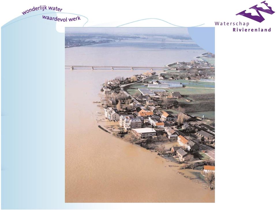
2 Helicopter view The Netherlands Land surface km 2 60% agriculturally cultivated 16% built area Inhabitants 16 million (470 per km 2 ) About 60% of area can be flooded by sea or river > water management is of key interest

3 Area at potential flood risk

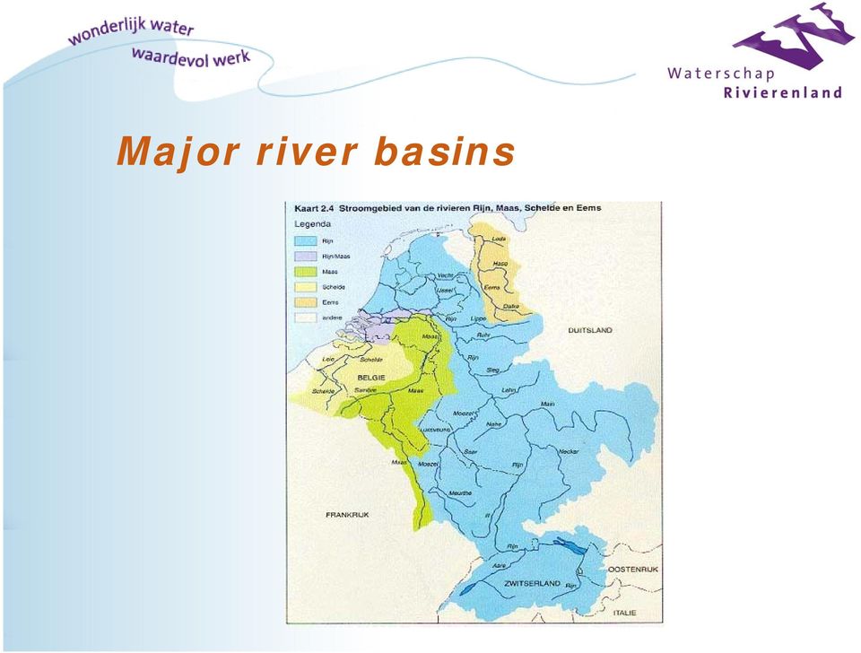
4 Major river basins
5 Geological cross section W-E

6 Water Boards in The Netherlands The oldest form of democratic government (13th century) Arisen by Natural circumstances The need and efficiency to cooperate and organise Decision making is ruled by the sequence of interest, payment, and influence

7 Dutch Water Boards at present Public authorities with a predetermined, limited task related to integrated water management Some figures (2008): - 26 all-in water boards (in 1950: 2500!) employees - 2 billion euro s annual tax income; almost completely self supporting
 - 11 000 employees - 2 billion euro s annual tax income; almost")
8
9 Rivierenland Water Board: area ha - 38 municipalities inhabitants km dikes km water courses - 39 wastewater treatment plants km pressure pipelines km roads employees

10 Rivierenland Water Board Major tasks: Flood control Integrated water management (hydrology, chemistry, biology) Municipal wastewater treatment Also: Musk rats control Road maintenance

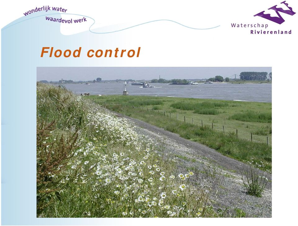
11 Flood control
12
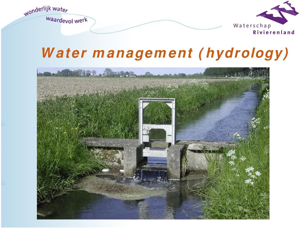
13 Water management (hydrology)
14 Water management (chemistry)

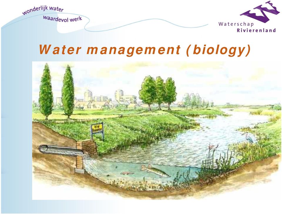
15 Water management (biology)
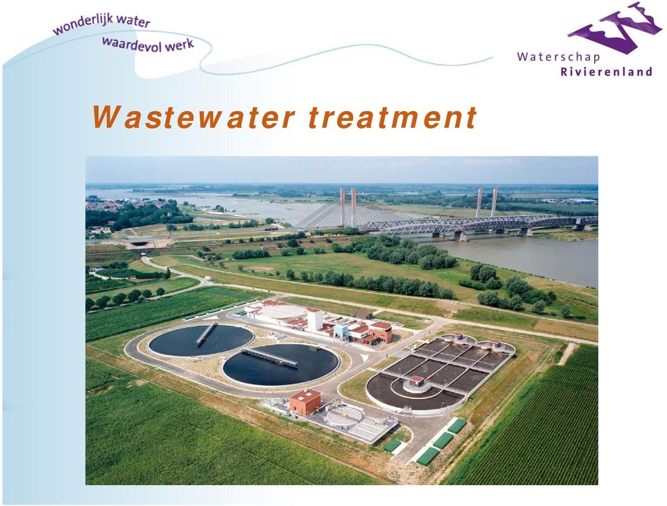
16 Wastewater treatment
17 Information water management Monitoring programme Hydrology Chemistry Ecology Actual management practices Modelling efforts (hydrology and chemistry) Surface water Top soil Regional groundwater
 Surface water Top soil")
18 Why to use simulation models? System analysis Integration of measurements in time and space Determine effects of policy measures beforehand Calculate effects of changing boundary conditions on water management, e.g. climate change Forecasting in operational water management

19 Model definition Hardware Software programmes System definition Schematisation Parameters BC s and IC s Calibration Validation Modelling expert Common sense

20 Three examples Regional groundwater modelling Full area Top soil and regional groundwater Climate and water management Specific polder area Surface and soil water system Surface water quality modelling Specific polder area Surface water system

21 Regional groundwater modelling
22 Regional groundwater modelling System analysis of groundwater Water tables and mass fluxes Travel times Provide information Influence of surface water management on land and land use by interaction with groundwater Spatial planning of land use Adaptation of water system to climate changes Steady state and transient situations Resolution: network 25 x 25 m² and 1 day time step
23 Regional groundwater modelling Software MODFLOW: regional groundwater flow MetaSWAP: groundwater recharge (Alterra) Coupled: MODFLOW-MetaSWAP Using the imod modelling environment (TNO/Deltares)
24 Regional groundwater modelling MetaSWAP Covers the top soil / unsaturated zone SWAP-model (Soil Water Atmosphere Plant) is basis: model output on variables converted into tables Database with functional relationship between unsaturated zone variables Runs 50 to 100 times faster as compared to SWAP
25 Regional groundwater modelling MODFLOW-MetaSWAP coupling scheme metaswap metaswap metaswap Aanvulling + Bergingstabel Aanvulling + Bergingstabel Initiele grondwaterstand grondwaterstand grondwaterstand MODFLOW MODFLOW MODFLOW T=0 T=dt T=2dt
26 Regional groundwater modelling imod modelling environment Central model database and server Remote desktop connected Several users GIS-interface Impuls Response (IR) database with results
27 Regional groundwater modelling Data needed 1 Subsurface geology 2 Soil map 3 Soil physical characteristics 4 Land use map 5 Surface water and drainage system: structure and variables 6 Water levels rivers 7 Ground surface height and topograph 8 Groundwater withdrawal data 9 Areal precipitation and potential evapotranspiration 10 Groundwater levels 11 and more
28 Regional groundwater modelling Modelling area
29 Regional groundwater modelling Results groundwater levels (time)
30 Regional groundwater modelling Results groundwater levels (space)
31 Regional groundwater modelling Results groundwater recharge/seepage (space)
32 Climate and water management
33 Climate and water management Climate changes with time Precipitation (volume and intensity) Evapotranspiration Water levels of river Rhine Consequences for water management in river area?
34 Climate and water management Software FutureView-R Upper groundwater soil water and surface water system
35 Climate and water management Results ET deficit in summer months 2003
36 Climate and water management Results discharge from area ( ) Model ModelW+ 8 Afvoer (mm/d) /00 7/00 1/01 7/01 1/02 7/02 1/03 7/03 1/04 7/04 Datum
37 Surface water quality modelling
38 Surface water quality modelling System analysis of surface water Mass fluxes and flow velocities Water and solute sources analysis Solute concentrations Provide information Influence of land use on surface water quality Spatial planning of land use Steady state and transient situation Resolution: network nodes at 100 m and 1 day time step
39 Surface water quality modelling Software stroomgebied watergangen MODFLOW-SWAP Modflow kwantiteit SOBEK-CF Swap Sobek-CF SOBEK-WQ modules Emissie Sobek-WQ kwaliteit
40 Surface water quality modelling Results solute concentration surface water (time) Locatie GBR-AVK 0,20 0,18 Huidige situatie processen (μg/l) Alternatief 1b (μg/l) Alternatief 3 (μg/l) Alternatief 5 (μg/l) Alternatief 1a (μg/l) Alternatief 2 (μg/l) Alternatief 4 (μg/l) MTR-Cbf Concentratie Carbofuran (ug/l) 0,16 0,14 0,12 0,10 0,08 0,06 0,04 0,02 0,
41 Surface water quality modelling Results solute concentration surface water (space)
42 Surface water quality modelling Results solute concentration above threshold value scenario 1a scenario 1b scenario 2 scenario 3 scenario 4 scenario 5 gemalen: Baanbreker 1,3 1,5 1,0 1,5 0,3 0,3 Van Dam van Brakel 1,3 1,8 1,5 1,0 0,5 0,3 HC de Jongh 1,3 1,3 1,8 1,0 0,5 0,3 afwateringsgebieden: Baanbreker 1 2,0 3,0 1,0 3,0 0,3 0,4 Baanbreker 2 1,0 1,0 1,0 1,0 0,5 0,5 Van Dam van Brakel 1 1,0 2,6 2,0 1,0 0,3 0,3 Van Dam van Brakel 2 3,0 4,0 2,2 1,0 1,2 0,2 HC de Jongh 1,0 1,0 1,9 1,0 0,6 0,5
43 Surface water quality modelling Results sources of water in space and time (fraction)
44 Conclusions
45 Conclusions (1) Weaknesses Modelling takes efforts (time, money, data, expertise): investments and patience necessary Pitfall: assumptions made and over-parametrization Integration of measurements and modelling results is necessary: what if measurements are lacking..? How to find out accuracy and reliability of results?
46 Conclusions (2) Strengths Modelling makes you think and leads to knowledge of how water system works Water system knowledge is needed to facilitate discussions with land users/owners, in own organization, and with province, state, Targeted and effective policy measures can be evaluated beforehand
47 Conclusions (3) Mass balances based on measurements from different sources go first! Make all three: Basin area Soil system Surface water system Start with simple models, then possibly extend Modelling facilitates good governance: at present facing future challenges
48 Thank you for your attention! Any questions? You re welcome! For further information: Gé van den Eertwegh Rivierenland Water Board PO Box AN TIEL The Netherlands Tel : g.vanden.eertwegh@wsrl.nl Website: PR China, Beijing, May 26-27, 2008 Advanced tools in Water Resources Management
Title: Guiding Models and Norm Study for Water Storage: A new way of thinking?
 Tools Title: Guiding Models and Norm Study for Water Storage: A new way of thinking? Keywords: Regional; communication; inundation; stakeholder engagement; water management; spatial planning Audience:
Water Management in Cuba: Problems, Perspectives, Challenges and the Role of the Cuban Academy of Sciences
 Water Management in Cuba: Problems, Perspectives, Challenges and the Role of the Cuban Academy of Sciences Daniela M. Arellano Acosta Environment Agency/ Water Commission, Academy of Science, CUBA Water
WATER AND DEVELOPMENT Vol. II - Types Of Environmental Models - R. A. Letcher and A. J. Jakeman
 TYPES OF ENVIRONMENTAL MODELS R. A. Letcher and A. J. Jakeman Centre for Resource and Environmental Studies, The Australian National University, Australia Keywords: environmental models, environmental
Climate-proofing freshwater supply in the Netherlands
 Climate-proofing freshwater supply in the Netherlands ECCA 2013 20 februari 2013 Ron Franken, Jelle van Minnen, Willem Ligtvoet 1 Climate-proofing freshwater supply in the Netherlands Leading questions
Applying MIKE SHE to define the influence of rewetting on floods in Flanders
 Applying MIKE SHE to define the influence of rewetting on floods in Flanders MARK HENRY RUBARENZYA 1, PATRICK WILLEMS 2, JEAN BERLAMONT 3, & JAN FEYEN 4 1,2,3 Hydraulics Laboratory, Department of Civil
Lars-Göran Gustafsson, DHI Water and Environment, Box 3287, S-350 53 Växjö, Sweden
 Alternative Drainage Schemes for Reduction of Inflow/Infiltration - Prediction and Follow-Up of Effects with the Aid of an Integrated Sewer/Aquifer Model Introduction Lars-Göran Gustafsson, DHI Water and
Climate vulnerability assessment Risks from urban flooding Interactive science and policy assessment
 Climate vulnerability assessment Risks from urban flooding Interactive science and policy assessment Flood risk from extreme precipitation in Copenhagen - Modelling results Per Skougaard Kaspersen, DTU
CLIMATE CHANGE AND NATURE,
 CLIMATE CHANGE AND NATURE, INTEGRATION OF SPATIAL POLICIES WITH A LAND USE MODEL Michiel van Eupen 1, Eveliene Steingröver 1, Sabine van Rooij 1 Eric Koomen 2 & Chris jacobs 2 Rotterdam 29 September 2010
New Brunswick s Flood Risk Reduction Strategy. Province of New Brunswick PO 6000, Fredericton NB E3B 5H1. www.gnb.ca
 New Brunswick s Flood Risk Reduction Strategy i New Brunswick s Flood Risk Reduction Strategy Province of New Brunswick PO 6000, Fredericton NB E3B 5H1 2014 www.gnb.ca ISBN 978-1-4605-0533-5 (print edition)
WATER QUALITY MONITORING AND APPLICATION OF HYDROLOGICAL MODELING TOOLS AT A WASTEWATER IRRIGATION SITE IN NAM DINH, VIETNAM
 WATER QUALITY MONITORING AND APPLICATION OF HYDROLOGICAL MODELING TOOLS AT A WASTEWATER IRRIGATION SITE IN NAM DINH, VIETNAM LeifBasherg (1) OlujZejlllJul Jessen (1) INTRODUCTION The current paper is the
MIKE SHE PP User Manual Water Balance Utility
 MIKE SHE PP User Manual Water Balance Utility CONTENTS 1 WATER BALANCE UTILITY... 1 1.1 Macro File... 2 1.1.1 Input to MIKE SHE water balance extraction program... 2 1.1.2 Input to MIKE SHE water balance
Preliminary advances in Climate Risk Management in China Meteorological Administration
 Preliminary advances in Climate Risk Management in China Meteorological Administration Gao Ge Guayaquil,Ecuador, Oct.2011 Contents China Framework of Climate Service Experience in Climate/disaster risk
Developments in Turkey in the Context of Participatory Approach Based on River Basin Management. Nermin ÇİÇEK, Özge Hande SAHTİYANCI
 Developments in Turkey in the Context of Participatory Approach Based on River Basin Management Nermin ÇİÇEK, Özge Hande SAHTİYANCI The Ministry of Forestry and Water Affairs, General Directorate of Water
Ruimtelijke planning in tijden van klimaatsverandering
 Ruimtelijke planning in tijden van klimaatsverandering Eric Koomen Vrije Universiteit Amsterdam/ Geodan Next Nascholingscursus Water, rivieren en GIS' 3 april 2008 Outline Climate change climate and land
06 - NATIONAL PLUVIAL FLOOD MAPPING FOR ALL IRELAND THE MODELLING APPROACH
 06 - NATIONAL PLUVIAL FLOOD MAPPING FOR ALL IRELAND THE MODELLING APPROACH Richard Kellagher 1, Mike Panzeri 1, Julien L Homme 1, Yannick Cesses 1, Ben Gouldby 1 John Martin 2, Oliver Nicholson 2, Mark
Estimating Potential Reduction Flood Benefits of Restored Wetlands
 Estimating Potential Reduction Flood Benefits of Restored Wetlands Kenneth W. Potter University of Wisconsin Introduction Throughout the summer of 1993 a recurring question was the impact of wetland drainage
July 11, 2013. Watershed Evaluation and Planning (WEAP) Water Budget Model
 Water Budget Model") July 11, 2013 Watershed Evaluation and Planning (WEAP) Water Budget Model Water Budget Inflow Outflow = Change in storage For a reach or a watershed.a defined boundary Check book wisdom: If your outflow
July 11, 2013 Watershed Evaluation and Planning (WEAP) Water Budget Model Water Budget Inflow Outflow = Change in storage For a reach or a watershed.a defined boundary Check book wisdom: If your outflow
Elizabeth Curmi, Keith Richards, Richard Fenner, Julian.M Allwood, Bojana Bajželj and Grant M. Kopec
 A new representation of integrated management of water resources: Sankey diagrams that link water sources and services for humans and nature at different scales Elizabeth Curmi, Keith Richards, Richard
Catchment Scale Processes and River Restoration. Dr Jenny Mant Jenny@therrc.co.uk. The River Restoration Centre therrc.co.uk
 Catchment Scale Processes and River Restoration Dr Jenny Mant Jenny@therrc.co.uk The River Restoration Centre therrc.co.uk 3 Main Catchment Elements Hydrology Energy associated with the flow of water affects
Abstract. 1 Introduction
 Assessment of flood risks in polders along the Dutch lakes F. den Heijer* & A.P. de LoofP WL\delft hydraulics ^Ministry of Transport, Public Works and Water Management, Directorate General of Public Works
Water Management in the Netherlands
 Water Management in the Netherlands Eric Boessenkool Senior Advisor to the Management Board of RIjkswaterstaat Ministry of Infrastructure and the Environment New ministry since end of 2010 Merger of Ministry
A quasi three-dimensional variably saturated groundwater flow model for climate modeling
 A quasi three-dimensional variabl saturated groundwater flow model for climate modeling Zhenghui Xie Zhenhua Di Zhendong LuoQian Ma LASG Institute of Atmospheric Phsics Chinese Academ of Sciences China
Master of Science (MSc) in Water Resources Engineering
 in Water Resources Engineering") Master of Science (MSc) in Water Resources Engineering Water Resources Engineering Water Resources Engineering deals with the methods and techniques applied in the study of: water needs for agriculture,
Master of Science (MSc) in Water Resources Engineering Water Resources Engineering Water Resources Engineering deals with the methods and techniques applied in the study of: water needs for agriculture,
Henry Van Offelen Natural Resource Scientist MN Center for Environmental Advocacy hvanoffelen@mncenter.org
 Henry Van Offelen Natural Resource Scientist MN Center for Environmental Advocacy hvanoffelen@mncenter.org Wetland study slide Water Quality NRE goals in watershed plans Protect habitat that remains.
Climate change impacts on city of Gdansk and its vicinity (Vistula Delta, Poland)
") Final International ASTRA Conference Espoo, 10-11 December, 2007 Climate change impacts on city of Gdansk and its vicinity (Vistula Delta, Poland) Dorota Kaulbarsz, Zbigniew Kordalski, Wojciech Jeglinski
Final International ASTRA Conference Espoo, 10-11 December, 2007 Climate change impacts on city of Gdansk and its vicinity (Vistula Delta, Poland) Dorota Kaulbarsz, Zbigniew Kordalski, Wojciech Jeglinski
Guideline for Stress Testing the Climate Resilience of Urban Areas
 Netherlands Ministry of Infrastructure and Environment Delta Programme Urban Development and Reconstruction Guideline for Stress Testing the Climate Resilience of Urban Areas Extended summary Version 1.0
The Dutch Delta Approach
 Sweden Mission from Skane The Dutch Delta Approach Future proof flood risk management in the Netherlands Martien Beek Special advisor to Delta Program Commissioner 18 September 2013 1 The Netherlands exposure
Lecture Series in Water, Soil and Atmosphere (315.340) Unit 1: Interaction Soil / Vegetation / Atmosphere
 Unit 1: Interaction Soil / Vegetation / Atmosphere") Dept. Water, Soil & Atmosphere Institute of Hydraulics and Rural Water Management University of Natural Resources and Life Sciences Vienna Lecture Series in Water, Soil and Atmosphere (315.340) Unit 1:
Dept. Water, Soil & Atmosphere Institute of Hydraulics and Rural Water Management University of Natural Resources and Life Sciences Vienna Lecture Series in Water, Soil and Atmosphere (315.340) Unit 1:
Water Security Agency. Plan for 2015-16. saskatchewan.ca
 Water Security Agency Plan for 2015-16 saskatchewan.ca Statement from the Minister I am pleased to present the Water Security Agency s Plan for 2015-16. The Honourable Scott Moe Minister Responsible for
FLOOD RISK AND SURFACE WATER DRAINAGE ASSESSMENT HILLHOUSE RESTORATION SITE, OFF JAMESON ROAD, THORNTON CLEVELEYS ON BEHALF OF NPL ESTATES
 FLOOD RISK AND SURFACE WATER DRAINAGE ASSESSMENT HILLHOUSE RESTORATION SITE, OFF JAMESON ROAD, THORNTON CLEVELEYS ON BEHALF OF NPL ESTATES Integra Consulting Engineers Limited NS / 2543 Fountain House
Hydrological transport modeling
 Hydrological transport modeling Catchment modeling example from the EU EUROCAT project Catchment - river - coast continuum modeling example from MONERIS modeling Sea-air exchange modeling example from
Risk and vulnerability assessment of the build environment in a dynamic changing society
 Risk and vulnerability assessment of the build environment in a dynamic changing society Limnei Nie SINTEF Building and infrastructure, P.O.Box 124 Blindern, NO-0314 Oslo, Norway. linmei.nie@sintef.no
Abaya-Chamo Lakes Physical and Water Resources Characteristics, including Scenarios and Impacts
 LARS 2007 Catchment and Lake Research Abaya-Chamo Lakes Physical and Water Resources Characteristics, including Scenarios and Impacts Seleshi Bekele Awulachew International Water Management Institute Introduction
EU China River Basin Management Programme
 Ministry of Water Resources Ministry of Environmental Protection EU China River Basin Management Programme Technical Report 075 Water Resource Supply Security Strategy Analysis Ben Piper, Zhang Wang and
Domestic Policy Framework on Adaptation to Climate Change in Water Resources: Case Study for India. Working Together to Respond to Climate Change
 Domestic Policy Framework on Adaptation to Climate Change in Water Resources: Case Study for India Working Together to Respond to Climate Change WATER ACCOUNTING OF INDIA S TOTAL WATER RESOURCES Unutilizable
Create Your Own Soil Profile Ac5vity
 Create Your Own Soil Profile Ac5vity Middle School: 5-8 Task Overview: Soil profile refers to layers of soil. A typical soil profile takes nearly 1,000 to 100,000 years to form. The formation of the soil
Water management and challenges in Norway
 Photo: Morten Nicholls Water management and challenges in Norway Geir Stene-Larsen Ministry of Health and Care Services Ministries and directorates involved in freshwater management Ministry of Health
FREE and open source tools for WATer resource
 FREE AND OPEN SOURCE SOFTWARE FOR GEOSPATIAL: TOWARD DIVERSITY! SEPTEMBER 14TH - 19TH 2015, SEOUL FREE and open source tools for WATer resource Massimiliano Cannata, Rudy Rossetto, Iacopo Borsi, Laura
Physiography and nature monitoring in the Kampinoski National Park and its buffer zone
 Ecohydrol. Hydrobiol 3 (3), 247-253 2003 Physiography and nature monitoring in the Kampinoski National Park and its buffer zone Anna Andrzejewska Kampinoski National Park, Tetmajera 38, 05-080 Izabelin,
CIESIN Columbia University
 Conference on Climate Change and Official Statistics Oslo, Norway, 14-16 April 2008 The Role of Spatial Data Infrastructure in Integrating Climate Change Information with a Focus on Monitoring Observed
Description of the table of the in-situ data requirements of GMES services
 Description of the table of the in-situ data requirements of GMES services 1. In-situ data requirement: Contains short description of each in-situ data (including spatial data) requirement defined by GMES
Flash Flood Guidance Systems
 Flash Flood Guidance Systems Introduction The Flash Flood Guidance System (FFGS) was designed and developed by the Hydrologic Research Center a non-profit public benefit corporation located in of San Diego,
Responding to the Challenges of Water Security: the VIII Phase of the International Hydrological Programme 2014-2021
 3rd UNECWAS Annual Seminar 21st of August, TUT Responding to the Challenges of Water Security: the VIII Phase of the International Hydrological Programme 2014-2021 Blanca Jimenez-Cisneros Director of the
How To Calculate Flood Damage Potential In European Landscape
 Background/Introduction RISK ANALYSIS MODULE 3, CASE STUDY 2 Flood Damage Potential at European Scale By Dr. Peter Burek There is good reason to be concerned about the growth of flood losses in Europe.
Earth Science. River Systems and Landforms GEOGRAPHY 1710. The Hydrologic Cycle. Introduction. Running Water. Chapter 14.
 Earth Science GEOGRAPHY 1710 River Systems and Landforms DAVID R. SALLEE Robert W. Christopherson Charlie Thomsen Chapter 14 Introduction Rivers and streams are dynamic systems that continually adjust
A HYDROLOGIC NETWORK SUPPORTING SPATIALLY REFERENCED REGRESSION MODELING IN THE CHESAPEAKE BAY WATERSHED
 A HYDROLOGIC NETWORK SUPPORTING SPATIALLY REFERENCED REGRESSION MODELING IN THE CHESAPEAKE BAY WATERSHED JOHN W. BRAKEBILL 1* AND STEPHEN D. PRESTON 2 1 U.S. Geological Survey, Baltimore, MD, USA; 2 U.S.
2D Modeling of Urban Flood Vulnerable Areas
 2D Modeling of Urban Flood Vulnerable Areas Sameer Dhalla, P.Eng. Dilnesaw Chekol, Ph.D. A.D. Latornell Conservation Symposium November 22, 2013 Outline 1. Toronto and Region 2. Evolution of Flood Management
Towards Integral Groundwater Management in Arid Basins in China. Sino-Dutch Cooperation Project
 Towards Integral Groundwater Management in Arid Basins in China Sino-Dutch Cooperation Project Dick van Doorn & Sophie Vermooten, Deltares, Enabling Delta Life Sino-Dutch project: Capacity Building of
River Basin Management in Croatia
 River Basin Management in Croatia 2. INTERNATIONAL RIVER BASIN MANAGEMENT HIGH LEVEL SYMPOSIUM Cappadocia/NEVŞEHİR, Turkey 16-18 April 2013 2 Water sector responsibilities are shared among: Croatian Parliament
CHAPTER 372-68 WAC WATER POLLUTION CONTROL AND ABATEMENT PLANS FOR SEWAGE DRAINAGE BASINS
 CHAPTER 372-68 WAC WATER POLLUTION CONTROL AND ABATEMENT PLANS FOR SEWAGE DRAINAGE BASINS Last Update: 6/8/88 WAC 372-68-010 Authority. 372-68-020 Purpose. 372-68-030 Definitions. 372-68-040 Planning guide.
Titelmasterformat durch Klicken. bearbeiten
 Evaluation of a Fully Coupled Atmospheric Hydrological Modeling System for the Sissili Watershed in the West African Sudanian Savannah Titelmasterformat durch Klicken June, 11, 2014 1 st European Fully
Integrated Water and Sediment Management of Yellow River
 Keeping Health Life of Yellow River: Integrated Water and Sediment Management of Yellow River Shang Hongqi Yellow River Conservancy Commission 18 March 2009 Istanbul, Turkey Outline: I. Yellow River Characteristic
Application of Space Technology for Disaster monitoring and assessment current state in Vietnam
 Application of Space Technology for Disaster monitoring and assessment current state in Vietnam Lai Anh Khoi SPACE TECHNOLOGY INSTITUTE 8th GEOSS Asian Pacific Symposium Beijing, Sep. 09-11, 2015 Types
Environmental Remediation Examples and Remediation Strategic Planning
 Environmental Remediation Examples and Remediation Strategic Planning Yasuo Onishi (yasuo.onishi@pnnl.gov) October 16, 2011 Pacific Northwest National Laboratory, and Washington State University, Civil
Flood risk reduction strategy along the river Loire
 Precautionary Flood Protection in Europe International Workshop 5 6 February 2003, Bonn Flood risk reduction strategy along the river Loire Nicolas-Gérard Camp'huis Flood risk management team on the Loire
HYDROMETEOROLOGICAL AND MONITORING SERVICE
 Regional Association VI, Forum Hydrology, Koblenz May 8 10, 2012 MINISTRY OF EMERGENCY SITUATIONS OF ARMENIA ARMENIAN STATE HYDROMETEOROLOGICAL AND MONITORING SERVICE Amalya Misakyan THE STRUCTURE OF ARMSTATEHYDROMET
Modelling floods and damage assessment using GIS
 HydroGIS 96: Application of Geographic Information Systems in Hydrology and Water Resources Management (Proceedings of the Vienna Conference, April 1996). IAHS Publ. no. 235, 1996. 299 Modelling floods
It s hard to avoid the word green these days.
 Going green : Environmental jobs for scientists and engineers Alice Ramey Alice Ramey is an economist in the Office of Occupational Statistics and Employment Projections, BLS. She is available at (202)
Building & Developing the Environmental
 Building & Developing the Environmental Web Explorer for Riyadh City Authors: Engineer Yousef Bin Othman Al-Fariheedi Manager of Environmental Data Unit Environmental Management and Protection Department
Flood Risk Management Plans
 Flood Risk Management Plans Main topics of interest and the workshop programme Jos van Alphen 26-01-2010 Content 1. Floods in Europe and related measures 2. The Floods Directive and Flood Risk Management
Local Water Supply, Sanitation and Sewage
 Local Water Supply, Sanitation and Sewage Country Report Turkey November 2005 "This report has been produced with the assistance of the European Union. The contents of this document is the sole responsibility
Two messages... Council of Europe. Flood Research
 Bonn, 12 May 2003 Insurance and Maladaptation Professor David Crichton University College London Middlesex University, London University of Dundee, Scotland Fellow of the Chartered Insurance Institute
Satellite derived Groundwater Storage Es4mates and Opportuni4es for Expanding Research in Arid Environments
 Satellite derived Groundwater Storage Es4mates and Opportuni4es for Expanding Research in Arid Environments NASA Ames DEVELOP Program Summer 2011 Amber Kuss, San Francisco State University William Brandt,
Regional economic effects of flooding
 Regional economic effects of flooding Olaf Koops, Olga Ivanova and Wouter Jonkhoff Contents Dutch water management Flood damage: short and long term Case Rotterdam Conclusions 2 Dutch water management
ALL GROUND-WATER HYDROLOGY WORK IS MODELING. A Model is a representation of a system.
 ALL GROUND-WATER HYDROLOGY WORK IS MODELING A Model is a representation of a system. Modeling begins when one formulates a concept of a hydrologic system, continues with application of, for example, Darcy's
Ground Water Surveys and Investigation
 Ground Water Surveys and Investigation By Gautam Mahajan ASHISH PUBLISHING HOUSE 8/81, PUNJABI BAGH, NEW DELHI-110 026 - Contents Preface List of Abbrivations (v) (vii) 1.1 1.2 1.3 1.4 1.5 1.6 1.7 1.7.1
SWAT INPUT DATA:.GW CHAPTER 24
 CHAPTER 24 SWAT INPUT DATA:.GW SWAT partitions groundwater into two aquifer systems: a shallow, unconfined aquifer which contributes return flow to streams within the watershed and a deep, confined aquifer
Water Act. Type hier de subtitel na een wit regel
 Water Act Type hier de subtitel na een wit regel Colophon Translation Polltaal Vertalingen Gabriëlle van Poll - Bakhuizen van den Brink Information Legal Department Telephone +31 70 351 61 71 Photography
HYDROLOGICAL CYCLE Vol. I - Anthropogenic Effects on the Hydrological Cycle - I.A. Shiklomanov ANTHROPOGENIC EFFECTS ON THE HYDROLOGICAL CYCLE
 ANTHROPOGENIC EFFECTS ON THE HYDROLOGICAL CYCLE I.A. Shiklomanov Director, State Hydrological Institute, St. Petersburg, Russia Keywords: hydrological cycle, anthropogenic factors, afforestation, land
Flood risk assessment through a detailed 1D/2D coupled model
 CORFU Project Barcelona Case Study Final Workshop 19 th of May 2014 Flood risk assessment through a detailed 1D/2D coupled model Beniamino Russo Aqualogy Urban Drainage Direction Introduction and general
Boundary Conditions of the First Kind (Dirichlet Condition)
") Groundwater Modeling Boundary Conditions Boundary Conditions of the First Kind (Dirichlet Condition) Known pressure (velocity potential or total heard) head, e.g. constant or varying in time or space.
Groundwater Modeling Boundary Conditions Boundary Conditions of the First Kind (Dirichlet Condition) Known pressure (velocity potential or total heard) head, e.g. constant or varying in time or space.
Asia-Pacific Environmental Innovation Strategy (APEIS)
") Asia-Pacific Environmental Innovation Strategy (APEIS) Integrated Environmental Monitoring IEM) Dust Storm Over-cultivation Desertification Urbanization Floods Deforestation Masataka WATANABE, National
Asia-Pacific Environmental Innovation Strategy (APEIS) Integrated Environmental Monitoring IEM) Dust Storm Over-cultivation Desertification Urbanization Floods Deforestation Masataka WATANABE, National
FLYS River Hydrology Software - the virtual gauge for German federal waterways
 FLYS River Hydrology Software - the virtual gauge for German federal waterways Dipl.-Geoökol. Marcus Hatz Jörg Graf, TA Federal Institute of Hydrology (BfG) Midterm Conference Szolnok, Hungary 24.11.2010
CE394K GIS IN WATER RESOURCES TERM PROJECT REPORT
 CE394K GIS IN WATER RESOURCES TERM PROJECT REPORT Soil Water Balance in Southern California Cheng-Wei Yu Environmental and Water Resources Engineering Program Introduction Historical Drought Condition
California Future Water Demand Projections (WEAP Model): Implications on Energy Demand
: Implications on Energy Demand") California Future Water Demand Projections (WEAP Model): Implications on Energy Demand Dr. Mohammad Rayej California Department of Water Resources Sacramento, California, U.S.A. Water Energy Conference
California Future Water Demand Projections (WEAP Model): Implications on Energy Demand Dr. Mohammad Rayej California Department of Water Resources Sacramento, California, U.S.A. Water Energy Conference
P02 Calibration of Density Driven Flow Model for the Freshwater Lens beneath the North Sea Island Borkum by Geophysical Data
 P02 Calibration of Density Driven Flow Model for the Freshwater Lens beneath the North Sea Island Borkum by Geophysical Data H. Sulzbacher (LIAG), H. Wiederhold* (LIAG), M. Grinat (LIAG), J. Igel (LIAG),
Sediment and Dredged Material Management - Relevance and Objectives 18 September 2003
 - Relevance and Objectives 1. Scope of the Dutch German Exchange (DGE) The Netherlands and Germany have large river systems such as Danube, Rhine, Meuse, Elbe, Weser and Ems, which have important hydrological
Global Water Resources
 Global Water Resources Highlights from assessment activities over the past two decades, which are used to establish present and future water trends, reveal that: 1. Freshwater resources are unevenly distributed,
The Horizon 2020 FREEWAT project: FREE and open source software tools for WATer management
 The Horizon 2020 FREEWAT project: FREE and open source software tools for WATer management Rudy Rossetto r.rossetto@sssup.it Joint International Workshop EU FP7 MARSOL and EU HORIZON 2020 FREEWAT projects
Strategy for 2012 to 2015. An active player from rural areas to the metropolis
 Strategy for 2012 to 2015 ELY Centre for An active player from rural areas to the metropolis Well-being and impact through cooperation network The operating environment of the Centre for Economic Development,
Sustainable Groundwater Management for Tomorrow s Livelihoods
 Groundwater Resources and Management Sustainable Groundwater Management for Tomorrow s Livelihoods Strategies and Products Federal Institute for Geosciences and Natural Resources (BGR), Germany Commissioned
4.14 Netherlands. Interactive flood risk map of a part of the province of Gelderland in the Netherlands. Atlas of Flood Maps
 4.14 Netherlands The Netherlands is flood prone for about 60% of its surface. 95 so-called dike-rings protect the polders from being flooded from the North Sea, rivers or lakes. The protection level has
Curt Kerns, M.S., R.P.Bio., C.F.S. WetlandsPacific Corp. 250-722-7117 www.wetlandspacific.com
 Curt Kerns, M.S., R.P.Bio., C.F.S. WetlandsPacific Corp. 250-722-7117 www.wetlandspacific.com Presentation Historical perspectives Present perspectives How wetlands function Examples of natural wetlands
The Masters in Applied & Environmental Geoscience AEG
 Faculty of Science Department of Geosciences The Masters in Applied & Environmental Geoscience AEG What is Applied & Environmental Geoscience? Applied & Environmental Geoscience (AEG) is a research oriented
Technical Consultant
 Terms of Reference Technical Consultant Providing services in the framework of a Study for Rehabilitation of Zemo Samgori Irrigation System, Georgie (ref. ORIO13/GE/01) Introduction The Ministry of Agriculture
Från nederbörd till flöden: Vad är avgörande i processen?
 Från nederbörd till flöden: Vad är avgörande i processen? Georgia Destouni Fernando Jaramillo, Carmen Prieto, Ype van der Velde, Steve Lyon Variabilitet och förändringar i hydroklimat - vattenfödens långtidsstatistik
City of London Climate Change Adaptation Strategy Dealing with Extreme Rainfall Events
 City of London Climate Change Adaptation Strategy Dealing with Extreme Rainfall Events May 29, 2014 Presented by: Berta Krichker M.Eng., FEC, P.Eng. Manager of Stormwater Unit Environmental and Engineering
Overview and highlights
 This country profile was compiled by the OECD Secretariat and reflects information available as of March 2015. Further information and analysis can be found in the publication: OECD (2015) Water Resources
CORUH RIVER DEVELOPMENT PLAN
 CORUH RIVER DEVELOPMENT PLAN International Workshop on Transboundary Water Resources Management Tbilisi, Georgia 8-10 December 2009 Ubeyd Sezer Geological Engineer U. Sezer GENERAL DIRECTORATE OF STATE
Mortgage lending and flood insurance in Poland
 Mortgage lending and flood insurance in Poland 2011 Agenda 1. General information on mortgage lending in Poland 2. Mortgage lendings and insurance 3. Polish flood exposure 4. Recent Polish major floods
Hydrological and Material Cycle Simulation in Lake Biwa Basin Coupling Models about Land, Lake Flow, and Lake Ecosystem
 Sengupta, M. and Dalwani, R. (Editors). 2008. Proceedings of Taal2007: The 12 th World Lake Conference: 819-823 Hydrological and Material Cycle Simulation in Lake Biwa Basin Coupling Models about Land,
FLOODPLAIN DELINEATION IN MUGLA-DALAMAN PLAIN USING GIS BASED RIVER ANALYSIS SYSTEM
 FLOODPLAIN DELINEATION IN MUGLA-DALAMAN PLAIN USING GIS BASED RIVER ANALYSIS SYSTEM Dr. Murat Ali HATİPOĞLU Fatih KESKİN Kemal SEYREK State Hydraulics Works (DSI), Investigation and Planning Department
REGIONAL CLIMATE AND DOWNSCALING
 REGIONAL CLIMATE AND DOWNSCALING Regional Climate Modelling at the Hungarian Meteorological Service ANDRÁS HORÁNYI (horanyi( horanyi.a@.a@met.hu) Special thanks: : Gabriella Csima,, Péter Szabó, Gabriella
Georgia Performance Standards Framework for Science Grade 6. Unit Organizer: Water in Earth s Processes. (Approximate Time: 5-6 Weeks)
") The following instructional plan is part of a GaDOE collection of Unit Frameworks, Performance Tasks, examples of Student Work, and Teacher Commentary. Many more GaDOE approved instructional plans are
The following instructional plan is part of a GaDOE collection of Unit Frameworks, Performance Tasks, examples of Student Work, and Teacher Commentary. Many more GaDOE approved instructional plans are
Charles A. Young, Ph.D.
 Charles A Young Senior Scientist Stockholm Environment Institute - Davis 133 D Street, Suite F Davis, CA 95616 Tel. +1 (530) 753-3035 cyoung@sei-us.org Charles A. Young, Ph.D. Professional Summary Charles
A Conceptual Software System for Water Allocation, Planning and Catchment Management
 A Conceptual Software System for Water Allocation, Planning and Catchment Management R.M. Argent a, P.J.A. Gijsbers b, J-M. Perraud c and G.M. Podger c a Department of Civil and Environmental Engineering
AZ EGER-PATAK HIDROLÓGIAI VIZSGÁLATA, A FELSZÍNI VÍZKÉSZLETEK VÁRHATÓ VÁLTOZÁSÁBÓL ADÓDÓ MÓDOSULÁSOK AZ ÉGHAJLATVÁLTOZÁS HATÁSÁRA
 AZ EGER-PATAK HIDROLÓGIAI VIZSGÁLATA, A FELSZÍNI VÍZKÉSZLETEK VÁRHATÓ VÁLTOZÁSÁBÓL ADÓDÓ MÓDOSULÁSOK AZ ÉGHAJLATVÁLTOZÁS HATÁSÁRA GÁBOR KEVE 1, GÉZA HAJNAL 2, KATALIN BENE 3, PÉTER TORMA 4 EXTRAPOLATING
Optimizing Water Resources Allocation System and Improving Water Resources Supply Capacity
 Optimizing Water Resources Allocation System and Improving Water Resources Supply Capacity Zhang Shiwei Department of Planning and Programming Ministry of Water Resources, P.R.China May. 2015 Contents
Software Development
 ARIDE Assessment of the Regional Impact of Droughts in Europe Report No. 12 Software Development December 2000 Institute of Hydrology, University of Freiburg Report No. 12 Software Development Siegfried
Forecasting, Modeling and Risk Assessment in Ukrainian National Level System
 Forecasting, Modeling and Risk Assessment in Ukrainian National Level System Alex Ischuk, Dmitry Kushnir United Software Corporation GIS Analyst Center ABSTRACT A National System on Disaster Management