Fundamental questions to consider: How likely is a glacier lake outburst flood?
|
|
|
- Irene Phillips
- 8 years ago
- Views:
Transcription
1 Fundamental questions to consider: How likely is a glacier lake outburst flood? How large will the flood be? How far will the flow reach?

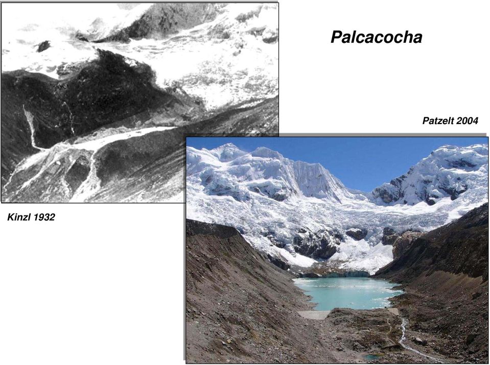
2 Estimate of probability of dam failure Palcacocha Indicator Attribute Qualitative probability Dam type Freeboard to dam height ratio Impact waves by ice/rock falls reaching the lake Kinzl 1932 Ice Moraine Bedrock Low Medium High Dam width to height ratio Small, Medium, Large, > 0.5 Extreme meteorological events (high temperature/ precipitation) Frequent / large volume Sporadic / medium volume Unlikely / small volume Frequent Sporadic Unlikely High Medium to high Low High Medium Low High Medium Low High Medium Low High Medium Low Patzelt 2004 from Huggel et al., 2004
 Frequent / large volume Sporadic / medium volume Unlikely / small volume")
3 Estimate of maximum discharge for different outburst mechanisms Palcacocha Patzelt 2004 Kinzl 1932 from Walder and Costa, 1996

4 Estimate of maximum discharge for moraine-dammed lakes Palcacocha Patzelt 2004 Kinzl 1932 from Huggel et al., 2002

5 Type of lake and dam failures Palcacocha Patzelt 2004 Kinzl 1932 from Huggel et al., 2002

6 Estimate of maximum runout (reach) Palcacocha Patzelt 2004 Kinzl 1932 from Huggel et al., 2002

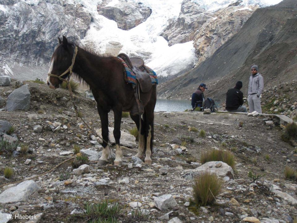
7 W. Haeberli

8 Huandoy Huascaran Hualcan Palcaraju

9 Palcacocha Patzelt 2004 Kinzl 1932
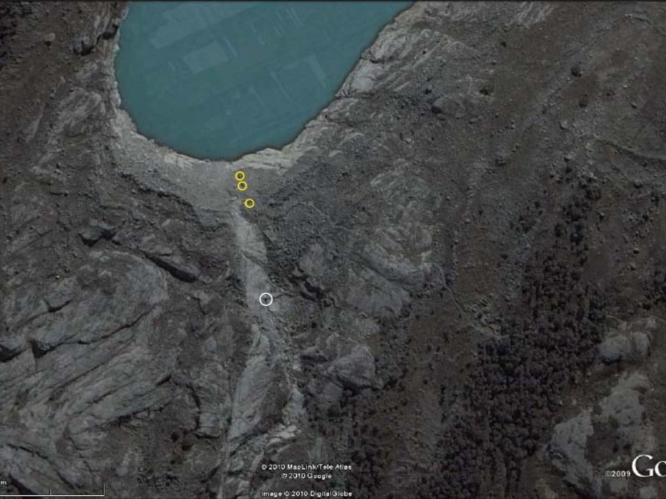
10 W. Haeberli

11 W. Haeberli

12 W. Haeberli
13 W. Haeberli

14 Impact waves from rock/ice avalanches into new glacial lakes: lessons learned from the Nevado Hualcán/Laguna 513 event of 11 April 2010

15 Nevado Hualcán Laguna 513 Pampa de Shonquil Río Chucchún

16

17 Potentially inundated areas by GLOF Reynolds et al. (1998)

18 October 1988: 1 syphon: 190 l/s Christmas 1988: 1 million m 3 drained but lake level remains the same January 1989: another syphon, total drainage capacity 500 l/s March 1989: lake level lowered by 2 m June 1989: two more meters down June 1990: a total of 5 m lake lowering 1991: important ice avalanche causes impact wave, overtopping dam but no one killed May 1993: Start of tunnel construction

19
20 La construcción de túneles a través de la roca para bajar el nivel de la laguna Reynolds, Dolecki, Portocarrero Reynolds et al. (1998)

21 Labores de construcción del túnel en 1993 Reynolds et al. (1998)
22
23 Portocarrero
24 ALOS satellite images
25 W. Haeberli
26 Río Chucchún W. Haeberli
27 Lake probably shallow Lake probably deep Lake formation uncertain Lake formation ongoing or imminent Lake formation in coming decades W. Haeberli possible retention
28 Schneider et al., 2013 Multi-process modeling Ice avalanche lake impact flood/debris flow
29 Schneider et al., 2013 Hazard map Based on modeling and field work
30 Laguna 513: Monitoring and Early Warning Design and implementation of a GLOF early warning system Electricidad de paneles solar y comunicación de radio por cada estación necesario Cerro Aracoto: Estación repetidora con video camera y geófono para la observación de la Laguna 513 y los glaciares empinados del Nevado Hualcán Carhuaz: Centro de datos y comunicación para la observación y análisis de los datos (conectado al internet) Pampa Shonquil: Estación meteorológica con sensor de presión para medir el flujo de agua del Río Chucchun y geófono Schneider et al., 2013 Rampac Chico: Estación repetidora Alternativa: Cerro Marcash Leyenda: Conexión de radio Geófonos adicionales
31 Design and implementation of a GLOF early warning system
32 Conclusions: Succesfull hazard prevention: many lives saved Efficient risk reduction but not to zero Shift of hazard source to summit areas: polythermal (?) hanging glaciers and warm permafrost Larger events (10 6 m 3 ) and new lakes possible, hence further measures necessary: Observation of starting zone important (stabilisation/destabilisation?) Enhancement of freeboard (deeper tunnel, breach closure) Retention at Pampa de Shonquil (multipurpose structure) Passive measures in town (EWS, escape information)... and especially...
33 Conclusions: The probability of large catastrophes as a consequence of impact waves caused by rock/ice avalanches into lakes may appear small now but is rising with continued warming of icy mountain peaks and a growing number of lakes at their foot!
34 Giétro / Mauvoisin, 1818 Jahrbuch SAC XXXIV
35 Kantonsarchiv Wallis
36 Escher von der Linth
37
38
39 Alean, ca. 1985
40 Röthlisberger 1970
41 Röthlisberger 1970
42
43 Röthlisberger 1970
44 Röthlisberger 1970
45
46 Worni et al., 2012
47 Worni et al., 2012 Flow transformations
48 Dam breach / GLOF modeling Worni et al., 2012
49 Worni et al., in press Flow transformations
50 Unterer Grindelwaldgletscher Städelin, 2008
51
52 2. Juli Juli
53 June 2008 August October 2008
54
55 Bauliche Massnahmen Abflussstollen
56 Bauliche Massnahmen Abflussstollen
57 Hydrograph of lake outburst in May 2008 Bauliche Massnahmen Abflussstollen
58 Täsch Mattertal (VS) Weingartensee, Täsch, 2001
59 Typische Moränenbastion der Kleinen Eiszeit, bis 36 steil, Fels auf ca. 100m Tiefe, Freibord des Sees vor 2001 ca. 1-2 m
60 Huggel, Paul
61
62 Crealp
63
64 Bauliche Massnahmen See Philippe Teysseire
65 Täschalp, dam mitigation structures Bauliche Massnahmen Schutz/Ablenkungsdamm Täsch
66 Täsch, sediment retention reservoir
67 Wrap-up Täsch, sediment retention reservoir
Glacial hazards and downstream effects of climate change on high mountain glaciers. John M. Reynolds Reynolds Geo-Sciences Ltd, Mold, UK
 Glacial hazards and downstream effects of climate change on high mountain glaciers John M. Reynolds Reynolds Geo-Sciences Ltd, Mold, UK Glacial hazards Hazard Description Time scale Avalanche Slide or
Safety of Small/Rural Dams and Barrier Lake Management
 Safety of Small/Rural Dams and Barrier Lake Management A. Introduction 1. Lessons learnt and recommendations are provided for artificial dams and barrier lakes. In the case of artificial dams, emphasis
The correct answers are given below. Some talking points have been added for the teachers use.
 Natural Resources Canada 2011: Lesson Plan Grades 11 and 12 Landslide activity 5b: Landslides in Canada quiz Description: This is an independent study activity for grades 11 and 12. Students will read
Contact lake growth at the Lys Glacier tongue (Aosta Valley, IT): evolution and risk evaluation
: evolution and risk evaluation") Contact lake growth at the Lys Glacier tongue (Aosta Valley, IT): evolution and risk evaluation PhotobyA. Welf, 2012 et dulogement public e edilizia residenziale pubblica Contents 1- The context: glaciers-related
Contact lake growth at the Lys Glacier tongue (Aosta Valley, IT): evolution and risk evaluation PhotobyA. Welf, 2012 et dulogement public e edilizia residenziale pubblica Contents 1- The context: glaciers-related
CRWR Online Report 13-06. Modeling Mitigation Strategies for Risk Reduction at Imja Lake, Nepal
 CRWR Online Report 13-06 Modeling Mitigation Strategies for Risk Reduction at Imja Lake, Nepal by Marcelo A. Somos-Valenzuela Daene C. McKinney Alton C. Byers David R. Rounce Cesar Portocarrero August
GM IFMGA 2013 in Huaraz Peru
 (AGMP) GM IFMGA 2013 in Huaraz Peru SUGGESTIONS FOR OPTIONAL PROGRAM IN THE REGION OF ANCASH PRIOR TO GENERAL MEETING (4 OR 6 DAYS) Two programs for the time between 9 th and 14 th October 2013 Coordinator
Climate Change in the Andes
 Mountain Day Highlighting the Critical Role of Mountain Ecosystems for Climate Adaptation and Sustainable Development Durban, South Africa 4 December 2011 Climate Change in the Andes Overview and Evidence
NATIONAL REPORT AUSTRIA
 26th Session of the EFC Working Party on the Impact of Climate Change on Natural Hazards in Austria NATIONAL REPORT AUSTRIA Seite 1 16.04.2009 Global increase of temperatures: between 1.8 C and 4.0 C (IPCC
National Glacier Strategy. Gonzalo BARCAZA DIRECCIÓN GENERAL DE AGUAS
 National Glacier Strategy Gonzalo BARCAZA DIRECCIÓN GENERAL DE AGUAS Overview Introduction National Glacier Strategy Observation Levels Glaciological Zones Progress Current studies In 2008, Ministry of
USSD Workshop on Dam Break Analysis Applied to Tailings Dams
 USSD Workshop on Dam Break Analysis Applied to Tailings Dams Antecedents Newtonian / non-newtonian flows Available models that allow the simulation of non- Newtonian flows (tailings) Other models used
Proposal for a Discovery-level WMO Metadata Standard
 WORLD METEOROLOGICAL ORGANIZATION MEETING OF EXPERT TEAM ON INTEGRATED DATA MANAGEMENT GENEVA, 17-20 SEPTEMBER 2001 ET-IDM/Doc. 3(1) (12.VI.2001) ITEM: 1.2 ENGLISH ONLY Proposal for a Discovery-level WMO
Flash Flood Science. Chapter 2. What Is in This Chapter? Flash Flood Processes
 Chapter 2 Flash Flood Science A flash flood is generally defined as a rapid onset flood of short duration with a relatively high peak discharge (World Meteorological Organization). The American Meteorological
National Dam Safety Program Technical Seminar #22. When is Flood Inundation Mapping Not Applicable for Forecasting
 National Dam Safety Program Technical Seminar #22 Thursday February 19 th 2015 Emmittsburg, MD When is Flood Inundation Mapping Not Applicable for Forecasting Victor Hom Hydrologic Services Division National
Management of flooding downstream of dams
 Management of flooding downstream of dams Attachment to Victoria State Flood Emergency Plan Version 1.0 (6 February 2013) This plan is produced by the Victoria State Emergency Service and Department of
FLOOD FORECASTING PRACTICE IN NORTHERN CALIFORNIA
 FLOOD FORECASTING PRACTICE IN NORTHERN CALIFORNIA California Department of Water Resources Post Office Box 219000, Sacramento, California 95821 9000 USA By Maurice Roos, Chief Hydrologist ABSTRACT Although
 Disaster Prevention Measures in Global-Local Context 4 th World Water Forum Dr. Yoshihiko Yamashita CTI Engineering Co., Ltd Association of Japanese Consulting Engineers Outline of Presentation Up-to to-date
Levee Certification/Accreditation Process Cameron and Hidalgo Counties
 Levee Certification/Accreditation Process Cameron and Hidalgo Counties Lower Rio Grande Citizens Forum October 21, 2009 Larry Voice Background As administrator of the National Flood Insurance Program (NFIP),
DAM BREACH MODELING AN OVERVIEW OF ANALYSIS METHODS. Tony L. Wahl, Hydraulic Engineer, Bureau of Reclamation, Denver, CO, twahl@usbr.
 DAM BREACH MODELING AN OVERVIEW OF ANALYSIS METHODS Tony L. Wahl, Hydraulic Engineer, Bureau of Reclamation, Denver, CO, twahl@usbr.gov Abstract The two primary tasks in the analysis of a potential dam
Problems and opportunities of integrated basin management in mountains
 Problems and opportunities of integrated basin management in mountains Carmen de Jong The Mountain Institute, University of Savoy France 5th World Water Forum Suggestions for possible contribution to RIOB
Author: Nicolás Barrios. El Hierro, Smart Tourist Destination
 Author: Nicolás Barrios El Hierro, Smart Tourist Destination An Action Plan In 2012, the Spanish Ministry of Industry, Energy and Tourism designed an Action Plan (PAE El Hierro 2012) with specific measures
Appendix 3: Glossary. Queensland Floods Commission of Inquiry Interim Report
 Appendix 3: Glossary ABC means the Australian Broadcasting Corporation. ACCESS forecast means a Bureau of Meteorology forecast obtained from the Australian Community Climate and Earth-System Simulator.
Morphological and Environmental Change Assessment: San Juan River Area (including Isla Portillos and Calero), Costa Rica
, Costa Rica") Morphological and Environmental Change Assessment: San Juan River Area (including Isla Portillos and Calero), Costa Rica OVERVIEW OF ASSESSMENT AREA FOR SAN JUAN RIVER CHANGES NEAR SAN JUAN RIVER & LAGUNA
Morphological and Environmental Change Assessment: San Juan River Area (including Isla Portillos and Calero), Costa Rica OVERVIEW OF ASSESSMENT AREA FOR SAN JUAN RIVER CHANGES NEAR SAN JUAN RIVER & LAGUNA
Instructions and Helpful Hints. for Preparation of. Emergency Action Plans
 Instructions and Helpful Hints for Preparation of Emergency Action Plans using the fillable form electronic template for the NRCS sample EAP June 25, 2007 Introduction Emergency Action Plans (EAPs) are
Disaster Risk Management: prevention and urgent repair procedures for infrastructure and facilities
 Disaster Risk Management: prevention and urgent repair procedures for infrastructure and facilities Jacob Greenstein Ph.D, PE, EGAT/ I&E EGAT workshop-december 2009 1 Natural disasters-new trends Natural
LEAGUE NOTES ON APPROVED COMMUNITY WATER SUPPLY PLAN
 1 AUGUST 2011 LEAGUE NOTES ON APPROVED COMMUNITY WATER SUPPLY PLAN KEY ELEMENTS OF THE PLAN: 1. Replace the existing unsafe Ragged Mountain dam with a new dam and raise the reservoir pool level initially
Inovagri: International Workshop on Technology Innovations in Irrigation Theme 2, Round Table 4: Engineering of Land Drainage
 Inovagri: International Workshop on Technology Innovations in Irrigation Theme 2, Round Table 4: Engineering of Land Drainage Some developments in land drainage Julián Martínez Beltrán Ex Drainage and
Armenian State Hydrometeorological and Monitoring Service
 Armenian State Hydrometeorological and Monitoring Service Offenbach 1 Armenia: IN BRIEF Armenia is located in Southern Caucasus region, bordering with Iran, Azerbaijan, Georgia and Turkey. The total territory
SIMPLIFIED INUNDATION MAPS FOR EMERGENCY ACTION PLANS. National Dam Safety Review Board Emergency Action Plan Workgroup
 SIMPLIFIED INUNDATION MAPS FOR EMERGENCY ACTION PLANS National Dam Safety Review Board Emergency Action Plan Workgroup EXECUTIVE SUMMARY Development of Emergency Action Plans (EAPs) for all high and significant
Dam Break Risk Assessment in Baker Valley (Chilean Patagonia)
") Dam Break Risk Assessment in Baker Valley (Chilean Patagonia) by Elisabetta Natale B.S. Civil and Environmental Engineering Università di Pavia, 2007 SUBMITTED TO THE DEPARTMENT OF CIVIL AND ENVIRONMENTAL
Dam Break Risk Assessment in Baker Valley (Chilean Patagonia) by Elisabetta Natale B.S. Civil and Environmental Engineering Università di Pavia, 2007 SUBMITTED TO THE DEPARTMENT OF CIVIL AND ENVIRONMENTAL
Belmont Forum Collaborative Research Action on Mountains as Sentinels of Change
 Belmont Forum Collaborative Research Action on Mountains as Sentinels of Change 1. Background and rationale Mountains exist in many regions of the world and are home to a significant fraction of the world
Flood Risk Assessment. For Application at: Brick House Farm Brick House Lane Hambleton Lancashire FY6 9BG
 Flood Risk Assessment For Application at: Brick House Farm Brick House Lane Hambleton Lancashire FY6 9BG Contents 1. Introduction 2. The Site 3. Flood Risk 4. Existing drainage 5. Proposed Development
Small Dam Hazard Assessment Inventory
 Small Dam Hazard Assessment Inventory What would happen if your dam were to fail? This is a question that most dam owners hope they will never have to answer. However it is a question you, as a responsible
FEMA Flood Zone Designations
 Note: SFHA "Special Flood Hazard Area" FEMA Flood Zone Designations Zone VE Zone A Zone AE Zone X Zone X500 UNDES along coasts subject to inundation by the 100-year flood with additional hazards due to
Food Security and Water in Central America in the context of Climate Change: Maureen Ballestero Chair GWP Costa Rica
 Maureen Ballestero Chair GWP Costa Rica Food Security and Water in Central America in the context of Climate Change: Reducing vulnerability through the construction of public policies in Central America
Natural Disasters. UNSD Workshop on Environment Statistics (Abuja, 19-23 May 2008)
") Natural Disasters UNSD Workshop on Environment Statistics (Abuja, 19-23 May 2008) Need for indicators Information on frequency and severity of natural disasters is important for preparedness and risk management
Natural Disasters UNSD Workshop on Environment Statistics (Abuja, 19-23 May 2008) Need for indicators Information on frequency and severity of natural disasters is important for preparedness and risk management
City of Cambridge Climate Protection Action Committee. Recommendations for Adaptation to Climate Change. Purpose
 City of Cambridge Climate Protection Action Committee Recommendations for Adaptation to Climate Change Purpose The Climate Protection Action Committee (CPAC) is an advisory body to the City Manager on
Risk Analysis within Coastal Zone Management
 Risk Analysis within Coastal Zone Management Nicole von Lieberman and Stephan Mai University of Hannover, Franzius-Institut for Hydraulic, Waterways and Coastal Engineering Hannover, Germany Summary Natural
Flood Facts 2F.1. Flood Facts
 Flood Facts 2F.1 Engage Flood Facts To introduce students to the causes and effects of flooding in Western Australia. Flooding occurs in the Australian environment as part of the natural water or hydrologic
Flood Damage Mitigation And Insurance Costs
 Flood Damage Mitigation And Insurance Costs Friday, September 25, 2015 at 7:00 PM Saturday, September 26, 2015 at 10:00 AM This presentation was prepared by the Town of South Bethany using Federal Funds
IMPACT OF CLIMATE CHANGE IN ANDEAN BOLIVIAN COMMUNITIES THAT DEPEND FROM TROPICAL GLACIERS
 IMPACT OF CLIMATE CHANGE IN ANDEAN BOLIVIAN COMMUNITIES THAT DEPEND FROM TROPICAL GLACIERS Prepared by: Adriana Soto Trujillo Review and complementation: Matilde Avejera, Danitza Salazar, Paula Pacheco,
IMPACT PROJECT - UniBwM www.impact-project.net. Universität der Bundeswehr München Lehrstuhl für Hydromechanik Univ. Prof. Dr.-Ing. W.
 Universität der Bundeswehr München Lehrstuhl für Hydromechanik Univ. Prof. Dr.-Ing. W. Bechteler BREAH LOATION Work Package 2.4 Identification of possible Breach Locations (contribution from WP5.1) Technical
The success of the hurricane protection around Chevron s refinery at Pascagoula, MS, during Katrina
 The success of the hurricane protection around Chevron s refinery at Pascagoula, MS, during Katrina Dr J.W. van der Meer, Dr C. Cooper, M.J. Warner, H. Adams-Morales and G.J. Steendam Abstract and presentation
Federal Guidelines for Dam Safety
 Federal Guidelines for Dam Safety Selecting and Accomodating Inflow Design Floods for Dams April 2004 FEDERAL GUIDELINES FOR DAM SAFETY: SELECTING AND ACCOMMODATING INFLOW DESIGN FLOODS FOR DAMS prepared
Structural Damage Due to Floods
 Structural Damage Due to Floods By Craig D. Rogers, P.E. The Federal Emergency Management Agency (FEMA) reports that each year approximately 90 percent of all disaster-related property damage results from
Serie Idegis Tecno. Piscina Privada / Private Pool
 Idegis Tecno Idegis Tecno ph m 160 m 000 hr ph Tecno, la electrolisis salina de IDEGIS al alcance de todos Tecno, IDEGIS salt electrolysis to everyone VENTAJAS / ADVANTAGES - Económico - Fácil instalación
EMERGENCY ACTION PLAN
 EMERGENCY ACTION PLAN INDIAN SPRINGS LAKE ESTATES PROPERTY OWNERS ASSOCIATION WILD INDIAN LAKE DAM Inventory No.: TX04915 Water Right Adjudication: 04416 Prepared April 12, 2010 by ISLEPOA PARTIALLY REVISED
HUDSON RIVER-BLACK RIVER REGULATING DISTRICT BOARD MEETING JUNE 10, 2014
 HUDSON RIVER-BLACK RIVER REGULATING DISTRICT BOARD MEETING JUNE 10, 2014 PRESENTATION TOPICS Analysis Objectives Analysis Dam Removal Plan Dam Remediation Plan Effects Analysis Permit Requirements Decision
Flooding Hazards, Prediction & Human Intervention
 Page 1 of 10 EENS 3050 Tulane University Natural Disasters Prof. Stephen A. Nelson Flooding Hazards, Prediction & Human Intervention This page last updated on 19-Oct-2015 Hazards Associated with Flooding
Do-Now. 1.) Get out notebook.
 Get out notebook.") Do-Now 1.) Get out notebook. 2.) Answer the following questions on the first clean sheet in your notebook. 1.) What are renewable resources? 2.) What are nonrenewable resources? Alternative Sources of
Do-Now 1.) Get out notebook. 2.) Answer the following questions on the first clean sheet in your notebook. 1.) What are renewable resources? 2.) What are nonrenewable resources? Alternative Sources of
WELCOMES ALL THE ATTENDEES WATER UTILISATION, MEASUREMENT AND METHODOLOGIES
 SUTRON india WELCOMES ALL THE ATTENDEES WATER UTILISATION, MEASUREMENT AND ABOUT SUTRON USA Strong Corporation was founded in 1975 Sutron Operates in : Hydrological Meteorological Oceanic Aviation Real-Time
BANGKOK FLOOD PROTECTION SYSTEM Bangkok Metropolitan Administration (BMA)
") BANGKOK FLOOD PROTECTION SYSTEM Bangkok Metropolitan Administration (BMA) Catchment area of Chao Phraya River is 160,000 sq.km. or about 1/3 of the country The Chao Phraya River flows passing through Bangkok
BANGKOK FLOOD PROTECTION SYSTEM Bangkok Metropolitan Administration (BMA) Catchment area of Chao Phraya River is 160,000 sq.km. or about 1/3 of the country The Chao Phraya River flows passing through Bangkok
Hydrologic Engineering Techniques for Regional Water Resources Planning
 US Army Corps of Engineers Hydrologic Engineering Center Hydrologic Engineering Techniques for Regional Water Resources Planning October 1969 Approved for Public Release. Distribution Unlimited. TP-17
FLOOD CONTROL FOR SPECIFIC TYPES OF FLOODS. A.F. Mandych Department of Physical Geography and Land Use, Institute of Geography, Moscow, Russia
 FLOOD CONTROL FOR SPECIFIC TYPES OF FLOODS A.F. Mandych Department of Physical Geography and Land Use, Institute of Geography, Moscow, Russia Keywords: control, dam, dike (dyke), embankment, flood, flood
Methods for Determination of Safe Yield and Compensation Water from Storage Reservoirs
 US Army Corps of Engineers Hydrologic Engineering Center Methods for Determination of Safe Yield and Compensation Water from Storage Reservoirs October 1966 Approved for Public Release. Distribution Unlimited.
Burnt River Black River and Gull River Flood Contingency Plan
 Burnt River Black River and Gull River Flood Contingency Plan Objective: The objective of this plan is to preplan and prepare for flooding events in the Burnt River, Black River and Gull River area of
Legend. Elevation (maod) Value. Borough Boundary. Main Rivers. Flow Path. No data 0-12 12-26 26-38 38-53 53-91. Topography. London Borough of Lewisham
 Value. Borough Boundary. Main Rivers. Flow Path. No data 0-12 12-26 26-38 38-53 53-91. Topography. London Borough of Lewisham") 535000 540000 Main Rivers Flow Path Elevation (maod) Value No data 0-12 12-26 26-38 38-53 53-91, 100017710 2008 0 245 490 980 SFRA Topography 1:30,000 PLEE NOTE - The inclusion of any site on this map
535000 540000 Main Rivers Flow Path Elevation (maod) Value No data 0-12 12-26 26-38 38-53 53-91, 100017710 2008 0 245 490 980 SFRA Topography 1:30,000 PLEE NOTE - The inclusion of any site on this map
Preventing Ice Dams on Roofs
 Preventing Ice Dams on Roofs Facility Manager November/December 2005 When a roof leaks, facility managers inevitably receive complaints from building occupants. If it is winter, ice dams are often the
WEATHERING, EROSION, AND DEPOSITION PRACTICE TEST. Which graph best shows the relative stream velocities across the stream from A to B?
 NAME DATE WEATHERING, EROSION, AND DEPOSITION PRACTICE TEST 1. The diagram below shows a meandering stream. Measurements of stream velocity were taken along straight line AB. Which graph best shows the
Lower Raritan Watershed Management Area Stormwater & Flooding Subcommittee Strategy Worksheet LRSW-S3C1
 Strategy Name: Reduce Existing Potential for Flood Damages LRSW-S3C1. Develop and implement a program to: Minimize flood damages through the use of structural measures. Minimize flood damages through the
STORMWATER MANAGEMENT CHECKLIST
 STORMWATER MANAGEMENT CHECKLIST *This checklist must be completed and part of the Land Disturbing Permit submittal for review if the acreage disturbed is one (1) acre or more: I. SUPPORTING DATA Narrative
INSTALLATION OF AN AUTOMATED EARLY WARNING SYSTEM FOR ANNOTTO BAY
 TERMS OF REFERENCE INSTALLATION OF AN AUTOMATED EARLY WARNING SYSTEM FOR ANNOTTO BAY A Community Disaster Risk Reduction Project funded through the Building Disaster Resilient Communities Project (ODPEM)
LOS ANGELES COUNTY S FLOODING HISTORY:
 LOS ANGELES COUNTY S FLOODING HISTORY: Since 1975, Los Angeles County has experienced twelve federally, declared flood disasters, with three of those disasters coming under El Niño conditions (1983, 1998,
MANITOBA FLOOD PROTECTION PROJECTS Project Justification and Benefits. Science Imagination Collaboration
 MANITOBA FLOOD PROTECTION PROJECTS Project Justification and Benefits Science Imagination Collaboration Presentation Outline Extreme events on Red and Assiniboine Manitoba Flood Protection Works KGS Group
CRS 610 Ventura County Flood Warning System Website
 CRS 610 Ventura County Flood Warning System Website Purpose This document gives instructions and a description of the information available via the Ventura County Watershed Protection District s (VCWPD)
The Earth System. The geosphere is the solid Earth that includes the continental and oceanic crust as well as the various layers of Earth s interior.
 The Earth System The atmosphere is the gaseous envelope that surrounds Earth. It consists of a mixture of gases composed primarily of nitrogen, oxygen, carbon dioxide, and water vapor. The atmosphere and
 1 2 A very short description of the functional center network: regarding the Hydraulic and Hydrogeological risk, the national alert system is ensured by the National Civil Protection Department (DPCN),
MASTER IN INDUSTRIAL SAFETY AND ENVIRONMENT. Department of Chemical and Nuclear Engineering.
 MASTER IN INDUSTRIAL SAFETY AND ENVIRONMENT. Department of Chemical and Nuclear Engineering. MASTER THESIS RISK ASSESSMENT OF PETROV'S GLACIAL LAKE OUTBURST FLOODS (KYRGYZSTAN). Presented by: Adilet Bekturov
Domestic Policy Frameworks on Adaptation to Climate Change in Water Resources Argentina Country Case Study
 ORGANISATION FOR ECONOMIC CO-OPERATION AND DEVELOPMENT Annex I Expert Group Seminar Working Together to Respond to Climate Change Domestic Policy Frameworks on Adaptation to Climate Change in Water Resources
..."... Cou"" Metro M"'"'""""'"r"...,..."..., SYSTEMS SAFETY AND OPERATIONS COMMITTEE APRIL 18, 2013 DIVISION 11 WATER MITIGATION
 ..."... Cou"" Metro M"'"'""""'"r"...,....."..., One Gateway Plaza Los Angeles, CA 90012-2952 213.922.2000 Tel metro.net 34 SYSTEMS SAFETY AND OPERATIONS COMMITTEE APRIL 18, 2013 SUBJECT: ACTION: DIVISION
SAC-D/Aquarius. Progress in DCS. An Observatory for Ocean, Climate and Environment. SAC-D DCS IE Gustavo Mercado
 An Observatory for Ocean, Climate and Environment SAC-D/Aquarius Progress in DCS SAC-D DCS IE Gustavo Mercado 1 8th Aquarius SAC-D Science Meeting Buenos Aires November 12-14, 2013 401.55 Mhz Antenna DCP
NATIONAL CIVIL PROTECTION SYSTEM ONEMI. Evolution Current Development Future Challenges
 NATIONAL CIVIL PROTECTION SYSTEM ONEMI Evolution Current Development Future Challenges CHILE 1 A nation exposed to all kind of hazards Volcanic Eruptions Wild Fires Tidal waves/ Tsunamis Quakes/ Earthquakes
LIBRO CAMPOS PROYECTOS 2015
 Page 1 of 5 Referencia: 1 Code: Address: ACIWC03-15 Name: BIOLOGICAL RESERVE (C. MOTIV,, CUOTA 150 EUR) Name: Location: SAN JOSÉ Project: Initial Date: Places: Descripction of Workcamp: Url: www.aci.cr
Assessment of hydropower resources
 Assessment of hydropower resources Oliver Froend Assessment of hydropower resources Relevance of surveys, data assessment and analyses to the success of the project. Required data and field survey. Key
COMPARING DSS-WISE- LITE TO OTHER DAM BREACH SOFTWARE
 National Dam Safety Program Technical Seminar No. 22 Dam Breach Modeling and Consequence Assessment National Emergency Training Center February 18-19, 2015 Emmitsburg, MD Brian Shane Cook, PE, LSIT formerly
ALTERNATIVES EVALUATION. SWEET POND DAM VT Dam #90.01 Town of Guilford, Vermont
 ALTERNATIVES EVALUATION SWEET POND DAM VT Dam #90.01 Town of Guilford, Vermont Prepared for: Vermont Department of Forests, Parks and Recreation Prepared by: January 27, 2012 D&K #221179 SWEET POND DAM
Flooding in the Middle Koyukuk River Basin, Alaska August 1994
 Flooding in the Middle Koyukuk River Basin, Alaska August 1994 By David F. Meyer U.S. GEOLOGICAL SURVEY Water-Resources Investigations Report 95-4118 Prepared in cooperation with the FEDERAL EMERGENCY
MAPPING THE ST. FRANCIS DAM OUTBURST FLOOD WITH GEOGRAPHIC INFORMATION SYSTEMS
 MAPPING THE ST. FRANCIS DAM OUTBURST FLOOD WITH GEOGRAPHIC INFORMATION SYSTEMS J. David Rogers Kevin James Department of Geological Engineering University of Missouri-Rolla St. Francis Dam was a 200-ft
Updated Federal Emergency Management Agency Flood Insurance Rate Maps and Zoning Ordinance Update. July 16, 2015 Policy Committee
 Updated Federal Emergency Management Agency Flood Insurance Rate Maps and Zoning Ordinance Update July 16, 2015 Policy Committee FEMA Map Update Costal Analysis and mapping study by FEMA in 2009 Changes
WILLOCHRA BASIN GROUNDWATER STATUS REPORT 2009-10
 WILLOCHRA BASIN GROUNDWATER STATUS REPORT 2009-10 SUMMARY 2009-10 The Willochra Basin is situated in the southern Flinders Ranges in the Mid-North of South Australia, approximately 50 km east of Port Augusta
Jessica Blunden, Ph.D., Scientist, ERT Inc., Climate Monitoring Branch, NOAA s National Climatic Data Center
 Kathryn Sullivan, Ph.D, Acting Under Secretary of Commerce for Oceans and Atmosphere and NOAA Administrator Thomas R. Karl, L.H.D., Director,, and Chair of the Subcommittee on Global Change Research Jessica
What are the technical features and performance of the AccuCell system?
 What is AccuCell? AccuCell is an alkaline-manganese battery system that allows recharging while preserving the advantages of disposable alkaline cells. The first batteries of this kind were developed in
SIMULATION TIGRIS RIVER FLOOD WAVE IN MOSUL CITY DUE TO A HYPOTHETICAL MOSUL DAM BREAK
 SIMULATION TIGRIS RIVER FLOOD WAVE IN MOSUL CITY DUE TO A HYPOTHETICAL MOSUL DAM BREAK Thair M. Al-Taiee 1 and Anass M. M. Rasheed 2 1 Assist. Prof., Research Center for Dams and Water Resources, Mosul
Stream Channel Cross Sections for a Reach of the Boise River in Ada County, Idaho
 U.S. Department of the Interior U.S. Geological Survey In cooperation with Federal Emergency Management Agency, City of Boise, City of Garden City, City of Eagle, and Ada County Stream Channel Cross Sections
Basements and Deep Building Construction Policy 2014
 Basements and Deep Building Construction Policy 2014 APPROVAL Council / CEO 27 October 2014 VERSION NO: Version 1.0 TRIM REF: 14/67838 REVIEW 30/10/2019 RESPONSIBLE EXECUTIVE General Manager City Assets
6.0 Results of Risk Analyses
 6. Results of Risk Analyses A risk analysis of the optimized embankment designs for the Salton Sea restoration project was conducted jointly by Kleinfelder and representatives from Reclamation. A risk
Facing an Uncertain Future: Increasing Resilience at Marinas and Harbors. Recreational Boating Educational Conference December 11, 2014
 Facing an Uncertain Future: Increasing Resilience at Marinas and Harbors Recreational Boating Educational Conference December 11, 2014 Operators Face Change and Challenges Environmental Conditions Fluctuating
5 Most Common Planning & Management Problems in Ontario County, Canada
 Name of Haz. Mit. Plan: Problem being Mitigated: Action Worksheet TB-1: Town Hall Flood Protection Ontario County Multi-Jurisdictional Hazard Mitigation Plan 2015 Flood risk to some critical facilities
Monitoring of Natural Hazards With the ImpactSentinel Alarming System An Intelligent Solution
 Monitoring of Natural Hazards With the ImpactSentinel Alarming System An Intelligent Solution ImpactSentinel Natural Hazard Sensors und Systems hazard signalization in protection fences overstress, shock
Volcanic Hazards & Prediction of Volcanic Eruptions
 Page 1 of 11 EENS 3050 Tulane University Natural Disasters Prof. Stephen A. Nelson Volcanic Hazards & Prediction of Volcanic Eruptions This page last updated on 03-Jul-2012 Volcanic Hazards This lecture
3211, Shawnee Industrial Way Suite 104 Suwanee GA. 30024 USA Phone : 770-904-6500 Fax : 770-904-6504 E-mail : sales.usa@packr.com
 LLENADORA Semi SEMIAUTOMATICA Automated PR MODELO 500 PR 500 ROBOT COMPLETAMENTE Fully automated AUTOMATICO R500 MODELO Robot R500 LINEA Fully AUTOMATICA automated MODELO PR 300 PR Inline 300 MODELO COMPLETAMENTE
Real Time Flood Alert System (RTFAS) for Puerto Rico
 for Puerto Rico") Prepared in cooperation with the Puerto Rico Emergency Management Agency (PREMA) Real Time Flood Alert System (RTFAS) for Puerto Rico Overview The Real Time Flood Alert System is a web-based computer program,
Prepared in cooperation with the Puerto Rico Emergency Management Agency (PREMA) Real Time Flood Alert System (RTFAS) for Puerto Rico Overview The Real Time Flood Alert System is a web-based computer program,
INTERPRETING CLIMATE SIGNALS FROM A SHALLOW EQUATORIAN ICE CORE: ANTISANA, ECUADOR
 Manuscript for Patagonia Ice Fields Working Group July 31, 2000 INTERPRETING CLIMATE SIGNALS FROM A SHALLOW EQUATORIAN ICE CORE: ANTISANA, ECUADOR Mark W. Williams Department of Geography and Institute
What We Do: Wetlands, Wildlife Habitat & Flood Hazards in the Root River Watershed
 What We Do: Wetlands, Wildlife Habitat & Flood Hazards in the Root River Watershed presented by Ceil Strauss, State Floodplain Manager DNR Ecological & Water Resources 1 EWR Roles In Floodplains Regulatory:
How To Use A Water Source Heat Pump
 Geothermal Energy Using Water-Source Heat Pumps By VIRSTAR Corporation Geothermal Expertise Since 1978 All information contained herein is the exclusive property of VIRSTAR Corporation, all rights reserved.
How To Amend A Stormwater Ordinance
 Regulatory Alternatives to Address Stormwater Management and Flooding in the Marlboro Street Study Area Alternative 1: Amend Existing Local Regulations This proposed alternative provides an incremental
EcoInformatics International Inc.
 1 von 10 03.08.2010 14:25 EcoInformatics International Inc. Home Services - solutions Projects Concepts Tools Links Contact EXPLORING BEAVER HABITAT AND DISTRIBUTION WITH GOOGLE EARTH: THE LONGEST BEAVER
Toward better decision tools for the management of frequent snow avalanches
 Natural risk management in a changing climate: Experiences in Adaptation Strategies from some European Projects December 14th, 2011 Toward better decision tools for the management of frequent snow avalanches
56h NIVEL LOWER INTERMEDIATE INGLÉS OBJETIVOS DEL CURSO. ÍNDICE 1 Objetivos didácticos_unit 1
 56h INGLÉS OBJETIVOS DEL CURSO Consta de 9 unidades que gramaticalmente comienzan con un refuerzo del nivel 1, llegando hasta el uso de los condicionales y el estilo indirecto. Continuamos introduciendo
THE STRATEGIC PLAN OF THE HYDROMETEOROLOGICAL PREDICTION CENTER
 THE STRATEGIC PLAN OF THE HYDROMETEOROLOGICAL PREDICTION CENTER FISCAL YEARS 2012 2016 INTRODUCTION Over the next ten years, the National Weather Service (NWS) of the National Oceanic and Atmospheric Administration
Leica Monitoring Solutions. Leica Monitoring Solutions Certainty builds confidence.
 Leica Monitoring Solutions Leica Monitoring Solutions Certainty builds confidence. Risk and Cost Reduction Proven Solutions Facing new challenges Engineering companies and contractors are facing challenges