How To Know The History Of The Airport
|
|
|
- Eunice Moody
- 3 years ago
- Views:
Transcription
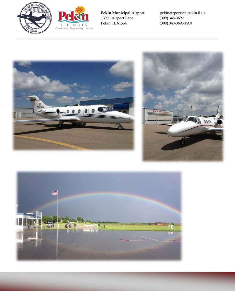
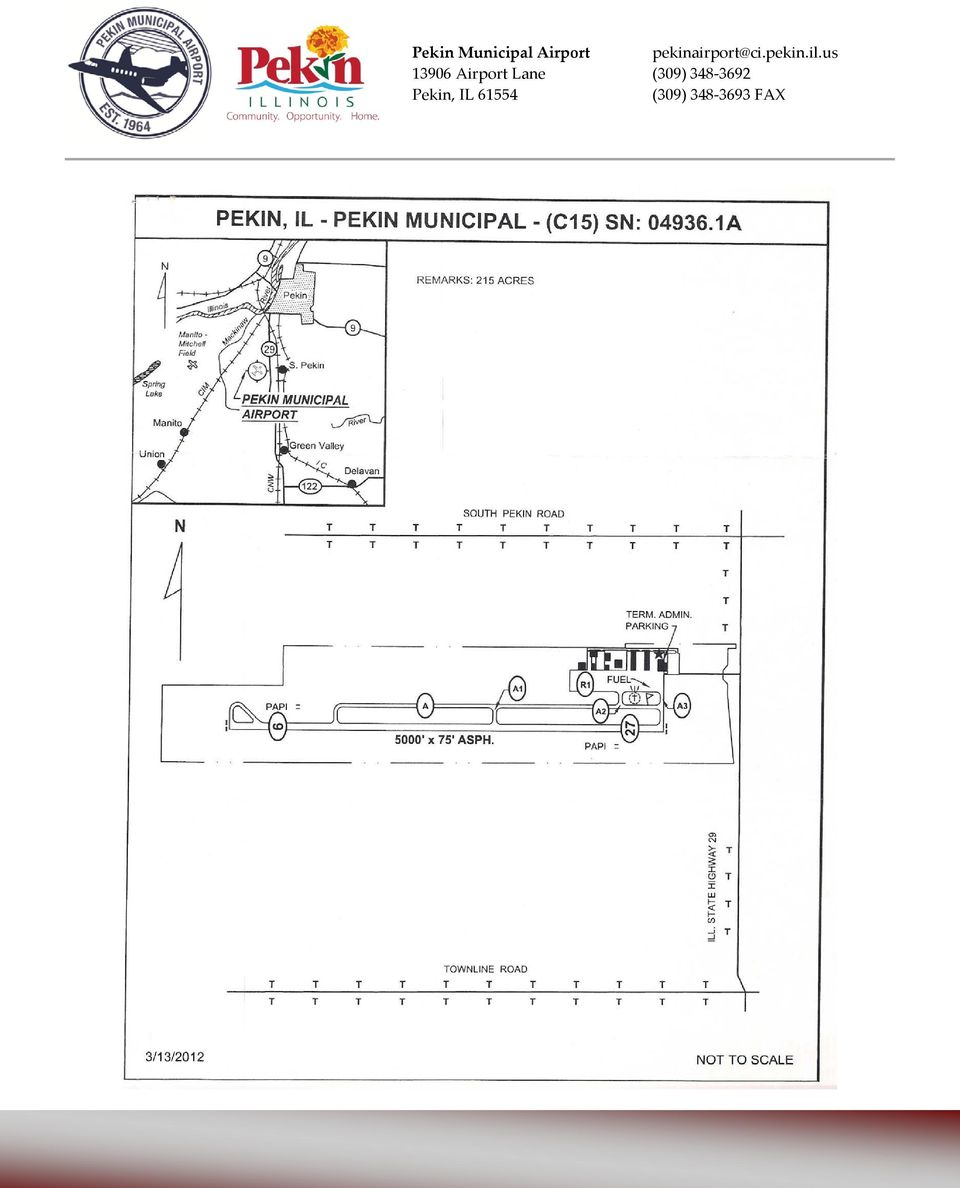
1 Pekin Municipal Airport (C1) John C. Kriegsman Air Field: Fact Sheet General aviation airport included in the National Plan of Integrated Airport Systems (NPIAS) Federally funded at an estimated $6,81,412 in regard to development cost. 10,000+ total operations per year (one takeoff or one landing) o Average 2+ operations per day Single lighted runway designated 09/27 with an asphalt surface o Measures,000 feet long by 7 feet wide (1,24 x 23 m) o 3 instrument approach procedures for all weather operations o Facilitates majority of general aviation aircraft, including large corporate jets
 o Average 2+ operations per day Single lighted runway designated 09/27 with an asphalt")
2 Services and amenities provided o 24/hour availability of 100LL and JET A fuel o 24/hour terminal access with restrooms o Crew van o Rental car arrangement o Hangar storage o Tie down storage o Executive terminal includes pilot lounge, meeting area, free coffee, free popcorn, pilot supplies, and vending machines o Other services provided at the airport include: agricultural spraying, air ambulance, wildlife patrol and survey, aerial photography, and aircraft sales 21 total acreage of airport property o 3 airside ready locations to build o 1 landside ready location to build based aircraft o 0 single engine o 2 multi engine o 1 Jet o 1 Helicopter

3 4 businesses located at the field o 2 agricultural operators o 1 aircraft broker and salesperson o 1 aerial imagery and surveillance company State/regional/local businesses and organizations that frequent the airport: o Aventine Renewable Energy, Inc. o Midwest Grain, Illinois Corn Products o Lifeline Pilots Organization o Aviation Angels of Hope o Ameren Corporation o Pipeline Patrol o Illinois National Guard o Sunrise Agriculture o State of Illinois o Excel Foundry o Federal Correctional Institute o Niemann foods o Wheelworx o Hanna Steel o Patriot Coal o ComEd 22 spots available for single aircraft hangar storage and 2 corporate style hangars for rent o Rentable spots currently full with a 1 person wait list o The airport is also home to private hangars Economic impaction of the airport as report by the Illinois Department of Transportation Division of Aeronautics: o 26 total jobs - total payroll of $820,900 thousand dollars o Total output $3.1 million Current and future projects: o Runway rehabilitation and crack repair o Airport lighting upgrades including LED airfield fixtures o Terminal facility improvements and new hangar development Elected representatives supportive of General Aviation and the Pekin Municipal Airport o City of Pekin Mayor Laurie Barra o Governor Bruce Rauner o U.S. Senator Mark Kirk o U.S. Representative Aaron Shock o U.S. Representative Cheri Bustos

4 Advantages of the airport: o Within 6 miles of downtown Pekin and miles of the city-owned business park o Within 30 minutes of Peoria and Morton o Within 1 mile of dining and convenience stores o Mixed airport use including corporate, recreational, flight training, and commercial Other activities common at the airport include utility inspection and law enforcement operations o Uncontrolled airspace makes it easy and advantageous to quickly fly in and out of the area o Low fuel prices, including no ramp or tie down fees, makes it a regular destination for itinerant traffic o Part of the national, state, and local transportation infrastructure a multimillion dollar asset with a minimal annual investment

5
6
7 RSA BRL BRL 40' 20' A4 A1 20' 42' 40' 20' A2 A3 TSA 13 8 Unit T-Hangars 14 Airport Facilities Number Description Elevation Terminal Building/Paint Shop T-Hangar T-Hangar Paint Strip Shop Corporate Hangar Corporate Hangar Loading Facility Corporate Hangar Fuel Facility Future 10 ±47.17 ±37.9 ±37.64 ±.31 ±0.36 ±.17 7 Corporate Hangar ± Existing ±48.47 ±49.66 Corporate Hangars 12 Corporate Hangars 8 Unit T-Hangars 1 8 Unit T-Hangars 16 8 Unit T-Hangars Corporate Hangars 18 Corporate Hangars 19 Corporate Hangars - Hurt Road Item Runway Safety Area Width Runway Safety Area Length Prior to Landing Threshold Runway Safety Area Length Beyond Runway End Runway Object Free Area Width Runway Object Free Area Width Area Length Beyond Runway End Runway Runway Obstacle Free Zone Width Runway Obstacle Free Zone Length Beyond Runway End General Notes 1. Where the existing/future Airport Property Line coincides with the Building Restriction Line, Runway Visibility Zone, Runway s, and/or the Perimeter Fencing the Airport Property Line is shown to supersede them for clarity. 2. Where the existing/future Part77 Approach Surface and the Runway Protection Zone surfaces coincide, the Part77 Approach Surface is shown to supersede the Runway for clarity. 3. Future conditions were evaluated using FAA Advisory Circular 10/300-13, change Approach Surfaces are depicted to a height of 0' above the runway end elevation. See the Airport Airspace drawing for depiction of full Part 77 Surfaces.. No known Obstacle Free Zone penetrations. 6. Refer to Approach Surface Drawings for Part77 Road Clearances. 7. No known Threshold Siting Surface penetrations. 8. Base mapping was developed from digitizing a 1.' resolution panchromatic (Black & White) USGS Digital Orthophoto Quarter-Quadrangles, dated The Building Restriction Line encompasses the Runway, the runway / taxiway Object Free Area, the Runway Visibilty Zone, Navaid Critical Areas with less than 2' clearance on Runway 9/27 and 3' clearance on Runway 13/86 under the FAR Part 77 Surfaces. 10.Survey Monuments (PEKPORT & PEKPORT AZ) are first order NGS monuments. Survey Monuments Name Latitude Longitude Elevation MSL PEKPORT PEKPORT AZ Horizontal Datum - NAD83 Vertical Datum - NAD ' 19.32" N 89 40' 1.968" W 40 29' " N 89 40' " W Allen Street Legend Existing Future Description Airport Reference Point Automated Weather Observing System (AWOS) Precision Approach Path Indicator (PAPI) Threshold Lights Runway End Indentifer Light (REIL) Wind Cone Wind Tee BRL BRL BRL BRL Building Restriction Line (BRL) Survey Mounuments FAR Part 77 Approach Surface Ground Contours Object Free Area () Perimeter Fenceline Storm Sewer Runway (RPZ) Runway Visibility Zone (RVZ) RSA RSA Runway Safety Area (RSA) TSA TSA Taxiway Safety Area (TSA) Airport Buildings Airfield Pavement Airport Property Avigation Easement Pavement Removal 0 NORTH PEKIN MUNICIPAL AIRPORT Future Airport Layout Plan Apple Road 10 9 End Elev High Point/TDZE BRL BRL BRL BRL Surface 34:1 00' x 1,010' x 1,700' 00' x 700' x 1000' Surface 20:1 00' x 800' x 1000' 00' x 700' x 1000' TSA TSA TSA RSA RSA RSA RSA RSA Future 820' Runway Extension Intersection Elev RSA RSA RSA TSA TSA BRL BRL BRL 30 St. Anthony Court St. Marks Drive BRL BRL BRL BRL BRL BRL BRL BRL BRL BRL BRL BRL BRL BRL BRL BRL BRL BRL BRL BRL BRL 49' 49' N. 0 30' 48.40" W. Future 2,827'x7' 240' Taxiway B Taxiway B 18 End Elev High Point/TDZE TSA TSA TSA TSA TSA TSA TSA TSA TSA TSA TSA TSA TSA TSA TSA TSA Taxiway A Taxiway A 3' Future 820'x7' RSA RSA RSA RSA RSA RSA RSA RSA RSA RSA RSA RSA RSA RSA RSA RSA RSA RSA RSA EL..71 Future A.R.P Elev Existing 000 'x 7' Existing A.R.P. EL..86 Low Point PEKPORT AZ N ' 4.29" E Existing / Future Runway 27 End Elev. 2.6 TDZE ' 2 PEKPORT 1 10 RSA Rotating Beacon EL BRL BRL Illinois State Highway 29 Rose Street Kevin Court James Street Surface 34:1 00' x 1,010' x 1,700' 00' x 700' x 1000' Scale in Feet Magnetic Declination (February 2, 2010) 1 34' West 0 6' W. Annual Change Wagonseller Road End Elev..96 Low Point Skyaire Drive 49' 49' Prairie Blvd Sunset Blvd Surface 20:1 00' x 800' x 1000' 00' x 700' x 1000' 33 4 Townline Road

REGULAR COUNCIL MEETING MONDAY, JULY 13, 2015 5:30 P.M. 1 2. ACTION: Motion to approve minutes of the Regular Council Meeting of June 22, 2015.
 1.0 CALL TO ORDER City of Pekin REGULAR COUNCIL MEETING MONDAY, JULY 13, 2015 5:30 P.M. 1 2 2.0 PLEDGE OF ALLEGIANCE Mayor John McCabe 3.0 ROLL CALL Clerk to Call the Roll 4.0 APPROVAL OF AGENDA ACTION:
Appendix E FAA ALP Sheet Checklist
 Appendix E FAA ALP Sheet Checklist AC 150/5070-6B (incl. Chg. 1, 5/1/07) Airport Layout Plan Drawing Set The following list provides general guidelines in preparing the Airport Layout Plan set. The individual
Operations at Coulter Airfield
 Operations at Coulter Airfield Outline Background Assets Budget Options Questions/Direction Vision (January 2010) 1. Maximize Economic Viability of Coulter Field as an Asset to the City Strategic Issue
CHAPTER 3 ALTERNATIVES CONSIDERED
 3.0 INTRODUCTION CHAPTER 3 ALTERNATIVES CONSIDERED The existing Afton Airport parallel taxiway, with its approximate 4,360 foot length, only accommodates one half of the runway s length, and is too short
Mary C. Frederick, RCE PMP Division Chief. Caltrans Division of Aeronautics 1
 Mary C. Frederick, RCE PMP Division Chief Caltrans Division of Aeronautics 1 Aeronautics Mission Assist in the development and preservation of a safe and environmentally compatible air transportation system
Cuyahoga County Airport - A Guide to Funding Capital Improvements
 7.01 General CHAPTER 7 - FINANCIAL PLAN This chapter presents a financial plan to assist with future capital improvements and provide a guide for implementing the development of Cuyahoga County Airport.
OCALA INTERNATIONAL AIRPORT MINIMUM STANDARDS FOR COMMERCIAL AERONAUTICAL ACTIVITIES
 OCALA INTERNATIONAL AIRPORT MINIMUM STANDARDS FOR COMMERCIAL AERONAUTICAL ACTIVITIES Revised June, 2012 1 OCALA INTERNATIONAL AIRPORT MINIMUM STANDARDS FOR COMMERCIAL AERONAUTICAL ACTIVITIES TABLE OF CONTENTS
(3) CATEGORY III means a permanent heliport facility. (4) COMMISSION means the City of Austin Airport Advisory Commission.
 CATEGORY III means a permanent heliport facility. (4) COMMISSION means the City of Austin Airport Advisory Commission.") 13-1-171 DEFINITIONS. (A) Terms not otherwise defined in this article have the meaning prescribed by applicable aviation law, including Federal Aviation Administration Advisory Circular 150/5390-2A (Heliport
13-1-171 DEFINITIONS. (A) Terms not otherwise defined in this article have the meaning prescribed by applicable aviation law, including Federal Aviation Administration Advisory Circular 150/5390-2A (Heliport
CHAPTER 8 - FINANCIAL PLAN
 8.01 General CHAPTER 8 - FINANCIAL PLAN This chapter presents a financial plan to support capital improvement decisions and to serve as a guide for orderly development of Erie International Airport. It
Snohomish County Airport Paine Field
 Snohomish County Airport Paine Field PUGET SOUND REGIONAL COUNCIL AND THE REGIONAL AIRPORT SYSTEM The Puget Sound Regional Council (PSRC) is the planning agency for the central Puget Sound region, which
NORTH TEXAS REGIONAL AIRPORT FACT SHEET. Approximately 60 miles north of Dallas, between Sherman and Denison, Texas
 NORTH TEXAS REGIONAL AIRPORT FACT SHEET CONTACT: Mike Shahan, Airport Director 903-786-2904 airport@co.grayson.tx.us or Bill Retz, Project Manager 484-343-4040 retzw@comcast.net LOCATION: AIRPORT: Approximately
COMMERCIAL AND GENERAL AVIATION
 Existing Facilities Daytona Beach International Airport is served by a number of airside and landside facilities. The airport has three asphalt runways: Runway 7L/25R (10,500 feet long by 150 feet wide),
10 Aviation Element. 10.1 Introduction. 10.1.1 Purpose of Chapter
 10 Aviation Element 10.1 Introduction 10.1.1 Purpose of Chapter This chapter provides the aviation element of the RFATS 2035 Long Range Transportation Plan. It describes the existing conditions and trends
Oregon s Land Use Planning & Air Space Analysis (FAA 7560-1)
") Oregon s Land Use Planning & Air Space Analysis (FAA 7560-1) 836.035 Effect of statute on airport zoning. ORS 836.005 to 836.120, 836.200, 836.205, 836.215, 836.220 and 836.240 do not limit any right,
Oregon s Land Use Planning & Air Space Analysis (FAA 7560-1) 836.035 Effect of statute on airport zoning. ORS 836.005 to 836.120, 836.200, 836.205, 836.215, 836.220 and 836.240 do not limit any right,
WATSONVILLE MUNICIPAL AIRPORT MASTER PLAN CITY OF WATSONVILLE, SANTA CRUZ COUNTY, CALIFORNIA CHAPTER 3. AVIATION FORECASTS REVISED APRIL 2010
 WATSONVILLE MUNICIPAL AIRPORT MASTER PLAN CITY OF WATSONVILLE, SANTA CRUZ COUNTY, CALIFORNIA CHAPTER 3. AVIATION FORECASTS REVISED APRIL 2010 TABLE OF CONTENTS WATSONVILLE MUNICIPAL AIRPORT MASTER PLAN
3.0 FACILITY REQUIREMENTS
 3.0 FACILITY REQUIREMENTS This chapter identifies the facility requirements necessary to meet existing and forecast airport requirements, satisfy FAA design standards, and improve safety. The facility
The City of Rockwall Request for Proposals for Fixed Base Operator Services at Ralph M. Hall / Rockwall Municipal Airport
 The City of Rockwall Request for Proposals for Fixed Base Operator Services at Ralph M. Hall / Rockwall Municipal Airport All proposals shall be addressed to: City of Rockwall Attn: Lea Ann Ewing, Purchasing
TRAINING PROGRAM FOR AIRPORT LIGHTING MAINTENANCE PERSONNEL
 TRAINING PROGRAM FOR AIRPORT LIGHTING MAINTENANCE PERSONNEL Copyright 2006 by Navaid Lighting Associates, Inc. About This Training Program This training program was developed at the request of the airport
Presentation to Morse Study Area Taskforce. Executive Airport Area Compatibility Plan and One-Mile Zoning Reviews March 1, 2011
 Presentation to Morse Study Area Taskforce Executive Airport Area Compatibility Plan and One-Mile Zoning Reviews March 1, 2011 151st Street and Pflumm Road: In the cities of Olathe and Overland Park. Its
Developing and Maintaining Your Airport Property Map Lessons from St. Louis
 Developing and Maintaining Your Airport Property Map Dana Ryan, St Louis Airport Authority Todd Madison, Central Region, FAA Chuck Reitter, Reitter Consulting, LLC Craig Bowles, St. Louis Airport Authority
MICHIGAN AIRPORT DEVELOPMENT PROGRAM PACKAGE MDOT Office of Aeronautics. Airport Capital Improvement Plan 2014-2018
 MICHIGAN AIRPORT DEVELOPMENT PROGRAM PACKAGE MDOT Office of Aeronautics Airport Capital Improvement Plan 20142018 Prepared for: West Michigan Regional Airport Holland, Michigan August 2013 Contact: Mr.
> Current Operations & Business Context. Bankstown Airport Master Plan 2004/05. Bankstown Airport / Master Plan > 29
 Bankstown Airport Master Plan 2004/05 Bankstown Airport / Master Plan > 29 8.1 Bankstown Airport s Role in the Sydney Basin Bankstown Airport is the premier GA airport in NSW. In addition to servicing
Coming To An Airport Near You
 Airport GIS Data & ealp Coming To An Airport Near You Kevin Shirer, AAE Project Manager Association of California Airports; September 2009 Today s Presentation & Expectations Take away Basic knowledge
Airport Safety Management Systems and New Technologies
 Airport Safety Management Systems and New Technologies Presented to: By: Eduardo Angeles, FAA Associate Administrator for Airports Date: Overview Safety Management Systems (SMS) Runway Incursions and Excursion
12.0 SAFETY AND SECURITY
 12.0 SAFETY AND SECURITY 12.0 SAFETY AND SECURITY Key points The development plan within this Master Plan: Will improve airfield safety by reducing the towed aircraft runway crossings and other airfield
Radio Communications in Class D Airspace by Russell Still, Master CFI
 Radio Communications in Class D Airspace by Russell Still, Master CFI Class D airspace is one of the most common parts of the airspace system that requires specific radio communications. Although you can
Existing Facilities. Current and Forecast Demand
 Existing Facilities JIA is served by a number of airside and landside facilities. There are two runways that serve the airport in an open V configuration. The Annual Service Volume (ASV) of the runway
Hospital Heliport Inspection Basics
 Hospital Heliport Inspection Basics Eric Peltier Aviation Representative Office of Aeronautics 222 E Plato Blvd St. Paul, MN 55107 651 234 7184 eric.peltier@state.mn.us Sources FAA AC 150/5390 2C Heliport
Charlotte County Airport
 Charlotte County Airport Origin Originally acquired by Charlotte County in early 1940s County leased the property to the US Army during WWII Army improvements were deeded back to the County as Surplus
SECTION 2 PURPOSE AND NEED
 SECTION 2 PURPOSE AND NEED This page intentionally left blank. 2.0 PURPOSE AND NEED The Purpose and Need Statement in a National Environmental Policy Act (NEPA) document is a formal statement of the overall
PROJECT PROPOSAL FOR THE SUPPLY AND OF A MULTI-PURPOSE AIRCRAFT HANGAR, A PARALLEL TAXI-WAY, NEW TERMINAL BUILDING AND
 PROJECT PROPOSAL FOR THE SUPPLY AND INSTALLATION OF A RADAR SYSTEM, CONSTRUCTION OF A MULTI-PURPOSE AIRCRAFT HANGAR, A PARALLEL TAXI-WAY, NEW TERMINAL BUILDING AND PRESIDENTIAL LOUNGE AT BANJUL INTERNATIONAL
8-1 Chapter 8 Radio Operations: Aviation Spoken Here
 8-1 Chapter 8 Radio Operations: Aviation Spoken Here Radio Technique 1. [8-2/1/1] Using the radio is no great mystery. When transmitting, hold the radio close to your. A. mouth B. ear C. tongue VHF Transmitions
APPENDIX B. Farmville Airport Access and Land Use Study. Individual Land Use Policy Reviews August 2008
 Introduction APPENDIX B Individual Land Use Policy Reviews August 2008 A land use policy review was undertaken to understand the land use and other inter-related policy issues that may influence the Farmville
Delaware Airpark Airport Business Plan
 Airport Business Plan Final Technical Report Prepared for: Delaware River & Bay Authority Prepared by: R.A. Wiedemann & Associates, Inc. P.O. Box 621! Georgetown, KY 40324 (502) 535-6570! FAX (502) 535-5314
Massachusetts Statewide Airport System Plan. Technical Report
 Massachusetts Statewide Airport System Plan Technical Report TABLE OF CONTENTS CHAPTER ONE: AIRPORT SYSTEM VISION, GOALS AND PERFORMANCE MEASURES INTRODUCTION... 1-1 STUDY OVERVIEW... 1-1 Study Approach
Planning requirements for heliports and helicopter landing sites
 Practice Note 75 December 2012 Planning requirements for heliports and helicopter landing sites The purpose of this practice note is to: 1. Explain how helicopter activity is regulated by the planning
Application For General Liability Coverage
 HOLMAN INSURANCE BROKERS LTD. Application For General Liability Coverage Instructions Please read carefully This application form deals with all areas of operations that may require this type of coverage.
Aerodrome Advisory Circular
 Aerodrome Advisory Circular AC(AD) NO-13 Integration of International Aviation Security (AVSEC) Measures into Designs and Constructions of New Facilities and alterations to Existing Facilities. CIVIL AVIATION
2. AIRPORT INVENTORY 2.1. LOCATION 2.2. HISTORY OF THE AIRPORT
 2. A review of existing facilities and conditions provides the baseline for evaluation of the improvements determined necessary to implement future safety and capacity improvements at the airport. This
Part 150: Records of Approval
 Part 150: Records of Approval Boca Raton Airport, Florida Approved on 6/28/02 The approvals listed herein include approvals of actions that the airport recommends be taken by the Federal Aviation Administration
Los Angeles International Airport North Airfield Assessment
 Appendix H-3 LAX SPECIFIC PLAN AMENDMENT STUDY REPORT Los Angeles International Airport North Airfield Assessment May 2007 Prepared for: Los Angeles World Airports One World Way Los Angeles, California
FedEx HUD/EFVS Update Aviation New Technology Workshop June 7th, 2012, Beijing, China
 FedEx HUD/EFVS Update Aviation New Technology Workshop June 7th, 2012, Beijing, China Daniel G. Allen Senior Manager, Flight Technical - Air Traffic Operations Overview Why HUD/EFVS Fleet Installation
MASTER PLAN PREPARATION
 Located in the East Valley of the Phoenix Metropolitan Area, Phoenix-Mesa Gateway Airport is a former military airfield that has successfully made the transition to a full service commercial passenger
Under Section: II Required Services: Under Section: III Leased Premises:
 May 14, 2012 The following are submitted in response to questions and for clarification. Under Section: II Required Services: 4. Maintenance, repair, and servicing of aircraft: Please clarify that the
Table of Contents 1. INTRODUCTION 2 2. DEFINITION 4 3. UAS CLASSIFICATION 6 4. REGULATORY PRINCIPLES 16 5. INTERACTION WITH AIR TRAFFIC CONTROL 16
 FOREWORD Table of Contents 1. INTRODUCTION 2 2. DEFINITION 4 3. UAS CLASSIFICATION 6 4. REGULATORY PRINCIPLES 16 5. INTERACTION WITH AIR TRAFFIC CONTROL 16 6. SENSE AND AVOID ( required for applicants
Corporate Address 215 East Freeman, Suite 105 Duncanville, Texas 75038 (972) 465-8400 phone (972) 767-5122 fax www.hangarsales.com
 465-8400 phone (972) 767-5122 fax www.hangarsales.com") HANGAR #3 17,500 SF HANGAR #2 22,500 SF HANGAR #1-19,500 SF HANGAR #X54 11,200 SF Corporate Hangar Facilities Now Available FOR LEASE David Wayne Hooks Memorial Airport (KDWH) (Northwest) Actual Property
HANGAR #3 17,500 SF HANGAR #2 22,500 SF HANGAR #1-19,500 SF HANGAR #X54 11,200 SF Corporate Hangar Facilities Now Available FOR LEASE David Wayne Hooks Memorial Airport (KDWH) (Northwest) Actual Property
CITY OF CHARLOTTE COUNCIL POLICY SUBJECT POLICY NO. APP. DATE PAGE. Airport Rules and Regulations 2008-06 07/28/2008 1 of 11
 Airport Rules and Regulations 2008-06 07/28/2008 1 of 11 1. PURPOSE The purpose of this policy is to establish rules and regulations governing operations and activities taking place at Fitch H. Beach Municipal
Background on Airspace
 Background on Airspace There are six classifications of airspace in the United States; A, B, C, D, E, and G. Class A is the most restrictive and Class G the least restrictive. They can be categorized as:
Current and Forecast Demand
 Existing Facilities A new terminal opened in September 2005 at the Southwest Florida International Airport (RSW), replacing the 17-gate original terminal that opened in 1983. The $438 million Midfield
2.34 Economic Development Immokalee Regional Airport
 2.34 Economic Development Immokalee Regional Airport A. Introduction & Background: In accordance with the Letter of Understanding between Collier County and the Florida Department of Community Affairs
CHAPTER 4. HOSPITAL HELIPORTS
 AC 150/5390-2B September 30, 2004 CHAPTER 4. HOSPITAL HELIPORTS 400. GENERAL. Helicopters have proven to be an effective means of transporting injured persons from the scene of an accident to a hospital
Field Reference Guide for Aviation Security for Airport or other Aviation Facilities (AAF)
") Field Reference Guide for Aviation Security for Airport or other Aviation Facilities (AAF) March 2006 Intentional Left Blank DOI Aviation Security Procedures for Airports or other Aviation Facilities (AAF)
Field Reference Guide for Aviation Security for Airport or other Aviation Facilities (AAF) March 2006 Intentional Left Blank DOI Aviation Security Procedures for Airports or other Aviation Facilities (AAF)
Capacity Analysis and Facility Requirements
 Capacity Analysis and Facility Requirements Introduction The capacity analysis for is composed of two distinct elements: the ability of airport facilities to accommodate existing and projected aircraft
The total estimated PFC revenue for the application is $266,900,000. The estimated charge effective date for this application is December 1, 2016.
 Public Notice of Application for Authority to Impose and Use Passenger Facility Charges (PFCs) at EWR, LGA, JFK and SWF and Amendment to Approved PFC Applications at EWR, LGA, and JFK The Port Authority
Construction Management Program
 Use and Limitation: The Sponsor may use this document as a guide in preparing a construction management program for their specific project. Sponsors and Consultants are cautioned that the provision of
3.1 Aerodrome information to be provided for a certified aerodrome
 CHAPTER 3:AERODROME DATA 3.1 Aerodrome information to be provided for a certified aerodrome 3.1.1 Aerodrome chart. An aerodrome chart will contain the following information: a) layout of runways, taxiways
RECURRENT FLIGHT SCHOOL SECURITY AWARENESS (FSSA) TRAINING
 TRAINING") U.S. Department of Homeland Security Arlington, VA 22202 RECURRENT FLIGHT SCHOOL SECURITY AWARENESS (FSSA) TRAINING Recurrent FSSA Training for Flight School Employees and independent Certified Flight
U.S. Department of Homeland Security Arlington, VA 22202 RECURRENT FLIGHT SCHOOL SECURITY AWARENESS (FSSA) TRAINING Recurrent FSSA Training for Flight School Employees and independent Certified Flight
Table of Contents for Model Airport Affected Area Regulations
 Table of Contents for Model Airport Affected Area Regulations Section I. General Provisions A. Title...1 B. Authority...1 C. Purpose and Intent...1 D. Designation of Airport Affected Area...1 E. Jurisdiction...2
AIRCRAFT PERFORMANCE Pressure Altitude And Density Altitude
 Performance- Page 67 AIRCRAFT PERFORMANCE Pressure Altitude And Density Altitude Pressure altitude is indicated altitude corrected for nonstandard pressure. It is determined by setting 29.92 in the altimeter
CRQ MASTER PLAN Public Workshop #2 CRQ MASTER PLAN Public Workshop #2
 CRQ MASTER PLAN May 7, 2014 Overview/Agenda Welcome & Introductions Where we are Facility Requirements Optimum Targets Remaining within existing property limits Format of Workshop Station 1: Master Plan
1: PURPOSE AND NEED 1-1 1.1 INTRODUCTION 1-1 1.2 PURPOSE OF THIS ENVIRONMENTAL ASSESSMENT 1-1 1.3 PROPOSED ACTION 1-4 1.
 Table of Contents TABLE OF CONTENTS for a New Runway at Ridgeland Airport Chapter and Section Page CHAPTER 1: PURPOSE AND NEED 1-1 1.1 INTRODUCTION 1-1 1.2 PURPOSE OF THIS ENVIRONMENTAL ASSESSMENT 1-1
H is for HELP! He was employed as an EMS pilot in Buffalo New York for about 2 years, than transferred to work as a relief pilot through out WI.
 H is for HELP! Wind Turbines and EMS helicopters in Wisconsin This interview with retired EMS pilot Ray Slavik, was submitted to the Calumet County Ad Hoc Committee researching proposed ordinances governing
COMMERCIAL GENERAL LIABILITY INSURANCE APPLICATION - AIRPORT TENANTS (FBO)
") QBAV-3019 (07-11) COMMERCIAL GENERAL LIABILITY INSURANCE APPLICATION - AIRPORT TENANTS (FBO) (Check which is desired) A QUOTATION INSURANCE POLICY RENEWAL POLICY Name of Applicant Address Applicant is:
QBAV-3019 (07-11) COMMERCIAL GENERAL LIABILITY INSURANCE APPLICATION - AIRPORT TENANTS (FBO) (Check which is desired) A QUOTATION INSURANCE POLICY RENEWAL POLICY Name of Applicant Address Applicant is:
Fiscal Year 2015 Quarter 4 April - June 2015 Stephanie Pollack Secretary & CEO
 Performance and Accountability Report Fiscal Year 2015 Quarter 4 April - June 2015 Stephanie Pollack Secretary & CEO Prepared by: Office of Performance Management & Innovation August 2015 Inside This Issue
APPENDIX E: 2012 Forecasting Report for RCA
 APPENDIX E: 2012 FORECASTING REPORT FOR RCA D 1 APPENDIX E: 2012 Forecasting Report for RCA RAVALLI COUNTY AIRPORT ENVIRONMENTAL ASSESSMENT TABLE OF CONTENTS i Table of Contents Table of Contents...
COMMERCIAL AND GENERAL AVIATION
 Existing Facilities Melbourne International Airport is served by three runways and a number of airside and landside facilities. The runways include Runway 05/23 (3,001 feet long by 75 feet wide), Runway
2. LIABILITY COVERAGE OPTIONS AND LIMITS DESIRED (please complete using N/A when not applicable)
") Aerospace New York - 1 WFC 200 Liberty Street. 3 rd Fl New York, NY 10281 USA Tel: 212-915-7000 Fax: 203-569-5290 www.xlaerospace.com Airport General Liability Insurance Application Please complete all
Aerospace New York - 1 WFC 200 Liberty Street. 3 rd Fl New York, NY 10281 USA Tel: 212-915-7000 Fax: 203-569-5290 www.xlaerospace.com Airport General Liability Insurance Application Please complete all
M i d M i d V V a a l lle ly e y A i r p A i o r p r o rtt Weslaco, T xas exas Airport Master Plan Airport Master Plan Airport Master Plan
 i l l e y Mid Valley l i r Airport p o r Weslaco, Texas Airport Master Plan MID VALLEY AIRPORT Weslaco, Texas AIRPORT MASTER PLAN FINAL TECHNICAL REPORT Prepared By Coffman Associates Airport Consultants
goals and objectives objectives for the SCASP were:
 1 executive summary 1 The South Carolina Airports System Plan (SCASP) of 2008 is to gain knowledge and understanding of the needs and requirements of South Carolina airports. The purpose of this project
Forecasting Summary Report: North Central Texas General Aviation Airport Activity. February 2012
 Forecasting Summary Report: North Central Texas General Aviation Airport Activity February 2012 FORECASTING SUMMARY REPORT TABLE OF CONTENTS A. GLOSSARY... 3 B. PURPOSE... 4 C. BACKGROUND... 6 D. DATA
Springdale Fire Department Policy & Procedures Manual Volume 2 Operations Section 203 Fire Operations 203.20 City Airport Emergency Plan
 Springdale Fire Department Policy & Procedures Manual Volume 2 Operations Section 203 Fire Operations 203.20 City Airport Emergency Plan In order to better protect the lives and property on and around
CHAPTER 4 LEGAL DESCRIPTION OF LAND DESCRIBING LAND METHODS OF DESCRIBING REAL ESTATE
 r CHAPTER 4 LEGAL DESCRIPTION OF LAND DESCRIBING LAND A legal description is a detailed way of describing a parcel of land for documents such as deeds and mortgages that will be accepted in a court of
Transportation. McKinley County Map of Roads. Trucking. Federal Express RAC Transport United Parcel Service Yellow Freight Line
 Transportation Gallup is accessible by truck, rail and bus transportation. Its location makes it accessible to major market centers such as Albuquerque (138 miles), Phoenix (295 miles), Las Vegas (444
We look forward to the meeting, which will also address the next steps in the study process.
 Airport & Aviation Consultants November 26, 2013 Mr. Randall Malik Ms. Michelle Hannah Executive Director Project Manager Cuero Development Corporation TxDOT Aviation Division 212 East Main Street 125
Jackson County Reynolds Field Airport Jackson, Michigan. Marketing Plan
 Jackson County Reynolds Field Airport Jackson, Michigan Marketing Plan 2011 OVERVIEW Jackson County Airport - Reynolds Field is located in south central Michigan near the intersection of I-94 and U.S.
For Flight Simulation purposes only on the VATSIM Network.
 Compiled by Daniel A. Hawton, ZDC Training Administrator For Flight Simulation purposes only on the VATSIM Network. Introduction The goal of the document is to introduce you, the controller, to the appropriate
WHICH AIR TRAFFIC CONTROLLER TO CONTACT
 WHICH AIR TRAFFIC CONTROLLER TO CONTACT 1. Introduction This article is written in order to explain to all beginners in the IVAO network the basics for any pilot to contact the correct air traffic controller.
COLUMBUS REGIONAL AIRPORT AUTHORITY. Economic Impact Study Update. Executive Summary
 COLUMBUS REGIONAL AIRPORT AUTHORITY Economic Impact Study Update Executive Summary November 2012 INTRODUCTION Hearing a plane overhead is an everyday occurrence. But how many people stop to think that
InFO Information for Operators
 InFO Information for Operators U.S. Department InFO 07015 of Transportation DATE: 7/3/2007 Federal Aviation Administration Flight Standards Service Washington, DC http://www.faa.gov/other_visit/aviation_industry/airline_operators/airline_safety/info
Page 2 of 7 SPKT FIGURE CHANGES
 Page 1 of 7 Gleim Sport Pilot FAA Knowledge Test 2014 Edition, 1st Printing Updates February 8, 2014 The FAA has released a new Computer Testing Supplement. The FAA made every effort to keep the figures
DEVELOPMENT STANDARDS FOR FACILITIES & IMPROVEMENTS. The Virginia Tech/Montgomery Regional Airport Authority November 19, 2002
 DEVELOPMENT STANDARDS FOR FACILITIES & IMPROVEMENTS The Virginia Tech/Montgomery Regional Airport Authority November 19, 2002 These Standards shall reflect all pre-existing agreements Adopted March 12,
Construction Management of Multiple Projects within a Large Scale Program. Tim Mentel, PMP RDM Rick Hines, P.E. RDM. Agenda
 Construction Management of Multiple Projects within a Large Scale Program Tim Mentel, PMP RDM Rick Hines, P.E. RDM Agenda Overview of Port Columbus Airport (CMH) 10R/28L Replacement Program Planning the
COUNTY OF LOS ANGELES
 Gail Farber Director of Public Works COUNTY OF LOS ANGELES AVIATION COMMISSION "To Enrich Lives Through Effective and Caring Service" 900 SOUTH FREMONT AVENUE ALHAMBRA, CALIFORNIA 91803-1331 Telephone:
MINIMUM STANDARDS OF ACCURACY, CONTENT AND CERTIFICATION FOR SURVEYS AND MAPS ARTICLE I. TYPES OF SURVEYS
 MINIMUM STANDARDS OF ACCURACY, CONTENT AND CERTIFICATION FOR SURVEYS AND MAPS ARTICLE I. TYPES OF SURVEYS Current with material published in Conn.L.J. through 5/13/08 Sec. 20-300b-1. General There are
Takeoff & Landing Data (TOLD) Software and Training for C-130J
 Software and Training for C-130J") Takeoff & Landing Data (TOLD) Software and Training for C-130J Kevin Halpin Elite Electronic Engineering, Inc. 1516 Centre Circle, Downers Grove, IL khalpin@elitetest.com (630) 495-9770 x 111 www.elitetest.com
Takeoff & Landing Data (TOLD) Software and Training for C-130J Kevin Halpin Elite Electronic Engineering, Inc. 1516 Centre Circle, Downers Grove, IL khalpin@elitetest.com (630) 495-9770 x 111 www.elitetest.com
Hospital Helipads. Safety, Regulatory and Liability Issues Hospitals Must Know & Consider. Provided by the National EMS Pilots Association
 Hospital Helipads Safety, Regulatory and Liability Issues Hospitals Must Know & Consider Provided by the National EMS Pilots Association Disclaimer This presentation is intended to provide architects,
AN AIRCRAFT TAXI SIMULATION MODEL FOR THE UNITED PARCEL SERVICE LOUISVILLE AIR PARK. W. Swain Ottman Angela C. Ford Gregory R.
 Proceedings of the 1999 Winter Simulation Conference P. A. Farrington, H. B. Nembhard, D. T. Sturrock, and G. W. Evans, eds. AN AIRCRAFT TAXI SIMULATION MODEL FOR THE UNITED PARCEL SERVICE LOUISVILLE AIR
TP 308 IMPACT STUDY TORONTO BILLY BISHOP/TORONTO CITY AIRPORT. for
 TP 308 IMPACT STUDY TORONTO BILLY BISHOP/TORONTO CITY AIRPORT for May, 2013 TABLE OF CONTENTS Report TAB 1 Map1: Runway 08-26 Extension TAB 2 Maps 2 & 3: Runway 08-26 Obstacle Assessment TAB 3 Canada Air
CHAPTER 7. AIRSPACE 7.1 AFFECTED ENVIRONMENT
 CHAPTER 7. AIRSPACE 7.1 AFFECTED ENVIRONMENT 7.1.1 Definition of Resource Airspace management is defined as directing, controlling, and handling flight operations in the volume of air that overlies the
CHICO MUNICIPAL AIRPORT MOVEMENT AREA DRIVER TRAINING PROGRAM
 CHICO MUNICIPAL AIRPORT MOVEMENT AREA DRIVER TRAINING PROGRAM Introduction In compliance with Federal Aviation Regulations (FAR) Part 139.329, and to provide for a safe operating environment for tenants,
Advisory Federal Aviation Circular Administration Subject: Date: AC No: Initiated by: Change: 1. PURPOSE 2. CANCELLATION. 3. BACKGROUND.
 U.S. Department of Transportation Federal Aviation Administration Advisory Circular Subject: MINIMUM STANDARDS FOR COMMERCIAL AERONAUTICAL ACTIVITIES Date: August 28, 2006 AC No: 150/5190-7 Initiated by:
14.0 AVIATION. I. Introduction 6/142010
 14.0 AVIATION I. Introduction Aviation plays an important role in the MARC region. As a mode of transportation, aviation provides vital connections for people and goods to destinations inside and outside
RISK MANAGEMENT PLAN E6-608 SUNSHINE COAST AIRPORT EXPANSION PROJECT TABLES CONTENTS. 6.1 Introduction...609 6.1.1 Hazard and risk...
 E6 Summary & Management Framework RISK MANAGEMENT PLAN CONTENTS TABLES 6.1 Introduction...609 6.1.1 Hazard and risk...609 6.2 assessment...609 6.2.1 Approach...609 6.2.2 register...609 6.2.3 Change in
Annual & Hourly Cost Detail
 CL604 vs Legacy 600 Annual & Hourly Cost Detail Bombardier Challenger 604 GENERAL PARAMETERS Min Crew / Max Passengers 2 / 9 Seats Full Range (NM / SM) 3862.24 / 4441.58 Normal Cruise Speed (KTS / MPH)
 ESER was established in 1968 under the name of Tekser Technical Services Inc. Following a change in its name in 1985, it has served its customers under the name of ESER Consulting Engineering Inc. ESER
Welcome. Pemberton Regional Airport Planning Continuum. and opportunities for dialogue 2005 2006 2007 2008 2009... PEMBERTON REGIONAL AIRPORT
 Welcome. The Village of Pemberton is initiating a community process on the future potential of the Pemberton Regional Airport and wants to hear from you! The purpose of this engagement is to: Communicate
How To Discuss Unmanned Aircraft System (Uas)
") Unmanned Aerial Systems (UAS) for American Association of Port Authorities Administration and Legal Issues Seminar New Orleans, LA April 9, 2015 Briefly about Flight Guardian Our Services: Educating public
Unmanned Aerial Systems (UAS) for American Association of Port Authorities Administration and Legal Issues Seminar New Orleans, LA April 9, 2015 Briefly about Flight Guardian Our Services: Educating public
OPERATING MINIMA FOR AEROPLANES AND HELICOPTER OPERATIONS PURPOSE REFERENCE 4.0 DEFINITION
 ORDER TCAA-O-OPS034A March 2013 OPERATING MINIMA FOR AEROPLANES AND HELICOPTER OPERATIONS PURPOSE 1. This Order gives guidance to the Authority s Operations Inspector on the procedures for approval of
Título ponencia: RNP APCH Implementation
 Título ponencia: RNP APCH Implementation Organizado por: Index Introduction RNP APCH implementation process PBN Europe plans Introduction RNP APCH Without vertical guidance With vertical guidance LNAV
03096 PL 12. Integrated solutions for airport operations
 03096 PL 12 Integrated solutions for airport operations 1 Complete airport GIS gap questionnaire Airport participants complete a questionnaire to gather information about the current use of spatial technologies.