Availability of ground water from the surficial aquifers in the Red River of the North Basin, Minnesota
|
|
|
- Allyson Miller
- 7 years ago
- Views:
Transcription
1 Availability of ground water from the surficial aquifers in the Red River of the North Basin, Minnesota by Thomas H.C. Reppe U.S. Geological Survey Water Science Center of Minnesota Prepared in cooperation with the Minnesota Geological Survey and the U.S. Department of the Interior, Bureau of Reclamation U.S. Department of the Interior U.S. Geological Survey

2 Red River Basin and Study Area MANITOBA STUDY AREA NORTH DAKOTA Drift Prairie Red River Valley Lake Plain Lake-Washed Till Plain Moraine miles MINNESOTA kilometers SOUTH DAKOTA

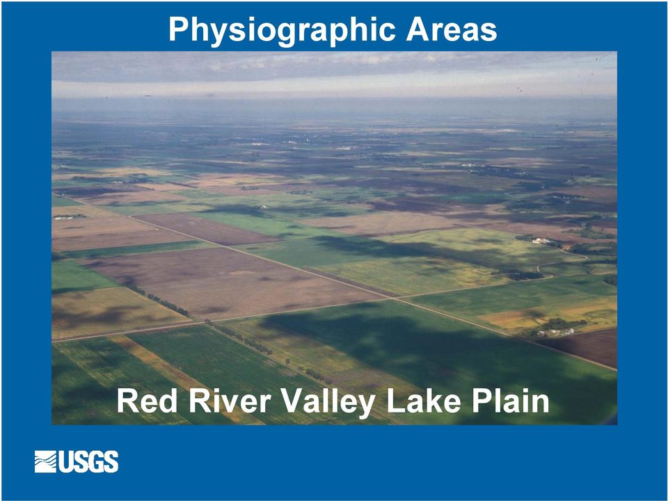
3 Physiographic Areas Red River Valley Lake Plain
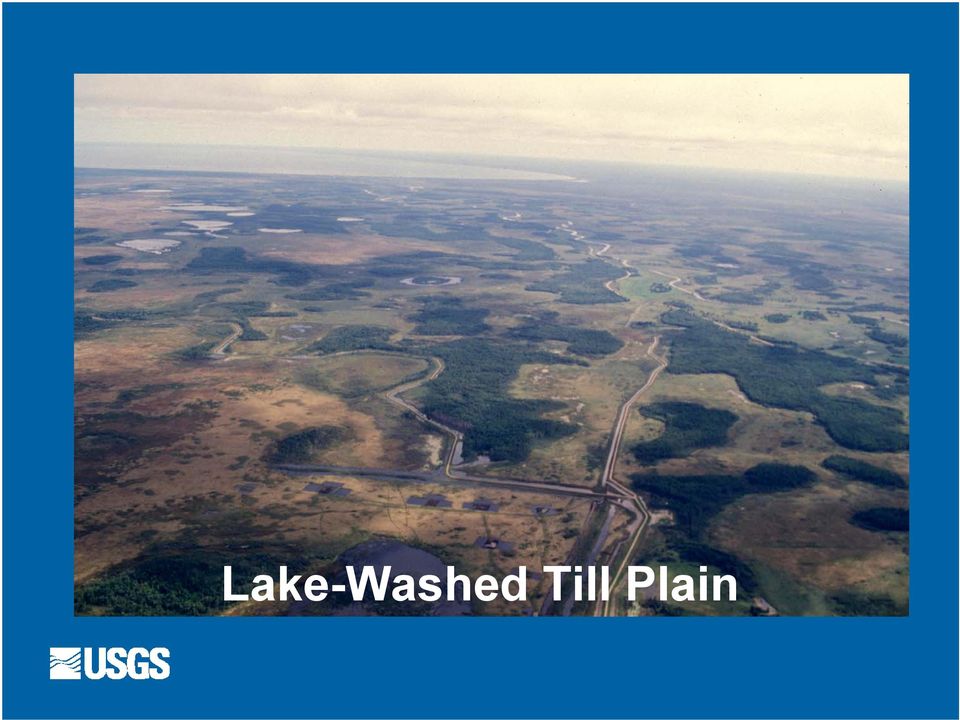
4 Lake-Washed Till Plain
5 Moraine

6 OBJECTIVES Estimate the availability of ground water in nine selected surficial aquifers located within and adjacent to the Minnesota portion of the Basin Compile water-quality data for the aquifers Evaluate potential effects of ground-water development on surface waters connected to the aquifers

7 What factors affect the availability of ground water? Aquifer Location, Thickness, and Extent Ground-Water Storage Water Sources and Discharges Withdrawal Rates Historic (and Planned) Water Use Water Quality

8 What defines availability of ground-water? Location where is it (in relation to need)? Volume how much is present (max. vs. actual)? Removal Rate recharge rates and sources? Interactions other unaccounted for discharges? Intended Use for whom / what purpose? Quality how good is it what is the use? Cost consequences and other water sources?

9 METHODS OF STUDY Compiled and reviewed information from published studies, hydrologic atlases, and regional hydrogeologic assessments Generated aquifer maps (including GW flow and saturated thickness contours) Compared and contrasted aquifers hydraulic characteristics and properties, ground-water quality, and recent (2003) ground-water use
 ground-water")
10 METHODS OF STUDY - continued Described ground water - surface water interactions, including simulated scenarios and actual ground-water pumping Estimated ground water storage in each aquifer using saturated thickness data (when available) Determined which aquifers have the greatest potential for additional ground-water development (i.e. availability of ground-water )
")
11 What factors influence ground-water availability? Water budget (recharge vs. discharge) Ability (or inability) to withdraw ground water (theoretical well yields and hydraulic properties) Volume of stored ground water relative to aquifer recharge (flux)
 Volume of")
12 What factors influence ground-water availability? Intended uses of water and necessary quality Hydraulic connection between the aquifers and surface waters (streams, lakes, wetlands) Acceptance of adverse impacts on the system from increased ground-water pumping
 Acceptance of adverse impacts on the system from")
13 Assumptions and (or) Complications with Study Methods Data reported as originally published With few modifications and (or) interpretations Data compiled from different sources, with varying levels of details and scales Reported most recent and comprehensive data, with acceptance of minor mapping discrepancies Much of the original data were in paper format, with little to no GIS-based data Conversion of data into digital-format was a tedious and piecemeal process

14 Factors Affecting Ground-Water Availability Aquifer Location, Thickness, and Extent relative to current uses and future needs

15 Surficial Aquifers of the Study Area Red River Basin boundary Major rivers and streams Beach Ridge Aquifers Buffalo Aquifer Middle River Surficial miles 50 kilometers Two Rivers Surficial Pelican River Sand-Plain Otter Tail Surficial Wadena Surficial Pineland Sands Surficial Bemidji-Bagley Surficial

16 Buffalo Aquifer (saturated thickness data not available) Saturated Thickness >0 to <25 ft 25 to <50 ft Fargo Moorhead 50 to <100 ft 100 to <150 ft of the North to <200 ft Regional water-table contour (MDNR, 2000) Red River CLAY Direction of ground-water flow miles 10 kilometers NORTH DAKOTA WILKIN

17 Otter Tail Surficial (unsaturated portions or saturated thickness data not available) Saturated Thickness >0 to <20 ft 20 to <40 ft Detroit Lakes BECKER 40 to <60 ft Perham 60 to <80 ft 80 to <100 ft 100 to <120 ft OTTER TAIL Pelican River Sand-Plain Wadena Surficial 1300 Regional water-table contour (MDNR, 2002) Direction of ground-water flow 0 10 miles 0 10 kilometers GRANT DOUGLAS
 Direction of ground-water flow 0 10 miles 0 10 kilometers GRANT")
18 Pineland Sands Surficial (saturated thickness data not available) Saturated Thickness >0 to <20 ft CLEARWATER HUBBARD Walker 20 to <40 ft 40 to <60 ft Park Rapids 60 to <80 ft 80 to <100 ft 100 to <120 ft BECKER 120 to <140 ft Otter Tail Surficial Wadena Surficial OTTER TAIL WADENA CASS 1300 Water-table contour Wadena Direction of ground-water flow miles 10 kilometers TODD

19 Factors Affecting Ground-Water Availability Aquifer Location, Thickness, and Extent relative to current uses and future needs Maximum volume of ground water capable of being stored in each aquifer

20 Estimating Maximum Volumes of Ground-Water Storage Compiled from aquifer studies, or calculated using aquifer areas (A), and published saturated thickness and porosity (n) data Storage = ( A * median sat. thick. * n ) Storage represents a maximum volume of water the aquifer is capable of holding
 Storage represents a maximum volume of water the aquifer is capable")
21 Maximum Ground-Water Storage (~2,900 bgal total) 250 bgal 270 bgal 5 bgal Buffalo Aquifer 1,000 bgal 400 bgal 500 bgal 300 bgal Middle River Surficial Two Rivers Surficial Pelican River Sand-Plain Otter Tail Surficial Wadena Surficial Pineland Sands Surficial Bemidji-Bagley Surficial 150 bgal
22 Factors Affecting Ground-Water Availability Aquifer Location, Thickness, and Extent relative to current uses and future needs Maximum volume of ground water capable of being stored in each aquifer Water sources and discharges determined from water budget estimations
23 Water Budget Estimation Methods Steady-state simulations from published aquifer studies Published estimations of recharge and discharge components based on precipitation data and hydrograph analysis
24 Evaluating Ground-Water Availability Using Water Budget Estimates Water budgets varied based on methods and provided a range of values for the components Water budgets were influenced most by recharge components and aquifer storage Availability was evaluated by comparing and contrasting recharge sources and total
25 Comparison of Recharge to Evaluate Ground-Water Availability Recharge was greatest in Otter Tail, Pineland Sands, Wadena Surficial Aquifers, and Pelican River Sand-Plain Aquifer - due to greater mean areal recharge (5-8 in./yr) and large aquifer areas Smallest recharge in Middle River and Two Rivers Surficial Aquifers mean areal recharge of only 3 in./yr; small aquifer areas
26 Factors Affecting Ground-Water Availability cont. Rate that ground water can be withdrawn from the aquifer (comparison of theoretical well yields and actual pumping data)
27 Maximum Theoretical Well Yields 12,000 10,000 8,000 6,000 4,000 2,000 Gallons per Minute 0 WEST EAST Beach Ridge Aquifers Buffalo Aquifer Middle River Surficial Two Rivers Surficial Pelican River Sand-Plain Otter Tail Surficial Wadena Surficial Pineland Sands Surficial Bemidji-Bagley Surficial
28 Factors Affecting Ground-Water Availability cont. Rate that ground water can be withdrawn from the aquifer (comparison of theoretical well yields and actual pumping data) Historic (and planned) use of the ground water
29 Ground-Water Withdrawals in 2003* 0.4 bgal <0.1 bgal 1 bgal (~28 bgal total) 0.4 bgal 1.9 bgal Buffalo Aquifer (1.5 %) Middle River Surficial (<0.1%) 8.2 bgal 6.8 bgal 9.2 bgal Two Rivers Surficial (1.5 %) Pelican River Sand-Plain (7%) Otter Tail Surficial (33%) Wadena Surficial (24%) Pineland Sands Surficial (29%) Bemidji-Bagley Surficial (4%) * 2003 ground-water pumping data provided by Minnesota DNR
30 Uses of Ground Water in 2003* (~28 bgal total) Agricultural Irrigation (85.6%) 2.7 bgal Public Supply (9.6%) Industrial (2.2%) Golf Irrigation (1.4%) Commercial (0.4%) 24 bgal Mining (0.4%) Thermal Energy (0.3%) Aquaculture (0.05%) Livestock (0.02%) * 2003 ground-water use data provided by Minnesota DNR
31 Factors Affecting Ground-Water Availability cont. Rate that ground water can be withdrawn from the aquifer (comparison of theoretical well yields and actual pumping data) Historic (and planned) use of the ground water Quality of the water (relative to the use)
32 Concentration of Nitrate (as Nitrogen) from Surficial Aquifers 1, USEPA MCL = 10 mg/l Concentration, mg/l 0.01 (26) NA (20) (25) (1) (14) (6) (20) (25) (29) (36) (50) WEST EAST Lake Plain ( ) Buffalo (1957) Buffalo (1978) Moraine ( ) Pelican R. ( ) Otter Tail ( ) Otter Tail ( ) Wadena ( ) Wadena ( ) Pineland Sands ( ) Straight R. - Pineland ( ) Bemidji-Bagley ( )
33 Concentration of Sulfate from Surficial Aquifers 10,000 1,000 USEPA SMCL = 250 mg/l Concentration, mg/l 0.1 (27) (46) (20) (24) (7) (14) (6) (20) (25) (25) (17) (55) WEST EAST Lake Plain ( ) Buffalo (1957) Buffalo (1978) Moraine ( ) Pelican R. ( ) Otter Tail ( ) Otter Tail ( ) Wadena ( ) Wadena ( ) Pineland Sands ( ) Straight R. - Pineland ( ) Bemidji-Bagley ( )
34 OTHER CONSIDERATIONS ( less quantifiable factors of ground-water availability ) Hydraulic connection between the surficial aquifers and adjacent ground waters and surface waters, and the effects of increased ground-water pumping Implications to sustainable use and the acceptance of potential adverse results due to increased ground-water development
35 CONCLUSIONS Otter Tail and Pineland Sands Surficial, and Pelican River Sand-Plain Aquifers have the greatest potential for development among the surficial aquifers studied Water levels and storage in Middle River Surficial Aquifer and Buffalo Aquifer are the most sensitive to increased pumping and the most susceptible to decline
36 Secondary Study Findings Surficial aquifers vary in hydraulic properties, water quality, and sources and rates of recharge and discharge Actual and simulated ground-water pumping indicate that aquifers can be hydraulically connected to surface waters Water-budget estimates may indicate aquifers that can be susceptible to ground-water losses due to increased withdrawals
37 Questions?
The Role of Groundwater in Alberta s Tight Water Supply Environment. Ken Baxter, M.Sc., P.Geol. Dan R. Brown, M.Sc., P.Geol.
 The Role of Groundwater in Alberta s Tight Water Supply Environment Ken Baxter, M.Sc., P.Geol. Dan R. Brown, M.Sc., P.Geol. The Role of Groundwater in Alberta s Tight Water Supply Environment Outline Importance
Ground-Water-Level Monitoring and the Importance of Long-Term Water-Level Data U.S. Geological Survey Circular 1217
 Ground-Water-Level Monitoring and the Importance of Long-Term Water-Level Data U.S. Geological Survey Circular 1217 by Charles J. Taylor William M. Alley Denver, Colorado 2001 U.S. DEPARTMENT OF THE INTERIOR
STATE OF VERMONT AGENCY OF NATURAL RESOURCES DEPARTMENT OF ENVIRONMENTAL CONSERVATION WASTE MANAGEMENT DIVISION SOLID WASTE MANAGEMENT PROGRAM
 STATE OF VERMONT AGENCY OF NATURAL RESOURCES DEPARTMENT OF ENVIRONMENTAL CONSERVATION WASTE MANAGEMENT DIVISION SOLID WASTE MANAGEMENT PROGRAM Solid Waste Management Program Waste Management Division 103
ESSENTIAL COMPONENTS OF WATER-LEVEL MONITORING PROGRAMS. Selection of Observation Wells
 ESSENTIAL COMPONENTS OF WATER-LEVEL MONITORING PROGRAMS Before discussing the uses and importance of long-term water-level data, it is useful to review essential components of a water-level monitoring
Industrial Water Use in the United States. U.S. Department of the Interior U.S. Geological Survey
 Industrial Water Use in the United States Methods, Status, t and Trends U.S. Department of the Interior U.S. Geological Survey Water withdrawals by category Livestock Self-Supplied Supplied Domestic Public
Water-Table Elevation and Depth to Water Table
 Water-Table Elevation and Depth to Water Table By Roberta Adams Minnesota Hydrogeology Atlas Series Atlas HG-03 Report Plate 1, Water-Table Elevation Plate 2, Depth to Water Table St. Paul June 2016 Minnesota
GROUNDWATER CONDITIONS
 GROUNDWATER CONDITIONS IN THE NORTHERN SACRAMENTO VALLEY LOCAL MANAGEMENT OF WATER RESOURCES IN THE NORTHERN SACRAMENTO VALLEY MEETING DECEMBER 16, 2011 KELLY STATON, SENIOR ENGINEERING GEOLOGIST, GROUNDWATER
Water Extraction Permitting Policy
 Water Extraction Policy 1 Water Extraction Permitting Policy Department of Environment, Labour & Justice January 2013 Water Extraction Policy 2 EXECUTIVE SUMMARY This document establishes a new policy
Multilevel Monitoring and Characterization of the Edwards and Trinity Aquifers of Central Texas
 Multilevel Monitoring and Characterization of the Edwards and Trinity Aquifers of Central Texas Brian A. Smith and Brian B. Hunt Barton Springs / Edwards Aquifer Conservation District, 1124 Regal Row,
Groundwater Training Course SOPAC, April 2005. Electromagnetic (EM) Induction method for Groundwater Investigations
 Induction method for Groundwater Investigations") Groundwater Training Course SOPAC, April 2005 Electromagnetic (EM) Induction method for Groundwater Investigations Electromagnetic (EM) Induction Method Basic principle: An AC electric current is applied
Groundwater Training Course SOPAC, April 2005 Electromagnetic (EM) Induction method for Groundwater Investigations Electromagnetic (EM) Induction Method Basic principle: An AC electric current is applied
Soil Cleanup Goals. Minnesota Department of Agriculture Pesticide and Fertilizer Management Division. Guidance Document 19
 This document is made available electronically by the Minnesota Legislative Reference Library as part of an ongoing digital archiving project. http://www.leg.state.mn.us/lrl/lrl.asp Minnesota Department
Preliminary Plan for Expansion of the Regional Network of Floridan and Surficial Aquifer Monitor Wells for Northern Tampa Bay
 DRAFT - August 24, 2000 Preliminary Plan for Expansion of the Regional Network of Floridan and Surficial Aquifer Monitor Wells for Northern Tampa Bay Introduction In 1999, the Southwest Florida Water Management
Funding for this project provided by Washington Department of Ecology Grants G1200126 & G0700149
 Funding for this project provided by Washington Department of Ecology Grants G1200126 & G0700149 Table of Contents Executive Summary.. 3 Introduction.. 4 Disaggregation of tive & Non-tive Water Use 5 Publicly
Ground Water and Surface Water
 Ground Water and Surface Water A Single Resource U.S. Geological Survey Circular 1139 by Thomas C. Winter Judson W. Harvey O. Lehn Franke William M. Alley Denver, Colorado 1998 U.S. DEPARTMENT OF THE INTERIOR
LR 314 Working Group 5 Final Report
 LR 314 Working Group 5 Final Report I. Nebraska Department of Natural Resources Table 1. NDNR and NATURAL RESOURCES COMMISSION WATER/INTEGRATED MANAGEMENT PLANNING RELATED RESEARCH, STUDIES AND RELATED
Ground-Water Availability in the United States
 Ground-Water Resources Program Ground-Water Availability in the United States Water Quality Water Quantity Aquifers Circular 1323 U.S. Department of the Interior U.S. Geological Survey The cover shows
National Groundwater Conference Canberra, November 2010
 DEVELOPMENT OF AN ADAPTIVE GROUNDWATER MONITORING FRAMEWORK TO INFORM SALINITY MANAGEMENT ACROSS THE VICTORIAN MALLEE REGION National Groundwater Conference Canberra, November 2010 Supported by the National
Minnesota Groundwater Level Monitoring Network. Guidance Document for Network Development
 Minnesota Groundwater Level Monitoring Network Guidance Document for Network Development May 2011 Funding for this project was provided by the Minnesota Environment and Natural Resources Trust Fund as
Ground Water in the Piedmont and Blue Ridge Provinces of North Carolina
 Ground Water in the Piedmont and Blue Ridge Provinces of North Carolina Prepared by: R.L. Huffman Extension Agricultural Engineering Specialist Published by: North Carolina Cooperative Extension Service
Evaluation of Site-Specific Criteria for Determining Potability
 Evaluation of Site-Specific Criteria for Determining Potability and Cleanup Goals for Impacted Groundwater This paper presents considerations used to evaluate site-specific criteria for determining groundwater
Streamflow Depletion by Wells Understanding and Managing the Effects of Groundwater Pumping on Streamflow
 Groundwater Resources Program Streamflow Depletion by Wells Understanding and Managing the Effects of Groundwater Pumping on Streamflow Circular 1376 U.S. Department of the Interior U.S. Geological Survey
Chapter 1 Introduction
 Chapter 1 Section 1421 of SDWA tasks EPA with protecting USDWs for all current and future drinking water supplies across the country (see section 1.3 for the complete definition of a USDW). EPA s UIC Program
ALL GROUND-WATER HYDROLOGY WORK IS MODELING. A Model is a representation of a system.
 ALL GROUND-WATER HYDROLOGY WORK IS MODELING A Model is a representation of a system. Modeling begins when one formulates a concept of a hydrologic system, continues with application of, for example, Darcy's
Supply and Demand Correlation New Mexico Gila Basin Arizona Water Settlement Act
 Supply and Demand Correlation New Mexico Gila Basin Arizona Water Settlement Act 1. 2. U.S. Department of the Interior Bureau of Reclamation Phoenix Area Office December 2010 Mission Statements The mission
1 INTRODUCTION. Kayenta Complex Page 9 December 2011 Cumulative Hydrologic Impact Assessment
 1 INTRODUCTION The Office of Surface Mining Reclamation and Enforcement (OSMRE) is the regulatory authority for coal mining operations under the Surface Mining Reclamation and Control Act of 1977 that
7_IWAVE_detail.doc Natural Water System Surface Water First-level surface-water effort (minimum necessary to provide the most rudimentary assessment)
") Surface Water First-level surface-water effort (minimum necessary to provide the most rudimentary assessment) Surface-water hydrography Map based on historical ground surveys Natural and man-made storage
Surface Water First-level surface-water effort (minimum necessary to provide the most rudimentary assessment) Surface-water hydrography Map based on historical ground surveys Natural and man-made storage
Disposal of Municipal Wastewater Treatment Plant Effluent by Indirect Discharge to Surface Water via Groundwater or Hyporheic Water
 Disposal of Municipal Wastewater Treatment Plant Effluent by Indirect Discharge to Surface Water via Groundwater or Hyporheic Water Internal Management Directive September 2007 Table of Contents Introduction...1
Preliminary Assessment
 Preliminary Assessment Bonebrake Theological Seminary Site Dayton Unit III Dayton, Ohio Prepared by: U.S. Army Corps of Engineers Buffalo District 1776 Niagara Street Buffalo, NY 14207-3199 September 5,
Global Water Resources
 Global Water Resources Highlights from assessment activities over the past two decades, which are used to establish present and future water trends, reveal that: 1. Freshwater resources are unevenly distributed,
Vulnerability Assessment
 Vulnerability Assessment VULNERABILITY As used in this report, vulnerability refers to the sensitivity of groundwater to contamination, and is determined by intrinsic characteristics of the aquifer. It
CHECKLIST FOR FILING AN APPLICATION FOR A GROUND AND/OR SURFACE WATER WITHDRAWAL PROJECT IN THE DELAWARE RIVER BASIN
 CHECKLIST FOR FILING AN APPLICATION FOR A GROUND AND/OR SURFACE WATER WITHDRAWAL PROJECT IN THE DELAWARE RIVER BASIN PLEASE COMPLETE CHECKLIST AND ENCLOSE WITH THE APPLICATION. If you need assistance,
Travel Centers of America 1003300
 Travel Centers of America 1003300 Source Water Assessment Report A State Assessment of Your Drinking Water Source s Vulnerability As a requirement of the 1996 Amendments to the Federal Safe Drinking Water
WILLOCHRA BASIN GROUNDWATER STATUS REPORT 2009-10
 WILLOCHRA BASIN GROUNDWATER STATUS REPORT 2009-10 SUMMARY 2009-10 The Willochra Basin is situated in the southern Flinders Ranges in the Mid-North of South Australia, approximately 50 km east of Port Augusta
SWAT INPUT DATA:.GW CHAPTER 24
 CHAPTER 24 SWAT INPUT DATA:.GW SWAT partitions groundwater into two aquifer systems: a shallow, unconfined aquifer which contributes return flow to streams within the watershed and a deep, confined aquifer
Early SNMP Case Studies Salt and Nutrient Management Plans and Related Issues at Camp Pendleton MCB. Rob Beggs, Brown and Caldwell
 Early SNMP Case Studies Salt and Nutrient Management Plans and Related Issues at Camp Pendleton MCB Rob Beggs, Brown and Caldwell November 7, 2013 Water Sustainability for Camp Pendleton Camp Pendleton
1.72, Groundwater Hydrology Prof. Charles Harvey Lecture Packet #2: Aquifers, Porosity, and Darcy s Law. Lake (Exposed Water Table)
") 1.72, Groundwater Hydrology Prof. Charles Harvey Lecture Packet #2: Aquifers, Porosity, and Darcy s Law Precipitation Infiltration Lake (Exposed Water Table) River Water table Saturated zone - Aquifer
1.72, Groundwater Hydrology Prof. Charles Harvey Lecture Packet #2: Aquifers, Porosity, and Darcy s Law Precipitation Infiltration Lake (Exposed Water Table) River Water table Saturated zone - Aquifer
Adam Todd Inn Restaurant 1904324
 Adam Todd Inn Restaurant 1904324 Source Water Assessment Report A State Assessment of Your Drinking Water Source s Vulnerability As a requirement of the 1996 Amendments to the Federal Safe Drinking Water
How To Map A Lake In The North Of The Holland (Fiji)
") 1. Hydrogelogical mapping Jiri Sima Aim of HG map Groundwater and rocks qualitative permeability and quantitative potential of rock units aquifers / aquitards / aquiclides Water points (spatial distribution
1. Hydrogelogical mapping Jiri Sima Aim of HG map Groundwater and rocks qualitative permeability and quantitative potential of rock units aquifers / aquitards / aquiclides Water points (spatial distribution
COST AND PERFORMANCE REPORT
 COST AND PERFORMANCE REPORT Pump and Treat of Contaminated Groundwater at the United Chrome Superfund Site Corvallis, Oregon September 1998 Prepared by: SITE INFORMATION Identifying Information: United
Groundwater Flooding: a UK Perspective
 Groundwater Flooding: a UK Perspective David Macdonald British Geological Survey Maclean Building Crowmarsh Gifford Wallingford OX10 8BB Tel 01491 838800 NERC All rights reserved Talk outline Definition
PRECIPITATION AND EVAPORATION
 PRECIPITATION AND EVAPORATION OBJECTIVES Use historical data to analyze relationships between precipitation, evaporation and stream flow in the San Antonio River Basin TOPICS Water cycle Precipitation
Christopher Harto Argonne National Laboratory
 Managing Water from CCS Programs Christopher Harto Argonne National Laboratory John A. Veil - Argonne National Laboratory Andrea McNemar - DOE/NETL GWPC Energy and Water Sustainability Symposium Pittsburgh,
ORGANIZATIONAL ONLINE SURVEY RESULTS EXECUTIVE SUMMARY
 Stakeholder Advisory Committee ORGANIZATIONAL ONLINE SURVEY RESULTS EXECUTIVE SUMMARY AUGUST 2012 Compiled and Summarized by: Facilitating Consensus Solutions, Supporting Collaborative Action. The Florida
A sediment monitoring program for North America
 Erosion and Sediment Transport Monitoring Programmes in River Basins (Proceedings of the Oslo Symposium, August 1992). IAHS Publ. no. 210, 1992. 391 A sediment monitoring program for North America W.R.
How To Build An Effluent Recovery Scheme
 NGEST Effluent Recovery Scheme tekopohjavettä jätevedestä 6.10.2010 / Suvi Niini NGEST Effluent Recovery Scheme Part of a larger Northern Gaza Emergency Sewage Treatment Project (NGEST) with several donors
Hydrologic Data Program Overview. Rio Grande Estuary, and Lower Laguna Madre Basin and Bay Area Stakeholder Committee (BBASC)
") Hydrologic Data Program Overview Rio Grande Estuary, and Lower Laguna Madre Basin and Bay Area Stakeholder Committee (BBASC) J. Mark Null Chief South Texas Program Office USGS Texas Water Science Center
Hydrologic Data Program Overview Rio Grande Estuary, and Lower Laguna Madre Basin and Bay Area Stakeholder Committee (BBASC) J. Mark Null Chief South Texas Program Office USGS Texas Water Science Center
BALLANTRAE-MUSSELMAN LAKE SERVICING REPORT. Submitted to: The Town of Whitchurch-Stouffville. Submitted by:
 BALLANTRAE-MUSSELMAN LAKE SERVICING REPORT Submitted to: The Town of Whitchurch-Stouffville Submitted by: AMEC Environment & Infrastructure 3215 North Service Road Burlington, ON L7N 3G2 Tel: 905-335-2353
FINAL GUIDANCE FOR CONDUCTING BENEFICIAL WATER USE DETERMINATIONS AT ENVIRONMENTAL CLEANUP SITES
 FINAL GUIDANCE FOR CONDUCTING BENEFICIAL WATER USE DETERMINATIONS AT ENVIRONMENTAL CLEANUP SITES Oregon Department of Environmental Quality Waste Management and Cleanup Division 811 SW Sixth Avenue Portland,
Marcellus Fast Facts
 1 Marcellus Fast Facts Covers about 95,000 square miles in 6 states Occurs at depths of up to 9,000 feet Thickness of 250 feet or more Largest natural gas reservoir in North America (est. 500 TCF recoverable
Plan Groundwater Procurement, Implementation and Costs, prepared for the Brazos River Authority, July 2005.
 6 Conjunctive Use 6.1 Lake Granger Augmentation 6.1.1 Description of Option Rapid population growth and development in Williamson County require additional water supplies throughout the planning period.
3. The submittal shall include a proposed scope of work to confirm the provided project description;
 QIN Shoreline Master Program Project Summary The Shoreline Master Program (SMP) development process for the Quinault Indian Nation (QIN) includes the completion of inventory and analysis report with corresponding
4. Environmental Impacts Assessment and Remediation Targets
 4. Environmental Impacts Assessment and Remediation Targets 4.1 Environmental Impacts Significant additional development in the Alder Creek watershed is not anticipated at this time; however, there are
Understanding Complex Models using Visualization: San Bernardino Valley Ground-water Basin, Southern California
 Understanding Complex Models using Visualization: San Bernardino Valley Ground-water Basin, Southern California Zhen Li and Wesley R. Danskin U.S. Geological Survey, zhenli@usgs.gov, wdanskin@usgs.gov,
STATE LAND OFFICE An Inventory of Its Lists and Maps of Land Offered for Sale
 MINNESOTA HISTORICAL SOCIETY Minnesota State Archives STATE LAND OFFICE An Inventory of Its Lists and Maps of Land Offered for Sale OVERVIEW OF THE RECORDS Agency: Series Title: Dates: 1912-1970. Minnesota.
AQUIFER STORAGE RECOVERY
 AQUIFER STORAGE RECOVERY This continuing education unit has been created to acquaint the reader with the topic of Aquifer Storage Recovery. The International School of Well Drilling gratefully acknowledges
California s Groundwater
 California s Groundwater Update 2013 A Compilation of Enhanced Content for California Water Plan Update 2013 April 2015 State of California Natural Resources Agency Department of Water Resources FINDINGS,
The Taos Valley lies between the Sangre de Cristo Mountains and the Rio
 Water Matters! Taos Settlement 23-1 Taos Pueblo Water Settlement The Taos Valley lies between the Sangre de Cristo Mountains and the Rio Grande Gorge. It is laced with streams that rush from the mountains,
USEPA Hydraulic Fracturing Study Water Management Workshop
 USEPA Hydraulic Fracturing Study Water Management Workshop March 29, 2011 How are Appropriate Water Sources for Hydraulic Fracturing Determined? Pre-development Conditions and Management of Development
Advanced tools in water management in The Netherlands
 Advanced tools in water management in The Netherlands Modelling for system knowledge, effective operational management, and policy making Gé van den Eertwegh Rivierenland Water Board The Netherlands PR
Expanded Monitoring Program
 Expanded Monitoring Program January June 2004 USGS PROGRESS REPORT Page 1 Near Deer Trail, Colorado Progress Report January June 2004 Volume 6, no. 1 CONTENTS Program Overview... 1 Site Map... 2 Questions
Update on Aquifer Storage and Recovery
 Update on Aquifer Storage and Recovery Dean Powell Bureau Chief Water Supply Bureau Governing Board Workshop September 2013 Objectives Discuss the basics of aquifer storage and recovery (ASR) technology
WATER QUALITY MONITORING AND APPLICATION OF HYDROLOGICAL MODELING TOOLS AT A WASTEWATER IRRIGATION SITE IN NAM DINH, VIETNAM
 WATER QUALITY MONITORING AND APPLICATION OF HYDROLOGICAL MODELING TOOLS AT A WASTEWATER IRRIGATION SITE IN NAM DINH, VIETNAM LeifBasherg (1) OlujZejlllJul Jessen (1) INTRODUCTION The current paper is the
APPENDIX G WATER SUPPLY ASSESSMENT
 APPENDIX G WATER SUPPLY ASSESSMENT THIS PAGE INTENTIONALLY LEFT BLANK February 2013 BLYTHE MESA SOLAR PROJECT Water Supply Assessment PREPARED BY: 731 East Ball Road, Suite 100 Anaheim, CA 92805 (714)
Groundwater Recharge from a Portion of the Santa Catalina Mountains
 Groundwater Recharge from a Portion of the Santa Catalina Mountains Item type text; Proceedings Authors Belan, R. A.; Matlock, W. G. Publisher Journal Rights Arizona-Nevada Academy of Science Hydrology
A plan for conversion of stormwater to groundwater recharge on the Utah Valley University main campus, Orem, Utah
 Hydrology Days 2013 A plan for conversion of stormwater to groundwater recharge on the Utah Valley University main campus, Orem, Utah Dylan B. Dastrup, Gabriela R. Ferreira, Daniel Zacharias, Daniel H.
Principles of groundwater flow
 Principles of groundwater flow Hydraulic head is the elevation to which water will naturally rise in a well (a.k.a. static level). Any well that is not being pumped will do for this, but a well that is
By Michael L. Merritt and Leonard F. Konikow. U.S. Geological Survey. Water-Resources Investigations Report 00-4167
 Documentation of a Computer Program to Simulate Lake-Aquifer Interaction Using the MODFLOW Ground-Water Flow Model and the MOC3D Solute-Transport Model By Michael L. Merritt and Leonard F. Konikow U.S.
Estimating Potential Reduction Flood Benefits of Restored Wetlands
 Estimating Potential Reduction Flood Benefits of Restored Wetlands Kenneth W. Potter University of Wisconsin Introduction Throughout the summer of 1993 a recurring question was the impact of wetland drainage
Long-Term Monitoring Network Optimization Evaluation. for. Wash King Laundry Superfund Site Lake County, Michigan
 Long-Term Monitoring Network Optimization Evaluation for Wash King Laundry Superfund Site Lake County, Michigan June 2006 Solid Waste and Emergency Response (5102P) EPA 542-R-06-004 December 2006 www.epa.gov
STATE OF MICHIGAN DEPARTMENT OF NATURAL RESOURCES. Michigan s Water Withdrawal Assessment Process and Internet Screening Tool
 DNR DEPARTMENT OF NATURAL RESOURCES MICHIGAN STATE OF MICHIGAN DEPARTMENT OF NATURAL RESOURCES SR55 May 2011 Michigan s Water Withdrawal Assessment Process and Internet Screening Tool David A. Hamilton
THE MARSHALL STREET ADVANCED POLLUTION CONTROL FACILITY (CLEARWATER, FLORIDA) CONVERSION TO 4-STAGE BARDENPHO TO IMPROVE BIOLOGICAL NITROGEN REMOVAL
 CONVERSION TO 4-STAGE BARDENPHO TO IMPROVE BIOLOGICAL NITROGEN REMOVAL") THE MARSHALL STREET ADVANCED POLLUTION CONTROL FACILITY (CLEARWATER, FLORIDA) CONVERSION TO 4-STAGE BARDENPHO TO IMPROVE BIOLOGICAL NITROGEN REMOVAL ABSTRACT Timur Deniz, Ph.D., Thomas W. Friedrich, P.E.
THE MARSHALL STREET ADVANCED POLLUTION CONTROL FACILITY (CLEARWATER, FLORIDA) CONVERSION TO 4-STAGE BARDENPHO TO IMPROVE BIOLOGICAL NITROGEN REMOVAL ABSTRACT Timur Deniz, Ph.D., Thomas W. Friedrich, P.E.
Groundwater Levels and Pumpage in the Peoria-Pekin Area, Illinois, 1890-1966
 REPORT OF INVESTIGATION 61 Groundwater Levels and Pumpage in the Peoria-Pekin Area, Illinois, 1890-1966 by MIGUEL A. MARINO and RICHARD J. SCHICHT Title: Groundwater Levels and Pumpage in the Peoria-Pekin
;# $%&!)+6'!*+,&!.-!0**&12(3!4<!(17.//&7')=!+!2>*)(7+'&!.-!:2-34&#&56& 7<9!5+6!/&*)+7&2!5('%!'%&!7.//&7'!:2-34&7&56&7#9!!!!!
+6'!*+,&!.-!0**&12(3!4<!(17.//&7')=!+!2>*)(7+'&!.-!:2-34&#&56& 7<9!5+6!/&*)+7&2!5('%!'%&!7.//&7'!:2-34&7&56&7#9!!!!!") !!!"#$%&'()*+$&'),-&).+#$/"()0'&+)1&2"3&'4)!$'+$&546)7+'2%)899:) ) ;''+$+) ) "# $%&!'(')&!*+,&!-./!0**&12(3!4!2+'&!5+6!7.//&7'&2!+12!7%+1,&2! -/.8!!"#$$%&'()*+,-.-/0"9!'.!:"#$$#&'()*+,-.-/01119!! ;# $%&!)+6'!*+,&!.-!0**&12(3!4
!!!"#$%&'()*+$&'),-&).+#$/"()0'&+)1&2"3&'4)!$'+$&546)7+'2%)899:) ) ;''+$+) ) "# $%&!'(')&!*+,&!-./!0**&12(3!4!2+'&!5+6!7.//&7'&2!+12!7%+1,&2! -/.8!!"#$$%&'()*+,-.-/0"9!'.!:"#$$#&'()*+,-.-/01119!! ;# $%&!)+6'!*+,&!.-!0**&12(3!4
9.1. Adequacy of Available Data and Monitoring Efforts
 9. DATA MANAGEMENT Data management is a crucial aspect of successful implementation of the ARB IRWMP and its component projects. This section discusses the adequacy of available data and monitoring efforts,
Addressing Declining Elevations in Lake Mead
 Integrated Resource Planning Advisory Committee July 23, 2014 Addressing Declining Elevations in Lake Mead 1 Meeting Topics Drought update Attribute finalization Interbasin Cooperation Intake Pumping Station
GUIDANCE DOCUMENT FOR DEVELOPMENTS AND SUBDIVISIONS WHERE ONSITE WASTEWATER TREATMENT SYSTEMS ARE PROPOSED
 February 2012 July 2012 GUIDANCE DOCUMENT FOR DEVELOPMENTS AND SUBDIVISIONS WHERE ONSITE WASTEWATER TREATMENT SYSTEMS ARE PROPOSED i Table of Contents List of Tables...iii List of Figures...iii 1 Introduction...
Development of Conservation and Restoration Targets for Sustainable Water Resource Management Mike Britt, Natural Resources Division Director
 Development of Conservation and Restoration Targets for Sustainable Water Resource Management Mike Britt, Natural Resources Division Director September 2012 FINAL Table of contents Section Pages 1. Introduction
4 Water supply description
 4 Water supply description A description of the drinking-water system is equally applicable to large utilities with piped distribution systems, piped and non-piped community supplies, including handpumps
ISO International Workshop on Water Kobe Convention Center, Japan, 25-26 July 2012. Water footprint. Taikan OKI
 ISO International Workshop on Water Kobe Convention Center, Japan, 25-26 July 2012 Water footprint Taikan OKI Institute of Industrial Science, The University of Tokyo 1 http://hydro.iis.u-tokyo.ac.jp/
Igneous rocks formed when hot molten material (magma) cools and hardens (crystallizes).
 cools and hardens (crystallizes).") Objectives You will learn about how the land of North Dakota was formed. Introduction North Dakota is a wonderful place to live. Have you ever though about how it was formed? To answer that question, you
Objectives You will learn about how the land of North Dakota was formed. Introduction North Dakota is a wonderful place to live. Have you ever though about how it was formed? To answer that question, you
Towards Integral Groundwater Management in Arid Basins in China. Sino-Dutch Cooperation Project
 Towards Integral Groundwater Management in Arid Basins in China Sino-Dutch Cooperation Project Dick van Doorn & Sophie Vermooten, Deltares, Enabling Delta Life Sino-Dutch project: Capacity Building of
ARIZONA DEPARTMENT OF WATER RESOURCES
 ARIZONA DEPARTMENT OF WATER RESOURCES WATER MANAGEMENT REQUIREMENTS FOR SOLAR POWER PLANTS IN ARIZONA ADWR CONTACT: Jeff Tannler, Statewide Active Management Area Director Arizona Department of Water Resources
Natural Resource Damage Assessment. Emphasis on Groundwater May 4, 2004
 Natural Resource Damage Assessment Emphasis on Groundwater May 4, 2004 MPCA Mission To help Minnesotans protect their environment. 2 Objectives Introduction to NRDA Introduction to NRDA Process Introduction
Design of a Shallow Ground-Water Network to Monitor Agricultural Chemicals, Lake Wales Ridge, Central Florida
 Design of a Shallow Ground-Water Network to Monitor Agricultural Chemicals, Lake Wales Ridge, Central Florida U.S. GEOLOGICAL SURVEY Water-Resources Investigations Report 00 4134 Prepared in cooperation
Review of Groundwater Vulnerability Assessment Methods Unsaturated Zone. Dept. of Earth Sciences University of the Western Cape
 Review of Groundwater Vulnerability Assessment Methods Unsaturated Zone Dept. of Earth Sciences University of the Western Cape Background Sililo et al. (2001) Groundwater contamination depends on: Intrinsic
CONCEPTS AND MODELING IN GROUND-WATER HYDROLOGY- A SELF-PACED TRAINING COURSE
 CONCEPTS AND MODELING IN GROUND-WATER HYDROLOGY- A SELF-PACED TRAINING COURSE by O. L Franke, G.D. Bennett, T.E. Reilly, R.L. Laney, H.T. Buxton, and RJ. Sun U.S. GEOLOGICAL SURVEY Open-File Report 90-707
RESTRICTING GROUNDWATER WITHDRAWALS TO PROTECT WATER RESOURCES: ECONOMIC IMPACT ASSESSMENT
 CHAPTER 14 RESTRICTING GROUNDWATER WITHDRAWALS TO PROTECT WATER RESOURCES: ECONOMIC IMPACT ASSESSMENT Grace Johns and Lisa A. McDonald Economic analysis methods have been used in Florida to identify positive
Water Quantity Trading & Banking: Concepts and Illustrations. Kurt Stephenson Dept. of Agricultural & Applied Economics October 15, 2015
 Water Quantity Trading & Banking: Concepts and Illustrations Kurt Stephenson Dept. of Agricultural & Applied Economics October 15, 2015 Groundwater Management Roles: Commonwealth and Users What GW goal
FY 2015-16 Springs Funding Projects
 FY 2015-16 Springs Funding Projects Spring Homosassa Springs Project Name and Description Garcia Point Septic Project: Through the connection of 88 residential septic systems to Citrus County s central
U.S. GEOLOGICAL SURVEY. Water-Resources Investigations Report 98-4148. A Contribution of the Regional Aquifer-System Analysis Program
 U.S. Department of the Interior U.S. Geological Survey Computer Programs for Describing the Recession of Ground-Water Discharge and for Estimating Mean Ground-Water Recharge and Discharge from Streamflow
Salinity Problems of the Safford Valley: An Interdisciplinary Analysis
 Salinity Problems of the Safford Valley: An Interdisciplinary Analysis Item type text; Proceedings Authors Muller, Anthony B. Publisher Journal Rights Arizona-Nevada Academy of Science Hydrology and Water
Water: Enough? Ronald Turco Professor, Environmental Microbiology & Agronomy. Keith Cherkauer Professor, Agriculture and Biological Engineering
 Water: Enough? Ronald Turco Professor, Environmental Microbiology & Agronomy Director, Indiana Water Resources Research Center & The Purdue Water Community Keith Cherkauer Professor, Agriculture and Biological
SHAFT CONSTRUCTION IN TORONTO USING SLURRY WALLS
 SHAFT CONSTRUCTION IN TORONTO USING SLURRY WALLS Vince Luongo Petrifond Foundation Co., Ltd. PROJECT DESCRIPTION The York Durham Sanitary System (YDSS) Interceptor in the Town of Richmond Hill located
Indoor Water Conservation and I&I Reduction (EIR Alternatives 1 and 2)
") SECTION 2 Description of Master Plan Alternatives The six alternatives that constitute the building blocks of the IRWP Master Plan are as follows: Indoor Water Conservation (EIR Alternative 1) I&I Reduction
SECTION 2 Description of Master Plan Alternatives The six alternatives that constitute the building blocks of the IRWP Master Plan are as follows: Indoor Water Conservation (EIR Alternative 1) I&I Reduction
Maricopa Association of Governments. Technical Memorandum No. 1 INFRASTRUCTURE DEVELOPMENT COSTS. August 2001
 Maricopa Association of Governments Technical Memorandum No. 1 INFRASTRUCTURE DEVELOPMENT COSTS August 2001 3033 NORTH 44TH STREET, SUITE 101 PHOENIX, ARIZONA 85018 (602) 263-9500 FAX (602) 265-1422 Technical
RESERVOIR EVALUATION. The volume of hydrocarbons in a reservoir can be calculated:
 RESERVOIR EVALUATION The volume of hydrocarbons in a reservoir can be calculated: 1. directly by volumetric methods 2. indirectly by material balance methods Volumetrics provide a static measure of oil
INFORMATION SHEET ORDER NO. R5-2011-XXXX TRIANGLE ROCK PRODUCTS, INC. FLORIN ROAD AGGREGATE PLANT SACRAMENTO COUNTY
 ORDER NO. R5-2011-XXXX INFORMATION SHEET Background Triangle Rock, Inc. (Discharger) submitted a Report of Waste Discharge (RWD) on 23 August 2010. The Discharger is expanding the mining operations at
The River Ribble is one of the longest rivers in the North West of England
 River Ribble The River Ribble is one of the longest rivers in the North West of England Did you know? The tidal limit of the Ribble is 11 miles inland (above Preston); The River Ribble is home to a variety
Basic Soil Erosion and Types
 Basic Soil Erosion and Types 2015 Wisconsin Lakes Convention Stacy Dehne DATCP Engineer Types of Soil Erosion Rain drop or splash erosion: Erosion preceded by the destruction of the crumb structure due
Modelling the Discharge Rate and the Ground Settlement produced by the Tunnel Boring
 Modelling the Discharge Rate and the Ground Settlement produced by the Tunnel Boring Giona Preisig*, Antonio Dematteis, Riccardo Torri, Nathalie Monin, Ellen Milnes, Pierre Perrochet *Center for Hydrogeology