Passive and Active Microwave Remote Sensing of Cold-Cloud Precipitation : Wakasa Bay Field Campaign 2003
|
|
|
- Claude Harris
- 8 years ago
- Views:
Transcription
1 Passive and Active Microwave Remote Sensing of Cold-Cloud Precipitation : Wakasa Bay Field Campaign 3 Benjamin T. Johnson,, Gail Skofronick-Jackson 3, Jim Wang 3, Grant Petty jbenjam@neptune.gsfc.nasa.gov Department of Atmospheric and Oceanic Sciences University of Wisconsin - Madison Joint Center for Earth Systems Technology University of Maryland Baltimore County 3 NASA Goddard Space Flight Center Code 64.6 October 4th, 6: CGMS-IPWG Third Workshop on Precipitation Measurements

2 Introduction Cold-Cloud Precipitation Motivation and Goals Wakasa Bay 3: Observations APR- and MIR Observations 3 Retrieval Method Dual Wavelength Ratio (DWR) Method 4 Snowfall Case Study: January 9th, 3 Example -D Profiles Brightness Temperature Simulations 5 Rainfall Case Study: January 7th, 3 Example -D Profiles Brightness Temperature Simulations 6 Conclusion

3 Introduction Cold-Cloud Precipitation Motivation and Goals Wakasa Bay 3: Observations APR- and MIR Observations 3 Retrieval Method Dual Wavelength Ratio (DWR) Method 4 Snowfall Case Study: January 9th, 3 Example -D Profiles Brightness Temperature Simulations 5 Rainfall Case Study: January 7th, 3 Example -D Profiles Brightness Temperature Simulations 6 Conclusion

4 Introduction Cold-Cloud Precipitation Motivation and Goals Wakasa Bay 3: Observations APR- and MIR Observations 3 Retrieval Method Dual Wavelength Ratio (DWR) Method 4 Snowfall Case Study: January 9th, 3 Example -D Profiles Brightness Temperature Simulations 5 Rainfall Case Study: January 7th, 3 Example -D Profiles Brightness Temperature Simulations 6 Conclusion

5 Introduction Cold-Cloud Precipitation Motivation and Goals Wakasa Bay 3: Observations APR- and MIR Observations 3 Retrieval Method Dual Wavelength Ratio (DWR) Method 4 Snowfall Case Study: January 9th, 3 Example -D Profiles Brightness Temperature Simulations 5 Rainfall Case Study: January 7th, 3 Example -D Profiles Brightness Temperature Simulations 6 Conclusion

6 Introduction Cold-Cloud Precipitation Motivation and Goals Wakasa Bay 3: Observations APR- and MIR Observations 3 Retrieval Method Dual Wavelength Ratio (DWR) Method 4 Snowfall Case Study: January 9th, 3 Example -D Profiles Brightness Temperature Simulations 5 Rainfall Case Study: January 7th, 3 Example -D Profiles Brightness Temperature Simulations 6 Conclusion

7 Introduction Cold-Cloud Precipitation Motivation and Goals Wakasa Bay 3: Observations APR- and MIR Observations 3 Retrieval Method Dual Wavelength Ratio (DWR) Method 4 Snowfall Case Study: January 9th, 3 Example -D Profiles Brightness Temperature Simulations 5 Rainfall Case Study: January 7th, 3 Example -D Profiles Brightness Temperature Simulations 6 Conclusion

8 Zonal Precipitation Occurrence

9 Zonal Precipitation Intensity

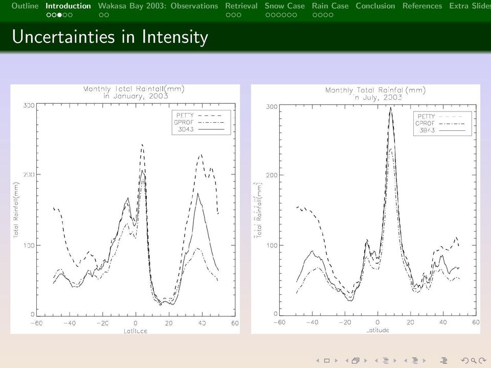
10 Uncertainties in Intensity
11 Current Passive Remote Sensing Problems Light snow and rain difficult to detect (signal to noise) In-situ and ground-based instruments limited; Satellites cover mid-to-high latitudes well, issues remain Current passive platforms (TMI, AMSR, AMSU, SSMI, etc.) cannot reliably detect light/shallow snow and rain Retrieval algorithms and models require accurate information about all geophysical quantities within a FOV
 cannot reliably detect light/shallow snow and rain Retrieval algorithms and models require accurate")
12 Current Passive Remote Sensing Problems Light snow and rain difficult to detect (signal to noise) In-situ and ground-based instruments limited; Satellites cover mid-to-high latitudes well, issues remain Current passive platforms (TMI, AMSR, AMSU, SSMI, etc.) cannot reliably detect light/shallow snow and rain Retrieval algorithms and models require accurate information about all geophysical quantities within a FOV
 cannot reliably detect light/shallow snow and rain Retrieval algorithms and models require accurate")
13 Current Passive Remote Sensing Problems Light snow and rain difficult to detect (signal to noise) In-situ and ground-based instruments limited; Satellites cover mid-to-high latitudes well, issues remain Current passive platforms (TMI, AMSR, AMSU, SSMI, etc.) cannot reliably detect light/shallow snow and rain Retrieval algorithms and models require accurate information about all geophysical quantities within a FOV
 cannot reliably detect light/shallow snow and rain Retrieval algorithms and models require accurate")
14 Current Passive Remote Sensing Problems Light snow and rain difficult to detect (signal to noise) In-situ and ground-based instruments limited; Satellites cover mid-to-high latitudes well, issues remain Current passive platforms (TMI, AMSR, AMSU, SSMI, etc.) cannot reliably detect light/shallow snow and rain Retrieval algorithms and models require accurate information about all geophysical quantities within a FOV
 cannot reliably detect light/shallow snow and rain Retrieval algorithms and models require accurate")
15 Relevant Questions and Issues What are the ranges particle shape, fall speed, composition, and sizes, cold-cloud precipitation? What are the physical relationships between microphysics and microwave radiative transfer, and how can these accurately simulated? How can independent measurements be used to quantify frozen and melting precipitation? How can these quantities be used to improve existing and future retrieval frameworks (e.g., using SSMI/S, GPM, etc.)?

16 Relevant Questions and Issues What are the ranges particle shape, fall speed, composition, and sizes, cold-cloud precipitation? What are the physical relationships between microphysics and microwave radiative transfer, and how can these accurately simulated? How can independent measurements be used to quantify frozen and melting precipitation? How can these quantities be used to improve existing and future retrieval frameworks (e.g., using SSMI/S, GPM, etc.)?

17 Relevant Questions and Issues What are the ranges particle shape, fall speed, composition, and sizes, cold-cloud precipitation? What are the physical relationships between microphysics and microwave radiative transfer, and how can these accurately simulated? How can independent measurements be used to quantify frozen and melting precipitation? How can these quantities be used to improve existing and future retrieval frameworks (e.g., using SSMI/S, GPM, etc.)?

18 Relevant Questions and Issues What are the ranges particle shape, fall speed, composition, and sizes, cold-cloud precipitation? What are the physical relationships between microphysics and microwave radiative transfer, and how can these accurately simulated? How can independent measurements be used to quantify frozen and melting precipitation? How can these quantities be used to improve existing and future retrieval frameworks (e.g., using SSMI/S, GPM, etc.)?

19 Introduction Cold-Cloud Precipitation Motivation and Goals Wakasa Bay 3: Observations APR- and MIR Observations 3 Retrieval Method Dual Wavelength Ratio (DWR) Method 4 Snowfall Case Study: January 9th, 3 Example -D Profiles Brightness Temperature Simulations 5 Rainfall Case Study: January 7th, 3 Example -D Profiles Brightness Temperature Simulations 6 Conclusion


20 January 9th, 3 3: to 3:4 UTC

21 January 7th, 3 5:5 to 5:55 UTC
22 Introduction Cold-Cloud Precipitation Motivation and Goals Wakasa Bay 3: Observations APR- and MIR Observations 3 Retrieval Method Dual Wavelength Ratio (DWR) Method 4 Snowfall Case Study: January 9th, 3 Example -D Profiles Brightness Temperature Simulations 5 Rainfall Case Study: January 7th, 3 Example -D Profiles Brightness Temperature Simulations 6 Conclusion
23 Description of DWR Method DWR goal: estimate two free parameters (N and Λ) of a size distribution (e.g., exponential): N(D) = N exp( Λ D). () DWR independent of N only sensitive to mode diameter (D = 3./Λ) Unknowns: Particle shape/composition, cloud water content, water vapor content, temperature, pressure, and instrument bias Nearby radiosonde obs. constrain WV, T, and P Particle shape/composition ( density in the case of spheres) and CLW free parameters (For further details of the DWR method see, for example, Meneghini et al. (997))

24 Snow Size, Number, and Density relationship to DWR
25
26 Introduction Cold-Cloud Precipitation Motivation and Goals Wakasa Bay 3: Observations APR- and MIR Observations 3 Retrieval Method Dual Wavelength Ratio (DWR) Method 4 Snowfall Case Study: January 9th, 3 Example -D Profiles Brightness Temperature Simulations 5 Rainfall Case Study: January 7th, 3 Example -D Profiles Brightness Temperature Simulations 6 Conclusion
27 Snow: Retrieved Quantities
28 Snow: Derived Quantities (IWC and precip. rate)
29 (Unconstrained ρ snow ): Retrieved N and Λ: Snow Observed DWR 35, Alt. (km) Alt. (km).5 observed Z 4 observed Z Reflectivity Factor (dbz) Dual Wavelength Ratio: 35/ Alt [km] Alt [km].5.5 Retrieved Λ [m ] Retrieved N [m 4 ] Λ [m ] log (N ) [m 4 ])
30 Snow: Retrieved N and Λ observed Z 4 Observed DWR 35,4 3 observed Z Alt. (km) Alt. (km) Reflectivity Factor (dbz) Dual Wavelength Ratio: 35/4 4.5 Retrieved N [m 4 ] 4 3 Retrieved Λ [m ] 3.5 Alt [km].5 Alt [km] Λ [m ] log (N ) [m 4 ])
31 (Unconstrained ρ snow ): Retrieved R and IWC: Snow observed Z 4 DWR 35,4 3 observed Z Alt. (km) Alt. (km) Reflectivity Factor (dbz) Dual Wavelength Ratio: 35/4 3 Retrieved LWC (kg/m 3 ) Z 35 LWC for Snow Z 35 LWC for Rain 3 Retrieved R (mm/hr) Z 35 R for Snow Z 35 R for Rain.5.5 Alt. (km) Alt. (km) (melted) Liquid Water Content (kg/m 3 ) Liquid Equivalent Rainfall Rate (mm/hr)
32 Snow: Retrieved R and IWC vs Z 35 -IWC and Z 35 -R observed Z 4 DWR 35,4 3 observed Z Alt. (km) Alt. (km) Reflectivity Factor (dbz) Dual Wavelength Ratio: 35/4 3 Retrieved LWC (kg/m 3 ) Z LWC for Snow 35 Z 35 LWC for Rain 3 Retrieved R (mm/hr) Z R for Snow 35 Z 35 R for Rain.5.5 Alt. (km) Alt. (km) (melted) Liquid Water Content (kg/m 3 ) Liquid Equivalent Precipitation Rate (mm/hr)
33 Snow: Simulated and Observed profile TBs Constrained TB Observed TB No CLW TB Obs. Clear TB Snow Case 4 TB [K] ± 83.3±3 83.3±7 34 Frequency (GHz)
34 Snow: Observed & Simulated Optimal-Fit TBs Segment TB [K] 4 Simulated & Matched 89 GHz Observed 89 GHz TB [K] Simulated & Matched 5 GHz Observed 5 GHz TB [K] 6 4 Simulated & Matched 83+/ 3 GHz Observed 83+/ 3 GHz TB [K] Simulated & Matched 83+/ 7 GHz Observed 83+/ 7 GHz TB [K] 6 4 Simulated & Matched GHz 8 Observed GHz Scan #
35 Introduction Cold-Cloud Precipitation Motivation and Goals Wakasa Bay 3: Observations APR- and MIR Observations 3 Retrieval Method Dual Wavelength Ratio (DWR) Method 4 Snowfall Case Study: January 9th, 3 Example -D Profiles Brightness Temperature Simulations 5 Rainfall Case Study: January 7th, 3 Example -D Profiles Brightness Temperature Simulations 6 Conclusion
36 Rain Case: Retrieved Quantities
37 Rain: Derived Quantities (IWC and precip. rate)
38 Rain: Retrieved N and Λ 5 5 observed Z 4 Observed DWR 35,4 4.5 observed Z Alt. (km) Reflectivity Factor (dbz) Alt. (km) Dual Wavelength Ratio: 35/4 Alt [km] Retrieved Λ [m ] Retrieved N [m 4 ] Alt [km] Λ [m ] log (N ) [m 4 ])
39 Rain: Retrieved R and IWC vs Z 35 -IWC and Z 35 R 5 5 observed Z 4 DWR 35,4 4.5 observed Z Alt. (km) Reflectivity Factor (dbz) Alt. (km) Dual Wavelength Ratio: 35/ Retrieved LWC (kg/m 3 ) Z LWC for Snow 35 Z 35 LWC for Rain Retrieved R (mm/hr) Z 35 R for Snow Z 35 R for Rain 3 3 Alt. (km).5 Alt. (km) (melted) Liquid Water Content (kg/m 3 ) Liquid Equivalent Precipitation Rate (mm/hr)
40 Rain: Simulated and Observed profile TBs 8 Rain Case 7 6 TB [K] Constrained TB Observed TB No CLW TB Obs. Clear TB ± 83.3±3 83.3±7 34 Frequency (GHz)
41 TB Constrained Profile and Insensitivity to CLW 5 5 Alt [km] (No Cloud) Λ [m ] TB Constr. Case Λ [m ] Alt [km] (No Cloud) N [m 4 ] TB Constr. Case N [m 4 ] Λ [m ] log (N ) [m 4 ]) Alt. (km) Alt. (km) (No Cloud) R (mm/hr) TB Constr. R (mm/hr).5 (No Cloud) LWC (kg/m 3 ) TB Constr. Case LWC (kg/m 3 ) (melted) Liquid Water Content (kg/m 3 ) Liquid Equivalent Rainfall Rate (mm/hr)
42 Introduction Cold-Cloud Precipitation Motivation and Goals Wakasa Bay 3: Observations APR- and MIR Observations 3 Retrieval Method Dual Wavelength Ratio (DWR) Method 4 Snowfall Case Study: January 9th, 3 Example -D Profiles Brightness Temperature Simulations 5 Rainfall Case Study: January 7th, 3 Example -D Profiles Brightness Temperature Simulations 6 Conclusion
43 Future Work Short-Term: Database of TB-constrained retrieved profiles consistent with observations Short-Term: Validate wind-emissivity algorithm: wind-sensitivity analysis Short-Term: Parameterize retrievals for use in PMW retrievals Medium-Term: Replace Mie-sphere with more realistic shape model (DDA?) compare Medium-Term: Address conically scanning TBs geometry issues vs. nadir radar (i.e., GMI & PR- on GPM) Long-term: Over-land retrievals: Land surface emissivity / radar cross-sections Long-term: GPM: Combined GMI/PR radar retrieval algorithm(s) for light rain and snow over both land and ocean
44 Conclusions Model database is robust enough to capture small variations in DWR, only when DWR <.; Retrievals of N and Λ appear to be consistent with published Z-R and Z-IWC relationships for rain and snow, given some guidance about particle density; Retrievals in rain cases require prior knowledge of melting layer altitude and extent, difficult when no melting layer is obvious (LDR is helpful for this); Multifrequency TB constraints look promising for rain and snow; simulations sensitive to free parameters
45 Selected References I Johnson, B. T. and G. W. Petty, 6: Methods and uncertainties in modeling of microwave scattering and extinction properties of frozen and mixed phase precipitation:. theory. In preparation for submission. Meneghini, R., H. Kumagai, J. Wang, T. Iguchi, and T. Kozu, 997: Microphysical Retrievals over Stratiform Rain Using Measurements from an Airborne Dual-Wavelength Radar-Radiometer. IEEE Trans. Geosci. Rem. Sens.., 35(3), Petty, G. W., : Physical and microwave radiative properties of precipitating clouds. Part I: Principal component analysis of observed multichannel microwave radiances in tropical stratiform rainfall. J. Appl. Meteorol., 4(), 5 4.
46 Growing Snowflakes
47 Theoretical Basis (Forward DWR Method) [ ] j A i (r j ) = A ext,i (r j )exp. ln()h N (r k )I e,i (Λ(r k )) k= f (r j ) = Z obs, (r j )A (r j ) Z obs, (r j )A (r j ) g (Λ (r j )) = Z sim, (r j, Λ, D, m) Z sim, (r j, Λ, D, m) solving for the slope parameter of the size distribution: () (3) (4) Λ (r j ) = g [f (r j )] D,m (5) and the coefficient N : N (r j ) Z obs,i (r j ) {Z sim,i (Λ (r j ))A (r j )} (6)
48 Constraining simulated TBs using observed TBs 5 5 T B 89 GHz T B 89 GHz T 5 GHz B T GHz B 5 T B 5 GHz T GHz B T B GHz T B 89 GHz T B 5 GHz

49 Rain Case: /7/3

50 Snow Case: /9/3
51 Middle to High Latitude Cold Cloud Precipitation Source
Combining Satellite High Frequency Microwave Radiometer & Surface Cloud Radar Data for Determination of Large Scale 3 D Cloud IWC 서은경
 11/21/2008 제9회 기상레이더 워크숍 Combining Satellite High Frequency Microwave Radiometer & Surface Cloud Radar Data for Determination of Large Scale 3 D Cloud IWC 서은경 공주대학교 지구과학교육과 Objective: To retrieve large
A Microwave Retrieval Algorithm of Above-Cloud Electric Fields
 A Microwave Retrieval Algorithm of Above-Cloud Electric Fields Michael J. Peterson The University of Utah Chuntao Liu Texas A & M University Corpus Christi Douglas Mach Global Hydrology and Climate Center
Outline. Case Study over Vale do Paraiba 11 February 2012. Comparison of different rain rate retrievals for heavy. Future Work
 Outline Short description of the algorithms for rain rate retrievals from passive microwave radiometers on board low-orbiting satellites (i.e., SSMI/S) Case Study over Vale do Paraiba 11 February 2012
Precipitation Remote Sensing
 Precipitation Remote Sensing Huade Guan Prepared for Remote Sensing class Earth & Environmental Science University of Texas at San Antonio November 14, 2005 Outline Background Remote sensing technique
Microwave observations in the presence of cloud and precipitation
 Microwave observations in the presence of cloud and precipitation Alan Geer Thanks to: Bill Bell, Peter Bauer, Fabrizio Baordo, Niels Bormann Slide 1 ECMWF/EUMETSAT satellite course 2015: Microwave 2 Slide
MCMC-Based Assessment of the Error Characteristics of a Surface-Based Combined Radar - Passive Microwave Cloud Property Retrieval
 MCMC-Based Assessment of the Error Characteristics of a Surface-Based Combined Radar - Passive Microwave Cloud Property Retrieval Derek J. Posselt University of Michigan Jay G. Mace University of Utah
Temporal variation in snow cover over sea ice in Antarctica using AMSR-E data product
 Temporal variation in snow cover over sea ice in Antarctica using AMSR-E data product Michael J. Lewis Ph.D. Student, Department of Earth and Environmental Science University of Texas at San Antonio ABSTRACT
Radiometer Physics GmbH Discrimination of cloud and rain liquid water path by groundbased polarized microwave radiometry
 Radiometer Physics GmbH Discrimination of cloud and rain liquid water path by groundbased polarized microwave radiometry Harald Czekala RPG Radiometer Physics GmbH AOGS Meeting, Singapore, July 6, 2004
Evaluation of the Effect of Upper-Level Cirrus Clouds on Satellite Retrievals of Low-Level Cloud Droplet Effective Radius
 Evaluation of the Effect of Upper-Level Cirrus Clouds on Satellite Retrievals of Low-Level Cloud Droplet Effective Radius F.-L. Chang and Z. Li Earth System Science Interdisciplinary Center University
Climatology of aerosol and cloud properties at the ARM sites:
 Climatology of aerosol and cloud properties at the ARM sites: MFRSR combined with other measurements Qilong Min ASRC, SUNY at Albany MFRSR: Spectral irradiances at 6 six wavelength passbands: 415, 500,
Science Goals for the ARM Recovery Act Radars
 DOE/SC-ARM-12-010 Science Goals for the ARM Recovery Act Radars JH Mather May 2012 DISCLAIMER This report was prepared as an account of work sponsored by the U.S. Government. Neither the United States
Estimating Firn Emissivity, from 1994 to1998, at the Ski Hi Automatic Weather Station on the West Antarctic Ice Sheet Using Passive Microwave Data
 Estimating Firn Emissivity, from 1994 to1998, at the Ski Hi Automatic Weather Station on the West Antarctic Ice Sheet Using Passive Microwave Data Mentor: Dr. Malcolm LeCompte Elizabeth City State University
Feuer und Eis: von den Tücken der
 Feuer und Eis: von den Tücken der Schneefallfernerkundung What happened Prof. Susanne Crewell after Institut für Geophysik und Meteorologie CLIWA-NET 2000-2003? Prof. Susanne Crewell University of Cologne
The study of cloud and aerosol properties during CalNex using newly developed spectral methods
 The study of cloud and aerosol properties during CalNex using newly developed spectral methods Patrick J. McBride, Samuel LeBlanc, K. Sebastian Schmidt, Peter Pilewskie University of Colorado, ATOC/LASP
Tropical Cloud Population
 Tropical Cloud Population Before Satellites Visual Observation View from and aircraft flying over the South China Sea Radiosonde Data Hot tower hypothesis Riehl & Malkus 1958 Satellite Observations Post
Report on the Third International Workshop on Space-based Snowfall Measurement
 Report on the Third International Workshop on Space-based Snowfall Measurement 30 March - 2 April 2011 Grainau, near Zugspitze, Germany Ralf Bennartz 1, Paul Joe 2, Ulrich Loehnert 3, Jarkko Koskinen 4,
Roelof Bruintjes, Sarah Tessendorf, Jim Wilson, Rita Roberts, Courtney Weeks and Duncan Axisa WMA Annual meeting 26 April 2012
 Aerosol affects on the microphysics of precipitation development in tropical and sub-tropical convective clouds using dual-polarization radar and airborne measurements. Roelof Bruintjes, Sarah Tessendorf,
Remote Sensing of Clouds from Polarization
 Remote Sensing of Clouds from Polarization What polarization can tell us about clouds... and what not? J. Riedi Laboratoire d'optique Atmosphérique University of Science and Technology Lille / CNRS FRANCE
An A-Train Water Vapor Thematic Climate Data Record Using Cloud Classification
 An A-Train Water Vapor Thematic Climate Data Record Using Cloud Classification Eric J. Fetzer, Qing Yue, Alexandre Guillaume, Van T. Dang, Calvin Liang, Brian H. Kahn, Brian D. Wilson, Bjorn H. Lambrigtsen
IOMASA DTU Status October 2003
 IOMASA DTU Status October 2003 Leif Toudal Pedersen Dorthe Hofman-Bang Roberto Saldo LTP - 04/11/2003-1 DTU IOMASA Web site http://www.seaice.dk/iomasa LTP - 04/11/2003-2 OI-SAF products in browser LTP
Validation of SEVIRI cloud-top height retrievals from A-Train data
 Validation of SEVIRI cloud-top height retrievals from A-Train data Chu-Yong Chung, Pete N Francis, and Roger Saunders Contents Introduction MO GeoCloud AVAC-S Long-term monitoring Comparison with OCA Summary
Cloud detection and clearing for the MOPITT instrument
 Cloud detection and clearing for the MOPITT instrument Juying Warner, John Gille, David P. Edwards and Paul Bailey National Center for Atmospheric Research, Boulder, Colorado ABSTRACT The Measurement Of
Mark S. Kulie. Bachelor of Science, Engineering 1993 University of Michigan, Meteorology
 Mark S. Kulie Cooperative Institute for Meteorological Satellite Studies Space Science and Engineering Center University of Wisconsin-Madison 1225 W. Dayton St. Madison, WI 53706 608.262.7287(W)/608.833.2339(H)
Cloud-Resolving Simulations of Convection during DYNAMO
 Cloud-Resolving Simulations of Convection during DYNAMO Matthew A. Janiga and Chidong Zhang University of Miami, RSMAS 2013 Fall ASR Workshop Outline Overview of observations. Methodology. Simulation results.
Glaciogenic Cloud Seeding to Increase Orographic Precipitation Bruce A. Boe bboe@weathermod.com Director of Meteorology
 Glaciogenic Cloud Seeding to Increase Orographic Precipitation Bruce A. Boe bboe@weathermod.com Director of Meteorology Weather Modification, Inc. Fargo, North Dakota, USA www.weathermodification.com Content
Cloud Profiling at the Lindenberg Observatory
 Cloud Profiling at the Lindenberg Observatory Ulrich Görsdorf DWD, Cloud Profiling with a Ka-Band radar at the Lindenberg Observatory Ulrich Görsdorf DWD, MIRA 35.5 GHz (8 mm) Radar (Ka-Band) Coherent
P1.24 USE OF ACTIVE REMOTE SENSORS TO IMPROVE THE ACCURACY OF CLOUD TOP HEIGHTS DERIVED FROM THERMAL SATELLITE OBSERVATIONS
 P1.24 USE OF ACTIVE REMOTE SENSORS TO IMPROVE THE ACCURACY OF CLOUD TOP HEIGHTS DERIVED FROM THERMAL SATELLITE OBSERVATIONS Chris R. Yost* Patrick Minnis NASA Langley Research Center, Hampton, Virginia
Liquid Water in Snowing Clouds: Implications for Satellite Remote Sensing of Snowfall
 Liquid Water in Snowing Clouds: Implications for Satellite Remote Sensing of Snowfall Yu Wang a,b, Guosheng Liu b, Eun-Kyoung Seo c, and Yunfei Fu a a. School of Earth and Space Science, University of
Classification of hydrometeors using microwave brightness. temperature data from AMSU-B over Iran
 Iranian Journal of Geophysics, 2016, Page 24-39 Classification of hydrometeors using microwave brightness temperature data from AMSU-B over Iran Abolhasan Gheiby 1* and Majid Azadi 2 1 University of Hormozgan,
Comparison of visual observations and automated ceilometer cloud reports at Blindern, Oslo. Anette Lauen Borg Remote sensing MET-Norway
 Comparison of visual observations and automated ceilometer cloud reports at Blindern, Oslo Anette Lauen Borg Remote sensing MET-Norway A test of our ceilometer data To fully exploit our new ceilometer
Validating MOPITT Cloud Detection Techniques with MAS Images
 Validating MOPITT Cloud Detection Techniques with MAS Images Daniel Ziskin, Juying Warner, Paul Bailey, John Gille National Center for Atmospheric Research, P.O. Box 3000, Boulder, CO 80307 ABSTRACT The
All-sky assimilation of microwave imager observations sensitive to water vapour, cloud and rain
 All-sky assimilation of microwave imager observations sensitive to water vapour, cloud and rain A.J. Geer, P. Bauer, P. Lopez and D. Salmond European Centre for Medium-Range Weather Forecasts, Reading,
A model to observation approach to evaluating cloud microphysical parameterisations using polarimetric radar
 A model to observation approach to evaluating cloud microphysical parameterisations using polarimetric radar Monika Pfeifer G. Craig, M. Hagen, C. Keil Polarisation Doppler Radar POLDIRAD Rain Graupel
The ARM-GCSS Intercomparison Study of Single-Column Models and Cloud System Models
 The ARM-GCSS Intercomparison Study of Single-Column Models and Cloud System Models R. T. Cederwall and D. J. Rodriguez Atmospheric Science Division Lawrence Livermore National Laboratory Livermore, California
Clear Sky Radiance (CSR) Product from MTSAT-1R. UESAWA Daisaku* Abstract
 Product from MTSAT-1R. UESAWA Daisaku* Abstract") Clear Sky Radiance (CSR) Product from MTSAT-1R UESAWA Daisaku* Abstract The Meteorological Satellite Center (MSC) has developed a Clear Sky Radiance (CSR) product from MTSAT-1R and has been disseminating
Clear Sky Radiance (CSR) Product from MTSAT-1R UESAWA Daisaku* Abstract The Meteorological Satellite Center (MSC) has developed a Clear Sky Radiance (CSR) product from MTSAT-1R and has been disseminating
Since launch in April of 2006, CloudSat has provided
 A Multipurpose Radar Simulation Package: QuickBeam BY J. M. HAYNES, R. T. MARCHAND, Z. LUO, A. BODAS-SALCEDO, AND G. L. STEPHENS Since launch in April of 2006, CloudSat has provided the first near-global
Weather Radar Basics
 Weather Radar Basics RADAR: Radio Detection And Ranging Developed during World War II as a method to detect the presence of ships and aircraft (the military considered weather targets as noise) Since WW
JOURNAL OF GEOPHYSICAL RESEARCH, VOL. 115, XXXXXX, doi:10.1029/2008jd011189, 2010
 Click Here for Full Article JOURNAL OF GEOPHYSICAL RESEARCH, VOL. 115,, doi:10.1029/2008jd011189, 2010 2 Comment on Variations of tropical upper 3 tropospheric clouds with sea surface temperature and 4
Passive Remote Sensing of Clouds from Airborne Platforms
 Passive Remote Sensing of Clouds from Airborne Platforms Why airborne measurements? My instrument: the Solar Spectral Flux Radiometer (SSFR) Some spectrometry/radiometry basics How can we infer cloud properties
A SURVEY OF CLOUD COVER OVER MĂGURELE, ROMANIA, USING CEILOMETER AND SATELLITE DATA
 Romanian Reports in Physics, Vol. 66, No. 3, P. 812 822, 2014 ATMOSPHERE PHYSICS A SURVEY OF CLOUD COVER OVER MĂGURELE, ROMANIA, USING CEILOMETER AND SATELLITE DATA S. STEFAN, I. UNGUREANU, C. GRIGORAS
Presented by Stella Melo Environment Canada, Science and Technology, Cloud Physics and Severe Weather Research Section
 Validation/Verification of the microphysical and dynamic characteristics of Arctic Cloud systems: what infrastructure is required to meet the challenge? Presented by Stella Melo Environment Canada, Science
Dual-polarization radar and microwave radiometer observations of winter precipitation during LPVEx
 Dual-polarization radar and microwave radiometer observations of winter precipitation during LPVEx Susanna Lautaportti 1, Dmitri Moisseev 1, Pablo Saavedra 2, Alessandro Battaglia 3, V. Chandrasekar 1,4,5
Surface-Based Remote Sensing of the Aerosol Indirect Effect at Southern Great Plains
 Surface-Based Remote Sensing of the Aerosol Indirect Effect at Southern Great Plains G. Feingold and W. L. Eberhard National Oceanic and Atmospheric Administration Environmental Technology Laboratory Boulder,
Passive Microwave Remote Sensing for Sea Ice Thickness Retrieval Using Neural Network and Genetic Algorithm
 Progress In Electromagnetics Research Symposium, Beijing, China, March 23 27, 2009 229 Passive Microwave Remote Sensing for Sea Ice Thickness Retrieval Using Neural Network and Genetic Algorithm H. J.
IMPACT OF DRIZZLE AND 3D CLOUD STRUCTURE ON REMOTE SENSING OF CLOUD EFFECTIVE RADIUS
 IMPACT OF DRIZZLE AND 3D CLOUD STRUCTURE ON REMOTE SENSING OF CLOUD EFFECTIVE RADIUS Tobias Zinner 1, Gala Wind 2, Steven Platnick 2, Andy Ackerman 3 1 Deutsches Zentrum für Luft- und Raumfahrt (DLR) Oberpfaffenhofen,
A glance at compensating errors between low-level cloud fraction and cloud optical properties using satellite retrievals
 A glance at compensating errors between low-level cloud fraction and cloud optical properties using satellite retrievals Christine Nam & Sandrine Bony Laboratoire de Météorologie Dynamique Structure Overview
New Precipitation products (GPM, GCOM-W) and more
 and more") New Precipitation products (GPM, GCOM-W) and more Misako KACHI Earth Observation Research Center (EORC) Japan Aerospace Exploration Agency (JAXA) 19 Nov. 2014, IPWG Training Course 2 Satellite Product
New Precipitation products (GPM, GCOM-W) and more Misako KACHI Earth Observation Research Center (EORC) Japan Aerospace Exploration Agency (JAXA) 19 Nov. 2014, IPWG Training Course 2 Satellite Product
Comparison of regime sorted tropical cloud profiles observed by CloudSat with GEOS5 analyses and two general circulation model simulations
 JOURNAL OF GEOPHYSICAL RESEARCH, VOL. 116,, doi:10.1029/2010jd014971, 2011 Comparison of regime sorted tropical cloud profiles observed by CloudSat with GEOS5 analyses and two general circulation model
Satellite Products and Dissemination: Visualization and Data Access
 Satellite Products and Dissemination: Visualization and Data Access Gregory Leptoukh GES DISC, NASA GSFC Dana Ostrenga GES DISC, NASA GSFC Introduction The Goddard Earth Sciences Data and Information Services
Simulations of Infrared Radiances over a Deep Convective Cloud System Observed during TC 4 : Potential for Enhancing Nocturnal Ice Cloud Retrievals
 Remote Sens. 2012, 4, 3022-3054; doi:10.3390/rs4103022 Article OPEN ACCESS Remote Sensing ISSN 2072-4292 www.mdpi.com/journal/remotesensing Simulations of Infrared Radiances over a Deep Convective Cloud
Evaluation of all weather microwave-derived land surface temperatures with in situ CEOP measurements
 JOURNAL OF GEOPHYSICAL RESEARCH, VOL. 116,, doi:10.1029/2011jd016439, 2011 Evaluation of all weather microwave-derived land surface temperatures with in situ CEOP measurements J. Catherinot, 1,2 C. Prigent,
Parameterization of Cumulus Convective Cloud Systems in Mesoscale Forecast Models
 DISTRIBUTION STATEMENT A. Approved for public release; distribution is unlimited. Parameterization of Cumulus Convective Cloud Systems in Mesoscale Forecast Models Yefim L. Kogan Cooperative Institute
Radar Interferometric and Polarimetric Possibilities for Determining Sea Ice Thickness
 Radar Interferometric and Polarimetric Possibilities for Determining Sea Ice Thickness by Scott Hensley, Ben Holt, Sermsak Jaruwatanadilok, Jeff Steward, Shadi Oveisgharan Delwyn Moller, Jim Reis, Andy
Modeling, Simulation and Comparison Study of Cirrus Clouds Ice Crystals
 Modeling, Simulation and Comparison Study of Cirrus Clouds Ice Crystals Jorge M. Villa *a, Sandra L. Cruz-Pol* a, José Colom-Ustáriz* a, Stephen M. Sekelsky ** b a Dept. of Electrical and Computer Engineering,
Profiles of Low-Level Stratus Cloud Microphysics Deduced from Ground-Based Measurements
 42 JOURNAL OF ATMOSPHERIC AND OCEANIC TECHNOLOGY VOLUME 20 Profiles of Low-Level Stratus Cloud Microphysics Deduced from Ground-Based Measurements XIQUAN DONG* AND GERALD G. MACE Meteorology Department,
Thomas Fiolleau Rémy Roca Frederico Carlos Angelis Nicolas Viltard. www.satmos.meteo.fr
 Comparison of tropical convective systems life cycle characteristics from geostationary and TRMM observations for the West African, Indian and South American regions Thomas Fiolleau Rémy Roca Frederico
Satellite'&'NASA'Data'Intro'
 Satellite'&'NASA'Data'Intro' Research'vs.'Opera8ons' NASA':'Research'satellites' ' ' NOAA/DoD:'Opera8onal'Satellites' NOAA'Polar'Program:'NOAA>16,17,18,19,NPP' Geosta8onary:'GOES>east,'GOES>West' DMSP'series:'SSM/I,'SSMIS'
Developing Continuous SCM/CRM Forcing Using NWP Products Constrained by ARM Observations
 Developing Continuous SCM/CRM Forcing Using NWP Products Constrained by ARM Observations S. C. Xie, R. T. Cederwall, and J. J. Yio Lawrence Livermore National Laboratory Livermore, California M. H. Zhang
Comparison of microwave and optical cloud water path estimates from TMI, MODIS, and MISR
 Click Here for Full Article JOURNAL OF GEOPHYSICAL RESEARCH, VOL. 112,, doi:10.1029/2006jd007101, 2007 Comparison of microwave and optical cloud water path estimates from TMI, MODIS, and MISR Ákos Horváth
SURFACE SOURCE OF ICE PARTICLES IN MOUNTAIN CLOUDS
 SURFACE SOURCE OF ICE PARTICLES IN MOUNTAIN CLOUDS Gabor Vali, Bart Geerts, David Leon and Jefferson R. Snider. Department of Atmospheric Science, University of Wyoming Laramie, WY USA.
Assessing Cloud Spatial and Vertical Distribution with Infrared Cloud Analyzer
 Assessing Cloud Spatial and Vertical Distribution with Infrared Cloud Analyzer I. Genkova and C. N. Long Pacific Northwest National Laboratory Richland, Washington T. Besnard ATMOS SARL Le Mans, France
Huai-Min Zhang & NOAAGlobalTemp Team
 Improving Global Observations for Climate Change Monitoring using Global Surface Temperature (& beyond) Huai-Min Zhang & NOAAGlobalTemp Team NOAA National Centers for Environmental Information (NCEI) [formerly:
Observed Cloud Cover Trends and Global Climate Change. Joel Norris Scripps Institution of Oceanography
 Observed Cloud Cover Trends and Global Climate Change Joel Norris Scripps Institution of Oceanography Increasing Global Temperature from www.giss.nasa.gov Increasing Greenhouse Gases from ess.geology.ufl.edu
Summary Report on National and Regional Projects set-up in Russian Federation to integrate different Ground-based Observing Systems
 WORLD METEOROLOGICAL ORGANIZATION COMMISSION FOR INSTRUMENT AND METHODS OF OBSERVATION OPAG-UPPER AIR EXPERT TEAM ON REMOTE SENSING UPPER-AIR TECHNOLOGY AND TECHNIQUES First Session Geneva, Switzerland,
MSG-SEVIRI cloud physical properties for model evaluations
 Rob Roebeling Weather Research Thanks to: Hartwig Deneke, Bastiaan Jonkheid, Wouter Greuell, Jan Fokke Meirink and Erwin Wolters (KNMI) MSG-SEVIRI cloud physical properties for model evaluations Cloud
Climate Models: Uncertainties due to Clouds. Joel Norris Assistant Professor of Climate and Atmospheric Sciences Scripps Institution of Oceanography
 Climate Models: Uncertainties due to Clouds Joel Norris Assistant Professor of Climate and Atmospheric Sciences Scripps Institution of Oceanography Global mean radiative forcing of the climate system for
Fog and low cloud ceilings in the northeastern US: climatology and dedicated field study
 Fog and low cloud ceilings in the northeastern US: climatology and dedicated field study Robert Tardif National Center for Atmospheric Research Research Applications Laboratory 1 Overview of project Objectives:
MICROPHYSICS COMPLEXITY EFFECTS ON STORM EVOLUTION AND ELECTRIFICATION
 MICROPHYSICS COMPLEXITY EFFECTS ON STORM EVOLUTION AND ELECTRIFICATION Blake J. Allen National Weather Center Research Experience For Undergraduates, Norman, Oklahoma and Pittsburg State University, Pittsburg,
GCMs with Implicit and Explicit cloudrain processes for simulation of extreme precipitation frequency
 GCMs with Implicit and Explicit cloudrain processes for simulation of extreme precipitation frequency In Sik Kang Seoul National University Young Min Yang (UH) and Wei Kuo Tao (GSFC) Content 1. Conventional
Diurnal Cycle: Cloud Base Height clear sky
 Diurnal Cycle: Cloud Base Height clear sky Helsinki CNN I Madrid, 16 Dezember 2002 1 Cabauw Geesthacht Cabauw Geesthacht Helsinki Helsinki Petersburg Potsdam Petersburg Potsdam CNN I CNN II Madrid, 16
The Effect of Droplet Size Distribution on the Determination of Cloud Droplet Effective Radius
 Eleventh ARM Science Team Meeting Proceedings, Atlanta, Georgia, March 9-, The Effect of Droplet Size Distribution on the Determination of Cloud Droplet Effective Radius F.-L. Chang and Z. Li ESSIC/Department
ERAD 2002. Proceedings of ERAD (2002): 173 178 c Copernicus GmbH 2002
: 173 178 c Copernicus GmbH 2002") Proceedings of ERAD (22): 173 178 c Copernicus GmbH 22 ERAD 22 An enhanced algorithm for the retrieval of liquid water cloud properties from simultaneous radar and lidar measurements. Part I: The basic
Proceedings of ERAD (22): 173 178 c Copernicus GmbH 22 ERAD 22 An enhanced algorithm for the retrieval of liquid water cloud properties from simultaneous radar and lidar measurements. Part I: The basic
SYNERGISTIC USE OF IMAGER WINDOW OBSERVATIONS FOR CLOUD- CLEARING OF SOUNDER OBSERVATION FOR INSAT-3D
 SYNERGISTIC USE OF IMAGER WINDOW OBSERVATIONS FOR CLOUD- CLEARING OF SOUNDER OBSERVATION FOR INSAT-3D ABSTRACT: Jyotirmayee Satapathy*, P.K. Thapliyal, M.V. Shukla, C. M. Kishtawal Atmospheric and Oceanic
Evaluating GCM clouds using instrument simulators
 Evaluating GCM clouds using instrument simulators University of Washington September 24, 2009 Why do we care about evaluation of clouds in GCMs? General Circulation Models (GCMs) project future climate
Blackbody radiation. Main Laws. Brightness temperature. 1. Concepts of a blackbody and thermodynamical equilibrium.
 Lecture 4 lackbody radiation. Main Laws. rightness temperature. Objectives: 1. Concepts of a blackbody, thermodynamical equilibrium, and local thermodynamical equilibrium.. Main laws: lackbody emission:
The Remote Sensing of Clouds and Precipitation from Space: A Review
 3742 J O U R N A L O F T H E A T M O S P H E R I C S C I E N C E S S P E C I A L S E C T I O N VOLUME 64 The Remote Sensing of Clouds and Precipitation from Space: A Review GRAEME L. STEPHENS AND CHRISTIAN
http://www.isac.cnr.it/~ipwg/
 The CGMS International Precipitation Working Group: Experience and Perspectives Vincenzo Levizzani CNR-ISAC, Bologna, Italy and Arnold Gruber NOAA/NESDIS & Univ. Maryland, College Park, MD, USA http://www.isac.cnr.it/~ipwg/
Daily High-resolution Blended Analyses for Sea Surface Temperature
 Daily High-resolution Blended Analyses for Sea Surface Temperature by Richard W. Reynolds 1, Thomas M. Smith 2, Chunying Liu 1, Dudley B. Chelton 3, Kenneth S. Casey 4, and Michael G. Schlax 3 1 NOAA National
How To Understand Cloud Properties From Satellite Imagery
 P1.70 NIGHTTIME RETRIEVAL OF CLOUD MICROPHYSICAL PROPERTIES FOR GOES-R Patrick W. Heck * Cooperative Institute for Meteorological Satellite Studies, University of Wisconsin-Madison Madison, Wisconsin P.
Cloud Thickness Estimation from GOES-8 Satellite Data Over the ARM-SGP Site
 Cloud Thickness Estimation from GOES-8 Satellite Data Over the ARM-SGP Site V. Chakrapani, D. R. Doelling, and A. D. Rapp Analytical Services and Materials, Inc. Hampton, Virginia P. Minnis National Aeronautics
Radar, Passive Microwave, and Lightning Characteristics of Precipitating Systems in the Tropics
 802 MONTHLY WEATHER REVIEW Radar, Passive Microwave, and Lightning Characteristics of Precipitating Systems in the Tropics E. R. TORACINTA* AND DANIEL J. CECIL Department of Atmospheric Sciences, Texas
IMPACTS OF IN SITU AND ADDITIONAL SATELLITE DATA ON THE ACCURACY OF A SEA-SURFACE TEMPERATURE ANALYSIS FOR CLIMATE
 INTERNATIONAL JOURNAL OF CLIMATOLOGY Int. J. Climatol. 25: 857 864 (25) Published online in Wiley InterScience (www.interscience.wiley.com). DOI:.2/joc.68 IMPACTS OF IN SITU AND ADDITIONAL SATELLITE DATA
An Introduction to Twomey Effect
 An Introduction to Twomey Effect Guillaume Mauger Aihua Zhu Mauna Loa, Hawaii on a clear day Mauna Loa, Hawaii on a dusty day Rayleigh scattering Mie scattering Non-selective scattering. The impact of
Radiative effects of clouds, ice sheet and sea ice in the Antarctic
 Snow and fee Covers: Interactions with the Atmosphere and Ecosystems (Proceedings of Yokohama Symposia J2 and J5, July 1993). IAHS Publ. no. 223, 1994. 29 Radiative effects of clouds, ice sheet and sea
ADM-Aeolus pre-launch campaigns with an airborne instrument demonstrator
 ADM-Aeolus pre-launch campaigns with an airborne instrument demonstrator Oliver Reitebuch Institut für Physik der Atmosphäre Background The ADM-Aeolus instrument ALADIN uses several novel techniques, like
16 th IOCCG Committee annual meeting. Plymouth, UK 15 17 February 2011. mission: Present status and near future
 16 th IOCCG Committee annual meeting Plymouth, UK 15 17 February 2011 The Meteor 3M Mt satellite mission: Present status and near future plans MISSION AIMS Satellites of the series METEOR M M are purposed
Cloud Climatology for New Zealand and Implications for Radiation Fields
 Cloud Climatology for New Zealand and Implications for Radiation Fields G. Pfister, R.L. McKenzie, J.B. Liley, A. Thomas National Institute of Water and Atmospheric Research, Lauder, New Zealand M.J. Uddstrom
TECHNICAL REPORTS. Authors: Tatsuhiro Noguchi* and Takaaki Ishikawa*
 Application and Evaluation of Observation Data by Advanced Microwave Scanning Radiometer 2 Achievement of World s Top-Class Microwave Radiometer AMSR Series Authors: Tatsuhiro Noguchi* and Takaaki Ishikawa*
On the use of Synthetic Satellite Imagery to Evaluate Numerically Simulated Clouds
 On the use of Synthetic Satellite Imagery to Evaluate Numerically Simulated Clouds Lewis D. Grasso (1) Cooperative Institute for Research in the Atmosphere, Fort Collins, Colorado Don Hillger NOAA/NESDIS/STAR/RAMMB,
Water Vapor Continuum Absorption in the Microwave Vivienne H. Payne, Eli J. Mlawer, Karen E. Cady-Pereira, and Jean-Luc Moncet
 2194 IEEE TRANSACTIONS ON GEOSCIENCE AND REMOTE SENSING, VOL. 49, NO. 6, JUNE 2011 Water Vapor Continuum Absorption in the Microwave Vivienne H. Payne, Eli J. Mlawer, Karen E. Cady-Pereira, and Jean-Luc
WSR - Weather Surveillance Radar
 1 of 7 Radar by Paul Sirvatka College of DuPage Meteorology WSR - Weather Surveillance Radar It was learned during World War II that electromagnetic radiation could be sent out, bounced off an object and
Lecture 7a: Cloud Development and Forms
 Lecture 7a: Cloud Development and Forms Why Clouds Form Cloud Types (from The Blue Planet ) Why Clouds Form? Clouds form when air rises and becomes saturated in response to adiabatic cooling. Four Ways
Clouds, Fog, & Precipitation
 firecatching.blogspot.com Kids.brittanica.com Clouds and fog are physically the same just location is different Fog is considered a stratus cloud at or near the surface What does one see when looking at
LATEST DEVELOPMENTS OF NEFODINA SOFTWARE IN THE FRAMEWORK OF HYDROLOGICAL SAF PROJECT
 LATEST DEVELOPMENTS OF NEFODINA SOFTWARE IN THE FRAMEWORK OF HYDROLOGICAL SAF PROJECT Davide Melfi 1, Francesco Zauli 1, Daniele Biron 1, Massimiliano Sist 1, Luigi De Leonibus 2 (1) Centro Nazionale di
Arctic Cloud Microphysics Retrievals from Surface-Based Remote Sensors at SHEBA
 1544 J O U R N A L O F A P P L I E D M E T E O R O L O G Y VOLUME 44 Arctic Cloud Microphysics Retrievals from Surface-Based Remote Sensors at SHEBA MATTHEW D. SHUPE Cooperative Institute for Research
Nowcasting: analysis and up to 6 hours forecast
 Nowcasting: analysis and up to 6 hours forecast Very high resoultion in time and space Better than NWP Rapid update Application oriented NWP problems for 0 6 forecast: Incomplete physics Resolution space
Fundamentals of Climate Change (PCC 587): Water Vapor
: Water Vapor") Fundamentals of Climate Change (PCC 587): Water Vapor DARGAN M. W. FRIERSON UNIVERSITY OF WASHINGTON, DEPARTMENT OF ATMOSPHERIC SCIENCES DAY 2: 9/30/13 Water Water is a remarkable molecule Water vapor
Fundamentals of Climate Change (PCC 587): Water Vapor DARGAN M. W. FRIERSON UNIVERSITY OF WASHINGTON, DEPARTMENT OF ATMOSPHERIC SCIENCES DAY 2: 9/30/13 Water Water is a remarkable molecule Water vapor
II. Related Activities
 (1) Global Cloud Resolving Model Simulations toward Numerical Weather Forecasting in the Tropics (FY2005-2010) (2) Scale Interaction and Large-Scale Variation of the Ocean Circulation (FY2006-2011) (3)
Severe Weather & Hazards Related Research at CREST
 Severe Weather & Hazards Related Research at CREST (Lead Scientists) Z. Johnny Luo, Nir Krakauer, Shayesteh Mahani, Fabrice Papa, Marouane Temimi and Brian Vant Hull (NOAA Collaborators) Arnold Gruber,
A climatology of cirrus clouds from ground-based lidar measurements over Lille
 A climatology of cirrus clouds from ground-based lidar measurements over Lille Rita Nohra, Frédéric Parol, Philippe Dubuisson Laboratoire d Optique Atmosphérique université de Lille, CNRS UMR 8518 Objectives