PROSPECTING REPORT. Ghost Lake Serpentine Property. EVENT # TENURE # Tenure Name: Ghost Lake Serpentine
|
|
|
- Kelley Long
- 8 years ago
- Views:
Transcription
1 PROSPECTING REPORT Ghost Lake Serpentine Property EVENT # TENURE # Tenure Name: Ghost Lake Serpentine New Westminster Mining Division Map 092H Central Coordinate Reference W Longitude N Latitude Report Date June 14, 2009 prepared by William Larry Amey FMC

2 INDEX Page i Copy of Tenure Renewal 1 Cover Page 2 Index 3 Introduction / Location & Access / Geology & History 4 Summary / Conclusion 5... Work Evaluation & Cost Statement / Attending Parties & Qualifications / Affidavit 6... General Location Reference Map - Map Work Area Map - Map Contour Map - Map 3 Note: Unless otherwise referenced, map submissions are enhanced excerpts from the BC Ministry's Provincial Mapping System. Scale as that shown.

3 . 3 Introduction The Ghost Lake Serpentine property, tenure # , a fifteen cell tenure, is situate within the Cascade Mountains of southwestern BC, and comprises hectares. The area is recognized for its incidence of gold occurrences along the Hozameen Fault structure, with explorations dating to the early part of the 20 th century. Topographic relief over the tenure ranges from 1,780 m at the southwestern portion of the claim, to 1,140 m at the claim s northeastern sector, along the graduating slopes. Physiology of the area prospected would be considered heavily forested with Douglas Fir and other coniferous growth, with soils consisting primarily of glacial till. Annual precipitation is average to slightly above average, with heavy snowfalls rendering the claim conducive to prospecting for approximately five months out of the year, generally commencing mid to late June. Location & Access The Ghost Lake Serpentine (GLS) property is located on the northeast slopes of Mount Outram, or otherwise along the commonly known, Manson Ridge range, and lies within the New Westminster Mining District, approximately 20 air kilometers east of Hope BC. Access to the property is best gained via the Sowaqua Creek Forestry Service Road, a seasonal two-lane, two-wheel-drive, graveled road, leaving BC Highway #5 (the Coquihalla Highway) at the Sowaqua Creek Exit, #192, fifteen kilometers north of the BC Highway #3 intersect (or otherwise, nine kilometers north of the Orthello tunnels Exit, #183). Said FSR is taken to its terminus, thereat, the northeastern sector of the claim may be accessed from the central of the three southern most log cuts. Ghost Pass Creek, flows in a northerly direction, adjacent to the initial traverse of approach. Geology & History The Ghost Lake Serpentine property is cut by the Hozameen Fault, which during its formation, subordinate fracturing occurred creating an elongated body of ultramafic rock. This sequence, is wholly comprised within the claim s boundaries. The fault trends northwesterly and extends over a distance of approximately 100 kilometres, from the Boston Bar area in the north to well into Washington State, south of the International Border. To the east of the fault lies mudstone, siltstone, shale, and fine clastic sedimentary rocks, with undivided sedimentary rocks to the west. Exploration interest in the general claim area dates back to the 1920 s when gold was discovered by E.C. Rice and associates out of Coalmont, BC. The area lie dormant from the 1940 s until the mid 1980 s, and has since received only sporadic interest toward proving out the ground, with no actual mining development occurring to date. However, in the general region, during the late 1940's an independent mining consultant, W.S. Ford observed quartz veins containing chalcopyrite; copper carbonate and some float carrying visible gold and silver tel1urides. Other vein systems were also observed to carry "ribboned" or "banded" arsenopyrite in quartz. He also noted that sperrylite (arsenide of platinum) was believed to have been detected in some of the specimens.

4 Summary. 4 Reconnaissance prospecting on the Ghost Lake Serpentine property was carried out on August 30, 2008, by a party of five, divided into two teams. Team No.1 prospected the area along the traverse as indicated on Map 2, hereto attached, while Team No.2, prospected along its traverse, as also indicated on said Map 2. Both Teams commenced operations at the same entry point, along the northeast sector of the claim. Team 1 (T1), comprised of three members, randomly collected seven rock samples, secured from float, talus, an old trench and, two outcrops, from along its traverse. The exact locations where the samples were secured from, were not logged in the field notes, therefore, only the traverse is entered on Map 2. Team 2 (T2) on the other hand, comprised of two members, examined and panned creek-bed gravels and sediments along Ghostpass Creek, primarily in the vicinity of its outlet from Ghost Lake. Conclusion Select specimens were chipped from each of the seven rock samples, thence ground to a fine powder and examined under microscope. Though trace metals were found in four of the samples, the lack of mass was deemed insufficient to properly identify. Two of the remaining three, also prepared accordingly, showed identifiable presence of gold, with pyrite. The remaining specimen, originating in a 220 gram host grab sample, of which came from the old trench, demonstrated good showing of gold. The entire specimen was then ground to a fine state, thence the product was processed in a blue bowl, rendering 1.36 grams of fine gold. The crew of T2 reported their pan sampling resulted with a varying presence of fine gold in over 50% of the pans processed. In additions to the fines, four small gold nuggets totaling 0.727g and two somewhat smaller nuggets totaling 0.21g of platinum, were recovered in the immediate vicinity of Ghost lake The tenure was renewed to permit further explorations on the property.
, comprised of three members, randomly collected seven rock samples, secured from float, talus, an old trench and, two outcrops, from along its traverse.")
5 . 5 Work Evaluation & Cost Statement Man Hours Prospecting - - Labor Ken Spannier. Aug 30, hours $ Labor Tod Troyer. Aug 30, hours $ Labor Mike Kime. Aug 30, hours $ Labor Ira Troyer.. Aug 30, hours $ Supervisor Shannon Anderson Aug 30, hours $ Total Work Credits $ Meal Costs $ Sub Total $ 1, Allowable Vehicle Expenses (20%) $ Report Preparation $ Total $ 1, Attending Parties & Qualifications: Ken Spannier years prospecting experience (N/R) Tod Troyer years prospecting experience (N/R) Mike Kime years prospecting experience (N/R) Ira Troyer years prospecting experience (N/R) Shannon Anderson years prospecting experience (N/R) NOTE: This Report is based upon notes recorded by the field Supervisor. June 14, 2009 Prepared by William Larry Amey FMC
 Tod Troyer - - 16 years prospecting experience (N/R) Mike Kime - - 7 years prospecting experience (N/R)")
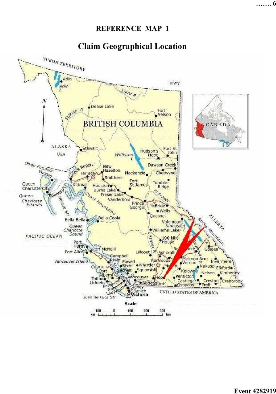
6 . 6 REFERENCE MAP 1 Claim Geographical Location
7 .. 7 REFERENCE MAP 2 Work Areas Scale 1:14,000 Map 092H Excerpt Tenure Coordinate Reference W Longitude N Latitude

8 . 8 REFERENCE MAP 3 Contour Map of Claim Area Scale 1:14,000 Map 092H Excerpt Tenure Coordinate Reference W Longitude N Latitude

2013 EXPLORATION REPORT Sowaqua Property Group. Report Date - November 18, 2013
 2013 EXPLORATION REPORT Sowaqua Property Group Report Date - November 18, 2013 EVENT # 5477447 Four Contiguous Tenures: 578998 - Sowaqua 3 579003 - Sowaqua 1 579004 - Sowaqua 1 579005 - Sowaqua 1 New Westminster
2010-2011 PROSPECTING REPORT. Broken Hill Property. EVENT # 4844124 TENURE # 600988 Tenure Name: Broken Hill. New Westminster Mining Division Map 092H
 2010-2011 PROSPECTING REPORT Broken Hill Property EVENT # 4844124 TENURE # 600988 Tenure Name: Broken Hill New Westminster Mining Division Map 092H Central Coordinate Reference 121 24 06.2 W Longitude
Coquihalla Gold Belt Project Reconnaissance and Sampling
 Coquihalla Gold Belt Project Reconnaissance and Sampling Claim ID Number: 600070 New Westminster Mining Division NTS 092H06 Claim Location: UTM NAD 83: Zone 10, 629500 East 5477000 North Registered Owner:
PICTOU PROPERTY : ATLIN GOLD CAMP
 PICTOU PROPERTY : ATLIN GOLD CAMP EXECUTIVE SUMMARY The Pictou Property in the Atlin Gold Camp ( AGC ) is an example of a Motherlode- Bonanza, lode gold, quartz vein exploration target in the northern
I+/' RD. 2 f.*rj GEOLOGICAL AND GEOCHEMICAL REPORT. on the SECOND CLAIM CROUP CLINTON MINING DIVISION, BRITISH COLUMBIA
 RD. I GEOLOGICAL AND GEOCHEMICAL REPORT on the SECOND CLAIM CROUP CLINTON MINING DIVISION, BRITISH COLUMBIA I+/' Latitude 51' k3' North Longitude 122' 03' West 2 f.*rj N.T.S. 920/1E by JOHN A, McCLINTOCK,
 Mineral Titles Online 1.1.1 - Print Payment Receipt http: //www.mtonline. gov.bc. ca/mto/j sp/printapprovedreceipt.j sp? t... Payment Receipt Service Provided: Mineral Tenure Operation Date: Aug 15, 2006
REPORT OF WORK GUIDELINES
 REPORT OF WORK GUIDELINES The following guidelines apply to a report of work submitted under section 56(1) of the Mining Act (http://laws.gnb.ca/en/showdoc/cs/m-14.1). 1 (1) A report of work shall be submitted
PROSPECTING SURVEY REPORT ON THE KLASK-INO #1 CLAIM NANALMO MJNXNG DXYXSION. NTS: 9245Elk5W Latitude: 5(P 18.9' Longitude: 127" 4-4.
 .........".,....- - PROSPECTING SURVEY REPORT ON THE KLASK-INO #1 CLAIM NANALMO MJNXNG DXYXSION.-e -.s z NTS: 9245Elk5W Latitude: 5(P 18.9' Longitude: 127" 4-4.3' LOGNO: ob27 Ri). I ACT I OM: -- _1 By
IRONSIDE RESOURCES INC.
 For the Six Months Ended December 31, 2015 Overview The following management s discussion and analysis ( MD&A ) of the financial position and results of operations of Ironside Resources Inc. ( the Company
The El Centenario Au-Ag Project
 Municipality of Santiago Papasquiero State of Durango, Mexico By: Alain R. Charest President and CEO of Arcelia Gold Corp Thursday, 5 th of May 2011 El Centenario Location of the El Centenario Project
EXHIBIT A LOCATION MAP AND LAND USE INFORMATION
 EXHIBIT A LOCATION MAP AND LAND USE INFORMATION In accordance with Arizona Corporation Commission Rules of Practice and Procedure R14-3-219, Applicant provides the following location maps and land use
SLOPE AND TOPOGRAPHY
 SLOPE AND TOPOGRAPHY What are Slope and Topography? Slope and topography describe the shape and relief of the land. Topography is a measurement of elevation, and slope is the percent change in that elevation
Queensland Mining Corporation L I M I T E D. Maiden JORC Resources Estimate for Horseshoe Copper Deposit, Duck Creek, South Cloncurry District
 ASX Release 12 October 2012 Maiden JORC Resources Estimate for Horseshoe Copper Deposit, Duck Creek, South Cloncurry District Total mineral resource at Duck Creek Project area of 960,000t @ 1.47% Cu (0.2%
Appendix 14 Traffic Management Plan
 Appendix 14 Traffic Management Plan Toms Gully Underground Project Table of Contents 1 Purpose... 3 2 Location & Production Overview... 3 3 Operations History... 3 4 Current Traffic Management & Traffic
TSX-V: CDA WKN: A0M6U5
 TSX-V: CDA WKN: A0M6U5 Mill Village Gold Property, Nova Scotia MidTex Oil & Gas, Texas Cash flow Developing cash flow producing gas wells Texas, USA expansion of gas & oil wells Texas, USA Canuc-Nambija
Evaluation of Forest Road Network Planning According to Environmental Criteria
 American-Eurasian J. Agric. & Environ. Sci., 9 (1): 91-97, 2010 ISSN 1818-6769 IDOSI Publications, 2010 Evaluation of Forest Road Network Planning According to Environmental Criteria Amir Hosian Firozan,
Unprecedented Opportunities in Final Frontier of B.C. s Golden Triangle. Exploration and mineral resource development
 TSX.V:RG OTC-PK: RM IOF FRANKFURT: D4R Unprecedented Opportunities in Final Frontier of B.C. s Golden Triangle Exploration and mineral resource development in North America Romios Galore Project, BC Newmont
CHALICE GOLD MINES AND SUB SAHARA RESOURCES ANNOUNCE PROPOSED MERGER TO CONSOLIDATE AND FUND ERITREAN GOLD PROJECT
 3 APRIL 2009 CHALICE GOLD MINES AND SUB SAHARA RESOURCES ANNOUNCE PROPOSED MERGER TO CONSOLIDATE AND FUND ERITREAN GOLD PROJECT Key Points Chalice Gold Mines and Sub Sahara Resources agree to merge by
TORONTO STOCK EXCHANGE COMPANY MANUAL APPENDIX B DISCLOSURE STANDARDS FOR COMPANIES ENGAGED IN MINERAL EXPLORATION, DEVELOPMENT & PRODUCTION
 B-1 APPENDIX B DISCLOSURE STANDARDS FOR COMPANIES ENGAGED IN MINERAL EXPLORATION, DEVELOPMENT & PRODUCTION 1.0 INTRODUCTION The disclosure of the results of exploration and development activity on mineral
For personal use only
 Investigator Resources Limited Date: 7 th February 2012 up to 2.25% Ag at the new Paris prospect in South Australia First assays received for new drilling on Paris Line 7 with all three holes assayed returning
FINAL FURTHER HIGH GRADE COPPER RESULTS IN SURFACE FLOAT SAMPLES AT NAKRU
 5 June 2015 ASX Code: COY FINAL FURTHER HIGH GRADE COPPER RESULTS IN SURFACE FLOAT SAMPLES AT NAKRU Mineral explorer Coppermoly Limited (Coppermoly and the Company) is pleased to announce final assay results
Information Request 14
 Information Request 14 Information Request 14 14-1 Responses to Information Request 14 Response to Information Request 14a Response to Information Request 14b Response to Information Request 14c Response
All sediments have a source or provenance, a place or number of places of origin where they were produced.
 Sedimentary Rocks, Processes, and Environments Sediments are loose grains and chemical residues of earth materials, which include things such as rock fragments, mineral grains, part of plants or animals,
Ch6&7 Test. Multiple Choice Identify the choice that best completes the statement or answers the question.
 Ch6&7 Test Multiple Choice Identify the choice that best completes the statement or answers the question. 1. Which of the following does NOT change the form of existing rock? a. tremendous pressure c.
Description of Simandou Archaeological Potential Model. 13A.1 Overview
 13A Description of Simandou Archaeological Potential Model 13A.1 Overview The most accurate and reliable way of establishing archaeological baseline conditions in an area is by conventional methods of
SITE RECOMMENDED FOR INCLUSION IN THE LIST OF HISTORICAL SITES AND MONUMENTS IN ANTARCTICA
 SITE RECOMMENDED FOR INCLUSION IN THE LIST OF HISTORICAL SITES AND MONUMENTS IN ANTARCTICA Introduction This paper was introduced during the XXVI ATCM at Madrid. As per the Report of the Committee for
If you require assistance in obtaining access to the presentations or have questions regarding the. 6300 or Glenn Young at (916) 341 6696.
 341 6696.") These materials were developed by CalRecycle staff to address specific technical training areas and are posted as reference documents for the local l government and CalRecycle staff who work on closed,
These materials were developed by CalRecycle staff to address specific technical training areas and are posted as reference documents for the local l government and CalRecycle staff who work on closed,
REPORT TO REGIONAL WATER SUPPLY COMMISSION MEETING OF WEDNESDAY, SEPTEMBER 4, 2013 LEECH WATER SUPPLY AREA RESTORATION UPDATE
 Making a difference... together Agenda Item #9 REPORT #RWSC 2013-17 REPORT TO REGIONAL WATER SUPPLY COMMISSION MEETING OF WEDNESDAY, SEPTEMBER 4, 2013 SUBJECT LEECH WATER SUPPLY AREA RESTORATION UPDATE
FORWARD LOOKING STATEMENTS
 MPH Ventures Corp. (MPS: TSX.V) Advancing Gold and Molybdenum Projects in Canada June 2013 1 FORWARD LOOKING STATEMENTS This presentation may contain forward-looking statements including but not limited
Alaska Resource Data File
 Hagemeister Island quadrangle Alaska Resource Data File Descriptions of the mineral occurrences shown on the accompanying figure follow. See U.S. Geological Survey (1996) for a description of the information
Specimen Labels v. 09/2002
 Division of Arthropods Museum of Southwestern Biology The University of New Mexico Specimen Labels v. 09/2002 All arthropod museum specimens must be properly labeled as to geographic collection locality,
ROME RESOURCES LTD. 205 16055 Fraser Highway Surrey, B.C. V4N 0G2
 Page 1 of 6 ROME RESOURCES LTD. 205 16055 Fraser Highway Surrey, B.C. V4N 0G2 FAX# (604) 507-2187 TSX-VEN Symbol RMR; Frankfurt: 33R WEB: www.romeresources.com CH Valoren No 699 171 Email: info@romeresources.com
Geology Merit Badge Workbook
 Merit Badge Workbook This workbook can help you but you still need to read the merit badge pamphlet. The work space provided for each requirement should be used by the Scout to make notes for discussing
EXTENSIVE GOLD IN SOILS TARGET IDENTIFIED AT MOMBUCA GOLD PROJECT, SE BRAZIL
 9 July 2015 EXTENSIVE GOLD IN SOILS TARGET IDENTIFIED AT MOMBUCA GOLD PROJECT, SE BRAZIL Open ended target zone up to 1.5km long identified Key Points Prospectivity of Centaurus recently secured Mombuca
Igneous rocks formed when hot molten material (magma) cools and hardens (crystallizes).
 cools and hardens (crystallizes).") Objectives You will learn about how the land of North Dakota was formed. Introduction North Dakota is a wonderful place to live. Have you ever though about how it was formed? To answer that question, you
Objectives You will learn about how the land of North Dakota was formed. Introduction North Dakota is a wonderful place to live. Have you ever though about how it was formed? To answer that question, you
FOR IMMEDIATE RELEASE NR15-19 November 10, 2015 RENAISSANCE GOLD REPORTS FIRST QUARTER 2016 RESULTS
 FOR IMMEDIATE RELEASE NR15-19 November 10, 2015 TSX: REN RENAISSANCE GOLD REPORTS FIRST QUARTER 2016 RESULTS Renaissance Gold Inc. (TSX: REN) ( RenGold or the Company ) reports financial results for the
Pacifico set to commence drilling at Borroloola West Project and co-funding secured from NT Government
 CORPORATE DIRECTORY Managing Director Simon Noon Directors Richard Monti (Chairman) Peter Harold (Non-exec.) Andrew Parker (Non-exec.) Company Secretary Joshua Ward Patrick Holywell Registered office Level
RAINBOW AURORA INDIAN PROPERTIES Goodpaster Mining District, Alaska
 RAINBOW AURORA INDIAN PROPERTIES Goodpaster Mining District, Alaska Prepared by: Carl Schaefer CPG# 10834 Northern Associates, Inc. February, 2006 Tonogold Resources, Inc. 5771 La Jolla Boulevard La Jolla,
ORANGE PUBLIC SCHOOLS OFFICE OF CURRICULUM AND INSTRUCTION OFFICE OF SCIENCE. GRADE 6 SCIENCE Post - Assessment
 ORANGE PUBLIC SCHOOLS OFFICE OF CURRICULUM AND INSTRUCTION OFFICE OF SCIENCE GRADE 6 SCIENCE Post - Assessment School Year 2013-2014 Directions for Grade 6 Post-Assessment The Grade 6 Post-Assessment is
Pasinex Resources Limited Reports Large New Area of Surface Copper Mineralisation on its Golcuk Property in Turkey
 Pasinex Resources Limited Reports Large New Area of Surface Copper Mineralisation on its Golcuk Property in Turkey July 11, 2013 - Pasinex Resources Limited (CNSX : PSE) (FSE: PNX) is pleased to announce
PMR EXPLORATION, LLC CHERRY CLAIMS PROJECT MONARCH MINE GOLDEN IDOL MINE (HILLSIDE) CHERRY KING MINE GOLD EAGLE MINE
 CHERRY KING MINE GOLD EAGLE MINE") PMR EXPLORATION, LLC CHERRY CLAIMS PROJECT MONARCH MINE GOLDEN IDOL MINE (HILLSIDE) CHERRY KING MINE GOLD EAGLE MINE PMR EXPLORATION, LLC - ALL RIGHTS RESERVED - 2011 PMR EXPLORATION, LLC - property information
PMR EXPLORATION, LLC CHERRY CLAIMS PROJECT MONARCH MINE GOLDEN IDOL MINE (HILLSIDE) CHERRY KING MINE GOLD EAGLE MINE PMR EXPLORATION, LLC - ALL RIGHTS RESERVED - 2011 PMR EXPLORATION, LLC - property information
How To Prepare A Geotechnical Study For A Trunk Sewer Project In Lincoln, Nebraska
 APPENDIX B Geotechnical Engineering Report GEOTECHNICAL ENGINEERING REPORT Preliminary Geotechnical Study Upper Southeast Salt Creek Sanitary Trunk Sewer Lincoln Wastewater System Lincoln, Nebraska PREPARED
STATE OF ALASKA DEPARTMENT OF NATURAL RESOURCES DIVISION OF MINING, LAND AND WATER. GENERAL SURVEY INSTRUCTIONS EASEMENTS Authority 11 AAC 53
 STATE OF ALASKA DEPARTMENT OF NATURAL RESOURCES DIVISION OF MINING, LAND AND WATER GENERAL SURVEY INSTRUCTIONS EASEMENTS Authority 11 AAC 53 These instructions define the survey and platting criteria unique
4S Archimedes Test for Density
 4S Archimedes Test for Density Density, or specific gravity of minerals is important in separating them. It is important to have a test for the density of mineral samples found at Snailbeach. Galena is
Range Management Databases on the Web: Two Examples
 Range Management Databases on the Web: Two Examples George Ruyle, Chair, Rangeland & Forest Research Program, School of Renewable Natural Resources, Biological Sciences East 302, University of Arizona,
Carbonate Rock Formation
 Limestone, dolomite (or dolostone), and marble are often collectively referred to as carbonate rocks because the main mineral is calcite. The chemical name of calcite is calcium carbonate. Limestone, dolomite,
Sedimentary Rocks Practice Questions and Answers Revised September 2007
 Sedimentary Rocks Practice Questions and Answers Revised September 2007 1. Clastic sedimentary rocks are composed of and derived from pre-existing material. 2. What is physical weathering? 3. What is chemical
For personal use only
 ANNOUNCEMENT TO THE AUSTRALIAN SECURITIES EXCHANGE: 18 March 2013 Update on Bunawan and Bahayan Permit Approvals. The Directors of Sierra Mining Limited ( Sierra ) are pleased to update shareholders on
ARTICLE 8: OUTDOOR BURNING
 ARTICLE 8: OUTDOOR BURNING SECTION 8.04 GENERAL CONDITIONS FOR OUTDOOR BURNING Adopted 03/18/76 (361) Revised 01/12/89 (639), 04/09/92 (724), 04/14/94 (783), 10/08/98 (873), 03/11/99 (881), 11/09/00 (933),
The Basics of Navigation
 The Basics of Navigation Knowledge of map reading and the use of the compass is an indispensable skill of bushcraft. Without this skill, a walker is a passenger and mere follower on a trip. To become a
Ministry of Lands, Parks and Housing Parks and Outdoor Recreation Division South Coast Region BRIDAL VEIL FALLS PARK MASTER PLAN
 Ministry of Lands, Parks and Housing Parks and Outdoor Recreation Division South Coast Region BRIDAL VEIL FALLS PARK MASTER PLAN February, 1984 To: Mr. C. J. Velay SOUTH COAST REGION Director, Park Programs
Quartz Mining Act Guidelines for Claim Staking. Please use the following document as a guide when staking and recording claims in Yukon.
 Quartz Mining Act Guidelines for Claim Staking Please use the following document as a guide when staking and recording claims in Yukon. Before you set out to stake your own Yukon mineral claim, read these
APPENDIX E CULTURAL RESOURCE MANAGEMENT REPORT (CRM, 2013) Environmental Assessment Registration Document for Irish Cove Quarry Expansion
 Environmental Assessment Registration Document for Irish Cove Quarry Expansion") APPENDIX E CULTURAL RESOURCE MANAGEMENT REPORT (CRM, 2013) Environmental Assessment Registration Document for Irish Cove Quarry Expansion DEXTER CONSTRUCTION COMPANY LIMITED IRISH COVE QUARRY EXPANSION
APPENDIX E CULTURAL RESOURCE MANAGEMENT REPORT (CRM, 2013) Environmental Assessment Registration Document for Irish Cove Quarry Expansion DEXTER CONSTRUCTION COMPANY LIMITED IRISH COVE QUARRY EXPANSION
NATURAL RESOURCES & NATURAL FEATURES
 A3 NATURAL RESOURCES & NATURAL FEATURES INTRODUCTION This chapter will discuss the topography, geology, soils, and other natural features found in Casco Township. The identification of the natural features
December 2015 Quarterly Report
 ANNOUNCEMENT TO THE AUSTRALIAN SECURITIES EXCHANGE December 2015 Quarterly Report The Board of OreCorp Limited (OreCorp or the Company) is pleased to present its quarterly report for the period ended 31
Electric Power Grid coming to the GOLDEN TRIANGLE
 Electric Power Grid coming to the GOLDEN TRIANGLE In British Columbia Canada they call it "The Golden Triangle" because of the great geological potential of several world class mineral deposits discovered
ACQUIRING MINERAL RIGHTS IN THE NORTHWEST TERRITORIES
 ACQUIRING MINERAL RIGHTS IN THE NORTHWEST TERRITORIES Introduction Establishing and maintaining strong working relationships between the mineral industry and Northwest Territories (NWT) residents and community
How To Understand The History Of The American Gold Mine
 September 12, 2011 THE ATLANTA GOLD MINE, EASTERN NEVADA Gold Exploration in Nevada with Near-Term Production Potential TSXV: MAY OTCQX:MAYGF Atlanta Gold & Silver Mine, Nevada Atlanta is located in northeastern
GREEN SHEET OV-10A AIRTACTICAL PLANE CRASH SEPTEMBER 6, 2006 MOUNTAIN FIRE INCIDENT NUMBER 06-CA-TUU-010573
 GREEN SHEET CALIFORNIA DEPARTMENT OF FORESTRY AND FIRE PROTECTION INVESTIGATION SUMMARIES OF SERIOUS CDF INJURIES, ILLNESSES, ACCIDENTS AND NEAR-MISS INCIDENTS OV-10A AIRTACTICAL PLANE CRASH SEPTEMBER
Critical Assets and Extreme Weather Process & Lessons
 Critical Assets and Extreme Weather Process & Lessons Steven Olmsted Intermodal Transportation Division Arizona Department of Transportation 2014 Transportation Asset Management Conference April 28-30,
SHAFT CONSTRUCTION IN TORONTO USING SLURRY WALLS
 SHAFT CONSTRUCTION IN TORONTO USING SLURRY WALLS Vince Luongo Petrifond Foundation Co., Ltd. PROJECT DESCRIPTION The York Durham Sanitary System (YDSS) Interceptor in the Town of Richmond Hill located
6. Base your answer to the following question on the graph below, which shows the average monthly temperature of two cities A and B.
 1. Which single factor generally has the greatest effect on the climate of an area on the Earth's surface? 1) the distance from the Equator 2) the extent of vegetative cover 3) the degrees of longitude
December 8, 2008. Visit www.ivanhoemines.com for pictures of the drill core and maps and sections of the new discovery.
 December 8, 2008 Ivanhoe Mines Makes Another High-Grade Discovery of Gold and Copper at the Oyu Tolgoi Project in Mongolia Discovery Remains Open to Expansion in All Directions ULAANBAATAR, MONGOLIA John
Data Sharing System (DSS) Data Entry Instruction for Archaeological Survey
 Data Entry Instruction for Archaeological Survey") Data Sharing System (DSS) Data Entry Instruction for Archaeological Survey Introduction The following data entry guidelines are to be followed for new Data Sharing System (DSS) entries. When updating previously
Data Sharing System (DSS) Data Entry Instruction for Archaeological Survey Introduction The following data entry guidelines are to be followed for new Data Sharing System (DSS) entries. When updating previously
Gold Eagle Mines Ltd. GEA, TSX
 March 1, 2007 Gold Eagle Mines Ltd. GEA, TSX Taking Flight in Canada s Richest Gold District Share Statistics (all values in C$ unless otherwise noted) Close $9.50 12-Month High - Low: $10.37-$6.25 Previous
COLORADO DEPARTMENT OF TRANSPORTATION STORMWATER FIELD INSPECTION REPORT - ACTIVE CONSTRUCTION
 COLORADO DEPARTMENT OF TRANSPORTATION STORMWATER FIELD INSPECTION REPORT - ACTIVE CONSTRUCTION (1) Project Name: (2) Project Contractor: (3) Erosion Control Supervisor/SWMP Administrator: (4) CDOT Project
Regents Questions: Plate Tectonics
 Earth Science Regents Questions: Plate Tectonics Name: Date: Period: August 2013 Due Date: 17 Compared to the oceanic crust, the continental crust is (1) less dense and more basaltic (3) more dense and
EARTH SCIENCE 110 INTRODUCTION to GEOLOGY MINERALS & ROCKS LABORATORY
 EARTH SCIENCE 110 INTRODUCTION to GEOLOGY DR. WOLTEMADE NAME: SECTION: MINERALS & ROCKS LABORATORY INTRODUCTION The identification of minerals and rocks is an integral part of understanding our physical
Rocks & Minerals 1 Mark Place, www.learnearthscience.com
 Name: KEY Rocks & Minerals 1 KEY CONCEPT #1: What is a mineral? It is a naturally occurring, inorganic substance which has a definite chemical composition What would be the opposite of this? man-made,
How Did These Ocean Features and Continental Margins Form?
 298 10.14 INVESTIGATION How Did These Ocean Features and Continental Margins Form? The terrain below contains various features on the seafloor, as well as parts of three continents. Some general observations
YAMANA GOLD ANNOUNCES SIGNIFICANT NEW DISCOVERIES AT CHAPADA AND EL PEÑÓN IMPROVE OPERATIONAL OUTLOOK
 YAMANA GOLD ANNOUNCES SIGNIFICANT NEW DISCOVERIES AT CHAPADA AND EL PEÑÓN IMPROVE OPERATIONAL OUTLOOK TORONTO, ONTARIO, December 15, 2014 YAMANA GOLD INC. (TSX:YRI; NYSE:AUY) ( Yamana or the Company )
Construction Site Inspection. Inspecting to Keep You in Compliance
 Construction Site Inspection Inspecting to Keep You in Compliance Inspection/Monitoring/Reporting Know if your plan is working Document corrective actions Ketchikan A Contractor that destroys their site
Q ueeuz1a i ANNO TRICESIMO TERTIO ELIZABETHAE SECUNDAE REGINAE. No. 77 of 1984
 854 Q ueeuz1a i ANNO TRICESIMO TERTIO ELIZABETHAE SECUNDAE REGINAE No. 77 of 1984 An Act to ratify and confirm certain regulations made pursuant to the provisions of the Education Act 1964-1984 and a certain
ALBERTA ENERGY AND UTILITIES BOARD Calgary Alberta
 ALBERTA ENERGY AND UTILITIES BOARD Calgary Alberta HUNT OIL COMPANY OF CANADA INC. APPLICATION FOR A SWEET NATURAL GAS PIPELINE HARMATTAN-ELKTON, RICINUS, Examiner Report 2001-3 AND CAROLINE FIELDS Application
BASIN MANAGEMENT OBJECTIVES CHEROKEE SUBINVENTORY UNIT
 BASIN MANAGEMENT OBJECTIVES CHEROKEE SUBINVENTORY UNIT Butte County Water Advisory Committee Member John Scott Contact Information Phone Number: (530) 533-8394 Email Address: john_lewis_scott@msn.com Description
MINERALS LAW OF MONGOLIA June 5, 1997 Ulaanbaatar CHAPTER ONE. General Provisions
 Article 1. Purpose of the law MINERALS LAW OF MONGOLIA June 5, 1997 Ulaanbaatar CHAPTER ONE General Provisions The purpose of this law is to regulate relations with respect to exploration, mining and related
MCLAREN VALE PWA GROUNDWATER LEVEL AND SALINITY STATUS REPORT 2009 10
 MCLAREN VALE PWA GROUNDWATER LEVEL AND SALINITY STATUS REPORT 2009 10 SUMMARY 2009 10 The McLaren Vale PWA is located approximately 35 km south of Adelaide. It is a regional-scale resource for which groundwater
UNIVERSITY GEOLOGY DAYTON. and ENVIRONMENTAL GEOLOGY
 UNIVERSITY OF DAYTON GEOLOGY and ENVIRONMENTAL GEOLOGY Meet the Geology Department... 10 Full-time Faculty & Staff 5 Part-time Faculty The Department of Geology at the University of Dayton seeks to prepare
Western Forest Products Sustainable Forest Management System CAN/CSA Z809-2008
 Western Forest Products Sustainable Forest Management System CAN/CSA Z809-2008 Overview of Western Forest Products Forest Operations WFP holds the harvesting rights to 2 million hectares of Crown land
The key points of the 2013 Annual Compliance Report are described fully in the following sections of this report:
 Introduction Snowy Hydro Limited (Snowy Hydro) relies on precipitation falling over the catchments of the Snowy Mountains to supply water for the production of hydro-electricity. Cloud seeding over this
Definition of Tower from the Bradley County Zoning Resolution
 Definition of Tower from the Bradley County Zoning Resolution 43. TOWER. Any outdoor structure designed and constructed to support one (1) or more transmitting or receiving devices for telephone, radio
North Atlantic and Rio Tinto Joint Venture Potash Project in Saskatchewan, Canada. Resource Summary
 North Atlantic and Rio Tinto Joint Venture Potash Project in Saskatchewan, Canada Resource Summary The Canadian Potash Project is located in the central Saskatchewan Potash district that represents nearly
For personal use only CONSOLIDATED GLOBAL INVESTMENTS LIMITED (ABN 97 009 212 293)
") CONSOLIDATED GLOBAL INVESTMENTS LIMITED (ABN 97 009 212 293) INTERIM FINANCIAL STATEMENT 31 DECEMBER 2011 CONTENTS Page * Directors' report 2 * Consolidated statement of comprehensive income 13 * Consolidated
CONSOLIDATED GLOBAL INVESTMENTS LIMITED (ABN 97 009 212 293) INTERIM FINANCIAL STATEMENT 31 DECEMBER 2011 CONTENTS Page * Directors' report 2 * Consolidated statement of comprehensive income 13 * Consolidated
Curriculum Map Earth Science - High School
 September Science is a format process to use Use instruments to measure Measurement labs - mass, volume, to observe, classify, and analyze the observable properties. density environment. Use lab equipment
Strategic Metals Ltd.
 Strategic Metals Ltd. Corporate Presentation June 2016 Forward Looking Statements Certain information regarding the Company contained herein may constitute forward-looking statements within the meaning
 Benchmark Identify physical & human characteristics of places, regions in North America. Grade Level Indicator Describe, compare landforms, climates, population, vegetation, economic characteristics of
POTENTIAL FOR SUBSIDENCE FISSTJRING IN THE PHOENIX ARIZONA USA AREA
 POTENTIAL FOR SUBSIDENCE FISSTJRING IN THE PHOENIX ARIZONA USA AREA Michael K. Larson Kansas Department of Health and Environment Bureau of Oil Field and Environmental Geology 10U Cody Hays, Kansas 67601
ENVIRONMENTAL AND GEOETHICAL PROBLEMS IN THE MINING AREA OF ERDENET (CASE STUDY)
") Ochir GEREL G 13 Professor Ochir Gerel Dept. of Geology, Mongolian University of Science & Technology, P.O. 46, Box 520, Ulaanbaatar, Mongolia. gerel@must.edu.mn ENVIRONMENTAL AND GEOETHICAL PROBLEMS IN
Ochir GEREL G 13 Professor Ochir Gerel Dept. of Geology, Mongolian University of Science & Technology, P.O. 46, Box 520, Ulaanbaatar, Mongolia. gerel@must.edu.mn ENVIRONMENTAL AND GEOETHICAL PROBLEMS IN
INTERPRETATION ADDENDUM CANADIAN MINING COMPANY INC. SUITE 2300-1066 WEST HASTINGS STREET VANCOUVER, BC V6E 3X2 3D INDUCED POLARIZATION
 INTERPRETATION ADDENDUM FOR CANADIAN MINING COMPANY INC. SUITE 2300-1066 WEST HASTINGS STREET VANCOUVER, BC V6E 3X2 3D INDUCED POLARIZATION ON THE SAN BERNARDO PROJECT EL GOCHICO GRID Approximate Location:
FIRST GRADE ROCKS 2 WEEKS LESSON PLANS AND ACTIVITIES
 FIRST GRADE ROCKS 2 WEEKS LESSON PLANS AND ACTIVITIES ROCK CYCLE OVERVIEW OF FIRST GRADE CHEMISTRY WEEK 1. PRE: Comparing solids, gases, liquids, and plasma. LAB: Exploring how states of matter can change.
GEOCHEUICAL AND GEOLOGICAL REPORT ON THE BAND UINERAL CSAIUS. White River?uea Skeena Uining Division British Columbia
 GEOCHEUICAL AND GEOLOGICAL REPORT ON THE BAND UINERAL CSAIUS White River?uea Skeena Uining Division British Columbia NTS : 103P/l4W 55049.4'N 129 26.6'W OWNER: RICHARD T. HEARD AUTHOR: N.C. CARTER, Ph.D.
PRINCETON RURAL DATE REC'D OUR FILE NO. BC LANDS LEGAL DESC. OWNER APC DATE PROPOSED LAND USE DATE SENT FILE NO. LOCATION AGENT TO CROWN
 2005 Jan. 11/05 H-33-1-05 3410879 All that unsurveyed Crown Princeton Lights Application for power line March 9/05 land in the vicinity of and Power Co. purposes, covering an area DL 2422, KDYD Northeast
7) A clastic sedimentary rock composed of rounded to subrounded gravel is called a A) coal. B) shale. C) breccia.
 A clastic sedimentary rock composed of rounded to subrounded gravel is called a A) coal. B) shale. C) breccia.") Please read chapters 10 and 5 CHAPTER 5 Sedimentary Rocks 1) Sedimentary rocks A) form by compaction and cementation of loose sediment. B) are widespread on the continents and ocean floor. C) are common
Please read chapters 10 and 5 CHAPTER 5 Sedimentary Rocks 1) Sedimentary rocks A) form by compaction and cementation of loose sediment. B) are widespread on the continents and ocean floor. C) are common
K M D Hire Services, LONDON ROAD, NANTWICH, CW5 6LU
 Application No: 11/2196N Location: Proposal: Applicant: Expiry Date: K M D Hire Services, LONDON ROAD, NANTWICH, CW5 6LU Extension and New Store Mr Dan Mellor 17-Aug-2011 SUMMARY RECOMMENDATION Approve
SAMPLE FRACTION MITIGATION CONTINGENCY PLAN FOR DIRECTIONAL DRILLING
 SAMPLE FRACTION MITIGATION CONTINGENCY PLAN FOR DIRECTIONAL DRILLING 1 TABLE OF CONTENTS 1.0 Introduction and Purpose 3 2.0 Description of Work 3 3.0 Site Supervisor/Foremen Responsibilities 4 4.0 Equipment
FORMULA FOR FINDING THE SQUARE FEET OF A RECTANGLE L x W = A
 UNIT I REAL ESTATE MATH AREA MEASUREMENTS FORMULA FOR FINDING THE SQUARE FEET OF A RECTANGLE L x W = A Where: A = Area L = Length W = Width If the length = 30 and the width = 20 20 x 30 = 600 Sq. Feet
Statement of Qualifications for Natural Resource Management Services October 2014
 Statement of Qualifications for Natural Resource Management Services October 2014 Prepared By: Michael Zenthoefer Point Environmental LLC 911 N Birch ST Canby, OR 97013 541 207 8441 mikez@pointenv.com
MAY 2005. Numbered crosses relate to the property locations on the accompanying map.
 MAY 2005 In May 2005, 583 new claims were staked; 346 in Labrador and 237 on the Island. This increased the staking total for 2005 to 7,284; 4,807 in Labrador and 2,477 on the Island. Numbered crosses
Eurocode 7 - Geotechnical design - Part 2 Ground investigation and testing
 Brussels, 18-20 February 2008 Dissemination of information workshop 1 Eurocode 7 - Geotechnical design - Part 2 Ground investigation and testing Dr.-Ing. Bernd Schuppener, Federal Waterways Engineering
Right Above Front Cover.
 Right. A sample of the ore mineral cinnabar (red mineral) collected from one of several abandoned mercury mines in southwestern Alaska. The mines in the region were studied to evaluate effects of mercury