Software solutions for Lynxs, Ilris and ALTM sensors data fusion Matteo Sgrenzaroli, Eng Phd, - Marco Fiocco Eng Giorgio Vassena, Prof.
|
|
|
- Benjamin Gibson
- 8 years ago
- Views:
Transcription
1 Software solutions for Lynxs, Ilris and ALTM sensors data fusion Matteo Sgrenzaroli, Eng Phd, - Marco Fiocco Eng Giorgio Vassena, Prof. Eng

2 Who we are Gexcel stands for Geomatics & Excellence is a spin off company of the University of Brescia. Its main aim is to act as a link from the scientific to the enterprises world, transferring outside the technological solutions developed inside the Geomatics group of the UniBS Engineering Faculty SOFTWARE PROJECT SERVICE Development JRC 3D Reconstructor Complete software package for treating 3D data from laser scanner and topographical measure in combination with digital images Development of dedicated solution Support to laser scanner user for special projects 3D Reconstructor

3 Problem ingredients 3D Laser sensor: ILRIS

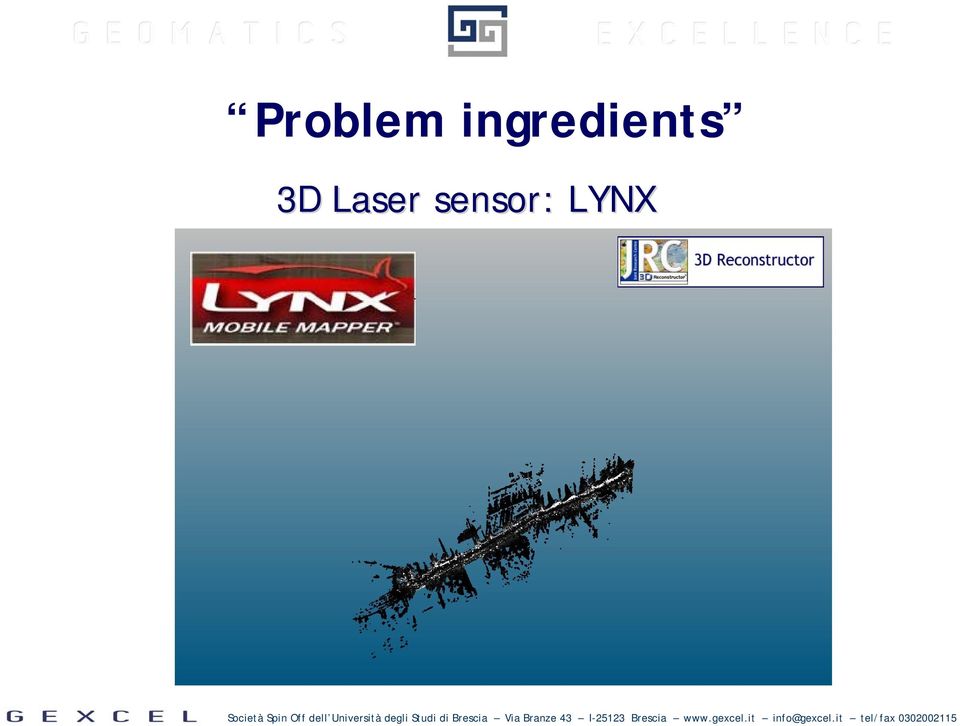
4 Problem ingredients 3D Laser sensor: LYNX
5 Problem ingredients 3D Laser sensors: ALTM

6 Problem ingredients Different data format: structured and unstructured point clouds Needs for a common geo-referenced systems How to organize the data: street, building, facade How to map 2D images How extract information

7 DATA INTEGRATION Ixf, las, ascii importing Geo-referenced data supported DATA ORGANIZATION Virtual scan Data links PHOTO MAPPING Cameras calibration INFORMATION EXTRACTION Bubble view and drawing tools

8 DATA INTEGRATION

9 DATA INTEGRATION: Ixf, las, ascii importing

10 DATA ORGANIZATION: Virtual scan is an innovative tool, included in JRC 3D Reconstructor software, to virtually scan a 3D object by the definition of a new scan position

11 DATA ORGANIZATION: Virtual scan is an innovative tool, included in JRC 3D Reconstructor software, to virtually scan a 3D object by the definition of a new scan position

12 DATA ORGANIZATION: data integration and organization using Virtual scan tool

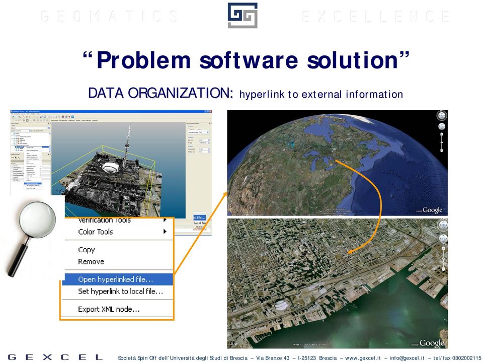
13 DATA ORGANIZATION: hyperlink to external information
14 PHOTO MAPPING: images calibration using LYNX data

15 PHOTO MAPPING: images calibration using LYNX data

16 PHOTO MAPPING: virtual scan to create a measurable 3D image

17 PHOTO MAPPING: textured mesh

18 PHOTO MAPPING: textured mesh

19 INFORMATION EXTRACTION: cross section

20 INFORMATION EXTRACTION: cross section

21 INFORMATION EXTRACTION: bubble view
22 INFORMATION EXTRACTION: drawing on the data
23 INFORMATION EXTRACTION: drawing on the data
24 Please visit: Or contact us:
25 Questions and discussion
DAMAGED ROAD TUNNEL LASER SCANNER SURVEY
 University of Brescia - ITALY DAMAGED ROAD TUNNEL LASER SCANNER SURVEY Prof. Giorgio Vassena giorgio.vassena@unibs.it WORKFLOW - Demand analysis - Instruments choice - On field operations planning - Laser
Distributors Meeting Singapore 2015
 Gexcel is located in Italy inside technology parks, in the Sardinia island and in Brescia. More then 20% of the annual budget of Gexcel is spent in Research & Development activities. Distributors Meeting
How To Fuse A Point Cloud With A Laser And Image Data From A Pointcloud
 REAL TIME 3D FUSION OF IMAGERY AND MOBILE LIDAR Paul Mrstik, Vice President Technology Kresimir Kusevic, R&D Engineer Terrapoint Inc. 140-1 Antares Dr. Ottawa, Ontario K2E 8C4 Canada paul.mrstik@terrapoint.com
Teaching and Learning Strategies for 3D Urban and Landscape Modelling
 Teaching and Learning Strategies for 3D Urban and Landscape Modelling Martin SMITH, Andrew BURTON, and Nikolaos KOKKAS, United Kingdom Key words: 3D modelling, visualization, teaching, learning SUMMARY
RIEGL VZ-400 NEW. Laser Scanners. Latest News March 2009
 Latest News March 2009 NEW RIEGL VZ-400 Laser Scanners The following document details some of the excellent results acquired with the new RIEGL VZ-400 scanners, including: Time-optimised fine-scans The
3D MODELING OF LARGE AND COMPLEX SITE USING MULTI-SENSOR INTEGRATION AND MULTI-RESOLUTION DATA
 3D MODELING OF LARGE AND COMPLEX SITE USING MULTI-SENSOR INTEGRATION AND MULTI-RESOLUTION DATA G. Guidi 1, F. Remondino 2, 3, M. Russo 1, F. Menna 4, A. Rizzi 3 1 Dept.INDACO, Politecnico of Milano, Italy
Laser Scanning Surveying and Ground Penetrating Radar The Full Three Dimensional Picture Above and Below Ground
 Laser Scanning Surveying and Ground Penetrating Radar The Full Three Dimensional Picture Above and Below Ground CIVILEX 2009 Mark Hudson, Director, Coastway, FInstCES MRICS MIS BTS Jeff Hott, Laser Scanning
How To Use Bodescan For 3D Imaging Of The Human Body
 «Bodescan» THE ULTIMATE 3D SCANNER FOR DATA ACQUISITION OF HUMAN BODY A COMPREHENSIVE SYSTEM INCLUDING HARDWARE AND SOFTWARE TOOLS Page 2 of 9 Bodescan HUMAN BODY3D SCANNING HARDWARE AND SOFTWARE INCLUDED
Land Mobile Mapping & Survey
 Land Mobile Mapping & Survey Trimble Geospatial Solutions Trimble s geospatial solution portfolio has been designed to put information to work. Mobile sensors on the land, in the air or indoors capture
Mobile Laser Scanning for Oilfield Asset Mapping and Management
 Mobile Laser Scanning for Oilfield Asset Mapping and Management Dr. Robert Radovanovic, P.Eng., A.L.S., C.L.S. Cell : 403-461-4056 Email : rradovanovic@sarpointeng.com SarPoint Engineering Ltd. June 4,
3D Laser Scanning Technology. Rugged hardware and powerful software combined with streamlined survey workflow
 3D Laser Scanning Technology Rugged hardware and powerful software combined with streamlined survey workflow Maptek specialises in the research, development and application of 3D laser scanning technology.
Point clouds colorized by elevation of downtown Detroit, MI.
 Point clouds colorized by elevation of downtown Detroit, MI. Mobile Mapping: Fact, Fiction, or Fad? If the question What is mobile mapping and when did it start? was asked to ten different people in the
VIA THE SCANNING OF THE PYRAMIDS PROJECT. W. Neubauer, N. Studnicka
 Vienna Institute for Archaeological Science THE SCANNING OF THE PYRAMIDS PROJECT W. Neubauer, N. Studnicka The Scanning of the Pyramids Project was invoked by the Austrian Archaeological Institute Cairo
ASSESSMENT OF VISUALIZATION SOFTWARE FOR SUPPORT OF CONSTRUCTION SITE INSPECTION TASKS USING DATA COLLECTED FROM REALITY CAPTURE TECHNOLOGIES
 ASSESSMENT OF VISUALIZATION SOFTWARE FOR SUPPORT OF CONSTRUCTION SITE INSPECTION TASKS USING DATA COLLECTED FROM REALITY CAPTURE TECHNOLOGIES ABSTRACT Chris Gordon 1, Burcu Akinci 2, Frank Boukamp 3, and
ACCURACY ASSESSMENT OF BUILDING POINT CLOUDS AUTOMATICALLY GENERATED FROM IPHONE IMAGES
 ACCURACY ASSESSMENT OF BUILDING POINT CLOUDS AUTOMATICALLY GENERATED FROM IPHONE IMAGES B. Sirmacek, R. Lindenbergh Delft University of Technology, Department of Geoscience and Remote Sensing, Stevinweg
Determining the Roughness Angles of Surfaces Using Laser Scanners
 , TURKEY Keywords: Laser Scanner, 3D Model, DEM, Geology, Surface Roughness SUMMARY Terrestrial laser scanners are measuring instruments providing the detailed 3D object geometry directly and fastly. The
The acquisition of appearance properties of real objects: state of the art, challenges, perspectives
 The acquisition of appearance properties of real objects: state of the art, challenges, perspectives Matteo Dellepiane Visual Computing Lab, ISTI-CNR Pisa 26th February 2015 The research leading to these
REGISTRATION OF LASER SCANNING POINT CLOUDS AND AERIAL IMAGES USING EITHER ARTIFICIAL OR NATURAL TIE FEATURES
 REGISTRATION OF LASER SCANNING POINT CLOUDS AND AERIAL IMAGES USING EITHER ARTIFICIAL OR NATURAL TIE FEATURES P. Rönnholm a, *, H. Haggrén a a Aalto University School of Engineering, Department of Real
Fabrizio Tadina Regional Sales Manager Western Europe Airborne Products Optech Incorporated
 Fabrizio Tadina Regional Sales Manager Western Europe Airborne Products Optech Incorporated Airborne Trends Analysis Review of market pressures that are driving Optech development efforts Product Announcements
IP-S2 Compact+ 3D Mobile Mapping System
 IP-S2 Compact+ 3D Mobile Mapping System 3D scanning of road and roadside features Delivers high density point clouds and 360 spherical imagery High accuracy IMU options without export control Simple Map,
Title: The leading fusion of Laser scanning and Close range Photogrammetry Subtitle: Laser-Photogrammetric mapping of Bam Citadel (Arg-E-Bam)
") Title: The leading fusion of Laser scanning and Close range Photogrammetry Subtitle: Laser-Photogrammetric mapping of Bam Citadel (Arg-E-Bam) Abstract In the last days of the year 2003 a terrible earth
Title: The leading fusion of Laser scanning and Close range Photogrammetry Subtitle: Laser-Photogrammetric mapping of Bam Citadel (Arg-E-Bam) Abstract In the last days of the year 2003 a terrible earth
3D City Modelling of Istanbul Historic Peninsula by Combination of Aerial Images and Terrestrial Laser Scanning Data
 4th EARSel Workshop on Remote Sensing for Developing Countries/GISDECO 8, Istanbul, Turkey, June 4-7, 2008 3D City Modelling of Istanbul Historic Peninsula by Combination of Aerial Images and Terrestrial
State of the art in mobile terrestrial laser scanning systems in Romania and at an international level
 UN/Moldova/USA Workshop on the Applications of GNSS Chisinau, 17-21 May 2010 State of the art in mobile terrestrial laser scanning systems in Romania and at an international level V.G. Olteanu, A. Badea,
Trimble Realworks Software
 TECHNICAL NOTES Trimble Realworks Software A Powerful 3D Laser Scanning Office Software Suite DESIGNED FOR TODAY S MULTIFACETED SCANNING PROFESSIONAL, TRIMBLE REALWORKS IS A POWERFUL OFFICE SOFTWARE THAT
EFFICIENT INTEGRATION OF AERIAL AND TERRESTRIAL LASER DATA FOR VIRTUAL CITY MODELING USING LASERMAPS
 EFFICIENT INTEGRATION OF AERIAL AND TERRESTRIAL LASER DATA FOR VIRTUAL CITY MODELING USING LASERMAPS Jan Böhm, Norbert Haala University of Stuttgart, Institute for Photogrammetry, Germany Forename.Lastname@ifp.uni-stuttgart.de
Film Scanner The term Film Scanner can refer to a dedicated slide and negative film scanner or to a capture type scanner.
 Film Scanner The term Film Scanner can refer to a dedicated slide and negative film scanner or to a capture type scanner. Negative Scanner The term Negative Scanner can refer to a dedicated slide and negative
3D-FORENSICS - MOBILE HIGH-RESOLUTION 3D SCANNER AND 3D DATA ANLYSIS FOR FORENSIC EVIDENCE This paper was published in 9 th Future Security, Security
 3D-FORENSICS - MOBILE HIGH-RESOLUTION 3D SCANNER AND 3D DATA ANLYSIS FOR FORENSIC EVIDENCE This paper was published in 9 th Future Security, Security Research Conference; Berlin, September 16-18, 2014;
Kuaternion srl. Advanced Geomatics solutions: from Academy to Industry. Let s measure your World
 Kuaternion srl Let s measure your World Advanced Geomatics solutions: from Academy to Industry Co-founders and employers: Dr Andrea Nascetti, Eng PhD CEO Dr Roberta Ravanelli, Eng CTO Dr Elisa Benedetti,
Barcode option details & costing February 2008
 Barcode Option 1a & 1b BTU International Barcode option details & costing February 2008 Option 1a: 1D SICK IT3800 Handheld Barcode Scanner: BTU Sell Price: $2600 Option 1b: 2D LYNX D432 Handheld Barcode
Description of field acquisition of LIDAR point clouds and photos. CyberMapping Lab UT-Dallas
 Description of field acquisition of LIDAR point clouds and photos CyberMapping Lab UT-Dallas Description of field acquisition of LIDAR point clouds and photos Objective: Introduce the basic steps that
Differentiation of 3D scanners and their positioning method when applied to pipeline integrity
 11th European Conference on Non-Destructive Testing (ECNDT 2014), October 6-10, 2014, Prague, Czech Republic More Info at Open Access Database www.ndt.net/?id=16317 Differentiation of 3D scanners and their
JEDDAH HISTORICAL BUILDING INFORMATION MODELING "JHBIM" OLD JEDDAH - SAUDI ARABIA
 JEDDAH HISTORICAL BUILDING INFORMATION MODELING "JHBIM" OLD JEDDAH - SAUDI ARABIA A.Baik a,, J. boehm b, S. Robson c a Dept. of Geomatic Engineering, University College London, Gower Street, London, WC1E
Drawing Accurate Ground Plans from Laser Scan Data
 Drawing Accurate Ground Plans from Laser Scan Data Kevin Cain Institute for the Study and Integration of Graphical Heritage Techniques (INSIGHT) Abstract. In addition to the kinds of standard documentation
3D Vision An enabling Technology for Advanced Driver Assistance and Autonomous Offroad Driving
 3D Vision An enabling Technology for Advanced Driver Assistance and Autonomous Offroad Driving AIT Austrian Institute of Technology Safety & Security Department Christian Zinner Safe and Autonomous Systems
IP-S2 HD. High Definition 3D Mobile Mapping System
 IP-S2 HD High Definition 3D Mobile Mapping System Integrated, turnkey solution High Density, Long Range LiDAR sensor for ultimate in visual detail High Accuracy IMU and DMI Odometry for positional accuracy
Three-Dimensional Models of Archaeological Objects: From Laser Scanners to Interactive PDF Documents
 Three-Dimensional Models of Archaeological Objects: From Laser Scanners to Interactive PDF Documents Ángel M. Felicísimo, María-Eugenia Polo, and Juan A. Peris ABSTRACT Three-dimensional (3-D) laser scanners
A CAD MODELLING SYSTEM AUTOMATION FOR REVERSE ENGINEERING APPLICATIONS
 A CAD MODELLING SYSTEM AUTOMATION FOR REVERSE ENGINEERING APPLICATIONS Jafar Jamshidi, Antony R. Mileham and Geraint W. Owen The University of Bath, UK J.Jamshidi@bath.ac.uk, A.R.Mileham@bath.ac.uk, G.W.Owen@bath.ac.uk
One Survey One Hundred Solutions. TLidar in Africa
 TLidar in Africa Africa Geospatial Forum The Survey Profession 35 Years of Change Johannesburg 19 August 2015 Norman Banks Change & Progress! The reasonable man adapts himself to the world; the unreasonable
XXI International CIPA Symposium, 01-06 October, Athens, Greece
 2 DIFFERENT TECHNIQUES OF SCANNING CULTURAL HERITAGE 1. CLOSE-RANGE-SCANNING OF 250 CLAYFIGURINES IN XIAN, CHINA 2. LASER-SCANNING OF 3.200 DINOSAUR-STEPS IN SUCRE, BOLIVIA Stefan Linsinger a Dipl.-Ing.
Applications of Advanced Laser Scanning Technology in Geology
 Applications of Advanced Laser Scanning Technology in Geology A. Fowler, Riegl USA, Orlando, United States of America J. I. France, Riegl USA, Orlando, United States of America M. Truong, Riegl USA, Orlando,
Geospatial Technologies integrated with Building Information Modelling on Large Construction Site for Health and Safety Management
 Geo-IT: The Enabler Ingredient in the Infrastructure Construction Project Life Cycle Mix Geospatial Technologies integrated with Building Information Modelling on Large Construction Site for Health and
3D Object Digitalization Project: Digital Langweil s model of Prague. Visual Connection, a.s. www.visual.cz 8.7.2008
 3D Object Digitalization 8.7.2008 Langweil s model of Prague This realistic, 1826-37 paper model of Prague, named after its creator, shows more than two thousand buildings in the city's historic centre
Visual Sensing and Analytics for Construction and Infrastructure Management
 Visual Sensing and Analytics for Construction and Infrastructure Management Academic Committee Annual Conference Speaker Moderator: Burcu Akinci, Carnegie Mellon University 2015 CII Annual Conference August
APPLICATION OF CLOSE RANGE PHOTOGRAMMETRY IN CRIME SCENE INVESTIGATION (C.S.I.) MAPPING USING IWITNESS AND CRIME ZONE SOFTWARE
 MAPPING USING IWITNESS AND CRIME ZONE SOFTWARE") APPLICATION OF CLOSE RANGE PHOTOGRAMMETRY IN CRIME SCENE INVESTIGATION (C.S.I.) MAPPING USING IWITNESS AND CRIME ZONE SOFTWARE Saiful Adilin Bin Ab Aziz, Zulkepli Bin Majid, Halim Bin Setan UTM-Photogrammetry
APPLICATION OF CLOSE RANGE PHOTOGRAMMETRY IN CRIME SCENE INVESTIGATION (C.S.I.) MAPPING USING IWITNESS AND CRIME ZONE SOFTWARE Saiful Adilin Bin Ab Aziz, Zulkepli Bin Majid, Halim Bin Setan UTM-Photogrammetry
3D recording of archaeological objects with photogrammetric techniques
 3D recording of archaeological objects with photogrammetric techniques Manuel May Castillo/Gabriel Gómez Pastor In Guatemala and México: - Nowadays most of archaeologycal interventions are made without
FINDING THE DISPLACEMENT OF WOOD STRUCTURE IN HERITAGE BUILDING BY 3D LASER SCANNER
 FINDING THE DISPLACEMENT OF WOOD STRUCTURE IN HERITAGE BUILDING BY 3D LASER SCANNER M.C. Lee a, *, Y.L. Tsai b, R.Z. Wang c, M.L. Lin a a Dept. of Interior Design, National Taichung University of Science
THE NEED TO IMPLEMENT CONSTRUCTION DEFORMATION SPATIAL MONITORING SYSTEMS IN ROMANIA
 THE NEED TO IMPLEMENT CONSTRUCTION DEFORMATION SPATIAL MONITORING SYSTEMS IN ROMANIA Cristian ONU, Lecturer PhD. Eng., Technical University Gheorghe Asachi of Iasi, Romania, e-mail: cristi_onu@yahoo.com
Terrestrial laser scanning for urban survey: a test case over the Dalmine company-town
 Articolo 4.2 ING_Layout 1 21/01/15 12:19 Pagina 57 57 * Luigi Colombo * Barbara Marana Terrestrial laser scanning for urban survey: a test case over the Dalmine company-town DOI: 10.14609/Ti_2_14_4e Keywords:
MULTI-LAYER VISUALIZATION OF MOBILE MAPPING DATA
 MULTI-LAYER VISUALIZATION OF MOBILE MAPPING DATA D. Eggert, M. Sester Institute of Cartography and Geoinformatics, Leibniz Universität Hannover, Germany - (eggert, sester)@ikg.uni-hannover.de KEY WORDS:
3D Vision Based Mobile Mapping and Cloud- Based Geoinformation Services
 3D Vision Based Mobile Mapping and Cloud- Based Geoinformation Services Prof. Dr. Stephan Nebiker FHNW University of Applied Sciences and Arts Northwestern Switzerland Institute of Geomatics Engineering,
technical notes trimble realworks software
 technical notes trimble realworks software A POWERFUL 3D LASER SCANNING OFFICE SOFTWARE SUITE Designed for today s multifaceted scanning professional, Trimble RealWorks is a powerful office software that
The YellowScan system: A test on the oppida of Nages/Roque de Viou (Languedoc, France) Tristan Allouis, PhD Research and Development, L'Avion Jaune
 Tristan Allouis, PhD Research and Development, L'Avion Jaune") The YellowScan system: A test on the oppida of Nages/Roque de Viou (Languedoc, France) Tristan Allouis, PhD Research and Development, L'Avion Jaune L'Avion Jaune : Earth observation data provider UAVs
The YellowScan system: A test on the oppida of Nages/Roque de Viou (Languedoc, France) Tristan Allouis, PhD Research and Development, L'Avion Jaune L'Avion Jaune : Earth observation data provider UAVs
ENGN 2502 3D Photography / Winter 2012 / SYLLABUS http://mesh.brown.edu/3dp/
 ENGN 2502 3D Photography / Winter 2012 / SYLLABUS http://mesh.brown.edu/3dp/ Description of the proposed course Over the last decade digital photography has entered the mainstream with inexpensive, miniaturized
삼각함수 정리(요약-1) [21~29]
![삼각함수 정리(요약-1) [21~29]](/thumbs/27/10061867.jpg "삼각함수 정리(요약-1) [21~29]") 삼각함수 정리(요약-1) [21~29] 1 Prof. Ihn-Seok Ahn, Div. of Energy & Electrical Eng., Uiduk University 삼각함수 정리(요약-2) [21~29] 2 Prof. Ihn-Seok Ahn, Div. of Energy & Electrical Eng., Uiduk University 삼각함수 정리(요약-3)
삼각함수 정리(요약-1) [21~29] 1 Prof. Ihn-Seok Ahn, Div. of Energy & Electrical Eng., Uiduk University 삼각함수 정리(요약-2) [21~29] 2 Prof. Ihn-Seok Ahn, Div. of Energy & Electrical Eng., Uiduk University 삼각함수 정리(요약-3)
Mobile Print/Scan Guide for Brother iprint&scan (Windows Phone )
") Mobile Print/Scan Guide for Brother iprint&scan (Windows Phone ) Before You Use Your Brother Machine Definitions of Notes We use the following symbol and convention throughout this User's Guide: Tips icons
Mobile Print/Scan Guide for Brother iprint&scan (Windows Phone ) Before You Use Your Brother Machine Definitions of Notes We use the following symbol and convention throughout this User's Guide: Tips icons
Petra documentation project using Laser Scanning
 Petra documentation project using Laser Scanning The Zamani research group in the Geomatics Division at the University of Cape Town has completed the third phase of the documentation of the UNESCO World
Geospatial Cloud Computing - Perspectives for
 Geospatial Cloud Computing - Perspectives for Startups and Open Source Projects The Cases of OpenWebGlobe and 3D Vision Mobile Mapping for Urban Infrastructure Management Prof. Dr. Stephan Nebiker FHNW
How 2D Scanning Can Benefit your Business
 How 2D Scanning Can Benefit your Business BarcodesInc www.barcodesinc.com 1.800.351.9962 What You'll Learn in this ebook 2D scanning vs. traditional laser scanning - what are the advantages? How 2D scanners
MetropoGIS: A City Modeling System DI Dr. Konrad KARNER, DI Andreas KLAUS, DI Joachim BAUER, DI Christopher ZACH
 MetropoGIS: A City Modeling System DI Dr. Konrad KARNER, DI Andreas KLAUS, DI Joachim BAUER, DI Christopher ZACH VRVis Research Center for Virtual Reality and Visualization, Virtual Habitat, Inffeldgasse
METHODOLOGY FOR LANDSLIDE SUSCEPTIBILITY AND HAZARD MAPPING USING GIS AND SDI
 The 8th International Conference on Geo-information for Disaster Management Intelligent Systems for Crisis Management METHODOLOGY FOR LANDSLIDE SUSCEPTIBILITY AND HAZARD MAPPING USING GIS AND SDI T. Fernández
3D Model of the City Using LiDAR and Visualization of Flood in Three-Dimension
 3D Model of the City Using LiDAR and Visualization of Flood in Three-Dimension R.Queen Suraajini, Department of Civil Engineering, College of Engineering Guindy, Anna University, India, suraa12@gmail.com
THE OHIO STATE UNIVERSITY CIVIL, ENVIRONMENTAL & GEODETIC ENGINEERING
 THE OHIO STATE UNIVERSITY CIVIL, ENVIRONMENTAL & GEODETIC ENGINEERING Graduate Tracks GEOINFORMATION & GEODETIC ENGINEERING Geoinformation and Geodetic Engineering emerged from the scientific framework
Digital Image Increase
 Exploiting redundancy for reliable aerial computer vision 1 Digital Image Increase 2 Images Worldwide 3 Terrestrial Image Acquisition 4 Aerial Photogrammetry 5 New Sensor Platforms Towards Fully Automatic
AirborneHydroMapping. New possibilities in bathymetric and topographic survey
 AirborneHydroMapping New possibilities in bathymetric and topographic survey AIRBORNE HYDROMAPPING (2008 2011) Layout needs from water engineering side: - Shallow water applications - High point density
TECNICHE DI RILIEVO E MODELLAZIONE 3D applicate ai Beni Culturali
 TECNICHE DI RILIEVO E MODELLAZIONE 3D applicate ai Beni Culturali Fabio REMONDINO 3D Optical Metrology (3DOM) Bruno Kessler Foundation (FBK), Trento, Italy Email: remondino@fbk.eu http://3dom.fbk.eu 3D
A. OPENING POINT CLOUDS. (Notepad++ Text editor) (Cloud Compare Point cloud and mesh editor) (MeshLab Point cloud and mesh editor)
 (Cloud Compare Point cloud and mesh editor) (MeshLab Point cloud and mesh editor)") MeshLAB tutorial 1 A. OPENING POINT CLOUDS (Notepad++ Text editor) (Cloud Compare Point cloud and mesh editor) (MeshLab Point cloud and mesh editor) 2 OPENING POINT CLOUDS IN NOTEPAD ++ Let us understand
MeshLAB tutorial 1 A. OPENING POINT CLOUDS (Notepad++ Text editor) (Cloud Compare Point cloud and mesh editor) (MeshLab Point cloud and mesh editor) 2 OPENING POINT CLOUDS IN NOTEPAD ++ Let us understand
Combined High Resolution Laser Scanning and Photogrammetrical Documentation of the Pyramids at Giza
 Combined High Resolution Laser Scanning and Photogrammetrical Documentation of the Pyramids at Giza W. Neubauer a, M. Doneus b, N. Studnicka c, J. Riegl c a VIAS-Vienna Institute for Archaeological Science,
IP-S3 HD1. Compact, High-Density 3D Mobile Mapping System
 IP-S3 HD1 Compact, High-Density 3D Mobile Mapping System Integrated, turnkey solution Ultra-compact design Multiple lasers minimize scanning shades Unparalleled ease-of-use No user calibration required
STATE OF THE ART OF THE METHODS FOR STATIC 3D SCANNING OF PARTIAL OR FULL HUMAN BODY
 STATE OF THE ART OF THE METHODS FOR STATIC 3D SCANNING OF PARTIAL OR FULL HUMAN BODY Dr. Nicola D Apuzzo N. D Apuzzo, 14.6.06 1 Contents of presentation Introduction on 3D human body digitization Measurement
Limits and Possibilities of Markerless Human Motion Estimation
 Limits and Possibilities of Markerless Human Motion Estimation Bodo Rosenhahn Universität Hannover Motion Capture Wikipedia (MoCap): Approaches for recording and analyzing Human motions Markerless Motion
TRIMBLE 3D SCANNING FOR SURVEYORS
 TRIMBLE 3D SCANNING FOR SURVEYORS T. LEMMON & P. BIDDISCOMBE TRIMBLE SURVEY, WESTMINSTER, COLORADO, USA ABSTRACT 3D Scanning is a powerful technology that uses advanced laser measurement technology to
Positioning Aware Solutions for Smart Grid. Enterprise Geospatial & Business Development Manager- GIS DC (Trimble, MEIA Region)
") Positioning Aware Solutions for Smart Grid Presented by: Pankaj Gupta Enterprise Geospatial & Business Development Manager- GIS DC (Trimble, MEIA Region) Overview: Position-aware solutions for Smart Grid
Positioning Aware Solutions for Smart Grid Presented by: Pankaj Gupta Enterprise Geospatial & Business Development Manager- GIS DC (Trimble, MEIA Region) Overview: Position-aware solutions for Smart Grid
3D Vision An enabling Technology for Advanced Driver Assistance and Autonomous Offroad Driving
 3D Vision An enabling Technology for Advanced Driver Assistance and Autonomous Offroad Driving AIT Austrian Institute of Technology Safety & Security Department Manfred Gruber Safe and Autonomous Systems
Self-Positioning Handheld 3D Scanner
 Self-Positioning Handheld 3D Scanner Method Sheet: How to scan in Color and prep for Post Processing ZScan: Version 3.0 Last modified: 03/13/2009 POWERED BY Background theory The ZScanner 700CX was built
A method of generating free-route walk-through animation using vehicle-borne video image
 A method of generating free-route walk-through animation using vehicle-borne video image Jun KUMAGAI* Ryosuke SHIBASAKI* *Graduate School of Frontier Sciences, Shibasaki lab. University of Tokyo 4-6-1
Virtual Environments - Basics -
 Virtual Environments - Basics - What Is Virtual Reality? A Web-Based Introduction Version 4 Draft 1, September, 1998 Jerry Isdale http://www.isdale.com/jerry/vr/whatisvr.html Virtual Environments allow
Optical Digitizing by ATOS for Press Parts and Tools
 Optical Digitizing by ATOS for Press Parts and Tools Konstantin Galanulis, Carsten Reich, Jan Thesing, Detlef Winter GOM Gesellschaft für Optische Messtechnik mbh, Mittelweg 7, 38106 Braunschweig, Germany
VENETOREGION ROAD NETWORK ROAD MAPPING LASER SCANNING FACILITY MANAGEMENT
 VENETOREGION ROAD NETWORK ROAD MAPPING LASER SCANNING FACILITY MANAGEMENT ing. Augusto Burchi burchi@sitecoinf.it Siteco profile Italian software house specialized in GIS and RDBMS dedicated to Road networks
Greg Colley, Suave Aerial Photographers
 Greg Colley, Suave Aerial Photographers Use of UAVs and low cost software for surveys of heritage sites 1. Introduction 2. Case Study: Chester Amphitheatre 3. Case Study: Chester Walls 4. Project and Equipment
Using Web Services for scanning on your network (Windows Vista SP2 or greater, Windows 7 and Windows 8)
") Using Web Services for scanning on your network (Windows Vista SP2 or greater, Windows 7 and Windows 8) The Web Services protocol allows Windows Vista (SP2 or greater), Windows 7 and Windows 8 users to
Using Web Services for scanning on your network (Windows Vista SP2 or greater, Windows 7 and Windows 8) The Web Services protocol allows Windows Vista (SP2 or greater), Windows 7 and Windows 8 users to
STATE OF NEVADA Department of Administration Division of Human Resource Management CLASS SPECIFICATION
 STATE OF NEVADA Department of Administration Division of Human Resource Management CLASS SPECIFICATION TITLE PHOTOGRAMMETRIST/CARTOGRAPHER V 39 6.102 PHOTOGRAMMETRIST/CARTOGRAPHER II 33 6.110 PHOTOGRAMMETRIST/CARTOGRAPHER
RECORDING APPROACH OF HERITAGE SITES BASED ON MERGING POINT CLOUDS FROM HIGH RESOLUTION PHOTOGRAMMETRY AND TERRESTRIAL LASER SCANNING
 RECORDING APPROACH OF HERITAGE SITES BASED ON MERGING POINT CLOUDS FROM HIGH RESOLUTION PHOTOGRAMMETRY AND TERRESTRIAL LASER SCANNING P. Grussenmeyer *, E. Alby, T. Landes, M. Koehl, S. Guillemin, J.-F.
A Simple Guide To Understanding 3D Scanning Technologies
 A Simple Guide To Understanding 3D Scanning Technologies First Edition www.lmi3d.com Table of Contents Introduction At LMI Technologies, solving complex problems in a simple way is the philosophy that
Microsoft OneNote. Presented by Ben M. Schorr OM42 5/22/2014 2:15 PM - 3:15 PM. May 19-22, 2014, Toronto ON Canada
 May 19-22, 2014, Toronto ON Canada Microsoft OneNote Presented by Ben M. Schorr OM42 5/22/2014 2:15 PM - 3:15 PM The handouts and presentations attached are copyright and trademark protected and provided
Terrasolid Software for LiDAR processing
 Terrasolid Software for LiDAR processing Terrasolid Ltd. Founded in 1989, privately held 25+ years of software development on MicroStation 15+ years of point cloud software development Last fiscal year
Optical Methods of Surface Measurement
 Optical Methods of Surface Measurement Ted Vorburger, Guest Researcher National Institute of Standards and Technology (NIST) Measurement Science and Standards in Forensic Firearms Analysis 2012 NIST, Gaithersburg,
Introduction to Computer Graphics
 Introduction to Computer Graphics Torsten Möller TASC 8021 778-782-2215 torsten@sfu.ca www.cs.sfu.ca/~torsten Today What is computer graphics? Contents of this course Syllabus Overview of course topics
Get Optimal Point Cloud of Eaves of Sino Ancient Buildings with Mini VTOL
 Get Optimal Point Cloud of Eaves of Sino Ancient Buildings with Mini VTOL ------Placement of Targets/Marks for photogrammetry Li Zhe, Li Yan Architecture School,Tianjin University National Key Lab of Surveying
OBLIQUE AERIAL PHOTOGRAPHY TOOL FOR BUILDING INSPECTION AND DAMAGE ASSESSMENT
 OBLIQUE AERIAL PHOTOGRAPHY TOOL FOR BUILDING INSPECTION AND DAMAGE ASSESSMENT A. Murtiyoso 1, F. Remondino 2, E. Rupnik 2, F. Nex 2, P. Grussenmeyer 1 1 INSA Strasbourg / ICube Laboratory, France Email:
3D Scanner using Line Laser. 1. Introduction. 2. Theory
 . Introduction 3D Scanner using Line Laser Di Lu Electrical, Computer, and Systems Engineering Rensselaer Polytechnic Institute The goal of 3D reconstruction is to recover the 3D properties of a geometric
Processing the point cloud with RiscanPro or Riprofile. CyberMapping Lab UT-Dallas
 Processing the point cloud with RiscanPro or Riprofile CyberMapping Lab UT-Dallas RiScanPro Overview of how to import and display scans Table of Contents Window Start New Project Right Click SCANS New
Computer Animation and Visualisation. Lecture 1. Introduction
 Computer Animation and Visualisation Lecture 1 Introduction 1 Today s topics Overview of the lecture Introduction to Computer Animation Introduction to Visualisation 2 Introduction (PhD in Tokyo, 2000,
Architectural Photogrammetry Lab., College of Architecture, University of Valladolid - jgarciaf@mtu.edu b
 AN APPROACH TO 3D DIGITAL MODELING OF SURFACES WITH POOR TEXTURE BY RANGE IMAGING TECHNIQUES. SHAPE FROM STEREO VS. SHAPE FROM SILHOUETTE IN DIGITIZING JORGE OTEIZA S SCULPTURES J. García Fernández a,
Surface Curvature from Laser Triangulation Data. John Rugis ELECTRICAL & COMPUTER ENGINEERING
 Surface Curvature from Laser Triangulation Data John Rugis ELECTRICAL & COMPUTER ENGINEERING 1) Laser scan data? Application: Digital archive, preserve, restore. Cultural and scientific heritage. Michelangelo
INTEGRATED GEOPHYSICAL AND REMOTE SENSING STUDIES ON GROTTA GIGANTE SHOW CAVE (TRIESTE ITALY) P. Paganini, A. Pavan, F. Coren, A.
 P. Paganini, A. Pavan, F. Coren, A.") INTEGRATED GEOPHYSICAL AND REMOTE SENSING STUDIES ON GROTTA GIGANTE SHOW CAVE (TRIESTE ITALY) P. Paganini, A. Pavan, F. Coren, A. Fabbricatore Aerial lidar survey - strumentation Piper Seneca II - PA34
INTEGRATED GEOPHYSICAL AND REMOTE SENSING STUDIES ON GROTTA GIGANTE SHOW CAVE (TRIESTE ITALY) P. Paganini, A. Pavan, F. Coren, A. Fabbricatore Aerial lidar survey - strumentation Piper Seneca II - PA34
The ASTM E57 File Format for 3D Imaging Data Exchange
 The ASTM E57 File Format for 3D Imaging Data Exchange Image courtesy Intelisum, Inc. Daniel Huber The Robotics Institute Carnegie Mellon University Member of the ASTM E57 Committee on 3D Imaging Systems
How To Use Lidar Data Processing Software
 Civil and Coastal Engineering Department An Overview of Lidar Point Cloud Processing Software GEM Center Report No. Rep_2007-12-001 J.C. Fernandez, A. Singhania, J. Caceres, K.C. Slatton, M Starek, R.
Visual Servoing Methodology for Selective Tree Pruning by Human-Robot Collaborative System
 Ref: C0287 Visual Servoing Methodology for Selective Tree Pruning by Human-Robot Collaborative System Avital Bechar, Victor Bloch, Roee Finkelshtain, Sivan Levi, Aharon Hoffman, Haim Egozi and Ze ev Schmilovitch,
anatomage table Interactive anatomy study table
 anatomage table Interactive anatomy study table Anatomage offers a unique, life-size interactive anatomy visualization table for the medical community. Anatomage Table offers an unprecedented realistic
Dense Matching Methods for 3D Scene Reconstruction from Wide Baseline Images
 Dense Matching Methods for 3D Scene Reconstruction from Wide Baseline Images Zoltán Megyesi PhD Theses Supervisor: Prof. Dmitry Chetverikov Eötvös Loránd University PhD Program in Informatics Program Director: