Translating Dreams into Reality:
|
|
|
- Chester Butler
- 8 years ago
- Views:
Transcription
1 Translating Dreams into Reality: Assessing risk in an unpredictable world Surge from Hurricane Sandy crashes over a sea wall in Kennebunk, Maine on October 29, 2012 Judy Gates, Director, Environmental Office Maine Water and Sustainability Conference, March 31, 2015

2

3 Northeast Observed Change in Heavy Precipitation National Climate Assessment 2014

4 100-year precipitation event Capacity Current precipitation yr event Current precipitation Pipe lifespan Appropriate planning horizon?

5 The Lingo Capacity = ability to convey precipitation; based on familiar hydrology Resiliency = ability to withstand precipitation, sea level rise, storm surge; paradigm shift Criticality = function, e.g. emergency access, traffic volume, detour availability Vulnerability = exposure, sensitivity, adaptive capacity Green Infrastructure = using natural resources to protect built infrastructure Risk = [probability of event x probability of failure] x consequences

6 IMPLEMENTATION PLANNING Image courtesy of Renjith Krishnan at FreeDigitalPhotos.net

7 All we have to do Consider lifecycles and context in planning and design decisions to make even-handed, risk-based, consistent decisions at a predictable cost.

8 USACE Stream Mitigation FHWA Climate Resiliency Grants MaineDOT 3-year Work Plan MAP-21 Risk-based asset management Permit by Rule Updates? EO Flood-risk based management standard Eco-Logical & SHRP2 Landscape scale effects assessment FHWA Order 5520 Climate and extreme weather resiliency USACE Maine General Permit Expires October 2015 Maine Stream Barrier Assessment Sustainability Solutions Initiative FEMA Disaster Mitigation Program USACE Silver Jackets Report FEMA Public Assistance Program Gulf Coast Study Part 2

9 FHWA Order 5520 Transportation System Preparedness and Resilience to Climate Change and Extreme Weather Events December 15, 2014 EO (modifies EO 11988) Establishing a Federal Flood Risk Management Standard and a Process for Further Soliciting and Considering Stakeholder Input January 30, 2015

10 Engineering Project Timeline Benefit-Cost Analysis $ Benefit-Cost Analysis $ Design Build $ Planning

11 What the conversation is really about When will the next big storm hit? How do we know what to protect first? How much risk can we tolerate? What do customers expect? How much will it cost? Who is going to tell us how to engineer our way out of this?

12
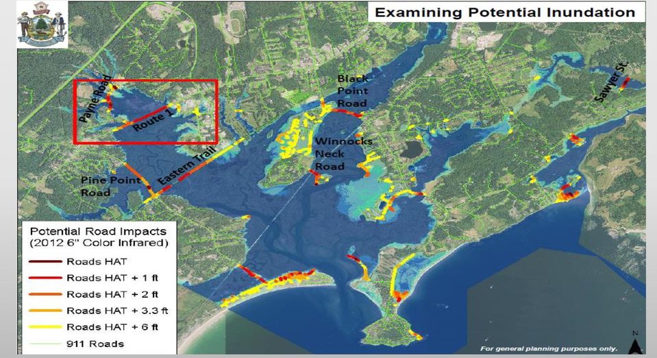
13 Elevation Basis of COAST New exceedance curves for future (i.e. how likely is a 10-yr storm to occur?) Exceedance curve based on FEMA flood studies Probability

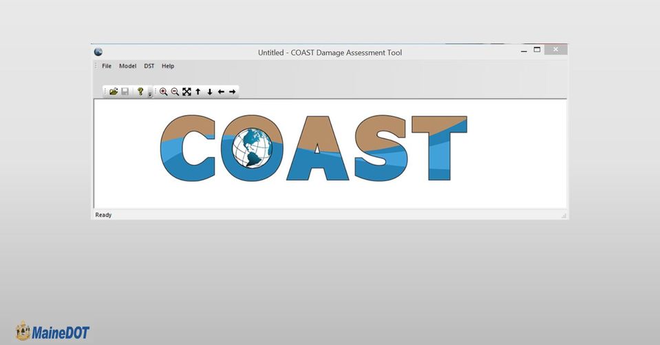
14 Using the lingo 1. Identify vulnerable infrastructure 2. Select critical transportation structure 3. Develop a Decision Support Tool (DST) to rank asset priorities within each town 4. Run highest priority assets through T-COAST scenarios 3 bridges 2 culverts 1 road 5. Pick most cost-efficient, resilient alternative

15
16

17 CRITICALITY VULNERABILITY DST Data needs 1. Feet of freeboard under bridge between lowest chord and 100 yr BFE or road segments < 5 ft above 100 yr BFE 2. % of bridge length at height of lowest chord or degree culverts/drainage structures are prone to failure during rain/tidal storm events 3. Approaches flood or road included in TIP for rehab or reconstruction 4. Scour critical 5. NBIS score > 5 or road surface asphalt or concrete 6. Functional classification of roadway 7. Utilities/other modes associated with bridge or road 8. Roadway is identified evacuation route 9. Hospital, emergency access way?

18 New Question: What asset to you worry about during a storm? ME Route 209, south of Sam Day Hill Rd, Phippsburg ME Route 127, at Sequinland Rd, Georgetown ME Route 1 over Scarborough Marsh, Scarborough New Meadows Rd on Old Bath Road, Bath ME Route 25, Bowdoinham Meadow Rd, Topsham

19 Methods Key elements of the approach: For each asset, the software analyzed cost-benefit relationships of three alternatives: Replace to current design standards Replace with structure built to standards for 3.3 of SLR Replace with structure built to standards for 6.6 of SLR

20 Methods Key elements of the approach: For each asset, the software analyzed cost-benefit relationships of three alternatives: Replace in-kind Replace with structure built to standards for 3.3 of SLR Replace with structure built to standards for 6.6 of SLR In general: Costs: Initial replacement or construction costs Maintenance and repair over time, after each storm surge event Benefits: Avoided damages provided by each structure in the face of a range of SLR and storm surge scenarios tallied cumulatively over time.

21 Depth Damage Functions Designed for Each Structure Elev. Damage Cost Extreme = $E/event Bridge cord height Severe = $D/event 8-11 Moderate = $C/event 7-8 Minor = $B/event 0-7 Slight = $A/event Waterway Base Elevation
22 Scarborough Low Sea Level Rise (3.3') Initial Construction Costs Total Damage/Repair Costs by 2100 TOTAL LIFE CYCLE COST BY 2100 Replace in Kind $3,600,000 $ 349,128 $3,949,128 Replace with 3.3' SLR design $4,300,000 $ 181,330 $4,481,330 Replace with 6' SLR design $6,000,000 $ 3,323 $6,003,323 High Sea Level Rise (6') Initial Construction Costs Total Damage/Repair Costs by 2100 TOTAL LIFE CYCLE COST BY 2100 Replace in Kind $3,600,000 $ 823,325 $4,423,325 Replace with 3.3' SLR design $4,300,000 $ 642,948 $4,942,948 Replace with 6' SLR design $6,000,000 $ 69,547 $6,069,547
23 Bath Low Sea Level Rise (3.3') Initial Construction Costs Total Damage/Repair Costs by 2100 TOTAL LIFE CYCLE COST BY 2100 Replace in Kind $ 400,000 $697,476 $1,097,476 Replace with 3.3' SLR design $ 594,000 $697,476 $1,291,476 Replace with 6' SLR design $1,000,000 $281,242 $1,281,242 High Sea Level Rise (6') Initial Construction Costs Total Damage/Repair Costs by 2100 TOTAL LIFE CYCLE COST BY 2100 Replace in Kind $ 400,000 $1,867,580 $2,267,580 Replace with 3.3' SLR design $ 594,000 $1,867,580 $2,461,580 Replace with 6' SLR design $1,000,000 $ 916,598 $1,916,598
24 Bowdoinham Initial Construction Costs Low Sea Level Rise (3.3') Total Damage/Repair Costs by 2100 TOTAL LIFE CYCLE COST BY 2100 Replace in Kind $250,000 $1,656,830 $1,906,830 Replace with 3.3' SLR design $394,000 $1,162,080 $1,556,080 Replace with 6' SLR design $491,000 $ 205,159 $696,159 Replace with 6' SLR design $491,000 Initial Construction Costs High Sea Level Rise (6') Total Damage/Repair Costs by 2100 TOTAL LIFE CYCLE COST BY 2100 Replace in Kind $250,000 $2,163,283 $2,413,283 Replace with 3.3' SLR design $394,000 $1,900,813 $2,294,813 Replace with 6' SLR design $491,000 Replace with 6' SLR design $491,000 $ 908,565 $1,399,565
25 Back to that conversation Q: When will the next big storm hit? A: Next week, next decade, next century Q: How will we know what to protect first? A: Use the best data and know-how available Q: How much risk can we tolerate? A: It depends who is footing the bill Q: What do customers expect? A: 100% accessibility, 100% of the time Q: What will it cost? A: too much zip, zero, zilch wiggle room Q: Who is going to tell us how to engineer our way out of this? A: Not it
26
27 Insanity Doing the same thing over and over again and expecting different results. Albert Einstein
28 Current Practices Bridges: Culverts: 90% full at Q50 Check that Q100 runs full, but not over road surface Check scour to Q500 Sized for Q50 90% full at Q50 Full at Q100 Check 1.2 bank full width
29 Back to our friend Albert You can t solve a problem at the same level of consciousness that created it. Albert Einstein
30 Getting at context and opportunity Surrounding landscape (e.g. land cover, topography) Flood potential Ecosystem services (current and potential) Debris potential (e.g. large woody debris, bed load) Risk of failure (e.g. condition ratings)


31 Route 2, Mercer


32 Route 4, the Berwicks
33 A few pesky realities Can t throw the baby out with the bathwater Can t love the new baby more Uncertainty is a fact of life Data will always be incomplete Money will always be a limiter Analysis paralysis is not effective asset management It only takes a small adjustment to avoid the iceberg
34 The road ahead See opportunity in necessity Risk resistant is the goal, not risk-proof no regrets decision-making Understand that everything relies on benefit:cost Lack of catastrophe breeds complacency Be clear that not getting in the way is not the same as helping The eaten by wolves factor
35
Screening Transportation Assets for Vulnerability
 Screening Transportation Assets for Vulnerability Impacts of Climate Change and Variability on Transportation Systems & Infrastructure (Gulf Coast Study, Phase 2) FHWA Office of Planning Environment and
Flood Emergency Response Planning: How to Protect Your Business from a Natural Disaster RIC005
 Flood Emergency Response Planning: How to Protect Your Business from a Natural Disaster RIC005 Speakers: Tom Chan, CEO, Global Risk Miyamoto Greg Bates, Principal, Global Risk Consultants Learning Objectives
Flood Damage Mitigation And Insurance Costs
 Flood Damage Mitigation And Insurance Costs Friday, September 25, 2015 at 7:00 PM Saturday, September 26, 2015 at 10:00 AM This presentation was prepared by the Town of South Bethany using Federal Funds
Infrastructure Flood Protection Guidance and Best Practices
 The standards and best practices contained in this document are required elements for new projects seeking State funding under the New Jersey Environmental Infrastructure Finance Program (NJEIFP). Further
Disaster Recovery Managing and Leveraging Multiple Funding Sources
 Disaster Recovery Managing and Leveraging Multiple Funding Sources Jordan Williams, CFM June 3, 2015 Overview Programs FEMA Public Assistance (PA) and Hazard Mitigation Grant Program HUD s Community Development
Why should communities invest in resiliency? What are the steps communities can take to become more resilient?
 Community Preparedness for Flood Resiliency Nina Peek, AICP New York Planning Federation Board of Directors Senior Technical Director AKRF, Inc. Focus of Today s Presentation Why should communities invest
1. GENERAL ADVISORY BASE FLOOD ELEVATION (ABFE) QUESTIONS
 QUESTIONS") INTRODUCTION As communities begin to recover from the devastating effects of Hurricane Sandy, it is important to recognize lessons learned and to employ mitigation actions that ensure structures are rebuilt
INTRODUCTION As communities begin to recover from the devastating effects of Hurricane Sandy, it is important to recognize lessons learned and to employ mitigation actions that ensure structures are rebuilt
Aligning Natural and Built Infrastructure for
 Aligning Natural and Built Infrastructure for Houston Climate Resilience National Exercise Program (NEP) Houston Climate Change Preparedness & Resilience Workshop Edmond J. Russo, Jr., PhD, PE, D.CE, D.NE,
AASHTO 2015 EXTREME WEATHER SESSIONS
 AASHTO 2015 EXTREME WEATHER SESSIONS AASHTO S CONFERENCE ON 21ST CENTURY MOBILITY FOR FREIGHT AND PASSENGER TRANSPORTATION BREAKOUT 6: FLOODING, VULNERABILITY AND RISK, OH MY! JULY 8, 2015 4:00 5:30 PM
Using Insurance Catastrophe Models to Investigate the Economics of Climate Change Impacts and Adaptation
 Using Insurance Catastrophe Models to Investigate the Economics of Climate Change Impacts and Adaptation Dr Nicola Patmore Senior Research Analyst Risk Management Solutions (RMS) Bringing Science to the
Sustainable Road Drainage Asset Management Strategy and Financial Requirements
 Sustainable Road Drainage Asset Management Strategy and Financial Requirements Liane Welch, P.E., Director, Tillamook County Public Works Patricia Bugas-Schramm, PBS Consulting Jeff Roorda, P.E., JRA TRB
Federal Triangle Stormwater Working Group Federal Triangle Floodproofing Seminar BUILDING STRONG SM
 Federal Triangle Stormwater Working Group Federal Triangle Floodproofing Seminar Initial Risk Flood Risk = Probability of Flooding x Consequences Zoning Building Codes Outreach Evacuation Planning Risk
Vermont Economic Resiliency Initiative (VERI) Community Forum Barre City & Barre Town
 Community Forum Barre City & Barre Town") Vermont Economic Resiliency Initiative (VERI) Community Forum Barre City & Barre Town MEETING NOTES April 16, 2015 6:00 8:00 PM VERI Project Overview With funding from the US Economic Development Administration
Vermont Economic Resiliency Initiative (VERI) Community Forum Barre City & Barre Town MEETING NOTES April 16, 2015 6:00 8:00 PM VERI Project Overview With funding from the US Economic Development Administration
Hoboken Resiliency & Readiness Plan
 Hoboken Resiliency & Readiness Plan Layers of Protection Mayor Dawn Zimmer Challenge: Hoboken was once an island outcrop. Surrounding tidal marshes were filled in, but City remains vulnerable to storm
chapter 9 conduct a climate change
 CONDUCT A CLIMATE RESILIENCY STUDY The following chapters recommend how to reach CRC Milestone Two, Conduct a Climate Resiliency Study. 2 MILESTONE Chapter 8: Conduct a Climate Change Vulnerability Assessment
Challenges. Estimated Damages from 100-Year Flood
 Suffield Suffield is a rural community located along the Massachusetts border. It encompasses about 42.2 square miles and has a population of about 15,735. Suffield s terrain rises from an elevation of
Designing and Developing WebGIS SLR tools: NJ Floodmapper
 Designing and Developing WebGIS SLR tools: NJ Floodmapper Richard Lathrop, Lisa Auermuller, Jeanne Herb, Marjorie Kaplan, James Trimble, John Bognar & Jennifer Rovito Coastal Community Resiliency Progression
Federal Emergency Management Agency (FEMA) Preliminary Flood Insurance Rate Maps (FIRMs) and Preliminary Flood Insurance Study (FIS) for New York City
 Preliminary Flood Insurance Rate Maps (FIRMs) and Preliminary Flood Insurance Study (FIS) for New York City") March 10, 2014 Submitted electronically via http://www.nyc.gov Mayor s Office of Long Term Planning and Sustainability c/o Flood Map Comments 253 Broadway, 10th Floor New York, NY 10007 Federal Emergency
March 10, 2014 Submitted electronically via http://www.nyc.gov Mayor s Office of Long Term Planning and Sustainability c/o Flood Map Comments 253 Broadway, 10th Floor New York, NY 10007 Federal Emergency
SPCC Plan - Calculation Guidance
 SPCC Plan - Calculation Guidance The following example compares two different design criteria: one based on the volume of the tank and one based on precipitation. Scenario: A 20,000-gallon horizontal tank
Hurricanes and Storm Surge www.hcfcd.org/tropicalweather
 Hurricanes and Storm Surge www.hcfcd.org High-level winds fl ow outward Strong surface winds spiral inward EYE Calm, sometimes cloudfree, sinking air Air sinks in calm area at the storm s eye THUNDERSTORMS
FLOOD HAZARD IN THE URBAN ENVIRONMENT: IMPLICATIONS FOR DEVELOPERS, DESIGNERS, AND ATTORNEYS
 FLOOD HAZARD IN THE URBAN ENVIRONMENT: IMPLICATIONS FOR DEVELOPERS, DESIGNERS, AND ATTORNEYS PRESENTED BY: CHAD W. COX, P.E. DANIEL C. STAPLETON, P.E. BOSTON, MA JAN. 24, 2014 PRESENTATION Flood Vulnerability
Community Engagement and Cost Benefit Analysis for Sea Level Rise and Storm Surge Adaptation
 Community Engagement and Cost Benefit Analysis for Sea Level Rise and Storm Surge Adaptation Methods, Case Studies, and Wetland-specific Opportunities Samuel B. Merrill, Ph.D. December 10, 2012 Muskie
Flooding Fast Facts. flooding), seismic events (tsunami) or large landslides (sometime also called tsunami).
, seismic events (tsunami) or large landslides (sometime also called tsunami).") Flooding Fast Facts What is a flood? Flooding is the unusual presence of water on land to a depth which affects normal activities. Flooding can arise from: Overflowing rivers (river flooding), Heavy rainfall
Flooding Fast Facts What is a flood? Flooding is the unusual presence of water on land to a depth which affects normal activities. Flooding can arise from: Overflowing rivers (river flooding), Heavy rainfall
Future of our coasts: Potential for natural and hybrid infrastructure to enhance ecosystem and community resilience Ariana Sutton-Grier
 Future of our coasts: Potential for natural and hybrid infrastructure to enhance ecosystem and community resilience Ariana Sutton-Grier University of Maryland & National Oceanic and Atmospheric Administration
Flood Protection Tips
 Flood Protection Tips Information About Floodplains and Flood Prevention What is a floodplain? Floodplains serve many useful purposes, and those that are preserved in their natural or nearly natural state
Submission by the United States of America to the UN Framework Convention on Climate Change Communication of U.S. Adaptation Priorities May 29, 2015
 Submission by the United States of America to the UN Framework Convention on Climate Change Communication of U.S. Adaptation Priorities May 29, 2015 Adaptation is a challenge for all Parties. In addition
And Flood Resilient Design in Austin, Texas
 And Flood Resilient Design in Austin, Texas The good, the bad and the ugly; What does this video show us? Riverine Flooding versus Flash Flooding Flash Flood Alley Stretches along the I 35 corridor between
EPA s Climate Resilience Evaluation and Awareness Tool (CREAT): A Case Study
: A Case Study") EPA s Climate Resilience Evaluation and Awareness Tool (CREAT): A Case Study South Monmouth Regional Sewerage Authority (SMRSA) Serves 9 Townships 9.1 MGD Wastewater Treatment Plant 11 pump stations 11.
EPA s Climate Resilience Evaluation and Awareness Tool (CREAT): A Case Study South Monmouth Regional Sewerage Authority (SMRSA) Serves 9 Townships 9.1 MGD Wastewater Treatment Plant 11 pump stations 11.
City of Cambridge Climate Protection Action Committee. Recommendations for Adaptation to Climate Change. Purpose
 City of Cambridge Climate Protection Action Committee Recommendations for Adaptation to Climate Change Purpose The Climate Protection Action Committee (CPAC) is an advisory body to the City Manager on
Climate Projections for Transportation Infrastructure Planning, Operations & Maintenance, and Design
 Climate Projections for Transportation Infrastructure Planning, Operations & Maintenance, and Design KATHARINE HAYHOE, ANNE STONER, JO DANIEL, JENNIFER JACOBS and PAUL KIRSHEN THE INFRASTRUCTURE CLIMATE
URBAN DRAINAGE CRITERIA
 URBAN DRAINAGE CRITERIA I. Introduction This division contains guidelines for drainage system design and establishes a policy for recognized and established engineering design of storm drain facilities
New Brunswick s Flood Risk Reduction Strategy. Province of New Brunswick PO 6000, Fredericton NB E3B 5H1. www.gnb.ca
 New Brunswick s Flood Risk Reduction Strategy i New Brunswick s Flood Risk Reduction Strategy Province of New Brunswick PO 6000, Fredericton NB E3B 5H1 2014 www.gnb.ca ISBN 978-1-4605-0533-5 (print edition)
Adaptation for City Infrastructure; A Case Study of East Boston, MA
 Adaptation for City Infrastructure; A Case Study of East Boston, MA Paul Kirshen and Thomas Ballestero with support from Kirk Bosma, Wood Hole Group EMF, July 22, 2014 Funded by SARP, OGP, US NOAA Climate
This plan forms one part of a suite of Asset Management Plans that have been developed:
 E: D1: Levee Footpath Bank Asset Management Plan March July 2014 2015 This plan forms one part of a suite of Asset Management Plans that have been developed: A. Bridges B. Buildings C. Drainage D. Footpaths
FTA Climate Change Adaptation Webinar August 8 th, 2011 Meeting Notes
 FTA Climate Change Adaptation Webinar August 8 th, 2011 Meeting Notes 1. Welcome: Robert J. Tuccillo, Federal Transit Administration Associate Administrator for Budget and Policy and Chief Financial Officer.
ECONOMIC ANALYSIS FLOOD DAMAGE REDUCTION. Lower Carmel River Floodplain Restoration and Enhancement Project
 ECONOMIC ANALYSIS FLOOD DAMAGE REDUCTION Lower Carmel River Floodplain Restoration and Enhancement Project I. Description of the Project and its Relationship to Other Projects in the Proposal The Lower
Community Outreach Kickoff Summaries. Boulder Creek and South Boulder Creek Meeting held Jan. 8, 2014, approximately 80 attendees
 Boulder Creek and South Boulder Creek Meeting held Jan. 8, 2014, approximately 80 attendees Key issues Discussed Roads & Access Damaged roads. The Oil & Gas company access roads acted like dams Public
Flood Risk Assessment. For Application at: Brick House Farm Brick House Lane Hambleton Lancashire FY6 9BG
 Flood Risk Assessment For Application at: Brick House Farm Brick House Lane Hambleton Lancashire FY6 9BG Contents 1. Introduction 2. The Site 3. Flood Risk 4. Existing drainage 5. Proposed Development
Climate Change Long Term Trends and their Implications for Emergency Management August 2011
 Climate Change Long Term Trends and their Implications for Emergency Management August 2011 Overview A significant amount of existing research indicates that the world s climate is changing. Emergency
South Florida Sea Level Rise Projections and Flood Risk Concerns
 South Florida Sea Level Rise Projections and Flood Risk Concerns MIAMI MIAMI Biscayne Bay Glenn B. Landers, P.E. Planning and Policy Division Jacksonville District EVERGLADES NATIONAL PARK USACE Flood
May 29, 2015. Ongoing Flood Damages to County Federal-aid Routes
 OKLAHOMA DEPARTMENT OF TRANSPORTATION Local Government Division 200 N.E. 21 st Street Oklahoma City, OK 73105-3204 www.odot.org May 29, 2015 Ongoing Flood Damages to County Federal-aid Routes We are anticipating
NOAA COASTAL SERVICES CENTER Strategic Plan: 2010 to 2015
 NOAA COASTAL SERVICES CENTER Strategic Plan: 2010 to 2015 N a t i o n a l O c e a n i c a n d A t m o s p h e r i c A d m i n i s t r a t i o n ( N O A A ) C o a s t a l S e r v i c e s C e n t e r March
Safe & Sound Bridge Terminology
 Safe & Sound Bridge Terminology Abutment A retaining wall supporting the ends of a bridge, and, in general, retaining or supporting the approach embankment. Approach The part of the bridge that carries
New York City Panel on Climate Change 2015 Report Executive Summary
 Ann. N.Y. Acad. Sci. ISSN 0077-8923 ANNALS OF THE NEW YORK ACADEMY OF SCIENCES Issue: Building the Knowledge Base for Climate Resiliency New York City Panel on Climate Change 2015 Report Executive Summary
Eastern Connecticut Risk & Vulnerability Assessment Workshop
 Coastal Resilience New York and Connecticut A Tool for Coastal Planning in a Changing World Eastern Connecticut Risk & Vulnerability Assessment Workshop January 11, 2012 Waterford Town Hall - Auditorium
Building Olive s Flood Resiliency
 Building Olive s Flood Resiliency Informed Flood Mitigation Planning The Local Flood Analysis Flood Advisory Committee Meeting #1 Town of Olive s Community Room 4/14/15 What is an LFA? 1. Uses science
Pine Creek Culvert Upgrade $ 560,000. Located at exiting hump dike, just south of Fire Training Center
 To: BOS From: Joseph Michelangelo, P.E. Director of Public Works Re: CDBG-DR Pine Creek Culvert Upgrade Date: April 20, 2015 On June 19, 2014, the Town of Fairfield was awarded the above referenced project
Post-Sandy Municipal Needs Assessment for Long-Term Recovery and Resiliency Planning EXECUTIVE SUMMARY
 Post-Sandy Municipal Needs Assessment for Long-Term Recovery and Resiliency Planning EXECUTIVE SUMMARY Prepared by Nathaly Agosto Filión, Resiliency Manager for the New Jersey Resiliency Network, a program
Miami-Dade County Roadmap for Adapting to Coastal Risk
 Miami-Dade County Roadmap for Adapting to Coastal Risk Vulnerability Assessment & Planning Workshop Results & Recommendations Roadmap for Adapting to Coastal Risk Page 1 Introduction GreenPrint is Miami-Dade
Coastal Erosion Risk Mitigation Strategies applied in a Small Island Developing State: The Barbados Model
 Coastal Erosion Risk Mitigation Strategies applied in a Small Island Developing State: The Barbados Model BY Dr. Leo Brewster, Director Coastal Zone Management Unit, Barbados Presented At UNFCCC Expert
Climate change impacts on city of Gdansk and its vicinity (Vistula Delta, Poland)
") Final International ASTRA Conference Espoo, 10-11 December, 2007 Climate change impacts on city of Gdansk and its vicinity (Vistula Delta, Poland) Dorota Kaulbarsz, Zbigniew Kordalski, Wojciech Jeglinski
Final International ASTRA Conference Espoo, 10-11 December, 2007 Climate change impacts on city of Gdansk and its vicinity (Vistula Delta, Poland) Dorota Kaulbarsz, Zbigniew Kordalski, Wojciech Jeglinski
5.0 OVERVIEW OF FLOOD DAMAGE REDUCTION MEASURES
 5.0 OVERVIEW OF FLOOD DAMAGE REDUCTION MEASURES Flood damage reduction consists of two basic techniques structural and non-structural. Structural methods modify the flood and take the flood away from people
U.S. Army Corps of Engineers
 Walla Walla District U.S. Army Corps of Engineers Hurricane Katrina Response Briefer: Joseph Saxon Today s Briefing U.S. Army Corps of Engineers Mission Events leading up to New Orleans flooding Corp s
FHWA Emergency Relief (FHWA-ER) Training
 Training") FHWA Emergency Relief (FHWA-ER) Training Training Developed and Coordinated By Colorado Department of Transportation 2 Agenda FHWA Flowchart Policies, Purpose, Agency Roles Application Process Eligibility
FHWA Emergency Relief (FHWA-ER) Training Training Developed and Coordinated By Colorado Department of Transportation 2 Agenda FHWA Flowchart Policies, Purpose, Agency Roles Application Process Eligibility
Hurricane Sandy: The Challenges and Opportunities to Link Disaster Management and Climate Change Adaptation*
 Hurricane Sandy: The Challenges and Opportunities to Link Disaster Management and Climate Change Adaptation* Gavin Smith, Ph.D. Associate Research Professor Department of City and Regional Planning University
Shooks Run Drainage Study Basic Terminology
 Shooks Run Drainage Study Basic Terminology PREPARED FOR: PREPARED BY: City of Colorado Springs CH2M DATE: April 9, 2015 Introduction This document is intended to provide an introduction to Colorado Springs
Development of Decision Support Matrices for Climate Change Adaptation Planning. Jay S. Gregg Malene Kauffmann Kirsten Halsnæs
 Development of Decision Support Matrices for Climate Change Adaptation Planning Jay S. Gregg Malene Kauffmann Kirsten Halsnæs 1 Outline I. Decision making within the context of climate adaptation Identifying
Critical Infrastructure
 Critical Infrastructure Long-term Trends and Drivers and Their Implications for Emergency Management June 2011 Overview The state and nature of infrastructure is likely to change over the next several
Sea Level Rise Adaptation in the Public Sector: Challenges, Solutions, and Opportunities
 White Paper Sea Level Rise Adaptation in the Public Sector: Challenges, Solutions, and Opportunities As climate change progresses, the relentless march of sea level rise (SLR) presents an array of challenges
Implementation of the New York City Wastewater Resiliency Plan: Opportunities And Lessons Learned
 Implementation of the New York City Wastewater Resiliency Plan: Opportunities And Lessons Learned Pinar Balci, Ph.D. Director, Bureau of Environmental Planning and Analysis NYC Department of Environmental
Integrating Extreme Weather Risk into Transportation Asset Management
 Integrating Extreme Weather Risk into Transportation Asset Management November 1, 2012 Michael D. Meyer, Ph.D., P.E., F. ASCE Emily Rowan, Michael J. Savonis, and Anne Choate, ICF International Table of
Norfolk Flooding Strategy Update. Presentation to Norfolk City Council March 27, 2012
 Norfolk Flooding Strategy Update Presentation to Norfolk City Council March 27, 2012 Presentation Overview The purpose of this presentation is to provide City Council an update on activities carried out
The success of the hurricane protection around Chevron s refinery at Pascagoula, MS, during Katrina
 The success of the hurricane protection around Chevron s refinery at Pascagoula, MS, during Katrina Dr J.W. van der Meer, Dr C. Cooper, M.J. Warner, H. Adams-Morales and G.J. Steendam Abstract and presentation
Section E2 Coastal Engineering: Reconstruction Management and Mitigation
 271 Section E2 Coastal Engineering: Reconstruction Management and Mitigation 272 Objectives To familiarize the assessor with the process that should be followed in organizing any reconstruction efforts.
ROSE CREEK WATERSHED HYDROLOGIC, HYDRAULIC, SEDIMENT TRANSPORT, AND GEOMORPHIC ANALYSES TASK 1 EXISTING DATA AND INFORMATION SUMMARY REPORT BACKGROUND
 ROSE CREEK WATERSHED HYDROLOGIC, HYDRAULIC, SEDIMENT TRANSPORT, AND GEOMORPHIC ANALYSES TASK 1 EXISTING DATA AND INFORMATION SUMMARY REPORT BACKGROUND The Rose Creek Watershed (RCW) consists of three planning
DIRECTIONS IN DEVELOPMENT Environment and Sustainable Development. Building Urban Resilience. Principles, Tools, and Practice
 DIRECTIONS IN DEVELOPMENT Environment and Sustainable Development Building Urban Resilience Principles, Tools, and Practice Abhas K. Jha,Todd W. Miner, and Zuzana Stanton-Geddes, Editors Australian THE
Swannanoa River Flood Risk Management Study
 Swannanoa River Flood Risk Management Study Measures Evaluated to Reduce Future Flood Damages City of Asheville U.S. Army Corps of Engineers Flooding History Part of the 132 square mile Swannanoa River
APPENDIX B: PUBLIC PARTICIPATION SURVEY RESULTS
 APPENDIX B: PUBLIC PARTICIPATION SURVEY RESULTS APPENDIX B: PUBLIC PARTICIPATION SURVEY RESULTS This section of the Plan includes a general summary of the results and findings of the Public Participation
Dirk Nyland - Chief Engineer BC Ministry of Transportation and Infrastructure NRCan - CCIAD Presentation 9 September 2014
 Considerations for Addressing Climate Change Adaptation for Transportation Infrastructure in Highway Management, Design, Operation and Maintenance in British Columbia Dirk Nyland - Chief Engineer BC Ministry
CITY UTILITIES DESIGN STANDARDS MANUAL
 CITY UTILITIES DESIGN STANDARDS MANUAL Book 2 (SW) SW9 June 2015 SW9.01 Purpose This Chapter provides information for the design of open channels for the conveyance of stormwater in the City of Fort Wayne.
Comprehensive Recommendations Supporting the Use of the Multiple Lines of Defense Strategy to Sustain Coastal Louisiana 2008 Report (Version I)
") Comprehensive Recommendations Supporting the Use of the Multiple Lines of Defense Strategy to Sustain Coastal Louisiana 2008 Report (Version I) This report recommends integrated coastal projects and levee
Comprehensive Recommendations Supporting the Use of the Multiple Lines of Defense Strategy to Sustain Coastal Louisiana 2008 Report (Version I) This report recommends integrated coastal projects and levee
Earth Retaining Structures
 Earth Retaining Structures and Asset Management Earth Retaining Structures and Asset Management A Critical Component Tool in Maintaining Public Safety Earth Retaining Structures (ERS) are often an overlooked
The Army Corps of Engineers and the Flood Risk Challenge
 The Army Corps of Engineers and the Flood Risk Challenge Presentation to Association of State Flood Plain Managers Steven L. Stockton, P.E. Director of Civil Works June 12, 2013 US Army Corps of Engineers
Guideline: A risk assessment approach to development assessment in coastal hazard areas
 Guideline: A risk assessment approach to development assessment in coastal hazard areas Prepared by: Environment Planning, Department of Environment and Heritage Protection State of Queensland, 2013. The
Chapter 5 RISK MANAGEMENT ANALYSIS CHAPTER 5 RISK MANAGEMENT ANALYSIS PAGE 49
 Chapter 5 RISK MANAGEMENT ANALYSIS CHAPTER 5 RISK MANAGEMENT ANALYSIS PAGE 49 This page intentionally left blank. PAGE 50 MINNESOTA GO MNDOT TRANSPORTATION ASSET MANAGEMENT PLAN RISK MANAGEMENT ANALYSIS
Lower Raritan Watershed Management Area Stormwater & Flooding Subcommittee Strategy Worksheet LRSW-S3C1
 Strategy Name: Reduce Existing Potential for Flood Damages LRSW-S3C1. Develop and implement a program to: Minimize flood damages through the use of structural measures. Minimize flood damages through the
Flood After Fire Fact Sheet
 FACT SHEET Flood After Fire Fact Sheet Risks and Protection Floods are the most common and costly natural hazard in the nation. Whether caused by heavy rain, thunderstorms, or the tropical storms, the
Floodplain Development Land Use Review
 COMMUNITY DEVELOPMENT DEPARTMENT Planning Division P.O. Box 490 333 Broadalbin Street SW Albany, OR 97321 Phone 541-917-7550 Fax 541-791-0150 www.cityofalbany.net Floodplain Development Land Use Review
Tools from the US EPA s Climate Ready Water Utilities Initiative (CRWU) EPA Region 3 Conference Extreme Weather Events: Adapt, Mitigate, and Survive
 EPA Region 3 Conference Extreme Weather Events: Adapt, Mitigate, and Survive") Tools from the US EPA s Climate Ready Water Utilities Initiative (CRWU) EPA Region 3 Conference Extreme Weather Events: Adapt, Mitigate, and Survive May 9, 2013 1 Presentation Overview Background on EPA
Tools from the US EPA s Climate Ready Water Utilities Initiative (CRWU) EPA Region 3 Conference Extreme Weather Events: Adapt, Mitigate, and Survive May 9, 2013 1 Presentation Overview Background on EPA
Tropical Storm Allison
 Tropical Storm Allison June 13, 2003, 2:41PM Two years after Allison, Houston has reached a watershed moment By KEVIN SHANLEY Houston is exploding with growth. But city building can be a messy business,
How To Improve Road Quality
 A Customer Service Level Approach for Maine DOT s Asset Management System Jeffrey L. Zavitski, B.A. Senior Implementation Specialist Deighton Associates Limited Chip Getchell, P.E. Director, Work Plan
Climate Change Preparedness and Resiliency Checklist Performance Criteria
 Climate Change Preparedness and Resiliency Checklist Performance Criteria The Climate Change Preparedness and Resiliency Policy, enacted in 2013, requires that all projects subject to Boston Zoning Code
Frequently-Asked Questions about Floodplains and Flood Insurance FLOOD INSURANCE
 Frequently-Asked Questions about Floodplains and Flood Insurance What is a floodplain? The floodplain is any area covered by water during normal water flows, and which could be inundated as a result of
UNOPS Risk-Sensitive Planning for Resilient Infrastructure Development
 UNOPS Risk-Sensitive Planning for Resilient Infrastructure Development 5 th Africa Regional Platform for Disaster Risk Reduction Abuja, Nigeria by Jeffrey Crawford, UNOPS 14 May 2014 What is Resilient
Sea Level Rise and Coastal Flood Web Tools Comparison Matrix - Oregon GENERAL
 Geographic Scope Organization/Sponsor Link Geographic extent the tool defines or covers (i.e. national, statewide, county ) The organization and/or sponsor of the mapping tool. The URL or link where the
Critical Assets and Extreme Weather Process & Lessons
 Critical Assets and Extreme Weather Process & Lessons Steven Olmsted Intermodal Transportation Division Arizona Department of Transportation 2014 Transportation Asset Management Conference April 28-30,
Challenges and Lessons Learned NASA Johnson Space Center and the Houston/Galveston Area
 Emergency Planning Challenges and Lessons Learned NASA Johnson Space Center and the Houston/Galveston Area May 2013 Pat Kolkmeier JSC CoF Program Manager Hurricane Ike and Other Texas Storms Texas Coast
Freeboard Incentives work for residents, town officials in Hull, MA
 Freeboard Incentives work for residents, town officials in Hull, MA The Town of Hull, Massachusetts, is situated on a peninsula in the southernmost part of Massachusetts Bay. It is densely developed, and
THE WHITE HOUSE. Office of the Press Secretary. For Immediate Release January 30, 2015 EXECUTIVE ORDER - - - - - - -
 THE WHITE HOUSE Office of the Press Secretary For Immediate Release January 30, 2015 EXECUTIVE ORDER - - - - - - - ESTABLISHING A FEDERAL FLOOD RISK MANAGEMENT STANDARD AND A PROCESS FOR FURTHER SOLICITING
Asset Management: A Best Practice
 Asset Management: A Best Practice Purpose Introduction This guide will help you understand: The definition of Asset Management. Why asset management is important to your utility. The best practices in
Hurricane Sandy Recovery Efforts
 Hurricane Sandy: Recovery Efforts One Year Later There's nothing more important than us getting this right. And we're going to spend as much time, effort and energy as necessary to make sure that all the
Storm tide is the water level rise during a storm due to the combination of storm surge and the astronomical tide.
 INTRODUCTION TO STORM SURGE Introduction to Storm Surge BOLIVAR PENINSULA IN TEXAS AFTER HURRICANE IKE (2008) What is Storm Surge? Inland Extent Storm surge can penetrate well inland from the coastline.
Climate Adaptation Planning in New York City
 Climate Adaptation Planning in New York City University of Helsinki November26, 2014 David C. Major, Ph.D. dcm29@columbia.edu Climate Change and a Global City: The Potential Consequences of Climate Variability
8.1.3 General Design Guidelines. The following guidelines shall be used when designing inlets along a street section:
 . Introduction Presented in this chapter are the criteria and methodology for design and evaluation of storm sewer inlets located in Town of Castle Rock. The review of all planning submittals will be based
The Local Government Self- Assessment Tool. Taking stock, celebrating achievements and planning for DRR in Addis Ababa
 The Local Government Self- Assessment Tool Taking stock, celebrating achievements and planning for DRR in Addis Ababa Background Throughout history, disaster events have disrupted urban life. With more
INSTALLATION OF AN AUTOMATED EARLY WARNING SYSTEM FOR ANNOTTO BAY
 TERMS OF REFERENCE INSTALLATION OF AN AUTOMATED EARLY WARNING SYSTEM FOR ANNOTTO BAY A Community Disaster Risk Reduction Project funded through the Building Disaster Resilient Communities Project (ODPEM)
Resolution XII.13. Wetlands and disaster risk reduction
 12 th Meeting of the Conference of the Parties to the Convention on Wetlands (Ramsar, Iran, 1971) Punta del Este, Uruguay, 1-9 June 2015 Resolution XII.13 Wetlands and disaster risk reduction 1. RECALLING
Standard Operating Procedures for Flood Preparation and Response
 Standard Operating Procedures for Flood Preparation and Response General Discussion Hurricanes, tropical storms and intense thunderstorms support a conclusion that more severe flooding conditions than
Chapter 4 ASSET INVENTORY AND CONDITION CHAPTER 4 ASSET INVENTORY AND CONDITION PAGE 33
 Chapter 4 ASSET INVENTORY AND CONDITION CHAPTER 4 ASSET INVENTORY AND CONDITION PAGE 33 This page intentionally left blank. PAGE 34 MINNESOTA GO MNDOT TRANSPORTATION ASSET MANAGEMENT PLAN ASSET INVENTORY
Floodplain 8-Step Process in accordance with Executive Order 11988: Floodplain Management. New Jersey Department of Environmental Protection
 Floodplain 8-Step Process in accordance with Executive Order 11988: Floodplain Management New Jersey Department of Environmental Protection U.S. Department of Housing and Urban Development Community Development