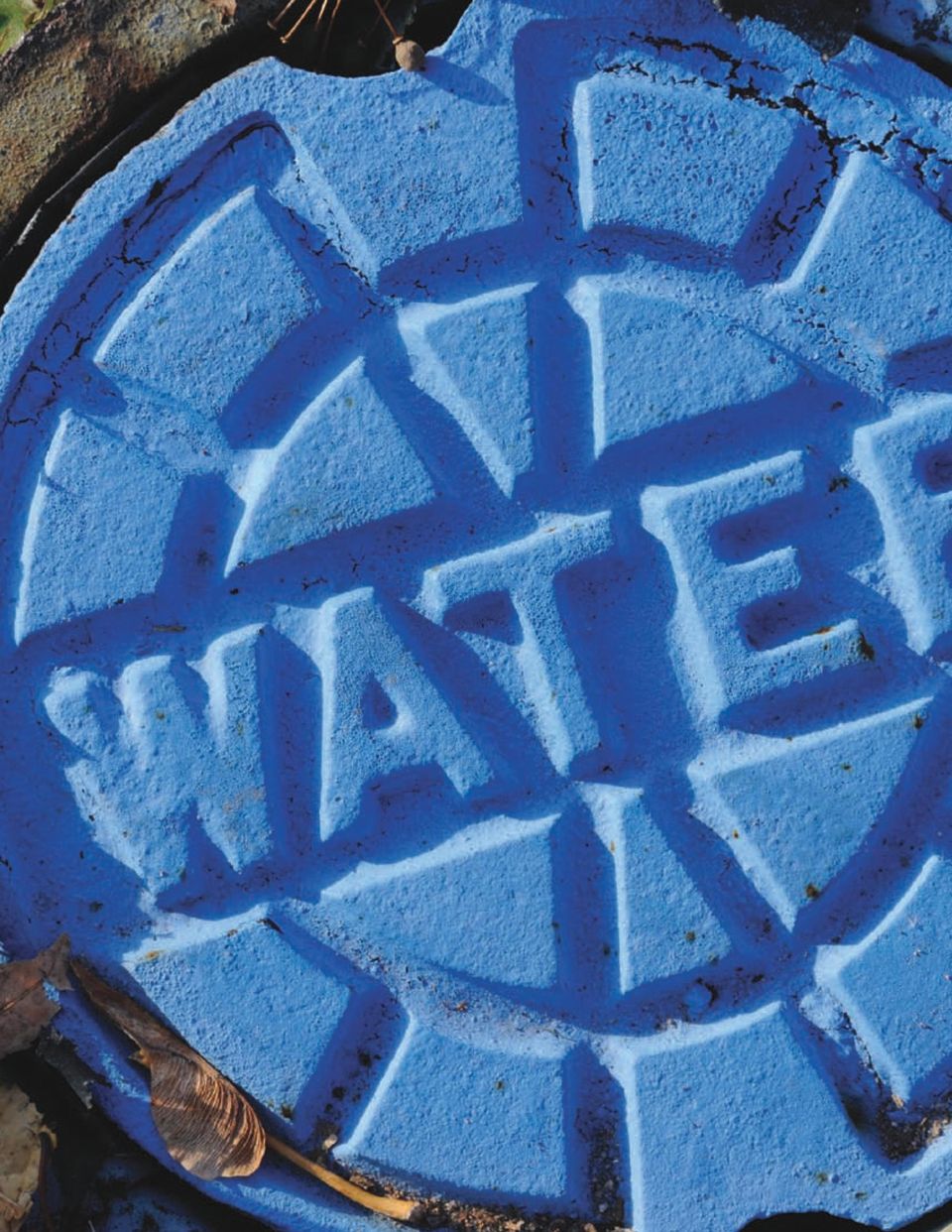
WATER InfRAsTRucTuRE MAnAgEMEnT
|
|
|
- Melinda Wheeler
- 8 years ago
- Views:
Transcription
1 SOLUTION WATER Infrastructure Management

2

3 Intergraph s water infrastructure management solution Municipal and private water and wastewater distribution systems worldwide rely on accurate databases to help manage everything from water mains and pipelines to sewers. A geospatially powered network is crucial in helping to keep the water flowing, whether it s allowing you to manage an ongoing project or pinpoint a leak or other disruption along the pipeline. Intergraph s Water Infrastructure Management solution supports all the details of a municipal or private water and wastewater distribution system. With it, you can plan expansions; conduct engineering analysis; design work orders; and manage mapping, asset, and maintenance records. Its geospatial network asset database, containing the distribution assets of the system, accommodates all system features, such as water mains and sewers, storage reservoirs, pumps, pipelines, valves, and meters. 1

4 Utilities are asset-intensive businesses, with a high percentage of the total corporate assets represented by large and expensive water and wastewater distribution systems. The majority of the utility workforce is involved in the planning, design, construction, and maintenance of these assets. Intergraph s Water Infrastructure Management solution can help you improve design and asset management productivity by more than 50 percent. More importantly, it helps engineers, planners, designers, dispatchers, accountants, and crews do a better job of leveraging and managing the facilities and serving customers. Key Applications Intergraph s geospatially powered solutions set the industry standard, encompassing all the tools you need to manage water and wastewater distribution systems. Intergraph s Water Infrastructure Management solution flawlessly manages the long-term transactions typical of the planning, analysis, design, and mapping of both transmission and distribution processes, while preserving data integrity and overall system performance among hundreds of thousands of simultaneous users. System applications support the workflows of the entire infrastructure, including design and operations management, field automation, and enterprise imaging distribution and management. Water Distribution Design and Asset Management This interactive graphic and database application enables the installation, modification, abandonment, or removal of water and wastewater distribution facilities in the asset repository. This application provides you with the ability to input various features of the water and wastewater distribution system, including storage reservoirs, pumps, pipelines, water mains, and meter connections, as well as landbase and street networks. The data model supports a fully connected water network model that is traceable for other application purposes, and you can use it to construct, maintain, and operate the water distribution system. Water Alignment Sheet Generation With this application, you can generate a water main or pipeline profile engineering drawing in elevation format, also known as an alignment sheet drawing. It includes graphic delimiters and tabular data describing the pipeline and indicating changes in material or coatings, or other attributes along the line. Water Distribution Leak/Survey Management Intergraph s Water Distribution/Leak Survey Management application provides you with a data store for leak survey data collected for piping sections. Using the leak history, together with material types and age of pipe, the application provides replacement prioritization of pipe sections. Water Distribution Cathodic Protection/Corrosion Management This application allows you to trace sections of the metal piping network to design electrical insulation points for sections of the metallic network 2

5 Anglian Water Services, United Kingdom Anglian Water Services Ltd., part of AWG Plc in the United Kingdom, implemented Intergraph s solution for the next generation of their core water infrastructure management system. Anglian Water sees geographic information as one of the cornerstones of its information infrastructure and recognizes that flexible integration with other core systems is essential. Intergraph provided a version of the water infrastructure management suite, designed specifically for the UK market, which will be at the heart of the solution. Intergraph s utility experts have created this solution using their extensive understanding of water company requirements and by embracing industry best practices. We expect Intergraph s Water Infrastructure Management solution to enhance decision support by increasing data exploitation throughout the business, said Kevin Brown, asset data centre manager, Anglian Water Services. Intergraph technology brings flexibility to support and enhance our business and IT strategies. The new system will provide a consistent view of our data and apply appropriate software tools at all access points empowering employees to make decisions that improve operations and customer service. 3

6 (protection zones), create electrically isolated zones, and locate and manage sacrificial anodes placed to electrically protect each network zone from corrosion. Landbase Management Intergraph s Landbase Management application supports the background landbase used for various utility infrastructure mapping and design tasks. It typically includes geospatial data, such as edge of roadways, street centerlines, and street names. It may also include company easements and right-of-ways as maintained by the utility company real estate department. When you use aerial photography or commercially available landbases for background land information, this application manages that information for you as well. Enterprise Image Management and Distribution Water and wastewater distribution and transmission personnel use imagery to help them understand the location and characteristics of the physical network and facilitate a variety of activities. Using Intergraph technology, you can have direct access to all imagery available throughout the enterprise through a modular client-server system that enables users to store, manage, and access multiple types of imagery and terrain data no matter where they are in the workflow. Imagery needed for planning, design, construction, and maintenance is available in seconds, not hours or days. Water and Wastewater Emergency Area Isolation Intergraph s Water and Wastewater Emergency Area Isolation application allows you to quickly identify the infrastructure asset in the event of a network break and helps determine appropriate repairs. Emergency area isolation requires a quick determination and geographic location of the minimum set of flow-control devices, such as valves. Tracing the network upstream, downstream, or in both directions, you can determine and display the nearest flow-control devices. If these assets are not accessible or have become inoperable, you can extend the trace to locate the next set of flow control devices. Water and Wastewater Hydraulic Analysis This application exports the network information you need for hydraulic analysis of a water or wastewater network. Hydraulic analysis is useful when you design or modify a water or wastewater network, and also provides an understanding of the characteristics of the existing network. You can conduct a pressure drop-and-flow analysis and determine the adequacy of the system to support new or existing customers. After you extract connected network information from the model, along with pertinent attributes such as material type and pipe diameter, you can pass it to a third-party hydraulic modeling application. Mobile Workforce Management Mobile Workforce Management (MWFM) supports dispatch, scheduling, and mobile computing solutions for all types of field work planned and unplanned, short-term and long-term. Productized interfaces, intranet access, and decision-support tools for reporting are integral components. This map-driven, mobile workforce application provides you with full dispatching and crew management capabilities, including 4

7 appointment and workload scheduling, assignment optimization, and CIS integration. MWFM supports mobile devices for field personnel and in vehicles. Technicians receive work automatically and update the status of work on mobile data terminals. Full-blown mapping and configuration functions provide capabilities such as street-level routing, street and facility queries, and even in-vehicle navigation. The system is highly configurable, eliminating the need for custom programming. Field Automation With advances in communications and more compact and rugged hardware, there is a growing trend by organizations to mobilize access to critical business applications. Intergraph s Field Automation application uniquely integrates mobile mapping and back office IT systems on one platform. It includes an optional MWFM application for short-cycle work scheduling and management to improve productivity of field personnel. Intergraph s rich functionality includes navigation, analysis, vehicle tracking and routing, job creation and management, and access to real-time status of crews and jobs. The application is designed to work in a connected or a disconnected mode with the ability to store and forward information allowing crews the flexibility to work inside and outside of wireless coverage. Field service personnel can accept multiple types of work orders, view up-to-date facility maps, turn redlines into almost immediate database updates, and communicate instantly with the back office. Field personnel can accomplish more work through immediate and efficient communication, data update, and use

8 Knoxville Utilities Board, Knoxville, Tennessee, usa Knoxville Utilities Board (KUB) is one of the largest full-service regional utilities in the United States, serving approximately 400,000 water, wastewater, electric, and gas customers and covering 800 square miles. KUB wanted a consolidated operations center to manage service orders and <PS: outages for its BLACKBAR multi-utility infrastructure. CALLOUT KUB implemented Intergraph s MWFM applications. HEADER> Providing a seamless environment for dispatch, MWFM, scheduling, crew management, and outage <PS: management, BLACK Intergraph s BAR BODY solution HEADER helps 2> KUB fulfill its vision of a consolidated <PS: operations Black Bar environment Body Copy> from which to make informed decisions related to trouble and service-order work for water, wastewater, and its other services. Doug Miller, coordinator of systems operations and project manager for KUB, said, Intergraph s response to our scripted demo and the ability to use our existing GIS data publishing process and connectivity greatly influenced KUB s selection of Intergraph and its outage and workforce management suite. <PS: Black Bar Image Caption> 6

9 of the most current enterprise data. The Field Automation application supports additional activities, such as field design, field inspection, and facility maintenance. Business Intelligence and Intergraph s Enterprise Web Portal Utilities need access to not only the infrastructure information, but also the ability to integrate geospatial information with a variety of other data types to support decision-making and reporting requirements, both internally and externally. Today, this is defined as business intelligence. Intergraph s Business Intelligence solutions provide your employees, customers, and the public with fast and easy access to integrated data within a geospatial context. Because Web technology has evolved from a means of posting static company information to become a powerful business platform, Intergraph s Enterprise Web Portal has emerged as the principal interface for delivering business intelligence and other customized content to executives, employees, and customers in a user-friendly format. It provides real-time access to multiple data stores, both on the Internet and on internal servers, and direct access to the communications infrastructure data and landbase information. It can also include current information on inspections, service interruptions, and any number of reports needed by employees or customers. Intergraph s Enterprise Web Portal is also an executive dashboard used for reporting, spatial analysis, and decision support functions, and is access-controlled according to your intended audience. The solution is a truly vendor-independent analysis tool, as it works with data from a variety of sources, including: Intergraph s infrastructure management systems Data formats from traditional geographic information system (GIS) venders Comercial database formats from Oracle, Microsoft, and others Design files from computer-aided design packages Data in OGIS (opengis) format, Web Services, and more The idea behind Intergraph s Business Intelligence solutions is straightforward provide real-time access to disparate data sources online and equip you with geospatial query, analysis, and visualization tools. With these tools, you can interrogate, analyze, assess, and formulate decisions in support of core business objectives, such as emergency management, critical infrastructure protection, economic development, and more. Any user equipped with a standard Web browser can accomplish these tasks and more with no GIS training. 7

10
11 ALT INTERGRAPH INTERIOR SOLUTIONS HEADER SUPPORT 2 WATER AND WASTEWATER DISTRIBUITION SYSTEMS 9

12

13 Extended Applications Spatial Data Infrastucture Compliance Intergraph offers the ability for utilities to collaborate and distribute information to the public using spatial data infrastructures (SDIs). Intergraph leverages International Standards Organization (ISO) and Open Geospatial Consortium (OGC ) standards for geospatial data and services. The SDI enables collaboration from both desktop and Web clients. Capabilities include: Metadata maintenance As data is prepared for distribution, metadata catalogs are generated or updated to pro vide background information about the geospatial data. Geospatial data publishing You can publish geospatial data using the Web and make it available to the enterprise for decision support and integration with various business systems, to other government organizations, or to the public. Some analysis capabilities are available as well. web services for data and metadata distribution Datasets and metadata catalogs are made available within government enterprises, to other government units, or to the public. web services access This provides access to Web services, which serve data and/or metadata on different types of clients. This includes desktop connectivity, Web portal connectivity, and others. Web services access includes catalog access (known as discovery) and data services access. Asset Management Interfaces Many organizations employ asset management systems to maintain inventories of water, wastewater, and stormwater systems. Intergraph s Asset Management Interfaces allow you to easily see the location of assets and answer geospatial queries in conjunction with asset queries for job planning and decision-support activities. Work Management Interfaces This application gives you interfaces to work management systems, allowing you to facilitate job management integration with geospatial data models. Using these interfaces, you can generate maps, network status/conditions, and other information related to the network model to assist in completing the work. We selected Intergraph s software because they could provide a comprehensive, modern geospatial environment for all business activities. Kevin Brown Asset Data Centre Manager Anglian Water Services 11

14

15 About intergraph Intergraph is the leading global provider of engineering and geospatial software that enables customers to visualize complex data. Businesses and governments in more than 60 countries rely on Intergraph s industry-specific software to organize vast amounts of data into understandable visual representations and actionable intelligence. Intergraph s software and services empower customers to build and operate more efficient plants and ships, create intelligent maps, and protect critical infrastructure and millions of people around the world. Intergraph operates through two divisions: Process, Power & Marine (PP&M) and Security, Government & Infrastructure (SG&I). Intergraph PP&M provides enterprise engineering software for the design, construction, and operation of plants, ships, and offshore facilities. Intergraph SG&I provides geospatially powered solutions to the defense and intelligence, public safety and security, government, transportation, photogrammetry, utilities, and communications industries. For more information, visit 13

16 Intergraph and the Intergraph logo are registered trademarks of Intergraph Corporation.Microsoft is a registered trademark of Microsoft Corporation Other brands and product names are trademarks of their respective owners. Intergraph believes the information in this publication is accurate as of its publication date. Such information is subject to change without notice Intergraph Corporation, 2/10 UAC-US-0015B-ENG

Solution. gas distribution. & Pipeline Infrastructure Management
 Solution gas distribution & Pipeline Infrastructure Management geospatial asset database refines workflows Asset-intensive pipeline and local distribution companies (LDCs) have large capital investments
Solutions for Gas Distribution & Pipeline Infrastructure Management
 Solutions for Gas Distribution & Pipeline Infrastructure Management Geospatial Asset Database Refines Workflows Asset-intensive pipeline and local distribution companies (LDCs) have large capital investments
SOLUTION COMMUNICATIONS
 SOLUTION COMMUNICATIONS Infrastructure Management Your Complete communications Solution Perhaps more than any other high-technology sector, the communications industry is experiencing unprecedented technological
Solution ELECTRIC INFRASTRUCTURE MANAGEMENT
 Solution ELECTRIC INFRASTRUCTURE MANAGEMENT MANAGE YOUR ENTIRE NEtwork GEOSPATIALLY Asset-intensive businesses, such as electric utilities, have large capital investments in their extensive and complex
SOLUTION COMMUNICATIONS
 SOLUTION COMMUNICATIONS Infrastructure Management Your Complete communications Solution Perhaps more than any other high-technology sector, the communications industry is experiencing unprecedented technological
Intergraph Roadway Information Management Solution. Title Title. Title Title. A White Paper
 Intergraph Roadway Information Management Solution A White Paper Security, Government & Infrastructure, a division of Intergraph Title Title Title Title Table of Contents 1. Introduction... 1 2. Intergraph
Y R T S TransporTaTion U D IN solutions
 I N D U S T R Y Transportation Solutions Keeping people and products moving safely and efficiently In a world of constant change, keeping people and products moving safely and efficiently is a complex,
SMARTPLANT ENTERPRISE
 SOLUTION SMARTPLANT ENTERPRISE FOR OWNER OPERATORS Leveraging the Engineering Design Basis Across the Plant Life Cycle BUSINESS CASE Owner operators face unprecedented demands to: Deliver new plants and
Solutions for Central and Federal Governments
 Solutions for Central and Federal Governments Intergraph s Advanced Geospatial Solutions for for Central and Federal Government Operations Central and federal governments are continually asked to do more
Solution. SmartPlant. Leveraging the Engineering Design Basis Across the Plant Life Cycle
 Solution Enterprise FOR owner Operators Leveraging the Engineering Design Basis Across the Plant Life Cycle BUSINESS CASE Owner operators currently face unprecedented demands to: Deliver multiple new
W H I T E P A P E R. Hub and Spoke Approach to Computer-Aided Dispatch
 W H I T E P A P E R Hub and Spoke Approach to Computer-Aided Dispatch 1 Introduction Intergraph s hub and spoke approach to computer-aided dispatch (CAD) provides an alternative to a standalone independent
Geofacilities Management System for Gas Distribution and Pipeline
 Geofacilities Management System for Gas Distribution and Pipeline Hong Kong and China Gas Company, Ltd. Hong Kong and China Gas Company Limited (HKCG) uses a geospatial resource management (GRM) system
INDUSTRY SOLUTIONS FOR PUBLIC SAFETY
 INDUSTRY SOLUTIONS FOR PUBLIC SAFETY CREATE A SAFER WORLD Protecting lives and property is a demanding and crucial mission. At Intergraph, we understand the ever-changing challenges of the public safety
ArcGIS. Server. A Complete and Integrated Server GIS
 ArcGIS Server A Complete and Integrated Server GIS ArcGIS Server A Complete and Integrated Server GIS ArcGIS Server enables you to distribute maps, models, and tools to others within your organization
{ { { Meeting Date 08/03/10. City of Largo Agenda Item 24. Leland Dicus, P.E., City Engineer
 City of Largo Agenda Item 24 Form Revision Date: 10/19/09: Meeting Date 08/03/10 Presenter: Leland Dicus, P.E., City Engineer Department: CD Community Development TITLE: GIS PROGRAM UPDATE The implementation
Motorola Solutions and SAP : Extend the value of your investments in SAP software with mobile apps
 Motorola Solutions and SAP : Extend the value of your investments in SAP software with mobile apps 2 Motorola Solutions and SAP: Manufacturing The challenge: Improving efficiency and accuracy throughout
PROCUREMENT, FABRICATION & CONSTRUCTION
 SmartPlant Enterprise PROCUREMENT, FABRICATION & CONSTRUCTION 2 Balancing Act PROCUREMENT, FABRICATION, AND CONSTRUCTION represent a complex balancing act between profit-making and risk-taking that requires
How To Create A Help Desk For A System Center System Manager
 System Center Service Manager Vision and Planned Capabilities Microsoft Corporation Published: April 2008 Executive Summary The Service Desk function is the primary point of contact between end users and
An integrated approach to managing today s energy and utility assets
 IBM Software Thought Leadership White Paper September 2011 An integrated approach to managing today s energy and utility assets IBM Maximo Asset Management addresses physical, human and technology challenges
Esri s Telecommunications Solutions. GIS for Telecom
 Esri s Telecommunications Solutions GIS for Telecom Enterprise GIS for Telecommunications Telecommunications companies face enormous pressure to grow revenues. Triple and quad play services are creating
IBM asset and service management solutions White paper. Geospatially enabled asset and service management.
 IBM asset and service management solutions White paper Geospatially enabled asset and service management. December 2007 2 Contents 2 Executive summary 3 Introduction 5 GIS and asset and service management
Solution. Smartplant. Reducing CAPEX and Improving ROCE
 Solution Smartplant Enterprise Reducing CAPEX and Improving ROCE Industry Pressures Significant growth especially in economic hot-spots such as China and India will continue to drive global demand for
TAKE OFF WITH ADVANTEX ENTERPRISE WORKFORCE MANAGEMENT
 E v e r y W o r k f o r c e c a n b e b e t t e r m a n a g e d TAKE OFF WITH ADVANTEX ENTERPRISE WORKFORCE MANAGEMENT Advantex dissolves the boundaries impeding efficient workflow and provides a platform
GeoMedia Smart Client
 GEOSPATIAL GeoMedia Smart Client Dynamically Jumpstart Your GIS GeoMedia Smart Client Is your geographic information system (GIS) at a gridlock, stuck in a department, limited to a few, contained and
Managing Linear Assets with Ventyx Ellipse
 A Ventyx Whitepaper: Managing Linear Assets with Ventyx Ellipse Discover How Ventyx solutions Uniquely Meet the Requirements for Linear Asset Management Copyright 2012 Ventyx, An ABB Company. All rights
Implementing an Imagery Management System at Mexican Navy
 Implementing an Imagery Management System at Mexican Navy The Mexican Navy safeguards 11,000 kilometers of Mexican coastlines, inland water bodies suitable for navigation, and the territorial sea and maritime
law enforcement records management solution
 Public Safety law enforcement records management solution 2 Secure and Reliable Management of Law Enforcement Records Managing the daily influx of law enforcement information is a massive job one that
TerraGo Geospatial Collaboration Solutions
 TerraGo Geospatial Collaboration Solutions Oil and Gas Deploying Enterprise Geospatial Information Throughout the Petroleum Lifecycle TerraGo Solutions for Oil and Gas Whether in the exploration phase
How To Improve Gis Data Quality
 An Esri White Paper July 2011 GIS Data Quality Best Practices for Water, Wastewater, and Stormwater Utilities Esri, 380 New York St., Redlands, CA 92373-8100 USA TEL 909-793-2853 FAX 909-793-5953 E-MAIL
SMARTPLANT ENTERPRISE
 INDUSTRY SMARTPLANT ENTERPRISE For the Metals and Mining Industry INDUSTRY CHALLENGES Metals and mining facilities are increasingly complex and large in scope, with mega-projects becoming the norm. There
Information Technology Master Plan Update: IMTech February 28, 2011
 Information Technology Master Plan Update: IMTech February 28, 2011 Information Technology Master Plan Update: Agenda Background City of Georgetown s Vision Technology Transformation Approach Assessment
GIS for Transportation Infrastructure Management
 GIS for Transportation Infrastructure GIS for Transportation Infrastructure Being able to visualize your assets and the surrounding environment when you build, upgrade, or repair transportation infrastructure
SMARTMARINE ENTERPRISE
 SOLUTION SMARTMARINE ENTERPRISE Improving the Complete Marine Structure Life Cycle InDUstry forecasts The marine industry is changing quickly. Industry leaders agree on a number of factors they predict
Spatial Data Infrastructure. A Collaborative Network
 Spatial Data Infrastructure A Collaborative Network Solving Challenges Takes Collaboration Social challenges, environmental issues, and economic downturns all take cooperation to solve. Working together
GIS Solutions for Highway and Roadway Management. Average Lane Speed (mph)
") GIS Solutions for Highway and Roadway Management Average Lane Speed (mph) Collect Information from the Field with Mobile GIS Esri s mobile GIS technology allows transportation maintenance and inspection
GIS Solutions for Highway and Roadway Management Average Lane Speed (mph) Collect Information from the Field with Mobile GIS Esri s mobile GIS technology allows transportation maintenance and inspection
IBM Maximo Asset Management solutions for the oil and gas industry
 IBM Software Oil and Gas IBM Maximo Asset solutions for the oil and gas industry Helping oil and gas companies achieve operational excellence 2 IBM Maximo Asset solutions for the oil and gas industry Highlights
An Esri White Paper June 2011 ArcGIS for INSPIRE
 An Esri White Paper June 2011 ArcGIS for INSPIRE Esri, 380 New York St., Redlands, CA 92373-8100 USA TEL 909-793-2853 FAX 909-793-5953 E-MAIL info@esri.com WEB esri.com Copyright 2011 Esri All rights reserved.
Information Technology Master Plan. Information Technology Master Plan
 Passion for Improving Performance Information Technology Master Plan Update: GGAF Subcommittee February 8, 2010 Information Technology Master Plan Update: Agenda Background City s Vision Master Plan Assessment
www.fieldez.com FieldEZ for Oil and Gas
 www.fieldez.com FieldEZ for Oil and Gas Overview Operating in a truly dynamic environment that includes fluctuating energy prices, strict government regulations and environmental pressures while balancing
Property Management and Data Visualization Solution with Autodesk and the Oracle E-Business Suite
 Property Management & Visualization White Paper Property Management and Visualization Solution with Autodesk and the Oracle E-Business Suite This paper presents the value and benefits of the integrated
Gatekeeper Systems. NaviGate USA (Underground Service Alert) Software Product Description. Product Summary. Product Description.
 Software Product Description. Product Summary. Product Description.") NaviGate USA (Underground Service Alert) Software Product Description Product Summary The NaviGate USA (Underground Service Alert) Module provides interfaces to Call-Before-You-Dig call centers so that
NaviGate USA (Underground Service Alert) Software Product Description Product Summary The NaviGate USA (Underground Service Alert) Module provides interfaces to Call-Before-You-Dig call centers so that
GeoMedia Product Update. Title of Presentation. Lorilie Barteski October 15, 2008 Edmonton, AB
 Product Update Title of Presentation Lorilie Barteski Edmonton, AB Know the audience poll Existing /Pro users Version 6.1 Version 6.0 Version 5.2 or earlier Existing WebMap users Version 6.1 Version 6.0
White Paper. www.geodecisions.com
 White Paper www.geodecisions.com A Geo Spatial Total Asset Management System (TAMS) To Improve Asset Management Decision Making Fall 2013 Abstract This paper describes a Geospatial Total Asset Management
Solution. SmartPlant. Information Management
 Solution SmartPlant Enterprise Information Management industry challenges Engineering, Procurement, and Construction Companies (EPCs) At both ends of the upstream/downstream owner operator spectrum, EPCs
Kingdom Of Bahrain Ministry of Works. Enterprise Asset Management System A Geocentric Approach. Presented By Hisham Y.
 Kingdom Of Bahrain Ministry of Works Enterprise Asset Management System A Geocentric Approach Presented By Hisham Y. Sater April 2012 Ministry Of Works Bahrain MOW The construction arm of the Kingdom of
Advanced Distribution Management System: Field Client
 Advanced Distribution Management System: Field Client Schneider Electric Smart Grid Solutions Suite Managing the Distribution Network of the Smart Grid Era Make the most of your energy SM Advanced Distribution
Enterprise ITSM software
 Enterprise ITSM software About vfire vfire is an Enterprise level IT Service Management Software tool developed by Alemba. As the successor to VMware s Service Manager product (formerly infraenterprise),
Join us to make SmarterDecisions New Zealand Intergraph Users Community Conference 2013
 Join us to make SmarterDecisions New Zealand Intergraph Users Community Conference 2013 Adding value to our business and community Wellington, 15 to 17 September Event Sponsors Conference Details Sunday,
1. Introduction... 1. 2. Architecture Overview... 4
 W H I T E P A P E R Field Automation Intergraph s Single, Comprehensive Mobile Solution Developed to Meet the Demanding Needs of the Utilities and Communications Industry Contents 1. Introduction... 1
Introduction to Geospatial Web Services
 Geospatial Web Services Introduction to Geospatial Web Services An introduction and inventory of geospatial web services and their importance to interoperability in the geospatial domain. vers. 20100604
ESRI Business Analyst for Telecommunications
 ESRI Business Analyst for Telecommunications GIS Market Analysis Package Drive Business Results with ESRI Business Analyst ESRI Business Analyst helps you Analyze your competition: Track customer churn.
Supporting Systems for a Smart Grid World The Role of Workforce, Asset and Network Management Systems in Supporting an Intelligent Electric Network
 White Paper Supporting Systems for a Smart Grid World The Role of Workforce, Asset and Network Management Systems in Supporting an Intelligent Electric Network Contents Contents... 2 Executive Summary...
SAN JOSE CAPITAL OF SILICON VALLEY
 T&E Committee: 11/03/2014 Item: (d) (5) CITY OF SAN JOSE CAPITAL OF SILICON VALLEY TO: TRANSPORTATION AND ENVIRONMENT COMMITTEE SUBJECT: SEE BELOW Memorandum FROM: Keme Romanow DATE: October 17,2014 Approved
redesigning the data landscape to deliver true business intelligence Your business technologists. Powering progress
 redesigning the data landscape to deliver true business intelligence Your business technologists. Powering progress The changing face of data complexity The storage, retrieval and management of data has
Reveal More Value in Your Data with Location Analytics
 Reveal More Value in Your Data with Location Analytics Brought to you compliments of: In nearly every industry, executives, managers and employees are increasingly using maps in conjunction with enterprise
Process Solutions. Uniformance Process History Database (PHD) Product Information Note
 Product Information Note") Process Solutions Product Information Note Uniformance Process History Database (PHD) Uniformance PHD enables you to make sense of all the data in your plant to help you make the right decision and optimize
Process Solutions Product Information Note Uniformance Process History Database (PHD) Uniformance PHD enables you to make sense of all the data in your plant to help you make the right decision and optimize
The GeoMedia Architecture Advantage. White Paper. April 2002. The GeoMedia Architecture Advantage Page 1
 The GeoMedia Architecture Advantage White Paper April 2002 The GeoMedia Architecture Advantage Page 1 Introduction What is wrong with GIS? GIS is primarily about data not software. Data should be independent
CA Configuration Management Database (CMDB)
") PRODUCT BRIEF: CA CMDB CA Configuration Management Database (CMDB) CA CONFIGURATION MANAGEMENT DATABASE (CMDB) HELPS YOU IDENTIFY AND UNDERSTAND THE DEPENDENCIES AND RELATIONSHIPS AMONG AND BETWEEN YOUR
PRODUCT BRIEF: CA CMDB CA Configuration Management Database (CMDB) CA CONFIGURATION MANAGEMENT DATABASE (CMDB) HELPS YOU IDENTIFY AND UNDERSTAND THE DEPENDENCIES AND RELATIONSHIPS AMONG AND BETWEEN YOUR
The optimum offshore survey workflow for high-quality GIS results. by integrating CARIS & EIVA software
 The optimum offshore survey workflow for high-quality GIS results by integrating CARIS & EIVA software As a result of a unique and dedicated partnership, CARIS and EIVA offer the optimum solution for offshore
Overcoming challenges of asset management amid declining federal budgets
 IBM Software Government Thought Leadership White Paper Overcoming challenges of asset management amid declining federal budgets Extending government infrastructure life cycles with IBM Maximo solutions
Delivering true enterprise mobility for business
 Delivering true enterprise mobility for business Get the whole picture straight from the field PLAN Our full company systems integration gives you the big picture and the detail at the touch of a button.
Case Study: The Hong Kong and China Gas Co. Ltd. (Towngas) Optimizes Customer Care and Field Service Operations by Leveraging CRM Technology
 Optimizes Customer Care and Field Service Operations by Leveraging CRM Technology") Case Study: The Hong Kong and China Gas Co. Ltd. (Towngas) Optimizes Customer Care and Field Service Operations by Leveraging CRM Technology Tony Yeung Head of Information Technology, Towngas Eric Thierry
Case Study: The Hong Kong and China Gas Co. Ltd. (Towngas) Optimizes Customer Care and Field Service Operations by Leveraging CRM Technology Tony Yeung Head of Information Technology, Towngas Eric Thierry
Asset management for local government
 IBM Software Government Thought Leadership White Paper Asset management for local government Achieving unified enterprise asset management with IBM Maximo software 2 Asset management for local government
GE Energy Oil & Gas. GIS & Data Management. Integrated software and services for pipelines
 GE Energy Oil & Gas GIS & Data Management Integrated software and services for pipelines Pipeline GIS & Data Management Efficient storage, control and access to accurate information are increasing concerns
USING THE INTERNET TO MANAGE AND DISTRIBUTE GEOSPATIAL SUBMARINE CABLE DATA
 USING THE INTERNET TO MANAGE AND DISTRIBUTE GEOSPATIAL SUBMARINE CABLE DATA GIS Database World Wide Web Internet Data Management Cable Marine RPL Protection David Caswell, Bill Gilmour, David Millar Racal
Achieve greater efficiency in asset management by managing all your asset types on a single platform.
 Asset solutions To support your business objectives Achieve greater efficiency in asset by managing all your asset types on a single platform. Obtain an entirely new level of asset awareness Every company
Data Management Practices for Intelligent Asset Management in a Public Water Utility
 Data Management Practices for Intelligent Asset Management in a Public Water Utility Author: Rod van Buskirk, Ph.D. Introduction Concerned about potential failure of aging infrastructure, water and wastewater
Bentley ArcGIS. Connector
 Bentley ArcGIS Connector Introduction ESRI, as a GIS software products company, and Bentley Systems, Incorporated, as a developer of solutions for architecture/engineering/construction (AEC) professionals,
Comprehensive geospatial network management based on MapInfo. Supporting both physical and logical network resource management
 Comprehensive geospatial network management based on MapInfo Supporting both physical and logical network resource management ConnectMaster is an open, integratable, scalable software solution for the
Lumeta IPsonar. Active Network Discovery, Mapping and Leak Detection for Large Distributed, Highly Complex & Sensitive Enterprise Networks
 IPsonar provides visibility into every IP asset, host, node, and connection on the network, performing an active probe and mapping everything that's on the network, resulting in a comprehensive view of
Improve Field Performance at A Lower Operating Cost with Oracle Utilities Mobile Workforce Management
 Improve Field Performance at A Lower Operating Cost with Oracle Utilities Mobile Workforce Management Oracle Utilities Mobile Workforce Management provides fully integrated, realtime, best-of-breed planning,
Water, Wastewater Operations Realize Efficiencies Through Software Solutions
 GE Intelligent Platforms Water, Wastewater Operations Realize Efficiencies Through Software Solutions Increased system complexities and rising operational costs drive the need for greater operation control
Taking the Service Desk to the Next Level BEST PRACTICES WHITE PAPER
 Taking the Service Desk to the Next Level BEST PRACTICES WHITE PAPER Table of Contents Executive Summary...1 The Service Desk Evolves...2 What s Next?...2 Enabling Innovations...3 > Configuration Management
Developing Fleet and Asset Tracking Solutions with Web Maps
 Developing Fleet and Asset Tracking Solutions with Web Maps Introduction Many organizations have mobile field staff that perform business processes away from the office which include sales, service, maintenance,
Advanced Enterprise Work and Asset Management for Performance-Driven Utilities
 Advanced Enterprise Work and Asset Management for Performance-Driven Utilities Asset & Resource Management (ARM) 2 CGI s Asset & Resource Management (ARM) 2 suite is a solution designed to streamline the
One solution, countless benefits
 www.exordia.co.za One solution, countless benefits exsam New generation strategic asset management PwC s exsam is built to empower the strategic management of diverse assets. 2 exsam One solution, countless
Empowering the Field Users in a Utility Enterprise. Lee Nelson PE 3-GIS
 Empowering the Field Users in a Utility Enterprise Lee Nelson PE 3-GIS Introducing 3-GIS Founded in May 2006 2010 Esri s Strategic Gold Partner Award 2011 Esri s Partners Choice Award GTI Strategic Development
A Solution to MOP/MAOP Data Management in PODS
 2013 Esri International User Conference July 8 12, 2013 San Diego, California A Solution to MOP/MAOP Data Management in PODS Chevron Pipe Line Company Nathan Marx, GIS Project Manager Marsh Wong, IT Systems
Service Lifecycle Management Solutions
 Service Lifecycle Management Solutions Complete Visibility & Control of Your Service Supply Chain The service landscape is shifting. Customer demands continue to increase. It is no longer enough to just
The Complete Solution for the Utility Mobile Workforce. Today and for the smart grid future
 The Complete Solution for the Utility Mobile Workforce Today and for the smart grid future Transforming Utility Field Operations Mobile workforce automation solutions exclusively for electric, gas and
Enterprise Historian Information Security and Accessibility
 Control Engineering 1999 Editors Choice Award Enterprise Historian Information Security and Accessibility ABB Automation Increase Productivity Decision Support With Enterprise Historian, you can increase
Business Continuity Management Software
 Business Continuity Management (BCM) Software 1 Business Continuity Management Software All In One Continuity Management Solution A Single Platform Approach Manage entire lifecycle with comprehensive BC
Information Technology Master Plan
 Information Technology Master Plan Building the base for continued reliable service and products El Dorado Irrigation District Serving people, agriculture, businesses and the environment since 1925 Information
Software. PowerExplorer. Information Management and Platform DATA SHEET
 DATA SHEET PowerExplorer Software Information Management and Platform KEY FEATURES Web-enabled Advanced, ad-hoc query capabilities Spatial E&P data presentation ZGF file import/export Spatializer Tabular
Designing and Managing Fiber Optic Networks
 W H I T E P A P E R Designing and Managing Fiber Optic Networks G/Technology Fiber Optic Works: Intergraph s Complete Solution for Fiber Management Contents 1. Introduction... 1 2. The Problem... 2 2.1.
SMARTPLANT ENTERPRISE
 SOLUTION SMARTPLANT ENTERPRISE 3D Modeling & Visualization INDUSTRY CHALLENGES Plant owner operators (O/Os) and engineering, procurement, and construction (EPC) companies alike are under continued pressure
Agenda. What is GIS? GIS and SAP Real Examples
 Agenda What is GIS? GIS and SAP Real Examples Life Without GIS My Stuff My Paper Maps Features Three Elements of a GIS Attributes What parcels are adjacent to Main Street? Behavior Display Query Analysis
W H I T E P A P E R. Security & Defense Solutions Intelligent Convergence with EdgeFrontier
 W H I T E P A P E R Security & Defense Solutions Intelligent Convergence with EdgeFrontier Contents 1. Introduction... 2 2. The Need for Intelligent Convergence... 3 2.1 Security Convergence with EdgeFrontier...
IBM Tivoli Service Request Manager
 Deliver high-quality services while helping to control cost IBM Tivoli Service Request Manager Highlights Streamline incident and problem management processes for more rapid service restoration at an appropriate
6 Steps to Data Blending for Spatial Analytics
 6 Steps to Data Blending for Spatial Analytics What is Spatial Analytics? Spatial analytics goes beyond understanding the physical location of key assets on a map, enabling you to gain deep insights into
Simplified Management With Hitachi Command Suite. By Hitachi Data Systems
 Simplified Management With Hitachi Command Suite By Hitachi Data Systems April 2015 Contents Executive Summary... 2 Introduction... 3 Hitachi Command Suite v8: Key Highlights... 4 Global Storage Virtualization
Geospatially Enabling the World: The Convergence of Geospatial and Architectural and Engineering Design
 Geospatially Enabling the World: The Convergence of Geospatial and Architectural and Engineering Design Geoff Zeiss Director of Technology Autodesk Map Middle East Dubai 2007 1 Overview Geospatial inflection
Achieve greater efficiency in asset management by managing all your asset types on a single platform.
 Asset solutions To support your business objectives Achieve greater efficiency in asset by managing all your asset types on a single platform. Obtain an entirely new level of asset awareness Every company
WHITE PAPER. iet ITSM Enables Enhanced Service Management
 iet ITSM Enables Enhanced Service Management iet ITSM Enables Enhanced Service Management Need for IT Service Management The focus within the vast majority of large and medium-size companies has shifted
An innovative option for fast ipad and iphone development
 An innovative option for fast ipad and iphone development Meeting the need to improve business processes with custom solutions for ipad/iphone Executive Summary Organizations must be more responsive and
Service Suite for Communications Mobile workforce management solutions
 Service Suite for Communications Mobile workforce management solutions No other mobile workforce management provider knows the communications industry like ABB. That s why ABB has become one of the leading
Microsoft Dynamics NAV for Government Contractors
 Microsoft Dynamics NAV for Government Contractors Introduction Small to midsize companies that do business with the federal government have unique challenges not typically faced by companies that exclusively
Track-It! 8.5. The World s Most Widely Installed Help Desk and Asset Management Solution
 The World s Most Widely Installed Help Desk and Asset Management Solution Key Benefits Easy to use! Gain full control of your IT assets, hardware and software Simplify software license management Save
Geospatial Information Management with Autodesk MapGuide and Oracle9i
 Geospatial Information Management with Autodesk MapGuide and Introduction This paper presents the value and benefits of the integrated Autodesk MapGuide / Spatial Information Management Solution, which
Best practice use of GI within utility companies From Desktop to the Field
 Best practice use of GI within utility companies From Desktop to the Field Agenda IMGS Introduction Historical Use of GI in utilities New Utility Trends GI - Moving off the island into the enterprise Integrated