Towards Integral Groundwater Management in Arid Basins in China. Sino-Dutch Cooperation Project
|
|
|
- Lizbeth Chapman
- 8 years ago
- Views:
Transcription
1 Towards Integral Groundwater Management in Arid Basins in China Sino-Dutch Cooperation Project Dick van Doorn & Sophie Vermooten, Deltares, Enabling Delta Life

2 Sino-Dutch project: Capacity Building of a China Groundwater Information Center ORETMiliev and Chinese funding Content Meetings/ courses/ visits Monitoring network and data-loggers Databases and GIS-development Groundwater modeling

3 hina Groundwater Information Centre Urumqi River Basin Beijing Plain A lot land, no water Fertile land, some water A lot water, less land Jinan Basin

4 History of the project meetings/ courses/ visits (CIGEM, Gems, UNESCO-IHE, van Essen, TNO) Kick-off meeting, fact finding mission Steering Committee meeting (Beijing) GIS-course refresher in China Steering Committee meeting (Jinan) Monitoring course GIS course in China Practical course on diver installation Management course in China Visits (van Doorn, Snepvangers and Zhou) to China Modeling training in China GIS and database hands on training in the Netherlands Visit of 15 Chinese managers to the Netherlands
 to China Modeling training in China GIS and database hands on training in the Netherlands Visit of 15 Chinese managers to the")
5 History of the project: meetings/ courses/ visits Steering Committee meeting (Urumqi) Groundwater quality and quantity modeling training Steering Committee meeting (Beijing) REGIS v4 training in China Groundwater modeling training in The Netherlands Decision Support model training in China Visits (van Doorn, Zhou) to China Visit Chinese delegation to Netherlands Visit Chinese project manager to Netherlands Visit Chinese delegation to Netherlands,

6 Three pilots: Urumqi River Basin pilot Beijing Plain pilot Jinan Karstic Spring area pilot

7 Field visits, the first impressions

8 From 2003 to 2007, many different results Monitoring, network lay-out and data-loggers REGIS v4, Databases and GIS-development Groundwater modeling

9 Beijing pilot (inh. 16 million)
")
10 Data Storage, Analysis, Information Dissemination Temporal characteristics (Hydrograph) Observation well s1101-a 30 Groundwater level (m) y = 1E-05x x R 2 = Obser vat i on dat e Groundwater level has dropped 23 m in last 13 years!

11 Diver course by Kasper Cloezen of Van Essen Instruments

12 To clean monitoring wells 19 wells were cleaned in 2007,about 75 wells have been cleaned since the project started

13 Destruction Status in June 2003 Status in Sep Salvaging the wells Only heads are above ground

14 Monitoring network Design of groundwater quality monitoring network DRASTIC 合 成

15 GIS development Surface soil characteristic Bedrock geology Coefficient of rainfall infiltration Hydrology Groundwater system

16 REGIS v4 groundwater quantity and quality
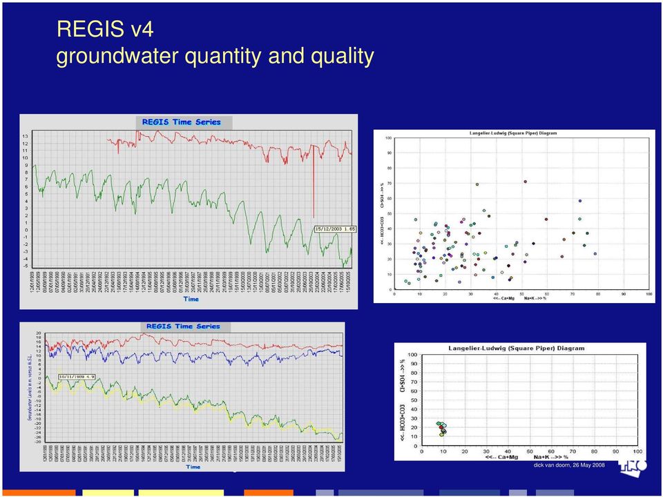
17 Hydrogeology layer model of Beijing plain viewed with 3d java viewer of REGIS v4

18 Results of the groundwater modeling The first aquifer The second aquifer The third aquifer The fourth aquifer The fifth aquifer

19 rediction model-water transfer From 2008 to 2020 Supply water 27 hundred million m 3 Build 14 water plants

20 Xinjiang pilot (pop. 4 million)
")
21 Databases and GIS-development Update of database in 2005 and 2006 Groundwater level data: 80 monitoring wells data from Jan to June 2006 => records in the database now! Groundwater quality data: 420 records of 46 monitoring wells. => records in the database now! Photos added: 70 monitoring wells
22 New well design in Urumqi
23 REGIS v4 S-12 S-17 W-11 W-17-2
24 Groundwater Model: results Simulation regional groundwater levels in North Plain, river valley and Chaiwopu basin
25 Scenarios and simulation methods Type 1 scenarios:model forecasts based on continuation of the existing water utilization The water utilization for 2006 is taken as a starting point Simulations of groundwater level changes for 4 years (up to 2010) and 9 years (up to 2015),and 14 years (up to 2020) and for wet years, normal years and dry years scenarios will be done Data collection:annual precipitation. Stress periods: 4,9 and 14, every stress period has 12 time steps
26 Type 5 scenarios:model forecasts based on the principle of sustainable development These scenarios are based on the combined annual import of 100 million cube of water from the north of Xinjinag and the closure of the Hegu well field (60% of total, equal to 8.85million cube ) and well fields in the North Plain (40% of total, equal to 100 million cube ) Increased irrigation return flows due to the import and decreased groundwater exploitation amounts will be applied to the model. Any changes in existing surface water supplies affecting groundwater have to be considered Groundwater modeling starting points, modeling periods, and wet, normal and dry years conditions are the same as for the Type 1 scenarios
27 Shandong pilot (inh. 3 million)
28 Analyzing the problems in the Jinan area
29 Genesis of Jinan springs Confluence discharge Cross-section showing formation course of Jinan springs Direct recharge (Cambrian limestone) Indirect recharge (Ordovician limestone) The consistency of strata dipping and topography inclination is the geologic and geomorphologic foundation for the formation of Jinan springs
30 GIS-development
31 3D GEOLOGY MODEL The wells Base on the geological and hydro-geological maps wells and data about physics-survey,more than 200 wells Advanced are input Tools in the in model Water Resources Management The cross-sections in the model area
32
33 Bottom Cambrian and the fault CROSS-SECTIONS GENERAL FROM THE 3D SOLID MODEL
34 Groundwater model
35 Groundwat er resource area Groundwat er resource area Springs area From this map we can know that when pumping water from the west groundwater resource area, it can affect the flow of springs Flow line near groundwater resource area Flow line near groundwater resource area and spring area
36 Management of the project: in China and the Netherlands Visit of project manager to three pilot areas and CIGEM, May- June 2004, including management course Visit of Chinese managers to the Netherlands, June 2004, July 2006 & July 2007 Visits to: Provinces of Zuid-Holland, Utrecht, Gelderland, Overijssel and Drenthe Waterboard of Stichtse Rijnlanden Watercompanies of Amsterdam, The Hague, Utrecht and prov. Drenthe Waterworks in the Netherlands UNESCO-IHE, TNO-NITG, Van Essen Instruments Belgium, France & Luxembourg
37 Steering Committee Meeting, 2005, Jinan & 2006, Urumqi
38 THANK YOU FOR YOUR ATTENTION.
GROUNDWATER CONDITIONS
 GROUNDWATER CONDITIONS IN THE NORTHERN SACRAMENTO VALLEY LOCAL MANAGEMENT OF WATER RESOURCES IN THE NORTHERN SACRAMENTO VALLEY MEETING DECEMBER 16, 2011 KELLY STATON, SENIOR ENGINEERING GEOLOGIST, GROUNDWATER
Hydrogeology Experiment on Surface-Groundwater Interactions: How Do Our Actions Affect Water Quantity and Quality?
 Name: Period: Hydrogeology Experiment on Surface-Groundwater Interactions: How Do Our Actions Affect Water Quantity and Quality? Purpose/Objective: Students will learn how groundcover influences surface
Applying MIKE SHE to define the influence of rewetting on floods in Flanders
 Applying MIKE SHE to define the influence of rewetting on floods in Flanders MARK HENRY RUBARENZYA 1, PATRICK WILLEMS 2, JEAN BERLAMONT 3, & JAN FEYEN 4 1,2,3 Hydraulics Laboratory, Department of Civil
Title: Guiding Models and Norm Study for Water Storage: A new way of thinking?
 Tools Title: Guiding Models and Norm Study for Water Storage: A new way of thinking? Keywords: Regional; communication; inundation; stakeholder engagement; water management; spatial planning Audience:
AZ EGER-PATAK HIDROLÓGIAI VIZSGÁLATA, A FELSZÍNI VÍZKÉSZLETEK VÁRHATÓ VÁLTOZÁSÁBÓL ADÓDÓ MÓDOSULÁSOK AZ ÉGHAJLATVÁLTOZÁS HATÁSÁRA
 AZ EGER-PATAK HIDROLÓGIAI VIZSGÁLATA, A FELSZÍNI VÍZKÉSZLETEK VÁRHATÓ VÁLTOZÁSÁBÓL ADÓDÓ MÓDOSULÁSOK AZ ÉGHAJLATVÁLTOZÁS HATÁSÁRA GÁBOR KEVE 1, GÉZA HAJNAL 2, KATALIN BENE 3, PÉTER TORMA 4 EXTRAPOLATING
Understanding Complex Models using Visualization: San Bernardino Valley Ground-water Basin, Southern California
 Understanding Complex Models using Visualization: San Bernardino Valley Ground-water Basin, Southern California Zhen Li and Wesley R. Danskin U.S. Geological Survey, zhenli@usgs.gov, wdanskin@usgs.gov,
The Horizon 2020 FREEWAT project: FREE and open source software tools for WATer management
 The Horizon 2020 FREEWAT project: FREE and open source software tools for WATer management Rudy Rossetto r.rossetto@sssup.it Joint International Workshop EU FP7 MARSOL and EU HORIZON 2020 FREEWAT projects
BRO: the Dutch Key Register of the Subsurface
 Fact sheet BRO: the Dutch Key Register of the Subsurface Data types explained January 2012 This BRO fact sheet, one of a series, is a publication of the Dutch Ministry of Infrastructure and the Environment.
Ground Water Surveys and Investigation
 Ground Water Surveys and Investigation By Gautam Mahajan ASHISH PUBLISHING HOUSE 8/81, PUNJABI BAGH, NEW DELHI-110 026 - Contents Preface List of Abbrivations (v) (vii) 1.1 1.2 1.3 1.4 1.5 1.6 1.7 1.7.1
3D stochastic modelling of litho-facies in The Netherlands
 3D stochastic modelling of litho-facies in The Netherlands Jan L. Gunnink, Jan Stafleu, Freek S. Busschers, Denise Maljers TNO Geological Survey of the Netherlands Contributions of: Armin Menkovic, Tamara
Advanced tools in water management in The Netherlands
 Advanced tools in water management in The Netherlands Modelling for system knowledge, effective operational management, and policy making Gé van den Eertwegh Rivierenland Water Board The Netherlands PR
WILLOCHRA BASIN GROUNDWATER STATUS REPORT 2009-10
 WILLOCHRA BASIN GROUNDWATER STATUS REPORT 2009-10 SUMMARY 2009-10 The Willochra Basin is situated in the southern Flinders Ranges in the Mid-North of South Australia, approximately 50 km east of Port Augusta
Physiography and nature monitoring in the Kampinoski National Park and its buffer zone
 Ecohydrol. Hydrobiol 3 (3), 247-253 2003 Physiography and nature monitoring in the Kampinoski National Park and its buffer zone Anna Andrzejewska Kampinoski National Park, Tetmajera 38, 05-080 Izabelin,
Satellite derived Groundwater Storage Es4mates and Opportuni4es for Expanding Research in Arid Environments
 Satellite derived Groundwater Storage Es4mates and Opportuni4es for Expanding Research in Arid Environments NASA Ames DEVELOP Program Summer 2011 Amber Kuss, San Francisco State University William Brandt,
Sustainable Groundwater Management for Tomorrow s Livelihoods
 Groundwater Resources and Management Sustainable Groundwater Management for Tomorrow s Livelihoods Strategies and Products Federal Institute for Geosciences and Natural Resources (BGR), Germany Commissioned
Increased understanding of the close interaction between surface waters
 A THREE-DIMENSIONAL PLEXI-GLASS MODEL OF THE HYDROGEOLOGY, HYDRO CHEMISTRY AND FLOW SYSTEMS IN THE COASTAL DUNES WITH ARTIFICIAL RECHARGE, CASTRICUM, NETHERLANDS G.B. Engelen Vrije Universiteit, Amsterdam,
GROUNDWATER BANKING AN AGRICULTURAL SYSTEMS APPROACH FOR WATER SECURITY IN CALIFORNIA
 GROUNDWATER BANKING AN AGRICULTURAL SYSTEMS APPROACH FOR WATER SECURITY IN CALIFORNIA Helen Dahlke Assistant Professor in Integrated Hydrologic Sciences LAWR, UC Davis FEBRUARY 13, 2015 EMAIL: hdahlke@ucdavis.edu
EU China River Basin Management Programme
 Ministry of Water Resources Ministry of Environmental Protection EU China River Basin Management Programme Technical Report 075 Water Resource Supply Security Strategy Analysis Ben Piper, Zhang Wang and
Indoor Water Conservation and I&I Reduction (EIR Alternatives 1 and 2)
") SECTION 2 Description of Master Plan Alternatives The six alternatives that constitute the building blocks of the IRWP Master Plan are as follows: Indoor Water Conservation (EIR Alternative 1) I&I Reduction
SECTION 2 Description of Master Plan Alternatives The six alternatives that constitute the building blocks of the IRWP Master Plan are as follows: Indoor Water Conservation (EIR Alternative 1) I&I Reduction
Software Development
 ARIDE Assessment of the Regional Impact of Droughts in Europe Report No. 12 Software Development December 2000 Institute of Hydrology, University of Freiburg Report No. 12 Software Development Siegfried
Water Recycles poster
 Water Recycles poster The "Water ReCycles" poster is designed for students of all ages. It shows the natural water cycle and humans influence on water resources. Raincloud illustration The raincloud in
How To Map A Lake In The North Of The Holland (Fiji)
") 1. Hydrogelogical mapping Jiri Sima Aim of HG map Groundwater and rocks qualitative permeability and quantitative potential of rock units aquifers / aquitards / aquiclides Water points (spatial distribution
1. Hydrogelogical mapping Jiri Sima Aim of HG map Groundwater and rocks qualitative permeability and quantitative potential of rock units aquifers / aquitards / aquiclides Water points (spatial distribution
Water Resources Development and Management in India - An Overview
 Water Resources Development and Management in India - An Overview A presentation by U. N. Panjiar Secretary to the Government of India This presentation Water resources scenario in India Water governance
Create Your Own Soil Profile Ac5vity
 Create Your Own Soil Profile Ac5vity Middle School: 5-8 Task Overview: Soil profile refers to layers of soil. A typical soil profile takes nearly 1,000 to 100,000 years to form. The formation of the soil
Groundwater exploration WATEX applications with Ground Penetrating Radars. Dr.Saud Amer USGS Dr.Alain Gachet Radar Technologies France
 Groundwater exploration WATEX applications with Ground Penetrating Radars Dr.Saud Amer USGS Dr.Alain Gachet Radar Technologies France GPR is a technology that allows rapid and non destructive collection
Geothermal. . To reduce the CO 2 emissions a lot of effort is put in the development of large scale application of sustainable energy.
 Geothermal Energy With increasing fossil fuel prices, geothermal energy is an attractive alternative energy source for district heating and industrial heating. In recent years the use of geothermal energy
Vulnerability Assessment
 Vulnerability Assessment VULNERABILITY As used in this report, vulnerability refers to the sensitivity of groundwater to contamination, and is determined by intrinsic characteristics of the aquifer. It
TEXAS: SAN ANTONIO San Antonio Protects Edwards Aquifer
 TEXAS: SAN ANTONIO San Antonio Protects Edwards Aquifer Background San Antonio, the seventh largest city in the United States, covers approximately 515 square miles of Bexar County in south central Texas.
Presentation from the 2013 World Water Week in Stockholm
 Presentation from the 2013 World Water Week in Stockholm www.worldwaterweek.org The Author(s), all rights reserved www.siwi.org Groundwater Resources Management Support Program Why is groundwater protection
STATE OF VERMONT AGENCY OF NATURAL RESOURCES DEPARTMENT OF ENVIRONMENTAL CONSERVATION WASTE MANAGEMENT DIVISION SOLID WASTE MANAGEMENT PROGRAM
 STATE OF VERMONT AGENCY OF NATURAL RESOURCES DEPARTMENT OF ENVIRONMENTAL CONSERVATION WASTE MANAGEMENT DIVISION SOLID WASTE MANAGEMENT PROGRAM Solid Waste Management Program Waste Management Division 103
Lars-Göran Gustafsson, DHI Water and Environment, Box 3287, S-350 53 Växjö, Sweden
 Alternative Drainage Schemes for Reduction of Inflow/Infiltration - Prediction and Follow-Up of Effects with the Aid of an Integrated Sewer/Aquifer Model Introduction Lars-Göran Gustafsson, DHI Water and
Course Plan Day 1: Introduction and Overview Hydrology & Fluvial Geomorphology Day 2: Fieldwork on the Braid Burn Alan Jones
 Course Plan Day 1: Introduction and Overview Hydrology & Fluvial Geomorphology Alan Jones E:mail: Alan.Jones@ed.ac.uk Water cycle Globally & Locally River shapes and forms River behaviour Closer look at
Development of Rural Drinking Water Security Plan A Case Study from Raipur Block, Bhilwara District, Rajasthan
 Development of Rural Drinking Water Security Plan A Case Study from Raipur Block, Bhilwara District, Rajasthan Dr. B. K. Bhadra Scientist/Engr. SF Regional Remote Sensing Centre (RRSC-W) NRSC/ISRO, Dept.
Proposed Construction of Basement Flood Risk Assessment. 35 Edwardes Square London W8 6HH
 Proposed Construction of Basement Flood Risk Assessment 35 Edwardes Square London W8 6HH 1 Introduction This FRA has been carried out in accordance with the National Planning Policy Statement (NPPF), the
Asia-Pacific Environmental Innovation Strategy (APEIS)
") Asia-Pacific Environmental Innovation Strategy (APEIS) Integrated Environmental Monitoring IEM) Dust Storm Over-cultivation Desertification Urbanization Floods Deforestation Masataka WATANABE, National
Asia-Pacific Environmental Innovation Strategy (APEIS) Integrated Environmental Monitoring IEM) Dust Storm Over-cultivation Desertification Urbanization Floods Deforestation Masataka WATANABE, National
CE394K GIS IN WATER RESOURCES TERM PROJECT REPORT
 CE394K GIS IN WATER RESOURCES TERM PROJECT REPORT Soil Water Balance in Southern California Cheng-Wei Yu Environmental and Water Resources Engineering Program Introduction Historical Drought Condition
< SUBSURFACE DAMS TO AUGMENT GROUNDWATER STORAGE IN BASEMENT TERRAIN FOR HUMAN SUBSISTENCE BRAZILIAN EXPERIENCE >
 CASE PROFILE COLLECTION No 5 < SUBSURFACE DAMS TO AUGMENT GROUNDWATER STORAGE IN BASEMENT TERRAIN FOR HUMAN SUBSISTENCE BRAZILIAN EXPERIENCE > Stephen Foster September 2002 TASK MANAGERS: Gabriel Azevedo
Guideline on: Groundwater monitoring for general reference purposes
 Guideline on: Groundwater monitoring for general reference purposes International Working Group I Utrecht June 2006 Revised March 2008 Report nr. GP 2008-1 Acknowledgements The publication of the Guideline
Climate change impacts on city of Gdansk and its vicinity (Vistula Delta, Poland)
") Final International ASTRA Conference Espoo, 10-11 December, 2007 Climate change impacts on city of Gdansk and its vicinity (Vistula Delta, Poland) Dorota Kaulbarsz, Zbigniew Kordalski, Wojciech Jeglinski
Final International ASTRA Conference Espoo, 10-11 December, 2007 Climate change impacts on city of Gdansk and its vicinity (Vistula Delta, Poland) Dorota Kaulbarsz, Zbigniew Kordalski, Wojciech Jeglinski
Tool for Regional scale assessment of groundwater Storage improvement in adaptation to climate change
 EUROPE-INBO 2012 10th International Conference Istanbul - Turkey, 17-19 October 2012 Tool for Regional scale assessment of groundwater Storage improvement in adaptation to climate change TRUST Team : Autorità
Water Quantity Trading & Banking: Concepts and Illustrations. Kurt Stephenson Dept. of Agricultural & Applied Economics October 15, 2015
 Water Quantity Trading & Banking: Concepts and Illustrations Kurt Stephenson Dept. of Agricultural & Applied Economics October 15, 2015 Groundwater Management Roles: Commonwealth and Users What GW goal
Monitoring at Credit Valley Conservation. Presented by Jackie Thomas and Luke Harvey
 Monitoring at Credit Valley Conservation Presented by Jackie Thomas and Luke Harvey Where are we? WHAT IS MONITORING? Long-term sampling of the same point or reach to track changes over time/space Short
The Alternatives of Flood Mitigation in The Downstream Area of Mun River Basin
 The Alternatives of Flood Mitigation in The Downstream Area of Mun River Basin Dr.Phattaporn Mekpruksawong 1, Thana Suwattana 2 and Narong Meepayoong 3 1 Senior Civil Engineer, Office of Project Management,
A Decision Support System (DSS) for Integrated Water Resources Management WEAP- MODFLOW DSS. K. Schelkes et al., BGR Hannover
 for Integrated Water Resources Management WEAP- MODFLOW DSS. K. Schelkes et al., BGR Hannover") A Decision Support System (DSS) for Integrated Water Resources Management WEAP- MODFLOW DSS K. Schelkes et al., BGR Hannover Outline Introduction WEAP Software developments Pilot study Zabadani Examples
A Decision Support System (DSS) for Integrated Water Resources Management WEAP- MODFLOW DSS K. Schelkes et al., BGR Hannover Outline Introduction WEAP Software developments Pilot study Zabadani Examples
ESSENTIAL COMPONENTS OF WATER-LEVEL MONITORING PROGRAMS. Selection of Observation Wells
 ESSENTIAL COMPONENTS OF WATER-LEVEL MONITORING PROGRAMS Before discussing the uses and importance of long-term water-level data, it is useful to review essential components of a water-level monitoring
Innovative Stormwater Solutions in Coastal Areas 2015 APWA Stormwater Conference
 Innovative Stormwater Solutions in Coastal Areas 2015 APWA Stormwater Conference September 15, 2015 Barrier Island Hydrology 2015 APWA Stormwater Conference September 15, 2015 2 Barrier Island Hydrology
GROUNDWATER MONITORING AND DATA MANAGEMENT IN THE MEDITERRANEAN REGION. Marrakech, May 2005
 GROUNDWATER MONITORING AND DATA MANAGEMENT IN THE MEDITERRANEAN REGION Marrakech, May 2005 WATER RESOURCES IN THE MEDITERRANEAN REGION Water resources are limited, fragile and threatened Different conditions
9.1. Adequacy of Available Data and Monitoring Efforts
 9. DATA MANAGEMENT Data management is a crucial aspect of successful implementation of the ARB IRWMP and its component projects. This section discusses the adequacy of available data and monitoring efforts,
Water Budgets and Climate Change Guidance, Web Application CC Training and Case Study
 Water Budgets and Climate Change Guidance, Web Application CC Training and Case Study OCCIAR and Northern Conservation Authorities March 26-27, 2012 Mike Garraway, MNR Centre of Excellence for Water Quantity
CLIMATE CHANGE AND NATURE,
 CLIMATE CHANGE AND NATURE, INTEGRATION OF SPATIAL POLICIES WITH A LAND USE MODEL Michiel van Eupen 1, Eveliene Steingröver 1, Sabine van Rooij 1 Eric Koomen 2 & Chris jacobs 2 Rotterdam 29 September 2010
Overview and highlights
 This country profile was compiled by the OECD Secretariat and reflects information available as of March 2015. Further information and analysis can be found in the publication: OECD (2015) Water Resources
Guideline for Stress Testing the Climate Resilience of Urban Areas
 Netherlands Ministry of Infrastructure and Environment Delta Programme Urban Development and Reconstruction Guideline for Stress Testing the Climate Resilience of Urban Areas Extended summary Version 1.0
MODULE GROUNDWATER MONITORING AND INFORMATION MANAGEMENT INTEGRATION OF GROUNDWATER MANAGEMENT INTO TRANSBOUNDARY BASIN ORGANIZATIONS IN AFRICA
 GROUNDWATER MONITORING AND INFORMATION MANAGEMENT 98 CONTENT MODULE MODULE.1 Introduction 100.2. Monitoring practice 103.3 Data storage and information management 108.4 Benefits and cost effectiveness
COMMENTS ON THE CADIZ CONSERVATION, RECOVERY, AND STORAGE PROJECT DRAFT ENVIRONMENTAL IMPACT REPORT
 March 13, 2012 Attn: Tom Barnes, ESA 626 Wilshire Boulevard, Ste. 1100 Los Angeles, CA 90017 Telephone: 213-599- 4300 Fax: 213-599- 4301 COMMENTS ON THE CADIZ CONSERVATION, RECOVERY, AND STORAGE PROJECT
Early SNMP Case Studies Salt and Nutrient Management Plans and Related Issues at Camp Pendleton MCB. Rob Beggs, Brown and Caldwell
 Early SNMP Case Studies Salt and Nutrient Management Plans and Related Issues at Camp Pendleton MCB Rob Beggs, Brown and Caldwell November 7, 2013 Water Sustainability for Camp Pendleton Camp Pendleton
Responding to the Challenges of Water Security: the VIII Phase of the International Hydrological Programme 2014-2021
 3rd UNECWAS Annual Seminar 21st of August, TUT Responding to the Challenges of Water Security: the VIII Phase of the International Hydrological Programme 2014-2021 Blanca Jimenez-Cisneros Director of the
Water Resources Review Committee
 Water Resources Review Committee Members of the Committee Representative Randy Fischer, Chair Senator Gail Schwartz, Vice-Chair Senator Greg Brophy Senator Mary Hodge Senator Matt Jones Senator Ellen Roberts
REFLECTION ON MANAGEMENT OF WATER RESOURCES. Guido Heijdra MSc MCM CMC Associate Professor Water and Environmental Management
 REFLECTION ON MANAGEMENT OF WATER RESOURCES Guido Heijdra MSc MCM CMC Associate Professor Water and Environmental Management 1 CONTENT 1. Introduction 2. Water cycle 3. Water usage 4. Water stress in urban
6 Chemicals from human settlements
 6 Chemicals from human settlements 6.1 Introduction The world is becoming increasingly urban, particularly in developing countries. The transition of people from rural areas to cities represents a major,
The Role of Groundwater in Alberta s Tight Water Supply Environment. Ken Baxter, M.Sc., P.Geol. Dan R. Brown, M.Sc., P.Geol.
 The Role of Groundwater in Alberta s Tight Water Supply Environment Ken Baxter, M.Sc., P.Geol. Dan R. Brown, M.Sc., P.Geol. The Role of Groundwater in Alberta s Tight Water Supply Environment Outline Importance
National Disaster Management Institute
 National Disaster Management Institute CONTENTS one Cause of Urban Flood Disaster two Urban Flood Damage Case three Disaster Prevention Measures for Future Urban Flood four NDMI s Measures & Strategy for
Review of Groundwater Vulnerability Assessment Methods Unsaturated Zone. Dept. of Earth Sciences University of the Western Cape
 Review of Groundwater Vulnerability Assessment Methods Unsaturated Zone Dept. of Earth Sciences University of the Western Cape Background Sililo et al. (2001) Groundwater contamination depends on: Intrinsic
Official Journal of the European Communities. (Acts whose publication is obligatory)
") 22.12.2000 L 327/1 I (Acts whose publication is obligatory) DIRECTIVE 2000/60/EC OF THE EUROPEAN PARLIAMT AND OF THE COUNCIL of 23 October 2000 establishing a framework for Community action in the field
22.12.2000 L 327/1 I (Acts whose publication is obligatory) DIRECTIVE 2000/60/EC OF THE EUROPEAN PARLIAMT AND OF THE COUNCIL of 23 October 2000 establishing a framework for Community action in the field
Building Resilient Infrastructure for the 21 st Century
 Building Resilient Infrastructure for the 21 st Century 1 Maria Mehranian Cordoba Corporation & Los Angeles Regional Water Quality Control Board October 19, 2014 24 th Annual Lake Arrowhead Symposium:
COMPREHENSIVE PLAN SECTION B, ELEMENT 4 WATER RESOURCES. April 20, 2010 EXHIBIT 1
 COMPREHENSIVE PLAN SECTION B, ELEMENT 4 WATER RESOURCES April 20, 2010 EXHIBIT 1 ELEMENT 4 WATER RESOURCES TABLE OF CONTENTS 4.1 INTRODUCTION 4.2 GOALS AND POLICIES 4.2.A General Goals and Policies 1 4.2.B
River Basin Management in Croatia
 River Basin Management in Croatia 2. INTERNATIONAL RIVER BASIN MANAGEMENT HIGH LEVEL SYMPOSIUM Cappadocia/NEVŞEHİR, Turkey 16-18 April 2013 2 Water sector responsibilities are shared among: Croatian Parliament
The Dutch Delta Approach
 Sweden Mission from Skane The Dutch Delta Approach Future proof flood risk management in the Netherlands Martien Beek Special advisor to Delta Program Commissioner 18 September 2013 1 The Netherlands exposure
Ruimtelijke planning in tijden van klimaatsverandering
 Ruimtelijke planning in tijden van klimaatsverandering Eric Koomen Vrije Universiteit Amsterdam/ Geodan Next Nascholingscursus Water, rivieren en GIS' 3 april 2008 Outline Climate change climate and land
The Use of Netafim Hydrocalc Program Version 2.21, for Designing Drip Irrigation Arrangements
 The Use of Netafim Hydrocalc Program Version 2.21, for Designing Drip Irrigation Arrangements IOANA ALINA COSTESCU, MIRCEA CONSTANTIN ORLESCU, RAREŞ HĂLBAC- COTOARĂ-ZAMFIR, EMANUEL HAŢEGAN, GEORGE NARCIS
GROUNDWATER DATA REQUIREMENT AND ANALYSIS
 GROUNDWATER DATA REQUIREMENT AND ANALYSIS C. P. Kumar National Institute of Hydrology Roorkee 1.0 INTRODUCTION Groundwater is used for a variety of purposes, including irrigation, drinking, and manufacturing.
Optimizing the hydraulic designing of pressurized irrigation network on the lands of village Era by using the computerized model WaterGems
 Optimizing the hydraulic designing of pressurized irrigation network on the lands of village Era by using the computerized model WaterGems Ali Ghadami Firouzabadi 1 and Majid Arabfard 2 1. Ali Ghadami
10/4/2012. 40 slide sample of Presentation. Key Principles to Current Stormwater Management
 40 slide sample of Presentation Please contact mhoalton@pacewater.com if you would like the complete presentation Key Principles to Current Stormwater Management Distributed Control Measures Integrated
Global Water Resources
 Global Water Resources Highlights from assessment activities over the past two decades, which are used to establish present and future water trends, reveal that: 1. Freshwater resources are unevenly distributed,
The SID&GRID GIS-integrated numerical hydrological model: applications and further development
 The SID&GRID GIS-integrated numerical hydrological model: applications and further development I. Borsi - TEA Sistemi SpA, Pisa, Italy R. Rossetto, E. Bonari - Land Lab, Scuola Superiore S.Anna di Pisa,
Groundwater Training Course SOPAC, April 2005. Electromagnetic (EM) Induction method for Groundwater Investigations
 Induction method for Groundwater Investigations") Groundwater Training Course SOPAC, April 2005 Electromagnetic (EM) Induction method for Groundwater Investigations Electromagnetic (EM) Induction Method Basic principle: An AC electric current is applied
Groundwater Training Course SOPAC, April 2005 Electromagnetic (EM) Induction method for Groundwater Investigations Electromagnetic (EM) Induction Method Basic principle: An AC electric current is applied
Optimization of water management for irrigation in Region of Murcia
 Optimization of water management for irrigation in Region of Murcia Mariano Soto (CRCC) District Level Oussama Mounzer (CEBAS-CSIC) Plot Level 2 nd MEDITERRANEAN WATER FORUM 3 rd Dutch Spanish Water Event:
The Potentials and Impacts of Water Harvesting Projects in Arid and Semi-Arid Regions (based on lessons learnt from some Implemented cases in Iran)
") The Potentials and Impacts of Water Harvesting Projects in Arid and Semi-Arid Regions (based on lessons learnt from some Implemented cases in Iran) Dr F. Sharifi Watershed Management and SCWM Institute,
The Potentials and Impacts of Water Harvesting Projects in Arid and Semi-Arid Regions (based on lessons learnt from some Implemented cases in Iran) Dr F. Sharifi Watershed Management and SCWM Institute,
Water Supply and Wells
 Re-issued under new categorization in August 2009 as Practice Note for Authorized Persons, Registered Structural Engineers and Registered Geotechnical Engineers APP-4 Buildings Department Practice Note
WATER AND DEVELOPMENT Vol. II - Types Of Environmental Models - R. A. Letcher and A. J. Jakeman
 TYPES OF ENVIRONMENTAL MODELS R. A. Letcher and A. J. Jakeman Centre for Resource and Environmental Studies, The Australian National University, Australia Keywords: environmental models, environmental
An Online School for Weather. www.srh.noaa.gov/jetstream/atmos/ll_whatacycle_aquifers.pdf
 JetStream An Online School for Weather Aquifers Aquifers Aquifers 1 3 5 Aquifers Aquifers Aquifers 2 4 6 /atmos/ll_whatacycle_aquifers.pdf There are over 35 lesson plans in the National Weather Service
Developments in Turkey in the Context of Participatory Approach Based on River Basin Management. Nermin ÇİÇEK, Özge Hande SAHTİYANCI
 Developments in Turkey in the Context of Participatory Approach Based on River Basin Management Nermin ÇİÇEK, Özge Hande SAHTİYANCI The Ministry of Forestry and Water Affairs, General Directorate of Water
BASIN MANAGEMENT OBJECTIVES ANGEL SLOUGH SUBINVENTORY UNIT. Butte County Water Advisory Committee Member Catherine Cottle
 BASIN MANAGEMENT OBJECTIVES ANGEL SLOUGH SUBINVENTORY UNIT Butte County Water Advisory Committee Member Catherine Cottle Contact Information Phone Number: 530-342-3620 Email Address: jncottle@gmail.com
Ground-Water-Level Monitoring and the Importance of Long-Term Water-Level Data U.S. Geological Survey Circular 1217
 Ground-Water-Level Monitoring and the Importance of Long-Term Water-Level Data U.S. Geological Survey Circular 1217 by Charles J. Taylor William M. Alley Denver, Colorado 2001 U.S. DEPARTMENT OF THE INTERIOR
Disposal of Municipal Wastewater Treatment Plant Effluent by Indirect Discharge to Surface Water via Groundwater or Hyporheic Water
 Disposal of Municipal Wastewater Treatment Plant Effluent by Indirect Discharge to Surface Water via Groundwater or Hyporheic Water Internal Management Directive September 2007 Table of Contents Introduction...1
4 th WORLD WATER FORUM. Risk Management in the Iullemeden Aquifer System. 4th World Water Forum, Mexico 2006
 4 th WORLD WATER FORUM Risk Management in the Iullemeden Aquifer System Mexico, Marsh 17 th, 2006 GEOGRAPHIC OVERVIEW IAS OVERVIEW Countries : Mali, Niger, Nigeria Mali Area : 525 000 km² Mali : 31000
APPENDIX G WATER SUPPLY ASSESSMENT
 APPENDIX G WATER SUPPLY ASSESSMENT THIS PAGE INTENTIONALLY LEFT BLANK February 2013 BLYTHE MESA SOLAR PROJECT Water Supply Assessment PREPARED BY: 731 East Ball Road, Suite 100 Anaheim, CA 92805 (714)
PRECIPITATION AND EVAPORATION
 PRECIPITATION AND EVAPORATION OBJECTIVES Use historical data to analyze relationships between precipitation, evaporation and stream flow in the San Antonio River Basin TOPICS Water cycle Precipitation
Ecosystem Approach as a Main Strategy for
 Urmia lake July 2011 1st International Conference for Urmia Lake Rescue 22 Nov. 2013 Berlin - Germany Ecosystem Approach as a Main Strategy for Urmia Lake Rescue Dr. Masoud Bagherzadeh Karimi Deputy Director
GEOLOGY AND GEOMORPHOLOGY Level. bachelor Semester. winter ECTS 9
 GEOLOGY AND GEOMORPHOLOGY ECTS 9 The subject includes knowledge of the construction of the Earth and the natural processes occurring deeply inside and on the surface of the Earth. It contains characteristics
A GIS BASED GROUNDWATER MANAGEMENT TOOL FOR LONG TERM MINERAL PLANNING
 A GIS BASED GROUNDWATER MANAGEMENT TOOL FOR LONG TERM MINERAL PLANNING Mauro Prado, Hydrogeologist - SRK Consulting, Perth, Australia Richard Connelly, Principal Hydrogeologist - SRK UK Ltd, Cardiff, United
Can GIS Help You Manage Water Resources? Erika Boghici Texas Natural Resources Information Systems
 Can GIS Help You Manage Water Resources? Erika Boghici Texas Natural Resources Information Systems Hydrologic Information System Hydrologic Modeling Arc Hydro Geodatabase Arc Hydro Data Model: combination
Funding for this project provided by Washington Department of Ecology Grants G1200126 & G0700149
 Funding for this project provided by Washington Department of Ecology Grants G1200126 & G0700149 Table of Contents Executive Summary.. 3 Introduction.. 4 Disaggregation of tive & Non-tive Water Use 5 Publicly
What is FRIEND -Water?
 What is FRIEND -Water? Water W REGIMES FROM INTERNATIONAL EXPERIMENTAL AND NETWOR IS AN INTERNATIONAL COLLABORATIVE NETWORK OF EXPERTS THAT AIMS TO GENERATE NEW UNDERSTANDING ABOUT REGIONAL HYDROLOGY AND
 1 2 A very short description of the functional center network: regarding the Hydraulic and Hydrogeological risk, the national alert system is ensured by the National Civil Protection Department (DPCN),
Groundwater Potential of Basement Aquifers in Part of Southwestern Nigeria
 American International Journal of Contemporary Research Vol. 3 No. 3; March 2013 Groundwater Potential of Basement Aquifers in Part of Southwestern Nigeria Yinusa Ayodele Asiwaju-Bello Department of Marine
NATIONAL GROUNDWATER MONITOR PROGRAMMES. Dr E van Wyk (Scientific Manager) N de Meillon (Pr.Sci.Nat.) Hydrological Services
 N de Meillon (Pr.Sci.Nat.) Hydrological Services") NATIONAL GROUNDWATER MONITOR PROGRAMMES Dr E van Wyk (Scientific Manager) N de Meillon (Pr.Sci.Nat.) Hydrological Services NATIONAL GROUNDWATER MONITOR PROGRAMME. Definition and Objectives. A programme
NATIONAL GROUNDWATER MONITOR PROGRAMMES Dr E van Wyk (Scientific Manager) N de Meillon (Pr.Sci.Nat.) Hydrological Services NATIONAL GROUNDWATER MONITOR PROGRAMME. Definition and Objectives. A programme
(http://www.molevalley.gov.uk/media/pdf/c/r/srfa_-_updated_jnauary_2012.pdf
 Possible Submission about Water and Flooding (See maps 3a and 3b) From Mole Valley Local Development Framework: Strategic Flood Risk Assessment Update 2012 (http://www.molevalley.gov.uk/media/pdf/c/r/srfa_-_updated_jnauary_2012.pdf
URBAN STORMWATER GUIDELINES AND BEST MANAGEMENT PRACTICES FOR PROTECTION OF FISH AND FISH HABITAT DRAFT DISCUSSION DOCUMENT
 URBAN STORMWATER GUIDELINES AND BEST MANAGEMENT PRACTICES FOR PROTECTION OF FISH AND FISH HABITAT DRAFT DISCUSSION DOCUMENT Contacts: Barry Chilibeck (666-3765) or Megan Sterling (666-2322) Revision 4
Hydrologic Engineering Techniques for Regional Water Resources Planning
 US Army Corps of Engineers Hydrologic Engineering Center Hydrologic Engineering Techniques for Regional Water Resources Planning October 1969 Approved for Public Release. Distribution Unlimited. TP-17
Storm water strategy of Turku City Citywater Storm water expert meeting 11.12.2014 Turku
 Storm water strategy of Turku City Citywater Storm water expert meeting 11.12.2014 Turku 17.12.2014 Olli-Pekka Mäki 1 Background of storm water strategy Strategy is based on Baltic Sea Challenge Action