If you haven t seen this city, you haven t seen the most beautiful one yet
|
|
|
- Linette Silvia Craig
- 8 years ago
- Views:
Transcription
1
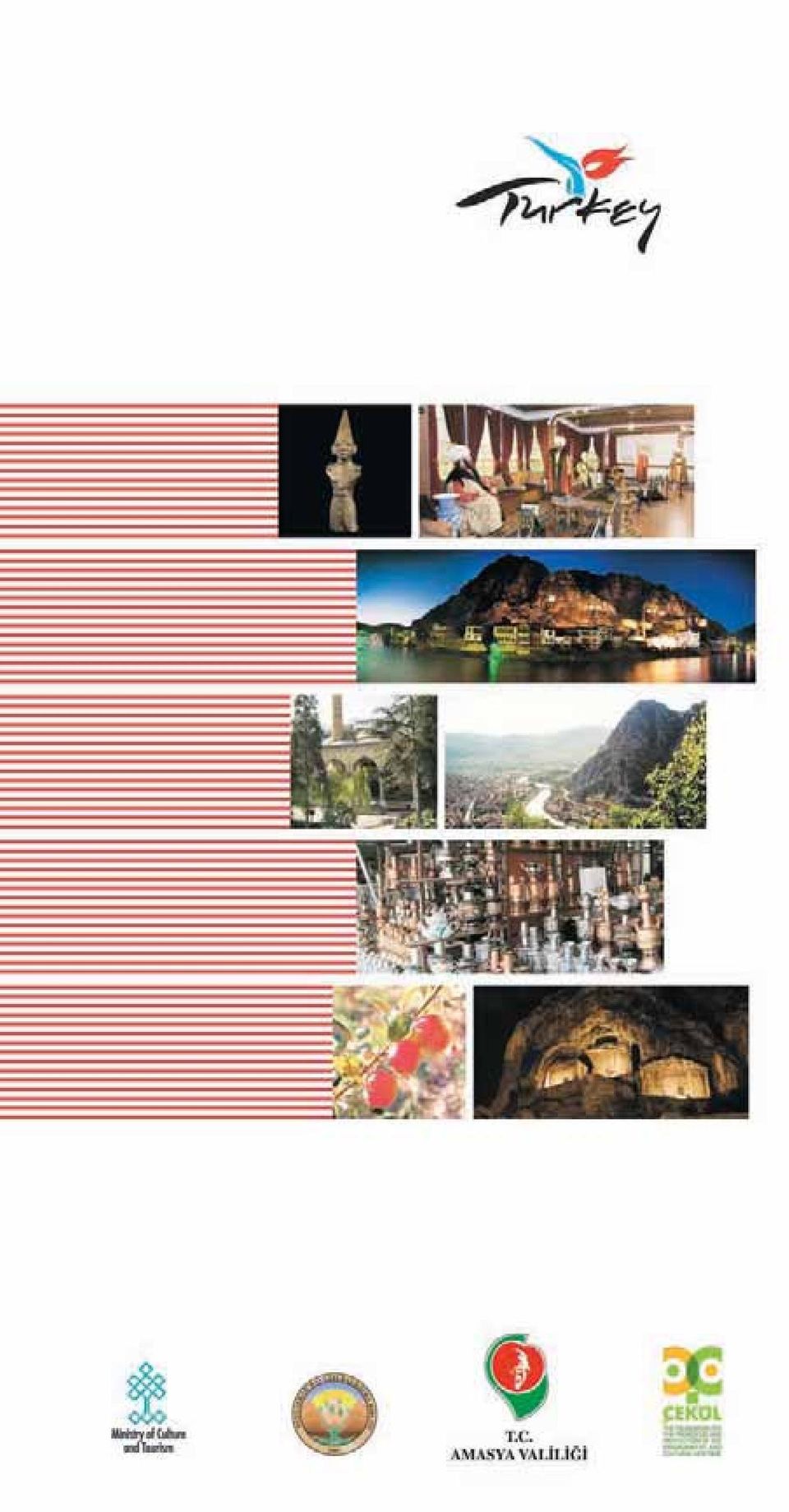
2 If you haven t seen this city, you haven t seen the most beautiful one yet

3

4 CONTENTS AMASYA: THE CITY OF SHAHZADEHS (Sultans Sons) HISTORY THE ORIGIN OF THE NAME AMASYA BRIF HISTORY OF AMASYA GEOGRAPHICAL CHARACTERISTICS AMASYA STEP BY STEP AMASYA KALES (CASTLE) HARfiENA KALES (FORT) KING ROCK TOMBS ENDERUN (THE CITADEL) - INTERIOR CASTLE ALÇAK KÖPRÜ (BRIDGE) KUNÇ KÖPRÜ (BRIDGE) MEYDAN / STASYON KÖPRÜSÜ (BRIDGE) ÇA LAYAN / LTEK N GAZ KÖPRÜSÜ (BRIDGE) TRADITIONAL DOMICIL ARCHITECTURE HAZERANLAR MANSION / ETNOGRAPHY MUSEUM fiehzadeler MUSEUM SARAYDÜZÜ MILITARY BARRACKS, NATIONAL WAR OF INDE- PENDENCE MUSEUM AND CONGRESS CENTER DARÜfifi FA / B MARHANE (HOSPITAL) BURMALI M NARE CAM (MOSQUE) BAYEZ D PAfiA CAM (MOSQUE) YÖRGÜÇ PAfiA CAM (MOSQUE) II. BAYEZ D KÜLL YES (ISLAMIC OTTOMAN SOCIAL COMPLEX) AZER LER / fi RVANLI CAM (MOSQUE) MEHMET PAfiA CAM (MOSQUE) Ç LEHANE CAM (MOSQUE) / P R LYAS ZAV YES (DERVISH LODGE) SARAÇHANE CAM (MOSQUE) SOFULAR CAM (MOSQUE) SULTAN BAYEZ D MEDRESES (MADRASAH) KÜÇÜK A A MEDRESES (MADRASAH) GÖK MEDRESE CAM (MOSQUE) BÜYÜK A A MEDRESES (MADRASAH) HAL FED GAZ TÜRBES (TOMB) HAMDULLAH EFEND TÜRBES (TOMB) P R SÜCAEDD N LYAS TÜRBES (TOMB) TORUMTAY TÜRBES (TOMB) AYfiE GAZ TÜRBES (TOMB) fi RVANLI SMA L TÜRBES (TOMB) CUMUDAR TÜRBES (TOMB) AMASYA BEDESTEN (BAZAAR) contents
 - INTERIOR CASTLE - - - - - - - - - - -48 ALÇAK KÖPRÜ (BRIDGE) - - - - - - - - - - - - - - - - - - - - - - - - - - - -50 KUNÇ KÖPRÜ (BRIDGE) - - - - - - - - - - - - - - - - - - - - - - - - -")
5 AMASYA TAfiHAN (INN) MUSTAFA BEY HAMAMI (HAMMAM) KUMACIK HAMAMI (HAMMAM) KALEKÖY KALES (CASTLE) AYNALI MA ARA (ROCK TOMB) FERHAT WATER CHANNEL ÇAKALLAR SEY R TERASI (PARK) YASSIÇAL SUNA I (ALTAR) EZ NE PAZAR HANI (INN) ÇAMLIK PROMENADE SARILIK PROMENADE UYGUR ÇAMLIGÖL PROMENADE YASSIÇAL / YAYLAGÖL PROMENADE KAYNAR LAKE AND PROMENADE TERZ KÖY KAPLICASI (THERMAL SPRINGS) GÖZLEK KAPLICASI (THERMAL SPRINGS) YASSIHÖYÜK (OLUZ MOUND) SULUOVA AfiITEPE MOUND KAPAKLI TOMBS AND PILGRIMAGE PLACES SULUOVA PLAIN DAM YED KIR (YED KU ULAR BIRD SANCTUARY) MERZ FON MERZ FON PLAIN ÇELEB MEHMET / MEDRESE ÖNÜ CAM (MOSQUE) SOFULAR CAM (MOSQUE) BOZACI CAM (MOSQUE) KARA MUSTAFA PAfiA CAM (MOSQUE) AB DE HATUN CAM (MOSQUE) P R BABA TÜRBES (TOMB) ÇELEB MEHMED MEDRESES (MADRASAH) AND THE CLOCK TOWER MERZ FON BEDESTEN (BAZAAR) MERZ FON TAfiHANI (INN) PAfiA HAMAMI (HAMMAM) GÖKOLUK GÜMÜfiHACIKÖY YÖRGÜÇ RÜSTEM PAfiA CAM (MOSQUE) KÖPRÜLÜ MEHMED PAfiA CAM (MOSQUE) MADEN CAM (MOSQUE) DARPHANE CAM (MOSQUE) HAL L YE MEDRESES (MADRASAH) contents CONTENTS
 - - - - - - - - - - - - - - - - - - - - - - - - - - - -75 ÇAMLIK PROMENADE - - - - - - - - - - - - - - - - - - - - - - - - - - - - - -75 SARILIK PROMENADE - - - - - - - - -")
6 CONTENTS GÜMÜfiHACIKÖY BEDESTEN (BAZAAR) THE MONASTERY GÜMÜfi PLAIN OMARCA fiarlayik HAMAMÖZÜ HAMAMÖZÜ THERMAL SPRINGS GÖYNÜCEK GÖKÇEL KALES (CASTLE) GÖYNÜCEK VALLEY ILISU KAPLICASI (THERMAL SPRING) TAfiOVA GEYDO AN BARAKLI KALES (CASTLE) THE MUSEUM OF ALPARSLAN MUNICIPALITY ULUKÖY S NAN PAfiA HAMAMI (HAMMAM) YUKARI BARAKLI ALACA KASE Z NDANI (DUNGEON) KAYABAfiI PLATEAU ARCHAELOGICAL SITE AND BARAKLI WATERFALL KIZGÜLDÜREN K L SES (CHURCH) ROMAN ROAD ESENÇAY TÜMÜLÜSLER (TUMULI) DÖRTYOL HAMAMI (HAMMAM) fieyh NURETT N ALPASLAN TÜRBES (TOMB) ERGÜNEfi BABA TÜRBES (TOMB) AMASYA LAKE BORABOY - AKDA NATIONAL PARK AKINO LU LAKE PROMENADE BELEV AKPINAR PROMENADE PROMENADES TRADITIONAL CULTURE HANDICRAFTS TRADITIONAL ATTIRE TRADITIONAL CUISINE TRADITIONAL FOLK DANCES VERBAL CULTURE CHRONOLOGY BIBLIOGRAPHY GENERAL INFORMATION MAPS contents
 - - - - - - - - - - - - - - - - - - - - - - - - - -102 GÖYNÜCEK VALLEY - - - - - - - - - - - - - - - - - - - - - - - - - - - - - -")
7

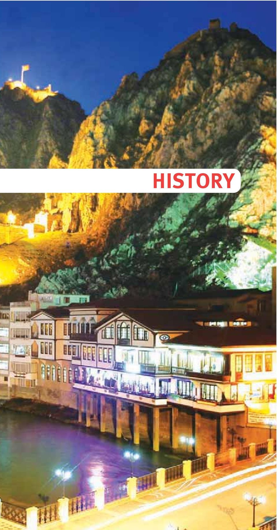
8 King Rock Tombs and Yal boyu Houses

9 Amasya; the Mysterious City of the Crown Amasya, is one of the most beautiful and special cities in the world with its history of 7500 years, immeasurable historical and cultural treasures, fascinating geography formed by Yeflil rmak River and Harflena Mountain, and graceful people. And it is a true museum city. The city which challenged Rome with Mithridates Eupator, maintained unity of Turks with Çelebi Mehmet, became a myth with its Ferhat and fiirin legend, is world famous with its Misket Elma (apple cultivated in Amasya), ruled the Ottoman Empire with its great princes (sons of sultans) who became sultans, layed the foundation of Republic of Turkey with Mustafa Kemal Atatürk. Amasya is a city that keeps history alive by living through it. Amasya is the city of Strabo, the first and most famous geographer in the world, of Mihrî Hatun the first female Divan poet, of Sabuncuo lu fierefeddin the great Ottoman surgeon, of fieyh Hamdullah the master of calligraphers. Amasya, the city of mysteries not imaginable without seeing, not perceivable without touching. From whichever way you enter Amasya, the magnificient Harflena Castle will greet you first. The King Rock Tombs of the Hellenistic Era at the piedmont of Harflena Mountain where Harflena Castle is situated and other historical monuments and natural beauties at each of your step will take you back in history, will fascinate you. You will be able to touch the steep cliffs and will fearlessly watch the city over them. You will realize that you are in the most interesting city in the world and you will feel sorry to have come here so late. A few hours will not be enough to walk around the city. You will not believe that there is so much history in this small region. If you spare little time for this city, what you will see will be less than what you won t. Besides the historical richness, you can do activities like hiking alongside Lake Boraboy and picnicking in the pine forests. You can take a break at Terziköy and Gözlek thermal springs and get some healing with the sulphurous thermal water. This booklet is only a little guide for you. You will find a lot more in Amasya than what you see in this guide. I would like to thank to everyone who contributed efforts in the preparation of this booklet, I believe, will be important and useful for the promotion of Amasya, a museum with its historical texture and a painting with its nature. Halil brahim DAfiÖZ Governor of Amasya
, ruled the Ottoman Empire with its great princes (sons of sultans) who became sultans, layed the foundation of Republic of Turkey with Mustafa Kemal Atatürk.")
10

11 HISTORY
12 12 A view from Amasya If one day a study like The Album of Cities Famous with their Extraordinary People is to be made, rest assured Amasya will take its place on the first pages of this album. Since the people who were to be the rulers of Ottoman Empire were related to this city, the title of the city was City of Shahzadehs. On the other hand Amasya is the territory of Baba lyas who was the leader of the insurgency of Babailer that shook the sovereignty of Seljuks to its foundations. Strabo, whose works that could be discovered were translated to almost all languages on earth, was a fellow citizen of Ferhat and fiirin who were the heroes of a love legend that was, unlike many love images, associated with labor, city life, functionality and vitality. This city is in the middle part of Black Sea Region but since it has no coast on the sea, it carries the climate and living culture characteristics of Central Anatolia Region rather history than a coastal city. Amasya is surrounded by Tokat to the east and south, by Yozgat to the south, by Çorum to the west and by Samsun to the north. The surface area of the city is 5701 km 2. The overall altitude of the city is 1150 m and of the city center is m. The world famous geography writer Strabo describes his town like this: Strabo My city; it is located on a wide and deep valley through which the Iris (Yeflil rmak River) flows. Human labour provides this place with a feature of being both a city and a citadel in the best way. Because, this place is very high and rocky, goes down the river upright. On the spot where the city is located around the river is a wall in addition to the walls extending up the steep hills on the two banks of the river. There are two of these hills and they rise like a splendid tower. Both the palaces and the monumental tombs of the kings are in this place.

13 Although Amaseia (Amasya) is a province now, it once belonged to kings... Strabo also said, What can be imagined can never be destroyed. Amasya and its surroundings have a rich geological structure with different rock groups that were formed in different geological periods. The rocks observed in the region were formed about 430 millions years ago. Amasya is situated on the massif of Tokat, the east extention of a landmass called Sakarya Continent and that is bordered by Çank r basin to the west, the edge of Neotetis Ocean to the south, and North Anatolian Fault to the north. This truely splendid geographical region is part of a mountain chain called Pontids that lie all along Black Sea. Mountains are a significant characteristic of Amasya where the main distributaries of Yeflil rmak River gather. The mountains that cover nearly 54% of the city are not very high but cause the geographers and geologists to call the terrain rough. Akda Mountain, Tavflan Mountain, Sakarat Mountain, negöl Mountain are among the important ones. The mountains and rivers give Amasya a sweet and tough wilderness and awaken feelings of exploring. Amasya has a bumpy terrain but its plains are fruitful and rich in terms of both agricultural production and living culture. A view from Amasya 13 history

14 14 Yal boyu Houses A view from Amasya THE ORIGIN OF THE NAME AMASYA As stated in the Hittite written sources, the oldest sources, Amasya was called as Hakmifl [Khakm(p)is] until the conquest of Persians. Today, the hill where Amasya Castle is called Harflena Mountain and the castle is called Harflena Castle. It is thought that the name HARfiUWANA-ARfiUAWA- WARfiAMA on the Hittite tablets is the old name of Harflena Castle and it means blessed city of rivers. The city was referred to as Amasseia during the period of Mithridates Kingdom. The name of the city is first seen as AMA E - A on the Amasya City coins that were minted in 2nd century B.C. In some sources the name Amaseia was interpreted as the city of Mother Goddess Ma based on the thought that it is related to Ama and its variant Ma which refer to Mother Goddess. This goddess was an history

15 eastern origin goddess that was worshipped after Anatolia s conquest by Persians. During the Roman period the name Amaseia did not change much and was used as AMACIAC (Amasia). This name is seen on the city coins that were minted during the periods of Roman Emperors Septimus Severus, Caracalla and Severus Alexander. During the Byzantine period the name was kept as Amasia ; slightly changed to Amasiyye and fiehr-i Haraflna (Hareflna City) during Danishmend period and reached our day as Amasya without changing throughout the periods of Seljuks, Ilkhanids, seigniories and Ottomans. BRIF HISTORY OF AMASYA Amasya is a city situated nearby the water in the middle of a valley among high mountain chains through which Iris River runs curling towards east. The passages that Yeflil rmak formed in the deep valleys had been the routes of trade caravans throughout thousands of years. This strategic location on the crossroads connecting Central and East Anatolia to Black Sea had caused the formation of many settlements since the early times. Yeflil rmak had been a life source, the water of vitality for these civilizations. Chalcolithic Age The earthenware, finds and architectural traces found in the mounds in Amasya show that the history of the city goes back to the Chalcolithic Age ( B.C.) Ovasaray Village, Hamam Hill Mound, Sar mefle Kümbet Mound, Kefllik Mound, Ayval p nar Mound; Devret Mound in Kanatp nar Village and Yo urtçu Baba Mounds in Deveci Village in Sulup nar have significant data from Chalcolithic Age in Amasya. Early Bronze Age and Mid-Bronze Age It is known that there were many settlements in Amasya history 15

16 Amasya Clock Tower and Amasya Castle

17 Axes, Early Bronze Age in the Early Bronze Age ( B.C.). Some of the settlements from this period are; Yass Mound (Oluz Mound) in the central Distrcit, Sallar Mound in Gümüflhac köy, Dericik Hill in Hayrettin Village in Merzifon, Kayadüzü Mound that is close to the city center, Gediksaray Mound in Göynücek district, Türkmenlik Hill Mound in Alakad Village. Mahmatlar Mound is an important settlement in Amasya which is inside the borders of the powerful civilization, known as Hatti Country in the written sources of Mesopotamia, founded in Anatolia in the Middle Bronze Age ( B.C.) when Seal, Early Bronze Age A view from Amasya Anatolia first met with writing. The Mahmatlar Treasure found in the mound about 2 km east of Mahmatlar Village of Amasya City Center are the most important findings. First big state of Anatolia, the Hittite was founded by Hattusili I in 1650 B.C. Amasya, was inside the borders of the Upper Country of the Hittite State. One of the important settlement areas of the Hittites in Amasya is Do antepe (Zara) of Amasya s central district. The bronze sculpture of Teshub the Hittite God of Storm found in this town and dated B.C. is a unique Hittite masterpiece and is exhibited in Amasya Museum today. Pot, Early Bronze Age 17 history

18 Teshub Statuette, Hittite Period

19 The Phrygians, The Cimmerians, The Scythians Arrow Heads, Scythian Period A view from Amasya After a period of more than 400 years, known as Dark Age which started by the ending of the Hittite civilization in 1190 B.C. as a result of many years of drought and the attacks of the Gasgan warrior tribes, Phrygians took control of the region. Becoming a political power after 750 B.C., the Phrygians expanded their borders during the period of King Midas ( B.C.). The Cimmerians coming from Caucasus in 676 B.C. caused the destruction of Phrygians. The Cimmerians ruling in the Black Sea Region, took over Amasya, too. The war tools that were found in a cairn in mirler Village in Gümüflhac - köy district and are exhibited in Amasya Museum today important artifacts of the Scythian period. In Anatolian history Cimmerians and Scythians are on the same stage. Generally, Scythians had lived on the settlements of Cimmerians. In this case we see Scythians after Cimmerians on the history stage in Anatolia. The Medes, The Persians By the end of the war between two Anatolian states, Lydia and Medes, Amasya went under the rule of Medes. After the short Medes rule, Amasya went under Persian rule in B.C. Amasya remained inside the borders of Cappadocia Province under Rython, Phrygian Period 19 history

20 Gryphon, Roman Period
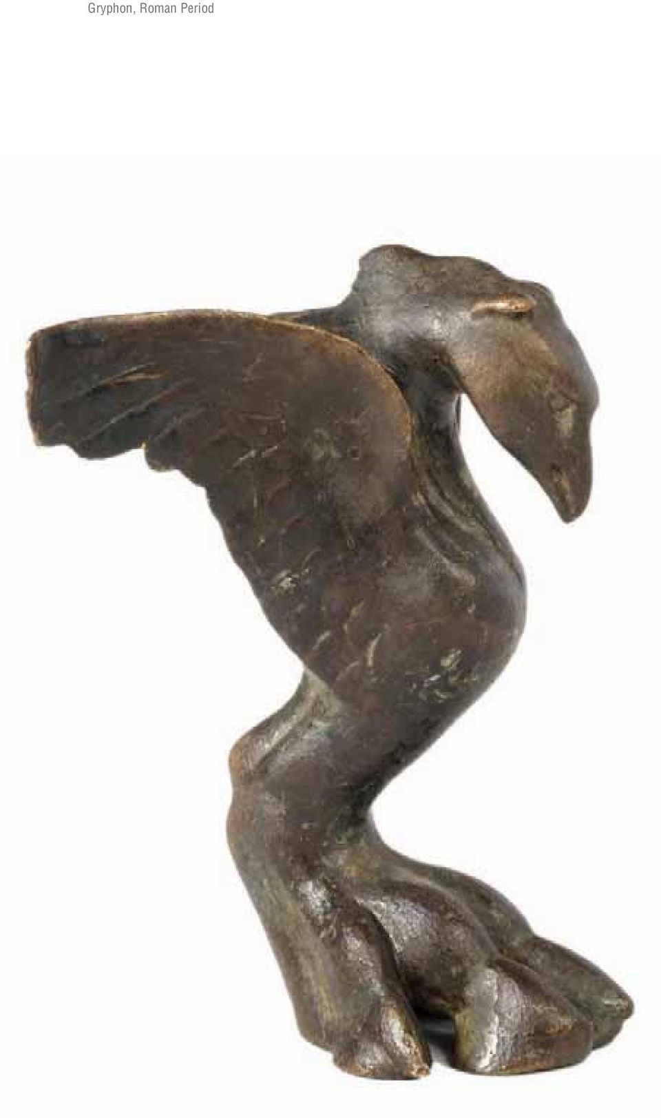
21 A view from Amasya Persian rule for about 250 years. When the Persians were defeated by Alexander the Great in 333 B.C., a large part of Anatolia went under the rule Macedonia Kingdom. After the death of Alexander the Great the unity of the empire could not be kept and it was divided into various kingdoms. In the meantime, in 301 BC, Mithridates Ctistes the Persian founded Mithridates Kingdom and made Amasya his capital city. The city became a cultural center after the developing and improving activities during Mithridates Eupator period. The good relations with Rome were damaged during the time of Mithridates Eupator and the Mithridates Wars started. The Roman general Pompeius ended the Mithridates Kingdom and Amasya went under Roman rule. The Roman Empire and The Byzantine Era The Parthians who have invaded Anatolia upto Karia Region were expelled from Anatolia after being defeated by Roman soldiers. After this incident Emperor Antonius came to Anatolia and founded small kingdoms among Parthians and his own lands. This way the area of Mithridates Kingdom that Amasya was also included in was given to Darius. Throughout the Roman Era it stayed under the rule of Polemon I, Lycomedes, Dieotoros, Polemon II, vassal kings and Queen Pythodoris. Stele, Roman Period history 21
22 Amasya King Rock Tombs
23 Golden Earing, Roman Period Bull Figurine, Roman Period A province during the Roman Empire, Amasya was at the same time the center of the interprovincial road system. For instance the Galatia and Cappadocia roads end in Amasya. Amasya City coins had been minted from Emperor Domitianus period (81-96 A.D.) till Severus Alexander period ( A.D.). Many of these coins are exhibited in the coins section in Amasya Museum. Amasya became the religious and administrative center of Diospontus after Emperor Diocletianus, and Haniballus became the king of the region in Terracotta, Roman Period Golden Ring, Roman Period 335 A.D. When the Roman Empire was devided into two in 395 A.D. Amasya remained within the borders of East Roman Empire (Byzantium). As of 8th century A.D. it became the center of the 11th brigade of military provinces (themes) of Byzantium. Esençay Trove, Byzantine Period 23 history
24 Gök Madrasah
25 The city was under invasion by Pechenegs and Cumans for a short time. Sasanians and Umayyads also ruled the city for short periods. The Anatolian Seljuks and The Era of Principalities The Great Seljuk Army started attacks towards the inlands of Anatolia after the 1071 Malazgirt War. As a result of these attacks independent principalities were established. Amasya and its surroundings were conquered by Danishmends and the region went under Turkish rule. After Danishmends, the Seljukian Sultan K l ç Arslan II captured Amasya and its surroundings in 1175 and the area went under Seljuk rule. The Mongols and the Eretna State Seljuk Empire was defeated by Mongolians in the battle of Köseda in 1243 and Anatolia went under Mongolian rule. Mongolians settled in Central Anatolia including Amasya Ça layan Bridge and they influenced these regions. When Sultan Alâeddin Eretna declared his independence, he founded the Eretna State and Amasya went under the rule of Eretna State in The state lost authority after Sultan Eretna. In 1360 Hac fiadgeldi Pafla founded an independent principality in Amasya and after his death in 1381 his son Fahreddin Ahmed Bey was appointed as the Director of Amasya. Fahreddin Ahmet Bey, offered to give Amasya to Ottomans in exchange for another district. Ottoman Era In the Ottoman Era, after the first half of the 15th century, Amasya is the county that the shahzadehs served and also the center of the Eyalet-i Rum (Rum Province). When Ottoman unity fell apart after the defeat of Ottomans in the Ankara War between Y ld r m Bayezid and Timur in 1402, Çelebi Sultan Mehmet took refuge in Amasya, and provided the Ottoman unity with the forces history 25
26 King Rock Tombs, Amasya Castle,
27 he gathered from Amasya and its surroundings. In the period when Yörgüç Pafla was the Beylerbeyi (governor the general) ( ); Amasya was a state consisting of the counties of Sivas, Tokat, Çorum and Samsun. Amasya was called as Vilayet-i Rum at that time. Amasya lived its golden age in the 15th and 16th centuries during the Ottoman Era and raised very important scientists, artists, poets and famous persons. The famous medical doctor and surgeon Sabuncuzade fierefeddin, historian Afl k Pafla, Yakut-i Mustasimi, one of the calligraphers that created Amasya Ecole in Ottoman calligraphy, fieyh Hamdullah known as the master of calligraphers, calligrapher and poet Tacizade Cafer Çelebi, Fatih Sultan Mehmed s teacher Akflemseddin, Zembilli Ali Efendi, Mihri Hatun the first Ottoman female poet with a divan (book of collected poems) and another female poet Zeynep Hatun. One of the important events that occured in Amasya during the Ottoman Era is the Geneological Table, Ottoman Period social events known as Celali Insurgencies in history. During this period when Amasya went through huge chaos, the Celali groups rather moved around Yeflil rmak Basin in the 16th century. Amasya also hosted a historical treaty during the Ottoman Era: this treaty that was done in 1555 and called as Amasya Treaty was the first treaty done with the Iranian - Safavi Dynasty. At this time Sultan Süleyman the Magnificient used to reside in Amasya. Ottoman sultans used the sanjak of Amasya as their winter residing place when they launched expeditions to east. Since Yavuz Sultan Selim and Murad II who were shahzadehs that shaped Ottoman history were born in Amasya, and since others were born and served here Amasya was called as City of Shahzadehs. Among these shahzadehs are; Y ld r m Bayezid, Mehmed I, Murad II, Fatih Sultan Mehmed, Shahzadeh Alâeddin, Bayezid II, Shahzadeh Ahmed, Shahzadeh Murad, Shahzadeh Mustafa, Shahzadeh Bayezid, Mu- history 27
28 Wood Globe, Ottoman Period
29 rad III who later became sultans. Therefore this city is also the City of Sultans. Manuscript and Inkstand, Ottoman Period Republican Era The first stage of the War of Independence, that started in May 19, 1919 in Samsun continued by the arrival of Mustafa Kemal to Amasya. The preparations of the plans of the War of Independence and the resolutions of the Erzurum and Sivas congresses were all done in Amasya. With the resolutions in the Amasya Memorandum upon the meetings held in Saraydüzü Military Barracks on June 22, 1919 the War of Independence was started here. So Amasya has been the first location that the first important step in the founding of Republic of Turkey was taken. 29 Manuscript, Ottoman Period history
30 Atatürk Monument
31 Saraydüzü Military Barracks, National War of Independence Museum and Congress Center Amasya Memorandum (June 22, 1919) 1- The unity of the country and the independence of the nation is under threat. 2- The Government in stanbul is not fulfilling the requirements of the responsibilities undertaken. 3- The independence of the nation will be saved by again the nation s perseverance and determination. 4- A national committee free of any control or supression will be assembled to speak out the rights of the nation and to put into action the requirements of the status and the conditions that the nation is in. 5- A national congress will be held in Sivas which is the safest place of Anatolia in any way. 6- Three representatives trusted by the people from each district of every province will participate in the congress. 7- A congress for the Eastern provinces will be held in Erzurum on July 23. If the representatives of the other provinces can come to Sivas until that date then the members of the Erzurum Congress will also set out to participate in the General Congress in Sivas. Atatürk Monument history 31
32
33 GEOGRAPHICAL CHARACTERISTICS
34 Akda Mountain
35 Canik Mountains, lie from K z - l rmak River through Yeflil rmak River and Kelkit Creek and Black Sea to Melet River. Inside Amasya borders Çal ca Hill at m is the highest point of the mountain whose highest altitude is m. Karaömer Mountain is between Tersakan Creek and Destek Creek and Akda Mountain. North Anatolian Fault Line is the border with Canik Mountains. The highest point is Karaömer Hill at 1979 m. Akda Mountain is surrounded by Yeflil rmak River from the south, fieyhsuyu Creek and Kocaalan Creek from the north. The highest point is Akda Hill at m. Sakarat Mountain starting from Amasya Ferhataras Valley reaches Köse Mountain through Yeflil rmak River and Kelkit Creek.The highest point is Cami Hill at 1956 m. negöl Mountain is surrounded by Lake Boraboy, Taflova Kavflak Creek to the north, Hamamözü Creek to the south, K z l rmak River to the west, and Gümüfl Plain to the east. The highest altitude is negöl Hill at 1873 m. Tavflan (Taflan) Mountain is surrounded by Merzifon Plain, K z l rmak River and Kuzçay. The highest point is Yuval Hill at 1901 m. This variety in height identifies Amasya in many ways such as settlement, transportation and climate. When you enter the city center you are fascinated but you do not understand how; the air, the wind, the center that the human and vehicle traffic runs through all make you feel that you are in a water city. This water is Yeflil rmak River, ancient Iris... Like it happened to many civilizations and to modern cities, Yeflil rmak River is one of the main elements that give Amasya its characteristic. 35 geographical characteristics
36 Lake Boraboy
37 Flowing towards west starting at Köse Mountains where it springs out, Yeflil rmak River leads towards north after passing through Tokat and Turhal Crocus plains, opens out to Çarflamba Plain between Topuzlu and E rikaz k Mountains after cutting through Canik Mountains. Making a wide delta within 37 Amasya is very rich in terms of ethnobotany and in species. It is also one of the leading cities in the region in terms of various ways in which these plants are used. For example, such plants as thyme, wild sage, dyers bugloss, parsley, mistletoe, hibiscus, rowanberry, corn, water fern, caltrop, rowan, balm, barberry, linseed, quince, ramson, wild pear, sugar beet, jujube, nettle, juniper, wild sweet melon, xanthium, calendula, cock s foot, some of which are endemic to Amasya, amount to as many FLORA as a hundred sub-species, used mainly for healing purposes. Most of these plants still exist and can be used. Many plants wild pear, rowan, wild sweet melon, sugar beet, dyers bugloss among them are an indispensable part of the local cuisine. People of Amasya use these plants not only as food and medicine, but also to produce medicine against animal ailments; sumac, coriander, peach, wild apple, cabbage, wild clover, thyme and many other plant species serve to this purpose. geographical characteristics
38 38 Crocus this plain Yeflil rmak reaches the sea at Cape of Çatl. Yeflil rmak Basin is in the area right behind Karadeniz mountain chain and its south part is an extention of Central Anatolia Plain. The narrowest part of the Basin is around Koyulhisar at 30.5 km; the widest part is around Ladik - Zile - Akde ir- FAUNA As far as wild life in Amasya is concerned, the first thing that comes to mind is the rock partridge. Wild life protection areas where both the rock partridge and many other animal and plant species are protected can be listed as follows: K z lca, Emine P nar, Zovall P nar, and Sö ütlüp - nar Mevkii in the central district; and Terzihaham, Kam fll dere S rt, Mefleliçiftlik farm, Emine P nar Mevkii to the west of this area. In addition, Ziyaret Beldesi close to the city centre is worth mentioning. When we take Radar Mevkii as our starting point, areas within Gümüflhac köy and in Merzifon include Sivri Tepe, Hasankoca Tepe, Bayrak, K rm z, K rt ll and Kabalakl hills in the north, as well as Derbas and Harmanc k plains, and Dipalan K fllas. In Gümüflhac köy, wild life population shows intensity around Çetmi-Keçiköy, whereas a similar intensity is observed Gerdo an in Taflova. Aksungur and its surrounding regions are also worth mentioning. In Görnücek, wide life under protection displays higher concentrations in the region where mineral waters abound. geographical characteristics
39 39 A view from Amasya menli at 170 km. Yeflil rmak and its distributaries Çekerek River, Tersakan Creek and Kelkit Creek basins make up a km 2 area in Yeflil rmak Basin. Whichever bank of Yeflil rmak you are at, especially in winter and spring months when it makes the city extraordinary with its crazy flow, you will be looking at a magnificient castle and a rock tower across not smaller than the castle. Climate Since the mountains are parallel in Amasya the atmosphere affects the horizontal and vertical distribution of climate elements partially by affecting the air masses. Since Yeflil rmak Valley runs north to south the winds mostly blow through this valley. The average temperature is over 22 º C in the lower sections of Amasya while it is below 18 ºC in the higher sections. Therefore the cooler sections are limited to the higher parts of mountain areas while the average temperature is over 20 ºC in more than half of the city. Among the average annual rain fall by season, spring has the highest rate. The lowest rate of rain fall is in summer. geographical characteristics
40
41 AMASYA STEP BY STEP
42 42 Amasya Castle AMASYA KALES (CASTLE) The Castle on Harflena Mountain which is in north of the city, is 262 m high from Yeflil rmak. It is also known as the Harflena Castle as it s on Harflena Mountain. It was built by Turkish ruler Karsan Khan according to the Arabic historians and by Mithridates, the Black Sea Cappadocia King according to the western historians. However, the findings show that the castle have continuously been inhabited since Early Bronze Age. It was restorated in 135 BC during Emperor Hadrianus Period in Roman Period and in during Emperor Justinianus Period time in the Byzantium period. It was restorated again by Danishmend Ahmet Gazi after 1075, by Mesud I in 1146, by Seljukian sultan Alâeddin Keykubad I in 1222, by Tacettin Mahmud Çelebi of Gümüfllü in 1319, by fiadgeldi Pafla in 1369 and during the Ottoman Era by Murad II in 1419, by Mustafa Bey the Ameer of Shahzadeh Ahmet in 1511, by Ali Bey the city center son of Hoca Ahmed in Evliya Çelebi who came to Amasya in 1645 wrote about Harflena Castle: The castle has a pentagon shape with rock gussets. It is a substantial one like Ferhat s work. It has fortyone towers and eight hundred walls. Inside, there are old style palaces, armories, supply storages, cisterns, and waterways going down to Tozanl River. The castle is full of caves underneath. Amasya Castle today consists of three parts. Harflena Fort covering the area where the flag tower and cannon towers are, K zlar Saray (Palace) where the rock tombs are and the area from below the railway upto the walls near Yeflil rmak, called Hatuniye District aka Inner City (Citadel of Enderun). The terraces in the area between the K zlar Saray and the outer walls near Yeflil rmak are mounds which preserved the ruins from Bronze Age, Collonial Age, Hittite, Phrygian, Persian Periods, Hellenistic Era-King Mithridates Period, Roman and Byzan-
43 tium periods, Seljuk and Ottoman periods. HARfiENA KALES (FORT) It forms the summit of the castle and consists of the porch entered through the original gate which is still used today, the area where the cannon tower is and the main tower with the flagpole. Discovered in this area are; the walls on the main tower made in the Hellenistic Age, the ruins of kitchen and supply storages of soldiers from the Ottoman era (discovered in archaeological excavations of 2007), rectangular cisterns used in Seljuk period, the oval cistern made of 11 m deep rubble stone mortar with the inner and outer surfaces covered with thick plaster which was used in the Roman Era and the site with large ashlar stones with Hellenistic Era bossages. It was found out that in this region the rain and snow waters flowing down the roofs of the military buildings were filled in the cisterns inside the soil under the buildings Amasya Castle via earthenware pipes. It is understood that the drinking water of the soldiers of the Harflena Castle were supplied from these cisterns. The building known as Cilanbolu Tunnel among the people was cleaned and brought out to light in the excavations done in Cilanbolu Tunnel thought to have been built in the Amasya Castle Cilanbolu Tunnel city center 43
44 44 Cilanbolu Water Tunnel 4th century B.C. is inside the ruins of the tower in the middle section of the Harflena Fort and was excavated 181 m long and 4 m wide by 3,90 m high inside the main rock with its bottom having 364 stones steps. The tunnel was layed up of rubble stones and bricks on the area where the flagpole is and the upper part raises covered with vaults. Cilanbolu Cistern where the water leaking from natural rock cracks accumulates is full of 60 m water up to the stairs. Part of the stepping path lying towards the main tower is ruined. It is understood that large amount of the water in the cisterns inside the main tower was taken from the water in the tunnel and carried and filled by man power. Evliya Çelebi mentioned when he visited the Harflena Castle in 1645 that there was an area where people lived, with a Turkish bath, a mosque and palaces. It is an area with the ruins of the street texture from the Ottoman period still largely under the ground, where the unique city settlement of Amasya can be observed. You can watch the unique sunset from the flag tower. KING ROCK TOMBS It is a unique area of the city, made the capital by the Mithridates Kingdom in 302/1 in the Hellentistic Era, near K zlar Saray, where the tombs of the kings as well as their palaces were. Mithridates meaning the sacred light of God or God given were members of city center
45 Mitra Religion. Mithridates Ktistes I, the founder of the kingdom in Amasya chose Amasya as the capital. Out of the five tombs carved in the calcareous rocks as flat walls in the palace area, the first tomb from the right of the triplet tomb group belongs to Mithridates Ktistes, the founder king. Different from the others, it has no U shaped corridor around it, it has triangular pediments, and with eight stone pillars in the front hall it has architecture similar to classical temples. The tomb is m high and m wide. The sepulchre is 4.21 x 5.11 m and it is covered by a roof shaped stone ceiling. The surfaces and the stone pillar carrying the triangular surfaces were broken and rolled down. The second tomb attached next to it was built in King Rock Tombs B.C. It belongs to Ariobarzan the son of Mithridates I, and this tomb also has stone pillars in the front hall, triangular surfaces and a hipped roof. The front hall is 7.20 m by 5.90 m and the grave is 7 m high. The sepulchre that was surrounded by a U shape hall after taken apart from the main limestone block in the mountain was made by carving and was covered with a big vault in the inside and outside. The sepulchre is 3.57 x 3.06 m and there are traces of a stone tomb placed on the base. It is seen that the surface of the inner vault of the sepulchre is plastered and the twelve apostles were drawn on this plaster on the two sides in groups of six. This shows that the sepulchres were used in the Byzantium period for the second time as tombs or mo- King Rock Tombs 45 city center
46 46 King Rock Tombs city center nasteries. The third sepulchre built adjacent to the left of this and sharing its U shaped corridor belongs to Mithridates II and was built in 222 B.C. by carving the rocks. It is in the same architectural structure as the previous sepulchre. In the southwest of the area after this triplet sepulchre group, there is the 4th sepulchre, the monumental tomb of King Mithridates III, reached after passing through a stepped tunnel carved into the rocks. This tomb was built around 195 B.C. and the entire sepulchre was taken apart from the main rock mass and has triangular pediments, a hipped roof, stone pillar front and a 980 cm x 985 cm U shaped corridor around. The sepulchre is 3.35 m x 2.40 m and covered with vaults inside and outside. There are several caverns and shapes on the floor in front of this sepulchre. To reach from sepulchre 4 to 5 the 210 m long 48 steps must be climbed. After the 2.30 x 2.30 m corridor shaped half closed stepping pathway, the 5th sepulchre is reached. This sepulchre was made for King Pharnakes in 185 B.C. and differs from the sepulchres in the area in terms of surface setting. The round arched hall in the front has no pillars and is plain m x 3.10 m sepulchre is covered with a vault. The extensive number of holes on the outside surface of the sepulchre attracts the attention of the visitors. These holes show that the outer surface of the sepulchre was covered with bronze (metal) or marble sheets. There is still residue of lead inside these holes made to attach these sheets on the surface of the sepulchre. The tomb of one of the greatest priests of the Mithridates Kingdom showing similarities with King Pharnakes tomb and with the words Tes, the great priest of the universe
47 carved in Greek letters on its wall is one of the most beautiful tombs in the valley. It is called the Aynal Ma ara (Mirrored Cave) among the people. On the inner surface of the vault covering the monumental sepulchre built in 2nd century B.C. are the frontal and standing paintings of the 12 apostles made on the rocks in groups of 6 facing each other. These paintings were made in 8-9th century A.D. during the Byzantium period when the sepulchre room was used as a monastery the second time. Next to the 5 monumental sepulchres in this area, there are two 14th and 15th century Seljuk and early Ottoman hamams, the secret passage Ceylan Yolu Tunnel starting here and going down to Yeflil rmak River partly carved in the rocks and the ruins of Hellenistic Age city walls. The terraces in the K zlar Saray section and the part, that reaches out to the outer city walls on King Rock Tombs From The Street the shores of Yeflil rmak, are a hill ruin (mound), and they contain historical artifacts belonging to the ruins of the eras Bronze Age, Colony Age, Hittites, Phrygian, Persian, Hellenistic, Mithridates Kingdom, Roman and Byzantine, Danishmend, Seljuk and Ottoman. The Amasya Castle, which has served as a capital for the Mihtridates Kingdom for about 250 years during the Hellenistic Period, has hosted the harim of Firuz A a (Kap a as ), who was the eunuch of Bayezid II during the 15th century during the Ottoman period and that the sfendiyar Çelebi has also lived here during the 16th century, which is understood from the historical records. During the period of the Mithridat Kingdom, it has been used as the holy family graveyard of the kingdom. There are 21 large and small rock tombs on the valley within the Amasya City Center. city center 47
48 K zlar Saray and Ottoman Hammam ENDERUN (THE CITADEL) INTERIOR CASTLE It reaches out to the city walls on the shore of the Yeflil rmak River, on the land, which remains between the K zlar Saray and the Yeflil rmak River, which is still known as the Hatuniye Quarter. Amasya has been declared as the capital city by the King Mithridates Ktistes, the king of the Black Sea Cappadocia. According to this, the castle and city walls, and rock tombs have been built by Mithridates Ktistes between the years 301 BC and 63 BC. The Seljuk Sultan Mesud I, who has renovated the Interior Castle in 1146, has chosen AMASYA MUNICIPALITY BAND A tradition, which is going on since the year 1860 in Amasya during the Ramadan (the ninth month of the Muslim year, when Muslims do not eat between the rising and setting of the sun), a mini concert is played prior to the iftar (Ramadan dinner) and sahur (Ramadan breakfast before the dawn) in the Harflena Castle by the Municipality Band. This tradition continues since 150 years. Furthermore, again during the Ramadan, the tradition of shooting with a cannonball for celebration of iftar and sahur, still continues since the year 1865 started by the Amasya Governor Ziya Pafla. city center
49 Yal boyu Houses and King Rock Tombs Amasya as the center. Mesud I, who has built a mosque, a madrasah and a Turkish bath in the Interior Castle, has continued to live in this palace. It has four doors. These are the Helkis Door, which is opening to Nerkis, the Palace Door, in front of Alçakköprü (Bridge), Ma denüs Bridge in front of the maret Door and the Meydan (Square) Door near the stasyon (Station) Bridge. On the street, where one can walk around within the 19th century Ottoman street texture with a nostalgia and cultural richness, one could see the Hatuniye Mosque, which has been built by Bülbül Hatun, the wife of Sultan Bayezid II in 1510, which has given its name to the quarter, next to this the Y ld z Turkish Bath, which had 49 The castle area of today s Amasya can be toured in three main parts, Hatuniye Quarter, which is also called as Interior City, K zlar Saray and Upper Castle (Harflena). Along the Yeflil rmak shores, there are many bridges, which lined up in order to connect the two sides of the river. The Amasya houses, mansions, Turkish baths and mosques are built in the Hatuniye Quarter, which lays between the stasyon Bridge, and Hükümet Bridge, on the ancient city walls, which are THE HISTORICAL CITY rising from the North of the Yeflil rmak River in the 18th and 19th centuries. This area, which is also called as Lower Castle, can be accessed by passing through the Alçak Bridge, stasyon Bridge, Ma denüs Bridge and Hükümet Bridge, which lay cross the Sultan Bayezid Mosque. On this untouched Ottoman street, you may walk through the street, take a bath in the Ottoman bath, can enjoy the local food, rest in the mansions, by touching and feeling the history. city center
50 50 Alçak Bridge been built in the 12th century, and has been used during the Ottoman period, and still being used, Ottoman fountains, Hazeranlar Mansion Ethnography Museum and fiehzadeler Museum, mansions managed as pensions and Boutique hotels, 67 historical mansions, which are still being used as the residences, restaurants, and cafes. Amasya Castle is an area, which needs to be taken as a special destination. Kunç Bridge city center ALÇAK KÖPRÜ (BRIDGE) It has been built during the Roman Era in 2nd century, over the Yeflil rmak River, in order to enable crossings between the Amasya Castle (acropolis) and the quarters across the river. Due to the fact that the antique artifacts, which are located across the river, is 6-7m lower than before, and since the river has risen throughout the years, the legs of the bridges remained low and therefore a wooden bridge has been built on top of the antique bridge by Ziya Pafla, the governor of Amasya in 1865, by building legs on top of the bridge arches. And because this wooden bridge has been damaged and carried away by the flood in 1950s, a concrete panel has been built recently. The bridge has been renovated in the year KUNÇ KÖPRÜ (BRIDGE) Built by the Seljukian Ruler Sultan Mesud s daughter Hundi Hatun, it connects Bayezidpafla and fiamlar quarters with each other. Its most prominent feature is the wide span of its arch that rises on three big pedestals.
51 MEYDAN / STASYON KÖPRÜSÜ (BRIDGE) It connects the Üçler Quarter to the stasyon area at the end of the Ziyapafla Boulevard. It has been built by Mesud I in the year 1145 as a bridge made of ashlar stone, with five sections and arch. The bridge, which has collapsed in the eartquake in year 1374, has been rebuilt by fiadgeldi Pafla again with ashlar stones by preserving its original structural identity. The construction has been lastly repaired by the Amasya Ayan Özlü Yusuf A a in ÇA LAYAN / LTEK N GAZ KÖPRÜSÜ (BRIDGE) It is at the Eryata exit in Helvac Quarter at a 5km distance stasyon Bridge to the city center. It has been built by ltekin Gazi, who was a Danishmend ruler, in the year The whole bridge is made out of ashlar stone and it is sitting on top of six round bents. The bridge has been named as the ltekin Bridge for long years. AMASYA TRADITIONAL DOMICIL ARCHITECTURE With respect to the civil architecture, traditional Turkish architectural features are observed regarding the wooden buildings. The houses with oriels, hipped roofs, attract attention with their wide and wooden decorations. The most beautiful examples of such houses are the Yeflil rmak Yal boyu Houses. Toget- Ça layan Bridge 51 city center
52 52 Amasya Yal boyu Houses Amasya Traditional Domicil Architecture her with its traditional Turkish civil architecture examples, Amasya owns rich urban characteristic and is a neat city with its outlook. Due to a fire, which broke out in the year 1915, the traditoional quarters within the Yüzevler Quarter have been burnt. The traditional domicil architecture examples, which were being able to be preserved until today, within today s urban texture, and which are located both in the city center of Amasya and the districts of Merzifon and Gümüflhac köy, are a real visual festivity. This architectural context has a very high density in the Amasya city center, especially at the Yeflil rmak shores and in the Hatuniye and Sofular quarters, and less density in Helkis, Hac lyas and fiamlar quarters. Amasya houses, in the yard cooled by mulberry and jujube trees, where floor furnaces and ovens are available, which are used in the summers, consisting of haremlik and selaml k, having the traditional and regional characteristic, are attracting the attention with their façades having above the sliding (guillotine) windows triangular pediments. The Amasya houses, which are mostly built with H - m fl and Ba dadî techniques, are carrying the architectural characteristics of the 19th century. On the shores of the Yeflil rmak River, on the historical city walls, as being built with the adobe bricks between wooden junctions, Ottoman Turkish style roof tiles with chamfers, on hipped or cradle roof, and arranged with city center
53 all features of the traditional Ottoman houses, these houses are called as Yal boyu Houses. The houses have been built as a single floor on the basement floor or as two storeys and in some applications with oriels. The houses usually have a courtyard and garden. With respect to those examples, which are built as having a harim and selam sections for men and women separately, the outlook is as being closed to the outside. This fact of being closed towards the outside confronts us sometimes with a high garden Amasya Traditional Domicil Architecture wall. The second floor applications of the residences are usually with oriels, leaning towards the outside and thereby a symetry is being established for the house plan and more space is gained for living. Especially for those houses, built on the city walls, known as Yal boyu Houses, this feature is explicitly being observed. The residential texture here, has been supported by bracket supports and it is leaning towards outside in this respect, and space is being gained for the interior of the houses. Amasya Traditional Domicil Architecture 53 city center
01 yesil rehber A 123 6/18/10 1:53 PM Page 19 AMASYA
 AMASYA Teshub Statuette, Hittite Period Amasya is a fairy tale city, dedicated to the Ancient Iris River (Yeflilirmak), written on the mountains. Stubborn, loving, maternal, and generous When you look
Ancient Greek Arts and Architecture
 Ancient Greek Arts and Architecture Ancient Greek Architecture The earliest buildings built in Greece in the New Stone Age are small houses or huts with wooden walls around them for protection. Later bigger
Figure 10.1 Totally collapsed mosque at Kavakl district of Gölcük
 10 DAMAGE TO DOMES, MINARETS AND HISTORICAL STRUCTURES Most of historical structures existing in the earthquake-affected area are in Istanbul. Istanbul is situated on two continents; Asia and Europe. Istanbul
Design and Re-Use Of Shovadans In Today's Architecture "With Due Attention To Have Thermal Energy Of The Earth"
 RESEARCH INVENTY: International Journal of Engineering and Science ISBN: 2319-6483, ISSN: 2278-4721, Vol. 1, Issue 8 (November 2012), PP 60-64 www.researchinventy.com Design and Re-Use Of Shovadans In
How To Visit Samsun
 REPUBLIC OF TURKEY ONDOKUZ MAYIS UNIVERSITY INTERNATIONAL RELATIONS OFFICE ERASMUS OFFICE SAMSUN GUIDE Samsun is a distinctive and important tourism destination which is home to the thousand year cultural
List of interventions for the improvement of the area as a pole of alternative tourism
 List of interventions for the improvement of the area as a pole of alternative tourism Contents 1. Maros Tower (Dapne)... 3 2. OLD LAGADI... 5 3. SPRINGS OF THERMA... 6 4. TERPNI: ARCHEOLOGICAL AREA...
Ninth Grade History & Social Science World History I
 SEPTEMBER WHI.1 Historical Research and Geographical Analysis *(ongoing throughout year) identify, analyze, and interpret primary and secondary sources use maps, globes, artifacts, pictures identify major
Egyptian History 101 By Vickie Chao
 Egyptian History 101 By Vickie Chao 1 A long time ago, before Egypt was a united country, there were two kingdoms -- Upper Egypt and Lower Egypt. Upper Egypt was in the south. It controlled the areas along
Africa Before the Slave Trade
 Africa Before the Slave Trade Overview of African Kingdoms Ghana and Songhai Ghana (Wagadu) is the earliest known empire of the western Sudan, came into the history books around the eighth century but
Timeline of Egyptian History. Ancient Egypt (Languages: Egyptian written in hieroglyphics and Hieratic script)
") Timeline of Egyptian History 1 Ancient Egypt (Languages: Egyptian written in hieroglyphics and Hieratic script) Timeline of Egyptian History 2 Early Dynastic Period 3100 2686 BCE 1 st & 2 nd Dynasty Narmer
Timeline of Egyptian History 1 Ancient Egypt (Languages: Egyptian written in hieroglyphics and Hieratic script) Timeline of Egyptian History 2 Early Dynastic Period 3100 2686 BCE 1 st & 2 nd Dynasty Narmer
NATURAL REGIONS OF KENTUCKY
 NATURAL WONDERS As you travel around Kentucky taking pictures, you are excited by what you see. Kentucky offers diverse and amazing sights. The Six Regions In the West, you see the Mississippi River, the
The City Where The Sun Smiles; Alanya
 The City Where The Sun Smiles; Alanya Alanya is a holiday resort located on the south coasts of Turkey with its popular and still-breathing ancient history. The city s unique, natural and blue flagged
Byzantium: Teacher s Guide
 Byzantium: Teacher s Guide Grade Level: 9-12 Curriculum Focus: World History Lesson Duration: Two class periods Program Description Rome fell in 476, but the empire moved east and lasted another thousand
AFRICAN KINGDOMS. Ghana. Around AD 800 the rulers of many farming villages united to create the kingdom of Ghana.
 AFRICAN KINGDOMS In Africa, towns soon became part of an important trade network. Gold and salt were the most important products traded. People needed salt in their diets to prevent dehydration. There
Woolooware High School YEAR 7 EGYPT HOMEWORK NAME: CLASS: TEACHER: HOMEWORK #
 Woolooware High School YEAR 7 EGYPT HOMEWORK NAME: CLASS: TEACHER: HOMEWORK # H0MEWORK # I THE RIVER NILE The river Nile is one of the world's great rivers. It begins its long journey in Africa, as two
TEST BOOK AND ANSWER KEY
 The Story of the World TEST BOOK AND ANSWER KEY Volume 1: Ancient Times Peace Hill Press Charles City, Virginia www.peacehillpress.com How to Use These Tests and Answer Key These Tests and their accompanying
Ancient Greece: the Nereid Tomb
 Ancient Greece: the Nereid Tomb Relief from the Nereid Tomb showing warriors storming a city Lycia, Turkey 390-380 BC Visit resource for teachers Key Stage 2 Contents Before your visit Background information
Works on the Geographical Information System (GIS) in the Ancient Town Kelenderis in Turkey
 in the Ancient Town Kelenderis in Turkey") Works on the Geographical Information System (GIS) in the Ancient Town Kelenderis in Turkey S. Savaş DURDURAN, Ali ERDI, Levent ZOROĞLU, Mehmet TEKOCAK, Turkey Key words: GIS, Archeology, Mapping, Ancient
Works on the Geographical Information System (GIS) in the Ancient Town Kelenderis in Turkey S. Savaş DURDURAN, Ali ERDI, Levent ZOROĞLU, Mehmet TEKOCAK, Turkey Key words: GIS, Archeology, Mapping, Ancient
Year 2 History: Ancient Egypt Resource Pack
 Year 2 History: Ancient Egypt Resource Pack This pack includes the following lessons: Locating Egypt The River Nile Archeology Hieroglyphics Pharaohs Every effort has been made to seek permission for the
Fry Phrases Set 1. TeacherHelpForParents.com help for all areas of your child s education
 Set 1 The people Write it down By the water Who will make it? You and I What will they do? He called me. We had their dog. What did they say? When would you go? No way A number of people One or two How
Labraunda 2012. Preliminary report
 Labraunda 2012. Preliminary report The excavations at Labraunda this year were very successful and lasted for eight weeks. Our main new discovery is obviously the gold coin from Philip II discovered in
How did the histories of the Byzantine Empire and Western Europe differ during the era of third-wave civilizations?
 How did the histories of the Byzantine Empire and Western Europe differ during the era of third-wave civilizations? Western Europe. Frankish Kingdoms. Roman Catholic Church. Holy Roman Empire. Eastern
Unit 4 Lesson 8 The Qin and Han Dynasties
 Unit 4 Lesson 8 The Qin and Han Dynasties Directions Read the False statements below. Replace each underlined word with one from the word bank that makes each sentence True. Word Bank Ying Zheng army copper
Webquest: The Dog of Pompeii by Louis Untermeyer
 Name Date Webquest: The Dog of Pompeii by Louis Untermeyer http://www.history.com/topics/ancient history/pompeii Watch the 2 minute video. Pay special attention to where Pompeii is and where Vesuvius is
DESIGNING A RESTORATION PROGRAM FOR THE BOMA A HISTORIC BUILDING IN BAGAMOYO, TANZANIA.
 Tanzania: Juliery Kagya Mtobesya DESIGNING A RESTORATION PROGRAM FOR THE BOMA A HISTORIC BUILDING IN BAGAMOYO, TANZANIA. 1.0 INTRODUCTION During the period of 1850-1910 Bagamoyo was marked with trade in
Bulgarian History & Culture Tours
 Bulgarian History & Culture Tours miel@miel.travel +359 2 915 77 15, +359 888 553 995 3, William Gladstone str., Sofia, Bulgaria Additional Information on the Destination Re-discover Europe by this History
In this chapter, you will learn about the African kingdom of Kush. Kush was located on the Nile River, to the south of Egypt.
 Name: Date: Period: Lesson 10 - The Kingdom of Kush Section 1 - Introduction In this chapter, you will learn about the African kingdom of Kush. Kush was located on the Nile River, to the south of Egypt.
a. farmers b. merchants c. priests d. warriors a. the Maya b. the Moche c. the Nazca a. making pottery b. making textiles c.
 Ancient America Chapter 9 Test Form A Part 1: Multiple Choice Choose the letter of the best answer. (4 points each) 1. What geographic feature is common in Mesoamerica s tropical lowlands? a. jungles b.
Late Medieval Period (WHI.12)
") Name Late Medieval Period (WHI.12) Label on Map: England, France, Spain, Russia, Holly Roman Empire, Paris, Rome, Mediterranean Sea, English Channel, Atlantic Ocean Term: Nation-state Describe: Draw: 1
Name Late Medieval Period (WHI.12) Label on Map: England, France, Spain, Russia, Holly Roman Empire, Paris, Rome, Mediterranean Sea, English Channel, Atlantic Ocean Term: Nation-state Describe: Draw: 1
Field Report: Caere Project 2015
 Bryn Critz Schockmel Boston University History of Art and Architecture Field Report: Caere Project 2015 This summer I had the pleasure of participating in the Caere Project, led by Professor Fabio Colivicchi
A BIBLIOGRAPHY RESEARCH ON EYÜP SULTAN - ARABIC / OTTOMAN TURKISH
 A BIBLIOGRAPHY RESEARCH ON EYÜP SULTAN - ARABIC / OTTOMAN TURKISH Prof. Dr. Ahmet Turan ARSLAN Prof. Arslan was born in 1949 in Sivas. He graduated from Istanbul mam-hatip High School in 1971 and from
Four Short Walks From the Mill
 Four Short Walks From the Mill With directions, duration and length of walk www.ratonera.com (0034) 958 339 560 There are steep sections on most of these walks so please wear boots or stout shoes. A stick
Ancient Rome Express Lapbook Mini Lapbook, Study Guide, Activities, and Crafts
 A J T L Any Age Ancient Rome Express Lapbook Mini Lapbook, Study Guide, Activities, and Crafts A Journey Through Learning www.ajourneythroughlearning.com Copyright 2013 A Journey Through Learning 1 Authors-Paula
SPECIAL DAYS, FESTIVALS and HOLIDAYS in TURKEY
 SPECIAL DAYS, FESTIVALS and HOLIDAYS in TURKEY Feast of the Sacrifice (October 15 18, 2013) In Turkey, every year two religious festivals are celebrated: Ramadan and the Feast of the Sacrifice. Both of
Garden design and restoration - rebuilding hystorical places Yvoire France
 Volume 17(3), 118-122, 2013 JOURNAL of Horticulture, Forestry and Biotechnology www.journal-hfb.usab-tm.ro Garden design and restoration - rebuilding hystorical places Yvoire France Szekely G. 1 * 1 Banat
The Oman Proton Therapy and Imaging Center. 2015 AIA DC Chapter Unbuilt Awards
 The Oman Proton Therapy and Imaging Center Project Overview The new cancer treatment facility is comprised of two separate buildings at the entrance of the German University of Technology in Muscat, Oman.
CAMBODIA. 5D4N Best of Cambodia
 CAMBODIA 5D4N Best of Cambodia (Phnom Penh / Siem Reap) S5PNH/S5REP-MH Cambodia is a country in Southeast Asia of incredible beauty, with famous breathtaking temples, fertile plains dotted with rice fields,
Native People in Early Virginia
 Name: Date: Native People in Early Virginia When the Jamestown settlers arrived in Virginia in 1607, there were already thousands of Native Americans, or First Americans, living on the land they called
The 14th World Conference on Earthquake Engineering October 12-17, 2008, Beijing, China
 The 14th World Conference on Earthquake Engineering October 12-17, 2008, Beijing, China SEISMIC ASSESSMENT OF THE ARCHITECTURAL HERITAGE IN THE FATIH DISTRICT OF ISTANBUL P. Gülkan 1, Z. Ahunbay 2, Z.
The Greeks 500 300 BC. Greek City States Early Greek sates called polis Usually built around a market or fortified hill top called an acropolis
 The Greeks 500 300 BC Greek City States Early Greek sates called polis Usually built around a market or fortified hill top called an acropolis Greek City-State Political Monarch - ruled by a single person
CH10 Practice Test 2015
 Name Date Mastering the Content Circle the letter next to the best answer. CH10 Practice Test 2015 1. An important way historians learn about ancient Kush is through A. Syrian trade agreements. B. Sumerian
TOURISTIC GUIDE FOR AMASYA
 TRANSPORTATION RAILWAY Amasya is located on Sivas-Smasun Railroad, 261 km to Sivas and 134 km to Samsun. Within the city there are two terminals (Amasya and Hacıbayram) and six railroad stations (Kızılca,
Second Grade Ancient Greece Assessment
 Second Grade Ancient Greece Assessment 1a. Which letter is labeling the Mediterranean Sea: A or B? A B 1b. Which body of water is labeled with an A? A 1c. Label the Mediterranean Sea. Then, answer the
6 th Grade Vocabulary-ALL CAMPUSES
 6 th Grade Vocabulary-ALL CAMPUSES 6.1 History. The student understands that historical events influence contemporary events. (B) analyze the historical background of the United States to evaluate relationships
IN A SMALL PART OF THE CITY WEST OF
 p T h e L a s t L e a f IN A SMALL PART OF THE CITY WEST OF Washington Square, the streets have gone wild. They turn in different directions. They are broken into small pieces called places. One street
Find your way around Lyngby
 Find your way around Lyngby Find your way and use your smartphone to learn about the town s history What is Find your way around Denmark? Find your way around Denmark is a simplified version of orienteering.
ART TREASURES OF KONYA: MEDIEVAL ISLAMIC ART AND ARCHITECTURE. Summer Abroad Program 2015 Necmettin Erbakan University
 ART TREASURES OF KONYA: MEDIEVAL ISLAMIC ART AND ARCHITECTURE Summer Abroad Program 2015 Necmettin Erbakan University Konya, Turkey July 21- to August 15 2015 INTERNATIONAL RUMI CENTER FOR THE STUDY OF
BUILDING WITH STONE AND EARTH
 BUILDING WITH STONE AND EARTH PART 1 Earth is a popular building material all over the world. It can be used by itself, but if there is stone available, then the two can be used together to make very good
THERE IS ONE DAY THAT IS OURS. THERE IS ONE
 p T w o T h a n k s g i v i n g D a y G e n t l e m e n THERE IS ONE DAY THAT IS OURS. THERE IS ONE day when all Americans go back to the old home and eat a big dinner. Bless the day. The President gives
Rural Settlement Patterns
 Rural Settlement Patterns A summary with pictures. Courtesy of Crescent School There are three types of rural settlement patterns that occurred where large numbers of people settled: the long lots of
DELIGHTFUL ANTALYA & ISTANBUL ISTANBUL AYDIN UNIVERSITY INTERNATIONAL WINTER SCHOOL 16-30 January 2016 PROGRAM DETAILS
 DELIGHTFUL ANTALYA & ISTANBUL ISTANBUL AYDIN UNIVERSITY INTERNATIONAL WINTER SCHOOL 16-30 January 2016 PROGRAM DETAILS 16th 22nd January Antalya Part Accommodation in Club Hotel Falcon on full board basis.
S T N TOKAT: THE CITY ROOTED IN TIME E HISTORY
 CONTENTS TOKAT: THE CITY ROOTED IN TIME HISTORY - - - - - - - - - - - - - - - - - - - - - - - -10 THE ORIGIN OF THE NAME, TOKAT - - - - - - - - - - - - - - - - - - - -14 BRIEF HISTORY OF TOKAT - - - -
01 yesil rehber A 123 6/18/10 1:54 PM Page 49 ÇORUM
 ÇORUM King Tudhaliya IV Relief A view from Çorum A ballad Written in Hattusa, a ballad screaming the history with the echoes of its mountains to the world Since ages, a land "both read and written", shining
make a model Roman Villa Supported by bbc.co.uk/history
 make a model Roman Villa Make a model Roman villa with under-floor heating! Supported by 4 hours This activity is great for an extended holiday project for children or the whole family. You can each take
Subproject plan II: Renovation first school building. - Namu Nigeria -
 Subproject plan II: Renovation first school building - Namu Nigeria - May 2011 Board Salek Foundation Table of contents 1 About Nigeria and Namu...3 1.1 About Nigeria...3 1.2 Education in Nigeria...3 1.3
ROCHESTER CATHEDRAL. Who s who in Rochester Cathedral
 ROCHESTER CATHEDRAL A cathedral is the main church of a diocese. A diocese is a group of churches looked after by a bishop. You can find a map of the Diocese of Rochester in the Cathedral crypt. Christians
RENOVATION AND RESTORATION OF OLD BUILDINGS IN SRI LANKA
 234 Abstract RENOVATION AND RESTORATION OF OLD BUILDINGS IN SRI LANKA Eng. Nandana Abeysuriya B.Sc. Eng (Hons), M.Eng.,C.Eng.,FIE(SL), Int PE(SL) 1A, Ananda Road, Melder Place, Nugegoda, Sri Lanka. Tel/Fax:
Kilkenny Castle Trail Background Information
 Kilkenny Castle Trail Background Information When Strongbow and the other Norman knights came to Kilkenny in 1172, the high ground beside the river was chosen as an ideal site on which to build a wooden
An Adventure in Chinese Cuisine
 An Adventure in Chinese Cuisine 2012 Culinary Study in China Led by Chef Francis Jacquinet from International Culinary School of Art Institute Houston and teamed up with top cooking schools in China, this
Section 1- Geography and the Early Greeks
 Name: Class: Date: 6 th Grade World History Chapter 8 Study Guide: Ancient Greece Section 1- Geography and the Early Greeks 1) Complete the chart below to show how geography shaped the lives of early Greeks.
TRIP PROPOSAL FOR. June 2009
 TRIP PROPOSAL FOR TORUŃ ŚWIECIE GDAŃSK GDYNIA SOPOT - MALBORK June 2009 Blue Sky Travel sp. z o.o. KRS 54368 www.bluesky.pl Ul. Roosevelta 2, 60-829 Poznań Regon 634227081 magdalena.wohlgetan@bluesky.pl
The Rise and Spread of Islam Study Guide
 The Rise and Spread of Islam Study Guide Terms: Bedouins: Nomadic people of Arabia who eventually became Islamic. Ka aba: Place believed where Abraham had worshipped. When Mohammed prayed there with the
WHAT MAPS SHOW US Maps do 4 things:
 WHAT MAPS SHOW US Maps show us a range of features, for example: Landforms: Settlement: Communication: Land Use: Geology: Other Info: - hills - valleys - mountains - isolated dwellings - farms - villages
Note Taking Study Guide THE BYZANTINE EMPIRE
 SECTION 1 Note Taking Study Guide THE BYZANTINE EMPIRE Focus Question: What made the Byzantine empire rich and successful for so long, and why did it finally crumble? As you read this section in your textbook,
Fishermen s Market. Indoor Public Space. Shipping Container Follies. Under the Steps Gallery. Beach
 1- Little Forest 2- Big Slide 3- Under the Steps Gallery 4- Green Slope 5- Swimming Pool 6- Hot Tub 7- Wood Beach 8- Bio Swale 9- Big Screen 10- Amphitheatre 11- Rocky Beach 12- Playground 13- Shipping
PUSD High Frequency Word List
 PUSD High Frequency Word List For Reading and Spelling Grades K-5 High Frequency or instant words are important because: 1. You can t read a sentence or a paragraph without knowing at least the most common.
ROSKILDE CATHEDRAL DISCOVER UNESCO WORLD HERITAGE AND ROYAL TOMBS IN...
 DISCOVER UNESCO WORLD HERITAGE AND ROYAL TOMBS IN... ROSKILDE CATHEDRAL Roskilde Cathedral has been inscribed on the UNESCO World Heritage List since 1995 a list including the most spectacular monuments
Climate, Vegetation, and Landforms
 Climate, Vegetation, and Landforms Definitions Climate is the average weather of a place over many years Geographers discuss five broad types of climates Moderate, dry, tropical, continental, polar Vegetation:
QUICK ISTANBUL GUIDE
 QUICK ISTANBUL GUIDE Map and Directions to the Congress Venue Raffles Hotel / Zorlu Center, Istanbul Raffles Hotel/ Zorlu Center Istanbul is 26 km away from Atatürk International Airport on the European
Haugesund Hardanger - Sunnhordland THE VIKING-WAY TO FJORD NORWAY
 Haugesund Hardanger - Sunnhordland THE VIKING-WAY TO FJORD NORWAY Langfoss waterfall DHH / Espen Mills Ryvarden Light House Tove V. Braathen Barony in Rosendal: Kjartan Pettersen Days: 5 Suitable for:
IRON STORM (WALKTHROUGH)
") IRON STORM (WALKTHROUGH) LEVEL 1 Collect as many ammunition and weapons as possible in the Headquarters including the Sniper rifle in the dormitory. Exit the Headquarters by following the 'Front lines'
IRON STORM (WALKTHROUGH) LEVEL 1 Collect as many ammunition and weapons as possible in the Headquarters including the Sniper rifle in the dormitory. Exit the Headquarters by following the 'Front lines'
THE OTTOMAN RENAISSANCE: SINAN
 THE OTTOMAN RENAISSANCE: SINAN SINGLE-DOME MOSQUES FIRST CAPITAL: Iznik (1299-1335) Green Mosque, Iznik, 1378-91 Single domed-square unit, Cut stone and brick, Brick minaret glazed with tiles Green Mosque,
Mona Lisa; Unique as masterpiece. Mona Roza; Moving as poem
 Mona Lisa; Unique as masterpiece Mona Roza; Moving as poem Newada: Your outlook towards Life and Istanbul will change! İstanbul becomes acquainted with one of the most challenging Residence projects. Newada
YEAR 2 TOPIC OVERVIEW 2014 2015. YEAR 1 Term 1 Term 2 Term 3 Term 4 Term 5 Term 6
 YEAR 2 TOPIC OVERVIEW 2014 2015 YEAR 1 Term 1 Term 2 Term 3 Term 4 Term 5 Term 6 TOPIC Here and there What s it made of? Changes SCIENCE ANIMALS INCLUDING HUMANS - HEALTHY EATING HISTORY THE GREAT FIRE
Format for scrutinising the Hill Station Building Applications ( Current File No. 24911/2001-HSBA) The application shall be accompanied by
 The application shall be accompanied by") Format for scrutinising the Hill Station Building Applications ( Current File No. 24911/2001-HSBA) 1 2 3 4 5 I. Tamil Nadu Districts Municipalities (Hill Stations) Building Rules 1993. Rules Required Available
Format for scrutinising the Hill Station Building Applications ( Current File No. 24911/2001-HSBA) 1 2 3 4 5 I. Tamil Nadu Districts Municipalities (Hill Stations) Building Rules 1993. Rules Required Available
GEOTECHNICAL ISSUES OF LANDSLIDES CHARACTERISTICS MECHANISMS PREPARDNESS: BEFORE, DURING AND AFTER A LANDSLIDE QUESTIONS FOR DISCUSSIONS
 GEOTECHNICAL ISSUES OF LANDSLIDES CHARACTERISTICS MECHANISMS PREPARDNESS: BEFORE, DURING AND AFTER A LANDSLIDE QUESTIONS FOR DISCUSSIONS Huge landslide Leyte, Phillipines, 1998 2000 casulties Small debris
How the Indus Valley sites were discovered.
 How the Indus Valley sites were discovered. Devised by Judith Evans at Rosebery School in Loughborough. The Commonwealth Institute in London has produced some excellent source material for the Indus Valley
Material AICLE. 5º de Primaria.: History Through the Ages (Solucionario)
") Material AICLE. 5º de Primaria.: History Through the Ages (Solucionario) 3 SOLUTIONS Activity 2. Read and complete the chart Historical sources Oral Written Graphic Materials - Songs - Books - Theatre
Material AICLE. 5º de Primaria.: History Through the Ages (Solucionario) 3 SOLUTIONS Activity 2. Read and complete the chart Historical sources Oral Written Graphic Materials - Songs - Books - Theatre
Amares Caniçada Júnias - Régua Pinhão Foz Côa - Amarante
 Amares Caniçada Júnias - Régua Pinhão Foz Côa - Amarante INTRODUCTION Some of Portugal wonders! A trip to inland Portugal, its authenticity, its traditions. A trip to two regions of Northern Portugal,
Ancient Greece: The Parthenon
 Ancient Greece: The Parthenon Figure of a river-god from the Parthenon Greece, 438-432 BC Visit resource for teachers Key Stage 2 Contents Before your visit Background information Resources Gallery information
PUBLIC SPACE AND SAFETY REGULATIONS FOR THE PATH EL CAMINITO DEL REY
 PUBLIC SPACE AND SAFETY REGULATIONS FOR THE PATH EL CAMINITO DEL REY GENERAL REGULATIONS Regulations that are to be followed during public visit to the path El Caminito del Rey (The King s Little Pathway)
6 wine tastings (3 to 5 Bulgarian wines) from Thracian origin
 from Thracian origin") Wine making is an ancient ritual dating some 6000 years B.C. in Bulgarian Lands. Today we rediscover the charm of Bulgarian regional wines along with local customs, culture and mineral springs! Wine &
Wine making is an ancient ritual dating some 6000 years B.C. in Bulgarian Lands. Today we rediscover the charm of Bulgarian regional wines along with local customs, culture and mineral springs! Wine &
Cisterns of Istanbul Tour Half Day City Tour Available Every Mornings & Afternoons
 Cisterns of Istanbul Tour Half Day City Tour Available Every Mornings & Afternoons A Walking Tour in the old part of Istanbul - Sultanahmet Booking Turkey.ORG Tours are offering you a nice half day visit
How To Plan A Buffer Zone
 Backyard Buffers Protecting Habitat and Water Quality What is a buffer? A buffer (also called a riparian buffer area or zone) is the strip of natural vegetation along the bank of a stream, lake or other
Mesopotamia is the first known civilization. Mesopotamia means land between two rivers. This civilization began on the plains between the Tigris and
 Mesopotamia Review Mesopotamia is the first known civilization. Mesopotamia means land between two rivers. This civilization began on the plains between the Tigris and Euphrates Rivers. This curving strip
Ancient India Lesson 2
 Name: Date: Ancient India Lesson 2 Early Indian Civilization Over 1,000 miles separate the Indus River valley from Iraq, the region once known as Mesopotamia. This distance did not keep people from traveling
Egypt. The Old Kingdom
 Egypt The Old Kingdom Vocabulary: Narmer (Menes)- King that united Upper and Lower Egypt Old Kingdom Began around 2600BC, rise of Egyptian cities as centers for religion and government Artisans- someone
Chapter 18 Introduction to. A f r i c a
 Chapter 18 Introduction to A f r i c a Ch. 18:1 Landforms & Resources 1. Africa s shape & landforms are the result of its location in the southern part of the ancient supercontinent of. Pangaea Over thousands
P.O. Box 8274 Silver Spring, MD 20907 301-589-1715 mailto:info@saveourseminary.org http://www.saveourseminary.org/
 SOS ONLINE P.O. Box 8274 Silver Spring, MD 20907 301-589-1715 mailto:info@saveourseminary.org http://www.saveourseminary.org/ April May 2008 If you visited our website (www.saveourseminary.org) recently,
Information Centres: Important Web sites:
 Information Centres: MIC Bruntál, nám. Míru 7, tel: 554 713 099, e-mail: mic@mubruntal.cz IC Karlova Studánka, tel: 554 772 004, e-mail: info@jeseniky-praded.cz IC Rýmařov, nám. Míru 13, tel: 554 212 381,
The Sudanic African Empires: Ghana / Mali / Songhay & The Swahili City States of East Africa
 The Sudanic African Empires: Ghana / Mali / Songhay & The Swahili City States of East Africa AP World History Mr. Blankenship Ghana Mali Songhay Swahili States The Kingdom of Ghana emerged c. 5 th century
A SHORT HISTORY OF CHURCH BUILDING
 A SHORT HISTORY OF CHURCH BUILDING From its beginning, a critical part of Christianity has been the gathering of people worshipping together. By virtue of this activity, the place where they worship has
The Graveyard Shift. Psalm 134:1-3
 The Graveyard Shift Psalm 134:1-3 Psalms 134:1 A Song of degrees. Behold, bless ye the LORD, all ye servants of the LORD, which by night stand in the house of the LORD. 2 Lift up your hands in the sanctuary,
FLORIDA STATE UNIVERSITY INTERNATIONAL PROGRAMS VALENCIA "GOLD" STUDY CENTER
 FLORIDA STATE UNIVERSITY INTERNATIONAL PROGRAMS VALENCIA "GOLD" STUDY CENTER REPORT ABOUT RESTORATION, ARCHAEOLOGICAL AND HISTORICAL REMAINS AND SUSTAINABLE "GARNET AND GOLD GO GREEN" DECISIONS. 1.- RESTORATION
Ancient China. Vocabulary. 15. Terracotta Army collection of seven thousand life-sized sculptures made from pottery in the tomb of Shi Huangdi
 Ancient China 1. Analects the collected sayings and teachings of Confucius 2. Bronze Age (3300 1200 B.C.) time when people made weapons and tools from bronze 3. calligraphy artistic form of ancient Chinese
The Skyline of London
 A Before you read 1. Which London landmarks do you know? Match the pictures and the names. 1 2 3 4 5 6 7 8 a) Buckingham Palace e) St Paul s b) Covent Garden Piazza f) The Globe c) Houses of Parliament
TRIP PROPOSAL FOR. TORUŃ MALBORK GDAŃSK GDYNIA SOPOT March 7th-10th 2012 15 PARTICIPANS
 TRIP PROPOSAL FOR TORUŃ MALBORK GDAŃSK GDYNIA SOPOT March 7th-10th 2012 15 PARTICIPANS Blue Sky Travel sp. z o.o. KRS 54368 www.bluesky.pl Ul. Roosevelta 2, 60-829 Poznań Regon 634227081 m.wohlgetan@bluesky.pl
I believe that bringing a little sunlight to the older adult is an opportunity and an honor we all can all be a part of. ~Doug
 Doug Ohman 763-543-1049 www.pioneerphotography.com Artist Statement My goal as a photographer is to capture images that tell stories. Many of my photos reflect a deep sense of nostalgic emotion. I have
01 yesil rehber A 123 6/18/10 1:57 PM Page 109 TOKAT
 TOKAT 110 A view from Tokat Tokat is a special and precious ciy where the Mawlawi semah (religious dance) first lightened, where the Ottoman architecture built excellent samples, where the nature thrilled