Lecture 11 Earthquake Waves. San Francisco Earthquake April 18 th The epicenter was just north of San Francisco on the San Andreas Fault
|
|
|
- Marianna Kelly
- 7 years ago
- Views:
Transcription
1 Lecture 11 Earthquake Waves San Francisco Earthquake April 18 th 1906 The epicenter was just north of San Francisco on the San Andreas Fault 1
2 San Francisco Earthquake April 18 th ft of movement along the San Andreas fault for 250 miles (little vertical movement). Damage along entire 250 miles and up to 20 miles on either side (about 375,000 sq. miles of total damage). Shock wave lasted for about 60 seconds and was felt in Oregon and Nevada. Damage to San Francisco Five square miles were totally destroyed (about 490 city blocks). Out of an initial population of 400,000 people, about 250,000 were left homeless and about 700 people were killed or missing. What caused most damage, the earthquake or the subsequent fire? 2


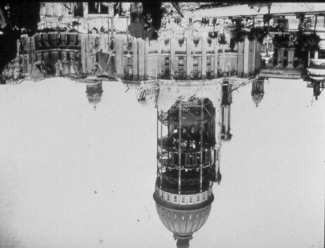

3 Slides of San Francisco 3


4 Ground movement caused by the earthquake Buildings collapse because of ground slumping 4


5 Faulting outside San Francisco Note about 8-10 ft of horizontal movement with very little vertical movement. City hall Santa Rosa Chapel at Stanford University, Palo Alto 5


6 250,000 homeless 700 people dead or missing The San Francisco earthquake gave valuable insights into how earthquakes develop:- o Geodetic surveys showed that during the 50 years prior to the earthquake, distant points on either side of the San Andreas fault had moved a total of about 10 feet. o The fault itself, however, had not moved during the same 50 year period. IT HAD REMAINED LOCKED!!! 6
7 o After the earthquake, the fault had also moved about feet in about one minute! o The damage was not caused by the fault movement, but by undulating and shaking ground (the earthquake) that accompanied the fault movement. o A lot of the damage was caused by the subsequent fire. These observations following the San Francisco earthquake in 1906 led to the development by H. F. Reid of the ELASTIC REBOUND THEORY 7
8 The Elastic Rebound Theory 10 miles 10 miles A A Fault B 50 years earlier C 20 feet B Just before the earthquake C A B Vertical view of the San Andreas fault (not to scale) B After the earthquake C Summary of the Elastic Rebound Theory Slow and gradual movement on either side of a fault builds up ELASTIC STRAIN in the surrounding rocks. At some point the fault ruptures (breaks) releasing all of this elastic energy as EARTHQUAKE WAVES. Waves radiate outwards from this point of rupture (focus). Note, the point at the surface above the focus is known as the epicenter. It follows that once the energy is released, there will be no more earthquakes on this specific part of the fault for some time to come. How long, is the multi-million dollar question!! 8
9 Types of Seismic Waves BODY WAVES - these move within the body of a rock and through the earth. There are two types:- P-Waves - or primary waves. These have the fastest velocities (about 300 km/minute), depending on the rock density. S-waves - or secondary waves. They have slower velocities than P-waves (roughly half) and are felt after the P-waves (hence the name). Seismic Waves continued SURFACE WAVES - only travel near the earth s surface. There are two types:- Love Waves - are similar to but slightly slower in velocity than S-waves. Rayleigh Waves - are also slightly slower than S-waves. 9

. Magnitude of earthquake (how big).")
10 BODY WAVES Primary Waves Secondary Waves SURFACE WAVES Love Waves Rayleigh Waves Remember Milne s three type of waves Recording Seismic Waves A typical seismic wave pattern recorded on a seismograph during an earthquake looks like this:- This record contains information about:- Distance to epicenter (how far). Magnitude of earthquake (how big). Relative movement on fault 10
, the record may look like")
, then the record may look")

11 If you are a long way from the epicenter (or the earthquake is small), the record may look like this:- P S If you are closer to the epicenter (or the earthquake is large), then the record may look like this:- P S Actually, these are records of the same earthquake at different places. This explains why 11

12 Locating an earthquake Which is the fastest of the seismic waves? The distance to the epicenter is given by the arrival time difference between the P and S waves. Distance to the epicenter is given by the time interval between the P and S waves 12
.")
13 Denver ~ 2000 km St Johns ~ 5300 km Lima ~ 9000 km Earthquake is located near Seattle A quick and dirty method for locating an earthquake Since S-waves travel through rock more slowly than P-waves, the time that elapses between the arrival at a seismograph of the first P-wave and the first S-wave will be proportional to the distance to the earthquake epicenter (remember Milne!). Distance to Epicenter = 5.7 miles/second [Note this is very rough - also if you want the distance in km the factor will be 5.7/0.62 = 9.2] 13
14 Example:- Suppose we have three seismic stations that record the arrival times of the P and S waves from the same earthquake. S - P (seconds) Distance (miles) Station A 21.0 x 5.7 = 120 Station B 20.4 x 5.7 = 116 Station C 11.4 x 5.7 = 65 (remember - we need three locations (or more) to locate the epicenter of an earthquake) 65 miles Station C Epicenter 116 mile 120 miles Station A Station B 14
Earthquakes. Earthquakes: Big Ideas. Earthquakes
 Earthquakes Earthquakes: Big Ideas Humans cannot eliminate natural hazards but can engage in activities that reduce their impacts by identifying high-risk locations, improving construction methods, and
EARTHQUAKES. Compressional Tensional Slip-strike
 Earthquakes-page 1 EARTHQUAKES Earthquakes occur along faults, planes of weakness in the crustal rocks. Although earthquakes can occur anywhere, they are most likely along crustal plate boundaries, such
Lecture 12 Earthquake Magnitude
 Lecture 12 Earthquake Magnitude Locating Earthquakes Last time, we learned that we could obtain a rough estimate of the distance in miles to an earthquake epicenter by multiplying the S - P time interval
Locating the Epicenter and Determining the Magnitude of an Earthquake
 Locating the and Determining the Magnitude of an Earthquake Locating the Measuring the S-P time interval There are hundreds of seismic data recording stations throughout the United States and the rest
EARTHQUAKE PREDICTION
 Lecture 15 Earthquake Prediction EARTHQUAKE PREDICTION To successfully predict an earthquake we would like to know:- PLACE TIME MAGNITUDE (rather like a weather forecast) 1 Evidence must be integrated
Seismic Waves Practice
 1. Base your answer to the following question on the diagram below, which shows models of two types of earthquake waves. Model A best represents the motion of earthquake waves called 1) P-waves (compressional
FOURTH GRADE EARTHQUAKES 1 WEEK LESSON PLANS AND ACTIVITIES
 FOURTH GRADE EARTHQUAKES 1 WEEK LESSON PLANS AND ACTIVITIES PLATE TECTONIC CYCLE OVERVIEW OF FOURTH GRADE VOLCANOES WEEK 1. PRE: Comparing different structures of volcanoes. DURING: Modeling three types
Unit 4 Lesson 6 Measuring Earthquake Waves. Copyright Houghton Mifflin Harcourt Publishing Company
 Shake, Rattle, and Roll What happens during an earthquake? As plates of the lithosphere move, the stress on rocks at or near the edges of the plates increases. This stress causes faults to form. A fault
Chapter 5: Earthquakes
 Chapter 5: Earthquakes 1. Experiencing an Earthquake firsthand 2. The Science of Ghost Forests and Megaearthquakes 3. Faults, Earthquakes, and Plate Tectonics 4. Seismic Waves and Earthquake Detection
Name: Date: Class: Finding Epicenters and Measuring Magnitudes Worksheet
 Example Answers Name: Date: Class: Finding Epicenters and Measuring Magnitudes Worksheet Objective: To use seismic data and an interactive simulation to triangulate the location and measure the magnitude
Chapter 7 Earthquake Hazards Practice Exam and Study Guide
 Chapter 7 Earthquake Hazards Practice Exam and Study Guide 1. Select from the following list, all of the factors that affect the intensity of ground shaking. a. The magnitude of the earthquake b. Rather
Name Date Class. By studying the Vocabulary and Notes listed for each section below, you can gain a better understanding of this chapter.
 CHAPTER 7 VOCABULARY & NOTES WORKSHEET Earthquakes By studying the Vocabulary and Notes listed for each section below, you can gain a better understanding of this chapter. SECTION 1 Vocabulary In your
The Dynamic Crust 2) EVIDENCE FOR CRUSTAL MOVEMENT
 EVIDENCE FOR CRUSTAL MOVEMENT") The Dynamic Crust 1) Virtually everything you need to know about the interior of the earth can be found on page 10 of your reference tables. Take the time to become familiar with page 10 and everything
The Dynamic Crust 1) Virtually everything you need to know about the interior of the earth can be found on page 10 of your reference tables. Take the time to become familiar with page 10 and everything
The earthquake source
 Global seismology: The earthquake source Reading: Fowler p111-140 and Bolt Appendix G Earthquake location Earthquake focus: Latitude, longitude, depth Earthquake epicenter: Latitude, longitude Earthquakes
How do scientists measure earthquakes?
 Name: Source: http://www.scholastic.com/browse/article.jsp?id=4892 http://gizmodo.com/5833688/what-do-earthquake-magnitudes-mean http://www.kids-fun-science.com/moment-magnitude-scale.html http://tremor.nmt.edu/faq/how.html
Activity #1-HS What is a Seismometer? High School Level
 Activity #1-HS What is a Seismometer? High School Level Objective Students will learn that a seismometer detects 3 components of motion and that a seismogram is the record of an earthquake. Background
Magnitude 7.2 GUERRERO, MEXICO
 A powerful magnitude-7.2 earthquake shook central and southern Mexico on Friday. The earthquake occurred at a depth of 24 km (15 miles). Its epicenter was in the western state of Guerrero, near the seaside
89.325 Geology for Engineers Earthquakes
 89.325 Geology for Engineers Earthquakes Name I. Introduction The crust of the earth behaves in a brittle manner. Stress is the force applied to a brittle substance and strain represents the build-up of
Magnitude 8.8 OFFSHORE MAULE, CHILE
 A great 8.8-magnitude struck central Chile early Saturday. The quake hit 200 miles (325 kilometers) southwest of the capital Santiago. The epicenter was just 70 miles (115 kilometers) from Concepcion,
EARTHQUAKE MAGNITUDE
 EARTHQUAKE MAGNITUDE Earliest measure of earthquake size Dimensionless number measured various ways, including M L local magnitude m b body wave magnitude M s surface wave magnitude M w moment magnitude
Earthquakes. www.earthquakes.bgs.ac.uk
 Earthquakes www.earthquakes.bgs.ac.uk Introduction Earthquakes are among the most deadly natural hazards. There are around 100 earthquakes each year of a size that could cause serious damage. They strike
Glossary. continental crust: the sections of crust, the outermost layer of the earth, that include the continents
 aftershock: an earthquake that follows a larger earthquake or main shock and originates in or near the rupture zone of the larger earthquake. Generally, major earthquakes are followed by a number of aftershocks
Earthquakes. www.earthquakes.bgs.ac.uk. Seismograph stations operated by the British Geological Survey
 Seismograph stations operated by the British Geological Survey Earthquakes Photograph supplied by Andy Thompson, Arup Advanced Technology, EEFIT Mission www.earthquakes.bgs.ac.uk Introduction Earthquakes
AS COMPETITION PAPER 2007 SOLUTIONS
 AS COMPETITION PAPER 2007 Total Mark/50 SOLUTIONS Section A: Multiple Choice 1. C 2. D 3. B 4. B 5. B 6. A 7. A 8. C 1 Section B: Written Answer Question 9. A mass M is attached to the end of a horizontal
Comparison of the P-wave Earthquake Alarm by Multi-Station and Single Station Detection System
 Comparison of the P-wave Earthquake Alarm by Multi-Station and Single Station Detection System Tsutomu Sato, Y. Nakamura System and Data Research Co., Ltd., Japan SUMMARY: The earthquake motion of the
SPEED, VELOCITY, AND ACCELERATION
 reflect Look at the picture of people running across a field. What words come to mind? Maybe you think about the word speed to describe how fast the people are running. You might think of the word acceleration
DYNAMIC CRUST: Unit 4 Exam Plate Tectonics and Earthquakes
 DYNAMIC CRUST: Unit 4 Exam Plate Tectonics and Earthquakes NAME: BLOCK: DATE: 1. Base your answer to the following question on The block diagram below shows the boundary between two tectonic plates. Which
Earthquakes Natural and Induced. Rick Aster Professor of Geophysics and Department Head Geosciences Department Colorado State University
 Earthquakes Natural and Induced Rick Aster Professor of Geophysics and Department Head Geosciences Department Colorado State University Overview What causes earthquakes? How do we detect, locate, and measure
Georgia Performance Standards Framework for Shaky Ground 6 th Grade
 The following instructional plan is part of a GaDOE collection of Unit Frameworks, Performance Tasks, examples of Student Work, and Teacher Commentary. Many more GaDOE approved instructional plans are
Unit 6 Earthquakes and Volcanoes
 Unit 6 Earthquakes and Volcanoes Earthquakes and Volcanoes: Essential Questions What evidence can students observe that the Earth is changing? How do scientists know what s inside the Earth? What processes
THE 2004 SUMATRA EARTHQUAKE AND INDIAN OCEAN TSUNAMI: WHAT HAPPENED AND WHY
 Page 6 The Earth Scientist THE 2004 SUMATRA EARTHQUAKE AND INDIAN OCEAN TSUNAMI: WHAT HAPPENED AND WHY Seth Stein and Emile A. Okal Dept of Geological Sciences, Northwestern University, Evanston Illinois
Layers of the Earth s Interior
 Layers of the Earth s Interior 1 Focus Question How is the Earth like an ogre? 2 Objectives Explain how geologists have learned about the interior of the Earth. Describe the layers of the Earth s interior.
Overview. NRC Regulations for Seismic. Applied to San Onofre Nuclear Generating Station. NRC History. How we Regulate
 Overview 1. NRC History and Overview NRC Regulations for Seismic Analysis and Design Applied to San Onofre Nuclear Generating Station Christie Hale Megan Williams 2. Regulations for Seismic Hazards 3.
Earthquake Preparedness Tips & Strategies
 Earthquake Preparedness Tips & Strategies What to Do BEFORE an Earthquake What to Do DURING an Earthquake BE PREPARED! For more information, log onto: www.gema.ga.gov www.ready.ga.gov www.geophysics.eas.gatech.edu
Earthquake Lab. A. Locate the Epicenter. Name: Lab Section:
 Earthquake Lab Name: Lab Section: The goal of this portion of the lab is to learn how recording of earthquakes seismograms are used to locate earthquakes, determine their magnitudes, and to understand
DISASTER RESISTANCE EARTHQUAKES AND STRUCTURES
 DISASTER RESISTANCE EARTHQUAKES AND STRUCTURES EARTHQUAKES Origin of earthquakes The earth was a single land about two hundred million years ago. This land split progressively over a long period of time
Earthquake Hazards and Risks
 Page 1 of 7 EENS 3050 Tulane University Natural Disasters Prof. Stephen A. Nelson Earthquake Hazards and Risks This page last updated on 28-Aug-2013 Earthquake Risk Many seismologists have said that "earthquakes
TECTONICS ASSESSMENT
 Tectonics Assessment / 1 TECTONICS ASSESSMENT 1. Movement along plate boundaries produces A. tides. B. fronts. C. hurricanes. D. earthquakes. 2. Which of the following is TRUE about the movement of continents?
Earthquakes and Plate Boundaries Deborah Jordan and Samuel Spiegel
 Earthquakes and Plate Boundaries Deborah Jordan and Samuel Spiegel Jordan, Deborah and Spiegel, Samuel: Learning Research Development Center, University of Pittsburgh. Earthquakes and Plate Boundaries.
The Severity of an Earthquake - ---- U.S. Department of the Interior/Geological Survey
 The Severity of an Earthquake - ---- U.S. Department of the Interior/Geological Survey ----~ Earthquakes can be measured in terms of either the effect of the earthquake (intensity) or of the energy released
February 28 Earthquake: We got off easy
 February 28 Earthquake: We got off easy State Geologist John Beaulieu Lucky may not be the first word that comes to mind after an earthquake that injured more than 200 and caused more than $1 billion damage,
Data in seismology: networks, instruments, current problems
 Data in seismology: networks, instruments, current problems Seismic networks, data centres, instruments Seismic Observables and their interrelations Seismic data acquisition parameters (sampling rates,
Earthquake Magnitude
 Earthquake Magnitude Earthquake magnitude scales: Logarithmic measure of earthquake size amplitude of biggest wave: Magnitude 6 quake 10 * Magnitude 5 energy: Magnitude 6 quake is about 32 * Magnitude
Representing Vector Fields Using Field Line Diagrams
 Minds On Physics Activity FFá2 5 Representing Vector Fields Using Field Line Diagrams Purpose and Expected Outcome One way of representing vector fields is using arrows to indicate the strength and direction
Topic Area: Circles. Definitions. Formulas Distance Formula: D = ( x x ) + ( y ) Equation of a Circle: Activity 8 Algebra II with the Casio fx-9750gii
 + ( y ) Equation of a Circle: Activity 8 Algebra II with the Casio fx-9750gii") Where Did That Come From? Teacher Notes Topic Area: Circles NCTM Standards: Use symbolic algebra to represent and explain mathematical relationships. Use geometric models to gain insights into, and answer
Where Did That Come From? Teacher Notes Topic Area: Circles NCTM Standards: Use symbolic algebra to represent and explain mathematical relationships. Use geometric models to gain insights into, and answer
Geology 112 Earthquakes. Activity 1 Worksheet Introduction to the Course. What is a Fault? What is an Earthquake?
 Geology 112 Earthquakes Name Activity 1 Worksheet Introduction to the Course. What is a Fault? What is an Earthquake? Activity 1 Objectives: Introduce student to the topics, requirements and format of
Regents Questions: Plate Tectonics
 Earth Science Regents Questions: Plate Tectonics Name: Date: Period: August 2013 Due Date: 17 Compared to the oceanic crust, the continental crust is (1) less dense and more basaltic (3) more dense and
Questions & Answers Proposed for Exam #3
 Questions & Answers Proposed for Exam #3 GE50 Introduction to Physical Geology (Geology for Engineers) Missouri University of Science and Technology Fall Semester 2007, Leslie Gertsch (GertschL@mst.edu)
Geological Maps 3: Faulted Strata
 Geological Maps 3: Faulted Strata Brittle deformation in rocks is characterized by fractures, joints and faults. Fractures and joints can be of any size, orientation or pattern. Some joints form regular
Plotting Earthquake Epicenters an activity for seismic discovery
 Plotting Earthquake Epicenters an activity for seismic discovery Tammy K Bravo Anne M Ortiz Plotting Activity adapted from: Larry Braile and Sheryl Braile Department of Earth and Atmospheric Sciences Purdue
Estimating Differences. Finding Distances on a Map
 Estimating Differences Problem Solving: Finding Distances on a Map Estimating Differences How do we use rounding to estimate differences? Sometimes subtraction is like addition. There are times when we
Earthquakes: Interesting Facts and F.A.Q.
 Earthquakes: Interesting Facts and F.A.Q. Earthquakes kill approximately 8,000 people each year and have caused an estimated 13 million deaths in the past 4,000 years. The moment magnitude scale (MMS)
Chapter 8: Plate Tectonics -- Multi-format Test
 Name: Class: Date: ID: A Chapter 8: Plate Tectonics -- Multi-format Test Modified True/False Indicate whether the statement is true or false. If false, change the identified word or phrase to make the
12.510 Introduction to Seismology Spring 2008
 MIT OpenCourseWare http://ocw.mit.edu 12.510 Introduction to Seismology Spring 2008 For information about citing these materials or our Terms of Use, visit: http://ocw.mit.edu/terms. 04/30/2008 Today s
Determination of source parameters from seismic spectra
 Topic Determination of source parameters from seismic spectra Authors Michael Baumbach, and Peter Bormann (formerly GeoForschungsZentrum Potsdam, Telegrafenberg, D-14473 Potsdam, Germany); E-mail: pb65@gmx.net
CHAPTER 6 THE TERRESTRIAL PLANETS
 CHAPTER 6 THE TERRESTRIAL PLANETS MULTIPLE CHOICE 1. Which of the following is NOT one of the four stages in the development of a terrestrial planet? 2. That Earth, evidence that Earth differentiated.
Interactive Plate Tectonics
 Interactive Plate Tectonics Directions: Go to the following website and complete the questions below. http://www.learner.org/interactives/dynamicearth/index.html How do scientists learn about the interior
Seismographs. Lesson 7. Seismographs recording activity on Kilauea
 Seismographs Lesson 7 E arthquakes generate seismic waves that travel all around the world and can be detected by sensitive instruments called seismographs. The earliest instrument to detect earthquakes
Tsunami Practice Questions and Answers Revised November 2008
 Tsunami Practice Questions and Answers Revised November 2008 1. What happened on 26 December 2004 off the west coast of Sumatra? 2. What is the final estimate of the magnitude of the Sumatra 26 December
Exploring plate motion and deformation in California with GPS
 Exploring plate motion and deformation in California with GPS Student worksheet Cate Fox-Lent, UNAVCO master teacher; Andy Newman, Georgia Institute of Technology; Shelley Olds, UNAVCO; and revised by
6. LECTURE 6. Objectives
 6. LECTURE 6 Objectives I understand how to use vectors to understand displacement. I can find the magnitude of a vector. I can sketch a vector. I can add and subtract vector. I can multiply a vector by
II. Earth Science (Geology) Section (9/18/2013)
 Section (9/18/2013)") EAPS 100 Planet Earth Lecture Topics Brief Outlines II. Earth Science (Geology) Section (9/18/2013) 1. Interior of the Earth Learning objectives: Understand the structure of the Earth s interior crust,
EAPS 100 Planet Earth Lecture Topics Brief Outlines II. Earth Science (Geology) Section (9/18/2013) 1. Interior of the Earth Learning objectives: Understand the structure of the Earth s interior crust,
The correct answers are given below. Some talking points have been added for the teachers use.
 Natural Resources Canada 2011: Lesson Plan Grades 11 and 12 Landslide activity 5b: Landslides in Canada quiz Description: This is an independent study activity for grades 11 and 12. Students will read
Evaluating an Illinois Earthquake
 Evaluating an Illinois Earthquake Grade Level: 7-8 Adapted from an activity by Robert A. Bauer, GeoActivity HAZD-1, ISGS GeoActivities Series, Activities and Other Resources for Teaching Geology, Illinois
Earth Retaining Structures
 Earth Retaining Structures and Asset Management Earth Retaining Structures and Asset Management A Critical Component Tool in Maintaining Public Safety Earth Retaining Structures (ERS) are often an overlooked
Reading GPS Time Series Plots Worksheet
 Reading GPS Time Series Plots Worksheet By: Roger Groom and Cate Fox-Lent, UNAVCO Master Teachers in-residence, Shelley Olds, UNAVCO The Global Positioning System, GPS, is used to study the Earth, how
Shake, Rattle, and Roll. Tina Moore, Denise Robinette, & Matt Utz
 Shake, Rattle, and Roll Tina Moore, Denise Robinette, & Matt Utz Shake, Rattle, and Roll - Earthquakes Lesson Plan - Day One I. Objective: A. Student will be able to read and label a two axis graph. B.
This chapter discusses: 1. Definitions and causes of stable and unstable atmospheric air. 2. Processes that cause instability and cloud development
 Stability & Cloud Development This chapter discusses: 1. Definitions and causes of stable and unstable atmospheric air 2. Processes that cause instability and cloud development Stability & Movement A rock,
Pressure drop in pipes...
 Pressure drop in pipes... PRESSURE DROP CALCULATIONS Pressure drop or head loss, occurs in all piping systems because of elevation changes, turbulence caused by abrupt changes in direction, and friction
Graphing Motion. Every Picture Tells A Story
 Graphing Motion Every Picture Tells A Story Read and interpret motion graphs Construct and draw motion graphs Determine speed, velocity and accleration from motion graphs If you make a graph by hand it
Projectile motion simulator. http://www.walter-fendt.de/ph11e/projectile.htm
 More Chapter 3 Projectile motion simulator http://www.walter-fendt.de/ph11e/projectile.htm The equations of motion for constant acceleration from chapter 2 are valid separately for both motion in the x
FOURTH GRADE PLATE TECTONICS 1 WEEK LESSON PLANS AND ACTIVITIES
 FOURTH GRADE PLATE TECTONICS 1 WEEK LESSON PLANS AND ACTIVITIES PLATE TECTONIC CYCLE OVERVIEW OF FOURTH GRADE VOLCANOES WEEK 1. PRE: Comparing different structures of volcanoes. LAB: Modeling three types
1.3.1 Position, Distance and Displacement
 In the previous section, you have come across many examples of motion. You have learnt that to describe the motion of an object we must know its position at different points of time. The position of an
A STUDY ON THE EFFECTS OF SURFACE WAVES GENERATED
 A STUDY ON THE EFFECTS OF SURFACE WAVES GENERATED IN DEEP SEDIMENTARY BASINS DURING A MAJOR EARTHQUAKE K. Eto ), K. Motoki 2) and K. Seo 3) )Graduate student, Department of Built Environment, Tokyo Institute
What do you imagine about the nature
 CHAPTER INTERIOR OF THE EARTH What do you imagine about the nature of the earth? Do you imagine it to be a solid ball like cricket ball or a hollow ball with a thick cover of rocks i.e. lithosphere? Have
A Report on Post-Earthquake Rapid Visual Damage Assessment of Buildings Of Tribhuvan International Airport
 A Report on Post-Earthquake Rapid Visual Damage Assessment of Buildings Of Tribhuvan International Airport Prepared By: Civil Engineering Division Tribhuvan International Airport Civil Aviation Office
Study Guide Questions Earth Structure and Plate Tectonics
 Study Guide Questions Earth Structure and Plate Tectonics What evidence did Alfred Wegener present in 1912 to support the idea of continental drift? Why did most geologists at the time dismiss Wegener
Santa Ana College. EMERGENCY OPERATIONS PLAN TRAINING Table Top Exercise EARTHQUAKE SCENARIO August 16, 2013
 Santa Ana College EMERGENCY OPERATIONS PLAN TRAINING Table Top Exercise EARTHQUAKE SCENARIO August 16, 2013 Objectives Simulate Activation of SAC EOC Set up and Identify EOC Operational Sections Utilize
Waves disturbances caused by the movement of energy from a source through some medium.
 Oceanography Chapter 10 Waves disturbances caused by the movement of energy from a source through some medium. Floating Gull- Figure 10.1 water is not moving only the energy is moving through the water.
Chapter 7 Earthquake Hazards
 Chapter 7 Earthquake Hazards by G.H. Girty, Department of Geological Sciences, San Diego State University Page 1 Introduction Any given earthquake produced by slip along a fault can produce a number of
Motion & The Global Positioning System (GPS)
") Grade Level: K - 8 Subject: Motion Prep Time: < 10 minutes Duration: 30 minutes Objective: To learn how to analyze GPS data in order to track an object and derive its velocity from positions and times.
Grade Level: K - 8 Subject: Motion Prep Time: < 10 minutes Duration: 30 minutes Objective: To learn how to analyze GPS data in order to track an object and derive its velocity from positions and times.
F N A) 330 N 0.31 B) 310 N 0.33 C) 250 N 0.27 D) 290 N 0.30 E) 370 N 0.26
 330 N 0.31 B) 310 N 0.33 C) 250 N 0.27 D) 290 N 0.30 E) 370 N 0.26") Physics 23 Exam 2 Spring 2010 Dr. Alward Page 1 1. A 250-N force is directed horizontally as shown to push a 29-kg box up an inclined plane at a constant speed. Determine the magnitude of the normal force,
Physics 23 Exam 2 Spring 2010 Dr. Alward Page 1 1. A 250-N force is directed horizontally as shown to push a 29-kg box up an inclined plane at a constant speed. Determine the magnitude of the normal force,
7.2.4 Seismic velocity, attenuation and rock properties
 7.2.4 Seismic velocity, attenuation and rock properties Rock properties that affect seismic velocity Porosity Lithification Pressure Fluid saturation Velocity in unconsolidated near surface soils (the
Section 1 The Earth System
 Section 1 The Earth System Key Concept Earth is a complex system made up of many smaller systems through which matter and energy are continuously cycled. What You Will Learn Energy and matter flow through
Rapid Changes in Earth s Surface
 TEKS investigate rapid changes in Earth s surface such as volcanic eruptions, earthquakes, and landslides Rapid Changes in Earth s Surface Constant Changes Earth s surface is constantly changing. Wind,
KINDERGARTEN PLATE TECTONICS 1 WEEK LESSON PLANS AND ACTIVITIES
 KINDERGARTEN PLATE TECTONICS 1 WEEK LESSON PLANS AND ACTIVITIES PLATE TECTONIC CYCLE OVERVIEW OF KINDERGARTEN VOLCANOES WEEK 1. PRE: Learning that all mountains are not volcanoes. LAB: Investigating rocks
What Is Heat? What Is Heat?
 What Is Heat? Paul shivered inside the wood cabin. It was cold outside, and inside the cabin it wasn t much warmer. Paul could hear the rain beating down on the roof. Every few minutes there would be a
Earth Egg Model Teacher Notes
 Ancient Greeks tried to explain earthquakes and volcanic activity by saying that a massive bull lay underground and the land shook when it became angry. Modern theories rely on an understanding of what
INITIAL RESULTS AT REDUCING SYSTEMATIC ERRORS FOR SEISMIC EVENT LOCATIONS USING A MODEL INCORPORATING ANISOTROPIC REGIONAL STRUCTURES
 INITIAL RESULTS AT REDUCING SYSTEMATIC ERRORS FOR SEISMIC EVENT LOCATIONS USING A MODEL INCORPORATING ANISOTROPIC REGIONAL STRUCTURES Gideon P. Smith and Douglas A. Wiens Washington University in St Louis
The Doppler Effect & Hubble
 The Doppler Effect & Hubble Objectives Explain the Doppler Effect. Describe Hubble s discoveries. Explain Hubble s Law. The Doppler Effect The Doppler Effect is named after Austrian physicist Christian
Review Chapters 2, 3, 4, 5
 Review Chapters 2, 3, 4, 5 4) The gain in speed each second for a freely-falling object is about A) 0. B) 5 m/s. C) 10 m/s. D) 20 m/s. E) depends on the initial speed 9) Whirl a rock at the end of a string
Contents. Specific and total risk. Definition of risk. How to express risk? Multi-hazard Risk Assessment. Risk types
 Contents Multi-hazard Risk Assessment Cees van Westen United Nations University ITC School for Disaster Geo- Information Management International Institute for Geo-Information Science and Earth Observation
Southern AER Atmospheric Education Resource
 Southern AER Atmospheric Education Resource Vol. 9 No. 5 Spring 2003 Editor: Lauren Bell In this issue: g Climate Creations exploring mother nature s remote control for weather and Climate. g Crazy Climate
= f x 1 + h. 3. Geometrically, the average rate of change is the slope of the secant line connecting the pts (x 1 )).
).") Math 1205 Calculus/Sec. 3.3 The Derivative as a Rates of Change I. Review A. Average Rate of Change 1. The average rate of change of y=f(x) wrt x over the interval [x 1, x 2 ]is!y!x ( ) - f( x 1 ) = y
Math 1205 Calculus/Sec. 3.3 The Derivative as a Rates of Change I. Review A. Average Rate of Change 1. The average rate of change of y=f(x) wrt x over the interval [x 1, x 2 ]is!y!x ( ) - f( x 1 ) = y
Earthquakes: Risk and Insurance Issues
 Page 1 of 8 HOT TOPICS & INSURANCE ISSUES Earthquakes: Risk and Insurance Issues THE TOPIC JULY 2003 An earthquake is a sudden and rapid shaking of the earth caused by the breaking and shifting of rock
Monday 11 June 2012 Afternoon
 Monday 11 June 2012 Afternoon A2 GCE PHYSICS B (ADVANCING PHYSICS) G495 Field and Particle Pictures *G412090612* Candidates answer on the Question Paper. OCR supplied materials: Data, Formulae and Relationships
Tectonic plates push together at convergent boundaries.
 KEY CONCEPT Plates converge or scrape past each other. BEFORE, you learned Plates move apart at divergent boundaries In the oceans, divergent boundaries mark where the sea floor spreads apart On land,
Acoustic design according to room shape
 Acoustic design according to room shape The shape of the room defines the movement of the sound waves within the room. Placement of acoustic materials should be determined by the way the sound moves in
KCC Event Brief: 2014 La Habra Earthquake
 KAREN CLARK & COMPANY KCC Event Brief: 2014 La Habra Earthquake June 2014 2 COPLEY PLACE BOSTON, MA 02116 T: 617.423.2800 F: 617.423.2808 Overview On Friday, March 28, 2014 at 9:09pm, a magnitude 5.1 earthquake