South Florida Winter Outlook and Forecast Tips
|
|
|
- Imogen Lucas
- 7 years ago
- Views:
Transcription

1 South Florida Winter Outlook and Forecast Tips Robert Molleda Warning Coordination Meteorologist National Weather Service Miami Forecast Office
2 South Dade Freeze Climatology Since 1948, 31 years have had freezing temperatures (32F or colder). Return period is slightly over 2 years. Longest stretch without freeze since 1948: 6 years (occurred twice and ). No freezes the past two winters
3 South Dade Freeze Climatology Since 1948, 46 years have had temperatures of 35F or lower (near freeze or freeze). 69% of years since Lowest recorded temperature in S. Dade ag area: 25F at Coop office (Dec 1989). 26F at Tamiami Airport on Jan 11, 2010.


4 Cold Outbreak Indicators High pressure from Canada centered over North Dakota/Minnesota and moving due south towards Gulf coast and Florida, with low pressure over NE U.S. or eastern Canada. Brown lines roughly depict wind flow around the two systems, in this case NW over Florida.
.")
5 Cold Outbreak Indicators Snow cover deep into southern U.S (shown in blue here). Arctic air blowing over snow cover will not warm as fast as it moves south.
6 What Could Happen This Winter??

7 Temperature Outlook: Dec-Feb Slight tendency for cooler than normal temperatures

8 Long-range CFS Model Temperature Projections: Jan-Mar
 Other factors play a big role in winter")
9 Long-Range Forecast Tools ENSO (El Niño Southern Oscillation). In other words, El Niño/La Niña This winter, we are expected to be in the El Niño phase (most likely a weak event) Other factors play a big role in winter weather pattern across N. America, such as North Atlantic Oscillation and Pacific-North American Pattern
10 El Niño/La Niña and South Florida Freezes 31 freeze seasons since Neutral 12 of 24 (1 in 2) - La Niña 11 of 21 (1 in 1.9) - El Niño - 8 of 21 (1 in 2.6)


11 North Atlantic Oscillation Slide Courtesy: NWS Melbourne, FL Periodic Fluctuation of Pressure Patterns over the North Atlantic Ocean Scale of Weeks Primary Impact on Winter Temperature Positive Warm Negative Cold

12
13 South Florida Winter Precipitation Outlook Likelihood of wetter than normal for Florida
14 NWS Cold/Freeze Products
15 NWS Freeze Products Freeze Outlook---issued 3-5 days before a freeze is forecast. Freeze Watch---issued hours before a freeze is forecast. Freeze Warning---issued hours before a freeze is expected. Hard Freeze 28F or below for 4 or more hours.
16 NWS Frost Products Frost Advisory---issued if scattered to widespread frost is expected within hours. Temperatures 33-37F with clear skies, winds below 5 mph, and sufficient low level moisture.
17 NWS Wind Chill Products Wind Chill Advisory- issued if wind chill expected to drop to below 35F for at least 4 hours (need wind of 5 mph or greater). Wind Chill Watch/Warning issued for wind chill 25F or lower for at least 4 hours (need 5 mph wind or greater).
18 Internet Sources Miami-South Florida National Weather Service (local weather forecasts and warnings, video weather briefings, model data, forecaster reasoning, etc.) weather.gov/miami Climate Prediction Center (long range outlooks)
19 NWS Miami Web Site Click on second map to get point forecast. weather.gov/miami


20 NWS Miami Web Site You can also enter city/state/zip at top left Caution: may not point to right area. Always confirm with map on right weather.gov/miami


21 NWS Miami Web Site Forecast Discussion provides meteorologist thinking behind forecast Jump to Radar & Satellite Images by clicking on corresponding images Hourly Weather Graph gives hour-by-hour detailed forecast for that location weather.gov/miami Forecast Database gives a graphical representation of forecast conditions.
22 VERY IMPORTANT Notes on NWS Temperature Forecasts NWS forecast temps are for standard height of 6 feet above ground with good exposure. Temps near ground (2 ft or below) are frequently a few to several degrees colder, especially on nights with light winds. Be familiar with your particular area and lay of the land. Temperatures in the field are usually several degrees colder than at reporting stations.
23 Monitoring Local Temperatures DO NOT RELY ON NWS SITES ALONE! Mesowest: Weather Underground/Wundermap: MADIS: IFAS Weather Stations:

24 NWS Sites Only

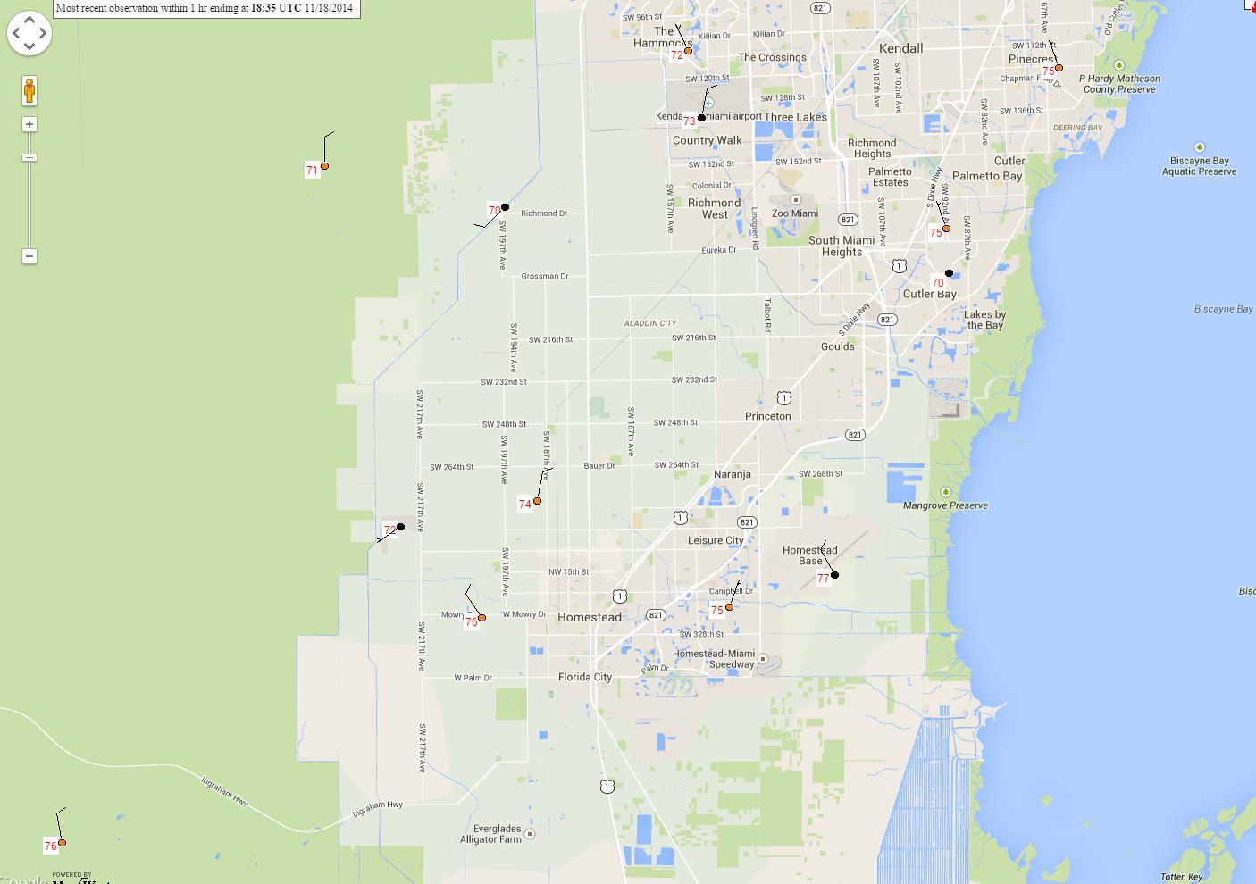
25 NWS + Supplemental Sites

26 Weather Underground

27 MADIS

28 IFAS Weather Stations

29 NOAA Climate Prediction Center: Good for long-range planning 6-10 day and 8-14 day outlooks give indication of above/below normal temperatures for that time frame. Updated each afternoon Interactive Display link gives additional detail
30 Timing of Temperatures/Winds First night after front usually the windiest night but NOT the coldest night. Depends on exact timing of frontal passage. Second or third night usually the coldest (with lighter winds but not totally calm the entire night). Overnight winds can be very fickle and tricky to forecast. Winds can keep temps up, but a brief calm period can drop temperatures several degrees in a very short time. Normally occurs second or third night.

31 Typical First Night temperature pattern. Steady temperature drop through the night with rather even temperature distribution.

32 Typical Second or Third Night temperature pattern. Uneven temperature drop with large difference between inland and metro/coast.
33 Timing of Temperatures/Winds Low dewpoints/dry air during afternoon leads to rapid temperature drop after sunset and increases freeze potential. Watch for very low relative humidity values during the late morning/early afternoon (below 35 percent) coupled with temperatures struggling to reach 60F despite full sun. Freezing temperatures can occur as early as Midnight, then steady or rising afterward. Official forecast graphs have very difficult time depicting the fast temperature drop
34 Temp/Wind Graphs for South Dade Agricultural Stations: Jan 3/4, 2012

35 Temperature increase between Midnight and 1 AM, fairly steady thereafter. Sapp Farm Station 2.5 SW of city of Homestead 25.46, Lull in wind around midnight followed by increase in wind. This corresponded with lowest temp around midnight and slow rise thereafter
36 Two minima, followed by steady to gradual increase after 1 AM. Accursio Station 4 SW of KTMB 25.61, Two minima corresponded with lulls in wind, then followed by increase after 1 AM.

37 Minimum around 1 AM followed by slow rise to steady temps thereafter. Alger s Farm Station 4 SW of KHST and east of Turnpike 25.46, Wind lull around 130 AM followed by increase.
38 Minimum around 1 AM. Homestead General Airport 5 NW of city of Homestead 25.5, Light winds through 1 AM, then slight increase afterwards.

39 Other Monkey Wrench High cloud cover which can sometimes be very hard to pinpoint.
40 NWS Forecasts Full forecast packages around 4-5 AM and 3-4 PM daily, with updates at intermediate times (9-10 AM and 8-9 PM)
41 Anticipating Freeze Events About 5-7 days out, forecast confidence can be quite low. Area forecast discussions are good to assess level of confidence: Also check Hazardous Weather Outlook: If trends hold, 3-5 days before an event a freeze outlook is issued. Continue to monitor forecast discussion and hazardous weather outlook.

42 Anticipating Freeze Events Continue to monitor up to day before event Forecast graphics give good areal perspective /sectors/mfl.php Point forecasts derived from these data
43 Final (VERY IMPORTANT) Note on NWS Temperature Forecasts NWS forecast temps are for standard height of 6 feet above ground with good exposure. Temps near ground (2 ft or below) are frequently a few to several degrees colder, especially on nights with light winds. Be familiar with your particular area and lay of the land. Temperatures in the field are usually several degrees colder than at reporting stations.

44 Questions? Thank You! Frost on car: NWS Miami parking lot Dec 28 th, 2010
MIAMI-SOUTH FLORIDA National Weather Service Forecast Office http://www.weather.gov/miami
 MIAMI-SOUTH FLORIDA National Weather Service Forecast Office http://www.weather.gov/miami January Summary: Warm and Dry Winter Rolls On February 1, 2013: South Florida s warm and dry winter pattern of
MIAMI-SOUTH FLORIDA National Weather Service Forecast Office http://www.weather.gov/miami
 MIAMI-SOUTH FLORIDA National Weather Service Forecast Office http://www.weather.gov/miami November 2014 Weather Summary Cooler and Drier than Normal December 1, 2014: Cooler than normal temperatures was
List 10 different words to describe the weather in the box, below.
 Weather and Climate Lesson 1 Web Quest: What is the Weather? List 10 different words to describe the weather in the box, below. How do we measure the weather? Use this web link to help you: http://www.bbc.co.uk/weather/weatherwise/activities/weatherstation/
Southern AER Atmospheric Education Resource
 Southern AER Atmospheric Education Resource Vol. 9 No. 5 Spring 2003 Editor: Lauren Bell In this issue: g Climate Creations exploring mother nature s remote control for weather and Climate. g Crazy Climate
WEATHER AND CLIMATE practice test
 WEATHER AND CLIMATE practice test Multiple Choice Identify the choice that best completes the statement or answers the question. 1. What role does runoff play in the water cycle? a. It is the process in
MIAMI-SOUTH FLORIDA National Weather Service Forecast Office http://www.weather.gov/miami
 MIAMI-SOUTH FLORIDA National Weather Service Forecast Office http://www.weather.gov/miami Summer 2015 Weather Summary Wet West and Dry East September 2, 2015: One of the most variable summers in recent
Name Period 4 th Six Weeks Notes 2015 Weather
 Name Period 4 th Six Weeks Notes 2015 Weather Radiation Convection Currents Winds Jet Streams Energy from the Sun reaches Earth as electromagnetic waves This energy fuels all life on Earth including the
IGAD CLIMATE PREDICTION AND APPLICATION CENTRE
 IGAD CLIMATE PREDICTION AND APPLICATION CENTRE CLIMATE WATCH REF: ICPAC/CW/No.32 May 2016 EL NIÑO STATUS OVER EASTERN EQUATORIAL OCEAN REGION AND POTENTIAL IMPACTS OVER THE GREATER HORN OF FRICA DURING
Geography affects climate.
 KEY CONCEPT Climate is a long-term weather pattern. BEFORE, you learned The Sun s energy heats Earth s surface unevenly The atmosphere s temperature changes with altitude Oceans affect wind flow NOW, you
Christmas. National Meteorological Library and Archive Fact sheet 5 White Christmas. (version 01)
") Christmas National Meteorological Library and Archive Fact sheet 5 White Christmas (version 01) The National Meteorological Library and Archive Many people have an interest in the weather and the processes
Christmas National Meteorological Library and Archive Fact sheet 5 White Christmas (version 01) The National Meteorological Library and Archive Many people have an interest in the weather and the processes
URGENT - WEATHER MESSAGE NATIONAL WEATHER SERVICE MELBOURNE FL 402 AM EST MON JAN 6 2014
 URGENT - WEATHER MESSAGE...FREEZE AND HARD FREEZE WARNINGS IN EFFECT FOR PORTIONS OF EAST CENTRAL FLORIDA TONIGHT......LAKE WIND ADVISORY IN EFFECT FOR PORTIONS OF EAST CENTRAL FLORIDA THIS AFTERNOON...
How Do Oceans Affect Weather and Climate?
 How Do Oceans Affect Weather and Climate? In Learning Set 2, you explored how water heats up more slowly than land and also cools off more slowly than land. Weather is caused by events in the atmosphere.
Mixing Heights & Smoke Dispersion. Casey Sullivan Meteorologist/Forecaster National Weather Service Chicago
 Mixing Heights & Smoke Dispersion Casey Sullivan Meteorologist/Forecaster National Weather Service Chicago Brief Introduction Fire Weather Program Manager Liaison between the NWS Chicago office and local
Central Oregon Climate and how it relates to gardening
 Central Oregon Climate and how it relates to gardening Garden Note #1 Amy Jo Detweiler Horticulture Faculty Rev. July 2009 Behind the beauty of the High Desert landscape lies many factors that create challenges
CGC1D1: Interactions in the Physical Environment Factors that Affect Climate
 Name: Date: Day/Period: CGC1D1: Interactions in the Physical Environment Factors that Affect Climate Chapter 12 in the Making Connections textbook deals with Climate Connections. Use pages 127-144 to fill
NWS Melbourne Flood Briefing for Event Ending Today
 NWS Melbourne Flood Briefing for Event Ending Today Saturday March 6, 2010 900 AM Scott Spratt; Warning Coordination Meteorologist TRAINING SCENARIO FOR DISASTER RESISTANT COMMUNITIES GROUP TRAINING SCENARIO
RaysWeather.Com 2015-2016 Winter Fearless Forecast
 Author: Dr. Ray Russell Founder and President of RaysWeather.Com Date: October 10, 2015 RaysWeather.Com 2015-2016 Winter Fearless Forecast Background It's that time of year--leaves change, temperatures
Anyone Else Notice That Its Been Windy Lately?
 National Weather Service Aberdeen, South Dakota January 2014 Inside this issue: Has it Been Windy Lately or What? 2013 Year in Review 2013 Year in Review (cont.) 1 2 3 Has it Been Windy Lately or What?
7613-1 - Page 1. Weather Unit Exam Pre-Test Questions
 Weather Unit Exam Pre-Test Questions 7613-1 - Page 1 Name: 1) Equal quantities of water are placed in four uncovered containers with different shapes and left on a table at room temperature. From which
2. The map below shows high-pressure and low-pressure weather systems in the United States.
 1. Which weather instrument has most improved the accuracy of weather forecasts over the past 40 years? 1) thermometer 3) weather satellite 2) sling psychrometer 4) weather balloon 6. Wind velocity is
The Climate of Oregon Climate Zone 2 Willamette Valley
 /05 E-55 No. ci oi Unbound issue e2_, Does not circulate Special Report 914 May 1993 The Climate of Oregon Climate Zone 2 Property of OREGON STATE UNIVERSITY Library Serials Corvallis, OR 97331-4503 Agricultural
South Dakota Severe Weather Awareness Week April 22nd through 26th
 National Weather Service Aberdeen, South Dakota April 2013 Inside this issue: Severe Weather Awareness Impact Based Warnings Impact Based Warnings (cont) Record Cold March Record Cold March (cont) Seasonal
Arizona Climate Summary February 2015 Summary of conditions for January 2015
 Arizona Climate Summary February 2015 Summary of conditions for January 2015 January 2015 Temperature and Precipitation Summary January 1 st 14 th : January started off with a very strong low pressure
Climate of Illinois Narrative Jim Angel, state climatologist. Introduction. Climatic controls
 Climate of Illinois Narrative Jim Angel, state climatologist Introduction Illinois lies midway between the Continental Divide and the Atlantic Ocean, and the state's southern tip is 500 miles north of
Weather Briefing for Southeast Texas October 24 th, 2015
 Weather Briefing for Southeast Texas October 24 th, 2015 Dangerous Flash Flood Event Saturday through Sunday 8:16 AM Overview Ongoing: record deep moisture in place, elevated seas, rip currents, high surf,
AIR TEMPERATURE IN THE CANADIAN ARCTIC IN THE MID NINETEENTH CENTURY BASED ON DATA FROM EXPEDITIONS
 PRACE GEOGRAFICZNE, zeszyt 107 Instytut Geografii UJ Kraków 2000 Rajmund Przybylak AIR TEMPERATURE IN THE CANADIAN ARCTIC IN THE MID NINETEENTH CENTURY BASED ON DATA FROM EXPEDITIONS Abstract: The paper
Temporal variation in snow cover over sea ice in Antarctica using AMSR-E data product
 Temporal variation in snow cover over sea ice in Antarctica using AMSR-E data product Michael J. Lewis Ph.D. Student, Department of Earth and Environmental Science University of Texas at San Antonio ABSTRACT
SITE SPECIFIC WEATHER ANALYSIS REPORT
 SAMPLE FLOOD ANALYSIS REPORT SITE SPECIFIC WEATHER ANALYSIS REPORT PREPARED FOR: Law Offices of Oliver Wendell Douglas Oliver Wendell Douglas PREPARED BY: November 29, 2007 CASE REFERENCE: Arnold Ziffel
Air Masses and Fronts
 Air Masses and Fronts Air Masses The weather of the United States east of the Rocky Mountains is dominated by large masses of air that travel south from the wide expanses of land in Canada, and north from
ENSO Cycle: Recent Evolution, Current Status and Predictions. Update prepared by Climate Prediction Center / NCEP 9 May 2011
 ENSO Cycle: Recent Evolution, Current Status and Predictions Update prepared by Climate Prediction Center / NCEP 9 May 2011 Outline Overview Recent Evolution and Current Conditions Oceanic Niño Index (ONI)
Seasonal Temperature Variations
 Seasonal and Daily Temperatures Fig. 3-CO, p. 54 Seasonal Temperature Variations What causes the seasons What governs the seasons is the amount of solar radiation reaching the ground What two primary factors
Storms Short Study Guide
 Name: Class: Date: Storms Short Study Guide Multiple Choice Identify the letter of the choice that best completes the statement or answers the question. 1. A(n) thunderstorm forms because of unequal heating
The Polar Climate Zones
 The Polar Climate Zones How cold is it in the polar climate? Polar areas are the coldest of all the major climate zones The Sun is hardly ever high enough in the sky to cause the plentiful ice to melt,
The Anatomy of a Forecast
 The Anatomy of a Forecast The Met Service issues forecasts for sky condition, precipitation probability, wind, seas state and temperature on a routine basis. Because the weather is always changing, the
How To Understand Cloud Radiative Effects
 A Climatology of Surface Radiation, Cloud Cover, and Cloud Radiative Effects for the ARM Tropical Western Pacific Sites. Chuck Long, Casey Burleyson, Jennifer Comstock, Zhe Feng September 11, 2014 Presented
El Niño-Southern Oscillation (ENSO): Review of possible impact on agricultural production in 2014/15 following the increased probability of occurrence
: Review of possible impact on agricultural production in 2014/15 following the increased probability of occurrence") El Niño-Southern Oscillation (ENSO): Review of possible impact on agricultural production in 2014/15 following the increased probability of occurrence EL NIÑO Definition and historical episodes El Niño
El Niño-Southern Oscillation (ENSO): Review of possible impact on agricultural production in 2014/15 following the increased probability of occurrence EL NIÑO Definition and historical episodes El Niño
ENSO: Recent Evolution, Current Status and Predictions. Update prepared by: Climate Prediction Center / NCEP 29 June 2015
 ENSO: Recent Evolution, Current Status and Predictions Update prepared by: Climate Prediction Center / NCEP 29 June 2015 Outline Summary Recent Evolution and Current Conditions Oceanic Niño Index (ONI)
SIXTH GRADE WEATHER 1 WEEK LESSON PLANS AND ACTIVITIES
 SIXTH GRADE WEATHER 1 WEEK LESSON PLANS AND ACTIVITIES WATER CYCLE OVERVIEW OF SIXTH GRADE WATER WEEK 1. PRE: Evaluating components of the water cycle. LAB: Experimenting with porosity and permeability.
ENVIRONMENTAL STRUCTURE AND FUNCTION: CLIMATE SYSTEM Vol. II - Low-Latitude Climate Zones and Climate Types - E.I. Khlebnikova
 LOW-LATITUDE CLIMATE ZONES AND CLIMATE TYPES E.I. Khlebnikova Main Geophysical Observatory, St. Petersburg, Russia Keywords: equatorial continental climate, ITCZ, subequatorial continental (equatorial
South Africa. General Climate. UNDP Climate Change Country Profiles. A. Karmalkar 1, C. McSweeney 1, M. New 1,2 and G. Lizcano 1
 UNDP Climate Change Country Profiles South Africa A. Karmalkar 1, C. McSweeney 1, M. New 1,2 and G. Lizcano 1 1. School of Geography and Environment, University of Oxford. 2. Tyndall Centre for Climate
Climates are described by the same conditions used to describe
 58 The Causes of Climate R E A D I N G Climates are described by the same conditions used to describe weather, such as temperature, precipitation, and wind. You now know that oceans have an important effect
Great Plains and Midwest Climate Outlook 19 March 2015
 Great Plains and Midwest Climate Outlook 19 March 2015 Wendy Ryan Assistant State Climatologist Colorado State University wendy.ryan@colostate.edu Grass fire in SE Nebraska 13 March 2015 General Information
A Few Facts about Antarctica
 A Few Facts about Antarctica Antarctica is the continent that surrounds the South Pole, the southernmost point at the bottom of the earth. Antarctica is a continent because it is land that is covered by
Technical Support Document For The May 2, 2008 Exceptional Event
 Technical Support Document For The May 2, 2008 Exceptional Event Prepared by the Technical Services Program Air Pollution Control Division June 9, 2009 2 Table of Contents: 1.0 Introduction... 4 2.0 Ambient
How To Assess Natural Hazards In Houston County, Minn.
 Natural Hazards Assessment Houston County, MN Prepared by: NOAA / National Weather Service La Crosse, WI Natural Hazards Assessment for Houston County, MN Prepared by NOAA / National Weather Service La
climate science A SHORT GUIDE TO This is a short summary of a detailed discussion of climate change science.
 A SHORT GUIDE TO climate science This is a short summary of a detailed discussion of climate change science. For more information and to view the full report, visit royalsociety.org/policy/climate-change
Partnerships Implementing Engineering Education Worcester Polytechnic Institute Worcester Public Schools
 Partnerships Implementing Engineering Education Worcester Polytechnic Institute Worcester Public Schools Supported by: National Science Foundation Weather: 4.H.3 Weather and Classical Instruments Grade
Wind Resource Assessment for BETHEL, ALASKA Date last modified: 2/21/2006 Compiled by: Mia Devine
 813 W. Northern Lights Blvd. Anchorage, AK 99503 Phone: 907-269-3000 Fax: 907-269-3044 www.akenergyauthority.org Wind Resource Assessment for BETHEL, ALASKA Date last modified: 2/21/2006 Compiled by: Mia
Analyze Weather in Cold Regions and Mountainous Terrain
 Analyze Weather in Cold Regions and Mountainous Terrain Terminal Learning Objective Action: Analyze weather of cold regions and mountainous terrain Condition: Given a training mission that involves a specified
FOR SUBSCRIBERS ONLY! - TRIAL PASSWORD USERS MAY NOT REPRODUCE AND DISTRIBUTE PRINTABLE MATERIALS OFF THE SOLPASS WEBSITE!
 FOR SUBSCRIBERS ONLY! - TRIAL PASSWORD USERS MAY NOT REPRODUCE AND DISTRIBUTE PRINTABLE MATERIALS OFF THE SOLPASS WEBSITE! 1 NAME DATE GRADE 5 SCIENCE SOL REVIEW WEATHER LABEL the 3 stages of the water
EXPLANATION OF WEATHER ELEMENTS AND VARIABLES FOR THE DAVIS VANTAGE PRO 2 MIDSTREAM WEATHER STATION
 EXPLANATION OF WEATHER ELEMENTS AND VARIABLES FOR THE DAVIS VANTAGE PRO 2 MIDSTREAM WEATHER STATION The Weather Envoy consists of two parts: the Davis Vantage Pro 2 Integrated Sensor Suite (ISS) and the
Quadrant 1 Sea Breeze: Routing Considerations Table of Contents
 Quadrant 1 Sea Breeze: Routing Considerations Table of Contents Introduction Quadrant 1 Sea Breeze Description 2 3 Introduction Four Sea Breeze Quadrants (Figure 1) When considering a sea breeze and its
Assignment Discovery Online Curriculum. Lesson title: Weather Maps. Grade level: 4-6. Subject area: Earth Science. Duration: Two class periods
 Assignment Discovery Online Curriculum Lesson title: Weather Maps Grade level: 4-6 Subject area: Earth Science Duration: Two class periods Objectives: Students will do the following: Understand basic information
Texas Department of Public Safety Texas Division of Emergency Management. Texas State Operations Center
 Texas Department of Public Safety Texas Division of Emergency Management Texas State Operations Center Situation Awareness Brief Saturday, July 20 th 2013 As of 0900 CDT Tropical Weather Outlook For the
Climatography of the United States No. 20 1971-2000
 Climate Division: CA 4 NWS Call Sign: Month (1) Min (2) Month(1) Extremes Lowest (2) Temperature ( F) Lowest Month(1) Degree s (1) Base Temp 65 Heating Cooling 1 Number of s (3) Jan 59.3 41.7 5.5 79 1962
Hurricanes. Characteristics of a Hurricane
 Hurricanes Readings: A&B Ch. 12 Topics 1. Characteristics 2. Location 3. Structure 4. Development a. Tropical Disturbance b. Tropical Depression c. Tropical Storm d. Hurricane e. Influences f. Path g.
James Hansen, Reto Ruedy, Makiko Sato, Ken Lo
 If It s That Warm, How Come It s So Damned Cold? James Hansen, Reto Ruedy, Makiko Sato, Ken Lo The past year, 2009, tied as the second warmest year in the 130 years of global instrumental temperature records,
How to analyze synoptic-scale weather patterns Table of Contents
 How to analyze synoptic-scale weather patterns Table of Contents Before You Begin... 2 1. Identify H and L pressure systems... 3 2. Locate fronts and determine frontal activity... 5 3. Determine surface
Climatography of the United States No. 20 1971-2000
 Climate Division: CA 6 NWS Call Sign: SAN Month (1) Min (2) Month(1) Extremes Lowest (2) Temperature ( F) Lowest Month(1) Degree s (1) Base Temp 65 Heating Cooling 100 Number of s (3) Jan 65.8 49.7 57.8
Monsoon Variability and Extreme Weather Events
 Monsoon Variability and Extreme Weather Events M Rajeevan National Climate Centre India Meteorological Department Pune 411 005 rajeevan@imdpune.gov.in Outline of the presentation Monsoon rainfall Variability
RE: James vs. ABC Company Greentown, NJ D/A: February 20, 2011
 PO Box 7100 Hackettstown, NJ 07840 Phone: 1 800 427 3456 Fax: 908-850-8664 http://www.weatherworksinc.com June 16, 2012 Attn: John Doe Law Offices of John Doe 123 Fourth Street Smithtown, NJ 04506 RE:
8.5 Comparing Canadian Climates (Lab)
") These 3 climate graphs and tables of data show average temperatures and precipitation for each month in Victoria, Winnipeg and Whitehorse: Figure 1.1 Month J F M A M J J A S O N D Year Precipitation 139
These 3 climate graphs and tables of data show average temperatures and precipitation for each month in Victoria, Winnipeg and Whitehorse: Figure 1.1 Month J F M A M J J A S O N D Year Precipitation 139
PMEL Press Releases and NOAA News Stories FY09- FY14
 PMEL Press Releases and NOAA News Stories FY09- FY14 PMEL WIDE Oceanographer named to head NOAA s Seattle research laboratory http://www.noaanews.noaa.gov/stories2011/20111018_pmel.html CLIMATE THEME most
Weather, San Francisco Bay
 Weather, San Francisco Bay The following weather overview focuses primarily on weather conditions of the San Francisco Bay and the coastal waters outside the Golden Gate. To a lesser extent, this overview
What Causes Climate? Use Target Reading Skills
 Climate and Climate Change Name Date Class Climate and Climate Change Guided Reading and Study What Causes Climate? This section describes factors that determine climate, or the average weather conditions
CLIMATE, WATER & LIVING PATTERNS THINGS
 CLIMATE, WATER & LIVING PATTERNS NAME THE SIX MAJOR CLIMATE REGIONS DESCRIBE EACH CLIMATE REGION TELL THE FIVE FACTORS THAT AFFECT CLIMATE EXPLAIN HOW THOSE FACTORS AFFECT CLIMATE DESCRIBE HOW CLIMATES
Examining the Recent Pause in Global Warming
 Examining the Recent Pause in Global Warming Global surface temperatures have warmed more slowly over the past decade than previously expected. The media has seized this warming pause in recent weeks,
Scholar: Elaina R. Barta. NOAA Mission Goal: Climate Adaptation and Mitigation
 Development of Data Visualization Tools in Support of Quality Control of Temperature Variability in the Equatorial Pacific Observed by the Tropical Atmosphere Ocean Data Buoy Array Abstract Scholar: Elaina
ROAD WEATHER AND WINTER MAINTENANCE
 Road Traffic Technology ROAD WEATHER AND WINTER MAINTENANCE METIS SSWM WMi ROAD WEATHER STATIONS ADVANCED ROAD WEATHER INFORMATION SYSTEM MAINTENANCE DECISION SUPPORT SYSTEM WINTER MAINTENANCE PERFORMANCE
The human body core temperature is constant around 37.1±1.0 o C ( degree Fahrenheit = degree Celsius 1.8 + 32 )
") The human body core temperature is constant around 37.1±1.0 o C ( degree Fahrenheit = degree Celsius 1.8 + 32 ) ( good to 20% over this range of T a and T skin ) 1. What is wind chill temperature?
The human body core temperature is constant around 37.1±1.0 o C ( degree Fahrenheit = degree Celsius 1.8 + 32 ) ( good to 20% over this range of T a and T skin ) 1. What is wind chill temperature?
The Pennsylvania Observer
 The Pennsylvania Observer August 3, 2009 July 2009 - Pennsylvania Weather Recap Written by: Dan DePodwin After a cool month of June, some hoped July would bring usual summertime warmth to the state of
Heat and Temperature: Front End Evaluation Report. Joshua Gutwill. October 1999
 Heat and Temperature: Front End Evaluation Report Joshua Gutwill October 1999 Keywords: 1 Heat and Temperature Front End Evaluation Report October 28, 1999 Goal:
How To Understand The Weather Patterns In Tallahassee, Florida
 PATTERN RECOGNITION OF SIGNIFICANT SNOWFALL EVENTS IN TALLAHASSEE, FLORIDA Jeffery D. Fournier and Andrew I. Watson NOAA/National Weather Service Weather Forecast Office Tallahassee, Florida Abstract Skew-T
Development of an Integrated Data Product for Hawaii Climate
 Development of an Integrated Data Product for Hawaii Climate Jan Hafner, Shang-Ping Xie (PI)(IPRC/SOEST U. of Hawaii) Yi-Leng Chen (Co-I) (Meteorology Dept. Univ. of Hawaii) contribution Georgette Holmes
Basic Climatological Station Metadata Current status. Metadata compiled: 30 JAN 2008. Synoptic Network, Reference Climate Stations
 Station: CAPE OTWAY LIGHTHOUSE Bureau of Meteorology station number: Bureau of Meteorology district name: West Coast State: VIC World Meteorological Organization number: Identification: YCTY Basic Climatological
KINGMAN IS GROWING! Column
 KINGMAN IS GROWING! Column Protect Plants When Temperatures Drop By Charlee Ware, Kingman Area Master Gardener Fortunately for us, we had three extra weeks of warm fall weather. In most years, that 32-degree
2013 Annual Climate Summary for the Southeast United States
 Months of heavy rain forced the U.S. Army Corp of Engineers to open the spillways at Lake Hartwell, located at the headwaters of the Savannah River along the South Carolina-Georgia border, on July 9,.
YORK CATHOLIC DISTRICT SCHOOL BOARD
 YORK CATHOLIC DISTRICT SCHOOL BOARD BOARD POLICY Policy Section Policy Number Students 221 Former Policy # Page 221 1 of 7 Original Approved Last Approved June 6, 2006 September 24, 2013 POLICY TITLE:
MiSP WEATHER WIND SPEED AND DIRECTION Teacher Guide, L1 L3. Introduction
 MiSP WEATHER WIND SPEED AND DIRECTION Teacher Guide, L1 L3 Introduction This MiSP unit can be included in a standard weather and climate unit. Some teachers may like it as part of the introduction. Others
Long term cloud cover trends over the U.S. from ground based data and satellite products
 Long term cloud cover trends over the U.S. from ground based data and satellite products Hye Lim Yoo 12 Melissa Free 1, Bomin Sun 34 1 NOAA Air Resources Laboratory, College Park, MD, USA 2 Cooperative
Note taker: Katherine Willingham (NSSL)
") SMART-R Event Log IOP 3 Project: Debris Flow Project Lat: 34.200610 Lon: -118.350563 Alt: 712 ft. Truck HD: 193 deg Date/Time SR1 ready for operation: 12 December 2240 UTC Site: BUR Airport, Burbank CA
SMART-R Event Log IOP 3 Project: Debris Flow Project Lat: 34.200610 Lon: -118.350563 Alt: 712 ft. Truck HD: 193 deg Date/Time SR1 ready for operation: 12 December 2240 UTC Site: BUR Airport, Burbank CA
Identification and Prevention of Frost or Freeze Damage By Linda Reddick, Kingman Area Master Gardener
 KINGMAN IS GROWING! COLUMN Identification and Prevention of Frost or Freeze Damage By Linda Reddick, Kingman Area Master Gardener Again this year we have been experiencing some very cold weather, with
Scheduling Best Practices
 The eighth article in the Scheduling Best Practices series is How to Handle the Weather. Our colleague Beth Blair, a managing consultant in Warner s Disputes Resolution Group, has over 20 years of experience
FOURTH GRADE WEATHER
 FOURTH GRADE WEATHER 1 WEEK LESSON PLANS AND ACTIVITIES WATER CYCLE OVERVIEW OF FOURTH GRADE WATER WEEK 1. PRE: Comparing different reservoirs of water. LAB: Experimenting with surface tension and capillary
Project 16 - PLAYING THE STOCK MARKET FOR GAIN OR LOSS
 Project 16 - PLAYING THE STOCK MARKET FOR GAIN OR LOSS Introduction: We hear of people who invest in stock and make a fortune. We do not hear much about the people who buy stock and lose money, sometimes
Follow That Hurricane!
 Discover Your World With NOAA Follow That Hurricane! What You Will Do Devastating damage expected A most Track a hurricane on the same powerful hurricane with unprecedented type of chart used at the strength
Basics of weather interpretation
 Basics of weather interpretation Safety at Sea Seminar, April 2 nd 2016 Dr. Gina Henderson Oceanography Dept., USNA ghenders@usna.edu Image source: http://earthobservatory.nasa.gov/naturalhazards/view.php?id=80399,
Winds. Winds on a weather map are represented by wind barbs; e.g., Notes:
 Winds Winds on a weather map are represented by wind barbs; e.g., flag half flag pennant wind direction The wind is blowing from the side with the flags and pennants (think an arrow with feathers) Speeds
Climate Change in North Carolina
 Climate Change in North Carolina Dr. Chip Konrad Director of the The Southeast Regional Climate Center Associate Professor Department of Geography University of North Carolina at Chapel Hill The Southeast
In This Issue. El Niño and Florida s Expected Severe Weather by Daniel Noah, Warning Coordination Meteorologist
 Wiinter 2015//2016 In This Issue El Niño and Florida s Expected Severe Weather National Weather Service Tampa Bay s Newest Forecaster New Marine Advisory Group forms at NWS Tampa We Are Looking for Ambassadors
Emergency Management is responsible for coordinating the City of Houston s preparation for and response to emergency situations.
 CITY OF HOUSTON Office of Emergency Management October 2004 Emergency Management is responsible for coordinating the City of Houston s preparation for and response to emergency situations. Houston is exposed
Climatography of the United States No. 20 1971-2000
 Climate Division: CA 2 NWS Call Sign: SAC Month (1) Min (2) Month(1) Extremes Lowest (2) Temperature ( F) Lowest Month(1) Degree s (1) Base Temp 65 Heating Cooling 100 Number of s (3) Jan 53.8 38.8 46.3
Weather Help - NEXRAD Radar Maps. Base Reflectivity
 Weather Help - NEXRAD Radar Maps Base Reflectivity Base Reflectivity Severe Thunderstorm/Torna do Watch Areas 16 levels depicted with colors from dark green (very light) to red (extreme) that indicate
Heavy Rainfall from Hurricane Connie August 1955 By Michael Kozar and Richard Grumm National Weather Service, State College, PA 16803
 Heavy Rainfall from Hurricane Connie August 1955 By Michael Kozar and Richard Grumm National Weather Service, State College, PA 16803 1. Introduction Hurricane Connie became the first hurricane of the
Weather Merit Badge Workbook
 Merit Badge Workbook This workbook can help you but you still need to read the merit badge pamphlet. The work space provided for each requirement should be used by the Scout to make notes for discussing
WEATHER THEORY Temperature, Pressure And Moisture
 WEATHER THEORY Temperature, Pressure And Moisture Air Masses And Fronts Weather Theory- Page 77 Every physical process of weather is a result of a heat exchange. The standard sea level temperature is 59
Climate Change: A Local Focus on a Global Issue Newfoundland and Labrador Curriculum Links 2010-2011
 Climate Change: A Local Focus on a Global Issue Newfoundland and Labrador Curriculum Links 2010-2011 HEALTH Kindergarten: Grade 1: Grade 2: Know that litter can spoil the environment. Grade 3: Grade 4:
YEAR 1: Seasons and Weather
 YEAR 1: Seasons and Weather Contents Include: The four seasons Tools to record the weather Making graphs Clouds Weather forecasts Weather around the world Please Note: The activities included in this pack
The Oceans Role in Climate
 The Oceans Role in Climate Martin H. Visbeck A Numerical Portrait of the Oceans The oceans of the world cover nearly seventy percent of its surface. The largest is the Pacific, which contains fifty percent