Modeling above ground biomass and carbon stock of tropical forest of Nepal using very high resolution satellite images and airborne Lidar
|
|
|
- Christina Barnett
- 7 years ago
- Views:
Transcription

1 Modeling above ground biomass and carbon stock of tropical forest of Nepal using very high resolution satellite images and airborne Lidar Y. A. Hussin and L. van Leeuwen Department of Natural Resources Faculty of Geo-information Science and Earth Observation ITC University of Twente, Hengelosstraat 99, 7514 AE Enschede, Netherlands Tel: (31) Fax (31)
2 Background Healthy forests sequester and store more carbon compared to any other terrestrial ecosystem and are considered to be an important natural brake on climate change (Gibbs et al., 2007) Tropical forests are a large pool of carbon sinks and sources, estimation of carbon stock is crucial for understanding the global carbon cycle and to reduce the global warming (Sierra et al., 2007) Nepal being a UNFCCC signatory and a member of UN-REDD Programme, need to show its current status of carbon stored by forests and emitted from deforestation and forest degradation (MOFSC, 2009). Project with ICIMOD on developing Guidelines to assess carbon stock To meet the IPCC Tier 3 standard of accuracy and lower level of uncertainty (Patenaude et al., 2005), it is crucial to precisely estimate the national forest carbon stocks in terms of biomass to develop a national REDD strategies in Nepal. Lidar data alone as well as in combination with other sensor or ancillary data, will provide an important data source for accurate forest biomass estimation (Drake et al., 2003; Hyde et al., 2006; Lim et al., 2003) 2
3 Traditional methods Carbon Estimation Methods Optical RS VHR Imagery Benefits and Limitation Radar LiDAR Expensive, Time consuming laborious No specific allometry Most accurate Mixed pixel inability to develop good model, Saturation Easily available data and temporal Reasonable accuracy Identify individual tree Expensive Saturation problem Ineffective in mountains Can be accurate for young forest Accurate but Expensive Uncertainty Low High Low to medium Medium Low to medium Source: Gibbs et al., 2007 More accurate 3

4 CPA and AGB 4


5 DBH AGB Mapping carbon Crown diameter DBH Segmentation CPA 5
6 Research Objective Main Objective: To develop an approach for accurate estimation of carbon stock using Worldview-2 satellite image and airborne LiDAR data in tropical broadleaved forests of Nepal. 6
7 Specific Objectives 1.To develop a canopy height model (CHM) for tropical broadleaved forest based on Lidar data and evaluate its accuracy 2.To determine the relationship among crown projection area (CPA), tree height and carbon stock of different tree species 3.To estimate/map carbon stock of study area using WorldView-2 satellite image and airborne LiDAR data 7


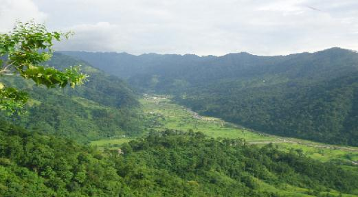
8 Study Areas 8

9 Study Area 9
10 Methodological Framework WorldView-2 MSS WorldView-2 Pan Lidar data Field measurement Co-registration Species-specific allometric equation Pan-sharpened image DSM-DTM Above ground carbon stock Integration CHM Multi-resolution Segmentation CPA and Lidar derived height Multiple regression model Carbon map 10
11 Research Methods: Above ground carbon calculation from species specific allometric equation ln (V) = a + b * ln(dbh) + c * ln(ht) Species wise stem volume of tree adapted from Sharma & Pukkala (1990) Stem biomass = Stem volume * Wood density Total AGB = Stem biomass + Branch biomass + Foliage biomass Total Carbon Stock = Total AGB*0.47 Branch biomass and foliage biomass was calculated from component tree biomass ratio developed by Sharma & Pukkala (1990) and Sharma (2011) 11
12 Research Methods: Canopy height model (CHM) generation Lidar data was processed in LasTools using several functions such as lasground, blast2dem and lasgrid for interpolation of elevation point DTM was generated from ground point using 0.5 m interpolation DSM was generated from non-ground points using 0.5 m interpolation CHM was obtained by subtracting the DTM from DSM using raster calculator of ArcGIS Height of individual trees was obtained from filtering of CHM using con function of raster calculator 12

13 Research Methods: Multi-resolution image segmentation 13
14 Results: Spectral separability of WorldView-2 image How accurately WorldView-2 image can differentiate tree species on the basis of spectral separability? Transformed Divergence Best average separability:

")
 CHM")
 CHM in 3D view")
15 Results: CHM generation from Lidar data a) DTM generated from last return b) DSM generated from first return c) CHM derived from DTM and DSM d) CHM in 3D view (tree height) 15
 DSM")
 DTM")
 Canopy")

16 Results: CHM generation - a) DSM generated from first return = b) DTM generated from last return c) Canopy Height Model(CHM) d) Subset of CHM (tree height) in 3D view 16


17 Canopy Height modeling & Segmentation Canopy Height Model Segmentation
18 Results: Accuracy assessment of CHM How accurately the height of individual trees can be estimated from the Lidar derived CHM? Summary of Fit Correlation coefficient R Square Adjusted R Square Standard Error Root Mean Square Error RMSE % Intercept Slope Observations 205 Pearson s correlation test indicated statistically significant relationship between height measured from field and derived from Lidar F-test showed indicated that there is no significant difference between height measured from field and derived from Lidar 18


19 Results: Image segmentation Panchromatic image Pan-sharpened image 19
20 Results: Image segmentation How accurate is the segmentation of CPA from WorldView-2 image in combination with Lidar data? Over segmentation: 0.29 Under segmentation: 0.34 D value: 0.33 (33% error of segmentation) Total no of reference CPA: 344 1:1 spatial correspondence: 261 Segmentation accuracy: 75.87% 20
21 Results: Image Classification What type of forest and tree species are found in each CFUG? Forest cover classification Name of Overall Class name CFs accuracy (%) Kappa statistics Devidhunga Forest area 94% 0.75 Forest area 86% 0.72 Nebuwater Janprogati B Name of CFs Non-forest area Forest area 82% Non-forest area Tree species classification Number of species classified Overall Accuracy (%) 0.70 Kappa statistics Devidhunga 7 67% 0.52 Nibuwatar 5 75% 0.69 Janprogati B 2 86% 0.71 Higher no of species classified, lower the accuracy obtained 21

22 Results: Classified image MSc Proposal presentaion /04/
23 Results: Correlation among CPA, height and carbon stock What is the relationship between CPA, height and carbon stock of dominant tree species? Species Name Variables df (n-2) t- statistic r R Square P value Shorea robusta Lagerstroemia parviflora Terminalia tomentosa Schima wallichii Others CPA and carbon < 0.01 Height and carbon < 0.01 CPA and height < 0.01 CPA and carbon < 0.01 Height and carbon < 0.01 CPA and height < 0.01 CPA and carbon < 0.01 Height and carbon < 0.01 CPA and height < 0.01 CPA and carbon < 0.01 Height and carbon < 0.01 CPA and height < 0.01 CPA and carbon < 0.01 Height and carbon < 0.01 CPA and height <
24 Results: Model calibration Ln Carbon = β 0 + β 1 * Ln (CPA) + β 2 * Ln (Height)... Multiple regression model Where, Ln is natural logarithm to the base Carbon is above ground carbon stock per tree in Kg β 0 is intercept β 1 is coefficient of CPA β 2 is coefficient of Lidar derived tree height Species β 0 β 1 β 2 R Square Adjusted R square Standard error Observations Shorea robusta Lagerstroemia parviflora Terminalia tomentosa Schima wallichii Others
25 Results: Model Validation R 2 = 0.94 RMSE% = R 2 = 0.78 RMSE% = Shorea robusta Lagersroemia parviflora R 2 = 0.76 RMSE% = R 2 = 0.84 RMSE% = R 2 = 0.78 RMSE% = Terminalia tomentosa Schima wallichii Others 25

26 Results: Carbon stock mapping 26

27 Results: Carbon stock estimation (species and CF wise) How much carbon is stored by each major type of tree species in the study area? Total carbon stock in study area: Carbon stock per ha: Mg Mg 27
28 Conclusions Lidar derived tree height was able to explain 76% of field measured tree height with RMSE of 3.84 m WorldView-2 satellite image is reasonably accurate in differentiating the tree species on the basis of spectral signature separability Combination of VHR satellite image and airborne Lidar data is reasonably accurate in segmenting individual tree crown Relationship among CPA, Lidar derived tree height and carbon measured from field data was found to be significant Species wise multiple regression models using CPA and height can accurately estimate the carbon stock of forest 28


29 Future Work Up-scaling Use medium resolution Affordable Practical REDD MRV Acknowledgement: N. Tsendbazar, S. Baral, R. Shah S. Kumar, S. Maharjan, Y. Karana, P. Mbaabu, M. Asmara, H. Gilani and others. 29
VCS REDD Methodology Module. Methods for monitoring forest cover changes in REDD project activities
 1 VCS REDD Methodology Module Methods for monitoring forest cover changes in REDD project activities Version 1.0 May 2009 I. SCOPE, APPLICABILITY, DATA REQUIREMENT AND OUTPUT PARAMETERS Scope This module
National and Sub-national Carbon monitoring tools developed at the WHRC
 National and Sub-national Carbon monitoring tools developed at the WHRC Nadine Laporte Woods Hole Research Center A. Baccini, W. Walker, S. Goetz, M. Sun, J. Kellndorfer Kigali, 20 th June 2011 Why measuring
Threats to tropical forests
 Threats to tropical forests and what we can do about it Ryszard Laskowski Institute of Environmental Sciences Jagiellonian University www.eko.uj.edu.pl/laskowski 1/22 Human activities: dangers and hopes
Assessing aboveground tropical forest biomass from optical very high resolution images
 Assessing aboveground tropical forest biomass from optical very high resolution images Pierre COUTERON IRD AMAP Lab, Montpellier, France N. Barbier, J-F Bastin, V. Droissart, R. Pélissier, P. Ploton, C.
Notable near-global DEMs include
 Visualisation Developing a very high resolution DEM of South Africa by Adriaan van Niekerk, Stellenbosch University DEMs are used in many applications, including hydrology [1, 2], terrain analysis [3],
Lidar Remote Sensing for Forestry Applications
 Lidar Remote Sensing for Forestry Applications Ralph O. Dubayah* and Jason B. Drake** Department of Geography, University of Maryland, College Park, MD 0 *rdubayah@geog.umd.edu **jasdrak@geog.umd.edu 1
Let s SAR: Mapping and monitoring of land cover change with ALOS/ALOS-2 L-band data
 Let s SAR: Mapping and monitoring of land cover change with ALOS/ALOS-2 L-band data Rajesh Bahadur THAPA, Masanobu SHIMADA, Takeshi MOTOHKA, Manabu WATANABE and Shinichi rajesh.thapa@jaxa.jp; thaparb@gmail.com
FOREST PARAMETER ESTIMATION BY LIDAR DATA PROCESSING
 P.-F. Mursa Forest parameter estimation by LIDAR data processing FOREST PARAMETER ESTIMATION BY LIDAR DATA PROCESSING Paula-Florina MURSA, Master Student Military Technical Academy, paula.mursa@gmail.com
.FOR. Forest inventory and monitoring quality
 .FOR Forest inventory and monitoring quality FOR : the asset to manage your forest patrimony 2 1..FOR Presentation.FOR is an association of Belgian companies, created in 2010 and supported by a university
Application of mobile devices for community based forest monitoring
 Sensing a Changing World 2012 Application of mobile devices for community based forest monitoring Arun Kumar Pratihast 1, 2, *, Carlos M. Souza Jr. 3, Martin Herold 1 and Lars Ribbe 2 1 2 3 Centre for
Moving Ahead with REDD
 Moving Ahead with REDD Issues, Options and Implications Edited by Arild Angelsen Disclaimer Any views expressed in this book are those of the authors. They do not necessarily represent the views of the
Jeongho SEO, Kyeonghak LEE, Raehyun KIM Korea Forest Research Institute. 6~8. Sept. 2007 Kuala Lumpur, Malaysia
 5 th Workshop on GHG Inventory in Asia Jeongho SEO, Kyeonghak LEE, Raehyun KIM Korea Forest Research Institute 6~8. Sept. 2007 Kuala Lumpur, Malaysia Contents 1/ 32 Background 2/ 32 Land Use and Forestry
MOVING FORWARD WITH LIDAR REMOTE SENSING: AIRBORNE ASSESSMENT OF FOREST CANOPY PARAMETERS
 MOVING FORWARD WITH LIDAR REMOTE SENSING: AIRBORNE ASSESSMENT OF FOREST CANOPY PARAMETERS Alicia M. Rutledge Sorin C. Popescu Spatial Sciences Laboratory Department of Forest Science Texas A&M University
CARBON BALANCE IN BIOMASS OF MAIN FOREST TREE SPECIES IN POLAND
 CARBON BALANCE IN BIOMASS OF MAIN FOREST TREE SPECIES IN POLAND PAWEŁ STRZELIŃSKI Department of Forest Management Poznan University of Life Science TOMASZ ZAWIŁA-NIEDŹWIECKI Forest Research Institute in
Key Words Forest Ecosystem, Carbon Dynamics, Boreal Forests, Tropical Forests, Plots Network
 1 - i Global Environment Research Account for National Institutes Advancement of East Asia Forest Dynamics Plots Network -Monitoring forest carbon cycling for the development of climate change adaptation-(abstract
Forestry Thematic Exploitation Platform Earth Observation Open Science 2.0
 Forestry Thematic Exploitation Platform Earth Observation Open Science 2.0 Tuomas Häme VTT Technical Research of Finland Ltd and the Forestry TEP Team Objective One-stop shop for forestry remote sensing
Contributions of the geospatial fields to monitoring sustainability of urban environments John Trinder. School of Civil and Environmental Engineering
 Contributions of the geospatial fields to monitoring sustainability of urban environments John Trinder School of Civil and Environmental Engineering 2 IMPACT OF HUMAN DEVELOPMENT Humans are modifying the
Monitoring forest emissions
 WORKING PAPER Monitoring forest emissions A review of methods Sheila Wertz-Kanounnikoff CIFOR Working Paper No. 39 Monitoring forest emissions A review of methods Sheila Wertz-Kanounnikoff November 2008
LiDAR remote sensing to individual tree processing: A comparison between high and low pulse density in Florida, United States of America
 LiDAR remote sensing to individual tree processing: A comparison between high and low pulse density in Florida, United States of America Carlos Alberto Silva 1 Andrew Hudak 2 Robert Liebermann 2 Kevin
LiDAR for vegetation applications
 LiDAR for vegetation applications UoL MSc Remote Sensing Dr Lewis plewis@geog.ucl.ac.uk Introduction Introduction to LiDAR RS for vegetation Review instruments and observational concepts Discuss applications
From Ideas to Innovation
 From Ideas to Innovation Selected Applications from the CRC Research Lab in Advanced Geomatics Image Processing Dr. Yun Zhang Canada Research Chair Laboratory in Advanced Geomatics Image Processing (CRC-AGIP
RESOLUTION MERGE OF 1:35.000 SCALE AERIAL PHOTOGRAPHS WITH LANDSAT 7 ETM IMAGERY
 RESOLUTION MERGE OF 1:35.000 SCALE AERIAL PHOTOGRAPHS WITH LANDSAT 7 ETM IMAGERY M. Erdogan, H.H. Maras, A. Yilmaz, Ö.T. Özerbil General Command of Mapping 06100 Dikimevi, Ankara, TURKEY - (mustafa.erdogan;
Remote Sensing Method in Implementing REDD+
 Remote Sensing Method in Implementing REDD+ FRIM-FFPRI Research on Development of Carbon Monitoring Methodology for REDD+ in Malaysia Remote Sensing Component Mohd Azahari Faidi, Hamdan Omar, Khali Aziz
Forest carbon sequestration and climate change. Dr Brian Tobin University College Dublin
 Forest carbon sequestration and climate change Dr Brian Tobin University College Dublin Overview Sequestration what is it & why important? Role of forests in climate change CARBiFOR research project Forest
A Streamlined Approach to the Component Ratio Method for RGGI U.S. Forest Projects Outside of California, Oregon, Washington, Alaska and Hawaii
 for RGGI U.S. Forest Projects Outside of California, Oregon, Washington, Alaska and Hawaii May 13, 2015 Background on the Component Ratio Method... 2 Streamlined Approach to the Component Ratio Method...
Technical paper. Summary
 UNITED NATIONS Distr. GENERAL FCCC/TP/2009/1 31 May 2009 ENGLISH ONLY Cost of implementing methodologies and monitoring systems relating to estimates of emissions from deforestation and forest degradation,
Innovation and new land monitoring services for climate change, forests and agroforestry
 Innovation and new land monitoring services for climate change, forests and agroforestry Martin Herold Wageningen University Center for Geoinformation Current distribution of aboveground biomass Terrestrial
Module EN: Developing a Reference Level for Carbon Stock Enhancements
 USAID LEAF TECHNICAL GUIDANCE SERIES FOR THE DEVELOPMENT OF A FOREST CARBON MONITORING SYSTEM FOR REDD+ Module EN: Developing a Reference Level for Carbon Stock Enhancements USAID LEAF TECHNICAL GUIDANCE
Special Publication. Multi-Scale Forest Biomass Assessment and Monitoring in the Hindu Kush Himalayan Region: A Geospatial Perspective
 Special Publication Multi-Scale Forest Biomass Assessment and Monitoring in the Hindu Kush Himalayan Region: A Geospatial Perspective 1 About ICIMOD The International Centre for Integrated Mountain Development,
Lidar 101: Intro to Lidar. Jason Stoker USGS EROS / SAIC
 Lidar 101: Intro to Lidar Jason Stoker USGS EROS / SAIC Lidar Light Detection and Ranging Laser altimetry ALTM (Airborne laser terrain mapping) Airborne laser scanning Lidar Laser IMU (INS) GPS Scanning
Nature Values Screening Using Object-Based Image Analysis of Very High Resolution Remote Sensing Data
 Nature Values Screening Using Object-Based Image Analysis of Very High Resolution Remote Sensing Data Aleksi Räsänen*, Anssi Lensu, Markku Kuitunen Environmental Science and Technology Dept. of Biological
Information Contents of High Resolution Satellite Images
 Information Contents of High Resolution Satellite Images H. Topan, G. Büyüksalih Zonguldak Karelmas University K. Jacobsen University of Hannover, Germany Keywords: satellite images, mapping, resolution,
UK Global Forest Monitoring Network: Forest Carbon Tracking
 UK Global Forest Monitoring Network: Forest Carbon Tracking Andy Shaw Director, Knowledge Exchange, NCEO Head of Strategic Business Development, ISIC GMES/GEO Forum, ISIC, 2011 What is happening to the
Integrated Global Carbon Observations. Beverly Law Prof. Global Change Forest Science Science Chair, AmeriFlux Network Oregon State University
 Integrated Global Carbon Observations Beverly Law Prof. Global Change Forest Science Science Chair, AmeriFlux Network Oregon State University Total Anthropogenic Emissions 2008 Total Anthropogenic CO 2
High Resolution RF Analysis: The Benefits of Lidar Terrain & Clutter Datasets
 0 High Resolution RF Analysis: The Benefits of Lidar Terrain & Clutter Datasets January 15, 2014 Martin Rais 1 High Resolution Terrain & Clutter Datasets: Why Lidar? There are myriad methods, techniques
5.5 QUALITY ASSURANCE AND QUALITY CONTROL
 0 0 0. QUALITY ASSURANCE AND QUALITY CONTROL.. Introduction The IPCC Good Practice Guidance and Uncertainty Management (GPG000, IPCC, 000), Chapter, Quality Assurance and Quality Control, defines quality
Digital Classification and Mapping of Urban Tree Cover: City of Minneapolis
 Digital Classification and Mapping of Urban Tree Cover: City of Minneapolis FINAL REPORT April 12, 2011 Marvin Bauer, Donald Kilberg, Molly Martin and Zecharya Tagar Remote Sensing and Geospatial Analysis
Urban Tree Planting Quantification Guidance
 Urban Tree Planting Quantification Guidance June 2014 This document provides guidance for quantifying an Urban Tree Planting (UTP) Project s carbon stocks, both for purposes of estimating a project s baseline
UPDATING OBJECT FOR GIS DATABASE INFORMATION USING HIGH RESOLUTION SATELLITE IMAGES: A CASE STUDY ZONGULDAK
 UPDATING OBJECT FOR GIS DATABASE INFORMATION USING HIGH RESOLUTION SATELLITE IMAGES: A CASE STUDY ZONGULDAK M. Alkan 1, *, D. Arca 1, Ç. Bayik 1, A.M. Marangoz 1 1 Zonguldak Karaelmas University, Engineering
Photogrammetric Point Clouds
 Photogrammetric Point Clouds Origins of digital point clouds: Basics have been around since the 1980s. Images had to be referenced to one another. The user had to specify either where the camera was in
Development of a forest stand top-height model for Airborne Laser Scanning Data (ALS)
") Development of a forest stand top-height model for Airborne Laser Scanning Data (ALS) Under the project ForseenPOMERANIA 2 Table of content 3 Airborne Laser Scanning (ALS) got more and more priority for
Development of a forest stand top-height model for Airborne Laser Scanning Data (ALS) Under the project ForseenPOMERANIA 2 Table of content 3 Airborne Laser Scanning (ALS) got more and more priority for
Report of the technical assessment of the proposed forest reference emission level of Brazil submitted in 2014
 United Nations FCCC/TAR/2014/BRA Distr.: General 1 December 2014 English only Report of the technical assessment of the proposed forest reference emission level of Brazil submitted in 2014 Summary This
CLIMATE CHANGE & FORESTS; STATUS OF SCIENCE, POLICY & RESEARCH. Prof. Ravindranath Indian Institute of Science Bangalore
 CLIMATE CHANGE & FORESTS; STATUS OF SCIENCE, POLICY & RESEARCH Prof. Ravindranath Indian Institute of Science Bangalore Forests and climate change 1. Deforestation and land use change contribute to CO
Research On The Classification Of High Resolution Image Based On Object-oriented And Class Rule
 Research On The Classification Of High Resolution Image Based On Object-oriented And Class Rule Li Chaokui a,b, Fang Wen a,b, Dong Xiaojiao a,b a National-Local Joint Engineering Laboratory of Geo-Spatial
Estimation of Carbon Stock in Indian Forests. Subhash Ashutosh Joint Director Forest Survey of India sashutosh30@yahoo.com
 Estimation of Carbon Stock in Indian Forests Subhash Ashutosh Joint Director Forest Survey of India sashutosh30@yahoo.com Salient Features of the Methodology most comprehensive assessment so far a GIS
Tools for National Forest Monitoring Systems in the context of REDD+
 Tools for National Forest Monitoring Systems in the context of REDD+ Dr. Inge JONCKHEERE UN-REDD Team (FAO HQ Rome, Italy) INPE/FUNCATE Team (Sao Jose dos Campos, Brasil) ECOWAS GBEP REGIONAL BIOMASS RESOURCE
Cost Considerations of Using LiDAR for Timber Inventory 1
 Cost Considerations of Using LiDAR for Timber Inventory 1 Bart K. Tilley, Ian A. Munn 3, David L. Evans 4, Robert C. Parker 5, and Scott D. Roberts 6 Acknowledgements: Mississippi State University College
The following was presented at DMT 14 (June 1-4, 2014, Newark, DE).
.") DMT 2014 The following was presented at DMT 14 (June 1-4, 2014, Newark, DE). The contents are provisional and will be superseded by a paper in the DMT 14 Proceedings. See also presentations and Proceedings
DMT 2014 The following was presented at DMT 14 (June 1-4, 2014, Newark, DE). The contents are provisional and will be superseded by a paper in the DMT 14 Proceedings. See also presentations and Proceedings
3D Model of the City Using LiDAR and Visualization of Flood in Three-Dimension
 3D Model of the City Using LiDAR and Visualization of Flood in Three-Dimension R.Queen Suraajini, Department of Civil Engineering, College of Engineering Guindy, Anna University, India, suraa12@gmail.com
GIS and Predictive Modeling: a Comparison of Methods Applied to Schima superba Potential Habitat and Decision Making
 GIS and Predictive Modeling: a Comparison of Methods Applied to Schima superba Potential Habitat and Decision Making Hou-Chang Chen 1 Nan-Jang Lo 2 Wei-I Chang 3 Kai-Yi Huang 4 1 Undergraduate (Senior),
GEO FOREST CARBON TRACKING Tasmania National Demonstrator
 GEO FOREST CARBON TRACKING Tasmania National Demonstrator Overview of quality assurance concepts for image processing in national carbon accounting systems Volume III Sept 2012 List of contents Executive
Forest Carbon Accounting: Overview & Principles
 Forest Carbon Accounting: Overview & Principles CDM Capacity Development in Eastern and Southern Africa Charlene Watson London School of Economics and Political Science c.watson2@lse.ac.uk Disclaimer The
 European Forest Data Centre Biosoil/Biodiversity Forest Type Map 2006 P. Kempeneers, JRC T. Durant F. Sedano, JRC L. Seebach, JRC J. San-Miguel-Ayanz, JRC EC -, IES Land Management and Natural Hazard Unit
METHODOLOGY FOR LANDSLIDE SUSCEPTIBILITY AND HAZARD MAPPING USING GIS AND SDI
 The 8th International Conference on Geo-information for Disaster Management Intelligent Systems for Crisis Management METHODOLOGY FOR LANDSLIDE SUSCEPTIBILITY AND HAZARD MAPPING USING GIS AND SDI T. Fernández
Application of airborne remote sensing for forest data collection
 Application of airborne remote sensing for forest data collection Gatis Erins, Foran Baltic The Foran SingleTree method based on a laser system developed by the Swedish Defense Research Agency is the first
Geospatial Software Solutions for the Environment and Natural Resources
 Geospatial Software Solutions for the Environment and Natural Resources Manage and Preserve the Environment and its Natural Resources Our environment and the natural resources it provides play a growing
Global Climate Change: Carbon Reporting Initiative
 United States Agency for International Development Cooperative Agreement No. EEM-A-00-06-00024-00 Global Climate Change: Carbon Reporting Initiative January 2012 Submitted by: Nancy Harris Ecosystem Services
Managing Lidar (and other point cloud) Data. Lindsay Weitz Cody Benkelman
 Data. Lindsay Weitz Cody Benkelman") (and other point cloud) Data Lindsay Weitz Cody Benkelman Presentation Context What is lidar, and how does it work? Not this presentation! What can you do with lidar in ArcGIS? What does Esri recommend
(and other point cloud) Data Lindsay Weitz Cody Benkelman Presentation Context What is lidar, and how does it work? Not this presentation! What can you do with lidar in ArcGIS? What does Esri recommend
Nationwide forest estimates in Sweden using satellite data and airborne LiDAR. (Or: going from 2 D to 3D)
") Nationwide forest estimates in Sweden using satellite data and airborne LiDAR (Or: going from 2 D to 3D) Håkan Olsson Mats Nilsson, Johan Fransson, Henrik Persson and Mikael Egberth (SLU) Umeå Svante Larsson
Nationwide forest estimates in Sweden using satellite data and airborne LiDAR (Or: going from 2 D to 3D) Håkan Olsson Mats Nilsson, Johan Fransson, Henrik Persson and Mikael Egberth (SLU) Umeå Svante Larsson
'Developments and benefits of hydrographic surveying using multispectral imagery in the coastal zone
 Abstract With the recent launch of enhanced high-resolution commercial satellites, available imagery has improved from four-bands to eight-band multispectral. Simultaneously developments in remote sensing
Land Use/Land Cover Map of the Central Facility of ARM in the Southern Great Plains Site Using DOE s Multi-Spectral Thermal Imager Satellite Images
 Land Use/Land Cover Map of the Central Facility of ARM in the Southern Great Plains Site Using DOE s Multi-Spectral Thermal Imager Satellite Images S. E. Báez Cazull Pre-Service Teacher Program University
Remote Sensing an Introduction
 Remote Sensing an Introduction Seminar: Space is the Place Referenten: Anica Huck & Michael Schlund Remote Sensing means the observation of, or gathering information about, a target by a device separated
Community Carbon Forestry: Remote Sensing of Forest Carbon and Forest Degradation in Nepal
 Community Carbon Forestry: Remote Sensing of Forest Carbon and Forest Degradation in Nepal Course Title: Level: Geo-Information Science and Earth Observation for Environmental Modelling and Management
Measurement and Monitoring of the World s Forests
 RFF REPORT Measurement and Monitoring of the World s Forests A Review and Summary of Remote Sensing Technical Capability, 2009 2015 Matthew Fagan and Ruth DeFries DECEMBER 2009 Preface This report is part
ENVI THE PREMIER SOFTWARE FOR EXTRACTING INFORMATION FROM GEOSPATIAL IMAGERY.
 ENVI THE PREMIER SOFTWARE FOR EXTRACTING INFORMATION FROM GEOSPATIAL IMAGERY. ENVI Imagery Becomes Knowledge ENVI software uses proven scientific methods and automated processes to help you turn geospatial
AN INVESTIGATION OF THE GROWTH TYPES OF VEGETATION IN THE BÜKK MOUNTAINS BY THE COMPARISON OF DIGITAL SURFACE MODELS Z. ZBORAY AND E.
 ACTA CLIMATOLOGICA ET CHOROLOGICA Universitatis Szegediensis, Tom. 38-39, 2005, 163-169. AN INVESTIGATION OF THE GROWTH TYPES OF VEGETATION IN THE BÜKK MOUNTAINS BY THE COMPARISON OF DIGITAL SURFACE MODELS
Multi-scale upscaling approaches of soil properties from soil monitoring data
 local scale landscape scale forest stand/ site level (management unit) Multi-scale upscaling approaches of soil properties from soil monitoring data sampling plot level Motivation: The Need for Regionalization
Chapter Contents Page No
 Chapter Contents Page No Preface Acknowledgement 1 Basics of Remote Sensing 1 1.1. Introduction 1 1.2. Definition of Remote Sensing 1 1.3. Principles of Remote Sensing 1 1.4. Various Stages in Remote Sensing
Need for up-to-date data to support inventory compilers in implementing IPCC methodologies to estimate emissions and removals for AFOLU Sector
 Task Force on National Greenhouse Gas Inventories Need for up-to-date data to support inventory compilers in implementing IPCC methodologies to estimate emissions and removals for AFOLU Sector Joint FAO-IPCC-IFAD
Digital image processing
 746A27 Remote Sensing and GIS Lecture 4 Digital image processing Chandan Roy Guest Lecturer Department of Computer and Information Science Linköping University Digital Image Processing Most of the common
y = Xβ + ε B. Sub-pixel Classification
 Sub-pixel Mapping of Sahelian Wetlands using Multi-temporal SPOT VEGETATION Images Jan Verhoeye and Robert De Wulf Laboratory of Forest Management and Spatial Information Techniques Faculty of Agricultural
PIXEL-LEVEL IMAGE FUSION USING BROVEY TRANSFORME AND WAVELET TRANSFORM
 PIXEL-LEVEL IMAGE FUSION USING BROVEY TRANSFORME AND WAVELET TRANSFORM Rohan Ashok Mandhare 1, Pragati Upadhyay 2,Sudha Gupta 3 ME Student, K.J.SOMIYA College of Engineering, Vidyavihar, Mumbai, Maharashtra,
LCCS & GeoVIS for land cover mapping. Experience Sharing of an Exercise
 LCCS & GeoVIS for land cover mapping Experience Sharing of an Exercise Forest Survey of India Subhash Ashutosh Joint Director Study Area Topographic sheet 53J4 Longitude - 78ºE - 78º15'E Latitude - 30ºN
Definitions of each biomass component and the equations used to estimate the ovendry weight in pounds are shown in appendix tables J-1 through J-5.
 . Biomass Estimation in the FIADB In previous versions of the FIADB, a variety of regional methods were used to estimate tree biomass for live and dead trees in the TREE table. In FIADB 4.0, a new nationally
Forest Carbon Monitoring: A Review of Selected Remote Sensing and Carbon Measurement Tools for REDD+
 Forest Carbon Monitoring: A Review of Selected Remote Sensing and Carbon Measurement Tools for REDD+ October 2011 Revised July 2012 United States Department of Agriculture Forest Service RSAC-10018-RPT1
The premier software for extracting information from geospatial imagery.
 Imagery Becomes Knowledge ENVI The premier software for extracting information from geospatial imagery. ENVI Imagery Becomes Knowledge Geospatial imagery is used more and more across industries because
Sub-pixel mapping: A comparison of techniques
 Sub-pixel mapping: A comparison of techniques Koen C. Mertens, Lieven P.C. Verbeke & Robert R. De Wulf Laboratory of Forest Management and Spatial Information Techniques, Ghent University, 9000 Gent, Belgium
WATER BODY EXTRACTION FROM MULTI SPECTRAL IMAGE BY SPECTRAL PATTERN ANALYSIS
 WATER BODY EXTRACTION FROM MULTI SPECTRAL IMAGE BY SPECTRAL PATTERN ANALYSIS Nguyen Dinh Duong Department of Environmental Information Study and Analysis, Institute of Geography, 18 Hoang Quoc Viet Rd.,
Virtual constellations, time series, and cloud screening opportunities for Sentinel 2 and Landsat
 Virtual constellations, time series, and cloud screening opportunities for Sentinel 2 and Landsat Sentinel 2 for Science Workshop 20 22 May 2014 ESA ESRIN, Frascati (Rome), Italy 1 Part 1: Title: Towards
Soil degradation monitoring by active and passive remote-sensing means: examples with two degradation processes
 Soil degradation monitoring by active and passive remote-sensing means: examples with two degradation processes Naftaly Goldshleger, *Eyal Ben-Dor,* *Ido Livne,* U. Basson***, and R.Ben-Binyamin*Vladimir
2.3 Spatial Resolution, Pixel Size, and Scale
 Section 2.3 Spatial Resolution, Pixel Size, and Scale Page 39 2.3 Spatial Resolution, Pixel Size, and Scale For some remote sensing instruments, the distance between the target being imaged and the platform,
EO based glacier monitoring
 EO based glacier monitoring THEMES 1. WGMS & GLIMS within GTN G: strategic set up 2. GlobGlacier & Glaciers_cci: EO based products 3. LDCM & Sentinel 2: future monitoring perspectives Frank Paul* Department
Planning Tools related to water in Promotional Complex Forest Western Sudety Mountains
 Planning Tools related to water in Promotional Complex Forest Western Sudety Mountains Radomir Balazy Forest Research Institute R.Balazy@ibles.waw.pl Content 1. Introduction 2. Technologies of data collection
Files Used in this Tutorial
 Generate Point Clouds Tutorial This tutorial shows how to generate point clouds from IKONOS satellite stereo imagery. You will view the point clouds in the ENVI LiDAR Viewer. The estimated time to complete
Evaluation of surface runoff conditions. scanner in an intensive apple orchard
 Evaluation of surface runoff conditions by high resolution terrestrial laser scanner in an intensive apple orchard János Tamás 1, Péter Riczu 1, Attila Nagy 1, Éva Lehoczky 2 1 Faculty of Agricultural
SEMI-AUTOMATED CLOUD/SHADOW REMOVAL AND LAND COVER CHANGE DETECTION USING SATELLITE IMAGERY
 SEMI-AUTOMATED CLOUD/SHADOW REMOVAL AND LAND COVER CHANGE DETECTION USING SATELLITE IMAGERY A. K. Sah a, *, B. P. Sah a, K. Honji a, N. Kubo a, S. Senthil a a PASCO Corporation, 1-1-2 Higashiyama, Meguro-ku,
3D Building Roof Extraction From LiDAR Data
 3D Building Roof Extraction From LiDAR Data Amit A. Kokje Susan Jones NSG- NZ Outline LiDAR: Basics LiDAR Feature Extraction (Features and Limitations) LiDAR Roof extraction (Workflow, parameters, results)
HAWASSA UNIVERSITY WONDO GENET COLLEGE OF FORESTRY AND NATURAL RESOURCES
 P a g e 1 HAWASSA UNIVERSITY WONDO GENET COLLEGE OF FORESTRY AND NATURAL RESOURCES TRAINING MANUAL ON: FOREST CARBON POOLS AND CARBON STOCK ASSESSMENT IN THE CONTEXT OF SFM AND REDD+ Compiled by: Genene
RULE INHERITANCE IN OBJECT-BASED IMAGE CLASSIFICATION FOR URBAN LAND COVER MAPPING INTRODUCTION
 RULE INHERITANCE IN OBJECT-BASED IMAGE CLASSIFICATION FOR URBAN LAND COVER MAPPING Ejaz Hussain, Jie Shan {ehussain, jshan}@ecn.purdue.edu} Geomatics Engineering, School of Civil Engineering, Purdue University
Agroforestry and climate change. Emmanuel Torquebiau FAO webinar 5 February 2013
 Agroforestry and climate change Emmanuel Torquebiau FAO webinar 5 February 2013 Agroforestry: well-known buffering and resilience effects Climate variability is well buffered by agroforestry because of
Assessment of cork production in new Quercus suber plantations under future climate. Joana A Paulo Margarida Tomé João HN Palma
 Assessment of cork production in new Quercus suber plantations under future climate Joana A Paulo Margarida Tomé João HN Palma 22 May 2012 1 Introduction Climate is related to several variables that affect
Map World Forum Hyderabad, India Introduction: High and very high resolution space images: GIS Development
 Very high resolution satellite images - competition to aerial images Dr. Karsten Jacobsen Leibniz University Hannover, Germany jacobsen@ipi.uni-hannover.de Introduction: Very high resolution images taken
LIDAR and Digital Elevation Data
 LIDAR and Digital Elevation Data Light Detection and Ranging (LIDAR) is being used by the North Carolina Floodplain Mapping Program to generate digital elevation data. These highly accurate topographic
Satellite Remote Sensing of Volcanic Ash
 Marco Fulle www.stromboli.net Satellite Remote Sensing of Volcanic Ash Michael Pavolonis NOAA/NESDIS/STAR SCOPE Nowcasting 1 Meeting November 19 22, 2013 1 Outline Getty Images Volcanic ash satellite remote
Science Rationale. Status of Deforestation Measurement. Main points for carbon. Measurement needs. Some Comments Dave Skole
 Science Rationale Status of Deforestation Measurement Some Comments Dave Skole Tropical deforestation is related to: Carbon cycle and biotic emissions/sequestration Ecosystems and biodiversity Water and
SUPPORTING FACTSHEET
 SUPPORTING FACTSHEET 13 August 2015 Progress towards delivering Asia Pulp & Paper Group s peatland commitments OVERVIEW... 2 APP CONSERVATION MILESTONES... 2 CONTEXT... 2 Indonesia scommitment to greenhouse
The United Nations Environment Programme and the 2030 Agenda. Global Action for People and the Planet
 The United Nations Environment Programme and the 2030 Agenda Global Action for People and the Planet Unemployment, resource scarcity, climate change, food insecurity and inequity all signal the need for
A remote sensing instrument collects information about an object or phenomenon within the
 Satellite Remote Sensing GE 4150- Natural Hazards Some slides taken from Ann Maclean: Introduction to Digital Image Processing Remote Sensing the art, science, and technology of obtaining reliable information
i-tree-eco International Versions
 i-tree-eco International Versions David J. Nowak (US Forest Service, Northern Research Station) June 28, 2010 Executive Summary To enhance the ability of i-tree to work outside the United States, various
The role of RS/GIS applications for National Forest Monitoring Systems in the context of REDD+
 The role of RS/GIS applications for National Forest Monitoring Systems in the context of REDD+ Dr. Inge JONCKHEERE UN-REDD Team (FAO HQ Rome, Italy) INPE/FUNCATE Team (Sao Jose dos Campos, Brasil) AGU