Stream Mapping Advisory Committee Update
|
|
|
- Isaac Holt
- 7 years ago
- Views:
Transcription
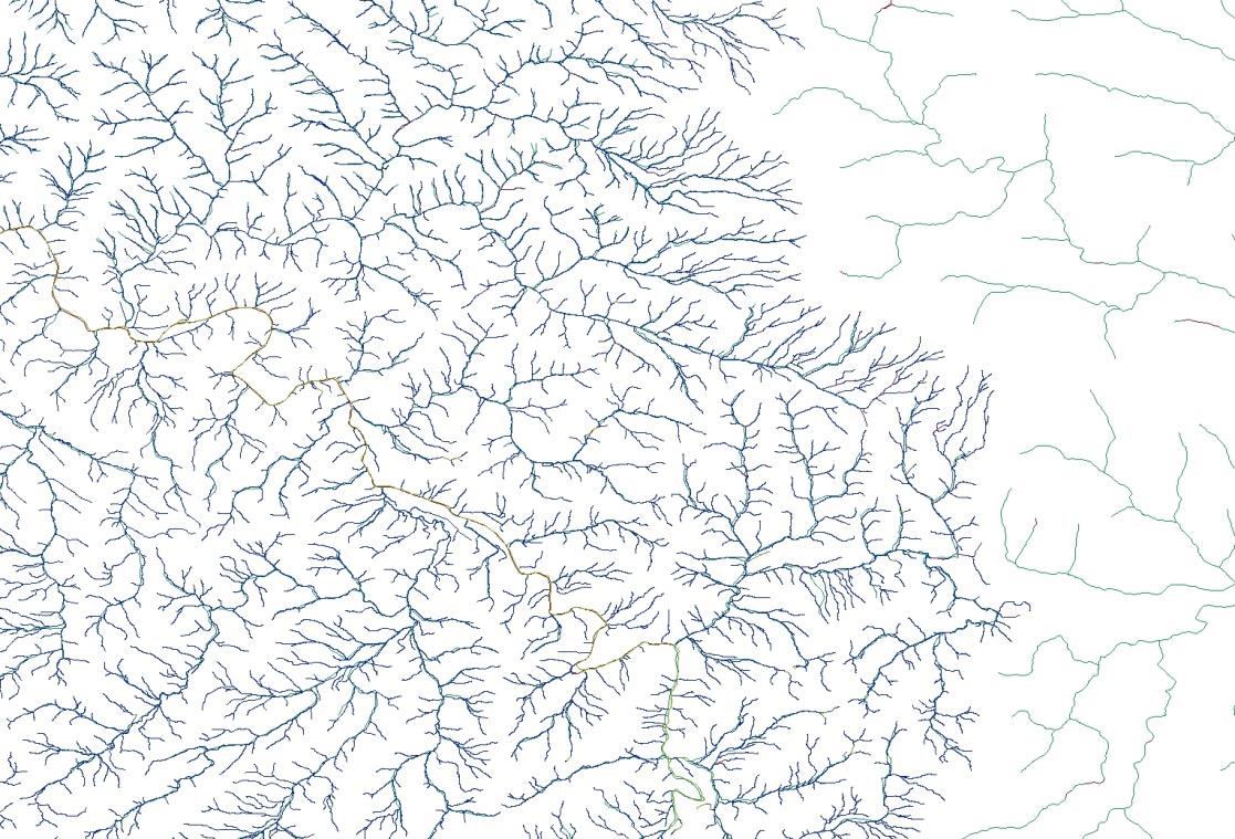
1 Stream Mapping Advisory Committee Update The North Carolina Streambed Mapping Advisory Committee (StreamMAC) is a standing committee of the Statewide Mapping Advisory Committee, which operates under the authority of the North Carolina Geographic Information Coordinating Council.
2 StreamMAC Role The North Carolina Streambed Mapping Advisory Committee is organized to establish policy and guide development of surface water mapping through the National Hydrography Dataset (NHD) and identification and delineation of watersheds and catchments through the Watershed Boundary Dataset (WBD) in North Carolina. The StreamMAC will generate recommendations based on the documented requirements of federal, state, and local government and tribal bodies.
3 StreamMAC Goals Establish designated representation with stakeholder organizations, and appoint representation with GICC committees, working groups, and related bodies. Maintain foundational materials and develop strategies to complete local resolution NHD production in North Carolina. Establish a governance framework for the technical and programmatic issues to enable technical maintenance. Establish a stewardship agreement that meets the needs of the StreamMAC membership and larger stakeholder community.
4 StreamMAC Participation NC Department of Transportation NC Department of Environment and Natural Resources NC Department of Agriculture NC Forest Service GICC Local Government Committee NC Department of Emergency Management NC Secretary of State NC Ecosystem Enhancement Program US Geological Survey US Natural Resources Conservation Service US Environmental Protection Agency US Park Service US Forest Service US Army Corps of Engineers Eastern Band of Cherokee
5 StreamMAC Workplan Develop consensus on workgroup goals and workplan for remainder of FY Designate StreamMAC representation for GICC entities and StreamMAC representation to stewardship workgroups for NHD and WBD. Develop and implement plan to document current user requirements and reassess 2004 Implementation Plan to Improve the Mapping and Digital Representation of Surface Waters in North Carolina. (ncstreams.org) Develop and implement a plan to develop a business case and updated cost model for completing local resolution NHD across North Carolina. Develop and implement a plan to establish a governance model and stewardship guidelines for NHD and WDB maintenance in North Carolina.
6 2005 Requirements Increase the quality and content of mapping, especially in upper reaches of the watersheds so that all regulated streams and water bodies are mapped and available on the Internet (through NC OneMap) Provide uniform mapping across all jurisdictions in the state resulting in an extraordinary opportunity for better decision making, closer collaborations on crossjurisdictional initiatives and better use of resources. Develop a resource that reflects current streams and lake locations in the landscape to enhance efforts to avoid wetlands in the planning of public-private facilities. Implement a plan to maintain and update the content as conditions change in the landscape thereby preserving North Carolina s investment Utilize larger, more detailed mapping scale to complement the mapping systems managed by local governments (mapping scales of 1:1,200) for local planning efforts. Improve accuracy and uniformity of stream mapping by utilizing (leveraging) the State s recent investment in statewide elevation data (using LIDAR technology), and the aerial image resources of counties and the state.
7 StreamMAC Business Requirements Updateable geometry (coastal emphasis) Consistent flow regime attribution Known accuracy Data management Integrate all forms of flow conveyance Maintenance, Change, Update Processes

8

9
10
11 Potential Business Needs Change submittal process GICC EMC approved map Mapping project approval process Local resolution NHD in NC mountain counties Local government geometries Headwaters Mapping Project Integrate Field Calls EEP and DOT realignments
12 USGS Business Requirements USGS National Assessment of Hydrography develop and refine future program alternatives that would provide enhanced hydrographic data to meet many Federal, State, and other national business needs Operational Improvements, Customer Service Improvements, and Societal Benefits
13 Challenges and Issues DWR rules with references to USGS and NRCS Regulatory Reform Act of 2013 (HB74, SL ) Name integration DWR compared to GNIS State tables in NC Local Resolution
14 2015 USGS Hydro Survey and Workshops DWR Business Requirements/Desires StreamMAC workgroups develop white papers for various processes and work flows
Alternative (Flexible) Mitigation Options Proposed Rule - Revised
 Mitigation Options Proposed Rule - Revised") Alternative (Flexible) Mitigation Options Proposed Rule - Revised NC Association of Environmental Professionals June 9, 2011 Background Purposes Update rules due to required changes from statutes Put all
Alternative (Flexible) Mitigation Options Proposed Rule - Revised NC Association of Environmental Professionals June 9, 2011 Background Purposes Update rules due to required changes from statutes Put all
Evolution of Partnership and the Geospatial Liaison Network at the USGS
 Evolution of Partnership and the Geospatial Liaison Network at the USGS Vicki Lukas September 13, 2012 NSGIC Annual Conference U.S. Department of the Interior U.S. Geological Survey An Abridged History
Earth Data Science in The Era of Big Data and Compute
 Earth Data Science in The Era of Big Data and Compute E. Lynn Usery U.S. Geological Survey usery@usgs.gov http://cegis.usgs.gov U.S. Department of the Interior U.S. Geological Survey Board on Earth Sciences
NC Geographic Information Coordinating Council Acronym List - By Category
 NC Geographic Information Coordinating Council Acronym List - By Category Acronym Full Name GICC Committees and Working Groups A Team LGC GIS Advisory Team BGN NC Board on Geographic Names LGC Local Government
Stream-Network Navigation in the U.S. Geological Survey StreamStats Web Application
 2009 International Conference on Advanced Geographic Information Systems & Web Services Stream-Network Navigation in the U.S. Geological Survey StreamStats Web Application Kernell G. Ries III, Peter A.
Business Plan for Orthoimagery in North Carolina
 Business Plan for Orthoimagery in North Carolina Statewide Mapping Advisory Committee Working Group for Orthophotography Planning October 2010 North Carolina Geographic Information Coordinating Council
SWAMP DATA MANAGEMENT PLAN
 SWAMP DATA MANAGEMENT PLAN Station Template Surface Water Ambient Monitoring Program August 27, 2013 TABLE OF CONTENTS C. Data Entry...3 D. Field Data Entry...3 1. PROGRAMS NEEDED FOR SWAMP DATA ENTRY
Michigan Tech Research Institute Wetland Mitigation Site Suitability Tool
 Michigan Tech Research Institute Wetland Mitigation Site Suitability Tool Michigan Tech Research Institute s (MTRI) Wetland Mitigation Site Suitability Tool (WMSST) integrates data layers for eight biophysical
EPA PARCELS PROJECT. Cadastral Data Exchange and RESTful APIs. Funded by US EPA Grant 83431001. Prepared for EN2014
 EPA PARCELS PROJECT Cadastral Data Exchange and RESTful APIs Funded by US EPA Grant 83431001 Prepared for EN2014 February 20, 2014 2 Today s Topics Collaboration in North Carolina Parcels Business Case
ALASKA GEOSPATIAL BUSINESS PLAN. Final, February 2012
 ALASKA GEOSPATIAL BUSINESS PLAN Final, February 2012 This page intentionally left blank Page 2 Business Plan Draft, V2.1 Contents Executive Summary 5 1 Introduction 9 1.1 Overview 9 1.2 Business Plan Unpacked
As stewards of the land, farmers must protect the quality of our environment and conserve the natural resources that sustain it by implementing
 N A T U R A L R E S O U R C E C O N S E R V A T I O N As stewards of the land, farmers must protect the quality of our environment and conserve the natural resources that sustain it by implementing conservation
North Carolina Statewide Orthoimagery 2010 Final Report
 North Carolina Statewide Orthoimagery 2010 Final Report Prepared for: The City of Durham and The North Carolina 911 Board Prepared by: North Carolina Center for Geographic Information and Analysis September
Development of an Impervious-Surface Database for the Little Blackwater River Watershed, Dorchester County, Maryland
 Development of an Impervious-Surface Database for the Little Blackwater River Watershed, Dorchester County, Maryland By Lesley E. Milheim, John W. Jones, and Roger A. Barlow Open-File Report 2007 1308
Presentation Program Outline
 Presentation Program Outline IRWM Program Background San Diego IRWM Planning 2013 IRWM Update Integrated Flood Management Flood Management Planning Study IRWM Program Background What is IRWM? Collaborative
Coastal Engineering Indices to Inform Regional Management
 Coastal Engineering Indices to Inform Regional Management Lauren Dunkin FSBPA 14 February 2013 Outline Program overview Standard products Coastal Engineering Index Conclusion and future work US Army Corps
9.1. Adequacy of Available Data and Monitoring Efforts
 9. DATA MANAGEMENT Data management is a crucial aspect of successful implementation of the ARB IRWMP and its component projects. This section discusses the adequacy of available data and monitoring efforts,
Chapter 9. Selected Watershed Initiatives in the Great Basin Region
 Chapter 9 Selected Watershed Initiatives in the Great Basin Region The Great Basin contains vast areas of sparsely populated desert lands. Lacking an ocean drainage, the Great Basin is a hydrologic sink
Chapter 1b - Priority Map Development
 North Carolina s Forest Resources Assessment A statewide analysis of the past, current and projected future conditions of North Carolina s forest resources 2010 Chapter 1b - Priority Map Development This
Santa Barbara County IRWM
 Santa Barbara County IRWM Presented to the Cooperating Partners of the Santa Barbara County IRWM Monday, November 2, 2015 10:00 am 12:00 pm CCWA, 255 Industrial Way, Buellton, CA 93427 Conference Call
Catalog of Domestic Assistance Number: 66.462 Announcement Date: February 23, 2005 Submission Date: Must be postmarked by April 20, 2005.
 Federal Agency Name: US Environmental Protection Agency Funding Opportunity Title: National Wetland Program Development Grants Announcement Number: HQWPDGFY05 Announcement Type: Initial Request for Proposals
Federal Research and Development in South Dakota
 Chapter 43 Federal Research and Development in South Dakota Approximately $39 million of federal R&D funds are spent each year in South Dakota. South Dakota ranks 52nd among the 5 states, District of Columbia,
Case Study: The History of the San Juan Headwaters Forest Health Partnership
 Case Study: The History of the San Juan Headwaters Forest Health Partnership Introduction: Wildfire is a part of life in Southwest Colorado. It plays an integral role in ecosystem health and management.
Management Strategy Development Work Session
 Management Strategy Development Work Session Healthy Watersheds Outcome Land Use Metrics and Methods Outcome Land Use Options Evaluation Outcome 10/30/2014 Agenda for today 10 10:30am Welcome and Review
Natural Resource Management Profile
 Conducting environmental impact assessments Ensures the identification of the geographic, environmental, economic, social, and cultural scope and parameters to be used for the impact assessment study.
MINIMUM STANDARDS FOR ACCEPTANCE OF AQUATIC RESOURCES DELINEATION REPORTS
 MINIMUM STANDARDS FOR ACCEPTANCE OF AQUATIC RESOURCES DELINEATION REPORTS U.S. ARMY CORPS OF ENGINEERS BUILDING STRONG January 2016 The U.S Army Corps of Engineers, through its Regulatory Program, regulates
Indiana Office of Community and Rural Affairs. Disaster Recovery and Mitigation Planning Ft. Worth, Texas February 15, 2012
 Indiana Office of Community and Rural Affairs Disaster Recovery and Mitigation Planning Ft. Worth, Texas February 15, 2012 Floods Indiana s costliest hazard State ranks 5 th in annual median flood damages
3. The submittal shall include a proposed scope of work to confirm the provided project description;
 QIN Shoreline Master Program Project Summary The Shoreline Master Program (SMP) development process for the Quinault Indian Nation (QIN) includes the completion of inventory and analysis report with corresponding
FWS Cultural Resource Management Planning
 I. What is required? FWS Cultural Resource Management Planning A number of laws, regulations, and Fish and Wildlife Service policies address cultural resource management planning requirements and objectives.
LR 314 Working Group 5 Final Report
 LR 314 Working Group 5 Final Report I. Nebraska Department of Natural Resources Table 1. NDNR and NATURAL RESOURCES COMMISSION WATER/INTEGRATED MANAGEMENT PLANNING RELATED RESEARCH, STUDIES AND RELATED
Natural Resource-Based Planning*
 Natural Resource-Based Planning* Planning, when done well, is among the most powerful tools available to communities. A solid plan, based on good natural resource information, guides rational land-use
Enterprise GIS Business Plan July 4, 2008
 Office for Information Resources GIS Services Enterprise GIS Business Plan July 4, 2008 VERSION 1.1 Table of Contents 1 Executive Summary... 3 2 Background... 6 2.1 Tennessee Base Mapping Program... 6
SEC. 4001. PURPOSE. SEC. 4002. DEFINITIONS. SEC. 4003. COLLABORATIVE FOREST LANDSCAPE RESTORATION PROGRAM.
 TITLE IV--FOREST LANDSCAPE RESTORATION SEC. 4001. PURPOSE. The purpose of this title is to encourage the collaborative, sciencebased ecosystem restoration of priority forest landscapes through a process
Using an All lands Framework for Conservation of Ecosystem Services
 Using an All lands Framework for Conservation of Ecosystem Services Robert Deal USDA Forest Service - PNW Research Station, Portland, OR Nikola Smith USDA Forest Service - Pacific Northwest Region, Portland,
September, 2014 INTRODUCTION
 Urban and Community Forestry Program Guidance September, 2014 INTRODUCTION This document establishes direction for the USDA Forest Service Urban and Community Forestry (UCF) Program, established by Section
Peninsular Florida Landscape Conservation Cooperative. Charter. Background
 Charter Background The Peninsular Florida Landscape Conservation Cooperative (Conservation Cooperative) is part of a national network of Landscape Conservation Cooperatives (LCCs). LCCs are applied conservation
National Network of Reference Watersheds
 National Network of Reference Watersheds National Water Quality Monitoring Council (NWQMC) Advisory Committee for Water Information (ACWI) Present proposal to NWQMC - approved May 2011 Present proposal
The Delaware DataMIL A Pilot Project for The National Map. April 18, 2002 Delaware GIS Conference: Connecting Communities
 The Delaware DataMIL A Pilot Project for The National Map April 18, 2002 Delaware GIS Conference: Connecting Communities The DataMIL Team University of Delaware Christina Callahan, Research & Data Management
DEVELOPING AN INUNDATION MAP STANDARD FOR THE U.S. ARMY CORPS OF ENGINEERS
 DEVELOPING AN INUNDATION MAP STANDARD FOR THE U.S. ARMY CORPS OF ENGINEERS Will Breitkreutz, Geographer, U.S. Army Corps of Engineers Kansas City District, Kansas City, Missouri, will.l.breitkreutz@usace.army.mil
2500 Mandatory Setback from Oil and Gas Development
 Colorado Oil & Gas Conservation Commission 2500 Mandatory Setback from Oil and Gas Development GIS-based assessment of impact proposed 2016 Colorado ballot initiative #78 would have on surface lands available
Strategic Plan 2015-2018
 Strategic Plan 2015-2018 Table of Contents Table of Contents... ii Agency and Mission Information... 1 Introduction... 1 Mission Statement... 2 Vision Statement... 2 Values Statement... 2 Scope of Responsibilities...
Utah State General Records Retention Schedule SCHEDULE 1 GEOSPATIAL DATA SETS
 Utah State General Records Retention Schedule SCHEDULE 1 BIOTA RECORDS (Item 1-26) These are geospatial records that depict wildlife use areas in the state of Utah as determined by wildlife biologists
NC Environmental Restoration Association
 NC Environmental Restoration Association NCERA Members Restoration Systems Environmental Banc & Exchange Wildlands Engineering Michael Baker Corporation KCI Technologies Land Management Group North State
Governing Board Meeting
 \ Governing Board Meeting Agenda July 28, 2015 9:00 AM 7601 US Hwy. 301 Tampa, Florida ( ) - 2379 Broad Street, Brooksville, Florida 34604-6899 (352) 796-7211 or 1-800-423-1476 (FL only) WaterMatters.org
The following was presented at DMT 14 (June 1-4, 2014, Newark, DE).
.") DMT 2014 The following was presented at DMT 14 (June 1-4, 2014, Newark, DE). The contents are provisional and will be superseded by a paper in the DMT 14 Proceedings. See also presentations and Proceedings
DMT 2014 The following was presented at DMT 14 (June 1-4, 2014, Newark, DE). The contents are provisional and will be superseded by a paper in the DMT 14 Proceedings. See also presentations and Proceedings
How To Study The Historic Resources Of The Project
 Name: Project Cultural Resources Survey Designation: Cultural 01 Study Short Description: Identify resources affected by the project that are eligible for the National Register of Historic Places. Applicable
Michigan Wetlands. Department of Environmental Quality
 Department of Environmental Quality Wetlands are a significant component of Michigan s landscape, covering roughly 5.5 million acres, or 15 percent of the land area of the state. This represents about
USGS StreamStats Web Application for Kentucky
 USGS StreamStats Web Application for Kentucky Implementation of selected low- and mean-flow estimating equations Gary Martin, Hydrologist Project Chief U.S. Geological Survey, Kentucky Water Science Center
Innovative Approaches in Flood Damage Reduction
 Innovative Approaches in Flood Damage Reduction Solutions for the Stormwater Management High Level Results 3D geospatial model of storm water management pond (GRCA, 2013) Enhanced understanding of storm
A HYDROLOGIC NETWORK SUPPORTING SPATIALLY REFERENCED REGRESSION MODELING IN THE CHESAPEAKE BAY WATERSHED
 A HYDROLOGIC NETWORK SUPPORTING SPATIALLY REFERENCED REGRESSION MODELING IN THE CHESAPEAKE BAY WATERSHED JOHN W. BRAKEBILL 1* AND STEPHEN D. PRESTON 2 1 U.S. Geological Survey, Baltimore, MD, USA; 2 U.S.
GIS Data Discovery Workshop
 Florida Division of Emergency Management 1 GIS Data Discovery Workshop Richard Butgereit GIS Administrator 850-413-9907 richard.butgereit@em.myflorida.com floridadisaster.org/gis Critical Facilities Inventory
GTM North Carolina Floodplain Mapping Program. RFQ 286-000023 Pre-Submittal Conference
 GTM North Carolina Floodplain Mapping Program RFQ 286-000023 Pre-Submittal Conference State Response / Strategies Strategy 1 - Establishment of a statewide program to acquire, process and disseminate current,
Water Trust Board. Background. Water Matters! Water Trust Board 28-1
 Water Matters! Water Trust Board 28-1 Water Trust Board The creation of a Water Trust Fund and Board in New Mexico is in no small part due to the early planning and fact finding efforts on [the Ute pipeline]
Water Quality Modeling in Delaware s Inland Bays: Where Have We Been and Where Should We Go?
 Water Quality Modeling in Delaware s Inland Bays: Where Have We Been and Where Should We Go? Damian C. Brady University of Maine Center for the Inland Bays Science and Technical Advisory Committee March
CALIFORNIA GIS COUNCIL CHARTER
 CALIFORNIA GIS COUNCIL CHARTER ADOPTED JANUARY 7, 2015 SECTION 1: FINDING AND DECLARATIONS WHEREAS: A. Geographic Information Systems (GIS) are a critical tool for improving the quality, accuracy and responsiveness
REGULATORY GUIDANCE LETTER
 REGULATORY GUIDANCE LETTER No. 08-02 Date: 26 June 2008 SUBJECT: Jurisdictional Determinations 1. Purpose. Approved jurisdictional determinations (JDs) and preliminary JDs are tools used by the U.S. Army
JOB DESCRIPTION. GS-11 $46,006 - $59,801 Annual/Full Benefits GS-12 $55,138 - $71,679 Annual/Full Benefits
 OPEN: CLOSE: OR UNTIL FILLED EXEMPT NON-EXEMPT_X_ JOB DESCRIPTION POSITION: RESPONSIBLE TO: SALARY: FLUVIAL GEOMORPHOLOGIST Senior Aquatics Biologist GS-11 $46,006 - $59,801 Annual/Full Benefits GS-12
Geographic Information System (GIS) Study
 Study") Geographic Information System (GIS) Study As Directed by House Bill 1473 Section 6.13(a), 6.13(b) and 6.13(c) February 2008 Prepared By: Office of State Budget and Management [THIS PAGE IS INTENTIONALLY
Geographic Information System (GIS) Study As Directed by House Bill 1473 Section 6.13(a), 6.13(b) and 6.13(c) February 2008 Prepared By: Office of State Budget and Management [THIS PAGE IS INTENTIONALLY
OSU Extension s Master Watershed Steward Program Derek Godwin, Oregon State University Extension
 325 OSU Extension s Master Watershed Steward Program Derek Godwin, Oregon State University Extension OSU Extension s Master Watershed Steward Program http://seagrant.orst.edu/wsep/ Derek Godwin Watershed
SALES AND USE TAX TECHNICAL BULLETINS SECTION 37 37-1 SALES BY AND SALES TO THE UNITED STATES GOVERNMENT OR ANY AGENCIES OR INSTRUMENTALITIES THEREOF
 SECTION 37 - THE UNITED STATES GOVERNMENT OR AGENCIES THEREOF 37-1 SALES BY AND SALES TO THE UNITED STATES GOVERNMENT OR ANY AGENCIES OR INSTRUMENTALITIES THEREOF A. Exemptions Sales by and sales directly
TITLE: Use of Hydro Event Management Tools by a Local Water Delivery Organization to Place Customer Parcel Events on the National Hydrography Database
 TITLE: Use of Hydro Event Management Tools by a Local Water Delivery Organization to Place Customer Parcel Events on the National Hydrography Database Author: Idaho Department of Water Resources (IDWR)
SAMPLE VISION, MISSION AND PURPOSE STATEMENTS
 SAMPLE VISION, MISSION AND PURPOSE STATEMENTS Most collaborative groups develop a vision, mission or purpose statement soon after the participants begin meeting together. These statements articulate a
5.14 Floodplains and Drainage/Hydrology
 I-70 East Final EIS 5.14 Floodplains and Drainage/Hydrology 5.14 Floodplains and Drainage/Hydrology This section discusses floodplain and drainage/hydrology resources and explains why they are important
Improved use of technology & automation Develop a comprehensive data base system to track & report progress on submissions
 Improved use of technology & automation Develop a comprehensive data base system to track & report progress on submissions Web based status reporting Development of electronic permitting system The database
Oregon GIS Program Leaders Meeting October 10, 2006 Department of Consumer and Business Services - Salem
 Oregon GIS Program Leaders Meeting October 10, 2006 Department of Consumer and Business Services - Salem Present: Rod Therriault, DOR; Phil McClellan, DOR; Gail Ewart, DAS/GEO; Joe Bernert, OED; Bob, OWRD;
Subactivity: Habitat Conservation Program Element: National Wetlands Inventory
 HABITAT CONSERVATION FY 29 BUDGET JUSTIFICATION Subactivity: Habitat Conservation Program Element: National Wetlands Inventory National Wetlands Inventory ($) FTE 27 4,7 2 28 Enacted 5,255 2 Fixed Costs
Description of the table of the in-situ data requirements of GMES services
 Description of the table of the in-situ data requirements of GMES services 1. In-situ data requirement: Contains short description of each in-situ data (including spatial data) requirement defined by GMES
NATIONAL GRASSLANDS MANAGEMENT A PRIMER
 NATIONAL GRASSLANDS MANAGEMENT A PRIMER Appendix B NATIONAL GRASSLANDS MANAGEMENT REVIEW ACTION PLAN USDA FOREST SERVICE APRIL 1996 Approved /s/ Janice McDougle Janice McDougle Associate Deputy Chief,
Subject: North Coast Integrated Regional Water Management Plan, Phase III revisions
 July 29, 2014 Ted Daum & Craig Cross California Department of Water Resources (DWR) Division of Integrated Regional Water Management Financial Assistance Branch Post Office Box 942836 Sacramento, CA 94236
For additional information on qualifications and experience of representative EDGE senior staff members, please contact us.
 About Us Edge Engineering & Science, LLC (EDGE) is a privately owned professional services firm headquartered in Houston, Texas. EDGE was established with the primary goal of providing high quality environmental
Government Data Analytics Center
 Government Data Analytics Center NC Juvenile Reentry Reform Task Force - August 24, 2015 GDAC Program Consultant: Carol Burroughs OFFICE OF INFORMATION TECHNOLOGY SERVICES 8/24/2015 Agenda History GDAC
State of North Dakota. GIS Program Strategic Plan 2015-2017
 State of North Dakota GIS Program Strategic Plan 2015-2017 Prepared By: Bob Nutsch GIS Coordinator Information Technology Department Approved By: North Dakota GIS Technical Committee Date of Publication:
How To Manage Water Resources In The Yakima Basin
 Yakima Basin Integrated Water Resource Management Plan October 23, 2014 Presented by Derek Sandison, Director Office of Columbia River Photo Courtesy of Tom Ring Basin size: 6,155 sq. miles Population:
FRONT RANGE WATERSHED PROTECTION DATA REFINEMENT WORK GROUP
 FRON RANGE WAERSHED PROECION DAA REFINEMEN WORK GROUP PROECING CRIICAL WAERSHEDS IN COLORADO FROM WILDFIRE: A ECHNICAL APPROACH O WAERSHED ASSESSMEN AND PRIORIIZAION EXECUIVE SUMMARY FEBRUARY 2009 PROECING
North Dakota GIS Program Report To Governor Jack Dalrymple. July 1, 2011 June 30, 2012
 North Dakota GIS Program Report To Governor Jack Dalrymple July 1, 2011 June 30, 2012 Executive Order 2001-06: The committee shall issue a report to the Governor's office at the end of each fiscal year,
OVERVIEW ABOUT WBI ENERGY
 OVERVIEW The proposed Demicks Lake Pipeline Project involves approximately 22 miles of 24-inch diameter natural gas pipeline between a natural gas processing plant proposed by ONEOK Rockies Midstream (ONEOK)
TABLE OF CONTENTS. Page. Executive Summary
 TABLE OF CONTENTS Executive Summary Page i-ii Chapter 1: Purpose, Introduction and Background 1 Chapter 2: The Planning Process 4 Map 1: Naturally Reproducing Trout & Wilderness Trout Streams 13 Chapter
Economic Analysis of the EPA-Army Clean Water Rule
 Economic Analysis of the EPA-Army Clean Water Rule May 2015 U.S. Environmental Protection Agency U.S. Department of the Army Abt Associates provided technical support to U.S. EPA under contract EP-C-07-023.
Appendix D Flood Damage Assessment
 Appendix D Flood Damage Assessment There is no single definition of the phrase flood-damage assessment that is applicable to all agencies. Such a definition would be difficult to develop and may be unnecessary.
LEAGUE NOTES ON APPROVED COMMUNITY WATER SUPPLY PLAN
 1 AUGUST 2011 LEAGUE NOTES ON APPROVED COMMUNITY WATER SUPPLY PLAN KEY ELEMENTS OF THE PLAN: 1. Replace the existing unsafe Ragged Mountain dam with a new dam and raise the reservoir pool level initially
Weed Survey and Mapping
 Weed Survey and Mapping The primary objective of weed surveying and mapping is to accurately identify and delineate land with populations of invasive plants or noxious weeds. These surveys allow land managers
The North State: Implementing the California Water Action Plan February 24, 2014
 The North State: Implementing the California Water Action Plan February 24, 2014 The North State Water Alliance applauds Governor Brown s California Water Action Plan (Action Plan) and his call for comprehensive
Center for Urban Ecology Strategic Plan
 January 2004 1 Center for Urban Ecology Strategic Plan Science and Service through Partnerships Mission The Center for Urban Ecology is an interdisciplinary team that provides scientific guidance, technical
Alluvial Fan Mapping and Risk Assessment
 Alluvial Fan Mapping and Risk Assessment Army Corps of Engineers: Webinar Week 12:30PM (MST) 08.21.2013 Silver Jacket Conference Idaho Department of Water Resources Boise, Idaho Overview PROJECT OVERVIEW
MEMORANDUM OF AGREEMENT Between THE CITY OF BALTIMORE And THE MID-ATLANTIC FEDERAL PARTNERSHIP FOR THE ENVIRONMENT
 MEMORANDUM OF AGREEMENT Between THE CITY OF BALTIMORE And THE MID-ATLANTIC FEDERAL PARTNERSHIP FOR THE ENVIRONMENT The Mid-Atlantic Federal Partnership for the Environment ( MAFPE ) and the City of Baltimore
California Department of Fish and Game (Wildlife) GIS Data and Services
 GIS Data and Services") California Department of Fish and Game (Wildlife) GIS Data and Services http://www.dfg.ca.gov Steve Goldman GIS Manager Biogeographic Data Branch 1. GIS Data 2. Web Applications 3. Map Services GIS Data:
California Department of Fish and Game (Wildlife) GIS Data and Services http://www.dfg.ca.gov Steve Goldman GIS Manager Biogeographic Data Branch 1. GIS Data 2. Web Applications 3. Map Services GIS Data:
Case Study A - Discussion Questions
 Case Study A In late 2002 the Healthy County Health Department convened a wide range of organizations and entities in order to develop a community health improvement plan. This collaboration included community
EPA s Conditional Approval of Delaware s Revised Draft BMP Verification Program Plans January 26, 2016
 EPA s Conditional Approval of Delaware s Revised Draft BMP Verification Program Plans January 26, 2016 EPA has conditionally approved Delaware s November 14, 2015 revised draft BMP verification program
Appendix A: Access Database Field Descriptions
 Appendix A: Access Database Field Descriptions Serial ID Serial Identification Number This number is an internal identifier automatically generated by Microsoft Access and is not used outside of the database.
Water Management, Conservation, and Preservation
 em feature by Suzanne Thomas-Cole, James Weinbauer, and Don Galya Suzanne Thomas-Cole, P.E., is program director, environment; James Weinbauer is vice president, sustainable development; and Don Galya,
Consensus Framework for Advancing Public Health Informatics
 Consensus Framework for Advancing Public Health Informatics Approved by the JPHIT Board on April 20, 2011 How will public health choose to transform and galvanize itself in light of the historic national
Next Generation Archives: The NC Geospatial Data Archiving Project
 Next Generation Archives: The NC Geospatial Data Archiving Project Jeff Essic North Carolina State University Libraries Zsolt Nagy North Carolina Center for Geographic Information and Analysis Coastal
STATE OF MICHIGAN DEPARTMENT OF NATURAL RESOURCES. Michigan s Water Withdrawal Assessment Process and Internet Screening Tool
 DNR DEPARTMENT OF NATURAL RESOURCES MICHIGAN STATE OF MICHIGAN DEPARTMENT OF NATURAL RESOURCES SR55 May 2011 Michigan s Water Withdrawal Assessment Process and Internet Screening Tool David A. Hamilton
4.2 Buena Vista Creek Watershed
 Buena Vista Creek Watershed 4.2 Buena Vista Creek Watershed Watershed Overview The Buena Vista Creek Watershed is the fourth-largest system within the Carlsbad Hydrologic Unit. The watershed extends approximately
A Method Using ArcMap to Create a Hydrologically conditioned Digital Elevation Model
 A Method Using ArcMap to Create a Hydrologically conditioned Digital Elevation Model High resolution topography derived from LiDAR data is becoming more readily available. This new data source of topography
National Inventory of Landscapes in Sweden
 Key messages Approaching the landscape perspective in monitoring experiences in the Swedish NILS program Johan Svensson, Future Forest Monitoring, 091112 Landscape level approaches are necessary to deal
Swannanoa River Flood Risk Management Study
 Swannanoa River Flood Risk Management Study Measures Evaluated to Reduce Future Flood Damages City of Asheville U.S. Army Corps of Engineers Flooding History Part of the 132 square mile Swannanoa River
33 CFR PART 332 COMPENSATORY MITIGATION FOR LOSSES OF AQUATIC RESOURCES. Authority: 33 U.S.C. 401 et seq. ; 33 U.S.C. 1344; and Pub. L. 108 136.
 33 CFR PART 332 COMPENSATORY MITIGATION FOR LOSSES OF AQUATIC RESOURCES Authority: 33 U.S.C. 401 et seq. ; 33 U.S.C. 1344; and Pub. L. 108 136. Source: 73 FR 19670, Apr. 10, 2008, unless otherwise noted.
Remaining Wetland Acreage 1,500,000 915,960 584,040-39%
 NEW JERSEY Original Wetland Acreage Remaining Wetland Acreage Acreage Lost % Lost 1,500,000 915,960 584,040-39% New Jersey Wetlands: Nearly 99 percent of New Jersey s wetlands are palustrine or estuarine.
Appendix J Online Questionnaire
 Appendix J Online Questionnaire In accordance with the Paperwork Reduction Act, this questionnaire was approved by the Office of Management and Budget (OMB). The OMB control number and expiration date
Water Quality Monitoring and MiSWIMS in Michigan
 NASCIO 2008 Recognition Awards Nomination Michigan Title of Nomination: Michigan Surface Water Information Management System (MiSWIMS) Category: Cross-Boundary Collaboration and Partnerships Nomination