TOLOMEO. ORFEO Toolbox. Jordi Inglada - CNES. TOoLs for Open Mul/- risk assessment using Earth Observa/on data TOLOMEO
|
|
|
- Frederick Waters
- 8 years ago
- Views:
Transcription
1 ORFEO Toolbox Jordi Inglada - CNES TOoLs for Open Mul/- risk assessment using Earth Observa/on data

2 Outline ORFEO Toolbox : general characteris>cs Example of OTB features OTB Applica>ons & Processing Chains Uses for

3 General characteris>cs

4 Orfeo Toolbox Framework: ORFEO Accompaniment Program Goals : make easier the development of new algorithms, their valida>on and capitalisa>on, fill the gap between researchers and ORFEO users OTB= Image processing library with focus on feature extrac>on Open source soqware for Image Processing labs, users and the industry CNES is responsible for design and specifica>on. Contractor : C- S

5 Orfeo Toolbox C++ library based on exis>ng developments OTB Applications External libs Utilities Users Library Developers

6 Orfeo Toolbox l External libs : l l l l l ( registration ITK (segmentation, ( ortho OSSIM (carto, ( GUI ) FLTK ( classification LibSVM (supervised learning and ( formats GDAL (IO for remote sensing

7 Orfeo Toolbox Version 2 (current): IO (image, vector), ortho- rec>fica>on, registra>on Pansharpening, padiometric correc>ons, filtering, segmenta>on and classifica>on, feature extrac>on (texture, lines, végéta>on indices), basic change detec>on, supervised learning, object coun>ng spa>al reasoning. U>li>es Quick look, ROI extrac>on, meta- data access, Ortho- rec>fica>on, cartographic projec>ons, classifica>on

8 Higher level languages: bindings Not all users like C++ programming Higher level languages are more appealing Many users have legacy code in other languages Rapid prototyping with an interac>ve command line OTB provides Python + Java IDL/ENVI add- ons

9 The Data Pipeline File Reader Ima ge Filter Ima ge Writer File

10 Data types Images (any pixel type, any number of bands) Meshes Polylines VectorData: OGC geometries (point, line, polygon, mul>- polygons) LabelObjects PostGIS tables
 LabelObjects")
11 OTB Goodies Streaming / Threading Transparent Image Format Handling Iterators Composite Filters Frameworks Registra>on Change Detec>on Classifica>on Level sets

12 Examples of OTB features
13 Line detec>on on SAR images

14 Meaningful alignment detec>on
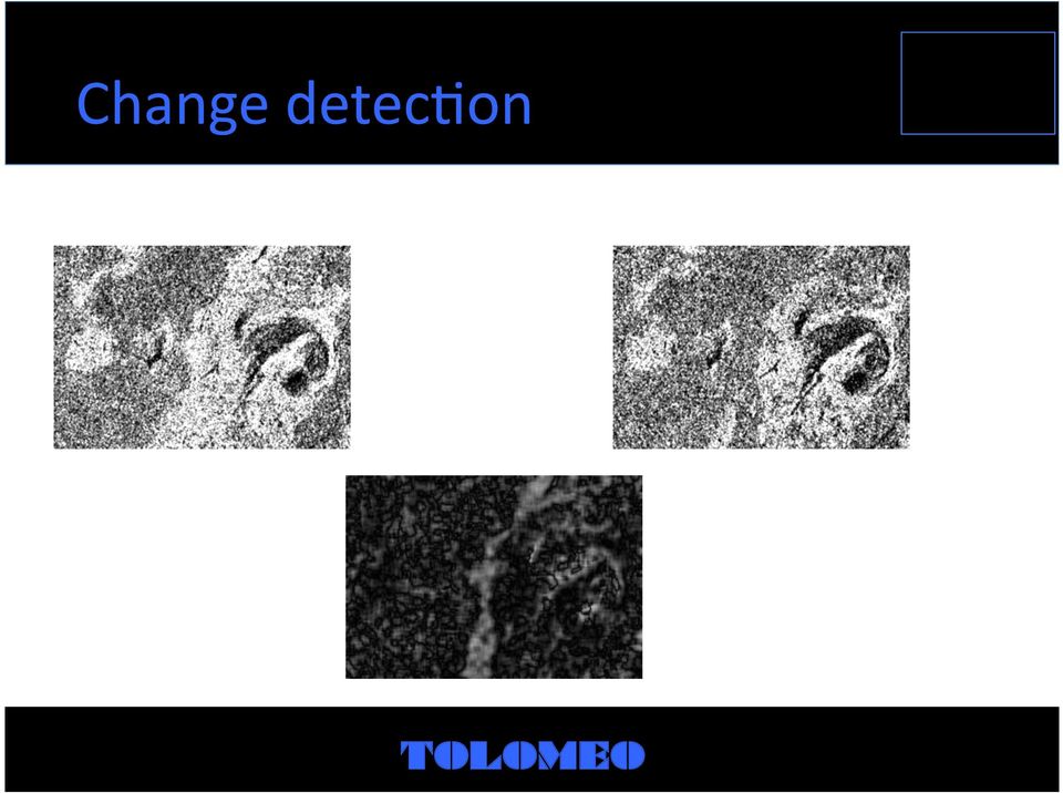
15 Change detec>on
16 Denoising Original Blurring Edge preserving

17 Circle extrac>on
18 Line detec>on and extrac>on

19 Watershed segmenta>on

20 Object segmenta>on

21 Markov random fields segmenta>on
22 An>- speckle filtering
23 Object detec>on (correla>on+ region growing )
24
25 OTB Applica>ons & Processing Chains
26 Goals and perimeter OTB lib is now rich enough Ready to use tools (no need for OTB compila>on, etc.) for thema>c valida>on and opera>onal use Complementary with methodology developed by thema/c users: capitalize, generalize, automate, deploy To be made availabe as IDL/ENVI add- ons, QGIS plug- ins or Monteverdi modules
27 Exis>ng chains Ortho- registra>on (Pléiades, CSK, SPOT5, QB, Ikonos, TSX, etc.) Ortho+pansharpening (Pléiades, QB) Supervised pixel- based classifica>on (mul>spectral, mul>temporal) Object Segmenta>on Standard FAO, Corine land cover map produc>on (Pléiades, QB, Ikonos, SPOT5) KML conversion (display & share on Google Earth) 3D & stereo anaglyh viewer
28 Exis>ng chains Image registra>on Object coun>ng (Pléiades, QB, Ikonos) Road network extrac>on (Pléiades, QB, Ikonos, SPOT5) Hydrographic network extrac>on (Pléiades, QB, Ikonos, SPOT5) Urban area extrac>on (Pléaides, CSK, QB, Ikonos, TSX, SPOT5) Image to Data Base registra>on (Pléiades/QB to BDTopo) Radiometric calibra>on (Pléiades, SPOT5, QB, CSK, ASAR, ERS, RadarSAT)
29 Image Viewer
30 Stereo Viewer
31 Ortho- rec>fica>on
32 Interac>ve Change Detec>on
33 Road (and hydrographic) Extrac>on
34 Feature extrac>on
35 Feature extrac>on
36 Feature extrac>on
37 Feature extrac>on
38 Feature extrac>on
39 Feature extrac>on
40 Feature extrac>on
41 Supervised Classifica>on (using SVM)
42
43
44
45
46 Segmenta>on by Region growing
47
48
49
50
51
52
53
54
55
56 Segmenta>on using SVM
57
58
59
60 Export to GoogleEarth Building shadows extracted from QB image
61 Object coun>ng
62 Urban area extrac>on
63 Urban area extrac>on
64 Image to DB registra>on
65 Image to DB registra>on
66 What is Monteverdi? Framework to simply and interac>vely build an image processing streaming pipeline Orfeo Toolbox components : Func>ons and filters Applica>ons Global framework w => Monteverdi
67 Monteverdi Main menu w File w SAR w Filtering w Learning w Geometry w Visualiza>on w Help
68 Monteverdi File w Open dataset w Save dataset : save results (no pipeline module created) w Extract ROI from dataset : extract ROI for pipeline computa>on w Save dataset (advanced) : save with choice of output format, channels, etc. w Cache dataset : execute previous pipelines elements and cache results w Concatenate images : concatenate several images w Quit
69 Monteverdi File > Extract ROI
70 Monteverdi File > Concatenate images
71 Monteverdi Viewer Visualiza>on w Viewer (1/4) 6 novembre 2009
72 Monteverdi Visualiza>on w Viewer (2/4) 6 novembre 2009
73 Monteverdi Visualiza>on w Viewer (3/4) 6 novembre 2009
74 Monteverdi Visualiza>on w Viewer (4/4) 6 novembre 2009
75 Monteverdi Geometry w Orthorec>fica>on w Reproject image : reprojec>on of ortho- images w Superimpose two images w Homologous points extrac>on : manual selec>on of homologous points, then re- sampling of the image on the fixed one. w GCP to Sensor Model : manual set of longitude / la>tude of geographical points, then re- sample of the image. 6 novembre 2009
76 Monteverdi Menu Geometry > Orthorec>fica>on (1/2)
77 Monteverdi Menu Geometry > Orthorec>fica>on (2/2)
78 Monteverdi Menu Geometry > Reproject image
79 Monteverdi Menu Geometry > Superimpose two images
80 Monteverdi Menu Geometry > Homologous points extrac>on
81 Monteverdi Menu Geometry > GCP to sensor model
82 Monteverdi Filtering w Feature Extrac>on w MeanshiQ clustering w Pan- sharpen an image w Band math w Change detec>on w Threshold
83 Monteverdi Filtering w Feature Extrac>on (1/3)
84 Monteverdi Filtering w Feature Extrac>on (2/3)
85 Monteverdi Filtering w Feature Extrac>on (3/3) More than 65 features Mean, variance, Gradient, spectral angle Textures (energy, entropy, contrast, etc) Morphological filters Radiometric indexes Vegeta>on (NDVI, ARVI, etc), Soil, Built up, Water Edge density Mean shiq Original data (=> no need to concatenate channels aqer filtering) Etc Use before SVM classifica>on for example
86 Monteverdi Filtering w MeanshiQ clustering
87 Monteverdi Filtering w Pan- sharpen an image Requires Panchroma>c and Mul>spectral input images at the same resolu>on
88 Monteverdi Filtering w Band math Addi>on, Substrac>on, Mul>plica>on, Ra>o, ShiQ- Scale (A*X+B)
89 Monteverdi Filtering w Change Detec>on
90 Monteverdi Filtering w Threshold
91 Monteverdi Learning w SVM classifica>on w K- Means clustering
92 Monteverdi Menu Learning > SVM classifica>on (1/3)
93 Monteverdi Menu Learning > SVM classifica>on (2/3)
94 Monteverdi Menu Learning > SVM classifica>on (3/3)
95 Monteverdi Menu Learning > K- means
96 Monteverdi SAR w Despeckle image : apply Frost / Lee filter w Compute intensity and log- intensity
97 Monteverdi Menu SAR > Despeckle image
98 Monteverdi Menu SAR > Compute intensity and log- intensity
99 Uses for
100 WP2 Tools for human exposure (HUEX) Urban area extrac>on Object- based segmenta>on Spa>al reasoning
101 WP3 Tools for deforesta>on risk analysis (DERA) Use of vegeta>on indices Radiometric image calibra>on Vegeta>on reflectance models (recently introduced in OTB) SVAT models (coming soon to OTB)
102 WP4 Tools for earthquake physical (ERVU) vulnerability Goal: fuse GIS layers OTB «speaks» PostGIS QGIS plug- ins Spa>al reasoning Conceptual graphs + Fuzzy Constraint Sa>sfac>on (recently added to OTB)
103 WP5 Tools for flood vulnerability (FLOV) characteriza>on Water indices DEM manipula>on Object recogni>on (dams, dykes, etc.)
104 WP6 Tools for post- event risk (POER) management Change detec>on Pixel based Object based Thorough experience through the Charter CNES Risk chain is based on OTB
Big data analy+cs for global change monitoring and research in forestry and agriculture. Lubia Vinhas
 Big data analy+cs for global change monitoring and research in forestry and agriculture Lubia Vinhas Earth observa+on satellites and geosensor webs provide key informa+on about global change but that informa+on
Supervised Classification workflow in ENVI 4.8 using WorldView-2 imagery
 Supervised Classification workflow in ENVI 4.8 using WorldView-2 imagery WorldView-2 is the first commercial high-resolution satellite to provide eight spectral sensors in the visible to near-infrared
ENVI THE PREMIER SOFTWARE FOR EXTRACTING INFORMATION FROM GEOSPATIAL IMAGERY.
 ENVI THE PREMIER SOFTWARE FOR EXTRACTING INFORMATION FROM GEOSPATIAL IMAGERY. ENVI Imagery Becomes Knowledge ENVI software uses proven scientific methods and automated processes to help you turn geospatial
Data Mining. Supervised Methods. Ciro Donalek donalek@astro.caltech.edu. Ay/Bi 199ab: Methods of Computa@onal Sciences hcp://esci101.blogspot.
 Data Mining Supervised Methods Ciro Donalek donalek@astro.caltech.edu Supervised Methods Summary Ar@ficial Neural Networks Mul@layer Perceptron Support Vector Machines SoLwares Supervised Models: Supervised
VCS REDD Methodology Module. Methods for monitoring forest cover changes in REDD project activities
 1 VCS REDD Methodology Module Methods for monitoring forest cover changes in REDD project activities Version 1.0 May 2009 I. SCOPE, APPLICABILITY, DATA REQUIREMENT AND OUTPUT PARAMETERS Scope This module
COMPARISON OF OBJECT BASED AND PIXEL BASED CLASSIFICATION OF HIGH RESOLUTION SATELLITE IMAGES USING ARTIFICIAL NEURAL NETWORKS
 COMPARISON OF OBJECT BASED AND PIXEL BASED CLASSIFICATION OF HIGH RESOLUTION SATELLITE IMAGES USING ARTIFICIAL NEURAL NETWORKS B.K. Mohan and S. N. Ladha Centre for Studies in Resources Engineering IIT
How To Use A Webmail On A Pc Or Macodeo.Com
 Big data workloads and real-world data sets Gang Lu Institute of Computing Technology, Chinese Academy of Sciences BigDataBench Tutorial MICRO 2014 Cambridge, UK INSTITUTE OF COMPUTING TECHNOLOGY 1 Five
REPORT FOR DELIVERABLE D4.2
 REPORT FOR DELIVERABLE D4.2 1 1 INTRODUCTION This report provides an overview of the technical characteristics and functionality of deliverable D4.2 Web Processing Services. Its purpose is to provide a
Institute of Natural Resources Departament of General Geology and Land use planning Work with a MAPS
 Institute of Natural Resources Departament of General Geology and Land use planning Work with a MAPS Lecturers: Berchuk V.Y. Gutareva N.Y. Contents: 1. Qgis; 2. General information; 3. Qgis desktop; 4.
Extraction of Satellite Image using Particle Swarm Optimization
 Extraction of Satellite Image using Particle Swarm Optimization Er.Harish Kundra Assistant Professor & Head Rayat Institute of Engineering & IT, Railmajra, Punjab,India. Dr. V.K.Panchal Director, DTRL,DRDO,
ARTIST Methodology and Tooling. Jesus Gorroñogoitia - Atos SOC Crete, 1 st July 2015
 ARTIST Methodology and Tooling Jesus Gorroñogoitia - Atos SOC Crete, 1 st July 2015 Motivation: From SaaP to SaaS So#ware as a Product based Company So#ware as a Service based Company : Cloud Computing
Big Data in medical image processing
 Big Data in medical image processing Konstan3n Bychenkov, CEO Aligned Research Group LLC bychenkov@alignedresearch.com Big data in medicine Genomic Research Popula3on Health Images M- Health hips://cloud.google.com/genomics/v1beta2/reference/
Levee Assessment via Remote Sensing Levee Assessment Tool Prototype Design & Implementation
 Levee Assessment via Remote Sensing Levee Assessment Tool Prototype Design & Implementation User-Friendly Map Viewer Novel Tab-GIS Interface Extensible GIS Framework Pluggable Tools & Classifiers December,
SUMMER SCHOOL ON ADVANCES IN GIS
 SUMMER SCHOOL ON ADVANCES IN GIS Six Workshops Overview The workshop sequence at the UMD Center for Geospatial Information Science is designed to provide a comprehensive overview of current state-of-the-art
Information Contents of High Resolution Satellite Images
 Information Contents of High Resolution Satellite Images H. Topan, G. Büyüksalih Zonguldak Karelmas University K. Jacobsen University of Hannover, Germany Keywords: satellite images, mapping, resolution,
Hall B So(ware Status. Veronique Ziegler
 Hall B So(ware Status Veronique Ziegler Physics Applica;on Design within the ClaRA SOA Physics applica;on design/composi;on based on services Development of services within ClaRA à Wri;ng a service simply
An Android based Quantum GIS prototype. Ramon Carrillo, Daniel Ochoa dochoa@espol.edu.ec
 An Android based Quantum GIS prototype Ramon Carrillo, Daniel Ochoa dochoa@espol.edu.ec Summary Background Past works Quantum GIS Mobile Quantum GIS Results Future works Background Robotic and computer
The premier software for extracting information from geospatial imagery.
 Imagery Becomes Knowledge ENVI The premier software for extracting information from geospatial imagery. ENVI Imagery Becomes Knowledge Geospatial imagery is used more and more across industries because
Files Used in this Tutorial
 Generate Point Clouds Tutorial This tutorial shows how to generate point clouds from IKONOS satellite stereo imagery. You will view the point clouds in the ENVI LiDAR Viewer. The estimated time to complete
DEVELOPMENT OF A SUPERVISED SOFTWARE TOOL FOR AUTOMATED DETERMINATION OF OPTIMAL SEGMENTATION PARAMETERS FOR ECOGNITION
 DEVELOPMENT OF A SUPERVISED SOFTWARE TOOL FOR AUTOMATED DETERMINATION OF OPTIMAL SEGMENTATION PARAMETERS FOR ECOGNITION Y. Zhang* a, T. Maxwell, H. Tong, V. Dey a University of New Brunswick, Geodesy &
TOWARDS AN AUTOMATED HEALING OF 3D URBAN MODELS
 TOWARDS AN AUTOMATED HEALING OF 3D URBAN MODELS J. Bogdahn a, V. Coors b a University of Strathclyde, Dept. of Electronic and Electrical Engineering, 16 Richmond Street, Glasgow G1 1XQ UK - jurgen.bogdahn@strath.ac.uk
Combining automated satellite based flood mapping with exposure mapping for flood risk assessment and management
 DLR.de Chart 1 > United Nations/Germany Expert Meeting > A. Twele and F. Hummel > 05 06 2014 Combining automated satellite based flood mapping with exposure mapping for flood risk assessment and management
WP2 HUEX. 1. Activities in the last 6 months. a. Tool developments:
 WP2 HUEX 1. Activities in the last 6 months a. Tool developments: a.i. Specification of HUEX processing chain. The HUEX processing chain has as a central component the InterIMAGE platform. The other major
WATER BODY EXTRACTION FROM MULTI SPECTRAL IMAGE BY SPECTRAL PATTERN ANALYSIS
 WATER BODY EXTRACTION FROM MULTI SPECTRAL IMAGE BY SPECTRAL PATTERN ANALYSIS Nguyen Dinh Duong Department of Environmental Information Study and Analysis, Institute of Geography, 18 Hoang Quoc Viet Rd.,
UPDATING OBJECT FOR GIS DATABASE INFORMATION USING HIGH RESOLUTION SATELLITE IMAGES: A CASE STUDY ZONGULDAK
 UPDATING OBJECT FOR GIS DATABASE INFORMATION USING HIGH RESOLUTION SATELLITE IMAGES: A CASE STUDY ZONGULDAK M. Alkan 1, *, D. Arca 1, Ç. Bayik 1, A.M. Marangoz 1 1 Zonguldak Karaelmas University, Engineering
RESOLUTION MERGE OF 1:35.000 SCALE AERIAL PHOTOGRAPHS WITH LANDSAT 7 ETM IMAGERY
 RESOLUTION MERGE OF 1:35.000 SCALE AERIAL PHOTOGRAPHS WITH LANDSAT 7 ETM IMAGERY M. Erdogan, H.H. Maras, A. Yilmaz, Ö.T. Özerbil General Command of Mapping 06100 Dikimevi, Ankara, TURKEY - (mustafa.erdogan;
The Use of Geographic Information Systems in Risk Assessment
 The Use of Geographic Information Systems in Risk Assessment With Specific Focus on the RiVAMP Methodology Presented by Nadine Brown August 27, 2012 Climate Studies Group Mona Climate Change Workshop Presentation
Ins+tuto Superior Técnico Technical University of Lisbon. Big Data. Bruno Lopes Catarina Moreira João Pinho
 Ins+tuto Superior Técnico Technical University of Lisbon Big Data Bruno Lopes Catarina Moreira João Pinho Mo#va#on 2 220 PetaBytes Of data that people create every day! 2 Mo#va#on 90 % of Data UNSTRUCTURED
3D Model of the City Using LiDAR and Visualization of Flood in Three-Dimension
 3D Model of the City Using LiDAR and Visualization of Flood in Three-Dimension R.Queen Suraajini, Department of Civil Engineering, College of Engineering Guindy, Anna University, India, suraa12@gmail.com
Pa8ern Recogni6on. and Machine Learning. Chapter 4: Linear Models for Classifica6on
 Pa8ern Recogni6on and Machine Learning Chapter 4: Linear Models for Classifica6on Represen'ng the target values for classifica'on If there are only two classes, we typically use a single real valued output
Introduction to Imagery and Raster Data in ArcGIS
 Esri International User Conference San Diego, California Technical Workshops July 25, 2012 Introduction to Imagery and Raster Data in ArcGIS Simon Woo slides Cody Benkelman - demos Overview of Presentation
Digital image processing
 746A27 Remote Sensing and GIS Lecture 4 Digital image processing Chandan Roy Guest Lecturer Department of Computer and Information Science Linköping University Digital Image Processing Most of the common
Graphical Processing Units to Accelerate Orthorectification, Atmospheric Correction and Transformations for Big Data
 Graphical Processing Units to Accelerate Orthorectification, Atmospheric Correction and Transformations for Big Data Amanda O Connor, Bryan Justice, and A. Thomas Harris IN52A. Big Data in the Geosciences:
Galaxy Morphological Classification
 Galaxy Morphological Classification Jordan Duprey and James Kolano Abstract To solve the issue of galaxy morphological classification according to a classification scheme modelled off of the Hubble Sequence,
Software Architecture Document (SAD) for the Interferometric Modules of the Next ESA SAR Toolbox (NEST)
 for the Interferometric Modules of the Next ESA SAR Toolbox (NEST)") Software Architecture Document (SAD) for the Interferometric Modules of the Next ESA SAR Toolbox (NEST) Contract number: 20809/07/I-LG Prepared by: PPO.labs Prepared for: The European Space Agency Revision
Software Architecture Document (SAD) for the Interferometric Modules of the Next ESA SAR Toolbox (NEST) Contract number: 20809/07/I-LG Prepared by: PPO.labs Prepared for: The European Space Agency Revision
Review for Introduction to Remote Sensing: Science Concepts and Technology
 Review for Introduction to Remote Sensing: Science Concepts and Technology Ann Johnson Associate Director ann@baremt.com Funded by National Science Foundation Advanced Technological Education program [DUE
Choosing the right GIS framework for an informed Enterprise Web GIS Solution
 13 ANNUAL INTERNATIONAL CONFERENCE AND EXHIBITION ON GEOSPATIAL INFORMATION TECHNOLOGY AND APPLICATIONS Epicentre; Gurgaon, India; 19-21 January, 2010 Choosing the right GIS framework for an informed Enterprise
AUTOMATIC BUILDING DETECTION BASED ON SUPERVISED CLASSIFICATION USING HIGH RESOLUTION GOOGLE EARTH IMAGES
 AUTOMATIC BUILDING DETECTION BASED ON SUPERVISED CLASSIFICATION USING HIGH RESOLUTION GOOGLE EARTH IMAGES Salar Ghaffarian, Saman Ghaffarian Department of Geomatics Engineering, Hacettepe University, 06800
UNIFIED, END- TO- END EDISCOVERY
 ac.onable informa.on governance Partners Providing Excellence in: UNIFIED, END- TO- END EDISCOVERY 2011 IBM Corpora.on Meet the Presenters Amir Jaibaji Vice President, Product Management StoredIQ Kevin
Advanced Image Management using the Mosaic Dataset
 Esri International User Conference San Diego, California Technical Workshops July 25, 2012 Advanced Image Management using the Mosaic Dataset Vinay Viswambharan, Mike Muller Agenda ArcGIS Image Management
Comparison of ALOS-PALSAR and TerraSAR-X Data in terms of Detecting Settlements First Results
 ALOS 2008 Symposium, 3-7 November Rhodes, Greece Comparison of ALOS-PALSAR and TerraSAR-X Data in terms of Detecting Settlements First Results Thomas Esch*, Achim Roth*, Michael Thiel, Michael Schmidt*,
SPOT4 (Take 5) first validation and application results
 first validation and application results") SPOT4 (Take 5) first validation and application results O.Hagolle CESBIO/CNES, M.Huc CESBIO/CNRS, M.Kadiri CESBIO/THEIA ; J.Inglada CESBIO/CNES, C. Marais-Sicre CESBIO/CNRS, J.Osman CESBIO/CNES (PhD),
SPOT4 (Take 5) first validation and application results O.Hagolle CESBIO/CNES, M.Huc CESBIO/CNRS, M.Kadiri CESBIO/THEIA ; J.Inglada CESBIO/CNES, C. Marais-Sicre CESBIO/CNRS, J.Osman CESBIO/CNES (PhD),
Coordina(ng Aircra- During NASA Airborne Science Field Campaigns AIST- 08-0072. Michael Goodman Earth Science Technology Forum 21 June 2011
 Coordina(ng Aircra- During NASA Airborne Science Field Campaigns AIST- 08-0072 Michael Goodman Earth Science Technology Forum 21 June 2011 Presenta(on Outline Introduc(on What is RTMM? Technology Infusion
GeoKettle: A powerful open source spatial ETL tool
 GeoKettle: A powerful open source spatial ETL tool FOSS4G 2010 Dr. Thierry Badard, CTO Spatialytics inc. Quebec, Canada tbadard@spatialytics.com Barcelona, Spain Sept 9th, 2010 What is GeoKettle? It is
LEOworks - a freeware to teach Remote Sensing in Schools
 LEOworks - a freeware to teach Remote Sensing in Schools Wolfgang Sulzer Institute for Geography and Regional Science University of Graz Heinrichstrasse 36, A-8010 Graz/Austria wolfgang.sulzer@uni-graz.at
Return on Experience on Cloud Compu2ng Issues a stairway to clouds. Experts Workshop Nov. 21st, 2013
 Return on Experience on Cloud Compu2ng Issues a stairway to clouds Experts Workshop Agenda InGeoCloudS SoCware Stack InGeoCloudS Elas2city and Scalability Elas2c File Server Elas2c Database Server Elas2c
Data Integration for ArcGIS Users Data Interoperability. Charmel Menzel, ESRI Don Murray, Safe Software
 Data Integration for ArcGIS Users Data Interoperability Charmel Menzel, ESRI Don Murray, Safe Software Product overview Extension to ArcGIS (optional) Jointly developed with Safe Software Based on Feature
Protec'ng Communica'on Networks, Devices, and their Users: Technology and Psychology
 Protec'ng Communica'on Networks, Devices, and their Users: Technology and Psychology Alexey Kirichenko, F- Secure Corpora7on ICT SHOK, Future Internet program 30.5.2012 Outline 1. Security WP (WP6) overview
An Assessment of the Effectiveness of Segmentation Methods on Classification Performance
 An Assessment of the Effectiveness of Segmentation Methods on Classification Performance Merve Yildiz 1, Taskin Kavzoglu 2, Ismail Colkesen 3, Emrehan K. Sahin Gebze Institute of Technology, Department
Environmental Remote Sensing GEOG 2021
 Environmental Remote Sensing GEOG 2021 Lecture 4 Image classification 2 Purpose categorising data data abstraction / simplification data interpretation mapping for land cover mapping use land cover class
Impact of water harvesting dam on the Wadi s morphology using digital elevation model Study case: Wadi Al-kanger, Sudan
 Impact of water harvesting dam on the Wadi s morphology using digital elevation model Study case: Wadi Al-kanger, Sudan H. S. M. Hilmi 1, M.Y. Mohamed 2, E. S. Ganawa 3 1 Faculty of agriculture, Alzaiem
NetCDF and HDF Data in ArcGIS
 2013 Esri International User Conference July 8 12, 2013 San Diego, California Technical Workshop NetCDF and HDF Data in ArcGIS Nawajish Noman Kevin Butler Esri UC2013. Technical Workshop. Outline NetCDF
Biomedical Informatics Applications, Big Data, & Cloud Computing
 Biomedical Informatics Applications, Big Data, & Cloud Computing Patrick Widener, PhD Assistant Professor, Biomedical Engineering Senior Research Scientist, Center for Comprehensive Informatics Emory University
A tiered reconnaissance approach toward flood monitoring utilising multi-source radar and optical data
 5 th International Workshop on Remote Sensing for Disaster Response A tiered reconnaissance approach toward flood monitoring utilising multi-source radar and optical data Anneley McMillan Dr. Beverley
Using PCI Geomatics Software with Oracle 10g Spatial and GeoRaster A PCI Geomatics Whitepaper
 Using PCI Geomatics Software with Oracle 10g Spatial and GeoRaster A PCI Geomatics Whitepaper November 2005 Table of Contents Table of Contents...1 1. Introduction...2 2. How Geomatica adds value to Oracle
ERDAS IMAGINE The world s most widely-used remote sensing software package
 ERDAS IMAGINE The world s most widely-used remote sensing software package ERDAS IMAGINE Geographic imaging professionals need to process vast amounts of geospatial data every day often relying on software
What is GIS. What is GIS? University of Tsukuba. What do you image of GIS? Copyright(C) ESRI Japan Corporation. All rights reserved.
 ESRI Japan Corporation. All rights reserved.") What is GIS University of Tsukuba Graduate School of Life and Environmental Science April 21 st, 2011 What is GIS? What do you image of GIS? Gas Insulated Switch Groupe Interventional Speciale Geographic
What is GIS University of Tsukuba Graduate School of Life and Environmental Science April 21 st, 2011 What is GIS? What do you image of GIS? Gas Insulated Switch Groupe Interventional Speciale Geographic
Standardized data sharing through an open-source Spatial Data Infrastructure: the Afromaison project
 Standardized data sharing through an open-source Spatial Data Infrastructure: the Afromaison project Yaniss Guigoz - University of Geneva/GRID-Geneva 1 EcoARM2ERA and AFROMAISON Why Afromaison in this
A Method Using ArcMap to Create a Hydrologically conditioned Digital Elevation Model
 A Method Using ArcMap to Create a Hydrologically conditioned Digital Elevation Model High resolution topography derived from LiDAR data is becoming more readily available. This new data source of topography
Web Mapping in Archaeology
 Non-invasive methods in the contemporary archaeological practice 25th February 2014 http://www.pborycki.pl/pdf/webmapping.pdf Plan of the presentation 1 Web Mapping General Idea History of Web Mapping
Chapter 6: Data Acquisition Methods, Procedures, and Issues
 Chapter 6: Data Acquisition Methods, Procedures, and Issues In this Exercise: Data Acquisition Downloading Geographic Data Accessing Data Via Web Map Service Using Data from a Text File or Spreadsheet
Data Warehousing. Yeow Wei Choong Anne Laurent
 Data Warehousing Yeow Wei Choong Anne Laurent Databases Databases are developed on the IDEA that DATA is one of the cri>cal materials of the Informa>on Age Informa>on, which is created by data, becomes
EPUB 3 Solu+ons Landscape. Bill McCoy Execu+ve Director, IDPF November 30, 2013
 EPUB 3 Solu+ons Landscape Bill McCoy Execu+ve Director, IDPF November 30, 2013 Agenda Authoring tools Content produc+on tools Distribu+on services Open source developments Strategic Ques+ons How much to
INTEROPERABLE IMAGE DATA ACCESS THROUGH ARCGIS SERVER
 INTEROPERABLE IMAGE DATA ACCESS THROUGH ARCGIS SERVER Qian Liu Environmental Systems Research Institute 380 New York Street Redlands, CA92373, U.S.A - qliu@esri.com KEY WORDS: OGC, Standard, Interoperability,
What's new in gvsig Desktop 2.0
 What's new in gvsig Desktop 2.0 What are the novelties? 2.0 1.12 Migrating and building... Some examples... Please pardon our appearance during construction Pie and bar chart legends Table in layout 1.12
Graphical Processing Units to Accelerate Orthorectification, Atmospheric Correction and Transformations for Big Data
 Graphical Processing Units to Accelerate Orthorectification, Atmospheric Correction and Transformations for Big Data Amanda O Connor, Bryan Justice, and A. Thomas Harris IN52A. Big Data in the Geosciences:
Development, deployment and validation of an oceanographic virtual laboratory based on Grid computing
 Development, deployment and validation of an oceanographic virtual laboratory based on Grid computing David Mera Pérez Santiago de Compostela, Feb. 15 th 2013 Index 1 Context and Motivation 2 Objectives
The Idiots Guide to GIS and Remote Sensing
 The Idiots Guide to GIS and Remote Sensing 1. Picking the right imagery 1 2. Accessing imagery 1 3. Processing steps 1 a. Geocorrection 2 b. Processing Landsat images layerstacking 4 4. Landcover classification
The Mantid Project. The challenges of delivering flexible HPC for novice end users. Nicholas Draper SOS18
 The Mantid Project The challenges of delivering flexible HPC for novice end users Nicholas Draper SOS18 What Is Mantid A framework that supports high-performance computing and visualisation of scientific
Nature Values Screening Using Object-Based Image Analysis of Very High Resolution Remote Sensing Data
 Nature Values Screening Using Object-Based Image Analysis of Very High Resolution Remote Sensing Data Aleksi Räsänen*, Anssi Lensu, Markku Kuitunen Environmental Science and Technology Dept. of Biological
How To Make A Remote Sensing Image Realtime Processing For Disaster Emergency Response
 Remote sensing image real-time processing for rapid disaster emergency response Dr.Haigang Sui LIESMARS, Wuhan University Oct 23, 2013 Outline 1 Major requirements in disaster emergency response 2 Main
The Benefits and Challenges in Global Meteorological Satellite Data Sharing
 The Benefits and Challenges in Global Meteorological Satellite Data Sharing Ninghai Sun and Fuzhong Weng Center for Satellite Applica0ons and Research Na0onal Oceanic and Atmospheric Administra0on Presented
The LSST Commissioning Plan
 The LSST Commissioning Plan Charles (Chuck) F. Claver LSST Systems Scien
«Shanoir : une solu/on pour la ges/on de données distribuées en imagerie in- vivo» Jus/ne Guillaumont Isabelle Corouge
 «Shanoir : une solu/on pour la ges/on de données distribuées en imagerie in- vivo» Jus/ne Guillaumont Isabelle Corouge Shanoir: a solu-on for neuro- imaging data management Jus/ne Guillaumont, Isabelle
Morphological analysis on structural MRI for the early diagnosis of neurodegenerative diseases. Marco Aiello On behalf of MAGIC-5 collaboration
 Morphological analysis on structural MRI for the early diagnosis of neurodegenerative diseases Marco Aiello On behalf of MAGIC-5 collaboration Index Motivations of morphological analysis Segmentation of
Outline. Multitemporal high-resolution image classification
 IGARSS-2011 Vancouver, Canada, July 24-29, 29, 2011 Multitemporal Region-Based Classification of High-Resolution Images by Markov Random Fields and Multiscale Segmentation Gabriele Moser Sebastiano B.
POTENTIAL OF MANUAL AND AUTOMATIC FEATURE EXTRACTION FROM HIGH RESOLUTION SPACE IMAGES IN MOUNTAINOUS URBAN AREAS
 POTENTIAL OF MANUAL AND AUTOMATIC FEATURE EXTRACTION FROM HIGH RESOLUTION SPACE IMAGES IN MOUNTAINOUS URBAN AREAS H. Topan a, *, M. Oruç a, K. Jacobsen b a ZKU, Engineering Faculty, Dept. of Geodesy and
Klaus Goelker. GIMP 2.8 for Photographers. Image Editing with Open Source Software. rocky
 Klaus Goelker GIMP 2.8 for Photographers Image Editing with Open Source Software rocky Table of Contents Chapter 1 Basics 3 1.1 Preface....4 1.2 Introduction 5 1.2.1 Using GIMP 2.8 About This Book 5 1.2.2
Digital Classification and Mapping of Urban Tree Cover: City of Minneapolis
 Digital Classification and Mapping of Urban Tree Cover: City of Minneapolis FINAL REPORT April 12, 2011 Marvin Bauer, Donald Kilberg, Molly Martin and Zecharya Tagar Remote Sensing and Geospatial Analysis
Map- reduce, Hadoop and The communica3on bo5leneck. Yoav Freund UCSD / Computer Science and Engineering
 Map- reduce, Hadoop and The communica3on bo5leneck Yoav Freund UCSD / Computer Science and Engineering Plan of the talk Why is Hadoop so popular? HDFS Map Reduce Word Count example using Hadoop streaming
Keeping Pace with Big Data
 - A Data Mining Perspec>ve Huan Liu, Tempe, AZ hep://www.public.asu.edu/~huanliu NSF Workshop on Big Data Analy6cs for Infrastructure and Building Resilience and Sustainability, Beijing, China Sept 19-20,
Modelling, Extraction and Description of Intrinsic Cues of High Resolution Satellite Images: Independent Component Analysis based approaches
 Modelling, Extraction and Description of Intrinsic Cues of High Resolution Satellite Images: Independent Component Analysis based approaches PhD Thesis by Payam Birjandi Director: Prof. Mihai Datcu Problematic
MASS PROCESSING OF REMOTE SENSING DATA FOR ENVIRONMENTAL EVALUATION IN EUROPE
 MASS PROCESSING OF REMOTE SENSING DATA FOR ENVIRONMENTAL EVALUATION IN EUROPE Lic. Adrián González Applications Research Earth Science Conference 2014 29.07.2014 Earth Science San Conference Francisco
Web-Based Enterprise Data Visualization a 3D Approach. Oleg Kachirski, Black and Veatch
 Web-Based Enterprise Data Visualization a 3D Approach Oleg Kachirski, Black and Veatch Contents - Introduction - Why 3D? - Applications of 3D - 3D Content Authoring - 3D/4D in GIS - Challenges of Presenting
Programming in Slicer4
 Programming in Slicer4 Sonia Pujol, Ph.D. Surgical Planning Laboratory, Harvard Medical School Paul Cézanne, Moulin sur la Couleuvre à Pontoise, 1881, Staatliche Museen zu Berlin, Na:onalgalerie Steve
Applying Machine Learning to Network Security Monitoring. Alex Pinto Chief Data Scien2st MLSec Project @alexcpsec @MLSecProject!
 Applying Machine Learning to Network Security Monitoring Alex Pinto Chief Data Scien2st MLSec Project @alexcpsec @MLSecProject! whoami Almost 15 years in Informa2on Security, done a licle bit of everything.
Multiscale Object-Based Classification of Satellite Images Merging Multispectral Information with Panchromatic Textural Features
 Remote Sensing and Geoinformation Lena Halounová, Editor not only for Scientific Cooperation EARSeL, 2011 Multiscale Object-Based Classification of Satellite Images Merging Multispectral Information with
Documentation of open source GIS/RS software projects
 Contract no. Workpackage Delivery Delivery Date 030776 WP1 D1.6 2007-07-02 CASCADOSS Development of a trans-national cascade training programme on Open Source GIS&RS Software for environmental applications
Cloud-based Geospatial Data services and analysis
 Cloud-based Geospatial Data services and analysis Xuezhi Wang Scientific Data Center Computer Network Information Center Chinese Academy of Sciences 2014-08-25 Outlines 1 Introduction of Geospatial Data
Mapping Mashup/Data Integration Development Resources Teaching with Google Earth and Google Ocean Stone Lab August 13, 2010
 Mapping Mashup/Data Integration Development Resources Teaching with Google Earth and Google Ocean Stone Lab August 13, 2010 David Hart GIS Specialist University of Wisconsin Sea Grant Institute Virtual
Andrea Bondì, Irene D Urso, Matteo Ombrelli e Paolo Telaroli (Thetis S.p.A.) Luisa Sterponi e Cesar Urrutia (Spacedat S.r.l.) Water Calesso (Marco
 Luisa Sterponi e Cesar Urrutia (Spacedat S.r.l.) Water Calesso (Marco") Generation of a digital elevation model of the Wadi Lebda basin, Leptis Magna - Lybia Andrea Bondì, Irene D Urso, Matteo Ombrelli e Paolo Telaroli (Thetis S.p.A.) Luisa Sterponi e Cesar Urrutia (Spacedat
Generation of a digital elevation model of the Wadi Lebda basin, Leptis Magna - Lybia Andrea Bondì, Irene D Urso, Matteo Ombrelli e Paolo Telaroli (Thetis S.p.A.) Luisa Sterponi e Cesar Urrutia (Spacedat
Norwegian Satellite Earth Observation Database for Marine and Polar Research http://normap.nersc.no USE CASES
 Norwegian Satellite Earth Observation Database for Marine and Polar Research http://normap.nersc.no USE CASES The NORMAP Project team has prepared this document to present functionality of the NORMAP portal.
64 Bits of MapInfo Pro!!! and the next BIG thing. March 2015
 64 Bits of MapInfo Pro!!! and the next BIG thing March 2015 MapInfo Professional v12.5 Themes Cartographic output Performance improvements Ability to work directly with a map in a layout. An all new Layout
DTCC Data Quality Survey Industry Report
 DTCC Data Quality Survey Industry Report November 2013 element 22 unlocking the power of your data Contents 1. Introduction 3 2. Approach and participants 4 3. Summary findings 5 4. Findings by topic 6
The Scientific Data Mining Process
 Chapter 4 The Scientific Data Mining Process When I use a word, Humpty Dumpty said, in rather a scornful tone, it means just what I choose it to mean neither more nor less. Lewis Carroll [87, p. 214] In
Multisensor Data Fusion and Applications
 Multisensor Data Fusion and Applications Pramod K. Varshney Department of Electrical Engineering and Computer Science Syracuse University 121 Link Hall Syracuse, New York 13244 USA E-mail: varshney@syr.edu
Analecta Vol. 8, No. 2 ISSN 2064-7964
 EXPERIMENTAL APPLICATIONS OF ARTIFICIAL NEURAL NETWORKS IN ENGINEERING PROCESSING SYSTEM S. Dadvandipour Institute of Information Engineering, University of Miskolc, Egyetemváros, 3515, Miskolc, Hungary,
Comparison of Open Source Virtual Globes
 FOSS4G 2010 Comparison of Open Source Virtual Globes Mathias Walker Pirmin Kalberer Sourcepole AG, Bad Ragaz www.sourcepole.ch About Sourcepole GIS-Knoppix: first GIS live-cd QGIS Core developer QGIS Mapserver
Research On The Classification Of High Resolution Image Based On Object-oriented And Class Rule
 Research On The Classification Of High Resolution Image Based On Object-oriented And Class Rule Li Chaokui a,b, Fang Wen a,b, Dong Xiaojiao a,b a National-Local Joint Engineering Laboratory of Geo-Spatial
Adaptation of High Resolution Ikonos Images to Googleearth for Zonguldak Test Field
 Adaptation of High Resolution Ikonos Images to Googleearth for Zonguldak Test Field Umut G. SEFERCIK, Murat ORUC and Mehmet ALKAN, Turkey Key words: Image Processing, Information Content, Image Understanding,