The Ike Dike. A Coastal Barrier Protecting the. Hurricane Storm Surge. Protecting the Houston/Galveston Region from Hurricane Storm Surge
|
|
|
- Meredith Bishop
- 7 years ago
- Views:
Transcription


1 The Ike Dike A Coastal Barrier Protecting the Houston/Galveston A Coastal Barrier Region from Hurricane Storm Surge Protecting the Houston/Galveston Region from Hurricane Storm Surge
2 The Houston/Galveston Region Nationally-important population and economic Center Considerable infrastructure near sea level with storm surges channeled up the Bay Supports largest petrochemical complex in US Port of Houston alone generates over $178 Billion in economic activity annually Galveston Bay provides valuable ecosystem services Affected by a major storm about every 15 years Large-scale evacuations are increasingly difficult, especially for Hurricanes that quickly increase in intensity and/or change direction

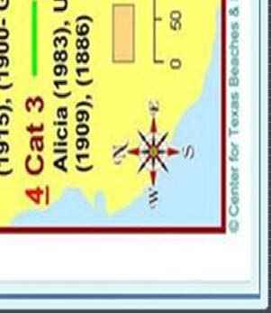
3 Hurricane Rita killed three people. The three day mass evacuation 1932 leading up hurricane to Rita's landfall killed image 108.


4


5 If farther west, many more lives lost, much more damage


6


7
8 Dutch Delta Commission Considered Two Major Options Continue building and strengthening internal dikes/barriers Shorten the surge defense needed with a coastal spine


9


10

11 Start of Gate Closing Texas Delegation


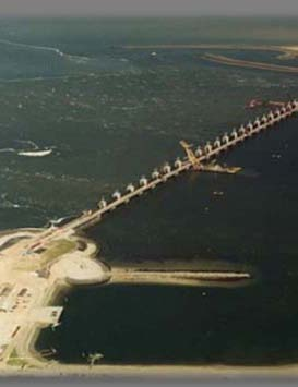
12 A giant engineering structure, The Eastern Scheldt storm surge barrier ('Oosterscheldekering'), was completed in 1986 and is part of the 'Deltaworks' started after the 1953 flood. The barrier has 62 steel doors each 140 feet wide. They are normally open but are closed when there is a North Sea high water level alert. The door gates slide between big concrete pillars, each one up to 130 feet high. The barrier consists of three parts between artificially created islands. When open, the gates allow water exchange between the North Sea and the estuary assuring a healthy bay. Eastern Scheldt Barrier

13 These gates, like much of the Deltaworks, are major tourist attractions.


14 The Netherlands Storm Surge Barrier in Action

15 The Ike Dike strategy is to keep the ocean surge out of Galveston Bay by using a gated coastal barrier Houston Ship Channel High Island Bolivar Roads Existing Seawall Intracoastal Waterway Coastal Spine San Luis Pass


16 The first component of the Ike Dike already exists the Galveston Seawall Houston Ship Channel High Island Bolivar Roads Existing Seawall Intracoastal Waterway San Luis Pass

17 The second component - Land Extensions of the protection afforded by the Seawall Houston Ship Channel High Island Bolivar Roads Existing Seawall Intracoastal Waterway San Luis Pass


18 Revetments can be hidden to look natural


19 The third component Flood Gates Houston Ship Channel High Island Bolivar Roads Existing Seawall Intracoastal Waterway San Luis Pass

20 Possible New York Barrier
21 Dutch Deltaworks and the Ike Dike Shorten the coast as much as possible Keep the surge out of internal waters Use surge gates to accomplish the above And to allow for ship traffic And to preserve marine ecosystem function
22 Ike Dike Additional Characteristics 1 System can be leaky - unlike New Orleans, Holland Can use Galveston Bay as a retention pond Only needs to hold maximum surge for a few hours Doesn t harm neighboring communities Doesn t lead to a race for more and higher dikes Proposed revetment

23 Ike Dike Additional Characteristics 2 Stops the Surge at the coast where it s the smallest Protects strategic assets of national importance Protects Bay s Natural Resources Occupies the minimum foot print for comprehensive protection Protects every community rich or poor Entire region recovers quickly Proposed revetment
24 A Coastal Spine Suppresses Surge and is Technically Feasible Economically Sound Environmentally Friendly, and Socially Just It Should Be the Cornerstone of Our Surge Suppression Strategy
25 Research Team Economics Institute for Regional Forecasting at UH, Dr Bill Gilmer Modeling Homeland Security Center of Excellence at Jackson State, Dr Robert Whalin and Dr Ty Wamsley, USACE/Eng Research & Dev Ctr Barrier Design Delft Technical University, Drs. Bas Jonkman and Mathijs van Ledden Overall Flood Risk Reduction/Project Coordination TAMUG, Drs. Sam Brody and Bill Merrell
26 Research Approach/Schedule Economic Study ASAP Modeling to Inform Economic Study and Barrier Design Dutch Dialogues And to Understand Galveston Bay s Roles Test Barrier Conceptual Designs Better Cost Estimates Costs/Benefits

27


28 The SSPEED Center (Rice University) has proposed a levee structure aligned along SH-146 to protect West Bayshore. The above schematic displays the integration of the levee structure in communities along the coastline


29 La Porte Seabrook Bacliff/San Leon

30 Levee System Ship Channel Gate
A Coastal Barrier Protecting the Houston/Galveston Region from Hurricane Storm Surge
 A Coastal Barrier Protecting the Houston/Galveston Region from Hurricane Storm Surge 1/20/2011 The Houston/Galveston Region Is home to about 2 Million people and may double by 2050 Galveston Bay provides
New Orleans Hurricane Storm Damage Risk Reduction System Tour March 23 24, 2012
 New Orleans Hurricane Storm Damage Risk Reduction System Tour March 23 24, 2012 Host: Falcolm E. Hull, Vice President/Technical Expert, ARCADIS, U.S. Inc. Attending: Cherie Coffman, Coastal Projection
SSPEED Center Phase III: Developing a Houston- Galveston Area Protection System (H-GAPS)
") Center Phase III: Developing a Houston- Galveston Area Protection System (H-GAPS) The Center 6100 Main St., MS317 Houston, Texas 77005 June 2, 2014 DPCAC meeting Center Phase I & II Recap (2009-2014) Phase
Center Phase III: Developing a Houston- Galveston Area Protection System (H-GAPS) The Center 6100 Main St., MS317 Houston, Texas 77005 June 2, 2014 DPCAC meeting Center Phase I & II Recap (2009-2014) Phase
A New Coastal Engineering Graduate Program
 Paper ID #12157 A New Coastal Engineering Graduate Program Dr. Robert W. Whalin, Jackson State University Dr. Robert W. Whalin, Professor of Civil and Environmental Engineering, and Director, Coastal Hazards
Framework for Flood Risk Reduction in the Galveston Bay Area
 GAME PLAN: Framework for Flood Risk Reduction in the Galveston Bay Area VERSION 1 December 5, 2014 Working document, draft Main report written and edited by: S.N. (Bas) Jonkman (TU Delft), Mathijs van
Hurricanes and Storm Surge www.hcfcd.org/tropicalweather
 Hurricanes and Storm Surge www.hcfcd.org High-level winds fl ow outward Strong surface winds spiral inward EYE Calm, sometimes cloudfree, sinking air Air sinks in calm area at the storm s eye THUNDERSTORMS
Water Management in the Netherlands
 Water Management in the Netherlands Eric Boessenkool Senior Advisor to the Management Board of RIjkswaterstaat Ministry of Infrastructure and the Environment New ministry since end of 2010 Merger of Ministry
Next Generation Flood Alert in Houston
 Next Generation Flood Alert in Houston Philip B. Bedient Civil and Environmental Eng., Rice University Houston, TX Major Causes of Urban Flooding (Excess Water that Inundates) Highly Developed (urbanized)
SSPEED Center SSPEED 2014 REPORT. Severe Storm Prediction, Education and Evacuation from Disasters Center. J.B. Blackburn P.B. Bedient L.G.
 J.B. Blackburn P.B. Bedient L.G. Dunbar SSPEED Center 2014 REPORT Severe Storm Prediction, Education and Evacuation from Disasters Center SSPEED SSPEED Center Rice University 6100 Main Street/MS-317, Houston,
Applying Best Practices To Galveston Bay November 2012. Applying Best Practices From The Delta Works And New Orleans To Galveston Bay
 Applying Best Practices To Galveston Bay November 2012 COLOFON Applying Best Practices From The Delta Works And New Orleans To Galveston Bay Author: Kasper Stoeten, Master Student Hydraulic Engineering,
Aligning Natural and Built Infrastructure for
 Aligning Natural and Built Infrastructure for Houston Climate Resilience National Exercise Program (NEP) Houston Climate Change Preparedness & Resilience Workshop Edmond J. Russo, Jr., PhD, PE, D.CE, D.NE,
climate change Houston-Galveston, 15 Texas Observed Climate Houston-Galveston Area (1901 2010) Observed Trends and Projected 67 Future
 Observed Trends and Projected 67 Future") Climate change, once considered an issue for a distant future, has moved firmly into the present. Houston-Galveston area residents are vulnerable to disruptions in essential services because the urban
Climate change, once considered an issue for a distant future, has moved firmly into the present. Houston-Galveston area residents are vulnerable to disruptions in essential services because the urban
that we name it, giving these events a metaphysical element. Carla hit 150 miles down the Texas coast in fear them, like ancient angry spirits.
 by Jim Blackburn BLOW- BY A N E N V I R O N M E N TA L AT TO R N E Y D E TA I L S A M A J O R H U R R I C A N E S P OT E N T I A L I M PACT O N H O U STO N 22 BL OW - FOR MOST OF US, IT IS DIFFICULT TO
Texas Universities Recover from Hurricane Ike University of Texas Medical Branch Galveston and Texas A&M University Galveston
 Texas Universities Recover from Hurricane Ike University of Texas Medical Branch Galveston and Texas A&M University Galveston Business Continuity and Disaster Recovery State of Texas Executive Summary
Comprehensive Recommendations Supporting the Use of the Multiple Lines of Defense Strategy to Sustain Coastal Louisiana 2008 Report (Version I)
") Comprehensive Recommendations Supporting the Use of the Multiple Lines of Defense Strategy to Sustain Coastal Louisiana 2008 Report (Version I) This report recommends integrated coastal projects and levee
Comprehensive Recommendations Supporting the Use of the Multiple Lines of Defense Strategy to Sustain Coastal Louisiana 2008 Report (Version I) This report recommends integrated coastal projects and levee
Impacts of Global Warming on Hurricane-related Flooding in Corpus Christi,Texas
 Impacts of Global Warming on Hurricane-related Flooding in Corpus Christi,Texas Sea-level Rise and Flood Elevation A one-foot rise in flood elevation due to both sea-level rise and hurricane intensification
Most Vulnerable US Cities to Storm Surge Flooding. August 2015 2 COPLEY PLACE BOSTON, MA 02116 T: 617.423.2800 F: 617.423.2808
 Most Vulnerable US Cities to Storm Surge Flooding August 2015 2 COPLEY PLACE BOSTON, MA 02116 T: 617.423.2800 F: 617.423.2808 Introduction Hurricane Katrina was a stark reminder that strong winds are only
Houston-Galveston Area Council. Disaster Recovery Housing Needs Assessment. Round 2 Phase 2 Funding
 Houston-Galveston Area Council Disaster Recovery Housing Needs Assessment Round 2 Phase 2 Funding Disaster Recovery Community Development Block Grant Funding DR-1791 Hurricanes Ike & Dolly Prepared by
Table of Contents. 2 Page
 1 Page Table of Contents Overview.. 3 BACPA Income 5 BACPA Expenses 5 BACPA Grants Funded.. 6 Resolutions supporting Ike Dike concept 7 Map of local governments support Ike Dike concept 10 2 Page Overview
Climate Change Long Term Trends and their Implications for Emergency Management August 2011
 Climate Change Long Term Trends and their Implications for Emergency Management August 2011 Overview A significant amount of existing research indicates that the world s climate is changing. Emergency
Storm tide is the water level rise during a storm due to the combination of storm surge and the astronomical tide.
 INTRODUCTION TO STORM SURGE Introduction to Storm Surge BOLIVAR PENINSULA IN TEXAS AFTER HURRICANE IKE (2008) What is Storm Surge? Inland Extent Storm surge can penetrate well inland from the coastline.
Offshore Alabama Prepared by the University of South Alabama MBA Consulting Group in December 2010
 Offshore Alabama Prepared by the University of South Alabama MBA Consulting Group in December 2010 Executive Summary The Mobile Area Chamber of Commerce s Oil and Gas Task Force (Task Force) was created
Develop hazard mitigation policies and programs designed to reduce the impact of natural and human-caused hazards on people and property.
 6.0 Mitigation Strategy Introduction A mitigation strategy provides participating counties and municipalities in the H-GAC planning area with the basis for action. Based on the findings of the Risk Assessment
Storm tide is the water level rise during a storm due to the combination of storm surge and the astronomical tide.
 INTRODUCTION TO STORM SURGE Introduction to Storm Surge National Hurricane Center Storm Surge Unit BOLIVAR PENINSULA IN TEXAS AFTER HURRICANE IKE (2008) What is Storm Surge? Inland Extent Storm surge can
Tropical Storm Allison 2001
 Texas State Senate Subcommittee on Flooding and Evacuations Testimony of Robert Eckels 18 October 2010 The challenges of Hurricanes and Flooding can best be illustrated in the Tale of Two Storms. Tropical
Standard Operating Procedures for Flood Preparation and Response
 Standard Operating Procedures for Flood Preparation and Response General Discussion Hurricanes, tropical storms and intense thunderstorms support a conclusion that more severe flooding conditions than
CRS Report for Congress
 CRS Report for Congress Received through the CRS Web Order Code RS22297 October 14, 2005 Ports in Louisiana: New Orleans, South Louisiana, and Baton Rouge Summary Vanessa Cieslak Information Research Specialist
Tradeoffs of Ecosystem Services from Wetlands in the Houston Region
 Tradeoffs of Ecosystem Services from Wetlands in the Houston Region L. James Lester 1, Gregory R. Biddinger 1 and Lisa A. Gonzalez 1 1 HARC, The Woodlands, TX, USA The Starting Point: ES Workshop Galveston
Flood Risk Management Plans
 Flood Risk Management Plans Main topics of interest and the workshop programme Jos van Alphen 26-01-2010 Content 1. Floods in Europe and related measures 2. The Floods Directive and Flood Risk Management
Hurricane Rita September 20 24, 2005 Situation Paper
 Hurricane Rita September 20 24, 2005 Situation Paper ABOVE: Hurricane Rita on Sept. 21, 2005 Prepared by Crawford & Company www.crawfordandcompany.com September 28, 2005 Information in this briefing is
Challenges and Lessons Learned NASA Johnson Space Center and the Houston/Galveston Area
 Emergency Planning Challenges and Lessons Learned NASA Johnson Space Center and the Houston/Galveston Area May 2013 Pat Kolkmeier JSC CoF Program Manager Hurricane Ike and Other Texas Storms Texas Coast
What if Hurricane Sandy made landfall on the SC Coastline???
 What if Hurricane Sandy made landfall on the SC Coastline??? Charlie Kaufman Dorchester County Emergency Management Department Dr. Norm Levine College of Charleston: Lowcountry Hazards Center Background
The success of the hurricane protection around Chevron s refinery at Pascagoula, MS, during Katrina
 The success of the hurricane protection around Chevron s refinery at Pascagoula, MS, during Katrina Dr J.W. van der Meer, Dr C. Cooper, M.J. Warner, H. Adams-Morales and G.J. Steendam Abstract and presentation
Flood Risk Assessment in the Netherlands: A Case Study for Dike Ring South Holland
 Risk Analysis, Vol. 28, No. 5, 2008 DOI: 10.1111/j.1539-6924.2008.01103.x Flood Risk Assessment in the Netherlands: A Case Study for Dike Ring South Holland Sebastiaan N. Jonkman, 1,2 Matthijs Kok, 1,3
Climate Change in Coastal Florida: Economic Impacts of Sea Level Rise
 Climate Change in Coastal Florida: Economic Impacts of Sea Level Rise CLIMTE CHNGE IN COSTL FLORID: ECONOMIC IMPCTS OF SE LEVEL RISE Context Global warming is expected to cause: Sea level rise Increased
STATUS REPORT FOR THE SUBMERGED REEF BALL TM ARTIFICIAL REEF SUBMERGED BREAKWATER BEACH STABILIZATION PROJECT FOR THE GRAND CAYMAN MARRIOTT HOTEL
 STATUS REPORT FOR THE SUBMERGED REEF BALL TM ARTIFICIAL REEF SUBMERGED BREAKWATER BEACH STABILIZATION PROJECT FOR THE GRAND CAYMAN MARRIOTT HOTEL performed by Lee E. Harris, Ph.D., P.E. Consulting Coastal
Hurricanes: Nature's Wildest Storms by Erin Ryan
 Name: : Nature's Wildest Storms by Erin Ryan You may already know that hurricanes are major tropical storms that can cause devastating waves, wind, and rain. They happen during Hurricane Season, which
Community Engagement and Cost Benefit Analysis for Sea Level Rise and Storm Surge Adaptation
 Community Engagement and Cost Benefit Analysis for Sea Level Rise and Storm Surge Adaptation Methods, Case Studies, and Wetland-specific Opportunities Samuel B. Merrill, Ph.D. December 10, 2012 Muskie
Future of our coasts: Potential for natural and hybrid infrastructure to enhance ecosystem and community resilience Ariana Sutton-Grier
 Future of our coasts: Potential for natural and hybrid infrastructure to enhance ecosystem and community resilience Ariana Sutton-Grier University of Maryland & National Oceanic and Atmospheric Administration
AP ENVIRONMENTAL SCIENCE 2010 SCORING GUIDELINES
 AP ENVIRONMENTAL SCIENCE 2010 SCORING GUIDELINES Question 4 (a) Based on the rate cited above, calculate the expected increase in sea level, in meters, during the next 50 years. One point can be earned
Lower Breton Sound Sediment Diversion Conceptual Engineering Design Presentation
 EXPERT PANEL ON DIVERSION PLANNING AND IMPLEMENTATION Lower Breton Sound Sediment Diversion Conceptual Engineering Design Presentation February 12, 2015 Topics I. Introduction II. Geotechnical Study III.
Policy & Management Applications of Blue Carbon. fact SHEET
 Policy & Management Applications of Blue Carbon fact SHEET Policy & Management Applications of Blue Carbon Coastal Blue Carbon - An Important Wetland Ecosystem Service Coastal Blue Carbon refers to the
New York Sea Grant Strategic Plan
 New York Sea Grant Strategic Plan Introduction and Process This is the new strategic plan for New York Sea Grant (NYSG) for the years 2010-2013 as requested by the National Sea Grant Office. This plan
Flood Risk Management
 Flood Risk Management Value of Flood Risk Management Every year floods sweep through communities across the United States taking lives, destroying property, shutting down businesses, harming the environment
Flood Risk Management
 Flood Risk Management Value of Flood Risk Management Value to Individuals and Communities Every year floods sweep through communities across the United States taking lives, destroying property, shutting
In the Caribbean, August and September are peak months during the hurricane season that lasts from June 1 through November 30.
 Hurricane Fact sheet What is a hurricane? A hurricane is a tropical storm with winds that have reached a constant speed of 74 miles per hour more. Hurricane winds blow in a large spiral around a relative
HURRICANE IKE DAMAGE SURVEY
 P 2.41 HURRICANE IKE DAMAGE SURVEY Timothy P. Marshall* Haag Engineering Co. Irving, Texas 1. INTRODUCTION The author conducted both aerial and ground damage surveys of the upper Texas coast after Hurricane
BANGKOK FLOOD PROTECTION SYSTEM Bangkok Metropolitan Administration (BMA)
") BANGKOK FLOOD PROTECTION SYSTEM Bangkok Metropolitan Administration (BMA) Catchment area of Chao Phraya River is 160,000 sq.km. or about 1/3 of the country The Chao Phraya River flows passing through Bangkok
BANGKOK FLOOD PROTECTION SYSTEM Bangkok Metropolitan Administration (BMA) Catchment area of Chao Phraya River is 160,000 sq.km. or about 1/3 of the country The Chao Phraya River flows passing through Bangkok
U.S. Army Corps of Engineers
 Walla Walla District U.S. Army Corps of Engineers Hurricane Katrina Response Briefer: Joseph Saxon Today s Briefing U.S. Army Corps of Engineers Mission Events leading up to New Orleans flooding Corp s
South Florida Resilient Redesign. Dense Urban Community South Beach Miami Beach, Florida
 South Florida Resilient Redesign Dense Urban Community South Beach Miami Beach, Florida Project Team Project Team (in alphabetical order): Reinaldo Borges, Borges and Associates Architects Dominic Dusseau,
Briefing Paper on Lower Galveston Bay and Bayou Watersheds Lower Bay I: Armand Bayou to Moses Lake and Adjacent Bay Waters
 Briefing Paper on Lower Galveston Bay and Bayou Watersheds Lower Bay I: Armand Bayou to Moses Lake and Adjacent Bay Waters Jim Lester, PhD. and Lisa Gonzalez Houston Advanced Research Center Galveston
Storm Surge: A Rising Danger by Andrew M. Dzambo
 Storm Surge: A Rising Danger by Andrew M. Dzambo Citizens of the United States are migrating towards the nation s coasts; according to the U.S. Census Bureau, the U.S. coastal watershed county population
Tropical Cyclones. This document last updated on 17-Nov-2014
 Page 1 of 14 EENS 3050 Tulane University Natural Disasters Prof. Stephen A. Nelson Tropical Cyclones This document last updated on 17-Nov-2014 We have already discussed the factors involved in the circulation
Impact of Hurricane Ike
 Island Transit History, Design and Impact of Hurricane Ike By Gary A. Gordon, P.E. Assistant Federal Security Director-Surface Surface, South Central Region and Michael Worthy Director of Transportation,
DEPARTMENT OF THE ARMY OFFICE OF THE CHIEF OF ENGINEERS WASHINGTON, D.C. Z0314-1000
 DEPARTMENT OF THE ARMY OFFICE OF THE CHIEF OF ENGINEERS WASHINGTON, D.C. Z0314-1000 REPLY TO ATTENTION OF: CECW-PC (l0-1-7a).oi9 MAY 1996. THE SECRETARY OF THE ARMY ". 1. I submit for transmission to Congress
Abstract. 1 Introduction
 Assessment of flood risks in polders along the Dutch lakes F. den Heijer* & A.P. de LoofP WL\delft hydraulics ^Ministry of Transport, Public Works and Water Management, Directorate General of Public Works
Restore Americas Estuaries 5 th National Conference
 Restore Americas Estuaries 5 th National Conference Richard Raynie Chief, LACES Division OCPR Patricia Strayer, PE Principal Engineer Dynamic Solutions, LLC KRR and LCA are bookends in progress of federal
Weather Briefing for Southeast Texas October 24 th, 2015
 Weather Briefing for Southeast Texas October 24 th, 2015 Dangerous Flash Flood Event Saturday through Sunday 8:16 AM Overview Ongoing: record deep moisture in place, elevated seas, rip currents, high surf,
Martine Jak 1 and Matthijs Kok 2
 A DATABASE OF HISTORICAL FLOOD EVENTS IN THE NETHERLANDS Martine Jak 1 and Matthijs Kok 2 1 Department of Transport, Public works and Water Management Road and Hydraulic Engineering Division P.O. Box 5044
Gulf Intracoastal Waterway
 TEXAS DEPARTMENT OF TRANSPORTATION Gulf Intracoastal Waterway Photo by TexasGulfCoastOnline.com Gulf Intracoastal Waterway in Texas Figure 1 - Texas GIWW Executive Summary The Texas Department of Transportation
Darja Tretjakova MANAGING FLOOD RISK IN INTERNATIONAL HARBOURS
 Darja Tretjakova MANAGING FLOOD RISK IN INTERNATIONAL HARBOURS Outline Origins and reasons Methodology Results Conclusions 2 Why this research? Increasing flood risk: CC, socio-economic development Port
4.14 Netherlands. Interactive flood risk map of a part of the province of Gelderland in the Netherlands. Atlas of Flood Maps
 4.14 Netherlands The Netherlands is flood prone for about 60% of its surface. 95 so-called dike-rings protect the polders from being flooded from the North Sea, rivers or lakes. The protection level has
United States Army Corps of Engineers, Civil Works
 United States Army Corps of Engineers, Civil Works Fiscal Year 2013 Federal Program Inventory May 2013 Table of Contents Introduction... 2 Program Inventory... 3 1. Navigation... 3 2. Flood Risk Management...
SITE INVESTIGATIONS OF THE BEACH EROSION PROBLEM AT MAHO BEACH, ST. MAARTEN
 SITE INVESTIGATIONS OF THE BEACH EROSION PROBLEM AT MAHO BEACH, ST. MAARTEN Performed February 2003 Performed by: Dr. Lee E. Harris, Ph.D., P.E. Associate Professor of Ocean Engineering & Oceanography
How To Understand The Financial Impact Of Hurricane Ireke
 Lessons Learned from 2008: Hurricane Ike Session: Lessons of the 2008 Cat Season Michael A. Kistler Senior Product Manager, Weather Risk Risk Management Solutions Bringing Science to the Art of Underwriting
Flooding Fast Facts. flooding), seismic events (tsunami) or large landslides (sometime also called tsunami).
, seismic events (tsunami) or large landslides (sometime also called tsunami).") Flooding Fast Facts What is a flood? Flooding is the unusual presence of water on land to a depth which affects normal activities. Flooding can arise from: Overflowing rivers (river flooding), Heavy rainfall
Flooding Fast Facts What is a flood? Flooding is the unusual presence of water on land to a depth which affects normal activities. Flooding can arise from: Overflowing rivers (river flooding), Heavy rainfall
THE BAY OF KIEL CLIMATE ALLIANCE
 ADAPTATION TO CLIMATE CHANGE IN MOUNTAIN & COASTAL AREAS: A TRANSATLANTIC DIALOGUE APRIL 16 19, 2013, Climate Service Center, Hamburg, Germany Experience of Adaptation Activities in THE BAY OF KIEL CLIMATE
Investigating Resiliency of the Netherlands HOUSING, PRESERVED RESILIENT LANDSCAPE AND HARD AND SOFT APPROACHES TO HAZARD MITIGATION
 Investigating Resiliency of the Netherlands HOUSING, PRESERVED RESILIENT LANDSCAPE AND HARD AND SOFT APPROACHES TO HAZARD MITIGATION "It is not the strongest of the species that survive, nor the most intelligent,
Walter Gillis Peacock Hazard Reduction and Recovery Center Texas A&M University
 Walter Gillis Peacock Hazard Reduction and Recovery Center Texas A&M University September 23, 2009 Presentation to the National Academies Second Sustainability R&D Forum. Research discussed herein was
Hurricane Ike Impact Report
 Texas Engineering Extension Service Knowledge Engineering 800 541 7149 KE@teexmail.tamu.edu HURRICANE IKE IMPACT REPORT EXECUTIVE SUMMARY Hurricane Ike study region included 8 counties: Brazoria Chambers
Sandy s Effects on Housing in New York City
 MARCH 2013 FACT BRIEF Effects on Housing in New York City Four months after Superstorm Sandy, New Yorkers continue to pick up the pieces and rebuild. Sandy devastated many parts of the city, including
How To Develop An Early Warning System
 149 SECTION AREA Saving lives through early warning systems and emergency preparedness Maryam Golnaraghi Ph.D, chief; James Douris, technical officer and Jean-Baptiste Migraine, junior professional officer,
Delta development. Teunis Louters Delta Development, the Netherlands
 Delta development Teunis Louters Delta Development, the Netherlands Jasper Fiselier DHV, date 10 June 2011 Active worldwide Over 5.500 employees DHV Group Expertise: - Water - Mobility including Airports
In Coastal Virginia, flooding
 Fall 2012, Vol. 7, No. 2 In Coastal Virginia, flooding has been an on-going issue. Flooding is caused by precipitation events, high tides or storm surge. Although flooding has occurred throughout recorded
Emergency Management THERE WHEN YOU NEED US
 Emergency Management THERE WHEN YOU NEED US Disasters can change our lives in an instant. Although emergency preparedness, response and recovery are primarily the responsibilities of states and local communities,
PART 2 NEW ORLEANS DRAINAGE CANALS
 PART 2 NEW ORLEANS DRAINAGE CANALS The Old Basin drainage canal was excavated in the 1790s.. This shows the systems of drainage ditches and canals established by 1829, leading to Bayou St. John. Cross
BEFORE A FLOOD Prepare a family disaster plan and a disaster
 The City of Fort Lauderdale participates in the National Flood Insurance Program (NFIP) so that residents can obtain flood insurance to cover their property against loss from flood damage. Participation
RESUME for Christopher G. Creed, P.E.
 Page One of Five Current Position Senior Engineer / Vice-President for Olsen Associates, Inc. a coastal engineering consulting firm in Jacksonville, Florida. Education Master of Civil Engineering, 1992.
Mike Spranger, PhD. Professor, University of Florida spranger@ufl.edu
 Mike Spranger, PhD. Professor, University of Florida spranger@ufl.edu Outline What is Resiliency? Background on Clean and Resilient Marina Initiative Elements of the Clean and Resilient Marina Initiative
Senator Roger F. Wicker Testimony on the Reauthorization of the National Flood Insurance Program Senate Banking Committee June 9, 2011
 Senator Roger F. Wicker Testimony on the Reauthorization of the National Flood Insurance Program Senate Banking Committee June 9, 2011 Thank you, Chairman Johnson and Ranking Member Shelby, for holding
Levees in Texas A Historical Perspective
 Levees in Texas A Historical Perspective Melinda Luna, PE, 1 T. Lynn Lovell, PE, CFM 2, Joe T. Barrow, P.E. CFM 3, John Ivey, P.E. CFM 4, Jack Furlong, P.E., CFM 5 This paper describes a brief history
Jacksonville Port Authority: Fire and Rescue Marine Fire Station #40, Jacksonville, Florida
 Draft Tiered Site-Specific Environmental Assessment Jacksonville Port Authority: Fire and Rescue Marine Fire Station #40, Jacksonville, Florida Port Security Grant Program Project # 2008-GB-T8-K019 November
Ecosystem Services, Wetlands and Houston s Growth. Jim Lester
 Ecosystem Services, Wetlands and Houston s Growth Jim Lester Definitions (MEA 2005) Ecosystem: a dynamic complex of plant, animal, and microorganism communities and the nonliving environment interacting
Greater New Orleans Hurricane and Storm Damage Risk Reduction System
 Greater New Orleans Hurricane and Storm Damage Risk Reduction System Mike Park Chief Task Force Hope Mississippi Valley Division U.S. Army Corps of Engineers March 15, 2011 US Army Corps of Engineers BUILDING
Risk Analysis, GIS and Arc Schematics: California Delta Levees
 Page 1 of 7 Author: David T. Hansen Risk Analysis, GIS and Arc Schematics: California Delta Levees Presented by David T. Hansen at the ESRI User Conference, 2008, San Diego California, August 6, 2008 Abstract
Created by Neevia docuprinter Pro trial version http://www.neevia.com Created by Neevia docuprinter Pro trial version
 GEOGRAPHIC INFORMATION SYSTEMS AND WATER RESOURCES IV AWRA SPRING SPECIALTY CONFERENCE Houston, Texas May 8-10, 2006 Copyright 2006, AWRA HURRICANE KATRINA AND DISASTER RECOVERY GEOSPATIAL PROCESS FOR
Goal 1 To protect the public health, safety and property from the harmful effects of natural disasters.
 Plan Framework for Coastal Management The purpose of this element is to provide for the protection of residents and property in within the coastal area of the host community, and to limit expenditures,
Inland Waterway Infrastructure - Mekong River cruise promoting factor. Tokyo September 2010
 Inland Waterway Infrastructure - Mekong River cruise promoting factor Tokyo September 2010 Mekong river system Mekong river system Land and resources: Parts of China, Myanmar and Viet Nam, nearly 1/3 of
WHEN DISASTER STRIKES PROMISING PRACTICES
 Evacuation OVERVIEW When a disaster is imminent, often the safest course of action is to evacuate people from harm s way. Evacuation can help communities -- especially vulnerable populations in those communities
The Army Corps of Engineers and the Flood Risk Challenge
 The Army Corps of Engineers and the Flood Risk Challenge Presentation to Association of State Flood Plain Managers Steven L. Stockton, P.E. Director of Civil Works June 12, 2013 US Army Corps of Engineers
Flood Emergency Response Planning: How to Protect Your Business from a Natural Disaster RIC005
 Flood Emergency Response Planning: How to Protect Your Business from a Natural Disaster RIC005 Speakers: Tom Chan, CEO, Global Risk Miyamoto Greg Bates, Principal, Global Risk Consultants Learning Objectives
7) Coastal Storms: Multi-Hazard Analysis for New York City
 Coastal Storms: Multi-Hazard Analysis for New York City") 7) Coastal Storms: Multi-Hazard Analysis for New York City a) Hazard Profile i) Hazard Description Coastal storms, including nor'easters, tropical storms, and hurricanes, can and do affect New York City.
7) Coastal Storms: Multi-Hazard Analysis for New York City a) Hazard Profile i) Hazard Description Coastal storms, including nor'easters, tropical storms, and hurricanes, can and do affect New York City.
Implementing the Water Resources Development Act of 2007
 Implementing the Water Resources Development Act of 2007 Rich Worthington U.S. Army Corps of Engineers, Headquarters December 5, 2007 WRDA 2007 (PL 110-114 ) PROVISIONS IMPORTANT TO AAPA STATUS: Passed
Hurricane Sandy: The Challenges and Opportunities to Link Disaster Management and Climate Change Adaptation*
 Hurricane Sandy: The Challenges and Opportunities to Link Disaster Management and Climate Change Adaptation* Gavin Smith, Ph.D. Associate Research Professor Department of City and Regional Planning University
Finding Aid to the Martha s Vineyard Museum Record Unit 265 Hurricanes Collection By Julia Novakovic & Will Joyner
 Finding Aid to the Martha s Vineyard Museum Record Unit 265 Hurricanes Collection By Julia Novakovic & Will Joyner Descriptive Summary Repository: Martha s Vineyard Museum Call No. Title: Hurricanes Collection
U.S. Coast Guard. America s Maritime Guardian
 U.S. Coast Guard America s Maritime Guardian Nov. 2009 A few armed vessels, judiciously stationed at the entrances of our ports, might at a small expense be made useful sentinels of the laws. Alexander
The Sigmaplan: policy-integration and stakeholder management
 The Sigmaplan: policy-integration and stakeholder management 1/07/2014 ir. Maarten Jans commissioned by ir. Wim Dauwe Waterways and Sea Canal (W&Z) Sea Scheldt Department NWRM workshop 1.07.2014 Agenda
XII A Range of Options to Cope with Sea Level Rise
 Excerpted from Rising Sea Levels: An Introduction to Cause and Impact by Hunt Janin and Scott A. Mandia, published October 2012 by McFarland & Company. Copyright 2012 by Hunt Janin and Scott A. Mandia.
STRATEGIC ASSET MANAGEMENT POLICY. For Real Property Assets
 STRATEGIC ASSET MANAGEMENT POLICY For Real Property Assets August 8, 2013 TABLE OF CONTENTS Page Port Management. Sources of Information. ii iii Introduction.. 1, 2 General Provisions. 3 Portfolio Management
NOAA COASTAL SERVICES CENTER Strategic Plan: 2010 to 2015
 NOAA COASTAL SERVICES CENTER Strategic Plan: 2010 to 2015 N a t i o n a l O c e a n i c a n d A t m o s p h e r i c A d m i n i s t r a t i o n ( N O A A ) C o a s t a l S e r v i c e s C e n t e r March