Mapping from Space: Photogrammetry Using Commercial Satellite Imagery
|
|
|
- Colin Wilcox
- 7 years ago
- Views:
Transcription

1 Mapping from Space: Photogrammetry Using Commercial Satellite Imagery An overview prepared for MAGIC 2012 Conference April 25, 2011 Ron Schonegg, Account Manager Steve Roberts, Survey Manager Mapping from Earth, Sky, and Space


2 Corporate Background Established in 1999 HeadquarteredinMadison Madison, WI Additional offices in Indianapolis, IN and Kansas City, MO Staff of ~25


3 Photogrammetric Capabilities Focus on primary geospatial data creation Aerial photography Satellite imagery Photogrammetric mapping Lidar acquisition and processing Aerial and mobile collection Imagery products Digital vector products Dt Data integration ti services Remote sensing data extraction Mobile lidar data of railroad tunnel


4 Who We Work For Federal Clients include USACE, USGS, National Park Service, USFWS, NGA DOTs: Experienced in 12 different state specifications Master Contracts with Wisconsin, Minnesota, Indiana, and Tennessee DOTs. Project for 12 other state DOTs including Texas Very High Accuracy: up to 005 vertical 0.05 accuracies County and Municipal government clients Private Manufacturing and Engineering Firms Utility Companies
5 Mapping from Space Commercial Satellite Photogrammetry: Moving to the Mainstream
6 History of High Resolution Satellites Oct. 6, 2009 WorldView-2 50cm 50-cm / 2.0-m Pan / 8-band MS Sept. 24, 1999 IKOOS 80-cm / 3.2-m Pan / MS Sept. 18, 2007 WorldView-1 50cm Pan Oct. 21, 2001 QuickBird 60-cm / 2.4-m Pan / MS Coming Soon. SPOT Pleiades 1 & GeoEye-2 late 2012 Sept. 6, 2008 GeoEye-1 50-cm / 2.0-m Pan / MS
7 Spaced Based vs. Aerial Mapping Platforms : : the clear cut distinction between satellite and aerial photogrammetry is disappearing Why Now?
8 Why Now? Processing Innovations Business i Solutions
9 Processing Innovations & Business Solutions Rational function model (or rational polynomial coefficient) for high res satellites stabilized and implemented in many photogrammetric software packages Provides the mathneeded to transform from image to object space in a geographic reference system (camera model)
10 Processing Innovations & Business Solutions Rapid adoption in many photogrammetric and Remote Sensing packages (2010) ENVI, ERDAS, BAE Socet Set, Datem, Intergraph, Others Standard d df formats for ephemeris wrap allowing for easy photogrammetric software ingest Help Available through software providers and photogrammetry/remote sensing community Body of recent comparative accuracy assessments
11 Processing Innovations & Business Solutions Commercial satellite firms (and others) adjusting tomeet need Pricing models in place to compete with aerial for many applications Customer focused order processing, monitoring, and delivery systems (kmz, start date, end date, off nadir restrictions, resolution, color/pan, cloud % limit, stereo/mono, ftp pull) Liability appropriately balanced between providers and photogrammetric buyers
12 Why use a Satellite instead of Aerial? Our job as photogrammetrists is to find solutions to build primary (foundational) geospatial data Satellite solutions now in the mix for many project designs Currency, Clarity, Contentdecisions
13 Moving it to Main Street Accuracy for many applications comparable / acceptable compared to aerial solutions Cost (collection and processing) sometimes advantageous Global Reach Access/Speed/Refresh
14 Common Satellite Services Orthoimagery Better clarity and/orcurrency than web based baseddata data Change Detection Algorithms guide user to potentialchanged area(s) Multispectral Including Near IR, and 4 additional bands Volumetric Studies Volume of pits and piles accurately measured in 3D Archival Imagery Less expensive than mission specific tasking
15 Brief Commercial Satellite Comparisons GeoEye 1 Resolution: 0.5 m Panchromatic & 1.65 m multispectral 4 bands total Swath width of 15.2 km minimum size order of 100 km 2 WorldView 1 Resolution: 0.5 m Panchromatic no multispectral Swath width of 17.6 km minimum size order of 64 km 2 WorldView 2 Resolution: 0.5 m Panchromatic & 1.82 m multispectral 8 bands total Swath width of 16.4 km minimum size order TBD Stereo coverage is only guaranteed on new orders!

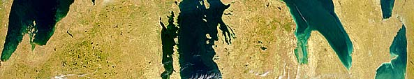
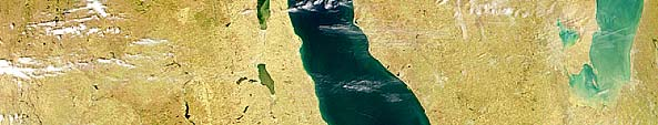

16 Stereo Coverage
17 Workflow Mirrors typical Photogrammetric project Acquire stereo imagery Acquire suitable ground control Perform Absolute Orientation View/collect in stereo Auto correlated surface Output data in client format
18 Project Example Pipeline Corridor Quarterly Pipeline Monitoring (FERC required) pipeline miles, reaching into 3 states Baselinemappingfrom aerial inplace Need: change detection at 1/8 th acre cell size along 500 wide corridor Deliverables: change detection cells, ortho insets of change areas, plan mapping for changes within 200 corridor


19 WV2 Tasking Feasibility Study Weather + Competition + Accesses Estimated 45 days per season 15% or less cloud cover ~6 WV 2 strips
20 Example:WorldView 2 8 MS bands 2 m MS / 50 cm pan Swath ~16 km wide Extremely agile Stereo capable High XY accuracy 3 4 day refresh at 40N X, Y, Z RMSE s(w/ control) m m m
21 Change Detection Workflow 1. Image to to image registration Not completed in winter or 1 st 2. Resample to 1/8 acre pixels 3. Determine changed pixels Via 8 band weighed difference difference and thresholding Major shifts veg. to human made; made; human made made to veg. Work to minimize false negatives 4. Create polygon of changed pixels Chopped to 750/1,500 ft pipeline pp corridor quarter Iterative process Ideas to explore Season to season change detection Thematic class based change detection Additional ortho and plan map updates as required
22 Project Example Coal Pile Volume Mining site in Northwest NM totaling ~70 acres Goal: coal pile(s) volume calculations Used WorldView 2 05meter 0.5 panchromatic Deliverables: DTM surface in 3D, 2 contours, Volumetric report, and m digital it orthophotos h t Compared satellite collected DTM to aerial photography volume calculations within 1%
23 0.5 meter panchromatic ortho
24 2 Contours from DTM
25 Where we see opportunity Urban/ Infrastructure planning applications Regional scale change detection and monitoring Globalreach projects, usinggloballyavailable globally available ground control Opportunities are limitless! itl


26 Isometric view


27 Future?? Not yet Resolution is controlled by US govt restrictions
28 Thank You / Questions??? Ron Schonegg, Account Manager rschonegg@continentalmapping.com Steve Roberts, LS, CFedS Survey Manager sroberts@continentalmapping.com
'Developments and benefits of hydrographic surveying using multispectral imagery in the coastal zone
 Abstract With the recent launch of enhanced high-resolution commercial satellites, available imagery has improved from four-bands to eight-band multispectral. Simultaneously developments in remote sensing
SPOT Satellite Earth Observation System Presentation to the JACIE Civil Commercial Imagery Evaluation Workshop March 2007
 SPOT Satellite Earth Observation System Presentation to the JACIE Civil Commercial Imagery Evaluation Workshop March 2007 Topics Presented Quick summary of system characteristics Formosat-2 Satellite Archive
High Resolution Digital Surface Models and Orthoimages for Telecom Network Planning
 Renouard, Lehmann 241 High Resolution Digital Surface Models and Orthoimages for Telecom Network Planning LAURENT RENOUARD, S ophia Antipolis FRANK LEHMANN, Berlin ABSTRACT DLR of Germany and ISTAR of
Spectral Response for DigitalGlobe Earth Imaging Instruments
 Spectral Response for DigitalGlobe Earth Imaging Instruments IKONOS The IKONOS satellite carries a high resolution panchromatic band covering most of the silicon response and four lower resolution spectral
Files Used in this Tutorial
 Generate Point Clouds Tutorial This tutorial shows how to generate point clouds from IKONOS satellite stereo imagery. You will view the point clouds in the ENVI LiDAR Viewer. The estimated time to complete
How To Make An Orthophoto
 ISSUE 2 SEPTEMBER 2014 TSA Endorsed by: CLIENT GUIDE TO DIGITAL ORTHO- PHOTOGRAPHY The Survey Association s Client Guides are primarily aimed at other professionals such as engineers, architects, planners
Point Clouds: Big Data, Simple Solutions. Mike Lane
 Point Clouds: Big Data, Simple Solutions Mike Lane Light Detection and Ranging Point Cloud is the Third Type of Data Vector Point Measurements and Contours Sparse, highly irregularly spaced X,Y,Z values
Earth Data Science in The Era of Big Data and Compute
 Earth Data Science in The Era of Big Data and Compute E. Lynn Usery U.S. Geological Survey usery@usgs.gov http://cegis.usgs.gov U.S. Department of the Interior U.S. Geological Survey Board on Earth Sciences
Core Imagery Product Guide. v. 2.0
 Core Imagery Product Guide v. 2.0 Disclaimer & Copyright Copyright 2014 DigitalGlobe, Inc. All rights reserved. The DigitalGlobe s Core Imagery Product Guide is purposely designed as a general guideline
Leica Photogrammetry Suite Project Manager
 Leica Photogrammetry Suite Project Manager Copyright 2006 Leica Geosystems Geospatial Imaging, LLC All rights reserved. Printed in the United States of America. The information contained in this document
ERDAS PRO600. A state-of-the-art package for 3D feature collection and editing
 ERDAS PRO600 A state-of-the-art package for 3D feature collection and editing MicroStation design file graphics are displayed by PRO600 in full 3D stereo. PRO600 PRO600 is a highly sophisticated, function-rich
MULTIPURPOSE USE OF ORTHOPHOTO MAPS FORMING BASIS TO DIGITAL CADASTRE DATA AND THE VISION OF THE GENERAL DIRECTORATE OF LAND REGISTRY AND CADASTRE
 MULTIPURPOSE USE OF ORTHOPHOTO MAPS FORMING BASIS TO DIGITAL CADASTRE DATA AND THE VISION OF THE GENERAL DIRECTORATE OF LAND REGISTRY AND CADASTRE E.ÖZER, H.TUNA, F.Ç.ACAR, B.ERKEK, S.BAKICI General Directorate
Digital Orthophoto Production In the Desktop Environment 1
 Digital Orthophoto Production In the Desktop Environment 1 By Dr. Roy A. Welch and Thomas R. Jordan Digital orthophotos are proving suitable for a variety of mapping, GIS and environmental monitoring tasks.
ENVI THE PREMIER SOFTWARE FOR EXTRACTING INFORMATION FROM GEOSPATIAL IMAGERY.
 ENVI THE PREMIER SOFTWARE FOR EXTRACTING INFORMATION FROM GEOSPATIAL IMAGERY. ENVI Imagery Becomes Knowledge ENVI software uses proven scientific methods and automated processes to help you turn geospatial
The premier software for extracting information from geospatial imagery.
 Imagery Becomes Knowledge ENVI The premier software for extracting information from geospatial imagery. ENVI Imagery Becomes Knowledge Geospatial imagery is used more and more across industries because
Advanced Image Management using the Mosaic Dataset
 Esri International User Conference San Diego, California Technical Workshops July 25, 2012 Advanced Image Management using the Mosaic Dataset Vinay Viswambharan, Mike Muller Agenda ArcGIS Image Management
Andrea Bondì, Irene D Urso, Matteo Ombrelli e Paolo Telaroli (Thetis S.p.A.) Luisa Sterponi e Cesar Urrutia (Spacedat S.r.l.) Water Calesso (Marco
 Luisa Sterponi e Cesar Urrutia (Spacedat S.r.l.) Water Calesso (Marco") Generation of a digital elevation model of the Wadi Lebda basin, Leptis Magna - Lybia Andrea Bondì, Irene D Urso, Matteo Ombrelli e Paolo Telaroli (Thetis S.p.A.) Luisa Sterponi e Cesar Urrutia (Spacedat
Generation of a digital elevation model of the Wadi Lebda basin, Leptis Magna - Lybia Andrea Bondì, Irene D Urso, Matteo Ombrelli e Paolo Telaroli (Thetis S.p.A.) Luisa Sterponi e Cesar Urrutia (Spacedat
RESOLUTION MERGE OF 1:35.000 SCALE AERIAL PHOTOGRAPHS WITH LANDSAT 7 ETM IMAGERY
 RESOLUTION MERGE OF 1:35.000 SCALE AERIAL PHOTOGRAPHS WITH LANDSAT 7 ETM IMAGERY M. Erdogan, H.H. Maras, A. Yilmaz, Ö.T. Özerbil General Command of Mapping 06100 Dikimevi, Ankara, TURKEY - (mustafa.erdogan;
Adaptation of High Resolution Ikonos Images to Googleearth for Zonguldak Test Field
 Adaptation of High Resolution Ikonos Images to Googleearth for Zonguldak Test Field Umut G. SEFERCIK, Murat ORUC and Mehmet ALKAN, Turkey Key words: Image Processing, Information Content, Image Understanding,
ERDAS IMAGINE The world s most widely-used remote sensing software package
 ERDAS IMAGINE The world s most widely-used remote sensing software package ERDAS IMAGINE Geographic imaging professionals need to process vast amounts of geospatial data every day often relying on software
DEVELOPMENT OF A SUPERVISED SOFTWARE TOOL FOR AUTOMATED DETERMINATION OF OPTIMAL SEGMENTATION PARAMETERS FOR ECOGNITION
 DEVELOPMENT OF A SUPERVISED SOFTWARE TOOL FOR AUTOMATED DETERMINATION OF OPTIMAL SEGMENTATION PARAMETERS FOR ECOGNITION Y. Zhang* a, T. Maxwell, H. Tong, V. Dey a University of New Brunswick, Geodesy &
Supervised Classification workflow in ENVI 4.8 using WorldView-2 imagery
 Supervised Classification workflow in ENVI 4.8 using WorldView-2 imagery WorldView-2 is the first commercial high-resolution satellite to provide eight spectral sensors in the visible to near-infrared
One Survey One Hundred Solutions. TLidar in Africa
 TLidar in Africa Africa Geospatial Forum The Survey Profession 35 Years of Change Johannesburg 19 August 2015 Norman Banks Change & Progress! The reasonable man adapts himself to the world; the unreasonable
Recent advances in Satellite Imagery for Oil and Gas Exploration and Production. DESK AND DERRICK APRIL 2016 PRESENTED BY GARY CREWS---RETIRED
 Recent advances in Satellite Imagery for Oil and Gas Exploration and Production. DESK AND DERRICK APRIL 2016 PRESENTED BY GARY CREWS---RETIRED Agenda Brief review of state of the applications in 2010 Basics
Applying High-resolution Satellite Imagery and Remotely Sensed Data to Local Government Applications
 Applying High-resolution Satellite Imagery and Remotely Sensed Data to Local Government Applications Sioux Falls, South Dakota Presentation Prepared by Steven J. Van Aartsen City of Sioux Falls GIS November
From Pixel to Info-Cloud News at Leica Geosystems JACIE Denver, 31 March 2011 Ruedi Wagner Hexagon Geosystems, Geospatial Solutions Division.
 From Pixel to Info-Cloud News at Leica Geosystems JACIE Denver, 31 March 2011 Ruedi Wagner Hexagon Geosystems, Geospatial Solutions Division What else can I do with my sensor/data? Earth to Image Image
EVALUATION OF AIRBORNE LIDAR DIGITAL TERRAIN MAPPING FOR HIGHWAY CORRIDOR PLANNING AND DESIGN
 Waheed Uddin Director, Center for Advanced Infrastructure Technology, Carrier Hall 203 The University of Mississippi, University, MS 38677-1848, USA cvuddin@olemiss.edu KEY WORDS: Terrain, mapping, airborne,
Price List. January 1 st, 2016. 1 of 40. PRICE LIST January 1 st, 2016 SLS-COM-16-001
 Price List January 1 st, 2016 1 of 40 INDEX INDEX... 2 COSMO-SKYMED... 4 IKONOS... 10 QUICKBIRD... 10 GEOEYE-1... 10 WORLDVIEW-1/2/3... 10 RADARSAT-1... 20 RADARSAT-2... 20 ASTER... 26 IRS P6... 28 IRS
HIGH SPATIAL RESOLUTION IMAGES - A NEW WAY TO BRAZILIAN'S CARTOGRAPHIC MAPPING
 CO-192 HIGH SPATIAL RESOLUTION IMAGES - A NEW WAY TO BRAZILIAN'S CARTOGRAPHIC MAPPING BIAS E., BAPTISTA G., BRITES R., RIBEIRO R. Universicidade de Brasíia, BRASILIA, BRAZIL ABSTRACT This paper aims, from
SeeMore. The 2013 Geospatial Portfolio Desktop. Geospatial for Smarter Decisions
 SeeMore The 2013 Geospatial Portfolio Desktop Geospatial for Smarter Decisions united. Modern. Dynamic. domore Geospatial for Smarter Decisions powering the geospatial enterprise More than ever before,
ORTHORECTIFICATION OF HR SATELLITE IMAGES WITH SPACE DERIVED DSM
 ORTHORECTIFICATION OF HR SATELLITE IMAGES WITH SPACE DERIVED DSM R. Cavallinia, F. Mancinia, M. Zannia a DISTART, University of Bologna, V.le Risorgimento 2, 40136 Bologna, Italy roberto74@libero.it, fmancini@racine.ra.it,
Review for Introduction to Remote Sensing: Science Concepts and Technology
 Review for Introduction to Remote Sensing: Science Concepts and Technology Ann Johnson Associate Director ann@baremt.com Funded by National Science Foundation Advanced Technological Education program [DUE
SOCET SET. Overview ELECTRONICS, INTELLIGENCE & SUPPORT
 SOCET SET Overview SOCET SET, BAE Systems digital mapping software application, is used for precision photogrammetry and geospatial analysis. The software is renowned for its unequaled depth, performance,
Opportunities for the generation of high resolution digital elevation models based on small format aerial photography
 Opportunities for the generation of high resolution digital elevation models based on small format aerial photography Boudewijn van Leeuwen 1, József Szatmári 1, Zalán Tobak 1, Csaba Németh 1, Gábor Hauberger
Imagery. 1:50,000 Basemap Generation From Satellite. 1 Introduction. 2 Input Data
 1:50,000 Basemap Generation From Satellite Imagery Lisbeth Heuse, Product Engineer, Image Applications Dave Hawkins, Product Manager, Image Applications MacDonald Dettwiler, 3751 Shell Road, Richmond B.C.
Understanding Raster Data
 Introduction The following document is intended to provide a basic understanding of raster data. Raster data layers (commonly referred to as grids) are the essential data layers used in all tools developed
From Ideas to Innovation
 From Ideas to Innovation Selected Applications from the CRC Research Lab in Advanced Geomatics Image Processing Dr. Yun Zhang Canada Research Chair Laboratory in Advanced Geomatics Image Processing (CRC-AGIP
COMPARISON OF AERIAL IMAGES, SATELLITE IMAGES AND LASER SCANNING DSM IN A 3D CITY MODELS PRODUCTION FRAMEWORK
 COMPARISON OF AERIAL IMAGES, SATELLITE IMAGES AND LASER SCANNING DSM IN A 3D CITY MODELS PRODUCTION FRAMEWORK G. Maillet, D. Flamanc Institut Géographique National, Laboratoire MATIS, Saint-Mandé, France
An integrated approach to production utilising the Intergraph DMC and TerraShare
 'Photogrammetric Week 05' Dieter Fritsch, Ed. Wichmann Verlag, Heidelberg 2005. Tabor, Marshall 173 An integrated approach to production utilising the Intergraph DMC and TerraShare MARK TABOR, PAUL MARSHALL,
Geospatial Positioning Accuracy Standards Part 3: National Standard for Spatial Data Accuracy
 Subcommittee for Base Cartographic Data Federal Geographic Data Committee Federal Geographic Data Committee Department of Agriculture Department of Commerce Department of Defense Department of Energy Department
Remote sensing is the collection of data without directly measuring the object it relies on the
 Chapter 8 Remote Sensing Chapter Overview Remote sensing is the collection of data without directly measuring the object it relies on the reflectance of natural or emitted electromagnetic radiation (EMR).
The RapidEye optical satellite family for high resolution imagery
 'Photogrammetric Week 01' D. Fritsch & R. Spiller, Eds. Wichmann Verlag, Heidelberg 2001. Scherer, Krischke 139 The RapidEye optical satellite family for high resolution imagery STEFAN SCHERER and MANFRED
TUTORIAL Extraction of Geospatial Information from High Spatial Resolution Optical Satellite Sensors
 TUTORIAL Extraction of Geospatial Information from High Spatial Resolution Optical Satellite Sensors E. Baltsavias 1,L. Zhang 2, D. Holland 3, P.K. Srivastava 4, B. Gopala Krishna 4, T.P. Srinivasan 4
Graphical Processing Units to Accelerate Orthorectification, Atmospheric Correction and Transformations for Big Data
 Graphical Processing Units to Accelerate Orthorectification, Atmospheric Correction and Transformations for Big Data Amanda O Connor, Bryan Justice, and A. Thomas Harris IN52A. Big Data in the Geosciences:
Map World Forum Hyderabad, India Introduction: High and very high resolution space images: GIS Development
 Very high resolution satellite images - competition to aerial images Dr. Karsten Jacobsen Leibniz University Hannover, Germany jacobsen@ipi.uni-hannover.de Introduction: Very high resolution images taken
Mobile 360 Degree Imagery: Cost Effective Rail Network Asset Management October 22nd, 2015. Eric McCuaig, Trimble Navigation
 Mobile 360 Degree Imagery: Cost Effective Rail Network Asset Management October 22nd, 2015 Eric McCuaig, Trimble Navigation The debate: Point Clouds vs. Imagery Both are useful pick the right tool for
Definition of KOMPSAT-3 Product Quality
 KOMPSAT-1 KOMPSAT-2 KOMPSAT-3 KOMPSAT-5 KOMPSAT-3A Korea Aerospace Research Institute 115 Gwahangro, Yuseong-gu Daejeon, 305-333, Korea Definition of KOMPSAT-3 Product Quality March 27, 2014 DongHan Lee
3D MODELING AND VISUALIZATION OF LARGE CULTURAL HERITAGE SITES AT VERY HIGH RESOLUTION: THE BAMIYAN VALLEY AND ITS STANDING BUDDHAS
 3D MODELING AND VISUALIZATION OF LARGE CULTURAL HERITAGE SITES AT VERY HIGH RESOLUTION: THE BAMIYAN VALLEY AND ITS STANDING BUDDHAS Armin Gruen, Fabio Remondino, Li Zhang Institute for Geodesy and Photogrammetry,
Databases for 3D Data Management: From Point Cloud to City Model
 Databases for 3D Data Management: From Point Cloud to City Model Xavier Lopez, Ph.D. Senior Director, Spatial and Graph Technologies Oracle Program Agenda Approach: Spatially-enable the Enterprise Oracle
EO Information Services in support of West Africa Coastal vulnerability - Service Utility Review -
 EO Information Services in support of West Africa Coastal vulnerability - Service Utility Review - Christian Hoffmann, GeoVille World Bank HQ, Washington DC Date : 24 February 2012 Content - Project background
PHOTOGRAMMETRIC TECHNIQUES FOR MEASUREMENTS IN WOODWORKING INDUSTRY
 PHOTOGRAMMETRIC TECHNIQUES FOR MEASUREMENTS IN WOODWORKING INDUSTRY V. Knyaz a, *, Yu. Visilter, S. Zheltov a State Research Institute for Aviation System (GosNIIAS), 7, Victorenko str., Moscow, Russia
Digital Classification and Mapping of Urban Tree Cover: City of Minneapolis
 Digital Classification and Mapping of Urban Tree Cover: City of Minneapolis FINAL REPORT April 12, 2011 Marvin Bauer, Donald Kilberg, Molly Martin and Zecharya Tagar Remote Sensing and Geospatial Analysis
Notable near-global DEMs include
 Visualisation Developing a very high resolution DEM of South Africa by Adriaan van Niekerk, Stellenbosch University DEMs are used in many applications, including hydrology [1, 2], terrain analysis [3],
IMPERVIOUS SURFACE MAPPING UTILIZING HIGH RESOLUTION IMAGERIES. Authors: B. Acharya, K. Pomper, B. Gyawali, K. Bhattarai, T.
 IMPERVIOUS SURFACE MAPPING UTILIZING HIGH RESOLUTION IMAGERIES Authors: B. Acharya, K. Pomper, B. Gyawali, K. Bhattarai, T. Tsegaye ABSTRACT Accurate mapping of artificial or natural impervious surfaces
Resolutions of Remote Sensing
 Resolutions of Remote Sensing 1. Spatial (what area and how detailed) 2. Spectral (what colors bands) 3. Temporal (time of day/season/year) 4. Radiometric (color depth) Spatial Resolution describes how
Mapping Earth from Space Remote sensing and satellite images. Remote sensing developments from war
 Mapping Earth from Space Remote sensing and satellite images Geomatics includes all the following spatial technologies: a. Cartography "The art, science and technology of making maps" b. Geographic Information
2003 INTERNATIONAL CONFERENCE AIRPORTS: PLANNING, INFRASTRUCTURE & ENVIRONMENT
 AIRPORTS: PLANNING, INFRASTRUCTURE & ENVIRONMENT AIRBORNE AND SPACEBORNE REMOTE SENSING TERRAIN MAPPING FOR PLANNING AND DESIGN OF TRANSPORTATION INFRASTRUCTURE ASSETS Waheed Uddin Associate Professor
The Role of SPOT Satellite Images in Mapping Air Pollution Caused by Cement Factories
 The Role of SPOT Satellite Images in Mapping Air Pollution Caused by Cement Factories Dr. Farrag Ali FARRAG Assistant Prof. at Civil Engineering Dept. Faculty of Engineering Assiut University Assiut, Egypt.
VISIONMAP A3 - SUPER WIDE ANGLE MAPPING SYSTEM BASIC PRINCIPLES AND WORKFLOW
 VISIONMAP A3 - SUPER WIDE ANGLE MAPPING SYSTEM BASIC PRINCIPLES AND WORKFLOW Michael Pechatnikov, Erez Shor, Yuri Raizman VisionMap Ltd., www.visionmap.com 13 Mozes St., Tel-Aviv, 67442, Israel michael@visionmap.com,
Information Contents of High Resolution Satellite Images
 Information Contents of High Resolution Satellite Images H. Topan, G. Büyüksalih Zonguldak Karelmas University K. Jacobsen University of Hannover, Germany Keywords: satellite images, mapping, resolution,
REGISTRATION OF LASER SCANNING POINT CLOUDS AND AERIAL IMAGES USING EITHER ARTIFICIAL OR NATURAL TIE FEATURES
 REGISTRATION OF LASER SCANNING POINT CLOUDS AND AERIAL IMAGES USING EITHER ARTIFICIAL OR NATURAL TIE FEATURES P. Rönnholm a, *, H. Haggrén a a Aalto University School of Engineering, Department of Real
3-D Object recognition from point clouds
 3-D Object recognition from point clouds Dr. Bingcai Zhang, Engineering Fellow William Smith, Principal Engineer Dr. Stewart Walker, Director BAE Systems Geospatial exploitation Products 10920 Technology
the Cloud Dean McCormick Regional Sales Manager Geospatial MEA Region
 Powering Big Data: From Creation to the Cloud Dean McCormick Regional Sales Manager Geospatial MEA Region The only constant is change, continuing change, inevitable change, that is the dominant factor
Business Plan for Orthoimagery in North Carolina
 Business Plan for Orthoimagery in North Carolina Statewide Mapping Advisory Committee Working Group for Orthophotography Planning October 2010 North Carolina Geographic Information Coordinating Council
Geospatial exploitation Products. GXP WebView. Powered by the GXP Platform
 Geospatial exploitation Products GXP WebView Powered by the GXP Platform Exploitation Capabilities GXP WebView Powered by the GXP Platform Detailed annotation (text, points, lines, and polygons) Distance,
Constructing and Evaluating a Request for Proposal. Ray Fox USGS Geospatial Liaison to Missouri MAGIC 2012 Conference
 Constructing and Evaluating a Request for Proposal Ray Fox USGS Geospatial Liaison to Missouri MAGIC 2012 Conference What you will need! TIME RFP s need time to construct An RFP for a spring leaf-off flight
The Status of Geospatial Information Management in China
 The Status of Geospatial Information Management in China Submitted by the National Administration of Surveying, Mapping and Geoinformation of China 1. Administration System The National Administration
Mobile Mapping Solutions for Ohio s Integrated Transportation Network. Brad Fugate, CP Nathan Fischer, PE
 Mobile Mapping Solutions for Ohio s Integrated Transportation Network Brad Fugate, CP Nathan Fischer, PE About Woolpert Established in 1911 Over 600 Professionals 25 Offices $12,000,000 invested in new
16 th IOCCG Committee annual meeting. Plymouth, UK 15 17 February 2011. mission: Present status and near future
 16 th IOCCG Committee annual meeting Plymouth, UK 15 17 February 2011 The Meteor 3M Mt satellite mission: Present status and near future plans MISSION AIMS Satellites of the series METEOR M M are purposed
URBAN LAND COVER CLASSIFICATION AND MOVING VEHICLE EXTRACTION USING VERY HIGH RESOLUTION SATELLITE IMAGERY
 URBAN LAND COVER CLASSIFICATION AND MOVING VEHICLE EXTRACTION USING VERY HIGH RESOLUTION SATELLITE IMAGERY BAHRAM SALEHI September 2012 TECHNICAL REPORT NO. 281 URBAN LAND COVER CLASSIFICATION AND MOVING
MAPPING MINNEAPOLIS URBAN TREE CANOPY. Why is Tree Canopy Important? Project Background. Mapping Minneapolis Urban Tree Canopy.
 MAPPING MINNEAPOLIS URBAN TREE CANOPY Why is Tree Canopy Important? Trees are an important component of urban environments. In addition to their aesthetic value, trees have significant economic and environmental
IP-S3 HD1. Compact, High-Density 3D Mobile Mapping System
 IP-S3 HD1 Compact, High-Density 3D Mobile Mapping System Integrated, turnkey solution Ultra-compact design Multiple lasers minimize scanning shades Unparalleled ease-of-use No user calibration required
Request for Proposals for Topographic Mapping. Issued by: Teton County GIS and Teton County Engineering Teton County, Wyoming
 Request for Proposals for Topographic Mapping Issued by: Teton County GIS and Teton County Engineering Teton County, Wyoming Proposals due: 2:00PM MDT July 1, 2015 Proposals may be delivered to: Teton
Raster Data Structures
 Raster Data Structures Tessellation of Geographical Space Geographical space can be tessellated into sets of connected discrete units, which completely cover a flat surface. The units can be in any reasonable
NWS Flood Inundation Mapping Program
 NWS Flood Inundation Mapping Program Carson River Floodplain Management Forum April 22, 2015 Mark Faucette, Senior Forecaster Hydrology Program Manager NOAA/NWS, WFO Reno, NV NWS Hydrologic Services Program
Land Use/ Land Cover Mapping Initiative for Kansas and the Kansas River Watershed
 Land Use/ Land Cover Mapping Initiative for Kansas and the Kansas River Watershed Kansas Biological Survey Kansas Applied Remote Sensing Program April 2008 Previous Kansas LULC Projects Kansas LULC Map
MODULATION TRANSFER FUNCTION MEASUREMENT METHOD AND RESULTS FOR THE ORBVIEW-3 HIGH RESOLUTION IMAGING SATELLITE
 MODULATION TRANSFER FUNCTION MEASUREMENT METHOD AND RESULTS FOR THE ORBVIEW-3 HIGH RESOLUTION IMAGING SATELLITE K. Kohm ORBIMAGE, 1835 Lackland Hill Parkway, St. Louis, MO 63146, USA kohm.kevin@orbimage.com
DEVELOPING AN INUNDATION MAP STANDARD FOR THE U.S. ARMY CORPS OF ENGINEERS
 DEVELOPING AN INUNDATION MAP STANDARD FOR THE U.S. ARMY CORPS OF ENGINEERS Will Breitkreutz, Geographer, U.S. Army Corps of Engineers Kansas City District, Kansas City, Missouri, will.l.breitkreutz@usace.army.mil
Cartosat-1 10 years and beyond
 nrsc Cartosat-1 10 years and beyond Cartosat-1 : 10 years completion in Orbit (2005-2015) 5th May 2015 National Remote Sensing Centre Indian Space Research Organisation Dept. of Space, Govt. of India Balanagar,
Photogrammetric Point Clouds
 Photogrammetric Point Clouds Origins of digital point clouds: Basics have been around since the 1980s. Images had to be referenced to one another. The user had to specify either where the camera was in
Land Use/Land Cover Map of the Central Facility of ARM in the Southern Great Plains Site Using DOE s Multi-Spectral Thermal Imager Satellite Images
 Land Use/Land Cover Map of the Central Facility of ARM in the Southern Great Plains Site Using DOE s Multi-Spectral Thermal Imager Satellite Images S. E. Báez Cazull Pre-Service Teacher Program University
Coastal Engineering Indices to Inform Regional Management
 Coastal Engineering Indices to Inform Regional Management Lauren Dunkin FSBPA 14 February 2013 Outline Program overview Standard products Coastal Engineering Index Conclusion and future work US Army Corps
ENVI Services Engine: Scientific Data Analysis and Image Processing for the Cloud
 ENVI Services Engine: Scientific Data Analysis and Image Processing for the Cloud Bill Okubo, Greg Terrie, Amanda O Connor, Patrick Collins, Kevin Lausten The information contained in this document pertains
Big Data Volume & velocity data management with ERDAS APOLLO. Alain Kabamba Hexagon Geospatial
 Big Data Volume & velocity data management with ERDAS APOLLO Alain Kabamba Hexagon Geospatial Intergraph is Part of the Hexagon Family Hexagon is dedicated to delivering actionable information through
GEOMETRIC ACCURACY AND FEATURE COMPILATION ASSESSMENT OF HIGH RESOLUTION SATELLITE IMAGES
 GEOMETRIC ACCURACY AND FEATURE COMPILATION ASSESSMENT OF HIGH RESOLUTION SATELLITE IMAGES V.O.Atak a, * and M. O. Altan b a General Command of Mapping, 06100, Ankara, Turkey - okan.atak@hgk.mil.tr b ITU,
Pima Regional Remote Sensing Program
 Pima Regional Remote Sensing Program Activity Orthophoto GIS Mapping and Analysis Implementing Agency Pima Association of Governments (Tucson, Arizona area Metropolitan Planning Organization) Summary Through
Integer Computation of Image Orthorectification for High Speed Throughput
 Integer Computation of Image Orthorectification for High Speed Throughput Paul Sundlie Joseph French Eric Balster Abstract This paper presents an integer-based approach to the orthorectification of aerial
WHAT IS GIS - AN INRODUCTION
 WHAT IS GIS - AN INRODUCTION GIS DEFINITION GIS is an acronym for: Geographic Information Systems Geographic This term is used because GIS tend to deal primarily with geographic or spatial features. Information
PIXEL-LEVEL IMAGE FUSION USING BROVEY TRANSFORME AND WAVELET TRANSFORM
 PIXEL-LEVEL IMAGE FUSION USING BROVEY TRANSFORME AND WAVELET TRANSFORM Rohan Ashok Mandhare 1, Pragati Upadhyay 2,Sudha Gupta 3 ME Student, K.J.SOMIYA College of Engineering, Vidyavihar, Mumbai, Maharashtra,
Research On The Classification Of High Resolution Image Based On Object-oriented And Class Rule
 Research On The Classification Of High Resolution Image Based On Object-oriented And Class Rule Li Chaokui a,b, Fang Wen a,b, Dong Xiaojiao a,b a National-Local Joint Engineering Laboratory of Geo-Spatial
Operational Space- Based Crop Mapping Protocols at AAFC A. Davidson, H. McNairn and T. Fisette.
 Operational Space- Based Crop Mapping Protocols at AAFC A. Davidson, H. McNairn and T. Fisette. Science & Technology Branch. Agriculture and Agri-Food Canada. 1. Introduction Space-Based Crop Mapping at
TAMARISK MAPPING & MONITORING USING HIGH RESOLUTION SATELLITE IMAGERY. Jason W. San Souci 1. John T. Doyle 2
 TAMARISK MAPPING & MONITORING USING HIGH RESOLUTION SATELLITE IMAGERY Jason W. San Souci 1 John T. Doyle 2 ABSTRACT QuickBird high resolution multispectral satellite imagery (60 cm GSD, 4 spectral bands)
U.S. Geological Survey Earth Resources Operation Systems (EROS) Data Center
 Data Center") U.S. Geological Survey Earth Resources Operation Systems (EROS) Data Center World Data Center for Remotely Sensed Land Data USGS EROS DATA CENTER Land Remote Sensing from Space: Acquisition to Applications
U.S. Geological Survey Earth Resources Operation Systems (EROS) Data Center World Data Center for Remotely Sensed Land Data USGS EROS DATA CENTER Land Remote Sensing from Space: Acquisition to Applications
3D GIS: It s a Brave New World
 3D GIS: It s a Brave New World Reida ELWANNAS, United Arab Emirates Key words: 3D Models, CityGML, GIS SUMMARY For the past several decades we have been enjoying the power of GIS. The introduction of 2.5D
METHODOLOGY FOR LANDSLIDE SUSCEPTIBILITY AND HAZARD MAPPING USING GIS AND SDI
 The 8th International Conference on Geo-information for Disaster Management Intelligent Systems for Crisis Management METHODOLOGY FOR LANDSLIDE SUSCEPTIBILITY AND HAZARD MAPPING USING GIS AND SDI T. Fernández
HEXAGON GEOSPATIAL BENELUX 2015. Hexagon Geospatial Benelux 2015
 HEXAGON GEOSPATIAL BENELUX 2015 IMAGINE for UAV Irmgard Runkel GEOSYSTEMS GmbH, Germany Are drones a new market*? > 50 % * http://dronelife.com/2015/08/28/the-latest-drone-numbers-from-cb-insights-future-of-frontier-tech-report/
How To Fuse A Point Cloud With A Laser And Image Data From A Pointcloud
 REAL TIME 3D FUSION OF IMAGERY AND MOBILE LIDAR Paul Mrstik, Vice President Technology Kresimir Kusevic, R&D Engineer Terrapoint Inc. 140-1 Antares Dr. Ottawa, Ontario K2E 8C4 Canada paul.mrstik@terrapoint.com
Introduction to GIS (Basics, Data, Analysis) & Case Studies. 13 th May 2004. Content. What is GIS?
 & Case Studies. 13 th May 2004. Content. What is GIS?") Introduction to GIS (Basics, Data, Analysis) & Case Studies 13 th May 2004 Content Introduction to GIS Data concepts Data input Analysis Applications selected examples What is GIS? Geographic Information
Introduction to GIS (Basics, Data, Analysis) & Case Studies 13 th May 2004 Content Introduction to GIS Data concepts Data input Analysis Applications selected examples What is GIS? Geographic Information
Intelligent High Resolution Satellite/Aerial Imagery 1. Introduction 1.1 Digital Data Collection
 Intelligent High Resolution Satellite/Aerial Imagery Nadeem Fareed COMSATS Institute of Information Technology Islamabad, Pakistan Na-232 Newmalpur 7 th Road Satellite Town, Rawalpindi, Pakistan 46000