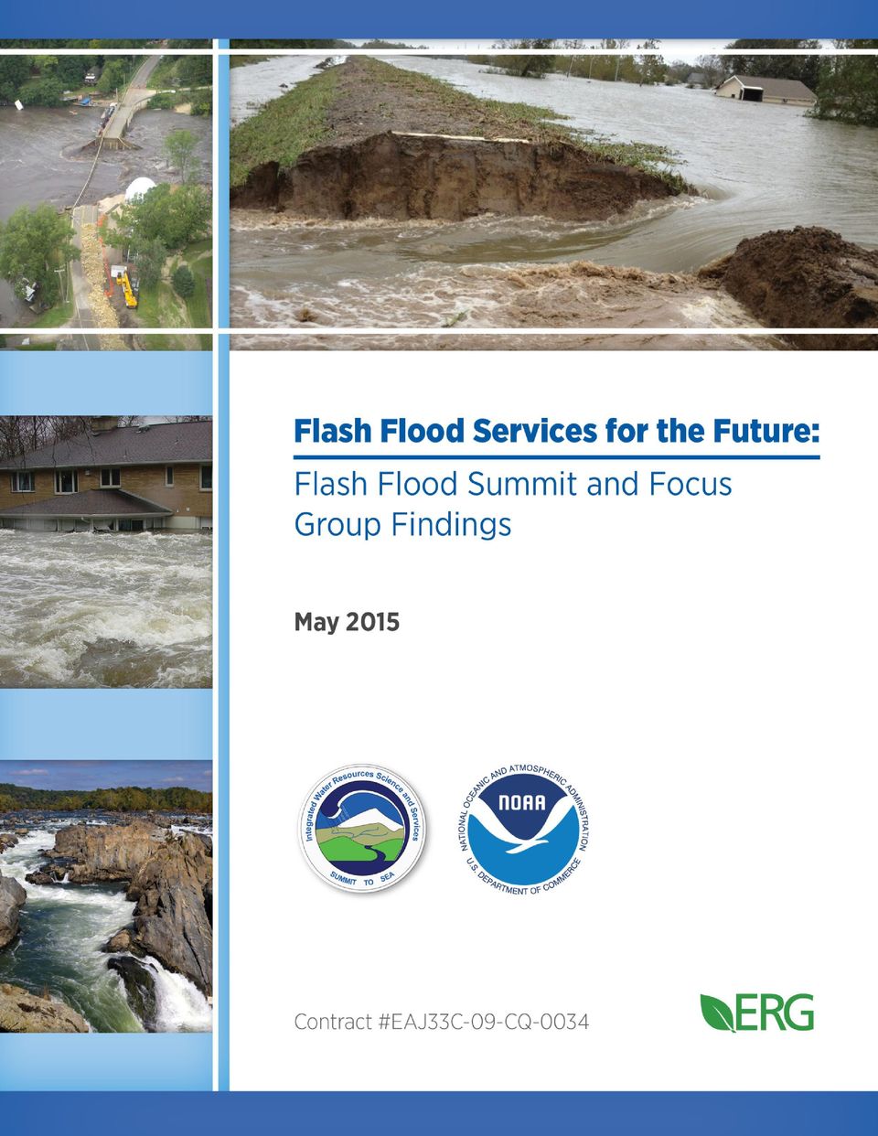
Cover: Top and side panel photos courtesy of Ed Clark, National Weather Service. Bottom side panel photo courtesy of Jim Palmer.
|
|
|
- Philip Hunt
- 8 years ago
- Views:
Transcription
1
2 Cover: Top and side panel photos courtesy of Ed Clark, National Weather Service. Bottom side panel photo courtesy of Jim Palmer.

3 ACKNOWLEDGEMENTS The Flash Flood Summit and Focus Groups were the combined efforts of many offices, organizations, and individuals. The National Weather Service would like to acknowledge and thank the National Water Center staff for assisting in organizing and conducting the Summit, as well as all the attendees and presenters for their active participation and insights. National Weather Service would also like to thank the following Weather Forecast Office staff that helped plan and organize flash flood focus groups across the country: Paul Yura and Hector Guerrero (Austin, Texas); Nezette Rydell and Bob Glancy (Boulder, Colorado); Ben Schott, Jim Brewster (Binghamton, New York) and Barbara Watson (State College, Pennsylvania); Jeff Zogg (Des Moines, Iowa), Ed Fenelon, and Bill Morris (Romeoville, Illinois); and Jeff Medlin and John Werner (Mobile, Alabama). Additionally, the focus groups would not have been possible without the participation of local emergency managers, meteorologists, local officials, and non-profit organizations; thank you for taking the time to share your thoughts and concerns with the National Weather Service. i

4 LIST OF ACRONYMS AWIPS BOC CWFDP DART DOT EM EPA ESRI FEMA FFG FFPI GFE GIS GUI HWM HWT IWRSS MPE NASA NCAR NCEP NEXRAD NFIE NGO NOAA NSF NSSL NWC NWS OAR Advanced Weather Interactive Processing System Baseline operating capability Centralized Water Forecasting Demonstration Project Deep-ocean Assessment and Report of Tsunamis U.S. Department of Transportation Emergency manager U.S. Environmental Protection Agency Environmental Systems Research Institute Federal Emergency Management Agency Flash flood guidance Flash Flood Potential Index Graphical Forecast Editor Geographic information system Graphical user interface High water mark Hazardous Weather Testbed Integrated Water Resources Science and Services Multi-Sensor Precipitation Estimation National Aeronautics and Space Administration National Center for Atmospheric Research National Centers for Environmental Prediction Next generation radar National Flood Interoperability Experiment Non-governmental organization National Oceanic and Atmospheric Administration National Science Foundation National Severe Storms Laboratory National Water Center National Weather Service (NOAA) Office of Oceanic and Atmospheric Research ii

5 OHD QC QPE RBC RENCI RFC SPC SLOSH UCAR USACE USBR USGS VIPER WEA WFO WPC WRES WRN Office of Hydrologic Development Quality control Quantitative precipitation estimation River Basin Commission Renaissance Computing Institute River Forecast Center Storm Prediction Center Sea, Lake, and Overland Surges from Hurricanes University Corporation for Atmospheric Research U.S. Army Corps of Engineers U.S. Bureau of Reclamation U.S. Geological Survey Virginia Interoperability Picture for Emergency Response Wireless emergency alert Weather Forecast Office Weather Prediction Center Water Resources Evaluation Service Weather-Ready Nation iii

6 EXECUTIVE SUMMARY Flash floods are a critical issue of concern to communities across the United States. A changing climate is complicating decades-old regional assumptions about the frequency and magnitude of flash flood events. In some areas, an aging infrastructure is reducing communities protection from flooding. Increased development in flood-prone areas is also putting more citizens in harm s way. The combined impact of these factors increases both the scientific and flood management challenges faced by many communities. Reducing the societal cost of flooding, in terms of both economic losses and tragic fatalities, is a great challenge facing the nation. To effectively prepare for and respond to these flood risks, the National Weather Service (NWS) must document stakeholders needs, identify service gaps, develop and implement science and technology, and enhance operations to advance flash flood services. Another critical component of flash flood services includes effective communication among warning and response officials, media, and the general public. On September 9 11, 2014, the NWS convened a two-and-a-half-day Flash Flood Summit to begin refining the vision for the future of U.S. flash flood services. The Summit, held in the newly constructed National Water Center (NWC) in Tuscaloosa, Alabama, brought together 60 representatives from federal and state governments, the private sector, academia, and non-governmental organizations (NGOs). The objectives of the Summit were to: Agree on a shared vision for future flash flood services: hydrologically consistent, end-to-end flash flood services to be implemented through a national water modeling and information services framework. Identify priority requirements/functional components to achieve the flash flood services vision. Explore the intersection between science and social science requirements to help inform priorities. Agree on a path forward to transform flash flood services over the next 10 years. At the outset of the Summit, the organizers proposed a vision for future flash flood services as a starting point for discussion: Transform predictive flash flood services for any causative event by establishing an end-to-end, nationally consistent framework that provides: Seamlessly integrated observation and monitoring networks. High-resolution, hydrologically continuous (from flash flooding to flooding) national water model directly coupled with numerical weather prediction datasets and other forcings. Objective forecasting and characterization of the urgency, severity, and certainty of flood impacts at the street level. Actionable information, consistent communication, and decision support services to transform society to become ready, responsive, and resilient to flash flood and flood threats. Participants were charged with refining the vision by further defining and developing specific requirements that reflected their knowledge and practical experience, as well as emerging technical, scientific, and social science developments in the area of flash floods. Starting with a very broad vision iv

7 and group brainstorming of all potential needs, the Summit was structured to hone in on the most important needs among the flash flood vision s four primary elements observation/monitoring, modeling, forecasting/characterization, and communication and to explore inter-relationships among these elements. During a series of small breakout group sessions, each building on the work accomplished during prior sessions, participants subscribed to the vision and identified, discussed, and prioritized the most pressing needs/requirements for advancing the vision (Figure 1). Focus groups were held in: Austin, Texas (11/12/14) Boulder, Colorado (12/10/14) Binghamton, New York (1/14/15) Romeoville (Chicago), Illinois (2/18/15) Mobile, Alabama (3/2/15) Following the Summit, NWS convened five focus groups across the country to gain a better understanding of local flash flood needs and to help ground truth and supplement the communications vision developed during the Summit. Three recommendations emerged from the focus groups that would help advance flash flood communication locally and align with the NWS communications vision. Simplify flash flood messaging. The current watch/warning/advisory system is confusing to the public, and both emergency managers and broadcast meteorologists expressed difficulty conveying the risk level using this terminology. Rethinking the system in simpler, widely understood terms that convey actionable information will likely improve overall understanding and response. NWS should also consider how these messages are being disseminated, with an emphasis on including video and/or graphics. Improve modeling capacity to allow for higher resolution products. While clarification and simplification of the existing watch/warning system is desired, participants also recommended greater specificity on the timing, severity, and location of flash flood risks. Modeling capacity will have to be improved to forecast with greater geographic and temporal specificity (e.g., a less than one-hour time step, identifying specific stream or road intersection impacted). When higher resolution information is eventually available for dissemination, it will need to be distilled into actionable, simple terms for users. Continue to foster and cultivate strong relationships between Weather Forecast Offices (WFOs) and local partners. Over the years, WFOs and local partners have built valuable relationships based on open data sharing, transparent personal communication, and trust. Every effort must be made to foster and strengthen these relationships so that WFOs can continue to provide the services and information decision-makers need to effectively communicate flash flood risks. These collaborative partnerships provide WFOs with a valuable boots on the ground feedback loop for real-time, sitespecific conditions, and they help disseminate consistent messages across the affected community before, during, and after flash flood events. Over the course of the next several years, the NWS will use the vision crafted during the Summit and focus groups to outline a series of near-term, mid-term, and long-term projects and activities to begin implementing the requirements set forth in this report. At the same time, the NWS will establish a community of practice a cadre of interested parties within the NWS, other federal agencies, and research organizations to cultivate its capabilities in alignment with the vision. This community will serve as the focal group for requirements validation, establish an interdisciplinary approach to design v
.")
8 and development, and work to integrate other related water resources capacity building activities to transform flash flood information and services. A number of new initiatives and activities will help create the building blocks for meeting the flash flood vision and its associated requirements. Beginning in 2015, a centralized water forecasting demonstration project with critical data and evaluation services will be established at the NWC. A highresolution, hydrologically continuous, physically based water model will concurrently be established for testing and evaluation. This testing will include exploring new, geospatially based datasets and services that can better inform stakeholders. Mid-term and longer-term proposals build on these capabilities to provide objectively derived characterizations of flash flooding at the street level. Flash Flood Summit participants and vision board vi

9 Flash Flood Services for the Future: Figure 1. The vision board was used as a guide throughout the Summit to remind participants of the Flash Flood vision s primary elements and how they are connected (the original vision board can be found in Figure 3). Through several facilitated breakout group sessions, participants identified and narrowed down the priority requirements for each element required to advance the vision. This graphic is a cleaned-up version of the vision board that was populated by Summit participants. vii

10 TABLE OF CONTENTS Acknowledgements... i List of Acronyms... ii Executive Summary... iv 1.0 Background and Introduction Summit Design Summary of Summit Outcomes Ground Truthing Flash Flood Summit Findings: Flash Flood Focus Groups Next Steps Appendix A: Attendee List... A-1 Appendix B: Needs/Requirements Identified (first round of index cards)... B-1 Appendix C: Needs/Requirements Prioritized... C-1 Appendix D: Summary Notes from Flash Flood Focus Groups... D-1 LIST OF TABLES Table 1. Summary of Opening Panel Presentations... 4 LIST OF FIGURES Figure 1. Cleaned-up version of the vision board populated by Summit participants... vii Figure 2. Information presented during Summit keynote by Donald Cline, NWS Figure 3. Original vision board Figure 4. Breakout group process: refining flash flood services vision needs Figure 5. Revised vision board presented at focus groups Figure 6. IWRSS timeline viii

11 1.0 BACKGROUND AND INTRODUCTION On September 9 11, 2014, the NWS convened a two-and-a-half-day Flash Flood Summit at the NWC to develop the vision for the future of U.S. flash flood services. The need for the Summit was clear. The annual average damage due to flooding has risen in each of the past three decades (costs adjusted for inflation): : $4.7 billion : $7.9 billion : $10.2 billion Over the next 30 years, the NWS estimates that flash floods will (see Figure 2): Cause at least $300 billion in damages. Lead to over 2,500 fatalities. Despite improvements in forecasting accuracy and advancements in hydrological and atmospheric modeling, many challenges remain in providing timely and actionable information about flash floods. Such challenges include making decisions within a dynamic environment (i.e., continuously changing landscape and climate) and effectively communicating flash flood risk to the public (e.g., the location and severity of flooding expected to occur as well as where it is not expected to occur), so that fatalities and damages are reduced in the future. Figure 2. Information presented during Summit keynote by Donald Cline, NWS. 1

12 1.1 Summit Objectives and Flash Flood Vision The Summit brought together an interdisciplinary group of 60 scientists, social scientists, and community leaders from federal and state governments, the private and non-profit sectors, and academia. The group included participants from the National Oceanic and Atmospheric Administration (NOAA) (both NWS and the Office of Oceanic and Atmospheric Research [OAR]), the U.S. Army Corps of Engineers (USACE), the U.S. Geological Survey (USGS), the Federal Emergency Management Agency (FEMA), the University Corporation for Atmospheric Research (UCAR), the University of Alabama, and the Alabama Office of Water Resources (for a complete participant list, see Appendix A). The Summit was held in the newly constructed NWC in Tuscaloosa, Alabama, on the campus of the University of Alabama. Hydrologic, atmospheric, and other scientific expertise were combined with social science expertise so that the vision for flash flood services could benefit from input by both technical and communications perspectives. Social scientists intimately understand the process needed to translate scientific information in ways that effectively communicate flood risks to target audiences and result in the appropriate behavioral responses. This mix of physical and social scientists led to rich discussions and a fuller appreciation of the human dimensions of flash flood services. The workshop design was intended to ensure that strategies for effective communication would be discussed and integrated throughout the Flash Flood Summit deliberations and development of the vision requirements. The Summit objectives were to: National Water Center 65,000 square foot facility on the campus of University of Alabama, Tuscaloosa. Certified Leadership in Energy and Environmental Design Gold Building. Designed specifically for major programmatic functions: Operations Center with Situation Rooms. Geo-Intelligence Laboratory. Collaborative Science and Software Engineering Studio. Systems Proving Ground. Agree on a shared vision for future flash flood services: a hydrologically consistent, end-to-end flash flood services to be implemented through a national water modeling and information services framework. Identify priority requirements/functional components to achieve the flash flood services vision. Explore the intersection between science and social science requirements to help inform priorities. Agree on a path forward to transform flash flood services over the next 10 years. At the outset of the Summit, the NWS proposed a vision for future flash flood services that would guide the work sessions for the duration of the two-and-a-half days: 2
![The group included participants from the National Oceanic and Atmospheric Administration (NOAA) (both NWS and the Office of Oceanic and Atmospheric Research [OAR]), the U.S. Army Corps of Engineers (USACE), the U.](/docs-images/41/4085066/images/page_12.jpg "S. Geological Survey (USGS), the Federal Emergency Management Agency (FEMA), the University Corporation for Atmospheric Research (UCAR), the University of Alabama, and the Alabama Office of Water")
13 Transform predictive flash flood services for any causative event by establishing an end-to-end, nationally consistent framework that provides: Seamlessly integrated observation and monitoring networks. High-resolution, hydrologically continuous (from flash flooding to flooding) national water model directly coupled with numerical weather prediction datasets and other forcings. Objective forecasting and characterization of the urgency, severity, and certainty of flood impacts at the street level. Actionable information, consistent communication, and decision support services to transform society to become ready, responsive, and resilient to flash flood and flood threats. 2.0 SUMMIT DESIGN To achieve the Summit objectives, the NWS presented a flash flood vision statement for validation, vetting, and further development by participants. The vision consisted of four key elements: Observation and monitoring: methods by which atmospheric and hydrological data are collected. Modeling: methods by which data are inputted into a variety of models (e.g., landscape, atmospheric circulation, earth system) to help predict precipitation events and precipitation behavior in the landscape. Forecasting and characterization: model outputs and predictions used to make more precise statements about possible flash flood events and associated hazards. Communication: methods by which flash flood forecasts are effectively conveyed to emergency responders and the public to elicit appropriate action. To facilitate the Summit s opening discussion, participants responded to a poll at the time they registered for the Summit. The poll established interests, perspectives, and opinions about current challenges and opportunities associated with flash flood services. Results of the poll are summarized below: Top priority elements (total votes in parentheses) Forecasting and characterization (21) Modeling (19) Communication (18) Observation and monitoring (13) Major challenges (sample of common answers) Communication (at appropriate spatial and temporal scales, with enough lead time, consistent terminology, etc.) Forecasting and characterization (precipitation, magnitude, etc.) Scaling of practices, consistency across offices (modeling, terminology) Major opportunities (sample of common answers) Growing public awareness (attributable to recent extreme events) 3

14 Improved modeling (hydrology, climate, etc.) Agency/office collaboration (cross-disciplines) New methods of communicating with public (social media) More accurate data, better mapping capabilities Clarifying communication, methods for communication The NWS used the poll results to gain an understanding of participants needs prior to the Summit, to confirm critical elements for moving the flash flood services vision forward, and to identify common themes expressed by participants. Donald Cline, Acting Director of the NWS Office of Hydrologic Development (OHD), opened the Summit with a keynote presentation introducing the NWS s challenge of reducing flash flood-related damages and fatalities over the next 30 years. He posed several questions to participants to get them thinking about the types of observation and monitoring, modeling, forecasting and characterization, and communication needs that may be necessary to progress flash flood services forward. The overarching challenge issued to the group was: How can we reverse the trend of increasing fatalities and damages over the next 30 years? To establish a common understanding of the Summit s necessity and to elucidate current and emerging issues, a series of presentations (see Table 1) provided the state of the science and emerging technologies and practices from scientific, practical, and social perspectives. These thought-provoking presentations gave participants the context for subsequent discussions, as well as a common starting point of understanding going into breakout group discussions. Table 1. Summary of Opening Panel Presentations Panel #1: Physical Science Panel #2: Practitioner Experience Panelists David Gochis, National Center for Atmospheric Research (NCAR) J.J. Gourley, NOAA/National Severe Storms Laboratory David Maidment, University of Texas at Austin Leslie Durham, Alabama Office of Water Resources Panel topics The feasibility of moving towards forecasting water flow everywhere all the time (beyond point flow forecasts), taking into account the impacts of infrastructure (e.g., dams, levees); improving representations of landscape dynamics; and providing more meaningful risk guidance by creating a probabilistic framework for forecasters/decisionmakers, all of which would require significant geospatial data support capable of evolving over time. Improve flash flood watches and warnings and make them more actionable based on the work conducted under the Hazardous Weather Testbed-Hydrology experiment. The National Flood Interoperability Experiment (NFIE) will attempt to connect national scale flood modeling with local emergency planning and response. The importance of moving the public away from reactive behavior to proactive behavior (in the context of recent coastal flash flooding in Alabama, where 1 out of every 4 flood events in the state occur outside FEMA-designated flood areas). The desire to maximize federal capabilities to provide local solutions, gaining a better understanding of how to 4

15 Table 1. Summary of Opening Panel Presentations Panel #3: Social Science Panelists Benjamin Pratt, Susquehanna River Basin Commission Gene Longenecker, FEMA Office of Response & Recovery Mike Sprague, Environmental Emergency Services, Inc. Hector Guerrero, Texas Flash Flood Coalition Rachel Hogan Carr, Nurture Nature Center Julie Demuth, NCAR Laura Myers, University of Alabama, Tuscaloosa Panel topics maximize the huge opportunities that are available as technologies continue to advance, and the value in understanding where the risk is in each community so that actions can be focused. FEMA looks to Deep-ocean Assessment and Report of Tsunamis (DART) monitoring systems; the Sea, Lake, and Overland Surges from Hurricanes (SLOSH) model; and Hazus (hazard loss estimation software), but it can often be difficult for the agency to combine all these sources to provide inundation assessments to local EMs. In central New York, a three-county NGO provides flood warning service based on its own precipitation and stream gauges and NWS data, but it is grappling with various facets of delivering messages to the public. The Texas Flash Flood Coalition brings together numerous stakeholders to share best practices and mitigate flash flood impacts. Some examples include a variety of communications and education products (signs, slogans, etc.), an early warning system developed in Austin, and the establishment of alternative routes at low water crossing locations. Focus on Floods education campaign (Pennsylvania), as well as studies in Delaware River Basin to see whether flooding products (e.g., hydrograph, watches and warnings, flood inundation maps) were being used and understood by the general public. Tried to determine how products could be revised to address confusion. National Science Foundation (NSF) study looking at flash floods in Boulder, Colorado, and how forecasters, public officials, and media make decisions and perceive the public s decision-making. Results suggest a need for improved risk management among professionals and improved risk communication with the public, focusing on information at the spatial and temporal scales needed for decision-making. Studies have shown that out of all weather threats, the public is least concerned about flash flooding. Some issues to consider when communicating with the public include whether 1) environmental cues are being recognized (rain, etc.), 2) watches/warnings/alerts are understood, 3) multiple warning modes should be established, 4) time of day needs to be considered, 5) graphical information is as important as lead time, 6) impact-based messaging may get the public s attention but not necessarily get them to act. 5

16 After the panel presentations, the vision statement and a key visual a 10-foot by 4-foot vision board were unveiled for discussion. The vision board displayed the four main elements of the flash flood services vision and various causative events (Figure 3). Smaller versions of the vision board were also displayed in each of the breakout rooms. Figure 3. Original vision board. Participants populated the board and used it interactively throughout the Summit. The four elements of the flash flood services vision served to guide the work sessions, which focused on: Identifying requirements for each vision element. Prioritizing requirements. Identifying each requirement s status (where it was in the development process and about how much time/effort would be required to implement it). Breakout Session Topics In the plenary session, the vision board was explained and participants were given the opportunity to discuss the vision statement, the definitions of each element, and the charge to populate the vision board with specific requirements. Participants agreed that the vision board, statement, and elements represented a good working framework that would be built out over the course of the workshop. The first breakout session was held during the afternoon of Day 1 to discuss the flash flood vision s benefits and challenges. Participants were randomly Breakout Session 1: Identify flash flood vision benefits, challenges, and opportunities. Breakout Session 2: Bin and prioritize ideas to improve flash flood observation, modeling, forecasting, and communications. Breakout Session 3: Choose top three priorities for each element, define them clearly, and what s needed to implement them. Breakout Session 4: Top three priorities are scoped out: who needs to be involved, how long will it take, what level of resources is required? 6


 and record them on color-coded index cards (Step 1,")
17 assigned to the first breakout group to ensure a mix of expertise. Each breakout group had a facilitator equipped with an on screen worksheet, which was populated in real time during the session so that all ideas were captured accurately. These groups then reconvened in plenary session and reported back on their discussions. Participants were asked at the conclusion of Day 1 to identify at least four needs (one for each flash flood vision element mentioned previously) and record them on color-coded index cards (Step 1, Figure 4; see Appendix B). On Day 2, participants (in the same groups as Day 1) brought their index cards into the second breakout session to be prioritized by vision element (Step 2, Figure 4). Working in small sub-groups, 12 requirements for each element were reduced to three or four and were hand-written on post-it notes. The smaller sub-groups reported back to the breakout group, and priorities for each element were discussed. Figure 4. Breakout group process: refining flash flood services vision needs. At the conclusion of the session, the post-it notes were then placed onto the large vision board in the rotunda for all Summit participants to see and discuss (see photo below). Approximately 12 requirements were present in each designated element space of the vision board. On Day 2 of the Summit, participants attended element-specific groups. Participants chose one of the four groups based on their expertise and interest. In the third breakout session, participants were tasked with taking the 12 or so priority requirements for their specific flash flood vision board element and refining the list further (Step 3, Figure 4). Participants again wrote the new priority requirements on post-it notes and stuck them on the rotunda vision board for all to see. 7
 and record them on color-coded index cards (Step 1,")
18 In the fourth breakout session, the same groups were tasked with discussing timelines and approaches for moving each need forward (Step 4, Figure 4). By the end of Day 1, over 150 cards were submitted with ideas for improved flash flood services. By the end of Day 2, these needs had been combined, reorganized, prioritized, and fleshed out into three to four top priority requirements that must be developed to advance the flash flood vision (Figure 3). The last session of the Summit was a plenary discussion of how to move forward with the new vision, including how to best make the business case and develop a community of practice. Participants were also asked to provide suggestions for future focus group locations where the vision could continue to be vetted and refined. By the conclusion of the Summit, participants had provided a wealth of information, which will allow NWS to define requirements for the end-to-end national water model, identify research priorities, better understand the communication needs of the public and others, and create a community of practice to advance flash flood services. Participants gathered in the rotunda to discuss the results of a breakout session posted on the vision board. 3.0 SUMMARY OF SUMMIT OUTCOMES 3.1 Flash Flood Vision: Benefits, Challenges, and Opportunities Benefits All of the groups discussed the new flash flood vision s benefits related to improved modeling and forecasting. Key benefits mentioned across several groups included: More accurate and precise hydrologically based products. Moving from reactive to proactive flash flood services with more accurate, precise, and consistent information. 8
. The last session of the Summit was a plenary discussion of how to move forward with the new vision, including how to best make the business case and develop a community of practice.")
19 Better modeling that includes greater specificity (refined locations, magnitude, etc.) and incorporates all types of forcings. Improved forecasting that responds to landscapes and changing climates and integrates observations so that forecasters do not have to check multiple sources. Consistency in messaging and products across agencies, which will lead to increased consistency in data management. Participants noted that improvements in consistency ultimately benefit the public, who are apt to place more trust in flash flood services if they receive consistent information. Several groups mentioned how improvements in modeling (leading to better estimates of timing, duration, and severity) would also contribute to building public trust and compliance with flash flood watches and warnings. Utilizing new mobile communication technologies will allow for customized alerts based on where people are located at the time of a flash flood and provide the safest evacuation route to the user. In the end, improved flash flood services will mean more lives saved. Challenges Funding was seen as one of the biggest challenges to achieving the vision. Participants noted that forecasting extreme events and accounting for the complexity of physical processes involved in flash floods is another significant challenge. They also pointed to a lack of consistency in datasets, noting that detailed attributes are often missing, and data is not always synchronized, publically available, or integrated. In terms of modeling, the size and diversity of the landscape across the entire United States is daunting. Participants also pointed to the overwhelming number of NWS products and the lack of consistency across products; a lack of coordinated roles and responsibilities among agencies (and even within NOAA Overcome challenges in funding, data and modeling complexities and inconsistencies, and communication. and NWS) contributes to those inconsistencies. Depending on resources and the experience level of local media and emergency responders, the current watch/warning/advisory paradigm has different levels of effectiveness that are difficult to assess. Participants also identified communications-related challenges, including the ability to reach all members of the public (including those without smartphones) and getting the public to take warnings seriously ( crying wolf problem). Throughout the entire Summit, participants discussed the difficulty of issuing an accurate warning that conveys the appropriate action to the public. Opportunities Participants discussed the NWS being ready to adjust products and services to potentially simplify the product suite and create greater consistency. If there was a clear, consistent framework for flash flood information, it could allow for addressing behavioral response more proactively. There is an opportunity to use the NWC to integrate extreme precipitation forecasts and land-surface modeling. The NWC could partner with academia to combine their high-resolution models and participation in NOAA Hydrometeorology Testbed activities and other field campaigns. The NFIE could provide a good opportunity to advance/demonstrate capabilities quickly and build upon this success. Many groups identified the new vision as an opportunity to re-engage the public on new The NWC provides the opportunity to physically bring people together across federal agencies and academia to address grand challenges. 9

20 communications products (e.g., specific locations available using mobile technology) and to learn from other successful marketing campaigns on how to get people to act. 3.2 Prioritized Requirements for Achieving Flash Flood Vision For the third and fourth work sessions, participants chose to join one of four groups, each representing a vision board element. During the third session, each elementspecific group distilled the prioritized requirements that were identified during the second work session. During the final breakout, groups refined the prioritized requirements, if necessary, and then rated each on a scale of 0 to 10, where 0 indicated that the work towards the requirement was in nascent stages, 5 represented planning stages, and 10 meant the requirement was already being undertaken. Questions on timelines and funding level needed to implement the requirements were only addressed if the group had time available. (See Appendix B for full lists of requirements developed and then prioritized.) The following sections summarize the top priorities identified for each of the vision board s four elements. Observation and Monitoring 1. Observation network: Define and develop a sustainable observation network to adequately support flash flood monitoring, verification, prediction, and warning. This includes: Participants discuss forecasting during the second breakout group session. Capability for real-time, high frequency/low latency data transmission. Incorporating non-traditional and/or locally managed data sources and new technologies/methodologies when and where appropriate (emerging models will have new needs). Filling in the instrumentation and qualitative/situational gaps. Level of development (scale of 0 to 10): 3 for integration and 5 for infrastructure. Networks are already in place, but they are not specifically for flash flooding; however, they could easily be repurposed. New technologies will take longer to deploy, understand, and develop quality assurance methods (see MesoNET in Lubbock, Texas). Agencies currently involved: State and local governments, FEMA, the private sector, data providers, River Basin Commissions (RBCs), NWS, NOAA, OAR (has new technologies, including next generation radars [NEXRADs]), USACE, USGS (has temporary gauges for potential dam breaks), and the U.S. Bureau of Reclamation (USBR). Agencies to be involved in future: NWC becomes the integrator of all available observation networks. Any additional thoughts on timeline and funding needs: Longer term (> five years), requiring medium amount of funding (for adding sites, maintenance, and building new technologies). These would be sustained costs over time. 10

21 2. Database: Establish a comprehensive forecast, situational awareness, and post-event cross-agency database that includes: Characterization and interpretation of the event, including links to inundation maps. Different data types, seamless time series/timeline, and non-time series (social media, high water marks [HWMs], emergency management circumstances, burn scars, etc.). Archiving and verification. Level of development (scale of 0 to 10): 2. Some databases are already out there, but they are not coordinated, extensive, consistent, or reliable. Need to connect damage assessment information with the NWS; Annual Flood Loss Report; OHD/Weather Prediction Center (WPC)/National Severe Storms Laboratory (NSSL)/multi-source flash flood experimental database; geographic information system (GIS) database of flash flood events from NWS, USGS streamflow, and public reports; national high water database; E5 hydrologic conditions report by WFOs. Agencies currently involved: State and local governments, FEMA, the private sector, data providers, RBCs, NWS, NOAA, OAR (has new technologies, including NEXRADs), USACE, USGS (has temporary gauges for potential dam breaks), and USBR. Agencies to be involved in future: NWC could host the database. Any additional thoughts on timeline and funding needs: Medium term (two to five years). Hard part is gathering/dedicating people to focus on this; requires medium funding amount. 3. Standards: Develop uniform standards across agencies for formatting observations and network analyses that include metadata. Level of development (scale of 0 to 10): 6. Already being completed in pockets. The Integrated Water Resources Sciences and Services (IWRSS) Interoperability and Data Synchronization team is working towards the design phase now, so the backbone is in place. Agencies currently involved: IWRSS partners and RBCs. Agencies to be involved in future: FEMA is on the cusp of participating; community-based systems (municipalities, states, universities). Any additional thoughts on timeline and funding needs: Medium term (two to five years). Coordinating all players will take longer to happen; requires low funding amount (depends on how much work is needed to move to the new standards). Modeling 1. Data assimilation: Develop and implement data assimilation methods for distributed hydrologic/hydraulic model applications that incorporate observations of precipitation, streamflow, air temperature, soil moisture/temperature, groundwater, snowpack, river stages, and inundation extent. Level of development (scale of 0 to 10): Precipitation: 10 Streamflow: 5 Soil moisture: 5 Air temperature: 10 Soil temperature: 5 Groundwater: 5 11
22 Snowpack: 10 River stages: 4 Surface inundation: 0 Changes in operating rules: 2 Agencies currently involved: Data collection: Observational partners, state and local partners (need for sharing of state and local observation and monitoring data). Methods development: Academia, federal experts, NWS Hydrology Program. Agencies to be involved in future: Data collection: Local and private operators. Methods development: Academia, private-sector engineering. Any additional thoughts on timeline and funding needs: Data assimilation: Cost will be high. Data availability: Two to five years. Methods/full scale development: Will take more than 5 years. 2. Model structure: A nationwide, high-resolution (tens to hundreds of meters) ensemble prediction system that is spatially and temporally continuous and has a fully coupled hill slope/channel. The system will provide scalable, multi-physics, short-term probabilistic forecasts of flood flow, stage, and inundation across dynamic landscapes. It will accommodate: National and local (very high-resolution) implementations in both standing operations and on-demand modes. Earth System dynamics leading to evolving land-cover/land-use characteristics, including human and natural disturbances (e.g., wildfires, population dynamics, channel erosion, landslides, and urbanization). The built environment s static and dynamic influences, such as hydraulic infrastructure and water management operations. Relevant graphical user interface (GUI)-based automation of the prediction workflow (i.e., model configuration, ensemble generation, execution, and post-processing). Level of development (scale of 0 to 10): 6. Sub-group during second breakout discussing communication priorities. Agencies currently involved: Federal experts (USGS, National Aeronautics and Space Administration [NASA], NOAA, USACE, USBR, FEMA, U.S. Environmental Protection Agency [EPA]), NWS Hydrology Program, academia, and the private sector. Agencies to be involved in future: WFOs, River Forecast Centers (RFCs). Any additional thoughts on timeline and funding needs: Developing the model structure will require a high amount of funding and will take approximately two to five years. 12
23 3. Model verification capability: Develop a robust, multivariate model verification framework that is supported by an independent set of observations. These observations will be used to routinely develop quantified evaluation and verification/performance metrics across the suite of water budget variables. Level of development (scale of 0 to 10): 2. Agencies currently involved: NWS Hydrology Program, other federal experts. Agencies to be involved in future: More federal experts, academia, emergency response partners, and stakeholders (all levels). Any additional thoughts on timeline and funding needs: Developing the model verification capability will require substantial and sustained funding and will take approximately two to five years. Forecasting and Characterization 1. Tools: Tools for forecasting natural hazards Continue developing hazard services: o Advanced Weather Interactive Processing System (AWIPS) 2 GIS services and land surface layers. o Layering radar and observations with community-provided land surface information. o Information-centric, AtomicDB, trigger thresholds. Improved tools: Tools that are more grounded in science for forecasting behavior and the evolution of high-intensity precipitation at time scales ranging from 0 to 48 hours. Output from these tools should provide both probabilistic and deterministic guidance. Streamlined forecast process: Process to include a weighted ensemble (prediction system and general tools). Level of development (scale of 0 to 10): Hazard services: 7 o AWIPS 2 GIS services: 3 o Land surface layers: 1 Improved tools: 1 Streamlined forecast process: 3 Agencies currently involved: Improved tools: Environmental Modeling Center, academia, National Labs, WFO staff (involved with National Lab work), and Hazardous Weather Testbed (HWT). Streamlined forecast process: WPC, NSSL, academia, and National Centers for Environmental Prediction (NCEP). Agencies to be involved in future: Improved tools: NOAA OAR, NWS Office of Science and Technology Integration, and NWC. Streamlined forecast process: NWC, RFCs, and WFOs. Any additional thoughts on timeline and funding needs: 13
24 Hazard services: Medium term; two to five years. Improved tools: Some are already grant funded (maybe tens of millions). Tools for forecasting hazard impacts Hazard services: See Tools for forecasting natural hazards, above. Platform: Provides flood inundation risk and impacts characterization by integrating forecasts, observations (gauging, radar, HWM documentation), and other relevant situational awareness layers (burn scars, debris, etc.). o Focused on communication to forecasters; updated by different agencies. o Integrated with hazard services. Level of development (scale of 0 to 10): 2. Agencies currently involved: University of Oklahoma, NSSL, FEMA, University of Texas at Austin. Agencies to be involved in future: NWS. Any additional thoughts on timeline and funding needs: Not discussed. 2. Characterization: By magnitude: Characterize flash flood events by their relative magnitude (such as minor, moderate, and major flash flooding). This must include an understanding of the infrastructure design, channel capacity, and other features (natural and human-made) to transition to impact-based flash flood products. Thresholds: Establish severity (impact-based) thresholds that are consistent. Accuracy and uncertainty: Improve weather forecast model accuracy and characterization of uncertainty in predicting location and intensity of rainfall events to increase watch/warning lead-time through multiple-day outlook products (such as Excessive Rainfall Outlooks, and what-if scenarios). Best practices: Develop a set of flash flood forecasting best practices with respect to characterization methods and simplified forecasting terminology. Level of development (scale of 0 10): 3 (some aspects are currently underway for rivers). Agencies currently involved: NWS (RFCs and WFOs), USGS, EMs, academia, FEMA, NSSL, and NSF. Agencies to be involved in future: NWC. Any additional thoughts on timeline and funding needs: Not discussed. 3. Debris flow messages: New flash flood services include clear criteria for issuing debris flow messages based on methodologies currently used in southern California that are restricted to postfire landscapes. This should be expanded to cover the entire United States and its affiliated territories. Level of development (scale of 0 to 10): 6. Agencies currently involved: USGS (lead), Burned Area Emergency Response, U.S. Forest Service, U.S. Department of the Interior, Arizona Geological Survey, Los Angeles County Public Works, California Emergency Management Agency, Oxnard and San Diego WFOs, other WFOs, NWS Pilot Program, and other state geological surveys. Agencies to be involved in future: State geological surveys, the Urban Drainage District (Denver), USBR, WFOs, NASA, NSF, and academia. 14
25 Any additional thoughts on timeline and funding needs: Phase I: Less than five years, applying criteria to other post-fire landscapes in Colorado, Arizona, and New Mexico; will likely require around $4 million in funding. Phase II: Within 10 years, applying criteria to the rest of the western United States in post-fire landscapes; new appropriations of $8 million would be needed. Phase III: Ten to 20 years, applying criteria to the rest of the nation; new appropriations of $30 million would be needed. 4. Improvements in forecast funnel 1 : Create a consistent suite of products leading up to an event similar to how Storm Prediction Center (SPC) approaches probability of tornadoes/severe thunderstorms from day to hours (short-fused watch timeframe). As time and space narrows/focuses in on the event, show probability of event severity (threshold categories), in coordination with the Forecasting a Continuum of Environmental Threats project for modernized watch/warning program in the NWS. Phase I: Establish consistent messaging (e.g., national maps), continue Flash Flood and Intense Rainfall and HWT-Hydrology experiments, and implement Flooded Locations and Simulated Hydrographs Project and Multi-Radar/Multi-Sensor System products. Phase II: Establish a process for connecting dots and changing roles and responsibilities. Level of development (scale of 0 to 10): Phase I: 5 Phase II: 3 Agencies currently involved: OAR, NSSL, WPC, regional operation centers, RFCs, NCEP, and local meteorologists. Agencies to be involved in future: NWC. Any additional thoughts on timeline and funding needs: Phase I: One to two years; relatively low costs because this is mostly about collaboration and grants are already established for research. Phase II: Less than five years; relatively low costs because this is mostly about collaboration. New tools could assist collaboration. 1 A forecast funnel is a process that helps meteorologists make the best forecasts for a specific location days in advance of an event. 15
26 Large group discussion in the NWC auditorium. Communication 1. Content information: Identify and develop effective (i.e., precise, relevant, accurate, accessible, useable, timely) event-scale flash flood risk communication content with longer lead times and visualization to mitigate avoidable loss of life and property. This flash flood information should include: Impact-based, actionable messages that provide alternative actions. More specific hazard-impact locales. The urgency, severity, and certainty of a flash flood event. The ability to receive feedback and validation, as well as decision support. Level of development (scale of 0 to 10): 1. Generally in the embryonic stages, but pockets of research/warning systems are underway (e.g., City of Austin flood warning system). Agencies currently involved: Consultants, academia (University of Iowa, Renaissance Computing Institute [RENCI]), research organizations (NCAR, Natural Hazard Center) and centers (University of Alabama), some localities (e.g., Austin, Boulder, San Antonio pending), NSF, and the U.S. Department of Homeland Security. Agencies to be involved in future: State/local emergency management community, broadcast meteorologists/media, the weather enterprise, the American Meteorological Society, the National Weather Association, the Society for Risk Analysis, the American Society of Civil Engineers (ASCE), and Environmental Systems Research Institute (ESRI). 16
27 Any additional thoughts on timeline and funding needs: Four to 10+ years. Overall, estimated high costs; research estimated cost of $10 million. 2. Effective dissemination: Enhance and develop research-supported, effective (i.e., precise, accurate, accessible, useable) mechanisms for delivering flash flood risk communication. a. Public o o o b. Partners o o o Disseminate information flexibly to allow identified audiences to receive varying degrees of uniform information in different formats. NWS flash flood information should reach populations where they are and alert them to specific flash flood impacts relevant to them. Populations may be low-income, technologically disconnected, non-english speaking, etc. National database/website with data displayed in maps and other formats. Disseminate information flexibly to allow identified audiences to receive varying degrees of uniform information in different formats. Place more emphasis on local EMs and media; define roles (before, during, and after events) and facilitate collaboration between NWS and locals to help change mindsets to include flash flooding as severe weather/hazard. Enhance partner communication and coordination among organizations. Level of development (scale of 0 to 10): 1 (overall in the embryonic stage nationwide). There are some level-10 efforts (e.g., NWS using wireless emergency alerts [WEAs], the Integrated Public Alert and Warning System, and inws social media to transmit risk communication); some universities are exploring this topic as well). Agencies currently involved: NWS, U.S. Department of Transportation (DOT), technology providers, World Meteorological Organization, local jurisdictions/ems, the American Red Cross, Google, WEAs, hazard mapping groups, Iowa Flood Center, FEMA, USGS, the water/weather enterprise, some universities (University of Colorado s Empowering the Public with Information in Crisis, University of Alabama s Center for Advanced Public Safety), and Weather-Ready Nation (WRN). Agencies to be involved in future: Service organizations; the WRN Ambassadors Program; community groups (Kiwanis Club, etc.); cultural groups; the media; associations representing people with disabilities, the elderly, and other vulnerable populations; faith-based organizations; app providers. Any additional thoughts on timeline and funding needs: Four to 10+ years; medium cost. 3. Outreach and education: Provide ongoing, research-supported, comprehensive, and effective education and outreach to convey flash flood risk information developed by NWS and others. a. Public o o o b. Partners K-12 outreach; education should target the middle/high school level. All socioeconomic groups. Broader marketing campaign. 17
28 o o o Define the roles of partners (water/weather enterprise) in outreach/education. Enhance partner communication and coordination among organizations. Relationships. Level of development (scale of 0 to 10): Overall 6 (NWS has an education group but needs more social science). There are some level-10 efforts (NCAR gaps in flash flood risk perception research on longer term risk adjustment; UCAR COMET; Nurture Nature, though focus is on floods i.e., needs more advocacy from NWS). Agencies currently involved: UCAR COMET, NSSL, the Hydrologic Warning Council, the Iowa Flood Center, the American Red Cross, WRN Ambassadors, and many of the agencies mentioned above in priorities #1 and #2. Agencies to be involved in future: All organizations mentioned in priorities #1 and #2, as well as schools. Any additional thoughts on timeline and funding needs: Four to 10+ years; medium cost. 4. Communication during events: Enhance/develop capabilities to process and synthesize (data mining) real-time data, as well as to assimilate, synthesize, and communicate impacts in an event to all customers from traditional and nontraditional sources. Infuse real-time data into information and communications. Level of development (scale of 0 to 10): 1 (not on a national scale, though some limited tools exist). There are some level-10 efforts (Iowa State University Iowa Environmental Mesonet, Virtual Alabama, Virginia Interoperability Picture for Emergency Response [VIPER] statewide situational awareness systems, University of Texas, NWSChat). Agencies currently involved: Forecasters, media, EMs, universities, first responders, citizen-science networks, spotter networks, state Departments of Transportation, and the University of Colorado Empowering the Public with Information in Crisis (EPIC). Agencies to be involved in future: Technology providers and ESRI. Any additional thoughts on timeline and funding needs: Four to 10+ years, though data mining may be accomplished sooner; medium cost. 3.3 Intersection between Hydrometeorological and Social Sciences Throughout the Summit, there were important formal and informal discussions about how to effectively communicate flash flood risks. Several social science experts stressed that the social science behind effective communication is not one-size-fits-all, and research is needed to better understand how to improve flash flood communication. The many ideas expressed and questions asked throughout the two days were evidence of a strong interest in incorporating social sciences into the flash flood community of practice. Participants acknowledged that effective communication for improved decision-making is key to moving flash flood services forward in the future. Some specific ideas regarding communicationrelated challenges and opportunities were discussed at the Summit and are listed below: In-vehicle communication systems are a new way to reach people on the road. Low-technology strategies should not be overlooked. Messages should include telling people what they should do, rather than just what they should not do. Schools are great starting points; early education can teach kids how to be weather wise. 18
29 Develop a sense of community responsibility. Gain the public s trust. Color choice is important, but confusion exists over color use and patterning in some existing federal products. High-water marks as reminders of flood levels are emerging in the United States; their utility has yet to be evaluated. Mining Tweets during weather events could inform flash flood characterization and products. In addition to these specific ideas, an overarching suggestion emerged much can be learned about flash flood risk assessment, communication, and decision-making from the hazards and risk management communities, which are inherently interdisciplinary (e.g., geography, psychology, sociology, communication, public health). Research from these communities should be leveraged and built upon, and efforts should be made to better integrate researchers and practitioners into the weather community. 4.0 GROUND TRUTHING FLASH FLOOD SUMMIT FINDINGS: FLASH FLOOD FOCUS GROUPS Following the Summit, NWS convened five focus groups across the country to gain a better understanding of local flash flood needs and to help ground truth and supplement the communications vision developed during the Flash Flood Summit (Figure 5; see Appendix D for summary notes from each of the five locations). Focus groups were held in: Austin, Texas (11/12/14) Boulder, Colorado (12/10/14) Binghamton, New York (1/14/15) Romeoville (Chicago), Illinois (2/18/15) Mobile, Alabama (3/2/15) Focus group participants (72 in all) included local officials, EMs, broadcast meteorologists, local NGOs, and community leaders. NWS WFOs also participated and were instrumental in organizing and assembling participants for the meetings. To provide continuity and information sharing between the Summit and the focus groups, at least one participant at each focus group session had also attended the Flash Flood Summit. The focus group participants were asked four questions: How would you characterize your community s vulnerabilities to flash floods? What currently works/doesn t work in terms of communicating flash flood risks? What more can be done? What can NWS do to improve communication? Each community reported facing a variety of challenges unique to their geography. However, three recommendations emerged that would help advance flash flood communication locally and align with the NWS communications vision. Simplify flash flood messaging. The current watch/warning/advisory system is confusing to the public, and both EMs and broadcast meteorologists expressed difficulty conveying the risk level using this terminology. Rethinking the system in simpler, widely understood terms that convey actionable information will likely improve overall understanding and response. NWS should also consider how these messages are being disseminated, with an emphasis on including video and/or graphics. 19
30 Improve modeling capacity to allow for higher resolution products. While clarification and simplification of the existing watch/warning system is desired, participants also recommended greater specificity on the timing, severity, and location of flash flood risks. Modeling capacity will have to be improved to forecast with greater geographic and temporal specificity (e.g., a less than one-hour time step, identifying specific stream or road intersection impacted). When higher resolution information is eventually available for dissemination, it will need to be distilled into actionable, simple terms for users. Continue to foster and cultivate strong relationships between WFOs and local partners. Over the years, WFOs and local partners have built valuable relationships based on open data sharing, transparent personal communication, and trust. Every effort must be made to foster and strengthen these relationships so that WFOs can continue to provide the services and information decisionmakers need to effectively communicate flash flood risks. These collaborative partnerships provide WFOs with a valuable boots on the ground feedback loop for real-time, site-specific conditions, and they help disseminate consistent messages across the affected community before, during, and after flash flood events. Vulnerabilities Figure 5. Revised vision board presented at focus groups. All focus groups agreed that the severity and frequency of flash flood events appear to be getting worse. In Austin, reaching non-english speaking populations is a major concern, and transient and homeless populations are also highly vulnerable during flash flood events. Boulder s already complex hydrology and dramatic canyon terrain has been exacerbated by burn scars left from recent wildfires; this has reduced flash flood warning lead times to two minutes in some instances. In Binghamton, shallow hydrologic features and sharp changes in terrain, coupled with the lack of creek maintenance on private property, has created some highly Alabama has a statewide talk group over public safety radio systems, which allows emergency managers to hear emotion in the WFO s voice. Text isn t nearly as effective as hearing the level of urgency in a voice, especially a familiar voice. Mobile, Alabama focus group participant 20
31 vulnerable populations. Chicago s dense lakeshore development and relatively flat and impervious terrain result in fast-moving flood waters that often overwhelm storm drains and flood major roads and highways, cutting off access to businesses and healthcare facilities. Chicago, Binghamton, and Austin all have soil characteristics (shallow or nonexistent topsoil and non-porous clay) that cannot absorb precipitation from high-intensity events. Mobile faces the additional challenge of coastal flooding associated with high tides or storm surge during flash flood events, as well as municipal drainage systems that are unable to handle the large runoff volumes during extreme precipitation events. In Mobile, rainfall amounts associated with one storm are often measured in feet rather than inches. Most communities also mentioned land development in high-risk areas as an issue, as well as other land use changes that impact people s vulnerability to flash flood events by increasing impervious surfaces. All focus groups reported members of the population who increase their vulnerability to flash floods by not taking warnings seriously or not believing they are truly at risk. In more than one focus group, participants mentioned how the public will respond to warnings for other severe weather events, such as tornadoes, but not flash floods. What works? What does not work? Some common themes were identified regarding what works and what does not work in communicating flash flood risks. Communications that focus on mobile phone use such as phone alert systems, applications (e.g., social media), or mobile-enabled websites were considered successful and especially important for reaching people driving in their vehicles during a flash flood event. The timing and type of message makes a difference; using visuals/graphics, memorable slogans ( Turn around, don t drown ), human voices, and pre-event warnings were mentioned as effective strategies. All focus groups cited good communication and positive relationships with WFOs as important before, during, and after events. Participants valued WFO-led pre-event briefings (webinars), and WFOs value, when available, local observational network data to help ground truth radar data. Due to the increasing reliance on mobile-based communication, reaching populations without smartphones or internet is a major challenge. A related challenge is reverse 911 alert systems that require landlines, which are becoming less common. There is often a lack of specificity regarding flood intensity levels and georeferences in recognizable, actionable terms (e.g., identifying exact road crossings that are flooded, referring to a creek or stream by a different name than locals call it). Although the safest routes are identified and made available to the public in cities like San Antonio, Texas, the safest routes during an event are not always known. Participants considered some NWS products to be effective, but noted that there has been confusion when river flood warnings are issued as bulk products and then portions of the warning are cancelled, or when a flash flood watch is issued for an area where an ongoing river flood watch/warning is in effect. Overall, all focus group locations agreed that there is general confusion among knowledgeable users and the public on the NWS watch/warning/advisory system. What more can be done? When discussing what more can be done, focus group participants offered several recommendations related to enhanced resolution of forecasts (both spatial and temporal), such as characterizing flood severity on a more targeted basis; increasing flash flood updates to an hour or less time step (versus current six-hour); expanding observation networks by funding and integrating local observations like the Community Collaborative Rain, Hail, and Snow Network and other local rainfall gauge networks; and determining what is nationally feasible in response to demands for street level forecasts. Thresholds and indices were also mentioned, such as developing a tool that provides watershed-scale rainfall thresholds and including higher resolution versions of flash flood potential. Other suggestions included 21
32 expanding local rain gauge observation networks for real-time information to supplement national networks and to ground truth flash flooding events. Mobile, Alabama, focus group. What can NWS do to improve communication? Focus group participants indicated that NWS needs better graphics and tools (apps, social media, etc.) and some clarification or simplification of the watch/warning/advisory language. Some suggested presenting flash flooding to the public in its historical context (e.g. comparing predicted event to previous event), as well as building awareness through post-event public education and debriefs for local officials and EMs (which would complement the already popular and effective pre-event briefings). Participants also encouraged NWS to convey actionable information in its communications and to engage local officials in tailored trainings (e.g., for floodplain managers). Although most groups discussed the potential value of a national education campaign, some felt it would be more effective to train local leaders to educate the public. All groups conceded that individuals will still make decisions on their own to engage in risky behavior, no matter how well information is disseminated. 5.0 NEXT STEPS Achieving the vision for transforming flash flood services is a great challenge. The goals and requirements identified by the Flash Flood Summit participants and follow-up focus groups will require concerted and coordinated efforts spanning multiple years (Figure 6). The NWS intends for these efforts to be supported by an interdisciplinary team of subject matter experts from physical sciences, high performance computing, informational science, and social sciences. In the near-term, NWS will focus on the following: 22


33 Near Term Figure 6. IWRSS timeline Establishing a community of practice. A community of practice will be established to ensure that flash flood requirements developed at the Summit are further vetted/refined, and comprehensive solutions to meet these requirements are integrated with other program areas and baseline capabilities. The community of practice will include partner agencies such as FEMA, USACE, and USGS, as well as members beyond NWS and the federal sector, to leverage agency assets and capabilities and avoid duplication. The community of practice will be expanded beyond the federal sector to ensure that experts from the social science discipline and other partner organizations work with physical and computer scientists to explore solutions and develop vision elements for transformed flash flood services. At the same time, the community must communicate with and inform related programs slated to build foundational water resource services, such as the emerging Open Data movement, the continued progress of IWRSS, and the development of baseline operating capabilities (BOCs) at the NWC. The community of practice will act as a focal group for continued stakeholder engagement and will continue to validate the requirements proposed by the broader practitioner community. It will also ensure that design and development activities meet the end goal for meaningful and actionable information that allows an individual or organization to take proactive steps toward reducing their flood risk. The community of practice can be leveraged to define operating principles for emerging enterpriselevel capabilities; for example, the information forecasters should communicate as they become more confident in the timing, severity, and impacts of a flash flood event. One such example is the anticipated release of Hazard Services, an internal decision support and software package that will integrate the capabilities of three existing software packages. With Hazard Services, the forecaster can 23
THE STRATEGIC PLAN OF THE HYDROMETEOROLOGICAL PREDICTION CENTER
 THE STRATEGIC PLAN OF THE HYDROMETEOROLOGICAL PREDICTION CENTER FISCAL YEARS 2012 2016 INTRODUCTION Over the next ten years, the National Weather Service (NWS) of the National Oceanic and Atmospheric Administration
Integrated Water Resources Science and Services. National Water Center
 TOO MUCH POOR QUALITY TOO LITTLE Integrated Water Resources Science and Services and the National Water Center Partnering to Address America s Water Resources Information Needs Mary G. Mullusky National
National Weather Service Flash Flood Modeling and Warning Services
 National Weather Service Flash Flood Modeling and Warning Services Seann Reed, Middle Atlantic River Forecast Center Peter Ahnert, Middle Atlantic River Forecast Center August 23, 2012 USACE Flood Risk
Flood Risk and Visual Communication Techniques
 FLOOD RISK AND UNCERTAINTY Assessing the National Weather Service s Flood Forecast and Warning Tools Rachel Hogan Carr Delaware River Basin Commission December 3, 2014 Nurture Nature Center is a non-profit
Na#onal Flood Interoperability Experiment: Leveraging Na+onal Hydrography Dataset to explore the future of flood forecas+ng
 Na#onal Flood Interoperability Experiment: Leveraging Na+onal Hydrography Dataset to explore the future of flood forecas+ng Edward Clark Office of the Na#onal Water Center NOAA Na#onal Weather Service
They Had the Facts, Why Didn t They Act?
 They Had the Facts, Why Didn t They Act? Understanding and Improving Public Response to National Weather Service s Coastal Flood Forecasts Rachel Hogan Carr October 15, 2014 Nurture Nature Center is a
The National Integrated Drought Information System. The NIDIS Implementation Team www.drought.gov
 The National Integrated Drought Information System The NIDIS Implementation Team www.drought.gov National Integrated Drought Information System No systematic collection and analysis of social, environmental,
Design and Deployment of Specialized Visualizations for Weather-Sensitive Electric Distribution Operations
 Fourth Symposium on Policy and Socio-Economic Research 4.1 Design and Deployment of Specialized Visualizations for Weather-Sensitive Electric Distribution Operations Lloyd A. Treinish IBM, Yorktown Heights,
End to End Multi Hazard Early Warning Systems By Curt Barrett Hydrometeorological Consultant
 End to End Multi Hazard Early Warning Systems By Curt Barrett Hydrometeorological Consultant Disaster Risk Management- East Asia and Pacific Experts Roundtable on Urban Flood Risk Management March 17,
National Dam Safety Program Technical Seminar #22. When is Flood Inundation Mapping Not Applicable for Forecasting
 National Dam Safety Program Technical Seminar #22 Thursday February 19 th 2015 Emmittsburg, MD When is Flood Inundation Mapping Not Applicable for Forecasting Victor Hom Hydrologic Services Division National
New challenges of water resources management: Title the future role of CHy
 New challenges of water resources management: Title the future role of CHy by Bruce Stewart* Karl Hofius in his article in this issue of the Bulletin entitled Evolving role of WMO in hydrology and water
Oregon Pre-Disaster Mitigation Program Plan Update Training Manual
 FEMA Oregon Pre-Disaster Mitigation Program Plan Update Training Manual Prepared by: Oregon Partnership for Disaster Resilience OPDR FEMA OPDR FEMA OPDR 2010, University of Oregon s Community Service Center
Flash Flood Guidance Systems
 Flash Flood Guidance Systems Introduction The Flash Flood Guidance System (FFGS) was designed and developed by the Hydrologic Research Center a non-profit public benefit corporation located in of San Diego,
Estimating Potential Reduction Flood Benefits of Restored Wetlands
 Estimating Potential Reduction Flood Benefits of Restored Wetlands Kenneth W. Potter University of Wisconsin Introduction Throughout the summer of 1993 a recurring question was the impact of wetland drainage
National Weather Service (NWS) Service Assessment for the SE US Floods of September 2009: Lessons Learned
 Service Assessment for the SE US Floods of September 2009: Lessons Learned") National Weather Service (NWS) Service Assessment for the SE US Floods of September 2009: Lessons Learned MELISSA TUTTLE CARR INDEPENDENT C ONSULTA N T ( A SFPM) GAFM 6 TH A N N U A L C ONFERENCE MARCH
National Weather Service (NWS) Service Assessment for the SE US Floods of September 2009: Lessons Learned MELISSA TUTTLE CARR INDEPENDENT C ONSULTA N T ( A SFPM) GAFM 6 TH A N N U A L C ONFERENCE MARCH
Flood Risk Management
 Flood Risk Management Value of Flood Risk Management Every year floods sweep through communities across the United States taking lives, destroying property, shutting down businesses, harming the environment
Flood Risk Management
 Flood Risk Management Value of Flood Risk Management Value to Individuals and Communities Every year floods sweep through communities across the United States taking lives, destroying property, shutting
NWS Flood Inundation Mapping Program
 NWS Flood Inundation Mapping Program Carson River Floodplain Management Forum April 22, 2015 Mark Faucette, Senior Forecaster Hydrology Program Manager NOAA/NWS, WFO Reno, NV NWS Hydrologic Services Program
Improved Warnings for Natural Hazards: A Prototype System for Southern California
 Improved Warnings for Natural Hazards: A Prototype System for Southern California Yehuda Bock Research Geodesist Scripps Institution of Oceanography University of California San Diego, La Jolla, Calif.
CRS 610 Ventura County Flood Warning System Website
 CRS 610 Ventura County Flood Warning System Website Purpose This document gives instructions and a description of the information available via the Ventura County Watershed Protection District s (VCWPD)
Flash Flood Science. Chapter 2. What Is in This Chapter? Flash Flood Processes
 Chapter 2 Flash Flood Science A flash flood is generally defined as a rapid onset flood of short duration with a relatively high peak discharge (World Meteorological Organization). The American Meteorological
Coastal Research Proposal Abstracts
 Coastal Research Proposal Abstracts An Automated Data Analysis, Processing, and Management System Proposal to NASA with SAIC Total Budget $15K Submitted 10/31/2008 The goal of this study is to design,
NOAA COASTAL SERVICES CENTER Strategic Plan: 2010 to 2015
 NOAA COASTAL SERVICES CENTER Strategic Plan: 2010 to 2015 N a t i o n a l O c e a n i c a n d A t m o s p h e r i c A d m i n i s t r a t i o n ( N O A A ) C o a s t a l S e r v i c e s C e n t e r March
Real Time Flood Alert System (RTFAS) for Puerto Rico
 for Puerto Rico") Prepared in cooperation with the Puerto Rico Emergency Management Agency (PREMA) Real Time Flood Alert System (RTFAS) for Puerto Rico Overview The Real Time Flood Alert System is a web-based computer program,
Prepared in cooperation with the Puerto Rico Emergency Management Agency (PREMA) Real Time Flood Alert System (RTFAS) for Puerto Rico Overview The Real Time Flood Alert System is a web-based computer program,
ROLE OF THE MODELING, MAPPING, AND CONSEQUENCES PRODUCTION CENTER
 ROLE OF THE MODELING, MAPPING, AND CONSEQUENCES PRODUCTION CENTER Russ Wyckoff, P.E., CFM, MMC Modeling Lead, Tulsa District, USACE, Tulsa, Oklahoma, russell.wyckoff@usace.army.mil ABSTRACT: The goal of
NOTICE: This publication is available at: http://www.nws.noaa.gov/directives/.
 Department of Commerce National Oceanic & Atmospheric Administration National Weather Service NATIONAL WEATHER SERVICE INSTRUCTION 10-1604 July 29, 2011 Operations and Services Performance, NWSPD 10-16
Department of Commerce National Oceanic & Atmospheric Administration National Weather Service
 Department of Commerce National Oceanic & Atmospheric Administration National Weather Service NATIONAL WEATHER SERVICE WESTERN REGION SUPPLEMENT 2-2009 APPLICABLE TO INSTRUCTION NWSI 10-602 May 17, 2013
Creating a More Resilient Future. Friday 30 May, 11:00 to 12:30, Rooms S29-31
 Creating a More Resilient Future Friday 30 May, 11:00 to 12:30, Rooms S29-31 Empowering Resilience With GIS ICLEI Smart Resilient Cities Strategic Use of Spatial Systems Jim Geringer, Esri Former Governor,
INSTALLATION OF AN AUTOMATED EARLY WARNING SYSTEM FOR ANNOTTO BAY
 TERMS OF REFERENCE INSTALLATION OF AN AUTOMATED EARLY WARNING SYSTEM FOR ANNOTTO BAY A Community Disaster Risk Reduction Project funded through the Building Disaster Resilient Communities Project (ODPEM)
SITE SPECIFIC WEATHER ANALYSIS REPORT
 SAMPLE FLOOD ANALYSIS REPORT SITE SPECIFIC WEATHER ANALYSIS REPORT PREPARED FOR: Law Offices of Oliver Wendell Douglas Oliver Wendell Douglas PREPARED BY: November 29, 2007 CASE REFERENCE: Arnold Ziffel
Section 19. Basin-wide Mitigation Action Plans
 Section 19. Basin-wide Mitigation Action Plans This Mitigation Plan identifies twelve specific hazards that could affect the Basin. Section 20 of this Plan set forth mitigation action plans to be carried
Department of Commerce National Oceanic & Atmospheric Administration National Weather Service
 Department of Commerce National Oceanic & Atmospheric Administration National Weather Service NATIONAL WEATHER SERVICE WESTERN REGION SUPPLEMENT 17-2003 APPLICABLE TO NWSI 10-701 MARCH 16, 2015 Operations
Environmental Data Services for Delaware:
 Environmental Data Services for Delaware: Serving Emergency Responders, Planners, and Researchers Network Delaware Day November 6, 2013 Overview Operational Data Services More than just research DEOS and
Argonne National Laboratory
 Argonne National Laboratory Using Climate Data to Inform Critical Infrastructure Resilience and Urban Sustainability Decisionmaking National Academy of Sciences Roundtable on Science and Technology for
Next Generation Flood Alert in Houston
 Next Generation Flood Alert in Houston Philip B. Bedient Civil and Environmental Eng., Rice University Houston, TX Major Causes of Urban Flooding (Excess Water that Inundates) Highly Developed (urbanized)
Project Summary. Project Description
 Project Summary This project will help to bridge the gap between meteorology education and local operational forecasting through collaboration with the National Weather Service (NWS). By leveraging emerging
AASHTO 2015 EXTREME WEATHER SESSIONS
 AASHTO 2015 EXTREME WEATHER SESSIONS AASHTO S CONFERENCE ON 21ST CENTURY MOBILITY FOR FREIGHT AND PASSENGER TRANSPORTATION BREAKOUT 6: FLOODING, VULNERABILITY AND RISK, OH MY! JULY 8, 2015 4:00 5:30 PM
[ Climate Data Collection and Forecasting Element ] An Advanced Monitoring Network In Support of the FloodER Program
![[ Climate Data Collection and Forecasting Element ] An Advanced Monitoring Network In Support of the FloodER Program](/thumbs/33/16326315.jpg "[ Climate Data Collection and Forecasting Element ] An Advanced Monitoring Network In Support of the FloodER Program") [ Climate Data Collection and Forecasting Element ] An Advanced Monitoring Network In Support of the FloodER Program December 2010 1 Introduction Extreme precipitation and the resulting flooding events
[ Climate Data Collection and Forecasting Element ] An Advanced Monitoring Network In Support of the FloodER Program December 2010 1 Introduction Extreme precipitation and the resulting flooding events
Science Infusion, RTO Transition & Phase-2 Planning
 Science Infusion, RTO Transition & Phase-2 Planning D.-J. Seo and Yuqiong Liu Hydrologic Ensemble Prediction Group (HEP) Hydrologic Science and Modeling Branch Hydrology Laboratory Office of Hydrologic
TOPIC 4 Disaster Risks, Mitigation, Warning Systems & Socio-Economic Impacts. Jim Davidson
 TOPIC 4 Disaster Risks, Mitigation, Warning Systems & Socio-Economic Impacts Jim Davidson Richard Murnane Bill Read Lixion Avila - ST Chan Linda Anderson-Berry David King - Ryan Crompton IWTC-VII November
An Esri White Paper May 2012 ArcGIS for Emergency Management
 An Esri White Paper May 2012 ArcGIS for Emergency Management Esri, 380 New York St., Redlands, CA 92373-8100 USA TEL 909-793-2853 FAX 909-793-5953 E-MAIL info@esri.com WEB esri.com Copyright 2012 Esri
Flood risk assessment through a detailed 1D/2D coupled model
 CORFU Project Barcelona Case Study Final Workshop 19 th of May 2014 Flood risk assessment through a detailed 1D/2D coupled model Beniamino Russo Aqualogy Urban Drainage Direction Introduction and general
Miami-Dade County Roadmap for Adapting to Coastal Risk
 Miami-Dade County Roadmap for Adapting to Coastal Risk Vulnerability Assessment & Planning Workshop Results & Recommendations Roadmap for Adapting to Coastal Risk Page 1 Introduction GreenPrint is Miami-Dade
David P. Ruth* Meteorological Development Laboratory Office of Science and Technology National Weather Service, NOAA Silver Spring, Maryland
 9.9 TRANSLATING ADVANCES IN NUMERICAL WEATHER PREDICTION INTO OFFICIAL NWS FORECASTS David P. Ruth* Meteorological Development Laboratory Office of Science and Technology National Weather Service, NOAA
Belmont Forum Collaborative Research Action on Mountains as Sentinels of Change
 Belmont Forum Collaborative Research Action on Mountains as Sentinels of Change 1. Background and rationale Mountains exist in many regions of the world and are home to a significant fraction of the world
Emergency Management Service. early warning FLOOD AND FIRE ALERTS. Space
 Emergency Management Service early warning FLOOD AND FIRE ALERTS Space 1 Copernicus at a Glance Copernicus is the European Union s Earth Observation programme: a user-driven space programme under civil
ARkStorm: California s Other Big One!
 ARkStorm: California s Other Big One! Understanding the Impacts of Massive Winter Storms Mark Jackson Meteorologist in Charge NOAA/National Weather Service Los Angeles/Oxnard What is ARkStorm? Emergency-preparedness
NWS WRN Roadmap. Table of Contents
 Apri l2013 Table of Contents Executive Summary... 1 Introduction... 4 1. Services Plan... 5 1.1. Service Concepts... 5 1.1.1. Shift from Product-Focused Service to Interpretation and Consultation... 6
Submitted to: Fellowship Coordinator NOAA Office of Coastal Management2234 South Hobson Avenue Charleston, SC 29405-2413.
 Tapping Crowd-Sourced Information to Improve Healthy Coastal Ecosystems and make New York Coastal Communities more Resilient: Expanding the New York Geographic Information Gateway (Gateway), a Tool for
Flood Incident Management - the next ten years
 Flood Incident Management - the next ten years Consultation on the future of FlM in England and Wales, Aug Oct 2012 Table of Contents 1. About this consultation 3 1.1 Introduction 1.2 Why are we consulting?
AMS 2009 Summer Community Meeting Renewable Energy Topic
 AMS 2009 Summer Community Meeting Renewable Energy Topic The 2009 American Meteorological Society s Summer Community Meeting addressed the roles of academia, industry and government in supporting the development
NWSCHAT LIVE USER MANUAL
 NWSCHAT LIVE USER MANUAL March 11, 2012 Page 1 TABLE OF CONTENTS 1. Introduction... 3 2. Quick Start... 3 3. NWSChat Live Menu... 5 a. Actions menu... 5 b. Available (Status)... 5 c. Sound... 5 d. Buddies...
Hydrologic Engineering Techniques for Regional Water Resources Planning
 US Army Corps of Engineers Hydrologic Engineering Center Hydrologic Engineering Techniques for Regional Water Resources Planning October 1969 Approved for Public Release. Distribution Unlimited. TP-17
StormSurgeViz: A Visualization and Analysis Application for Distributed ADCIRC-based Coastal Storm Surge, Inundation, and Wave Modeling
 : A Visualization and Analysis Application for Distributed ADCIRC-based Coastal Storm Surge, Inundation, and Wave Modeling Brian Blanton Renaissance Computing Institute University of North Carolina at
Federal Emergency Management Agency (FEMA) Preliminary Flood Insurance Rate Maps (FIRMs) and Preliminary Flood Insurance Study (FIS) for New York City
 Preliminary Flood Insurance Rate Maps (FIRMs) and Preliminary Flood Insurance Study (FIS) for New York City") March 10, 2014 Submitted electronically via http://www.nyc.gov Mayor s Office of Long Term Planning and Sustainability c/o Flood Map Comments 253 Broadway, 10th Floor New York, NY 10007 Federal Emergency
March 10, 2014 Submitted electronically via http://www.nyc.gov Mayor s Office of Long Term Planning and Sustainability c/o Flood Map Comments 253 Broadway, 10th Floor New York, NY 10007 Federal Emergency
Appendix J Online Questionnaire
 Appendix J Online Questionnaire In accordance with the Paperwork Reduction Act, this questionnaire was approved by the Office of Management and Budget (OMB). The OMB control number and expiration date
Real-time Ocean Forecasting Needs at NCEP National Weather Service
 Real-time Ocean Forecasting Needs at NCEP National Weather Service D.B. Rao NCEP Environmental Modeling Center December, 2005 HYCOM Annual Meeting, Miami, FL COMMERCE ENVIRONMENT STATE/LOCAL PLANNING HEALTH
Critical Assets and Extreme Weather Process & Lessons
 Critical Assets and Extreme Weather Process & Lessons Steven Olmsted Intermodal Transportation Division Arizona Department of Transportation 2014 Transportation Asset Management Conference April 28-30,
Risk Analysis, GIS and Arc Schematics: California Delta Levees
 Page 1 of 7 Author: David T. Hansen Risk Analysis, GIS and Arc Schematics: California Delta Levees Presented by David T. Hansen at the ESRI User Conference, 2008, San Diego California, August 6, 2008 Abstract
DESWAT project (Destructive Water Abatement and Control of Water Disasters)
") A new national hydrological forecast and warning system is now in advanced implementation phase, within the Romanian Waters National Administration, in the framework of DESWAT project. The main objectives
A new national hydrological forecast and warning system is now in advanced implementation phase, within the Romanian Waters National Administration, in the framework of DESWAT project. The main objectives
How To Prepare For A Flood In Hampshire
 Chapter 6. Emergency Services Emergency services measures protect people during and after a flood. Locally, these measures are coordinated by the Huntsville-Madison County Emergency Management Agency.
Accelerating Cross-Sectoral Collaboration on Data in Climate, Education and Health
 Accelerating Cross-Sectoral Collaboration on Data in Climate, Education and Health A Workshop on Data Sharing and Emerging Data Collaboratives U.S. General Services Administration Building 1800 F Street,
3. CyAir Recommendations
 Page 1 of 17 This version created 10/06/2010. Please provide comments at CyAir.net or by email to comments@cyair.net. 3. CyAir Recommendations 1. Develop, distribute, and update guidance and best practices
Natural Disasters & Assessing Hazards and Risk. Natural Hazards and Natural Disasters
 Page 1 of 9 EENS 3050 Tulane University Natural Disasters Prof. Stephen A. Nelson Natural Disasters & Assessing Hazards and Risk This page last updated on 19-Aug-2014 Natural Hazards and Natural Disasters
Indiana Office of Community and Rural Affairs. Disaster Recovery and Mitigation Planning Ft. Worth, Texas February 15, 2012
 Indiana Office of Community and Rural Affairs Disaster Recovery and Mitigation Planning Ft. Worth, Texas February 15, 2012 Floods Indiana s costliest hazard State ranks 5 th in annual median flood damages
GIS Initiative: Developing an atmospheric data model for GIS. Olga Wilhelmi (ESIG), Jennifer Boehnert (RAP/ESIG) and Terri Betancourt (RAP)
, Jennifer Boehnert (RAP/ESIG) and Terri Betancourt (RAP)") GIS Initiative: Developing an atmospheric data model for GIS Olga Wilhelmi (ESIG), Jennifer Boehnert (RAP/ESIG) and Terri Betancourt (RAP) Unidata seminar August 30, 2004 Presentation Outline Overview
GIS Initiative: Developing an atmospheric data model for GIS Olga Wilhelmi (ESIG), Jennifer Boehnert (RAP/ESIG) and Terri Betancourt (RAP) Unidata seminar August 30, 2004 Presentation Outline Overview
NOAA Big Data Project. David Michaud Acting Director, Office of Central Processing Office Monday, August 3, 2015
 NOAA Big Data Project David Michaud Acting Director, Office of Central Processing Office Monday, August 3, 2015 Central Processing Portfolio Benefits and Scope Central Processing Portfolio Benefits Ensures
RISK AND RESILIENCE $58,000,000 +$38,000,000 / 190.0%
 RISK AND RESILIENCE $58,000,000 +$38,000,000 / 190.0% Overview The economic competiveness and societal well-being of the United States depend on the affordability, availability, quality, and reliability
Data Management Framework for the North American Carbon Program
 Data Management Framework for the North American Carbon Program Bob Cook, Peter Thornton, and the Steering Committee Image courtesy of NASA/GSFC NACP Data Management Planning Workshop New Orleans, LA January
New Brunswick s Flood Risk Reduction Strategy. Province of New Brunswick PO 6000, Fredericton NB E3B 5H1. www.gnb.ca
 New Brunswick s Flood Risk Reduction Strategy i New Brunswick s Flood Risk Reduction Strategy Province of New Brunswick PO 6000, Fredericton NB E3B 5H1 2014 www.gnb.ca ISBN 978-1-4605-0533-5 (print edition)
October 15, 2013. Mayor and Council City of New Westminster 511 Royal Avenue New Westminster, BC V3L 1H9
 October 15, 2013 Mayor and Council City of New Westminster 511 Royal Avenue New Westminster, BC V3L 1H9 RE: Business Plan Advancing a Collaborative, Regional Approach to Flood Management in BC s Lower
North American Weather & Climate Extremes: Progress in Monitoring and Research
 North American Weather & Climate Extremes: Progress in Monitoring and Research July 15-21, 2005 Aspen Global Change Institute Aspen, Colorado Shaun McGrath Western Governors Association WGA Drought Report
PART 1. Representations of atmospheric phenomena
 PART 1 Representations of atmospheric phenomena Atmospheric data meet all of the criteria for big data : they are large (high volume), generated or captured frequently (high velocity), and represent a
Southeast River Forecast Center (SERFC) Subscription Service (Gov Delivery) Service Description Document
 Subscription Service (Gov Delivery) Service Description Document") Southeast River Forecast Center (SERFC) Subscription Service (Gov Delivery) Part 1 Mission Connection Service Description Document 1. Product Description: The Southeast River Forecast Center (SERFC) subscription
Southeast River Forecast Center (SERFC) Subscription Service (Gov Delivery) Part 1 Mission Connection Service Description Document 1. Product Description: The Southeast River Forecast Center (SERFC) subscription
Home Fire Preparedness Campaign Mobilize Guide
 Home Fire Preparedness Campaign Mobilize Guide Disaster Cycle Services Job Tools DCS JT PRE/MTC August 2014 : Autumn Lotze Change Log Date Page(s) Section Change Owner: Disaster Cycle Services 2 Table
Guideline for Stress Testing the Climate Resilience of Urban Areas
 Netherlands Ministry of Infrastructure and Environment Delta Programme Urban Development and Reconstruction Guideline for Stress Testing the Climate Resilience of Urban Areas Extended summary Version 1.0
Climate Change Long Term Trends and their Implications for Emergency Management August 2011
 Climate Change Long Term Trends and their Implications for Emergency Management August 2011 Overview A significant amount of existing research indicates that the world s climate is changing. Emergency
Flood Emergency Response Planning: How to Protect Your Business from a Natural Disaster RIC005
 Flood Emergency Response Planning: How to Protect Your Business from a Natural Disaster RIC005 Speakers: Tom Chan, CEO, Global Risk Miyamoto Greg Bates, Principal, Global Risk Consultants Learning Objectives
Ensuring the Preparedness of Users: NOAA Satellites GOES R, JPSS Laura K. Furgione
 Ensuring the Preparedness of Users: NOAA Satellites GOES R, JPSS Laura K. Furgione U.S. Permanent Representative with the WMO Deputy Director, NOAA s s National Weather Service WMO Executive Council 65
THE COLORADO RIVER BASIN WATER SUPPLY AND DEMAND STUDY: MODELING TO SUPPORT A ROBUST PLANNING FRAMEWORK
 THE COLORADO RIVER BASIN WATER SUPPLY AND DEMAND STUDY: MODELING TO SUPPORT A ROBUST PLANNING FRAMEWORK Alan Butler, Hydrologic Engineer, Bureau of Reclamation, Lower Colorado Region, rabutler@usbr.gov;
Dr. Donald A. Wilhite School of Natural Resources University of Nebraska-Lincoln
 Dr. Donald A. Wilhite School of Natural Resources University of Nebraska-Lincoln Mexico s National Drought Program Meeting, Mexico City 25-26 November 2013 How do we prepare for and mitigate the impacts
Strategic Vision. for Stewarding the Nation s Climate Data. Our. NOAA s National Climatic Data Center
 Strategic Vision Our for Stewarding the Nation s Climate Data NOAA s National Climatic Data Center M AY 2013 Our Strategic Vision for Stewarding the Nation s Climate Data 2 FOREWORD From the Director The
Title: Guiding Models and Norm Study for Water Storage: A new way of thinking?
 Tools Title: Guiding Models and Norm Study for Water Storage: A new way of thinking? Keywords: Regional; communication; inundation; stakeholder engagement; water management; spatial planning Audience:
A. Service Description: Background
 National Weather Service (NWS) Service Description Document (SDD) Proposed Enhanced Impact-Based Decision Support Services, for the Emergency Management Community and Government Core Partners, Supporting
Agenda Item Executive Summary
 Agenda Item Executive Summary Title: Willow Road STADI Project Engineering: Change Order #2: Initial Permit Submittals Presenter: Steven M. Saunders, Director of Public Works/Village Engineer Agenda Date:
Flood After Fire Fact Sheet
 FACT SHEET Flood After Fire Fact Sheet Risks and Protection Floods are the most common and costly natural hazard in the nation. Whether caused by heavy rain, thunderstorms, or the tropical storms, the
Whole Community Concept Integration into National Disaster Preparedness Training Center University of Hawaii
 Whole Community Concept Integration into National Disaster Preparedness Training Center University of Hawaii Established in 2007 under H.R. 1, Implementing Recommendations of the 9/11 Commission Act of
Post-Flood Assessment
 Page 1 of 7 Post-Flood Assessment CHAPTER 4 AGENCY COORDINATION Agency coordination is an essential element for the operation of the flood management systems in the Central Valley. Due to the nature of
Probabilistic Risk Assessment Studies in Yemen
 Probabilistic Risk Assessment Studies in Yemen The catastrophic risk analysis quantifies the risks of hazard, exposure, vulnerability, and loss, thus providing the decision maker with the necessary information
Addressing Climate Change in Long-Term Water Resources Planning
 Addressing Climate Change in Long-Term Water Resources Planning and Management User Needs for Improving Tools and Information Executive Summary January 2011 Approved for public release; distribution is
7.10 INCORPORATING HYDROCLIMATIC VARIABILITY IN RESERVOIR MANAGEMENT AT FOLSOM LAKE, CALIFORNIA
 7.10 INCORPORATING HYDROCLIMATIC VARIABILITY IN RESERVOIR MANAGEMENT AT FOLSOM LAKE, CALIFORNIA Theresa M. Carpenter 1, Konstantine P. Georgakakos 1,2, Nicholas E. Graham 1,2, Aris P. Georgakakos 3,4,
The NIDIS Pilot in the Upper Colorado River Basin
 The NIDIS Pilot in the Upper Colorado River Basin Jim Verdin (USGS), Roger Pulwarty (NOAA), Nolan Doesken (CSU), Mike Gillespie (NRCS), Kevin Werner (NOAA), Olga Wilhelmi (NCAR), Michael Lewis (USGS),
6.9 A NEW APPROACH TO FIRE WEATHER FORECASTING AT THE TULSA WFO. Sarah J. Taylor* and Eric D. Howieson NOAA/National Weather Service Tulsa, Oklahoma
 6.9 A NEW APPROACH TO FIRE WEATHER FORECASTING AT THE TULSA WFO Sarah J. Taylor* and Eric D. Howieson NOAA/National Weather Service Tulsa, Oklahoma 1. INTRODUCTION The modernization of the National Weather
Opportunities to Overcome Key Challenges
 The Electricity Transmission System Opportunities to Overcome Key Challenges Summary Results of Breakout Group Discussions Electricity Transmission Workshop Double Tree Crystal City, Arlington, Virginia
Standardized Runoff Index (SRI)
") Standardized Runoff Index (SRI) Adolfo Mérida Abril Javier Gras Treviño Contents 1. About the SRI SRI in the world Methodology 2. Comments made in Athens on SRI factsheet 3. Last modifications of the factsheet
Standardized Runoff Index (SRI) Adolfo Mérida Abril Javier Gras Treviño Contents 1. About the SRI SRI in the world Methodology 2. Comments made in Athens on SRI factsheet 3. Last modifications of the factsheet
SOUTH EAST EUROPE TRANSNATIONAL CO-OPERATION PROGRAMME
 SOUTH EAST EUROPE TRANSNATIONAL CO-OPERATION PROGRAMME 3 rd Call for Proposals Terms of reference Climate Change Adaptation: assessing vulnerabilities and risks and translating them to implementation actions
HAZUS 2014. 7 th Annual Conference
 HAZUS 2014 7 th Annual Conference HAZUS Comparison of Storm Surge Levels from Different Hurricanes to the Newest SLOSH Models for Berkeley, Charleston, & Dorchester Counties Along the SC Coastline. Charlie
Develop hazard mitigation policies and programs designed to reduce the impact of natural and human-caused hazards on people and property.
 6.0 Mitigation Strategy Introduction A mitigation strategy provides participating counties and municipalities in the H-GAC planning area with the basis for action. Based on the findings of the Risk Assessment
HAZARD RISK ASSESSMENT, MONITORING, MAINTENANCE AND MANAGEMENT SYSTEM (HAMMS) FOR LANDSLIDE AND FLOOD. Mohd. Nor Desa, Rohayu and Lariyah, UNITEN
 FOR LANDSLIDE AND FLOOD. Mohd. Nor Desa, Rohayu and Lariyah, UNITEN") HAZARD RISK ASSESSMENT, MONITORING, MAINTENANCE AND MANAGEMENT SYSTEM (HAMMS) FOR LANDSLIDE AND FLOOD Mohd. Nor Desa, Rohayu and Lariyah, UNITEN WHAT WE HAVE IN MIND AND FROM OUR PREVIOUS PROJECT CONTRIBUTION
HAZARD RISK ASSESSMENT, MONITORING, MAINTENANCE AND MANAGEMENT SYSTEM (HAMMS) FOR LANDSLIDE AND FLOOD Mohd. Nor Desa, Rohayu and Lariyah, UNITEN WHAT WE HAVE IN MIND AND FROM OUR PREVIOUS PROJECT CONTRIBUTION
6.0 Systems Integration
 6.0 The Program s function provide a disciplined approach to the research, design, development and validation of complex systems to ensure that requirements are identified, verified, and met while minimizing