Brain Wrinkles. Location, Climate, & Natural Resources of. Where People Live & How They Trade
|
|
|
- Ann Hunter
- 7 years ago
- Views:
Transcription

1 Location, Climate, & Natural Resources of Where People Live & How They Trade

2
3 It s south of the US, east of the Pacific Ocean, and west of the Gulf of Mexico & Caribbean Sea. It s great that it s located between major bodies of water because: Great opportunities for trading Can easily ship goods around the world Another advantage: close to US, so trade between two countries is convenient.

4
5 In Mexico, the climate varies according to location: The northern part is mostly desert (hot). The beaches have a tropical climate. Mountains and plains have a more mild climate.

6 Chihuahua (Mexican state)

7 Sierra Madre Occidental

8 Chiapas (Mexican state)
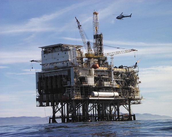
9 Oil is one of the top exports: Exports 1.7 million barrels/day. Money from oil sales provides 1/3 of government s budget. Mexico is one of the world s top producers of silver. Other exports include fruits, vegetables, coffee, & cotton. Tourism is also a major industry.
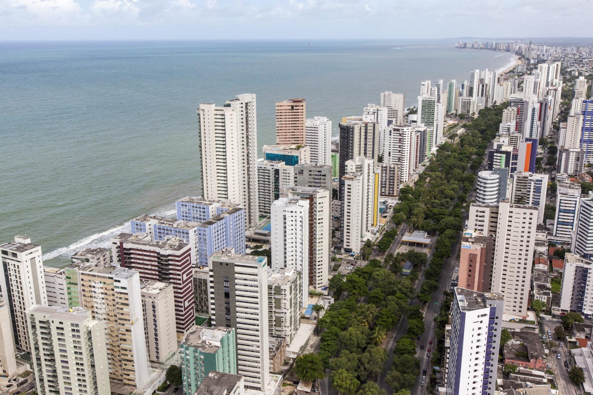
10 Most people live in central Mexico: Arable farmland with enough rain to grow crops Many manufacturing centers are located here (provide jobs to 75% of the country s population) Urban: 77% Rural: 23%
11 Mexico City

12 Mexico City
13 Mexico has a mix of new and old industries. Recently expanded railroads, airports, and electric generating plants 7 major seaports Exports: oil, manufactured goods, silver, fruits, vegetables, coffee, & cotton Tourism

14


15 Venezuela is in the northeast part of South America, just north of equator. It has coasts on Caribbean Sea and Atlantic Ocean. This gives it easy access to trade with other countries. The nearby Panama Canal provides a shortcut to the Pacific to trade with Asian countries. There are mountains in the north and south, so only about 3% of the land is arable.

16

17
18 Venezuela has a hot, tropical climate. It s cooler in the mountains. Rain varies by region (16 inches on the coast; over 100 inches in the mountains).

19

20
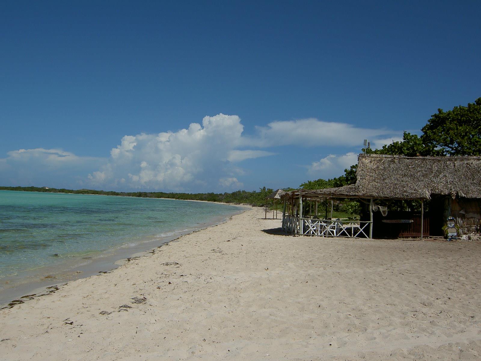
21 Venezuela is the sixth-largest oil exporter in the world. It produces 2.8 million barrels/day. 90% of the money the government makes on trade comes from oil exports. Farming provides jobs for 10% of the population.
22
23 Urban: 88% Rural: 12% Caracas is the largest city. Most people live in the northern highlands, along the coast.

24 Caracas Brain Wrinkles

25 Caracas

26 90% of money made on exports comes from oil. 4 major seaports Other exports: bauxite and aluminum, steel, chemicals, agricultural products, basic manufactures Tourism

27
28 Cuba is an island 90 miles south of Florida, in the Caribbean Sea. It s only 700 miles long. It the largest island in the West Indies. It s location on ocean trading routes has been an important influence on its history and economy.

29
 There s a rainy season from May to October and a dry season from November to April. Cuba is a target for hurricanes.")
30 The climate is tropical but moderated by trade winds. (It s warm-to-hot all year long, but the winds provide relief from the heat.) There s a rainy season from May to October and a dry season from November to April. Cuba is a target for hurricanes. Hurricane season runs from June to November.
31

32

33 28% of Cuba s land is arable. It s most important export is sugar cane. Other exports include: coffee, fish, fruits, & tobacco. Tourism is a fast-growing industry.

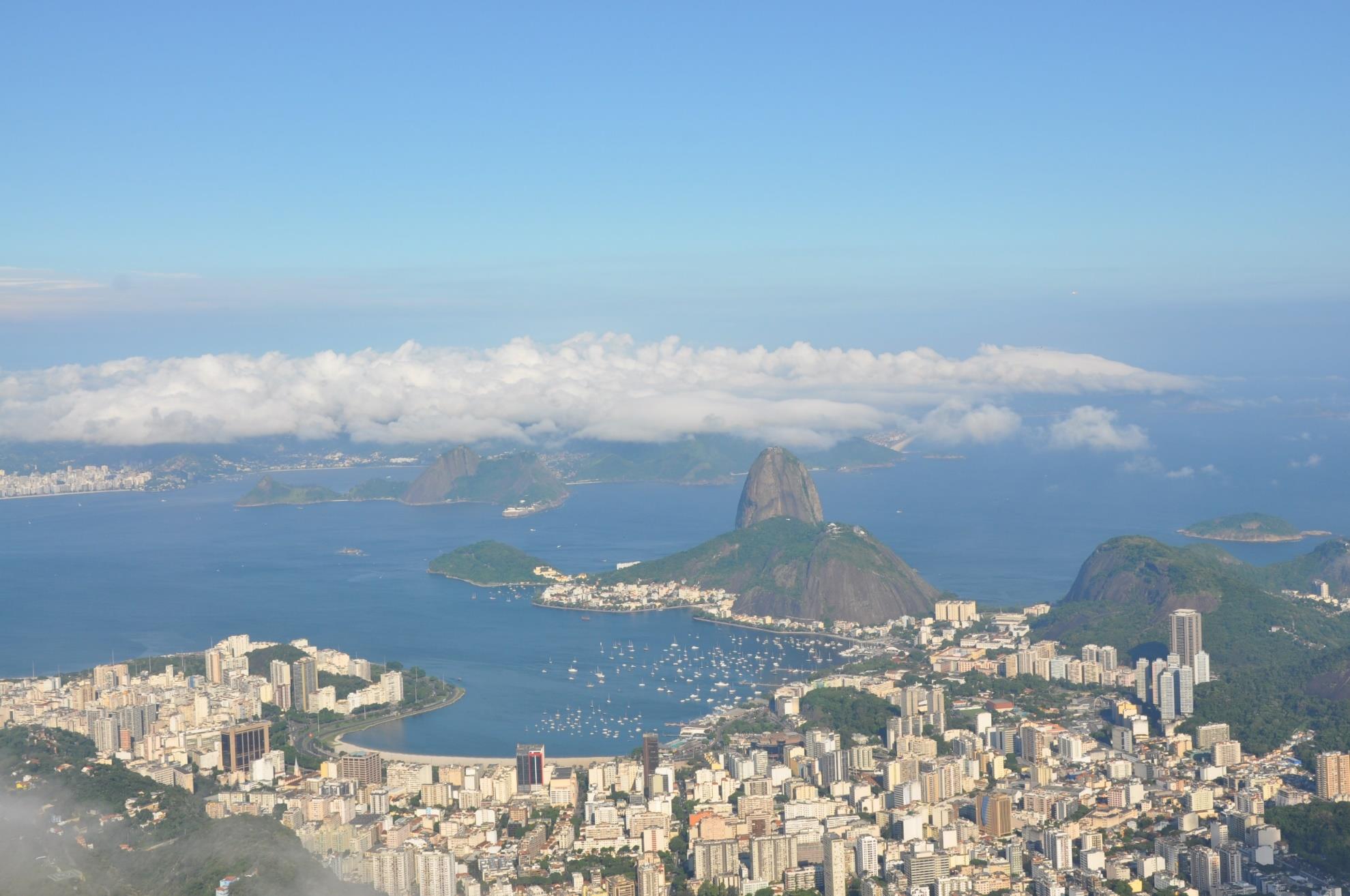
34 Sugar Cane Farm

35
36 Urban: 76% Rural: 24% Havana is the largest city. 20% of Cubans live in Havana.

37 Havana

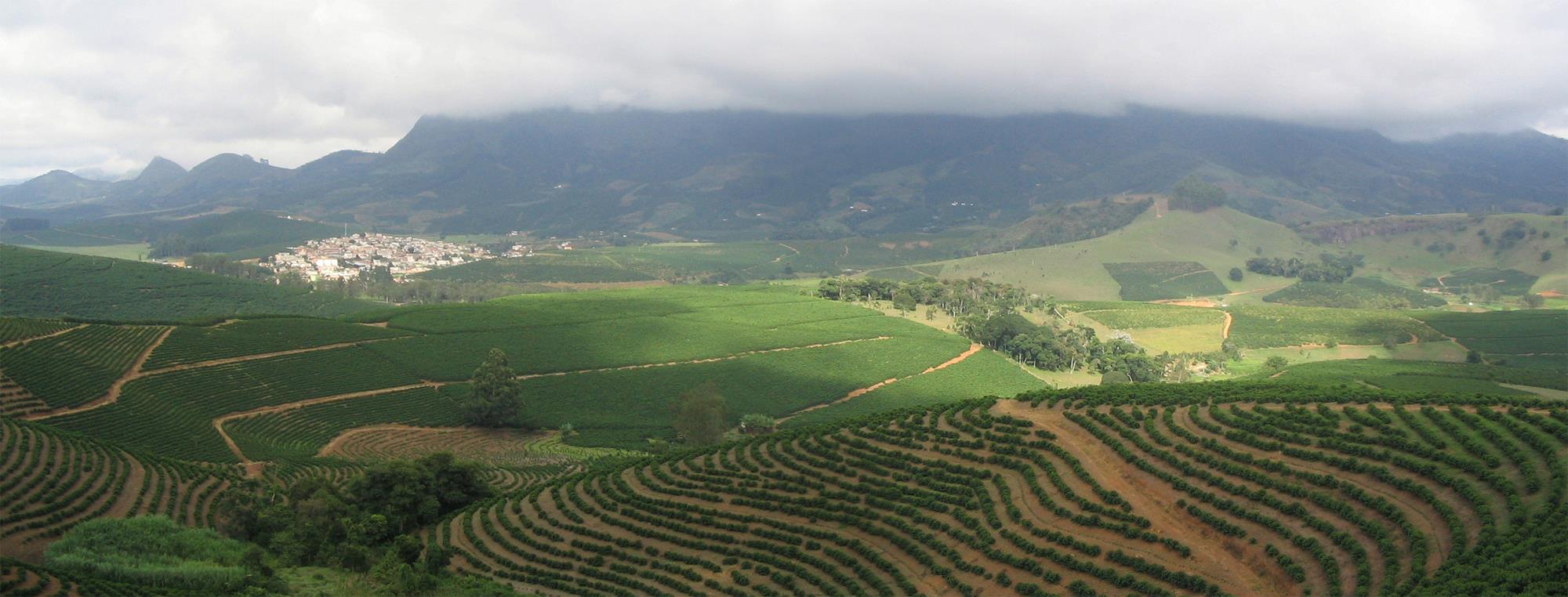
38 Havana
39 3 major seaports Exports: sugar, nickel, tobacco, fish, medical products, citrus, coffee Tourism Venezuela is Cuba s largest trading partner; it sells oil to Cuba at a reduced price.
40 The Communist government of the Soviet Union helped support Cuba for many years. When it collapsed in 1991, Cuba faced difficult times. Trade from other countries does not bring in enough money to meet needs of Cuba s people. Government sometimes orders businesses & factories to close. It also orders blackouts times when all electricity is cut off in order to save electricity.

41
42 Brazil is on the eastern side of South America, along the coast of the Atlantic Ocean. It shares a border with nearly every country in South America! Amazon River and other large rivers stretch across Brazil.


43
44 Brazil s location on the equator gives it the climate needed to support one of the world s largest rain forests. Its climate is mostly hot and tropical. In the south, the climate is temperate (mild).

45
46 Only 7% of land is arable, but Brazil makes the most of this resource. Farmers grow 1/3 rd of the world s coffee, and lead the world in production of oranges, papayas, sugar cane, and soybeans. Only the US exports more farm products than Brazil.
47 Coffee Plantation
48 Urban: 84% Rural: 16% It s the most populated country in Latin America. It s the largest Portuguese-speaking country in the world. Most Brazilians live along the coasts; 80% live within 200 miles of the ocean.
49
50
51 Urban: 84% Rural: 16% It s the most populated country in Latin America. It s the largest Portuguese-speaking country in the world. Most Brazilians live along the coasts; 80% live within 200 miles of the ocean.
Tropical Horticulture: Lecture 11
 Lecture 11 Agricultural Development in Tropical America Cuba Until 1900 the island was in an era of hacienda, only few plantations. A modern plantation developed at the end of the Colonial period. The
Physiography, Geography and Climate of Latin America (Lecture 3)
") Physiography, Geography and Climate of Latin America (Lecture 3) Natural Landmarks in Latin America World's longest and second highest mountain range, and the world's highest active volcanoes. Biggest
Physiography, Geography and Climate of Latin America (Lecture 3) Natural Landmarks in Latin America World's longest and second highest mountain range, and the world's highest active volcanoes. Biggest
Chapter 18 Introduction to. A f r i c a
 Chapter 18 Introduction to A f r i c a Ch. 18:1 Landforms & Resources 1. Africa s shape & landforms are the result of its location in the southern part of the ancient supercontinent of. Pangaea Over thousands
SS6E1 The student will analyze different economic systems.
 Brazil & Cuba Standards SS6E1 The student will analyze different economic systems. a. Compare how traditional, command, and market, economies answer the economic questions of 1-what to produce, 2-how to
student. They should complete the
 Brazil & Cuba Standards SS6E1 The student will analyze different economic systems. a. Compare how traditional, command, and market, economies answer the economic questions of 1- what to produce, 2-how
1. Incredible India. Shade the map on the next page, to show India s relief. The correct shading is shown on the final page! Incredible India India
 1. Incredible India Shade the map on the next page, to show India s relief. The correct shading is shown on the final page! Incredible India India The DCSF supported Action plan for Geography is delivered
CLIMATE, WATER & LIVING PATTERNS THINGS
 CLIMATE, WATER & LIVING PATTERNS NAME THE SIX MAJOR CLIMATE REGIONS DESCRIBE EACH CLIMATE REGION TELL THE FIVE FACTORS THAT AFFECT CLIMATE EXPLAIN HOW THOSE FACTORS AFFECT CLIMATE DESCRIBE HOW CLIMATES
Week 1. Week 2. Week 3
 Week 1 1. What US city has the largest population? 2. Where is Aachen? 3. What is the capitol of Florida? 4. What is the longest mountain range in Spain? 5. What countries border Equador? Week 2 1. What
Regional Atlas: Introduction to South Asia
 Name Regional Atlas: Introduction to South Asia Study the map on page 593 of the textbook. 1. The Khyber Pass connects which two countries? CHAPTER 28 2. What capital city is located at 80 E longitude?
6 th Grade Unit 5: Latin America Today
 The following instructional plan is part of a GaDOE collection of Unit Frameworks, Performance Tasks, examples of Student Work, and Teacher Commentary for the SIXTH GRADE Social Studies course. 6 th Grade
Ch.1. Name: Class: Date: Matching
 Name: Class: Date: Ch.1 Matching Match each item with the correct statement below. a. technology e. democracy b. diffusion f. extended family c. exports g. interdependence d. climate 1. goods sent to markets
Cuban Agricultural Development and Implications for U.S. Exports
 Cuban Agricultural Development and Implications for U.S. Exports Presentation to the USDA Agricultural Outlook Forum 2012 Washington, DC February 23, 2012 by William A. Messina, Jr. Food and Resource Economics
2. The map below shows high-pressure and low-pressure weather systems in the United States.
 1. Which weather instrument has most improved the accuracy of weather forecasts over the past 40 years? 1) thermometer 3) weather satellite 2) sling psychrometer 4) weather balloon 6. Wind velocity is
Geography affects climate.
 KEY CONCEPT Climate is a long-term weather pattern. BEFORE, you learned The Sun s energy heats Earth s surface unevenly The atmosphere s temperature changes with altitude Oceans affect wind flow NOW, you
Rural developments in Latin America, 1930-2015. Michiel Baud CEDLA
 Rural developments in Latin America, 1930-2015 Michiel Baud CEDLA Export-orientation, 1870-1930 Expansion agrarian frontier Agrarian monocultures Replacement of traditional large landowners New forms of
The Regions of the United States
 CHAPTER 1 Identify characteristic landforms of the five major regions of the United States. Describe, compare, and contrast regional climates of the United States. Identify regional resources of the United
CLIMATE OF RWANDA. Overview. Linked to other lessons
 Geography S6 GENERAL PHYSICAL GEOGRAPHY OF RWANDA Lesson 75 Developed by (Niwagaba Innocent) Subtopic Climate and factors influencing it in Rwanda Specific Objectives The learners must be able to: Describe
Brazil s Response to Lower Commodity Prices Will Infrastructure Improvements Support Further Expansion?
 Brazil s Response to Lower Commodity Prices Will Infrastructure Improvements Support Further Expansion? By Dr. Michael Cordonnier www.soybeansandcorn.com soycorn@comcast.net 630-325-0192 (Chicago) Overview
Geography at GISSV: An Introduction to the Curriculum
 Geography at GISSV: An Introduction to the Curriculum Classes Geography is taught for two hours per week in Grades 5-9. The only exception is in Grade 8, where class is taught for one hour per week for
Multi-Temporal Wild Fire Monitoring in Lao PDR using MODIS Data
 Multi-Temporal Wild Fire Monitoring in Lao PDR using MODIS Data Vivarad Phonekeo Ph. D. Geoinformatics Center (GIC) Asian Institute of Technology vivarad@ait.ac.th, vivarad@gmail.com www.vivarad.info Thatheva
Impacts of Global Warming on North Carolina s Coastal Economy
 Impacts of Global Warming on North Carolina s Coastal Economy IMPACTS OF GLOBAL WARMING ON NORTH CAROLINA S COASTAL ECONOMY Key Findings Global warming is projected to have significant impacts on North
Prentice Hall World Studies: Latin America 2008 Correlated to: Missouri Social Studies Grade Level Expectations (Grade 7)
") Principles of Constitutional Democracy 1. Knowledge of the principles expressed in documents shaping constitutional democracy in the United States A. (1) Principles expressed in documents shaping constitutional
Principles of Constitutional Democracy 1. Knowledge of the principles expressed in documents shaping constitutional democracy in the United States A. (1) Principles expressed in documents shaping constitutional
SECTION 3 COMMUNITY PROFILE. Geography and the Environment
 SECTION 3 This section of the Plan provides a general overview of New Hanover County and its incorporated municipal jurisdictions. This information has been updated to reflect the community profile for
NATURAL REGIONS OF KENTUCKY
 NATURAL WONDERS As you travel around Kentucky taking pictures, you are excited by what you see. Kentucky offers diverse and amazing sights. The Six Regions In the West, you see the Mississippi River, the
CUBA CONFRONTING CLIMATE CHANGE
 CUBA CONFRONTING CLIMATE CHANGE CUBA: Main Characteristics Total population: 11.2 millions Length of the Island of Cuba: 1,200 Km. Maximum Width: 191 Km. Minimum Width: 31 Km. More than 4,000 islands and
Chapter 3: Climate and Climate Change Answers
 Chapter 3: Climate and Climate Change Answers Section A: Climate 1. (a) Explain what each of the following means: (4 x 1 mark) (i) climate the average weather of an area over a 25 30 year period (ii) maritime
CGC1D1: Interactions in the Physical Environment Factors that Affect Climate
 Name: Date: Day/Period: CGC1D1: Interactions in the Physical Environment Factors that Affect Climate Chapter 12 in the Making Connections textbook deals with Climate Connections. Use pages 127-144 to fill
Federation of Industries of the State of Goiás FIEG (Brazil)
") Federation of Industries of the State of Goiás FIEG (Brazil) State of GOIÁS General Information Area Population 2010 GDP PIB - 2011 340,086 km² 6,004 million R$ 103,4 billion Industrial plants 2011 19,858
Federation of Industries of the State of Goiás FIEG (Brazil) State of GOIÁS General Information Area Population 2010 GDP PIB - 2011 340,086 km² 6,004 million R$ 103,4 billion Industrial plants 2011 19,858
Threats to tropical forests
 Threats to tropical forests and what we can do about it Ryszard Laskowski Institute of Environmental Sciences Jagiellonian University www.eko.uj.edu.pl/laskowski 1/22 Human activities: dangers and hopes
VISUAL 6.1 GREAT BRITAIN S AMERICAN COLONIES
 SPECIALIZATION AND TRADE IN THE THIRTEEN COLONIES LESSON 6 VISUAL 6.1 GREAT BRITAIN S AMERICAN COLONIES GREAT BRITAIN S COLONIES All colonies are rich in natural resources but short on labor. PRODUCTIVE
U.S. Agriculture and International Trade
 Curriculum Guide I. Goals and Objectives A. Understand the importance of exports and imports to agriculture and how risk management is affected. B. Understand factors causing exports to change. C. Understand
Physical Environment. There are economic reasons for countries to cut down their rainforests.
 Tropical Rainforests Reasons for their Destruction Tropical Rainforests are found in the Amazon Basin of South America, (e.g. Brazil) Central Africa (e.g. Congo) and South East Asia (e.g. Indonesia). There
Cuba has responded in part to its current economic crisis by
 26 Economic Research Service/USDA Agricultural Outlook/October 1998 Cuba s Agriculture: Collapse & Economic Reform Cuba has responded in part to its current economic crisis by beginning to open the economy
As you begin to search for a U.S. college or university, you should think about:
 Define Your Priorities When searching for an undergraduate program in the United States, it is important to first decide what is most important to you. This will help guide you through each of Your 5 Steps
Southern AER Atmospheric Education Resource
 Southern AER Atmospheric Education Resource Vol. 9 No. 5 Spring 2003 Editor: Lauren Bell In this issue: g Climate Creations exploring mother nature s remote control for weather and Climate. g Crazy Climate
sample The IPCC Special Report on Managing the Risks of Extreme Events and Disasters to Advance Climate Change Adaptation
 sample The IPCC Special Report on Managing the Risks of Extreme Events and Disasters to Advance Climate Change Adaptation A changing climate leads to changes in extreme weather and climate events 2 Impacts
SOUTH AMERICA CONTENTS. What s in This Book... 2. Section 1: South America in the World... 3. Section 2: Political Divisions of South America...
 SOUTH CONTENTS What s in This Book 2 Section 1: 3 Section 2: Political Divisions of 1 Section 3: Physical Features of 41 Section 4: Valuable Resources of 67 Section : n Culture 89 Section 6: Assessment
Sixth Grade Social Studies Georgia Performance Standards. Grade Six. LATIN AMERICA and CANADA
 Grade Six LATIN AMERICA, the CARIBBEAN and CANADA, EUROPE, and AUSTRALIA Sixth grade is the first year of a two year World Area Studies course. Sixth grade students study Latin America, Canada, Europe,
The Northern Economy and Industrialization Changes in the North
 Chapter 17: The North After the Civil War The Northern Economy and Industrialization Changes in the North Population Two ways the U.S. changed between 1800 and 1860 = size & population Beginning of industrialization
300431 Timişoara, Romania, Str. Agricultorilor nr. 40 Tel: 0747-047.800 Fax: 0356-414.175 office.armand@gmail.com
 300431 Timişoara, Romania, Str. Agricultorilor nr. 40 Tel: 0747-047.800 Fax: 0356-414.175 office.armand@gmail.com Pagina1 Pagina2 INVEST IN ROMANIA 300431 Timişoara, Romania, Str. Agricultorilor nr. 40
Climate, Vegetation, and Landforms
 Climate, Vegetation, and Landforms Definitions Climate is the average weather of a place over many years Geographers discuss five broad types of climates Moderate, dry, tropical, continental, polar Vegetation:
Colombia in the world
 Colombia in the world Proexport around the world Process of attracting Foreign Direct Investment Proexport offers detailed and professional assistance for investors that find interesting business opportunities
Hurricanes. Characteristics of a Hurricane
 Hurricanes Readings: A&B Ch. 12 Topics 1. Characteristics 2. Location 3. Structure 4. Development a. Tropical Disturbance b. Tropical Depression c. Tropical Storm d. Hurricane e. Influences f. Path g.
Using a Concept Definition Map
 Lesson Plan Using a Concept Definition Map 1. Set Expectations Print Disaster on the board. Tell students, You are going to come up with as many words as you can that are related to the word disaster,
TYPES OF ECONOMIC SYSTEMS Definition Key Terms Countries
 Cuba Brazil TYPES OF ECONOMIC SYSTEMS Definition Key Terms Countries 1) Market economy An economic system in which individuals own and operate the factors of production. 2) Command economy An economic
Status and trends in perception of Organic vegetable and fruit production in China
 Chinese-Danish Networking Status and trends in perception of Organic vegetable and fruit production in China Yuhui Qiao Dr. Associate Professor Department of Ecology and Ecological Engineering China Agricultural
TANZANIA. The land area of Tanzania is about 1 million square kilometres. This includes the offshore islands of Zanzibar, Pemba and Mafia.
 TANZANIA 1. INTRODUCTION 1.1 THE COUNTRY Tanzania lies on the East Coast of Africa between 1 O and 11 O S latitude and between 29o and 40 o E Longitude. It is bordered by Kenya in the North and shares
Correlation Analysis of Factors Influencing Changes in Land Use in the Lower Songkhram River Basin, the Northeast of Thailand
 Correlation Analysis of Factors Influencing Changes in Land Use in the Lower Songkhram River Basin, the Northeast of Thailand Rasamee SUWANWERAKAMTORN and Chat CHANTHALUECHA Geo-informatics Centre for
WEATHER AND CLIMATE practice test
 WEATHER AND CLIMATE practice test Multiple Choice Identify the choice that best completes the statement or answers the question. 1. What role does runoff play in the water cycle? a. It is the process in
Send all inquiries to: Glencoe/McGraw-Hill 8787 Orion Place Columbus, Ohio 43240-4027 ISBN 0-07-824996-1. Printed in the United States of America
 Copyright by The McGraw-Hill Companies, Inc. All rights reserved. Permission is granted to reproduce the material contained herein on the condition that such material be reproduced only for classroom use;
MIAMI-SOUTH FLORIDA National Weather Service Forecast Office http://www.weather.gov/miami
 MIAMI-SOUTH FLORIDA National Weather Service Forecast Office http://www.weather.gov/miami Summer 2015 Weather Summary Wet West and Dry East September 2, 2015: One of the most variable summers in recent
Thailand s Organic 2011. Vitoon Panyakul Green Net Earth Net vitoon@greennet.or.th
 Thailand s Organic 2011 Vitoon Panyakul Green Net Earth Net vitoon@greennet.or.th Brief History (1) 1991 Chai Wiwat Agro-industry & Capital Rice Co started organic rice project 1992 Alternative Agriculture
Geography- Physical and Political Locations
 CRCT Social Studies Review- 6th Grade Geography- Physical and Political Locations Physical Features: 1. Ural Mtns. The mountain range that separates Europe from Asia. It is located in Russia 2. Pyrenees
The concepts developed in this standard include the following: Oceans cover about 70% of the surface of the Earth.
 Name Date Grade 5 SOL 5.6 Review Oceans Made by SOLpass - www.solpass.org solpass100@comcast.net Reproduction is permitted for SOLpass subscribers only. The concepts developed in this standard include
Inland Waterway Infrastructure - Mekong River cruise promoting factor. Tokyo September 2010
 Inland Waterway Infrastructure - Mekong River cruise promoting factor Tokyo September 2010 Mekong river system Mekong river system Land and resources: Parts of China, Myanmar and Viet Nam, nearly 1/3 of
Agricultural Production and Research in Heilongjiang Province, China. Jiang Enchen. Professor, Department of Agricultural Engineering, Northeast
 1 Agricultural Production and Research in Heilongjiang Province, China Jiang Enchen Professor, Department of Agricultural Engineering, Northeast Agricultural University, Harbin, China. Post code: 150030
As you begin to search for a graduate program in the United States, you should think about:
 Define Your Priorities When searching for a graduate program in the United States, it is important to first decide what is most important to you. This will help guide you through each of Your 5 Steps to
Ocean Floor Continental Slope Begins at the Continental Shelf Very sharp drop to depths over 2 miles Covered with thick layers of sand, mud, and rocks
 Ocean Floor Continental Shelf Begins at the shoreline Gently slopes underwater Average depth of 430 feet Thick layers of sand, mud, and rocks The beach is part of the Continental Shelf Ocean Floor Continental
Laurie Stone 2001 Laurie Stone
 Laurie Stone 2001 Laurie Stone Juan Abrahantes School, Imias Municipality, Guantanamo Province. ravel around rural Latin America and you re sure to see schools without basic educational tools, let alone
Growing Cocoa Beans. Growing Region
 Growing Cocoa Beans All chocolate begins with cocoa beans, the fruit of the cacao tree (also called a cocoa tree). Scientists know that the cacao tree originated somewhere in South or Central America.
What Causes Climate? Use Target Reading Skills
 Climate and Climate Change Name Date Class Climate and Climate Change Guided Reading and Study What Causes Climate? This section describes factors that determine climate, or the average weather conditions
Witness an online magazine
 Witness an online magazine Cuba: An Island In Transition www.visionproject.org Photos & Text by Richard Falco Cuba: An Island In Transition Photos & Text by Richard Falco Cuba is quickly approaching a
Answer Keys to Unit Tests
 Reading Geography Series Answer Keys to Unit Tests Unit 1 The Five Themes of Geography Unit 2 Patterns in Physical Geography Unit 3 Natural Resources 7 Portage & Main Press Unit Test for The Five Themes
Biomes An Overview of Ecology Biomes Freshwater Biomes
 Biomes An Overview of Ecology Ecology is the scientific study of the interactions between organisms and their environments. Ecology can be divided into four increasingly comprehensive levels: Organismal
Region of Georgia : Mountains
 Region of Georgia : Mountains Northern most region of GA Cold weather in the winter Brasstown Bald is the highest point in Georgia Lots of creeks and streams High above sea level Poor soil for farming
Climate Change in Mexico implications for the insurance and reinsurance market
 Climate Change in Mexico implications for the insurance and reinsurance market Eberhard Faust Geo Risks Research Munich Reinsurance Company 1980 April 2008: Billion & Ten Billion Dollar Losses The costliest
Communities, Biomes, and Ecosystems
 Chapter Test A CHAPTER 3 Communities, Biomes, and Ecosystems Part A: Multiple Choice In the space at the left, write the letter of the term or phrase that best answers each question Part B: Matching 1
The IPCC Special Report on Managing the Risks of Extreme Events and Disasters to Advance Climate Change Adaptation
 The IPCC Special Report on Managing the Risks of Extreme Events and Disasters to Advance Climate Change Adaptation A changing climate leads to changes in extreme weather and climate events 2 How do changes
STATUS OF HAZARD MAPS VULNERABILITY ASSESSMENTS AND DIGITAL MAPS TRINIDAD AND TOBAGO COUNTRY REPORT
 Japan International Cooperation Agency STATUS OF HAZARD MAPS VULNERABILITY ASSESSMENTS AND DIGITAL MAPS TRINIDAD AND TOBAGO COUNTRY REPORT THE CARIBBEAN DISASTER EMERGENCY RESPONSE AGENCY (CDERA) October
PENNSYLVANIA QUICK FACTS
 PENNSYLVANIA QUICK FACTS 1. World Class Economy 2. Location / Access to Markets 3. Transportation / Infrastructure 4. Workforce 5. Research & Development Center 1. WORLD-CLASS ECONOMY Fact: Pennsylvania
UNIT I INTRODUCTION. This unit deals with Location space relations and India s place in the world
 UNIT I INTRODUCTION This unit deals with Location space relations and India s place in the world CHAPTER INDIA LOCATION You have already seen the map of India in the previous classes. Now you closely examine
Pay Later: The Cost of Inaction. Climate change will have a negative impact on many of the industries that 3500 3000 2500 2000 1500 1000 500 5.
 FACTS CONNECTICUT A M E R I C A N S E C U R I T Y P R O J E C T Pay Now, Pay Later: Connecticut The Environmental Protection Agency estimates that the cost of protecting Connecticut s coast from the potential
Deciduous Forest. Courtesy of Wayne Herron and Cindy Brady, U.S. Department of Agriculture Forest Service
 Deciduous Forest INTRODUCTION Temperate deciduous forests are found in middle latitudes with temperate climates. Deciduous means that the trees in this forest change with the seasons. In fall, the leaves
Who is responsible for the destruction of the Amazon rainforest?
 The dictionary defines deforestation as the removal of a forest where the land is then used for a non-forest use. In recent years, deforestation has become a significant issue with the loss of large areas
The Pennsylvania Observer
 The Pennsylvania Observer August 3, 2009 July 2009 - Pennsylvania Weather Recap Written by: Dan DePodwin After a cool month of June, some hoped July would bring usual summertime warmth to the state of
Farming. In the Standard Grade Geography exam there are three types of farming you need to know about arable, livestock and mixed.
 Types of Farming In the Standard Grade Geography exam there are three types of farming you need to know about arable, livestock and mixed. Arable farms are ones where the main way of making money is by
Crop production. 0 5 10 15 million ha. 0 5 10 15 20 million tonnes PART 1. CHART 7: Harvested area of the most important crops in Central Asia (2010)
") PART 1 Crop production is the most important crop in the region of Europe and Central Asia. More than 80 million hectares of land are dedicated to growing wheat, of which 240 were produced in 2010. is
PART 1 Crop production is the most important crop in the region of Europe and Central Asia. More than 80 million hectares of land are dedicated to growing wheat, of which 240 were produced in 2010. is
How Do Oceans Affect Weather and Climate?
 How Do Oceans Affect Weather and Climate? In Learning Set 2, you explored how water heats up more slowly than land and also cools off more slowly than land. Weather is caused by events in the atmosphere.
A DIACHRONIC STUDY ON THE URBAN GROWTH OF DAKAR YEAR 1988, 1998 AND 2007
 A DIACHRONIC STUDY ON THE URBAN GROWTH OF DAKAR YEAR 1988, 1998 AND 2007 Presented by DIALLO Ngagne PGD in GIS and Cartography Gis analyst in the Cadastre of Senegal Republic of Senegal Ministry of Economy
Robert M. Persaud, MBA, MP Minister of Agriculture
 Robert M. Persaud, MBA, MP Minister of Agriculture Overview Brief Overview of the World Food Situation An integrated perspective: Primary Agriculture, Energy Production, Climate Change, and a world financial
Agri Commodities ABN AMRO Bank NV
 Agri Commodities ABN AMRO Bank NV Fausto Caron Head of Commodities Brazil Chicago, June 2013 1 Agenda Brazilian Agriculture A Historical Perspective Infra-Structure: The Brazilian quest for competitiveness
Rural Settlement Patterns
 Rural Settlement Patterns A summary with pictures. Courtesy of Crescent School There are three types of rural settlement patterns that occurred where large numbers of people settled: the long lots of
Outlook for the 2013 U.S. Farm Economy
 Outlook for the 213 U.S. Farm Economy Kevin Patrick Farm and Rural Business Branch Resource and Rural Economics Division Highlights Net farm income in 213 forecast: $128.2 billion Net cash income in 213
By Gerald Urquhart, Walter Chomentowski, David Skole, and Chris Barber http://earthobservatory.nasa.gov/library/deforestation/
 By Gerald Urquhart, Walter Chomentowski, David Skole, and Chris Barber http://earthobservatory.nasa.gov/library/deforestation/ The clearing of tropical forests across the Earth has been occurring on a
Climate Change Impacts in the Asia/Pacific Region
 Climate Change Impacts in the Asia/Pacific Region Global CC threat CC in the A/P region The Stern Review and IPCC 4 th Assessment Report both state that climate change will have adverse impact on people
ALABAMA INSURANCE UNDERWRITING ASSOCIATION COMMERCIAL LINES
 ADDITIONAL RULE(S) Wind-Only Policy If desired, a policy covering only the peril of Windstorm or Hail may be issued on an eligible Commercial risk. (Plan of Operation and Rules and Procedures for Submitting
Discovering World Geography WESTERN HEMISPHERE
 WESTERN HEMISPHERE Follow Lesson Correlations for Instructional strategies that encourage the development of critical thinking, problem solving and performance skills. Custom Book: Student Edition REFERENCE
MIAMI-SOUTH FLORIDA National Weather Service Forecast Office http://www.weather.gov/miami
 MIAMI-SOUTH FLORIDA National Weather Service Forecast Office http://www.weather.gov/miami January Summary: Warm and Dry Winter Rolls On February 1, 2013: South Florida s warm and dry winter pattern of
Deforestation in the Amazon
 Deforestation in the Amazon By Rhett A Butler Rainforests once covered 14% of the earth's land surface; now they cover a mere 6% and experts estimate that the last remaining rainforests could be consumed
7) Coastal Storms: Multi-Hazard Analysis for New York City
 Coastal Storms: Multi-Hazard Analysis for New York City") 7) Coastal Storms: Multi-Hazard Analysis for New York City a) Hazard Profile i) Hazard Description Coastal storms, including nor'easters, tropical storms, and hurricanes, can and do affect New York City.
7) Coastal Storms: Multi-Hazard Analysis for New York City a) Hazard Profile i) Hazard Description Coastal storms, including nor'easters, tropical storms, and hurricanes, can and do affect New York City.
Prentice Hall World Studies 2005, 8 Book Series Correlated to: Millard Public School District (Nebraska) Social Studies Standards (Grades 6-7)
 Social Studies Standards (Grades 6-7)") Millard Public School District (Nebraska) Social Studies Standards (Grades 6-7) Note: This is a sample correlation based on four available titles of the new 2005 series in development. Titles include:,
Millard Public School District (Nebraska) Social Studies Standards (Grades 6-7) Note: This is a sample correlation based on four available titles of the new 2005 series in development. Titles include:,
III. BACKGROUND KNOWLEDGE
 Geography of South America Grade Level: Second Grade Presented by: Pamela Lee, Margaret Davenport, Hawthorne Elementary; Etta Kay Nickel, R. B. Green Elementary, San Antonio, TX Length of Unit: 7 lessons
Geography Is... More than a dot on the map.
 Geography Is... More than a dot on the map. Google Maps Absolute Loca-on North Carolina is located at La7tude 35.80 degrees North and Longitude 79.0 degrees West. The capital city, Raleigh is located at
Renewable Wind. Wind Basics. Energy from Moving Air. The Daily Wind Cycle. Wind Energy for Electricity Generation
 Renewable Wind Wind Basics Energy from Moving Air Wind is simply air in motion. It is caused by the uneven heating of the Earth's surface by the sun. Because the Earth's surface is made of very different
AGRICULTURE & NATURAL RESOURCES. East Asia: Agriculture & Natural Resources
 EAST ASIA: AGRICULTURE & NATURAL RESOURCES East Asia: Agriculture & Natural Resources BTheme Mary Lou Luebbehusen Forest Park Junior/Senior High School PURPOSE To show the effect that physical geography
Climates are described by the same conditions used to describe
 58 The Causes of Climate R E A D I N G Climates are described by the same conditions used to describe weather, such as temperature, precipitation, and wind. You now know that oceans have an important effect
Antigua and Barbuda: Hurricane Earl
 Antigua and Barbuda: Hurricane Earl DREF operation n MDRAG2 Glide n TC-21-171-ATG 6 September 21 The International Federation s Disaster Relief Emergency Fund (DREF) is a source of un-earmarked money created
Name Date Hour. Plants grow in layers. The canopy receives about 95% of the sunlight leaving little sun for the forest floor.
 Name Date Hour Directions: You are to complete the table by using your environmental text book and the example given here. You want to locate all the abiotic (non-living) and biotic (living) factors in
2013 Annual Climate Summary for the Southeast United States
 Months of heavy rain forced the U.S. Army Corp of Engineers to open the spillways at Lake Hartwell, located at the headwaters of the Savannah River along the South Carolina-Georgia border, on July 9,.