NREM 461 Dr. Greg Bruland
|
|
|
- Alban Hopkins
- 7 years ago
- Views:
Transcription

1 USLE & Other Models NREM 461 Dr. Greg Bruland 1
2 I. Universal Soil Loss Equation (USLE) A. In math terms Erosion = ƒ[(erositivity)(erodibility)] y)] EROSIVITY ERODIBILITY RAINFALL PHYSICAL CHARACTERISTICS MANAGEMENT ENERGY CROP MGMT LAND MGMT 2

3 B. USLE developed by scientists at ARS, SCS, Purdue Univ. under leadership of Walter Wishmeier 1. 1st took form in 2. Equation published by Wishmeier & Smith in 3. Developed to predict long-term average annual soil loss from erosion on uniform cultivated fields in eastern U.S. How universal is it? Dr. W. Wischmeier 3
4 USLE Term English Units Metric Units A: avg. annual tons/acre-year Mg/hectare-year soil loss R: rainfall 100s of ft-tons t rainfall/ac-yr (MJ mm)/(ha h yr) erosivity range: range: K: soil erodibility tons soil/100 ft tons rainfall (Mg ha h)/(ha MJ mm) range: range: LS: slope length & dimensionless dimensionless gradient factor range: range: C: cover-mgmt factor P: supportingpractice factor dimensionless range: dimensionless range: dimensionless range: dimensionless range: 4
5 Components of USLE Rainfall Erosivity Factor (R) A = R x K x LS x C x P R estimated from maximum 30 minute rainstorm intensity values displayed on map in Troeh pg
6 Troeh et al. (2004) 6 6
7 Soil Erodibility Factor (K) Rate of soil loss on a standard plot 72.6 ft (22 m) long with 9% slope A = R x K x LS x C x P 7
8 8
9 K factors tabulated for soil series in County Soil Surveys 9

10 10
11 Slope Length & Steepness Factor (LS) Ratio of soil loss per unit area of plot with slope X, compared to what would be lost from a fallow 72.6-ft-long plot with 9% slope (can be <1 or >1) A = R x K x LS x C x P 11
12 LS can be determined from lookup tables or from the empirical equation: LS = (x/22.13) n ( s s 2 ) Where x = s = n = empirical parameter that should be varied based on slope steepness 12
13 Cover-Management Factor (C) Ratio of soil loss under specific cover conditions compared to fallow A = R x K x LS x C x P 13
14 14
15 Supporting-Practice (P) Factor The fractional amount of erosion that occurs when special practices, i.e. contour cultivation, contour strip cropping, & terracing are used compared to erosion that would occur w/o them A = R x K x LS x C x P 16
16 4. Notes about USLE a. USLE is an empirical equation based on measurements e e rather than theory b. Designed for Eastern U.S. needs to be reparameterized c. Provides annual estimatesd. Interdependence among variables & nonlinear relationships 18
17 Example USLE Calculations With conventional tillage: A= 170 x 0.26 x 1.62 x 0.20 x 1.0 = 14.3 t/a-y With contour cultivation: A= 170 x 0.26 x 1.62 x 0.20 x 0.61 = 8.7 t/a-y With conservation tillage & contouring: A = 170 x 0.26 x 1.62 x 0.11 x 0.61 = 4.8 t/a-y With conventional tillage & terracing: A = 170 x 026x 0.26 x 060x 0.60 x 020x 0.20 x 10= t/a-y 19
18 C. MUSLE (Modified USLE 1978) 1. R: expanded to cover western U.S. including HI (20-450), but not AK 2. K: erodibility nomograph developed based on clay, silt, sand, OM, structure, & permeability 3. LS: adapted to handle multi-segmented slopes 4. C: expanded to 6 crop stage periods, C values provided for 5. P: not changed for contour cult, & contour strip, 20
19 21
 (Troeh et al.")
20 K factor nomograph: K = ƒ(5 soil properties) (Troeh et al. 2004) 22
21 Multi-segmented slopes (2-5) 23
22 D. RUSLE (Revised USLE 1992) 1. Improved mapping of R values in lower 48 & Hawaii 2. K & C allowed to vary seasonally by climatic data 3. C becomes a continuous function w/ 5 subfactors a. Prior land use b. Surface cover c. Crop canopy d. Surface roughness e. Soil moisture 25
23 26
24 27
25 28
26 29
27 31
28 4. Data gathered to develop local databases for C factors 5. P factor includes data from 32
29 II. Other erosion models A. Empirical Models 1. RUSLE2: computerized extension of RUSLE a. includes much more detailed information about slope, veg, residues, P factors, etc. b. used to compare erosion under 34
30 35
31 2. AGNPS: Agricultural Nonpoint Source Pollution Model a. developed by USDA ARS to estimate runoff water quality from AG watersheds b. cell-based, distributed-parameter, event-driven model c. requires > input parameters d. e. integrated with Arcview GIS interface & includes RUSLE subroutines 36
32 37
33 38
34 3. EPIC: Erosion Productivity Impact Calculator a. designed to assess effect of erosion on productivity b. computes erosion from a single point on the landscape c. 39
35 40
36 B. Process-based models 1. WEPP: Water Erosion Prediction Project a. process-based, distributed ib t d parameter, continuous simulation, erosion prediction model b. 1 st model for erosion prediction in the U.S. not based on USLE c. Based on equation: Qs = sediment load per unit width per unit time x = distance downslope D i = delivery rate of particles detached by interrill erosion D f = rate of detachment/deposition by rill flow 41
37 D i = interrill erosion rate K i = interrill erodibility I = Ce = effect of plant canopy Ge = effect of ground cover Rs = spacing of rills w = width of rills D i = K i I 2 CeGe(Rs/w) Ce = 1 Fe -0.34PH Fe = fraction of soil protected by canopy PH = Ge = e -2.5gi gi = fraction of interrill surface covered by vegetation or residue 42
38 D f = D c (1-Qs/Tc) D f = rate of detachment of soil particles by rill flow D c = detachment capacity Qs = sediment load in the flow Tc = sediment load at transport capacity Dc = Kr(τ - τ c ) Kr = τ = flow sheer stress acting on soil τ c = critical flow sheer stress for detachment to occur Tc = k t τ 3/2 k t = is a transport coefficient τ = hydraulic shear acting on the soil 43
39 d. When tested for 4,000 storm events across 9 experimental stations ti in the U.S., WEPP model gave predictions of mean annual soil loss at the plot scale of similar accuracy to those of USLE & RUSLE (Zhang et al. 1996) e. Web version: 44
40 45
41 46
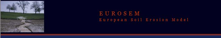
42 2. European Soil Erosion Model (EUROSEM) a. Funded by EU, developed by scientists in late 80s & early 90s b. Modular structured, process-based model that incorporates terms of erodibility, roughness that change w/ time c. d. 49

43 50
44 (Morgan 2005) 51
WEPP MODEL APPLICATIONS FOR EVALUATIONS OF BEST MANAGEMENT PRACTICES
 WEPP MODEL APPLICATIONS FOR EVALUATIONS OF BEST MANAGEMENT PRACTICES D.C. FLANAGAN 1, W.J. ELLIOT 2, J.R. FRANKENBERGER 3, C. HUANG 4 1 USDA-Agricultural Research Service, National Soil Erosion Research
Understanding Erosion. Revised Universal Soil Loss Equation
 Understanding Erosion with the Revised Universal Soil Loss Equation Towards a Better Understanding of the What, Why & How Erosion is a process of detachment and transport of soil particles by erosive forces.
Planning sediment monitoring programs using a watershed model
 Erosion and Sediment Transport Monitoring Programmes in River Basins (Proceedings of the Oslo _ Symposium, August 1992). IAHS Publ. no. 210, 1992. 343 Planning sediment monitoring programs using a watershed
FROM: Soilwater Group PROJECT TITLE: Yeelirrie Uranium Project MCP DATE: 19/06/2015 PROJECT & DOCUMENT NO: CAM-003-1-13 003
 SOILWATER CONSULTANTS t: +61 08 9228 3060 f: +61 08 9228 3210 a: 45 Gladstone St, East Perth, WA 6004 e: admin@soilwatergroup.com w: www.soilwatergroup.com MEMO COMPANY: Cameco Australia Pty Ltd FROM:
A WIND-EROSION equation was developed (4) after nearly
 after nearly") SKDMORE ET AL: WND EROSON EQUATON: COMPUTER SOLUTON & APPLCATON 93 1 fluenced by mulches of crop residues. nt. Congr. Soil Sci. Trans. 7th (Madison, Wis.) : 629-637. - 7. Mannering, J. V., and L. D. Meyer.
SKDMORE ET AL: WND EROSON EQUATON: COMPUTER SOLUTON & APPLCATON 93 1 fluenced by mulches of crop residues. nt. Congr. Soil Sci. Trans. 7th (Madison, Wis.) : 629-637. - 7. Mannering, J. V., and L. D. Meyer.
Storm Water Runoff from Natural Gas Well Sites in North Texas: Sampling, Modeling, and Management Options
 Storm Water Runoff from Natural Gas Well Sites in North Texas: Sampling, Modeling, and Management Options Kenneth E. Banks David J. Wachal City of Denton, Texas David Wachal is now with ESRI Professional
Travel Time. Computation of travel time and time of concentration. Factors affecting time of concentration. Surface roughness
 3 Chapter 3 of Concentration and Travel Time Time of Concentration and Travel Time Travel time ( T t ) is the time it takes water to travel from one location to another in a watershed. T t is a component
Tennessee Watershed Modeling Tools. Southern Region Watershed Meeting, July 2005. Forbes Walker University of Tennessee Extension
 Tennessee Watershed Modeling Tools Southern Region Watershed Meeting, July 2005 Forbes Walker University of Tennessee Extension Outline Land Use and Water Quality in Tennessee Watershed models Watershed
Universal Soil Erosion Equation
 Author: Laura Swantek Time: 50 minute class period Grade Level: 9-12 Background: Soil is created by the weathering of rock and the decomposition of organic materials. Soils are classified according to
Basic Soil Erosion and Types
 Basic Soil Erosion and Types 2015 Wisconsin Lakes Convention Stacy Dehne DATCP Engineer Types of Soil Erosion Rain drop or splash erosion: Erosion preceded by the destruction of the crumb structure due
DEVELOPMENT OF WEB-BASED GIS INTERFACES FOR APPLICATION OF THE WEPP MODEL
 DEVELOPMENT OF WEB-BASED GIS INTERFACES FOR APPLICATION OF THE WEPP MODEL D.C. Flanagan A, J.R. Frankenberger A, C.S. Renschler B and B.A. Engel C A National Soil Erosion Research Laboratory, USDA-ARS,
Abstract. Introduction. Armando Brath, Attilio Castellarin and Alberto Montanari
 Hydrology and Earth System Sciences, 6(2), 255 265 Assessing (2002) the effects EGSof land-use changes on annual average gross erosion Assessing the effects of land-use changes on annual average gross
Slope Angle and Slope Length Solutions for GIS
 This paper was published in the journal Cartography Visit http://www.mappingsciences.org.au/journal.htm for more information. Full reference: Hickey, R., 2000, Slope Angle and Slope Length Solutions for
Soil Data and Interpretations for Applications in Food and Water Security
 Soil Data and Interpretations for Applications in Food and Water Security Maxine J. Levin ; Susan Southard, Steve Peasley; Robert Dobos; Cathy A. Seybold, USDA-Natural Resources Conservation Service(NRCS
CHAPTER 2 HYDRAULICS OF SEWERS
 CHAPTER 2 HYDRAULICS OF SEWERS SANITARY SEWERS The hydraulic design procedure for sewers requires: 1. Determination of Sewer System Type 2. Determination of Design Flow 3. Selection of Pipe Size 4. Determination
CONSTRUCTION GENERAL PERMIT RISK ASSESSMENT R-FACTOR CALCULATION NOTIFICATION
 CONSTRUCTION GENERAL PERMIT RISK ASSESSMENT R-FACTOR CALCULATION NOTIFICATION NATIONAL POLLUTANT DISCHARGE ELIMINATION SYSTEM (NPDES) GENERAL PERMIT FOR STORM WATER DISCHARGES ASSOCIATED WITH CONSTRUCTION
Basic Hydrology. Time of Concentration Methodology
 Basic Hydrology Time of Concentration Methodology By: Paul Schiariti, P.E., CPESC Mercer County Soil Conservation District What is the Time of Concentration? The time it takes for runoff to travel from
Design Considerations for a Prototype Erosion Control Testing Plot. R. P. Long and K. R. Demars
 Design Considerations for a Prototype Erosion Control Testing Plot R. P. Long and K. R. Demars Prepared for The New England Transportation Consortium December 2005 NETCR 56 Project No. 03-3 This report,
Rush River Citizen Monitoring Network 2003 Summary
 Rush River Citizen Monitoring Network 2003 Summary Introduction The Rush River Citizen Monitoring Network (RRCMN) was formed in the spring of 2003 to gather water quality information and precipitation
Web-based GIS Application of the WEPP Model
 Web-based GIS Application of the WEPP Model Dennis C. Flanagan Research Agricultural Engineer USDA - Agricultural Research Service National Soil Erosion Research Laboratory West Lafayette, Indiana, USA
Topic 8: Open Channel Flow
 3.1 Course Number: CE 365K Course Title: Hydraulic Engineering Design Course Instructor: R.J. Charbeneau Subject: Open Channel Hydraulics Topics Covered: 8. Open Channel Flow and Manning Equation 9. Energy,
Comparison of Streamside Management Zone Requirements in the Southeast
 Comparison of Streamside Management Zone Requirements in the Southeast Christine Hodges and Rien Visser Master s Student and Assistant Professor, Department of Forestry, Virginia Tech, Blacksburg VA 24061
LOW INTEREST LOANS FOR AGRICULTURAL CONSERVATION
 LOW INTEREST LOANS FOR AGRICULTURAL CONSERVATION LILAC MANUAL LOW INTEREST LOANS FOR AGRICULTURAL CONSERVATION TABLE OF CONTENTS Introduction... 3 General Eligibility... 4 Specific Eligibility Criteria
The Rational Method. David B. Thompson Civil Engineering Deptartment Texas Tech University. Draft: 20 September 2006
 The David B. Thompson Civil Engineering Deptartment Texas Tech University Draft: 20 September 2006 1. Introduction For hydraulic designs on very small watersheds, a complete hydrograph of runoff is not
Computing Stormwater Runoff Rates and Volumes
 New Jersey Stormwater Best Management Practices Manual February 2004 C H A P T E R 5 Computing Stormwater Runoff Rates and Volumes This chapter discusses the fundamentals of computing stormwater runoff
Rational Method Hydrologic Calculations with Excel. Rational Method Hydrologic Calculations with Excel, Course #508. Presented by:
 Rational Method Hydrologic Calculations with Excel, Course #508 Presented by: PDH Enterprises, LLC PO Box 942 Morrisville, NC 27560 www.pdhsite.com Calculation of peak storm water runoff rate from a drainage
Beasley Lake Watershed National Sedimentation Laboratory Water Quality & Ecology Research Unit USDA ARS Oxford, Mississippi
 Beasley Lake Watershed National Sedimentation Laboratory Water Quality & Ecology Research Unit USDA ARS Oxford, Mississippi M. A. Locke, S. S. Knight, C. M. Cooper, S. Smith, Jr., M. T. Moore, F. D. Shields,
Assessment of agricultural best management practices using mathematical models: a review
 2013 SWAT Conference Toulouse, Paris, France Assessment of agricultural best management practices using mathematical models: a review Hui Xie Lei Chen * Jiali Qiu Yucen Zhong Zhenyao Shen, Professor Beijing
Bayesian Modeling of Ecosystem Services in Human-Environment Systems
 Bayesian Modeling of in Human-Environment Systems Thomas Koellner1 and Adrienne Grêt-Regamey2 1Department of Environmental Sciences, Natural and Social Science Interface NSSI, ETH Zurich, Switzerland 2
A SOIL TESTING SERVICE FOR FARMERS IN THAILAND, USING MOBILE LABORATORIES
 A SOIL TESTING SERVICE FOR FARMERS IN THAILAND, USING MOBILE LABORATORIES Narong Chinabut Office of Science for Land Development Land Development Department, Ministry of Agriculture and Cooperatives, Bangkok
APPLICATION PROCESS FOR LAND DISTURBING PERMIT
 PREFACE: APPLICATION PROCESS FOR LAND DISTURBING PERMIT The property owner, developer and designated planners and engineers shall review the general development plans and detailed plans of the Local Issuing
Rainfall Intensities for Southeastern Arizona
 Rainfall Intensities for Southeastern Arizona By Herbert B. Osborn, Member, ASCE1 and Kenneth G. Renard, Fellow, ASCE1 Introduction Small watershed storm runoff in the southwestern United States is dominated
USDA Farm Program Agencies
 USDA Farm Program Agencies NRCS-Natural Resource Conservation Service Administers engineering and conservation plans Administers conservation programs FSA- Farm Service Agency Administers Commodity Programs
SOIL EROSION FROM MODELLING TO MITIGATION: CAN CONSERVATION AGRICULTURE BE A SOLUTION?
 SOIL EROSION FROM MODELLING TO MITIGATION: CAN CONSERVATION AGRICULTURE BE A SOLUTION? Giampaolo Sarno - Regione Emilia-Romagna D.G. Agriculture Francesca Staffilani - Regione Emilia-Romagna D.G. Environment
Land Disturbance, Erosion Control and Stormwater Management Checklist. Walworth County Land Conservation Department
 Land Disturbance, Erosion Control and Stormwater Management Checklist Walworth County Land Conservation Department The following checklist is designed to assist the applicant in complying with the Walworth
CITY UTILITIES DESIGN STANDARDS MANUAL
 CITY UTILITIES DESIGN STANDARDS MANUAL Book 2 (SW) SW9 June 2015 SW9.01 Purpose This Chapter provides information for the design of open channels for the conveyance of stormwater in the City of Fort Wayne.
Pervious Pavers: Where is the Perviousness?
 Pervious Pavers: Where is the Perviousness? Elizabeth (Betsy) Pappas Research Hydraulic Engineer Chi-hua Huang Soil Scientist United States Department of Agriculture Agricultural Research Service National
COMMONWEALTH OF KENTUCKY CITY OF LONDON ORDINANCE NO. 2006-19 AN ORDINANCE ESTABLISHING EROSION AND STORM WATER CONTROL
 COMMONWEALTH OF KENTUCKY CITY OF LONDON ORDINANCE NO. 2006-19 AN ORDINANCE ESTABLISHING EROSION AND STORM WATER CONTROL For health, safety and welfare reasons, particularly due to problems experienced
Course Plan Day 1: Introduction and Overview Hydrology & Fluvial Geomorphology Day 2: Fieldwork on the Braid Burn Alan Jones
 Course Plan Day 1: Introduction and Overview Hydrology & Fluvial Geomorphology Alan Jones E:mail: Alan.Jones@ed.ac.uk Water cycle Globally & Locally River shapes and forms River behaviour Closer look at
WATER CONSERVATION TECHNICAL BRIEFS
 WATER CONSERVATION TECHNICAL BRIEFS TB 2 Rainwater Harvesting and Artificial Recharge to Groundwater SAI Platform August 2009 This document has been produced for internal information purposes only among
6. Base your answer to the following question on the graph below, which shows the average monthly temperature of two cities A and B.
 1. Which single factor generally has the greatest effect on the climate of an area on the Earth's surface? 1) the distance from the Equator 2) the extent of vegetative cover 3) the degrees of longitude
Catchment Scale Processes and River Restoration. Dr Jenny Mant Jenny@therrc.co.uk. The River Restoration Centre therrc.co.uk
 Catchment Scale Processes and River Restoration Dr Jenny Mant Jenny@therrc.co.uk The River Restoration Centre therrc.co.uk 3 Main Catchment Elements Hydrology Energy associated with the flow of water affects
STORMWATER MANAGEMENT CHECKLIST
 STORMWATER MANAGEMENT CHECKLIST *This checklist must be completed and part of the Land Disturbing Permit submittal for review if the acreage disturbed is one (1) acre or more: I. SUPPORTING DATA Narrative
Retention/Irrigation. Design Considerations. Soil for Infiltration Area Required Slope Environmental Side-effects
 Description Retention/irrigation refers to the capture of stormwater runoff in a holding pond and subsequent use of the captured volume for irrigation of landscape of natural pervious areas. This technology
Crop residue management (CRM), a cultural practice that
, a cultural practice that") Chapter V Crop Residue Management Practices Crop residue management (CRM), a cultural practice that involves fewer and/or less intensive tillage operations and preserves more residue from the previous
Chapter V Crop Residue Management Practices Crop residue management (CRM), a cultural practice that involves fewer and/or less intensive tillage operations and preserves more residue from the previous
Program Funding WRP $ 7,699,388
 Program Funding WRP $ 7,699,388 WHIP $ - EQIP General $ 9,913,289 EQIP National Initiatives $ 2,472,492 EQIP Landscape Initiatives $ 1,648,300 EQIP State Initiatives $ 2,550,177 GRP $ 1,500,000 HFRP $
Agrodok 13 Water harvesting and soil moisture retention
 Agrodok 13 Water harvesting and soil moisture retention Justine Anschütz Antoinette Kome Marc Nederlof Rob de Neef Ton van de Ven Agromisa Foundation, Wageningen, 2003. All rights reserved. No part of
Measuring and monitoring soil erosion for soil conservation and soil protection in Israel
 Measuring and monitoring soil erosion for soil conservation and soil protection in Israel Yoram Benyamini Ministry of Agriculture (SERS), Israel / University of Amsterdam, Netherlands benyamin@science.uva.nl
Low Impact Development Checklist
 New Jersey Stormwater Best Management Practices Manual February 2004 A P P E N D I X A Low Impact Development Checklist A checklist for identifying nonstructural stormwater management strategies incorporated
#4.43 HYDRAULIC WASTEWATER LOADING RATES TO SOIL. E.J. Tyler* ABSTRACT INTRODUCTION
 HYDRAULIC WASTEWATER LOADING RATES TO SOIL #4.43 E.J. Tyler* ABSTRACT Onsite wastewater infiltration rate into soil depends on the nature of soil clogging and soil characteristics. The rate of transmission
Lecture 17 Design of Earthen Canals. I. General
 Lecture 17 Design of Earthen Canals I. General Much of this information applies in general to both earthen and lined canals Attempt to balance cuts and fills to avoid waste material and or the need for
Figure 1. Plot and catchment monitoring equipment.
 COALMINE REHABILITATION: A LONG TERM EROSION AND WATER QUALITY STUDY ON CENTRAL QUEENSLAND COALMINES C.Carroll A, L.Pink B, P.Burger B, A Queensland Department of Natural Resources Mines and Energy, Rockhampton,
Riprap-lined Swale (RS)
") Riprap-lined Swale (RS) Practice Description A riprap-lined swale is a natural or constructed channel with an erosion-resistant rock lining designed to carry concentrated runoff to a stable outlet. This
Riprap-lined Swale (RS) Practice Description A riprap-lined swale is a natural or constructed channel with an erosion-resistant rock lining designed to carry concentrated runoff to a stable outlet. This
TENNESSEE GAS PIPELINE COMPANY, L.L.C.
 TENNESSEE GAS PIPELINE COMPANY, L.L.C. HYDROLOGIC & HYDRAULIC CALCULATIONS FOR WATERBODIES CROSSED BY CONNECTICUT PIPELINE EXPANSION PROJECT CONNECTICUT LOOP Submitted by: Tennessee Gas Pipeline Company,
WATER EROSION PREDICTION PROJECT (WEPP): DEVELOPMENT HISTORY, MODEL CAPABILITIES,
: DEVELOPMENT HISTORY, MODEL CAPABILITIES,") WATER EROSION PREDICTION PROJECT (WEPP): DEVELOPMENT HISTORY, MODEL CAPABILITIES, AND FUTURE ENHANCEMENTS D. C. Flanagan, J. E. Gilley, T. G. Franti ABSTRACT. The Water Erosion Prediction Project (WEPP)
WATER EROSION PREDICTION PROJECT (WEPP): DEVELOPMENT HISTORY, MODEL CAPABILITIES, AND FUTURE ENHANCEMENTS D. C. Flanagan, J. E. Gilley, T. G. Franti ABSTRACT. The Water Erosion Prediction Project (WEPP)
A n. P w Figure 1: Schematic of the hydraulic radius
 BEE 473 Watershed Engineering Fall 2004 OPEN CHANNELS The following provide the basic equations and relationships used in open channel design. Although a variety of flow conditions can exist in a channel
Evaluation of Open Channel Flow Equations. Introduction :
 Evaluation of Open Channel Flow Equations Introduction : Most common hydraulic equations for open channels relate the section averaged mean velocity (V) to hydraulic radius (R) and hydraulic gradient (S).
Potential Erosion Map For Bagmati Basin Using GRASS GIS
 Proceedings of the Open source GIS - GRASS users conference 2002 - Trento, Italy, 11-13 September 2002 Potential Erosion Map For Bagmati Basin Using GRASS GIS Jha Raghunath Department of Civil Engineering,
U.S. SOYBEAN SUSTAINABILITY ASSURANCE PROTOCOL
 US SOYBEAN SUSTAINABILITY ASSURANCE PROTOCOL A Sustainability System That Delivers MARCH 2013 Since 1980, US farmers increased soy production by 96% while using 8% less energy US SOYBEAN SUSTAINABILITY
Introduction to Rainwater Harvesting. Department of Biological and Agricultural Engineering Texas A&M University
 Introduction to Rainwater Harvesting Department of Biological and Agricultural Engineering Texas A&M University Rainfall in your watershed What is a watershed? An area of land that drains to a common point
2) Relevance for environmental policy... 2. 4) Data sources and reporting... 4 5) References at the international level... 4
 Relevance for environmental policy... 2. 4) Data sources and reporting... 4 5) References at the international level... 4") F- 4: Pesticide consumption 1) General description... 2 1.1) Brief definition... 2 1.2) Units of measurement... 2 1.3) Context...2 2) Relevance for environmental policy... 2 2.1) Purpose... 2 2.2) Issue...
F- 4: Pesticide consumption 1) General description... 2 1.1) Brief definition... 2 1.2) Units of measurement... 2 1.3) Context...2 2) Relevance for environmental policy... 2 2.1) Purpose... 2 2.2) Issue...
LAND USE, LAND COVER AND SOIL SCIENCES - Vol. IV - Soil Conservation - David Sanders UNESCO EOLSS
 SOIL CONSERVATION David Sanders World Association of Soil and Water Conservation, Bristol, England,UK Keywords: soil conservation, soil erosion, wind erosion, water erosion, erosion control Contents 1.
Web-Based Database for Highway Erosion and Sedimentation Control Measures
 Web-Based Database for Highway Erosion and Sedimentation Control Measures Marian Muste IIHR-Hydroscience & Engineering University of Iowa 100 Hydraulics Laboratory Iowa City, IA 52242-1585 marian-muste@uiowa.edu
WATER AND DEVELOPMENT Vol. II - Types Of Environmental Models - R. A. Letcher and A. J. Jakeman
 TYPES OF ENVIRONMENTAL MODELS R. A. Letcher and A. J. Jakeman Centre for Resource and Environmental Studies, The Australian National University, Australia Keywords: environmental models, environmental
Emergency Spillways (Sediment basins)
") Emergency Spillways (Sediment basins) DRAINAGE CONTROL TECHNIQUE Low Gradient Velocity Control Short-Term Steep Gradient Channel Lining Medium-Long Term Outlet Control Soil Treatment Permanent [1] [1]
Emergency Spillways (Sediment basins) DRAINAGE CONTROL TECHNIQUE Low Gradient Velocity Control Short-Term Steep Gradient Channel Lining Medium-Long Term Outlet Control Soil Treatment Permanent [1] [1]
Chapter 5.0. Stormwater Credits for Innovative Site Planning
 Chapter 5.0 Stormwater Credits for Innovative Site Planning Chapter 5. Stormwater Credits...Introduction 5.0 Stormwater Credits In Maryland, there are many programs at both the State and local level that
Ponds- Planning, Design, Construction
 United States Department of Agriculture Soil Conservation Service Agriculture Handbook Number 590 Ponds- Planning, Design, Construction This handbook describes the requirements for building a pond. It
1.34 WASTE CONTAINMENT AND SITE REMEDIATION TECHNOLOGY TAKE-HOME FINAL EXAM DUE FRIDAY MAY 7, 2004 AT 9:30 AM
 1.34 WASTE CONTAINMENT AND SITE REMEDIATION TECHNOLOGY TAKE-HOME FINAL EXAM DUE FRIDAY MAY 7, 2004 AT 9:30 AM This is an open-book exam, but the work should be yours alone. Please do not work with others
A Traditional Island Industry
 A Traditional Island Industry The PEI wild public fishery has remained a productive Island industry for 150 years Wild public oyster fishers still fish in the traditional methods of their ancestors, using
SUSTAINABLE URBAN DRAINAGE SYSTEMS
 overflow can lead into a permeable conveyance system to increase further the benefit and reduce the need for pipe systems. Pollutant removal rates have been shown to be high, with some pollutants being
David Sanders World Association of Soil and Water Conservation, Bristol, England
 SOIL CONSERVATION David Sanders World Association of Soil and Water Conservation, Bristol, England Keywords: soil conservation, soil erosion, wind erosion, water erosion, erosion control. Contents 1. Introduction
BMP 6.7.3: Soil Amendment & Restoration
 BMP 6.7.3: Soil Amendment & Restoration Soil amendment and restoration is the process of improving disturbed soils and low organic soils by restoring soil porosity and/or adding a soil amendment, such
Ginger Paige and Nancy Mesner University of Wyoming Utah State University
 Effective Water Quality BMP Monitoring Tools Ginger Paige and Nancy Mesner University of Wyoming Utah State University Overview BMP Monitoring Guidance Document for Stream Systems Lessons learned CEAP
APPENDIX B DESIGN GUIDELINES FOR APPROVED TREATMENT METHODS
 APPENDIX B DESIGN GUIDELINES FOR APPROVED TREATMENT METHODS PLANTER BOXES 1. Determine the impervious area contributing flow to the planter box (see Chapter 4.2). 2. Assumption: Typical soil infiltration
Storm Drainage Systems 11.9-1
 Storm Drainage Systems 11.9-1 11.9 Gutter Flow Calculations 11.9.1 Introduction Gutter flow calculations are necessary in order to relate the quantity of flow (Q) in the curbed channel to the spread of
Burnsville Stormwater Retrofit Study
 Burnsville Stormwater Retrofit Study Prepared for City of Burnsville June 2006 4700 West 77 th Street Minneapolis, MN 55435-4803 Phone: (952) 832-2600 Fax: (952) 832-2601 Burnsville Stormwater Retrofit
Fort Dodge Stormwater Master Planning. Prepared By: Ralph C. Stark, Jr., P.E., C.F.M. Joel N. Krause, P.E., C.F.M.
 Fort Dodge Stormwater Master Planning Prepared By: Ralph C. Stark, Jr., P.E., C.F.M. Joel N. Krause, P.E., C.F.M. Project Location Project Background Flooding History Localized flooding and storm sewer
Data Mining and Meta-analysis as Tools to Evaluate the Impact of Management Practices on Dynamic Soil Properties
 Data Mining and Meta-analysis as Tools to Evaluate the Impact of Management Practices on Dynamic Soil Properties Carmen Ugarte, Michelle M. Wander University of Illinois at Urbana-Champaign National Cooperative
Accounting for Uncertainty in Offset and Trading Programs
 Accounting for Uncertainty in Offset and Trading Programs EPA Technical Memorandum February 12, 2014 Prepared by EPA Region III 1 of 12 CONTENTS Abbreviations and acronyms... 3 Scope... 4 Executive summary...
& Watershed Management Practices. 6 Soil Erosion & Conservation
 Module 2 (L6) Sustainable Watershed Approach & Watershed Management Practices 6 Soil Erosion & Conservation 1 1 L6 Soil Erosion & Conservation Topics Covered Soil erosion: causes, processes, erosion factors,
Follow the Drop. Activity Overview Students observe and collect information about water runoff on their school property. Objective Students will:
 Follow the Drop Activity Overview Students observe and collect information about water runoff on their school property. Objective Students will: Practice observation and investigative skills Survey and
Is Lower Priced Urea a Bargain?
 Is Lower Priced Urea a Bargain? James J Camberato Agronomy Department Purdue Univ., West Lafayette, IN Email: jcambera@purdue.edu Purdue University Department of Agronomy Corny News Network Published at
Spreadsheet Use for Partially Full Pipe Flow Calculations
 Spreadsheet Use for Partially Full Pipe Flow Calculations Course No: C02-037 Credit: 2 PDH Harlan H. Bengtson, PhD, P.E. Continuing Education and Development, Inc. 9 Greyridge Farm Court Stony Point, NY
How To Plan A Buffer Zone
 Backyard Buffers Protecting Habitat and Water Quality What is a buffer? A buffer (also called a riparian buffer area or zone) is the strip of natural vegetation along the bank of a stream, lake or other
Web-Based Spatial Data Infrastructure (SDI) to Implement and Monitor Nonpoint Source (NPS) Pollution Management in the Imperial Valley, California
 to Implement and Monitor Nonpoint Source (NPS) Pollution Management in the Imperial Valley, California") Web-Based Spatial Data Infrastructure (SDI) to Implement and Monitor Nonpoint Source (NPS) Pollution Management in the Imperial Valley, California University of Redlands The Redlands Institute Serene Ong
Web-Based Spatial Data Infrastructure (SDI) to Implement and Monitor Nonpoint Source (NPS) Pollution Management in the Imperial Valley, California University of Redlands The Redlands Institute Serene Ong
Guidelines for Control of Water Runoff on Small Lots. Revised 6/09
 Guidelines for Control of Water Runoff on Small Lots Revised 6/09 Table of Contents Introduction and Purpose 3 Administrative Procedures 3 Plan Submittal Requirements 3 General Design Criteria 4 Dry Wells
Flash Flood Science. Chapter 2. What Is in This Chapter? Flash Flood Processes
 Chapter 2 Flash Flood Science A flash flood is generally defined as a rapid onset flood of short duration with a relatively high peak discharge (World Meteorological Organization). The American Meteorological
Assessment of the US Conservation Service method for estimating design floods
 New DirectionsforSurface Water ModelingfPmceeàings of the Baltimore Symposium, May 1989) IAHSPubl.no. 181,1989. Assessment of the US Conservation Service method for estimating design floods A.A. Hoesein
CHAPTER 3 STORM DRAINAGE SYSTEMS
 CHAPTER 3 STORM DRAINAGE SYSTEMS 3.7 Storm Drains 3.7.1 Introduction After the tentative locations of inlets, drain pipes, and outfalls with tail-waters have been determined and the inlets sized, the next
RIPRAP From Massachusetts Erosion and Sediment Control Guidelines for Urban and Suburban Areas http://www.mass.gov/dep/water/laws/policies.
 RIPRAP From Massachusetts Erosion and Sediment Control Guidelines for Urban and Suburban Areas http://www.mass.gov/dep/water/laws/policies.htm#storm Definition: A permanent, erosion-resistant ground cover
ESTIMATION OF NRCS CURVE NUMBER FROM WATERSHED MORPHOMETRIC PARAMETERS: A CASE STUDY OF YIBA WATERSHED IN SAUDI ARABIA
 International Journal of Civil Engineering and Technology (IJCIET) Volume 7, Issue 2, March-April 2016, pp. 247 265, Article ID: IJCIET_07_02_022 Available online at http://www.iaeme.com/ijciet/issues.asp?jtype=ijciet&vtype=7&itype=2
Rainfall and Runoff. Page. 21.1 Introduction 21-3. 21.2 Christchurch Rainfall 21-3. 21.3 The Rational Method 21-3. 21.4 Advanced Analysis 21-9
 21-1 21 Rainfall and Runoff Page 21.1 Introduction 21-3 21.2 Christchurch Rainfall 21-3 21.3 The Rational Method 21-3 21.4 Advanced Analysis 21-9 21.5 Banks Peninsula 21-12 21.6 Detention Volume Calculation
Water Quality Management
 Water Quality Management Sustainable agriculture practices detailed in other sections of this publication are important ways to maintain or improve water quality on the farm and downstream from the farm.
Period #16: Soil Compressibility and Consolidation (II)
") Period #16: Soil Compressibility and Consolidation (II) A. Review and Motivation (1) Review: In most soils, changes in total volume are associated with reductions in void volume. The volume change of the
Period #16: Soil Compressibility and Consolidation (II) A. Review and Motivation (1) Review: In most soils, changes in total volume are associated with reductions in void volume. The volume change of the
Rain Gardens: Designing your Landscape to Protect Aquatic Resources. Curtis Hinman WSU Extension Faculty Watershed Ecologist chinman@wsu.
 Rain Gardens: Designing your Landscape to Protect Aquatic Resources Curtis Hinman WSU Extension Faculty Watershed Ecologist chinman@wsu.edu Basic Design Characteristics Shallow landscaped depressions that
IAC 7/2/08 Utilities[199] Ch 9, p.1 CHAPTER 9 RESTORATION OF AGRICULTURAL LANDS DURING AND AFTER PIPELINE CONSTRUCTION
![IAC 7/2/08 Utilities[199] Ch 9, p.1 CHAPTER 9 RESTORATION OF AGRICULTURAL LANDS DURING AND AFTER PIPELINE CONSTRUCTION](/thumbs/39/18416513.jpg "IAC 7/2/08 Utilities[199] Ch 9, p.1 CHAPTER 9 RESTORATION OF AGRICULTURAL LANDS DURING AND AFTER PIPELINE CONSTRUCTION") IAC 7/2/08 Utilities[199] Ch 9, p.1 CHAPTER 9 RESTORATION OF AGRICULTURAL LANDS DURING AND AFTER PIPELINE CONSTRUCTION 199 9.1(479,479B) General information. 9.1(1) Authority. The standards contained herein
IAC 7/2/08 Utilities[199] Ch 9, p.1 CHAPTER 9 RESTORATION OF AGRICULTURAL LANDS DURING AND AFTER PIPELINE CONSTRUCTION 199 9.1(479,479B) General information. 9.1(1) Authority. The standards contained herein
Erosion Control Blanket (ECB)
") Erosion Control Blanket (ECB) Practice Description To aid in controlling erosion on critical areas by providing a protective cover made of straw, jute, wood or other plant fibers; plastic, nylon, paper
Erosion Control Blanket (ECB) Practice Description To aid in controlling erosion on critical areas by providing a protective cover made of straw, jute, wood or other plant fibers; plastic, nylon, paper
BASICS OF PRECISION AGRICULTURE (PA)
") BASICS OF PRECISION AGRICULTURE (PA) specific production on particular place specific production, from foot to foot... Same sense: data collection and decision making for small pieces of the field. Particular
BASICS OF PRECISION AGRICULTURE (PA) specific production on particular place specific production, from foot to foot... Same sense: data collection and decision making for small pieces of the field. Particular
Multi-purpose Drainage Management (MDM) Plans
 Plans") Multi-purpose Drainage Management (MDM) Plans August 13, 2015 Chuck Brandel, PE Civil Engineer, ISG Joe Mutschler, PE Faribault County SWCD AGENDA 1. Multi-purpose Drainage Management (MDM) Plans 2. Examples
Multi-purpose Drainage Management (MDM) Plans August 13, 2015 Chuck Brandel, PE Civil Engineer, ISG Joe Mutschler, PE Faribault County SWCD AGENDA 1. Multi-purpose Drainage Management (MDM) Plans 2. Examples
Land Treatment Systems
 Onsite Wastewater Treatment Systems Technology Fact Sheet 12 Land Treatment Systems Description Land (surface) treatment systems (figures 1 and 2) are permitted in some states, but are not widely used