Geographic Information Systems
|
|
|
- Cory Wells
- 7 years ago
- Views:
Transcription
1 Project for the Strengthening of Spatial Data Infrastructures in Member States and Territories of the Association of Caribbean States Capacity Building Program Geographic Information Systems Dr Earl Edwards Ms. Valrie Grant, MSc.
2 Topic 3: Data Acquisition Techniques
3 Topic Outline Overview of Data Acquisition Fundamental Datasets required for GIS Sources of GIS Data Primary and Secondary Use of Terrestrial Photogrammetry Web-Based Data Sources Metadata
4 Data Acquisition The processes of data acquisition are also variously referred to as data capture, data automation, data conversion, data transfer, data translation, and digitizing When acquiring data, one must bear in mind: Purpose Accuracy Datum and Map Projection Scale
5 Data Acquisition A key success factor for any GIS is the acquisition of data appropriate for the applications identified in the needs assessment stage Data acquisition traditionally is the most costly component of a GIS project. (approx. 80%) It is important to determine exactly what data is required in terms of accuracy, resolution, scale, completeness, and consistency Data availability and data quality requirements affect the time taken and cost incurred in database development


6 Fundamental Datasets Required for GIS Cadastral Parcels Buildings Addresses Streets/Roads Administrative Area Boundaries Contours & Spot Heights What is the most appropriate method for acquiring each of these datasets? Digital Elevation Models Hill shading Digital Orthoimages Geodetic Reference Network Rivers and Lakes Landuse/Zoning


7 Sources of GIS Data Digital data Maps and Plans Paper files Data Photogrammetry GIS Interviews Data Remote Sensing Field survey


8 Primary and Secondary Sources of GIS Data Primary Methods Data collected directly from the field Field Surveying GNSS Photogrammetry LiDAR Remote Sensing Meteorological Sensors Secondary Methods The use of existing sources Digitising Existing Maps/Charts Paper Files

9 Field Surveying Terrestrial Surveying Primary Methods measured angles and distances from known points are used to determine the positions of other points. traditional method of spatial data collection. Requires skilled and experienced field personnel and checking the accuracy infield. Accuracy was a function of the equipment as well as the observational technique. Convenient for smaller areas.
10 Primary Methods - GNSS The term Global Navigation Satellite System (GNSS) refers to a constellation of satellites providing signals from space transmitting positioning and timing data. By definition, a GNSS provides global coverage. Determines location by using the timing and positioning data encoded in the signals from space Global Positioning System (GPS), Navstar, USA Most widely used and recognized GNSS global satellite based radio-navigation system/technology, consisting of 24 orbiting satellites at an altitude of 20,000 km in space, in six different orbital paths/plane and their ground stations. They are constantly moving, making two complete orbits in less than 24 hours.


11 NAVSTAR GPS Satellites

12 Examples of GNSS worldwide

13 GPS Receivers

14 Capturing Data with GNSS/Tablets Trimble R2 ArcGIS Collector ipad mini 4 Bluetooth connectivity Data sim VRS connectivity Accuracy +/- 2cm to 1.5m

15 Capturing Data with GNSS/Tablets Students from the MSc Geoinformatics programme at UWI, St. Augustine, configuring the mobile device for data capture.

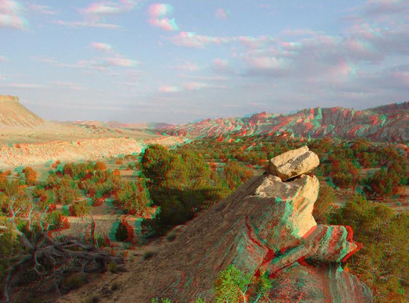
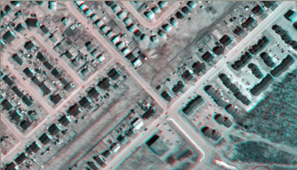
16 Primary Methods Photogrammetry Involves estimating real world coordinates (X,Y,Z) for ground based objects in 2 or more 2D images based on the approximate perspective and location of the sensor. Overlapping images enable stereo viewing Active: Stereo pair images are alternately flashed on the monitor Passive: both images on monitor simulataeneously, stereo view achieved with anaglyph or polarised. Products: Planimetric maps, orthophotos, DTM, etc. Single photograph + Sensor parameters = 2D measurements Multiple photographs + Sensor parameters = 3D measurements

17
18

19
20
21

22 Anaglyphic View

23 Anaglyphic View

24 Photogrammetry Workflow
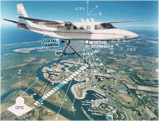
25 Primary Methods H LiDAR GPS Base Station N E Laser Z Y Z GPS X Y X IMU 10 o or 20 o GPS Base Station Light Detection And Ranging (LiDAR) System components Laser scanner emitting more than 100,000 pulses per sec GPS for measuring platform position Inertial Measurement Unit (IMU) for platform orientation Data processing and data storage unit (PC) Records first, last or multiple pulses Horizontal accuracy: 1/1000 th of flying height Vertical accuracy: 5 20cm Operates day or night Cannot operate above clouds

26 DSM DTM


27
28 Satellite Remote Sensing Primary Methods Remote sensing is closely related to photogrammetry. Both fields deal with images of the earth. It includes all information collected from sensors which are physically separate from the object. Remote sensing instruments rely on the detection of energy emitted from or reflected by the object under consideration.

29

30
31 Secondary Methods Scanning and Digitizing Legacy Datasets Scanning The process of converting existing maps to digital form (raster format) Setbacks in Scanning Editing can take nearly as long as manual digitizing would have taken

32 Scanning
33 Digitizing Digitizing is the process of capturing knowledge of a feature s geometry and attributes into a digital format stored on the computer s hard drive. Digitizing can be: Manual: Heads-down or heads-up Semi-Automated: data automatically recorded while manually following a line- by distance along the line, offset distance or time Fully automated- line following
34 Heads-Up Digitizing Heads-up digitizing is a combination of scanning and manual digitizing. The main steps in heads-up digitizing typically include: Scanning the map: a user can scan the map at a high resolution Registering the map: using transformation methods, the user can enter control points on screen and transform the scanned image to real world coordinates. Digitizing the map: the user can zoom to specific areas on screen and trace points, line or polygons on the map. Because the maps are already in the correct geographic coordinate system anything digitized on top of the map will also be in the correct coordinate system.


35 Heads-Up Digitizing 1. Scan 2. Georeference Final Map 3. Digitize

36 Heads-Up Digitizing

37 Example using Orthoimage

38 Digitizing Features of Interest

39 Final Product
40 Plan Before Digitizing There are many issues to consider before digitizing commences: For what purpose will the data be used? What coordinate system will be used for the project? What is the accuracy of the layers to be associated? What is the accuracy of the map being used?
41

42 Terrestrial Photogrammetry

43 Terrestrial Photogrammetry

44 Example: Google Street View


45 Web-Based Data Sources Can these sources provide AUTHORATIVE data for our GIS???

46 Applications Requiring Spatial Data
47 Metadata Data acquisition process is not complete until the appropriate metadata has been recorded Who, what, why, when, where, how?????? Metadata elements should include: Spatial data quality Spatial reference system
48 Metadata Elements Identification Title? Area covered? Themes? Currency? Restrictions? Data Quality (5 aspects) Positional & Attribute Accuracy? Completeness? Logical Consistency? Lineage? Spatial Data Organization Indirect? Vector? Raster? Type of elements? Number? Spatial Reference Projection? Grid system? Datum? Coordinate system? Entity and Attribute Information Features? Attributes? Attribute values? Distribution Distributor? Formats? Media? Online? Price? Metadata Reference Metadata currency? Responsible party?
49 Choosing an appropriate data source What are the considerations in choosing a data source? Purpose Scale Resolution Accuracy Datum transformation and map projection Completeness Content Costs
50 Real World The GIS Process Data Sources Geospatial Information processing begins and ends with the real world Data Input Users Data Management Analysis Source: Aronoff (1991)
51 UP NEXT.. Topic 4: Augmenting Data Acquisition using suavs
IP-S2 Compact+ 3D Mobile Mapping System
 IP-S2 Compact+ 3D Mobile Mapping System 3D scanning of road and roadside features Delivers high density point clouds and 360 spherical imagery High accuracy IMU options without export control Simple Map,
Introduction to GIS (Basics, Data, Analysis) & Case Studies. 13 th May 2004. Content. What is GIS?
 & Case Studies. 13 th May 2004. Content. What is GIS?") Introduction to GIS (Basics, Data, Analysis) & Case Studies 13 th May 2004 Content Introduction to GIS Data concepts Data input Analysis Applications selected examples What is GIS? Geographic Information
Introduction to GIS (Basics, Data, Analysis) & Case Studies 13 th May 2004 Content Introduction to GIS Data concepts Data input Analysis Applications selected examples What is GIS? Geographic Information
Digital Terrain Model Grid Width 10 m DGM10
 Digital Terrain Model Grid Width 10 m Status of documentation: 23.02.2015 Seite 1 Contents page 1 Overview of dataset 3 2 Description of the dataset contents 4 3 Data volume 4 4 Description of the data
STATE OF NEVADA Department of Administration Division of Human Resource Management CLASS SPECIFICATION
 STATE OF NEVADA Department of Administration Division of Human Resource Management CLASS SPECIFICATION TITLE PHOTOGRAMMETRIST/CARTOGRAPHER V 39 6.102 PHOTOGRAMMETRIST/CARTOGRAPHER II 33 6.110 PHOTOGRAMMETRIST/CARTOGRAPHER
PLOTTING SURVEYING DATA IN GOOGLE EARTH
 PLOTTING SURVEYING DATA IN GOOGLE EARTH D M STILLMAN Abstract Detail surveys measured with a total station use local coordinate systems. To make the data obtained from such surveys compatible with Google
ADWR GIS Metadata Policy
 ADWR GIS Metadata Policy 1 PURPOSE OF POLICY.. 3 INTRODUCTION.... 4 What is metadata?... 4 Why is it important? 4 When to fill metadata...4 STANDARDS. 5 FGDC content standards for geospatial metadata...5
Files Used in this Tutorial
 Generate Point Clouds Tutorial This tutorial shows how to generate point clouds from IKONOS satellite stereo imagery. You will view the point clouds in the ENVI LiDAR Viewer. The estimated time to complete
3D Building Roof Extraction From LiDAR Data
 3D Building Roof Extraction From LiDAR Data Amit A. Kokje Susan Jones NSG- NZ Outline LiDAR: Basics LiDAR Feature Extraction (Features and Limitations) LiDAR Roof extraction (Workflow, parameters, results)
LIDAR and Digital Elevation Data
 LIDAR and Digital Elevation Data Light Detection and Ranging (LIDAR) is being used by the North Carolina Floodplain Mapping Program to generate digital elevation data. These highly accurate topographic
The Status of Geospatial Information Management in China
 The Status of Geospatial Information Management in China Submitted by the National Administration of Surveying, Mapping and Geoinformation of China 1. Administration System The National Administration
How To Make An Orthophoto
 ISSUE 2 SEPTEMBER 2014 TSA Endorsed by: CLIENT GUIDE TO DIGITAL ORTHO- PHOTOGRAPHY The Survey Association s Client Guides are primarily aimed at other professionals such as engineers, architects, planners
Submitted to: Submitted by: Department of Geology and Mineral Industries 800 NE Oregon Street, Suite 965 Portland, OR 97232
 LIDAR REMOTE SENSING DATA COLLECTION DEPARTMENT OF F GEOLOGY AND MINERAL INDUSTRIES CRATER LAKE, OREGON NOVEMBER 30, 2010 Submitted to: Department of Geology and Mineral Industries 800 NE Oregon Street,
Opportunities for the generation of high resolution digital elevation models based on small format aerial photography
 Opportunities for the generation of high resolution digital elevation models based on small format aerial photography Boudewijn van Leeuwen 1, József Szatmári 1, Zalán Tobak 1, Csaba Németh 1, Gábor Hauberger
GEOGRAPHIC INFORMATION SYSTEMS CERTIFICATION
 GEOGRAPHIC INFORMATION SYSTEMS CERTIFICATION GIS Syllabus - Version 1.2 January 2007 Copyright AICA-CEPIS 2009 1 Version 1 January 2007 GIS Certification Programme 1. Target The GIS certification is aimed
EFFICIENT INTEGRATION OF AERIAL AND TERRESTRIAL LASER DATA FOR VIRTUAL CITY MODELING USING LASERMAPS
 EFFICIENT INTEGRATION OF AERIAL AND TERRESTRIAL LASER DATA FOR VIRTUAL CITY MODELING USING LASERMAPS Jan Böhm, Norbert Haala University of Stuttgart, Institute for Photogrammetry, Germany Forename.Lastname@ifp.uni-stuttgart.de
RELEASE NOTES. Introduction. New in this release. Trimble Positions Mobile extension
 RELEASE NOTES Trimble Positions Mobile extension These release notes provide important information about the Trimble Positions Mobile extension version 10.2.0.1. Please read these release notes carefully.
IP-S3 HD1. Compact, High-Density 3D Mobile Mapping System
 IP-S3 HD1 Compact, High-Density 3D Mobile Mapping System Integrated, turnkey solution Ultra-compact design Multiple lasers minimize scanning shades Unparalleled ease-of-use No user calibration required
Learning about GPS and GIS
 Learning about GPS and GIS Standards 4.4 Understand geographic information systems (G.I.S.). B12.1 Understand common surveying techniques used in agriculture (e.g., leveling, land measurement, building
Subdivision Mapping: Making the Pieces Fit David P. Thaler, GIS Analyst A geographit White Paper, June 2009
 Subdivision Mapping: Making the Pieces Fit P David P. Thaler, GIS Analyst A geographit White Paper, June 2009 1525 Oregon Pike, Suite 202 Lancaster, PA USA 17601-7300 Phone: 717-399-7007 Fax: 717-399-7015
Asset Data: A New Beginning, A New AURIZON. OmniSurveyor3D - The one source of truth
 Asset Data: A New Beginning, A New AURIZON OmniSurveyor3D - The one source of truth Gerard Buckett Program Manager, Asset Management Improvement, Aurizon Network 30 years experience in rail engineering
LiDAR Point Cloud Processing with
 LiDAR Research Group, Uni Innsbruck LiDAR Point Cloud Processing with SAGA Volker Wichmann Wichmann, V.; Conrad, O.; Jochem, A.: GIS. In: Hamburger Beiträge zur Physischen Geographie und Landschaftsökologie
GPS: A Primer. presented by Jim Pugh, GISP GIS Project Manager. 2007, EMH&T, Inc.
 GPS: A Primer presented by Jim Pugh, GISP GIS Project Manager GPS: A Primer GPS = Global Positioning System 24 Satellites in Orbit around Earth Each Broadcasts precise time and known location Receivers
High Resolution RF Analysis: The Benefits of Lidar Terrain & Clutter Datasets
 0 High Resolution RF Analysis: The Benefits of Lidar Terrain & Clutter Datasets January 15, 2014 Martin Rais 1 High Resolution Terrain & Clutter Datasets: Why Lidar? There are myriad methods, techniques
Managing Lidar (and other point cloud) Data. Lindsay Weitz Cody Benkelman
 Data. Lindsay Weitz Cody Benkelman") (and other point cloud) Data Lindsay Weitz Cody Benkelman Presentation Context What is lidar, and how does it work? Not this presentation! What can you do with lidar in ArcGIS? What does Esri recommend
(and other point cloud) Data Lindsay Weitz Cody Benkelman Presentation Context What is lidar, and how does it work? Not this presentation! What can you do with lidar in ArcGIS? What does Esri recommend
Technology Trends In Geoinformation
 Technology Trends In Geoinformation Dato Prof. Sr Dr. Abdul Kadir Bin Taib Department of Survey and Mapping Malaysia (JUPEM) Email: drkadir@jupem.gov.my www.jupem.gov.my NGIS 2008 3 rd. National GIS Conference
IP-S2 HD. High Definition 3D Mobile Mapping System
 IP-S2 HD High Definition 3D Mobile Mapping System Integrated, turnkey solution High Density, Long Range LiDAR sensor for ultimate in visual detail High Accuracy IMU and DMI Odometry for positional accuracy
Development of Large-Scale Land Information System (LIS) by Using Geographic Information System (GIS) and Field Surveying
 by Using Geographic Information System (GIS) and Field Surveying") Engineering, 2012, 4, 107-118 http://dx.doi.org/10.4236/eng.2012.42014 Published Online February 2012 (http://www.scirp.org/journal/eng) Development of Large-Scale Land Information System (LIS) by Using
Engineering, 2012, 4, 107-118 http://dx.doi.org/10.4236/eng.2012.42014 Published Online February 2012 (http://www.scirp.org/journal/eng) Development of Large-Scale Land Information System (LIS) by Using
METHODOLOGY FOR LANDSLIDE SUSCEPTIBILITY AND HAZARD MAPPING USING GIS AND SDI
 The 8th International Conference on Geo-information for Disaster Management Intelligent Systems for Crisis Management METHODOLOGY FOR LANDSLIDE SUSCEPTIBILITY AND HAZARD MAPPING USING GIS AND SDI T. Fernández
3D Model of the City Using LiDAR and Visualization of Flood in Three-Dimension
 3D Model of the City Using LiDAR and Visualization of Flood in Three-Dimension R.Queen Suraajini, Department of Civil Engineering, College of Engineering Guindy, Anna University, India, suraa12@gmail.com
Earth Coordinates & Grid Coordinate Systems
 Earth Coordinates & Grid Coordinate Systems How do we model the earth? Datums Datums mathematically describe the surface of the Earth. Accounts for mean sea level, topography, and gravity models. Projections
EVALUATION OF AIRBORNE LIDAR DIGITAL TERRAIN MAPPING FOR HIGHWAY CORRIDOR PLANNING AND DESIGN
 Waheed Uddin Director, Center for Advanced Infrastructure Technology, Carrier Hall 203 The University of Mississippi, University, MS 38677-1848, USA cvuddin@olemiss.edu KEY WORDS: Terrain, mapping, airborne,
Chapter Contents Page No
 Chapter Contents Page No Preface Acknowledgement 1 Basics of Remote Sensing 1 1.1. Introduction 1 1.2. Definition of Remote Sensing 1 1.3. Principles of Remote Sensing 1 1.4. Various Stages in Remote Sensing
High Resolution Digital Surface Models and Orthoimages for Telecom Network Planning
 Renouard, Lehmann 241 High Resolution Digital Surface Models and Orthoimages for Telecom Network Planning LAURENT RENOUARD, S ophia Antipolis FRANK LEHMANN, Berlin ABSTRACT DLR of Germany and ISTAR of
Positioning Aware Solutions for Smart Grid. Enterprise Geospatial & Business Development Manager- GIS DC (Trimble, MEIA Region)
") Positioning Aware Solutions for Smart Grid Presented by: Pankaj Gupta Enterprise Geospatial & Business Development Manager- GIS DC (Trimble, MEIA Region) Overview: Position-aware solutions for Smart Grid
Positioning Aware Solutions for Smart Grid Presented by: Pankaj Gupta Enterprise Geospatial & Business Development Manager- GIS DC (Trimble, MEIA Region) Overview: Position-aware solutions for Smart Grid
SURVEYING WITH GPS. GPS has become a standard surveying technique in most surveying practices
 SURVEYING WITH GPS Key Words: Static, Fast-static, Kinematic, Pseudo- Kinematic, Real-time kinematic, Receiver Initialization, On The Fly (OTF), Baselines, Redundant baselines, Base Receiver, Rover GPS
RiMONITOR. Monitoring Software. for RIEGL VZ-Line Laser Scanners. Ri Software. visit our website www.riegl.com. Preliminary Data Sheet
 Monitoring Software RiMONITOR for RIEGL VZ-Line Laser Scanners for stand-alone monitoring applications by autonomous operation of all RIEGL VZ-Line Laser Scanners adaptable configuration of data acquisition
Notable near-global DEMs include
 Visualisation Developing a very high resolution DEM of South Africa by Adriaan van Niekerk, Stellenbosch University DEMs are used in many applications, including hydrology [1, 2], terrain analysis [3],
Penmap Surveying for Everyone. www.penmap.com. Visit us on: www.facebook.com/mypenmap A TRIMBLE COMPANY
 Penmap Surveying for Everyone. Visit us on: www.facebook.com/mypenmap www.penmap.com A TRIMBLE COMPANY Penmap Applications An Open Software for all of your tasks and ideas We at HHK Datentechnik are passionate
APLS 2011. GIS Data: Classification, Potential Misuse, and Practical Limitations
 APLS 2011 GIS Data: Classification, Potential Misuse, and Practical Limitations GIS Data: Classification, Potential Misuse, and Practical Limitations Goals & Objectives Develop an easy to use geospatial
LiDAR Remote Sensing Data Collection: Panther Creek, Oregon April 27, 2012
 LiDAR Remote Sensing Data Collection: Panther Creek, Oregon April 27, 2012 Submitted to: Department of Interior Bureau of Land Management Oregon State Office 333 SW 3 rd Ave Portland, OR 97204 Submitted
WHAT IS GIS - AN INRODUCTION
 WHAT IS GIS - AN INRODUCTION GIS DEFINITION GIS is an acronym for: Geographic Information Systems Geographic This term is used because GIS tend to deal primarily with geographic or spatial features. Information
Traffic Monitoring Systems. Technology and sensors
 Traffic Monitoring Systems Technology and sensors Technology Inductive loops Cameras Lidar/Ladar and laser Radar GPS etc Inductive loops Inductive loops signals Inductive loop sensor The inductance signal
BASICS OF PRECISION AGRICULTURE (PA)
") BASICS OF PRECISION AGRICULTURE (PA) specific production on particular place specific production, from foot to foot... Same sense: data collection and decision making for small pieces of the field. Particular
BASICS OF PRECISION AGRICULTURE (PA) specific production on particular place specific production, from foot to foot... Same sense: data collection and decision making for small pieces of the field. Particular
Digital Orthophoto Production In the Desktop Environment 1
 Digital Orthophoto Production In the Desktop Environment 1 By Dr. Roy A. Welch and Thomas R. Jordan Digital orthophotos are proving suitable for a variety of mapping, GIS and environmental monitoring tasks.
The X100. Safe and fully automatic. Fast and with survey accuracy. revolutionary mapping. create your own orthophotos and DSMs
 The X100 revolutionary mapping Safe and fully automatic create your own orthophotos and DSMs Fast and with survey accuracy operates even in harsh weather conditions (up to 65 km/h wind & light rain) Image
Teaching and Learning Strategies for 3D Urban and Landscape Modelling
 Teaching and Learning Strategies for 3D Urban and Landscape Modelling Martin SMITH, Andrew BURTON, and Nikolaos KOKKAS, United Kingdom Key words: 3D modelling, visualization, teaching, learning SUMMARY
Request for Proposals for Topographic Mapping. Issued by: Teton County GIS and Teton County Engineering Teton County, Wyoming
 Request for Proposals for Topographic Mapping Issued by: Teton County GIS and Teton County Engineering Teton County, Wyoming Proposals due: 2:00PM MDT July 1, 2015 Proposals may be delivered to: Teton
SAMPLE: DO NOT COMPLETE
 EXP: EXPERIENCE POINT PROCEDURE Use the EXP-W experience worksheets, EXP-P professional profiles and EXP-S summary sheet to document your GIS professional experience. The Experience Schedule (next page)
ArcGIS Data Models Practical Templates for Implementing GIS Projects
 ArcGIS Data Models Practical Templates for Implementing GIS Projects GIS Database Design According to C.J. Date (1995), database design deals with the logical representation of data in a database. The
Assessment Tasks Pass theory exams at > 70%. Meet, or exceed, outcome criteria for projects and assignments.
 CENTRAL OREGON COMMUNITY COLLEGE: GEOGRAPHIC INFORMATION SYSTEM PROGRAM 1 CENTRAL OREGON COMMUNITY COLLEGE Associate Degree Geographic Information Systems Program Outcome Guide (POG) Program Outcome Guide
The Production of Orienteering Maps in Austria
 The Production of Orienteering Maps in Austria Ditz Robert Institute for Military Geography, Federal Ministry of Defence and Sports, Austria Abstract. Due to changing technologies in collecting data, the
Activites in Survey Department. Data Development Progress
 Introduction Activites in Survey Department Data Development Progress Conclusion Data Development in Brunei Darussalam Presented by : Hj Mohd Jamil bin Hj Mohd Ali Hj Jali bin Hj Nudin Survey Department
UNITED NATIONS E/CONF.97/5/CRP. 13
 UNITED NATIONS E/CONF.97/5/CRP. 13 ECONOMIC AND SOCIAL COUNCIL Seventeenth United Nations Regional Cartographic Conference for Asia and the Pacific Bangkok, 18-22 September 2006 Item 6 (b) of the provisional
Program Learning Objectives
 Geographic Information Science, M.S. Majors in Computational Geosciences. 2012-201. Awase Khirni Syed 1 *, Bisheng Yang 2, Eliseo Climentini * 1 s.awasekhirni@tu.edu.sa, Assitant Professor, Taif University,
Survey Ties Guidelines
 North Carolina Board of Examiners for Engineers and Surveyors Survey Ties Guidelines The North Carolina Board of Examiners for Engineers and Surveyors is providing this document to serve as an interpretative
What do I do first in ArcView 8.x? When the program starts Select from the Dialog box: A new empty map
 www.library.carleton.ca/find/gis Introduction Introduction to Georeferenced Images using ArcGIS Georeferenced images such as aerial photographs or satellite images can be used in many ways in both GIS
INTEGRATED GEOPHYSICAL AND REMOTE SENSING STUDIES ON GROTTA GIGANTE SHOW CAVE (TRIESTE ITALY) P. Paganini, A. Pavan, F. Coren, A.
 P. Paganini, A. Pavan, F. Coren, A.") INTEGRATED GEOPHYSICAL AND REMOTE SENSING STUDIES ON GROTTA GIGANTE SHOW CAVE (TRIESTE ITALY) P. Paganini, A. Pavan, F. Coren, A. Fabbricatore Aerial lidar survey - strumentation Piper Seneca II - PA34
INTEGRATED GEOPHYSICAL AND REMOTE SENSING STUDIES ON GROTTA GIGANTE SHOW CAVE (TRIESTE ITALY) P. Paganini, A. Pavan, F. Coren, A. Fabbricatore Aerial lidar survey - strumentation Piper Seneca II - PA34
COMPARISON OF AERIAL IMAGES, SATELLITE IMAGES AND LASER SCANNING DSM IN A 3D CITY MODELS PRODUCTION FRAMEWORK
 COMPARISON OF AERIAL IMAGES, SATELLITE IMAGES AND LASER SCANNING DSM IN A 3D CITY MODELS PRODUCTION FRAMEWORK G. Maillet, D. Flamanc Institut Géographique National, Laboratoire MATIS, Saint-Mandé, France
IMPERVIOUS SURFACE MAPPING UTILIZING HIGH RESOLUTION IMAGERIES. Authors: B. Acharya, K. Pomper, B. Gyawali, K. Bhattarai, T.
 IMPERVIOUS SURFACE MAPPING UTILIZING HIGH RESOLUTION IMAGERIES Authors: B. Acharya, K. Pomper, B. Gyawali, K. Bhattarai, T. Tsegaye ABSTRACT Accurate mapping of artificial or natural impervious surfaces
Lidar 101: Intro to Lidar. Jason Stoker USGS EROS / SAIC
 Lidar 101: Intro to Lidar Jason Stoker USGS EROS / SAIC Lidar Light Detection and Ranging Laser altimetry ALTM (Airborne laser terrain mapping) Airborne laser scanning Lidar Laser IMU (INS) GPS Scanning
3D Vision Based Mobile Mapping and Cloud- Based Geoinformation Services
 3D Vision Based Mobile Mapping and Cloud- Based Geoinformation Services Prof. Dr. Stephan Nebiker FHNW University of Applied Sciences and Arts Northwestern Switzerland Institute of Geomatics Engineering,
Image Analysis CHAPTER 16 16.1 ANALYSIS PROCEDURES
 CHAPTER 16 Image Analysis 16.1 ANALYSIS PROCEDURES Studies for various disciplines require different technical approaches, but there is a generalized pattern for geology, soils, range, wetlands, archeology,
GEOScaN Remote Data Acquisition for Hydrographic, Topographic and GIS Surveying
 GEOScaN Remote Data Acquisition for Hydrographic, Topographic and GIS Surveying Laurence WATERHOUSE, United Kingdom Key words: remote sensing, hydrographic, laser scanning, GIS SUMMARY British Waterways
LiDAR for vegetation applications
 LiDAR for vegetation applications UoL MSc Remote Sensing Dr Lewis plewis@geog.ucl.ac.uk Introduction Introduction to LiDAR RS for vegetation Review instruments and observational concepts Discuss applications
Coming To An Airport Near You
 Airport GIS Data & ealp Coming To An Airport Near You Kevin Shirer, AAE Project Manager Association of California Airports; September 2009 Today s Presentation & Expectations Take away Basic knowledge
Mapping Earth from Space Remote sensing and satellite images. Remote sensing developments from war
 Mapping Earth from Space Remote sensing and satellite images Geomatics includes all the following spatial technologies: a. Cartography "The art, science and technology of making maps" b. Geographic Information
http://www.esri.com/bia
 ArcGIS for Tribal Transportation Management David Gadsden Federal Account Manager dgadsden@esri.com d d 1 David Gadsden GIS Background UW Geography (1995) Peace Corps Tanzania Environmental Social Science
Evaluation of surface runoff conditions. scanner in an intensive apple orchard
 Evaluation of surface runoff conditions by high resolution terrestrial laser scanner in an intensive apple orchard János Tamás 1, Péter Riczu 1, Attila Nagy 1, Éva Lehoczky 2 1 Faculty of Agricultural
A PHOTOGRAMMETRIC APPRAOCH FOR AUTOMATIC TRAFFIC ASSESSMENT USING CONVENTIONAL CCTV CAMERA
 A PHOTOGRAMMETRIC APPRAOCH FOR AUTOMATIC TRAFFIC ASSESSMENT USING CONVENTIONAL CCTV CAMERA N. Zarrinpanjeh a, F. Dadrassjavan b, H. Fattahi c * a Islamic Azad University of Qazvin - nzarrin@qiau.ac.ir
In Flight ALS Point Cloud Georeferencing using RTK GPS Receiver
 Integration of Geodetic Sensors In Flight ALS Point Cloud Georeferencing using RTK GPS Receiver Yannick Stebler, Philipp Schär, Jan Skaloud, Bertrand Merminod E mail: yannick.stebler@epfl.ch Web: http://topo.epfl.ch
MULTIPURPOSE USE OF ORTHOPHOTO MAPS FORMING BASIS TO DIGITAL CADASTRE DATA AND THE VISION OF THE GENERAL DIRECTORATE OF LAND REGISTRY AND CADASTRE
 MULTIPURPOSE USE OF ORTHOPHOTO MAPS FORMING BASIS TO DIGITAL CADASTRE DATA AND THE VISION OF THE GENERAL DIRECTORATE OF LAND REGISTRY AND CADASTRE E.ÖZER, H.TUNA, F.Ç.ACAR, B.ERKEK, S.BAKICI General Directorate
Using Optech LMS to Calibrate Survey Data Without Ground Control Points
 Challenge An Optech client conducted an airborne lidar survey over a sparsely developed river valley. The data processors were finding that the data acquired in this survey was particularly difficult to
Esri s ArcPad vs. ArcGIS Mobile vs. Trimble s TerraSync vs. TerraFlex Comparison By: Electronic Data Solutions
 Esri s ArcPad vs. ArcGIS Mobile vs. Trimble s TerraSync vs. TerraFlex Comparison By: Electronic Data Solutions ArcPad is mobile field mapping and data collection software designed for GIS professionals.
Metadata for Big River Watershed Geologic and Geomorphic Data
 Metadata for Big River Watershed Geologic and Geomorphic Data Metadata are descriptions and information regarding compiled data. This appendix contains the metadata that describes the compiled data used
Digital Remote Sensing Data Processing Digital Remote Sensing Data Processing and Analysis: An Introduction and Analysis: An Introduction
 Digital Remote Sensing Data Processing Digital Remote Sensing Data Processing and Analysis: An Introduction and Analysis: An Introduction Content Remote sensing data Spatial, spectral, radiometric and
GIS: Geographic Information Systems A short introduction
 GIS: Geographic Information Systems A short introduction Outline The Center for Digital Scholarship What is GIS? Data types GIS software and analysis Campus GIS resources Center for Digital Scholarship
NJDEP GPS Data Collection Standards For GIS Data Development
 NJDEP GPS Data Collection Standards For GIS Data Development Bureau of Geographic Information Systems Office of Information Resource Management June 8, 2011 1.0 Introduction... 3 2.0 GPS Receiver Hardware
GIS Spatial Data Standards
 GIS Spatial Data Standards Manatee County, FL GIS Section, Information Services Department TABLE OF CONTENTS I. Introduction 2 A. Purpose 2 B. Reference 2 II. Spatial Reference Information 2 A. Projection:
LiDAR REMOTE SENSING
 LiDAR REMOTE SENSING LOS OSOS CALIFORNIA 5/18/2011 (Updated 2/19/2013) Prepared for: Prepared by: WSI Corvallis Office 517 SW 2 nd St, Suite 400 Corvallis, OR 97333 LIDAR REMOTE SENSING DATA COLLECTION:
Prof. Ludovico Biagi. Satellite Navigation and Monitoring
 Prof. Ludovico Biagi Satellite Navigation and Monitoring Navigation: trajectories control positions estimations in real time, at high frequency popular applications: low accuracy (10 m) required specific
Understanding Raster Data
 Introduction The following document is intended to provide a basic understanding of raster data. Raster data layers (commonly referred to as grids) are the essential data layers used in all tools developed
Introduction to GIS. http://libguides.mit.edu/gis
 Introduction to GIS http://libguides.mit.edu/gis 1 Overview What is GIS? Types of Data and Projections What can I do with GIS? Data Sources and Formats Software Data Management Tips 2 What is GIS? 3 Characteristics
Big Data in OpenTopography
 Big Data in OpenTopography Vishu Nandigam San Diego Supercomputer Center NSF Big Data in Educa
Geospatial Cloud Computing - Perspectives for
 Geospatial Cloud Computing - Perspectives for Startups and Open Source Projects The Cases of OpenWebGlobe and 3D Vision Mobile Mapping for Urban Infrastructure Management Prof. Dr. Stephan Nebiker FHNW
PHASE 2_3 RD SESSION REPORT KU GIS LABS ARCGIS TRAINING: USING ARCGIS (APPLICATIONS) 18 TH - 22 ND AUGUST 2014 SCHOOL OF ENGINEERING COMPUTER LAB
 18 TH - 22 ND AUGUST 2014 SCHOOL OF ENGINEERING COMPUTER LAB") PHASE 2_3 RD SESSION REPORT KU GIS LABS ARCGIS TRAINING: USING ARCGIS (APPLICATIONS) 18 TH - 22 ND AUGUST 2014 SCHOOL OF ENGINEERING COMPUTER LAB PHASE 2_3 rd SESSION REPORT ARCGIS TRAINING: 18 TH - 22
PHASE 2_3 RD SESSION REPORT KU GIS LABS ARCGIS TRAINING: USING ARCGIS (APPLICATIONS) 18 TH - 22 ND AUGUST 2014 SCHOOL OF ENGINEERING COMPUTER LAB PHASE 2_3 rd SESSION REPORT ARCGIS TRAINING: 18 TH - 22
A GIS helps you answer questions and solve problems by looking at your data in a way that is quickly understood and easily shared.
 A Geographic Information System (GIS) integrates hardware, software, and data for capturing, managing, analyzing, and displaying all forms of geographically referenced information. GIS allows us to view,
3D MODELING OF LARGE AND COMPLEX SITE USING MULTI-SENSOR INTEGRATION AND MULTI-RESOLUTION DATA
 3D MODELING OF LARGE AND COMPLEX SITE USING MULTI-SENSOR INTEGRATION AND MULTI-RESOLUTION DATA G. Guidi 1, F. Remondino 2, 3, M. Russo 1, F. Menna 4, A. Rizzi 3 1 Dept.INDACO, Politecnico of Milano, Italy
Publishing Hosted 3D Feature Layers. An Esri White Paper September 2015
 An Esri White Paper September 2015 Copyright 2015 Esri All rights reserved. Printed in the United States of America. The information contained in this document is the exclusive property of Esri. This work
Leica Photogrammetry Suite Project Manager
 Leica Photogrammetry Suite Project Manager Copyright 2006 Leica Geosystems Geospatial Imaging, LLC All rights reserved. Printed in the United States of America. The information contained in this document
Land Management Geoinformatics Surveying and Mapping
 Master Programmes in Land Management Geoinformatics Surveying and Mapping The School of Architecture, Design and Planning (SADP) at Aalborg University covers a number of MSc programmes within the field
<Insert Picture Here> Data Management Innovations for Massive Point Cloud, DEM, and 3D Vector Databases
 Data Management Innovations for Massive Point Cloud, DEM, and 3D Vector Databases Xavier Lopez, Director, Product Management 3D Data Management Technology Drivers: Challenges & Benefits
Ministry of Food Production Land and Marine Affairs Lands and Surveys Division
 Ministry of Food Production Land and Marine Affairs Lands and Surveys Division THE PARCEL INDEX MAP Cadastral Records and Cadastral Management at the Lands and Surveys Division, Trinidad and Tobago Alicia
The usage of DEM to create the 3D cadastre
 Scientific Journals Maritime University of Szczecin Zeszyty Naukowe Akademia Morska w Szczecinie 2013, 33(105) pp. 86 90 2013, 33(105) s. 86 90 ISSN 1733-8670 The usage of DEM to create the 3D cadastre
Standard on Digital Cadastral Maps and Parcel Identifiers
 Standard on Digital Cadastral Maps and Parcel Identifiers APPROVED JULY 2003 INTERNATIONAL ASSOCIATION OF ASSESSING OFFICERS 1. Scope This standard provides recommendations on the development and maintenance
Mobile 360 Degree Imagery: Cost Effective Rail Network Asset Management October 22nd, 2015. Eric McCuaig, Trimble Navigation
 Mobile 360 Degree Imagery: Cost Effective Rail Network Asset Management October 22nd, 2015 Eric McCuaig, Trimble Navigation The debate: Point Clouds vs. Imagery Both are useful pick the right tool for
A CONCEPT OUTLINE ESTABLISHING THE
 Updated 13 November 2009 A CONCEPT OUTLINE ESTABLISHING THE Philippine GIS Data Clearinghouse (PhilGIS) www.philgis.org Prepared by Al Tongco, Ph.D. Stillwater, Oklahoma, U.S.A. al_tongco@yahoo.com Introduction
Remote Sensing, GPS and GIS Technique to Produce a Bathymetric Map
 Remote Sensing, GPS and GIS Technique to Produce a Bathymetric Map Mark Schnur EES 5053 Remote Sensing Fall 2007 University of Texas at San Antonio, Department of Earth and Environmental Science, San Antonio,
How To Use Gss Software In Trimble Business Center
 Trimble Business Center software technical notes Trimble Business Center Software Makes Processing GNSS Survey Data Effortless Trimble Business Center is powerful surveying office software designed to
5. GIS, Cartography and Visualization of Glacier Terrain
 5. GIS, Cartography and Visualization of Glacier Terrain 5.1. Garhwal Himalayan Glaciers 5.1.1. Introduction GIS is the computer system for capturing, storing, analyzing and visualization of spatial and
The process components and related data characteristics addressed in this document are:
 TM Tech Notes Certainty 3D November 1, 2012 To: General Release From: Ted Knaak Certainty 3D, LLC Re: Structural Wall Monitoring (#1017) rev: A Introduction TopoDOT offers several tools designed specifically