City of Austin Stream Restoration Program Mid-Atlantic Stream Restoration Conference, Rocky Gap, MD November 2011
|
|
|
- Rosamund O’Brien’
- 8 years ago
- Views:
Transcription


1 Welcome

2 City of Austin Stream Restoration Program Mid-Atlantic Stream Restoration Conference, Rocky Gap, MD November 2011 Morgan Byars, P.E. City of Austin Watershed Protection Department Environmental Resource Management Division Stormwater Treatment and Stream Restoration Section

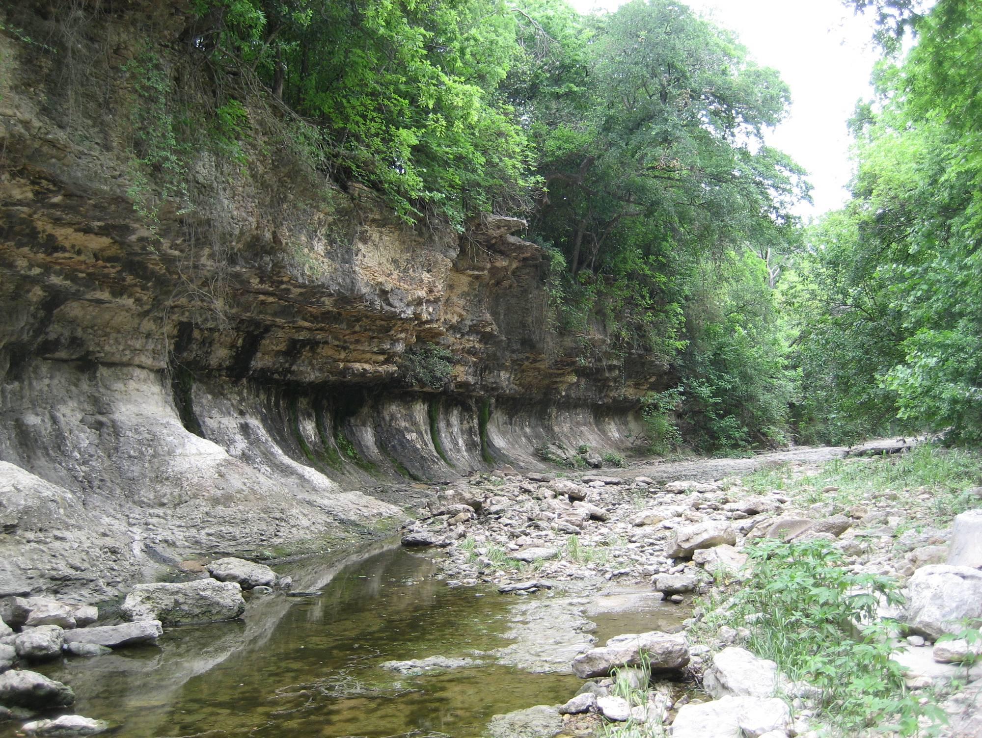
3 Stream Restoration Program stream stabilization riparian restoration habitat enhancement For over a decade, the City of Austin has been a leading agency in developing and implementing bioengineering and stream restoration practices resulting in creeks that: remain stable, provide habitat, and retain the natural and traditional character of Austin s waterways.
4 City of Austin Watershed protection department three primary service missions: Water Quality Green Infrastructure/LID Creek Erosion Stream restoration Flood Control A mission integration process (MIP) was developed to : Maximize the opportunities and Minimize negative impacts to Other missions (flooding, erosion and water quality) when planning capital improvement projects. The team is composed of experts representing each of missions who evaluate opportunities and impacts at the project planning level.
5 stream stabilization water quality treatment
6 Stream Restoration Program program history 1992: The first bond passed to address erosion in Little Walnut Creek. 1994: erosion Control Services Program was established in response to citizen complaints. Service began with drainage utility funding for operating expenses. 1997: WPD initiated the citywide erosion assessments to identify and prioritize erosion problems as part of the Watershed Protection Master plan. 2001: Watershed Protection Master Plan adopted by City Council to guide future solution implementation. Since : Completed more than 5 miles of stream projects, but the demand for stream restoration services has continued to increase.
7 Stream Restoration Program PROGRAM SERVICES watershed erosion assessments Project planning and prioritization survey, design, construction administration special studies and analyses technical assistance presentations and training
8 Watershed Erosion Assessments Stream Inventory: document and photograph stream features Hydraulic change as a result of urbanization Determination of channel enlargement Delineate erosion hazard areas Knick point identification and management strategy Identify meander migration problems Identify and classify stream reaches and erosion sites Watershed Mapping (GIS)
9 Geomorphic Reach Assessment Rapid Geomorphic Assessment For Stream Reaches Assessment by: Date: Stream: Tributary: Reach: STA: Bank Material Composition* Bed Material Composition* *AL = Alluvial (sand/gravel/clay), RH = Hard Rock (Buda/Edwards), RS = Soft rock (Austin/Taylor) COMP = Composite (alluvium over rock), STRUCT = Structural (concrete/gabions) FORM/ GEOMORPHIC PRESENT INDEX PROCESS INDICATOR NO YES 1. Iobate bars 2. coarse material in riffles embedded EVIDENCE OF 3 siltation of pools AGGRADATION 4. medial bars (Al) 5. accretion on point bar 6. poor longitudinal sorting of bed materials 7. deposition of sediment in the overbank zone 8. buried structures or tree base 1. exposed bridge footing(s) 2. exposed sanitary sewer/gas pipelines/etc 3. elevated storm sewer outfall(s) EVIDENCE OF 4. undermined gabion baskets/concrete aprons etc. DEGRADATION 5. scour pools downstream of culverts/stormsewer outlets (Dl) 6. avalanche faces on bar forms 7. head cutting due to knick point migration 8.terrace cut through older bar material 9. suspended armor layer visible in bank 10. channel worn into undisturbed overburden 1. fallen/leaning trees fence posts 2. occurrence of Large Organic Debris EVIDENCE OF 3. exposed roots on trees WIDENING 4. basal scour on inside meander bends (Wl) 5. basal scour on both sides of the channel in riffle sections 6. gabion baskets/concrete walls/etc. out flanked 7. Iength of channel with basal scour > 50% 1. formation of chutes EVIDENCE OF 2. evolution of single thread channel to multiple PLANIMETRIC 3. evolution of pool-riffle to braided form ADJUSTMENT 4. cutoff channels (Pl) 5. formation of islands 6. thawleg alignment out of phase with meander geometry 7. bar forms poorly formed/re-worked/removed STABILITY INDEX SI Geomorphic Reach Data aggradation degradation channel widening planimetric adjustment Stability Index (0 < SI < 1) The stability index (SI) is defined as: SI = (Al + Dl +WI +PI)/m where m=4, Al, Dl, Wl, and Pl are the normalized values of the aggradation, degradation, width enlargement and planimetric indices, respectively. The normalized value for each of the four FORM/PROCESS categories is computed as the sum the GEOMORPHIC INDICATOR for which a Yes determination is reported in the PRESENT column divided by n = the number of GEOMORPHIC INDICATORS used for each index. If a GEOMORPHIC INDICATOR is not applicable note N/A opposite this INDICATOR in the PRESENT column and reduce n by 1. For example, if there are no bridges in the reach then GEOMORPHIC INDICATOR No. 1 "exposed bridge footing(s)" under "EVIDENCE OF DEGRADATION (DI)" is not applicable and the observer should record an N/A opposite this INDICATOR, reduce n to 9 and move to the next INDICATOR. SI < >0.4 Stable In Transition In Adjustment
10 Erosion Site Inspection Stream Restoration Program - Erosion Site Inspection Form Date Inspector Address Property Type (Commercial/single-family/multi-family/COA/AISD/Texas) Watershed Geomorphic Reach Resource Threatened (See Resource Code Sheet i.e. House, Building, Major Road, Minor Road, Low Water Crossing, Mobile Home, Fixed Storage Building, Garage, Dam, Deck, Driveway, Sidewalk, Fence, Yard, Grade Control, Retaining Wall, Parking Lot, Public Recreational Amenity, Swimming Pool, Tennis Court, Playscape, Hike and Bike Trail, Protected Tree, Manhole, Utility, Line, Storm Drain, Wastewater Pipe, Gas Line, Power Pole, Concrete Riprap Slope Protection,, Concrete Flume, Bridge, Railroad Bridge, Railroad, Pedestrian Bridge) Erosion Type Rating (1, 2 or 3) Type 1: Imminent threat to a habitable/primary structure or public roadway. Type 2: Threat to secondary structure/ private property or public infrastructure (Doffset <.5 ft) Type 3: Property or structure that may be threatened by future stream channel erosion (DOffset >= 0.5 ft) Horizontal Offset from Top of Bank to Threatened Resource (ft) D offset Bank Height (ft) Horizontal Distance from Top of Bank to Toe (ft) Y D Top2Toe Existing Bank Slope, Horizontal:Vertical SS = (D Top2Toe / Y) : 1 Erosion Damage Length along Creek Flowpath (ft) Bank Material Composition* Bed Material Composition* *AL = Alluvial (sand/gravel/clay), RH = Hard Rock (Buda/Edwards), RS = Soft rock (Austin/Taylor) COMP = Composite (alluvium over rock), STRUCT = Structural (concrete/gabions) Resource at Top of Bank Le Erosion Site Data property type easement resource value distance to resource bank height bank slope bank material bed material DOffset DTop2Toe SS Top of Bank Y = Bank Height **In-Channel Resource (i.e. PIPE-WW) Toe of Bank Stream Bed ** for in-channel resources such as pipelines use N/A for D offset and indicate the exposed length, height and depth of undermining. Notes:
11 Erosion Problems in Austin HOUSE UTILITY POLE - HOUSE WASTE WATER LINE PEDESTRIAN BRIDGE HOUSE BRIDGE - TRAIL HOUSE PEDESTRIAN BRIDGE STORM DRAIN PIPE
12 Stream Restoration Program Prioritization and Planning
13 Stream Restoration Program Erosion problems are identified through Watershed Erosion Assessments Citizen Service Requests Staff Reconnaissance SRP DATABASE PRIORITIZATION CAPITAL PROJECT IN-HOUSE DESIGN CONSTRUCTION
14 Stream Restoration Program City-Wide Erosion Problem Prioritization Problem Score Approach
15 Stream Restoration Program Erosion Problem Prioritization Problem Score Approach Problem Score = f(# resources in the reach, resource value, Erosion Site severity) Individual Erosion Site Score Geomorphic Reach Score Geomorphic Reach Erosion Sites
16 Stream Restoration Program Erosion Problem Prioritization
17 Stream Restoration Program Erosion Problem Prioritization Geotechnical Score = f(bank height, bank angle, resource distance, soils) Threatened Resource Offset Top of Bank H existing Resource Critical Slope b Toe of Bank
18 Stream Restoration Program Erosion Problem Prioritization Geotechnical Score = (H/Hc) * Normalization Factor H = Existing Bank Height Hc = Critical Bank Height Normalization Factor such that values range Hc = 4*c/gamma*[sin(B)*cos(phi)/(1 cos(b - phi))] where: Hc = critical bank height (ft) {Cullman s Limit Equilibrium Method} c = bank material cohesion (lb/ft^2) gamma = unit weight of bank material (lb/ft^3) phi = bank material internal friction angle (degrees) B = critical resource slope angle
19 Stream Restoration Program solutions REGULATORY solutions EROSION HAZARD BUYOUTS DESIGN solutions
20 Stream Restoration Program Regulatory solutions Floodplain regulations Stormwater management Controls Critical water quality zones Erosion hazard zone Headwater protection
21 Stormwater Management Erosion Detention Study
22 EROSION HAZARD ZONE
23 Current Buffers
24 Potential Buffers

25 Voluntary Erosion Hazard Buyouts purchasing property and removing the structure may be the best long term solution. cost benefit analysis compares stream stabilization cost to property acquisition cost. voluntary acquisition no threat of condemnation appraised market value and relocation costs offered
26 Stream Restoration Program Construction Projects
27 Active Restoration Techniques Vegetated Graded Slopes Natural Limestone Boulder Toe with Vegetated Upper Slopes Natural Limstone Boulder Wall

28 Stream Team Projects in-house design and construction management Stream restoration program staff prepare erosion repair and stream stabilization designs and plans for two field operations construction crews. Stream restoration staff specialize in natural stream design that stabilize channels while enhancing the natural character of Austin s waterways.
29 Stream Restoration Program In-house Projects
30 BLUNN STACY PARK - BEFORE
31
32 BLUNN STACY PARK - AFTER
33 BLUNN STACY PARK - AFTER
34 BLUNN STACY PARK - BEFORE
35
36
37 BLUNN STACY PARK - AFTER
38 Stream Restoration Program Capital Projects Larger Projects (>1000 ft) are generally implemented with private contractors
39 Passive Restoration Example Willow Brook Reach (Before) 1997
40 Passive Restoration Example Willow Brook Reach (After) 2011
41 Active Restoration Example Shipe Park (Before) 1997
42 Active Restoration Example Shipe Park (After) 2009
43 Active Restoration Example Fort Branch Project (before)
44 Active Restoration Example Fort Branch Project (After) 2011


45 Ecological Benefits
46 Austin Ecological Benefits Change in Metrics
47 I like it natural
48 PLEASE VISIT US AT
49 Thank You
1.7.0 Floodplain Modification Criteria
 1.7.0 Floodplain Modification Criteria 1.7.1 Introduction These guidelines set out standards for evaluating and processing proposed modifications of the 100- year floodplain with the following objectives:
CITY UTILITIES DESIGN STANDARDS MANUAL
 CITY UTILITIES DESIGN STANDARDS MANUAL Book 2 (SW) SW9 June 2015 SW9.01 Purpose This Chapter provides information for the design of open channels for the conveyance of stormwater in the City of Fort Wayne.
Neversink River East Branch
 Neversink River East Branch Management Unit 10 Summary of Post-Flood Recommendations Intervention Level Full restoration of the stream reach including the eroding bank site between Station 38380 and Station
How To Check For Scour At A Bridge
 Case Studies Bridge Scour Inspection and Repair Edward P. Foltyn, P.E. Senior Hydraulic Engineer ODOT Bridge Unit 2013 PNW Bridge Inspectors Conference April 2013 REFERENCES Stream Stability at Highway
Interim Technical Guidelines for the Development of Environmental Management Plans for Underground Infrastructure Revised - July 2013.
 Interim Technical Guidelines for the Development of Environmental Management Plans for Underground Infrastructure Revised - July 2013 Rationale Underground infrastructure may be at risk from valley, streambank
Stream Rehabilitation Concepts, Guidelines and Examples. Objectives. Pierre Y. Julien. Three Laws of Stream Restoration
 Stream Rehabilitation Concepts, Guidelines and Examples Pierre Y. Julien Wuhan 2005 Objectives Part I - Stream restoration and rehabilitation: 1. Present and discuss important concepts, laws, criteria
Bond Release Process for New Subdivision Developments in Fairfax County
 Bond Release Process for New Subdivision Developments in Fairfax County An Overview for Homeowners Associations A Fairfax County, Va., publication April 2009 For more information or to request this document
Harris County Flood Control District. Policy, Criteria, and Procedure Manual
 Harris County Flood Control District Policy, Criteria, and Procedure Manual For Approval and Acceptance of Infrastructure General Review October 10, 2003 Draft Please Provide Written Comments to the HCFCD
Adopted 9/23/98 CHATTAHOOCHEE CORRIDOR PLAN. The goals of the Chattahoochee Corridor Plan (hereinafter also referred to as the Plan ) are:
 are:") CHATTAHOOCHEE CORRIDOR PLAN Adopted 9/23/98 PART 1: GOALS. POLICY. COVERAGE. A. Goals The goals of the Chattahoochee Corridor Plan (hereinafter also referred to as the Plan ) are: 1. Preservation and protection
CHATTAHOOCHEE CORRIDOR PLAN Adopted 9/23/98 PART 1: GOALS. POLICY. COVERAGE. A. Goals The goals of the Chattahoochee Corridor Plan (hereinafter also referred to as the Plan ) are: 1. Preservation and protection
Flood Hazard Area Technical Manual Section 8 Bank Stabilization and Stream Restoration
 Flood Hazard Area Technical Manual Section 8 Bank Stabilization and Stream Restoration Prepared by: New Jersey Section American Water Resources Association Stream Restoration Committee FHA Subcommittee
A Stream Restoration Case Study in the California Central Coast
 International Erosion Control Association Annual Conference 2009, Reno, Nevada Case Study Technical Presentation A Stream Restoration Case Study in the California Central Coast Justin S. Rogers, P.E.,
Chapter 3 CULVERTS. Description. Importance to Maintenance & Water Quality. Culvert Profile
 Chapter 3 CULVERTS Description A culvert is a closed conduit used to convey water from one area to another, usually from one side of a road to the other side. Importance to Maintenance & Water Quality
3. Design Procedures. Design Procedures. Introduction
 Design Procedures 3. Design Procedures Introduction This chapter presents a procedure for the design of natural channels. The chapter primarily focuses on those physical properties of the channel required
RIPRAP From Massachusetts Erosion and Sediment Control Guidelines for Urban and Suburban Areas http://www.mass.gov/dep/water/laws/policies.
 RIPRAP From Massachusetts Erosion and Sediment Control Guidelines for Urban and Suburban Areas http://www.mass.gov/dep/water/laws/policies.htm#storm Definition: A permanent, erosion-resistant ground cover
Carlton Fields Memorandum
 Carlton Fields Memorandum TO: FROM: RE: DAN WEEDE FRED RUSHING RIPARIAN BUFFER DATE: JULY 26, 2013 BACKGROUND Both the state of Georgia and the city of Atlanta 1 have certain guidelines that must be followed
The Bond Release Process for New Subdivision Developments: An Overview for Homeowners Associations DRAFT 6-4-08. Revised 9-25-08
 The Bond Release Process for New Subdivision Developments: An Overview for Homeowners Associations DRAFT 6-4-08. Revised 9-25-08 Fairfax County requires developers to post a performance bond if they are
Safe & Sound Bridge Terminology
 Safe & Sound Bridge Terminology Abutment A retaining wall supporting the ends of a bridge, and, in general, retaining or supporting the approach embankment. Approach The part of the bridge that carries
BRIDGES ARE relatively expensive but often are
 Chapter 10 Bridges Chapter 10 Bridges Bridg Bridges -- usually the best, but most expensive drainage crossing structure. Protect bridges against scour. BRIDGES ARE relatively expensive but often are the
The Teton Creek Restoration Project Summary:
 The Teton Creek Restoration Project Summary: The Teton Creek Restoration Project area extends for approximately one mile upstream from the Cemetery Road Bridge and includes the Aspen Pointe, The Aspens
Salt Lake County June 2010 Flooding and Restoration
 Salt Lake County June 2010 Flooding and Restoration Little Cottonwood (LCC) and Big Cottonwood (BCC) Kade Moncur, PE, CFM Salt Lake County Engineering August 10 th - 12 th SLCo Symposium 2011 August 10
Flood Protection in Garland Past, Present, and Future. Presented by: R. Lyle Jenkins, P.E., CFM City of Garland, Texas
 Flood Protection in Garland Past, Present, and Future Presented by: R. Lyle Jenkins, P.E., CFM City of Garland, Texas A few facts about Garland: Originally incorporated in 1891 Population 226,876 (2010
City of Shelbyville Site Inspection Checklist
 City of Shelbyville Site Inspection Checklist General Information Project Name: KYR10 Permit Number: Date: Project Location: Contractor: Conractor Representative: Inspector's Name: Title: Signature : Weather
Assessing Rivers for Restoration Purposes. Ann L. Riley Waterways Restoration Institute
 Assessing Rivers for Restoration Purposes Ann L. Riley Waterways Restoration Institute Assessing Rivers for Restoration Purposes Ann L. Riley Waterways Restoration Institute Assessing Rivers for Restoration
Land Disturbance, Erosion Control and Stormwater Management Checklist. Walworth County Land Conservation Department
 Land Disturbance, Erosion Control and Stormwater Management Checklist Walworth County Land Conservation Department The following checklist is designed to assist the applicant in complying with the Walworth
Mission Creek Flood Control & Restoration Project. City of Fremont, Alameda County
 Mission Creek Flood Control & Restoration Project City of Fremont, Alameda County Agenda Background Why are proposed improvements necessary? Proposed project components Challenges Construction schedule/phasing
Various options are discussed below.these low cost, low impact interventions can also be applied as general erosion control methods.
 Week 10 River Hydraulics Rehabilitating Urban Waterways (From http://hubpages.com/hub/river-bank-erosion-control-methods) See also the resources placed on Moodle. Water channels should be viewed as a resource
 Coldwater Heritage Partnership Implementation Grant Final Report Morrison Run Watershed Restoration Project Western Pennsylvania Conservancy Project Summary The goal of the Morrison Run Watershed Restoration
Bentle Branch Storm Water and Stream Bank Stability Study ABSTRACT
 Bentle Branch Storm Water and Stream Bank Stability Study Walter Skipwith, PE 1, Jeffrey Alvarez, EIT 2 and Dr. Peter Allen, PhD 3 ABSTRACT In the summer of 2004, flooding caused 2 deaths and an estimated
Outlet stabilization structure
 Overview of Sedimentation and Erosion Control Practices Practice no. 6.41 Outlet stabilization structure Erosion at the outlet of channels, culverts, and other structures is common, and can cause structural
Homeowner s Guide to Drainage
 Homeowner s Guide to Drainage a scottsdale homeowner s guide to drainage produced by the city of scottsdale s stormwater management division Transportation Department TABLE OF CONTENTS Introduction 2 Drainage
Sims Bayou Federal Flood Damage Reduction Project
 Sims Bayou Federal Flood Damage Reduction Project A. Gene Rushing, Jr., P.E., PMP HCFCD Project Manager January 15, 2014 Harris County s Watersheds Historical Flooding in Harris County 1929 1935 HCFCD
Interlocking Concrete Pavement Institute (ICPI) Model Stormwater Ordinance for Permeable Interlocking Concrete Pavements August 2010
 Model Stormwater Ordinance for Permeable Interlocking Concrete Pavements August 2010") Interlocking Concrete Pavement Institute (ICPI) Model Stormwater Ordinance for Permeable Interlocking Concrete Pavements August 2010 Background What are permeable interlocking concrete pavements (PICP)?
Interlocking Concrete Pavement Institute (ICPI) Model Stormwater Ordinance for Permeable Interlocking Concrete Pavements August 2010 Background What are permeable interlocking concrete pavements (PICP)?
5.0 OVERVIEW OF FLOOD DAMAGE REDUCTION MEASURES
 5.0 OVERVIEW OF FLOOD DAMAGE REDUCTION MEASURES Flood damage reduction consists of two basic techniques structural and non-structural. Structural methods modify the flood and take the flood away from people
DRAINAGE :: DRAINAGE CONCERN FREQUENTLY ASKED QUESTIONS
 DRAINAGE :: DRAINAGE CONCERN FREQUENTLY ASKED QUESTIONS The City of DeSoto s Department of Development Services is the point of contact for storm drainage related issues. The following are some frequently
Shooks Run Drainage Study Basic Terminology
 Shooks Run Drainage Study Basic Terminology PREPARED FOR: PREPARED BY: City of Colorado Springs CH2M DATE: April 9, 2015 Introduction This document is intended to provide an introduction to Colorado Springs
Floodplain Connectivity in Restoration Design
 Floodplain Connectivity in Restoration Design 2015 Symposium on Restoration in a Contaminated Environment: Lessons Learned and Challenges in Moving Forward Part II April 2015 Karin Boyd Applied Geomorphology,
STORM DRAINS CHAPTER 7
 CHAPTER 7 Chapter 7 - Storm Drains A storm drain is a drainage system that conveys water or stormwater, consisting of two or more pipes in a series connected by one or more structures. Storm drains collect
SECTION 5 - STORM DRAINS
 Drainage Criteria Manual SECTION 5 - STORM DRAINS 5.1.0 GENERAL This The purpose of this section discusses briefly is to consider the hydraulic aspects of storm drains and their appurtenances in a storm
Prattsville Berm Removal Project. 1.0 Project Location
 Prattsville Berm Removal Project 1.0 Project Location The project site is located between the New York State Route 23 Bridge over the Schoharie Creek and the Schoharie Reservoir. The restoration plan encompassed
How To Prepare A Geotechnical Study For A Trunk Sewer Project In Lincoln, Nebraska
 APPENDIX B Geotechnical Engineering Report GEOTECHNICAL ENGINEERING REPORT Preliminary Geotechnical Study Upper Southeast Salt Creek Sanitary Trunk Sewer Lincoln Wastewater System Lincoln, Nebraska PREPARED
BLACK/HARMONY/FAREWELL CREEK WATERSHED EXISTING CONDITIONS REPORT CHAPTER 12 - STORMWATER MANAGEMENT
 Harmony Creek subwatershed Harmony Creek subwatershed BLACK/HARMONY/FAREWELL CREEK WATERSHED EXISTING CONDITIONS REPORT CHAPTER 12 - STORMWATER MANAGEMENT April 2011 TABLE OF CONTENTS 1.0 INTRODUCTION...
Photo Credit: Geoff Brosseau
 Objectives Contain Educate Reduce/Minimize Description As a consequence of its function, the stormwater conveyance system collects and transports urban runoff that may contain certain pollutants. Maintaining
CITY OF VAUGHAN SCHEDULE O LOT GRADING DESIGN FOR RESIDENTIAL DEVELOPMENT
 Page 1 CITY OF VAUGHAN SCHEDULE O LOT GRADING DESIGN FOR RESIDENTIAL DEVELOPMENT CIVIC CENTRE 2141 MAJOR MACKENZIE DRIVE MAPLE ONTARIO L6A 1T1 905-832-2281 Page 2 SECTION 1 - GENERAL OBJECTIVES To provide
DRAFT SOUTH FORK SKYKOMISH RIVER
 DRAFT SOUTH FORK SKYKOMISH RIVER 9 levees and revetments / Approximately 1.1 miles of river bank are armored Revetments provide limited, localized erosion protection, but impact habitat Frequent and costly
Chapter 3 SENSITIVE AREAS AND VEGETATED CORRIDORS
 Chapter 3 3.01 General Provisions 3.01.1 Introduction 3.01.2 Application and Interpretation of Chapter 3.01.3 Unbuildable Lots 3.01.4 Other Permits 3.01.5 Prohibited Activities 3.02 Service Provider Letter
Emergency Spillways (Sediment basins)
") Emergency Spillways (Sediment basins) DRAINAGE CONTROL TECHNIQUE Low Gradient Velocity Control Short-Term Steep Gradient Channel Lining Medium-Long Term Outlet Control Soil Treatment Permanent [1] [1]
Emergency Spillways (Sediment basins) DRAINAGE CONTROL TECHNIQUE Low Gradient Velocity Control Short-Term Steep Gradient Channel Lining Medium-Long Term Outlet Control Soil Treatment Permanent [1] [1]
Scour and Scour Protection
 Design of Maritime Structures Scour and Scour Protection Steven A. Hughes, PhD, PE Coastal and Hydraulics Laboratory US Army Engineer Research and Development Center Waterways Experiment Station 3909 Halls
General Permit for Activities Promoting Waterway - Floodplain Connectivity [working title]
![General Permit for Activities Promoting Waterway - Floodplain Connectivity [working title]](/thumbs/39/18645965.jpg "General Permit for Activities Promoting Waterway - Floodplain Connectivity [working title]") General Permit for Activities Promoting Waterway - Floodplain Connectivity [working title] Purpose These rules set forth the conditions under which a person may, without an individual removal-fill permit
General Permit for Activities Promoting Waterway - Floodplain Connectivity [working title] Purpose These rules set forth the conditions under which a person may, without an individual removal-fill permit
P-23 - DEVELOPMENT OF DELAWARE DEPARTMENT OF TRANSPORTATION STORMWATER BEST MANAGEMENT PRACTICE INSPECTION PROGRAM
 P-23 - DEVELOPMENT OF DELAWARE DEPARTMENT OF TRANSPORTATION STORMWATER BEST MANAGEMENT PRACTICE INSPECTION PROGRAM A. INTRODUCTION Peter Mattejat, PE KCI Technologies, Inc.; Laurel, Maryland Bruce Thompson
The checklist utilized by the Authority will be similar to that which is shown below. Project Name: Location: Consulting Engineering Firm:
 Page 1 of 6 Section 1. PURPOSE This policy is an Engineering checklist of the Local Review Program for sanitary sewer improvement projects by the Bedford Regional Water Authority ( Authority ). Section
Environmental Case Study Decatur, Georgia, DeKalb County A Suburban Creek Resists Channelization
 Introduction A visual examination of Doolittle Creek in a highly developed suburban county in Georgia yielded telltale signs of a creek whose original streambed had been altered. Examination of official
Stormwater/Wetland Pond Construction Inspection Checklist
 : Construction Inspection ChecklistsTools Stormwater/Wetland Pond Construction Inspection Checklist Project: Location: Site Status: Date: Time: Inspector: SATISFACTORY/ UNSATISFACTORY COMMENTS Pre-Construction/Materials
How To Amend A Stormwater Ordinance
 Regulatory Alternatives to Address Stormwater Management and Flooding in the Marlboro Street Study Area Alternative 1: Amend Existing Local Regulations This proposed alternative provides an incremental
IMPROVING SOUTH FORK PEACHTREE CREEK WATERSHED USING THE TRIPLE BOTTOM LINE DEKALB COUNTY, GEORGIA
 IMPROVING SOUTH FORK PEACHTREE CREEK WATERSHED USING THE TRIPLE BOTTOM LINE DEKALB COUNTY, GEORGIA David Chastant AUTHORS:DeKalb County, 330 West Ponce De Leon Ave, Decatur, Georgia 30030 REFERENCE:Proceedings
APPENDIX C INLETS. The application and types of storm drainage inlets are presented in detail in this Appendix.
 Storm Drainage 13-C-1 APPENDIX C INLETS 1.0 Introduction The application and types of storm drainage inlets are presented in detail in this Appendix. 2.0 Inlet Locations Inlets are required at locations
Site Development Information Worksheet for single family residential development
 Site Development Information Worksheet for single family residential development Project description: Address: Owner Name: Phone No. Date Signature & phone number of Individual who Completed this Worksheet
Mission Reach Self-Guided Tour Mission Concepción Portal Loop and Mission Reach Phase II Embayment Loop
 Mission Reach Self-Guided Tour Mission Concepción Portal Loop and Mission Reach Phase II Embayment Loop Welcome to the Mission Reach! The Mission Reach Ecosystem Restoration and Recreation Project is transforming
King County Flood Hazard Management Plan Update Cedar/ Sammamish Rivers. Public Meeting December 5, 2012
 King County Flood Hazard Management Plan Update Cedar/ Sammamish Rivers Public Meeting December 5, 2012 Goals of the Presentation Cedar and Sammamish R. Plan Update Context - Brief summary info about the
Small Dam Hazard Assessment Inventory
 Small Dam Hazard Assessment Inventory What would happen if your dam were to fail? This is a question that most dam owners hope they will never have to answer. However it is a question you, as a responsible
PROJECT COST ESTIMATE ASSUMPTIONS AND EXCLUSIONS
 C PROJECT ESTIMATE ASSUMPTIONS AND EXCLUSIONS In support of the alternatives development process, preliminary cost estimates were prepared for each of the three Candidate Build Alternatives. The cost estimates
ROSE CREEK WATERSHED HYDROLOGIC, HYDRAULIC, SEDIMENT TRANSPORT, AND GEOMORPHIC ANALYSES TASK 1 EXISTING DATA AND INFORMATION SUMMARY REPORT BACKGROUND
 ROSE CREEK WATERSHED HYDROLOGIC, HYDRAULIC, SEDIMENT TRANSPORT, AND GEOMORPHIC ANALYSES TASK 1 EXISTING DATA AND INFORMATION SUMMARY REPORT BACKGROUND The Rose Creek Watershed (RCW) consists of three planning
Vermont Economic Resiliency Initiative (VERI) Community Forum Barre City & Barre Town
 Community Forum Barre City & Barre Town") Vermont Economic Resiliency Initiative (VERI) Community Forum Barre City & Barre Town MEETING NOTES April 16, 2015 6:00 8:00 PM VERI Project Overview With funding from the US Economic Development Administration
Vermont Economic Resiliency Initiative (VERI) Community Forum Barre City & Barre Town MEETING NOTES April 16, 2015 6:00 8:00 PM VERI Project Overview With funding from the US Economic Development Administration
DOÑA ANA COUNTY DESIGN STORM CRITERIA GUIDELINES FOR COMMERCIAL AND RESIDENTIAL SITES. Run-off Analysis Methods
 DOÑA ANA COUNTY DESIGN STORM CRITERIA GUIDELINES FOR COMMERCIAL AND RESIDENTIAL SITES Run-off Analysis Methods This document sets forth the minimum design, technical criteria and specifications for the
7.0 Stream Restoration
 7.0 Stream Restoration 7.1 Issue Statements One of the primary concerns of residents in the Bassett Creek watershed is the maintenance of the natural beauty of the creek in residential and recreational
EFFECTS OF ARUNDO DONAX ON RIVER HYDRAULICS, SEDIMENT TRANSPORT, AND GEOMORPHOLOGY, SANTA MARGARITA RIVER, CALIFORNIA
 EFFECTS OF ARUNDO DONAX ON RIVER HYDRAULICS, SEDIMENT TRANSPORT, AND GEOMORPHOLOGY, SANTA MARGARITA RIVER, CALIFORNIA René Leclerc Geomorphologist Robert C. MacArthur, Ph.D., P.E. Principal Headwaters
SECTION 7- STORM SEWER
 SECTION 7- STORM SEWER 7.1. STORM SEWERS.... 7-1 7.2. SUMP DRAINS... 7-3 7.3. CATCH BASINS... 7-3 7.4. MANHOLES... 7-4 7.5. STORM SEWER CALCULATIONS... 7-4 7.6. CULVERTS AND BRIDGES... 7-5 7.7. OPEN CHANNELS...
CHAPTER 3 STORM DRAINAGE SYSTEMS
 CHAPTER 3 STORM DRAINAGE SYSTEMS 3.7 Storm Drains 3.7.1 Introduction After the tentative locations of inlets, drain pipes, and outfalls with tail-waters have been determined and the inlets sized, the next
Architectural Processing and Inspections for Home Mortgage Insurance
 Page 1 of 5 [Text Only] Architectural Processing and Inspections for Home Mortgage Insurance Directive Number: 4145.1 SITE GRADING AND DRAINAGE GUIDELINES Construction complaints and structural defect
City of West Linn Public Works Design Standards 2010. Table of Contents
 City of West Linn Public Works Design Standards Table of Contents SECTION TWO STORM DRAIN REQUIREMENTS... 1 2.0000 STORM DRAINS... 1 2.0010 General Design Requirements...1 2.0011 Site Drainage Plans...2
CHAPTER 3A Environmental Guidelines for STREAM CROSSING BY ALL-TERRAIN VEHICLES
 GOVERNMENT OF NEWFOUNDLAND AND LABRADOR DEPARTMENT OF ENVIRONMENT AND LABOUR CHAPTER 3A Environmental Guidelines for STREAM CROSSING BY ALL-TERRAIN VEHICLES WATER RESOURCES MANAGEMENT DIVISION Water Investigations
Mitigating Post-Fire Runoff from the Schultz Fire. ASCE/ASHE 2015 Annual State Conference
 Mitigating Post-Fire Runoff from the Schultz Fire ASCE/ASHE 2015 Annual State Conference Revisiting the Schultz Fire Burned ~15,000 acres (23.4 sm) in June/July 2010 2 Revisiting the Schultz Fire Burn
Guidelines for Rights of Way
 Guidelines for Rights of Way Guidelines for Statutory Rights of Way for Engineering and Public Works Infrastructure Rights of Way (Drainage, Sanitary, Water & Electrical Utilities) A Statutory Right of
8.1.3 General Design Guidelines. The following guidelines shall be used when designing inlets along a street section:
 . Introduction Presented in this chapter are the criteria and methodology for design and evaluation of storm sewer inlets located in Town of Castle Rock. The review of all planning submittals will be based
URBAN DRAINAGE CRITERIA
 URBAN DRAINAGE CRITERIA I. Introduction This division contains guidelines for drainage system design and establishes a policy for recognized and established engineering design of storm drain facilities
Index. protection. excavated drop inlet protection (Temporary) 6.50.1 6.51.1. Block and gravel inlet Protection (Temporary) 6.52.1
 6.50.1 6.51.1. Block and gravel inlet Protection (Temporary) 6.52.1") 6 Index inlet protection excavated drop inlet protection (Temporary) 6.50.1 HARDWARE CLOTH AND GRAVEL INLET PROTECTION Block and gravel inlet Protection (Temporary) sod drop inlet protection ROCK DOUGHNUT
6 Index inlet protection excavated drop inlet protection (Temporary) 6.50.1 HARDWARE CLOTH AND GRAVEL INLET PROTECTION Block and gravel inlet Protection (Temporary) sod drop inlet protection ROCK DOUGHNUT
Lower Raritan Watershed Management Area Stormwater & Flooding Subcommittee Strategy Worksheet LRSW-S3C1
 Strategy Name: Reduce Existing Potential for Flood Damages LRSW-S3C1. Develop and implement a program to: Minimize flood damages through the use of structural measures. Minimize flood damages through the
Trenching and Excavation Safety
 1.0 ACTIVITY DESCRIPTION 1.1 This document provides basic safety guidelines related to excavation and trenching in pipeline construction activities. These guidelines are applicable to the locating, marking
SUSTAINABLE DESIGN FOR THE SOLDIER CREEK LEVEE REPAIR. John Ruhl 1 Seth Laliberty 2 ABSTRACT
 SUSTAINABLE DESIGN FOR THE SOLDIER CREEK LEVEE REPAIR John Ruhl 1 Seth Laliberty 2 ABSTRACT The Soldier Creek Diversion Unit Repair Project represents the latest USACE Kansas City District investment in
MITIGATION STRATEGY OVERVIEW
 ALL-HAZARDS MITIGATION PLAN MITIGATION STRATEGY Code of Federal Regulations (CFR) Requirement 44 CFR Part 201.6(c)(3)(i): The mitigation strategy shall include a description of mitigation goals to reduce
The Basics of Chapter 105 Waterways and Wetlands Permitting in PA
 The Basics of Chapter 105 Waterways and Wetlands Permitting in PA April 17, 2013 Goal To develop a basic understanding of PA Department of Environmental Protection (DEP) and US Army Corps of Engineers
Work Breakdown Structure Element Dictionary. Final Design
 Initiation FD 4.1 Initiation encompasses deliverables associated with the development, implementation and control of the project s schedule, budget and scope. The lead office develops these project parameters
SEDIMENT/STORMWATER MANAGEMENT BASIN CONSTRUCTION CHECKLIST
 SEDIMENT/STORMWATER MANAGEMENT BASIN CONSTRUCTION CHECKLIST For permanent structures per Delaware SCS Pond Code 378 and Delaware Sediment and Stormwater Regulations KEY PROJECT INFORMATION Item meets standard
LATEST ENHANCEMENTS TO THE RIVERMorph STREAM RESTORATION SOFTWARE
 LATEST ENHANCEMENTS TO THE RIVERMorph STREAM RESTORATION SOFTWARE J. George Athanasakes, PE RIVERMorph, LLC 1901 Nelson Miller Parkway Louisville, KY 40223-2177 233 BIOGRAPHICAL SKETCH J. George Athanasakes,
LYNDE CREEK WATERSHED EXISTING CONDITIONS REPORT CHAPTER 12 - STORMWATER MANAGEMENT
 Whitby CLOCA Whitby CLOCA LYNDE CREEK WATERSHED EXISTING CONDITIONS REPORT CHAPTER 12 - STORMWATER MANAGEMENT June 2008 TABLE OF CONTENTS 1.0 INTRODUCTION... 3 2.0 STUDY AREA AND SCOPE... 4 3.0 METHODOLOGY...
Chehalis River Basin Flood Damage Reduction 2013-2015 Capital Budget Approved by Legislature in June 2013
 Chehalis River Basin Flood Damage Reduction 2013-2015 Capital Budget Approved by Legislature in June 2013 1. Design alternatives for large capital flood projects (basinlevel water retention and Interstate
3.4 DRAINAGE PLAN. 3.4.1 Characteristics of Existing Drainages. 3.4.2 Master Drainage System. Section 3: Development Plan BUTTERFIELD SPECIFIC PLAN
 3.4 DRAINAGE PLAN This section describes the existing onsite drainage characteristics and improvements proposed within this Specific Plan. Following this description, drainage plan development standards
Town of Elkton & Cecil Soil Conservation District Checklist for Joint Agency Review Stormwater Management / Erosion and Sediment Control
 Town of Elkton & Cecil Soil Conservation District Checklist for Joint Agency Review Stormwater Management / Erosion and Sediment Control Project Name: Tax Map Parcel: Acreage: Plat: ADC Map & Grid Engineering
Concepts for Post Flood River Corridor Restoration
 Concepts for Post-Flood River Corridor Restoration Dave Rosgen, P.H., Ph.D. Wildland Hydrology Fort Collins, Colorado A Special Thanks to our Sponsors: Copyright 2014 Wildland Hydrology 1 Workshop Goals
SECTION 108 - INLETS 108.1 INLET LOCATIONS
 Greene County Design Standards -Adopted April 5, 1999 SECTION 108 - INLETS SECTION 108 - INLETS 108.1 INLET LOCATIONS 108.2 INLET INTERCEPTION CAPACITIES 108.2.1 Clogging Factors 108.3 INTERCEPTION AND
Final Report. Dixie Creek Restoration Project. Funded by Plumas Watershed Forum
 Final Report Dixie Creek Restoration Project Funded by Plumas Watershed Forum Plumas Corporation January 2009 1 Background FR-CRM staff presented this project to the Dixie Valley Landowners Association
720 Contour Grading. General. References. Resources. Definitions
 720 Contour Grading General Contour grading directs water to a desired point, prevents erosion, provides noise deflection, provides visual fit of the facility into the landscape, and protects desirable
NATIONAL INSTITUTE OF GOVERNMENT PURCHASING (NIGP) DESIGN AND CONSTRUCTION CODES
 DESIGN AND CONSTRUCTION CODES") NATIONAL INSTITUTE OF GOVERNMENT PURCHASING (NIGP) DESIGN AND CONSTRUCTION CODES All searches and notifications on Bid4Michigan are based on National Institute of Government Purchasing (NIGP) codes. It
NATIONAL INSTITUTE OF GOVERNMENT PURCHASING (NIGP) DESIGN AND CONSTRUCTION CODES All searches and notifications on Bid4Michigan are based on National Institute of Government Purchasing (NIGP) codes. It
Develop hazard mitigation policies and programs designed to reduce the impact of natural and human-caused hazards on people and property.
 6.0 Mitigation Strategy Introduction A mitigation strategy provides participating counties and municipalities in the H-GAC planning area with the basis for action. Based on the findings of the Risk Assessment
Table 2: State Agency Recommendations Agency of Agriculture, Food and Markets
 SUPPORTING INFORMATION ASSOCIATED WITH THE ALLOCATION PRIORITIES FOR CLEAN WATER FUND BOARD Table 2: State Agency Recommendations Agency of Agriculture, Food and Markets 1 Agriculture AAFM On-Farm Implementation
Riprap-lined Swale (RS)
") Riprap-lined Swale (RS) Practice Description A riprap-lined swale is a natural or constructed channel with an erosion-resistant rock lining designed to carry concentrated runoff to a stable outlet. This
Riprap-lined Swale (RS) Practice Description A riprap-lined swale is a natural or constructed channel with an erosion-resistant rock lining designed to carry concentrated runoff to a stable outlet. This
CHAPTER 7 STORM WATER DESIGN
 CITY OF BOULDER DESIGN AND CONSTRUCTION STANDARDS CHAPTER 7 STORM WATER DESIGN TABLE OF CONTENTS Section Page 7.01 GENERAL...4 (A) INTENT... 4 (B) STORM WATER AND GREENWAYS MASTER PLANS... 4 (C) REFERENCE
2011 HYDRAULICS MANUAL
 STATE OF LOUISIANA DEPARTMENT OF TRANSPORTATION AND DEVELOPMENT P.O. Box 94245 Baton Rouge, Louisiana 70804-9245 http://www.dotd.la.gov/ HYDRAULICS MANUAL Hydraulics (225) 379-1306 PREFACE The following
DESCRIPTION OF STORMWATER STRUCTURAL CONTROLS IN MS4 PERMITS
 DESCRIPTION OF STORMWATER STRUCTURAL CONTROLS IN MS4 PERMITS Phase I MS4 permits require continuous updating of the stormwater system inventory owned and operated by the MS4. They also include inspection
County Watersheds. Total Project Cost - $11.1 M. Project Description. Funding Sources. Project Milestones. Service Impact
 County Watersheds Total Project Cost - $11.1 M Project Description These funds are for watershed capital projects throughout the County. Projects can include stream restoration, best management practices
Low Impact Development Checklist
 New Jersey Stormwater Best Management Practices Manual February 2004 A P P E N D I X A Low Impact Development Checklist A checklist for identifying nonstructural stormwater management strategies incorporated