Saving Constituents Money on Flood Insurance Under FEMA s Community Rating System (CRS)
|
|
|
- Ashley Adams
- 8 years ago
- Views:
Transcription
1 Saving Constituents Money on Flood Insurance Under FEMA s Community Rating System (CRS)

2 Today s Discussion 1. FEMA s Flood Insurance Program: A Brief Overview 2. Flood Insurance Rates: Are they rising? Will they? Why? 3. The Community Rating System: What is it? How does it save people money? What do local governments have to do?

3 But first.why do we care? Savannah 2014 Valdosta 2013

4 Sandy Springs 2013 Sandy Springs 2011

5 FEMA s Flood Insurance Program: A Brief Overview

6 The NFIP required. Identification of flood risk Development of building standards in high risk areas Make flood insurance available within participating communities. Flood maps Flood ordinance: minimum standards Federally subsidized flood insurance

7 NFIP in Georgia 543 Communities Enrolled 64,000 Policies in Force $47 Million in Annual Premiums 97 not in the program but have hazards

8 The NFIP required. Identification of flood risk Development of building standards in high risk areas Make flood insurance available within participating communities. Flood maps Flood ordinance: minimum standards Federally subsidized flood insurance

9 Special Flood Hazard Areas Base Flood Elevation (Depths) Flood insurance risk zones What is a FEMA flood map?

10 Regulatory Trigger: Flood Insurance Required What is a FEMA flood map?

11 What is a FEMA flood map?

12 The 100 Year Floodplain Statistical probability 1 in 4 chance you will be flooded during a 30 year mortgage Over a 30 year mortgage, you are 27 times more likely to experience flood than fire. Event % Chance 25 year flood 4 in 100 Car accident 3 in 100 Cancer 3 in year flood 1 in 100 Victim of auto theft 1 in 100 Residential fire 4 in 10,000 Killed in car accident 3 in 10,000

13 The NFIP required. Identification of flood risk Development of building standards in high risk areas Flood insurance available within participating communities. Flood maps Flood ordinance: minimum standards Federally subsidized flood insurance

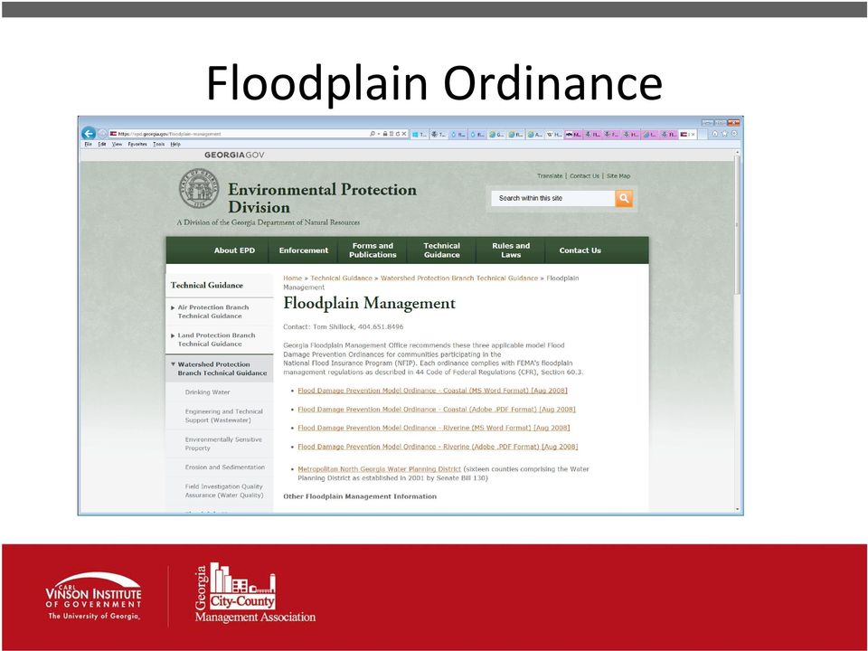
14 Floodplain Ordinance
15 Wait. There s More FEMA Map Modernization Project Development of building standards in high risk areas Flood insurance available within participating communities. New Flood maps Update floodplain ordinance Some new people in the floodplain; some people out.

16

17 GA Risk M.A.P. Program Upper & Middle Chattahoochee Watersheds. Cobb, Coweta, DeKalb, Douglas, Forsyth, Fulton, & Gwinnett Counties Georgia Coastal Project Bryan, Camden, Charlton, Chatham, Effingham, Glynn, Liberty, Long, & McIntosh Counties Newton County Discovery Projects Middle Chattahoochee - Lake Harding, Upper Ocmulgee

18 Flood Insurance Rates: Are they rising? Why?

19

20 So Congress passed a law in Biggert Waters: 25% Rate Increases Effective Immediately Subsidized non primary residences in SFHA; severe repetitive loss/properties with cumulative flood claim damage totaling more than the value of the property, etc. Full Rates Immediately First time policy purchase; renewal after a policy lapse; policy purchase after a property sale. 20% Increase in Rates 2014 All remaining subsidized or grandfathered properties phased out with new maps.

21 People Were Upset
22 So Congress passed another law in BOTTOM LINE: Not as bad, but rates are rising for many. The law will be revisited in Rates will continue to rise. The population is growing, and more people are living in floodplains. Communities are looking for ways to ease the burden on policyholders.
23 The Community Rating System (CRS)
24 Community Rating System (CRS) NFIP voluntary program offers discounts on flood insurance to reward good floodplain management within a community Community = municipality, county Established in 1990 Created to encourage participation in the NFIP in order to spread risk and allow program to be more effective
25 Goals of the CRS Reduce flood damage to insurable property Strengthen and support the insurance aspects of the NFIP Encourage a comprehensive approach to floodplain management
26 CRS Rating Table Class Points Premium Reduction % % % % % % % % % %
27 As of May 2012, 527 in NFIP. Of these communities, 36 (or 7%) participate in CRS. Of the top 50 Georgia communities, in terms of total Flood Insurance policies held by residents, 21 participate in the CRS. The remaining 29 communities present an outreach opportunity for encouraging participation in the CRS.
28 Joining CRS: Getting Started
29
30
31 Steps to Join Any community in full compliance with the rules and regulations of the NFIP may, at any time, request a Community Rating System (CRS) classification. To request a CRS classification, follow these steps: 1. Provide a letter of interest, signed by the community's chief elected official, to the Federal Emergency Management Agency (FEMA) Regional Office. A sample letter of interest is in the CRS Quick Check. 2. Provide documentation showing that your community is implementing CRS activities that warrant at least 500 credit points. The CRS Quick Check tool assists with this documentation. 3. Send the items listed above to your ISO/CRS Specialist. 4. With the approval of the FEMA Regional Office the ISO/CRS Specialist will schedule a meeting with your community's representatives, called a verification visit, to work through the application process. 5. Communities interested in participating in the CRS also must appoint a community CRS Coordinator.
32 The CRS Coordinator The CRS Coordinator is designated by the community's chief elected official (CEO) to serve as the point of contact with the community, FEMA, and the Insurance Services Office (ISO) for CRS matters. Duties include: Attaining familiarity with the CRS operation, prerequisites, and credited activities; Assembling and coordinating materials for the community's CRS application, cycle verification visits, and annual recertification; Completing and signing CRS Activity Worksheets, as appropriate, for credit; and Coordinating verification visits with the ISO/CRS Specialist.
33 Joining CRS: Terminology New Application Cycle Verification Recertification Modification
34 CRS Activity Examples Public Information Elevation certificates, outreach, hazard disclosure Mapping and Regulations Open space preservation, stormwater management Flood Damage Reduction Acquisition/relocation, floodplain management planning Warning and Response Flood warning and response, dams, levees
35
36 300 Series: Public Information
37
38
39 400 Series: Mapping & Regulations
40 CRS and Open Space Credit for measures that either require or incentivize preventing development in flood hazard areas. A community may receive up to 1,970 credits for open space. The average Georgia community earns 130 credits. Fayette County stands out: 624 Credits
41 CRS and Open Space 1. Be located in the floodplain. 2. Be open space. Vacant land alone does not qualify. The land must contain no buildings, no impervious surfaces, and not be filled or used to store materials. 3. Be preserved as open space.
42 CRS and Open Space HOW MUCH CREDIT IS AVAILABLE FOR OPEN SPACE PRESERVATION? Up to 1,450 credits. Deed The open space land must contain a restriction in the deed that prohibits new buildings on the Restrictions land, the deed restriction must transfer to future owners (run with the land), and can only be Up to 50 amended by a court for just cause. credits. Documentation Required: A copy of the actual deed restriction for each property along with the impact map. Natural Functions Open Space Up to 350 credits. The open space land must either be in an undeveloped state not developed, graded, or farmed or that have been returned to a state approximating the pre development condition. Documentation Required: 1. Each parcel must have documentation that supports the natural floodplain functions prepared by a qualified entity, such as a habitat conservation plan, natural areas inventory, green infrastructure plan, or a memo or letter signed by professional in the natural sciences attesting to the natural functions of the parcel. The CRS Coordinator s Manual also provides a Natural Floodplain Functions Form that may be used. 2. Impact adjustment map. 3. A copy of any plan and the adoption thereof if the parcel is receiving additional credit. 4. Copies or photographs of any educational material used.
43 CRS and Open Space Special Floodrelated Hazards Open Space Up to 50 credits. Natural Shoreline Protection Up to 120 credits. Credits are available for Special Flood related Hazards Open Space (SFHOS), which is open space directly related to coastal erosion, tsunamis, inland flood hazards from uncertain flow paths (alluvial fans, channel migration, etc.), closed basin lakes, ice jams, land subsidence, and mudflows. These credits apply to particular circumstances are not generally applicable. Credit is available for allowing natural stream channels and shorelines to follow the courses dictated by natural process and for encouraging natural shorelines that provide water quality benefits for runoff. The program must prohibit filling, dredging, and armoring existing channels and shorelines, including beach nourishment projects. The program may allow alterations that improve natural floodplain functioning such as removing a levee, habitat restoration, and plantings. Two types of programs are credited: Programs that protect channels. This includes programs that govern construction activities and written policies followed on public lands such as city parks. Credit is only available to channels or shorelines approximately in their natural state without substantial human intervention. Programs that restore impaired channels. This covers programs that actively restore floodplain functions; regulations that require restoration activities by developers are credited under 422.e. Required Documentation: 1. A map or list of parcels preserved and which credits for which they qualify. 2. Documentation about how it is preserved, i.e. documentation from the owner or the pertinent regulatory language. 3. For parcels preserved outside the SFHA, documentation that the floodplain regulation are in effect in the area. 4. An impact adjustment map.
44 CRS and Open Space OTHER FLOODPLAIN PROTECTIONS: Credits for Incentivizing Floodplain Protection. Open Space Communities can receive credit for regulations that encourage developers to set aside floodprone areas. Credit is adjusted based on the ratio of the area affected by the OSI regulation to Incentives Up to 250 credits. the floodplain area. Open space incentives include: density transfers, transfers of development rights, bonuses for avoiding the floodplain, planned unit developments, cluster development, greenway and setback rules, and open space ratio credits. Low density Zoning Up to 600 credits. Documentation Required: 1. Relevant ordinance language. 2. OSP Impact Adjustment Map showing areas credited for OSI. 3. Documentation regulating flood prone non SFHA areas. 4. Site plans and final plats documenting how ordinances have been applied. Land that does not qualify for open space credits may create credits with low density zoning. The qualifying area must be zoned with lot sizes of at least five acres. Agricultural, conservation, or large residential lots are all permitted uses. The regulation must be a zoning ordinance; other ordinances such a minimum lot size for septic systems are not credited. Documentation Required: 1. Zoning language explaining the density requirements. 2. Impact adjustment map. 3. If extra credit is claimed for low density zoning in flood prone non SFHA areas, documentation that the regulations are in effect in that area.
45 So how did Fayette County do it?
46 Fayette County Watershed Protection Ordinance Adopted in 1987 Required by GAEPD s to develop water supply reservoirs within Fayette County. Adopted prior to Environmental Planning Criteria ratified by GAEPD in Protects both streams and floodplains Credit: Vanessa Birrell
47 Watershed Protection Ordinance Buffer Requirements Any property within 1,000 ft. of reservoir 150 ft. buffer from normal pool or BFE (whichever is greater)flint River, Whitewater Creek (and streams within 1,000 ft.) 400 ft. buffer from wrested vegetation or 100 ft. from BFE (whichever is greater) All other perennial streams and state waters within Flint River and Whitewater Creek watersheds 100 ft. buffer from wrested vegetation or 50 ft. from BFE (whichever is greater) Credit: Vanessa Birrell
48 500 Series: Flood Damage Reduction Activities
49 CRS and Acquisition/Relocation Credit available for removing insurable buildings from the floodplain Emphasis on the value of natural floodplain functions Up to 2,250 points available (4+ classes/20% premium reduction) Opened lands must qualify for open space preservation; get CRS credit for both
50 600 Series: Flood Warning & Response
51
52
53 67,918 policies in Georgia Georgians pay $47.4 million in premiums CRS savings = $6.6 million
54
MANAGING FLOODPLAINS CRS AND THE NFIP
 MANAGING FLOODPLAINS CRS AND THE NFIP Landon K. Smith, CBO, CFM BUILDING OFFICIAL / FLOODPLAIN ADMINISTRATOR EMERGENCY MANAGEMENT DIRECTOR CITY OF ORANGE BEACH, ALABAMA www.aafmfloods.org AAFM Users Group
Town of Hingham. Changes to Flood Insurance Rate Maps and Flood Insurance Costs Frequently Asked Questions
 Town of Hingham 1. What is a floodplain? Changes to Flood Insurance Rate Maps and Flood Insurance Costs Frequently Asked Questions A floodplain is an area of land where water collects, pools and flows
COMMUNITY CERTIFICATIONS
 National Flood Insurance Program Community Rating System COMMUNITY CERTIFICATIONS Public reporting burden for this form is estimated to average 4 hours for annual recertification, per response. The burden
Floodplain Management - What You Need to Know
 The National Program and the Community Rating System Shannon Hulst, Wetlands Watch March 26, 2014 What We are Doing with the CRS Partnership with VIMS & VCPC (W&M Law School) VCPC working with DCR to ensure
Chapter 10. The National Flood Insurance Program
 Chapter 10 The National Flood Insurance Program Chapter Overview The National Flood Insurance Program has been mentioned in numerous instances in preceding chapters. Its time has arrived in this course!
Flood Insurance Changes Come to Virginia Wetlands Watch, October 2013
 Flood Insurance Changes Come to Virginia Wetlands Watch, October 2013 Major changes to the National Flood Insurance Program (NFIP), including rate increases that will affect many Middle Peninsula residents,
FLOOD PROTECTION PAY-OFFS
 March 2015 FLOOD PROTECTION PAY-OFFS A LOCAL GOVERNMENT GUIDE TO THE COMMUNITY RATING SYSTEM Lead Author: Shannon Hulst Jarbeau, CFM Contributing Author: Mary-Carson Stiff, JD, CFM Review Draft W E T L
Town of Chatham Department of Community Development
 Town of Chatham Department of Community Development TOWN ANNEX 261 GEORGE RYDER ROAD 02633 CHATHAM, MA TELEPHONE (508) 945-5168 FAX (508) 945-5163 FEMA FLOOD MAP UPDATE & PROPOSED ZONING BYLAW AMENDMENT
What We Do: Wetlands, Wildlife Habitat & Flood Hazards in the Root River Watershed
 What We Do: Wetlands, Wildlife Habitat & Flood Hazards in the Root River Watershed presented by Ceil Strauss, State Floodplain Manager DNR Ecological & Water Resources 1 EWR Roles In Floodplains Regulatory:
Biggert Waters Flood Insurance Reform Act of 2012
 Biggert Waters Flood Insurance Reform Act of 2012 Impact of National Flood Insurance Program (NFIP) Changes Note: This Fact Sheet deals specifically with Sections 205 and 207 of the Act. I n 2012, the
Develop hazard mitigation policies and programs designed to reduce the impact of natural and human-caused hazards on people and property.
 6.0 Mitigation Strategy Introduction A mitigation strategy provides participating counties and municipalities in the H-GAC planning area with the basis for action. Based on the findings of the Risk Assessment
Changes Coming to the National Flood Insurance Program What to Expect
 Changes Coming to the National Flood Insurance Program What to Expect Impact of changes to the NFIP under the Biggert-Waters Act Norm Ashford 303-235-4912 Norman.ashford@dhs.gov Erin May 303-299-7873 emay@ostglobal.com
CRS State Profile: New Mexico
 CRS State Profile: New Mexico This is a profile for communities in your state that are participating in the Community Rating System (CRS). This profile is intended to provide information to the State NFIP
Understanding the National Flood Insurance Program (NFIP)in Georgia Jeff Brady September 10, 2015 2:45 PM 4:15 PM
in Georgia Jeff Brady September 10, 2015 2:45 PM 4:15 PM") Education Session H Understanding the National Flood Insurance Program (NFIP)in Georgia Jeff Brady September 10, 2015 2:45 PM 4:15 PM GREC Course Code # 66076 / 66077 / 66078 You must attend two 1½-hour
Education Session H Understanding the National Flood Insurance Program (NFIP)in Georgia Jeff Brady September 10, 2015 2:45 PM 4:15 PM GREC Course Code # 66076 / 66077 / 66078 You must attend two 1½-hour
The Changing Landscape of the National Flood Insurance Program: A Federal Perspective. Niki L. Pace *
 The Changing Landscape of the National Flood Insurance Program: A Federal Perspective Niki L. Pace * In the last few years, the National Flood Insurance Program (NFIP) has seen changes at both the legislative
Flood Risk Management
 Flood Risk Management Value of Flood Risk Management Every year floods sweep through communities across the United States taking lives, destroying property, shutting down businesses, harming the environment
Flood Risk Management
 Flood Risk Management Value of Flood Risk Management Value to Individuals and Communities Every year floods sweep through communities across the United States taking lives, destroying property, shutting
Homeowner Flood Insurance Affordability Act of 2014 Section by Section Summary
 Homeowner Flood Insurance Affordability Act of 2014 Section by Section Summary On March 21, 2014, President Obama signed into law the Homeowner Flood Insurance Affordability Act of 2014 (HIFAA) (P.L. 113-89).
SARASOTA COUNTY Dedicated to Quality Service
 SARASOTA COUNTY Dedicated to Quality Service Florida Flood Map Updates and the National Flood Insurance Program Joy Duperault, CFM State of Florida NFIP Coordinator Desiree (Des) Companion, CFM CRS Coordinator
Flood Insurance - Factors Affecting the Rate Changes
 Changes Coming to the National Flood Insurance Program What to Expect Impact of changes to the NFIP under Section 205 of the Biggert-Waters Act Changes are Coming to the NFIP Congress passed the Flood
Stormwater Management and Open Space Preservation in Virginia
 Go Green, Save Money: Lowering Flood Insurance Rates in Virginia with Stormwater Management and Open Space Adele Young J.D. Virginia Coastal Policy Clinic at William & Mary Law School Kristen Clark, J.D.
Changes Coming to the National Flood Insurance Program What to Expect. Impact of changes to the NFIP under Section 205 of the Biggert-Waters Act
 Changes Coming to the National Flood Insurance Program What to Expect Impact of changes to the NFIP under Section 205 of the Biggert-Waters Act Why the Changes to the NFIP? 1968: Congress created the NFIP
Building Olive s Flood Resiliency
 Building Olive s Flood Resiliency Informed Flood Mitigation Planning The Local Flood Analysis Flood Advisory Committee Meeting #1 Town of Olive s Community Room 4/14/15 What is an LFA? 1. Uses science
NYSDEC Optional Additional Language Model Local Law for Flood Damage Prevention Optional Additional Language
 NYSDEC General Comments. The contains language that complies with the floodplain management requirements of the National Flood Insurance Program (NFIP) contained in federal regulations 44 CFR 60.3 through
King County Flood Hazard Management Plan Update Cedar/ Sammamish Rivers. Public Meeting December 5, 2012
 King County Flood Hazard Management Plan Update Cedar/ Sammamish Rivers Public Meeting December 5, 2012 Goals of the Presentation Cedar and Sammamish R. Plan Update Context - Brief summary info about the
And Flood Resilient Design in Austin, Texas
 And Flood Resilient Design in Austin, Texas The good, the bad and the ugly; What does this video show us? Riverine Flooding versus Flash Flooding Flash Flood Alley Stretches along the I 35 corridor between
UNIT 9: FLOOD INSURANCE AND FLOODPLAIN MANAGEMENT
 UNIT 9: FLOOD INSURANCE AND FLOODPLAIN MANAGEMENT In this unit While you are probably not an insurance agent, you should be aware of the close relationship between floodplain management and flood insurance.
UNIT 9: FLOOD INSURANCE AND FLOOD MANAGEMENT
 UNIT 9: FLOOD INSURANCE AND FLOOD MANAGEMENT In this unit While you are probably not an insurance agent, you should be aware of the close relationship between floodplain management and flood insurance.
1. Why is Lee County getting new flood hazard maps? 3. What are the benefits of the new flood hazard maps?
 1. Why is Lee County getting new flood hazard maps? Flood hazard maps, also known as Flood Insurance Rate Maps (FIRMs), are important tools in the effort to protect lives and property. They indicate the
More Changes Coming to the National Flood Insurance Program What to Expect
 More Changes Coming to the National Flood Insurance Program What to Expect Impact of changes to the NFIP under Homeowner Flood Insurance Affordability Act of 2014 More Changes are Coming to the NFIP On
Frequently Asked Questions (FAQs) 1. Why is the City of Tucson getting new flood hazard maps? 2. Who is responsible for modernizing the maps?
 1. Why is the City of Tucson getting new flood hazard maps? 2. Who is responsible for modernizing the maps?") Frequently Asked Questions (FAQs) 1. Why is the City of Tucson getting new flood hazard maps? 2. Who is responsible for modernizing the maps? 3. What is a Flood Hazard Map? 4. What are the benefits of
Frequently Asked Questions (FAQs) 1. Why is the City of Tucson getting new flood hazard maps? 2. Who is responsible for modernizing the maps? 3. What is a Flood Hazard Map? 4. What are the benefits of
UNIT 6: ADDITIONAL REGULATORY MEASURES
 UNIT 6: ADDITIONAL REGULATORY MEASURES In this unit The NFIP encourages states and communities to implement flood-plain management programs that go beyond NFIP minimum requirements since local flood hazards
6.01 FEMA. 6.02 National Flood Insurance Program (NFIP)
") CHAPTER 6 FEMA AND FLOODPLAIN MANAGEMENT 6.01 FEMA The Federal Emergency Management Agency (FEMA) is an agency of the United States Department of Homeland Security. FEMA is tasked with responding to, planning
CHAPTER 6 FEMA AND FLOODPLAIN MANAGEMENT 6.01 FEMA The Federal Emergency Management Agency (FEMA) is an agency of the United States Department of Homeland Security. FEMA is tasked with responding to, planning
The Biggert-Waters Flood Insurance Reform Act 2012. Signed by the President July 6, 2012
 The Biggert-Waters Flood Insurance Reform Act 2012 Signed by the President July 6, 2012 Biggert-Waters 2012 (BW-12) What Does it Do? Reauthorizes the National Flood Insurance Program (NFIP) for 5 years
National Flood Insurance Program Community Rating System
 National Flood Insurance Program Community Rating System A Strategic Plan for the Community Rating System Fiscal Years 2008 2013 2008 EXECUTIVE SUMMARY Although the Community Rating System (CRS) has been
Lower Raritan Watershed Management Area Stormwater & Flooding Subcommittee Strategy Worksheet LRSW-S3C1
 Strategy Name: Reduce Existing Potential for Flood Damages LRSW-S3C1. Develop and implement a program to: Minimize flood damages through the use of structural measures. Minimize flood damages through the
Flood insurance why have it? Where can I buy it?
 Flood insurance why have it? Where can I buy it? NOAA/National Weather Service Des Moines, Iowa June 2010 Thank you for your interest in flood insurance. Below are frequently asked questions and answers
Please see Section IX. for Additional Information:
 The Florida Senate BILL ANALYSIS AND FISCAL IMPACT STATEMENT (This document is based on the provisions contained in the legislation as of the latest date listed below.) BILL: CS/SB 1094 Prepared By: The
Insurance Questions: Clothes washers and dryers, food freezers and the food in them are covered if there is contents coverage.
 Introduction: Floods occur when runoff from rain or snowmelt exceeds the capacity of rivers, stream channels or lakes and overflows onto adjacent land. Floods can also be caused by storm surges and waves
Changes to the National Flood Insurance Program What to Expect
 Changes to the National Flood Insurance Program What to Expect Impact of changes to the NFIP under Homeowner Flood Insurance Affordability Act of 2014 More Changes are Coming to the NFIP On March 21, 2014,
Changing Flood Maps: A Guide for Homeowners and Consumers
 Changing Flood Maps: A Guide for Homeowners and Consumers The flood maps in your community are being changed. What does this mean to you? Flood maps, also known as Flood Insurance Rate Maps or FIRMs, are
Please see Section IX. for Additional Information:
 The Florida Senate BILL ANALYSIS AND FISCAL IMPACT STATEMENT (This document is based on the provisions contained in the legislation as of the latest date listed below.) BILL: CS/SB 1094 Prepared By: The
3. The submittal shall include a proposed scope of work to confirm the provided project description;
 QIN Shoreline Master Program Project Summary The Shoreline Master Program (SMP) development process for the Quinault Indian Nation (QIN) includes the completion of inventory and analysis report with corresponding
How To Amend A Stormwater Ordinance
 Regulatory Alternatives to Address Stormwater Management and Flooding in the Marlboro Street Study Area Alternative 1: Amend Existing Local Regulations This proposed alternative provides an incremental
Monmouth County Preliminary Flood Insurance Study and Flood Insurance Rate Maps Release
 Monmouth County Preliminary Flood Insurance Study and Flood Insurance Rate Maps Release Thomas Song, Program Specialist FEMA Region 2 January 31, 2014 Agenda Introduction Review: Preliminary Work Maps
FEMA Updates Flood Plain Information For 2006
 Flood Insurance Rate Map Changes Informational Meeting For Property Owners Entering the Floodplain Durant Center February 23, 2011 Introductions City of Alexandria Transportation and Environmental Services
Why should communities invest in resiliency? What are the steps communities can take to become more resilient?
 Community Preparedness for Flood Resiliency Nina Peek, AICP New York Planning Federation Board of Directors Senior Technical Director AKRF, Inc. Focus of Today s Presentation Why should communities invest
Updated Federal Emergency Management Agency Flood Insurance Rate Maps and Zoning Ordinance Update. July 16, 2015 Policy Committee
 Updated Federal Emergency Management Agency Flood Insurance Rate Maps and Zoning Ordinance Update July 16, 2015 Policy Committee FEMA Map Update Costal Analysis and mapping study by FEMA in 2009 Changes
APRIL 2013 BIGGERT-WATERS SPECIAL EDITION
 News from Region X Inside this Issue April 2013 Volume 3, Issue 5 SPECIAL EDITION Biggert-Waters Reform Biggert-Waters Reform The National Flood Insurance Program (NFIP), administered by the Department
A. Flood Management in Nevada
 Nevada Division of Water Planning A. Flood Management in Nevada Introduction Flooding has been a concern for Nevada communities since the first settlers moved to the territory in the mid-1800 s. Fourteen
Overview. Homeowner Flood Insurance Affordability Act
 Homeowner Flood Insurance Affordability Act Overview On March 21, 2014, President Obama signed the Homeowner Flood Insurance Affordability Act of 2014 into law. This law repeals and modifies certain provisions
1.7.0 Floodplain Modification Criteria
 1.7.0 Floodplain Modification Criteria 1.7.1 Introduction These guidelines set out standards for evaluating and processing proposed modifications of the 100- year floodplain with the following objectives:
Protecting Floodplain. While Reducing Flood Losses
 Protecting Floodplain Natural and Beneficial i Functions While Reducing Flood Losses Jon Kusler Association of State Wetland Managers 518 872 1804; jon.kusler@aswm.org Report available at: http://aswm.org/pdf_lib/nbf.pdf
FEMA Takes Action to Implement National Flood Insurance Reform Act
 FEMA Takes Action to Implement National Flood Insurance Reform Act The implementation of the National Flood Insurance Reform Act of 1994 requires a great deal of coordination and support within the Federal
Frequently Asked Questions (FAQs)
") 1. Why is Cedar Rapids getting new flood hazard maps? Flood hazard maps, also known as Flood Insurance Rate Maps (FIRMs), are important tools in the effort to protect lives and properties in Cedar Rapids.
1. Why is Cedar Rapids getting new flood hazard maps? Flood hazard maps, also known as Flood Insurance Rate Maps (FIRMs), are important tools in the effort to protect lives and properties in Cedar Rapids.
Chapter 6: Mitigation Strategies
 Chapter 6: Mitigation Strategies This section of the Plan describes the most challenging part of any such planning effort the development of a Mitigation Strategy. It is a process of: 1. Setting mitigation
rescue and relief efforts in the aftermath of flooding, (iii) repair of flood damaged public facilities and utilities, and
 repair of flood damaged public facilities and utilities, and") 1. Purpose (1) It is the purpose of this Ordinance to protect human life, health, and property from flood conditions, to preserve the ability of floodplains to carry and discharge a base flood, and to
1. Purpose (1) It is the purpose of this Ordinance to protect human life, health, and property from flood conditions, to preserve the ability of floodplains to carry and discharge a base flood, and to
NAPA COUNTY WATERSHED SYMPOSIUM
 Planning, Building, and Environmental Services NAPA VALLEY GROWTH NAPA COUNTY WATERSHED SYMPOSIUM Plunging Forward May 15, 2015 1 YOU CAN T CROSS THE SEA MERELY BY STANDING AND STARING AT THE WATER. Rabindranath
Changes Coming to the National Flood Insurance Program What to Expect. Impact of changes to the NFIP under Section 205 of the Biggert-Waters Act
 Changes Coming to the National Flood Insurance Program What to Expect Impact of changes to the NFIP under Section 205 of the Biggert-Waters Act Changes are Coming to the NFIP Congress passed the Flood
Division of Water Frequently asked floodplain questions
 Division of Water Frequently asked floodplain questions Q: Where can I find copies of the floodplain mapping? A: Local floodplain administrators will have copies of the FEMA mapping. (Generally the local
National Flood Insurance Program Community Rating System. CRS Record-Keeping Guidance
 National Flood Insurance Program Community Rating System CRS Record-Keeping Guidance 2007 Note on this edition: This document has been revised to reflect the following 2006 and 2007 changes in the CRS
Floodplain Development Land Use Review
 COMMUNITY DEVELOPMENT DEPARTMENT Planning Division P.O. Box 490 333 Broadalbin Street SW Albany, OR 97321 Phone 541-917-7550 Fax 541-791-0150 www.cityofalbany.net Floodplain Development Land Use Review
The National Flood Insurance Program (NFIP)
") The National Flood Insurance Program (NFIP) Insurance Information Institute 110 William Street New York, NY 10038 (212) 346-5500 www.iii.org October 2005 Robert P. Hartwig, Ph.D., CPCU Senior Vice President
The National Flood Insurance Program (NFIP) Insurance Information Institute 110 William Street New York, NY 10038 (212) 346-5500 www.iii.org October 2005 Robert P. Hartwig, Ph.D., CPCU Senior Vice President
Relationship between Floodplain Management and Flood Insurance
 Relationship between Floodplain Management and Flood Insurance The National Flood Insurance Program [is] a voluntary program based on a mutual agreement between the Federal government and the local community:
Adopted 9/23/98 CHATTAHOOCHEE CORRIDOR PLAN. The goals of the Chattahoochee Corridor Plan (hereinafter also referred to as the Plan ) are:
 are:") CHATTAHOOCHEE CORRIDOR PLAN Adopted 9/23/98 PART 1: GOALS. POLICY. COVERAGE. A. Goals The goals of the Chattahoochee Corridor Plan (hereinafter also referred to as the Plan ) are: 1. Preservation and protection
CHATTAHOOCHEE CORRIDOR PLAN Adopted 9/23/98 PART 1: GOALS. POLICY. COVERAGE. A. Goals The goals of the Chattahoochee Corridor Plan (hereinafter also referred to as the Plan ) are: 1. Preservation and protection
More Changes Coming to the National Flood Insurance Program What to Expect
 More Changes Coming to the National Flood Insurance Program What to Expect Homeowner Flood Insurance Affordability Act 2014 April 2015 Changes Mark Lujan, CFM, ANFI Biggert Waters Reform Act Targets: Section
California Alluvial Fan Task Force
 California Alluvial Fan Task Force County of San Diego Alluvial Fan Flooding and Risk Reduction Sara Agahi, PE, CFM January 4, 2008 Outline of Presentation Show location of San Diego County Alluvial Fan
Appendix J Online Questionnaire
 Appendix J Online Questionnaire In accordance with the Paperwork Reduction Act, this questionnaire was approved by the Office of Management and Budget (OMB). The OMB control number and expiration date
Flood Insurance: Government Backed vs. Private Market Alternatives
 Flood Insurance: Government Backed vs. Private Market Alternatives National Hurricane Conference Austin, Texas April 2, 2015 Jeanne M. Salvatore, Senior Vice President, Public Affairs and Chief Communications
Frequently Asked Questions (FAQs)
") 1. Why is Wellesley getting new flood plain maps? Flood plain or flood hazard maps, also known as Flood Insurance Rate Maps (FIRMs), are important tools in the effort to protect lives and properties in
1. Why is Wellesley getting new flood plain maps? Flood plain or flood hazard maps, also known as Flood Insurance Rate Maps (FIRMs), are important tools in the effort to protect lives and properties in
Flood Plain Reclamation to Enhance Resiliency Conserving Land in Urban New Jersey
 Flood Plain Reclamation to Enhance Resiliency Conserving Land in Urban New Jersey Rutgers Cooperative Extension Water Resources Program Christopher C. Obropta, Ph.D., P.E. Email: obropta@envsci.rutgers.edu
MITIGATION STRATEGY OVERVIEW
 ALL-HAZARDS MITIGATION PLAN MITIGATION STRATEGY Code of Federal Regulations (CFR) Requirement 44 CFR Part 201.6(c)(3)(i): The mitigation strategy shall include a description of mitigation goals to reduce
Shooks Run Drainage Study Basic Terminology
 Shooks Run Drainage Study Basic Terminology PREPARED FOR: PREPARED BY: City of Colorado Springs CH2M DATE: April 9, 2015 Introduction This document is intended to provide an introduction to Colorado Springs
Risk MAP Project Coordination Meeting: Burlington County, NJ. FEMA REGION II May 8, 2013 Westampton, New Jersey
 Risk MAP Project Coordination Meeting: Burlington County, NJ FEMA REGION II May 8, 2013 Westampton, New Jersey Agenda Introductions Purpose of this Meeting Risk MAP Program Overview Anticipated Project
REBUILDING BELMAR ABFE FLOOD MAPS &THE REBUILDING PROCESS
 REBUILDING BELMAR ABFE FLOOD MAPS &THE REBUILDING PROCESS REBUILDING BELMAR ABFE Maps Preliminary FIRM Maps Flood Insurance Increased Cost of Compliance (ICC) Elevation of Structures Building Permits Acronyms
Flood Damage Prevention in Delaware County, NY
 Flood Damage Prevention in Delaware County, NY Susquehanna Basin 2 Villages, 8 Hamlets Schoharie Basin 1 Hamlet Cannonsville Basin 4 Villages, 6 Hamlets Pepacton Basin 2 Villages, 6 Hamlets Upper Delaware
2012 Flood Hazard Prevention By Building and Planning Operations Manager Lou Ann Patellaro
 2012 Flood Hazard Prevention By Building and Planning Operations Manager Lou Ann Patellaro In 1968, Congress created the National Flood Insurance Program (NFIP) to provide affordable flood insurance to
Association of State Flood Managers Annual Conference Wednesday, June 4, 2014
 Association of State Flood Managers Annual Conference Wednesday, June 4, 2014 Hillsborough County, In the Trenches Local Mitigation Eugene Henry, CFM, AICP Hazard Mitigation Manager Floodplain Administrator
CHAPTER 3 page 69 LOCAL FLOODPLAIN REGULATIONS AND NFIP STANDARDS
 CHAPTER 3 page 69 LOCAL FLOODPLAIN REGULATIONS AND NFIP STANDARDS LOCAL FLOODPLAIN REGULATIONS AND NFIP STANDARDS, page 69 THE PARTICIPATION OF A COMMUNITY IN THE NFIP IS MADE POSSIBLE BY ITS ADOPTION
1. Why is the City of Dickinson getting new flood hazard maps?
 FREQUENTLY ASKED QUESTIONS 1. Why is the City of Dickinson getting new flood hazard maps? Flood hazard maps, also known as Flood Insurance Rate Maps (FIRMs), are important tools in the effort to protect
The answers to some of the following questions are separated into two major categories:
 Following the recent flooding events for Front Range communities in Colorado, property owners, communities, and the National Flood Insurance Program are being presented with some new challenges in the
FEMA Flood Insurance. What s Next?
 FEMA Flood Insurance What s Next? Why the Changes to the NFIP? 1968: Congress created the NFIP to make affordable flood insurance generally available (flood damage is not covered by a typical homeowners
2014 Delaware Ordinance Workshops and assistance. Higher Standards identified by Delaware Senate Bill 64
 INCREASING FLOOD RESILIENCY THROUGHT IMPROVED FLOOD CODES Michael S. Powell, Hazard Mitigation Program Manager, DNREC New Coastal Study and Floodplain Maps 2014 Delaware Ordinance Workshops and assistance
NATIONAL FLOOD INSURANCE PROGRAM (NFIP): THE BASICS & UPDATE
: THE BASICS & UPDATE") May 19, 2015 NATIONAL FLOOD INSURANCE PROGRAM (NFIP): THE BASICS & UPDATE ON THE CURRENT STATE Mary-Carson Stiff, JD, CFM Shannon Hulst Jarbeau, CFM Closing the Deal: How to respond to the new realities
May 19, 2015 NATIONAL FLOOD INSURANCE PROGRAM (NFIP): THE BASICS & UPDATE ON THE CURRENT STATE Mary-Carson Stiff, JD, CFM Shannon Hulst Jarbeau, CFM Closing the Deal: How to respond to the new realities
April 3, 2014. Write Your Own (WYO) Principal Coordinators and the National Flood Insurance Program (NFIP) Servicing Agent
 Principal Coordinators and the National Flood Insurance Program (NFIP) Servicing Agent") U.S. Department of Homeland Security 500 C Street, SW Washington, DC 20472 W-14011 April 3, 2014 MEMORANDUM FOR: Write Your Own (WYO) Principal Coordinators and the National Flood Insurance Program (NFIP)
U.S. Department of Homeland Security 500 C Street, SW Washington, DC 20472 W-14011 April 3, 2014 MEMORANDUM FOR: Write Your Own (WYO) Principal Coordinators and the National Flood Insurance Program (NFIP)
Changes Coming to the National Flood Insurance Program What to Expect Impact of changes to the NFIP under Section 205 of the Biggert-Waters Act
 Changes Coming to the National Flood Insurance Program What to Expect Impact of changes to the NFIP under Section 205 of the Biggert-Waters Act Joe Cecil, Federal Insurance and Mitigation Administration
Focus Areas: Program/Project Management, Repetitive Loss Properties, Flood Map Modernization, Standard Business Processes.
 NATIONAL FLOOD INSURANCE PROGRAM Focus Areas: Program/Project Management, Repetitive Loss Properties, Flood Map Modernization, Standard Business Processes. Sponsoring Executive: Lead Executive: Susan Shuback,
PLANNING FOR POST-DISASTER RECOVERY BRIEFING PAPERS FLOOD INSURANCE AND DESIGN REQUIREMENTS
 06 PLANNING FOR POST-DISASTER RECOVERY BRIEFING PAPERS FLOOD INSURANCE AND DESIGN REQUIREMENTS Flood losses are increasing nationwide. A community may take more than a decade to fully recover from a flood,
FREQUENTLY ASKED QUESTIONS ON THE FLOOD RESISTANT PROVISIONS OF THE 2010 FLORIDA BUILDING CODE
 STATE FLOODPLAIN MANAGEMENT OFFICE FREQUENTLY ASKED QUESTIONS ON THE FLOOD RESISTANT PROVISIONS OF THE 2010 FLORIDA BUILDING CODE The 2010 Florida Building Code (FBC) will include flood resistant provisions
CASS COUNTY COMMISSION POLICY MANUAL 38.07 ADOPTED DATE: FEBRUARY 2, 1998 PAGE 1 OF 9
 CASS COUNTY COMMISSION POLICY MANUAL 38.07 SUBJECT: ORDINANCE #1998-2 (FLOOD DAMAGE PREVENTION) ADOPTED DATE: FEBRUARY 2, 1998 PAGE 1 OF 9 NORTH DAKOTA COUNTY OF CASS ORDINANCE #1998-2 Be it ordained and
Changes to the National Flood Insurance Program What to Expect
 Changes to the National Flood Insurance Program What to Expect Impact of changes to the NFIP under Homeowner Flood Insurance Affordability Act of 2014 October 2014 Key Priorities FEMA continues to analyze
Flood Insurance Rating: Facts and Factors. Jana Green, CFM 2013 NJAFM Annual Conference October 17, 2013 Concurrent Session #3
 Flood Insurance Rating: Facts and Factors Jana Green, CFM 2013 NJAFM Annual Conference October 17, 2013 Concurrent Session #3 Purpose of Presentation THIS PRESENTATION IS INTENDED TO PROVIDE: A clear and
MT-EZ. Amendments to National Flood Insurance Program Maps. Application Form for Single Residential Structure Lot. FEMA Form 81-92 Series August 2004
 MT-EZ Amendments to National Flood Insurance Program Maps Application Form for Single Residential Structure Lot FEMA Form 81-92 Series August 2004 AMENDMENTS TO NATIONAL FLOOD INSURANCE PROGRAM MAPS APPLICATION
King County, Washington Policies and Practice for the Use of Eminent Domain For Flood Risk Reduction
 King County, Washington Policies and Practice for the Use of Eminent Domain For Flood Risk Reduction Introduction Eminent domain refers to the power possessed by the state over all property within the
FLOOD PROTECTION BENEFITS
 IV. (340 points) Flood Protection Benefits A. Existing and potential urban development in the floodplain (50) 1. Describe the existing and potential urban development at the site and the nature of the
Section 6: Mitigation Strategy
 Section 6: Mitigation Strategy The Mitigation Strategy section provides the blueprint for the participating jurisdictions in the Unifour Region to follow to become less vulnerable to the negative effects
Communicating the Flood Risk
 Communicating the Flood Risk National Hurricane Conference Orlando, Florida April 17, 2014 Jeanne M. Salvatore, Senior Vice President, Public Affairs and Chief Communications Officer @JeanneSalvatore Insurance
UNIT 5: THE NFIP FLOODPLAIN MANAGEMENT REQUIREMENTS
 UNIT 5: THE NFIP FLOODPLAIN MANAGEMENT REQUIREMENTS In this unit This unit reviews the NFIP standards for floodplain development, including: What maps, base flood elevations and other flood data must be
Flood Insurance for Risk Managers
 Flood Insurance for Risk Managers Basics of the National Flood Insurance Program August 20, 2012 Susan W. Wilson DHS/FEMA Region IV NFIP Created by National Flood Insurance Act of 1968 THIS Adopt a local
LOS ANGELES COUNTY S FLOODING HISTORY:
 LOS ANGELES COUNTY S FLOODING HISTORY: Since 1975, Los Angeles County has experienced twelve federally, declared flood disasters, with three of those disasters coming under El Niño conditions (1983, 1998,