Processing and serving INSPIRE data with deegree
|
|
|
- Edith Mitchell
- 7 years ago
- Views:
Transcription
1 Processing and serving INSPIRE data with deegree Sebastian Goerke
2 lat/lon Who we are: since 2000 software development and consulting in Germany linking standards-based geospatial applications with professional open source technology From startup active member of the Open Geospatial Consortium (OGC), since 2010 Principal Member Active participation in enhancing the capabilities of FOSS4G software, especially within the deegree initiative
3 deegree initiative Provides state-of-the-art geospatial software implements standards-based software for sustainable and interoperable solutions LGPL licence Since 2010 incubated OSGeo project EXSE deegree 2 OSGeo deegree 1 deegree 3
4 deegree & the OGC OGC Reference Implementations (currently recertification in progress) Web Coverage Service Web Map Service Web Map Service Web Feature Service Web Feature Service Web Map Tiling Service Geography Markup Language SLD Feature Portrayal Service 1.1.0
5 More Standards... Implementing: Web Processing Service Catalogue Service (ISO AP, ebrim) GML Filter Encoding & SLD SE 1.1.0
6 What about INSPIRE???

7 How INSPIRE works
8 Challenges Providing Geospatial Web Services compliant to INSPIRE profiles (technical guidance) for: Discovery Service (CSW ISO AP +) View Service (OGC WMS ) Download Service (OGC WFS ) Encoding: GML Harmonizing local datasets to complex INSPIRE data themes
9 Providing INSPIRE compliant webservices with deegree
10 How deegree does INSPIRE National Data Extract Transform Load Valid INSPIRE GML deegree 3
11 In detail deegree 3 WMS INSPIRE View Service INSPIRE Download Service WFS WFS-T INSPIRE Data Sets INSPIRE Feature Store Loader PostGIS Oracle SQL Server
12 deegree webservices & INSPIRE Implementing: Download Service Pre-defined Dataset Download Service Direct Access Download Service View Service WMS Profile WMTS Profile Discovery Service Complex INSPIRE GML Data Themes
13 deegree 3 downloadservice feature highlights Support of INSPIRE Download Service Specification WFS / 1.1.0, WFS-T + XLink profiles GML 2 / 3.0 / 3.1 / 3.2 output / input ISO 19107: Supports complex geometries Full XPath 1.0 support in filters On-the-fly coordinate transformation Streaming architecture High scalability
14 deegree 3 viewservice feature highlights Support of INSPIRE View Service Specification WMS / Rendering of complex datasets Sophisticated styling using SLD or SE GetFeatureInfo Streaming High scalability
15 deegree 3 viewservice feature highlights Support of INSPIRE View Service Specification WMTS Cascading WMS and WMTS GetFeatureInfo Support Real Caching High scalability
16 deegree 3 discoveryservice feature highlights Support of INSPIRE Discovery Service Specification CSW (ISO AP 1.0.0) Fully transactional Pluggable 'metadata stores' allow to add support for new APs and backends Modular inspector architecture allows to validate records Count interface for occurences of metadata elements
17 Harmonizing local data into complex INSPIRE datasets
18 National Data Extract Transform Load Valid INSPIRE GML deegree 3
19 E(xtract) T(ransform) L(oad) Tools Stetl HALE
20
21 Really?!
22 No!
23 National Data Extract Transform Load Valid INSPIRE GML deegree 3
24 deegree 3 WMS INSPIRE View Service INSPIRE Download Service WFS WFS-T INSPIRE Data Sets INSPIRE Feature Store Loader PostGIS Oracle SQL Server Do we really want to do this manually?
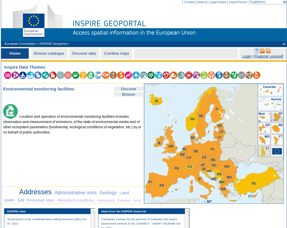
25 How to do it automatically? How to support more than one ETL tool?
26 Web Processing Service
27 Standard-based interface for ETL Tools deegree WPS ETL Tools (Valid INSPIRE GML) deegree INSPIRE Services
28 Advantages Use the ETL Tool of your choice Use more than one ETL tool OGC interface between harmonization and publication Choose between several Database Backends (Oracle, Postgres/PostGIS, MS SQL Server, Ingres) Independence from database and ETL developer deegree is OGC reference implementation for nearly all INSPIRE service profiles : WFS WMS WMTS GML 3.2.1
29 Some examples
30 Gazetteer for the province of Bolzano (IT) Gazetteer Service based on INSPIRE compliant deegree download service providing INSPIRE Annex I data theme Addresses
31 View & Download Service for Hamburg INSPIRE compliant View and Download Services based on deegree providing INSPIRE Data Theme Protected Sites This means: Direct Access Download Service INSPIRE WMS profile Having INSPIRE compliant Protected Sites data
32 EU INSPIRE Geoportal INSPIRE compliant Discovery Service providing metadata from all member states INSPIRE compliant View Service (WMTS) providing harvested member state's view services Harvester which collects member states metadata and network services data Registry to manage those data Validator to ensure compliance of metadata to INSPIRE requirements
33

34 EU INSPRIE Geoportal
35 Outlook What's hot? Providing INSPIRE Annex III datasets with deegree INSPIRE Metadata Validator deegree sercurity proxy Upcoming deegree 3.4
36 Thank you for your attention! Sebastian Goerke
UK Location Programme
 Location Information Interoperability Board Data Publisher How To Guide Understand the background to establishing an INSPIRE View Service using GeoServer DOCUMENT CONTROL Change Summary Version Date Author/Editor
Enabling embedded maps
 Enabling embedded maps Case: National geoportal of Finland Antti Rainio National Land Survey of Finland Trends: Web Services, Mapping Mashup, Open Source, Open Data Decentralised data s Service interfaces
Catalogue or Register? A Comparison of Standards for Managing Geospatial Metadata
 Catalogue or Register? A Comparison of Standards for Managing Geospatial Metadata Gerhard JOOS and Lydia GIETLER Abstract Publication of information items of any kind for discovery purposes is getting
CDI/THREDDS Interoperability: the SeaDataNet developments. P. Mazzetti 1,2, S. Nativi 1,2, 1. CNR-IMAA; 2. PIN-UNIFI
 CDI/THREDDS Interoperability: the SeaDataNet developments P. Mazzetti 1,2, S. Nativi 1,2, 1. CNR-IMAA; 2. PIN-UNIFI Outline Interoperability Issues in SeaDataNet A broker solution for CDI/THREDDS interoperability
FreeGIS.net, INSPIRE, Open Source Software and OGC standards
 FreeGIS.net, INSPIRE, Open Source Software and OGC standards Workshop: How Open Source / Free Software and Open Standards complement each other in an SDI environment SFScon 13 Free Software Conference
GeoNetwork, The Open Source Solution for the interoperable management of geospatial metadata
 GeoNetwork, The Open Source Solution for the interoperable management of geospatial metadata Ing. Emanuele Tajariol, GeoSolutions Ing. Simone Giannecchini, GeoSolutions GeoSolutions GeoSolutions GeoNetwork
GeoMedia Product Update. Title of Presentation. Lorilie Barteski October 15, 2008 Edmonton, AB
 Product Update Title of Presentation Lorilie Barteski Edmonton, AB Know the audience poll Existing /Pro users Version 6.1 Version 6.0 Version 5.2 or earlier Existing WebMap users Version 6.1 Version 6.0
GeoKettle: A powerful open source spatial ETL tool
 GeoKettle: A powerful open source spatial ETL tool FOSS4G 2010 Dr. Thierry Badard, CTO Spatialytics inc. Quebec, Canada tbadard@spatialytics.com Barcelona, Spain Sept 9th, 2010 What is GeoKettle? It is
Introduction to the Mapbender OWS Security Proxy
 Introduction to the Mapbender OWS Security Proxy Arnulf Christl, WhereGroup GmbH & Co. KG, Bonn, Germany 1/16 Agenda 1 Introduction to the Architecture OWS from Bottom Up with the OSGeo SDI Software Stack
GetLOD - Linked Open Data and Spatial Data Infrastructures
 GetLOD - Linked Open Data and Spatial Data Infrastructures W3C Linked Open Data LOD2014 Roma, 20-21 February 2014 Stefano Pezzi, Massimo Zotti, Giovanni Ciardi, Massimo Fustini Agenda Context Geoportal
GeoNetwork, The Open Source Solution for the interoperable management of geospatial metadata
 GeoNetwork, The Open Source Solution for the interoperable management of geospatial metadata Ing. Simone Giannecchini, GeoSolutions Ing. Emanuele Tajariol, GeoSolutions Outline GeoNetwork Introduction
Big Data Volume & velocity data management with ERDAS APOLLO. Alain Kabamba Hexagon Geospatial
 Big Data Volume & velocity data management with ERDAS APOLLO Alain Kabamba Hexagon Geospatial Intergraph is Part of the Hexagon Family Hexagon is dedicated to delivering actionable information through
INSPIRE in practice: Experiences with INSPIRE data and services
 INSPIRE in practice: Experiences with INSPIRE data and services Peter Parslow Principal Geographic Information Architect June 2014: ISO TC211 Standards in Practice workshop What s INSPIRE? European Commission
Development and the capacity building of the spatial information infrastructure geoportalin Poland
 Development and the capacity building of the spatial information infrastructure geoportalin Poland Marcin Grudzień, Eliza Asendy, Agnieszka Gruchała 25th June 2012, ISTANBUL Agenda GEOPORTAL 2 Main productsof
Analysis of the Free GIS Software Applications in respect to INSPIRE services and OGC standards
 Analysis of the Free GIS Software Applications in respect to INSPIRE services and OGC standards Authors: Francesco D'Alesio Peter Hopfgartner Paolo Viskanic June 2011 Executive Summary This document analyses
OPEN STANDARD WEB SERVICES FOR VISUALISATION OF TIME SERIES DATA OF FLOOD MODELS
 OPEN STANDARD WEB SERVICES FOR VISUALISATION OF TIME SERIES DATA OF FLOOD MODELS Barend Köbben FRMRC RPA 7 Workshop visualisations and flow simulations as flood risk communication tools
A Big Picture for Big Data
 Supported by EU FP7 SCIDIP-ES, EU FP7 EarthServer A Big Picture for Big Data FOSS4G-Europe, Bremen, 2014-07-15 Peter Baumann Jacobs University rasdaman GmbH p.baumann@jacobs-university.de Our Stds Involvement
EXPLORING AND SHARING GEOSPATIAL INFORMATION THROUGH MYGDI EXPLORER
 EXPLORING AND SHARING GEOSPATIAL INFORMATION THROUGH MYGDI EXPLORER Subashini Panchanathan Malaysian Centre For Geospatial Data Infrastructure ( MaCGDI ) Ministry of National Resources and Environment
Cloud-based Infrastructures. Serving INSPIRE needs
 Cloud-based Infrastructures Serving INSPIRE needs INSPIRE Conference 2014 Workshop Sessions Benoit BAURENS, AKKA Technologies (F) Claudio LUCCHESE, CNR (I) June 16th, 2014 This content by the InGeoCloudS
D.5.2: Metadata catalogue for drought information
 Project start date: 01 May 2009 Acronym: EuroGEOSS Project title: EuroGEOSS, a European Theme: FP7-ENV-2008-1: Environment (including climate change) Theme title: ENV.2008.4.1.1.1: European Environment
An Esri White Paper June 2011 ArcGIS for INSPIRE
 An Esri White Paper June 2011 ArcGIS for INSPIRE Esri, 380 New York St., Redlands, CA 92373-8100 USA TEL 909-793-2853 FAX 909-793-5953 E-MAIL info@esri.com WEB esri.com Copyright 2011 Esri All rights reserved.
Task AR-09-01a Progress and Contributions
 Doug Nebert, POC U.S. Geological Survey ddnebert@usgs.gov March 2010 Task AR-09-01a Progress and Contributions Background and scope for AR-09-01a This Task defines the minimum, common technical capabilities
Best Practice Network for SDI Nature Conservation TECHNOLOGICAL ASPECTS
 Best Practice Network for SDI Nature Conservation TECHNOLOGICAL ASPECTS Authors: Giorgio Saio, Carmelo Attardo Maria Cabello Giacomo Martirano Andrea Fiduccia, Stefano Turcato, Alina Kmiecik Monica De
Cadastre in the context of SDI and INSPIRE
 Cadastre in the context of SDI and INSPIRE Dr. Markus Seifert Bavarian Administration for Surveying and Cadastre Cadastre in the digital age the approach in Germany 3 rd CLGE Conference, Hanover, 11.10.2012
Web Map Service Architecture for Topographic Data in Finland
 Web Map Service Architecture for Topographic Data in Finland Teemu Sipilä National Land Survey of Finland Abstract. Since 2012 National Land Survey of Finland has been renewing its web map services and
ArcGIS Framework Plug-In: Extending the ArcGIS Desktop for ANSI Standard Framework Data to Support Government Decision Making
 ArcGIS Framework Plug-In: Extending the ArcGIS Desktop for ANSI Standard Framework Data to Support Government Decision Making Final Project Report October 28, 2008 Agreement Number Organization Project
GEOCOM PROJECT INTEGRATING DATA & TECHONOLOGIES
 GEOCOM PROJECT INTEGRATING DATA & TECHONOLOGIES Lucio Colaiacomo Chief Technology Officer l.colaiacomo@eusc.europa.eu Rationale for the project Providing support through our domain background & tech. expertise
Insight for location-powered decision making.
 Location Intelligence Geographic Information Systems MapInfo Pro Insight for location-powered decision making. Data drives our decisions every day. Blend this data with geography and you can visualise
OSGeo Web Mapping Typification: GeoMajas, Mapbender, MapFish and OpenLayers. Christoph Baudson Arnulf Christl FOSS4G 2010 Barcelona
 OSGeo Web Mapping Typification: GeoMajas, Mapbender, MapFish and OpenLayers Christoph Baudson Arnulf Christl FOSS4G 2010 Barcelona Disclaimer All information contained in this presentation has been compiled
The Nordic way to International standardization ISO/TC 211
 «Think Local - Act Global» Why engagement in international standards development is important A Nordic Perspective The Nordic way to International standardization Olaf Magnus Østensen Chair of Norway SOSI
COSTE: a Web-Services Infrastructure Enabling Interoperability and Integration of Spatial and Traffic e-contents for European Regions
 COSTE: a Web-s Infrastructure Enabling Interoperability and Integration of Spatial and Traffic e-contents for European Regions Marco Boero Softeco Sismat SpA Italy Geographic Information: Motivation, problem
Web Map Context Service for Adaptive Geospatial Data Visualization
 Web Map Context Service for Adaptive Geospatial Data Visualization Miloš Bogdanović, Danilo Vulović, Leonid Stoimenov INTRODUCTION Faculty of Electronic Engineering, University of Niš, Serbia {milos.bogdanovic,
INSPIRE Dashboard. Technical scenario
 INSPIRE Dashboard Technical scenario Technical scenarios #1 : GeoNetwork catalogue (include CSW harvester) + custom dashboard #2 : SOLR + Banana dashboard + CSW harvester #3 : EU GeoPortal +? #4 :? + EEA
Call for experts for INSPIRE maintenance & implementation
 INSPIRE Infrastructure for Spatial Information in Europe Call for experts for INSPIRE maintenance & implementation Title Creator Call for experts for INSPIRE maintenance & implementation EC & EEA INSPIRE
Interoperable Solutions in Web-based Mapping
 ISPRS SIPT IGU UCI CIG ACSG Table of contents Table des matières Authors index Index des auteurs Search Recherches Exit Sortir Interoperable Solutions in Web-based Mapping Marta Wojnarowska and Bridget
WP 3. Elaboration database Architecture Features (Software Architecture Document)
") Architecture Features (Software Architecture Document) o Best in class solution, using EC recommendations for IT in this field o Implementation based on free open source o Based on OGC standards, high
Architecture Features (Software Architecture Document) o Best in class solution, using EC recommendations for IT in this field o Implementation based on free open source o Based on OGC standards, high
Sydney Ph: +61 2 8570 5050. Melbourne Ph: +61 3 8680 3250. Adelaide Ph: +61 8 8425 8050. LISAsoft. Bespoke Development
 Sydney Ph: +61 2 8570 5050 Melbourne Ph: +61 3 8680 3250 Adelaide Ph: +61 8 8425 8050 LISAsoft Bespoke Development August 2008 MER Program Data Access Consultancy Monitoring, Evaluation and Reporting
GeoKettle: A powerful spatial ETL tool for feeding your Spatial Data Infrastructure (SDI)
") GeoKettle: A powerful spatial ETL tool for feeding your Spatial Data Infrastructure (SDI) Dr. Thierry Badard, CTO tbadard@spatialytics.com Spatialytics http://www.spatialytics.com FOSS4G 2011 Workshop,
GeoKettle: A powerful spatial ETL tool for feeding your Spatial Data Infrastructure (SDI) Dr. Thierry Badard, CTO tbadard@spatialytics.com Spatialytics http://www.spatialytics.com FOSS4G 2011 Workshop,
African European Georesources Observation System
 African European Georesources Observation System Spatial Data Infrastructure (SDI) Dr. Andreas Barth, Bernd Torchala Beak, Germany Outline Project Overview AEGOS SDI data / services hardware / software
What s new in Carmenta Server 4.2
 What s new in Carmenta Server 4.2 A complete solution for cost-effective visualisation and distribution of GIS data through web services Carmenta Server provides cost-effective technology for building
PostGIS Data Integration
 PostGIS Data Integration & Display on SIS Alex Hill GIS Manager Contents Plus Dane Group who we are PostGIS Data Integration and Display on SIS What is a Spatial Database? What is PostgreSQL/PostGIS? Why
INSPIRE Infrastructure for Spatial Information in Europe. INSPIRE Network Services Architecture. Network Services Architecture Creator.
 INSPIRE Infrastructure for Spatial Information in Europe Title Network Creator Network Drafting Team Date 19-07-2008 Subject Status Draft Publisher Network Drafting Team Type Text Description Network describes
EarthServer @ RDA. RDA: Co-chairing - Big Data IG - Geospatial IG. OGC co-chairing: - editor, Big Geo Data stds - BigData.DWG
 RDA: Co-chairing - Big Data IG - Geospatial IG OGC co-chairing: - editor, Big Geo Data stds - BigData.DWG EarthServer @ RDA RDA-DE/DINI Workshop, Karlsruhe, 2015-may-29 Peter Baumann Jacobs University
OpenGIS web services architecture description
 Open Geospatial Consortium Inc. Date: 2005-11-17 Reference number of this document: OGC 05-042r2 Version: 0.1.0 Category: OpenGIS Best Practices Paper Editor: Arliss Whiteside OpenGIS web architecture
Choosing the right GIS framework for an informed Enterprise Web GIS Solution
 13 ANNUAL INTERNATIONAL CONFERENCE AND EXHIBITION ON GEOSPATIAL INFORMATION TECHNOLOGY AND APPLICATIONS Epicentre; Gurgaon, India; 19-21 January, 2010 Choosing the right GIS framework for an informed Enterprise
Francesco Tortorelli
 Francesco Tortorelli Joint CEN/TC 287 and OGC Workshop Bringing GI Standards-making bodies together Frascati (Rome), 30 September 2013 (AgID) AgID (previously CNIPA and DigitPA) is a government agency
Institute of Computational Modeling SB RAS
 Institute of Computational Modeling SB RAS ORGANIZATION OF ACCESS TO OBSERVATIONAL DATA USING WEB SERVICES FOR MONITORING SYSTEMS THE STATE OF THE ENVIRONMENT Kadochnikov Aleksey A. Russia, Krasnoyarsk
Metadata for Data Discovery: The NERC Data Catalogue Service. Steve Donegan
 Metadata for Data Discovery: The NERC Data Catalogue Service Steve Donegan Introduction NERC, Science and Data Centres NERC Discovery Metadata The Data Catalogue Service NERC Data Services Case study:
Standards based spatial data management, GIS and web mapping. Spatial data management, analysis & sharing the free & easy way!
 or Spatial data management, analysis & sharing the free & easy way! Premise: Traditional GIS is inherently flawed, especially when it comes to many fisheries/maritime datasets Premise: Traditional GIS
Managing a Geographic Database From Mobile Devices Through OGC Web Services
 Managing a Geographic Database From Mobile Devices Through OGC Web Services Nieves R. Brisaboa 1, Miguel R. Luaces 1, Jose R. Parama 1, and Jose R. Viqueira 2 1 Database Laboratory, University of A Coruña,
WCS as Candidate INSPIRE Download Service for Coverage Data
 WCS as Candidate INSPIRE Download Service for Coverage Data Alexander Kotsev www.jrc.ec.europa.eu Serving society Stimulating innovation Supporting legislation Context NS Regulation defines two types of
INSPIRE Evaluation: Summary of findings for EU Member States
 INSPIRE Evaluation: Summary of findings for EU Member States Assessing data and services metadata resources through direct o bservations SPATIAL APPLICATIONS DIVISION K.U.LEUVEN RESEARCH & DEVELOPMENT
A framework for a networkbased datastore for spatial and spatio-temporal geoscience data
 A framework for a networkbased datastore for spatial and spatio-temporal geoscience data Paul Gabriel, Jan Gietzel, Le Hai Ha, Helmut Schaeben Kommunikationsforum 3D 2011, Freiberg Mi, 23. März 2011 Outline
From Geoportal to Spatial Data Service Platform. Jani Kylmäaho National Land Survey of Finland Development Centre
 From Geoportal to Spatial Data Service Platform Jani Kylmäaho National Land Survey of Finland Development Centre 29.6.2012 Introduction National Land Survey of Finland - 1900 employees Development Centre
INSPIRE INfrastructure for SPatial InfoRmation in Europe
 INSPIRE INfrastructure for SPatial InfoRmation in Europe Realisation Aspects at BEV in Austria Dr. techn. Markus Jobst Team INSPIRE/BEV Agenda INSPIRE common understanding at BEV/AT Infrastructure Framework
GIS Data Models for INSPIRE and ELF
 GIS Data Models for INSPIRE and ELF Paul Hardy Roberto Lucchi EuroSDR/ELF Copenhagen Data Modelling and Model Driven Implementation of Data Distribution 28 Jan 2015 ArcGIS for INSPIRE Extends ArcGIS for
Bringing spatial data and metadata from long term ecosystem research domain to the INSPIRE world
 Bringing spatial data and metadata from long term ecosystem research domain to the INSPIRE world Tomas Kliment Junior Researcher Italian National Research Council Institute of Marine Sciences in Venice
WCS 2.0 Extension for netcdf-cf; CSW and THREDDS Interoperability
 GEOSS Workshop XLIII: Sharing Climate Information & Knowledge NCAR Center Green, Boulder Colorado, 23 Sept 2011, 8:00am 5:30pm WCS 2.0 Extension for netcdf-cf; CSW and THREDDS Interoperability S.Nativi
Standardised Access to Geospatial Information and Services
 Department of Computing Science Umeå University Standardised Access to Geospatial Information and Services - Towards a European Infrastructure for Geospatial Information Master's Thesis Project, 20 Credits
Introduction to Geospatial Web Services
 Geospatial Web Services Introduction to Geospatial Web Services An introduction and inventory of geospatial web services and their importance to interoperability in the geospatial domain. vers. 20100604
Web-based spatio-temporal visualization and analysis of the Siberian Earth System Science Cluster (SIB-ESS-C)
") Web-based spatio-temporal visualization and analysis of the Siberian Earth System Science Cluster (SIB-ESS-C) Roman Gerlach Supervisor: Prof. C. Schmullius (Dept. of Geography, Friedrich-Schiller-University
Web-based spatio-temporal visualization and analysis of the Siberian Earth System Science Cluster (SIB-ESS-C) Roman Gerlach Supervisor: Prof. C. Schmullius (Dept. of Geography, Friedrich-Schiller-University
Free and Open Source GIS Software for Building a Spatial Data Infrastructure
 Free and Open Source GIS Software for Building a Spatial Data Infrastructure Stefan Steiniger, Andrew J. S. Hunter Department of Geomatics Engineering, University of Calgary, 2500 University Drive NW,
Proposal for a Spatial Data Infrastructure Standards Suite: SDI 1.0
 This article from Research and Theory in Advancing Spatial Data Infrastructure Concepts (ed. Harlan Onsrud; Redlands, CA: ESRI Press, 2007) is made available under a Creative Commons License, Attribution
How To Install The Arcgis For Inspire Server Extension On A Microsoft Gis For Inspire Server Extension (For Microsoft) On A Pc Or Macbook Or Ipa (For Macbook)
 On A Pc Or Macbook Or Ipa (For Macbook)") ArcGIS 10.2.1 for INSPIRE Server Extension Installation Guide Content 1 Introduction... 1 2 System Requirements... 1 3 Installation... 1 4 Software Authorization... 2 5 Changes to the System... 2 6 Performance
ArcGIS 10.2.1 for INSPIRE Server Extension Installation Guide Content 1 Introduction... 1 2 System Requirements... 1 3 Installation... 1 4 Software Authorization... 2 5 Changes to the System... 2 6 Performance
Minerals4EU - WP5 The EU-MKDP (Minerals Knowledge Data Platform)
") Minerals4EU - WP5 The EU-MKDP (Minerals Knowledge Data Platform) System architecture, objectives, services 1st MINCE Conference, Espoo, November 26-27, 2014 Daniel Cassard and the WP5 Team BRGM, CGS, GeoZS,
Minerals4EU - WP5 The EU-MKDP (Minerals Knowledge Data Platform) System architecture, objectives, services 1st MINCE Conference, Espoo, November 26-27, 2014 Daniel Cassard and the WP5 Team BRGM, CGS, GeoZS,
An HTML tool for exploiting geospatial web services
 An HTML tool for exploiting geospatial web services Theofilos Papadopoulos 1 and Konstantinos Evangelidis 2 1. Research Associate, priestont@gmail.com 2. Associate Professor, kevan70@gmail.com Technological
ERDAS APOLLO 2009. How to manage/catalog/share Raster & vector data. ERDAS, Inc. A Hexagon Company. All Rights Reserved 1
 ERDAS APOLLO 2009 How to manage/catalog/share Raster & vector data ERDAS, Inc. A Hexagon Company. All Rights Reserved 1 Here we are; Again Leica Geosystems Geospatial Imaging is now ERDAS, Inc. ERDAS,
Geospatial Data and the Semantic Web. The GeoKnow Project. Sebastian Hellmann AKSW/KILT research group, Leipzig University & DBpedia Association
 spatial Data and the Semantic Web The Geo Project Sebastian Hellmann AKSW/KILT research group, Leipzig University & DBpedia Association # About the project Collaborative Project 2012-2015 Information and
National Geothermal Data System and Global Geosciences Data Integration
 National Geothermal Data System and Global Geosciences Data Integration Lee Allison, AZGS Stephen Richard, AZGS Arlene Anderson, US DOE David Cuyler, US DOE & Sandia Natl Lab NERC 2008 Outline Rational
Use of ISO standards by NERC (a snapshot!)
") Use of ISO standards by NERC (a snapshot!) Dr Andrew Woolf andrew.woolf@stfc.ac.uk STFC Rutherford Appleton Laboratory Outline NERC overview The NERC SDI Metadata Data Services Standards activities UK/EU
Use of ISO standards by NERC (a snapshot!) Dr Andrew Woolf andrew.woolf@stfc.ac.uk STFC Rutherford Appleton Laboratory Outline NERC overview The NERC SDI Metadata Data Services Standards activities UK/EU
INSPIRE Infrastructure for Spatial Information in Europe. INSPIRE Network Services Architecture. Network Services Architecture Creator.
 INSPIRE Infrastructure for Spatial Information in Europe INSPIRE Network Services Architecture Title Network Services Architecture Creator Network Services Drafting Team Date 17-12-2007 Subject INSPIRE
GeoMedia & Geostandaarden. Frank Langelaan
 GeoMedia & Geostandaarden Frank Langelaan Invloeden van standaarden 2 Industrie trends 3 Technolgie trends 4 5 Architectuur trends Keeping up with advances in hardware and operating systems Windows XP
Geospatial Portal Reference Architecture
 Geospatial Portal Reference Architecture DRAFT OGC 04-039 Open Geospatial Consortium Inc. Date: 2004-07-02 Reference number of this OpenGIS document: OGC 04-039 Version: 0.2 Category: OpenGIS Discussion
SDI Workshop ESDIN Best Practices. 2011-06-28 INSPIRE conference, Edinburgh. Arnulf Christl, Metaspatial
 SDI Workshop ESDIN Best Practices 2011-06-28 INSPIRE conference, Edinburgh Arnulf Christl, Metaspatial Download this slide set as ODP (1.2MB) or PDF (1.1MB) at http://arnulf.us/publications Arnulf Christl
Chaining Façades: Higher Efficiency in evolution-enabled Spatial Data Infrastructures (SDI)
") Chaining Façades: Higher Efficiency in evolution-enabled Spatial Data Infrastructures (SDI) Roland M. Wagner Fraunhofer ISST, Berlin/Dortmund, Germany ABSTRACT After the first publication of the known
Chaining Façades: Higher Efficiency in evolution-enabled Spatial Data Infrastructures (SDI) Roland M. Wagner Fraunhofer ISST, Berlin/Dortmund, Germany ABSTRACT After the first publication of the known
Standardized data sharing through an open-source Spatial Data Infrastructure: the Afromaison project
 Standardized data sharing through an open-source Spatial Data Infrastructure: the Afromaison project Yaniss Guigoz - University of Geneva/GRID-Geneva 1 EcoARM2ERA and AFROMAISON Why Afromaison in this
Clemens Portele interactive instruments GmbH
 GML - TU Delft - Standards in Action - 17.11.2004 GML Geography Markup Language Clemens Portele interactive instruments GmbH interactive instruments GmbH GML - TU Delft - Standards in Action - 17.11.2004
Pennsylvania Geospatial Data Sharing Standards (PGDSS) V 2.5
 V 2.5") Submitted to: Pennsylvania Geospatial Data Sharing Standards (PGDSS) V 2.5 Spatial Data Migration Tools Report May 2, 2007 Table of Contents 1.0 Document Purpose...B-1 2.0 Overview of Spatial Data Migration
Submitted to: Pennsylvania Geospatial Data Sharing Standards (PGDSS) V 2.5 Spatial Data Migration Tools Report May 2, 2007 Table of Contents 1.0 Document Purpose...B-1 2.0 Overview of Spatial Data Migration
Environment Canada Data Management Program. Paul Paciorek Corporate Services Branch May 7, 2014
 Environment Canada Data Management Program Paul Paciorek Corporate Services Branch May 7, 2014 EC Data Management Program (ECDMP) consists of 5 foundational, incremental projects which will implement
The use of Semantic Web Technologies in Spatial Decision Support Systems
 The use of Semantic Web Technologies in Spatial Decision Support Systems Adam Iwaniak Jaromar Łukowicz Iwona Kaczmarek Marek Strzelecki The INSPIRE Conference 2013, 23-27 June Wroclaw University of Environmental
INSPIRE Compliant Provision of Metrological Sensor Data at the IMIDA Murcia, Spain
 INSPIRE Compliant Provision of Metrological Sensor Data at the IMIDA Murcia, Spain Authors: Manuel Erena Arrabal, Grupo de Sig y Teledeteccion, IMIDA Juan Antonio Lopez Morales, Grupo de Sig y Teledeteccion,
ArcGIS. Server. A Complete and Integrated Server GIS
 ArcGIS Server A Complete and Integrated Server GIS ArcGIS Server A Complete and Integrated Server GIS ArcGIS Server enables you to distribute maps, models, and tools to others within your organization
Access to ESPON Database by third- party applications An expertise on the potentialities of web services for accessing the ESPON metadata and data
 Access to ESPON Database by third- party applications An expertise on the potentialities of web services for accessing the ESPON metadata and data UNEP/GRID- Geneva 27/06/2013 ABOUT THIS DOCUMENT A technical
How To Write An Inspire Directive
 INSPIRE Infrastructure for Spatial Information in Europe Detailed definitions on the INSPIRE Network Services Title Detailed definitions on the INSPIRE Network Services Creator Date 2005-07-22 Subject
A Web services solution for Work Management Operations. Venu Kanaparthy Dr. Charles O Hara, Ph. D. Abstract
 A Web services solution for Work Management Operations Venu Kanaparthy Dr. Charles O Hara, Ph. D Abstract The GeoResources Institute at Mississippi State University is leveraging Spatial Technologies and
Implementing a Municipal SDI with Service Oriented Architecture
 Implementing a Municipal SDI with Service Oriented Architecture A. A. Ghaemi a, F. Samadzadegan b, A. Rajabifard c, M. Yadegari b a Tehran Municipality ICT Organazation, Tehran, Iran ghaemi@tehran.ir b
DEVELOPMENT OF THE INTEGRATING AND SHARING PLATFORM OF SPATIAL WEBSERVICES
 DEVELOPMENT OF THE INTEGRATING AND SHARING PLATFORM OF SPATIAL WEBSERVICES Lan Xiaoji 1,2 Lu Guonian 1 Zhang Shuliang 1 Shi Miaomiao 1 Yin Lili 1 1. Jiangsu Provincial Key Lab of GIS Science, Nanjing Normal
FOSSGIS: What is the future of Geonetwork? What changes are planned?
 FOSSGIS: What are the most prominent successful cases in using Geonetwork? JEROEN TICHELER: The first was within the United Nations system itself. GeoNetwork is in use in most of the specialized agencies
Data Visualization Using Web GIS Software
 Data Visualization Using Web GIS Software Tuomas Peltonen Radiation and Nuclear Safety Authority (STUK), Finland NKS NordDSS Workshop, Copenhagen, 1.-2.10.2009 RADIATION AND NUCLEAR SAFETY AUTHORITY Preface
Introduction to OSGeo and QGIS
 Introduction to OSGeo and QGIS Arnulf Christl OSGeo President Emeritus ESTGIS Pühajärve, Estonia Arnulf Christl Geospatial Systems Architect OSGeo President Emeritus Director of the metaspatial Institute
http://opendata.comune.fi.it
 The Environmental Observation Web and its Service Applications within the Future Internet OPENDATA IN CITY OF FLORENCE Gianluca Vannuccini Head of the IT Infrastructure Development Office IT Department
Open Geospatial Consortium, Inc.
 Open Geospatial Consortium, Inc. Date: 2010-08-18 Reference number of this document: OGC 10-130 Category: OGC Public Engineering Report Editor: Debbie Wilson OGC OWS-7 Aviation FUSE Deployment Engineering
INTEROPERABLE IMAGE DATA ACCESS THROUGH ARCGIS SERVER
 INTEROPERABLE IMAGE DATA ACCESS THROUGH ARCGIS SERVER Qian Liu Environmental Systems Research Institute 380 New York Street Redlands, CA92373, U.S.A - qliu@esri.com KEY WORDS: OGC, Standard, Interoperability,
13 th EC GI & GIS Workshop WIN: A new OGC compliant SOA. for risk management. GMV, 2007 Property of GMV All rights reserved
 13 th EC GI & GIS Workshop WIN: A new OGC compliant SOA for risk management GMV, 2007 Property of GMV All rights reserved Content 1. Introduction 2. Objectives 3. Architecture and Model 4. Technical aspects
Data interchange between Web client based task controllers and management information systems using ISO and OGC standards
 Data interchange between Web client based task controllers and management information systems using ISO and OGC standards Michael Nørremark 1*, Ole Jørgensen 1, Jens Bligaard 2 and Claus G. Sørensen 1
Scalability of LBS in Mobile GIS Using Web Services
 International Journal of Electronics and Computer Science Engineering 107 Available Online at www.ijecse.org ISSN- 2277-1956 Scalability of LBS in Mobile GIS Using Web Services G. B. V. Padmanadh 1, Dr.
CentropeSTATISTICS a Tool for Cross-Border Data Presentation Manfred Schrenk, Clemens Beyer, Norbert Ströbinger
 Manfred Schrenk, Clemens Beyer, Norbert Ströbinger (Dipl.-Ing. Manfred Schrenk, Multimediaplan.at, 2320 Schwechat, Austria, schrenk@multimediaplan.at) (Dipl.-Ing. Clemens Beyer, CORP Competence Center
Angelos Tzotsos IMIS Athena, Scientific & Technical Manager OSGeo Charter Member Copernicus Big Data Workshop, March 2014
 Angelos Tzotsos IMIS Athena, Scientific & Technical Manager OSGeo Charter Member Copernicus Big Data Workshop, March 2014 Genesis of the project Consortium established on active research, commercial, and
Solutions for Central and Federal Governments
 Solutions for Central and Federal Governments Intergraph s Advanced Geospatial Solutions for for Central and Federal Government Operations Central and federal governments are continually asked to do more
Sextant. Spatial Data Infrastructure for Marine Environment. C. Satra Le Bris, E. Quimbert, M. Treguer
 Sextant On-Line information system for marine geographical information E. Quimbert, M. Bellouis, F. Lecuy, M. Treguer Centre de Bretagne BP 70, Plouzané 29280 France E-mail: sextant@ifremer.fr Sextant