Forest Service Southern Region Jess Clark & Kevin Megown USFS Remote Sensing Applications Center (RSAC)
|
|
|
- Margery Warner
- 8 years ago
- Views:
Transcription
1 Hurricane Katrina Damage Assessment on Lands Managed by the Desoto National Forest using Multi-Temporal Landsat TM Imagery and High Resolution Aerial Photography Renee Jacokes-Mancini Forest Service Southern Region Jess Clark & Kevin Megown USFS Remote Sensing Applications Center (RSAC) RS2006 Conference Salt Lake City, Utah April 26, 2006
 RS2006 Conference Salt Lake City, Utah April 26,")
2 Overview Background of Hurricane Katrina damage Need for damage assessment Method use of assessment Results Discussion

3 Hurricane Katrina made landfall in Louisiana and Mississippi. Landfall: August 29, 2005 Strong Category 3 at landfall Hurricane Katrina Sustained winds of 111 to 130 mph Costliest Atlantic Hurricane in U.S. history

4 Water Damage June 2005

5 Water Damage September June

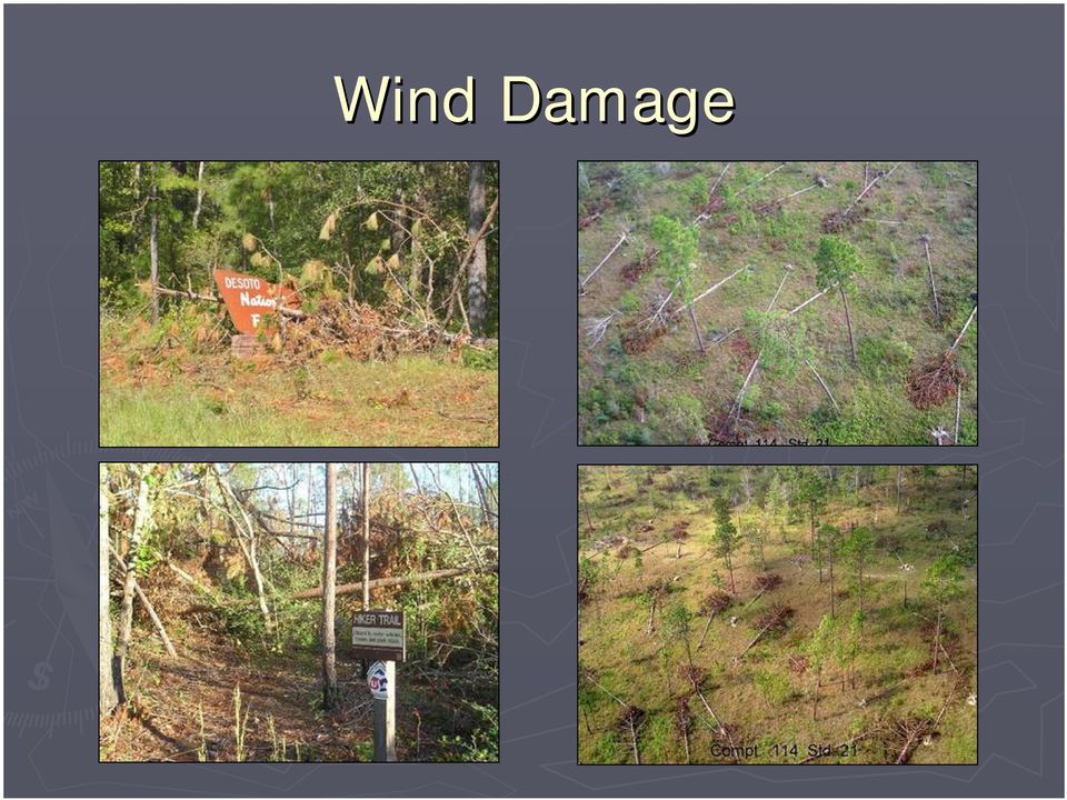
6 Wind Damage
7 Initial Forest Damage Assessments Forest Inventory and Analysis (FIA) September 2005 Forest Health Protection (FHP) November 2005 Initial assessments provided little explanation of damage severity or were based on few samples. Different method needed to meet National Forest management information requirements.

8 New Damage Assessment New damage assessment performed by RSAC Utilizes multi-stage sampling and multiple scales of remotely-sensed imagery Provides a statistically-defensible approach to mapping damage potential

9 Methods - Landsat Multi-temporal temporal Landsat imagery acquired Pre-storm: Oct. 15, 2004 Post-storm: storm: Nov. 3, 2005 WRS Path/Row: 21/39 Converted to Reflectance Other path/rows acquired but sampling performed only on 21/39

10 Methods - Landsat Multi-temporal temporal Landsat imagery acquired Pre-storm: Oct. 15, 2004 Post-storm: storm: Nov. 3, 2005 WRS Path/Row: 21/39 Converted to Reflectance Other path/rows acquired but sampling performed only on 21/39 Desoto NF overlaid on path 21 row 39

11 Methods Multi-stage Sample Built-up, up, Urban, and Ag areas masked out of Landsat imagery Those land use types can easily confuse the NDVI change We are interested in damage to forest Pre-storm Post-storm storm

12 Methods Multi-stage Sample Built-up, up, Urban, and Ag areas masked out of Landsat imagery Those land use types can easily confuse the NDVI change We are interested in damage to forest Urban/Ag Masked Out

13 Methods - Landsat Normalized Difference Vegetation Index (NDVI) performed on pre- and post- storm Landsat Change in NDVI calculated as a continuous dataset ISODATA Unsupervised Classification performed on NDVI change product Output: 12 class thematic image

14 Methods - Photos The Desoto NF sent RSAC over 400 scanned photos flown by FHTET during October, :15,840 scale Flown with Inertial Measurement Unit (IMU) Photos scanned 1/2 m pixels Data compiled into Block Files for Leica Photogrammetry Suite (LPS) Photos orthorectified using 30m DEM
 Photos orthorectified")
15 Methods - Sampling 12-class raster NDVI change product converted to point coverage Each point represented center of pixel 10 points randomly selected from each class 120 primary sampling units (PSUs( PSUs) Assessment done with this dataset to estimate variance and sample needs for whole study

16 Methods - Sampling Distribution of samples based on variance. Based off initial assessment, to reach a standard error of 2%, we needed to sample the following Class # of Samples Total: 423 Primary Sampling Units (PSUs)

17 Methods - Sampling 423 PSU locations chosen randomly Note: Top and west edges excluded because path 21 row 39 orbit excluded it from the Landsat acquisition.

18 Methods - Sampling 423 PSU locations chosen randomly Note: Top and west edges excluded because path 21 row 39 orbit excluded it from the Landsat acquisition.

19 Methods - Sampling Digital Mylar Image Interpreter (ArcMap extension) used to perform damage assessment 3x3 grid (9 points) centered around PSU All 9 points fit within one Landsat pixel Assessed for damage no damage Damage = obvious thrown trees

20 Methods - Sampling Size of Landsat pixel over digital photo Nearly 4,000 points interpreted for damage no damage

21 Methods - Sampling Size of Landsat pixel over digital photo
22 Methods - Sampling 1 = Primary Sample Unit = 9 points = 3807 samples 1 Primary Sample Unit 9 points 3807 Samples of Damage/Non-Damage
23 Methods - Analysis Strata Acres Damage (%) Std. Error (%) Sample provided basis for % damage estimates with standard errors for each of the 12 NDVI change classes Class 1 3, Class 2 38, Class 3 68, Class 4 57, Class 5 45, Class 6 76, Class 7 56, Class 8 40, Class 9 49, Class 10 36, Class 11 37, Class 12 27, , Overall 77,681 Acres Attributed as Damaged
24 Methods - Analysis Student- Newman-Keuls (SNK) Test used to create 4 separable damage classes Strata Class 11 Class 7 Class 9 Class 4 Class 10 Class 12 Damage (%) Acres Damaged 15, , , , , , Class , Class , Class , Class Class Class
25 Methods - Analysis Student- Newman-Keuls (SNK) Test used to create 4 separable damage classes Strata Class 11 Class 7 Class 9 Class 4 Class 10 Class 12 Class 6 Damage (%) Acres Damaged 15, , , , , , , Class Acres Damaged Class 4 35, Class 3 Class , , Class 3 20, Class 2 21, Class Class 2 Class 5 Class
26 Class 1 Lowest probability of damage Class 2 Class 3 Class 4 Highest probability of damage Results
27 Class 1 Lowest probability of damage Class 2 Class 3 Class 4 Highest probability of damage Results
28 Results Based on the data, less damage than originally assumed was present on the Desoto Ranger District Geographic Locations of Damaged Areas Reliable and Statistical Defensible Method Method can be applied to other events/locations Results in Weeks
29 Expected Time-Line Needs Acquisition of aerial photography: Variable days to weeks Orthorectification and reprojection of photography: 2 days Acquisition and processing of Landsat imagery: 2 days Sampling photography for damage/no-damage: damage: 3 days Data analysis: 1 day Hurricane Photography acquisition begins Scan images, compile into block files Orthorectify photos Begin photo sampling Day Data Analysis Landsat acquired NDVI change products created
30 Discussion Data-driven damage assessment Multi-stage sampling design an effective way to assess damage probability Quick and efficient way to create damage assessment Product can be used to help direct salvage and other management decisions Potential application for future events
31 Questions For Further information contact: Renee Jacokes-Mancini (404) Jess Clark (801)
32 Questions
Land Use/ Land Cover Mapping Initiative for Kansas and the Kansas River Watershed
 Land Use/ Land Cover Mapping Initiative for Kansas and the Kansas River Watershed Kansas Biological Survey Kansas Applied Remote Sensing Program April 2008 Previous Kansas LULC Projects Kansas LULC Map
Assessing Hurricane Katrina Damage to the Mississippi Gulf Coast Using IKONOS Imagery
 Assessing Hurricane Katrina Damage to the Mississippi Gulf Coast Using IKONOS Imagery Joseph P. Spruce Science Systems and Applications, Inc. John C., MS 39529 Rodney McKellip NASA Project Integration
Application of Remotely Sensed Data and Technology to Monitor Land Change in Massachusetts
 Application of Remotely Sensed Data and Technology to Monitor Land Change in Massachusetts Sam Blanchard, Nick Bumbarger, Joe Fortier, and Alina Taus Advisor: John Rogan Geography Department, Clark University
GULF COASTAL URBAN FOREST HAZARD ASSESSMENT AND REMOTE SENSING EFFORTS AFTER HURRICANES KATRINA AND RITA 1
 GULF COASTAL URBAN FOREST HAZARD ASSESSMENT AND REMOTE SENSING EFFORTS AFTER HURRICANES KATRINA AND RITA 1 Kamran K. Abdollahi, Zhu Hua Ning, Daniel Collins, Fulbert Namwamba and Asebe Negatu SU Agricultural
A GIS helps you answer questions and solve problems by looking at your data in a way that is quickly understood and easily shared.
 A Geographic Information System (GIS) integrates hardware, software, and data for capturing, managing, analyzing, and displaying all forms of geographically referenced information. GIS allows us to view,
Remote Sensing and Land Use Classification: Supervised vs. Unsupervised Classification Glen Busch
 Remote Sensing and Land Use Classification: Supervised vs. Unsupervised Classification Glen Busch Introduction In this time of large-scale planning and land management on public lands, managers are increasingly
Introduction to Imagery and Raster Data in ArcGIS
 Esri International User Conference San Diego, California Technical Workshops July 25, 2012 Introduction to Imagery and Raster Data in ArcGIS Simon Woo slides Cody Benkelman - demos Overview of Presentation
VCS REDD Methodology Module. Methods for monitoring forest cover changes in REDD project activities
 1 VCS REDD Methodology Module Methods for monitoring forest cover changes in REDD project activities Version 1.0 May 2009 I. SCOPE, APPLICABILITY, DATA REQUIREMENT AND OUTPUT PARAMETERS Scope This module
Texas Prairie Wetlands Project (TPWP) Performance Monitoring
 Performance Monitoring") Texas Prairie Wetlands Project (TPWP) Performance Monitoring Relationship to Gulf Coast Joint Venture (GCJV) Habitat Conservation: Priority Species: Wintering waterfowl species in the Texas portion of
Texas Prairie Wetlands Project (TPWP) Performance Monitoring Relationship to Gulf Coast Joint Venture (GCJV) Habitat Conservation: Priority Species: Wintering waterfowl species in the Texas portion of
APPLICATION OF MULTITEMPORAL LANDSAT DATA TO MAP AND MONITOR LAND COVER AND LAND USE CHANGE IN THE CHESAPEAKE BAY WATERSHED
 APPLICATION OF MULTITEMPORAL LANDSAT DATA TO MAP AND MONITOR LAND COVER AND LAND USE CHANGE IN THE CHESAPEAKE BAY WATERSHED S. J. GOETZ Woods Hole Research Center Woods Hole, Massachusetts 054-096 USA
A KNOWLEDGE-BASED APPROACH FOR REDUCING CLOUD AND SHADOW ABSTRACT
 A KNOWLEDGE-BASED APPROACH FOR REDUCING CLOUD AND SHADOW Mingjun Song, Graduate Research Assistant Daniel L. Civco, Director Laboratory for Earth Resources Information Systems Department of Natural Resources
Remote Sensing and GIS Application In Change Detection Study In Urban Zone Using Multi Temporal Satellite
 Remote Sensing and GIS Application In Change Detection Study In Urban Zone Using Multi Temporal Satellite R.Manonmani, G.Mary Divya Suganya Institute of Remote Sensing, Anna University, Chennai 600 025
Land Use/Land Cover Map of the Central Facility of ARM in the Southern Great Plains Site Using DOE s Multi-Spectral Thermal Imager Satellite Images
 Land Use/Land Cover Map of the Central Facility of ARM in the Southern Great Plains Site Using DOE s Multi-Spectral Thermal Imager Satellite Images S. E. Báez Cazull Pre-Service Teacher Program University
Opportunities for the generation of high resolution digital elevation models based on small format aerial photography
 Opportunities for the generation of high resolution digital elevation models based on small format aerial photography Boudewijn van Leeuwen 1, József Szatmári 1, Zalán Tobak 1, Csaba Németh 1, Gábor Hauberger
Digital Classification and Mapping of Urban Tree Cover: City of Minneapolis
 Digital Classification and Mapping of Urban Tree Cover: City of Minneapolis FINAL REPORT April 12, 2011 Marvin Bauer, Donald Kilberg, Molly Martin and Zecharya Tagar Remote Sensing and Geospatial Analysis
Operational Space- Based Crop Mapping Protocols at AAFC A. Davidson, H. McNairn and T. Fisette.
 Operational Space- Based Crop Mapping Protocols at AAFC A. Davidson, H. McNairn and T. Fisette. Science & Technology Branch. Agriculture and Agri-Food Canada. 1. Introduction Space-Based Crop Mapping at
MAPPING MINNEAPOLIS URBAN TREE CANOPY. Why is Tree Canopy Important? Project Background. Mapping Minneapolis Urban Tree Canopy.
 MAPPING MINNEAPOLIS URBAN TREE CANOPY Why is Tree Canopy Important? Trees are an important component of urban environments. In addition to their aesthetic value, trees have significant economic and environmental
Environmental Remote Sensing GEOG 2021
 Environmental Remote Sensing GEOG 2021 Lecture 4 Image classification 2 Purpose categorising data data abstraction / simplification data interpretation mapping for land cover mapping use land cover class
Remote Sensing: Correlating Satellite Images with In-field Observations for Advanced Damage Detection
 Remote Sensing: Correlating Satellite Images with In-field Observations for Advanced Damage Detection ImageCat, Inc. Shubharoop Ghosh Beverley J. Adams, Ph.D. ImageCat, Inc. J. Arn Womble, P.E. Texas Tech
Review for Introduction to Remote Sensing: Science Concepts and Technology
 Review for Introduction to Remote Sensing: Science Concepts and Technology Ann Johnson Associate Director ann@baremt.com Funded by National Science Foundation Advanced Technological Education program [DUE
SMEX04 Land Use Classification Data
 Notice to Data Users: The documentation for this data set was provided solely by the Principal Investigator(s) and was not further developed, thoroughly reviewed, or edited by NSIDC. Thus, support for
ArcGIS. Image Server tutorial
 ArcGIS 9 ArcGIS Image Server tutorial Copyright 2006, 2007, and 2008 Zanja Technologies, Inc. All rights reserved. The information contained in this work is the property of Zanja Technologies, Inc., under
Understanding Raster Data
 Introduction The following document is intended to provide a basic understanding of raster data. Raster data layers (commonly referred to as grids) are the essential data layers used in all tools developed
Accuracy Assessment of Land Use Land Cover Classification using Google Earth
 American Journal of Environmental Protection 25; 4(4): 9-98 Published online July 2, 25 (http://www.sciencepublishinggroup.com/j/ajep) doi:.648/j.ajep.2544.4 ISSN: 228-568 (Print); ISSN: 228-5699 (Online)
Objectives. Raster Data Discrete Classes. Spatial Information in Natural Resources FANR 3800. Review the raster data model
 Spatial Information in Natural Resources FANR 3800 Raster Analysis Objectives Review the raster data model Understand how raster analysis fundamentally differs from vector analysis Become familiar with
APPLICATION OF GOOGLE EARTH FOR THE DEVELOPMENT OF BASE MAP IN THE CASE OF GISH ABBAY SEKELA, AMHARA STATE, ETHIOPIA
 APPLICATION OF GOOGLE EARTH FOR THE DEVELOPMENT OF BASE MAP IN THE CASE OF GISH ABBAY SEKELA, AMHARA STATE, ETHIOPIA Abineh Tilahun Department of Geography and environmental studies, Adigrat University,
How To Make An Orthophoto
 ISSUE 2 SEPTEMBER 2014 TSA Endorsed by: CLIENT GUIDE TO DIGITAL ORTHO- PHOTOGRAPHY The Survey Association s Client Guides are primarily aimed at other professionals such as engineers, architects, planners
Statement of Qualifications
 Statement of Qualifications Prepared By: JAYA Corporation 4900 University Square, Suite 30 Huntsville, AL 35816 TEL: (256) 722-0700 FAX: (256) 722-0711 EMAIL: igis@jaya corp.com Small Disadvantaged Business,
RESULTS. that remain following use of the 3x3 and 5x5 homogeneity filters is also reported.
 RESULTS Land Cover and Accuracy for Each Landsat Scene All 14 scenes were successfully classified. The following section displays the results of the land cover classification, the homogenous filtering,
STATE OF NEVADA Department of Administration Division of Human Resource Management CLASS SPECIFICATION
 STATE OF NEVADA Department of Administration Division of Human Resource Management CLASS SPECIFICATION TITLE PHOTOGRAMMETRIST/CARTOGRAPHER V 39 6.102 PHOTOGRAMMETRIST/CARTOGRAPHER II 33 6.110 PHOTOGRAMMETRIST/CARTOGRAPHER
COASTAL MONITORING & OBSERVATIONS LESSON PLAN Do You Have Change?
 Coastal Change Analysis Lesson Plan COASTAL MONITORING & OBSERVATIONS LESSON PLAN Do You Have Change? NOS Topic Coastal Monitoring and Observations Theme Coastal Change Analysis Links to Overview Essays
Image Analysis CHAPTER 16 16.1 ANALYSIS PROCEDURES
 CHAPTER 16 Image Analysis 16.1 ANALYSIS PROCEDURES Studies for various disciplines require different technical approaches, but there is a generalized pattern for geology, soils, range, wetlands, archeology,
Land-Cover and Imperviousness Data for Regional Areas near Denver, Colorado; Dallas- Fort Worth, Texas; and Milwaukee-Green Bay, Wisconsin - 2001
 U.S. Geological Survey Data Series Land-Cover and Imperviousness Data for Regional Areas near Denver, Colorado; Dallas- Fort Worth, Texas; and Milwaukee-Green Bay, Wisconsin - 2001 By James Falcone and
Methods for Monitoring Forest and Land Cover Changes and Unchanged Areas from Long Time Series
 Methods for Monitoring Forest and Land Cover Changes and Unchanged Areas from Long Time Series Project using historical satellite data from SACCESS (Swedish National Satellite Data Archive) for developing
Partitioning the Conterminous United States into Mapping Zones for Landsat TM Land Cover Mapping
 Partitioning the Conterminous United States into Mapping Zones for Landsat TM Land Cover Mapping Collin Homer Raytheon, EROS Data Center, Sioux Falls, South Dakota 605-594-2714 homer@usgs.gov Alisa Gallant
How To Update A Vegetation And Land Cover Map For Florida
 Florida Vegetation and Land Cover Data Derived from 2003 Landsat ETM+ Imagery Beth Stys, Randy Kautz, David Reed, Melodie Kertis, Robert Kawula, Cherie Keller, and Anastasia Davis Florida Fish and Wildlife
Determination of Flood Extent Using Remote Sensing
 Determination of Flood Extent Using Remote Sensing A Term Paper Submitted to Dr. Benoit Rivard Professor Department of Earth and Atmospheric Science University of Alberta Source: Dartmouth Flood observatory
Government 98dn Mapping Social and Environmental Space
 Government 98dn Mapping Social and Environmental Space LAB EXERCISE 5: The Analysis of Fields Objectives of this lab: Visualizing raster data Using Spatial Analyst functions to create new data Analysis
Imagery. 1:50,000 Basemap Generation From Satellite. 1 Introduction. 2 Input Data
 1:50,000 Basemap Generation From Satellite Imagery Lisbeth Heuse, Product Engineer, Image Applications Dave Hawkins, Product Manager, Image Applications MacDonald Dettwiler, 3751 Shell Road, Richmond B.C.
Nature Values Screening Using Object-Based Image Analysis of Very High Resolution Remote Sensing Data
 Nature Values Screening Using Object-Based Image Analysis of Very High Resolution Remote Sensing Data Aleksi Räsänen*, Anssi Lensu, Markku Kuitunen Environmental Science and Technology Dept. of Biological
A tiered reconnaissance approach toward flood monitoring utilising multi-source radar and optical data
 5 th International Workshop on Remote Sensing for Disaster Response A tiered reconnaissance approach toward flood monitoring utilising multi-source radar and optical data Anneley McMillan Dr. Beverley
Remote Sensing Method in Implementing REDD+
 Remote Sensing Method in Implementing REDD+ FRIM-FFPRI Research on Development of Carbon Monitoring Methodology for REDD+ in Malaysia Remote Sensing Component Mohd Azahari Faidi, Hamdan Omar, Khali Aziz
Mapping Land Cover Patterns of Gunma Prefecture, Japan, by Using Remote Sensing ABSTRACT
 1 Mapping Land Cover Patterns of Gunma Prefecture, Japan, by Using Remote Sensing Zhaohui Deng, Yohei Sato, Hua Jia Department of Biological and Environmental Engineering, Graduate School of Agricultural
Urban Forests in Florida: Storm Damage Assessment Utility for Estimating Hurricane-Caused Tree Debris 1
 FOR268 Urban Forests in Florida: Storm Damage Assessment Utility for Estimating Hurricane-Caused Tree Debris 1 Benjamin Thompson, Francisco Escobedo, Christina Staudhammer, Jerry Bond, and Chris Luley
ENVI and ArcGIS Integration Bringing Imagery to GIS
 ITT ENVI and ArcGIS Integration Bringing Imagery to GIS The information contained in this document pertains to software products and services that are subject to the controls of the Export Administration
A STRATEGY FOR ESTIMATING TREE CANOPY DENSITY USING LANDSAT 7 ETM+ AND HIGH RESOLUTION IMAGES OVER LARGE AREAS
 A STRATEGY FOR ESTIMATING TREE CANOPY DENSITY USING LANDSAT 7 ETM+ AND HIGH RESOLUTION IMAGES OVER LARGE AREAS Chengquan Huang*, Limin Yang, Bruce Wylie, Collin Homer Raytheon ITSS EROS Data Center, Sioux
SPREADSHEET EDUCATION MATERIAL USING REMOTE SENSING IMAGE AND MAP IMAGE
 SPREADSHEET EDUCATION MATERIAL USING REMOTE SENSING IMAGE AND MAP IMAGE Kiyotada Sato a, *, Ryuzo Yokoyama b a Ichinoseki National College of Technology Mechanical Engineering, Hagisho Ichinoseki City,
Time and Trees on the Map Land Cover Database 4
 Time and Trees on the Map Land Cover Database 4 Key steps producing LCDB v3.0, v3.3 & v4.0 What s planned in v4.1 Applications using LCDB Data quality feedback Research results Satellite data processing
Extraction of Satellite Image using Particle Swarm Optimization
 Extraction of Satellite Image using Particle Swarm Optimization Er.Harish Kundra Assistant Professor & Head Rayat Institute of Engineering & IT, Railmajra, Punjab,India. Dr. V.K.Panchal Director, DTRL,DRDO,
ANALYSIS OF FOREST CHANGE IN FIRE DAMAGE AREA USING SATELLITE IMAGES
 ANALYSIS OF FOREST CHANGE IN FIRE DAMAGE AREA USING SATELLITE IMAGES Joon Mook Kang, Professor Joon Kyu Park, Ph.D Min Gyu Kim, Ph.D._Candidate Dept of Civil Engineering, Chungnam National University 220
WATER BODY EXTRACTION FROM MULTI SPECTRAL IMAGE BY SPECTRAL PATTERN ANALYSIS
 WATER BODY EXTRACTION FROM MULTI SPECTRAL IMAGE BY SPECTRAL PATTERN ANALYSIS Nguyen Dinh Duong Department of Environmental Information Study and Analysis, Institute of Geography, 18 Hoang Quoc Viet Rd.,
Comparison of Satellite Imagery and Conventional Aerial Photography in Evaluating a Large Forest Fire
 Purdue University Purdue e-pubs LARS Symposia Laboratory for Applications of Remote Sensing --98 Comparison of Satellite Imagery and Conventional Aerial Photography in Evaluating a Large Forest Fire G.
RESOLUTION MERGE OF 1:35.000 SCALE AERIAL PHOTOGRAPHS WITH LANDSAT 7 ETM IMAGERY
 RESOLUTION MERGE OF 1:35.000 SCALE AERIAL PHOTOGRAPHS WITH LANDSAT 7 ETM IMAGERY M. Erdogan, H.H. Maras, A. Yilmaz, Ö.T. Özerbil General Command of Mapping 06100 Dikimevi, Ankara, TURKEY - (mustafa.erdogan;
Cloud Detection for Sentinel 2. Curtis Woodcock, Zhe Zhu, Shixiong Wang and Chris Holden
 Cloud Detection for Sentinel 2 Curtis Woodcock, Zhe Zhu, Shixiong Wang and Chris Holden Background 3 primary spectral regions useful for cloud detection Optical Thermal Cirrus bands Legacy Landsats have
WHAT IS GIS - AN INRODUCTION
 WHAT IS GIS - AN INRODUCTION GIS DEFINITION GIS is an acronym for: Geographic Information Systems Geographic This term is used because GIS tend to deal primarily with geographic or spatial features. Information
LAND USE INFORMATION SYSTEM: ADAPTATION OF THE USGS SYSTEM FOR REGIONAL PLANNING
 Jim Meldrum Programmer Analyst Connie Blackmon Director of Data Services Atlanta Regional Commission 100 Edgewood Avenue NE, Suite 1801 Atlanta, Georgia 30335 LAND USE INFORMATION SYSTEM: ADAPTATION OF
MODIS IMAGES RESTORATION FOR VNIR BANDS ON FIRE SMOKE AFFECTED AREA
 MODIS IMAGES RESTORATION FOR VNIR BANDS ON FIRE SMOKE AFFECTED AREA Li-Yu Chang and Chi-Farn Chen Center for Space and Remote Sensing Research, National Central University, No. 300, Zhongda Rd., Zhongli
River Flood Damage Assessment using IKONOS images, Segmentation Algorithms & Flood Simulation Models
 River Flood Damage Assessment using IKONOS images, Segmentation Algorithms & Flood Simulation Models Steven M. de Jong & Raymond Sluiter Utrecht University Corné van der Sande Netherlands Earth Observation
ForeCAST : Use of VHR satellite data for forest cartography
 ForeCAST : Use of VHR satellite data for forest cartography I-MAGE CONSULT UCL- Dpt Sciences du Milieu et de l Aménagement du Territoire Description of the partnership I-MAGE Consult Private partner Team
A PRELIMINARY STUDY OF WEB-BASED SPATIAL DATA ANALYSIS FEASIBILITY - ONE OF POSSIBLE SOLUTIONS FOR DISASTER RESPONSE AND MANAGEMENT
 A PRELIMINARY STUDY OF WEB-BASED SPATIAL DATA ANALYSIS FEASIBILITY - ONE OF POSSIBLE SOLUTIONS FOR DISASTER RESPONSE AND MANAGEMENT Chang Cheak Lim a, *and Kuo-Chen Chang b a Department of Geography, National
Chapter Contents Page No
 Chapter Contents Page No Preface Acknowledgement 1 Basics of Remote Sensing 1 1.1. Introduction 1 1.2. Definition of Remote Sensing 1 1.3. Principles of Remote Sensing 1 1.4. Various Stages in Remote Sensing
Created by Neevia docuprinter Pro trial version http://www.neevia.com Created by Neevia docuprinter Pro trial version
 GEOGRAPHIC INFORMATION SYSTEMS AND WATER RESOURCES IV AWRA SPRING SPECIALTY CONFERENCE Houston, Texas May 8-10, 2006 Copyright 2006, AWRA HURRICANE KATRINA AND DISASTER RECOVERY GEOSPATIAL PROCESS FOR
USACE National Coastal Mapping Program and the Next Generation of Data Products
 USACE National Coastal Mapping Program and the Next Generation of Data Products C. L. Macon U.S. Army Corps of Engineers Mobile District Joint Airborne Lidar Bathymetry Technical Center of experitse 7225
Photogrammetric Point Clouds
 Photogrammetric Point Clouds Origins of digital point clouds: Basics have been around since the 1980s. Images had to be referenced to one another. The user had to specify either where the camera was in
MASS PROCESSING OF REMOTE SENSING DATA FOR ENVIRONMENTAL EVALUATION IN EUROPE
 MASS PROCESSING OF REMOTE SENSING DATA FOR ENVIRONMENTAL EVALUATION IN EUROPE Lic. Adrián González Applications Research Earth Science Conference 2014 29.07.2014 Earth Science San Conference Francisco
GEOGRAPHIC INFORMATION SYSTEMS Lecture 20: Adding and Creating Data
 Adding Existing Data Into ArcGIS - there are many different ways to get data into ArcGIS GEOGRAPHIC INFORMATION SYSTEMS Lecture 20: Adding and Creating Data Add Data - normally we use the Add Data button
Relating Land Cover Changes to Stream Water Quality in North Carolina
 Relating Land Cover Changes to Stream Water Quality in North Carolina STUDENT HANDOUT! Central Question How has land cover within Long Creek Watershed in Charlotte, NC changed between 1988 and 2008? Overview
TerraColor White Paper
 TerraColor White Paper TerraColor is a simulated true color digital earth imagery product developed by Earthstar Geographics LLC. This product was built from imagery captured by the US Landsat 7 (ETM+)
See Lab 8, Natural Resource Canada RS Tutorial web pages Tues 3/24 Supervised land cover classification See Lab 9, NR Canada RS Tutorial web pages
 SFR 406 Remote Sensing, Image Interpretation and Forest Mapping EXAM # 2 (23 April 2015) REVIEW SHEET www.umaine.edu/mial/courses/sfr406/index.htm (Lecture powerpoint & notes) TOPICS COVERED ON 2 nd EXAM:
Land Cover Mapping of the Comoros Islands: Methods and Results. February 2014. ECDD, BCSF & Durrell Lead author: Katie Green
 Land Cover Mapping of the Comoros Islands: Methods and Results February 2014 ECDD, BCSF & Durrell Lead author: Katie Green About the ECDD project The ECDD project was run by Bristol Conservation & Science
State of the Urban Forest: San Francisco Bay Area- Progress Report
 State of the Urban Forest: San Francisco Bay Area- Progress Report Jim Simpson, Greg McPherson, Chad Delany Center for Urban Forest Research USDA Forest Service, PSW Research Station Davis, CA June 20,
The USGS Landsat Big Data Challenge
 The USGS Landsat Big Data Challenge Brian Sauer Engineering and Development USGS EROS bsauer@usgs.gov U.S. Department of the Interior U.S. Geological Survey USGS EROS and Landsat 2 Data Utility and Exploitation
Introduction to GIS (Basics, Data, Analysis) & Case Studies. 13 th May 2004. Content. What is GIS?
 & Case Studies. 13 th May 2004. Content. What is GIS?") Introduction to GIS (Basics, Data, Analysis) & Case Studies 13 th May 2004 Content Introduction to GIS Data concepts Data input Analysis Applications selected examples What is GIS? Geographic Information
Introduction to GIS (Basics, Data, Analysis) & Case Studies 13 th May 2004 Content Introduction to GIS Data concepts Data input Analysis Applications selected examples What is GIS? Geographic Information
A HIERARCHICAL APPROACH TO LAND USE AND LAND COVER MAPPING USING MULTIPLE IMAGE TYPES ABSTRACT INTRODUCTION
 A HIERARCHICAL APPROACH TO LAND USE AND LAND COVER MAPPING USING MULTIPLE IMAGE TYPES Daniel L. Civco 1, Associate Professor James D. Hurd 2, Research Assistant III Laboratory for Earth Resources Information
Accuracy Assessment for the U.S. Geological Survey Regional Land-Cover Mapping Program: New York and New Jersey Region
 Accuracy Assessment for the U.S. Geological Survey Regional Land-Cover Mapping Program: New York and New Jersey Region Zhillang Zhu, Umin Yang, Stephen V. Stehman, and Raymond L. Czaplewski Abstract The
Mapping Earth from Space Remote sensing and satellite images. Remote sensing developments from war
 Mapping Earth from Space Remote sensing and satellite images Geomatics includes all the following spatial technologies: a. Cartography "The art, science and technology of making maps" b. Geographic Information
How To Map Land Cover In The Midatlantic Region
 ADVANCES IN LAND COVER CLASSIFICATION FOR APPLICATIONS RESEARCH: A CASE STUDY FROM THE MID-ATLANTIC RESAC Dmitry L. Varlyguin, Robb K. Wright, Scott J. Goetz, Stephen D. Prince Mid-Atlantic Regional Earth
Geography 3251: Mountain Geography Assignment III: Natural hazards A Case Study of the 1980s Mt. St. Helens Eruption
 Name: Geography 3251: Mountain Geography Assignment III: Natural hazards A Case Study of the 1980s Mt. St. Helens Eruption Learning Objectives: Assigned: May 30, 2012 Due: June 1, 2012 @ 9 AM 1. Learn
SEMI-AUTOMATED CLOUD/SHADOW REMOVAL AND LAND COVER CHANGE DETECTION USING SATELLITE IMAGERY
 SEMI-AUTOMATED CLOUD/SHADOW REMOVAL AND LAND COVER CHANGE DETECTION USING SATELLITE IMAGERY A. K. Sah a, *, B. P. Sah a, K. Honji a, N. Kubo a, S. Senthil a a PASCO Corporation, 1-1-2 Higashiyama, Meguro-ku,
Using Remote Sensing Imagery to Evaluate Post-Wildfire Damage in Southern California
 Graham Emde GEOG 3230 Advanced Remote Sensing February 22, 2013 Lab #1 Using Remote Sensing Imagery to Evaluate Post-Wildfire Damage in Southern California Introduction Wildfires are a common disturbance
SAMPLE MIDTERM QUESTIONS
 Geography 309 Sample MidTerm Questions Page 1 SAMPLE MIDTERM QUESTIONS Textbook Questions Chapter 1 Questions 4, 5, 6, Chapter 2 Questions 4, 7, 10 Chapter 4 Questions 8, 9 Chapter 10 Questions 1, 4, 7
AN OPENGIS WEB MAP SERVER FOR THE ESA MULTI-MISSION CATALOGUE
 AN OPENGIS WEB MAP SERVER FOR THE ESA MULTI-MISSION CATALOGUE T. Westin a, *, C. Caspar b, L. Edgardh a, L. Schylberg c a Spacemetric AB, Tingsv 19, 19161 Sollentuna, Sweden - tw@spacemetric.se b ESA Esrin,
LEOworks - a freeware to teach Remote Sensing in Schools
 LEOworks - a freeware to teach Remote Sensing in Schools Wolfgang Sulzer Institute for Geography and Regional Science University of Graz Heinrichstrasse 36, A-8010 Graz/Austria wolfgang.sulzer@uni-graz.at
REGISTRATION OF LASER SCANNING POINT CLOUDS AND AERIAL IMAGES USING EITHER ARTIFICIAL OR NATURAL TIE FEATURES
 REGISTRATION OF LASER SCANNING POINT CLOUDS AND AERIAL IMAGES USING EITHER ARTIFICIAL OR NATURAL TIE FEATURES P. Rönnholm a, *, H. Haggrén a a Aalto University School of Engineering, Department of Real
RESOURCE MANAGEMNET APPLICATIONS OF A WEB-BASED GEO-REFERENCED DIGITAL IMAGE MANAGEMENT SYSTEM
 RESOURCE MANAGEMNET APPLICATIONS OF A WEB-BASED GEO-REFERENCED DIGITAL IMAGE MANAGEMENT SYSTEM R.Yazdani a, a Ministry of Forests and Range, 3400 Davidson Avenue, Victoria, British Columbia, Canada, V8Z
TerraAmazon - The Amazon Deforestation Monitoring System - Karine Reis Ferreira
 TerraAmazon - The Amazon Deforestation Monitoring System - Karine Reis Ferreira GEOSS Users & Architecture Workshop XXIV: Water Security & Governance - Accra Ghana / October 2008 INPE National Institute
Improving global data on forest area & change Global Forest Remote Sensing Survey
 Improving global data on forest area & change Global Forest Remote Sensing Survey work by FAO and partners - Adam Gerrand, E. Lindquist, R. D Annunzio, M. Wilkie, FAO, - F. Achard et al. TREES team at
CIESIN Columbia University
 Conference on Climate Change and Official Statistics Oslo, Norway, 14-16 April 2008 The Role of Spatial Data Infrastructure in Integrating Climate Change Information with a Focus on Monitoring Observed
The Use of Geographic Information Systems in Risk Assessment
 The Use of Geographic Information Systems in Risk Assessment With Specific Focus on the RiVAMP Methodology Presented by Nadine Brown August 27, 2012 Climate Studies Group Mona Climate Change Workshop Presentation
Michigan Tech Research Institute Wetland Mitigation Site Suitability Tool
 Michigan Tech Research Institute Wetland Mitigation Site Suitability Tool Michigan Tech Research Institute s (MTRI) Wetland Mitigation Site Suitability Tool (WMSST) integrates data layers for eight biophysical
METHODOLOGY FOR LANDSLIDE SUSCEPTIBILITY AND HAZARD MAPPING USING GIS AND SDI
 The 8th International Conference on Geo-information for Disaster Management Intelligent Systems for Crisis Management METHODOLOGY FOR LANDSLIDE SUSCEPTIBILITY AND HAZARD MAPPING USING GIS AND SDI T. Fernández
The Idiots Guide to GIS and Remote Sensing
 The Idiots Guide to GIS and Remote Sensing 1. Picking the right imagery 1 2. Accessing imagery 1 3. Processing steps 1 a. Geocorrection 2 b. Processing Landsat images layerstacking 4 4. Landcover classification
Cost Considerations of Using LiDAR for Timber Inventory 1
 Cost Considerations of Using LiDAR for Timber Inventory 1 Bart K. Tilley, Ian A. Munn 3, David L. Evans 4, Robert C. Parker 5, and Scott D. Roberts 6 Acknowledgements: Mississippi State University College
Urban Ecosystem Analysis Atlanta Metro Area Calculating the Value of Nature
 August 2001 Urban Ecosystem Analysis Atlanta Metro Area Calculating the Value of Nature Report Contents 2 Project Overview and Major Findings 3 Regional Analysis 4 Local Analysis 6 Using Regional Data
Importing ASCII Grid Data into GIS/Image processing software
 Importing ASCII Grid Data into GIS/Image processing software Table of Contents Importing data into: ArcGIS 9.x ENVI ArcView 3.x GRASS Importing the ASCII Grid data into ArcGIS 9.x Go to Table of Contents
Aneeqa Syed [Hatfield Consultants] Vancouver GIS Users Group Meeting December 8, 2010
![Aneeqa Syed [Hatfield Consultants] Vancouver GIS Users Group Meeting December 8, 2010](/thumbs/27/11179985.jpg "Aneeqa Syed [Hatfield Consultants] Vancouver GIS Users Group Meeting December 8, 2010") NEAR-REAL-TIME FLOOD MAPPING AND MONITORING SERVICE Aneeqa Syed [Hatfield Consultants] Vancouver GIS Users Group Meeting December 8, 2010 SLIDE 1 MRC Flood Service Project Partners and Client Hatfield
NEAR-REAL-TIME FLOOD MAPPING AND MONITORING SERVICE Aneeqa Syed [Hatfield Consultants] Vancouver GIS Users Group Meeting December 8, 2010 SLIDE 1 MRC Flood Service Project Partners and Client Hatfield
1. Introduction. V.S.S. Kiran 1, Y.K. Srivastava 2 and M. Jagannadha Rao 3
 Cloud Publications International Journal of Advanced Remote Sensing and GIS 2014, Volume 3, Issue 1, pp. 592-597, Article ID Tech-273 ISSN 2320-0243 Case Study Open Access Utilization of Resourcesat LISS
Digital image processing
 746A27 Remote Sensing and GIS Lecture 4 Digital image processing Chandan Roy Guest Lecturer Department of Computer and Information Science Linköping University Digital Image Processing Most of the common
Institute of Natural Resources Departament of General Geology and Land use planning Work with a MAPS
 Institute of Natural Resources Departament of General Geology and Land use planning Work with a MAPS Lecturers: Berchuk V.Y. Gutareva N.Y. Contents: 1. Qgis; 2. General information; 3. Qgis desktop; 4.
Forest Biometrics From Space
 Forest Biometrics From Space Timothy B. Hill Lead Remote Sensing / GIS Analyst Geographic Resource Solutions 1125 16th Street, Suite 213 Arcata, CA 95521 ABSTRACT Geographic Resource Solutions (GRS) recently